Although George Plunkett took several thousand photographs outside the city boundary in the county of Norfolk, almost all depict structures that still stand. Here, however, are those of sights that have passed into history.
|
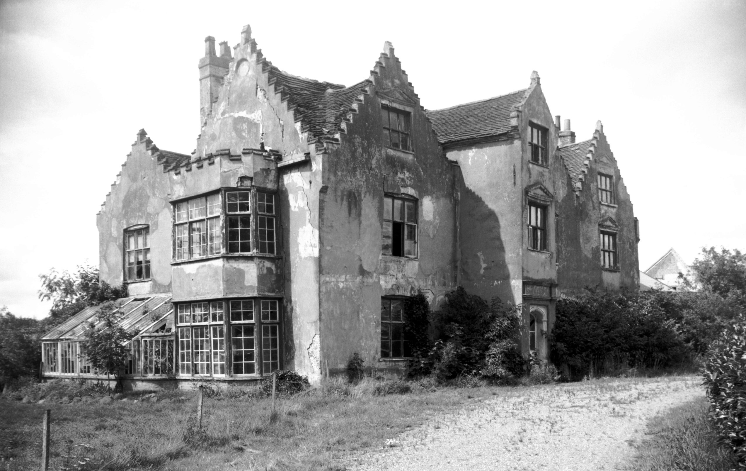
Bawburgh: Hall from the south-east 1960-08-01 Built for the Jerningham family, Bawburgh Hall stood from 1634 to 1963. |
|
|
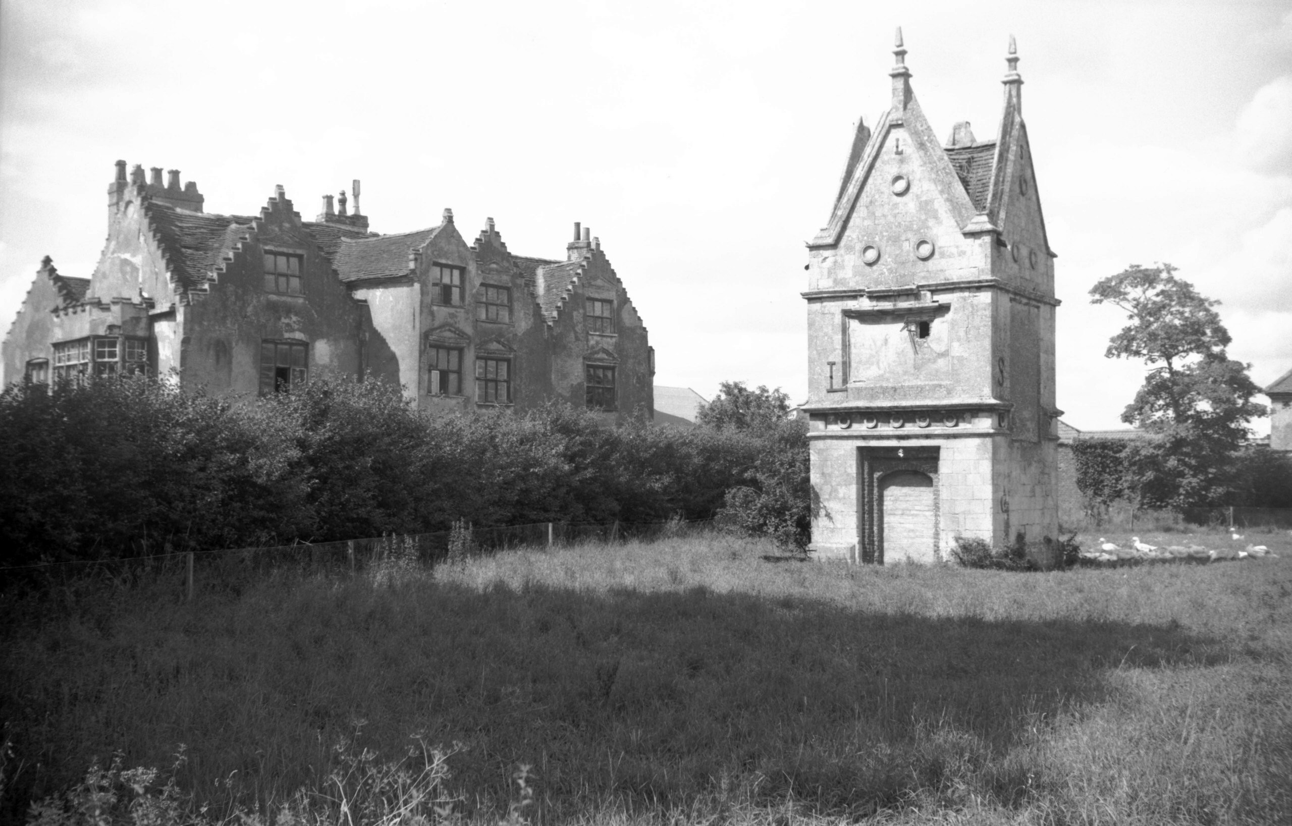
Hall and 'Slipper Chapel' (or Garden House)
1960-08-01 This and another folly (the Hermit's House) still exist. |
|
|
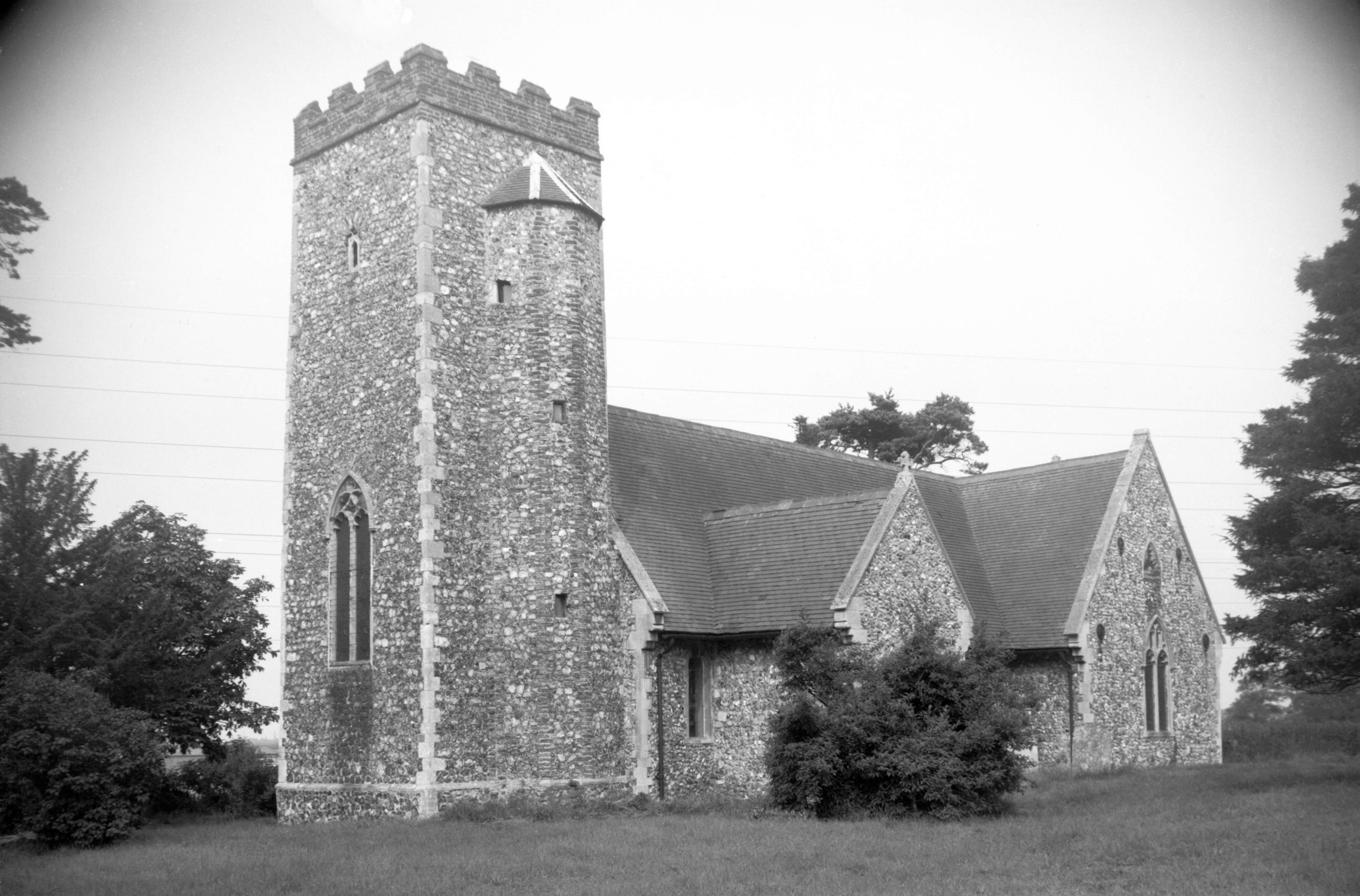
Bixley: St Wandregesilius church from the south-west 1984-08-16 A fire in 2004 gutted this late thirteenth century church, dedicated to the seventh century French monk, who is the patron saint of Flemish weavers. |
|
|
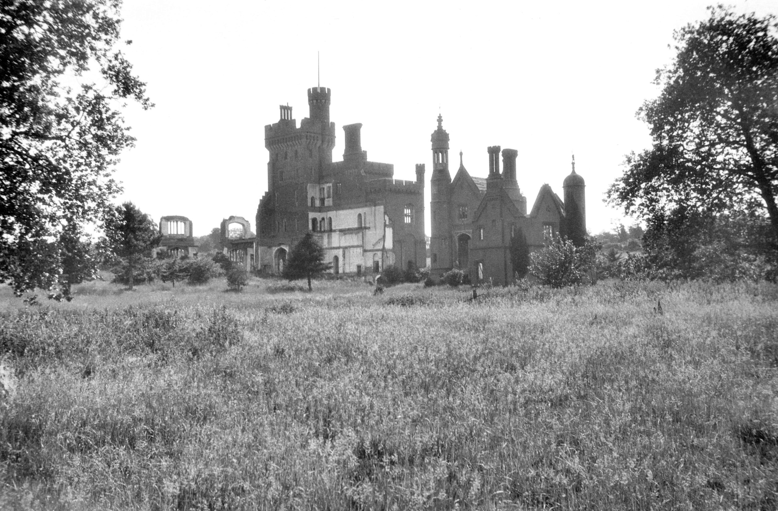
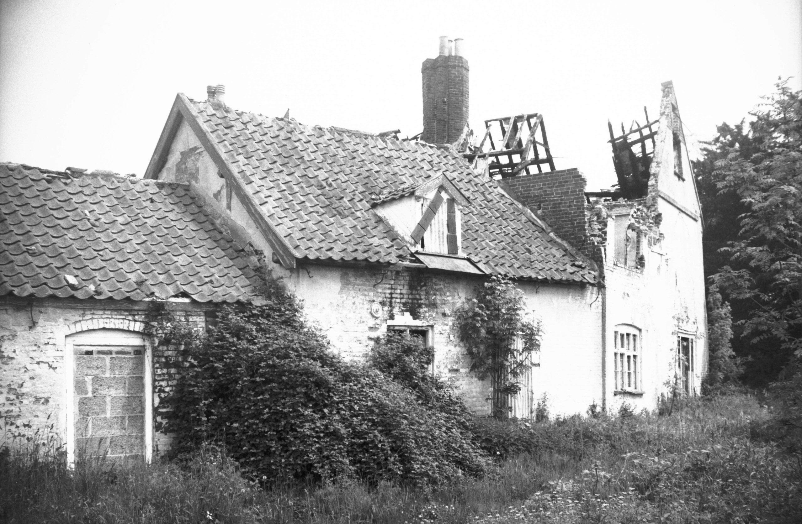
Costessey: Hall ruins 1933-07-02 Costessey Hall was built between 1826 and 1836, also for the Jerningham family (see Bawburgh). After WW1, the hall was unoccupied and earmarked for demolition. The belfry block still stands, in the Costessey Park Golf Club grounds. |
|
|
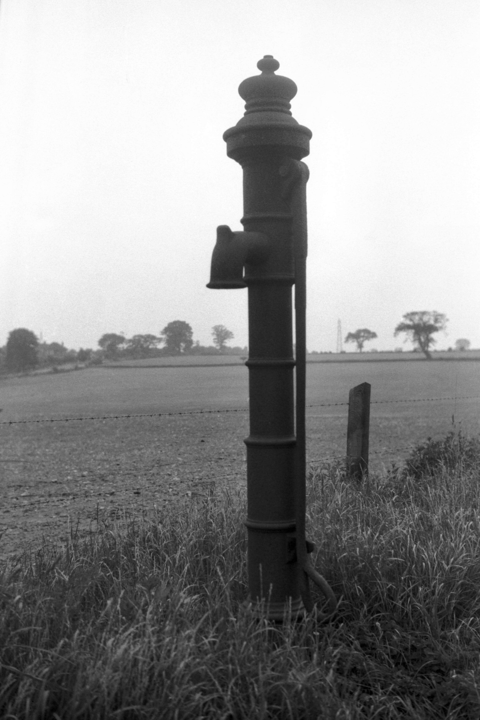
Cringleford: Newmarket Road, early 19th century iron pump 1964-05-23 The Turnpike Trustees placed several such pumps along the road from here to Wymondham at the beginning of the nineteenth century. They provided water for experiments in roadmaking as well as for laying the dust. A similar pump is at the foot of St John Maddermarket’s churchyard in Norwich. |
|
|
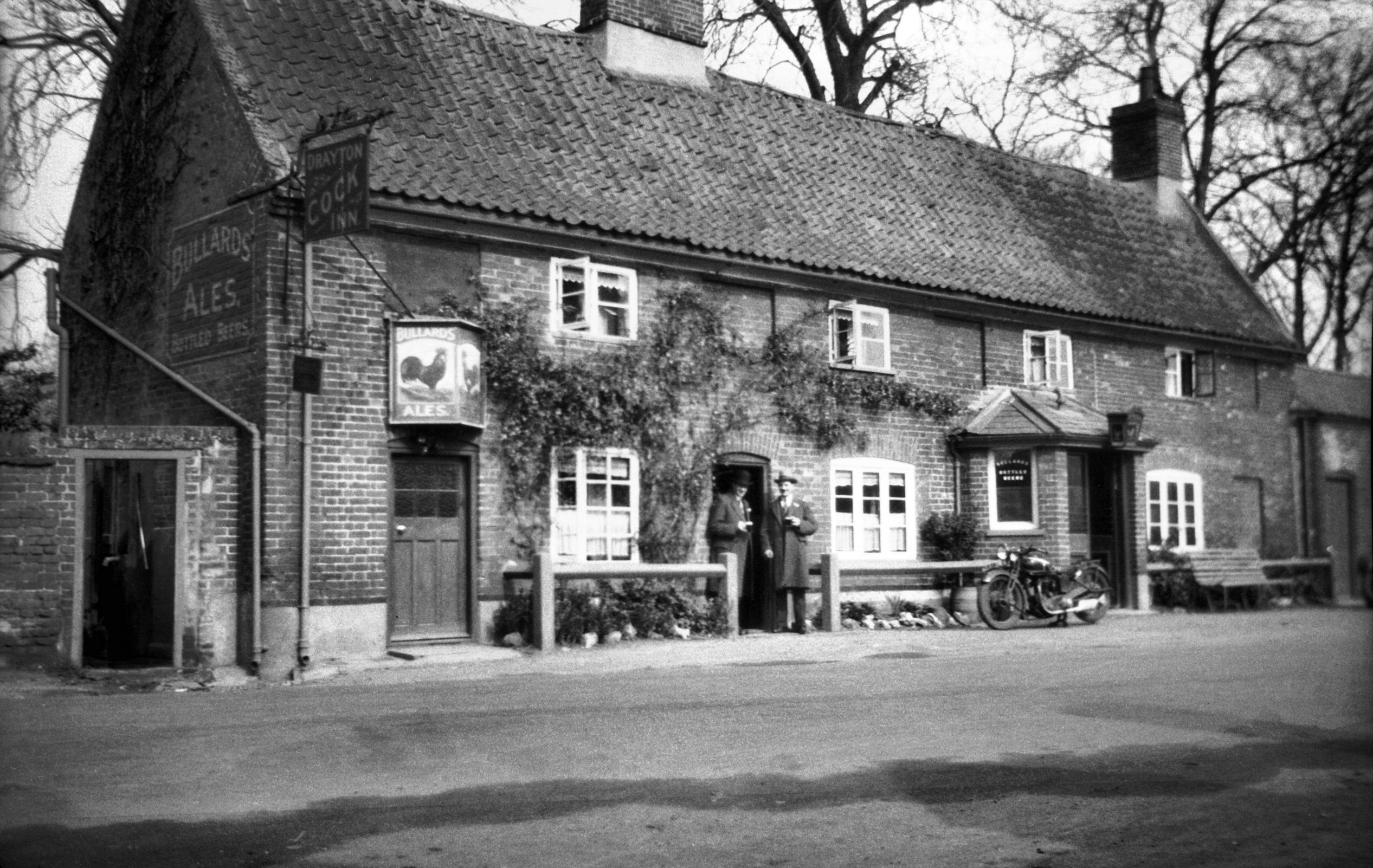
Drayton: Drayton High Road, Cock Inn public house 1932-03-20 A pub since 1836, this building was knocked down in 1956, being replaced by another on adjoining land. |
|
|
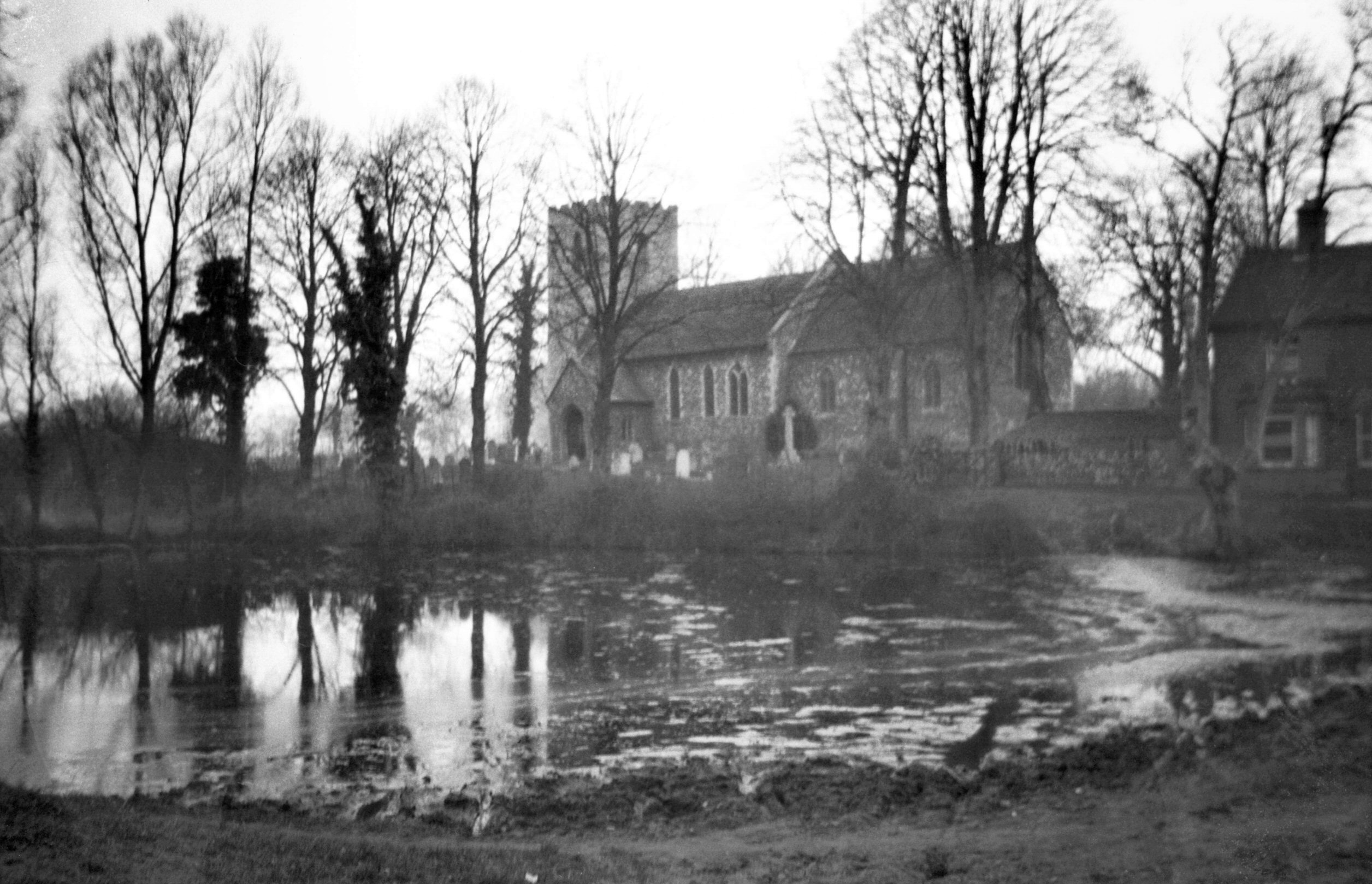
St Margaret's church and pond from the south
1932-03-20 The pond has been filled in and built on. |
|
|
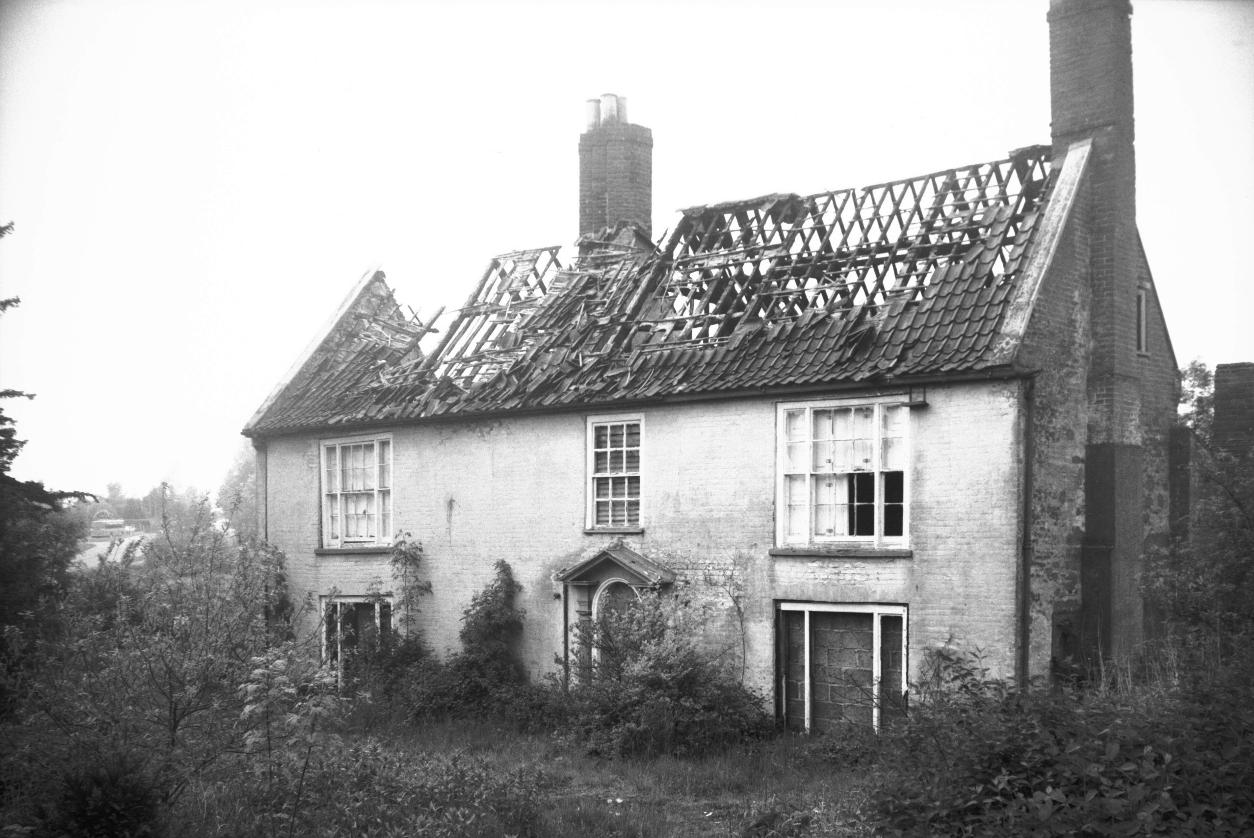
East Dereham: Sandy Lane, Dale farmhouse east front 1979-06-04 This seventeenth century house with Georgian doorway was in a terrible state but has been tastefully restored since these pictures were taken. |
|
|
Sandy Lane, Dale farmhouse south side 1979-06-04 | |
|
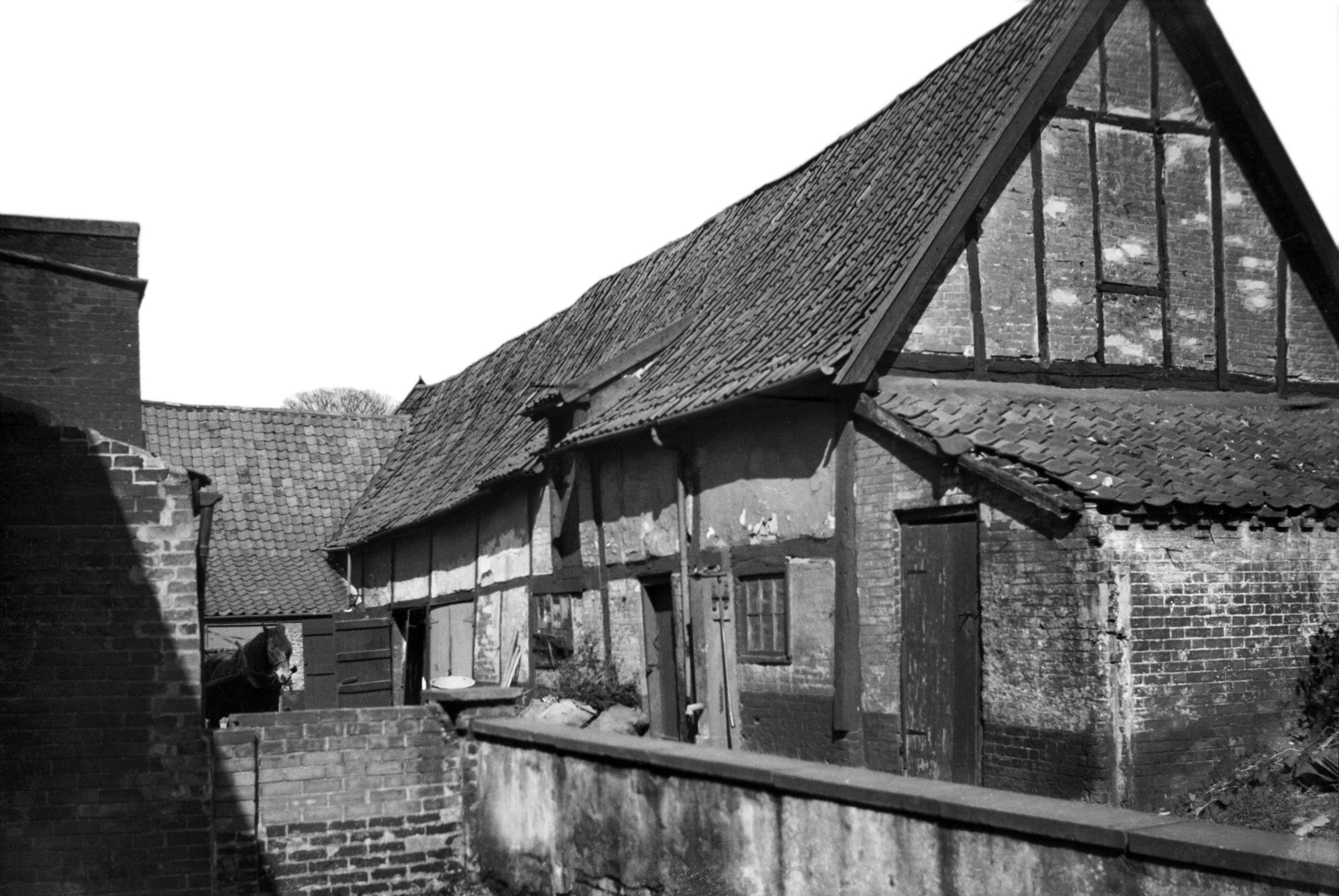
Timber stables north-east of St Nicholas' church
1937-03-27 These stables to the north-east of St Nicholas' church have been demolished. |
|
|
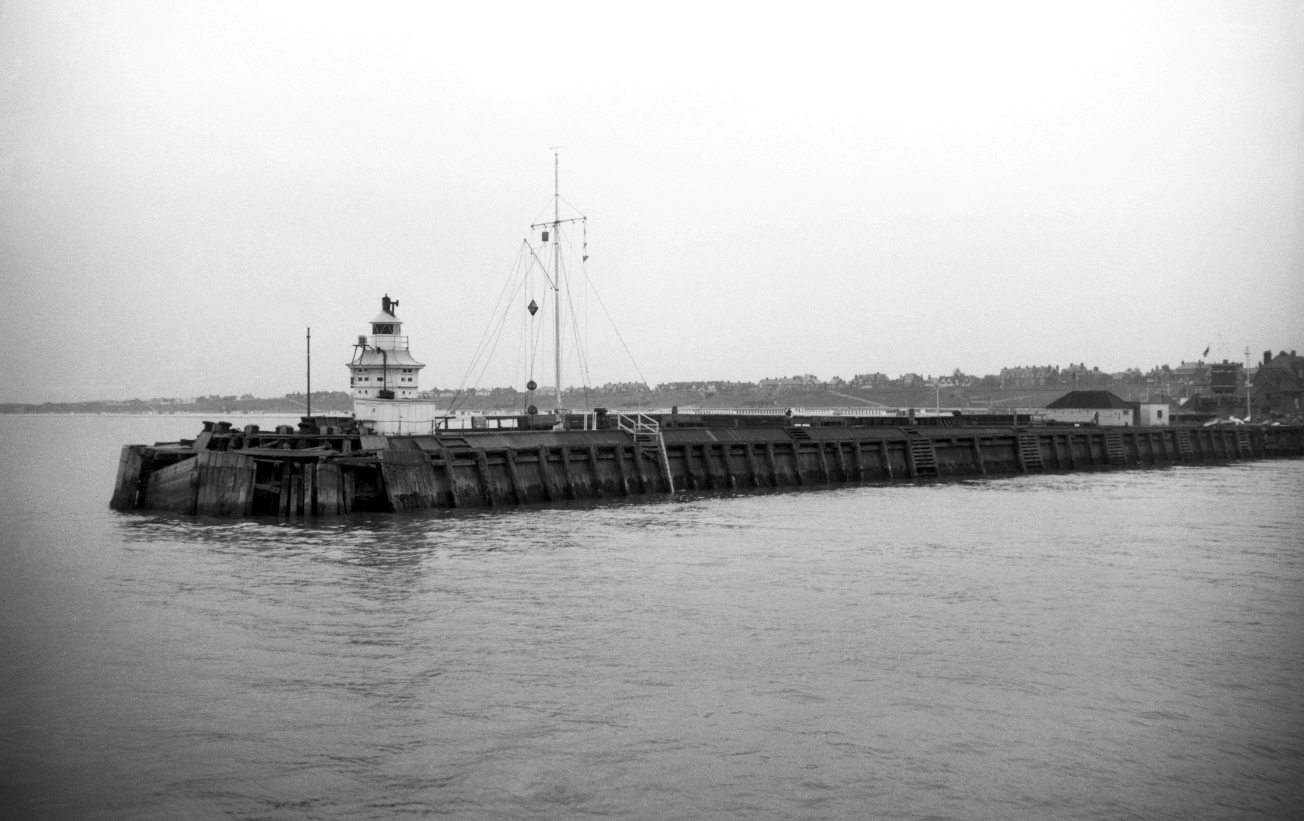
Gorleston on Sea: Dutch pier at the mouth of the River Yare 1961-05-25 Built by Johann Janssens, the pier has since been rebuilt. |
|
|
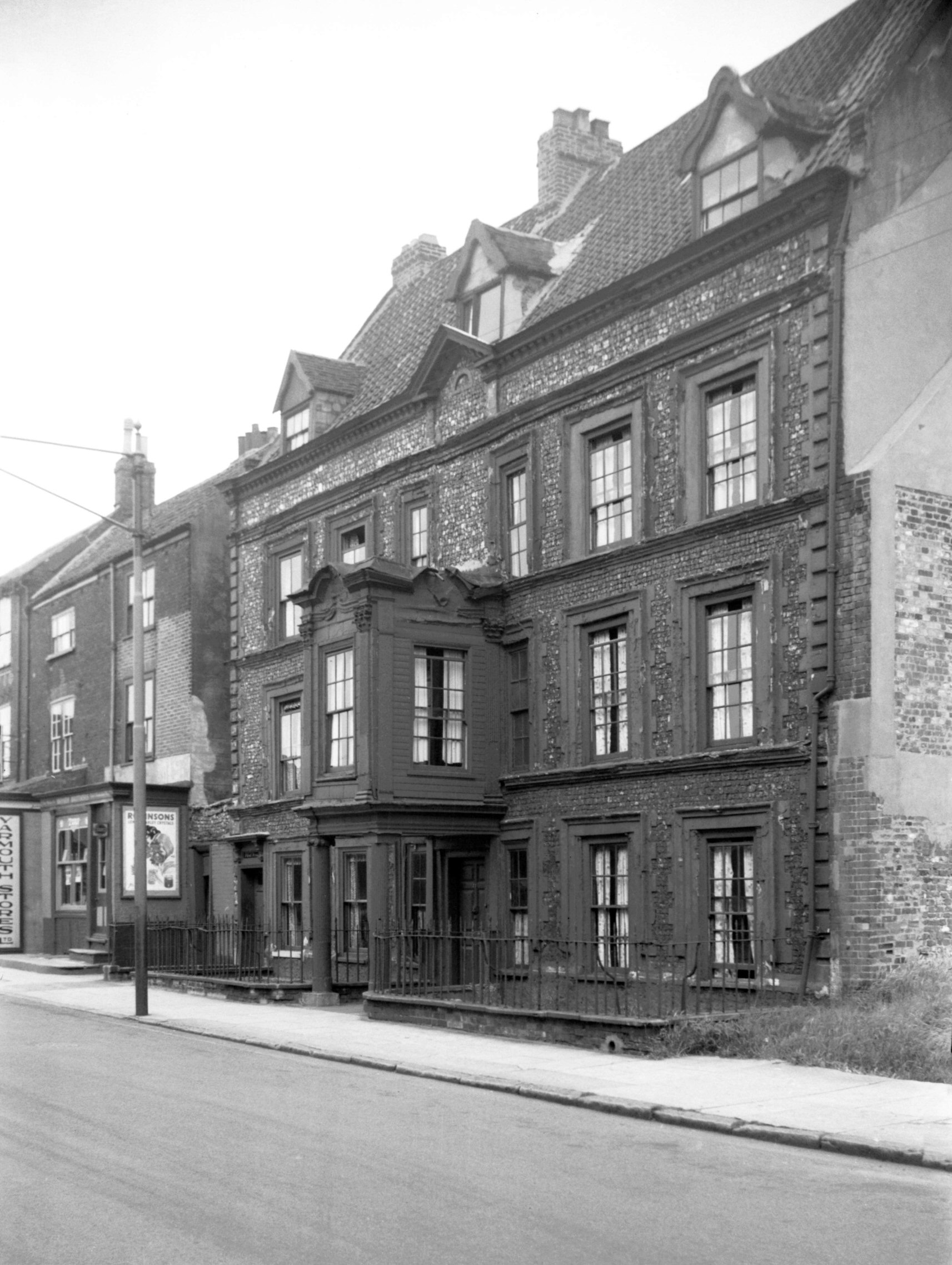
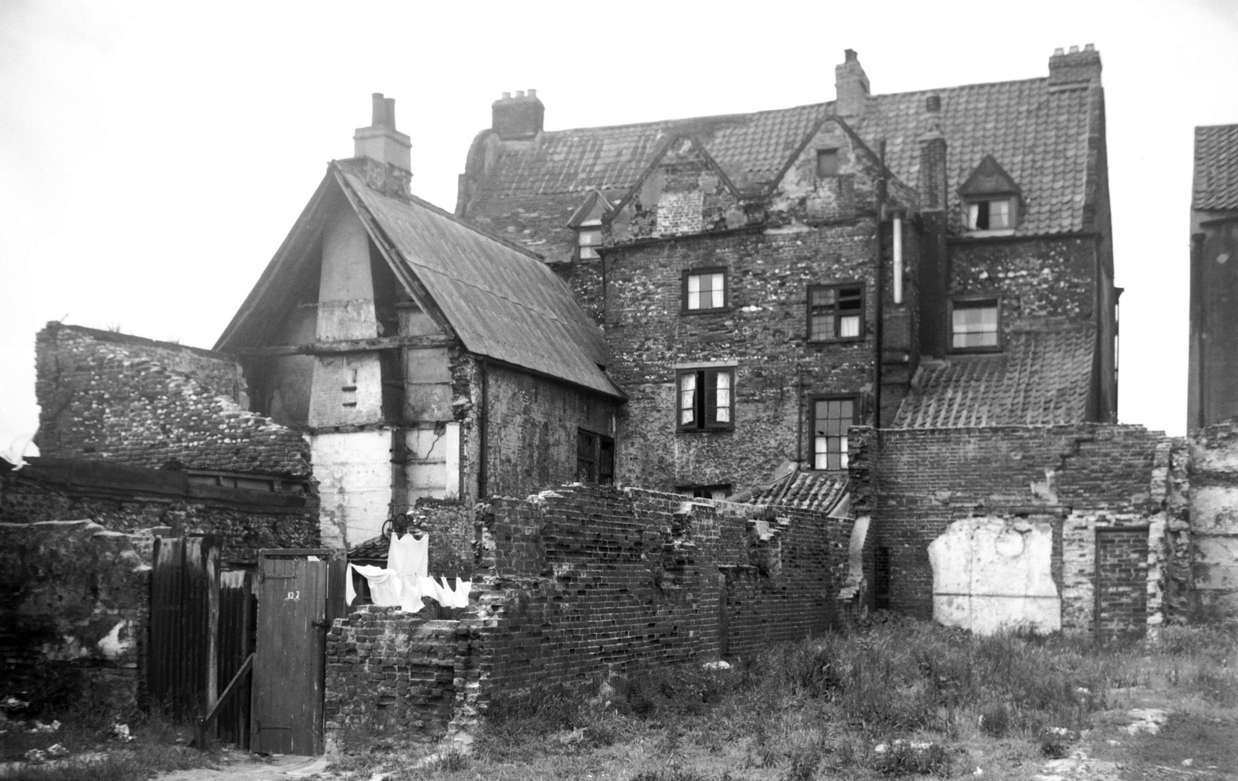
Great Yarmouth: 121 and 122 South Quay, Flint House and Drury House 1950-06-24 Before these houses were demolished, a staircase was removed from them and installed in Blickling Hall. |
|
|
121 and 122 South Quay, Flint House and Drury House rear 1954-06-26 | |
|
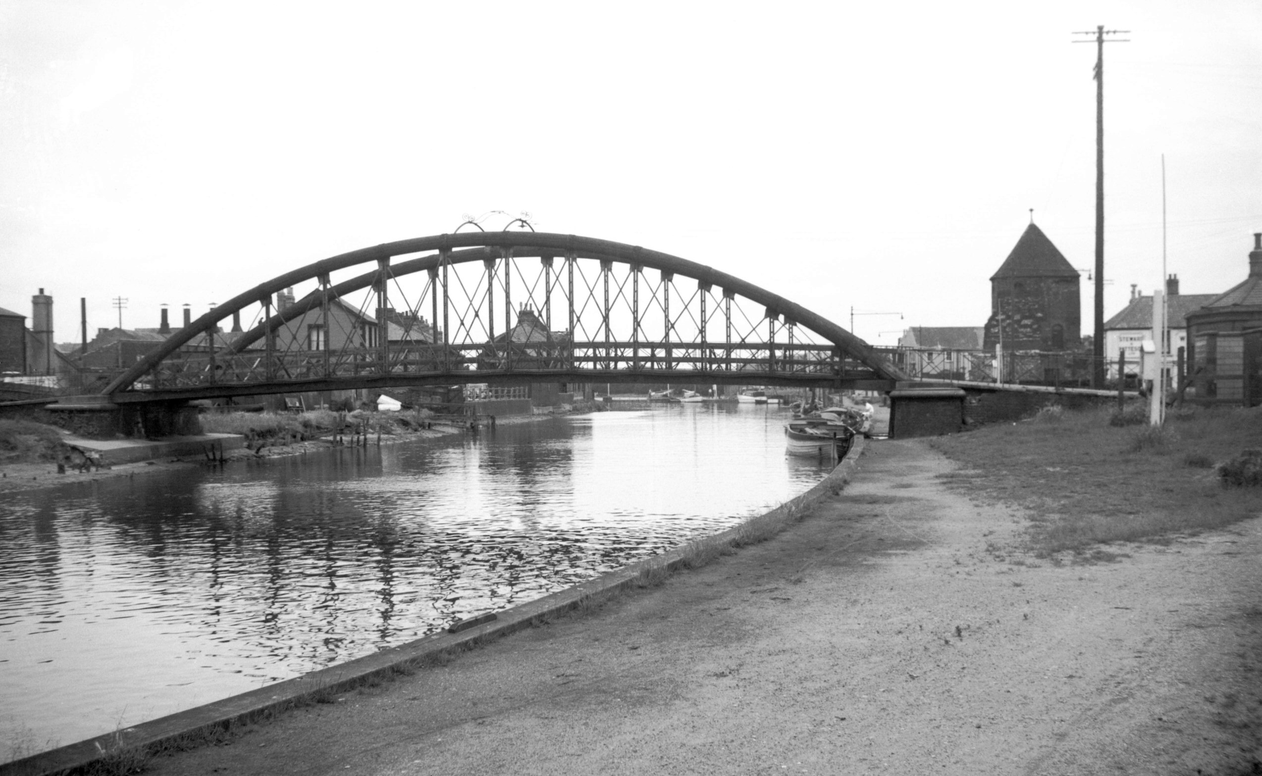
Bure road-bridge south side, and north-west tower of
town wall 1950-06-24 This bridge was replaced in 1972 by a simple concrete span, having itself been built after the previous suspension bridge collapsed in a terrible accident in 1845. At least 77 perished then, having crowded onto one side of the bridge to watch a clown called Nelson float underneath in a tub, pulled by four geese. |
|
|
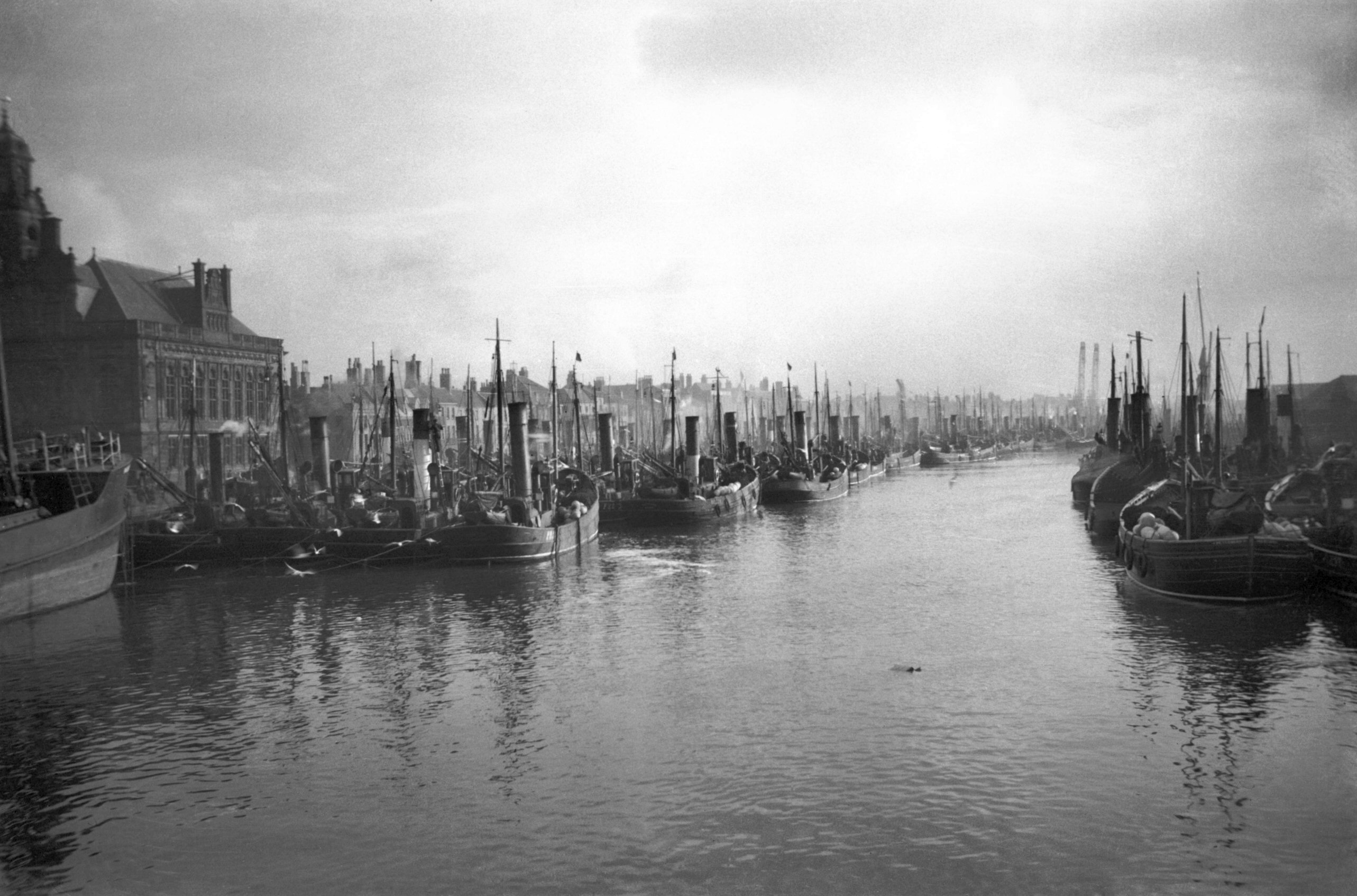
Fishing fleet from Haven Bridge looking downstream
1933-11-11 A remarkable sight, before the complete demise of the herring fishing industry. |
|
|
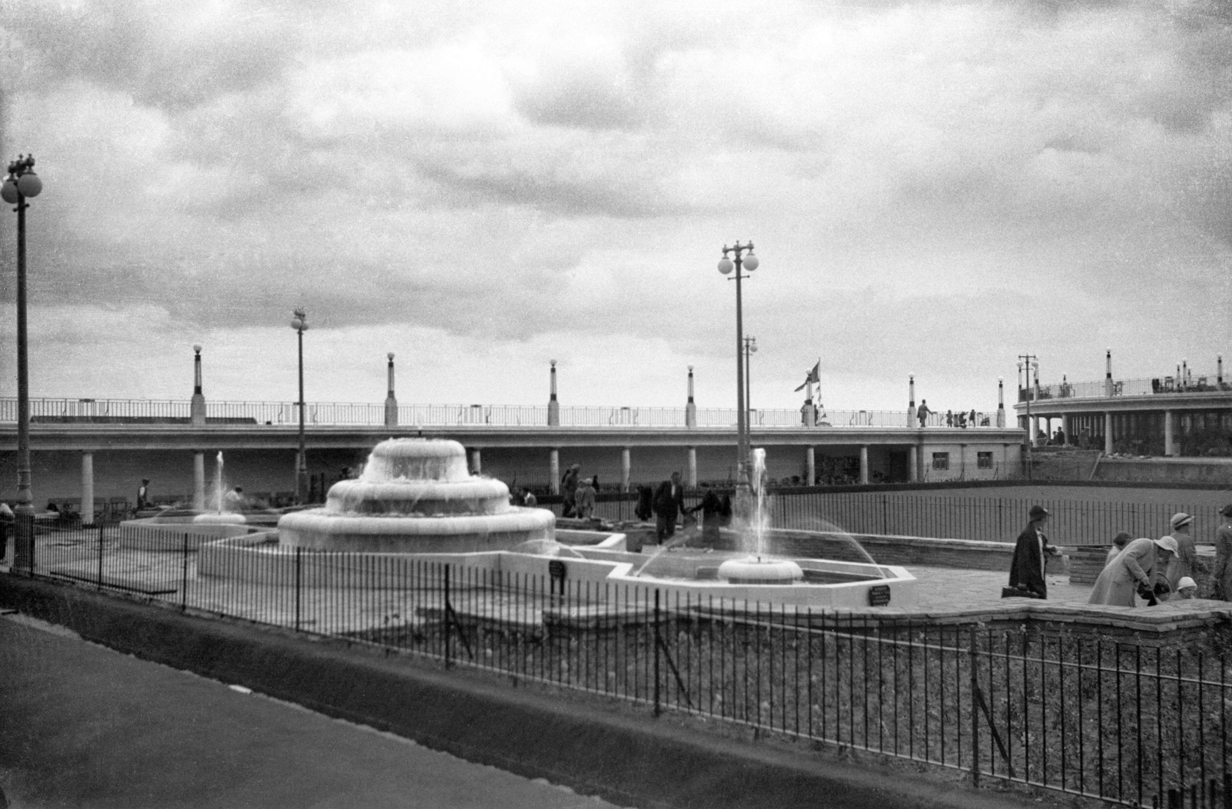
Marine Parade marina fountains 1937-07-22 These fountains have since been removed. |
|
|
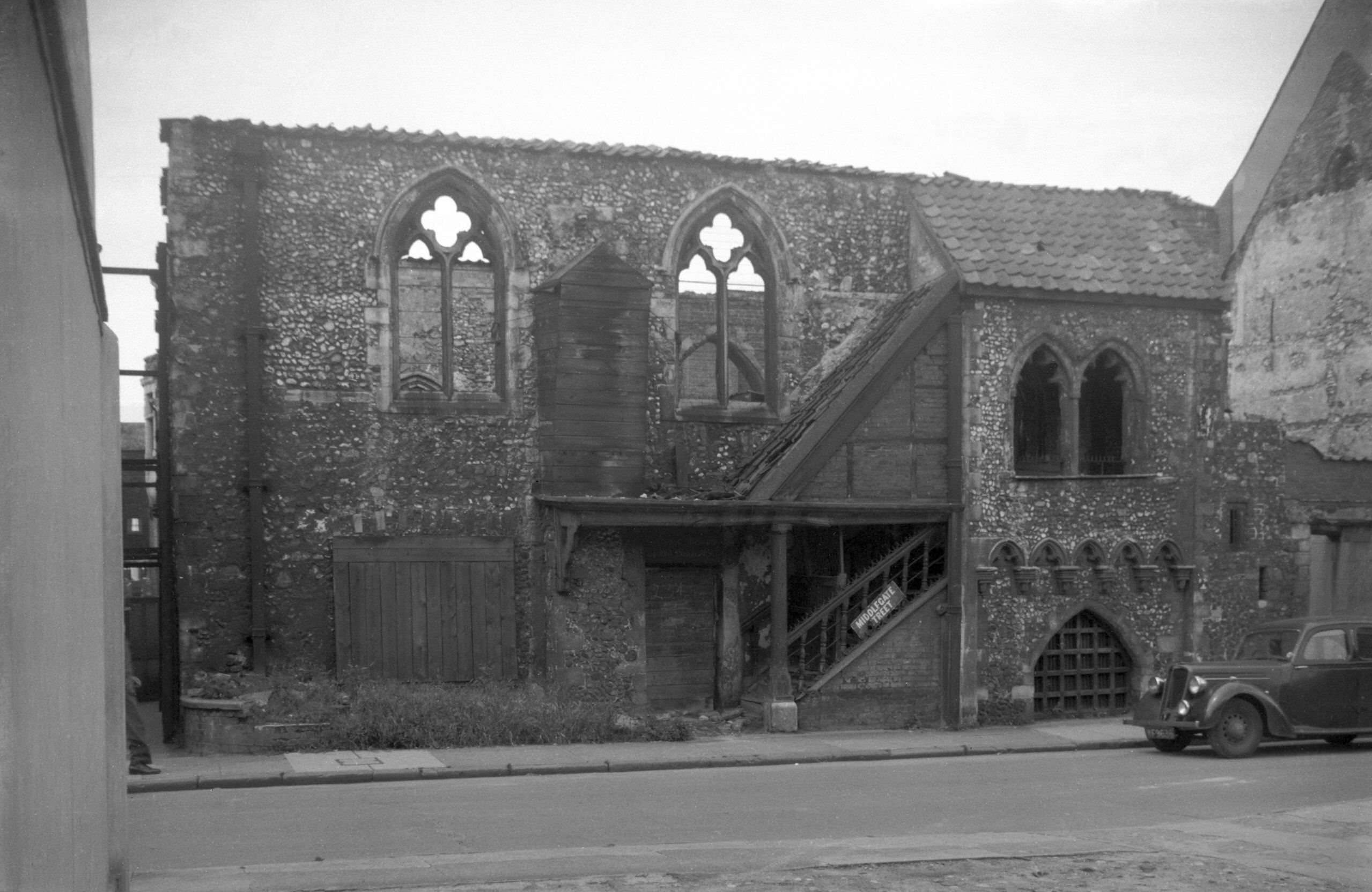
Middlegate Street Tollhouse ruins 1950-06-24 Blitzed in the war and left roofless, the Tollhouse dates back to the thirteenth century having been used as a Court of Justice, a gaol, and a place for the collection of customs or tolls. It has since been reconstructed and opened as a museum. |
|
|
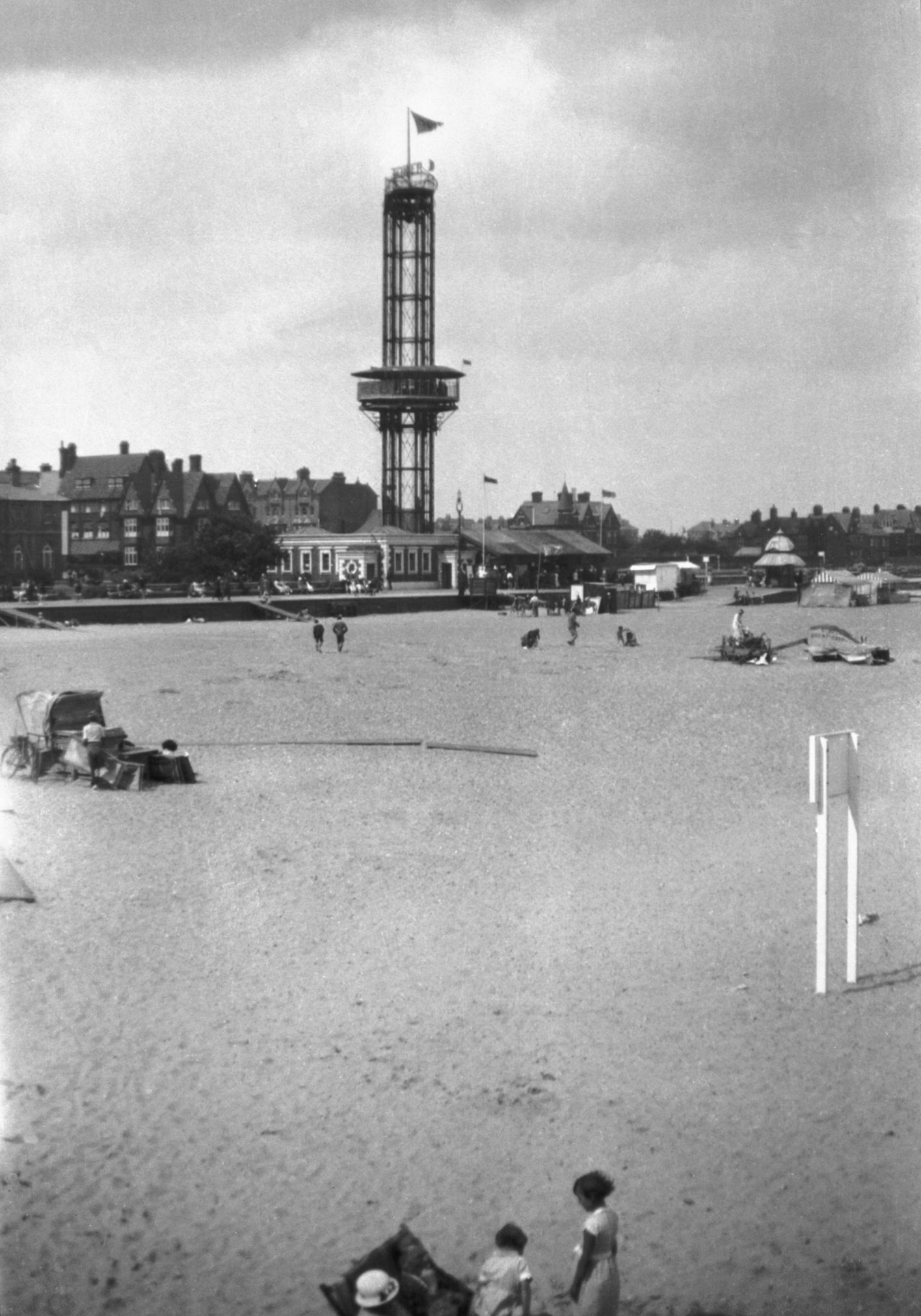
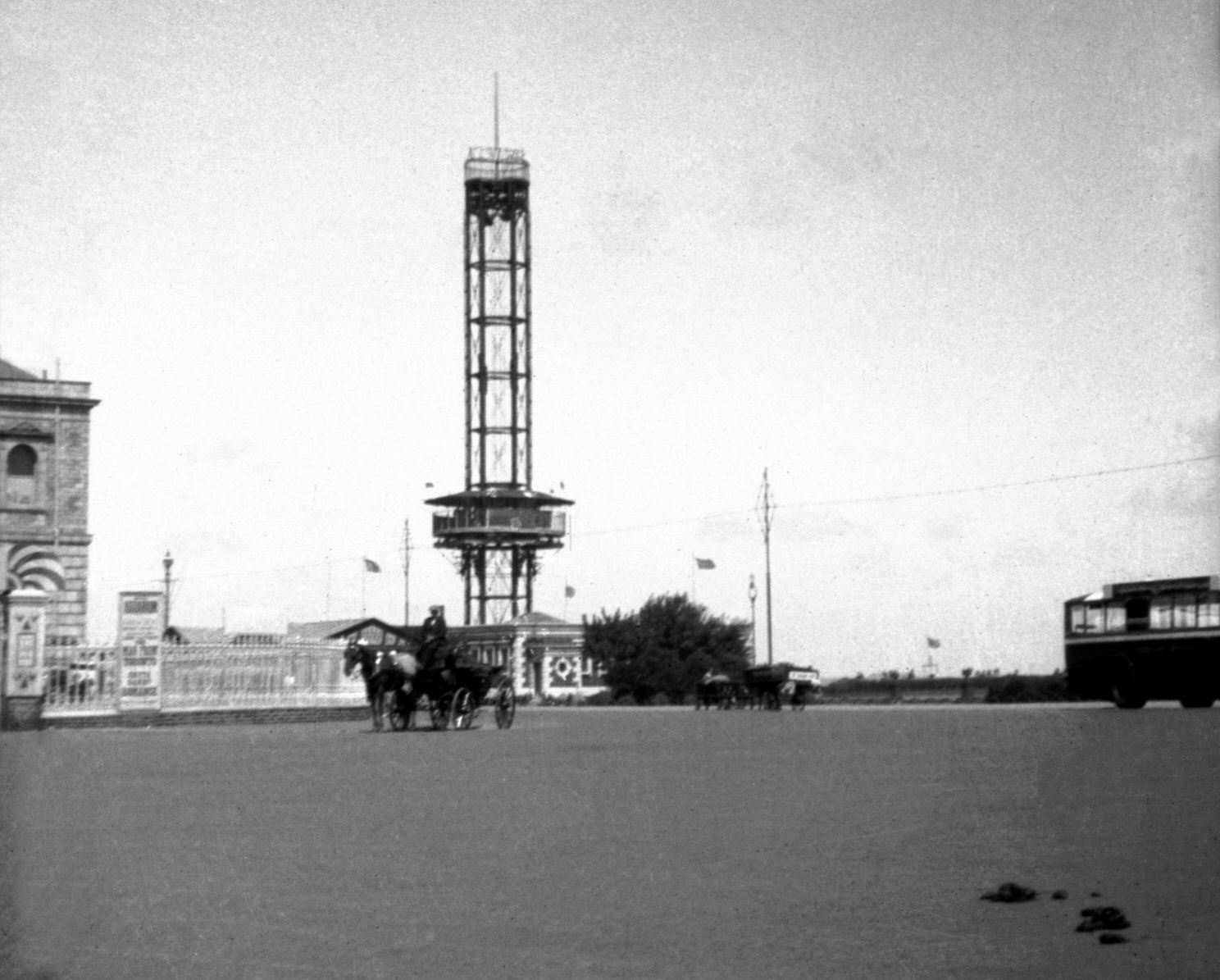
Observation tower from Britannia pier 1932 The tower stood amongst other amusements to the north of Britannia pier from 1897 to 1941. The viewing cage which ascended the tower also revolved until 1914. Being a potential landmark for enemy aircraft in WW2, the tower was dismantled, its metal assisting the war-effort. |
|
|
Observation tower from the south-west 1932 | |
|
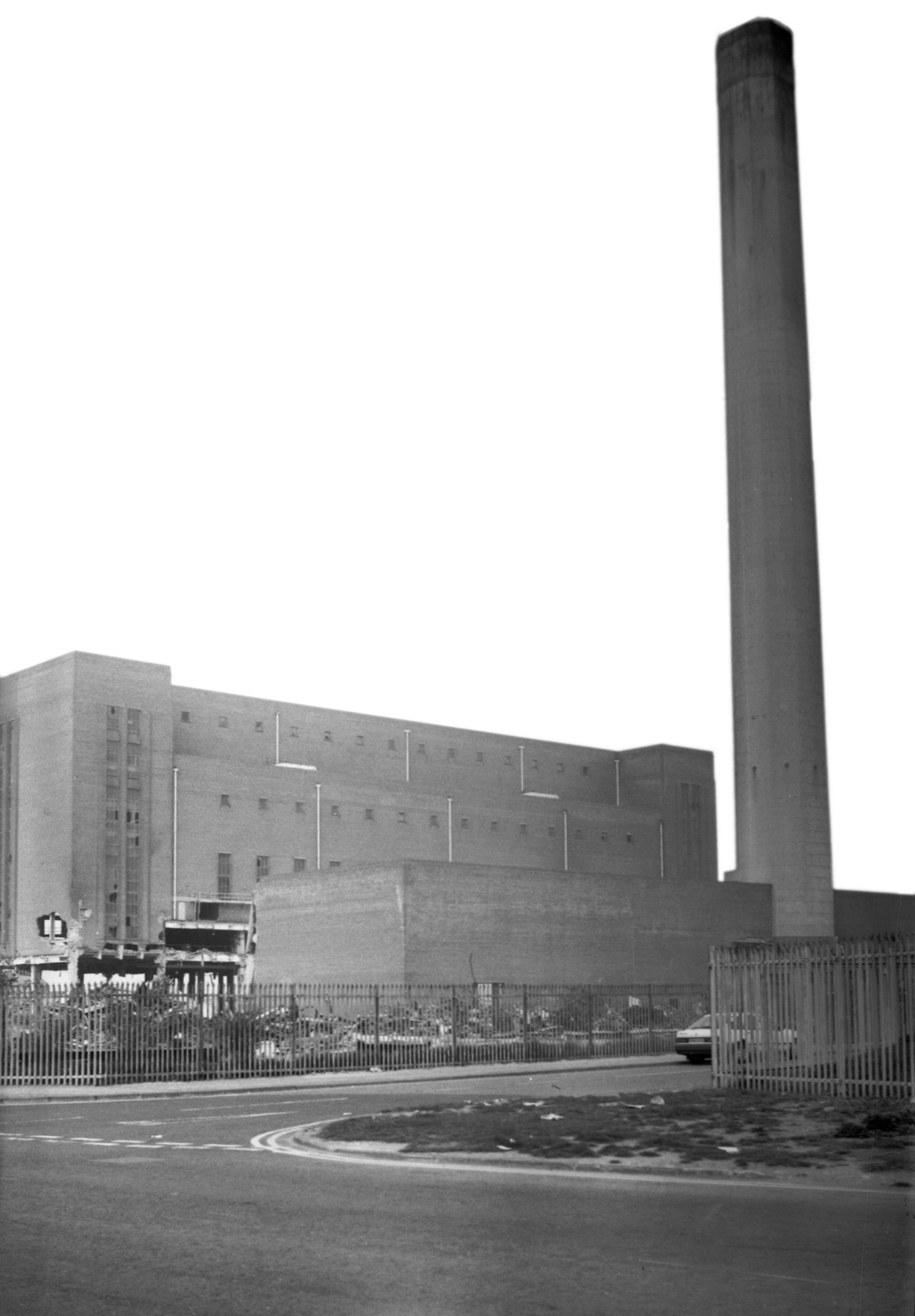
South Denes power station 1997-05-03 Seen here two days before its demolition, the building with its 360 foot chimney had lasted 40 years. |
|
|
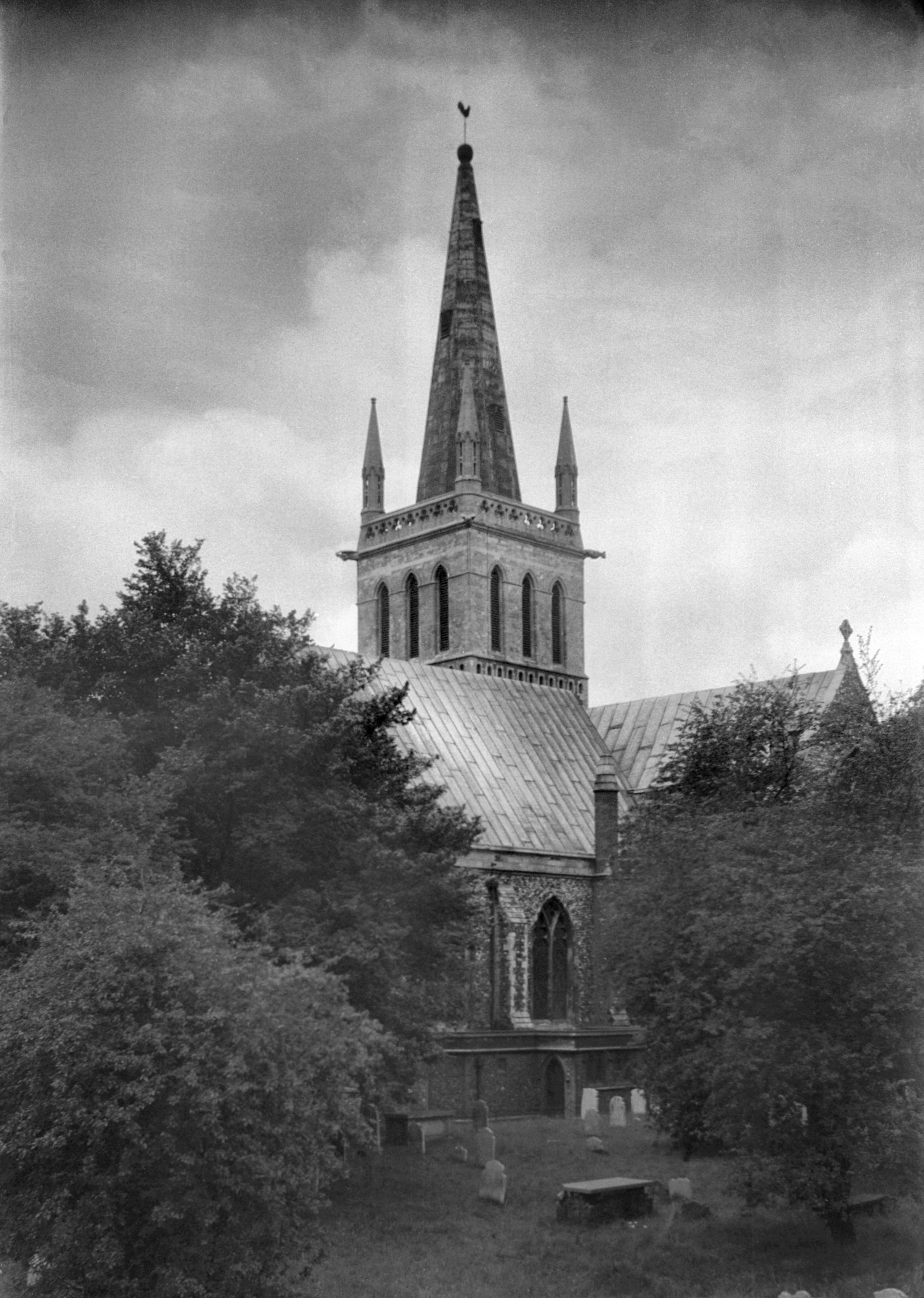
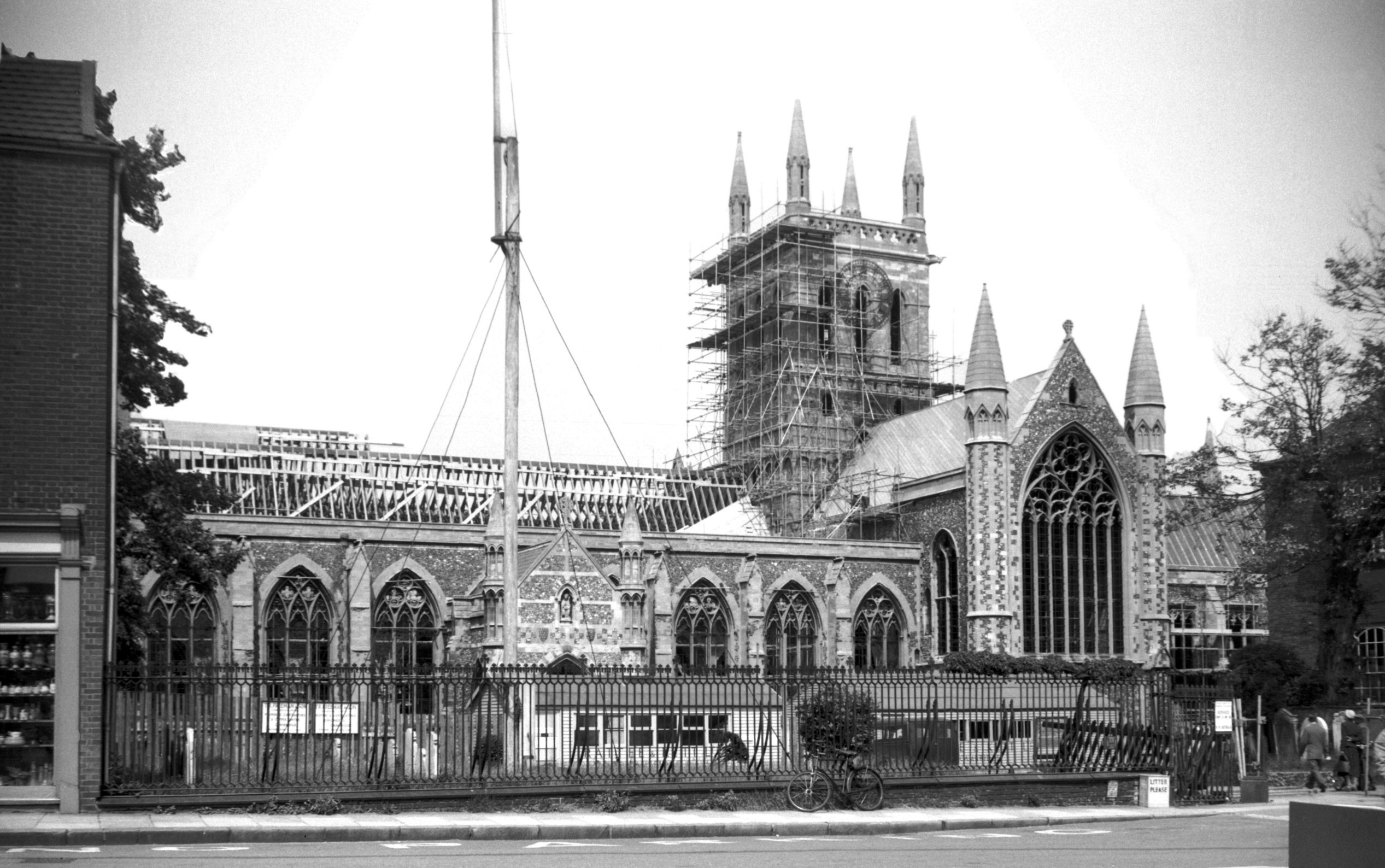
St Nicholas' church from the north-east 1936-08-01 This church is twelfth century. Before WW2, the church had a wood-framed spire. |
|
|
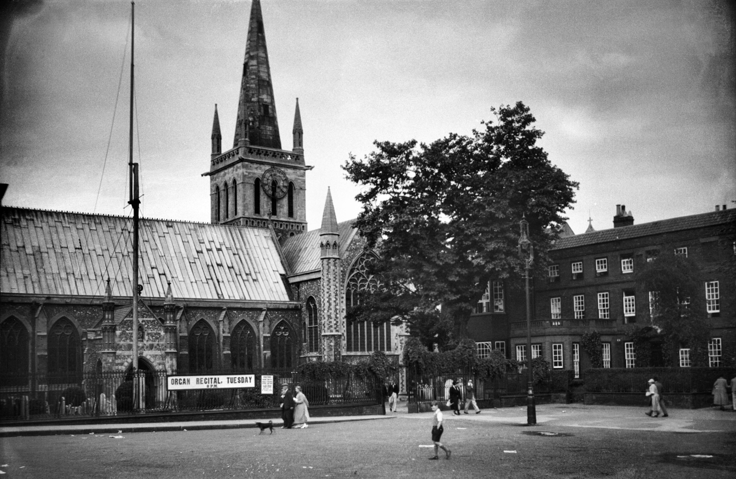
St Nicholas' church from the south (Church Plain) 1936-08-01 | |
|
St Nicholas' church blitzed ruin from the south
1950-06-24 The roof, spire and contents were lost in the blitz of June 24th, 1942. |
|
|
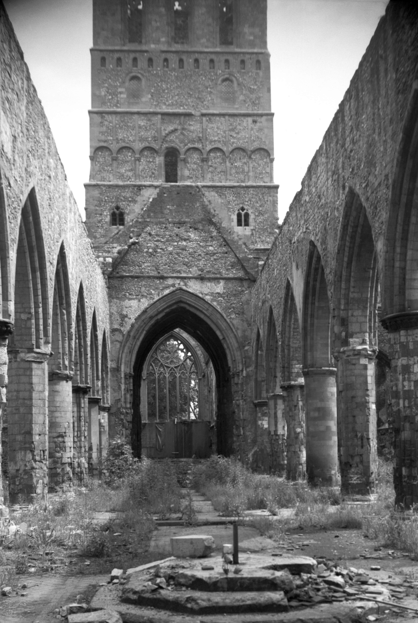
St Nicholas' church nave ruin interior looking east
1950-06-24 During restoration, the nave arches were widened by removing alternate pillars. |
|
|
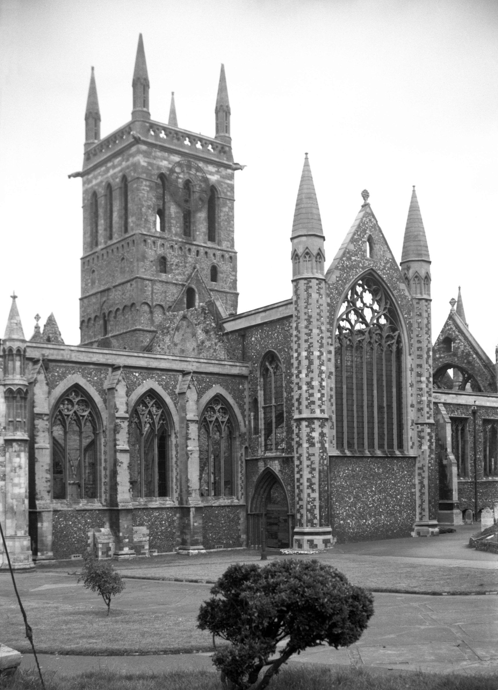
St Nicholas' church restoration from the south
(Church Plain) 1958-06-14 The spire has not been rebuilt however. |
|
|
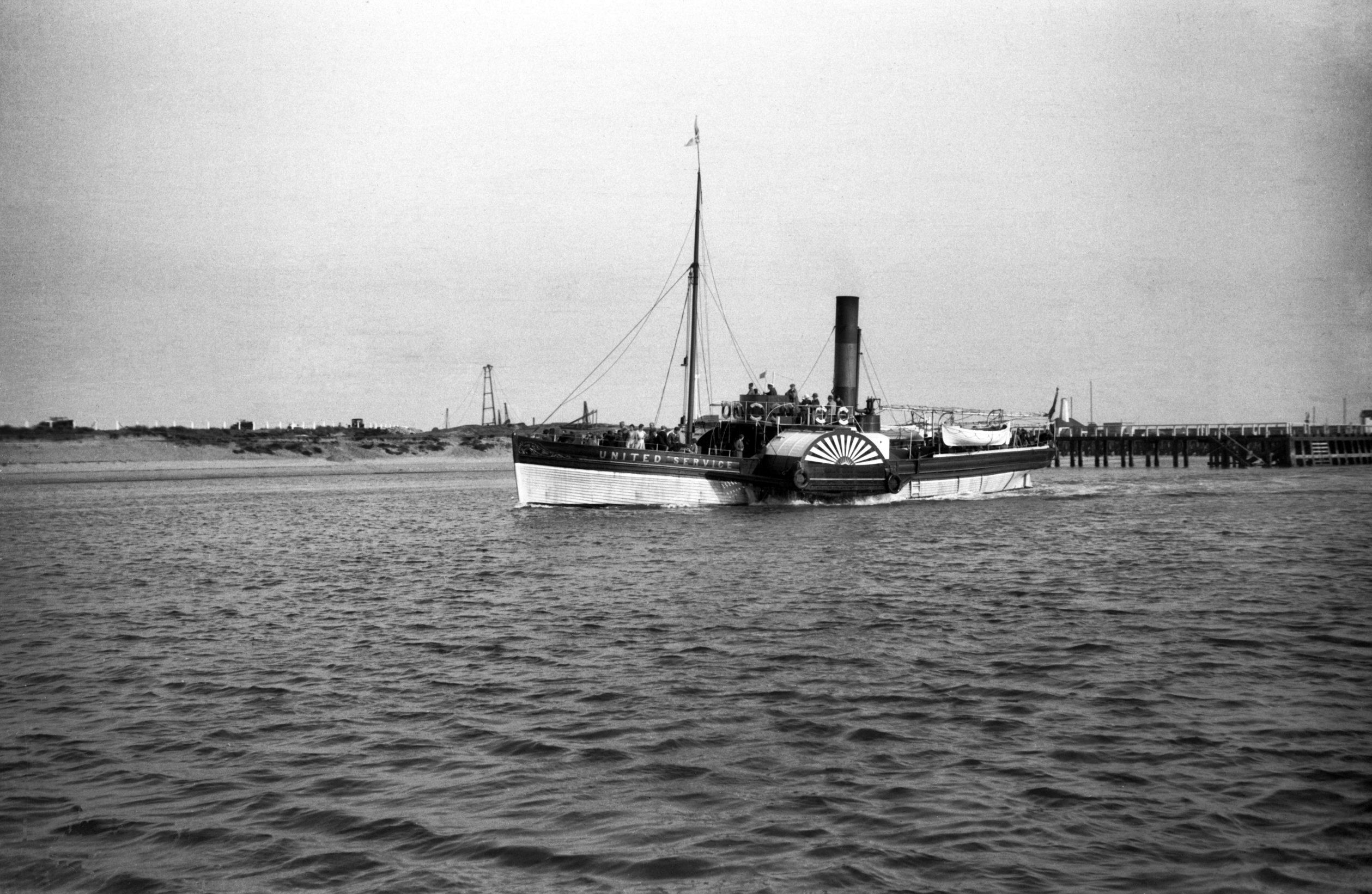
United Service' paddle steamer on the River Yare 1933-09-16 | |
|
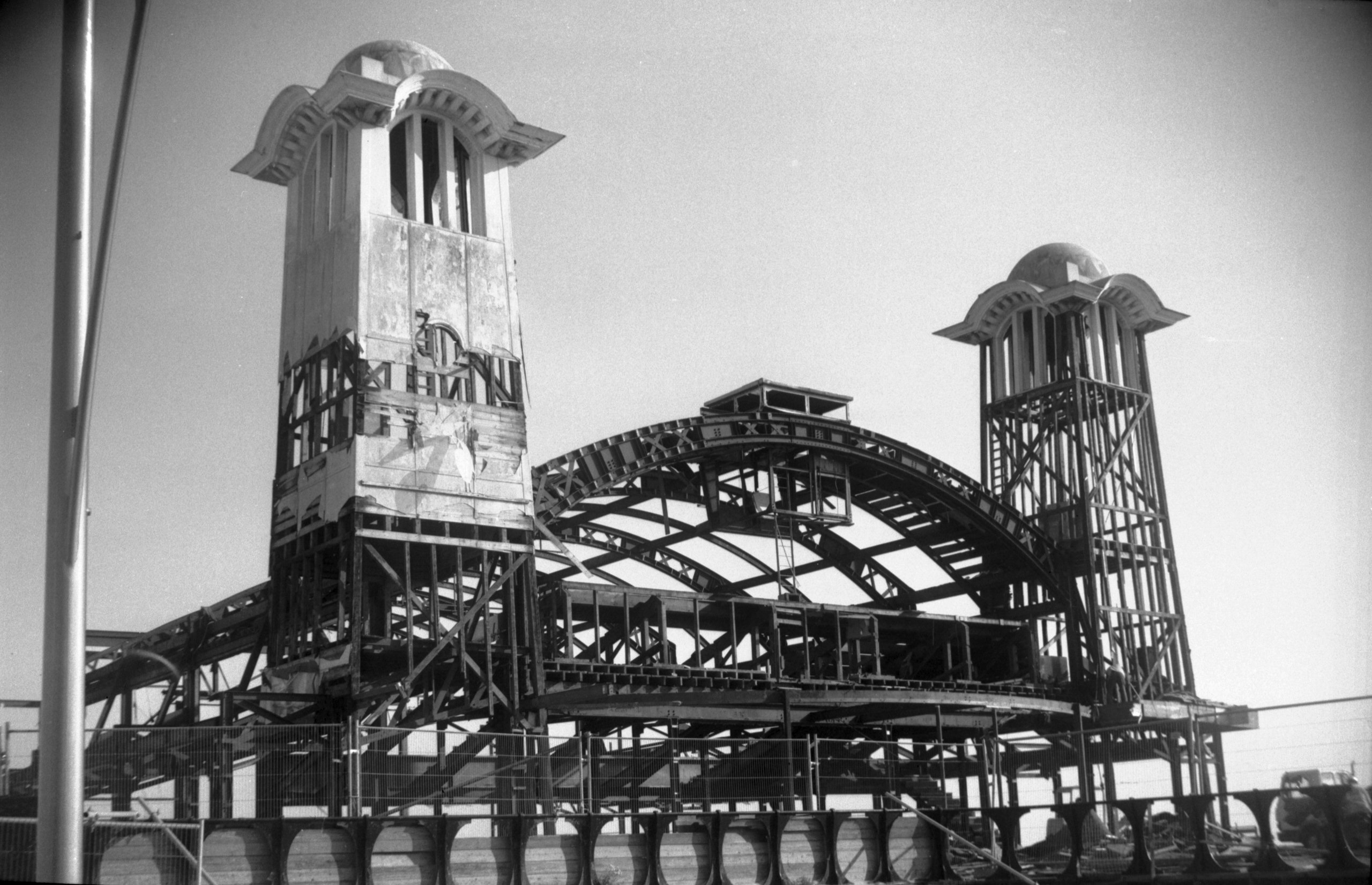
Wellington Pier pavilion gutted prior to reconstruction 2005-10-05 | |
|
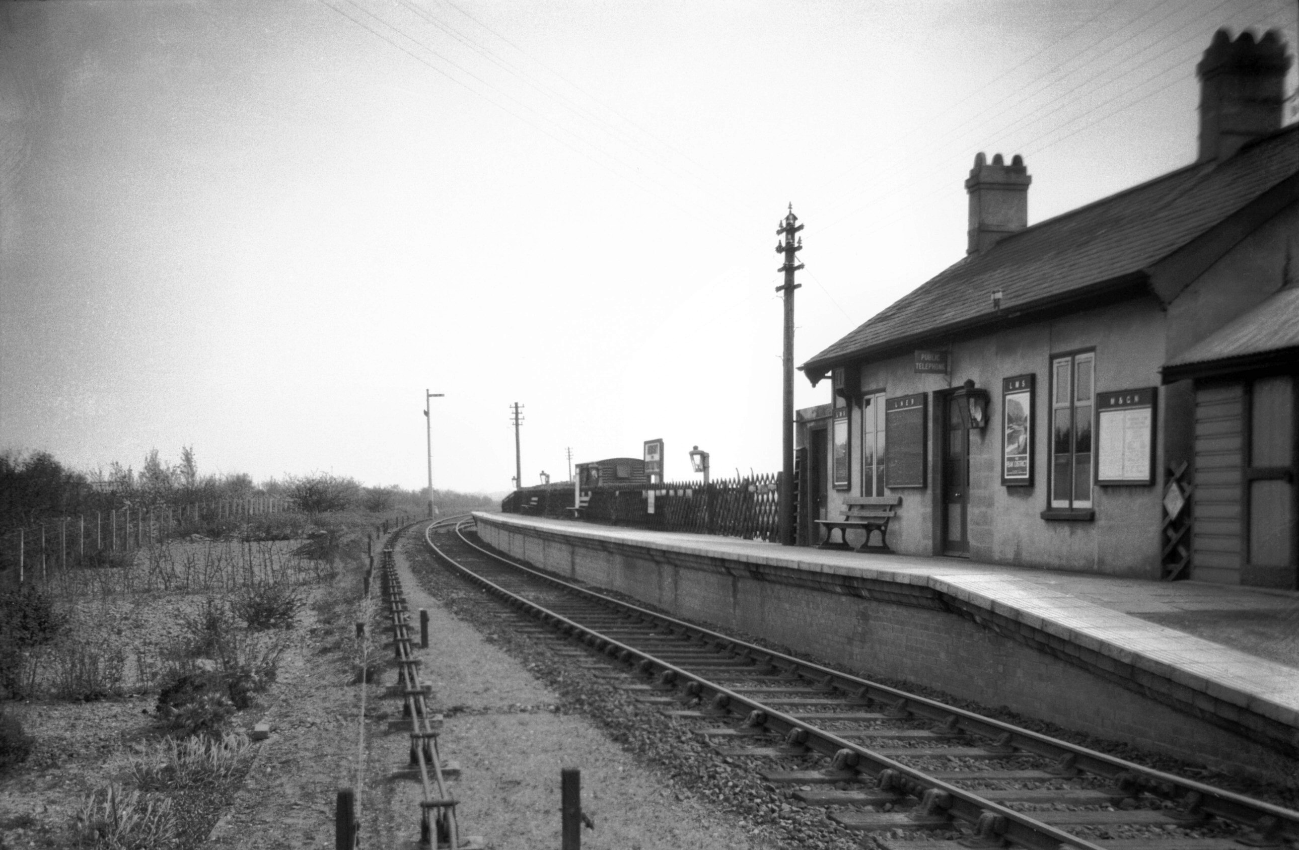
Hemsby: Midland and Great Northern station 1932-05-15 This line, from Yarmouth Beach station to North Walsham closed in 1959, as a result of the rise in private car ownership. |
|
|
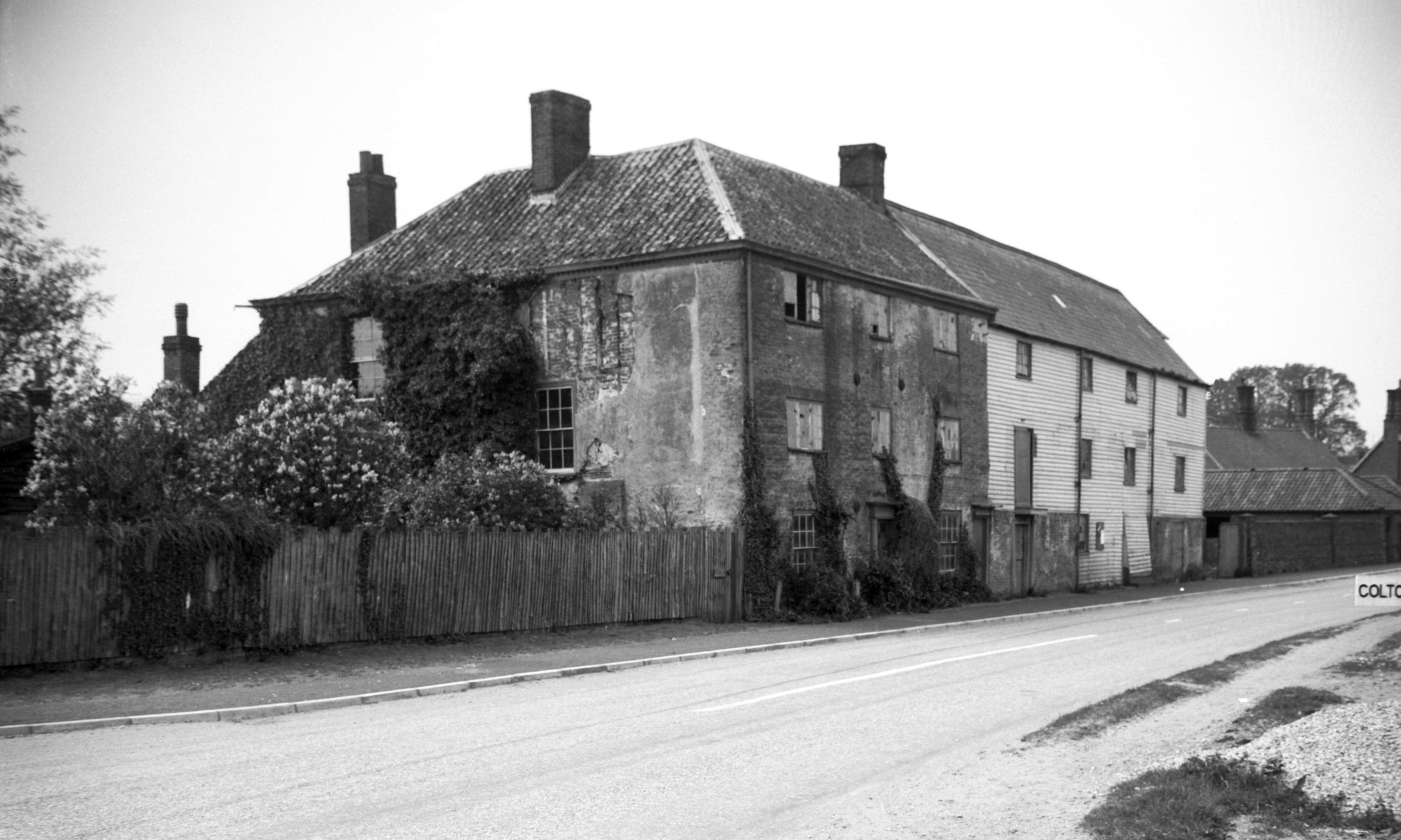
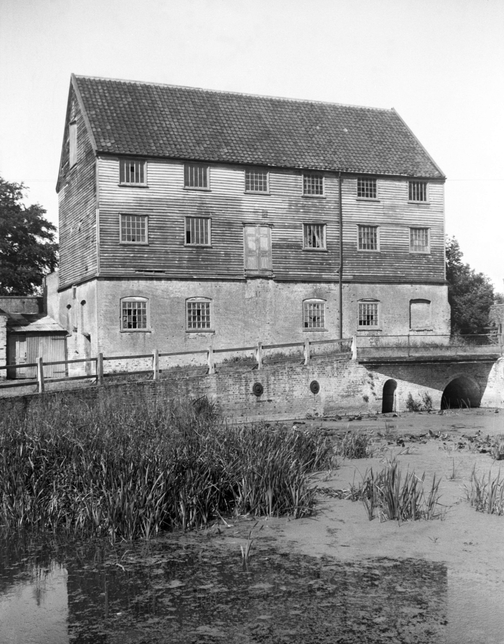
Honingham: Mill house and watermill 1939-05-21 |
|
|
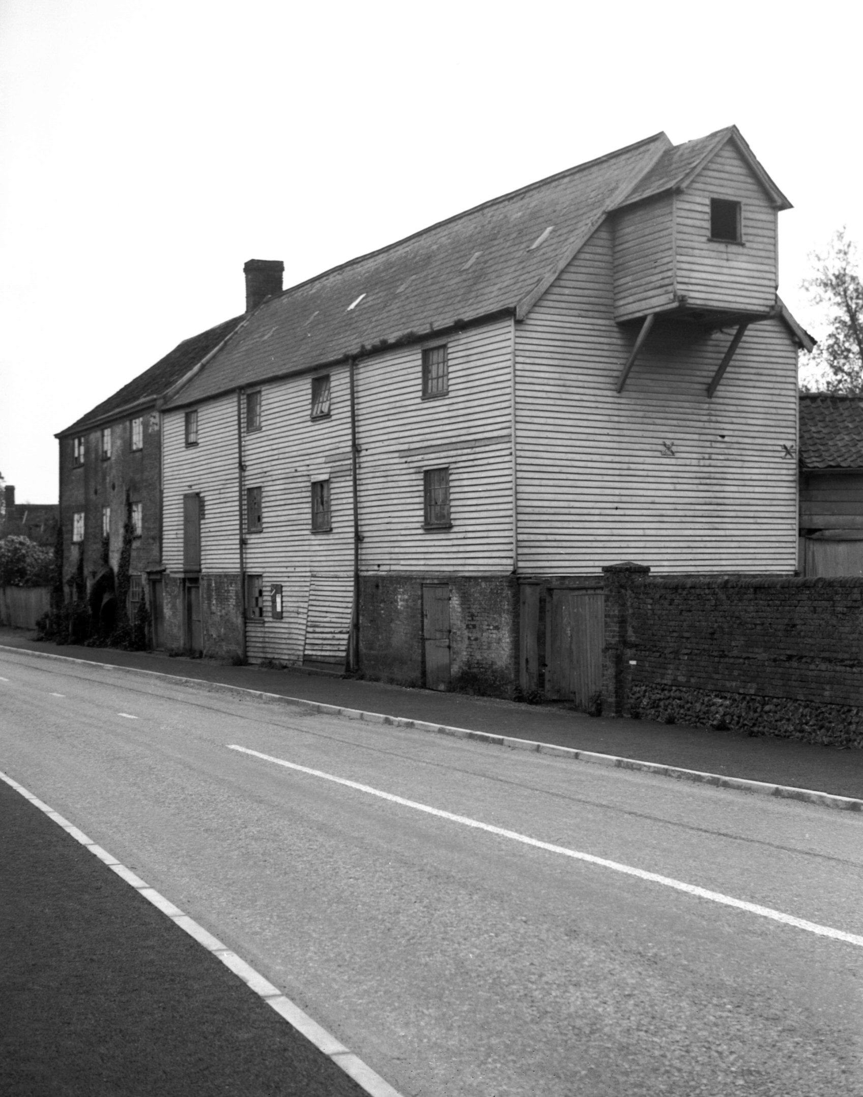
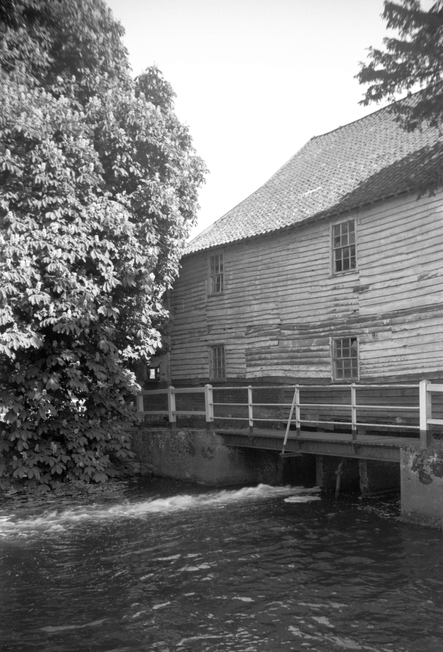
Watermill on the River Tud 1939-05-21 This mill was demolished in 1966. |
|
|
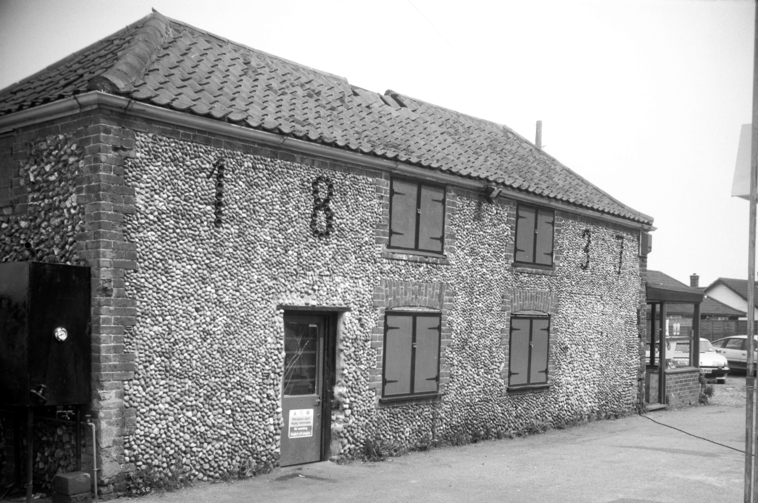
Horsford: Holt Road, 1837 cottages 1992-06-08 This was one of four or five pairs of cottages which included their construction date formed from the bottoms of glass bottles, set amongst the flints. One such building remains. |
|
|
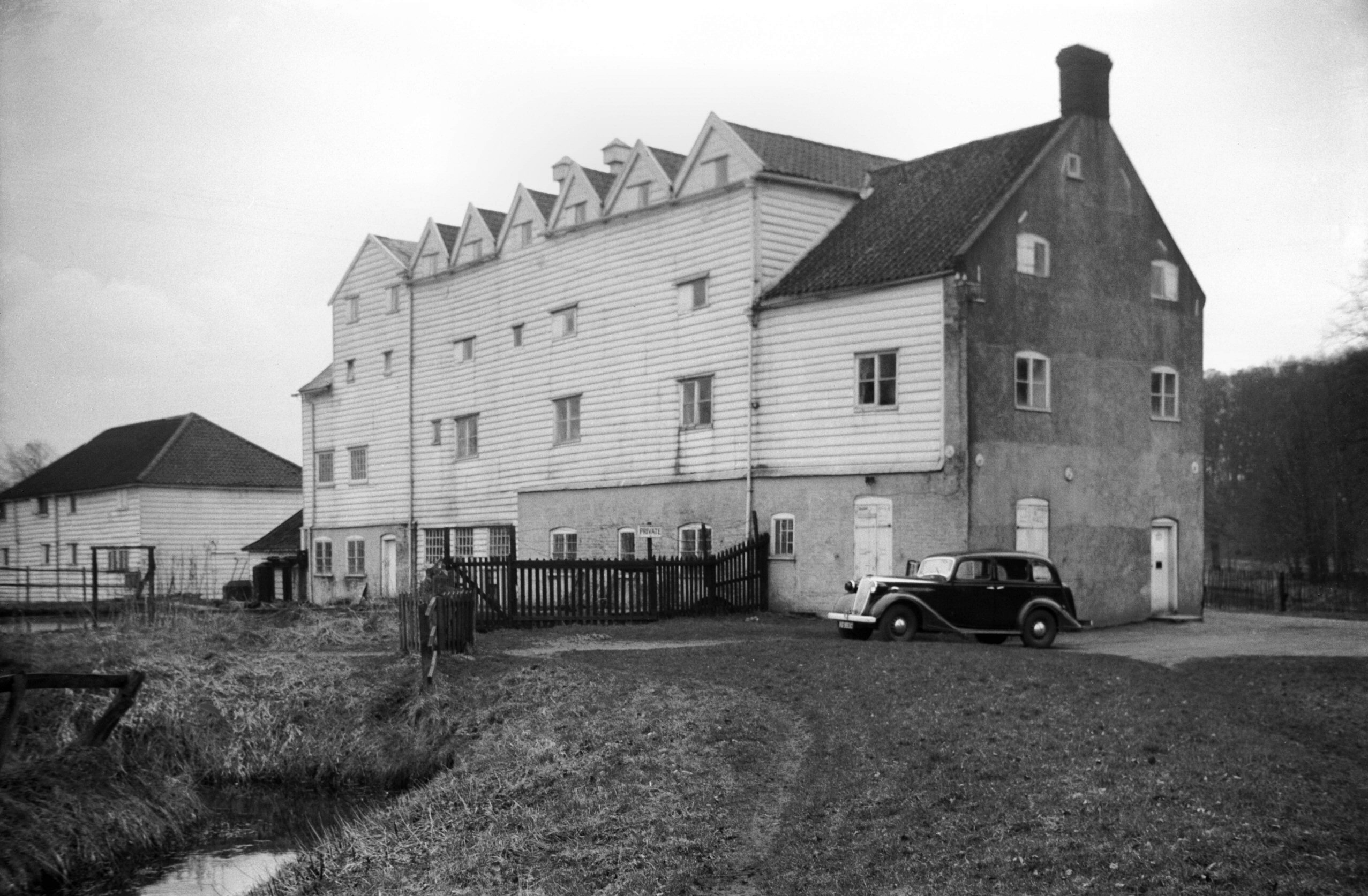
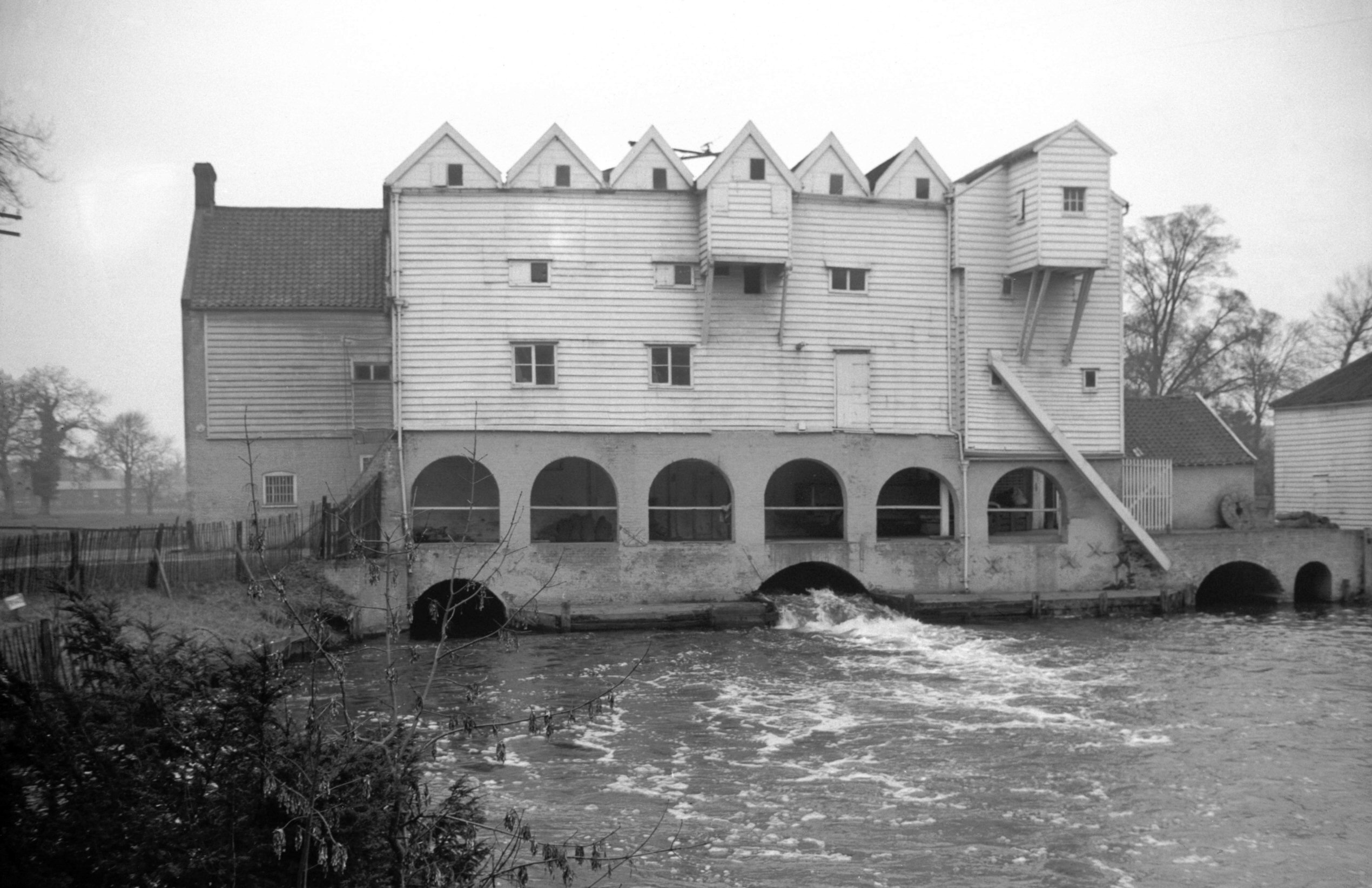
Horstead: Watermill on the River Bure, north side 1940-03-22 |
|
|
Watermill on the River Bure, south side 1940-04-07 | |
|
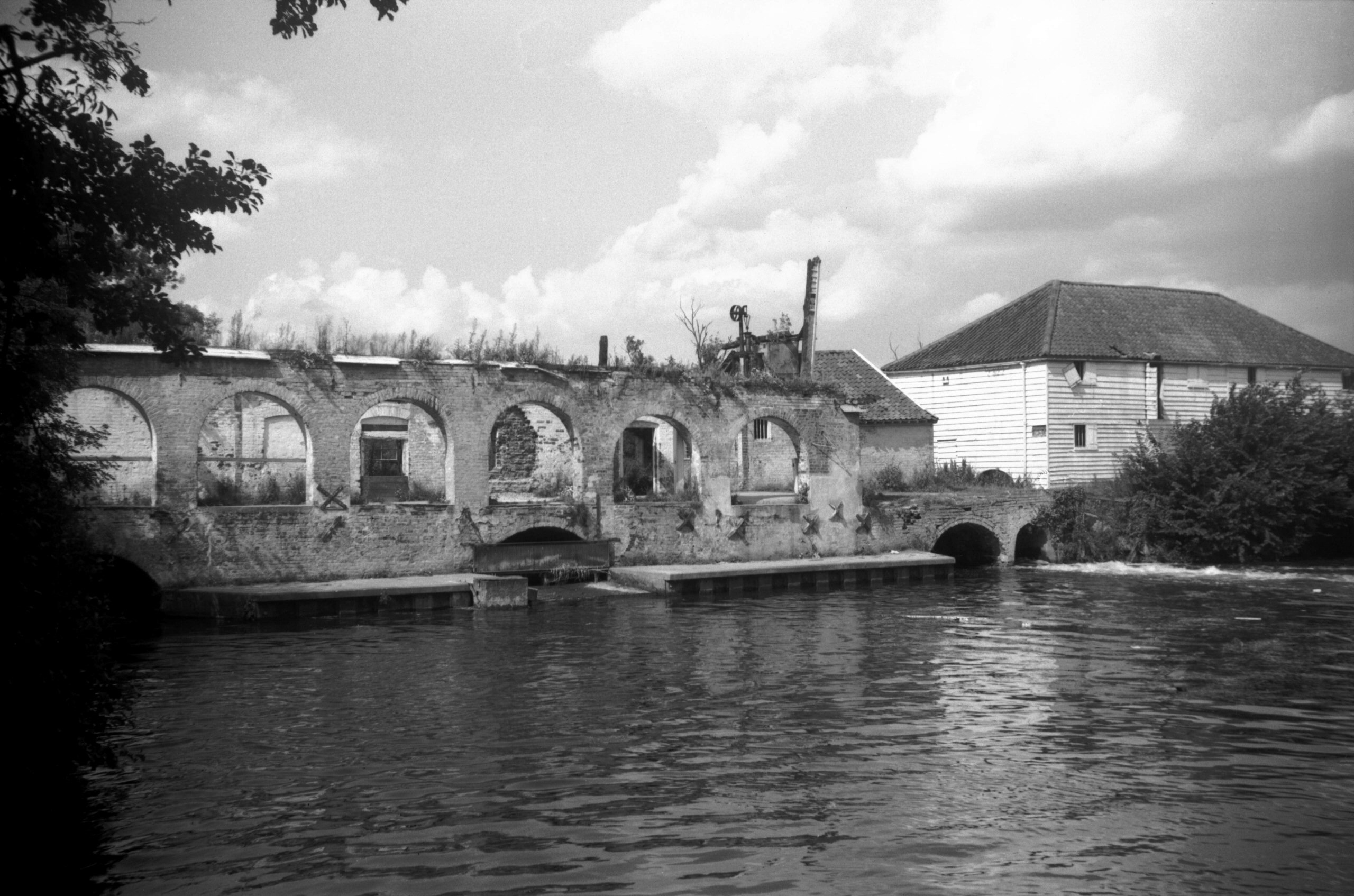
Watermill on the River Bure downstream side
1965-07-31 A fire destroyed this mill in 1963. |
|
|
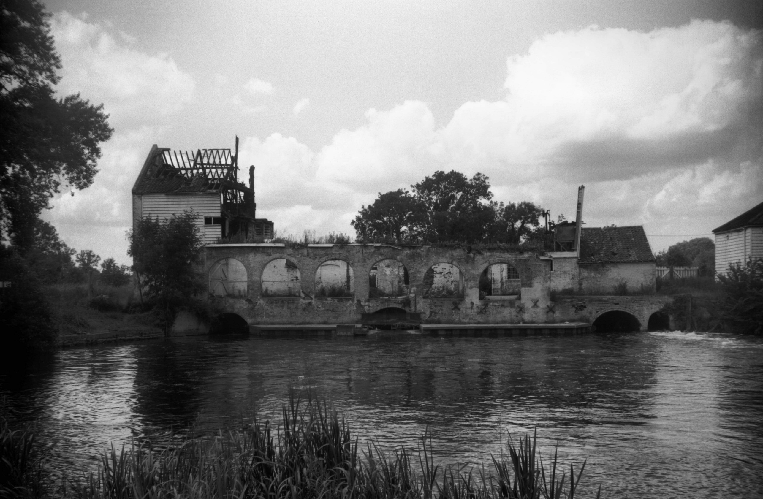
Watermill on the River Bure downstream side 1965-07-31 | |
|
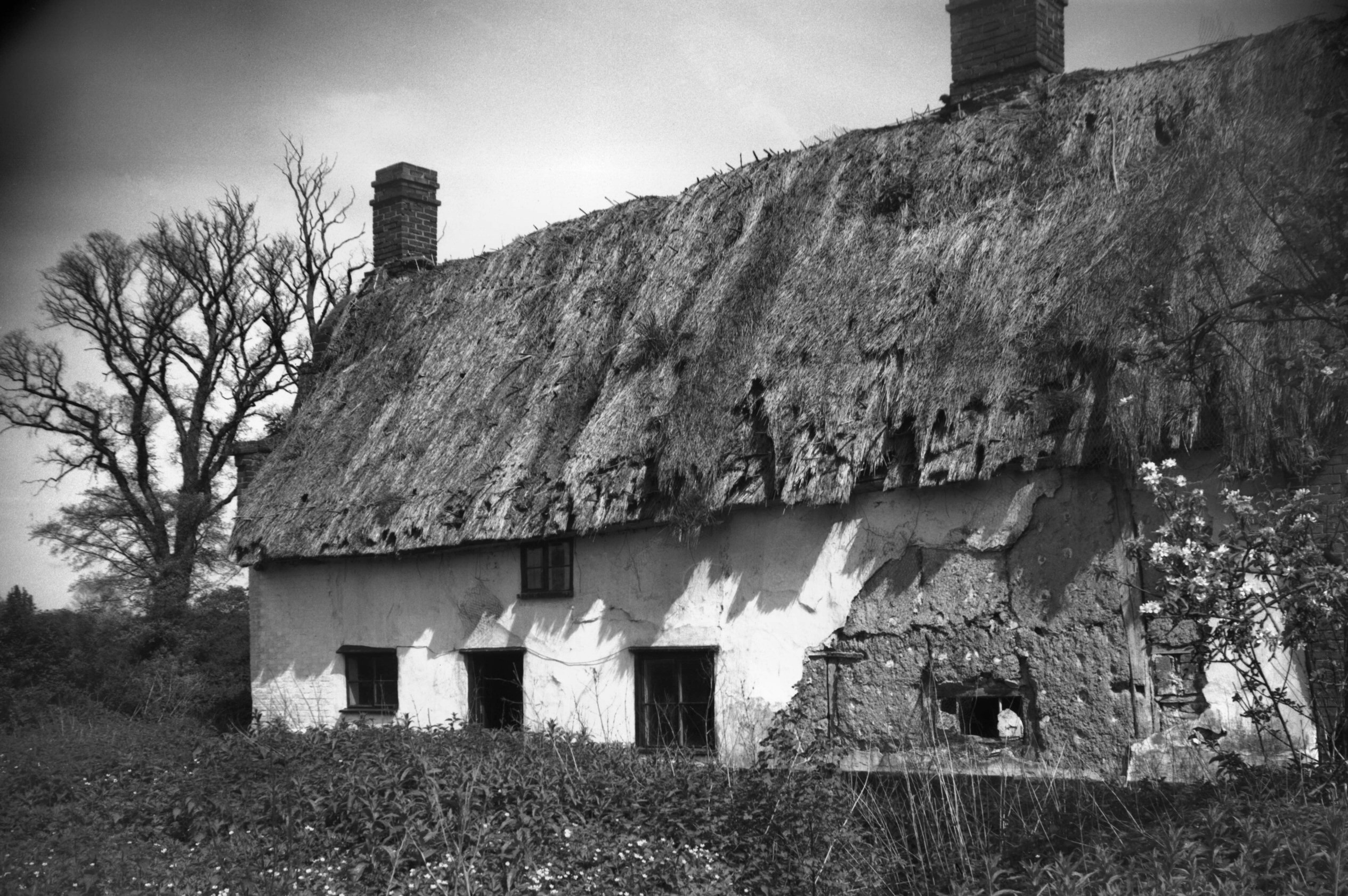
Newton Flotman: Thatched clay lump cottage 1969-05-25 Formed from old building materials, this cottage has since been demolished. |
|
|
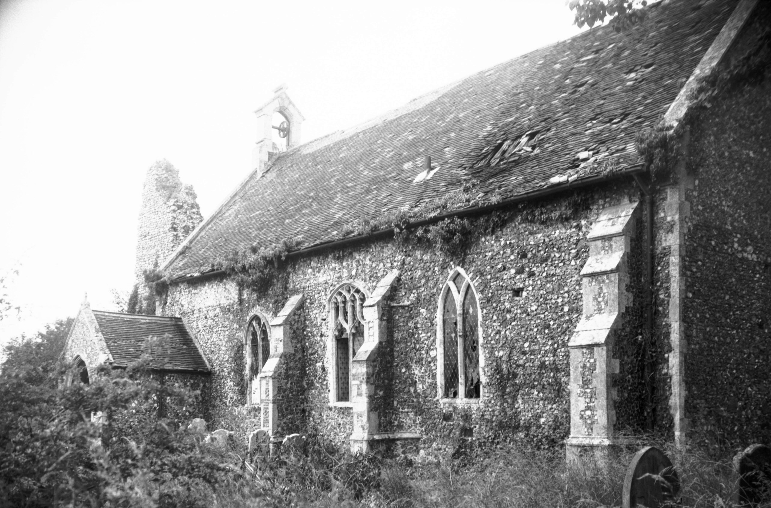
Sco Ruston: St Michael's church from the south-east 1978-07-14 This church has since been unroofed and is going to ruin. |
|
|
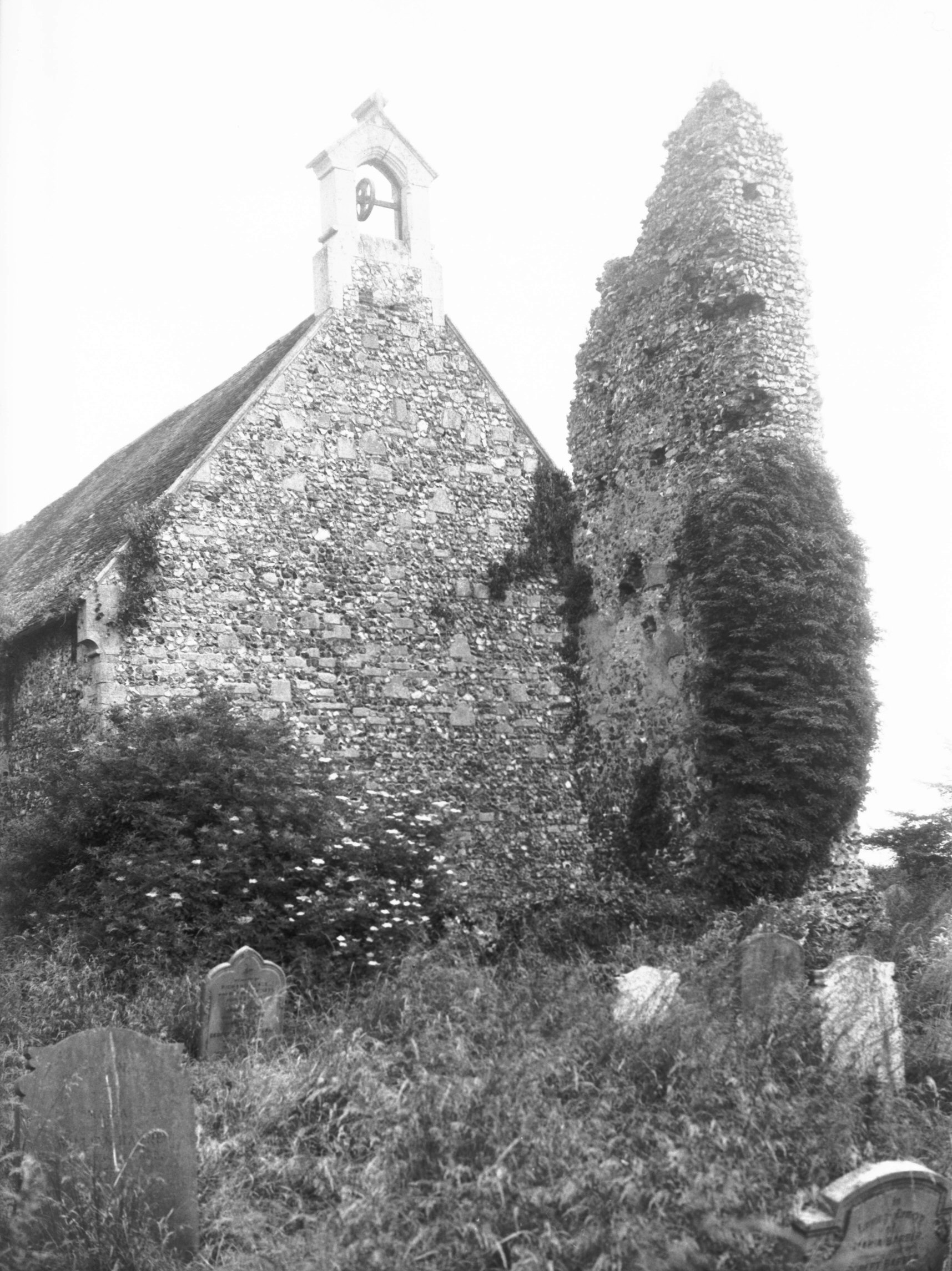
St Michael's church from the west with ruined tower fragment 1978-07-14 | |
|
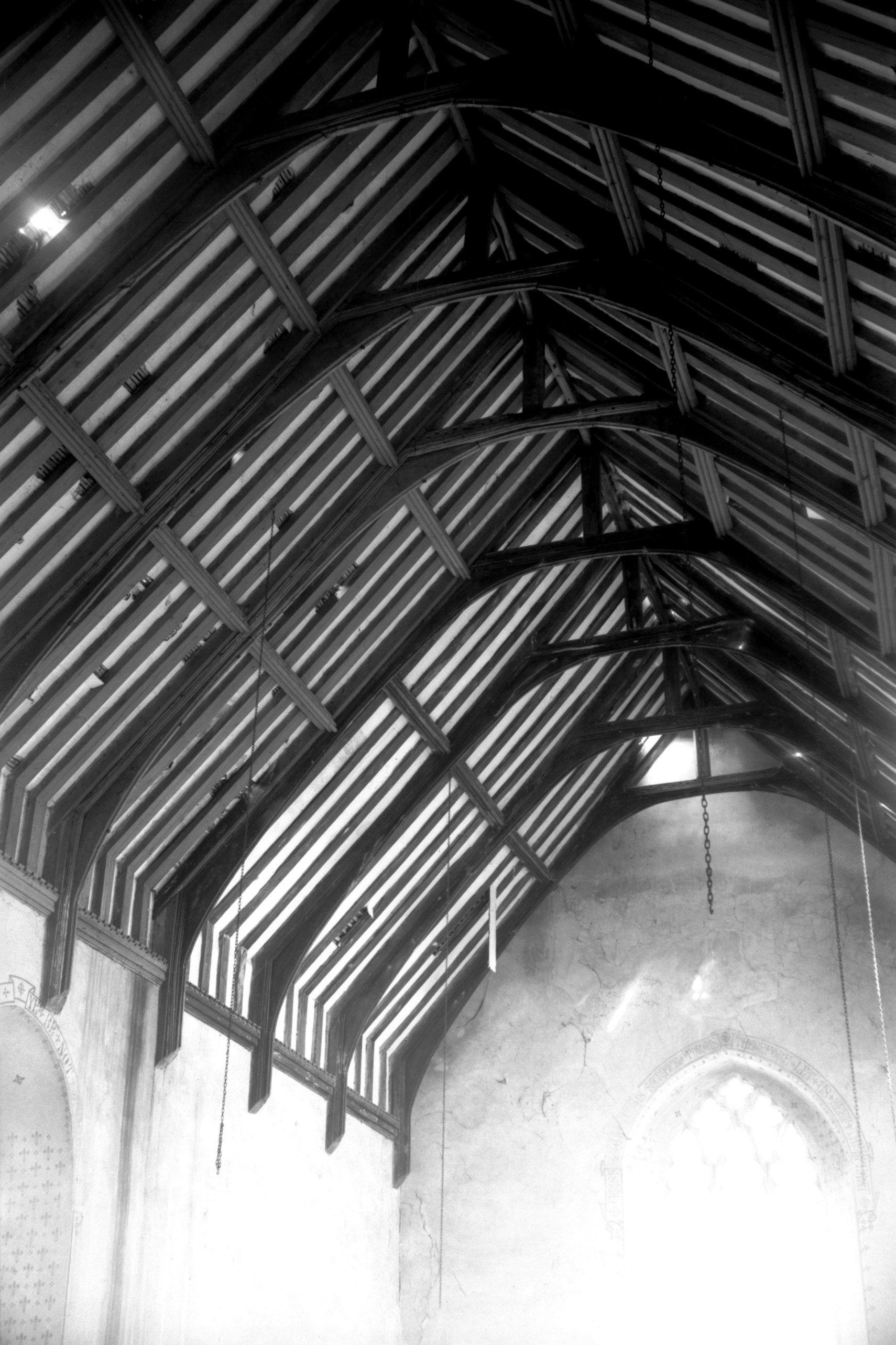
St Michael's church early 16th century archbraced roof looking east 1978-07-14 | |
|
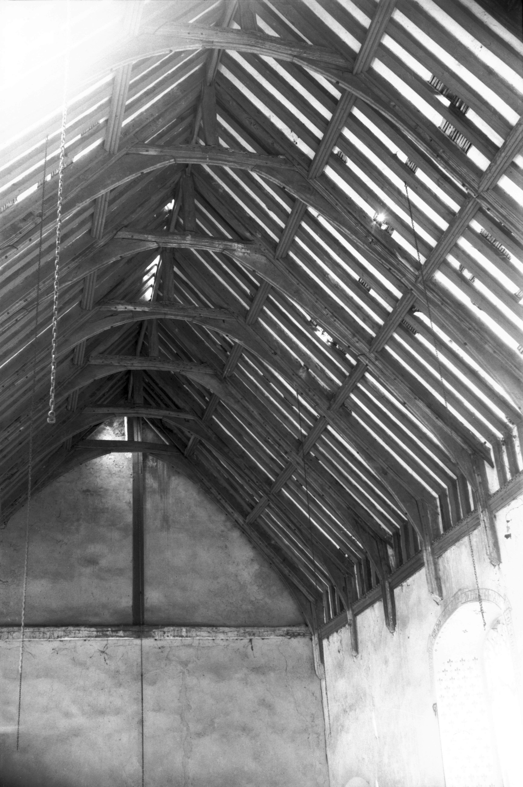
St Michael's church early 16th century archbraced roof looking west 1978-07-14 | |
|
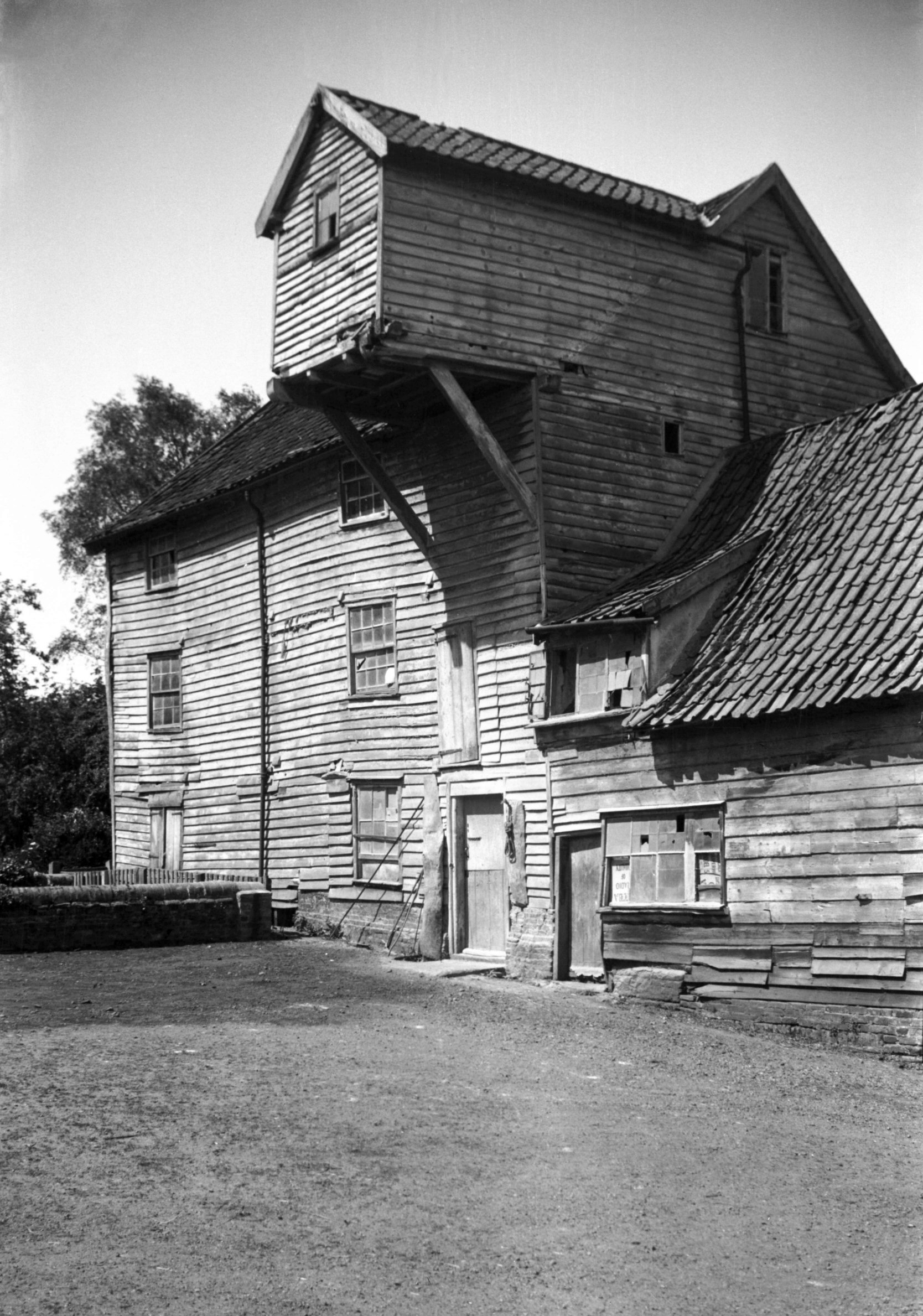
Shotesham St Mary: Watermill on the River Tas, north side 1939-06-03 This eighteenth century mill was demolished in 1949. |
|
|
Watermill on the River Tas, south side 1939-05-29 | |
|
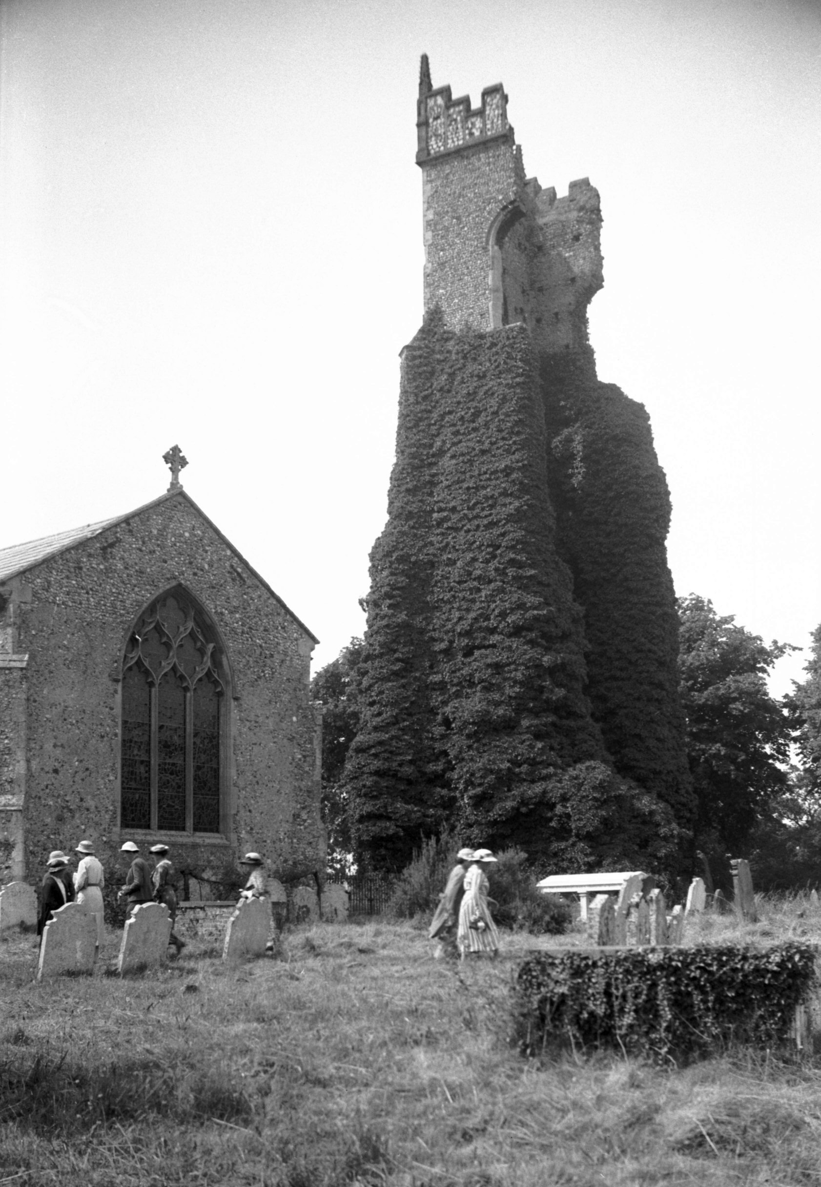
South Walsham: St Laurence's tower ruin, and east end of St Mary's church 1937-07-15 The two adjacent churches are fourteenth century. After a fire in 1827 St Lawrence's tower was left to go to ruin, finally collapsing in 1971. |
|
|
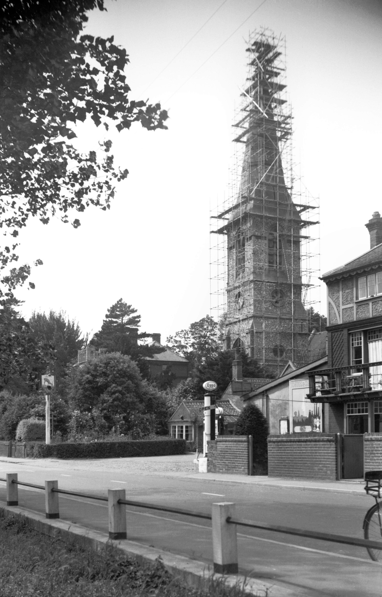
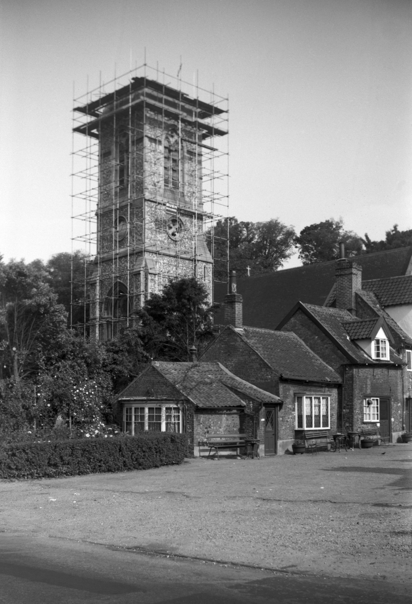
Thorpe St Andrew: Church tower and spire with scaffolding 1954-06-27 This Victorian church suffered bomb damage to its spire, which is seen here being removed. |
|
|
Church tower with spire removed 1955-06-27 The tower was subsequently given a pyramid shaped roof. |
|
|
Yarmouth Road, octagonal house 1964-05-23 Situated near the Griffin public house, this curiously shaped house has since been demolished. Similar octagonal houses still stand in Cringleford and Hellesdon. |
|
|
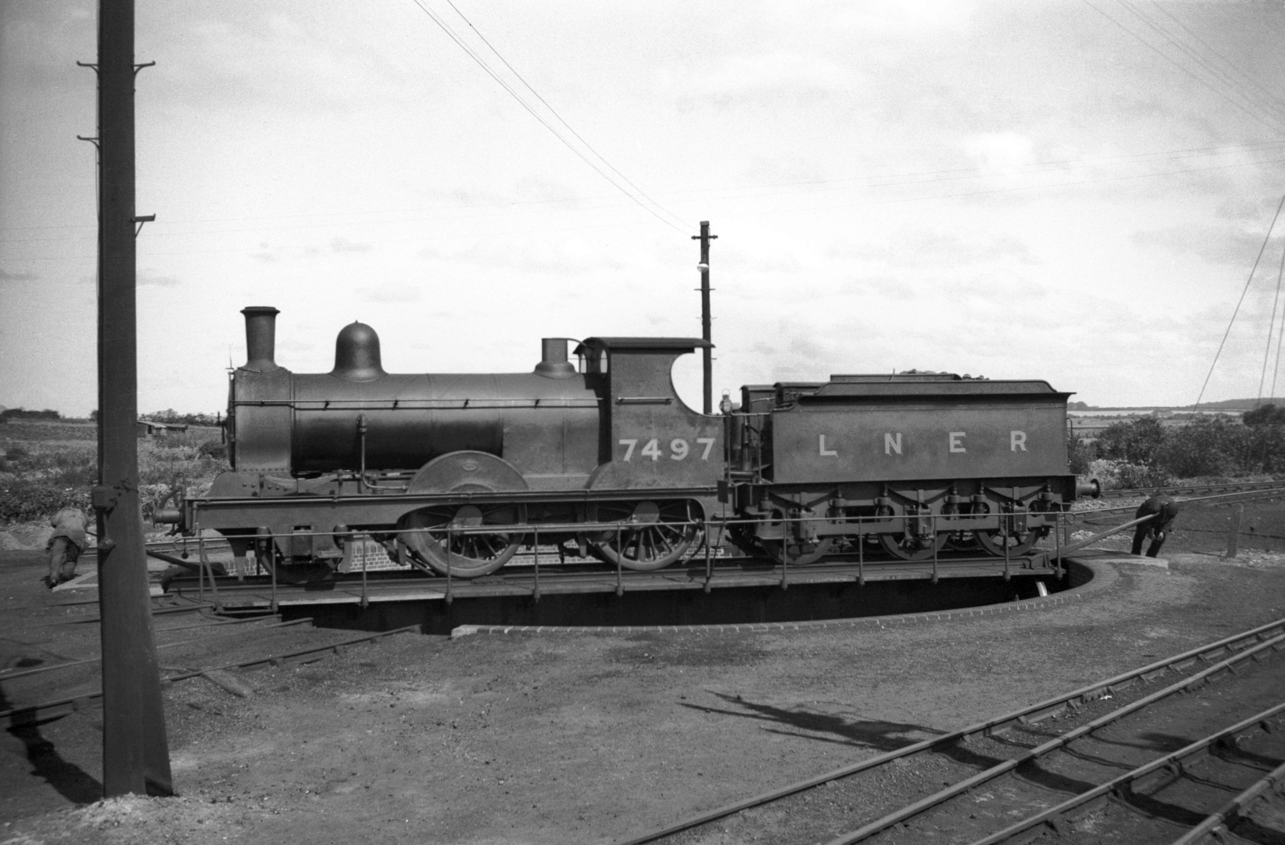
Wells next Sea: Steam locomotive on turntable 1935-08-13 Two men had to work hard to turn this LNER locomotive around at Wells station. |
|
|
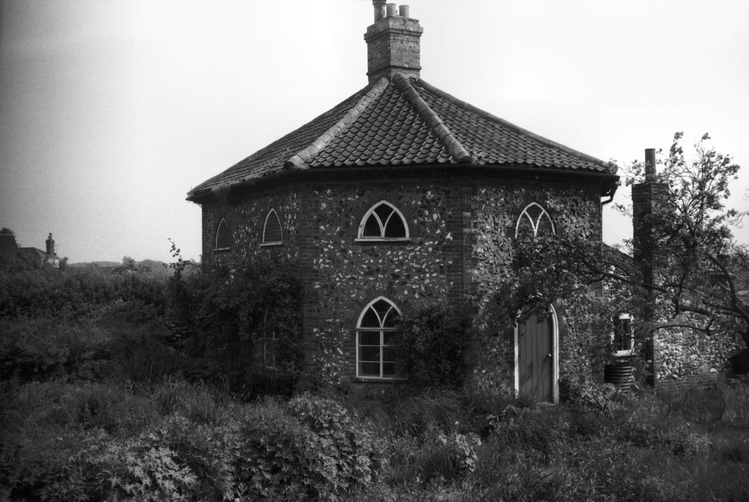
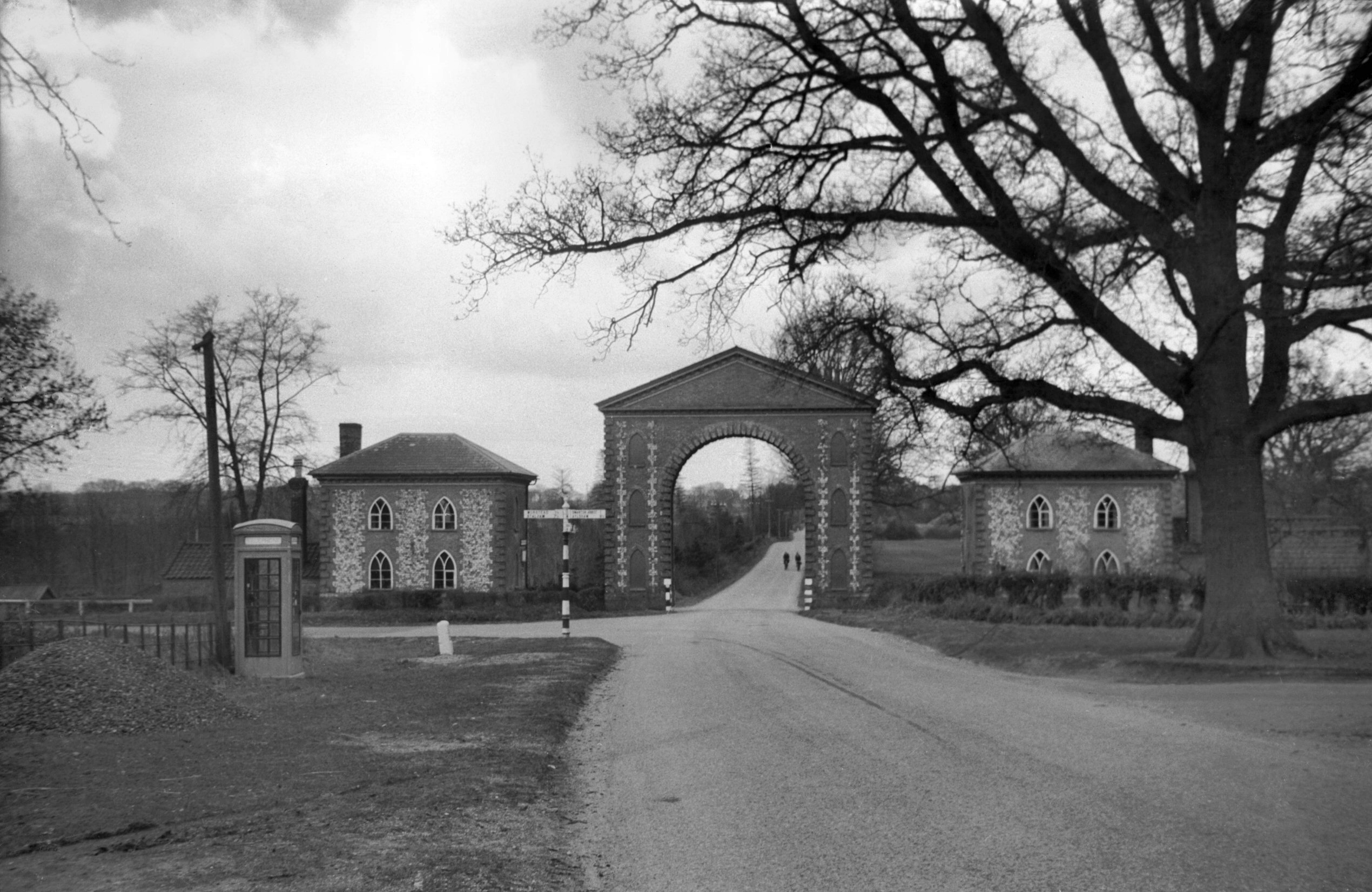
Westwick: Arch spanning the main road 1940-03-22 Built across the Norwich to North Walsham road in 1830, the Westwick Arch was also a dovecote. It was about to be given a grade 2 listing when its owners demolished it in 1981. The lodge buildings remain. |
|
|
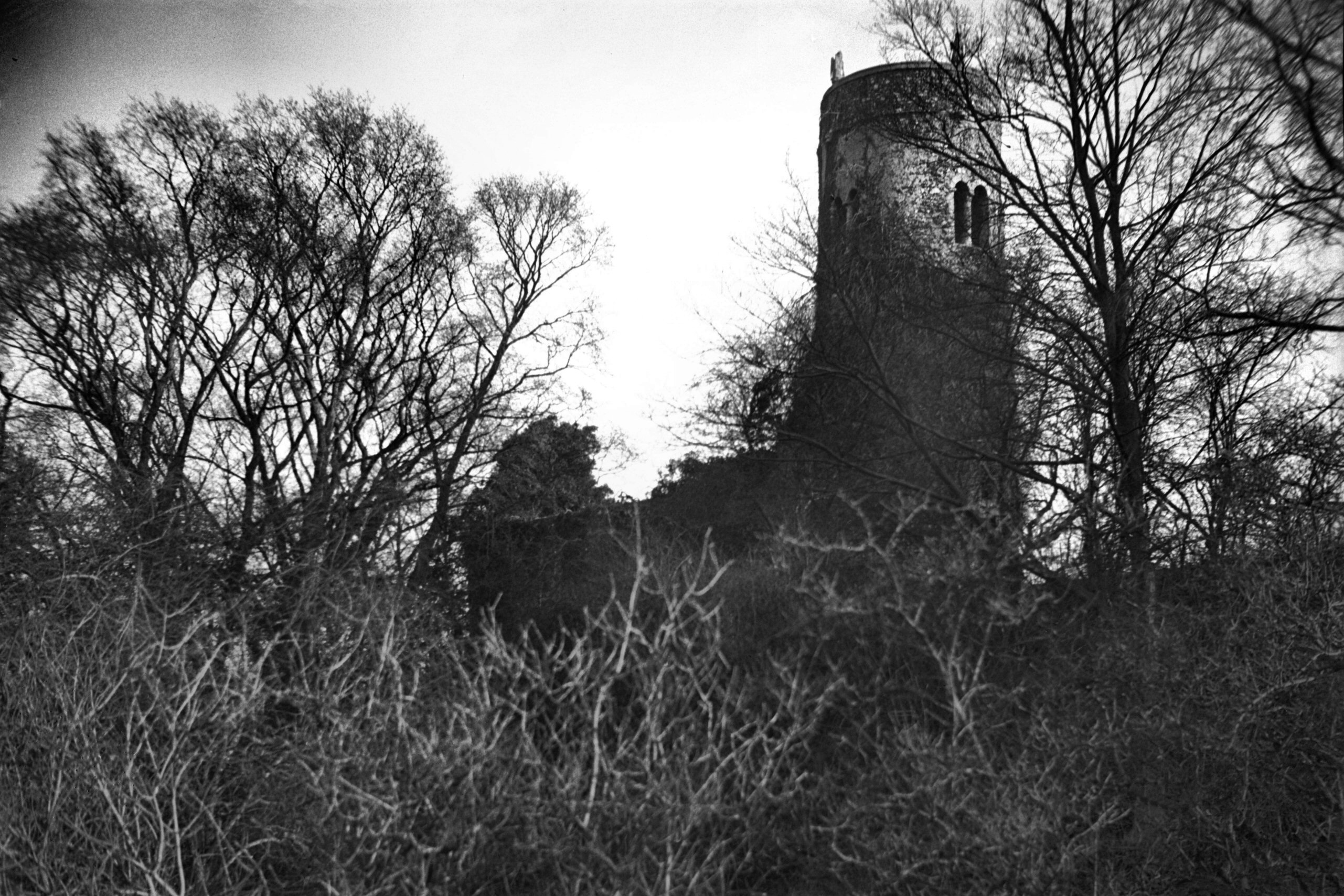
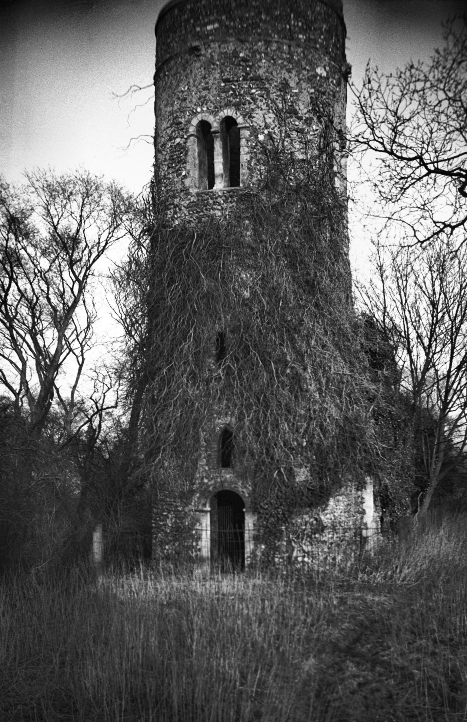
Whitlingham: St Andrew's church ruin from the north-west 1935-02-17 Remains of this church stand at the eastern end of Whitlingham Lane, just yards from Norwich's southern bypass. |
|
|
St Andrew's round tower ruin from the west 1935-02-17 The tower collapsed in 1940. |
|
|
Wramplingham: Watermill on the River Tiffey 1940-07-12 This mill north of Wymondham was demolished in 1945. |
Text and photographs copyright George Plunkett