| |
|
|
|
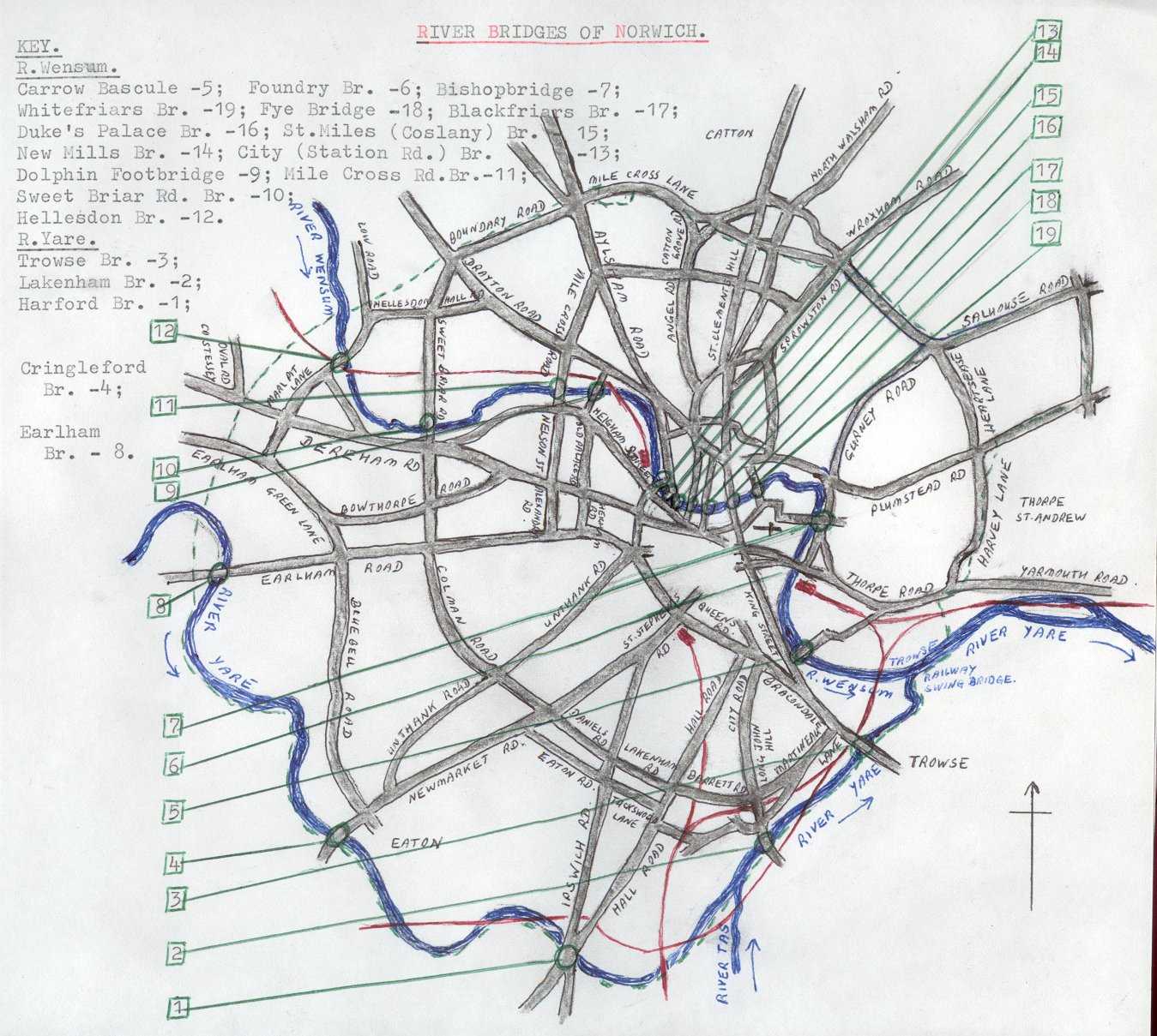
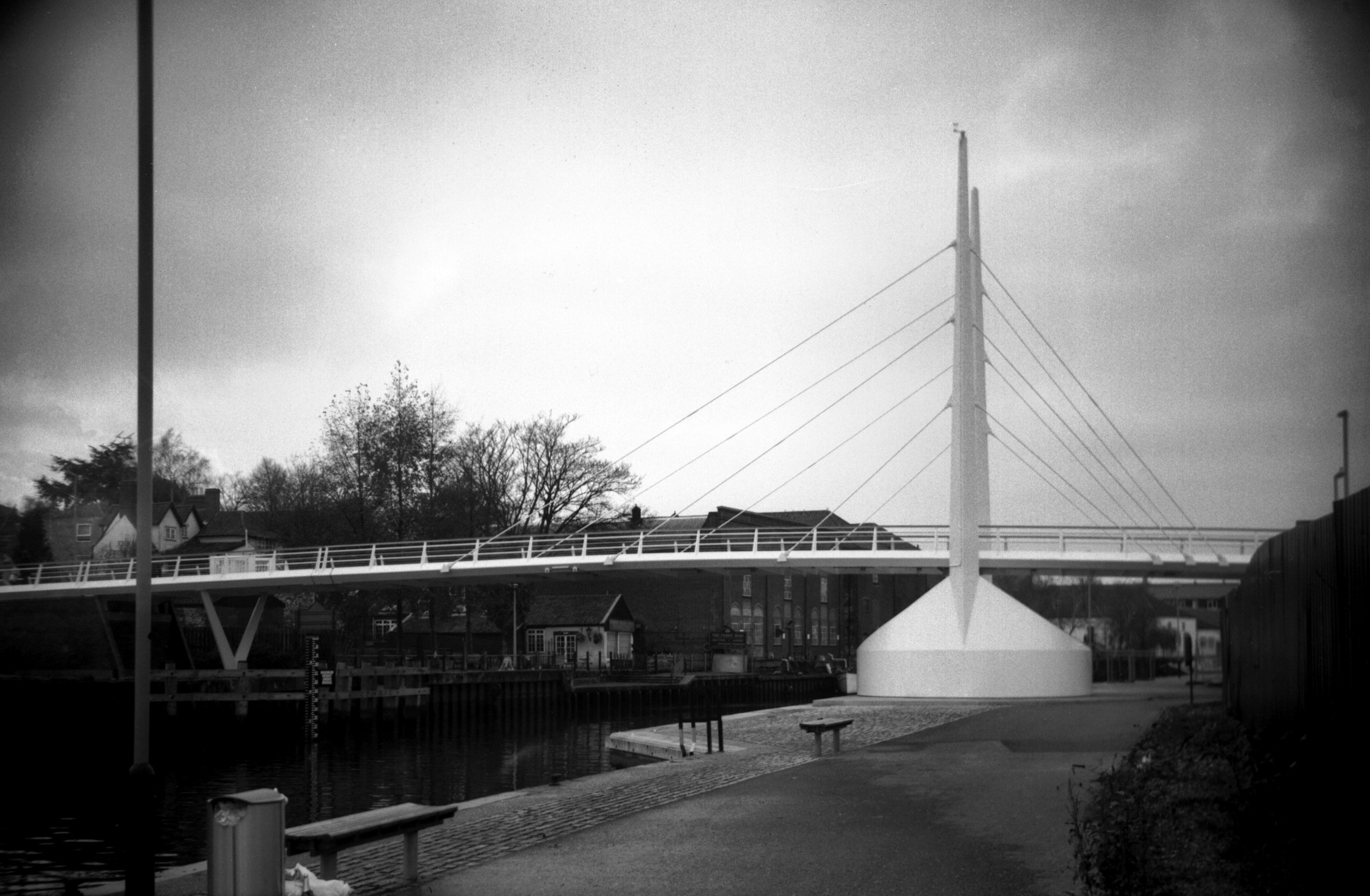
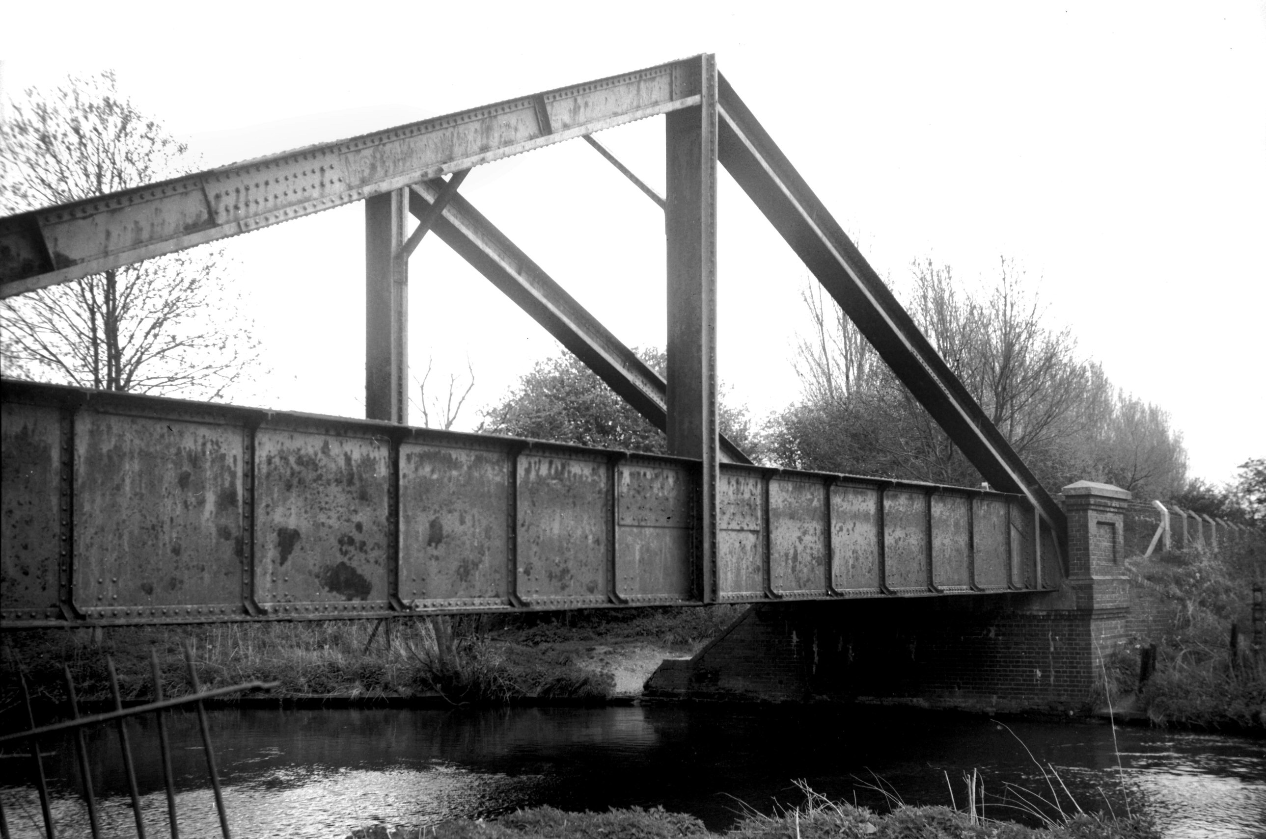
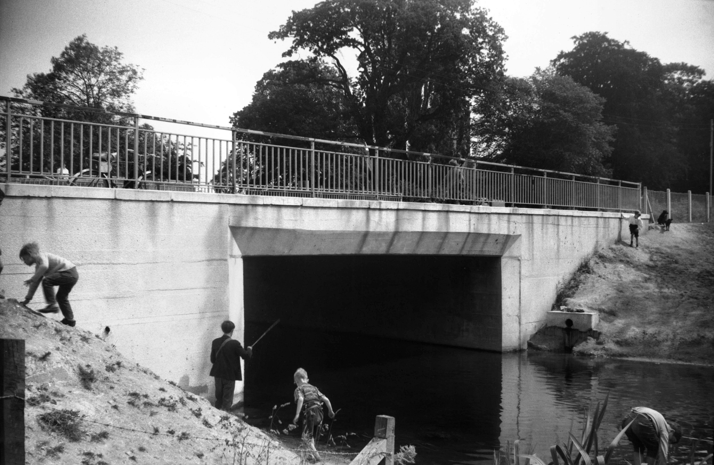
Wensum Trowse rail bridge with train [0605]
1935-08-05
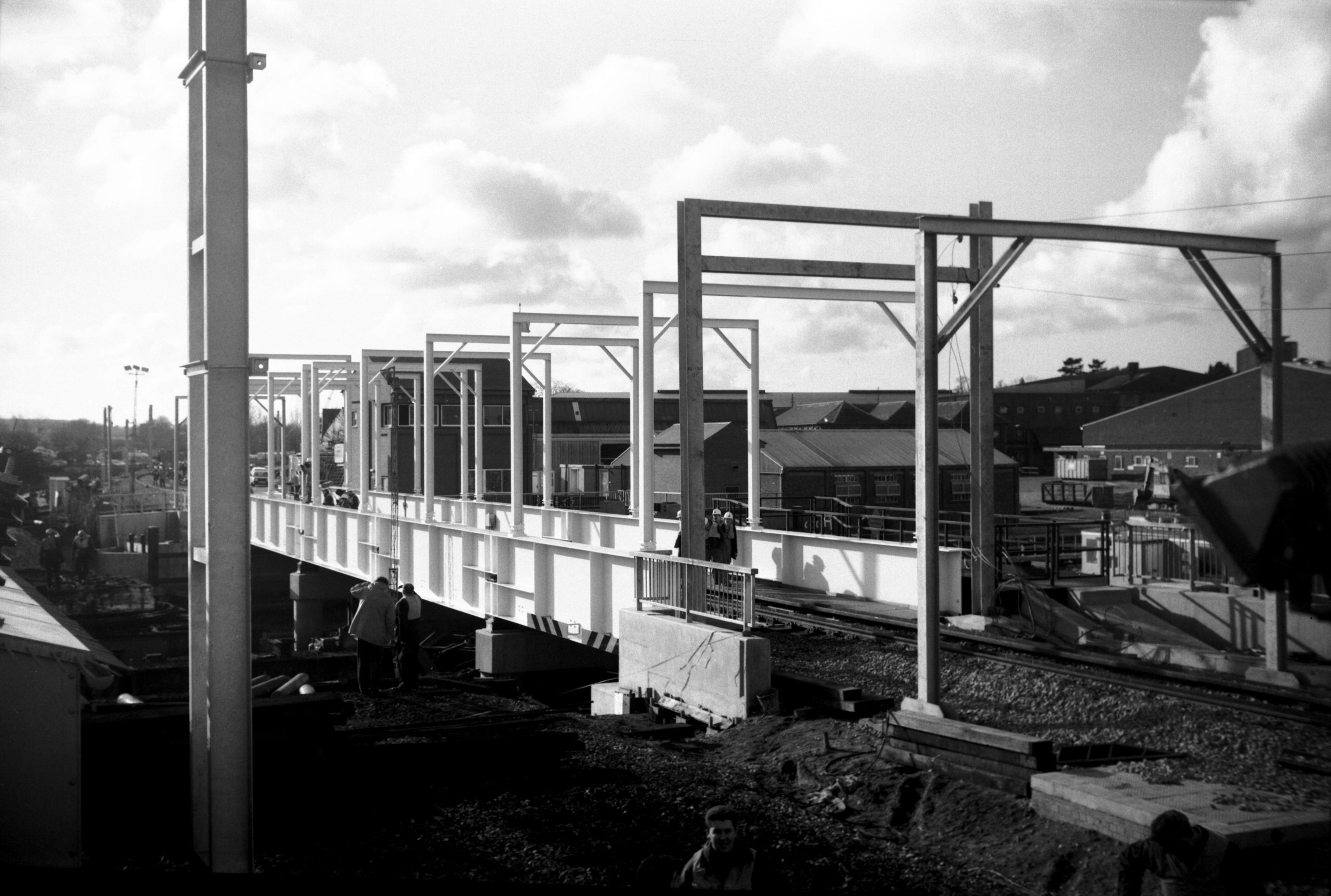
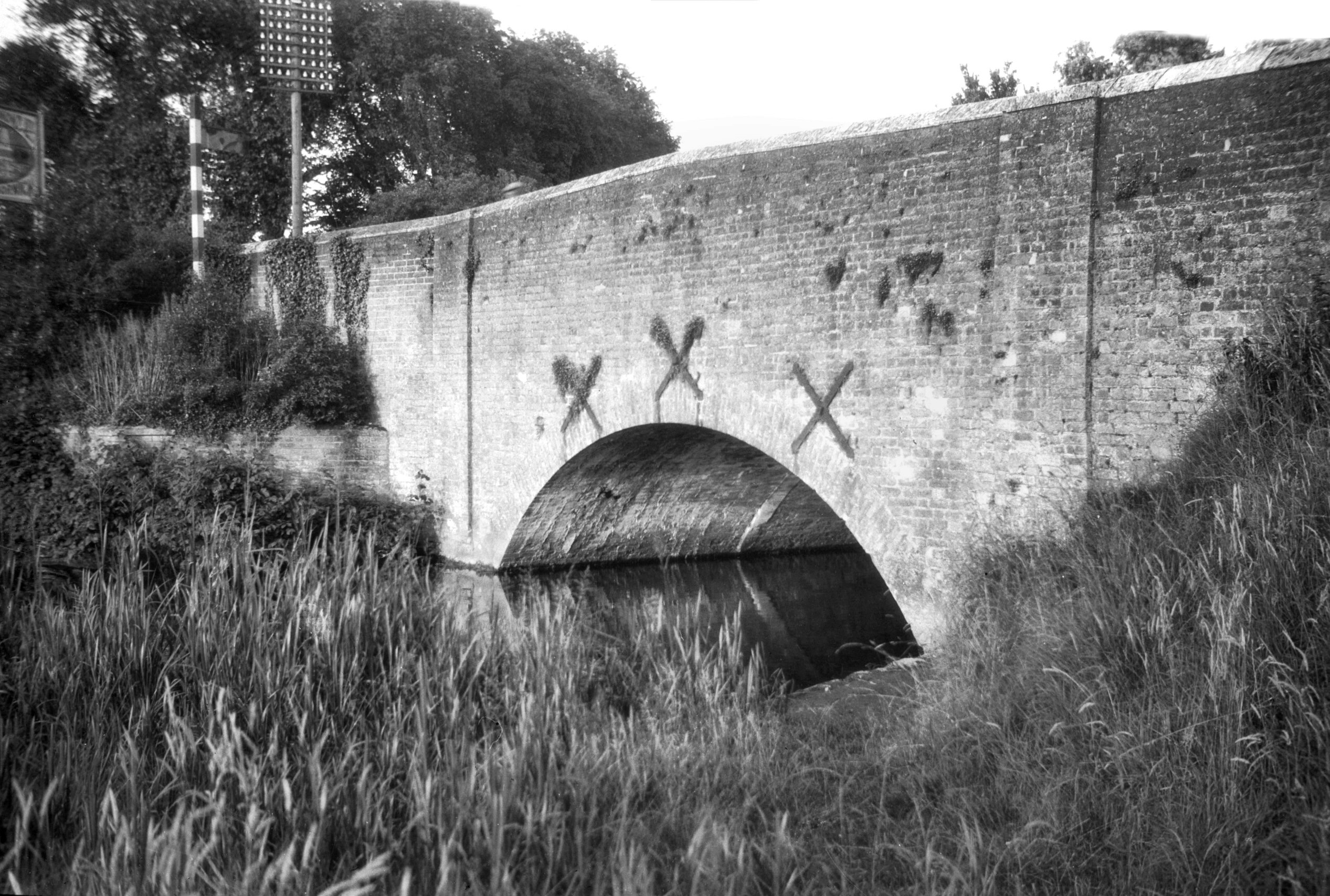
The first through line to London via Brandon and Ely was
opened on 30th July 1845. Owing to some delay in the
completion of the single-line swing bridge, the first
train started from Trowse. A later double-track structure
was opened in 1905. The present swing bridge was built in
connection with the electrification of the line from
London in 1986-7. Its specially designed swing-deck is
the only one in the world capable of carrying 25000 Volt
overhead cables. It has a single track allowing trains to
travel at 40 mph instead of the 15 mph restriction of the
previous bridge. The first train (drawn by a diesel
locomotive) crossed on 15th February 1987. |
|
|
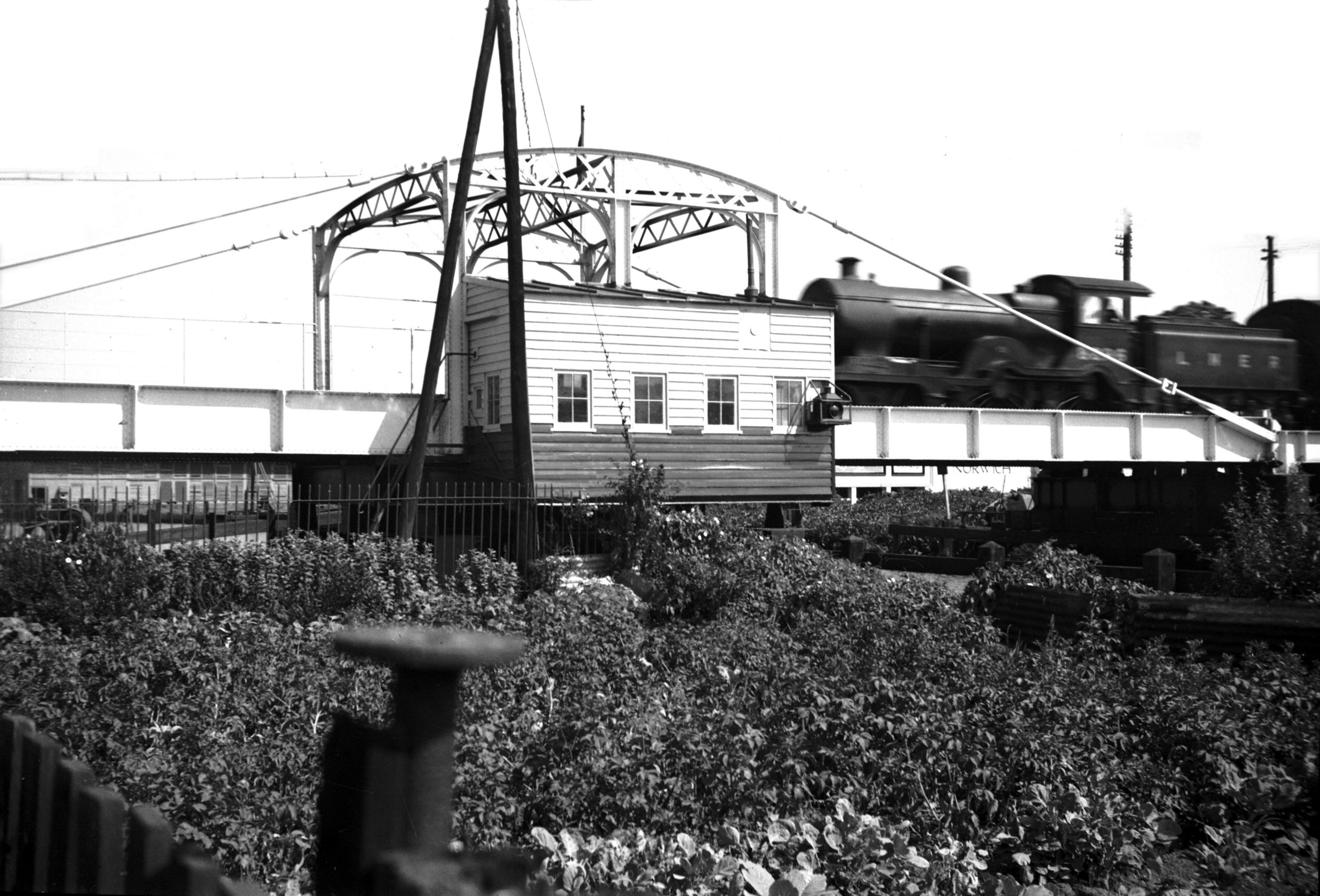
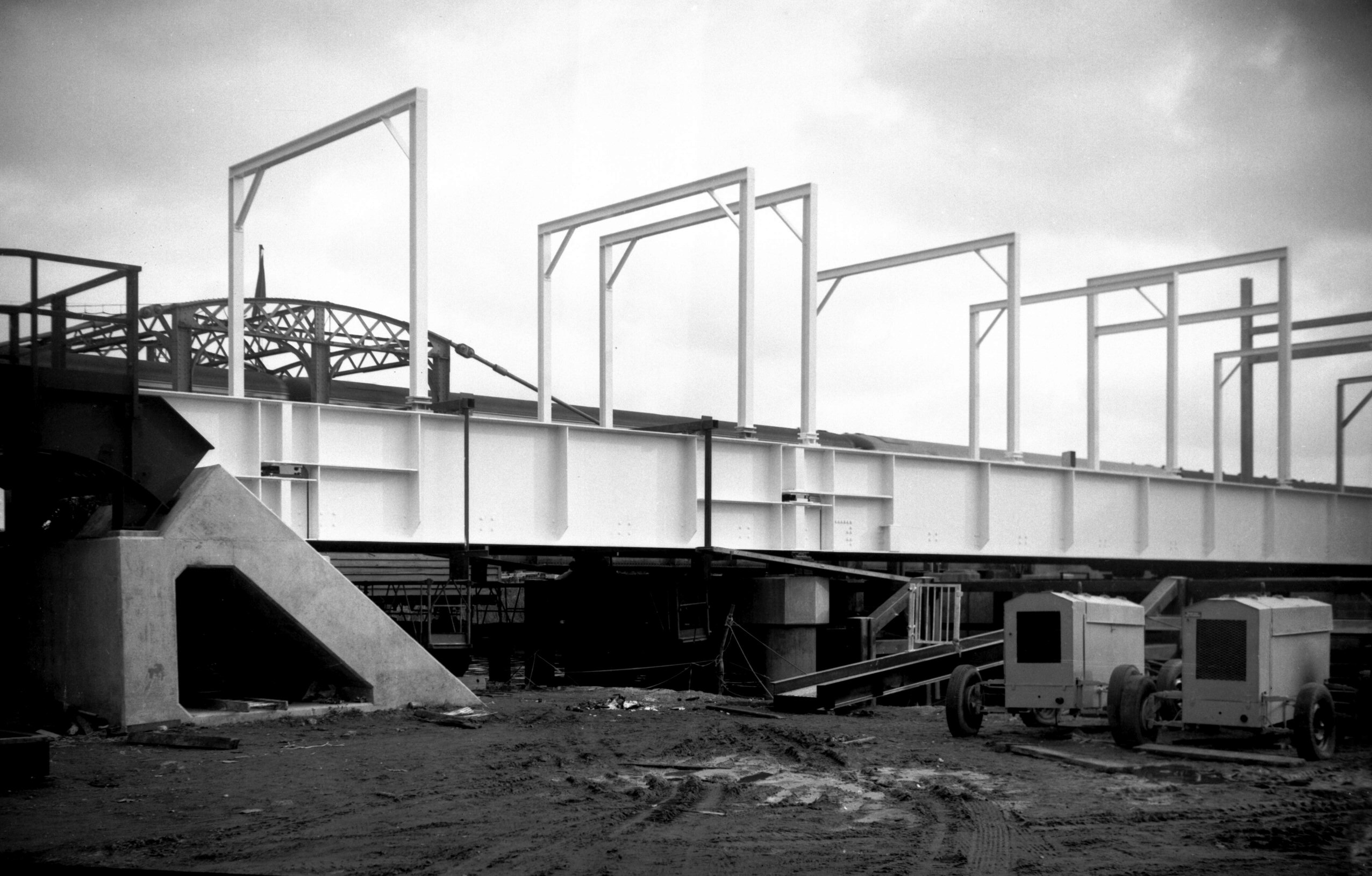
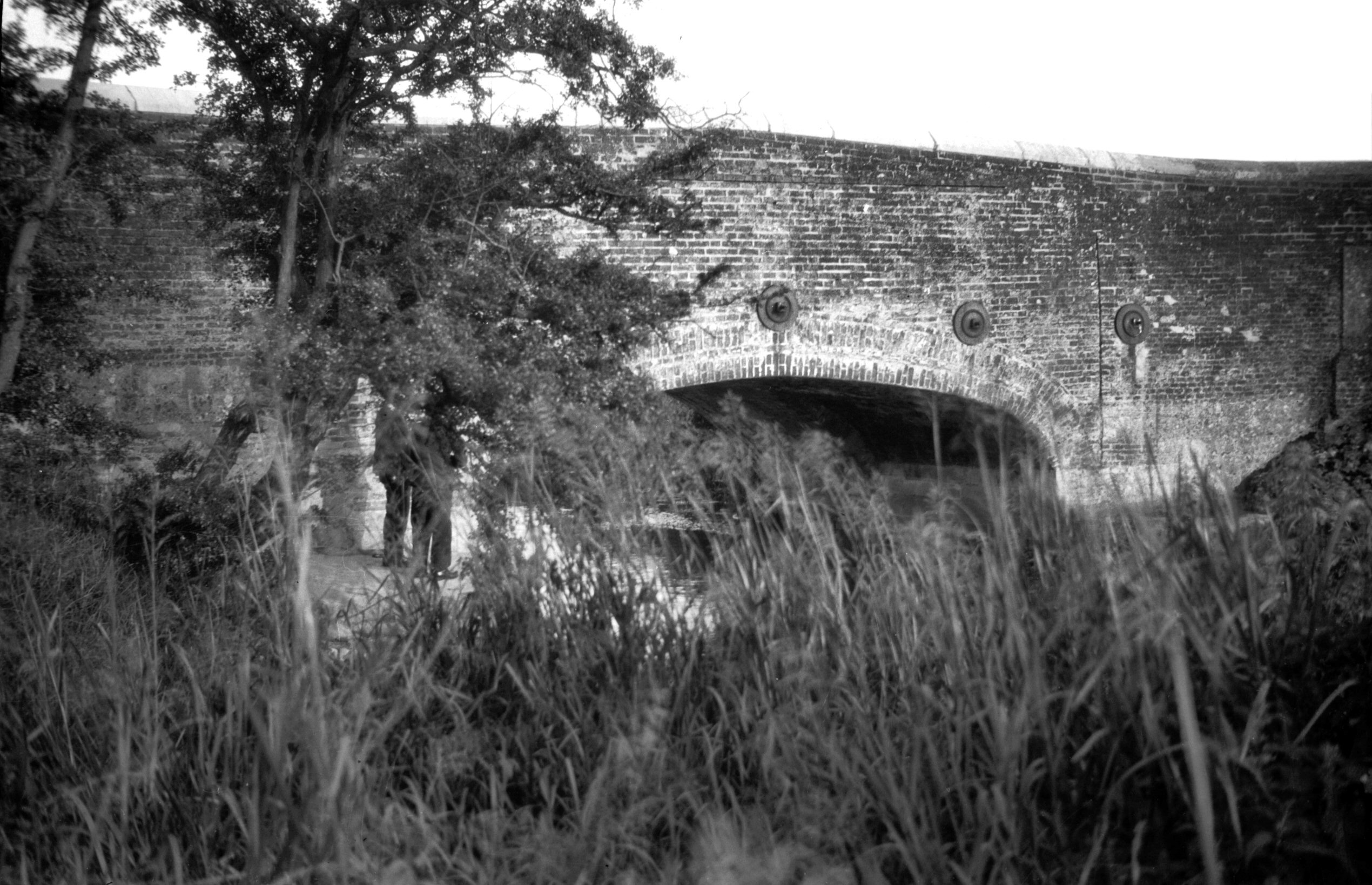
Wensum Trowse rail bridge construction [6360]
1986-05-08
|
|
|
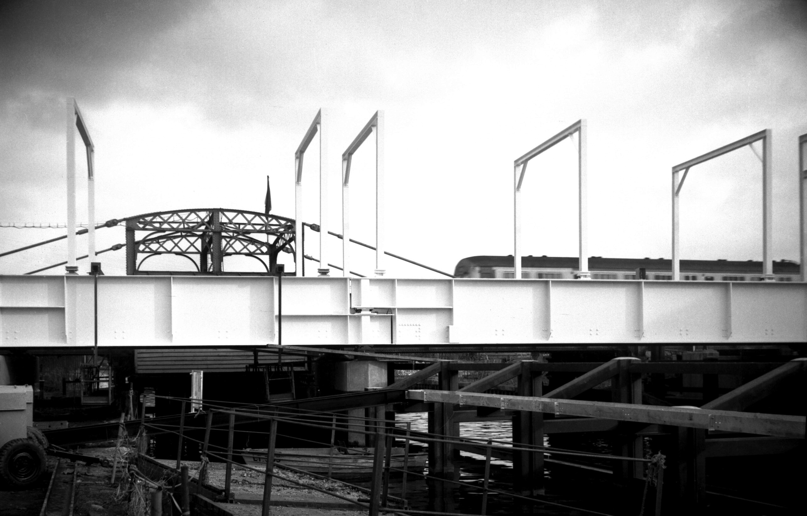
Wensum Trowse rail bridge construction [6361]
1986-05-08
|
|
|
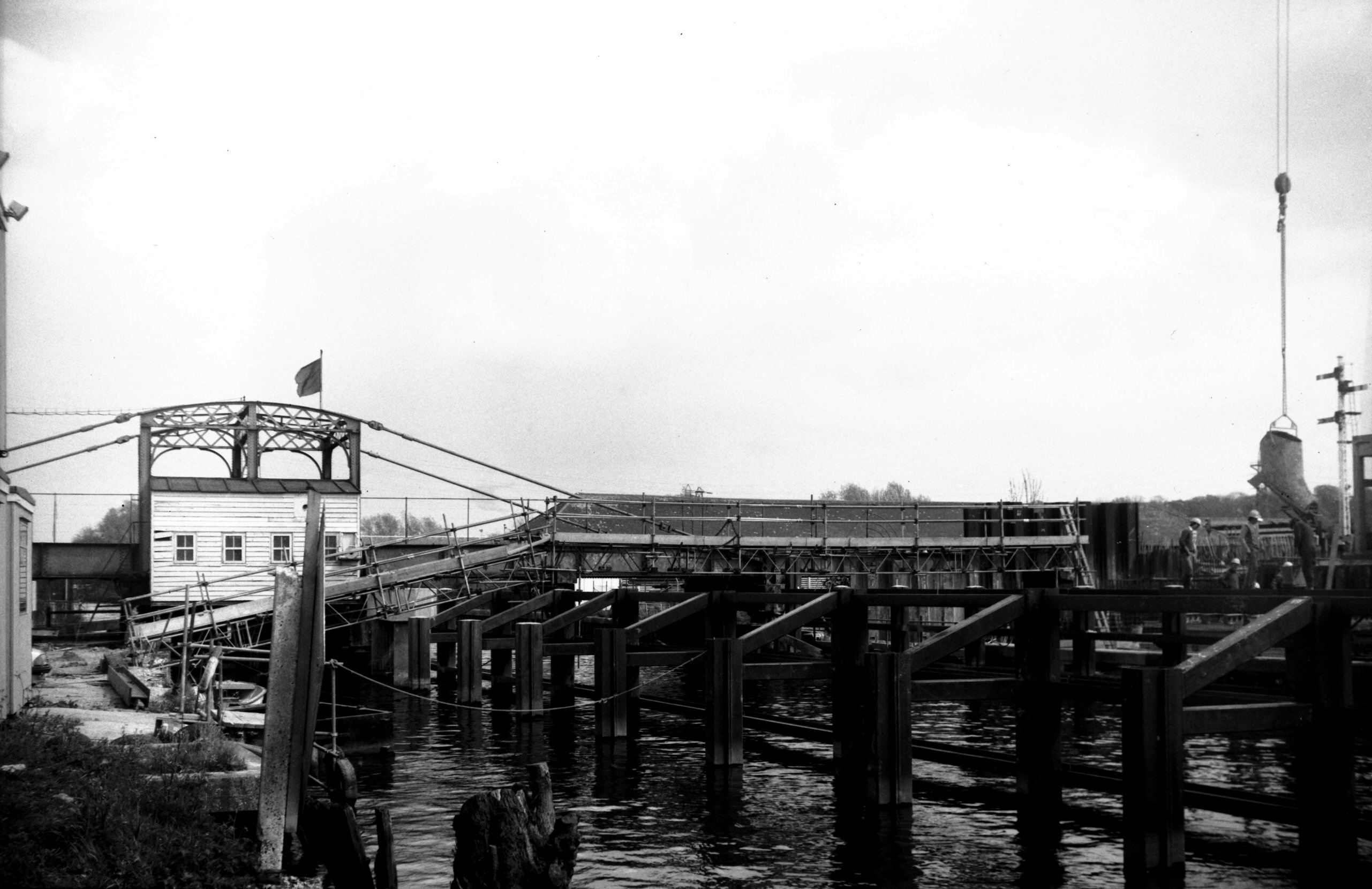
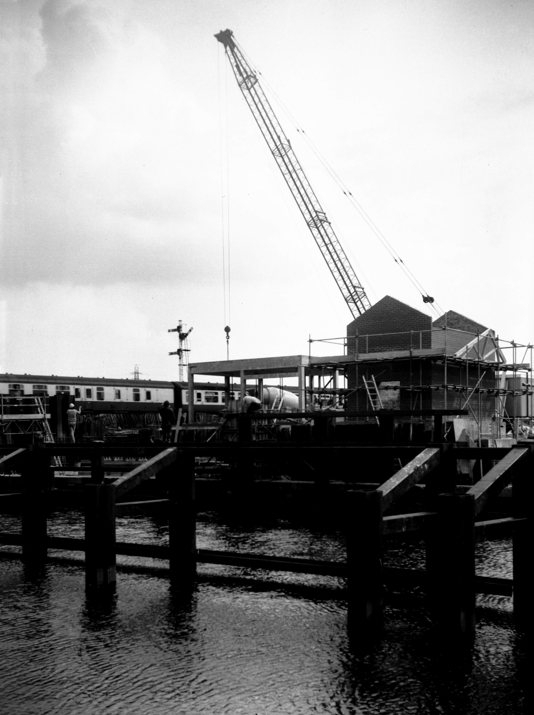
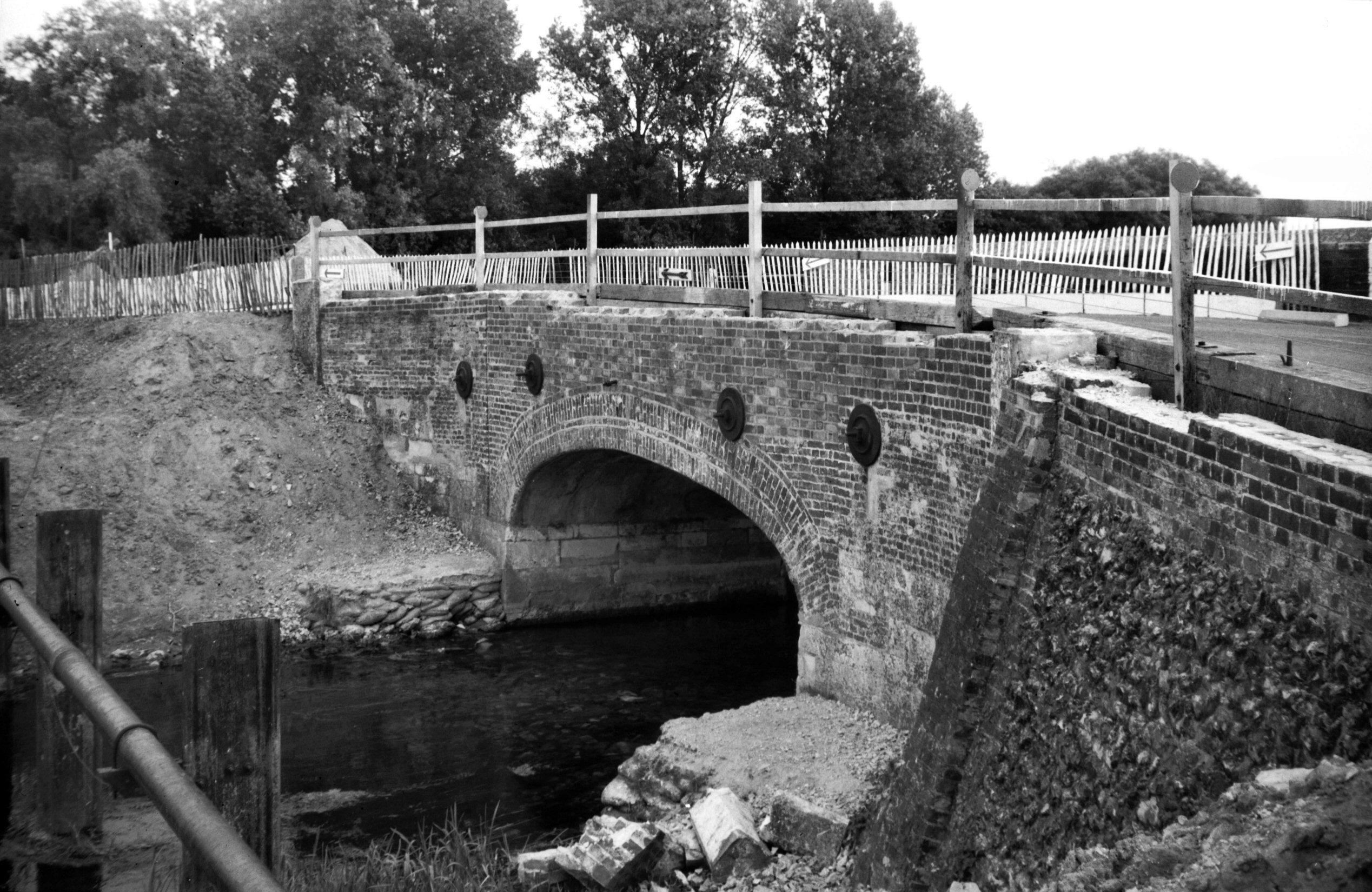
Wensum Trowse rail bridge construction [6430]
1987-02-07
|
|
|
Wensum Trowse rail bridge construction [6431]
1987-02-07
|
|
|
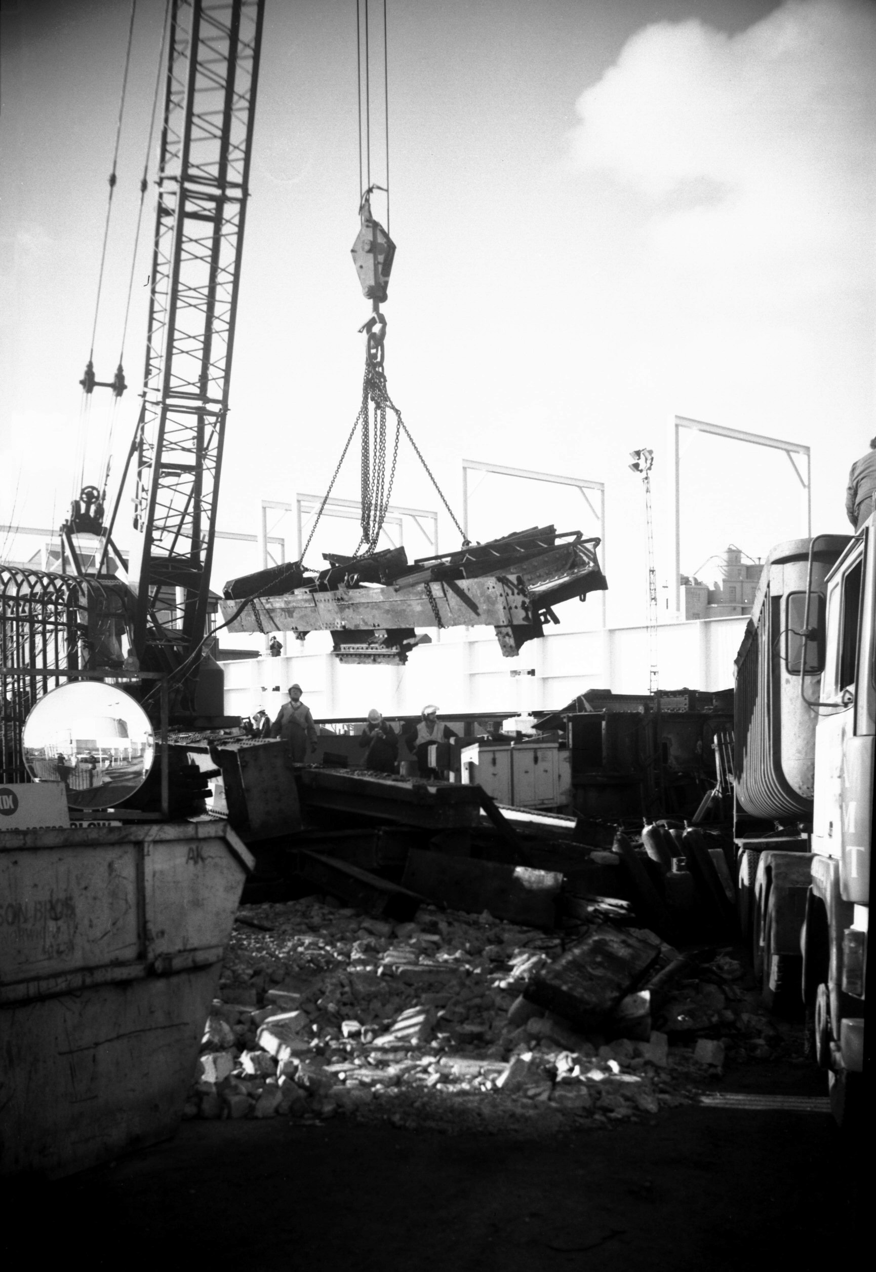
Wensum Trowse old rail bridge demolition [6433]
1987-02-15
|
|
|
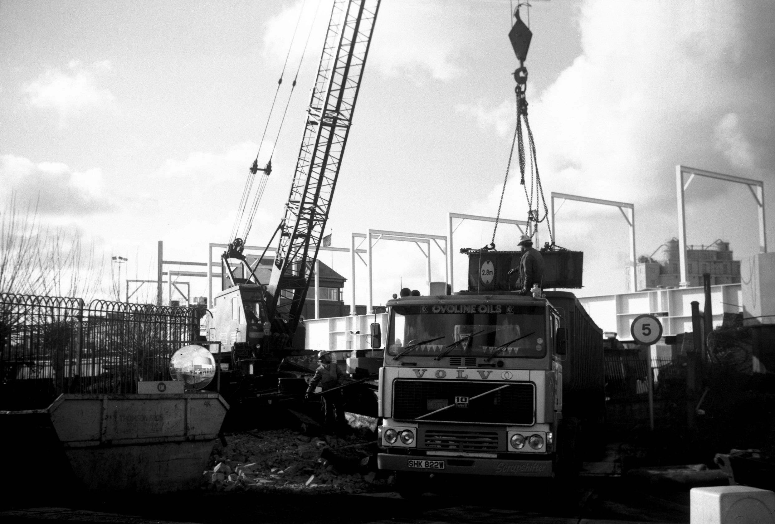
Wensum Trowse old rail bridge demolition [6434]
1987-02-15
|
|
|
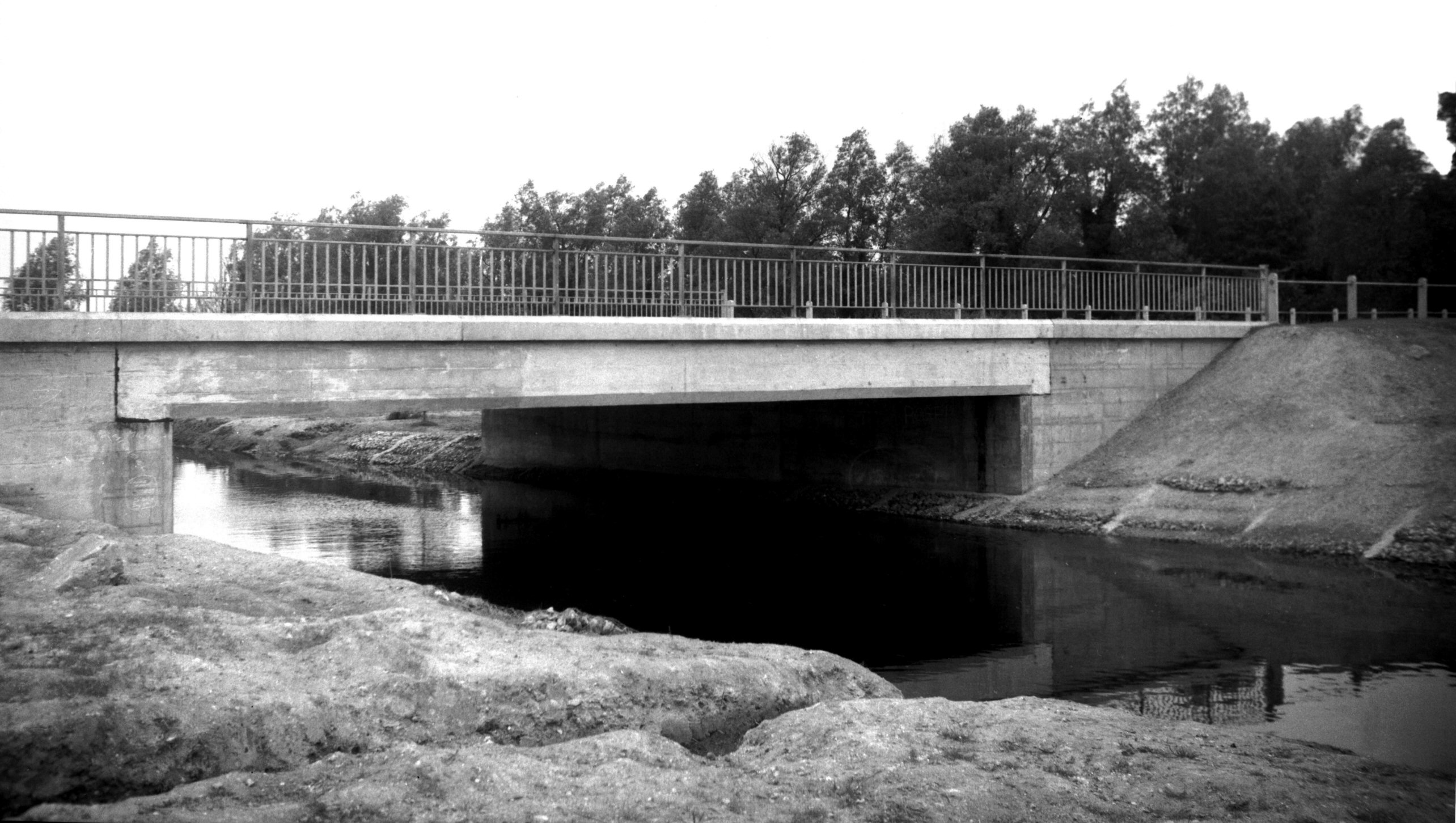
Wensum Trowse new rail bridge [6435] 1987-02-15
|
|
|
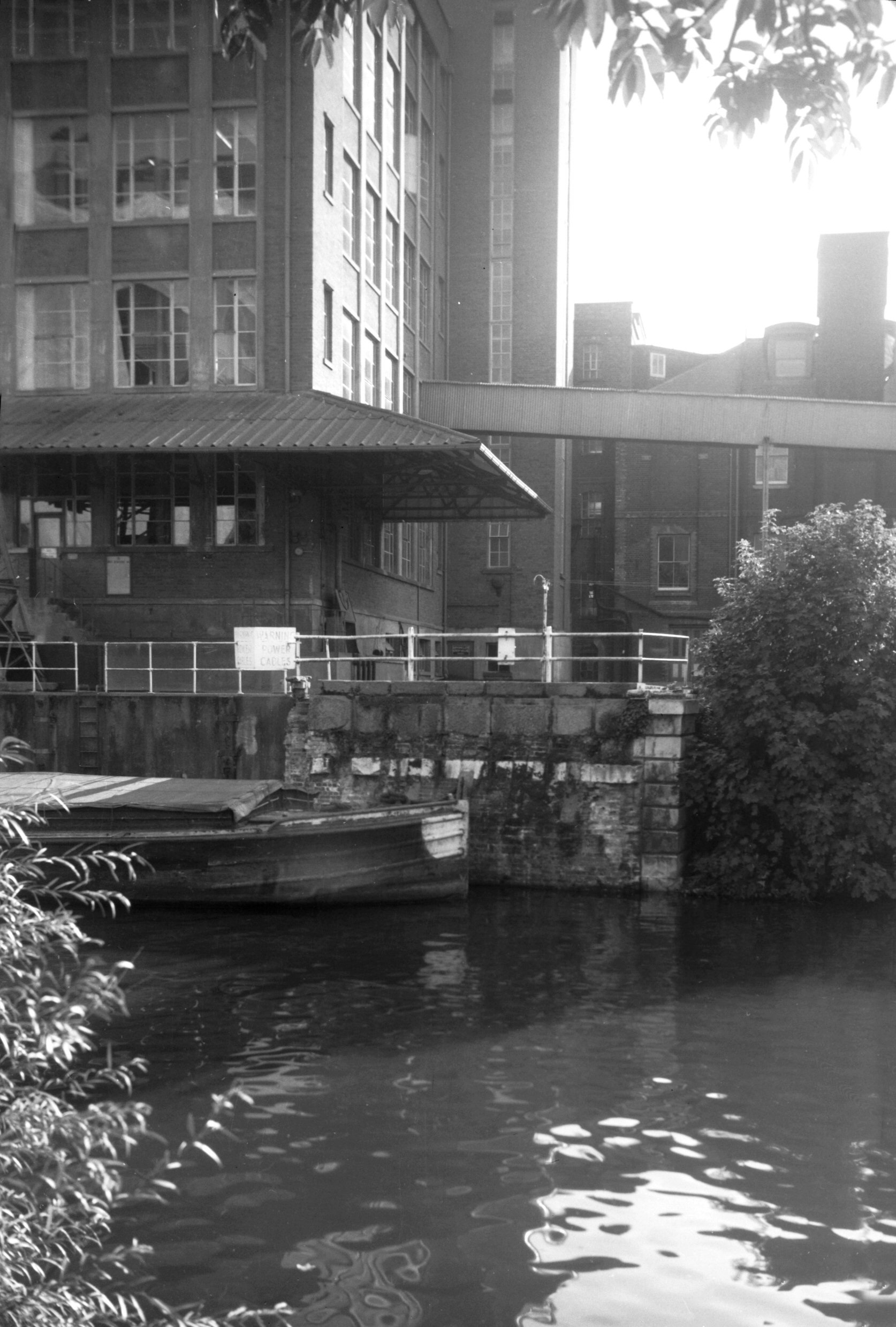
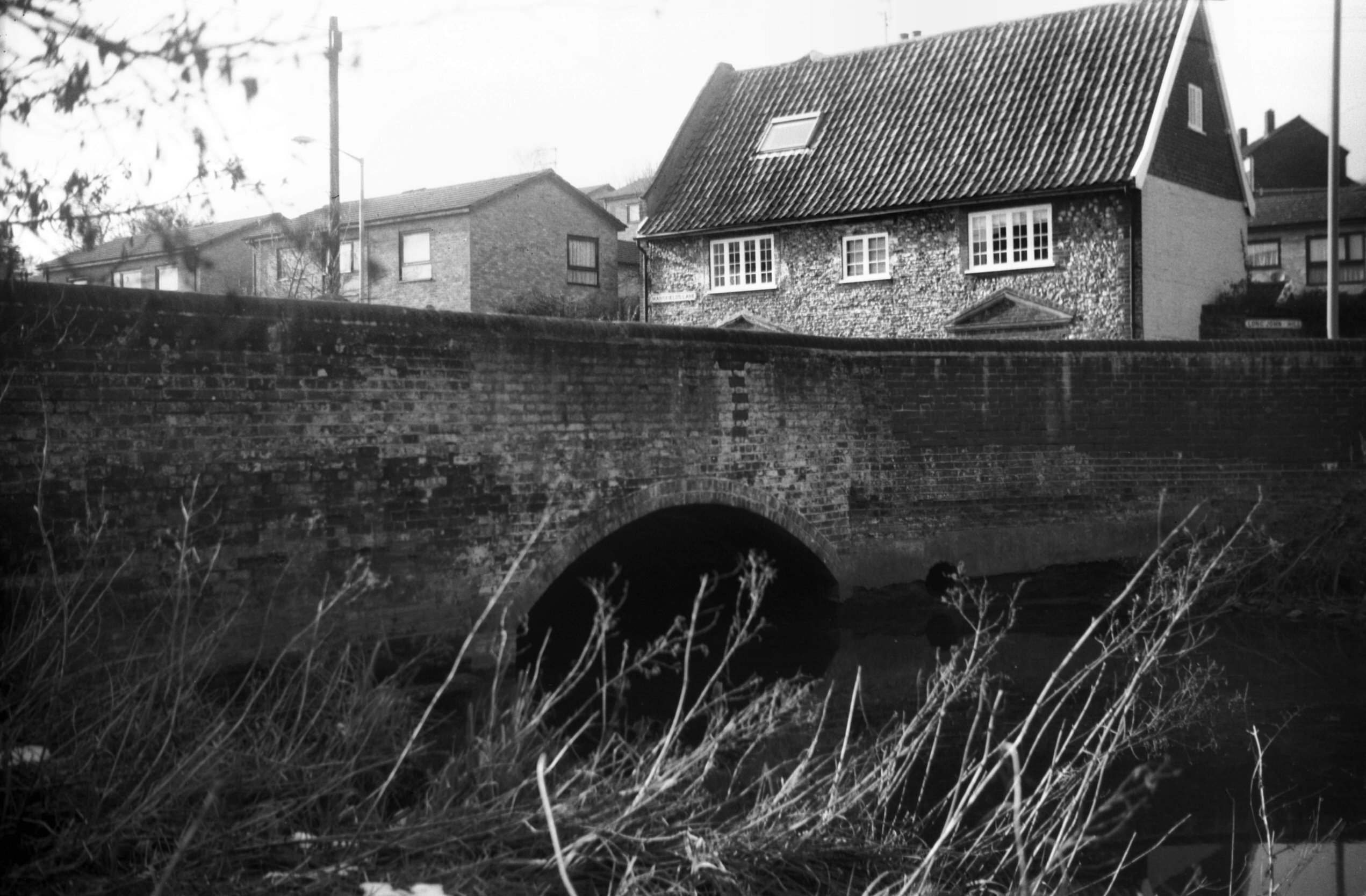
Wensum Carrow stone abutment of old bridge [4875]
1964-10-10
|
|
|
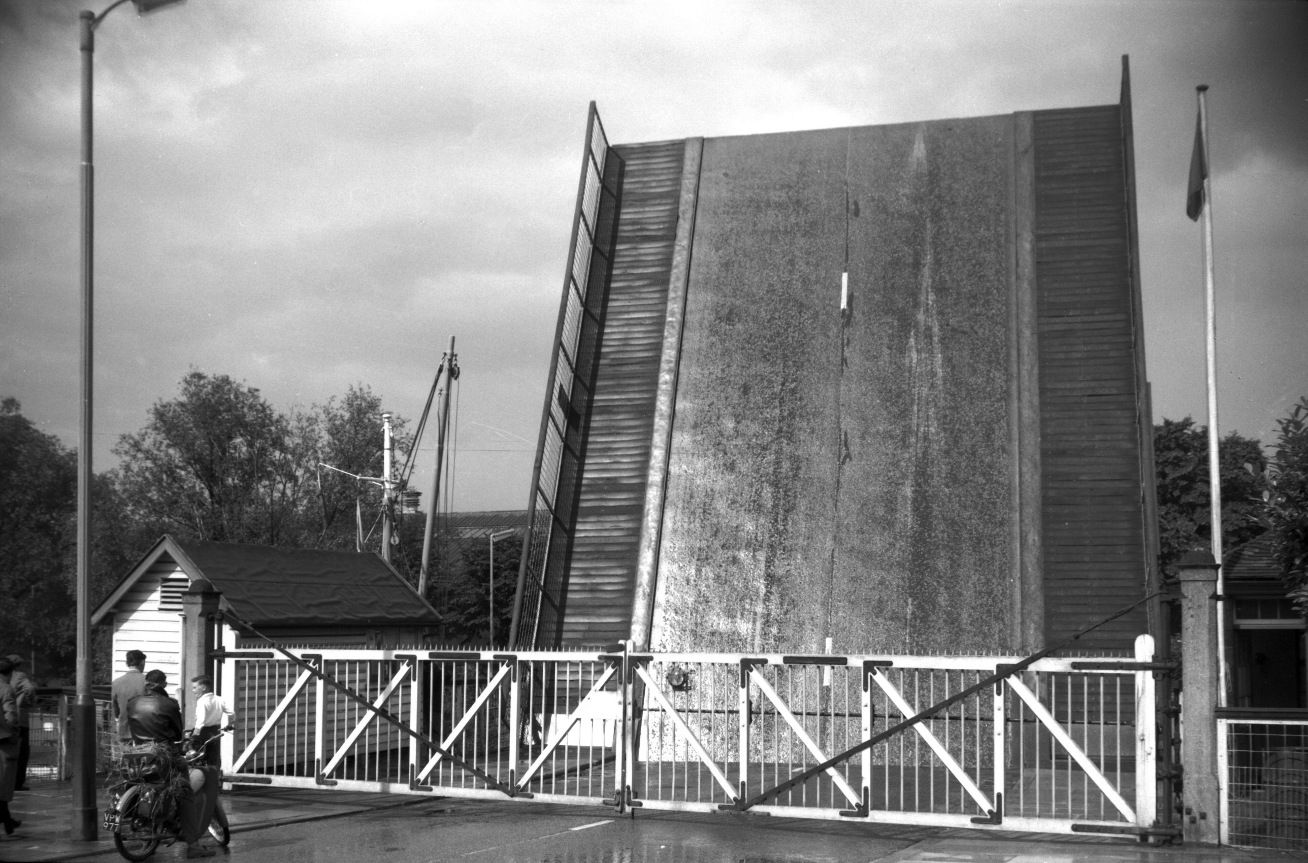
Wensum Carrow bascule bridge from Riverside [B602]
1933-06-28
|
|
|
Wensum Carrow bascule bridge south side [0061]
1934-03-25
The original bridge was erected in 1810 about 500 feet
downstream from the present structure, and linked Carrow
Hill directly with the north-eastern end of Carrow Rd. It
had an iron elliptical arch of 50 foot span; designed by
A.Brown; cast by J.G.Aggs; stonework by Athow and de
Carle and brickwork and abutments by N.Wyeth. It was
rebuilt largely of wood in 1833 as a drawbridge. The
present bridge by the football ground and new swimming
pool was built by J.Butler and Co of Leeds as a
single-leaf roller bascule, and was opened by the Prince
of Wales on 27th June 1923. |
|
|
Wensum Carrow bascule bridge road barrier [4695]
1962-07-21
|
|
|
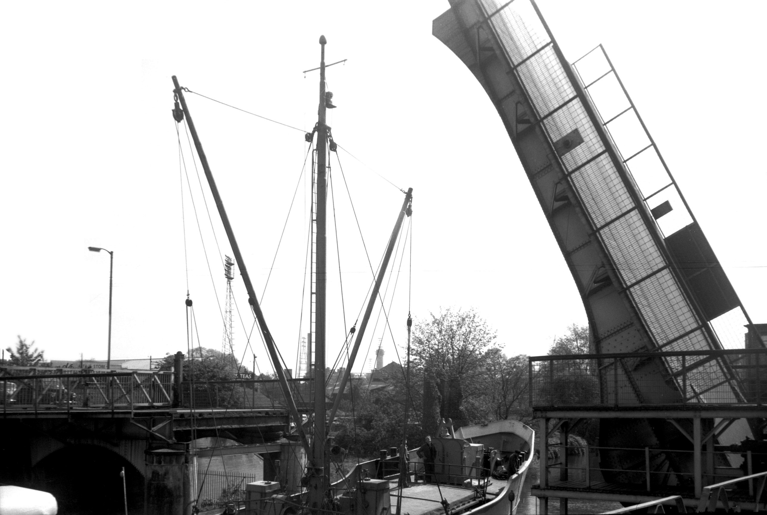
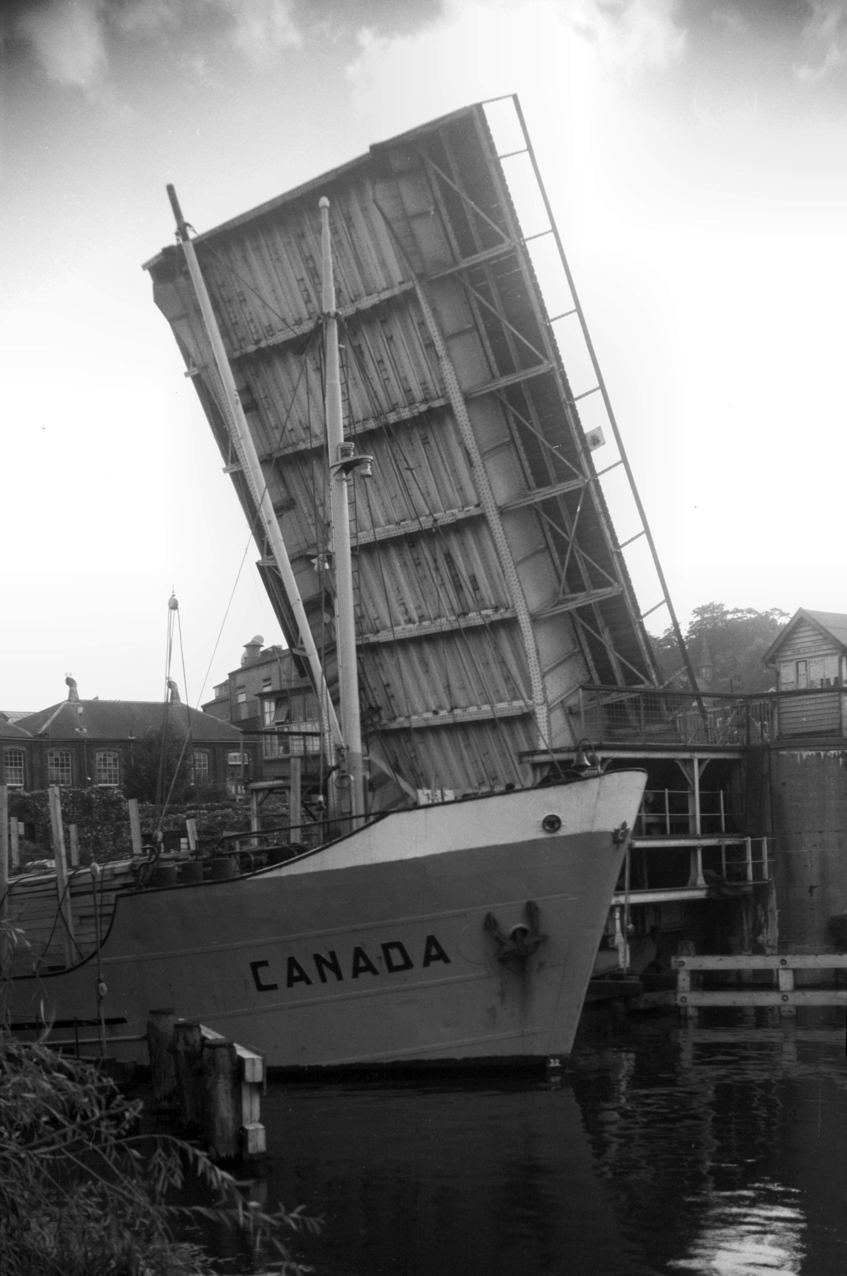
Wensum Carrow bascule bridge open for ship [4765]
1964-05-09
|
|
|
Wensum Carrow bascule bridge open to Canada [4874]
1964-10-10
|
|
|
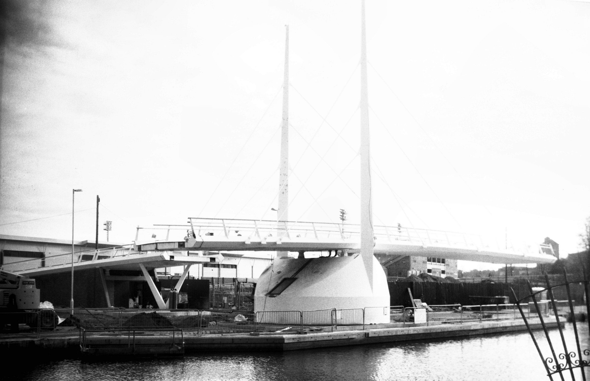
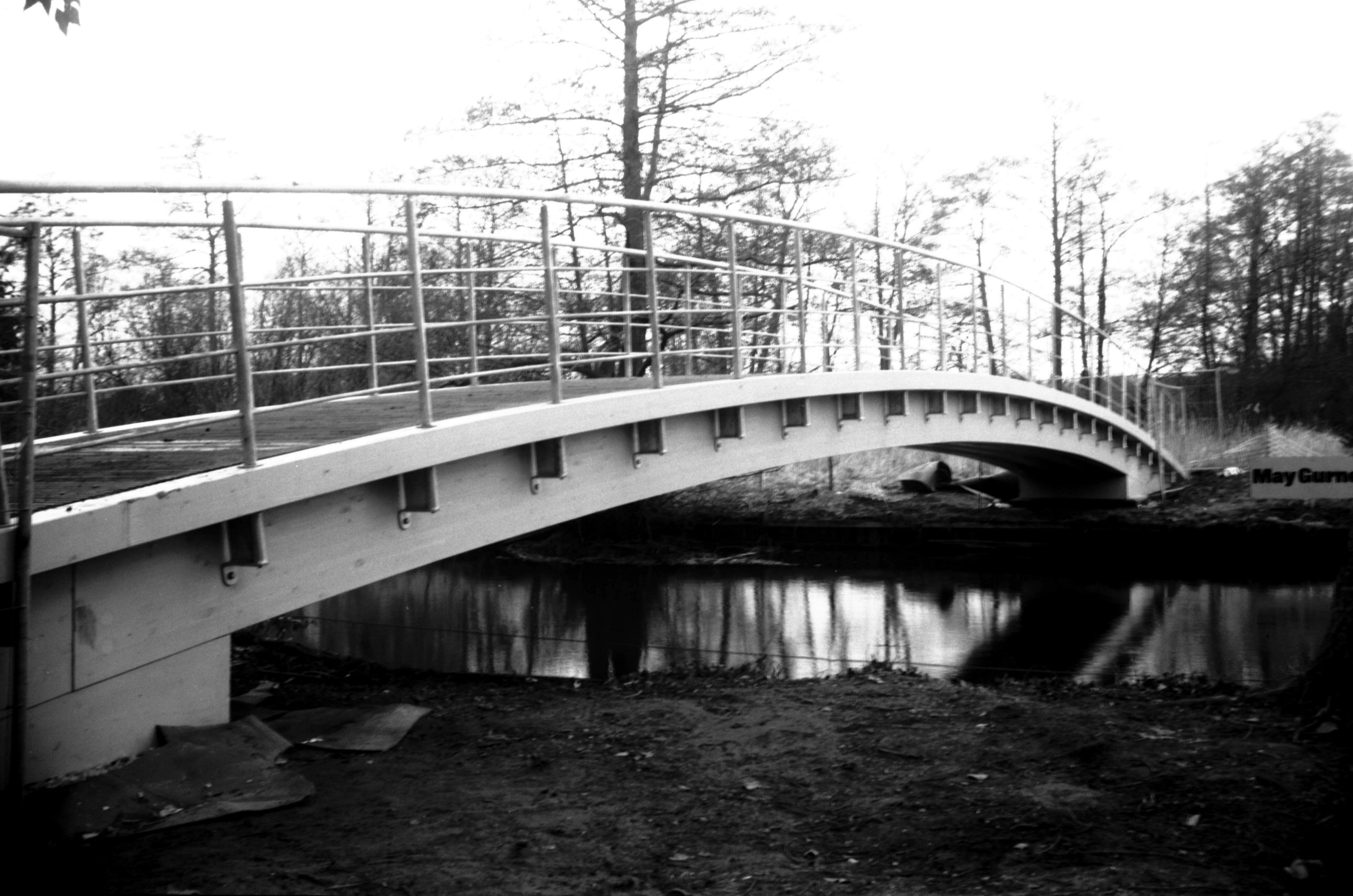
Wensum Friendship Bridge view downstream [7864]
2001-11-04
A pedestrian swing bridge linking the Riverside to Rouen
Rd. Constructed 2001 by May Gurney and named to
commemorate the twinning of Norwich with Novi Sad,
Serbia. Opened 12th November 2001 by the Ambassador in
the presence of the Mayor of Novi Sad and Keith
Ratcliffe, Lord Mayor of Norwich. |
|
|
Wensum Friendship Bridge view upstream [7865]
2001-12-09
|
|
|
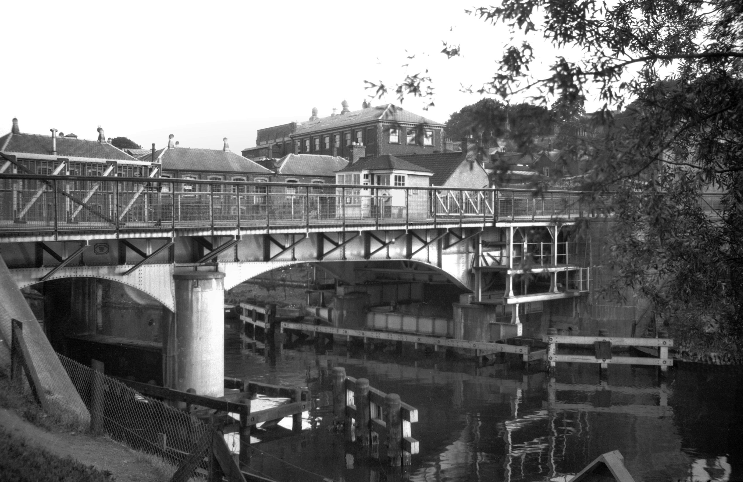
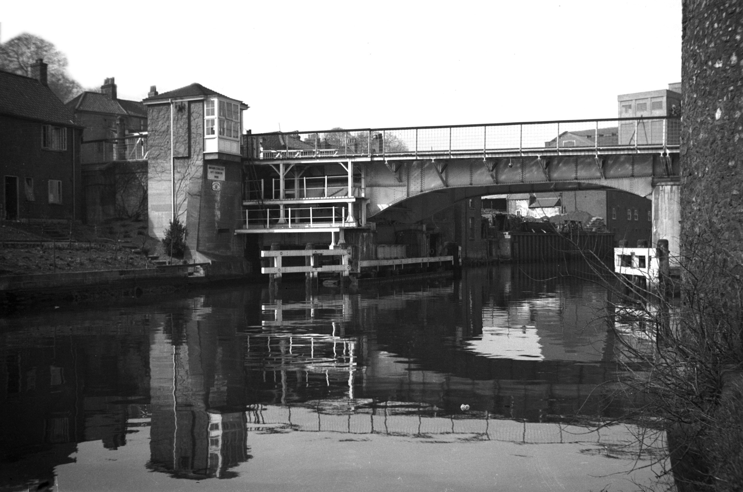
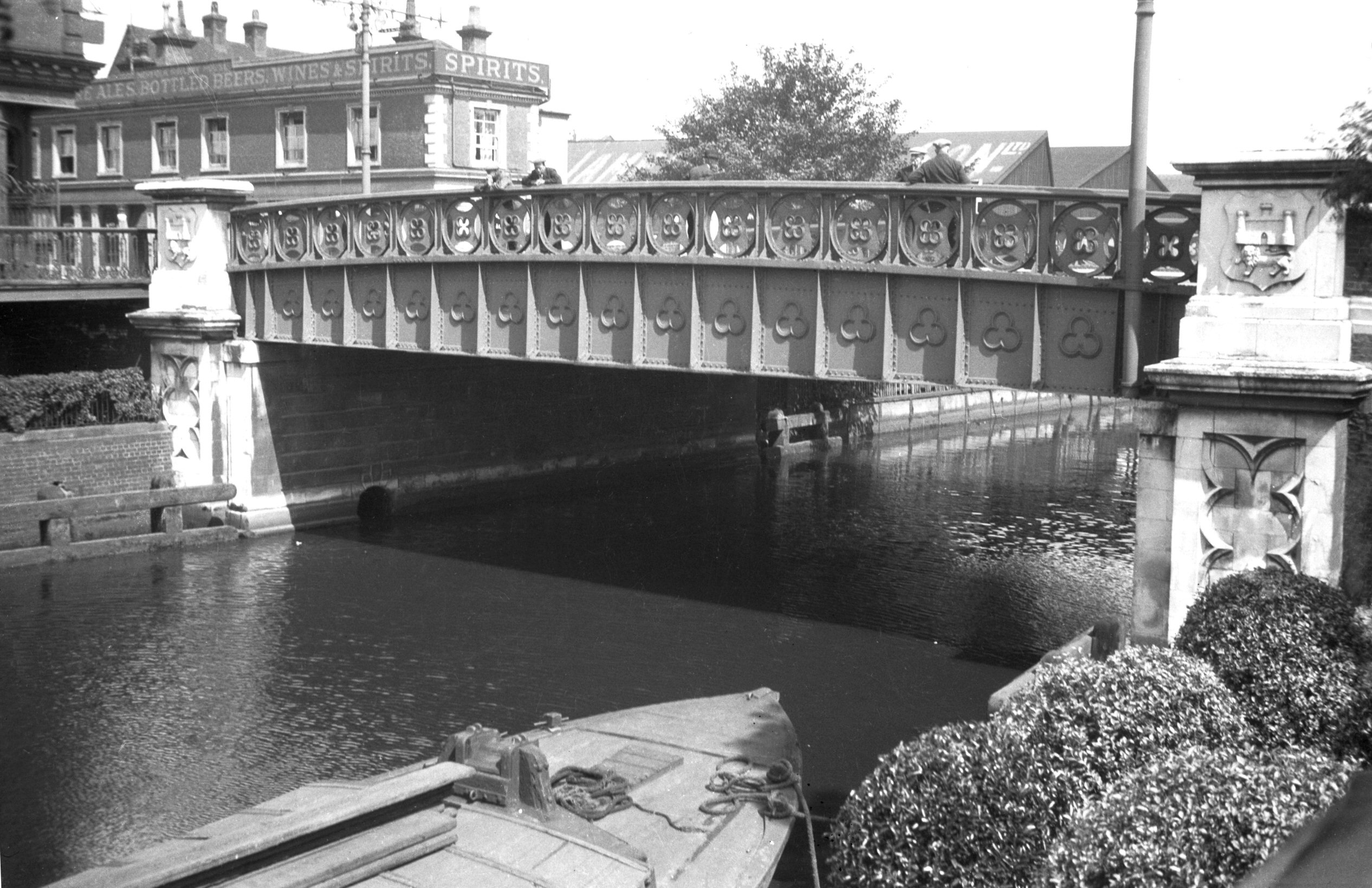
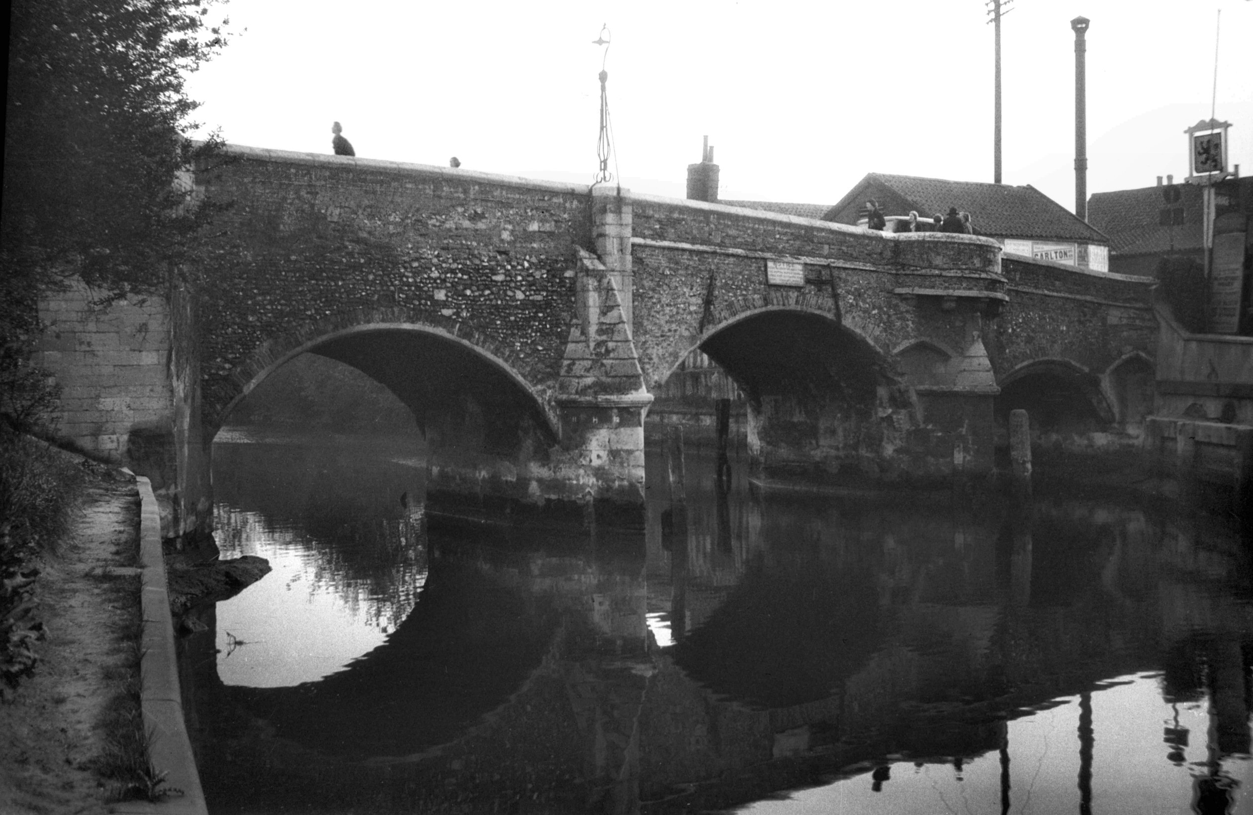
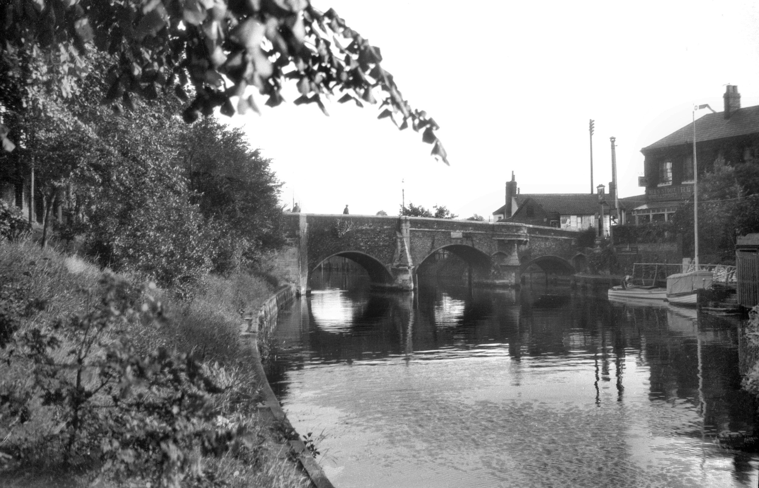
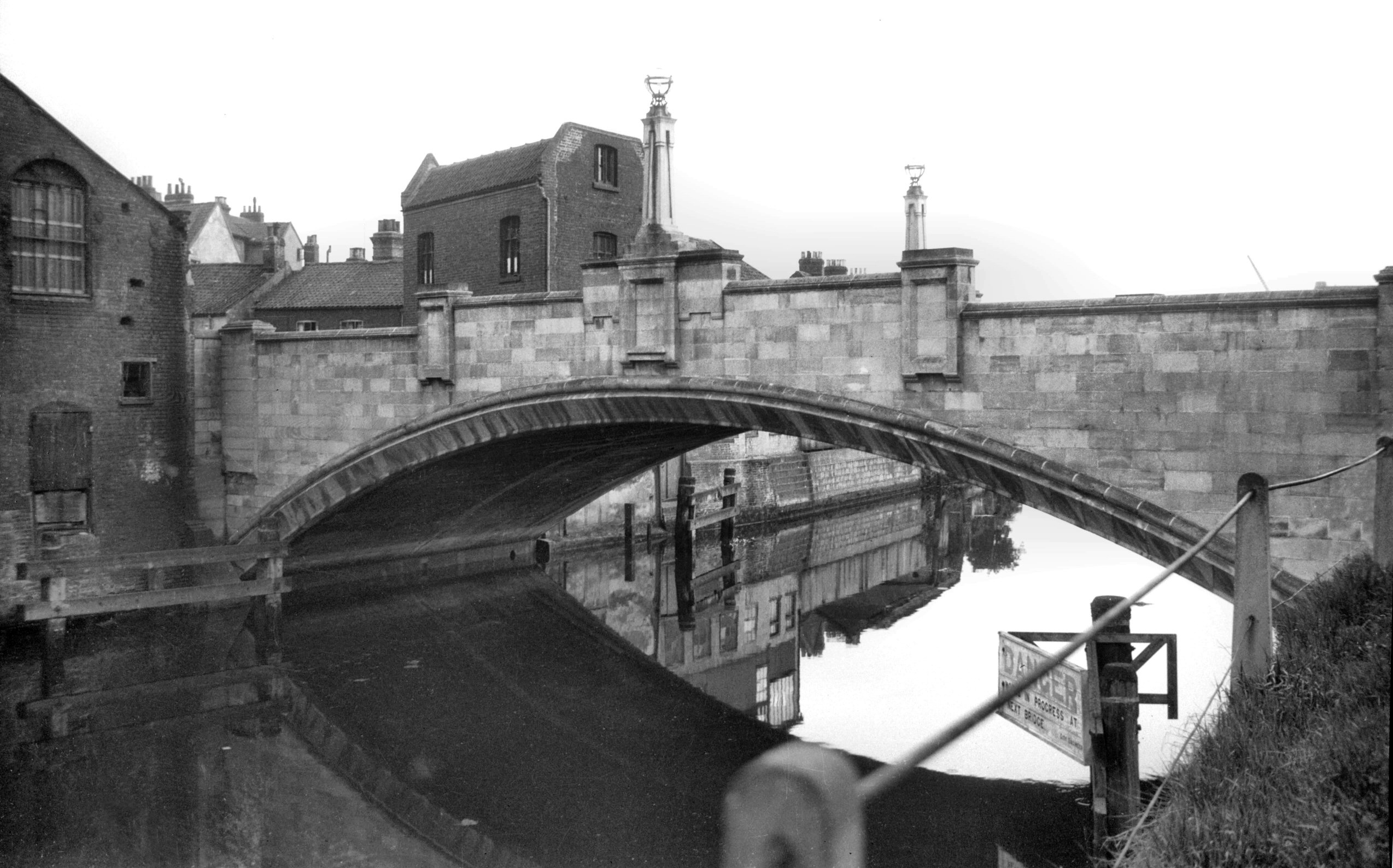
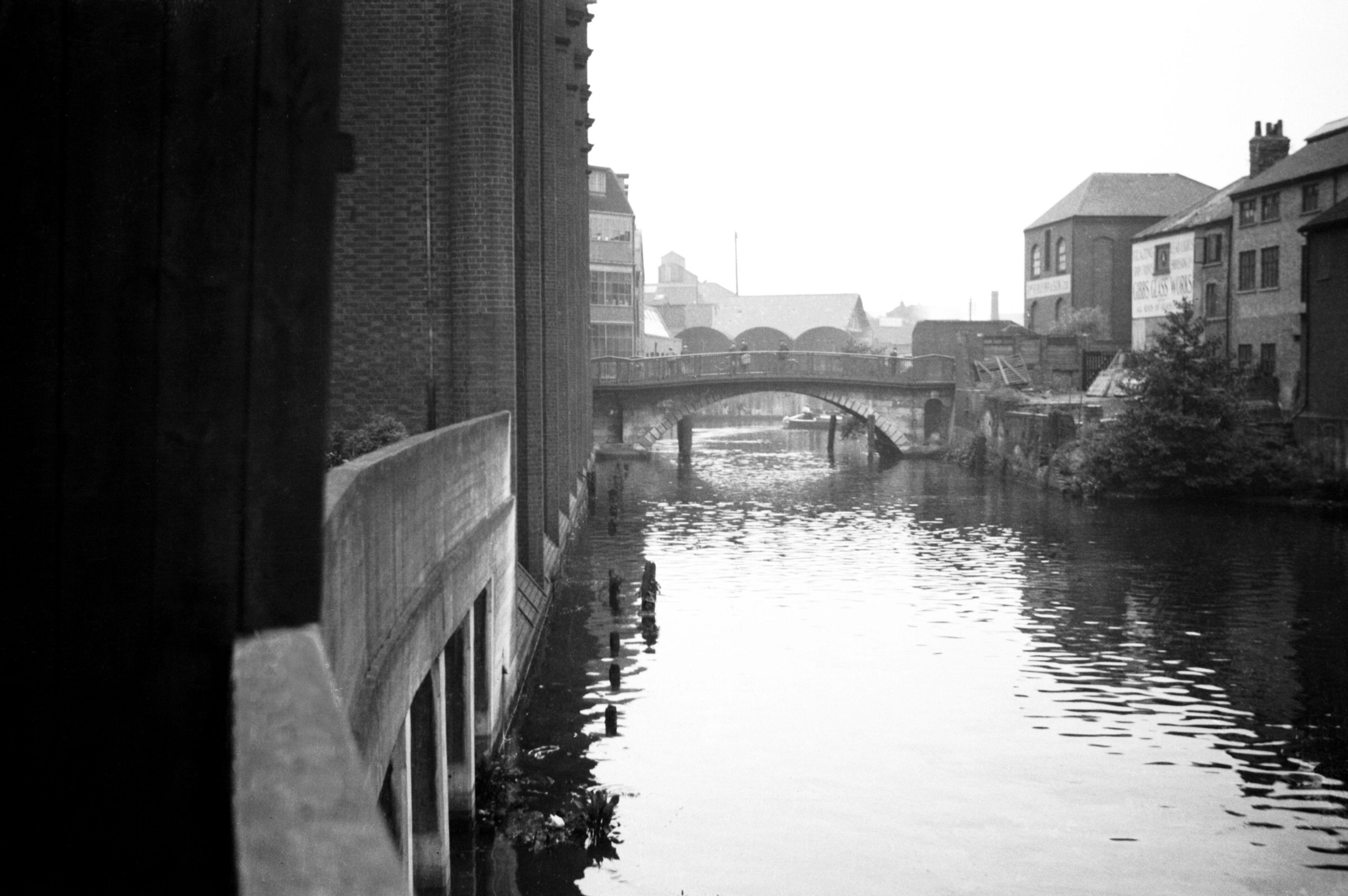
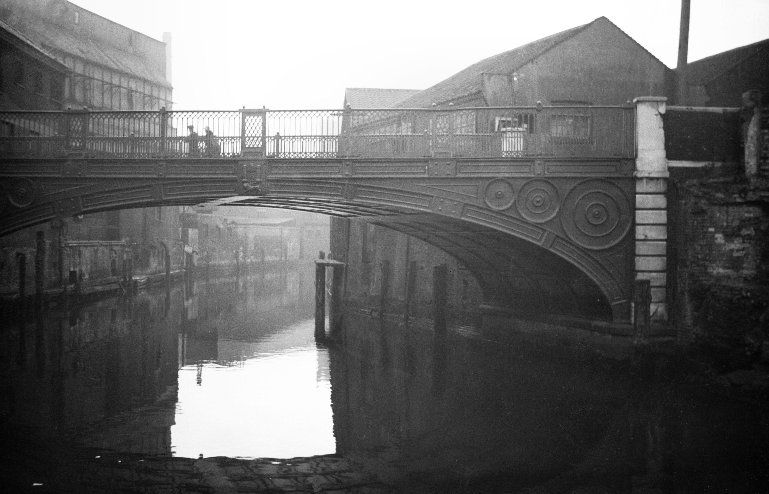
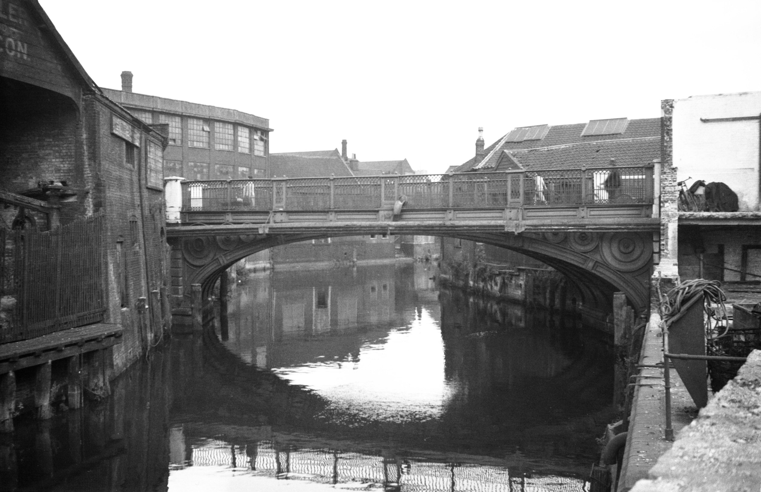
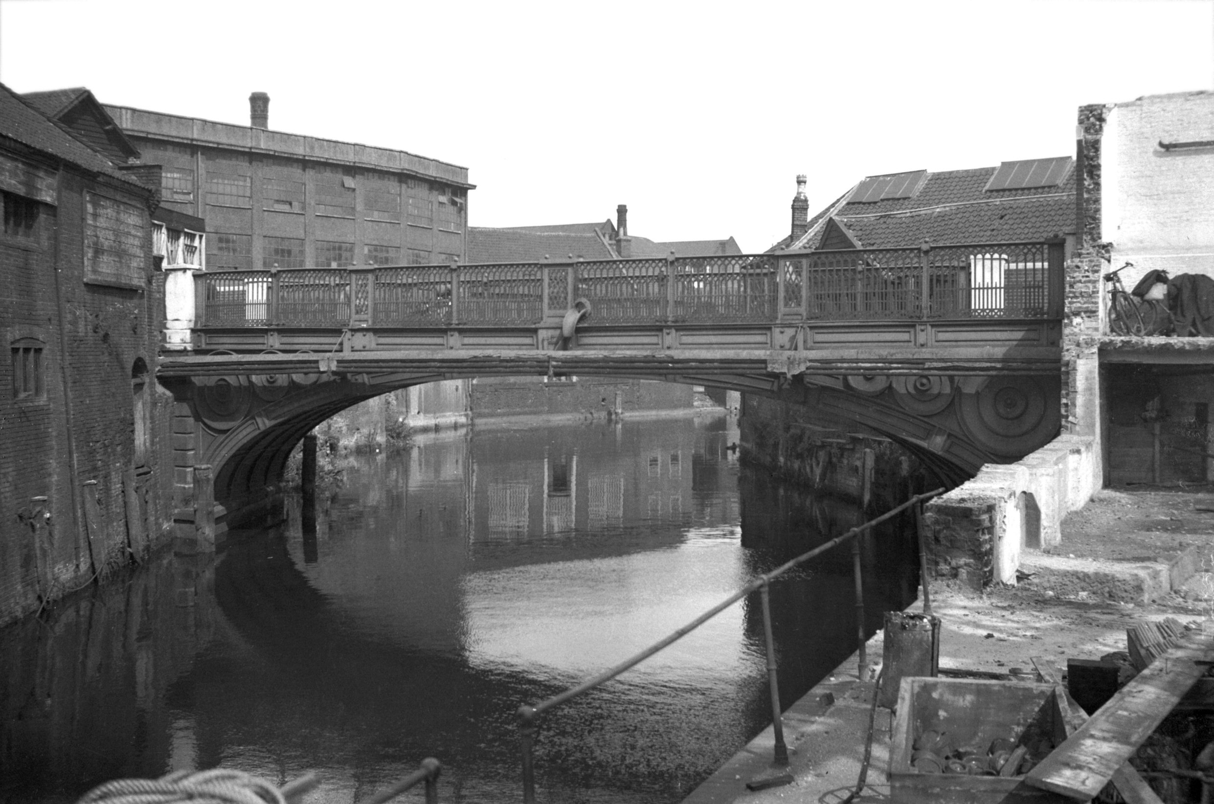
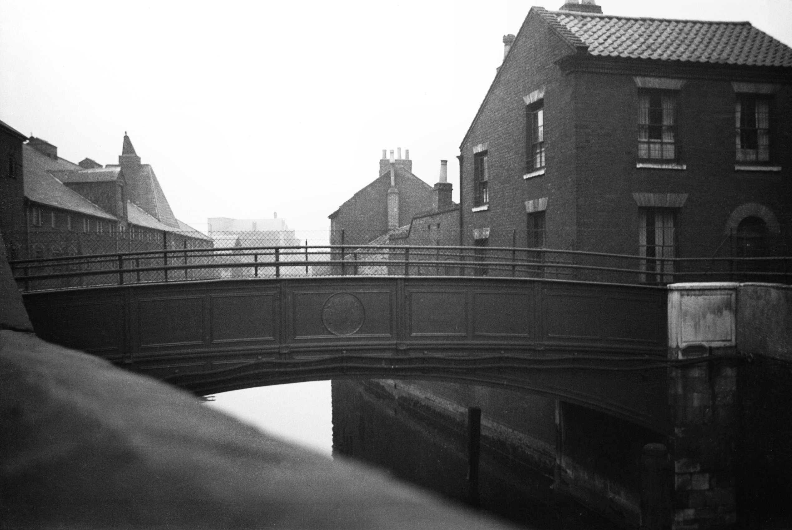
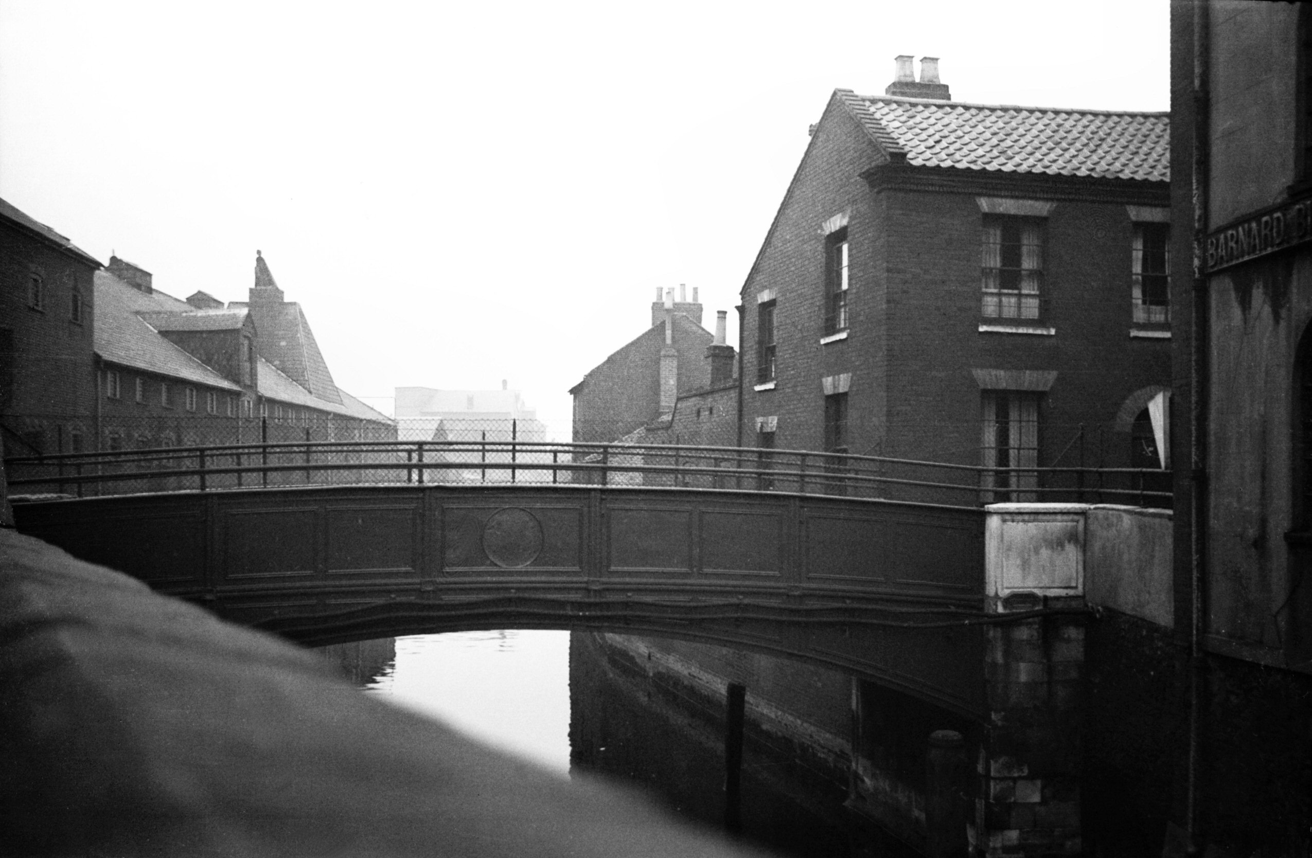
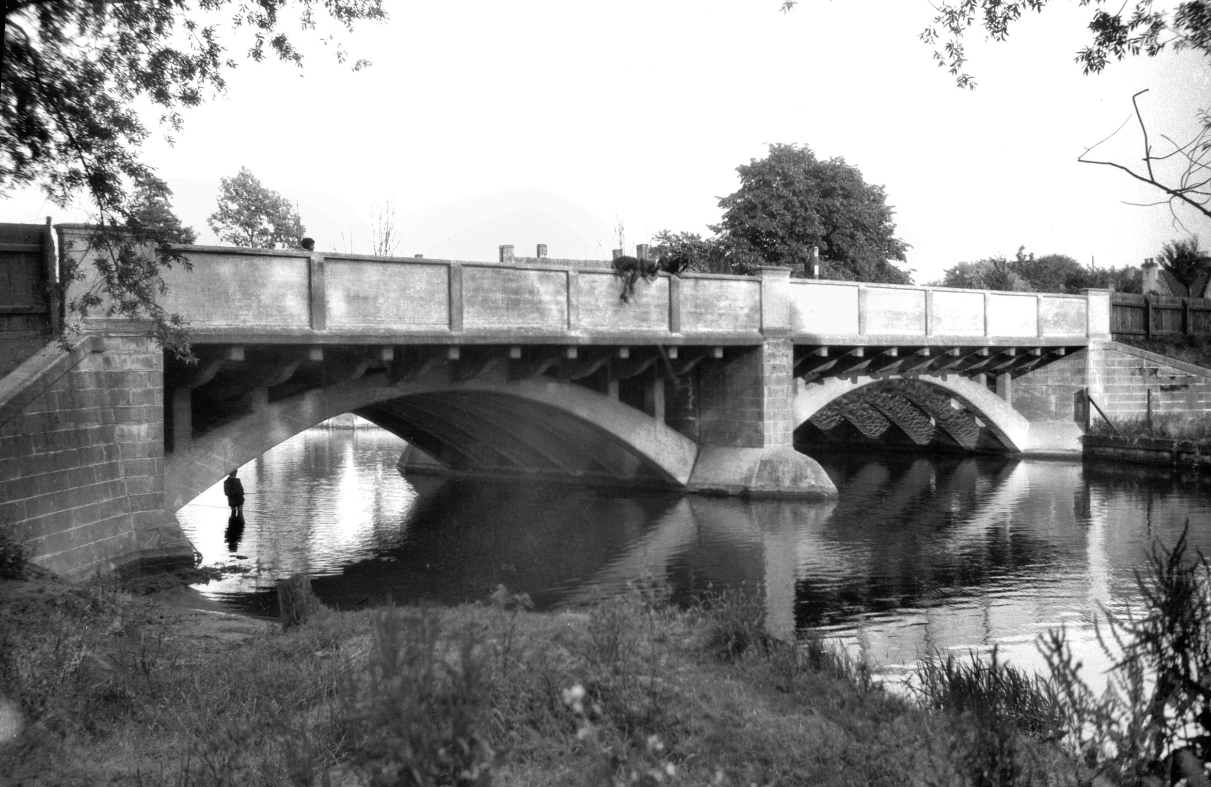
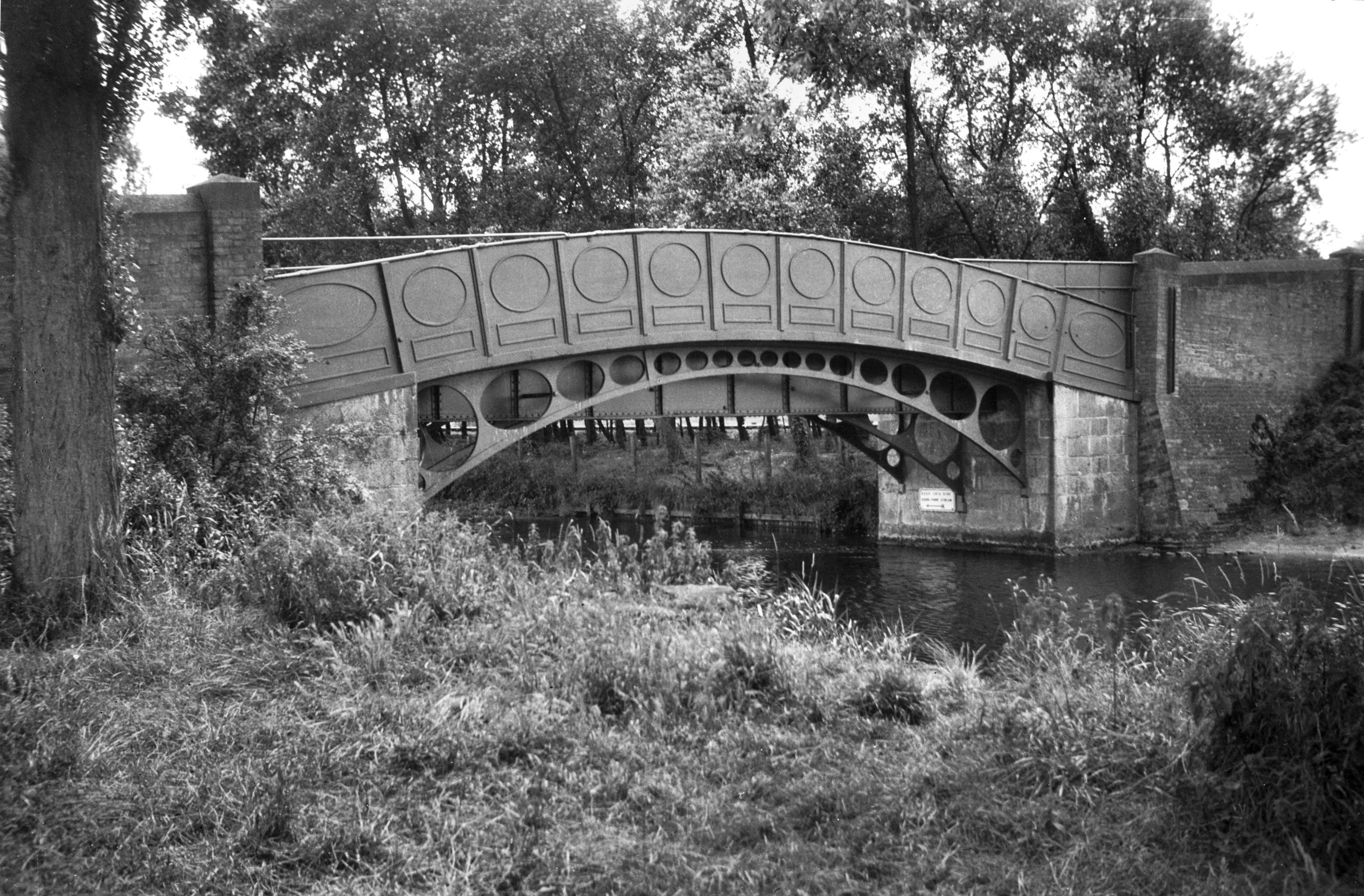
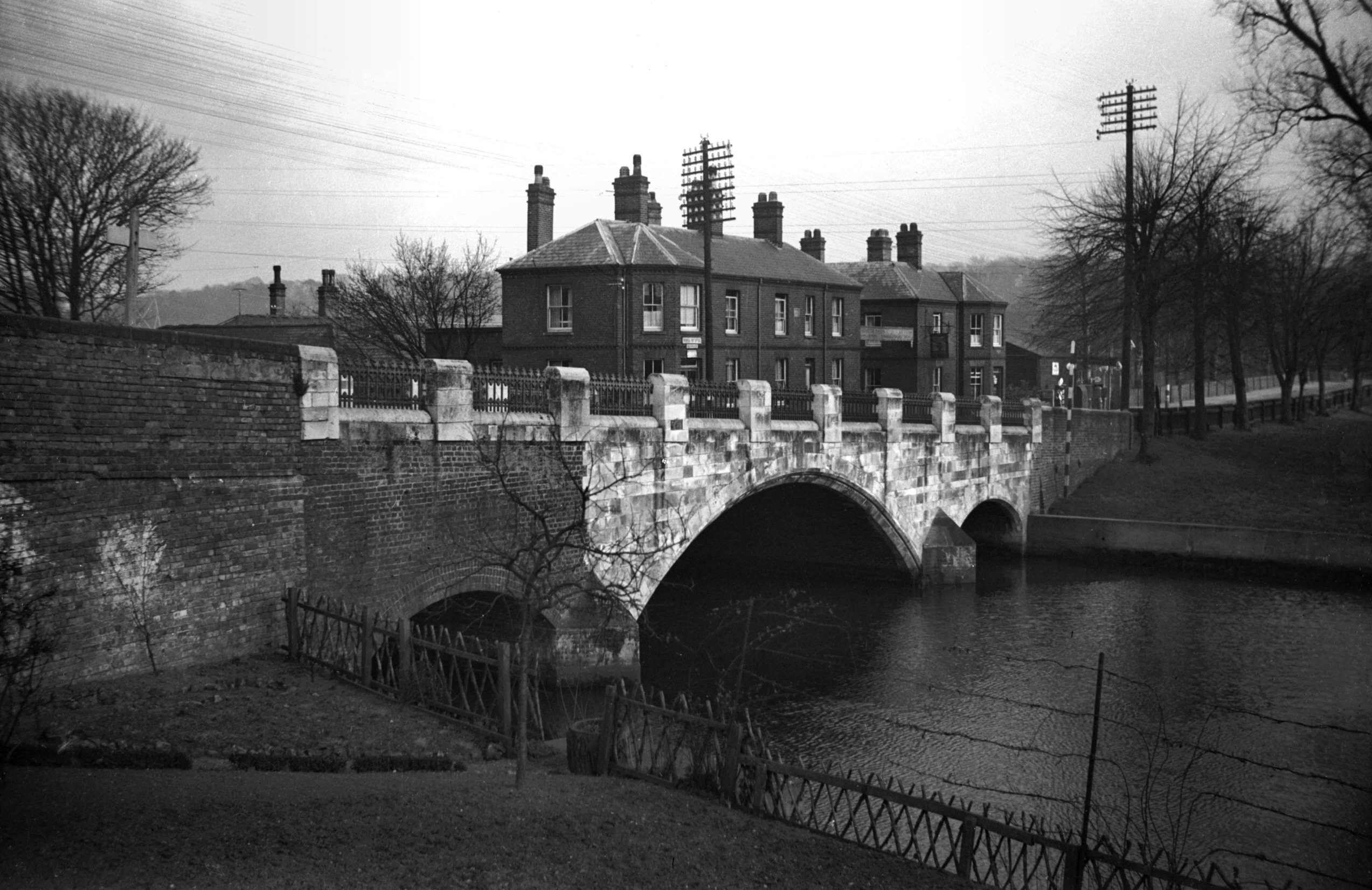
Wensum Foundry Bridge south side [B617] 1933-07-09
The first to occupy this site was a toll bridge built of
wood in 1811 - the contractors Mendham of Holt. In 1844
with the coming of the railway it was replaced by one of
iron by Bradley and Co of Wakefield, and designed by
C.D.Atkinson. Cost £800. It was then freed from toll.
The present structure was built when Thorpe Station was
enlarged; contractors R.Tidman and Co of Rosary Rd,
Norwich. Cost £12,032. Opened 17th January 1888. |
|
|
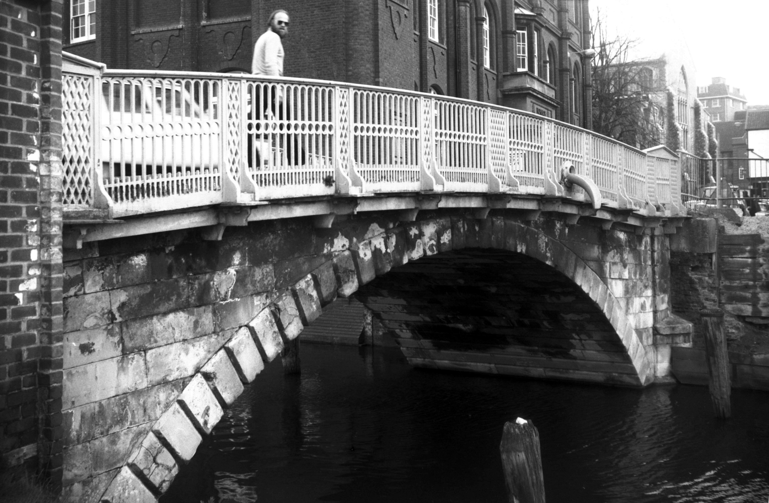
Wensum Bishop Bridge carriageway view east [0010]
1934-01-09
|
|
|
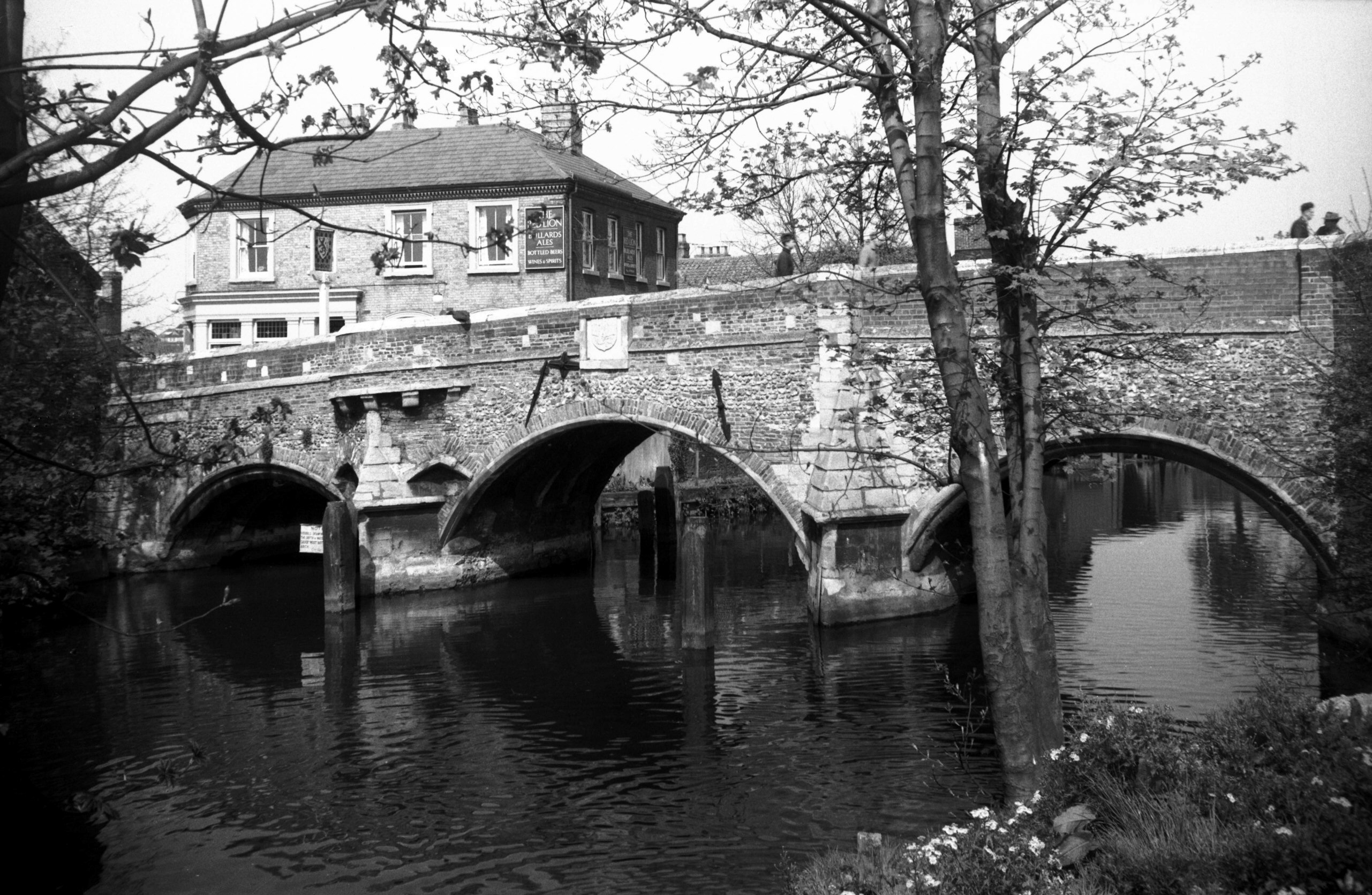
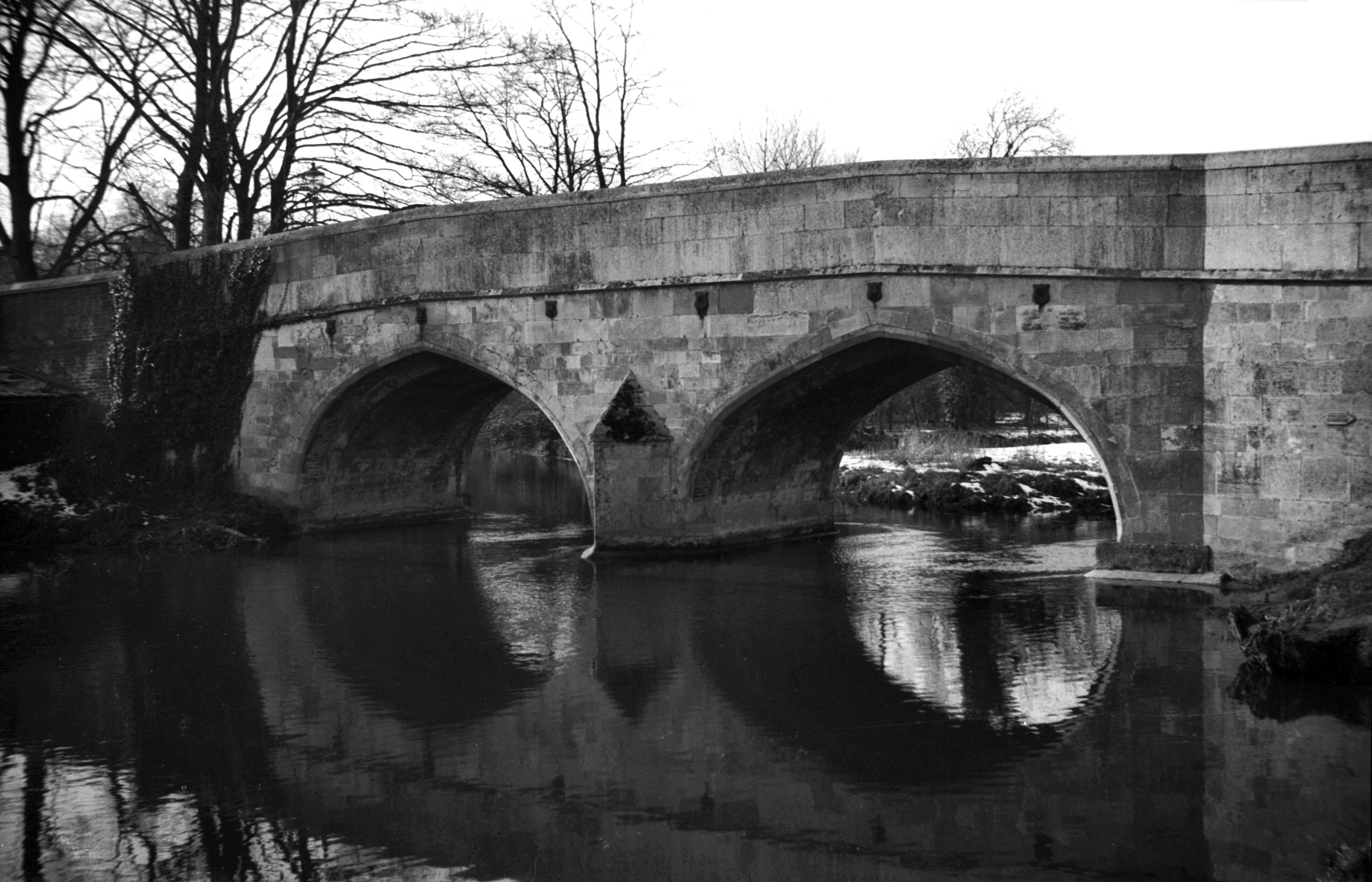
Wensum Bishop Bridge S side view upstream [4589]
1961-04-16
Constructed 14c. The only mediaeval bridge remaining in
Norwich. Of previous structures on the site little is
known. In 1249 it belonged to the Bishop's See. The
present structure probably dates from after 1275 when a
patent was granted to the Prior to erect a gate
"with a bridge 20 feet broad thereto
adjoining". This gate was built over the westernmost
arch at the expense of Richard Spynk according to his
charter of 1343. Handed over to the city in 1393 it saw
military action during Kett's rebellion (1549) but was
demolished in 1791. Only the bays above the western
cut-waters remain to mark the site of the two angle
turrets. |
|
|
Wensum Bishop Bridge south side illuminated [6745]
1991-11-08
|
|
|
Wensum Bishop Bridge N side view downstream [0938]
1936-05-06
|
|
|
Wensum Bishop Bridge N side from E towpath [B619]
1933-07-11
|
|
|
Wensum Bishop Bridge S side view upstream [4588]
1961-04-16
|
|
|
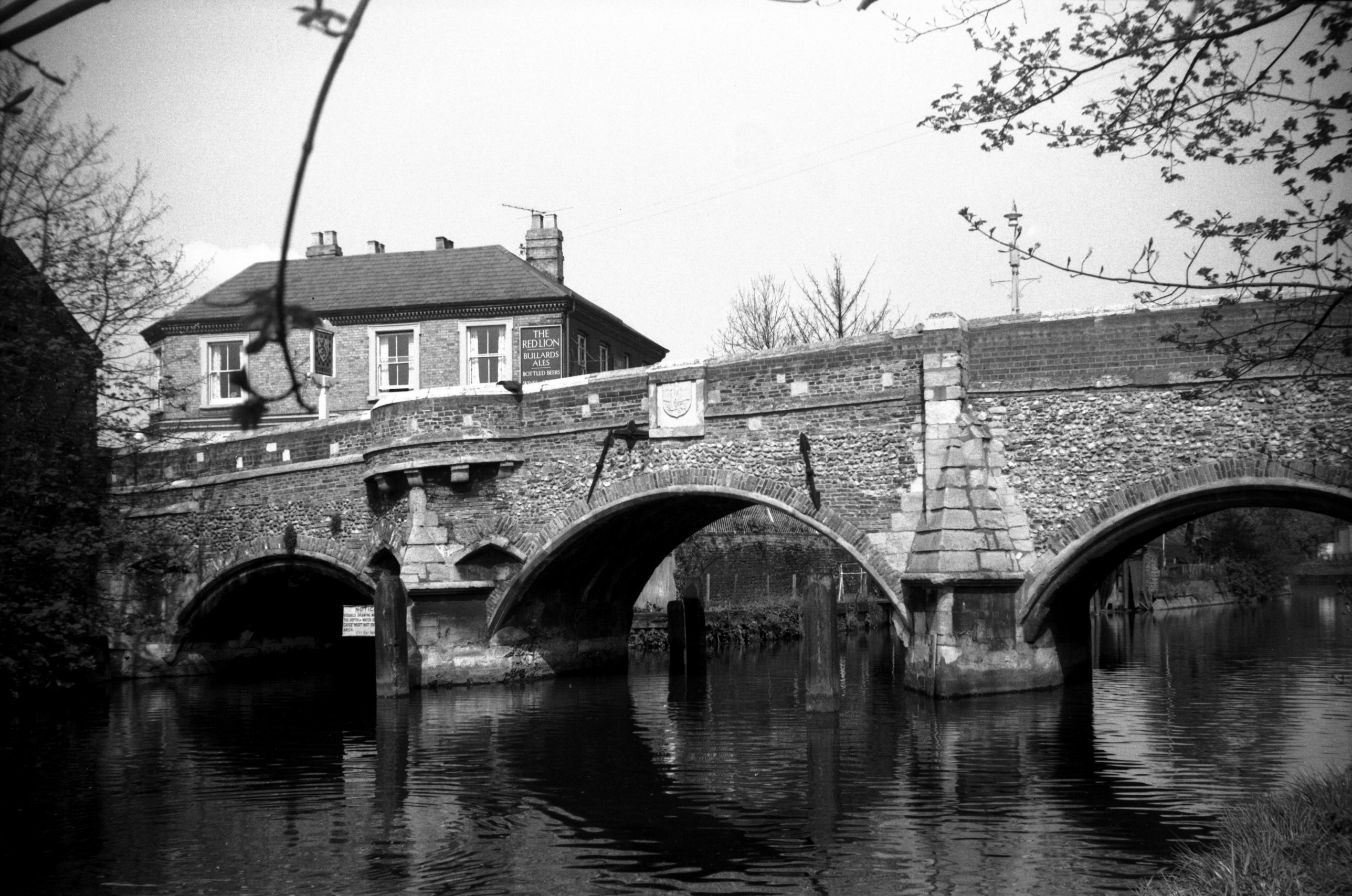
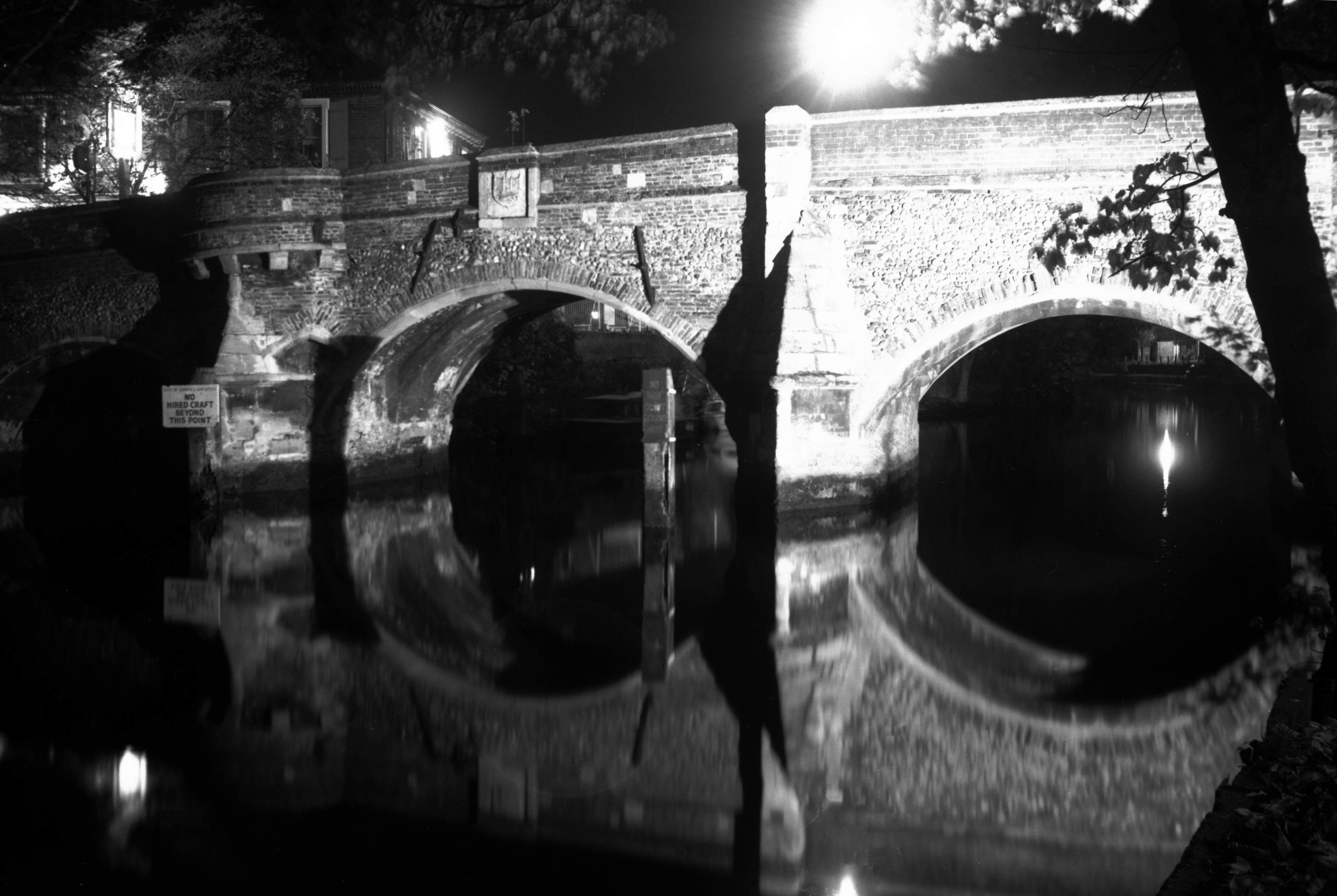
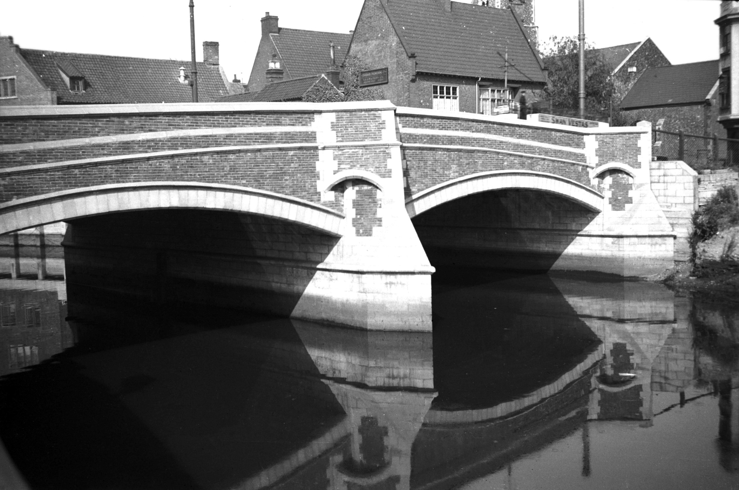
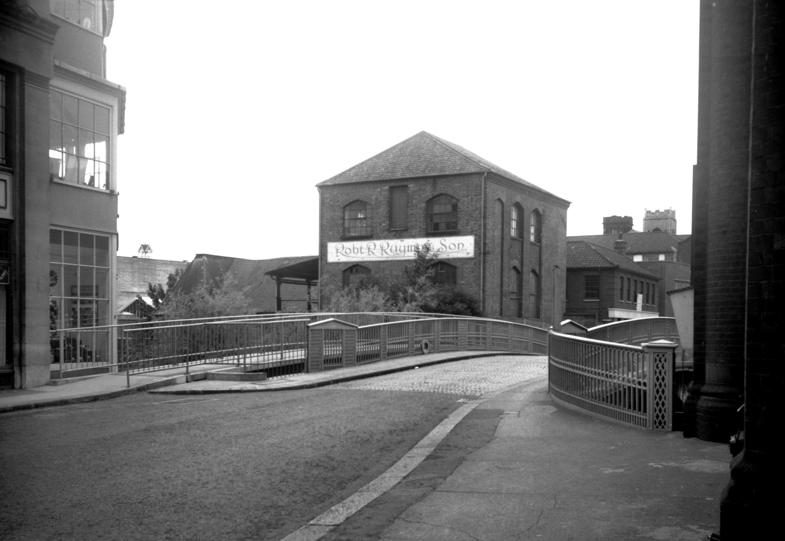
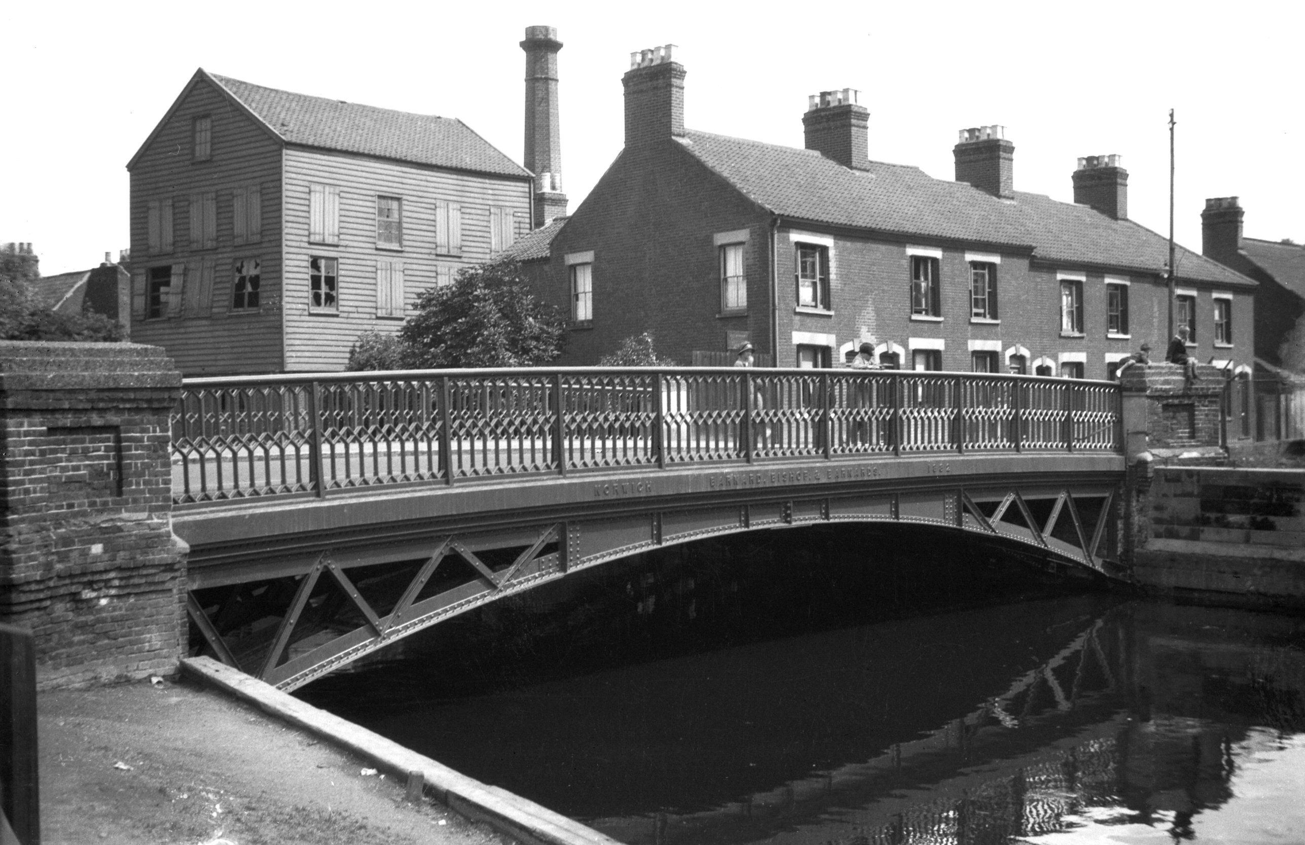
Wensum Whitefriars Bridge east side [B630] 1933-07-18
Whitefriars Bridge is one of several in Norwich rebuilt
during the 20c. Formerly known as St Martin's bridge, it
is first mentioned in a grant made by King Henry I to
Bishop Herbert de Losinga shortly after 1100. In 1290 it
was washed away by a great flood, and there are records
of it having to be rebuilt at different times throughout
the centuries. The earlier ones would have been wooden
constructions; during Kett's rebellion in 1549, we are
told, the bridge was deliberately demolished with the
dual purpose of impeding the rebels and using its timbers
to strengthen the nearby city gates.
In 1591 a more permanent edifice was built of stone, with
a single pointed arch. This survived until replaced by
the present bridge designed by Arthur E.Collins, City
Engineer, and built by unemployed labour under a skilled
foreman. It is of concrete reinforced by 1.5 inch steel
bars and faced with mica quartz and white cement. The
first half was opened to traffic on 19th February 1925.
Its span of about 80 feet is some 50 feet wider than that
of its predecessor.
It was said at the time that the stones of the old bridge
would be marked in order that it could be re-erected on a
different site, but this was never done. Several
suggestions have been put forward as to their fate, one
of the least plausible being "that they happened to
fall into a wherry as it passed under the bridge"
and were conveyed by water to Wroxham and Horning to be
used as foundations for riverside bungalows. It sees more
likely that some at least were taken from the bridge to
the Corporation Depot at Infirmary Square (now Starling
Rd), and were later moved to another store at St Martin
at Oak Wall Lane, finally ending up as foundations for
roadworks on Aylsham Rd. |
|
|
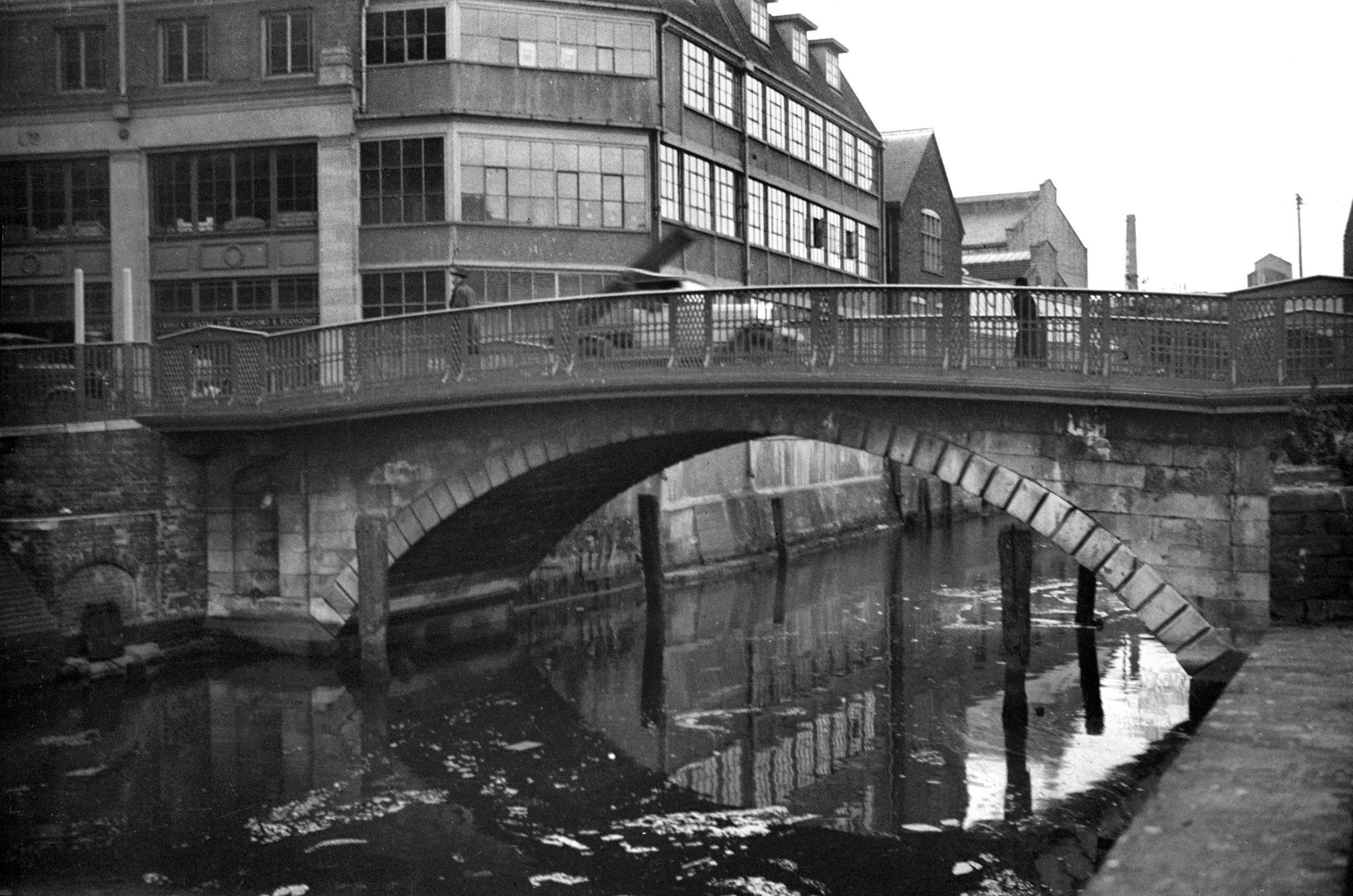
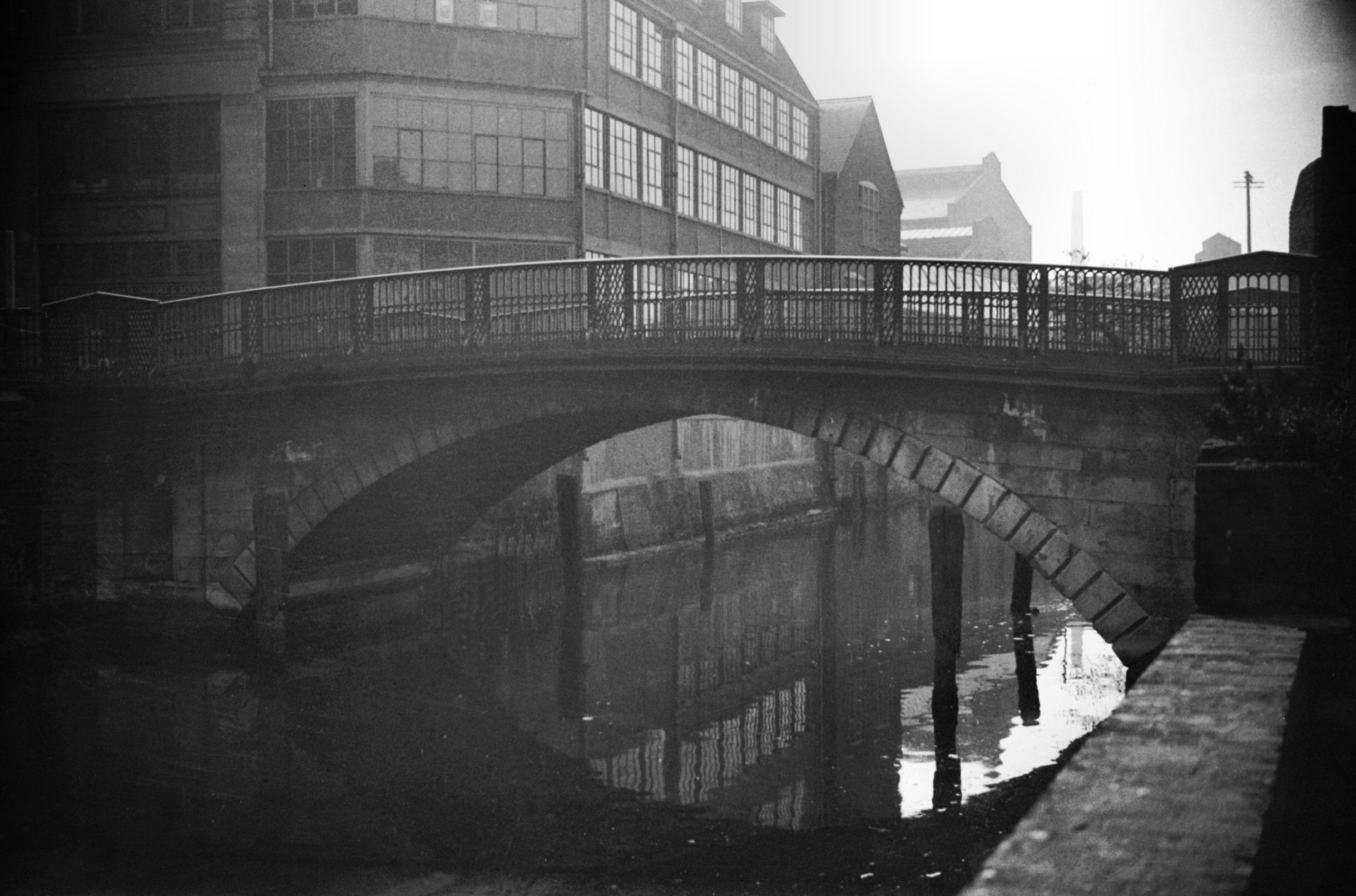
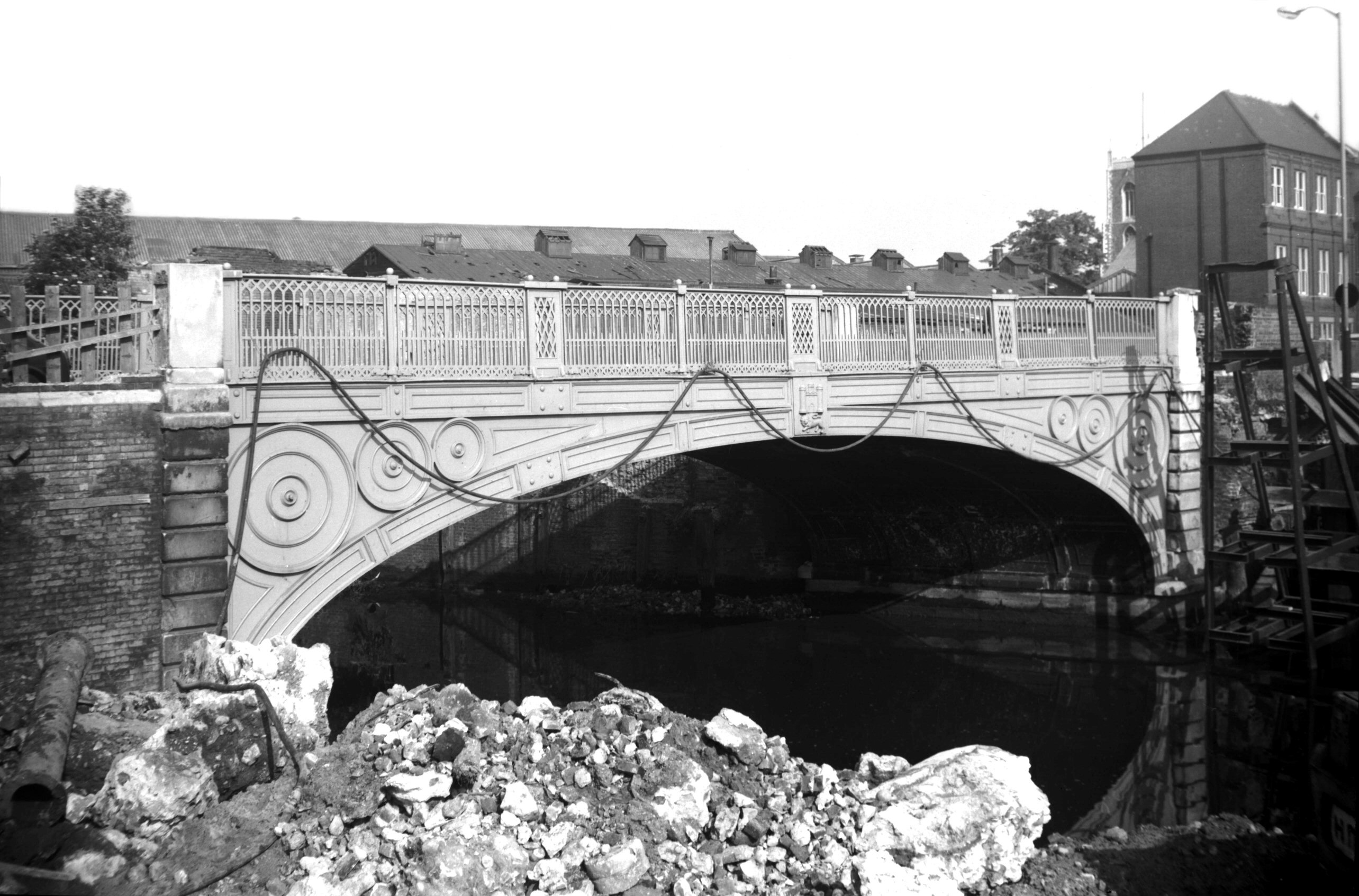
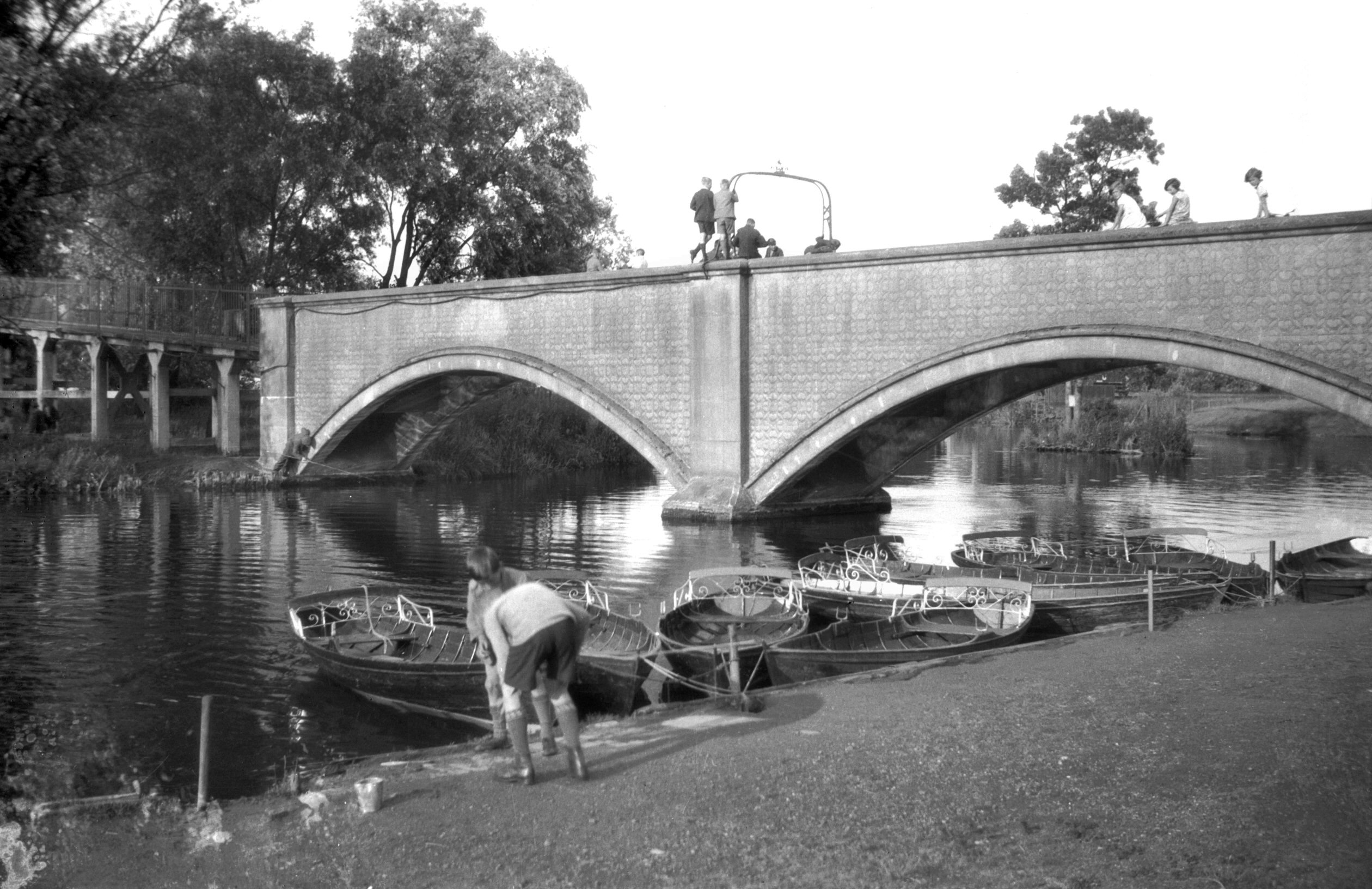
Wensum Fye Bridge east side from Quayside [0619]
1935-08-06
Probably the first bridge to be built over the river in
Norwich. Records go back to 1153 but in 1896, when
trenching for a drainage scheme, a series of wooden plies
from Elm Hill to Fishergate suggested an earlier wooden
plankway. A timber bridge here until Henry IV's time, it
was then rebuilt of stone. In 1572 a new bridge of two
arches replaced one washed down by floods. Repaired in
1756 it was replaced in 1829 by a single cast iron span
of 36 feet, 22 feet between parapets, later increased to
37 feet on the west side. The present structure has two
spans each of 35 feet, 50 feet between the parapets.
Supported by steel girders it is of reinforced concrete
faced with bricks. First half opened to traffic 1st July
1933. Completely opened 29th May 1934. |
|
|
Wensum Blackfriars or St George's Bridge [0066]
1934-03-31
Formerly called New Bridge, being built of timber in the
reign of Henry V and rebuilt during that of Edward IV.
Again rebuilt, this time of stone with three arches in
1586. Because the narrowness of the arches was found to
be a great impediment to the current it was superseded by
the present bridge, designed by Sir John Soane. It
consists of a single arch (44 feet span) of Portland
stone, with cast iron parapets, and is remarkably strong,
all the stones being cramped with iron. The bridge cost
£1,290 and was opened 3rd December 1783. A footbridge
which was erected on the west side in 1961 was removed
some years later when a single lane traffic system across
the bridge was introduced. |
|
|
Wensum Blackfriars or St George's Bridge [0055]
1934-03-22
|
|
|
Wensum Blackfriars or St George's Bridge [B595]
1933-06-20
|
|
|
Wensum St George's Bridge and footbridge [4655]
1961-10-12
|
|
|
Wensum St George's Bridge and footbridge N [4668]
1962-06-11
|
|
|
Wensum St George's Bridge west side [5900] 1978-04-25
|
|
|
Wensum Duke's Palace Bridge view upstream [5318]
1972-06-30
The old Duke's Palace Bridge, until 1972 carried the
street over the Wensum. No previous bridge had occupied
the site, but by early in the 19c the need was felt for a
more direct link between the north of the city and the
market place. In September and October 1819, therefore,
meetings presided over by the Mayor were held at the
Guildhall to discuss the matter. There was a minor
setback when a majority voted against the proposal, but
at a further meeting at the end of November it was
announced that £7,000 of the proposed £9,000 had been
subscribed, raised by shares of £25 each, which left the
way clear for promoting a Bill in Parliament. On 8th July
1820, the Bill had been passed by both Houses and on 28th
August 1821, Alderman T.S.Day laid the foundation stone.
The bridge, originally a toll bridge, was opened to
traffic during the following year.
The new road thus formed, built across the site of the
old palace of the Dukes of Norfolk, linked Charing Cross
and St John Maddermarket with Pitt St and St Augustine's.
The bridge, adorned on either aide with the city's coat
of arms had a skew-span of approximately 50 feet.
In 1839 a Bill was promoted in Parliament to provide,
among other things, for the freeing of this bridge and
those at Carrow and Thorpe (Foundry bridge). Four years
later the local inhabitants were still agitating for this
to be done, and it was not until 1855 that the tolls were
lifted; a celebratory dinner was held at the adjacent
Duke's Palace inn to mark the event.
By the 1930s the bridge was beginning to show its age,
and a weight limit of 12 tons was imposed. At this time,
too, with the city's traffic becoming increasingly
congested, plans were drawn up for a major road artery
running from north to south through the centre of the
city. This would have involved widening St Augustine's,
Pitt St and Duke St, with a new realigned bridge linking
up with Exchange St, the Market Place and St Stephen's.
Although apparently promoted by City Engineer Horace
Rowley in the 1945 City of Norwich Plan, this
arterial road idea was eventually superseded by the
"ring and loop" scheme based on the Inner Link
road, devised to preserve as much as possible of the
city's historic central area.
In May 1972, it was found necessary to reduce the weight
limit on the 150-year-old bridge to three tons. A few
months later Duke St was temporarily closed, the old
bridge dismantled, and a new and wider one erected in its
place. Supported by 15 concrete beams, each 65 feet in
length, the new bridge is of utilitarian design.
The ironwork from one side of the old bridge, which had
been listed as a structure of historic interest, was
re-erected after 20 years in storage, above the entrance
to the Castle Mall car park in Market Avenue. |
|
|
Wensum Duke's Palace Bridge view downstream [0058]
1934-03-24
|
|
|
Wensum Duke's Palace Bridge view downstream [2761]
1938-08-30
|
|
|
Wensum Duke's Palace Bridge view downstream [2762]
1938-08-30
|
|
|
Wensum Duke's Palace Bridge view downstream [5901]
1978-04-25
|
|
|
Wensum St Miles' Bridge Coslany east side [0056]
1934-03-22
|
|
|
Wensum St Miles' Bridge Coslany east side [0057]
1934-03-22
|
|
|
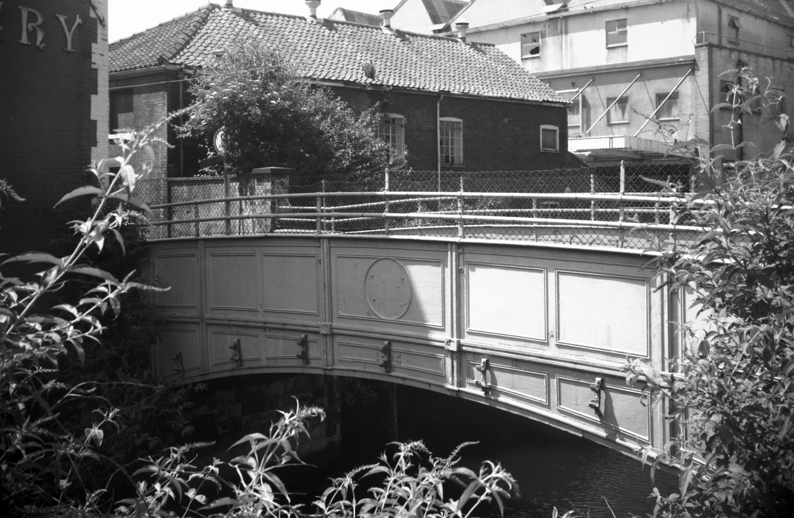
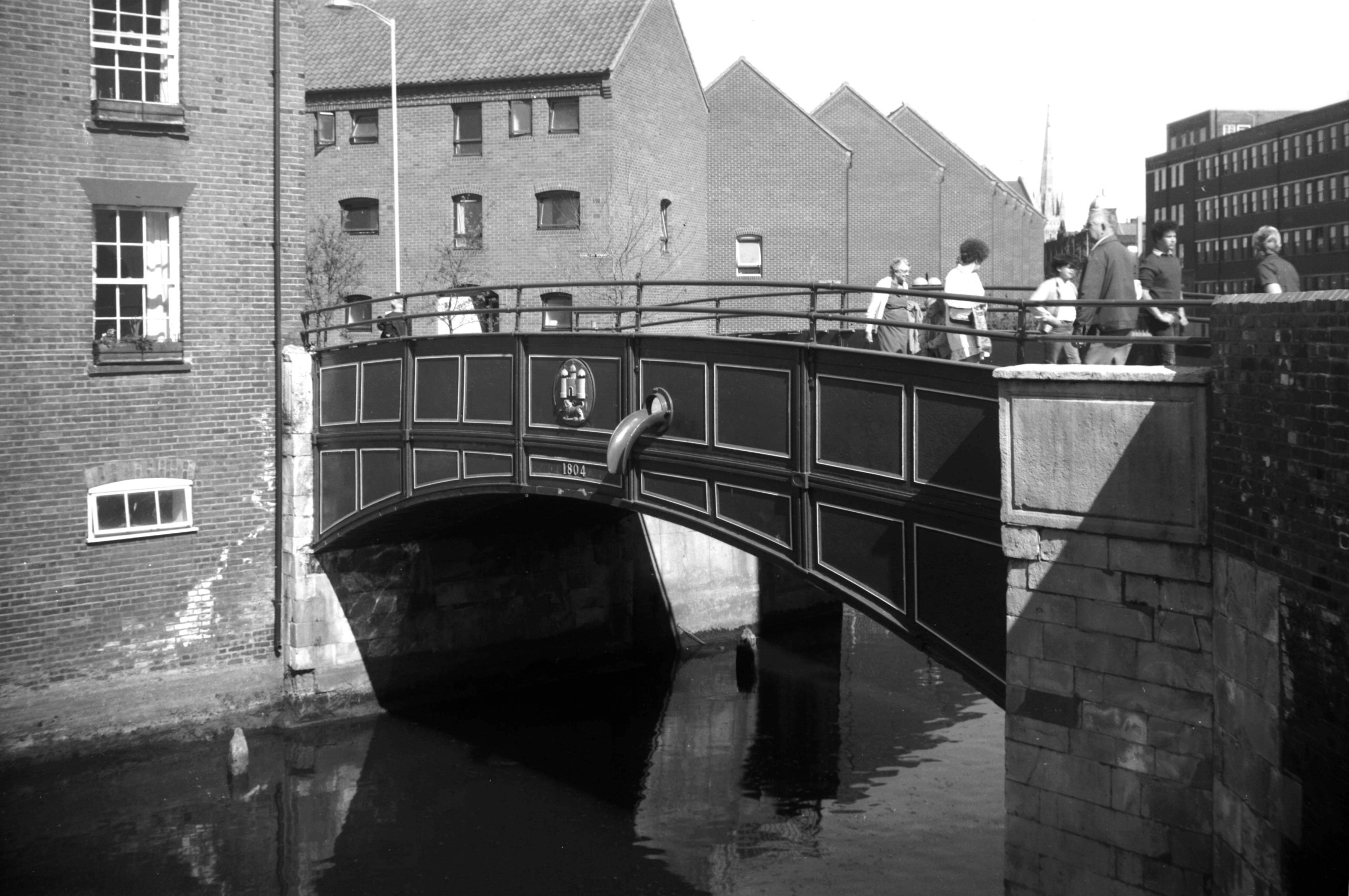
Wensum St Miles' Bridge Coslany east side [5433]
1975-07-03
Of previous structures the earlier ones were of timber.
Originally there were two bridges here, linking an island
to the mainland. By 1521 (and perhaps for some time
before) the island had become joined to the mainland as
on this date a single bridge was built here of stone. The
present structure was designed by James Frost, builder
and architect, and was opened on 15th November 1804. It
is of cast iron with a single span of approximately 30
feet and width between parapets 15 feet. |
|
|
Wensum St Miles' Bridge Coslany west side [6296]
1984-04-27
|
|
|
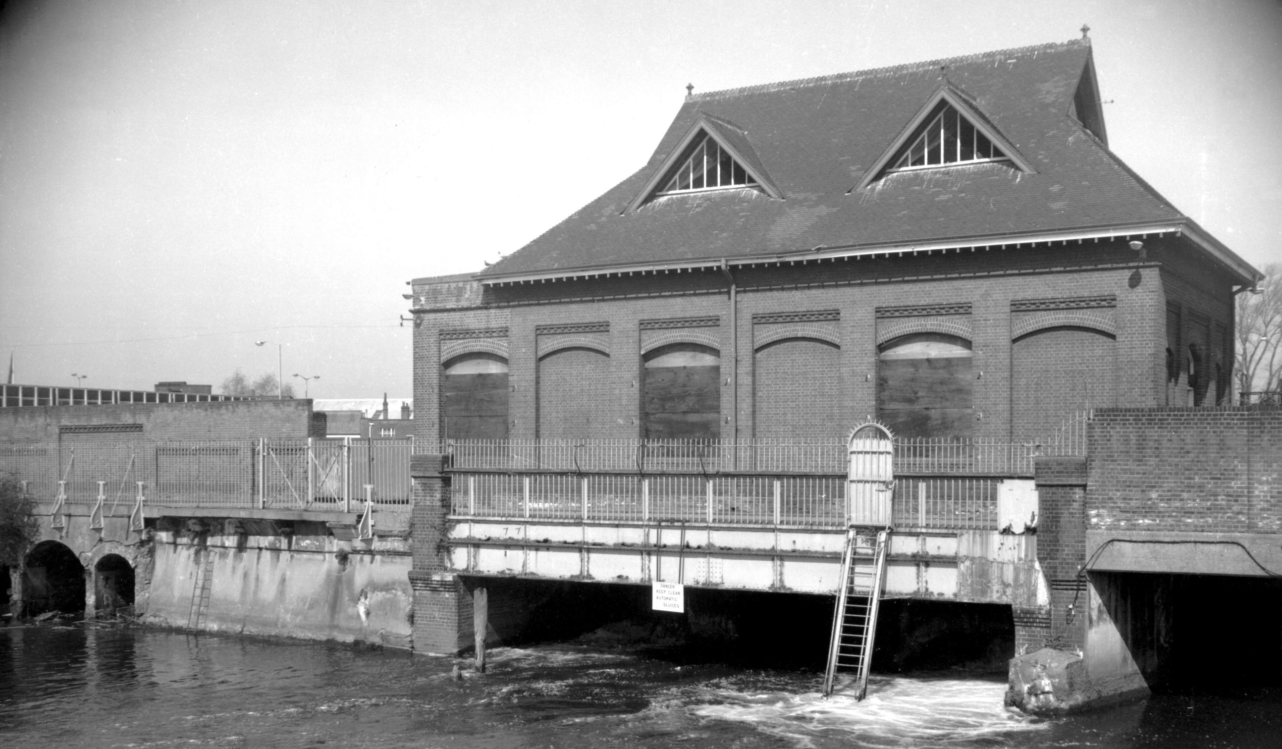
New Mills Yard New Mills [6294] 1984-04-24
Records of mills on this site go back at least to the
14c. Formerly known as Chese's, Bumpstede's and the
Appleyard's Mills, they became known as the
"New" Mills after being rebuilt in 1430. Corn
was ground here up to and during the 19c but in 1897
Norwich Corporation erected the present building as an
Air Compressor Station. Downstream from here the river
level is tidal; but the upstream level is maintained by
gates on the other side of the building. At low tide, a
sufficient head of water could drive turbines set in the
arches under the building. The turbines could then drive
the air compressors. At times when there was no head of
water, steam was generated in an adjacent building
(destroyed during the war) using the City's rubbish as
fuel, to drive a steam engine connected to the air
compressors.
The compressed air was piped underground around the City
and used for a variety of purposes such as driving lathes
and other machinery in the City Technical College (later
the Art School) and other Council workshops. However its
main use was to power eight 'Shones Ejector' underground
sewage pumps, located around the City. This unique system
was closed in 1972. |
|
|
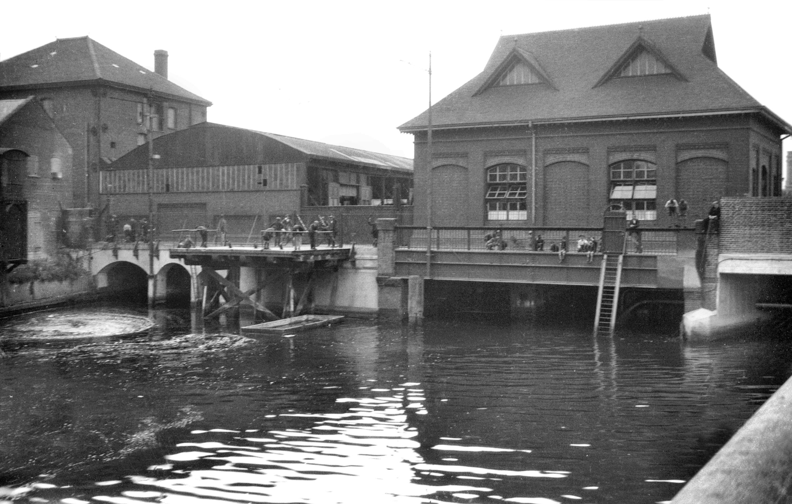
Wensum New Mills Bridge south side [B632] 1933-07-18
Constructed 1896. |
|
|
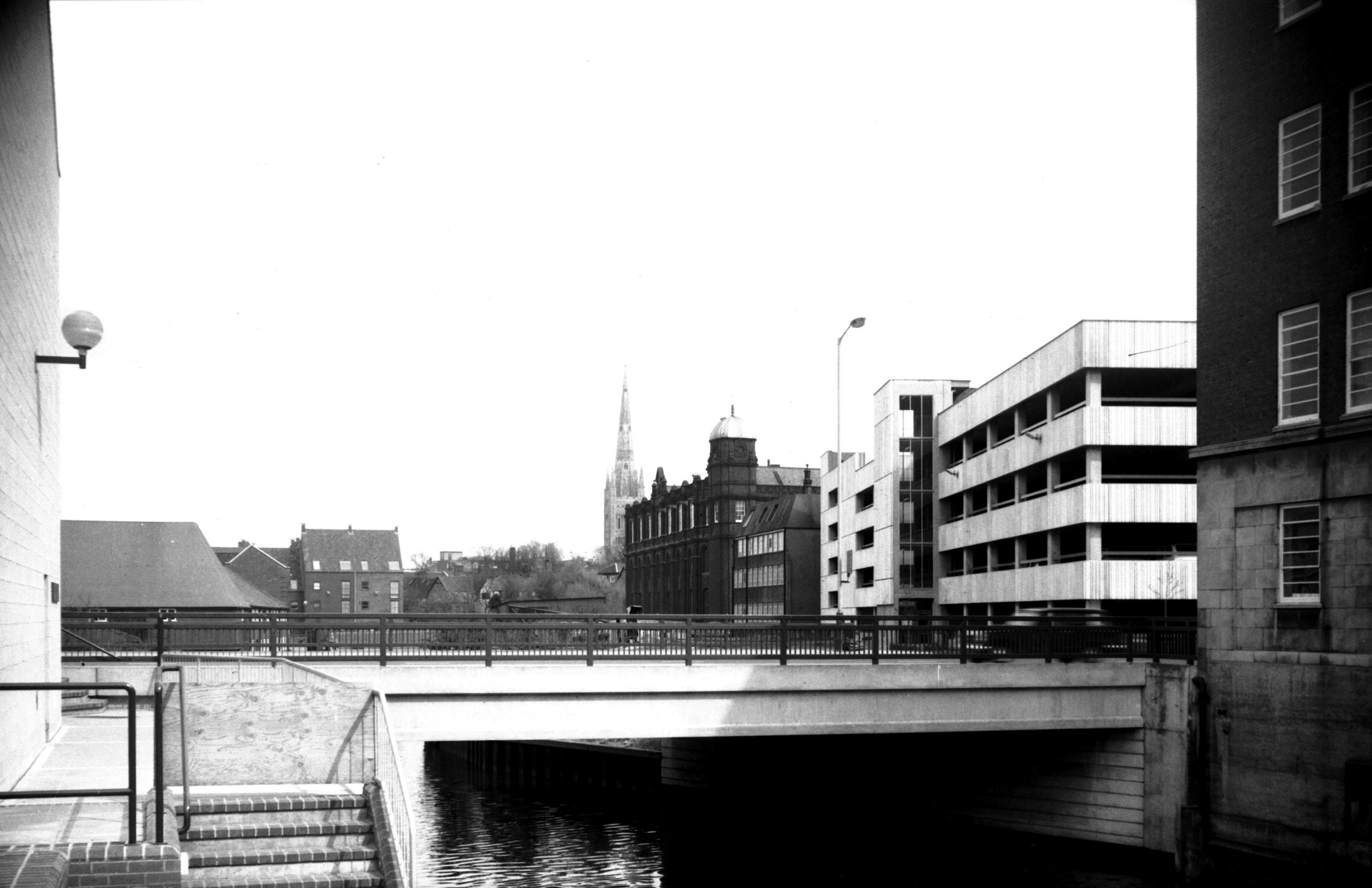
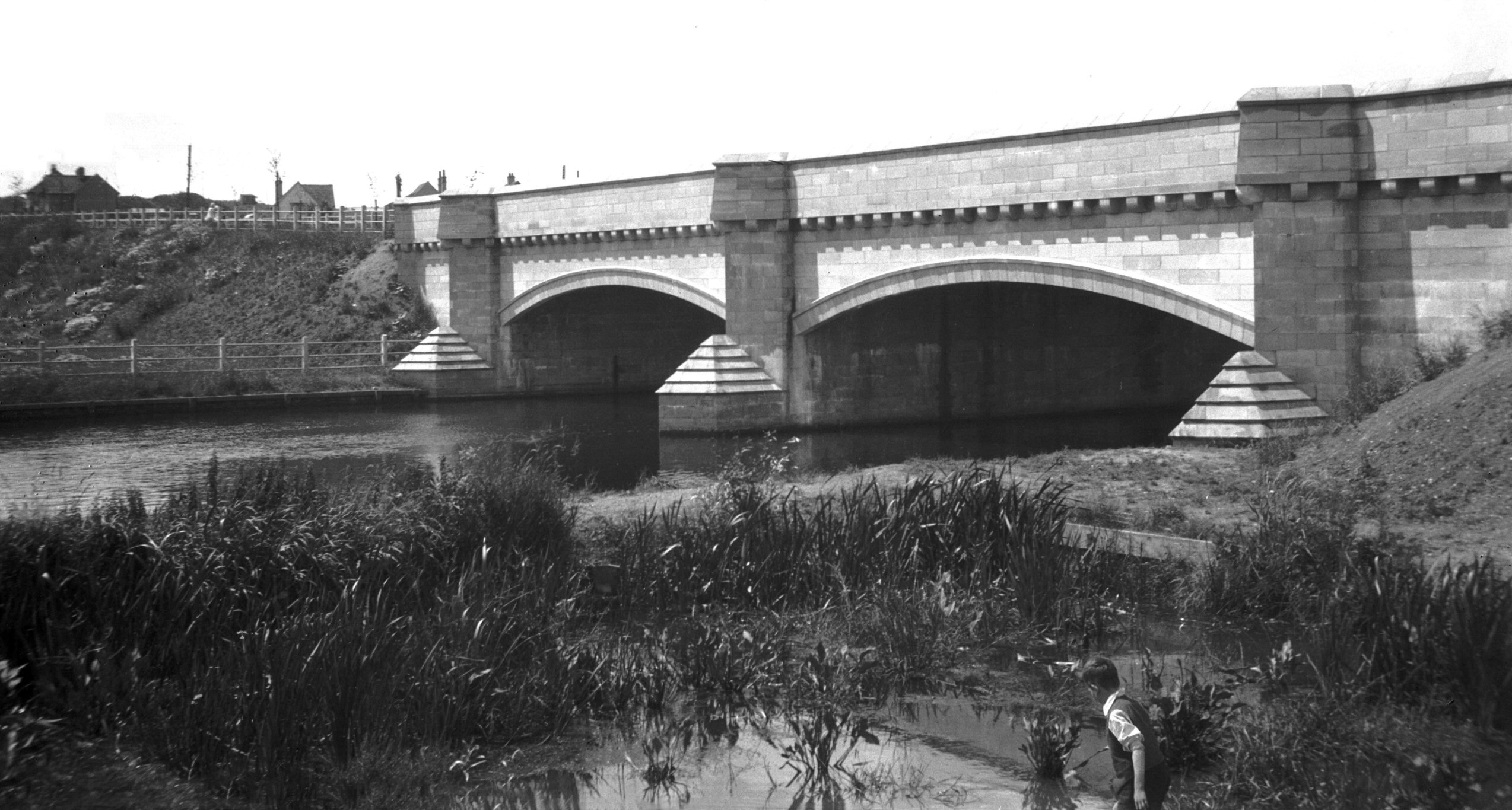
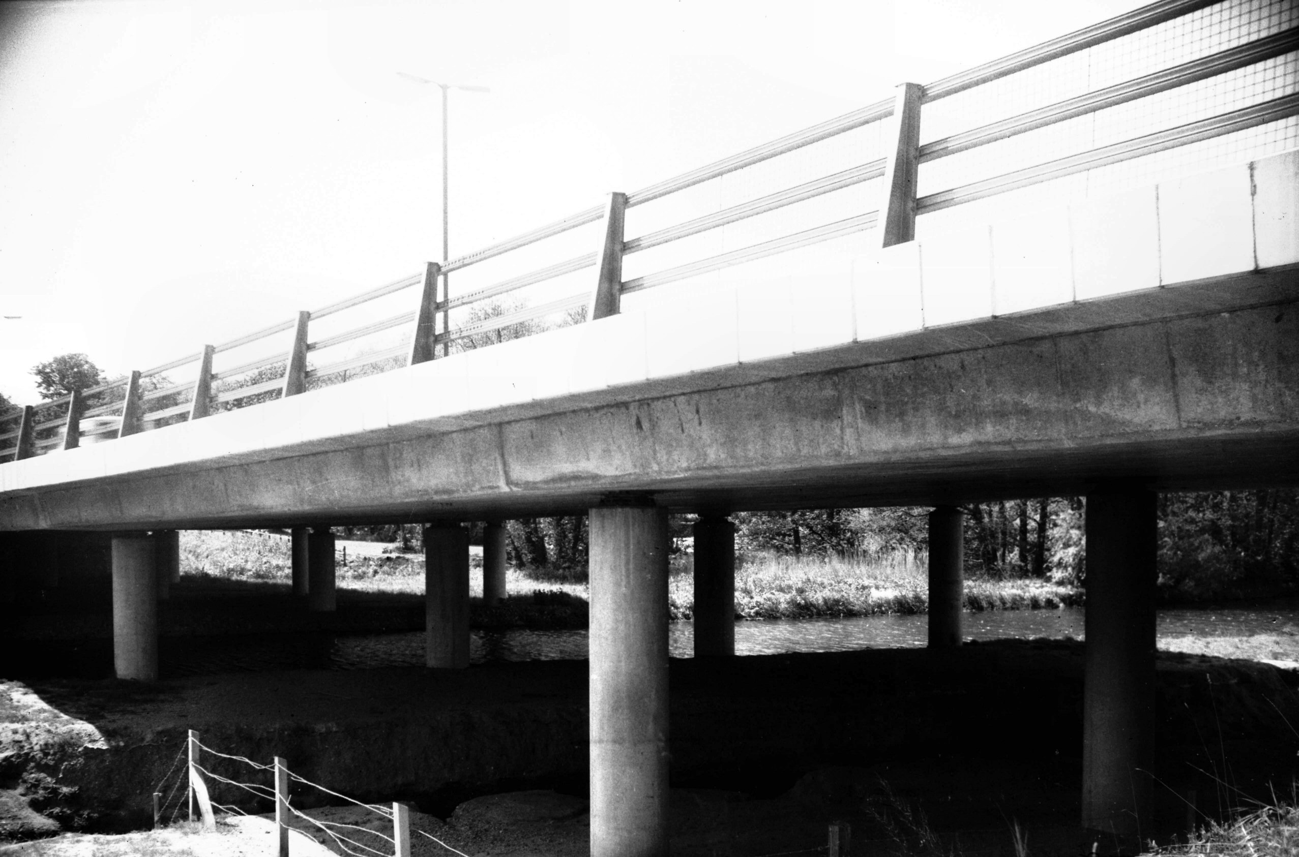
Wensum City Bridge St Crispin's Rd N side [5418]
1974-09-11
|
|
|
Wensum City Bridge St Crispin's Rd S side [B633]
1933-07-18
St Crispin's Rd. No previous structure had been erected
on this site. In 1880 a company was formed to promote a
Bill through Parliament relative to a proposed railway
line between Lynn, Fakenham and Norwich. The city
petitioned against this but agreed to withdraw it upon
the promoters undertaking to build a road between Barn Rd
and Oak St to be carried over the Wensum by a bridge.
Station Rd and the bridge (built largely of steel) were
the result. Constructed by iron founders Barnard, Bishop
and Barnard in 1882, the latter was a single span of
about 50 feet. In 1972 the northern section of the inner
link road was completed involving the construction of a
second bridge. Of reinforced concrete, this carries the
northern carriageway, the older bridge remaining to take
the southern lane. Station Rd then became divided between
St Crispin's Rd and Barn Rd. See also Station Rd. |
|
|
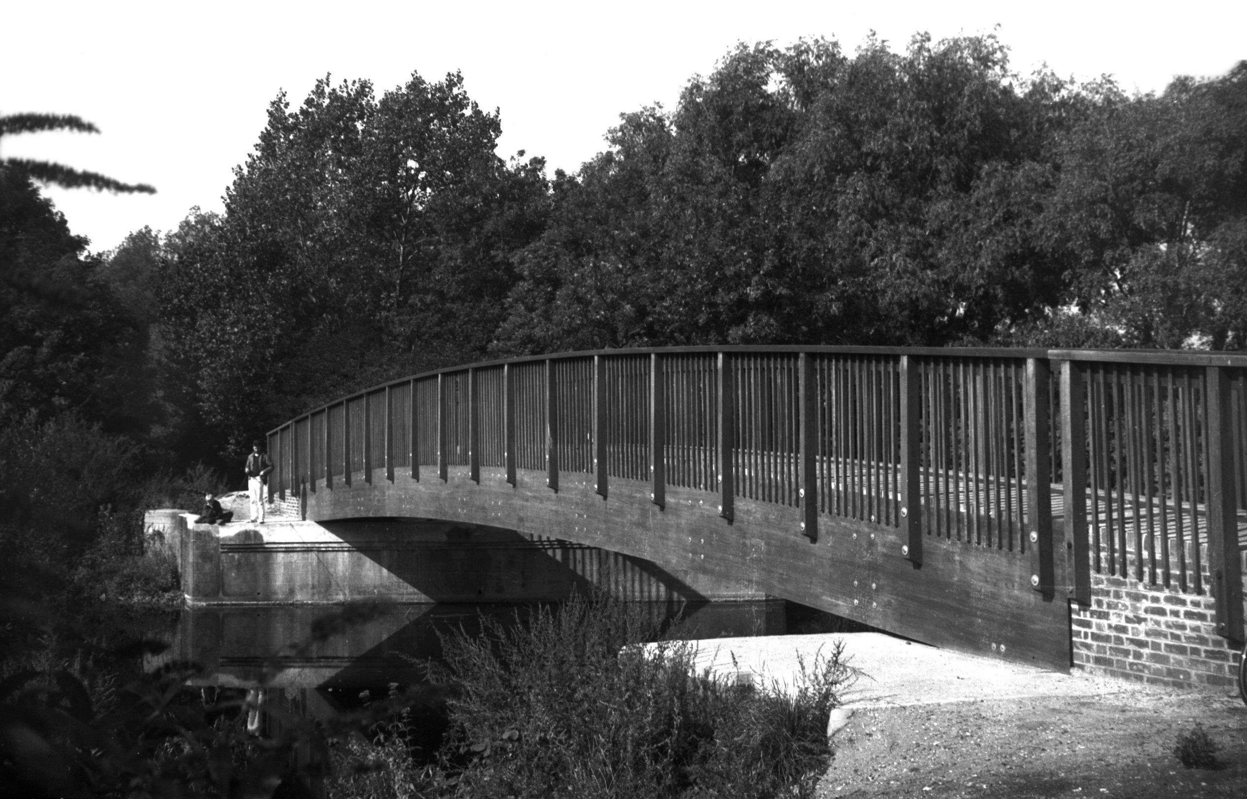
Wensum footbridge on site of M and GN rail [6425]
1986-09-20
Constructed 1986 on the site of an "A" frame
bridge carrying the disused M and GN railway line. |
|
|
Wensum M and GN rail bridge from Dolphin Br [B154]
1931-00-00
|
|
|
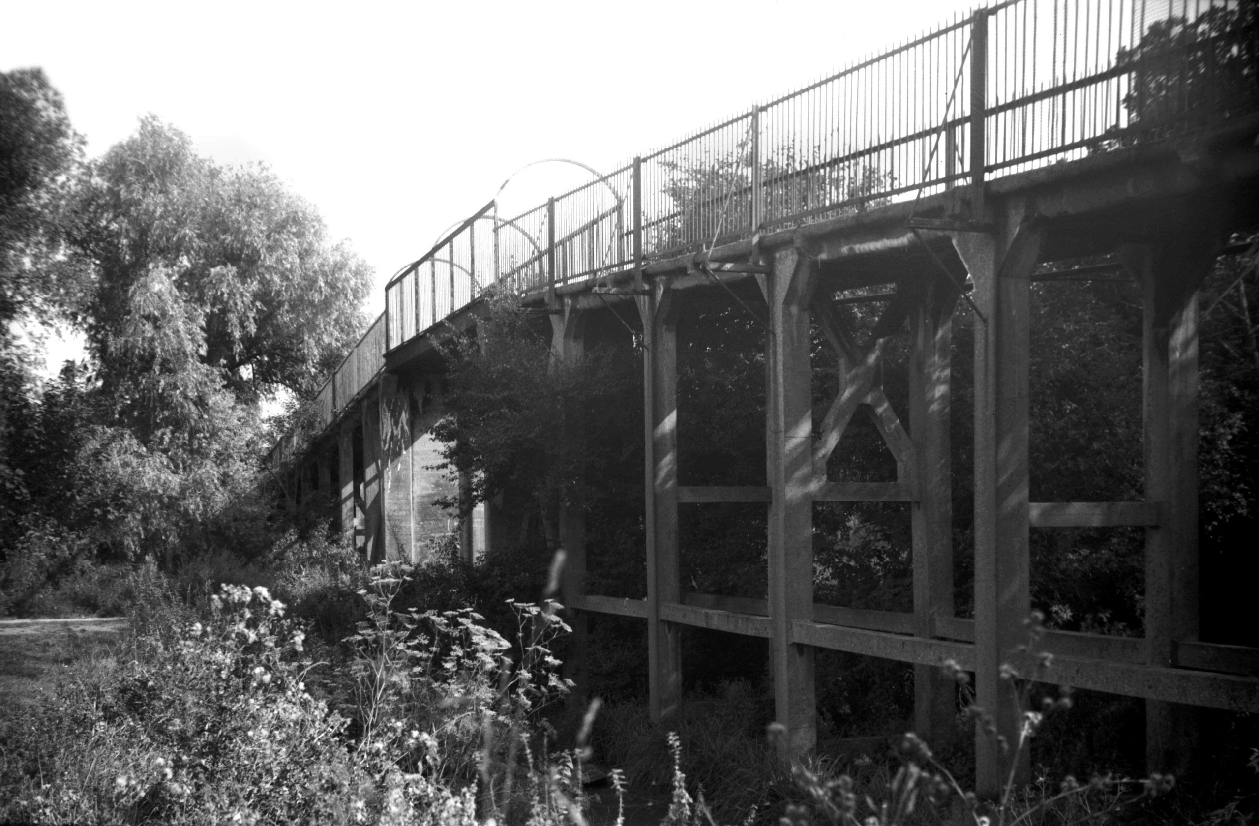
Wensum Dolphin footbridge west side [B620] 1933-07-11
No previous bridge occupied the site but it superseded
and ancient ferry. Built as a result of strong agitation
amongst the people of the district, the City Engineer
pointed out that because of bad approach gradients at the
northern end, the site of the present Mile Cross Rd was a
much better one for a vehicular bridge. Consequently it
is a footbridge only and was opened by the Mayor, Ernest
Egbert Blyth MA LL.D on 15th December 1909. The walkway
is only 6 feet wide and beyond the river bridge (which
has a double span of some 75 feet) is carried upward on
reinforced concrete supports to another bridge spanning
the site of the M and GN Railway line. This has been
described as an early Norwich example of the use of this
material. |
|
|
Wensum Dolphin footbridge walkway to river [6580]
1989-09-07
From site of railway line. |
|
|
Wensum Mile Cross Rd Bridge west side [B621]
1933-07-11
No previous bridge existed on this site. The present
bridge and thoroughfare were constructed as an
unemployment scheme, the Dolphin footbridge having become
inadequate after the building of the Drayton Rd and Mile
Cross housing estates. The bridge has a double span of
about 75 feet with arches of reinforced concrete ribs
supporting pillars carrying the deck beams and deck. The
estimated cost was £47,000. It was first opened to
traffic in 12th September 1923 by Sir H.P.Maybury. |
|
|
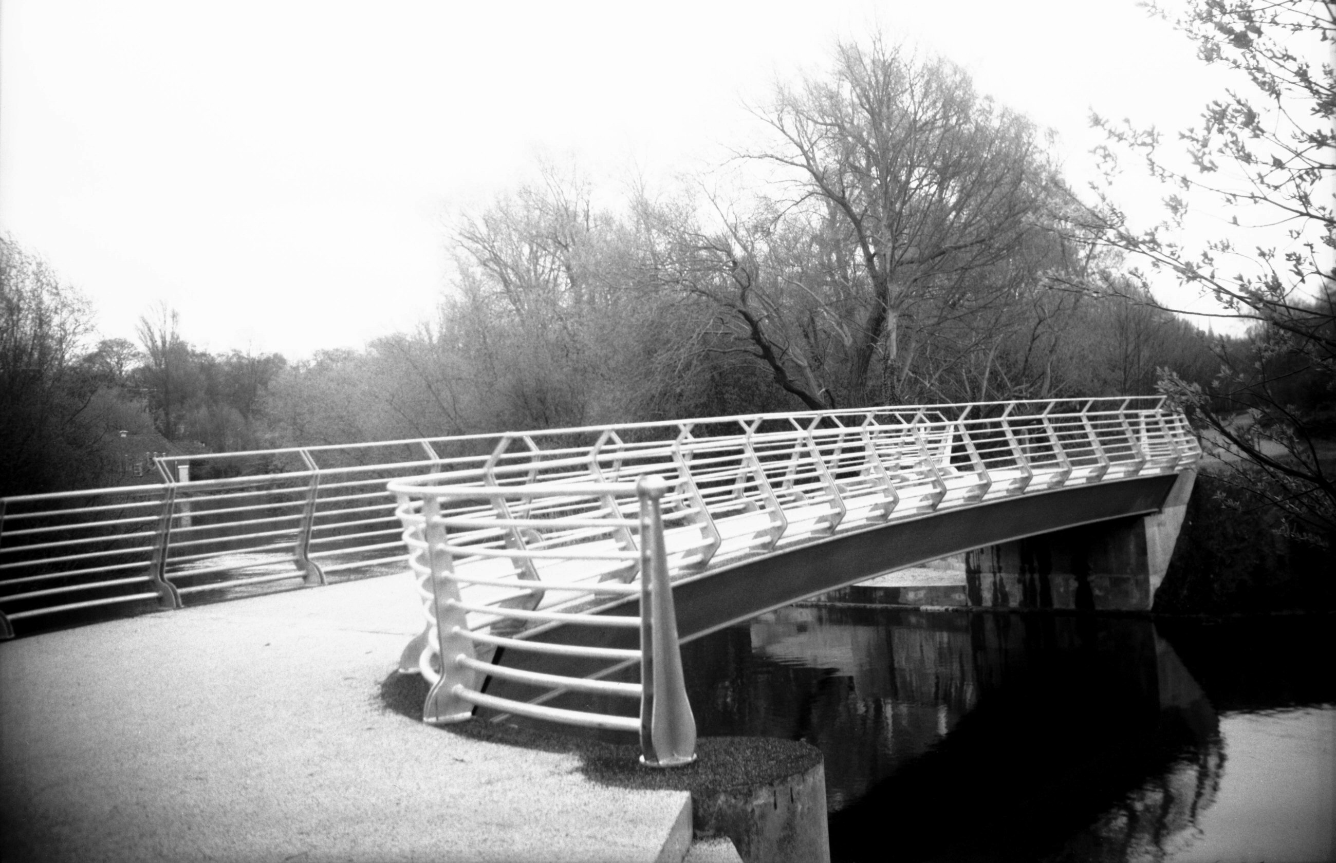
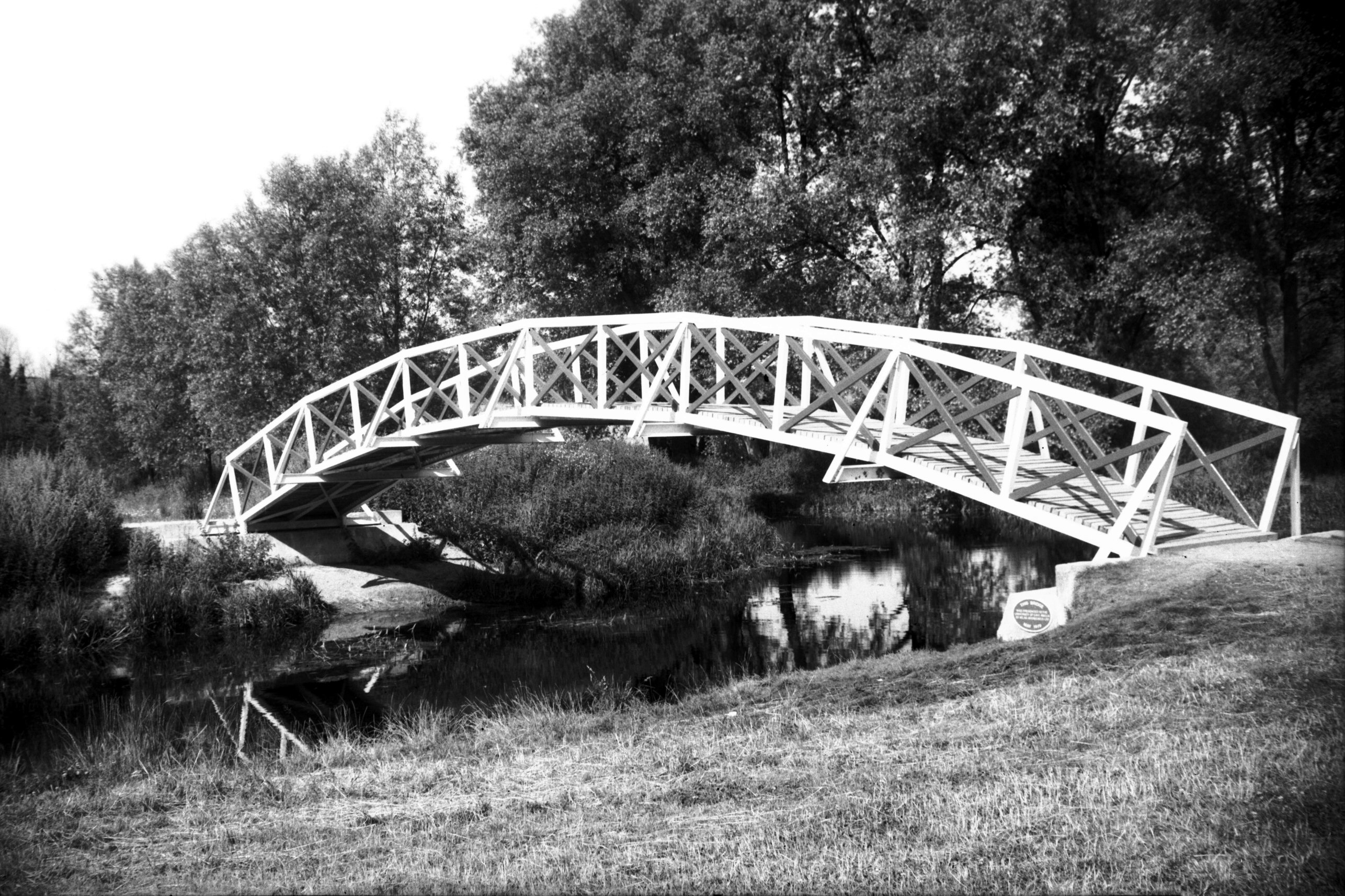
Wensum Sweet Briar footbridge view upstream [7429]
1997-02-09
Built to give access from the riverside path on the North
side of the Wensum to Sycamore Crescent Wood Nature
Reserve. Officially opened 5th May 1997 by Julian
Swainson, City Planning Committee Chairman. |
|
|
Wensum Sweet Briar Rd Bridge east side [B618]
1933-07-09
Opened 21st October 1932. No previous bridge occupied
this site. The present bridge and roadway (opened without
ceremony) were built as part of the ring road which
girdles much of the city. This was a scheme commenced
soon after the Great War to employ surplus labour and to
help relieve traffic congestion within the city. The
bridge is of concrete, having a double span of some 75
feet, the width between the parapets about 40 feet. |
|
|
Wensum footbridge on site of rail Hellesdon [7742]
2000-04-18
Constructed 2000, replacing the 1986 bridge. |
|
|
Wensum Hellesdon Bridge west side [B627] 1933-07-16
Except that Hellesdon bridge is mentioned in an account
of the city boundary in 1556, there is little record of
previous structures. The present bridge is a single 40
feet span of cast iron with a width between the parapets
of 12 feet. It was erected by the Corporation in 1819 at
a cost of £1,169, the builder and architect being James
Frost of St Faith's Lane Norwich. At its southern end the
road was built up to a bridge over the adjacent railway
line in the early 1880's but has since reverted to its
original level following the abandonment of the line. |
|
|
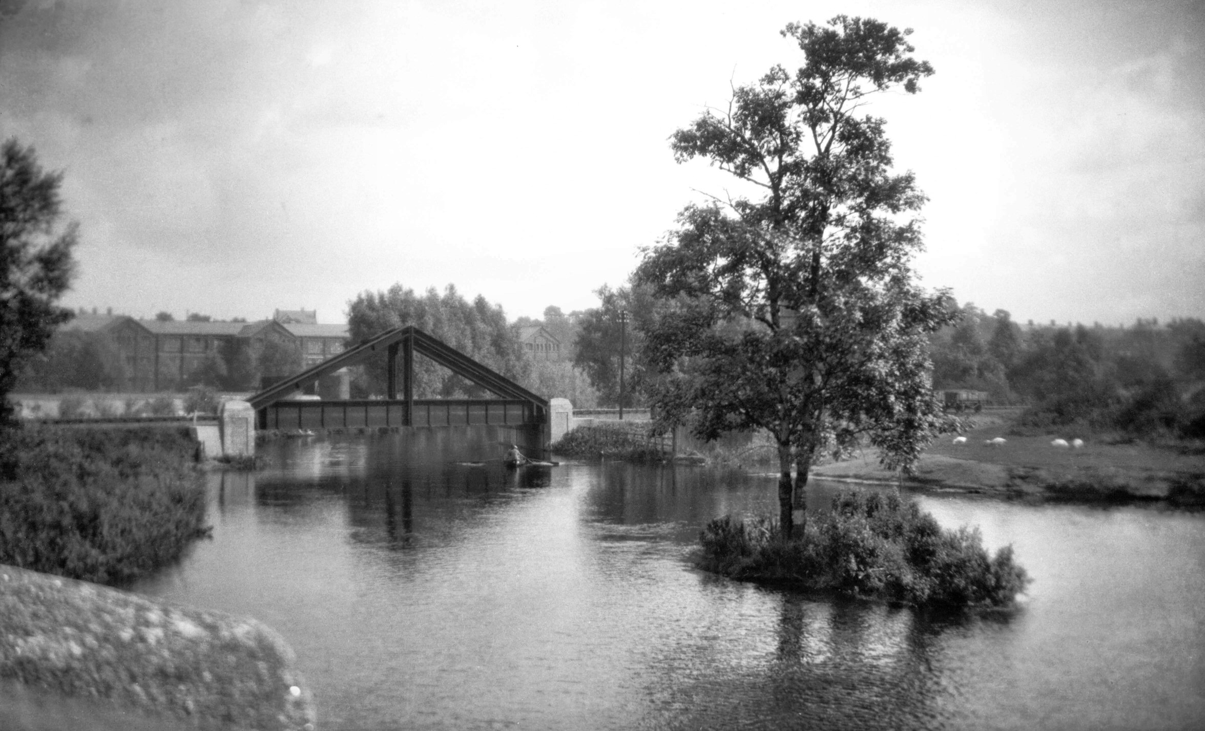
Wensum M and GN rail bridge Hellesdon [6362]
1986-05-08
Three "A" frame bridges were built over the
river Wensum when the Midland and Great Northern railway
constructed a spur line from Melton Constable to their
new City Station near Heigham St, Norwich around 1880.
One was around 500 yards east of Hellesdon Station;
another was a short distance downstream from the Dolphin
footbridge. A third bridge of similar construction was
built a mile or so further on at Drayton. |
|
|
Yare Trowse Bridge west side [0035] 1934-02-20
Earlier structures are mentioned in 1430 and in a Charter
of 1556. King Charles II was met by the Mayor here in
1671 and in October 1697 Trowse, Harford and Bungay
bridges were broken down by floods. The present bridge
was built in 1863 by J.Stanley, contractor, and
R.M.Hipson, County Surveyor. Widened in 1886, this
portion collapsed during the flood of 1912 but was
rebuilt a year later when T.H.B.Heslop was Surveyor. |
|
|
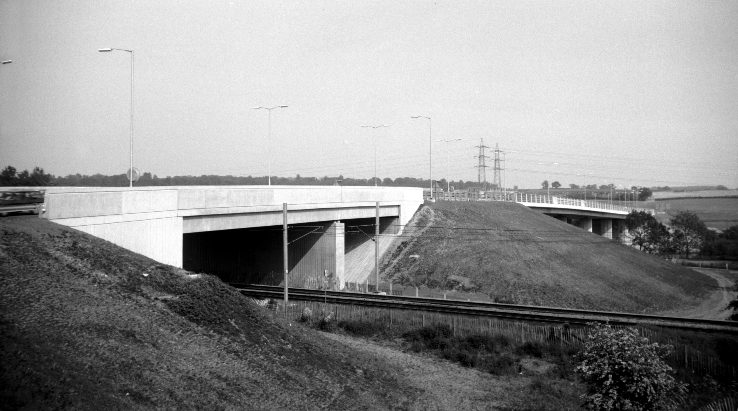
Yare Trowse bypass viaduct [6807] 1992-05-23
Over the railway and river Yare. Opened 20th May 1992. |
|
|
Yare Stoke Rd Bridge mill tributary [7806] 2001-03-06
Road leading to Lakenham water mill. |
|
|
Yare Lakenham Bridge NE side [0059] 1934-03-25
A bridge on this site is mentioned in 1461 and 1556 in
charters setting forth the city boundary. Since 1726,
under the Tonnage Act of that year, these boundary
bridges have been maintained by the Norfolk County
Authority with the exception of Lakenham bridge. This has
been kept in repair by the railway company since the
mid-19c when they rebuilt the approach road to the
adjoining railway bridge. The flood of August 1912 partly
demolished it by undermining the piers but it was rebuilt
in 1913. It has a single span of steel girders, the piers
and parapets being of brick. |
|
|
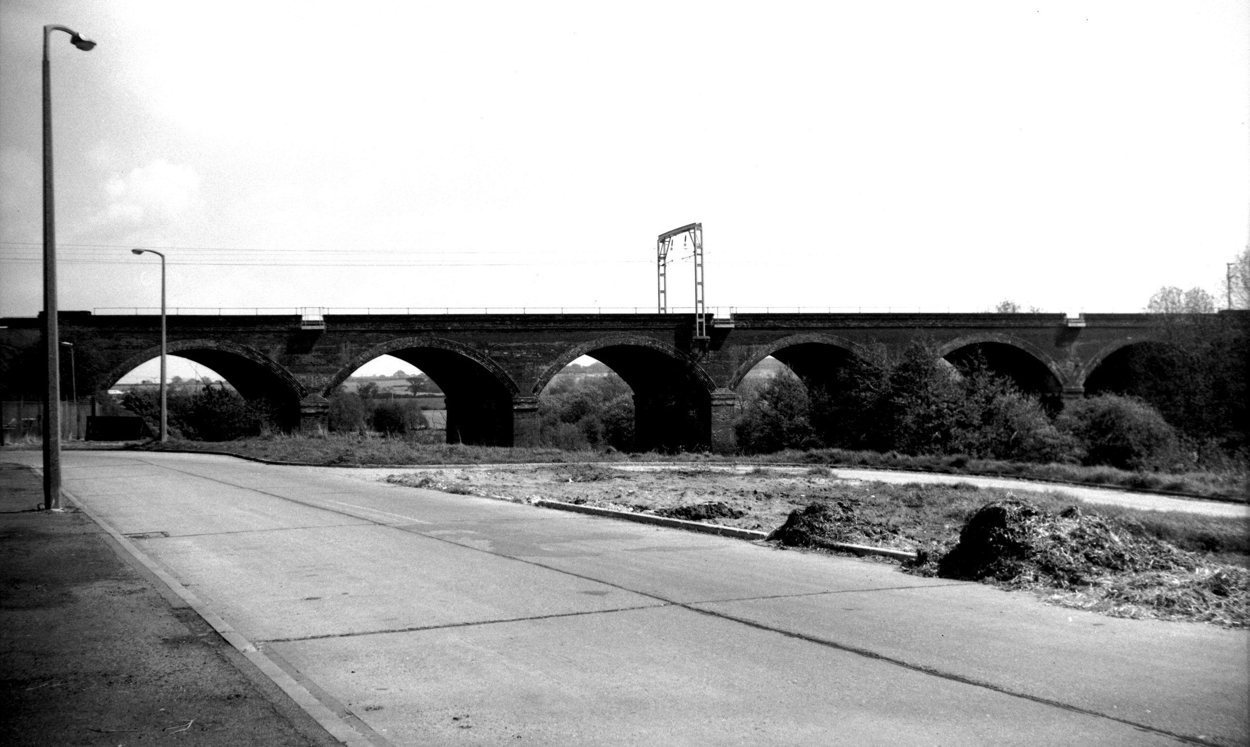
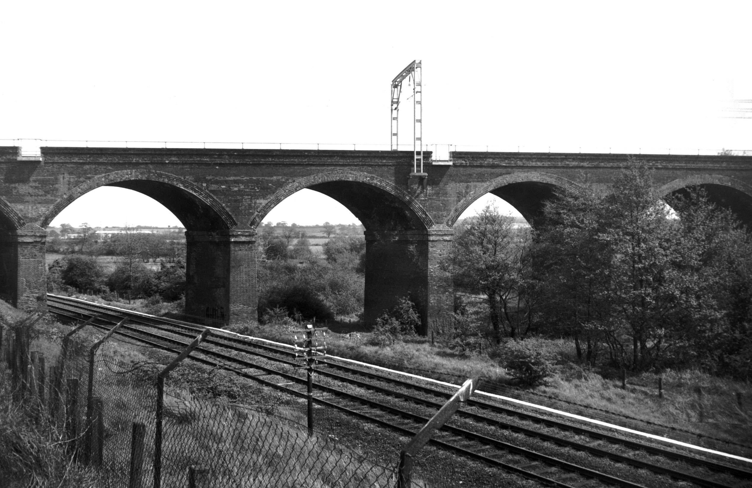
Yare Harford rail viaduct over [6376] 1986-05-19
Of six brick arches carrying the London (Liverpool St)
line over the river Yare and the line to Ely, it was
constructed in 1848-49. |
|
|
Yare Harford rail viaduct over [6377] 1986-05-19
|
|
|
Yare Harford North Bridge west side [B623] 1933-07-11
A member of the de Hereford family is said to have first
built a bridge here in King John's reign. Broken down by
a flood in October 1697 it was rebuilt, but in 1767 a
temporary bridge here was again washed away. In 1832 this
and the adjoining bridge across another arm of the river
were built with a roadway of over 20 feet, the former
bridge having an elliptical brick arch on stone abutments
and the latter having a four-centred arch. Both ridges
becoming weak through heavy traffic (they carried the
trunk road from Norwich to Ipswich) they were demolished
in 1965 and replaced by a wider, single span supported by
beams of reinforced concrete. |
|
|
Yare Harford South Bridge west side [B624] 1933-07-11
|
|
|
Yare Harford South Bridge before demolition [4798]
1964-07-26
|
|
|
Yare Harford Bridge view downstream [4913] 1965-07-10
|
|
|
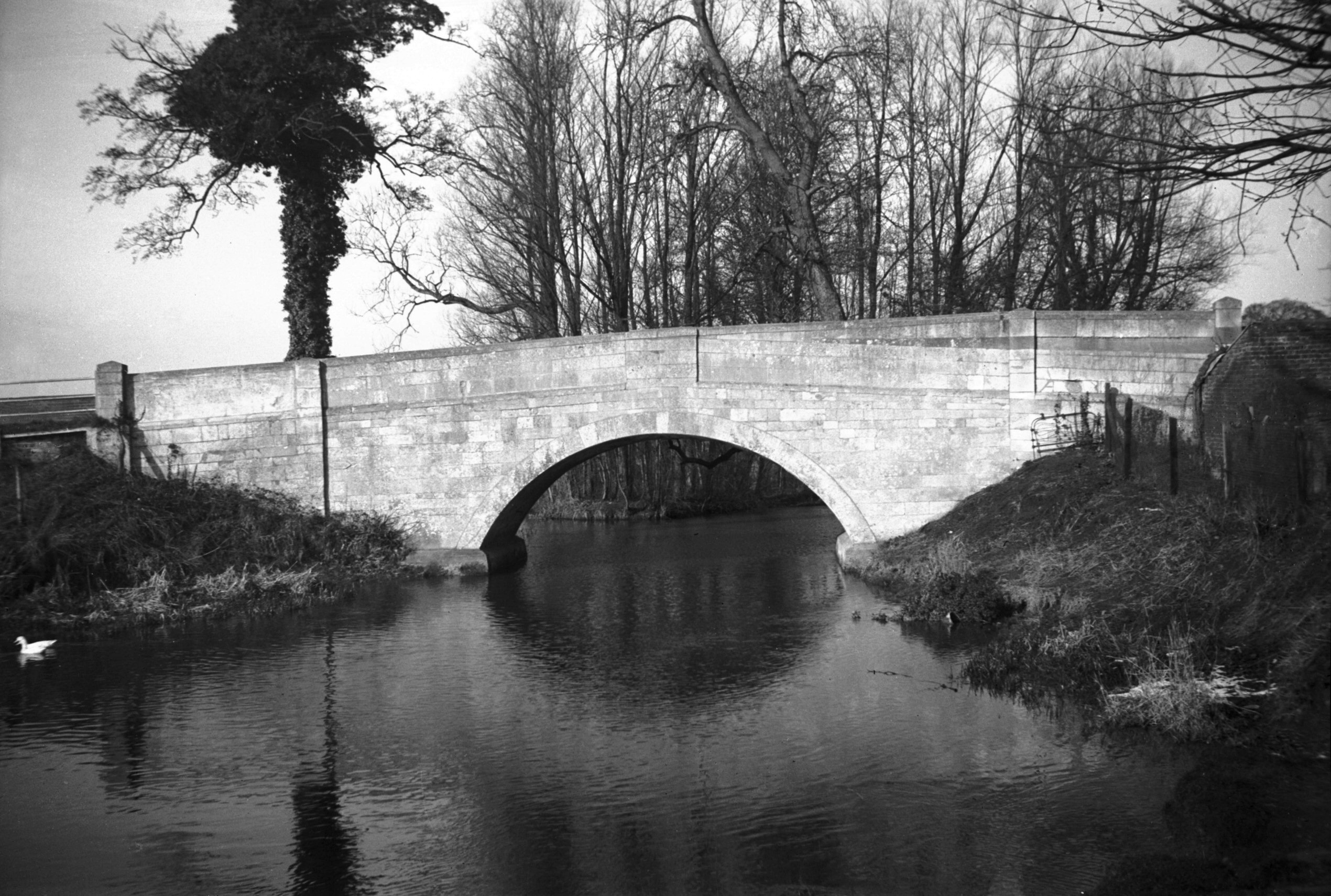
Yare Cringleford Bridge east side [0047] 1934-03-01
Constructed 16c. Of previous structures we have little
information. A bridge here is mentioned in a will of
1272, and in 1519 a flood broke down the bridge then
here. This was probably when the present bridge was
erected. Built of stone it has two four-centred arches
spanning a distance of 54 feet with a width of 15 feet
between the parapets. |
|
|
Yare Cringleford Bypass Bridge [5904] 1978-05-25
Over a period of many years Cringleford bridge was
totally inadequate for the volume of traffic carried by
the A11 trunk road (Norwich to Newmarket) and in 1975
Eaton and Cringleford were bypassed, the road crossing
the river higher upstream by a bridge of reinforced
concrete. |
|
|
Yare Earlham Park steel footbridge [6022] 1979-07-26
Constructed by Atlas Aggregates Ltd to give access to the
newly formed University Broad. It was opened to the
public on 21st May 1979. |
|
|
Yare Earlham Bridge south side [0046] 1934-03-01
Although for much of its length to the south and west of
Norwich the River Yare forms the boundary between city
and county, here at Earlham the city encroaches for some
yards beyond the bridge, perhaps because the river has
taken a different course at this point since the boundary
was fixed. Nevertheless, under the Tonnage Act of 1726
the county undertook to see to the maintenance and repair
of the bridge here, along with those at Cringleford,
Harford and Old Lakenham. Later on the railway company
took over Old Lakenham Bridge, after raising the road to
make a better approach to their adjoining bridge over the
Norwich-Ely-Peterborough line.
Of Earlham Bridge, the historian Francis Blomefield had
this to say, that it: "was built of Stone in 1502,
by the Will of Tho. Bachcroft of Little Melton, who gave
his Estate to be sold for that Purpose, and to make a
Stone Cross by it, and put on it a Scripture, desiring
the Passengers to pray for his Soul, and the Souls of
Margaret his Wife, his Father's and Mother's, and of Tho.
Northwold and Margaret his Wife. It was rebuilt in 1579,
and now again in 1744."
An even earlier bridge here is mentioned by name in 1461
in the draft of a charter setting forth the city
boundaries.
The 1744 bridge comprised a single arch of stone, with
the road sloping gently down from east to west. By 1961
its narrow width had rendered it quite inadequate to take
the considerable increase in road traffic, and plans were
drawn up to replace it. The new bridge, with both a wider
carriageway and increased river span, was completed and
opened to traffic by the beginning of 1964; the old
bridge, which remained standing a few yards to the north,
was fenced off, but it was not to remain so for long.
Because of vandalism and natural deterioration, as well
as the high cost of maintenance that its retention would
have entailed, it fell beneath the combined onslaught of
a dragline and ball and chain in August 1971. |
|
|
Yare Earlham Bridge south side [4775] 1964-06-27
|
|
|
Yare Bowthorpe Tollgate Way Bridge [7774] 2000-10-07
|
|
|
Yare Bowthorpe Tollgate Way Bridge [7785] 2000-10-29
Opened by the Lord Mayor, Ron Borrett, 28th July 2000. |