Norwich Maps


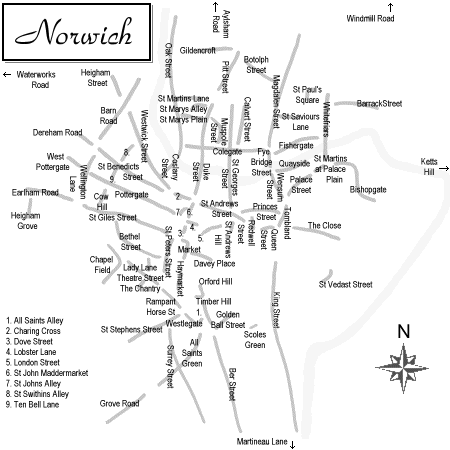
Click in the map below to see a section of Morant's 1873 street map.


These other historical maps of Norwich may also be of interest. Hover over each for a brief description. Click to launch a larger version in a separate window.

13th century Churches map, created for the 1896 book: How the City of Norwich Grew into Shape, by the Rev William Hudson Pre-dissolution monasteries map, created for the 1821 book: Index Monasticus - Diocese of Norwich, by Richard Taylor 1541 Sanctuary map, republished in the 1889 book: The Streets & Lanes of the City of Norwich To which are added Early Maps of the City of Norwich, by John Kirkpatrick, William Hudson & W T Bensley 1558 Cuningham map, republished in the 1928 book: Norfolk Maps and Norwich Plans, by T Chubb & George A Stephen 1581 Braun and Hogenberg map, republished in the 1928 book: Norfolk Maps and Norwich Plans, by T Chubb & George A Stephen 1585 Mousehold map, republished in the 1889 book: The Streets & Lanes of the City of Norwich To which are added Early Maps of the City of Norwich, by John Kirkpatrick, William Hudson & W T Bensley 1638 E L map, republished in the 1928 book: Norfolk Maps and Norwich Plans, by T Chubb & George A Stephen 1696 Clere map, republished in the 1889 book: The Streets & Lanes of the City of Norwich To which are added Early Maps of the City of Norwich, by John Kirkpatrick, William Hudson & W T Bensley 1723 T Kirkpatrick's north-east prospect, republished in the 1928 book: Norfolk Maps and Norwich Plans, by T Chubb & George A Stephen 1727 Corbridge map, republished in the 1928 book: Norfolk Maps and Norwich Plans, by T Chubb & George A Stephen 1741 Blomefield map, published in the 1745 book: An Essay Towards a Topographical History of the County of Norfolk (Folio edition - Vol 2), by Francis Blomefield & Charles Parkin 1789 Hochstetter map, republished in the 1928 book: Norfolk Maps and Norwich Plans, by T Chubb & George A Stephen 1797 Faden map, republished in the 1917 book: Monographs of Norwich Hamlets, by Walter Rye 1819 Longman map, published in the 1819 book: Excursions through the County of Norfolk 1826 Bryant map, republished in the 1928 book: Norfolk Maps and Norwich Plans, by T Chubb & George A Stephen 1832 Sketch OS map, republished in the 1917 book: Monographs of Norwich Hamlets, by Walter Rye 1838 OS map 1885 OS map, hosted by www norwich-yards co uk 1892 Drinkers map, published by the Norfolk and Norwich Gospel Temperance Union 1945 City Engineers ambitious plan, published in the City of Norwich Plan, by C H James, S R Pierce & H C Rowley

Home