|
Barn Rd: |
| |
From
St
Benedict's St / Grapes Hill / Dereham
Rd to St Crispin's Rd (formerly Station Rd)
passing Heigham St, Westwick
St
West side |
|
|
Barn Rd 55 to 59 [2924] 1939-04-08
|
|
|
Barn Rd 69 to 75 [2923] 1939-04-08
|
| |
East
side |
|
|
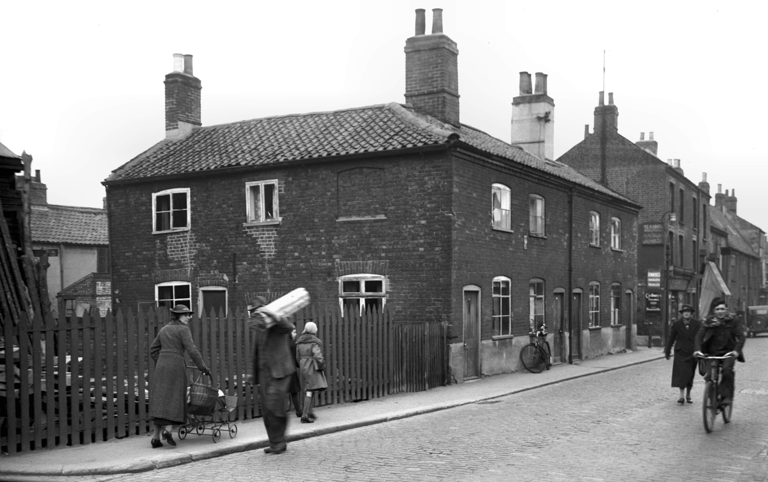
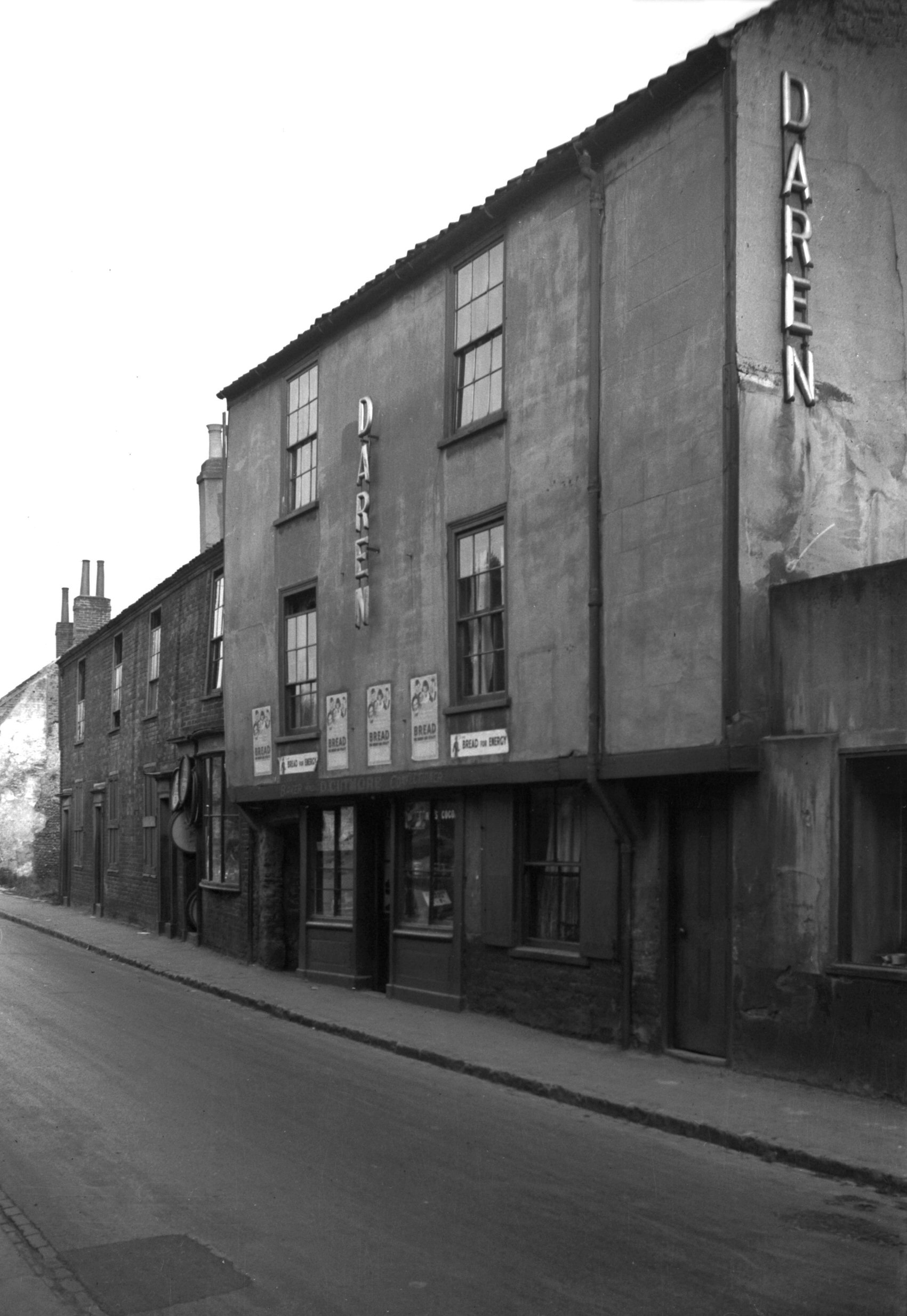
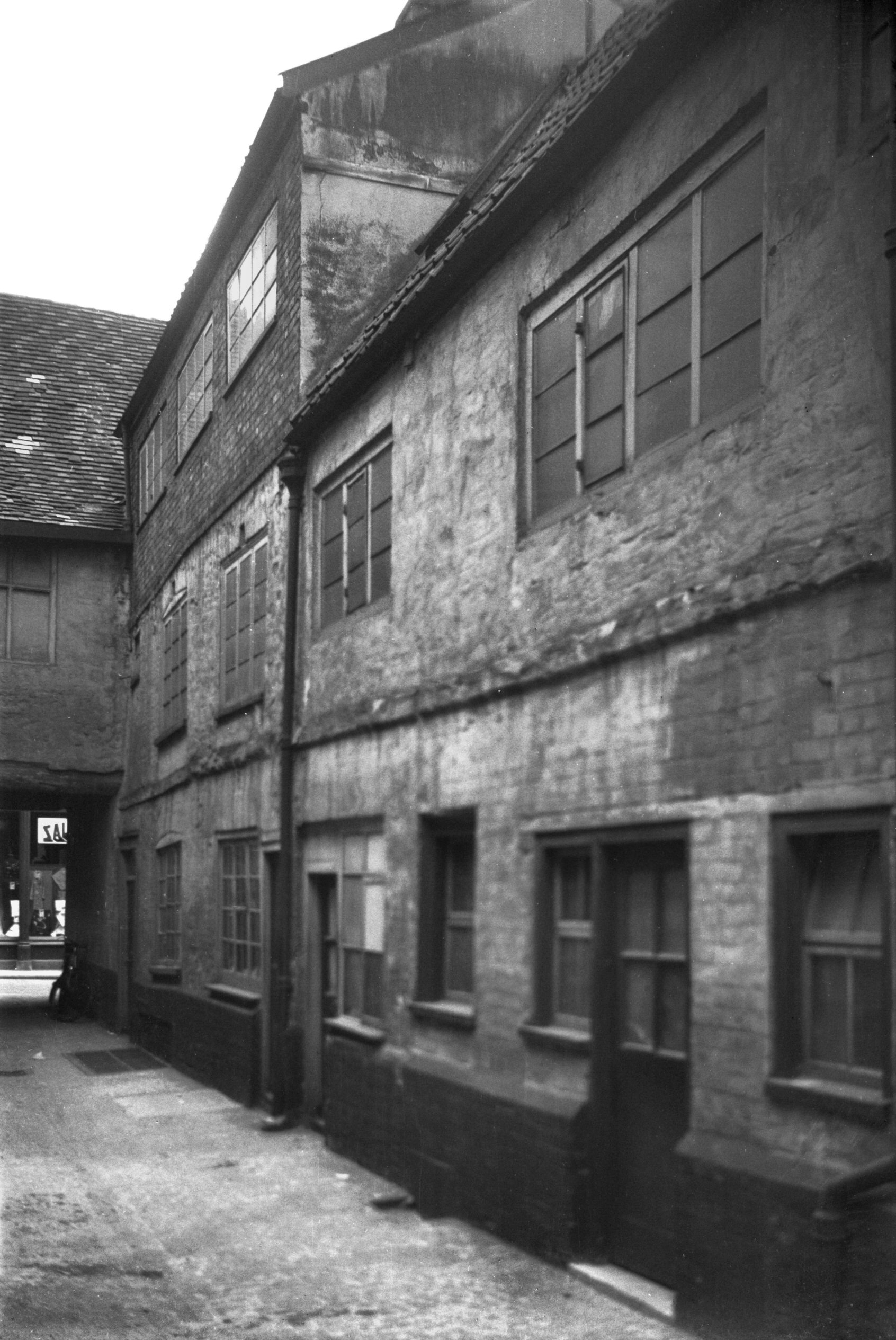
Barn Rd 4 to 8 [2424] 1938-05-23
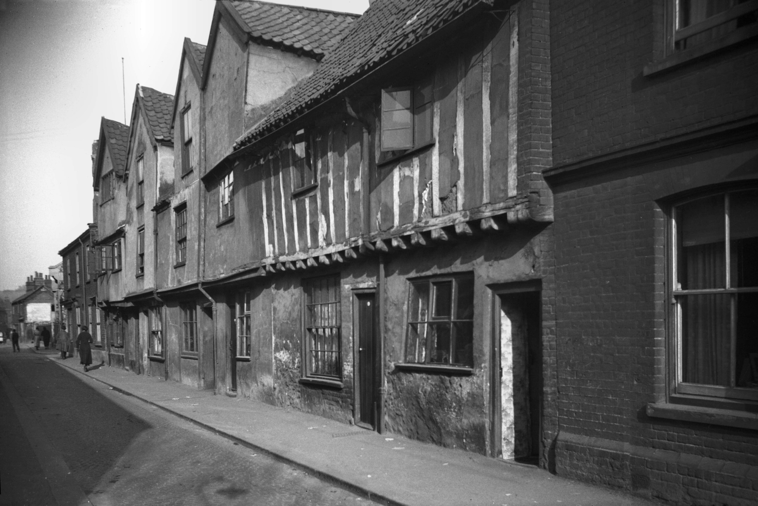
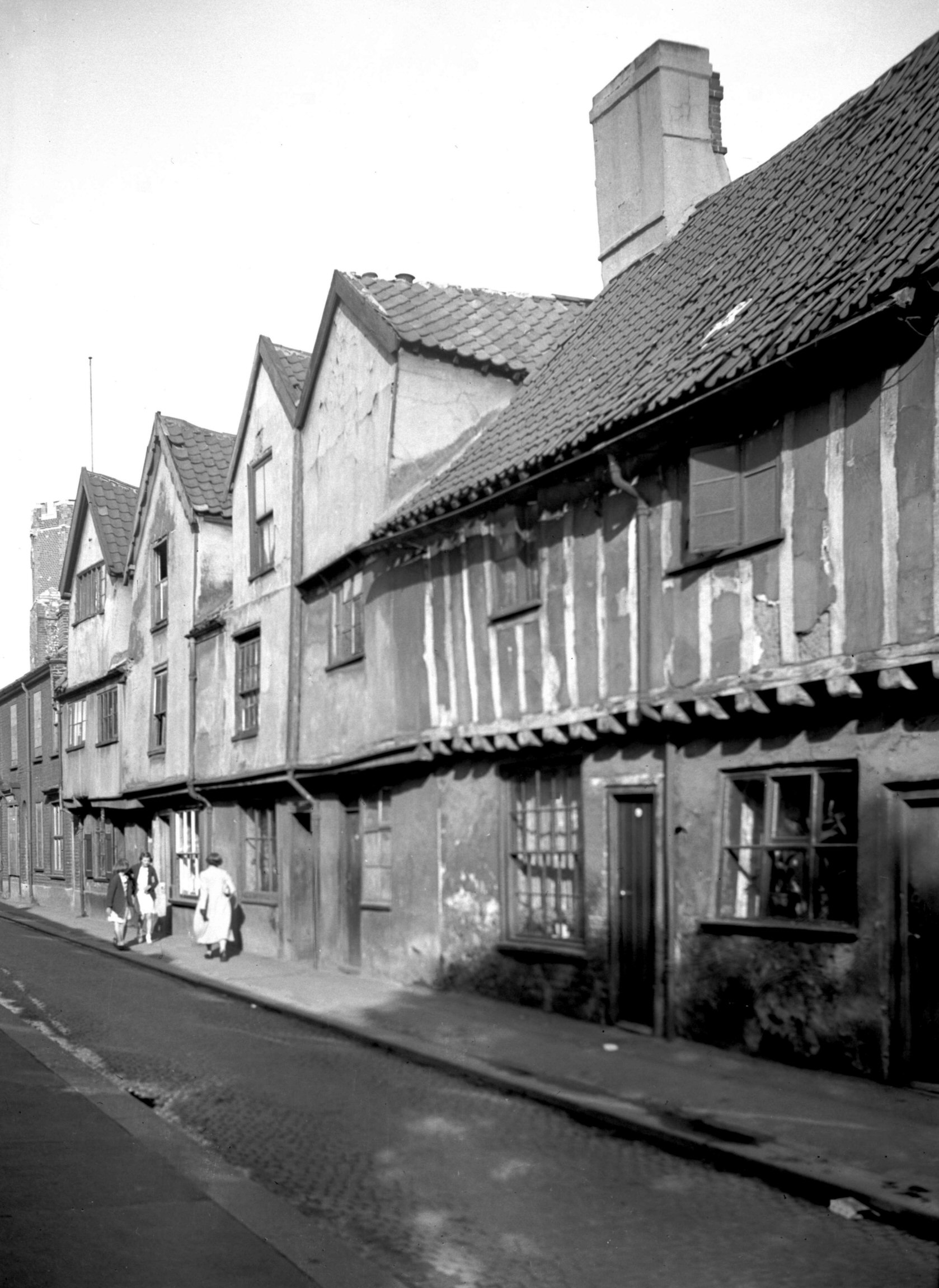
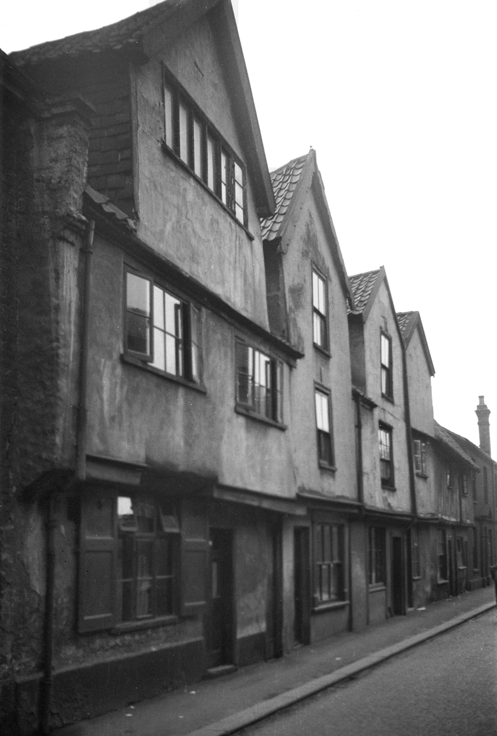
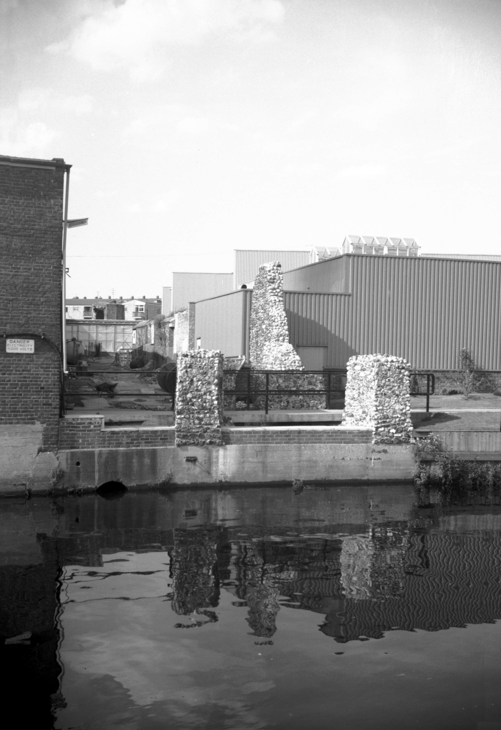
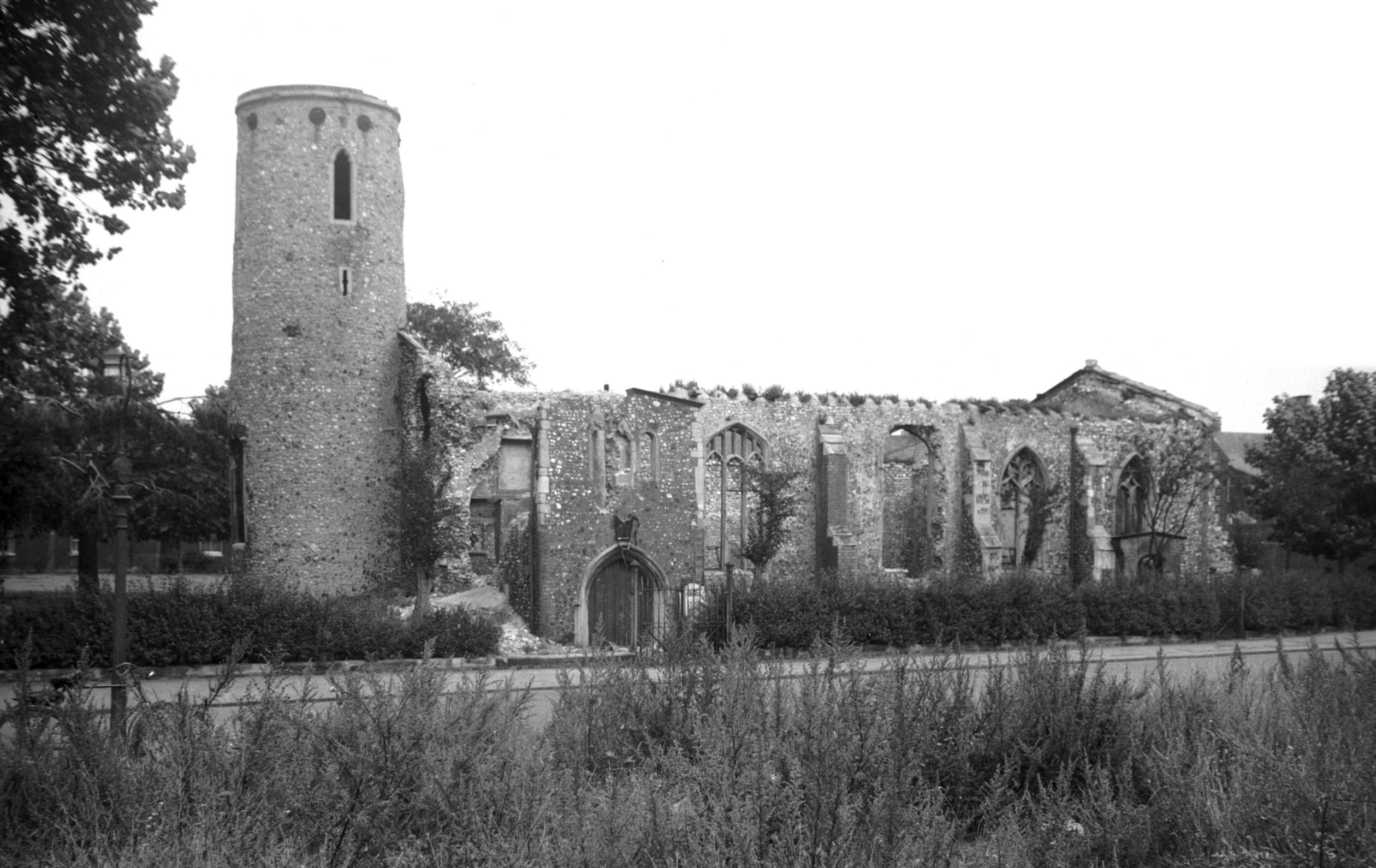
Once lined with nineteenth-century brick and tiled
terraced houses, Barn Rd is now almost unrecognisable
since being more than doubled in width to become part of
the Inner Link road. Perhaps the only familiar landmark
from earlier days is Cushion's timber yard, although even
this has changed and one misses the sight of those
massive tree trunks and the overhead travelling crane.
On the opposite side of the road there still stand
reduced and mutilated fragments of the city wall, which
before the war were incorporated in the rear wall of Nos
4-8 Barn Road. This was a terrace of three-storeyed
houses, their front wall constructed of knapped flints
with brick dressings around the casement windows. The
lower part of their rear wall which abutted upon St
Benedict's Back Lane, was contrived out of the city wall,
but arched recesses which originally opened towards the
lane were unblocked and reversed to add a little more
space to the back rooms of the houses. First built along
the site of the city ditch between 1779 and 1789, the row
was redeveloped in the mid-19c.
On the night of 27th April 1942, a heavy bomb fell near
St Benedict's Gates, wrecking these houses and creating
so much havoc in the vicinity that no sign of the lane
could be seen among the debris. Later, when the site was
cleared, the city wall was allowed to remain and
subsequent excavation revealed among other things the
foundations (long lost) of one of its bastions.
At the corner of Barn Rd and St Benedict's St stood a
"free house" familiarly known as Harcourt's,
but more correctly (from an inscribed stone built into
its south wall) as The Omnibus. This name was derived
from its being the stopping place on one of the routes of
the Norwich Omnibus Company which ran a series of horse
'buses in the city before the introduction of the
electric tramways at the commencement of the 20c. |
|
|
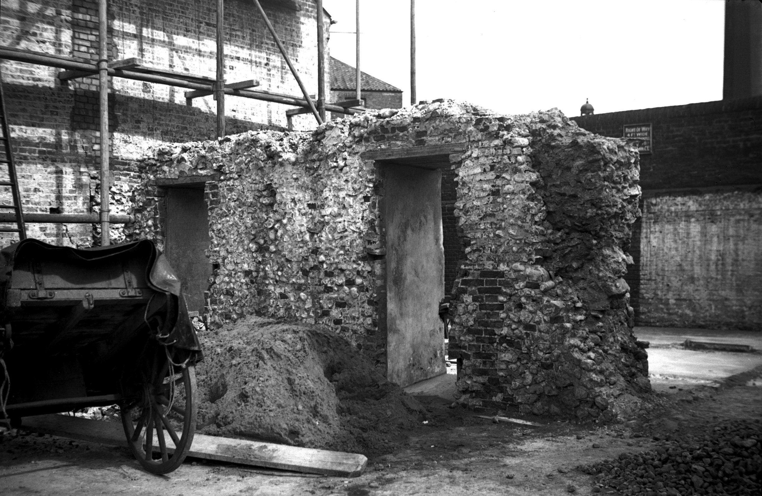
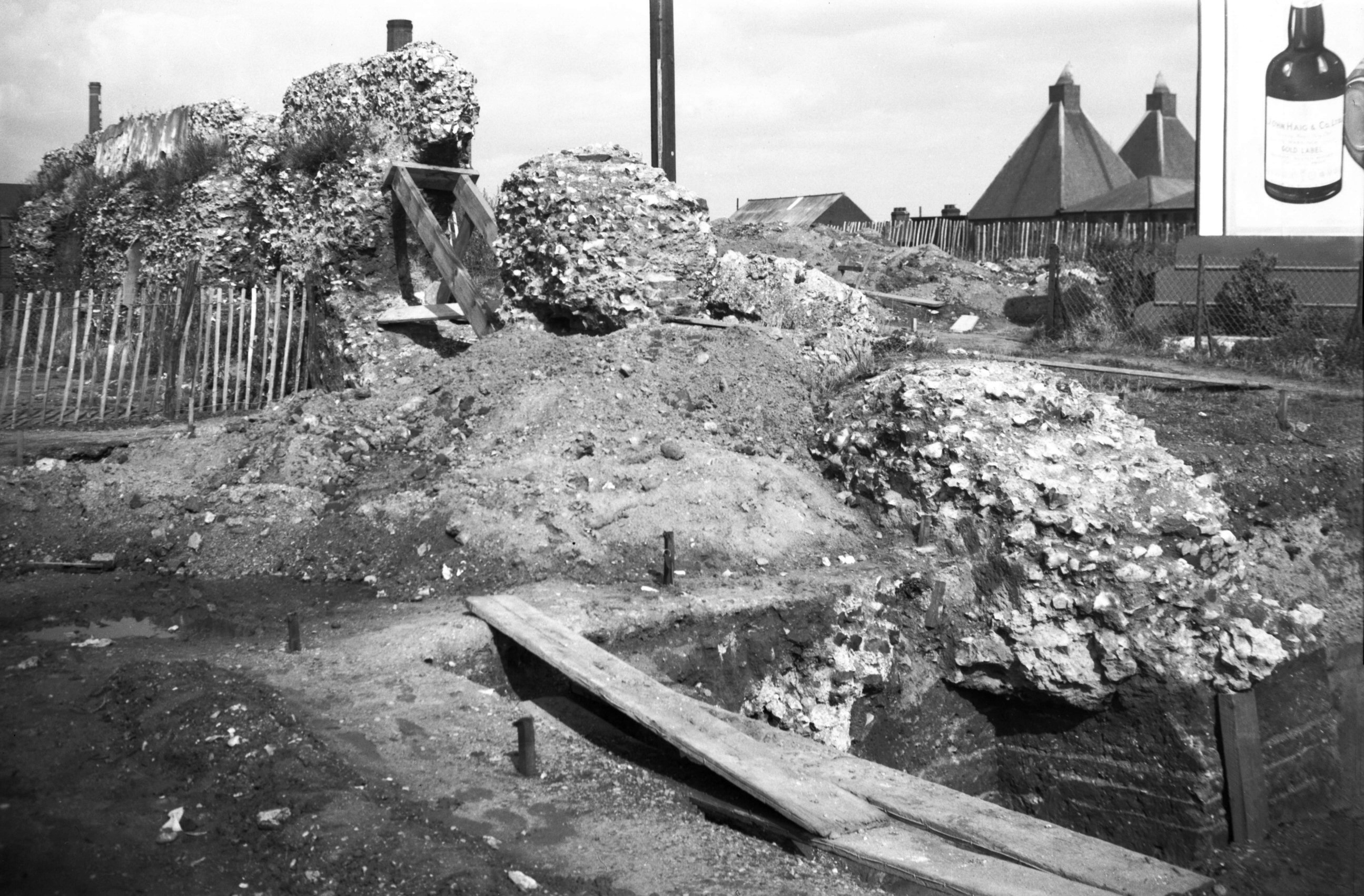
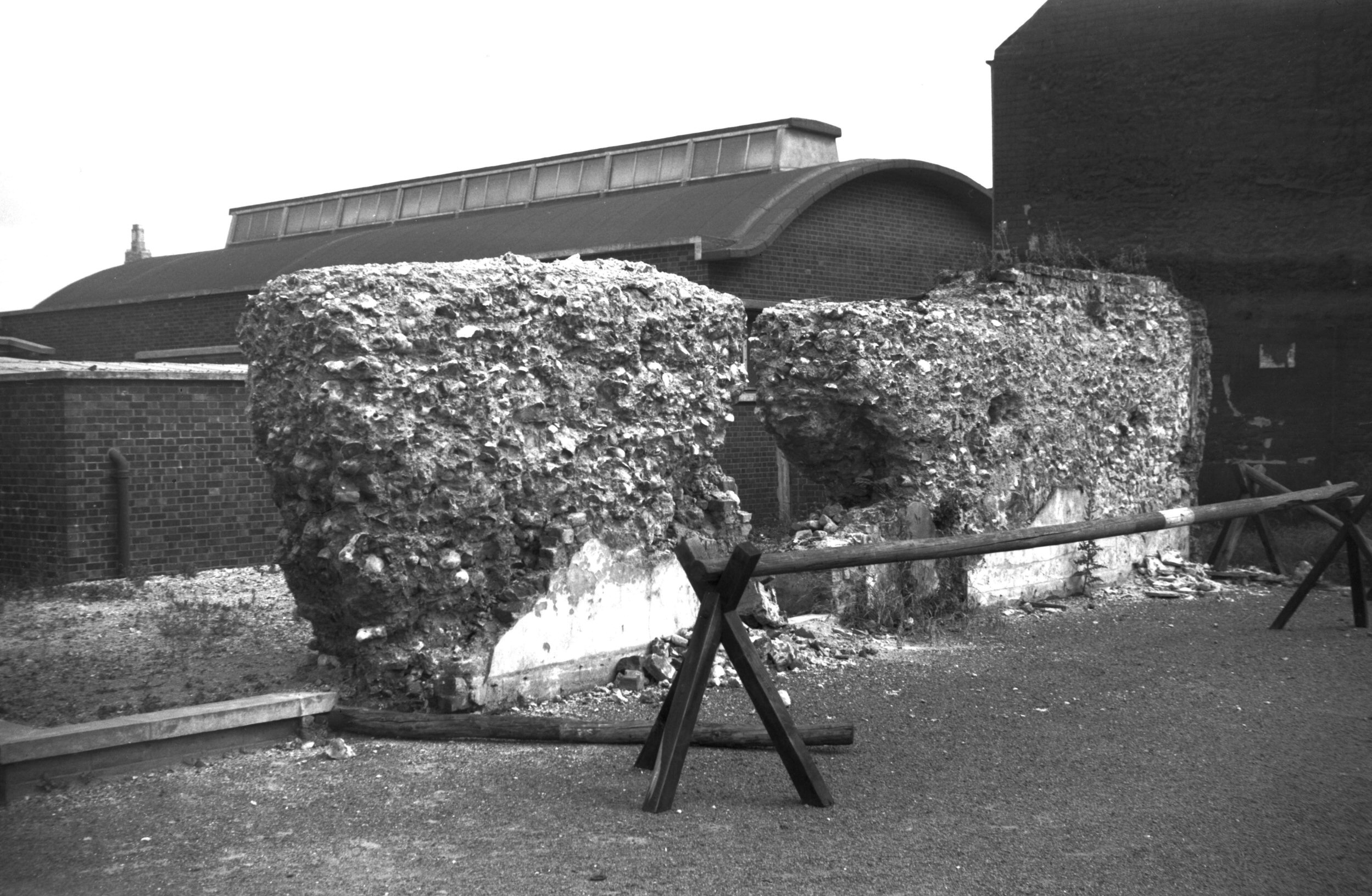
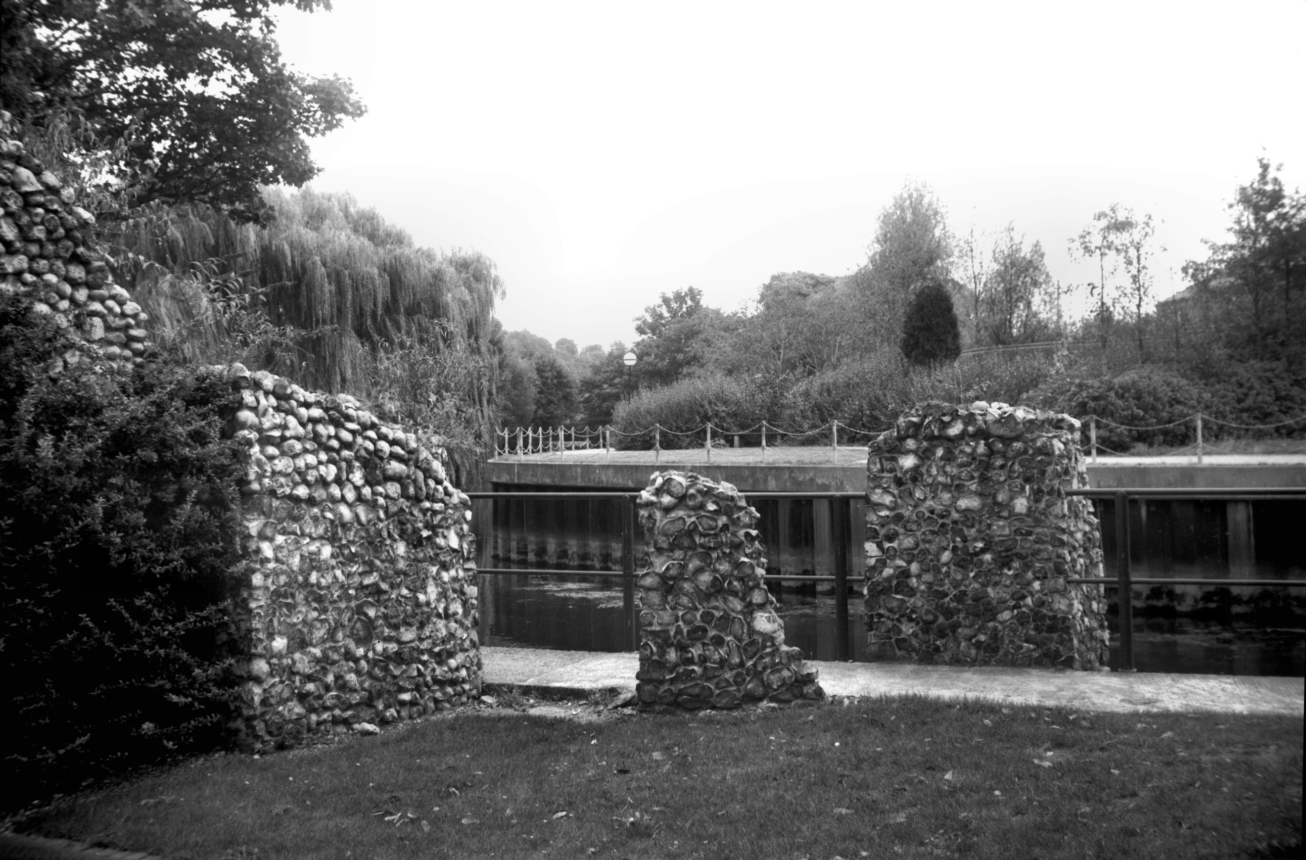
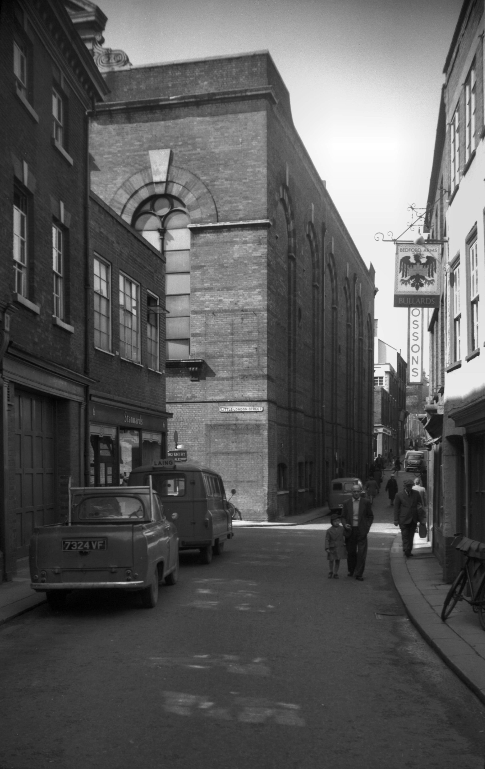
Barn Rd wall fragment [2284] 1938-04-10
Fragment formerly embedded in terrace houses. |
|
|
Barn Rd wall exposed by war view SW [3605] 1946-03-23
From the site of St Benedict's Back Lane. |
|
|
Barn Rd wall exposed by war view NW [3606] 1946-03-23
From the site of St Benedict's Back Lane. |
|
|
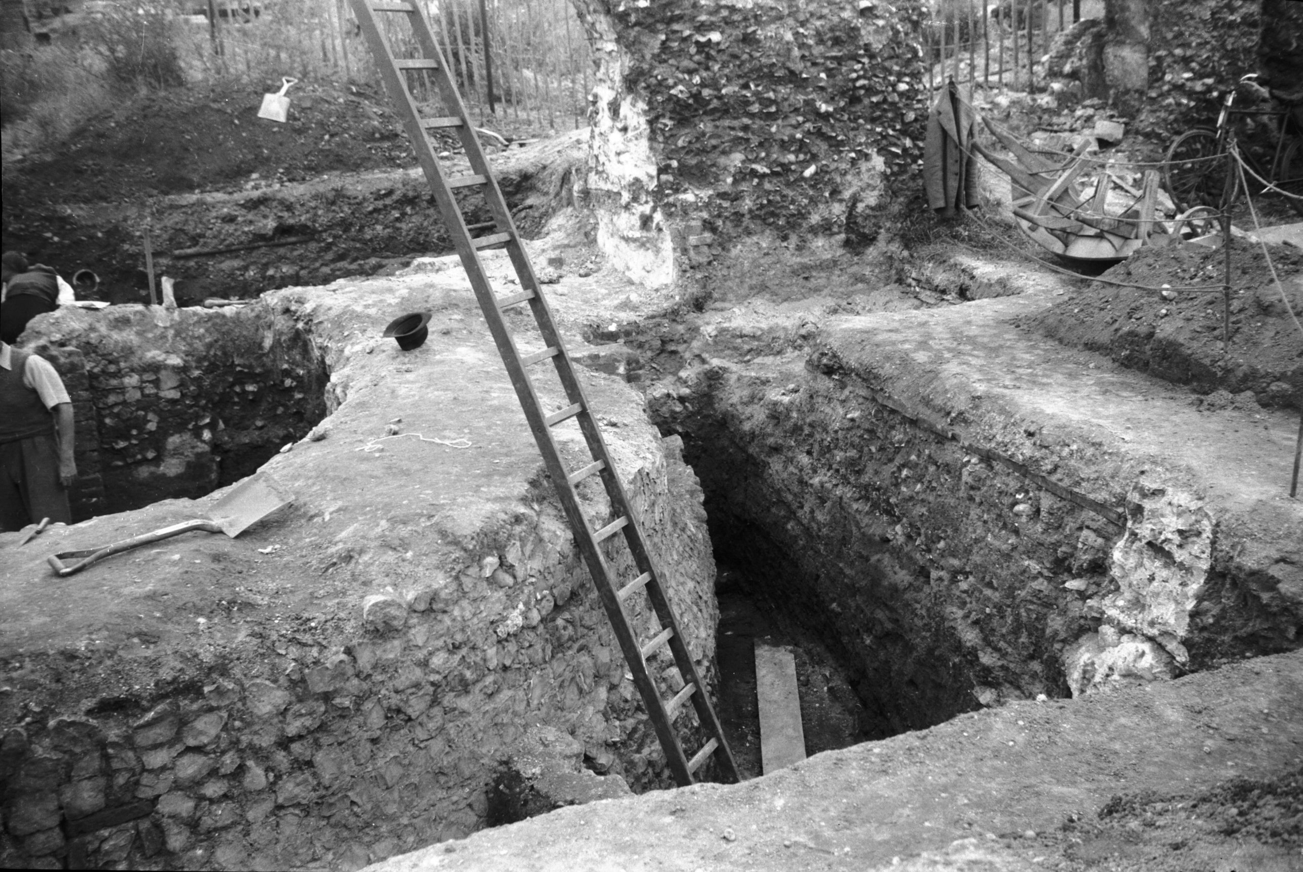
Barn Rd tower excavations [3698] 1948-08-06
The original flint facing of the tower revealed.
Excavations 1948-53. |
|
|
Barn Rd tower excavations threshold [3699] 1948-08-06
Threshold of tower entrance. |
|
|
Barn Rd tower excavations outer ditch [3700]
1948-08-06
|
|
|
Barn Rd tower excavations wall to north [4208]
1953-08-30
Wall fragments north of tower. |
|
|
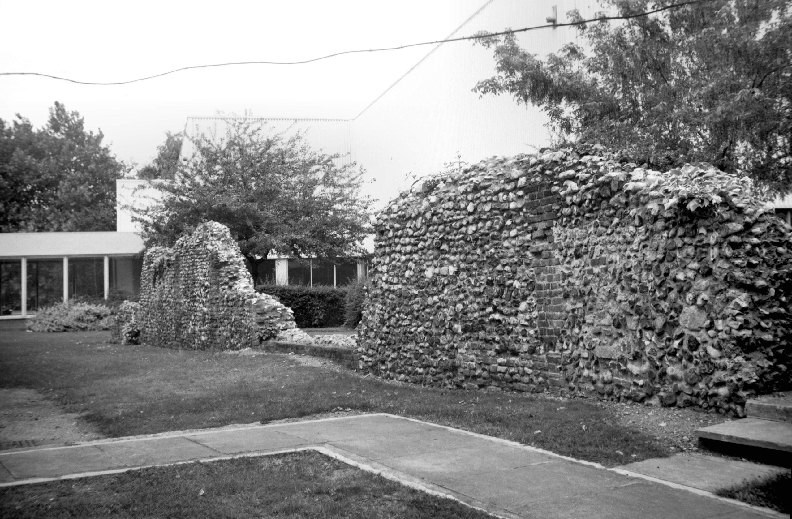
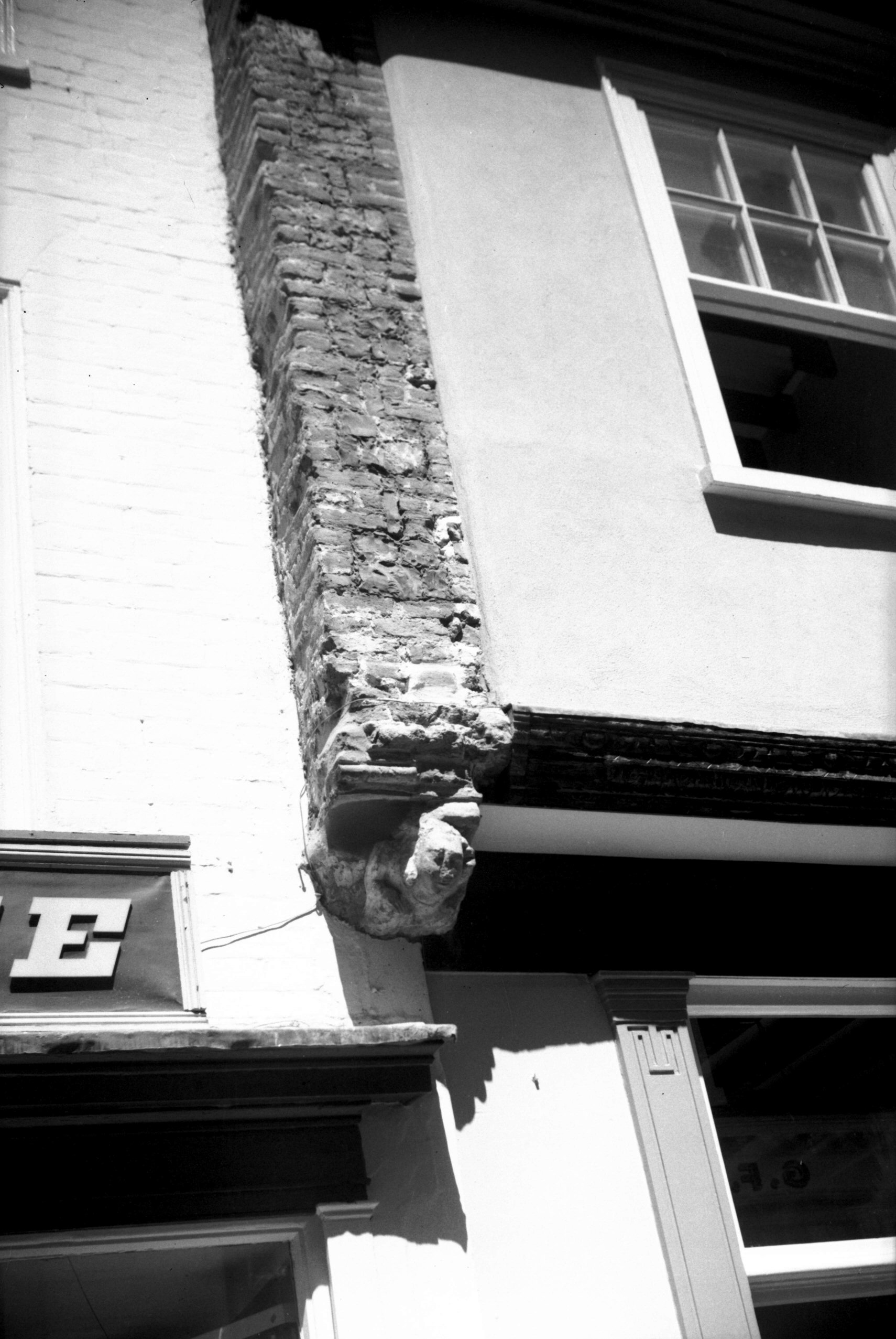
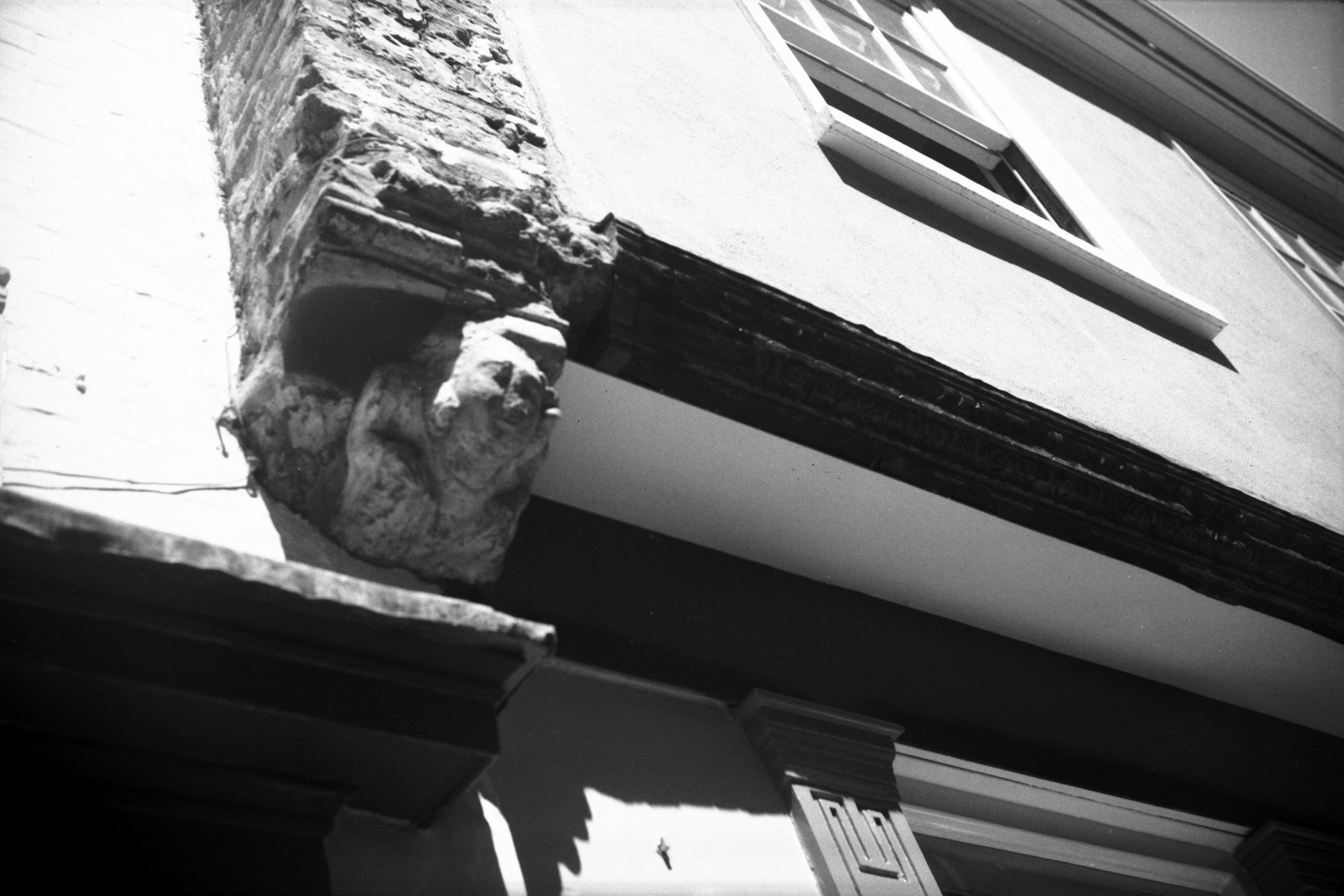
Barn Rd wall fragment [4272] 1954-06-27
Fragment formerly embedded in terrace houses. The apex of
the arched recess was originally 8-10 feet high but is
now only 3 feet above ground level showing the extent to
which this marshy ground has been built up. |
|
|
Barn Rd wall from inside city view NW [4759]
1964-04-18
From the site of St Benedict's Back Lane. |
|
Barrack St: |
| |
From
Whitefriars / St
Crispin's Rd / Cowgate (formerly from Peacock St) to Gurney Rd / Kett's
Hill / Bishop Bridge Rd
passing Silver Rd
South side |
|
|
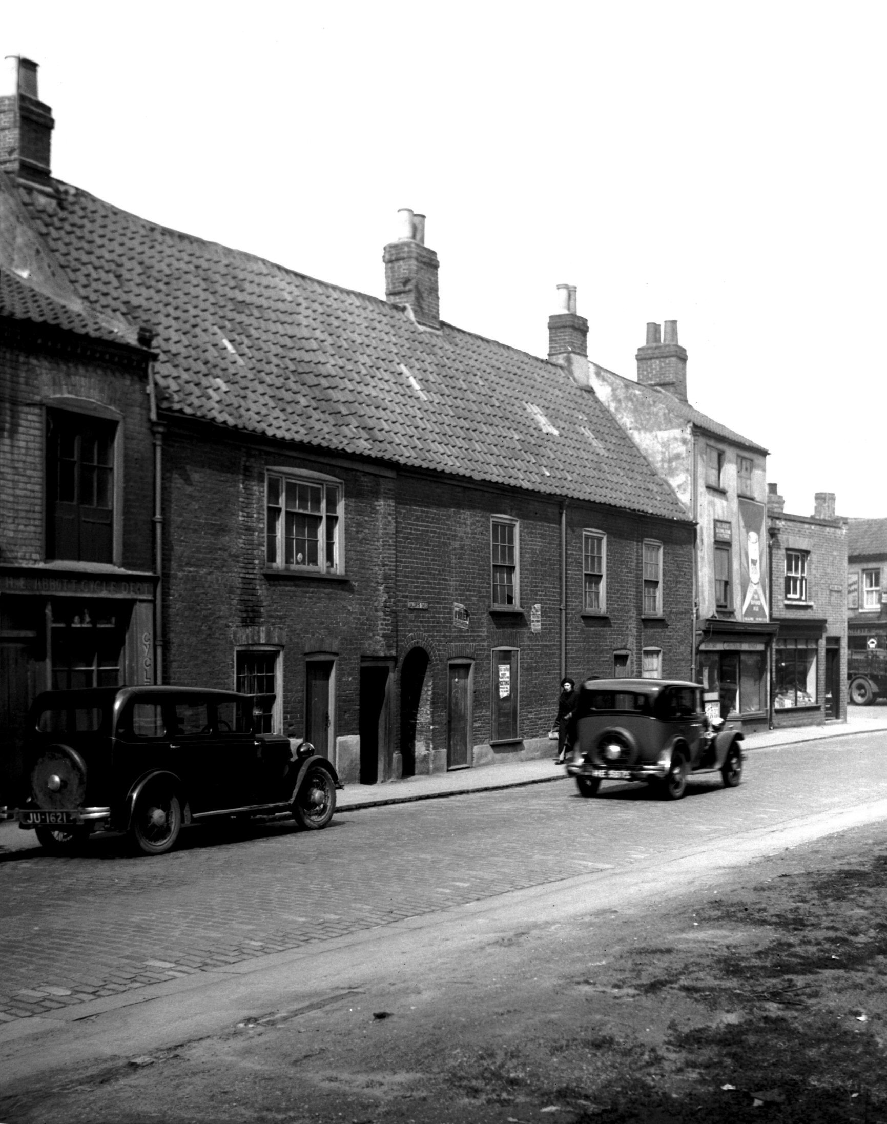
Barrack St 25 [0928] 1936-05-06
|
|
|
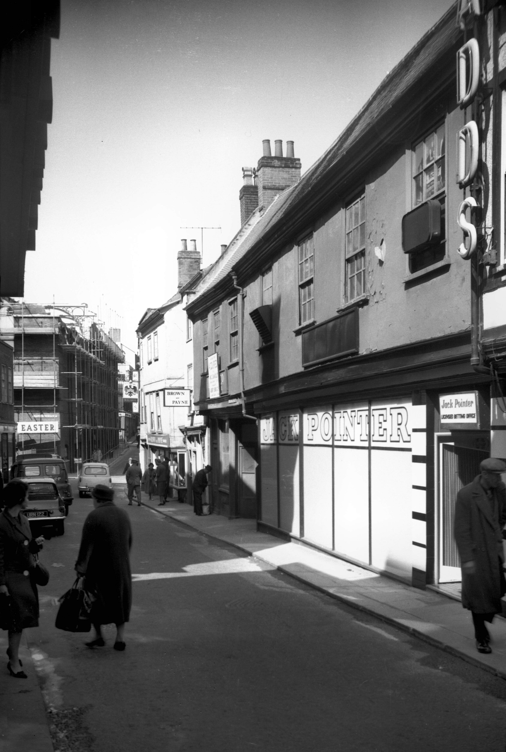
Barrack St 25 to 33 [2515] 1938-07-05
Barrack St formerly continued across Cowgate, terminating
at Peacock St. On its northern side stood St Paul's
Church with its round Norman tower, gutted by incendiary
bombs in the early morning of 27th June 1942; after
standing as a roofless ruin it was demolished ten years
later, despite pleas that the tower should remain. Of the
square surrounding the churchyard, William White in his Norfolk
Directory (1883) wrote:
"A rookery of disgraceful tenements in St Paul's has
been demolished under the Artizans' Dwelling Act, and a
colony of trim cottages erected in their place. This
improvement cost the city £10,000."
Writing in Norwich Fifty Years Ago 30 years later,
however, Mr F.T.Hibgame said:
"The most picturesque square in the whole city at
that time [the 1860's] was St Paul's, which showed a
complete square of singularly quaint half-timbered
houses. It looked very much then as no doubt it did in
mediaeval times; but alas the jerry builder came along,
down came all the old houses, and in their place arose
dozens of hideous red-brick cottages, all exactly like
one another, without a single thing to redeem their
innate ugliness."
Nos 23-33 Barrack St were contiguous to the south side of
St Paul's Square and but a few yards away - perhaps the
photograph will allow us to make our own judgment as the
houses themselves were cleared away just before the
Second World War. |
|
|
Barrack St 27 to 33 [1448] 1936-09-22
|
|
|
Barrack St 67 to 77 [7705] 1999-10-25
|
|
|
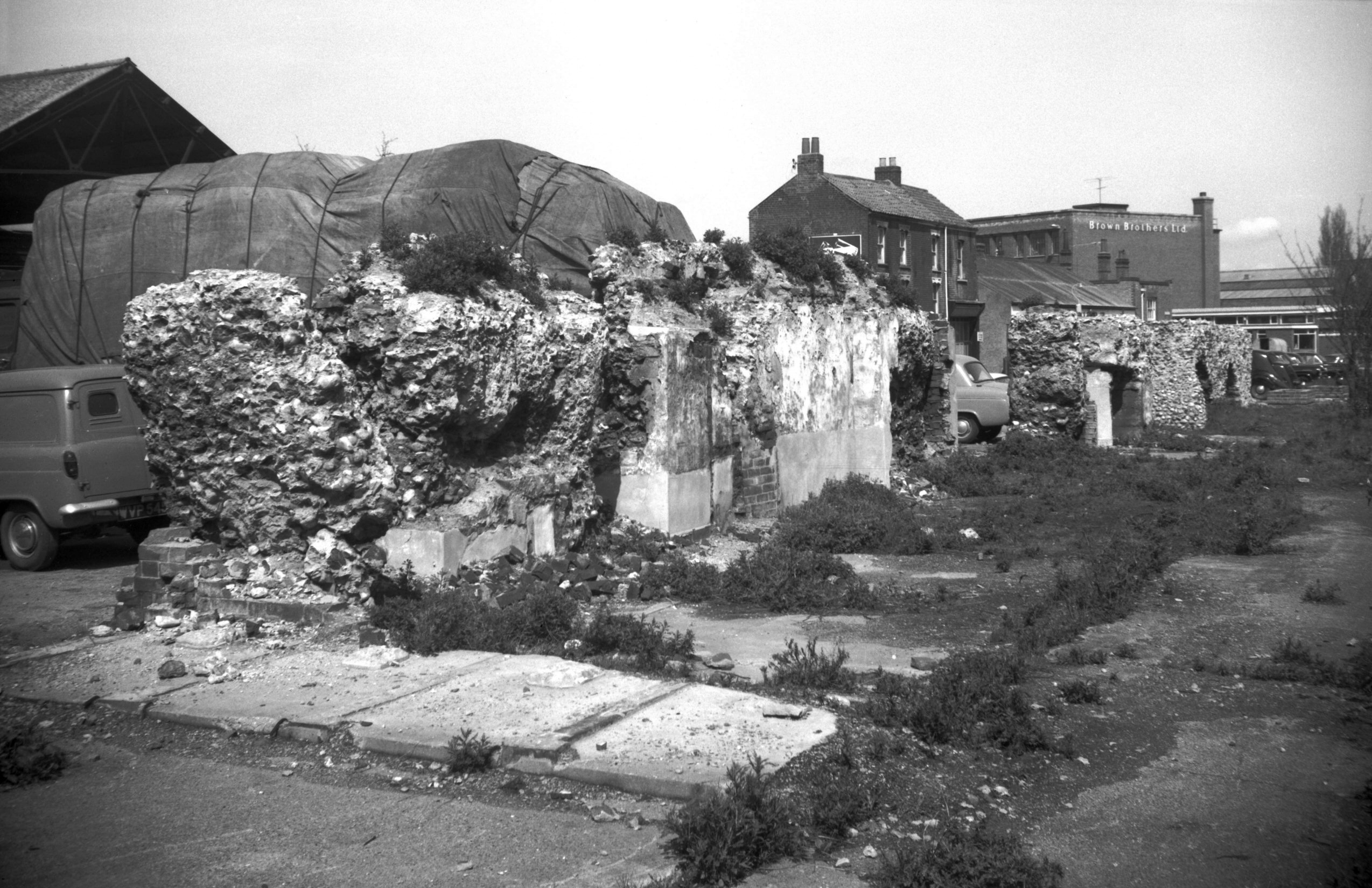
Barrack St River Lane tower fragments [5377]
1974-08-18
|
|
|
Barrack St tower fragments by river [7497] 1997-09-23
Much of the tower on the north bank of the Wensum was
destroyed when the river bank was restored. |
|
|
Barrack St wall near river from inside city [7498]
1997-09-23
Between Jarrold's printing works and the river. Formerly
River Lane. |
|
|
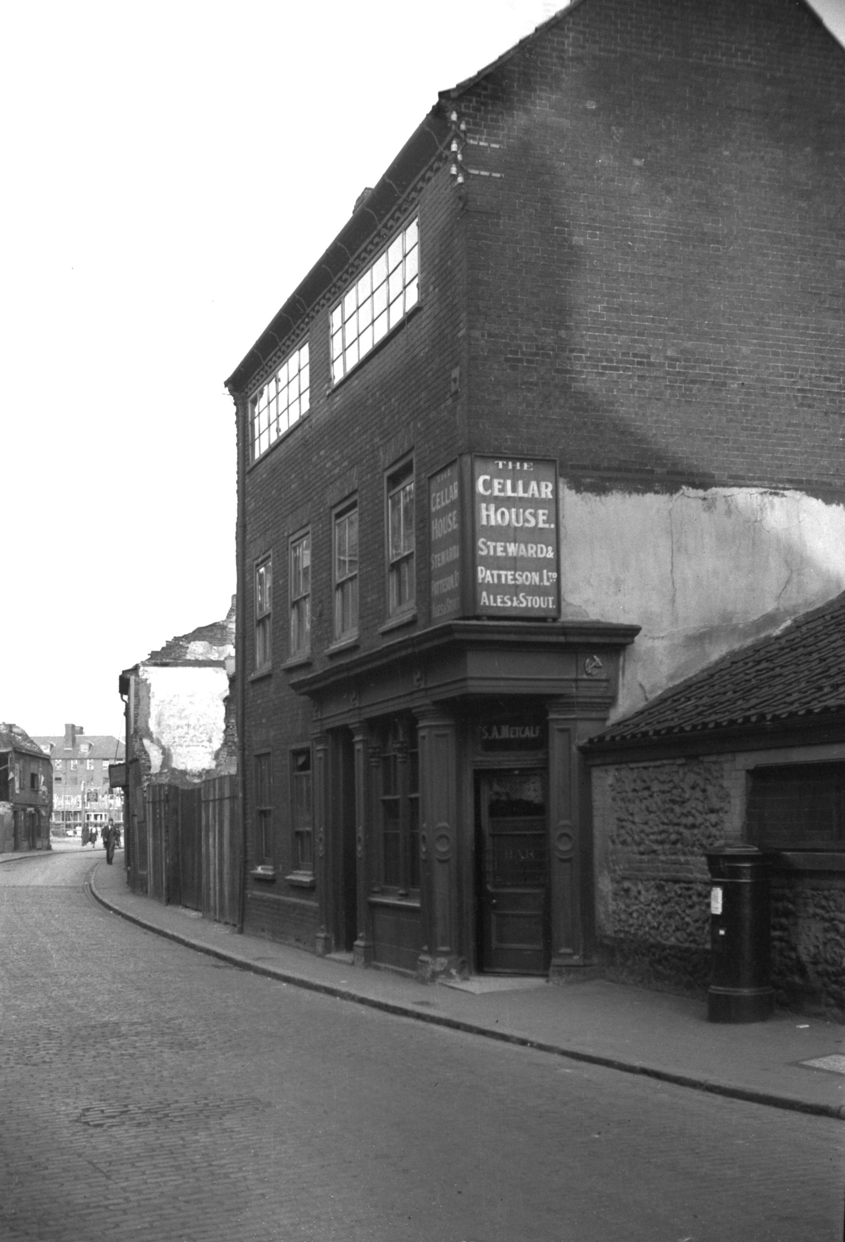
Barrack St 105 Cellar House PH [1683] 1937-06-05
The Cellar House at No 105 was a late Georgian building
with weavers' windows to light the top floor. Walter
Wicks in referring to this tavern recalled the ritual of
the Pockthorpe "Corporation", which was
modelled on the Norwich pageant, with "Mayor",
"Sheriffs", Officers" and snapdragon. Here
at the Cellar House in 1838, amid great cheering, the
newly elected "Mayor" promised in his inaugural
address "to remove the duty off tea and sugar".
After a state procession to the banquet held further
along the street at the Dun Cow public house (used as
their "guildhall") the "corporation"
returned to the Cellar House to hold various sports in
its gardens. |
|
|
Barrack St 127 [1684] 1937-06-05
|
|
|
Barrack St south side Light Horseman Yard [0936]
1936-05-06
|
|
|
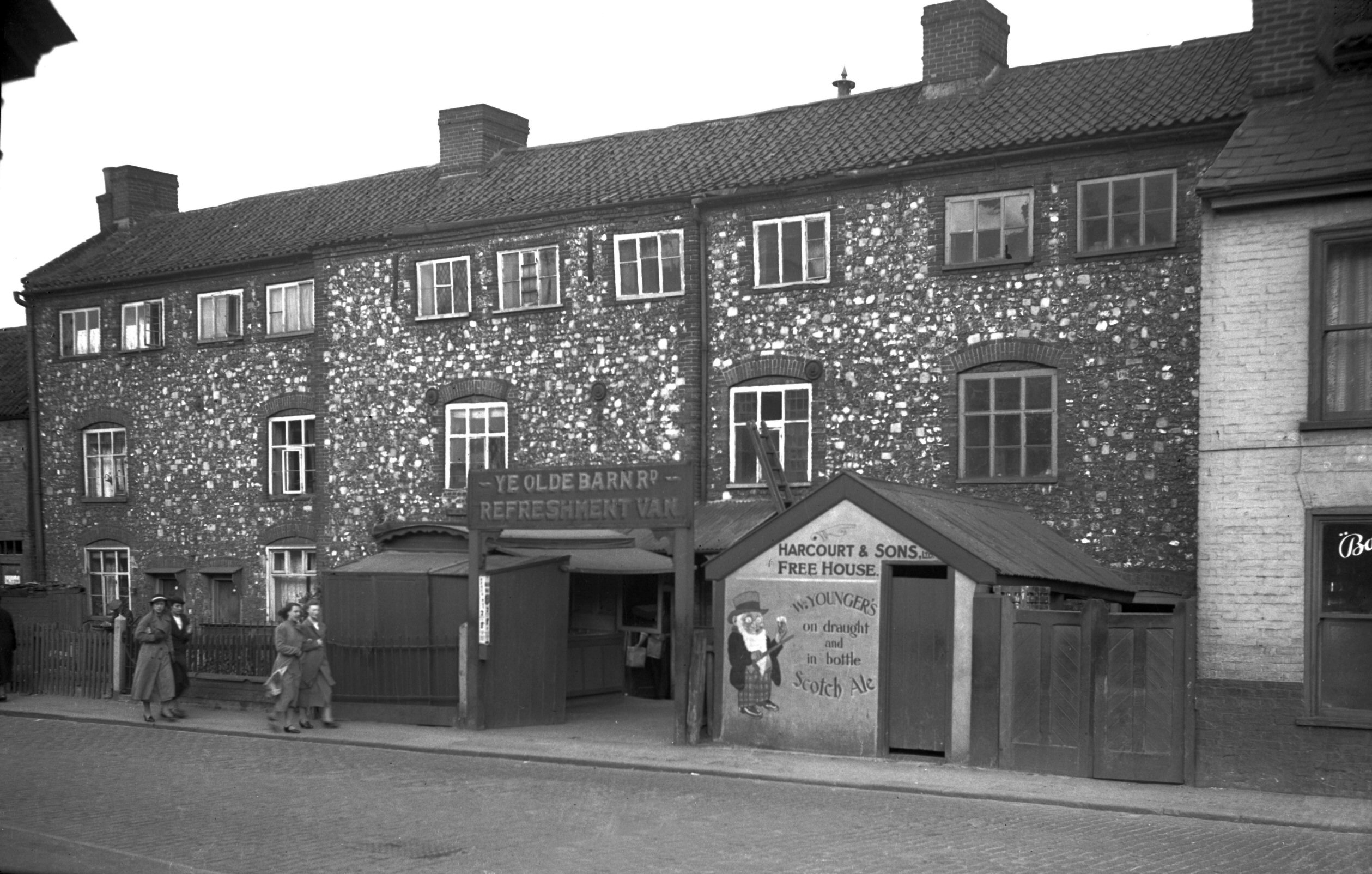
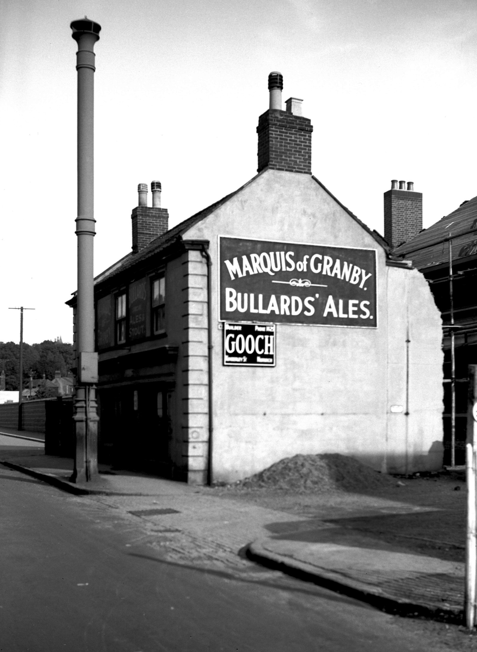
Barrack St 171 Marquis of Granby [2516] 1938-07-05
Marquis of Granby PH. |
|
|
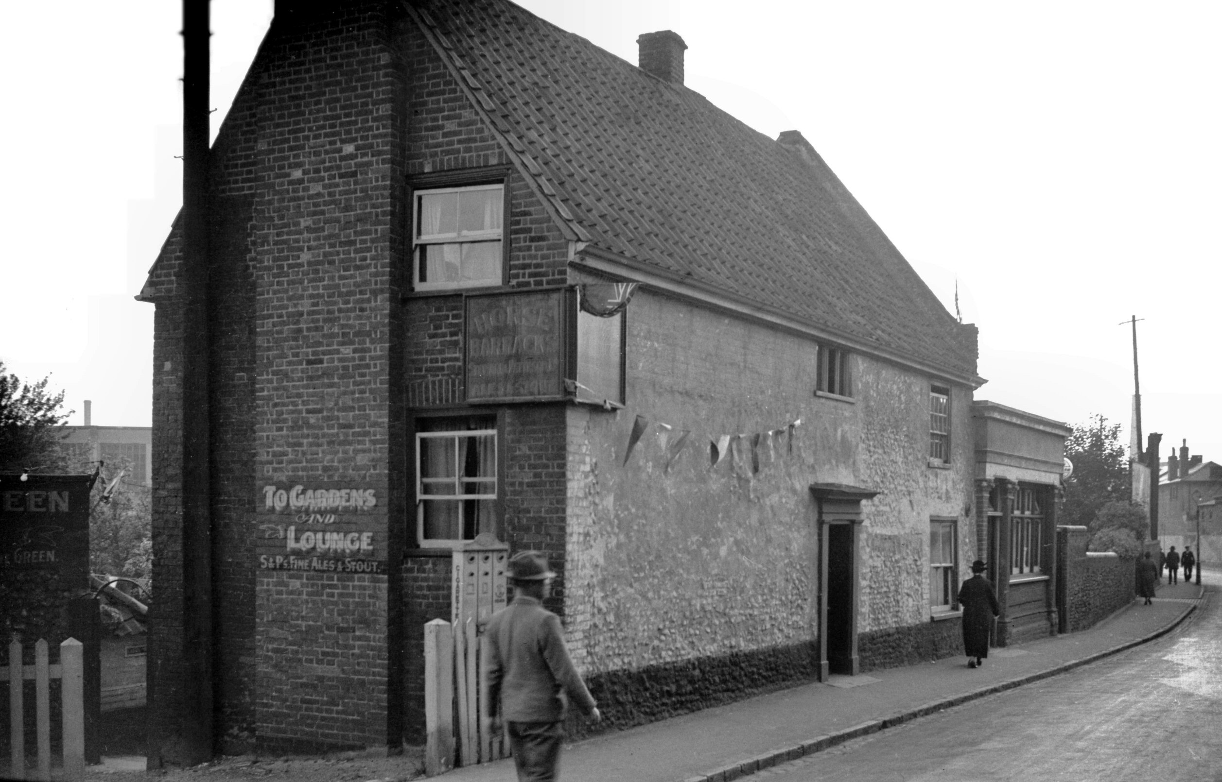
Barrack St 173 Horse Barracks PH [1682] 1937-06-05
|
| |
North
side |
|
|
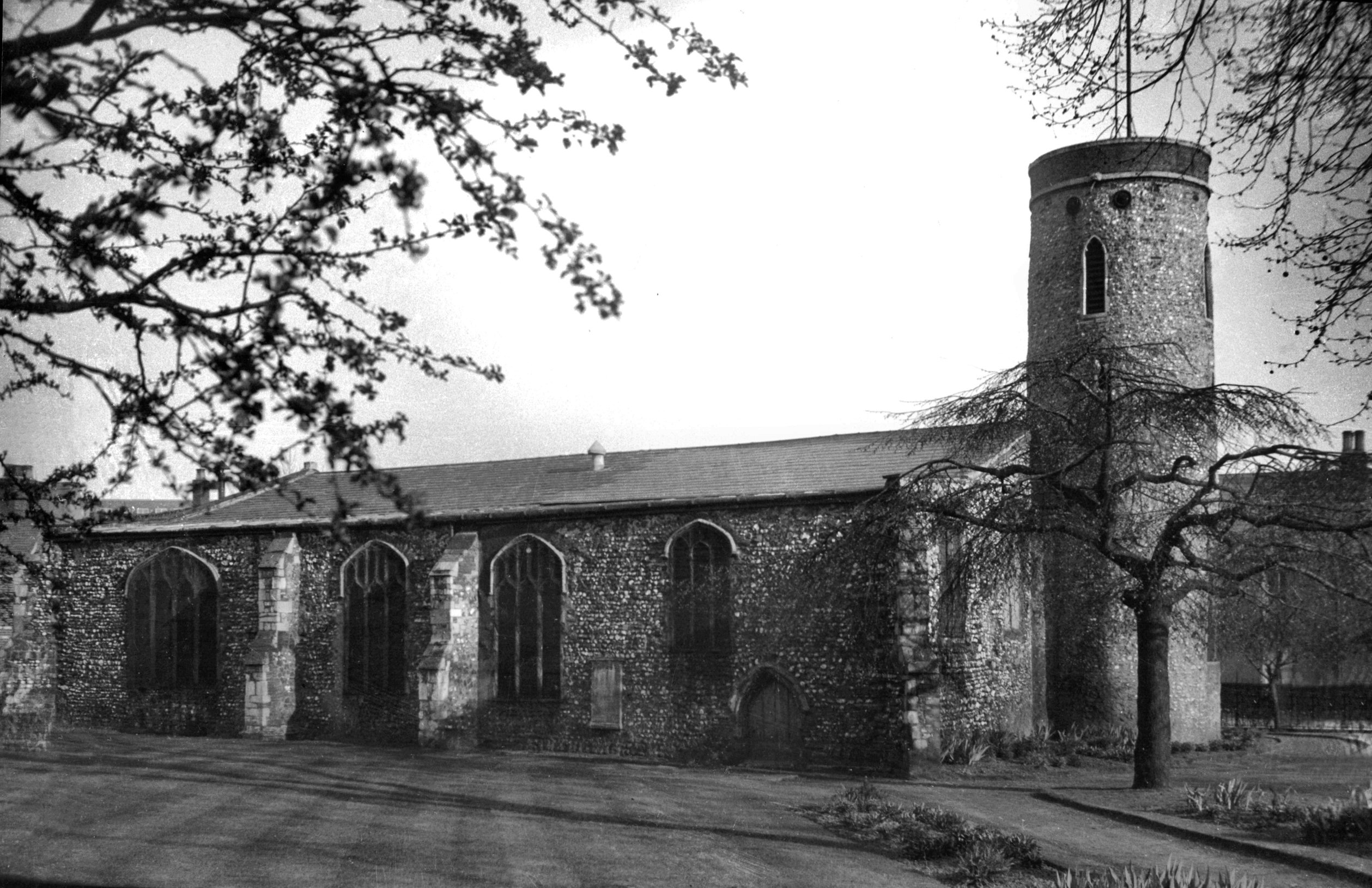
St Paul's from north [1553] 1937-05-03
Apart from its architectural merits, this church was of
particular interest in that originally it served not only
the parish but also a hospital for poor strangers,
vagrants, sick and impotent folk. Founded between 1118
and 1145 (over a century before its sister institution,
the Great Hospital) it became known as Norman's Spital
from a monk of that name who was one of its earliest
masters. In 1571 it was occupied as the city bridewell,
but this use ceased after 1583 when William Appleyard's
old house in St Andrew's was converted to that purpose.
Claude Messent recorded in 1934 that certain remains of
old walls and re-used materials in later buildings could
still be seen to the south of the square, but all was
finally swept away by the construction of the Inner Link
road in 1970. |
|
|
St Paul's tower south side from Barrack St [0172]
1934-07-17
Dedicated jointly to St Paul the apostle and St Paul the
first Christian hermit, the church was of ancient
foundation; the lower part of its round tower possibly of
Norman origin. It formerly possessed an octagonal belfry,
but this was taken down in 1819 and replaced with a
shallow coping of white brick and stone. It was also
about this time that two of its three bells were sold,
one to Postwick, the other to Witton, two churches only a
short distance apart.
The remainder of the building, which consisted of a nave
without clerestory, a north aisle and a rib-vaulted south
porch with chamber above, was largely late 15c in style. |
|
|
St Paul's from SE [3371] 1940-04-21
A small apsidal chancel had been added in 1870. |
|
|
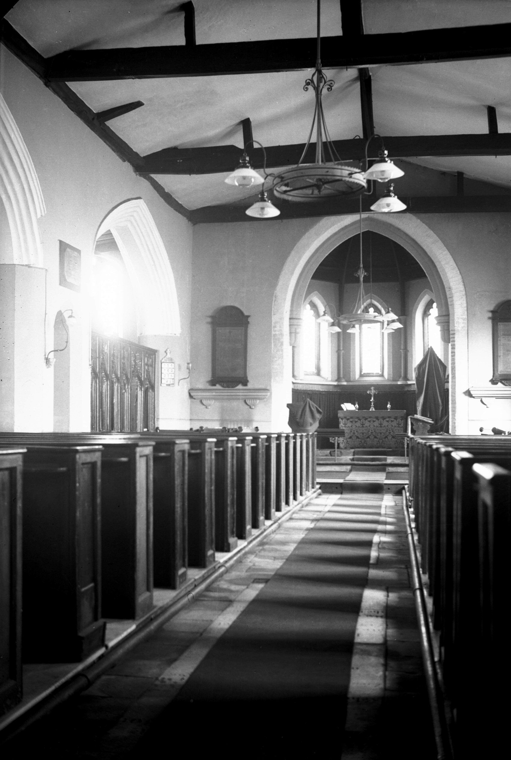
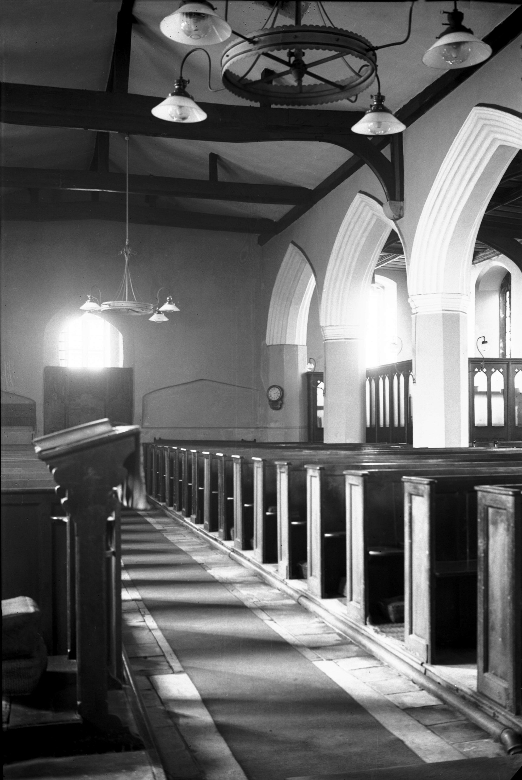
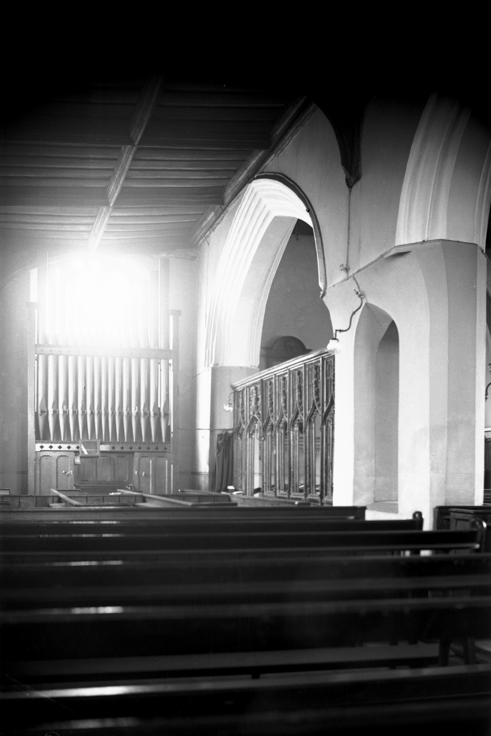
St Paul's interior view east [2251] 1938-04-02
The interior of the church had been renovated and
repaired in 1921 and again in 1933, when the organ was
overhauled. The building had not always been so well
kept, however, as we learn from certain notes made by
William Utten, the 18c public notary. In 1773 he recorded
that the very path to the north door was overgrown with
weeds, probably a matter of indifference to an
indifferent parish, and that the drainage was from the
graveyard to the church. Inside, the walls were green and
filthy with pavements bad and rain coming into the
vestry. Five years later he was still reporting that the
pavements, doors, seats, walls and windows were all
"wretched". The gallery was out of repair and
its removal was recommended on safety grounds; the tower
was "bad" and the churchyard walls falling
down. |
|
|
St Paul's interior view west [2252] 1938-04-02
|
|
|
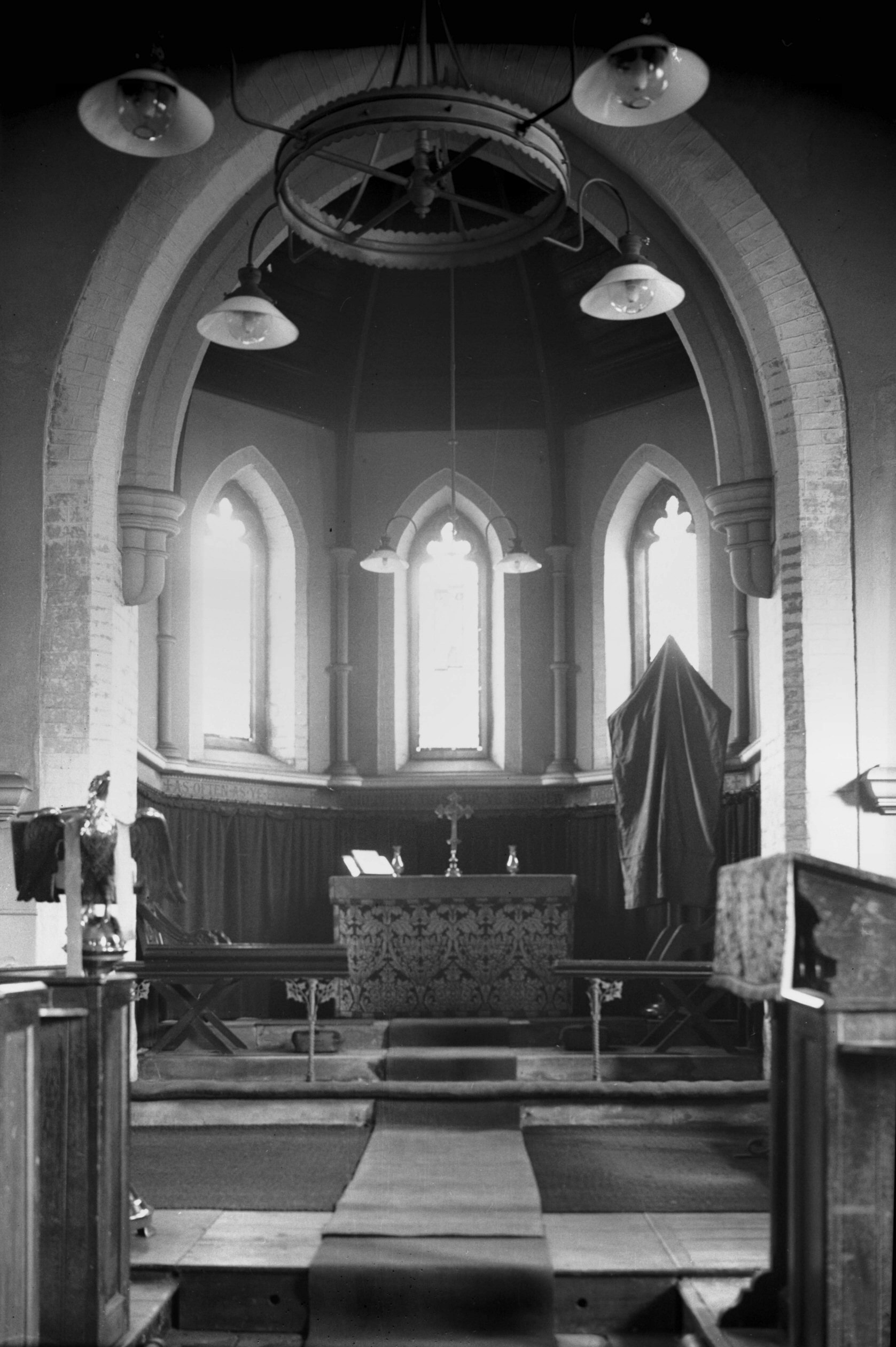
St Paul's apsidal chancel [2253] 1938-04-02
Added 1870. |
|
|
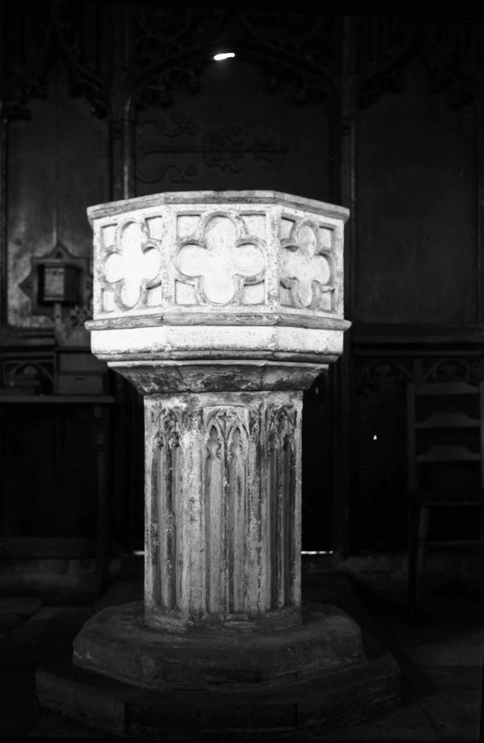
St Paul's 15c font [2254] 1938-04-02
The font was octagonal, with narrow traceried recesses in
the stem and a quatrefoil on each side of the bowl. |
|
|
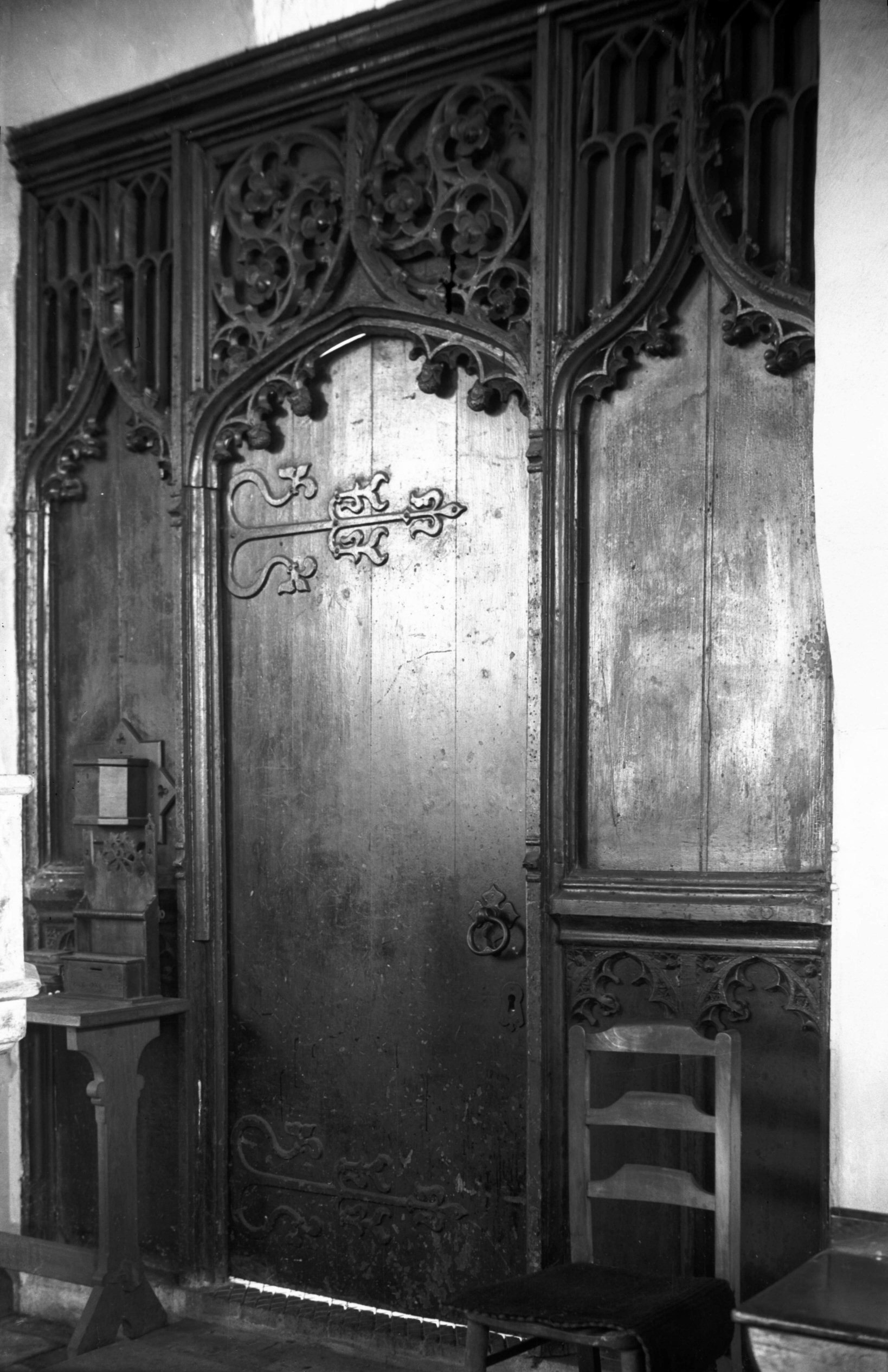
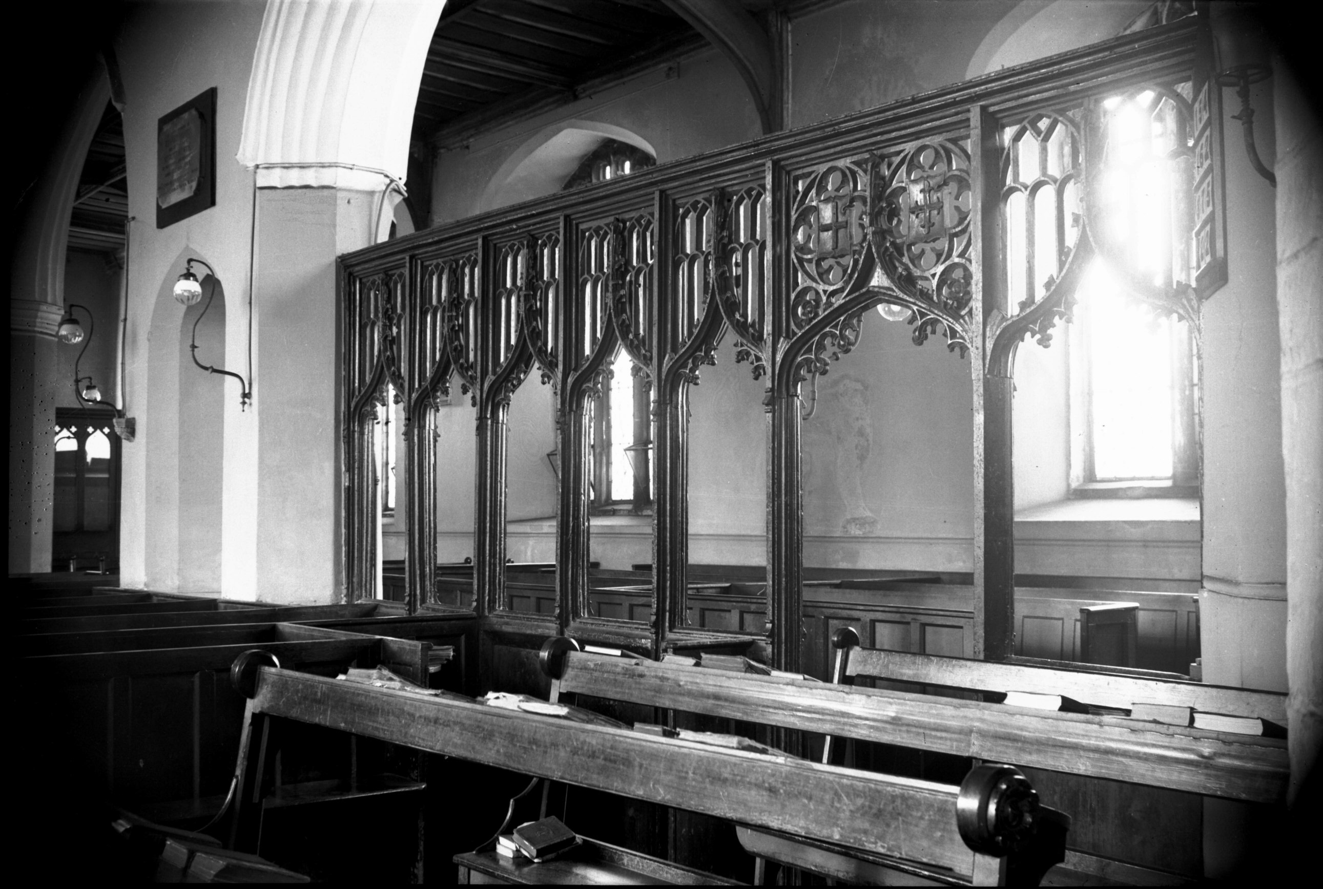
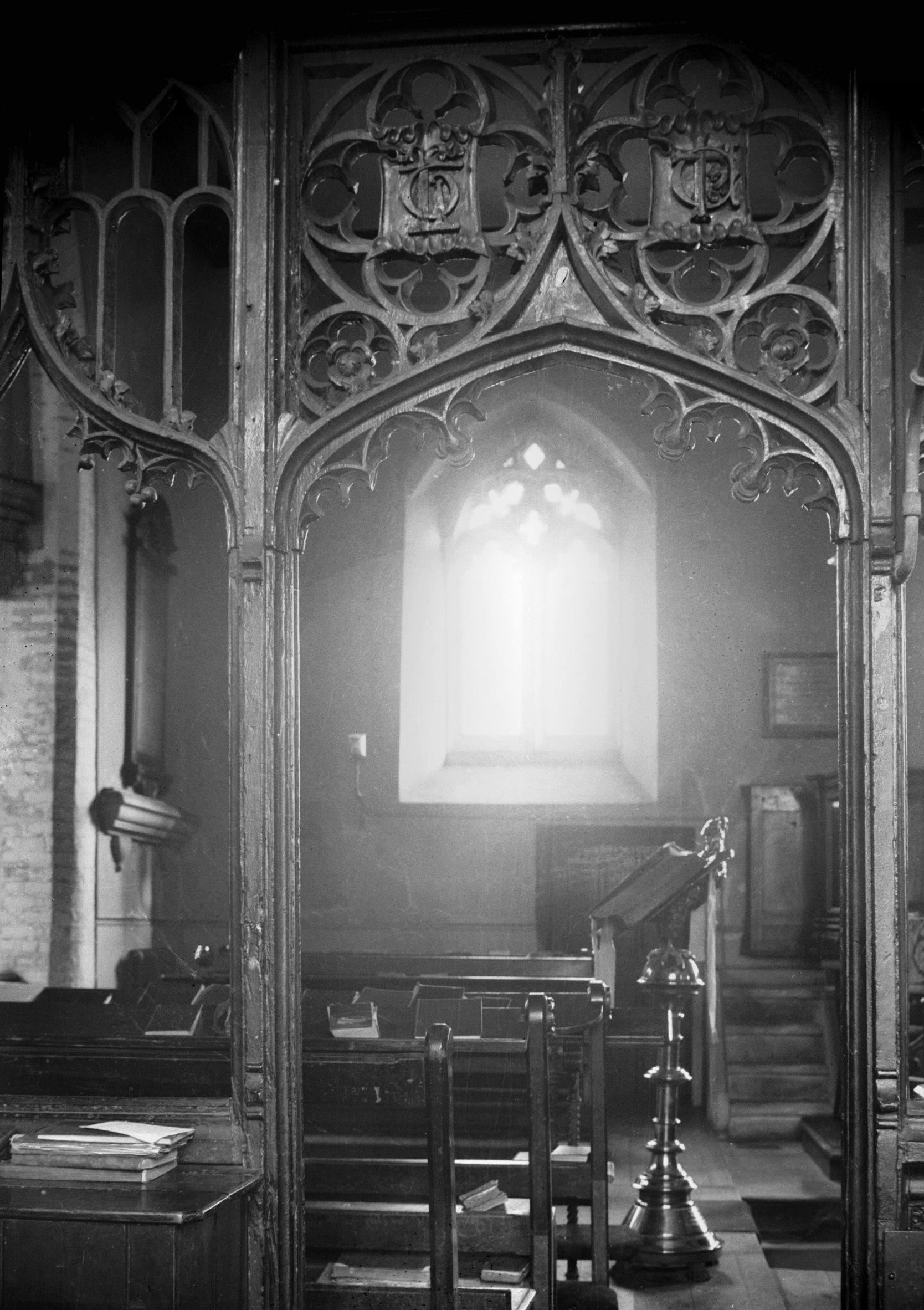
St Paul's screen across tower arch [2255] 1938-04-02
Originally forming the western arm of the parclose
screen. |
|
|
St Paul's parclose screen [2256] 1938-04-02
East end of north aisle. Above the doorway, facing north,
St George's Arms and a Cross Fleure. |
|
|
St Paul's doorway to parclose screen [2257]
1938-04-02
Most of the furnishings were modern, but there was a fine
parclose screen occupying the easternmost bay of the
arcading, formerly a chapel of St Mary; the screen had
perpendicular tracery with arms and initials in shields
above the doorway. Another portion of this screen had
been used to close the tower arch at the west end of the
nave. The historian Francis Blomefield identified the
initials C.L. on the screen as being those of Christopher
Lestrange, who had contributed towards its cost, and E.D.
as those of Elizabeth Drury, who had also contributed and
who was buried in the chancel in 1445. |
|
|
St Paul's north aisle [2258] 1938-04-02
The easternmost pier is pierced with a narrow arch. |
|
|
St Paul's air raid damage from south [3755]
1948-09-10
Part of the site of this church was later absorbed into
the Inner Link road, and the remainder was converted into
a small public garden and children's play area after
levelling and removal of any human remains. |
|
|
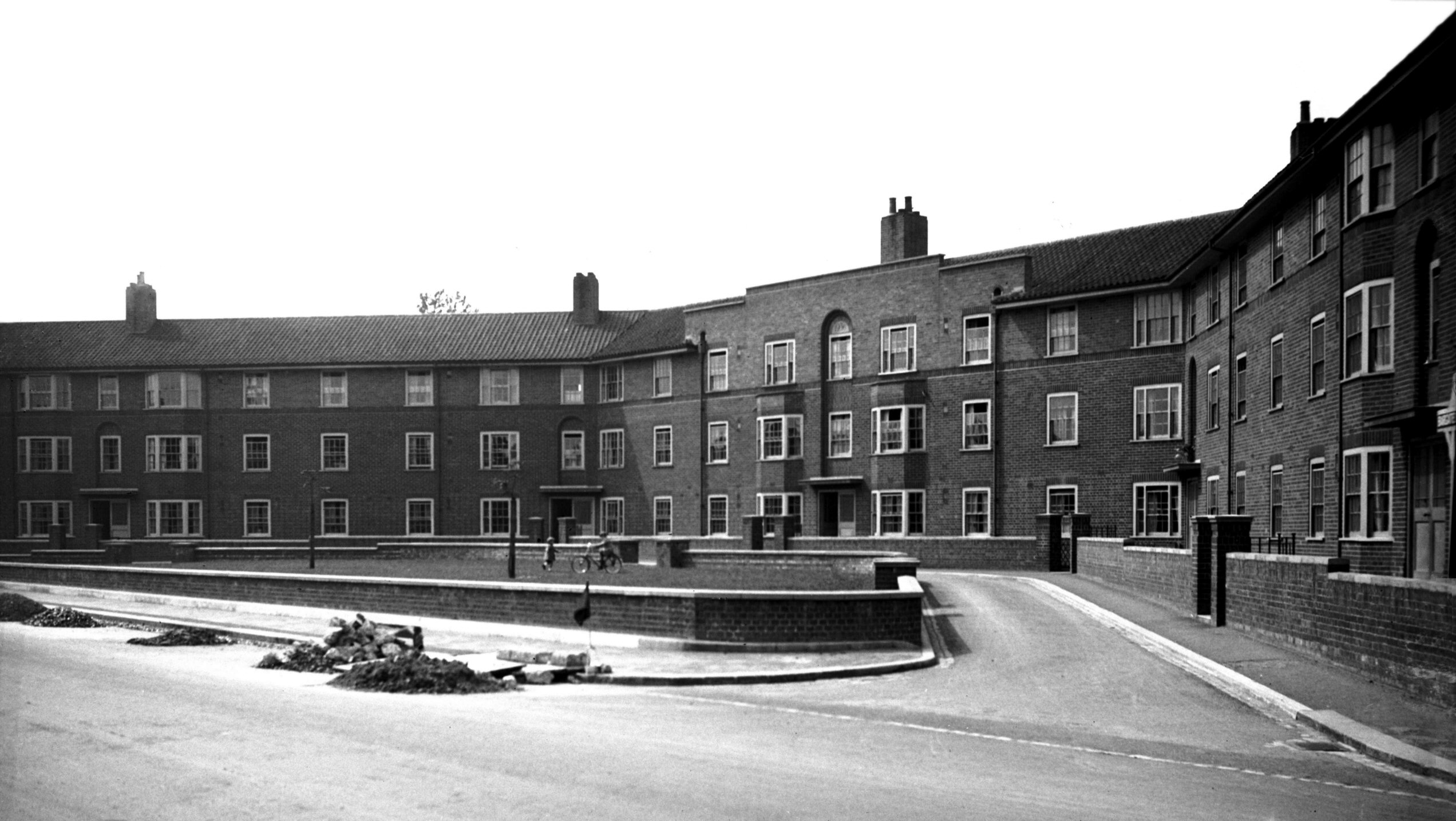
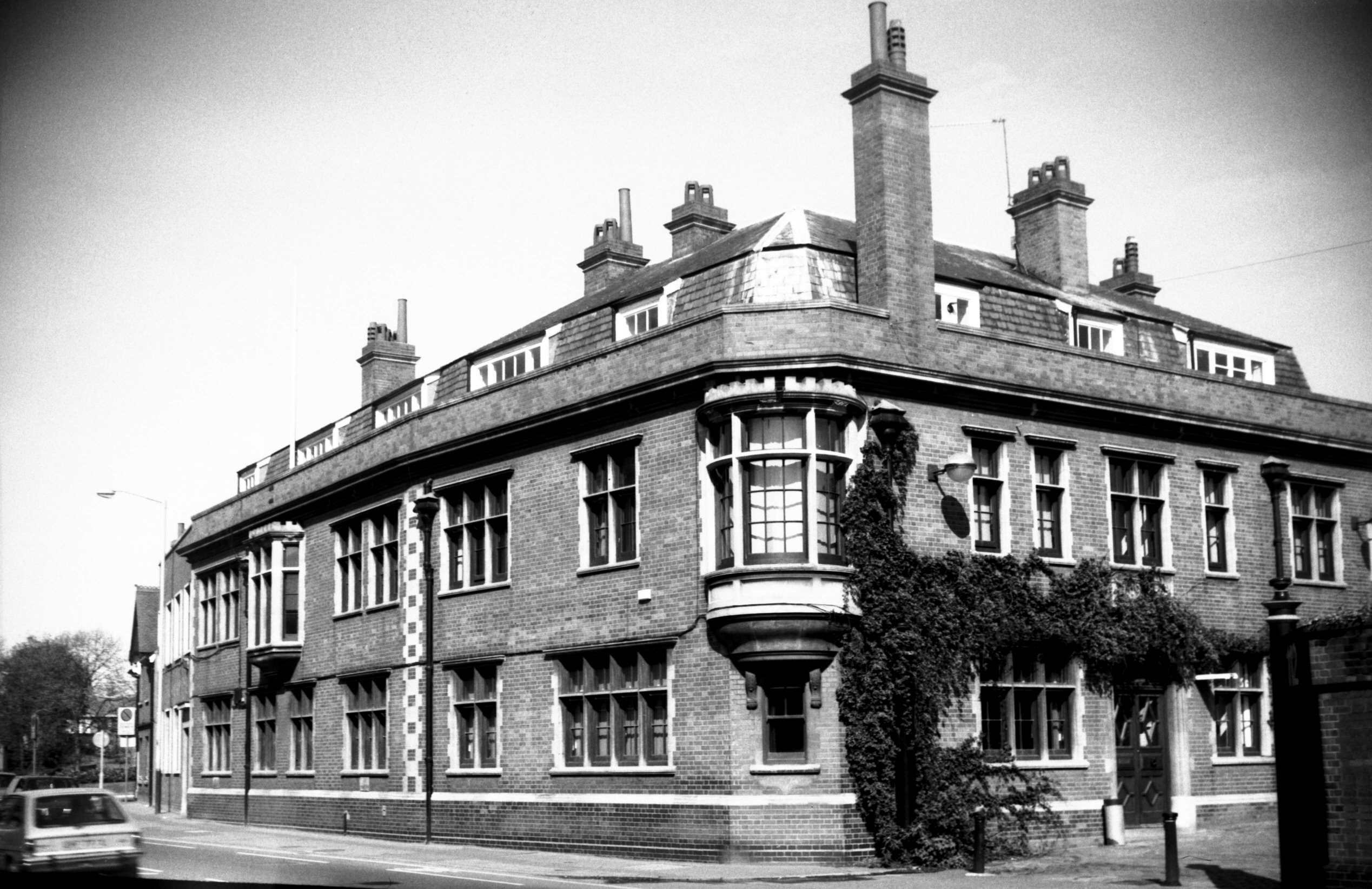
Barrack St Bargate Court view NW [2428] 1938-05-29
Three-storied council flats, erected 1936. |
|
|
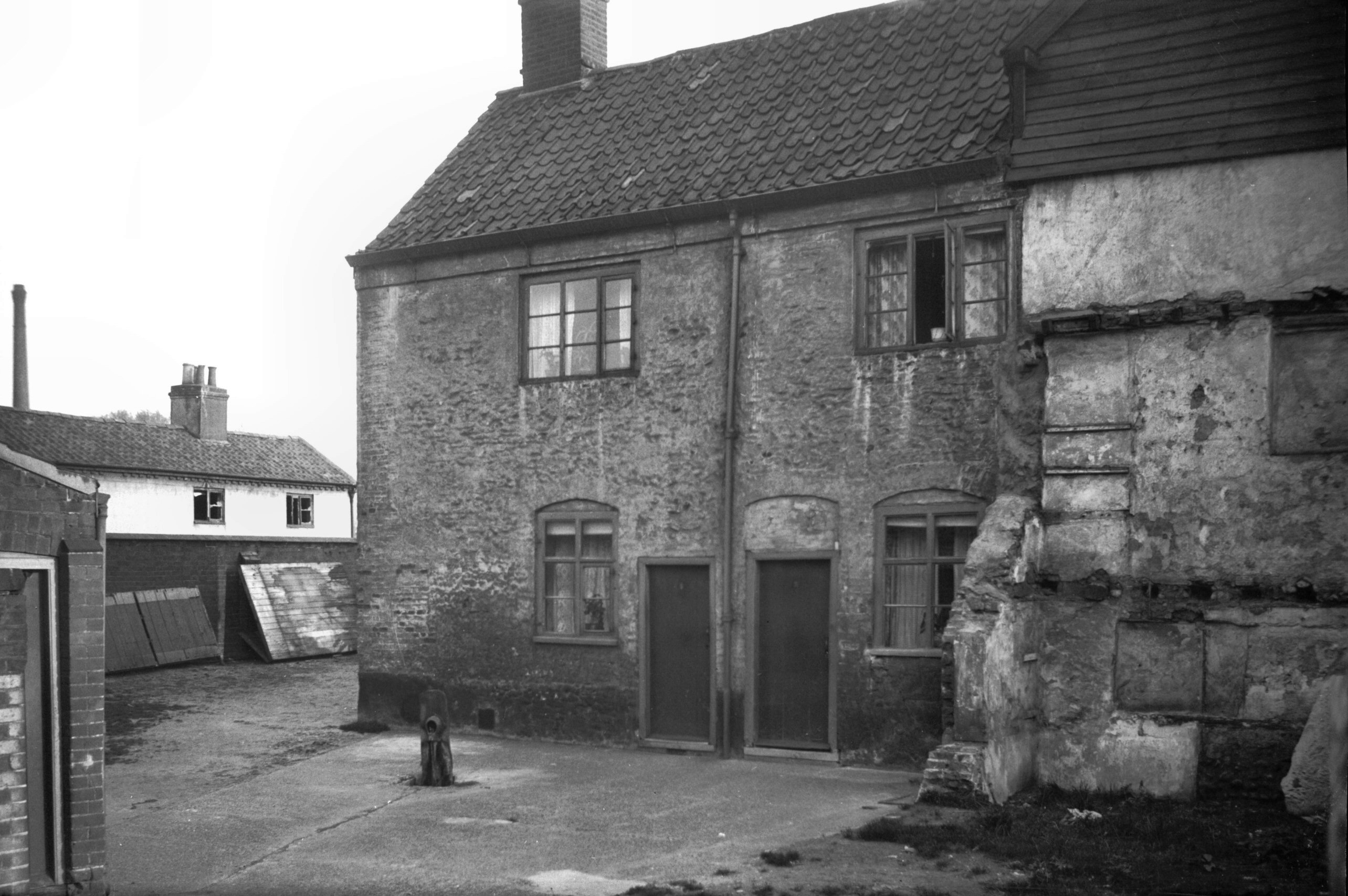
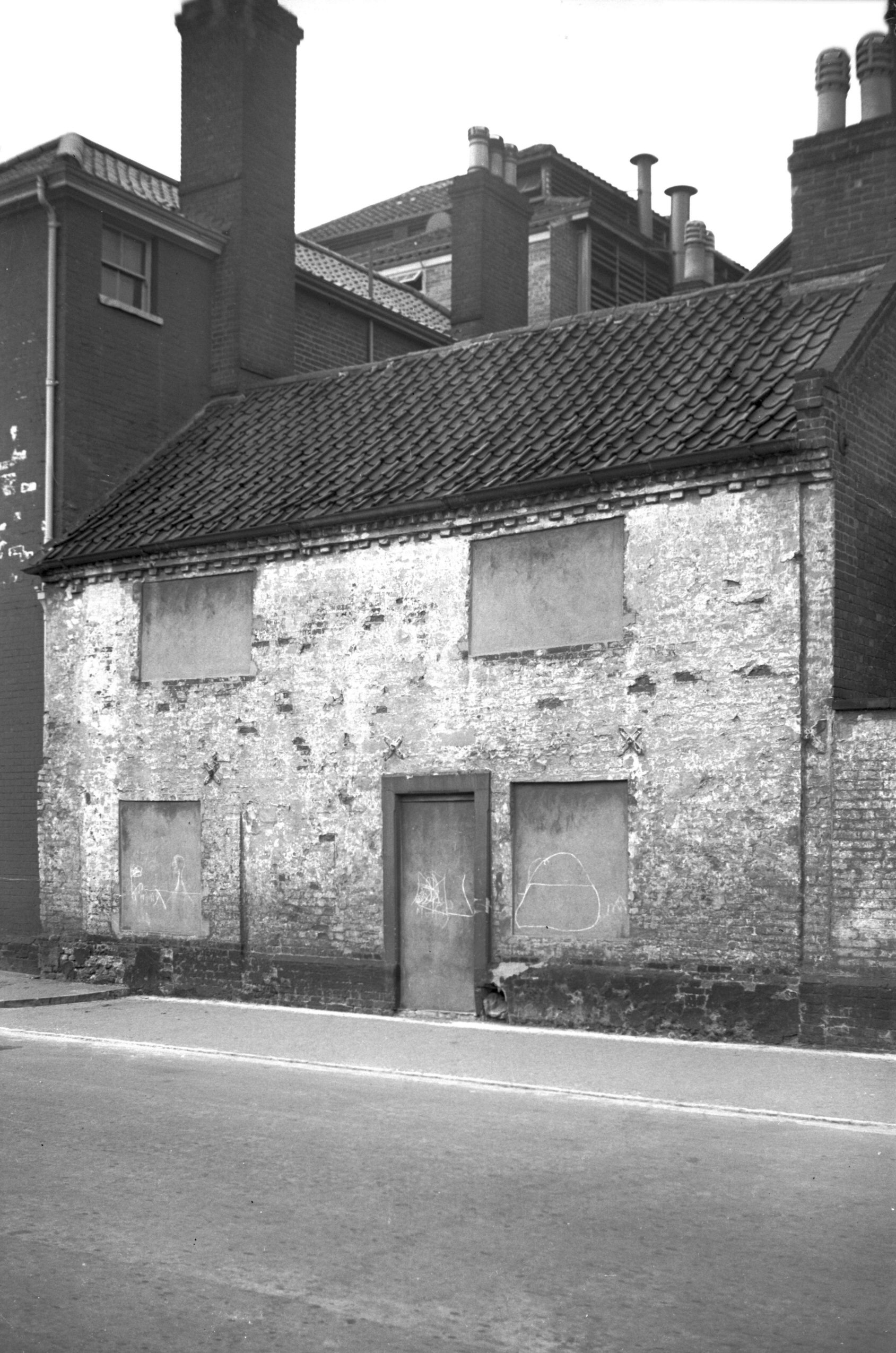
Barrack St 74 to 80 17c cottage [3188] 1939-07-30
17c cottage incorporated in brewery premises. |
|
|
Barrack St 82 to 86 former Griffin PH [0951]
1936-05-12
|
|
|
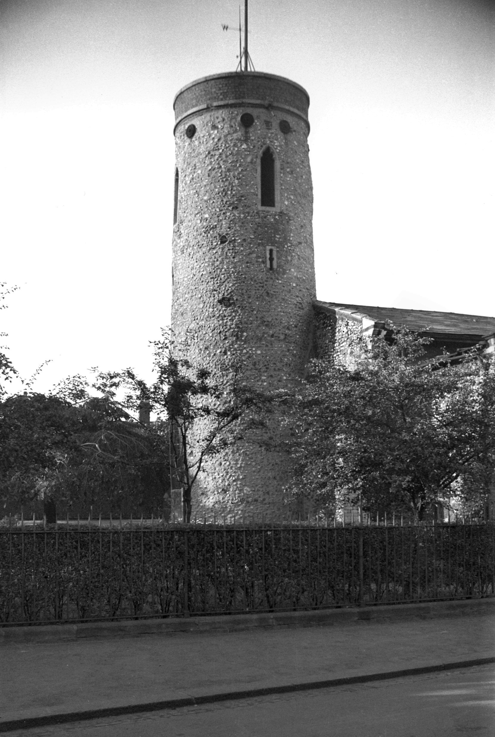
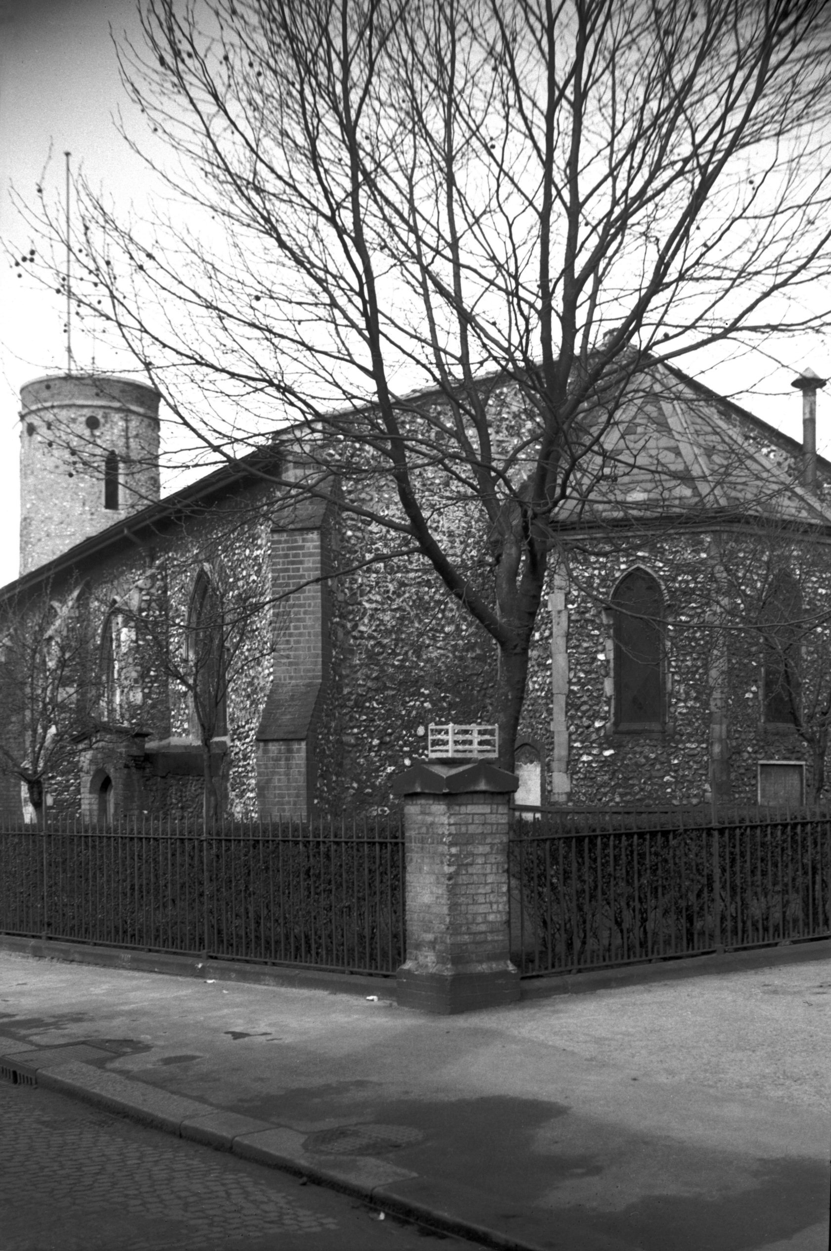
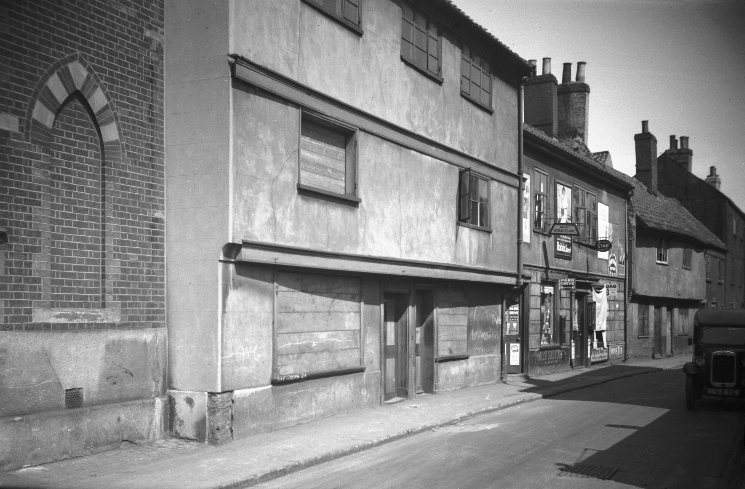
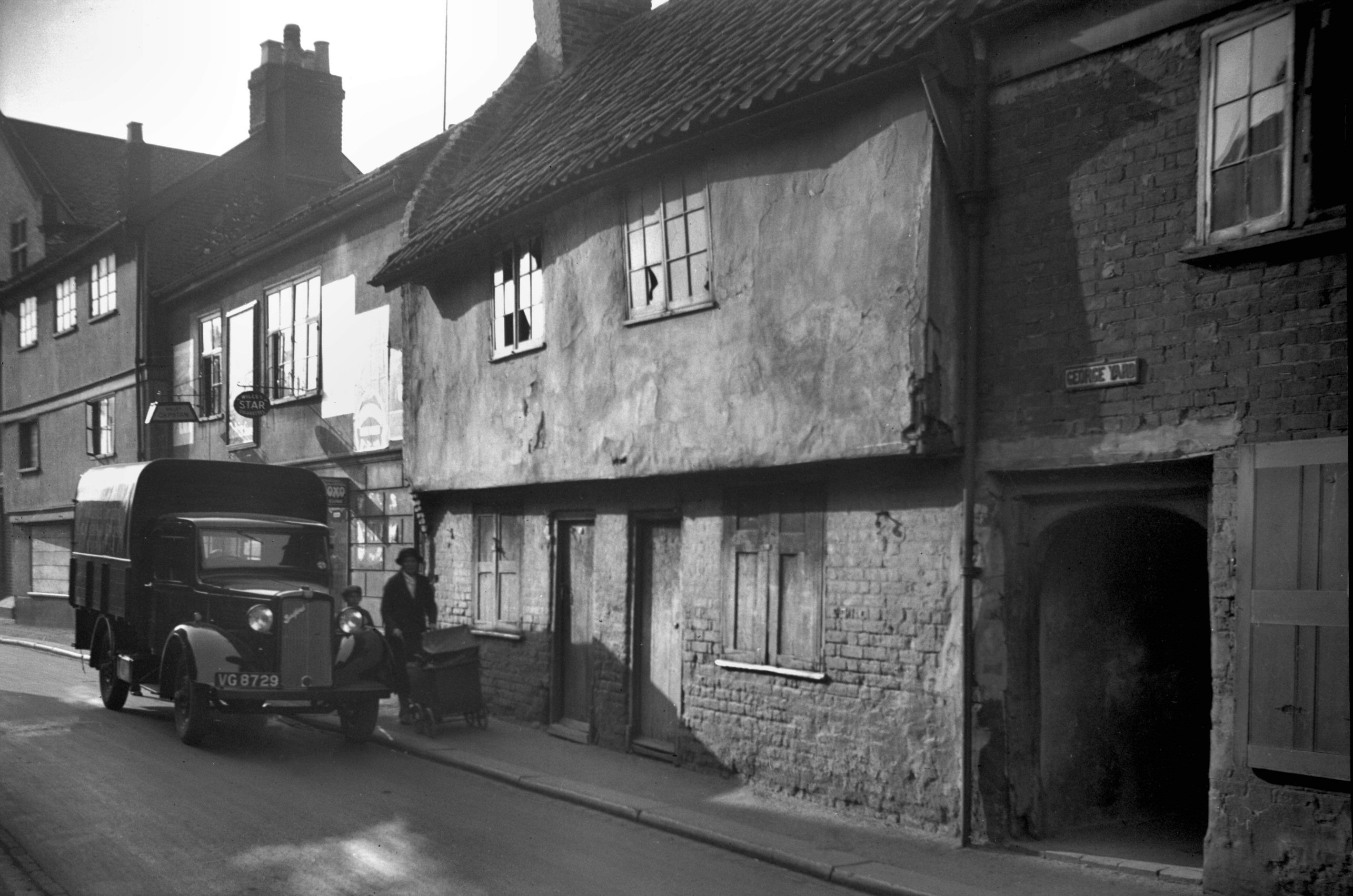
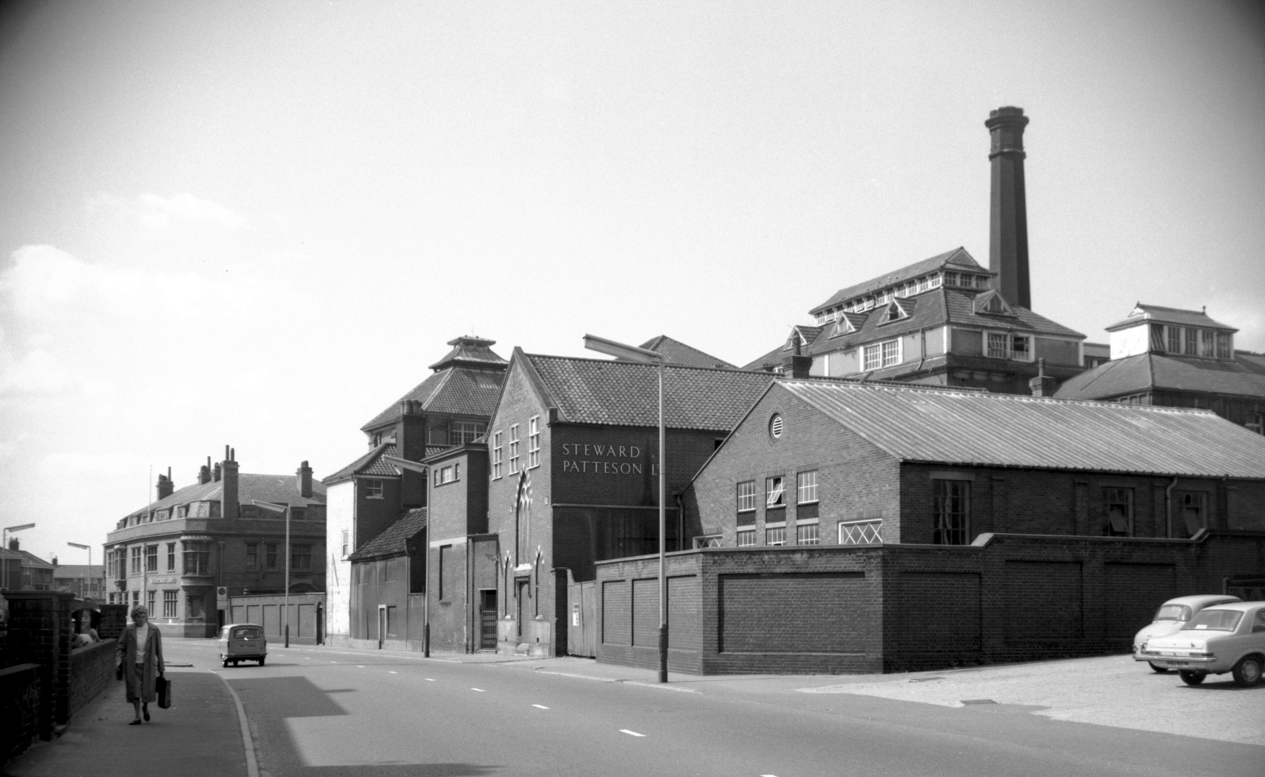
Barrack St 86 to 90 view NW [0927] 1936-05-06
Barrack St lies in the district of Pockthorpe, so called
from the Latin pauca, little, and Old English thorp,
village. Here was the Barregate, one of the 12 gates in
the city's circumvallation. The gate was removed in 1792,
one of the first to go, but the greater part of a wall
tower remains a few yards to the north, with most of its
stone vaulting intact.
In the 19c the name of Barrack St applied only to that
part of the highway outside the city wall, extending from
Silver Rd to Bishops Bridge Rd. West of this, the part
within the city was known as St James's St. Although slum
clearance had been active here for some years before
1931, when I first took up photography, evidence of an
early spread of the population beyond the walls was to be
seen in some of the houses that yet remained. Just beyond
Steward and Patteson's Pockthorpe, Brewery for instance,
Nos 82-84 and 88-90 were simple domestic buildings
probably of Tudor origin; both groups has jettied upper
storeys, and Nos 82-84 possessed an added second floor.
In between these two groups, at No 86 stood the Griffin
public house, one of several hostelries in the city with
that sign. |
|
|
Barrack St Steward and Patteson brewery SE [5378]
1974-08-24
Pockthorpe brewery. |
|
|
Barrack St Steward and Patteson brewery SW [5379]
1974-08-24
|
|
|
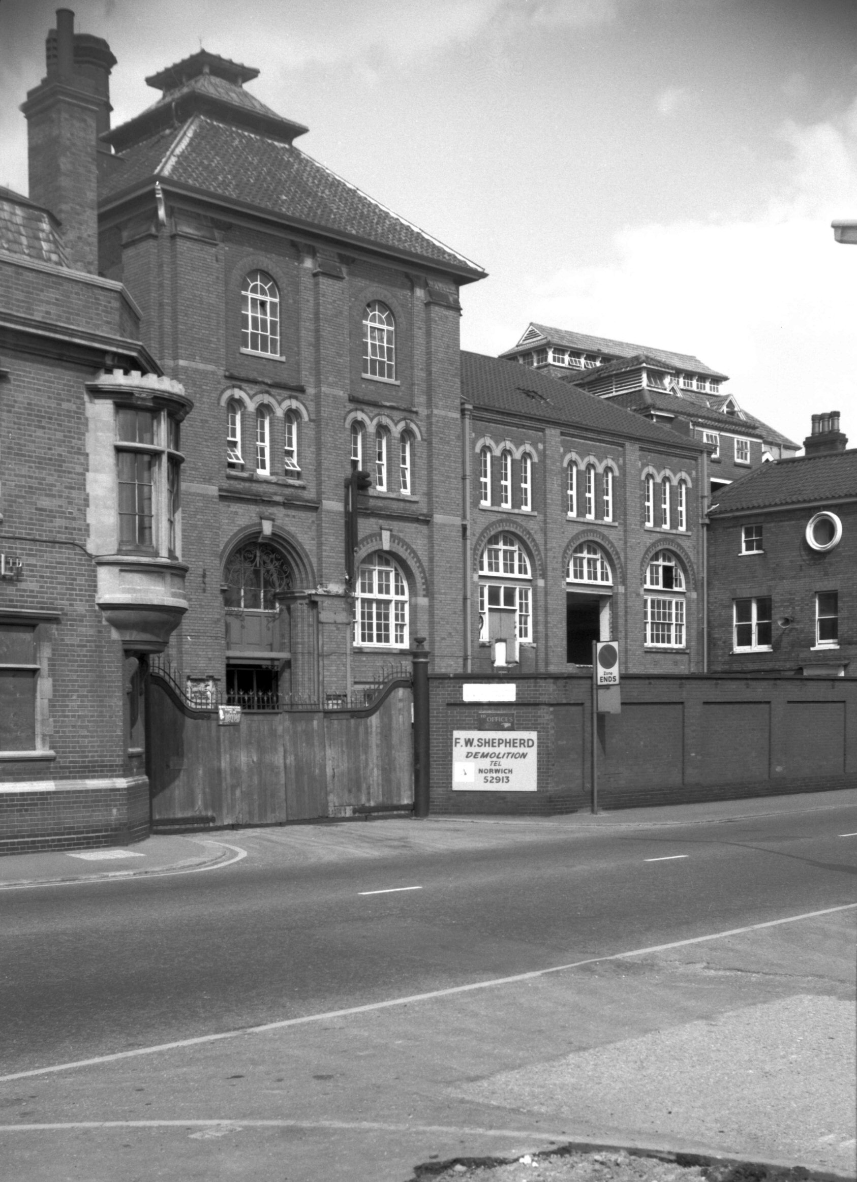
Barrack St 112 former brewery offices [7747]
2000-04-23
Former offices of Steward and Patteson's brewery. |
|
|
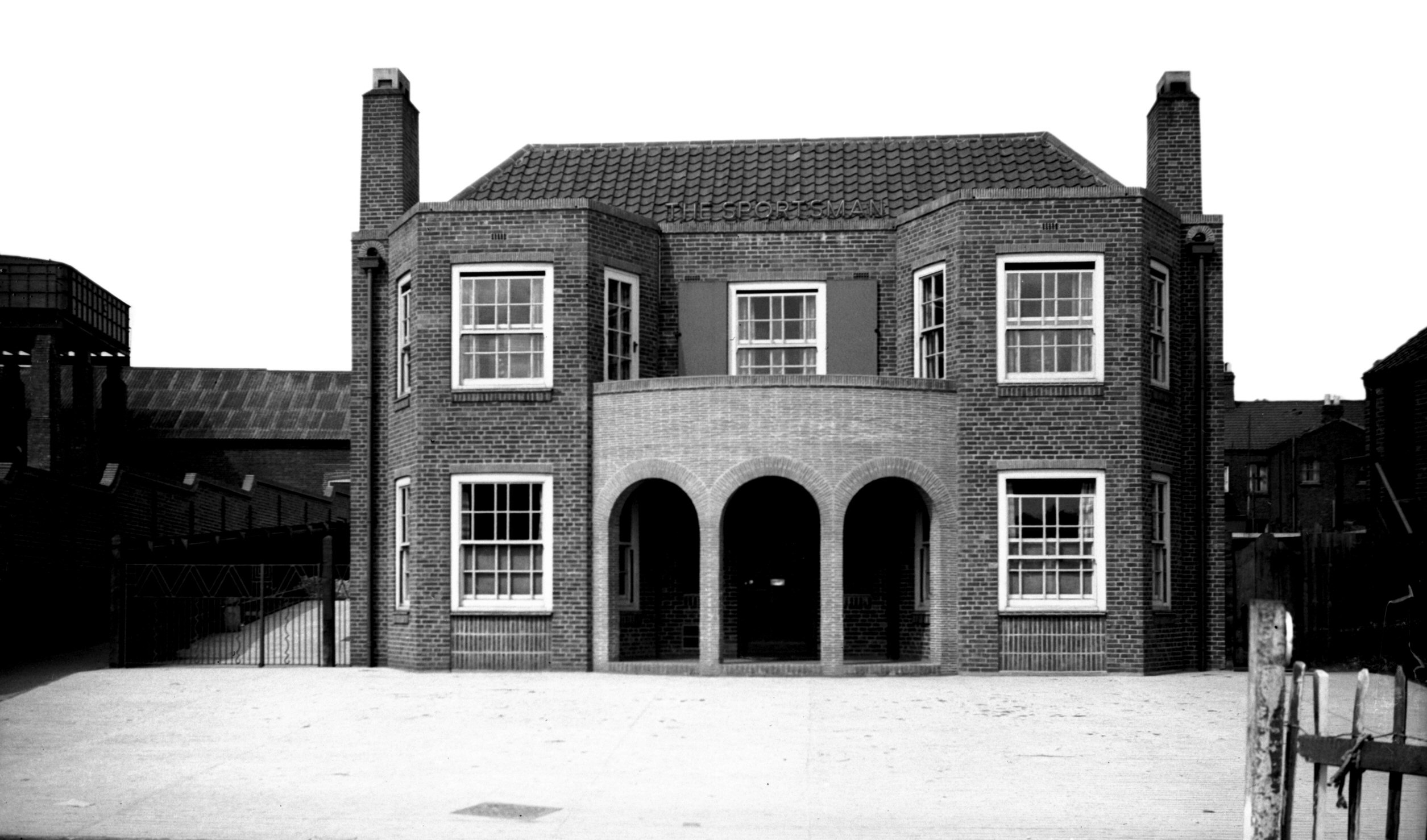
Barrack St Sportsman PH [2429] 1938-05-29
|
|
|
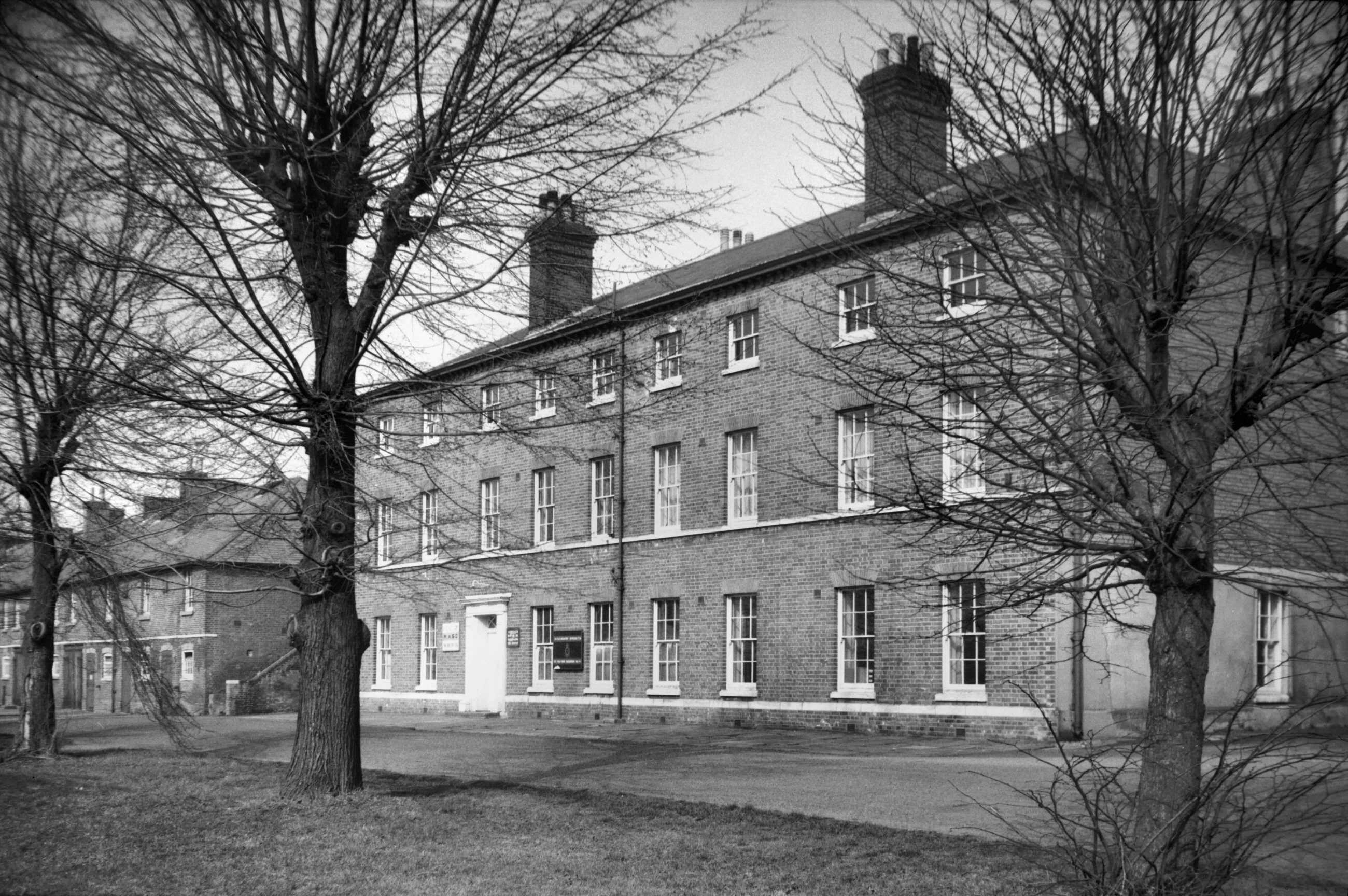
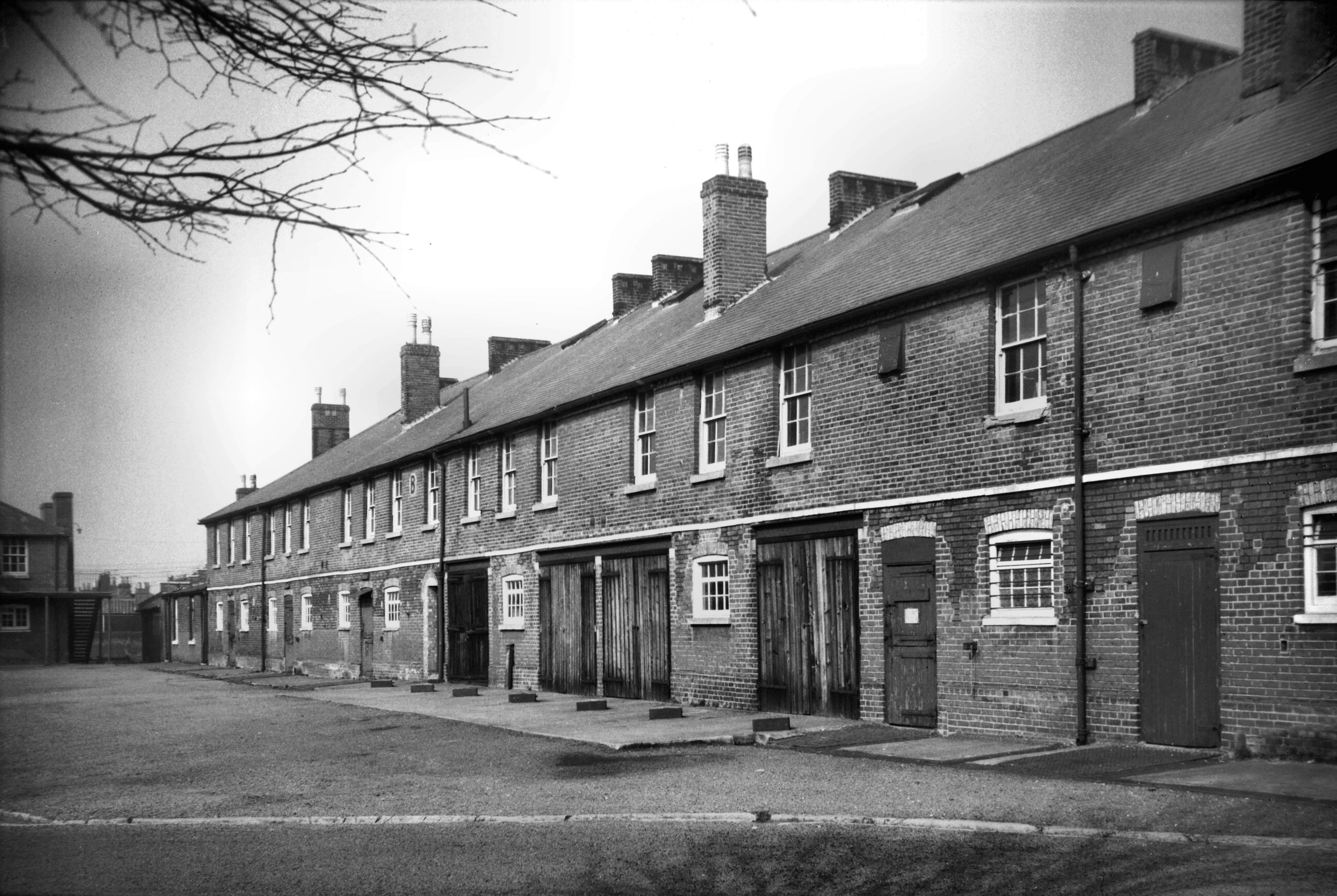
Barrack St Horse Barracks officers' wing [4881]
1965-03-13
|
|
|
Barrack St Horse Barracks soldiers' W wing [4883]
1965-03-13
First built 1791 on the site of Hassett House. Later
known as the Cavalry barracks and since c1920 as Nelson
barracks. Demolished in the 1950's. |
|
|
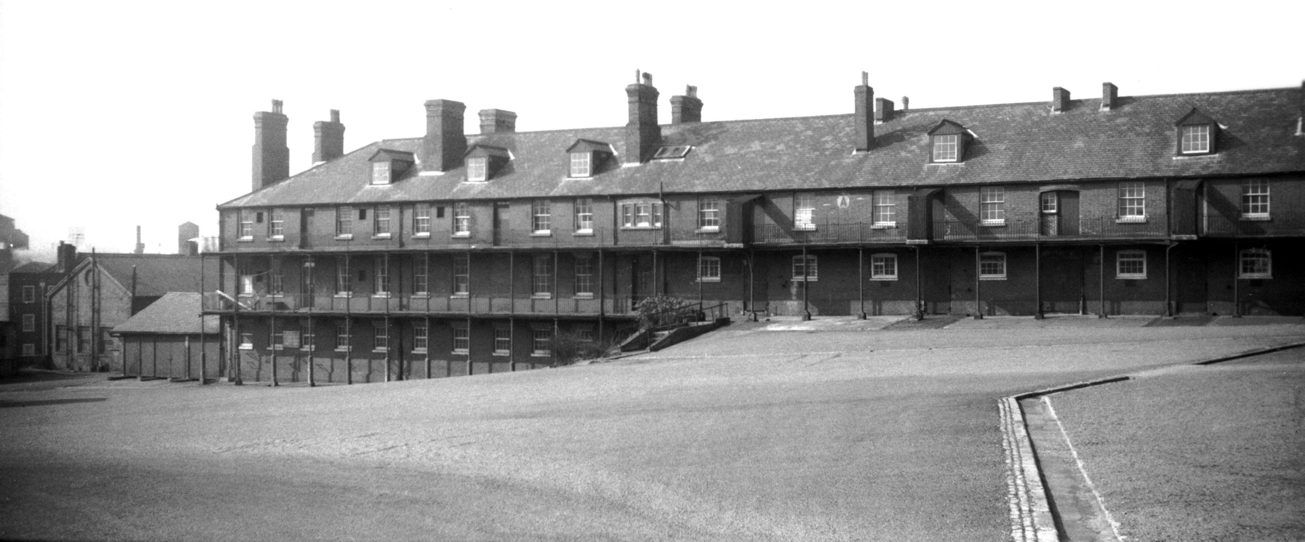
Barrack St Horse Barracks stables quarters [4882]
1965-03-13
Soldiers' quarters with stables beneath. |
|
|
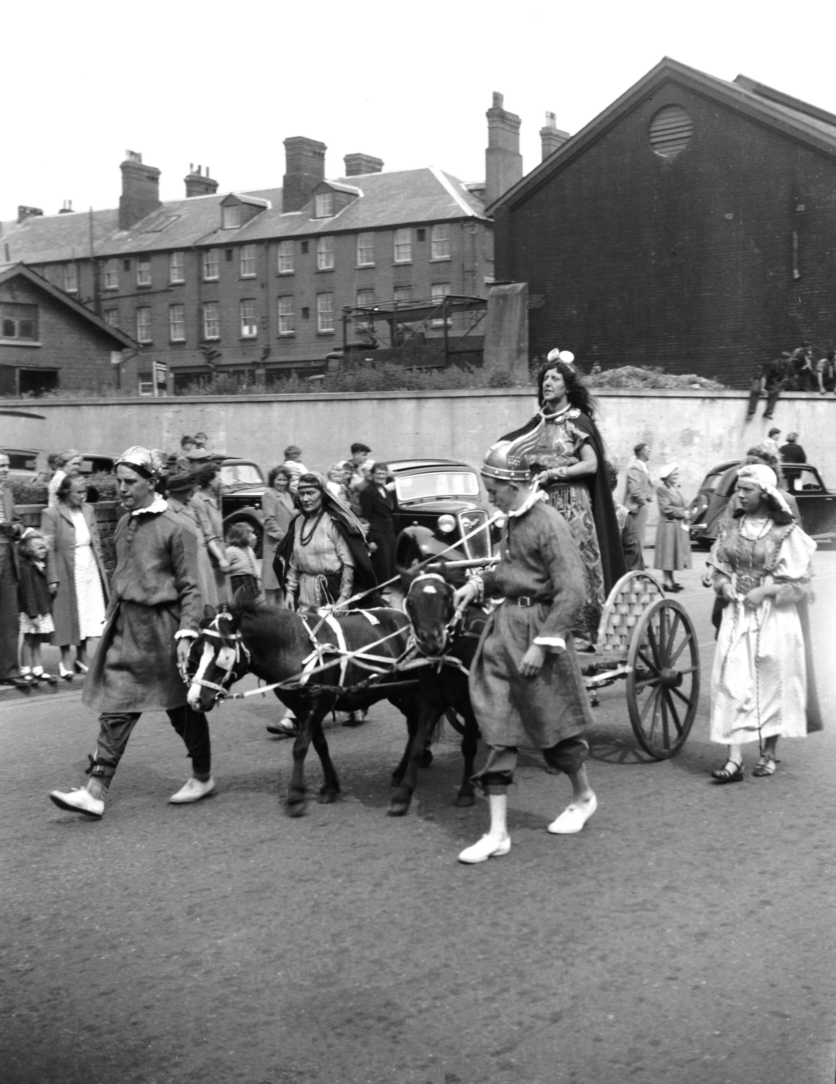
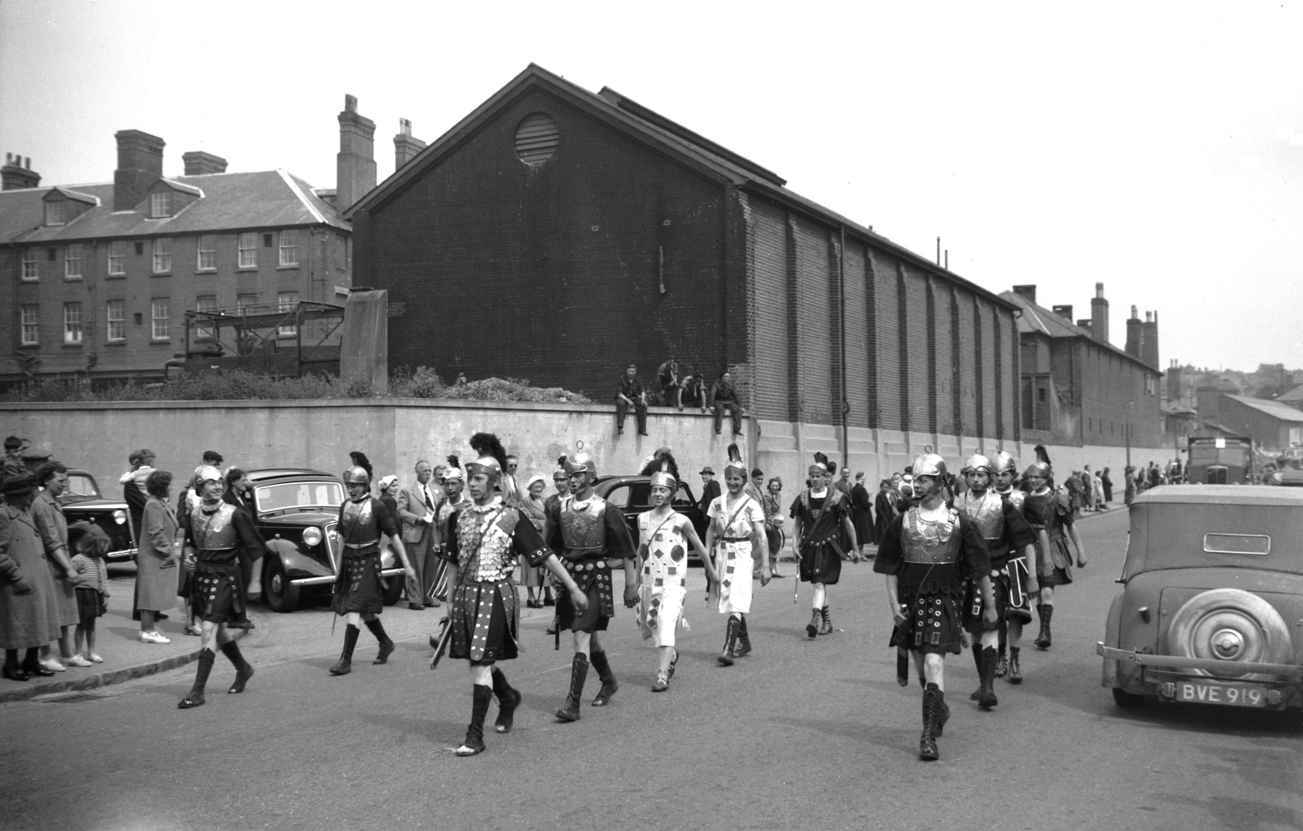
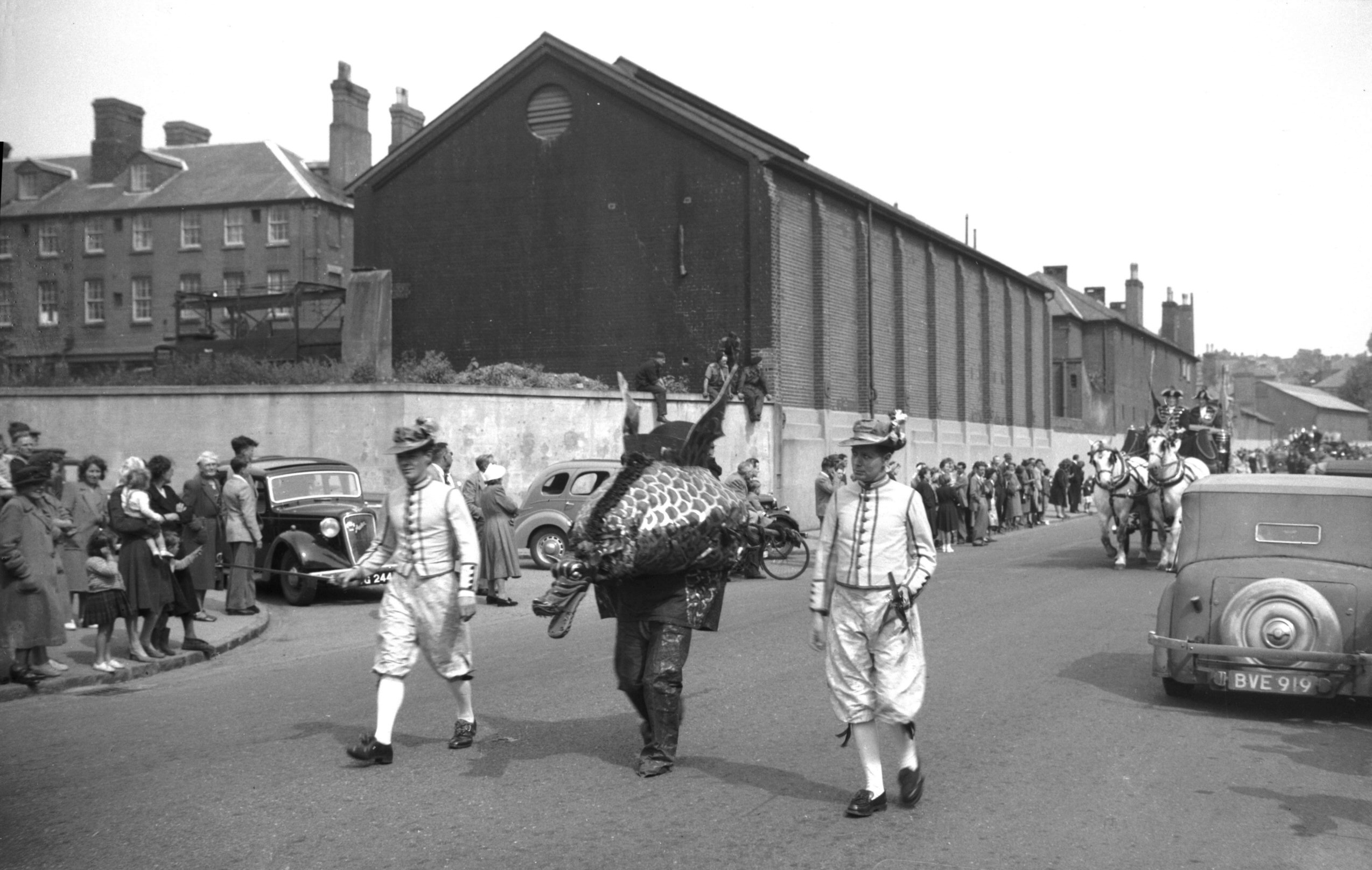
Festival procession Queen Boadicea [3999] 1951-06-24
1951 Festival Procession carts, Sunday 24th June (the
second of three days on which it was held). |
|
|
Festival procession Roman soldiers [4000] 1951-06-24
|
|
|
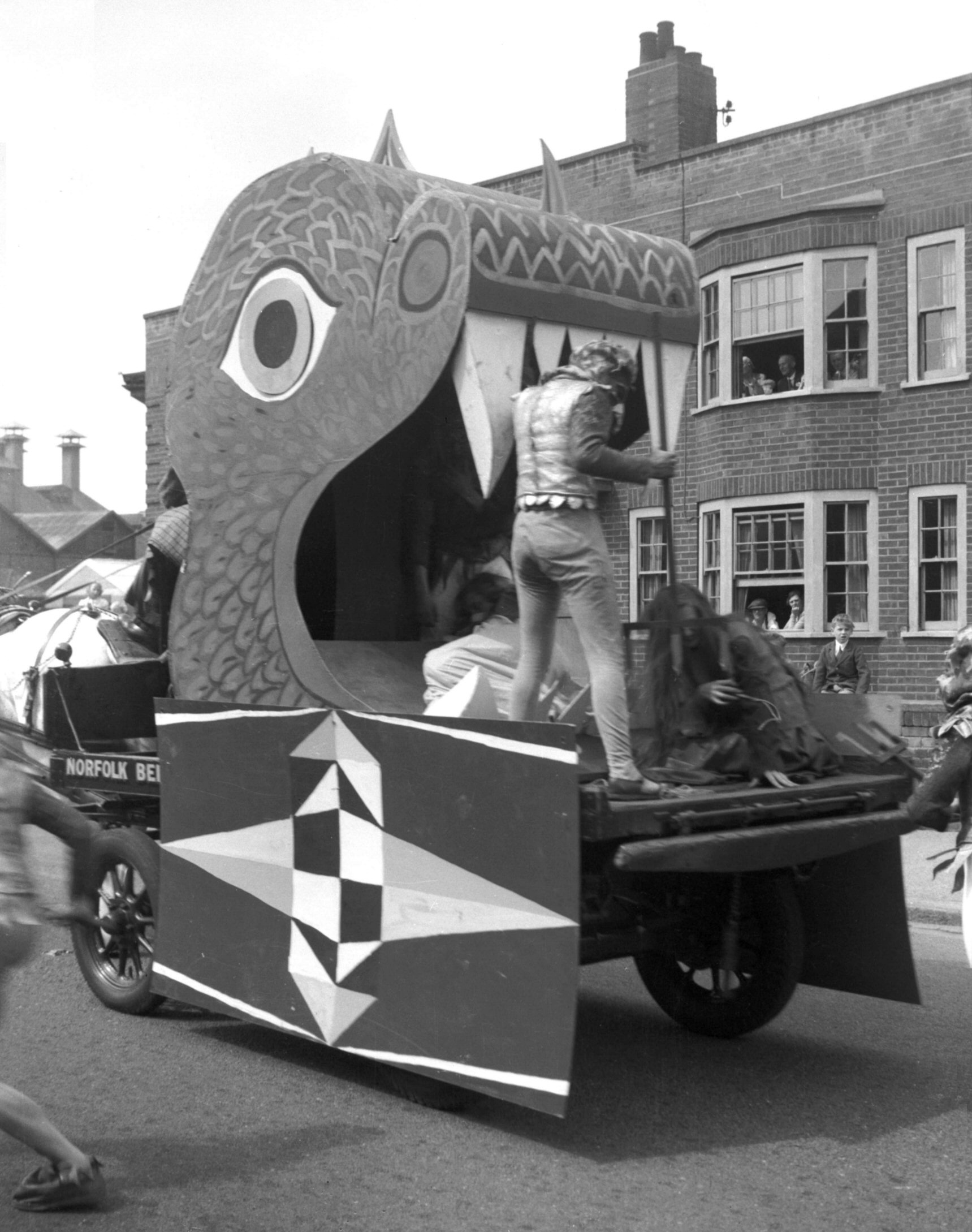
Festival procession trade guilds Hell cart [4001]
1951-06-24
Mediaeval Trade Guilds "Hell Cart". |
|
|
Festival procession Sir Thomas Erpingham [4002]
1951-06-24
Watches the building of his gateway to the Cathedral
Close. |
|
|
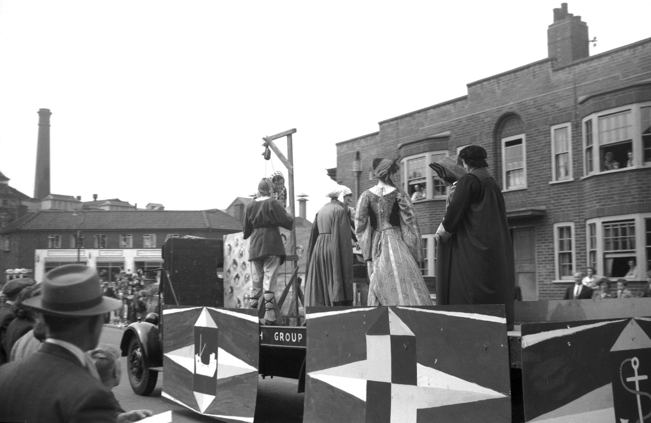
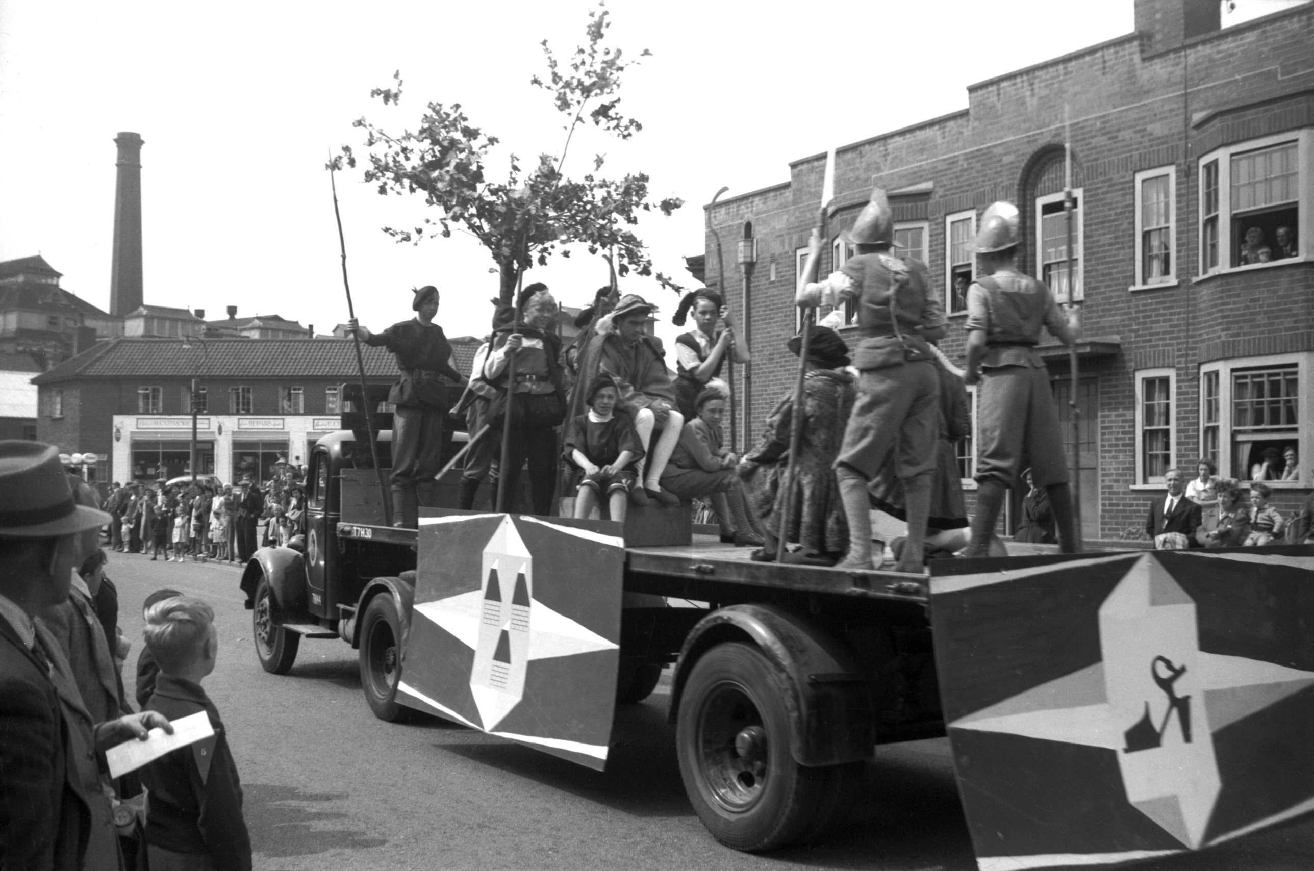
Festival procession Kett's rebellion [4003]
1951-06-24
1549 rebellion. |
|
|
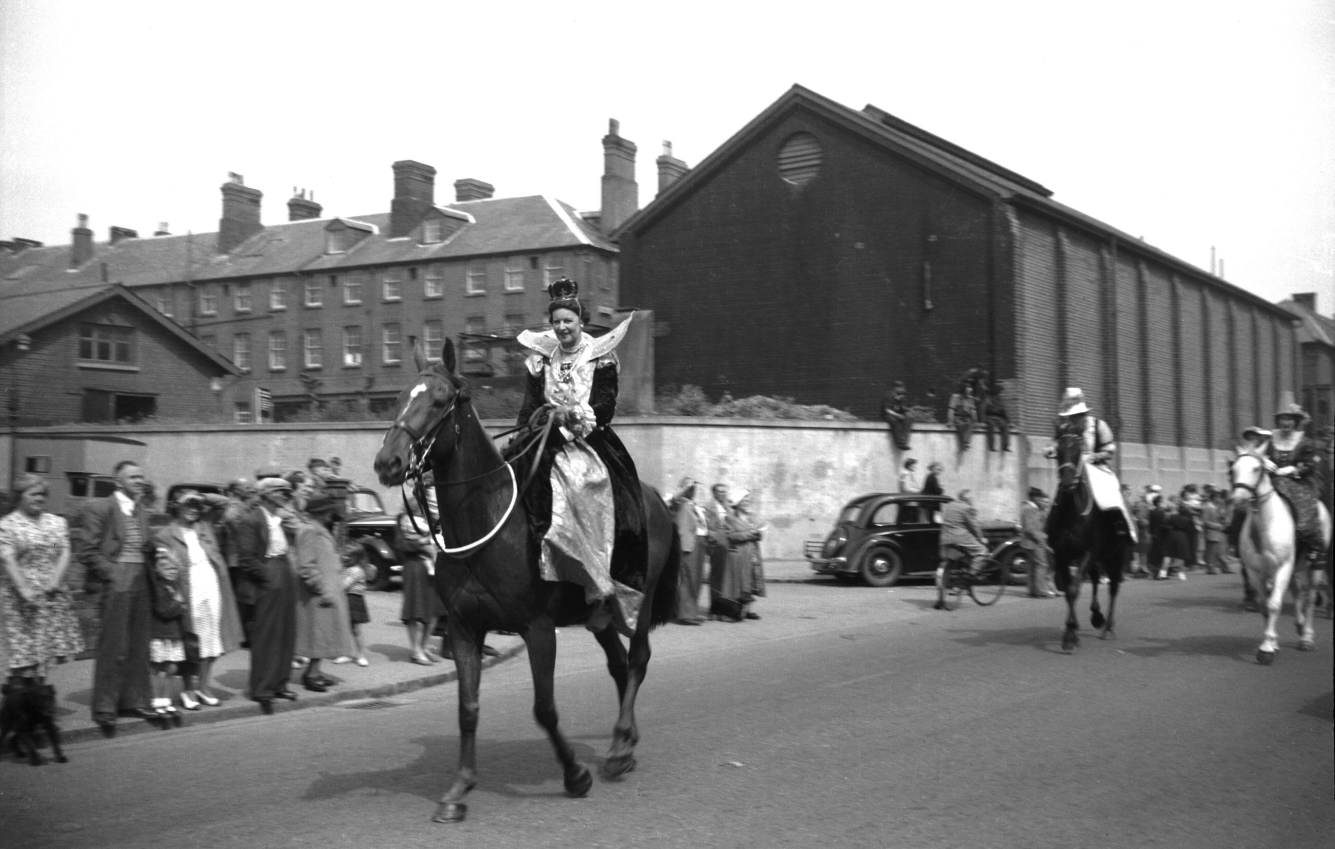
Festival procession Queen Elizabeth I [4004]
1951-06-24
|
|
|
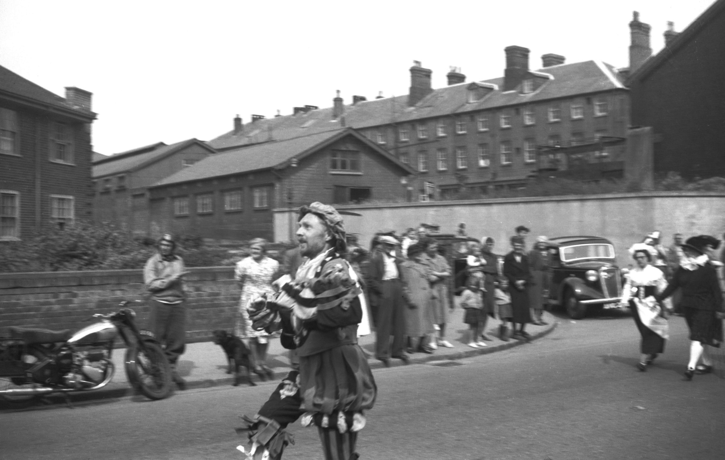
Festival procession William Kemp dancers [4005]
1951-06-24
"Nine Days' Wonder" dancing from London to
Norwich. |
|
|
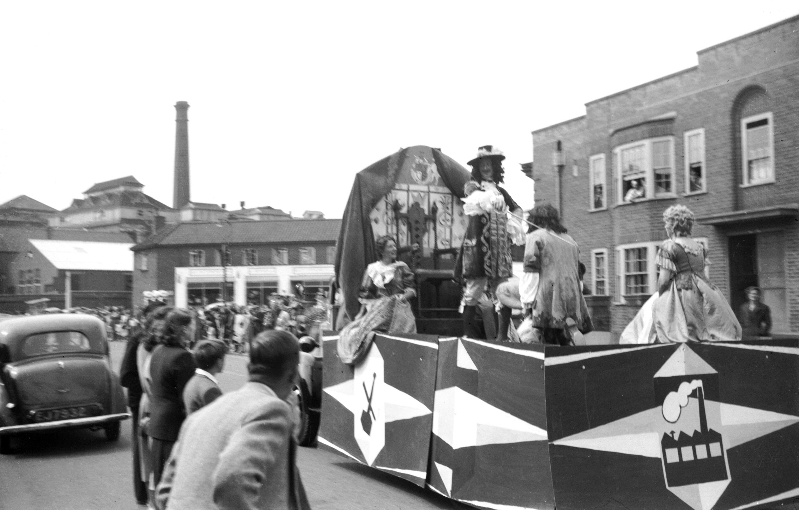
Festival procession Thomas Browne knighted [4006]
1951-06-24
King Charles II knights Dr Thomas Browne. |
|
|
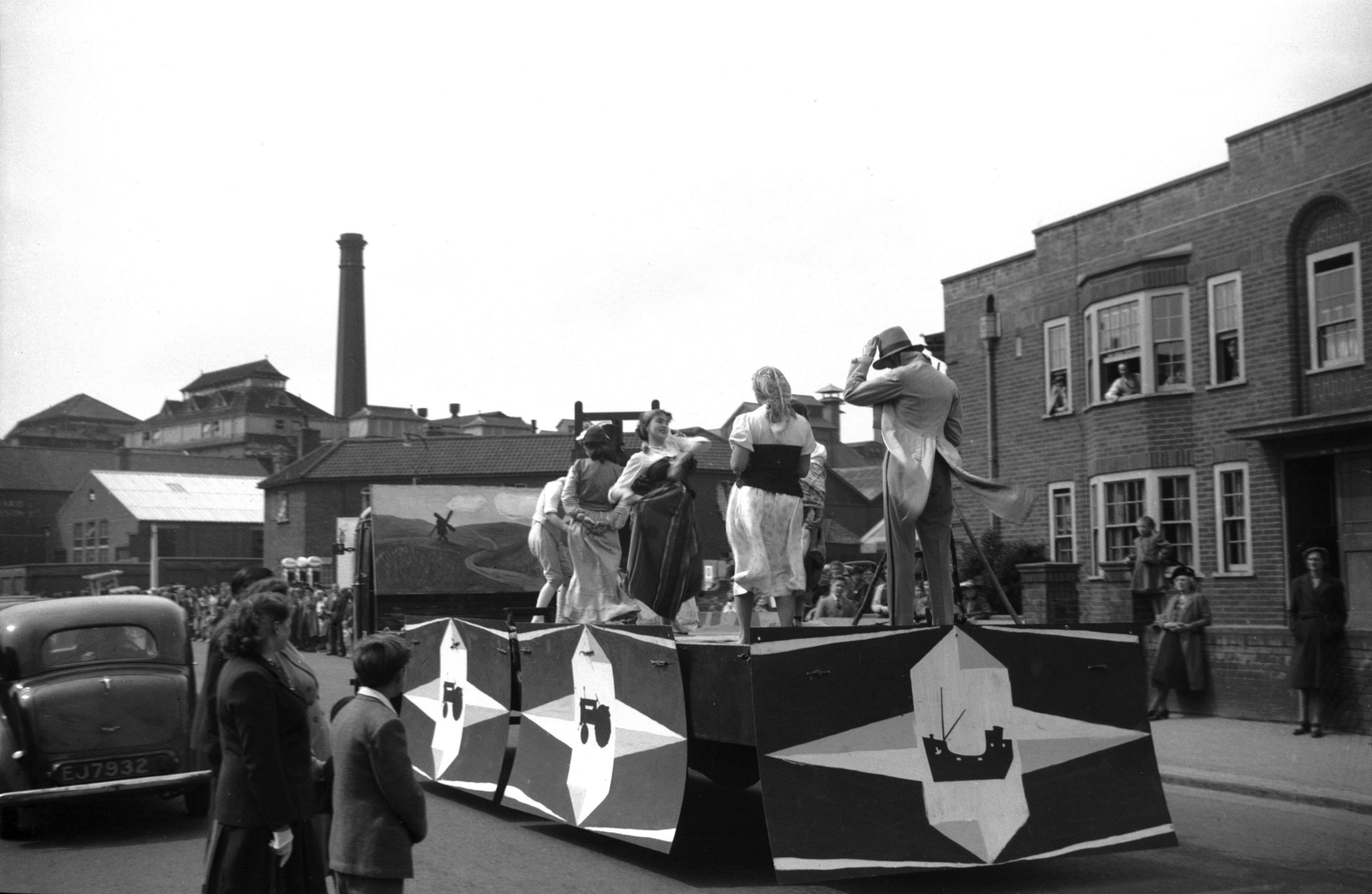
Festival procession John Crome and Borrow [4007]
1951-06-24
John Crome, George Borrow and Gypsies. |
|
|
Festival procession snapdragon and whiffler [4008]
1951-06-24
|
|
Barrett Rd: |
| |
From
Martineau
Lane to Hall Rd / Lakenham
Rd
passing Mansfield Lane |
|
|
Barrett Rd at Long John Hill [B790] 1933-10-08
|
|
|
Barrett Rd at Mansfield Lane [B791] 1933-10-08
|
|
|
Barrett Rd at Hall Rd [B767] 1933-09-10
Lakenham Rd beyond. |
|
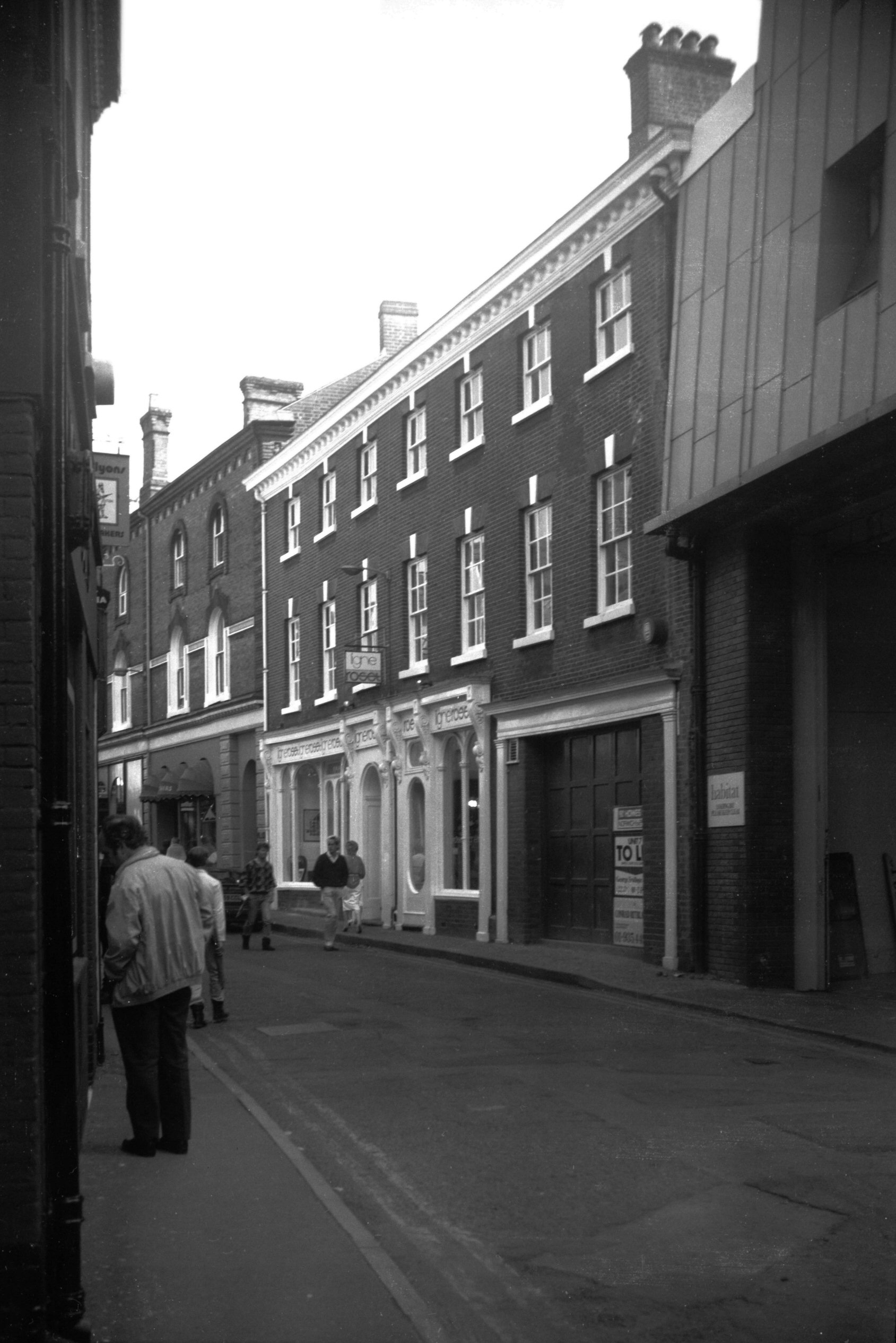
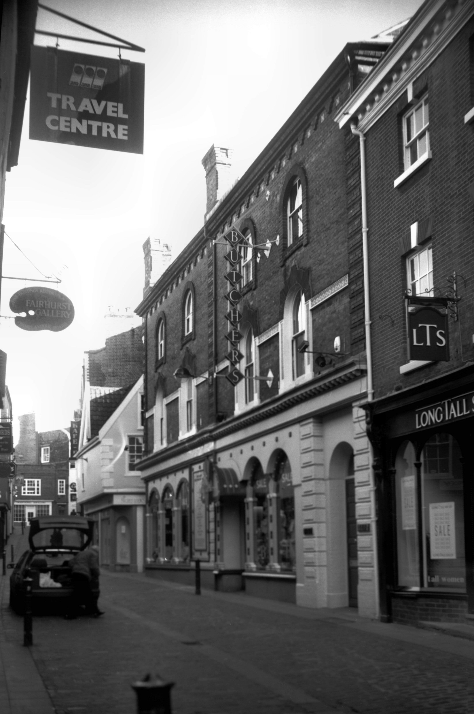
Bedford St: |
| |
From
Exchange St / Lobster
Lane to St Andrew's Hill / London
St
passing Swan Lane
North side |
|
|
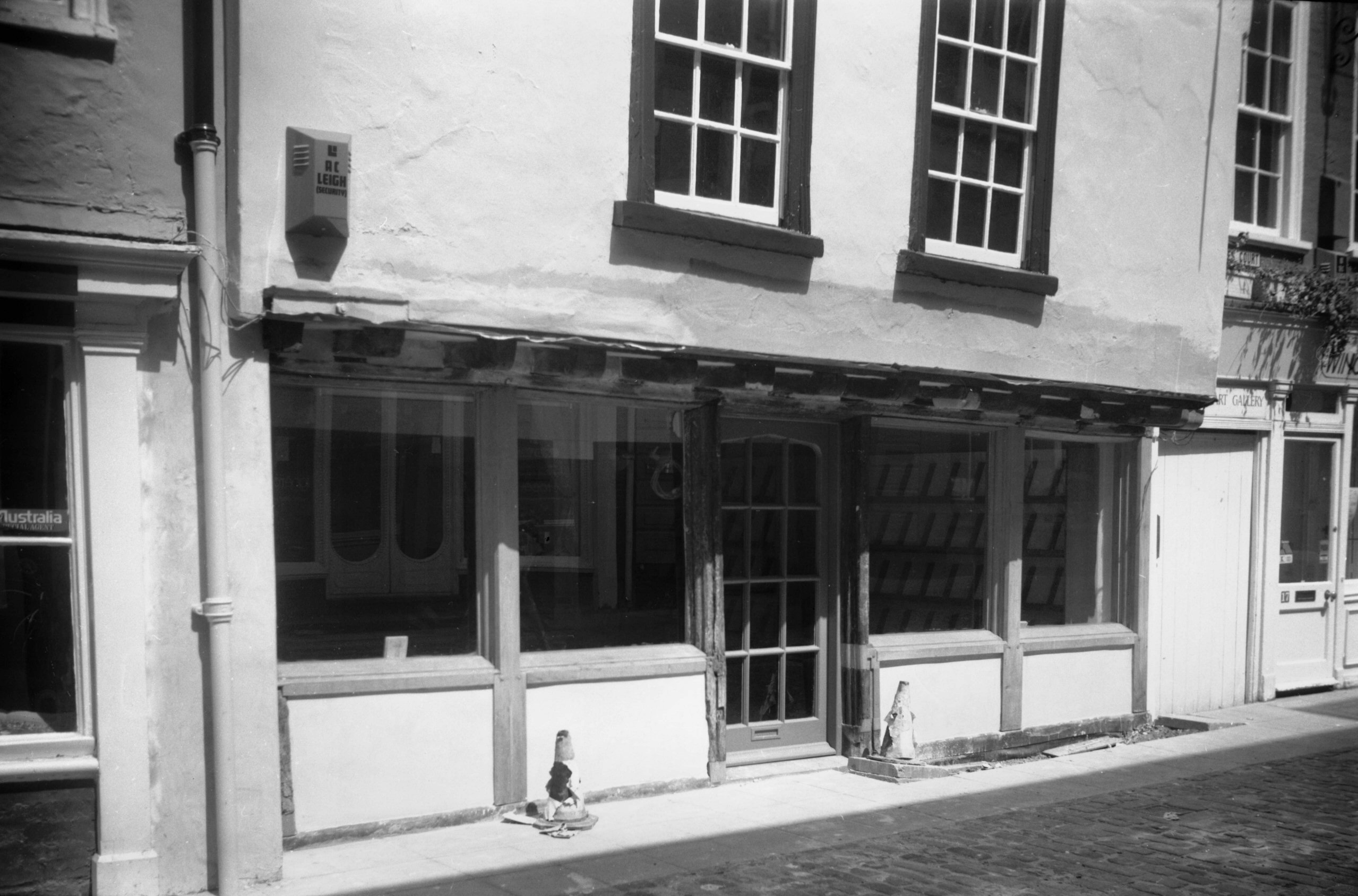
Bedford St 5 The Granary [6462] 1987-05-25
|
|
|
Bedford St 13 Bedford Arms PH to 15 [5208] 1968-06-07
|
|
|
Bedford St 15 [1436] 1936-09-22
Before restoration. |
|
|
Bedford St 15 restored [6492] 1988-04-12
|
|
|
Bedford St 15 restored 15c shop front [6463]
1987-05-25
|
|
|
Bedford St 15 to 21 Corn Exchange roof off [4761]
1964-05-09
|
|
|
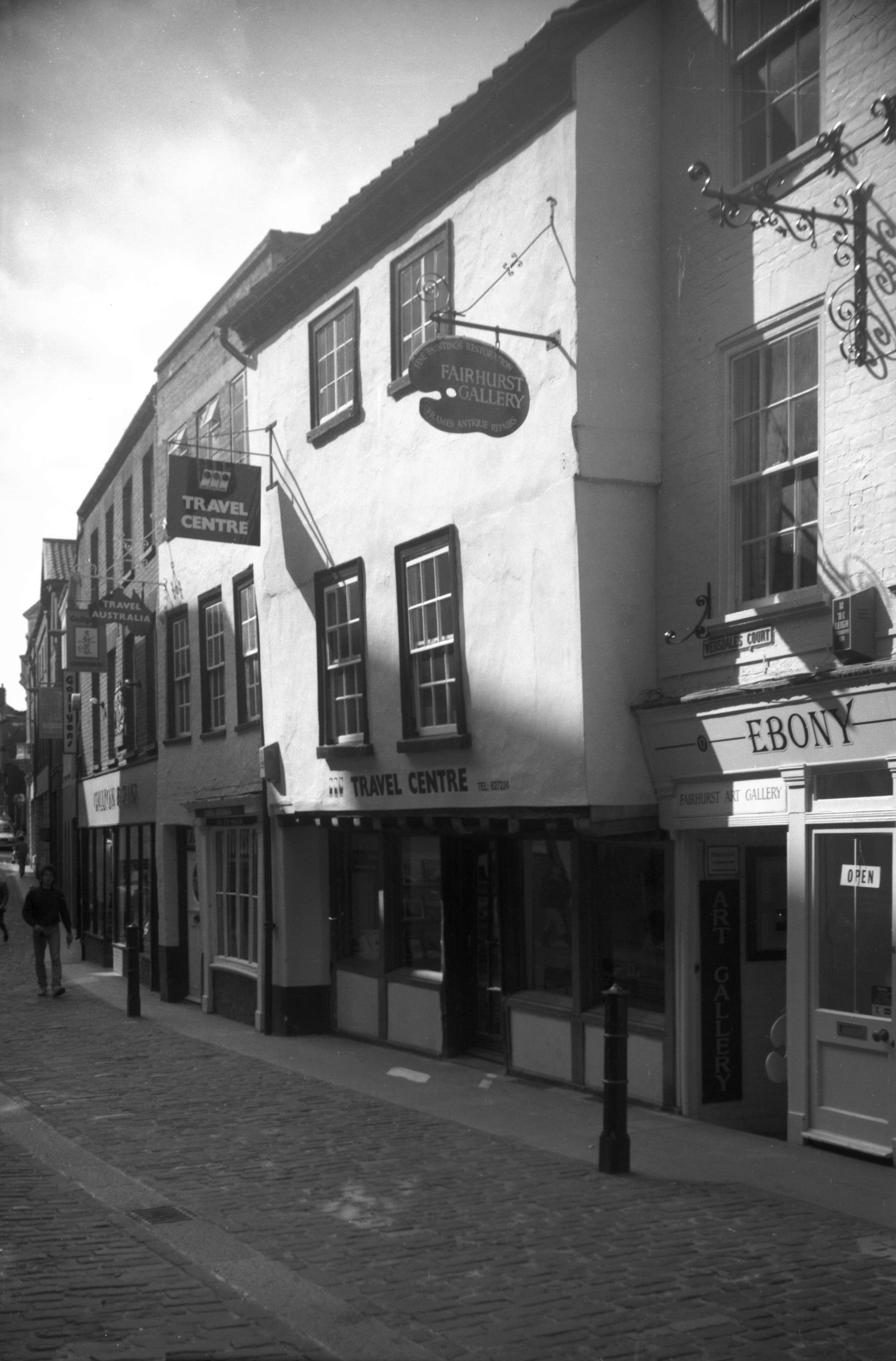
Bedford St 17 side in Websdale's Court [7568]
1998-07-25
|
|
|
Bedford St 17 Websdale's Court [6624] 1990-07-12
|
|
|
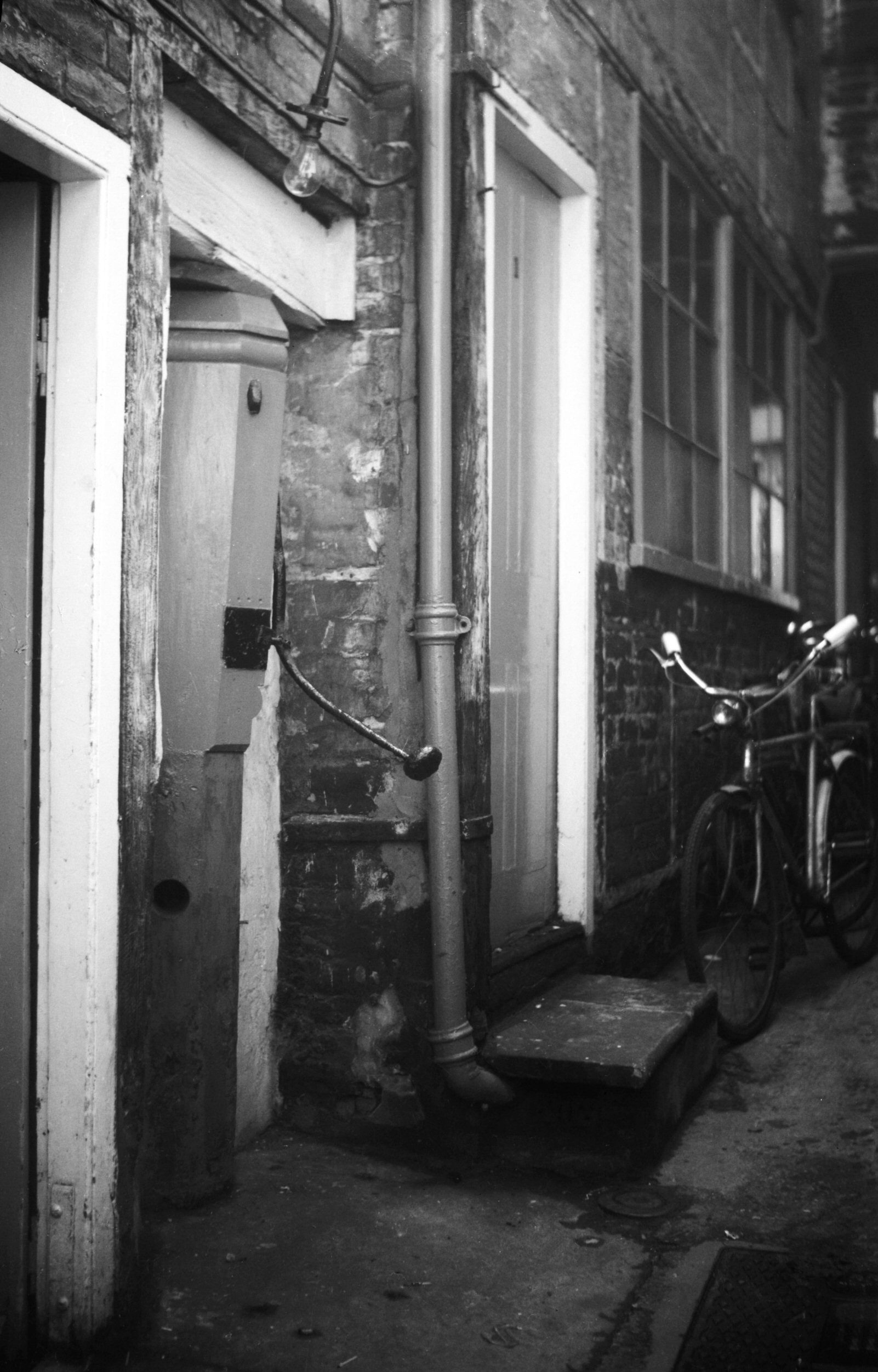
Bedford St Websdale's Court wooden pump [4756]
1964-04-18
|
|
|
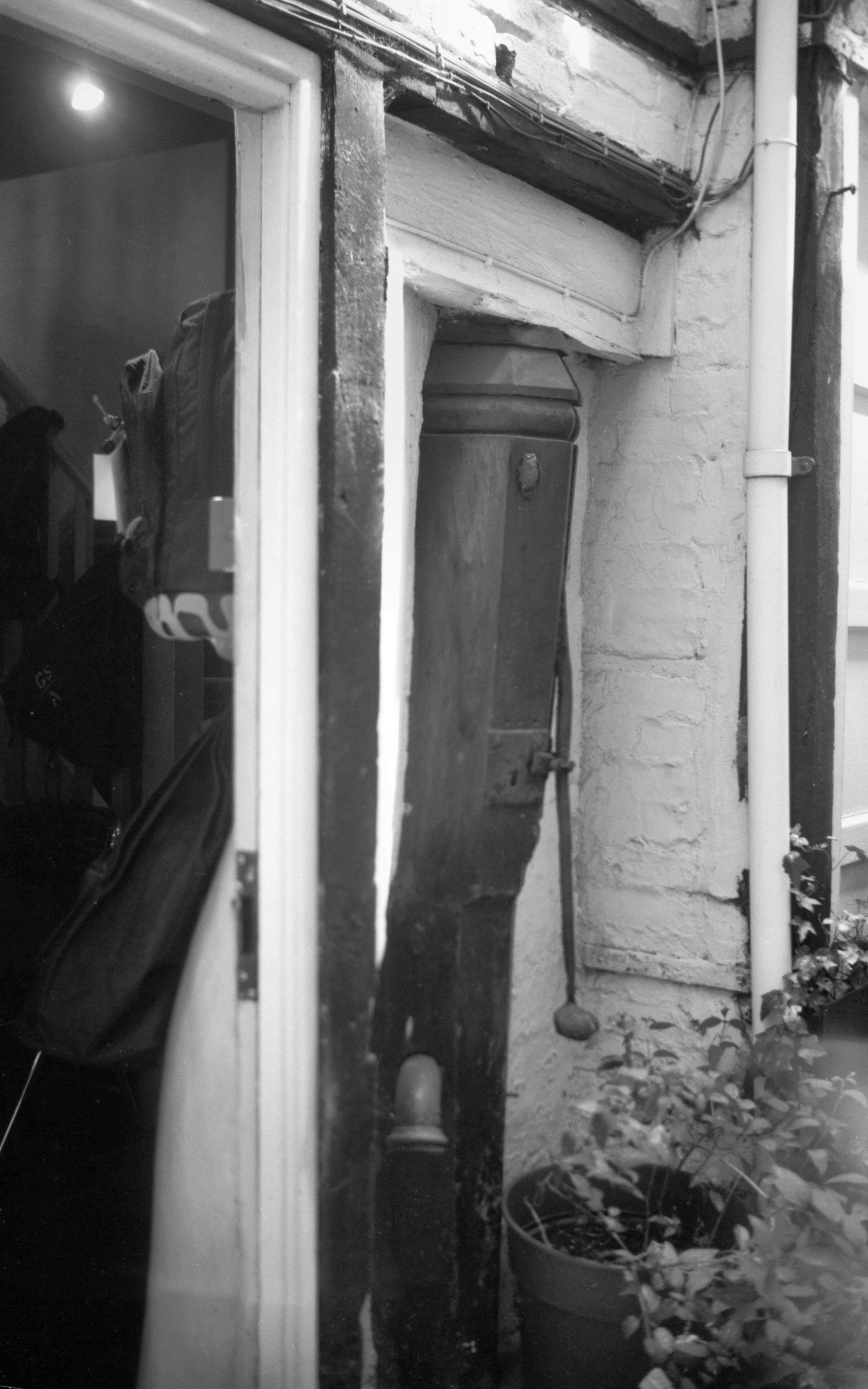
Bedford St Websdale's Court wooden pump [7567]
1998-07-25
|
|
|
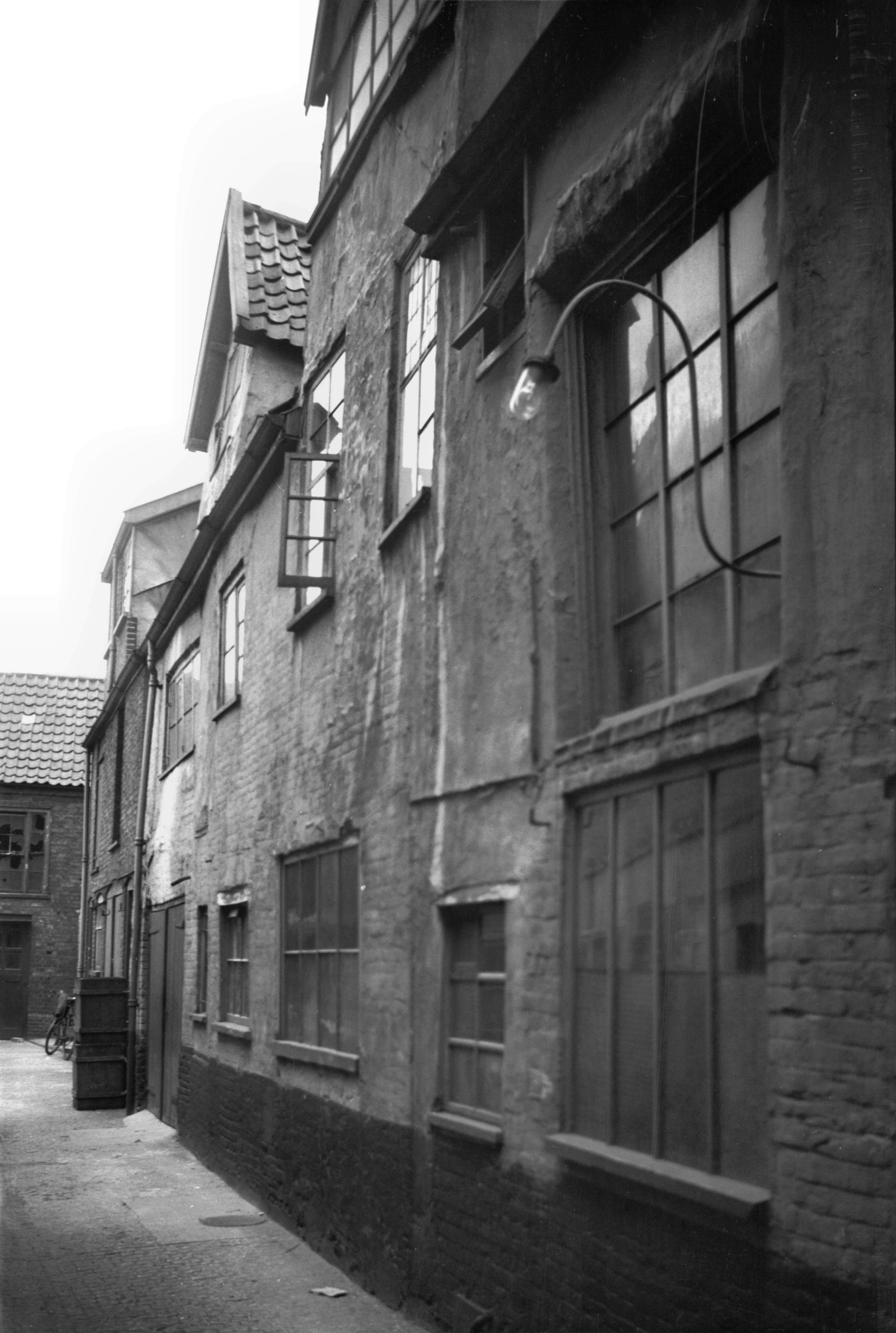
Bedford St Old Post Office Yard east view N [1144]
1936-07-21
|
|
|
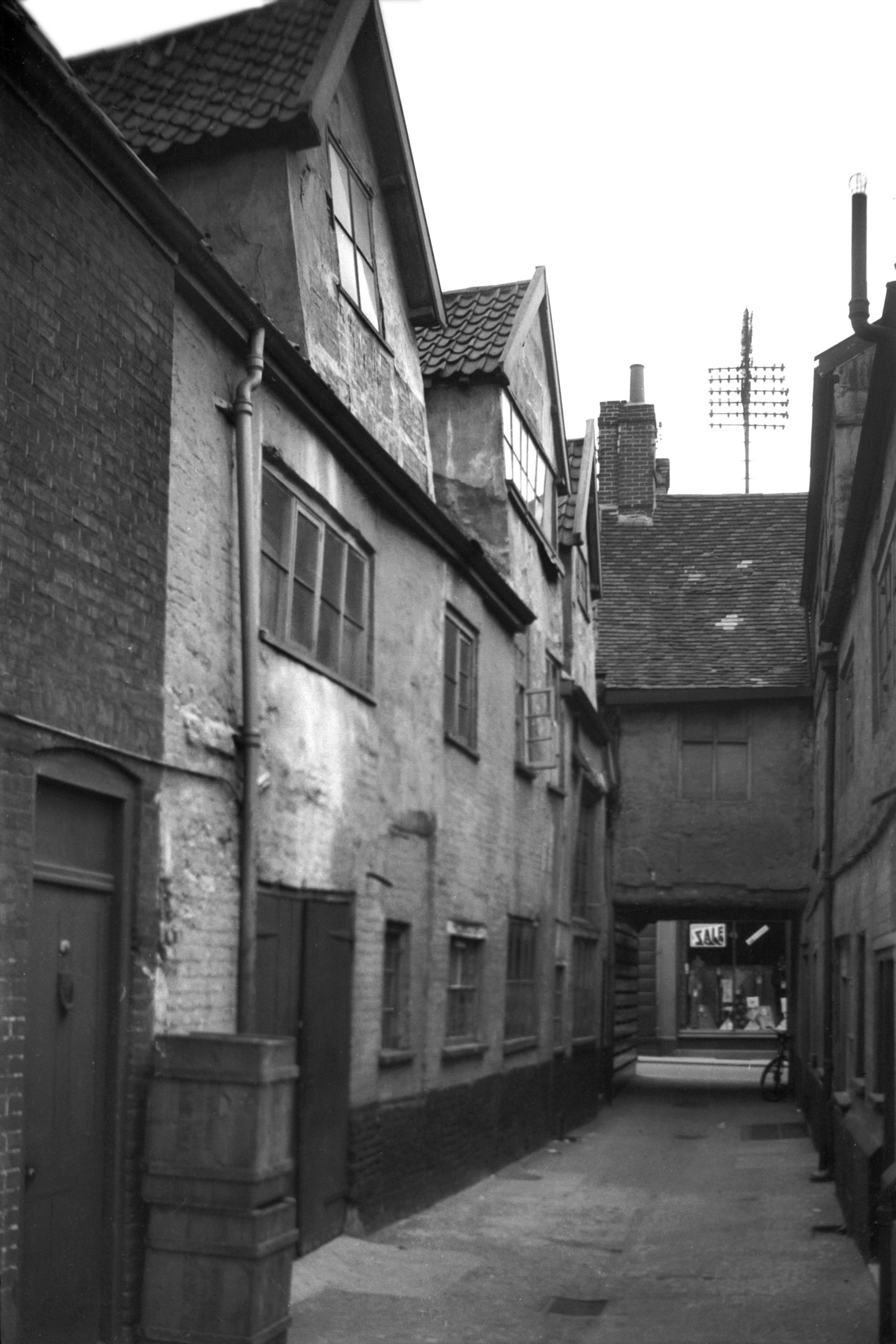
Bedford St Old Post Office Yard east view S [1147]
1936-07-21
|
|
|
Bedford St Old Post Office Yard west view S [1148]
1936-07-21
|
|
|
Bedford St 19 brick and flint pilaster [5425]
1975-06-12
|
|
|
Bedford St 19 stone corbel wooden lintel [5427]
1975-06-12
|
|
|
Bedford St 19 to 21 [1143] 1936-07-21
|
|
|
Bedford St 19 to 23 restored [5426] 1975-06-12
|
|
|
Bedford St 23 [5336] 1972-08-21
|
|
|
Bedford St 25 [1142] 1936-07-21
|
|
|
Bedford St 27 with weavers' window [4297] 1955-04-09
|
| |
South
side |
|
|
Bedford St view Corn Exchange east side [4757]
1964-04-18
|
|
|
Bedford St 8 [6426] 1986-09-20
|
|
|
Bedford St 14 Butchers store [7732] 2000-02-13
Victorian period drapery store. |
|
|
Bedford St 16 [1313] 1936-08-23
|
|
|
Bedford St 18 [7576] 1998-09-06
|
|
Bell Avenue: |
| |
Formerly
from Farmers
Avenue to Market Avenue |
|
|
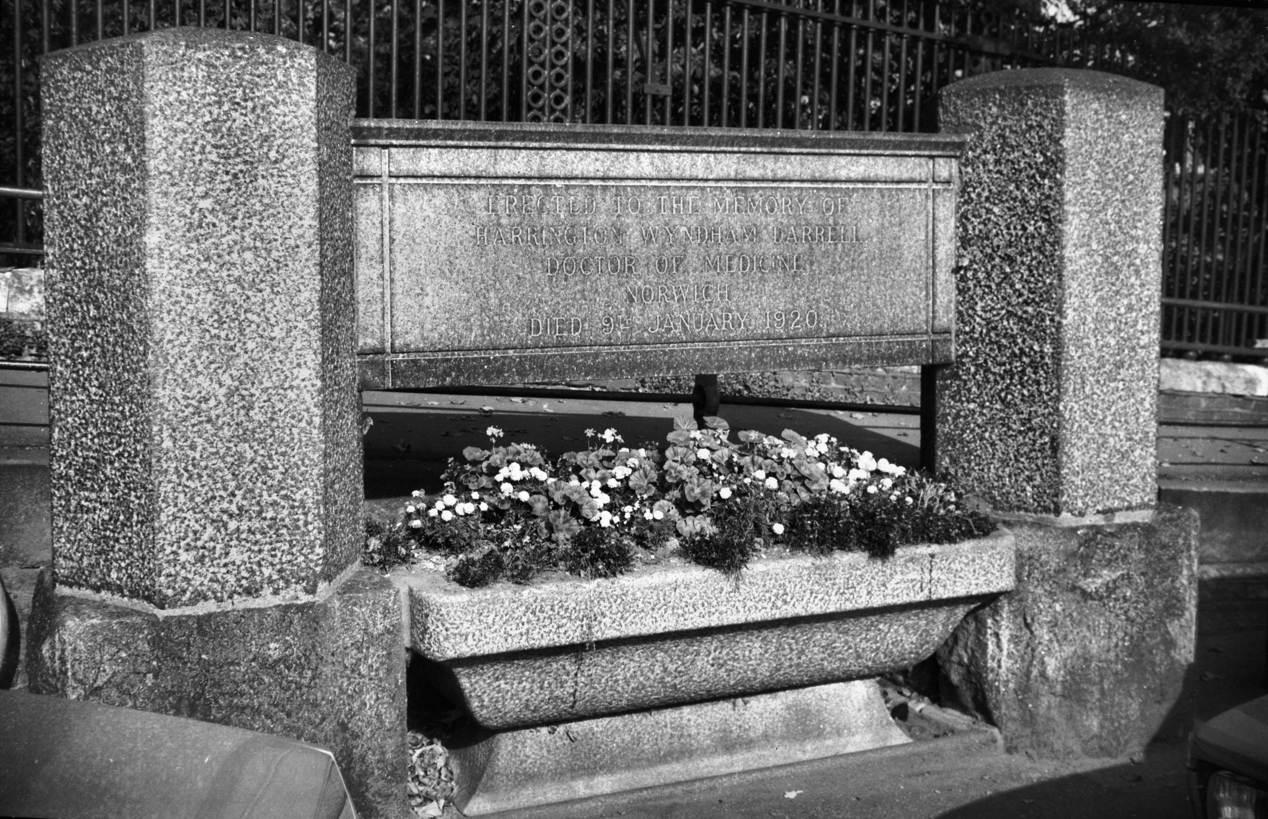
Bell Avenue Dr Darrell's cattle trough [6428]
1986-10-06
Now converted to flower display. Inscribed "Erected
to the Memory of/ Harrington Wyndham Darrell/ Doctor of
Medicine/ Norwich/ Died 9th January 1920". Dr
Darrell was a great animal lover. The trough was
originally placed next to his house at 12 All Saints
Green. |
|
|
Cattle Market excavation from Bell Avenue [6608]
1990-05-24
View south from entrance to castle bridge. |
|
Belvoir St: |
| |
From
Earlham Rd to Dereham Rd
East side |
|
|
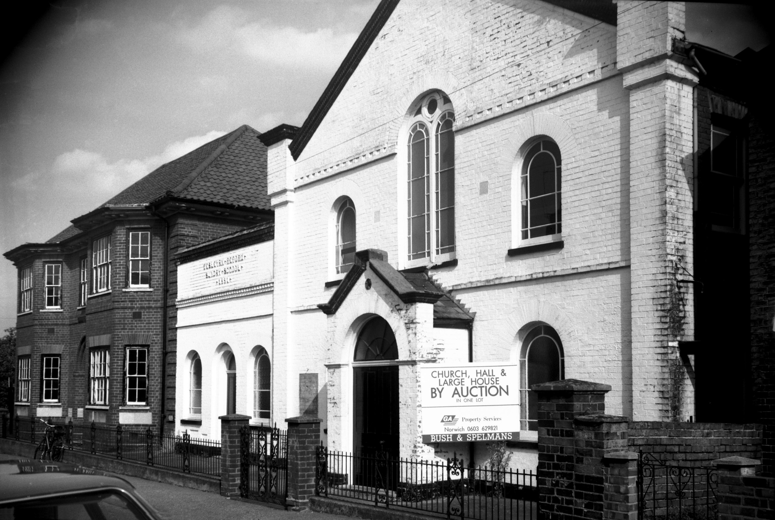
Belvoir St Wesleyan Reform Methodist church [6585]
1989-09-18
Opened April 1869. |