|
Old Grove Court: |
| |
From
Catton Grove Rd (Woodcock Rd) |
|
|
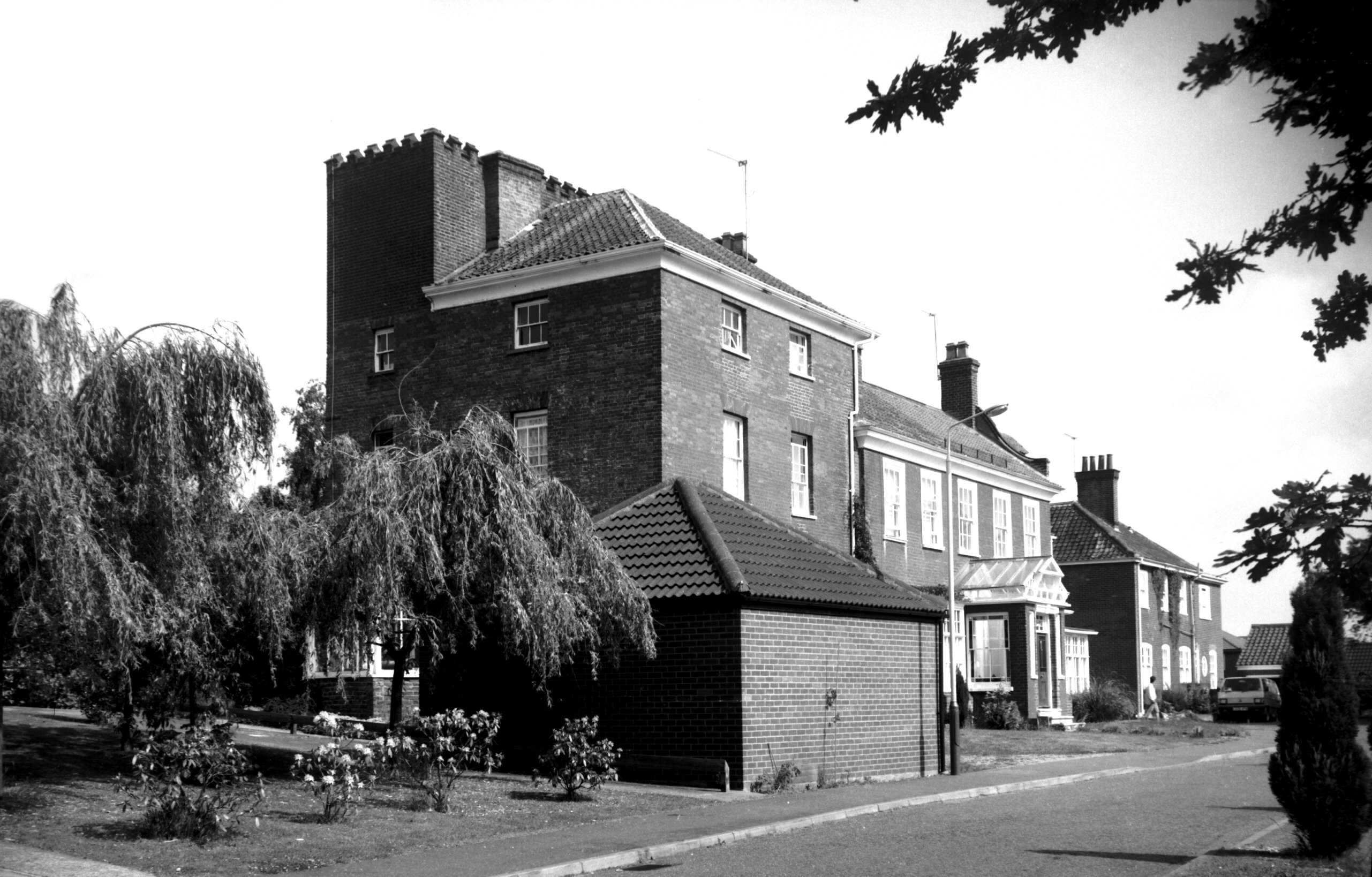
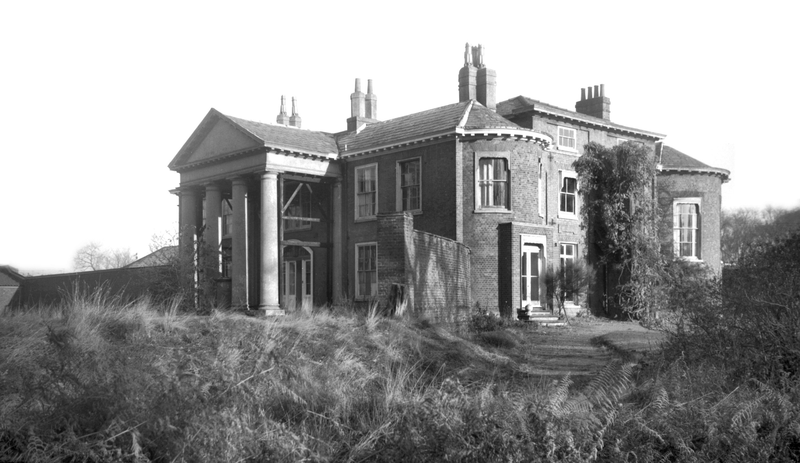
Old Grove Court Catton Grove House [6388] 1986-06-19
|
|
|
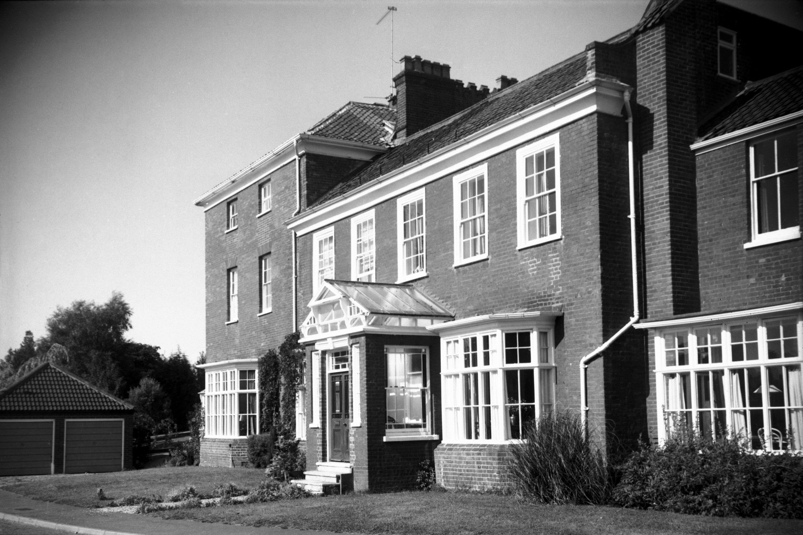
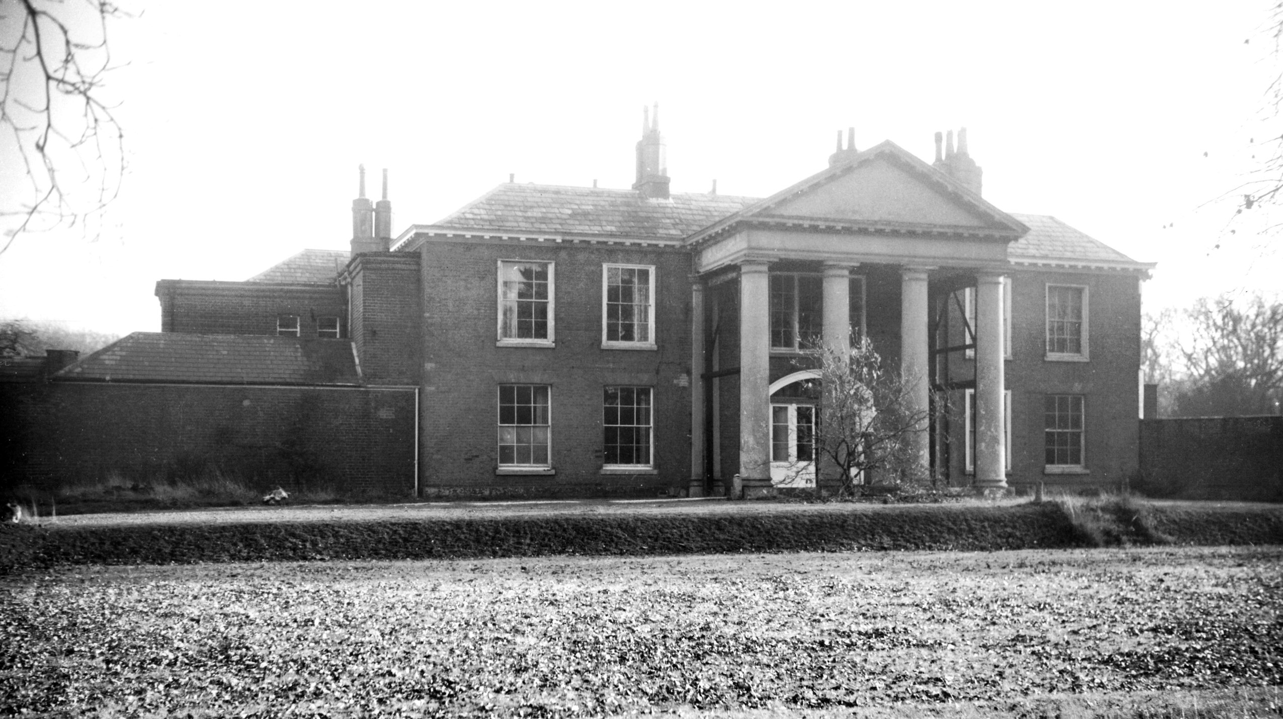
Old Grove Court Catton Grove House from NE [6418]
1986-08-06
|
|
Opie St: |
| |
From
Castle
Meadow to London St
West side |
|
|
Opie St Amelia Opie statue [7694] 1999-10-13
Amelia Opie in Quaker garb. Carved in wood by Z.Leon and
then cast in artificial stone. |
|
Orford Hill: |
| |
From
Orford St / Timberhill to Red Lion St / White Lion St
passing Red Lion St |
|
|
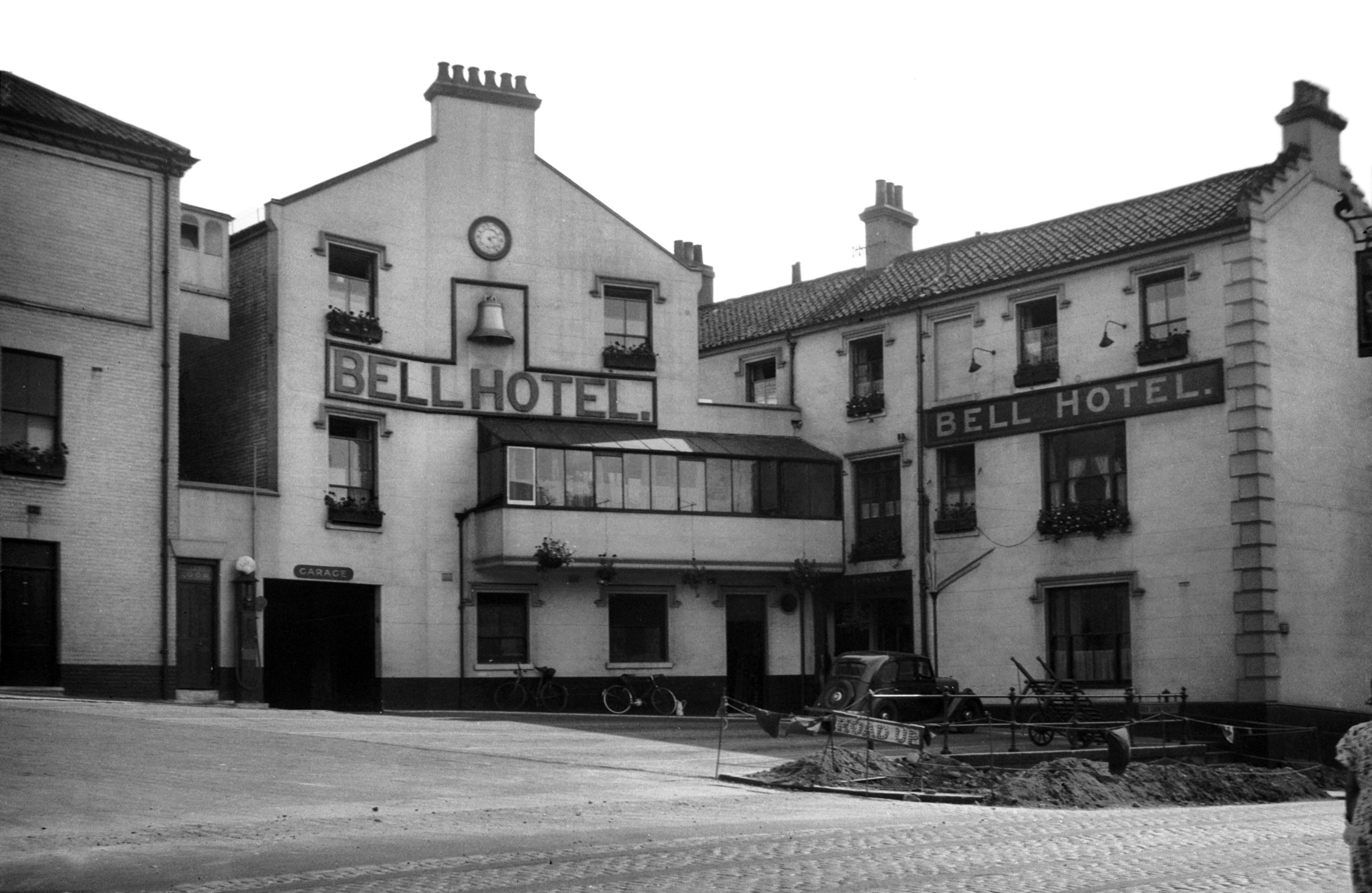
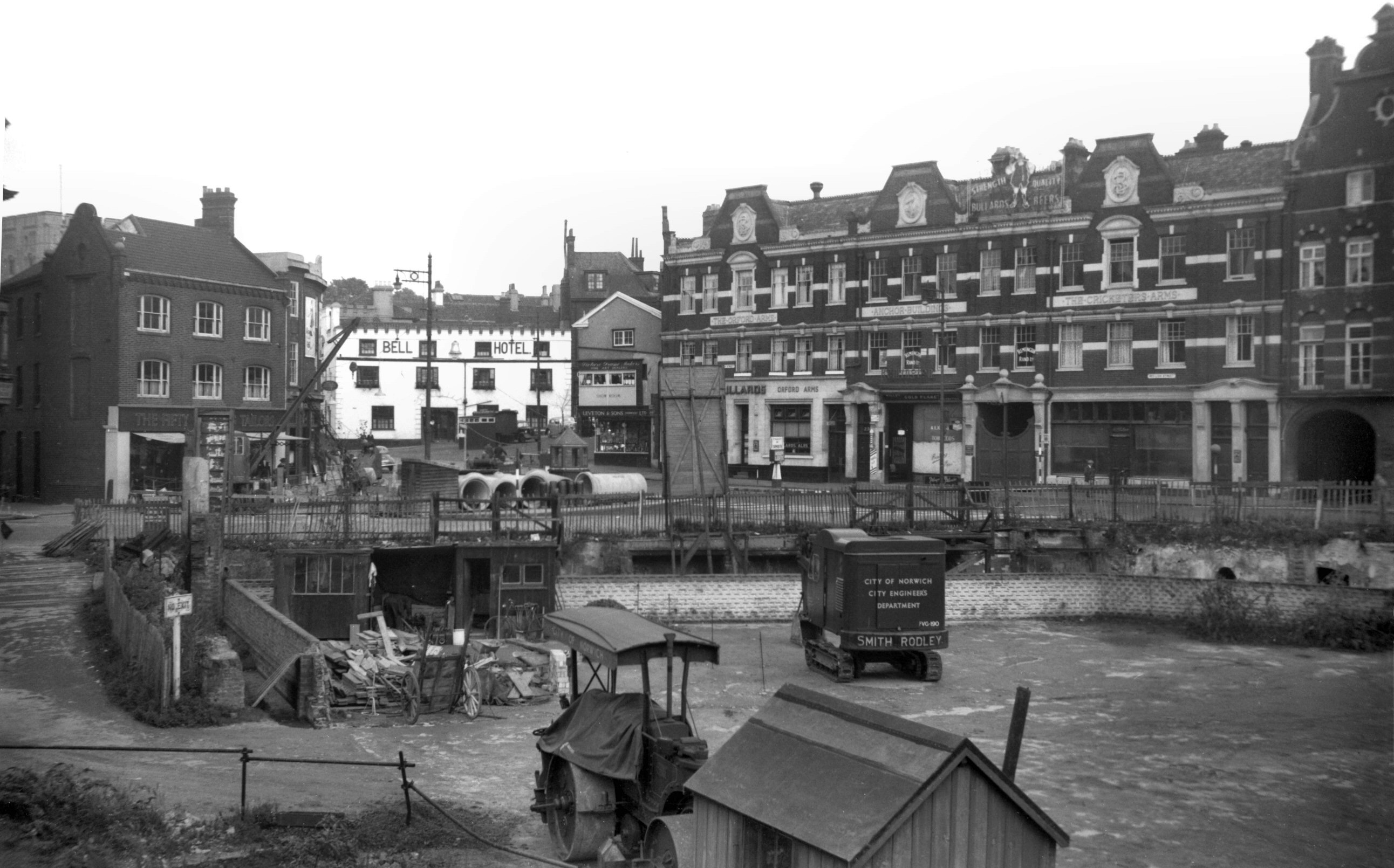
Orford Hill 3 to 4 Bell Hotel NE side [1310]
1936-08-23
|
|
|
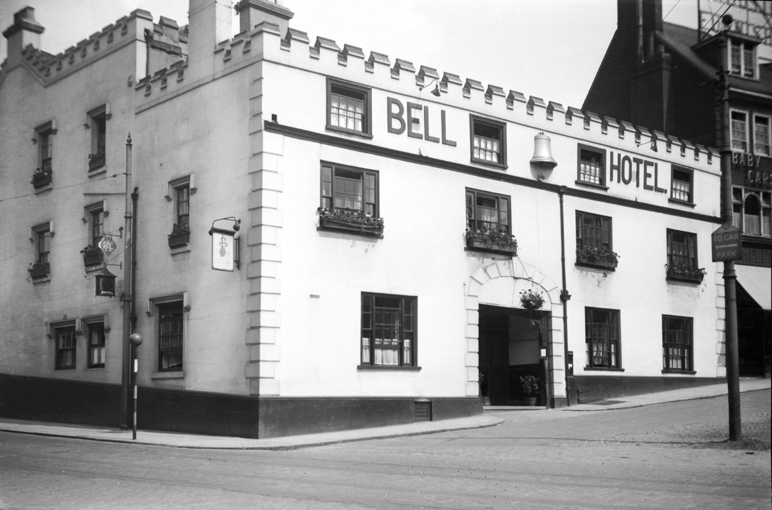
Orford Hill 3 to 4 Bell Hotel SW side [1259]
1936-08-13
|
|
|
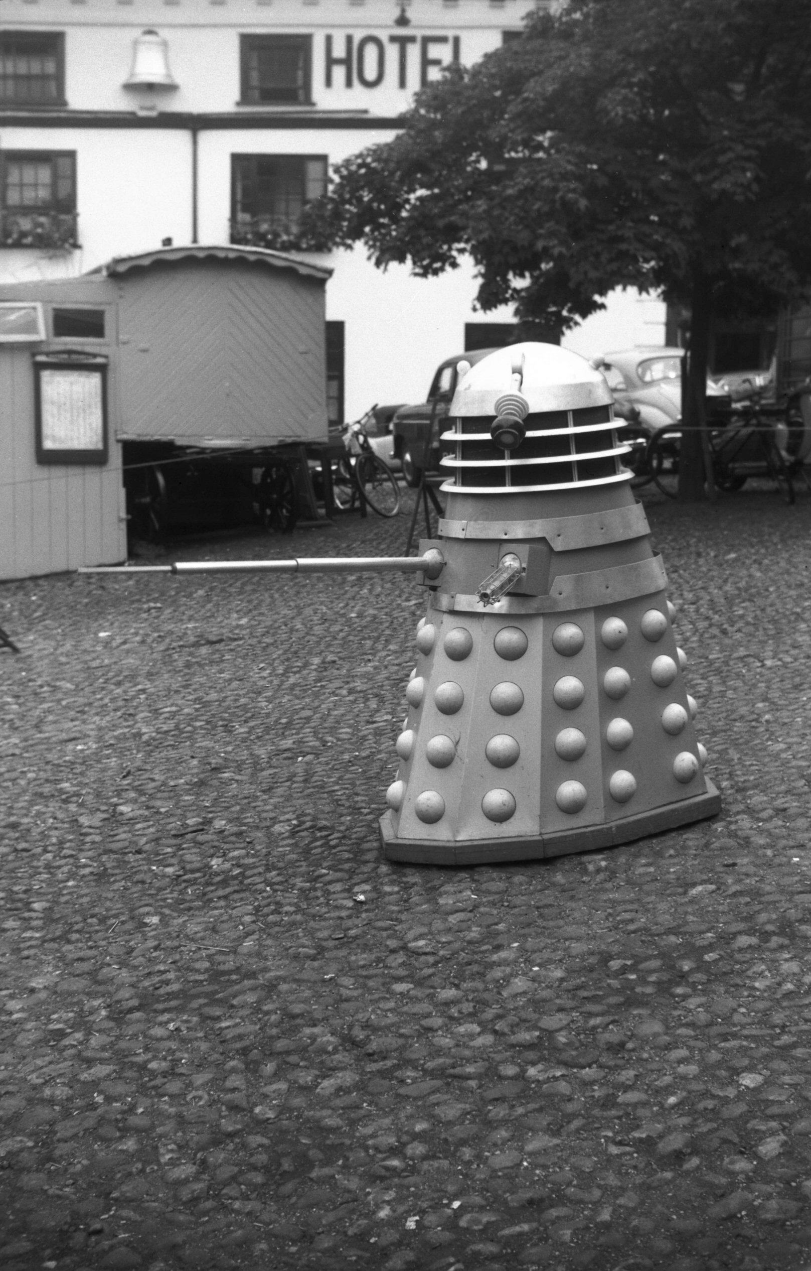
Orford Hill with Dalek from TV's Dr Who [4780]
1964-07-18
|
|
|
Orford Hill 6 [6279] 1983-07-29
|
|
|
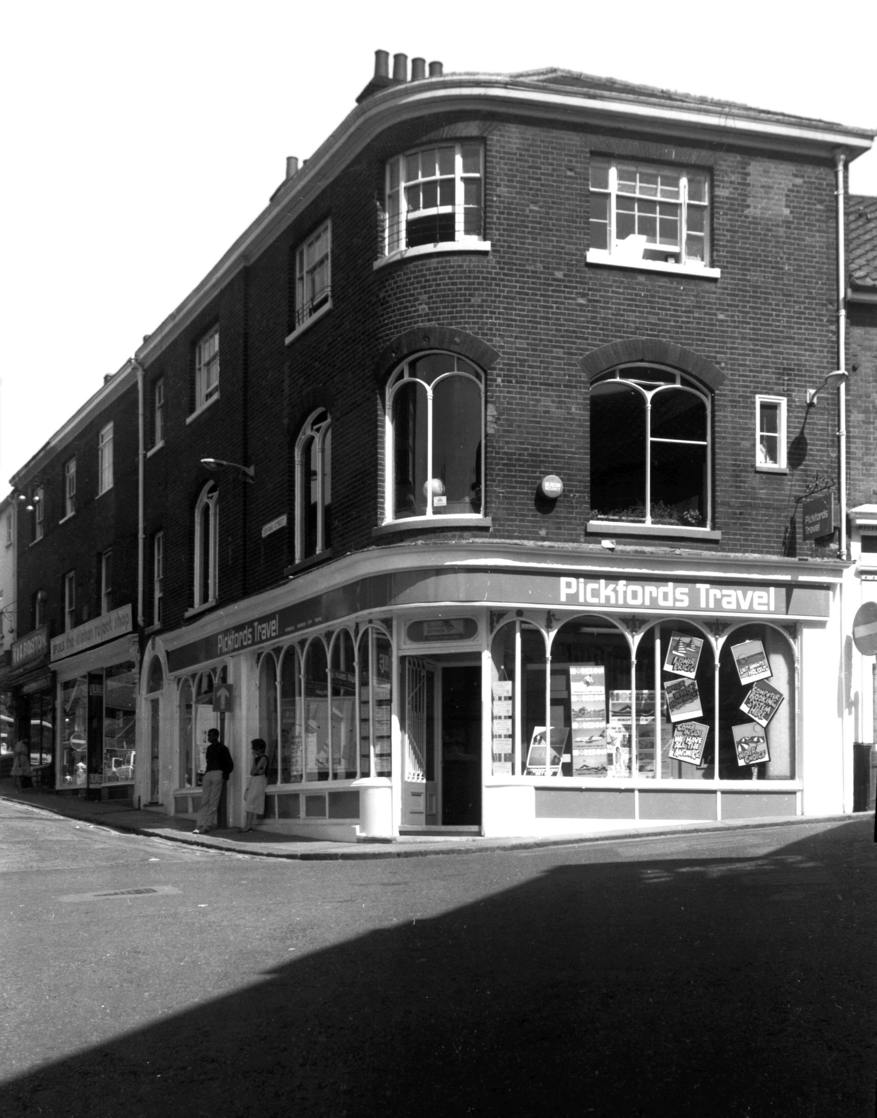
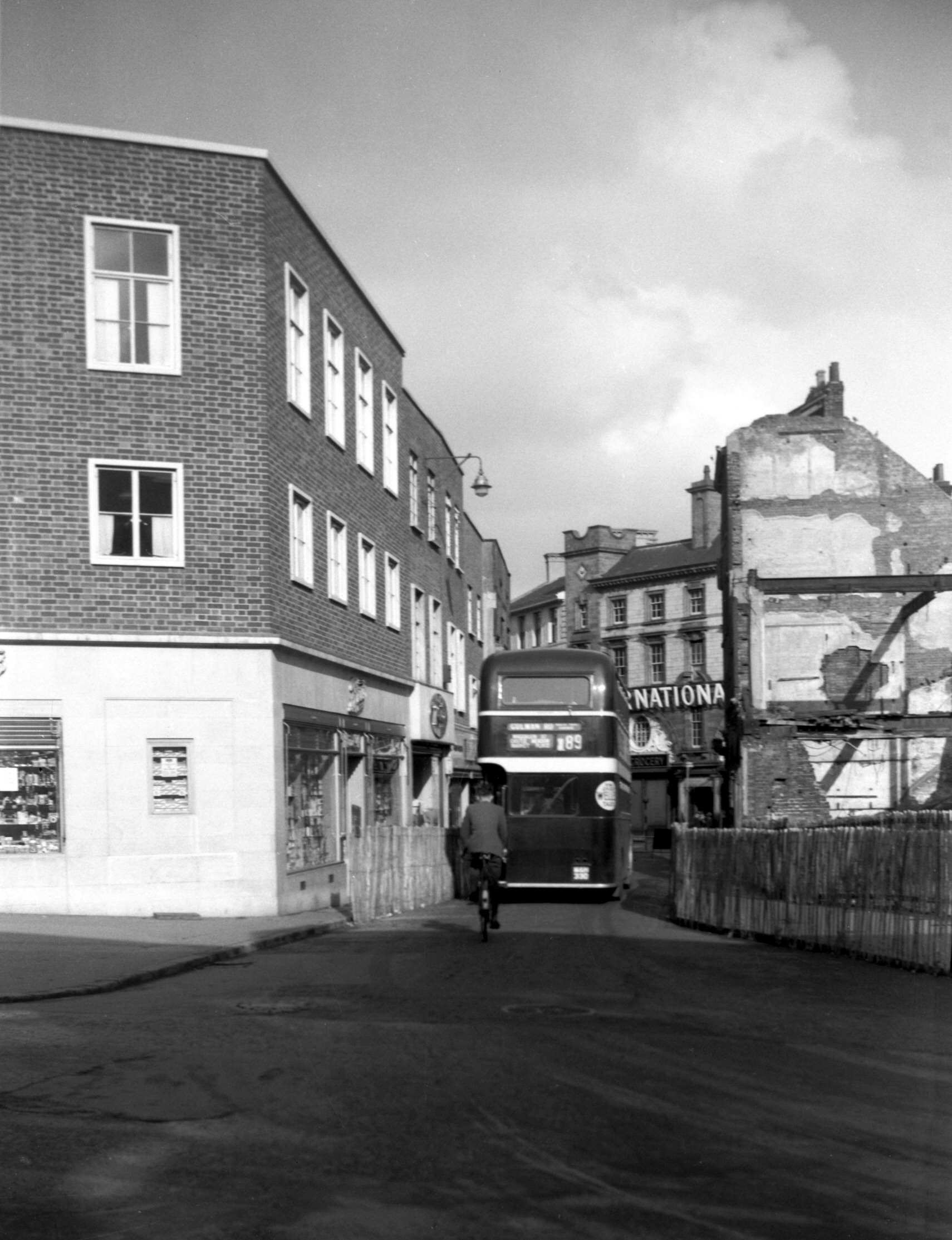
Orford Hill 7 to 10 [5428] 1975-06-13
See also 1 to 3 Timberhill. |
|
|
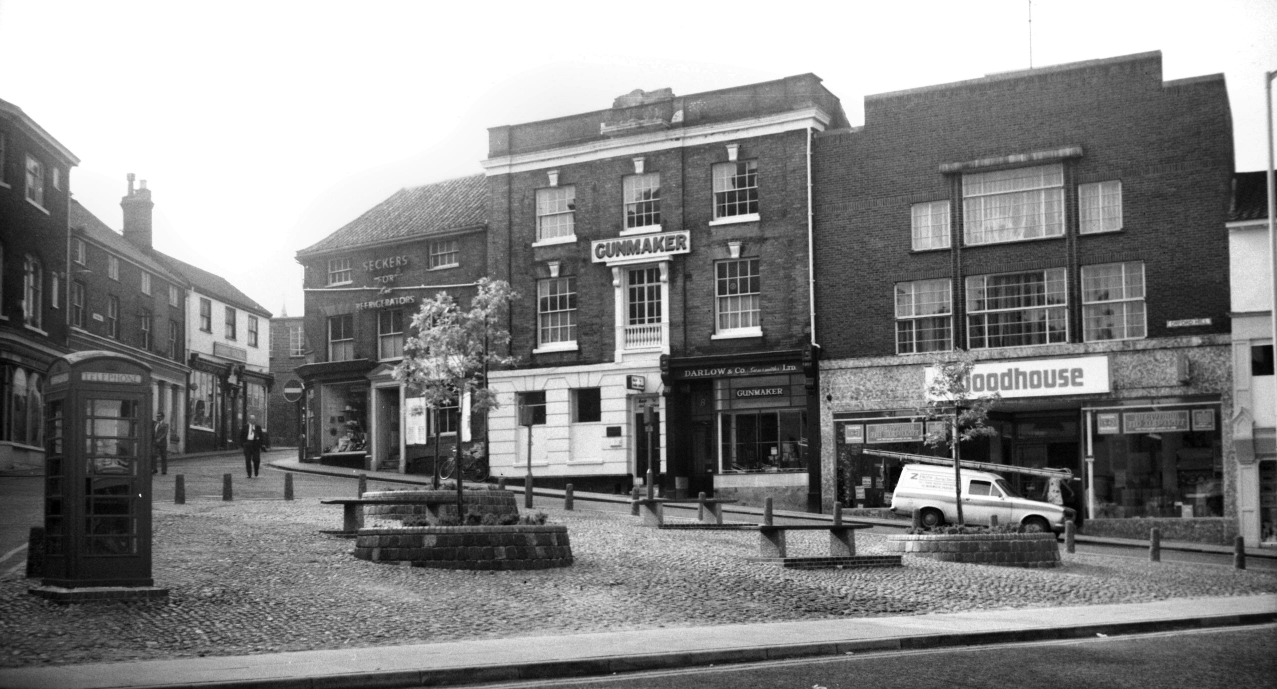
Orford Hill 8 [2707] 1938-08-13
|
|
|
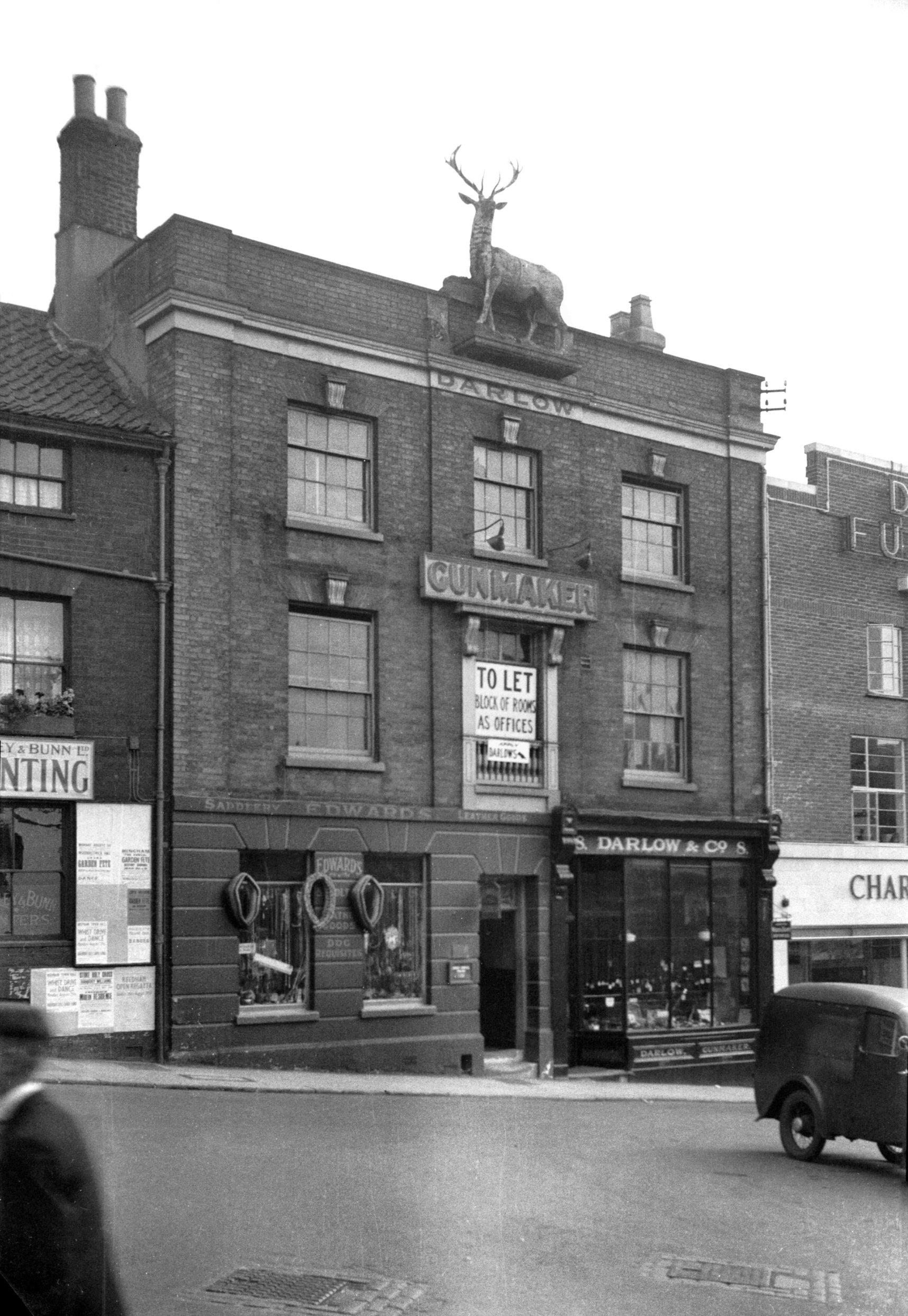
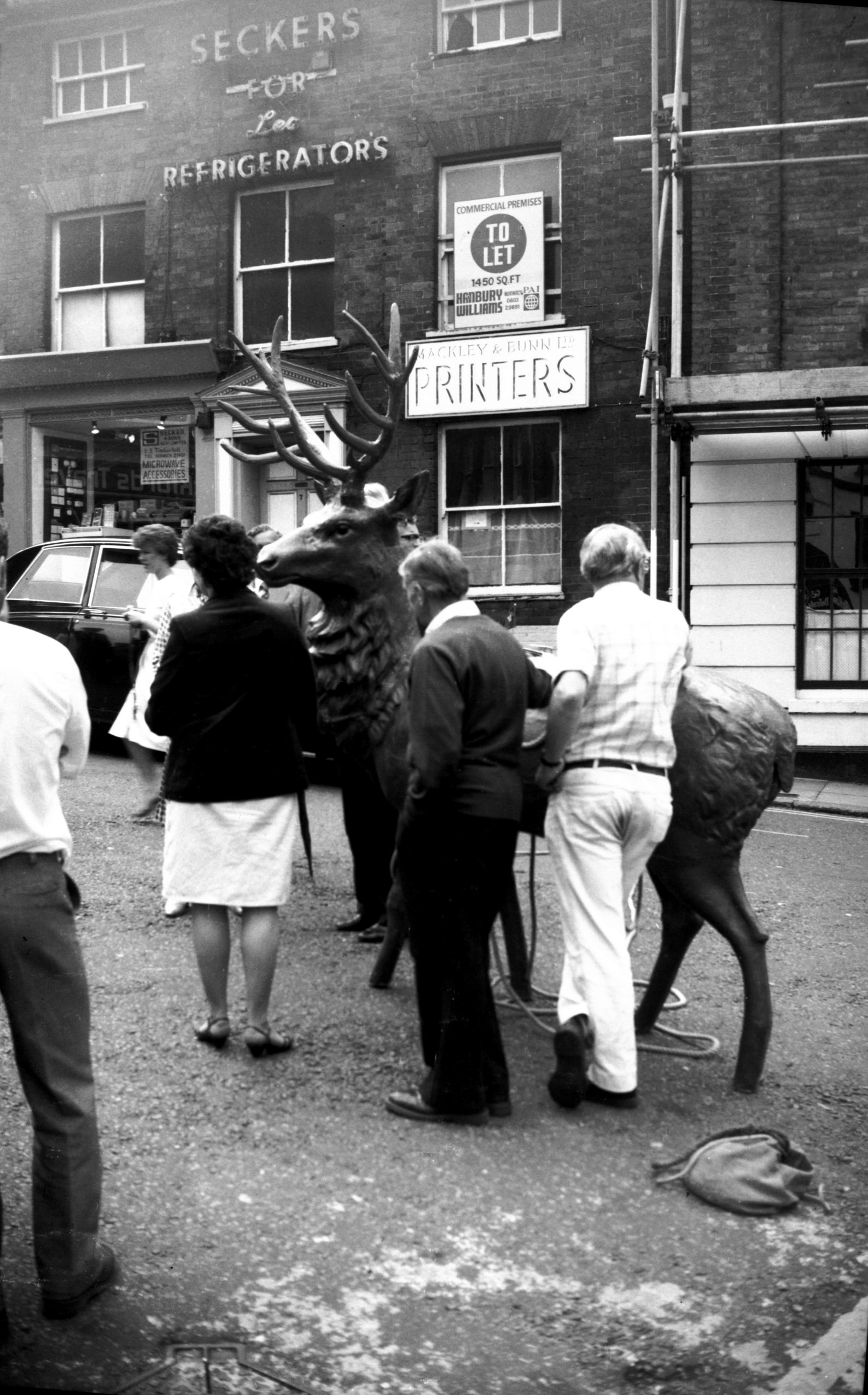
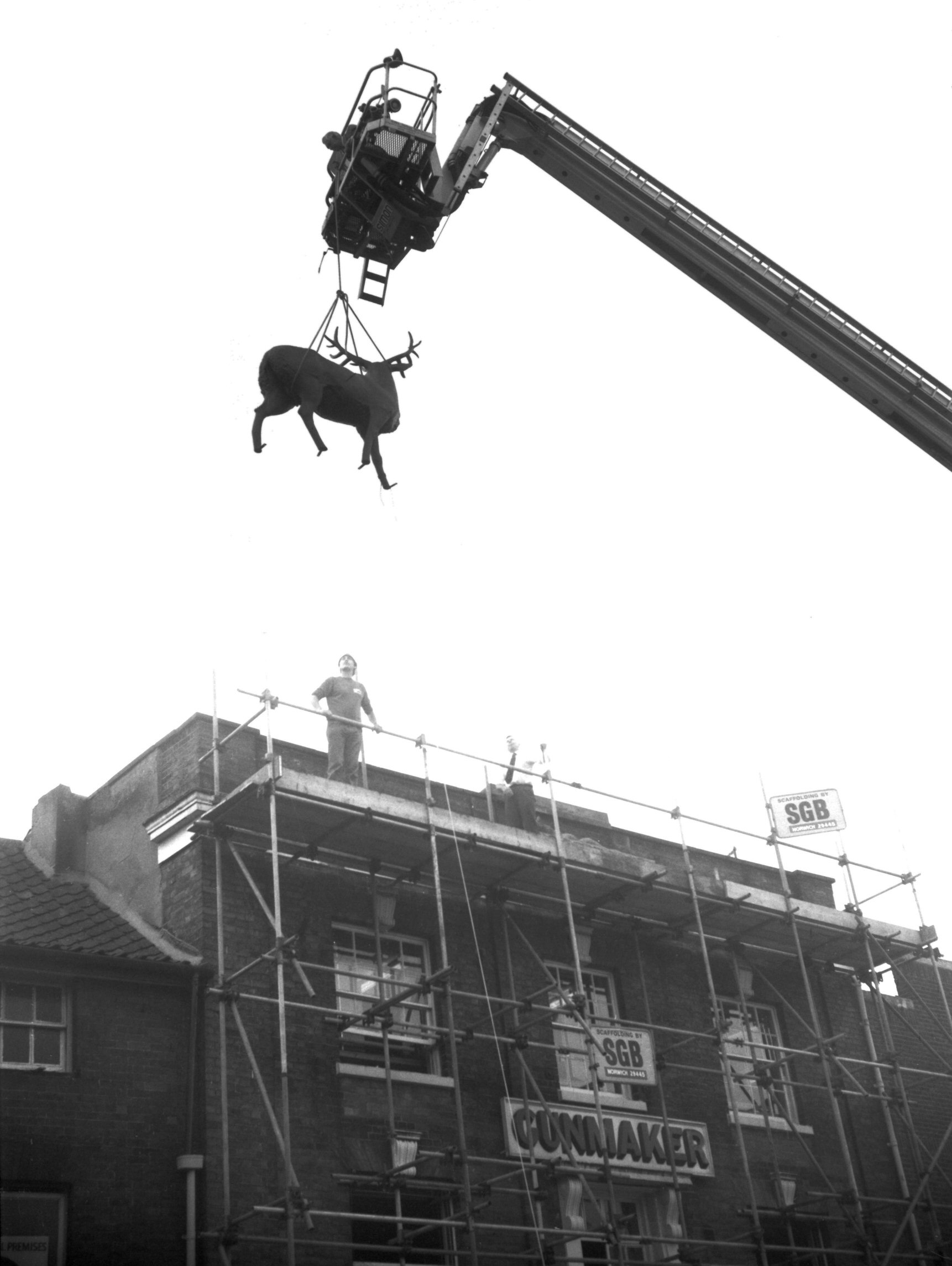
Orford Hill 8 replica stag installation [6301]
1984-06-21
For over a century a concrete stag surmounted Darlow's
gun shop at 8 Orford Hill, but after a fire in January
1973 it had to be removed. On 19th June 1984 a glass
fibre replica was hoisted into place with the aid of a
fire services snorkel. Immediately beforehand appropriate
speeches were made by the Lord Mayor (Mr Stan Peterson)
and the head mistress of Blyth-Jex school (Mrs V.Glauert)
where the new model had been constructed. |
|
|
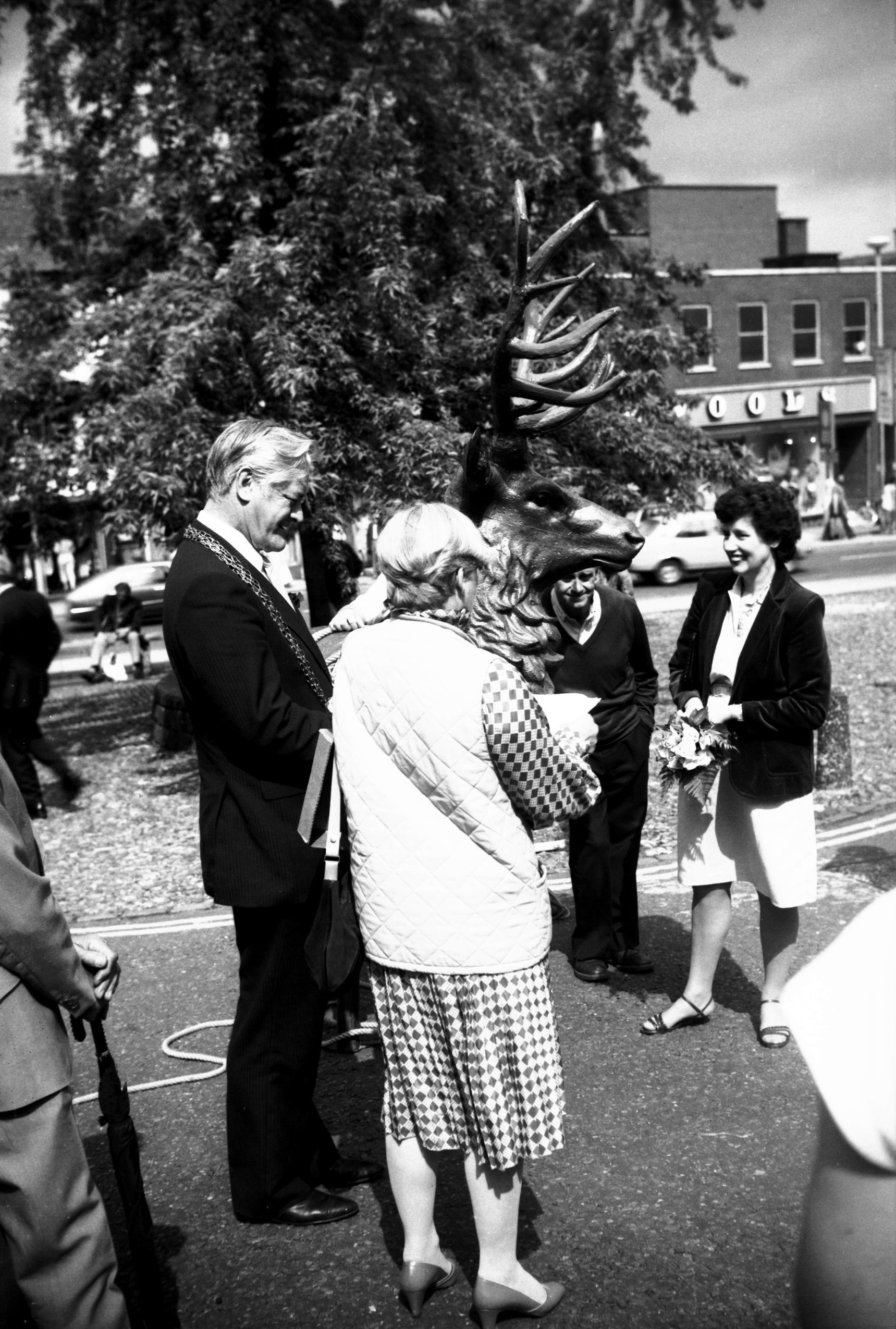
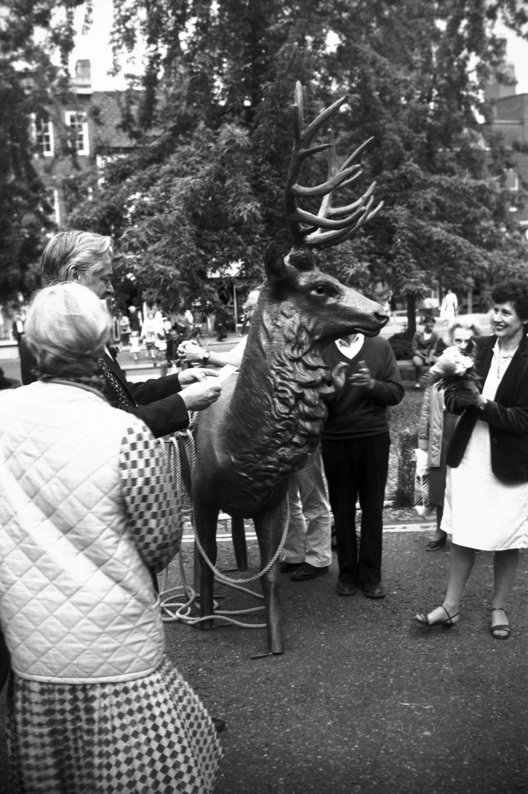
Orford Hill 8 replica stag with Lord Mayor [6302]
1984-06-21
|
|
|
Orford Hill 8 replica stag with Mrs Glauert [6303]
1984-06-21
Back to camera, |
|
|
Orford Hill 8 replica stag being hoisted [6304]
1984-06-21
|
|
|
Orford Hill 11 [5200] 1968-05-30
|
|
|
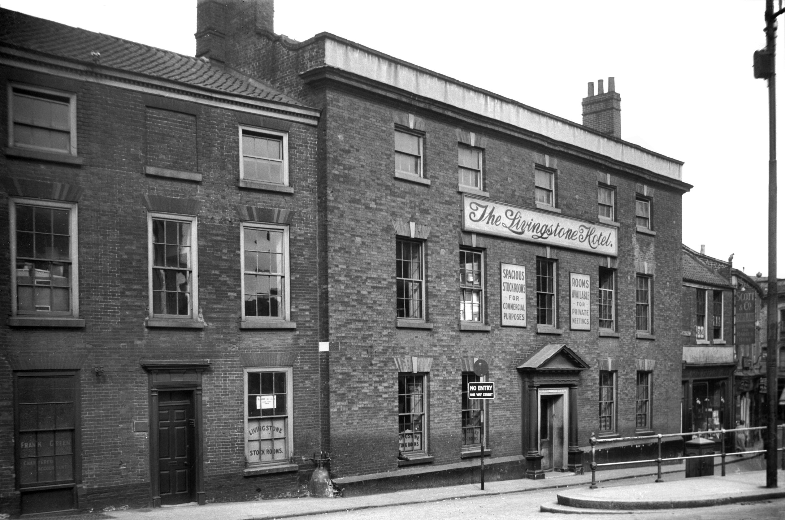
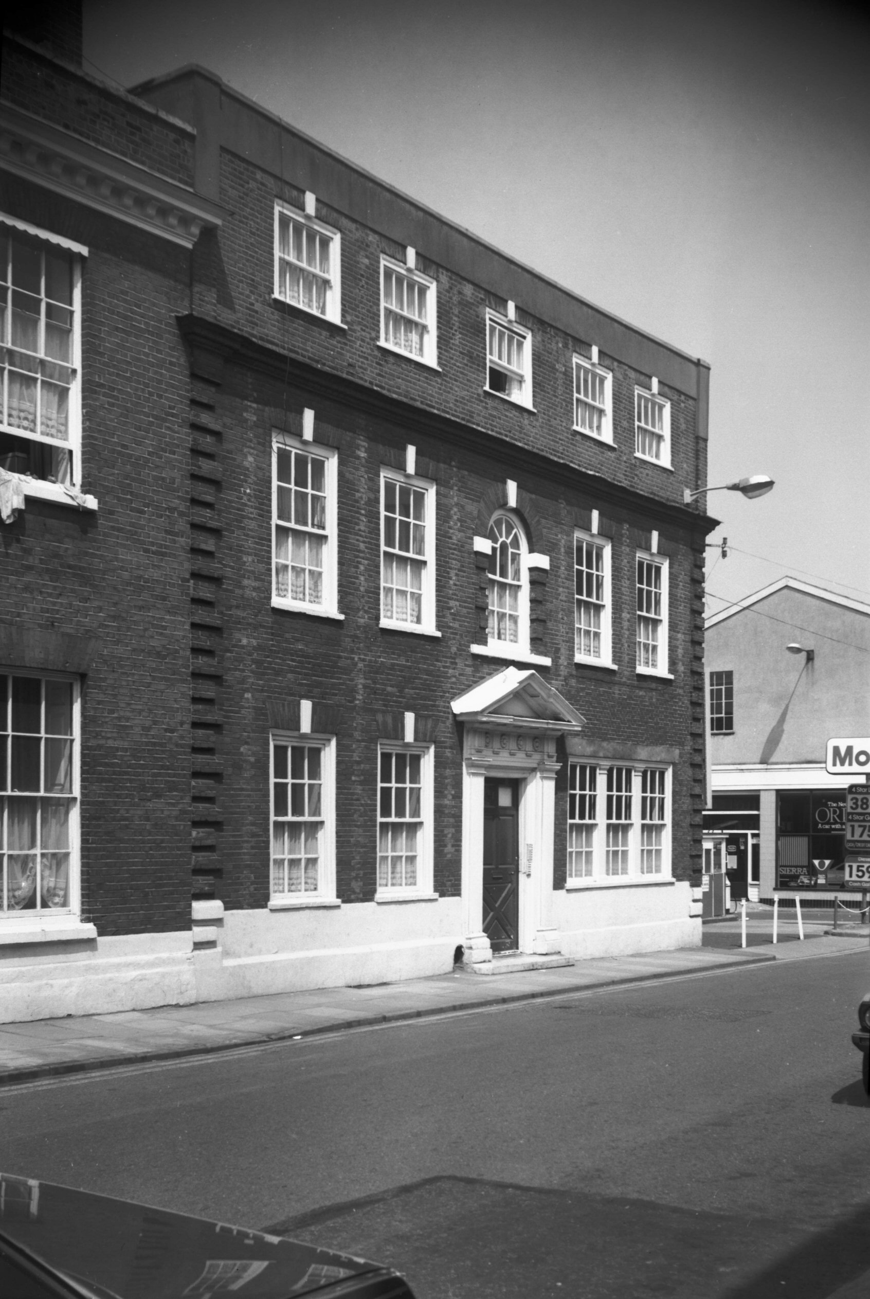
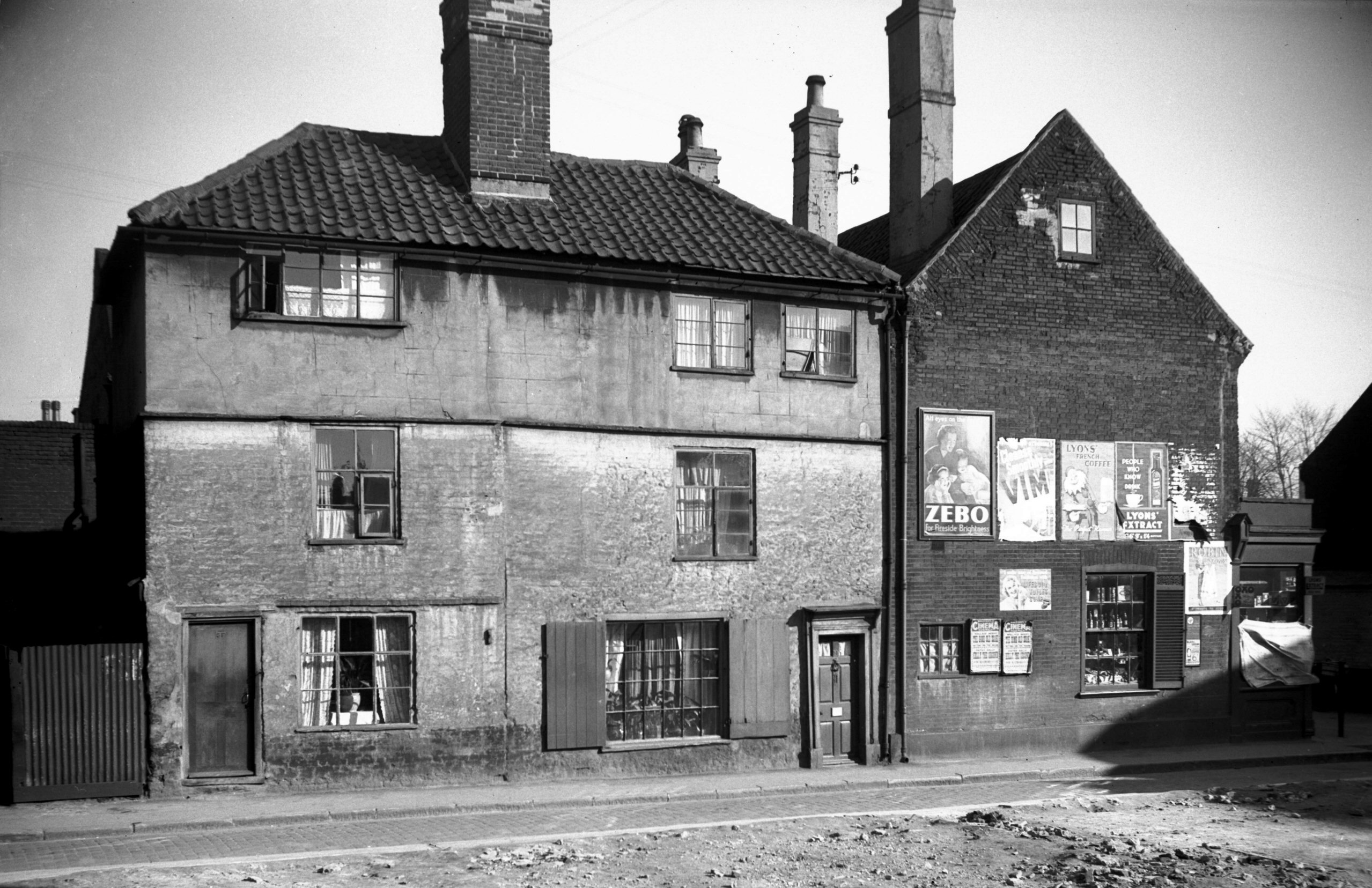
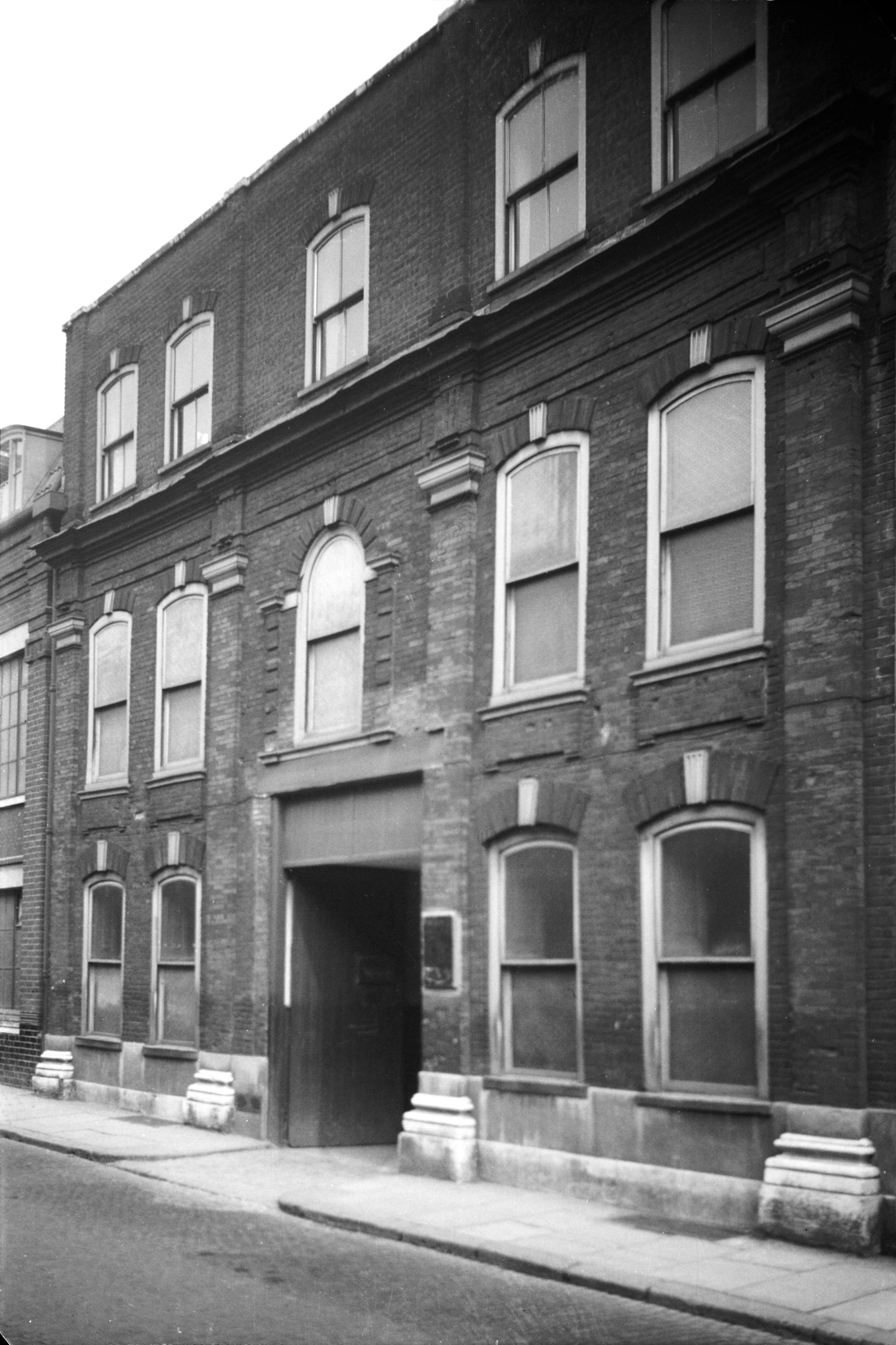
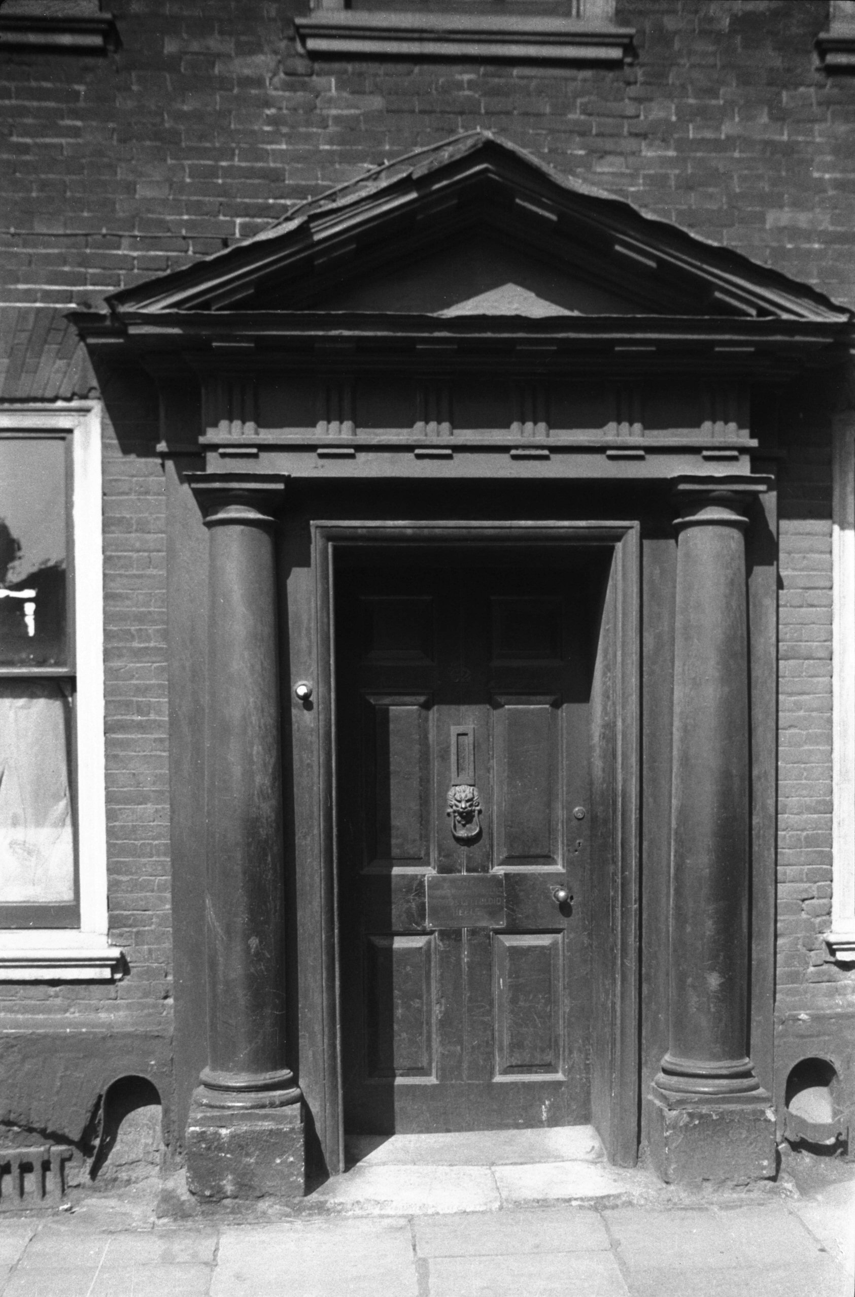
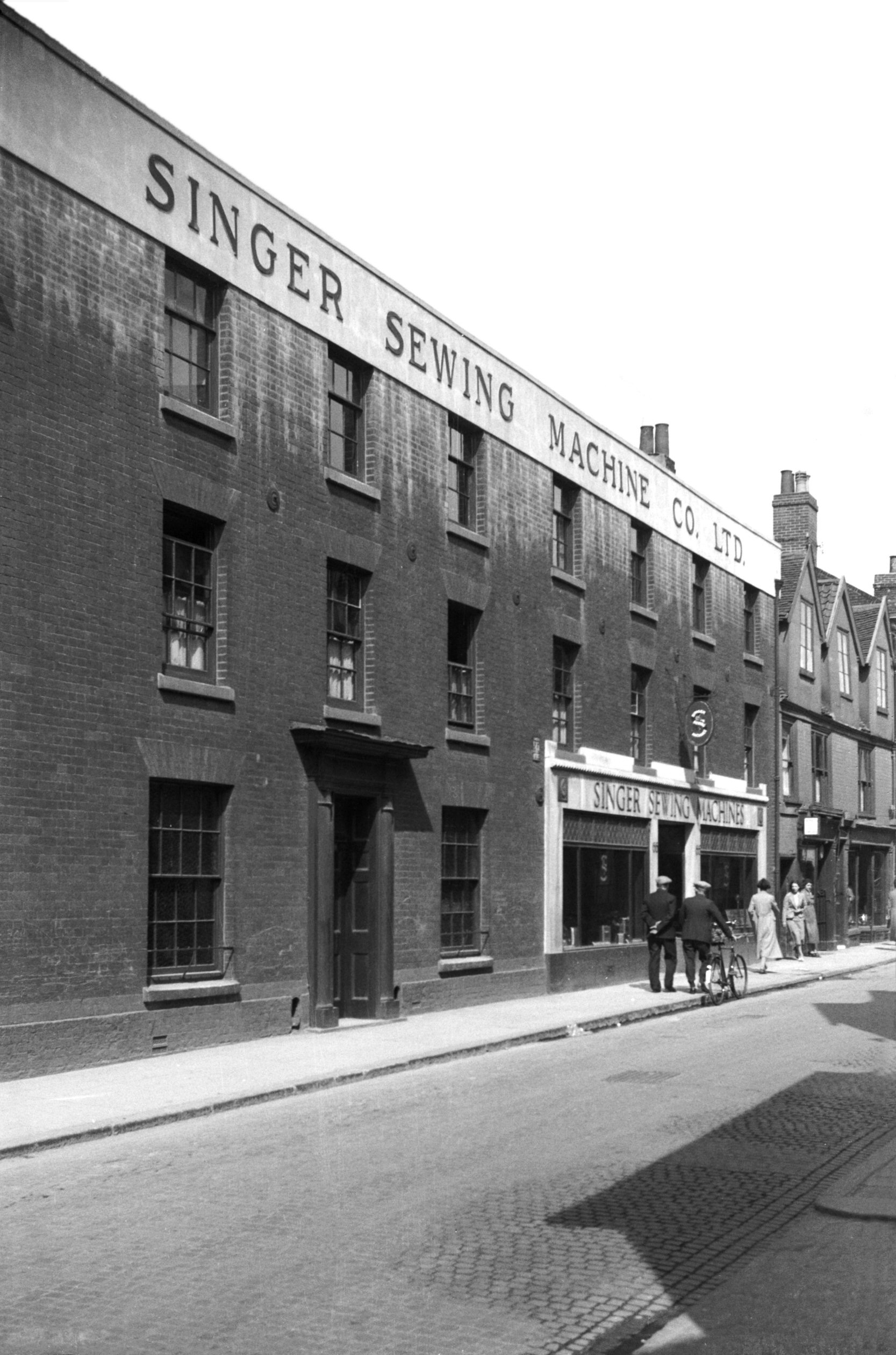
Orford Hill 16 Livingstone Hotel [1361] 1936-08-30
Red Lion St, which links St Stephen's with Castle Meadow,
passes Orford Place to Orford Hill. Here at No 16, now
occupied by a branch of Marks and Spencers, stood the
Livingstone hotel. Starting life about 1720 as a Georgian
mansion and once occupied by the Crosse family of medical
practitioners, it became during the 19c a temperance and
commercial hotel, although after about 1921 it was
largely used as stockrooms.
This and adjoining property, cleared away in 1961 for
Littlewood's new store, occupied an historical site.
George Green's tailor's and outfitter's shop, for
instance, built facing the Haymarket in 1893, replaced
the Star, known to have been a coaching inn as far back
as 1684. Walter Wicks in his book on the inns and taverns
of Norwich gave details of some of its more colourful
characters, one of whom, James Farmer, was licensed in
1677 to "make show" of an elephant there. To go
back even further, it is believed to include part of the
site of the city's old Jewry; although the Jews were
expelled at the end of the 13c, the last remnants of
their quarters here were said to have been swept away
only when Green's shop was built.
Perhaps better known is the fact that hereabouts stood
the residence of Sir Thomas Brown, MD, whose statue
graces the adjacent open square of the Haymarket. Here he
lived from 1650 until his death in 1682; a 19c building,
3 and 5 Orford Place, demolished early in 1956 to make
way for a new shoe shop, had an inscribed stone above a
first-floor window to commemorate this. Ralph Mottram has
related how it was probably this stone that led to the
1929 edition of Kelly's Street Directory recording
"Browne, Thomas, M.D.", as if he were still
residing there.
Although Sir Thomas's house had long since disappeared,
what is believed to have been his "garden
house" stood almost completely hidden from view
between the Livingstone and Green's shop. This was a
timber-framed building dating from about 1600, only the
peak of its tall attic gable visible above the roof of
the adjacent Lamb inn. A plaster ceiling enriched with a
geometrical design in high relief was carefully removed
and stored when the property was taken down. |
|
|
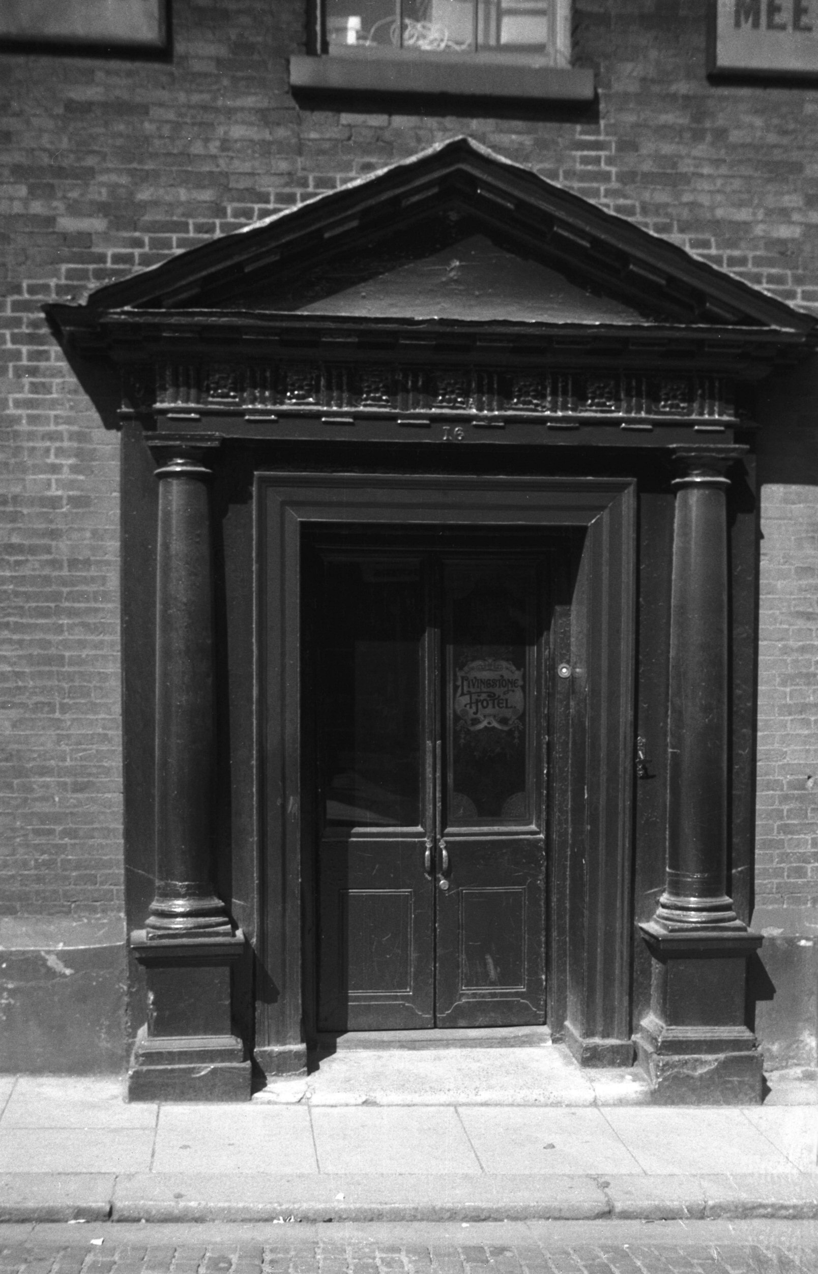
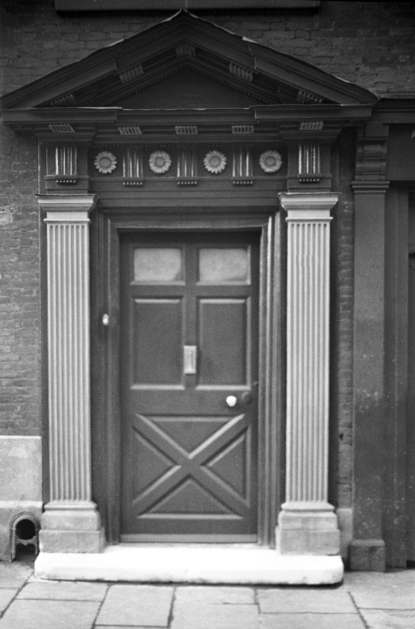
Orford Hill 16 Georgian doorway [3203] 1939-08-07
|
|
Orford Place: |
| |
From
Haymarket to Red Lion St |
|
|
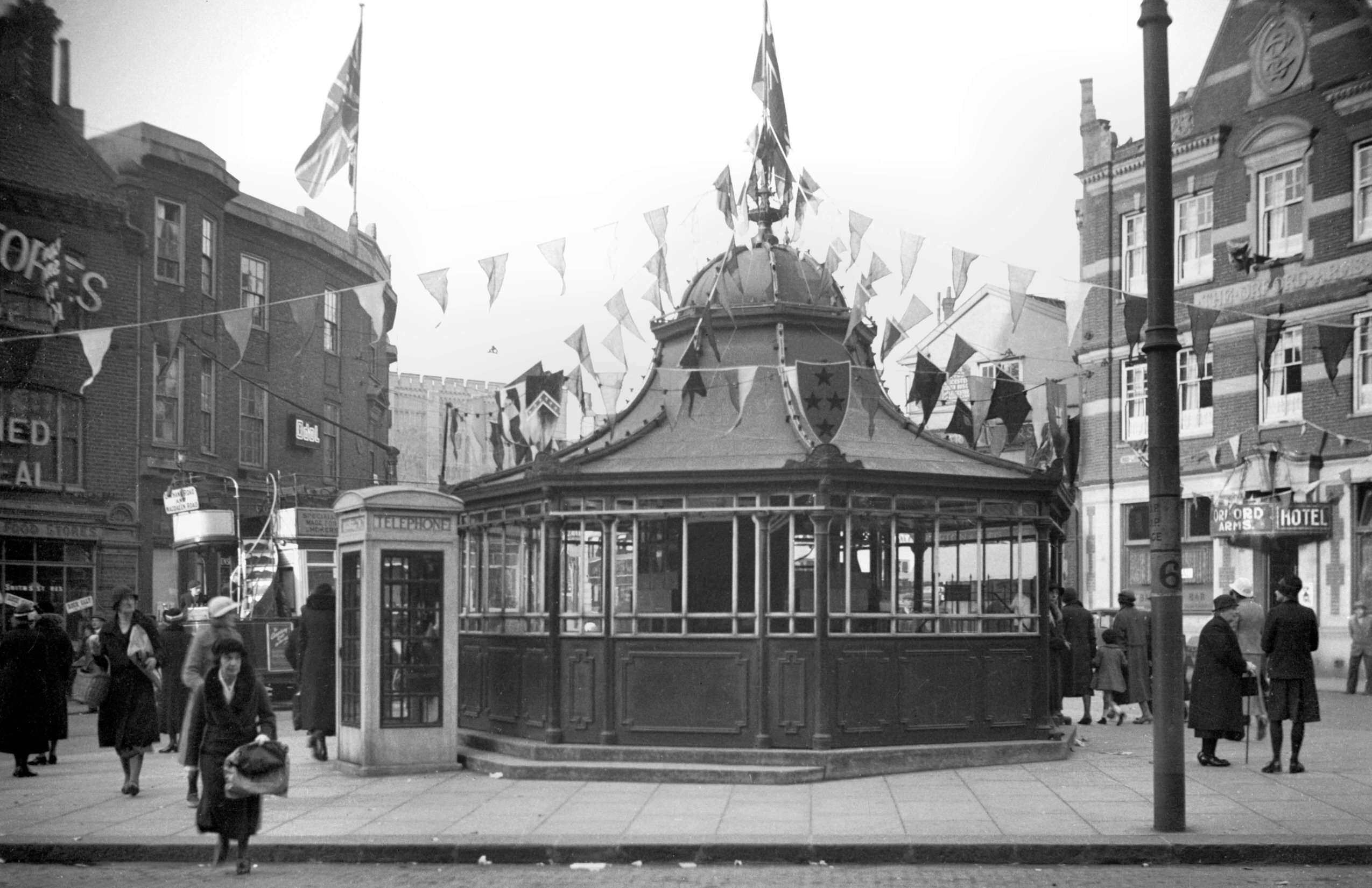
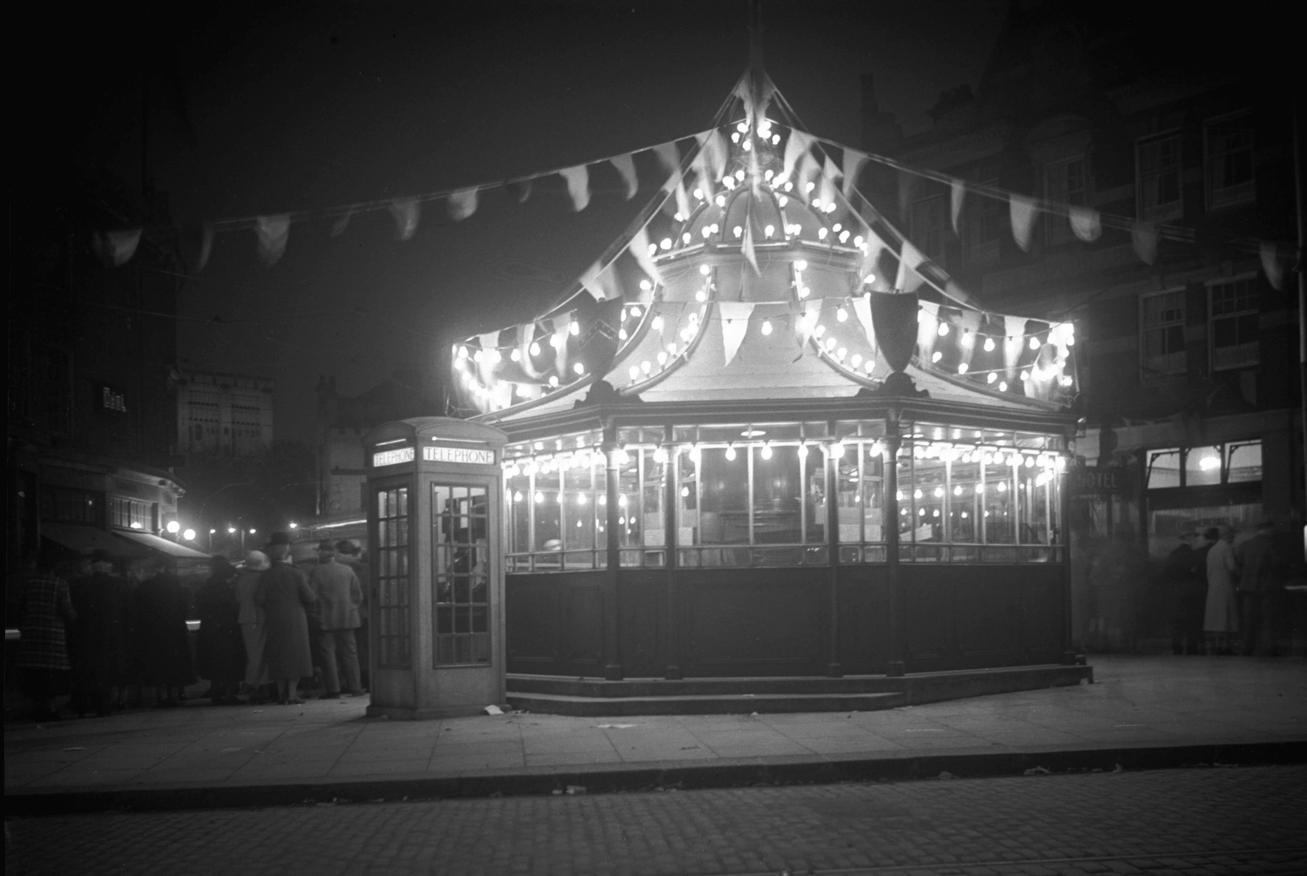
Silver Jubilee Orford Place tramway centre [0509]
1935-05-03
Tramway shelter and timekeeper's office. Erected 1928 by
Walter Macfarlane and Co Glasgow, cost £650. |
|
|
Orford Place shelter Jubilee floodlit [0536]
1935-05-06
|
|
|
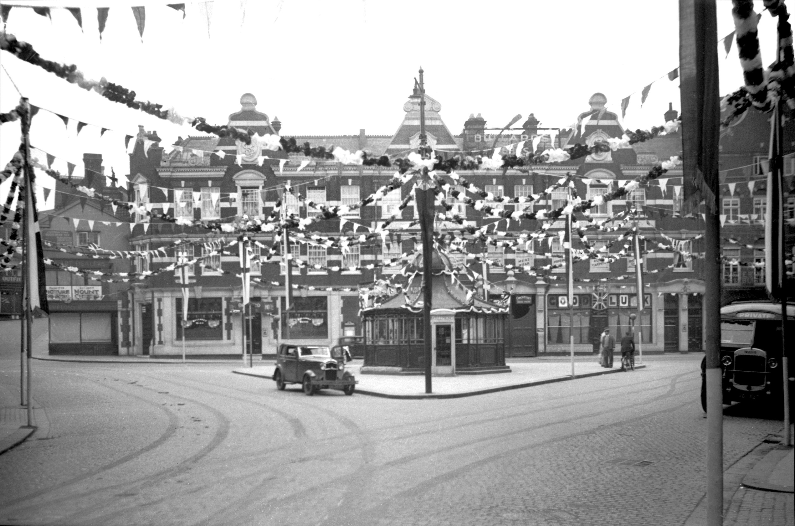
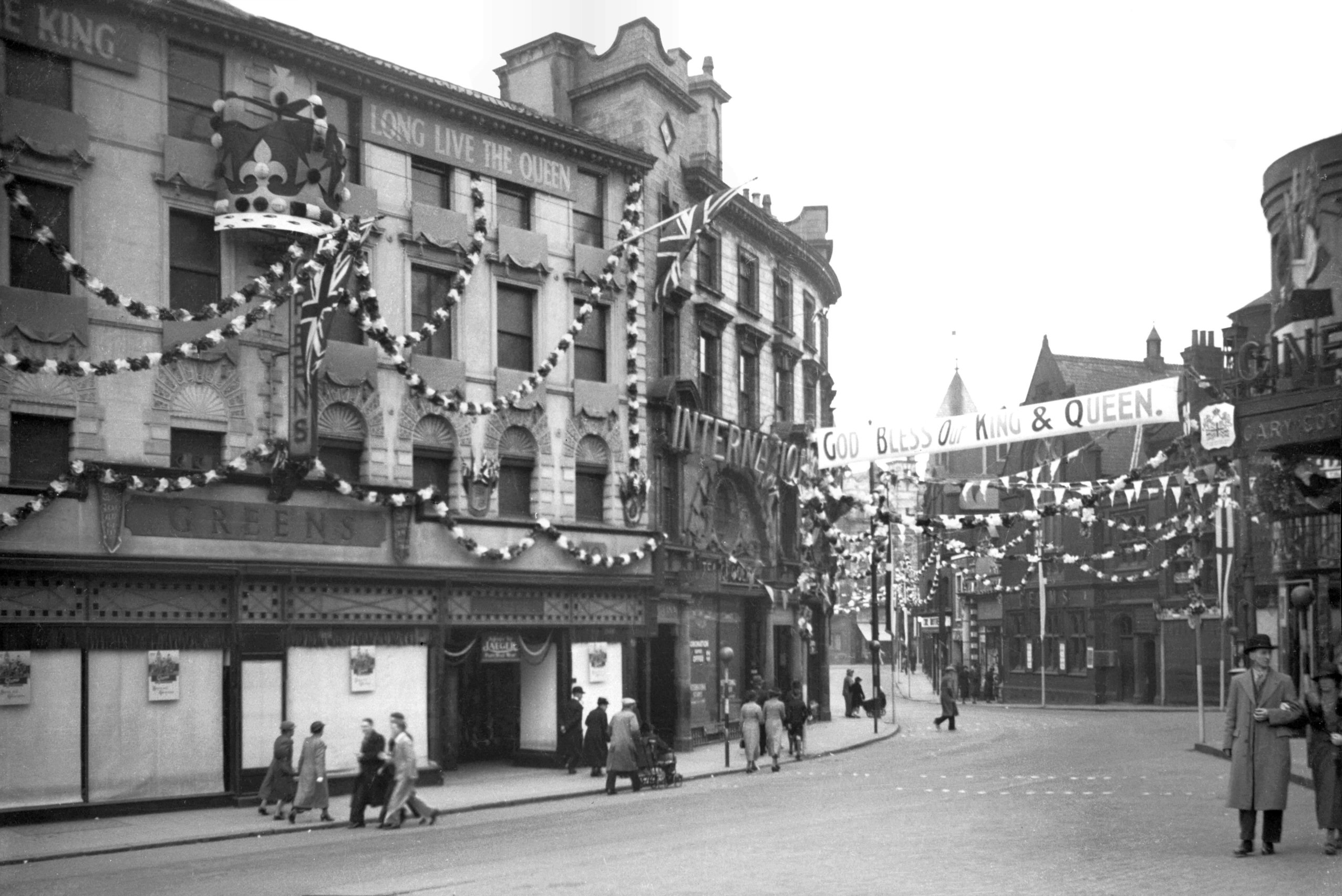
Coronation Orford Place [1560] 1937-05-09
Orford Place, second prize street decoration. 1937
coronation decorations. |
|
|
Coronation Orford Place Green's [1570] 1937-05-09
1937 coronation decorations. |
|
|
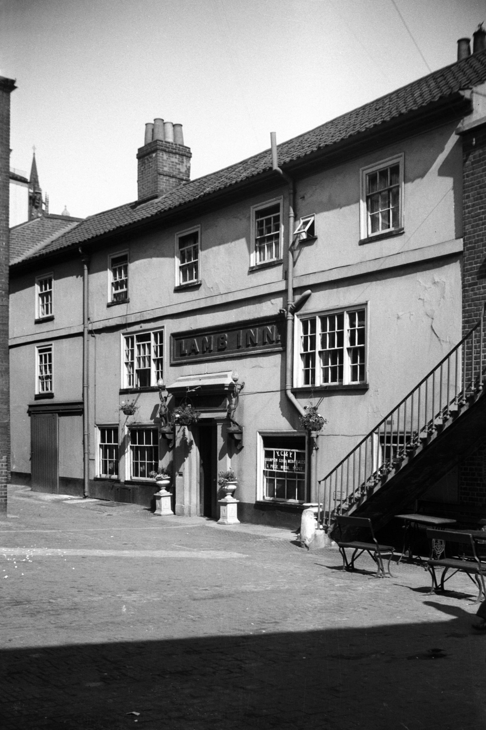
Orford Place Lamb Inn Yard Lamb Inn [3204] 1939-08-07
|
|
|
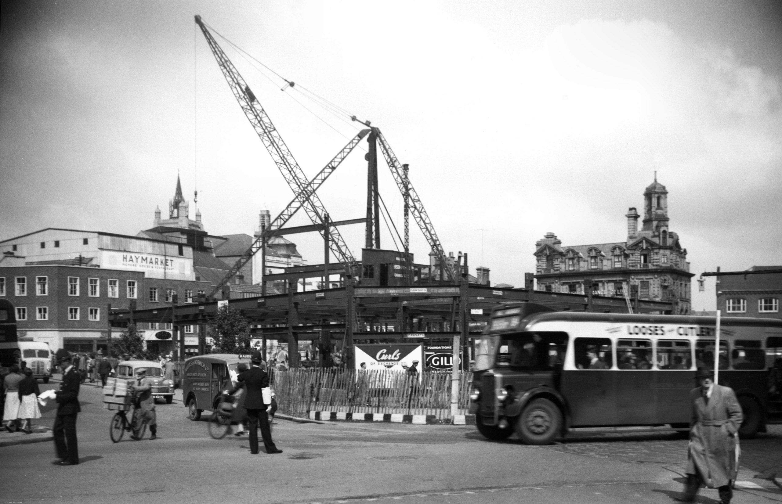
Orford Place Curls building site [3624] 1946-04-19
|
|
|
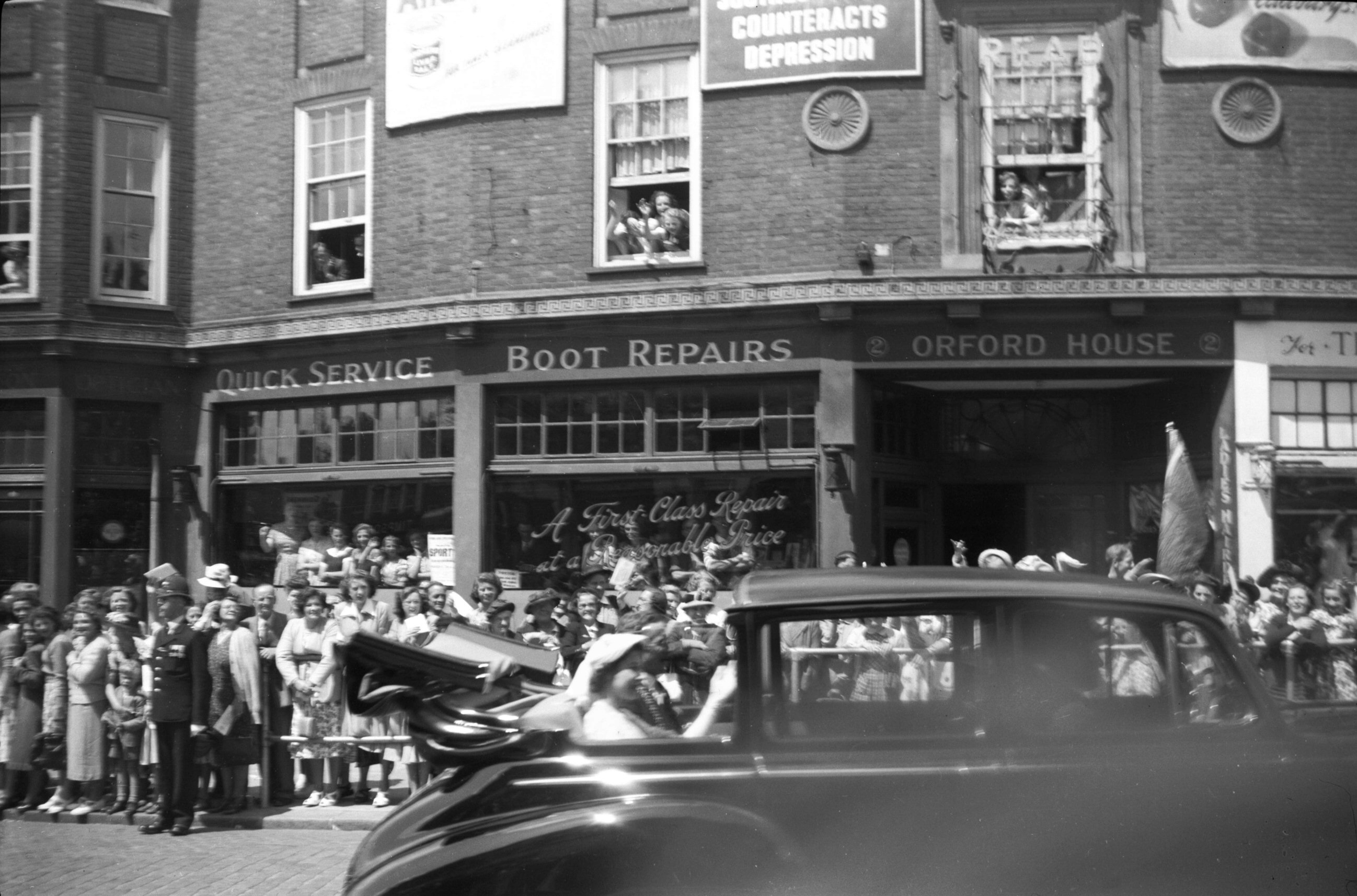
Festival Princess Elizabeth in Orford Place [3994]
1951-06-18
Norwich Festival 18th-30th June 1951:
The Festival was opened by Princess Elizabeth who spoke
from the balcony of the City Hall. She then proceeded to
the Castle Museum to open the Colman Galleries, built
through a bequest by the late Russell Colman to house his
collection of pictures of the Norwich School which he had
also left to the City.
Princess Elizabeth en route from City Hall to the Castle
and then to the Assembly House for lunch. |
|
|
Orford Place and Brigg St [4104] 1952-09-28
The island site formerly occupied by Curls and other
shops, largely destroyed during air raids in 1942, was
originally earmarked for an open space in the City of
Norwich Plan 1945. It was later considered to be too
valuable for this, but the former street plan was altered
to divert all road traffic via Brigg St - Rampant Horse
St (which was widened); Orford Place being reduced in
width to be used by pedestrians only. |
|
|
Orford Place sewerage system alterations [4235]
1953-10-25
|
|
|
Orford Place view NE from Rampant Horse St [4236]
1953-10-25
|
|
|
Orford Place Brigg St view north [4237] 1953-10-25
|
|
|
Orford Place entrance from Haymarket [4263]
1954-06-23
|
|
|
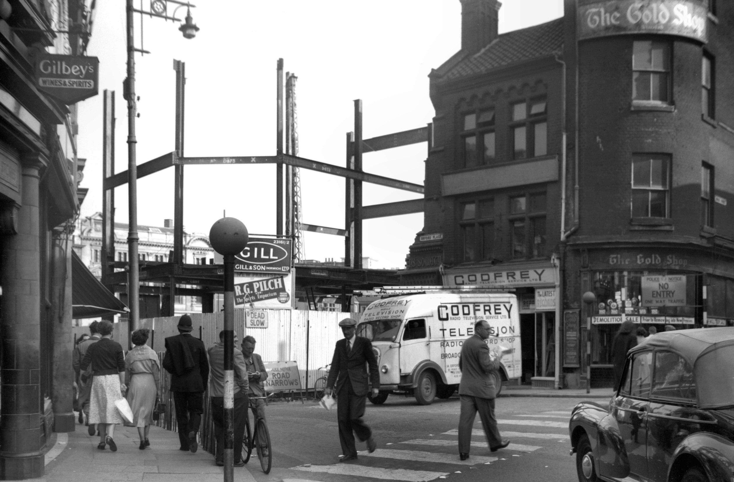
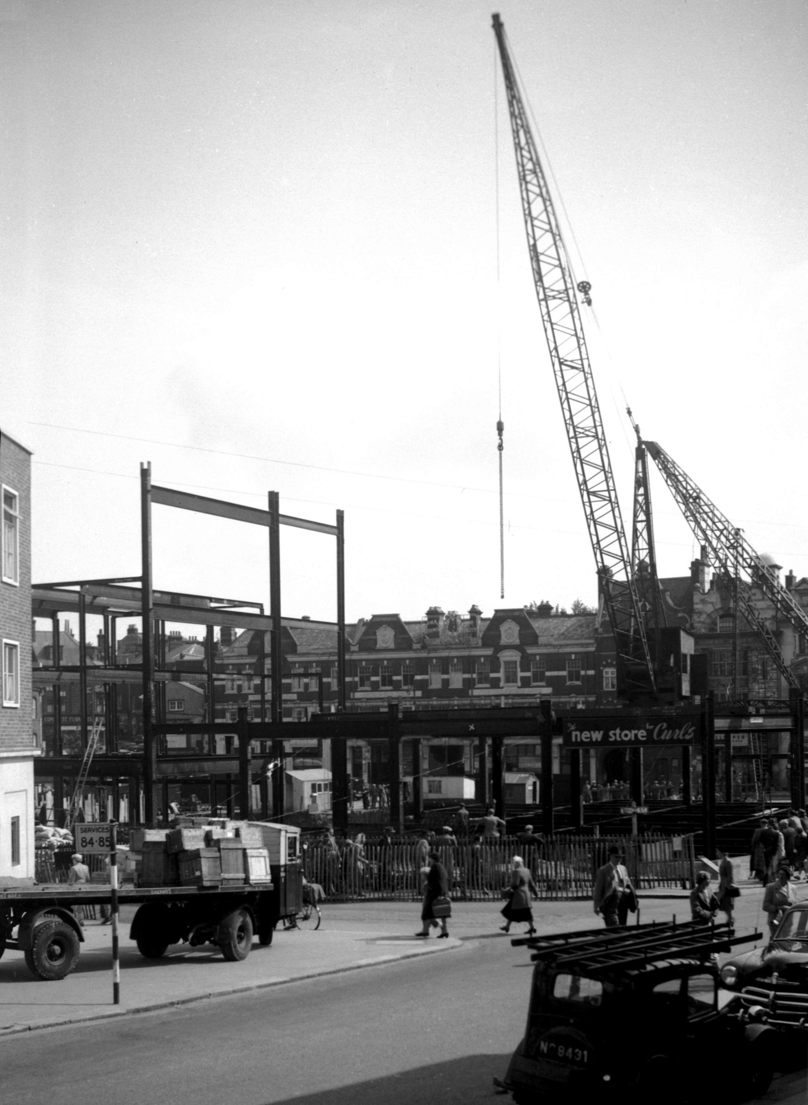
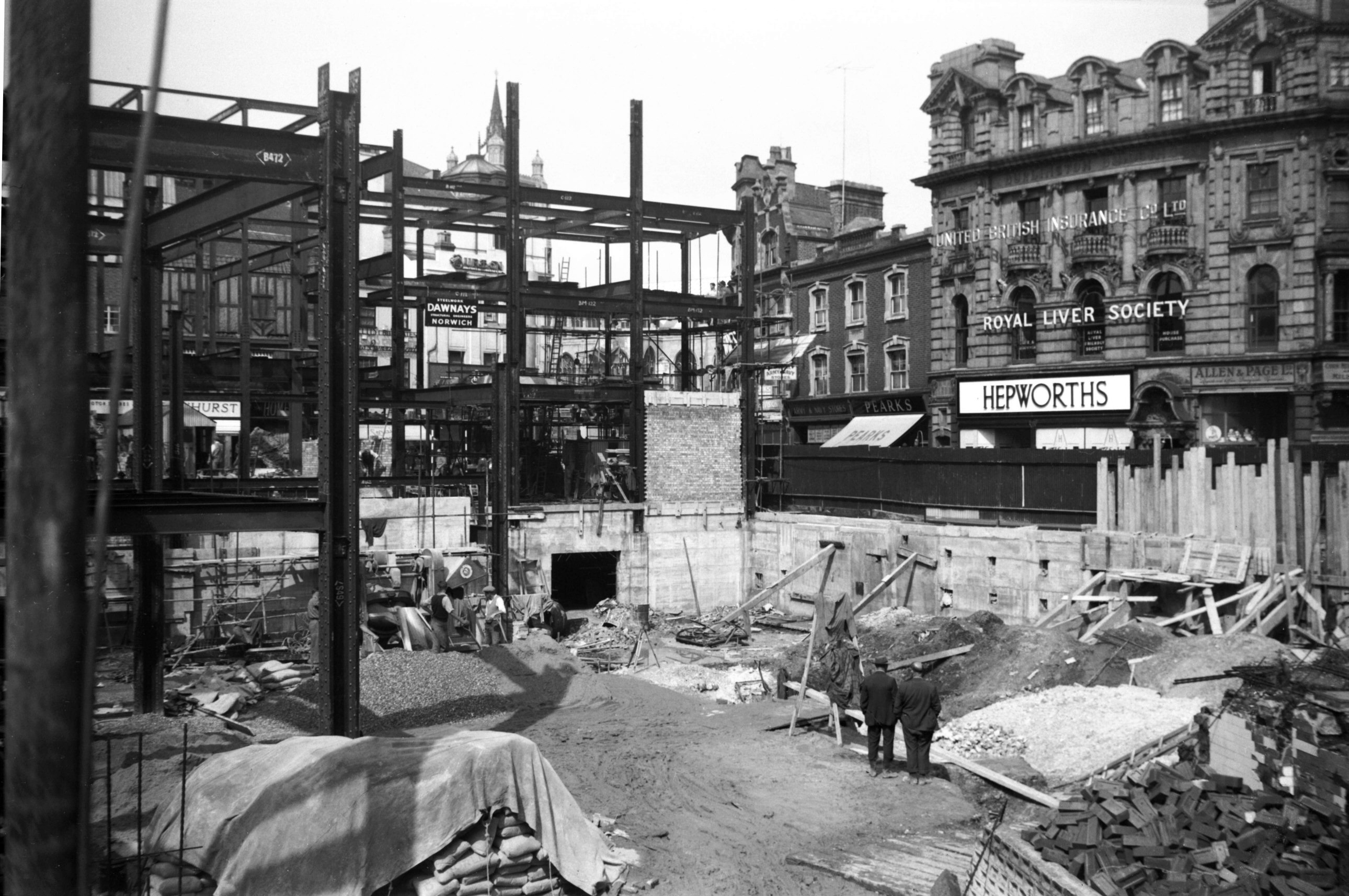
Orford Place Curls girderwork Brigg St [4276]
1954-08-25
Rampant Horse St corner. |
|
|
Orford Place Curls girderwork St Stephen's [4277]
1954-08-25
From St Stephen's Plain. |
|
|
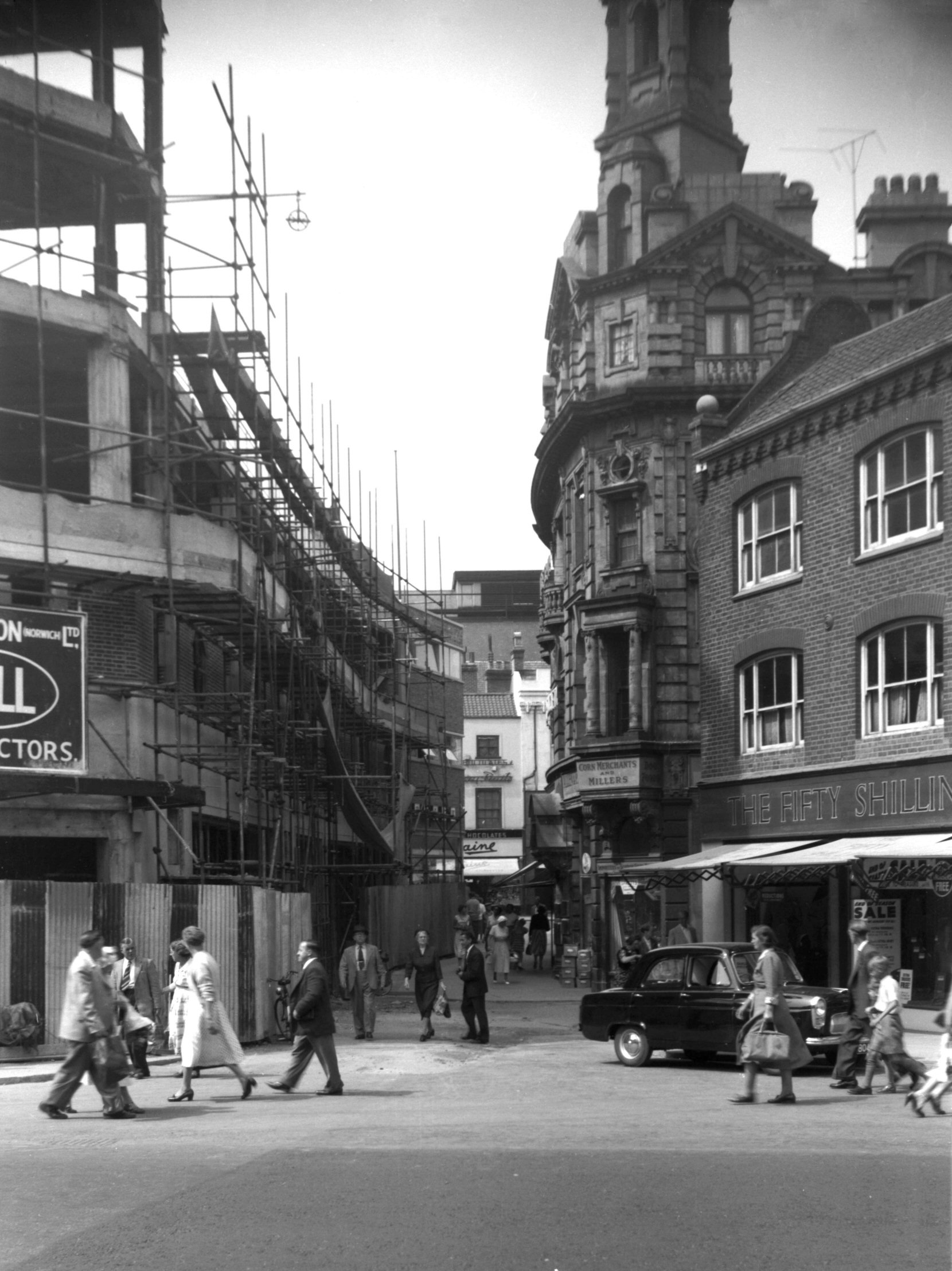
Orford Place Curls girderwork Red Lion St [4278]
1954-08-25
|
|
|
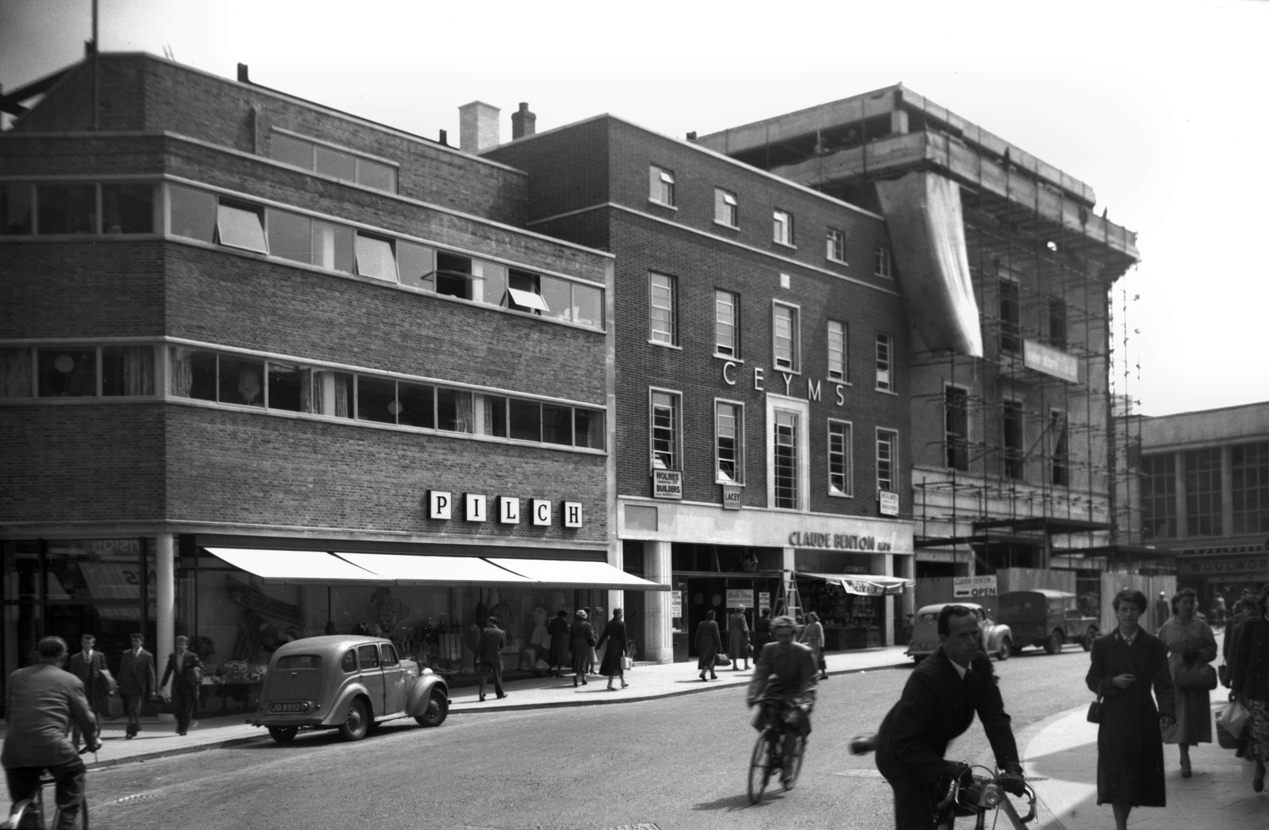
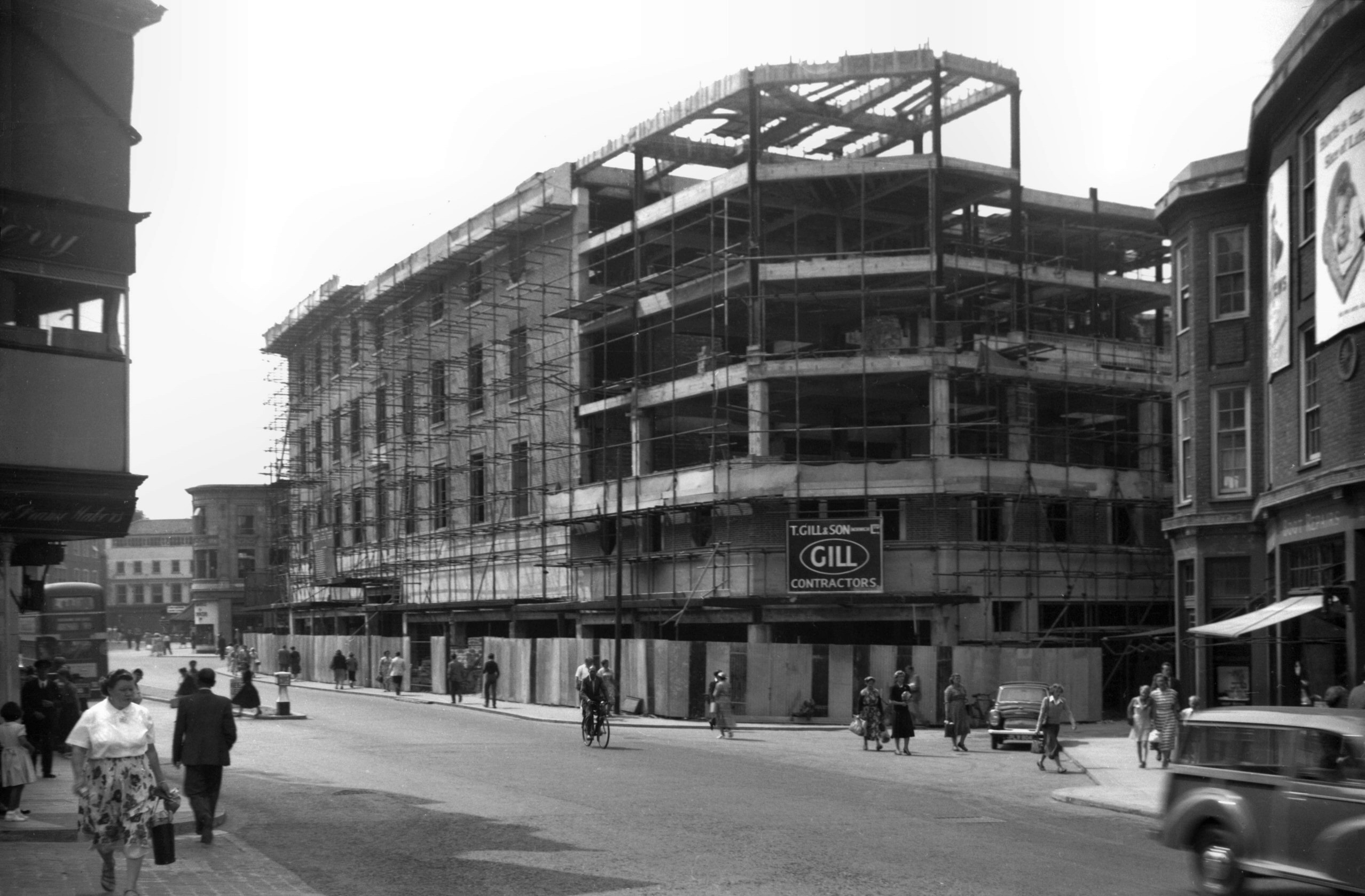
Orford Place Brigg St east side complete [4312]
1955-06-17
Pilch and C.E.Y.M.S buildings complete. Curls still under
construction. |
|
|
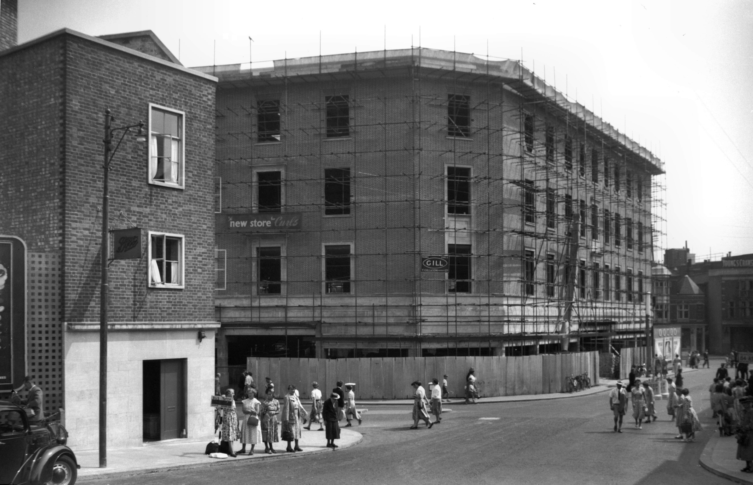
Orford Place Curls Rampant Horse St [4345] 1955-08-05
Brigg St corner. |
|
|
Orford Place Curls Red Lion St view south [4346]
1955-08-05
|
|
|
Orford Place reduced width [4347] 1955-08-05
|
|
|
Orford Place Burlington Buildings [6696] 1991-06-09
Built 1904, architect J.Owen Bond. |
|
Orford St: |
| |
From
Farmers
Avenue to Timberhill / Orford
Hill |
|
|
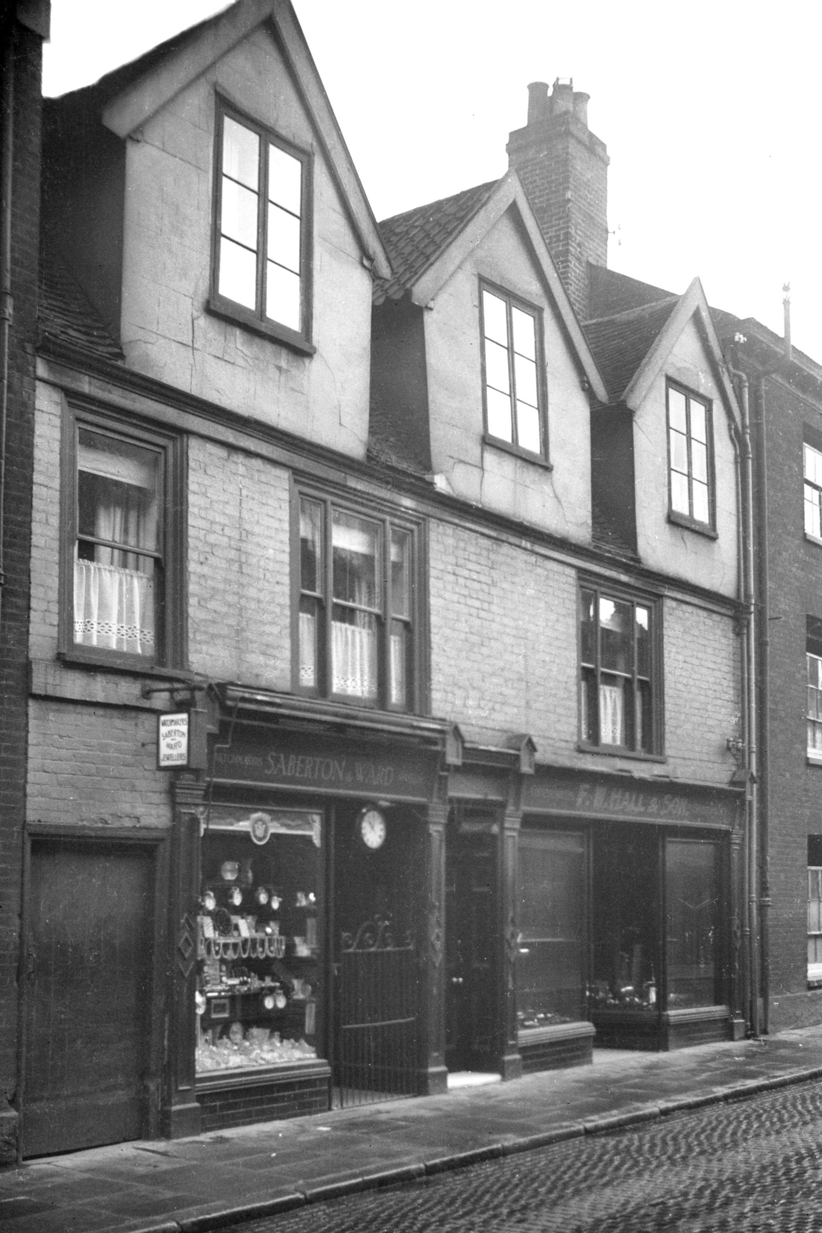
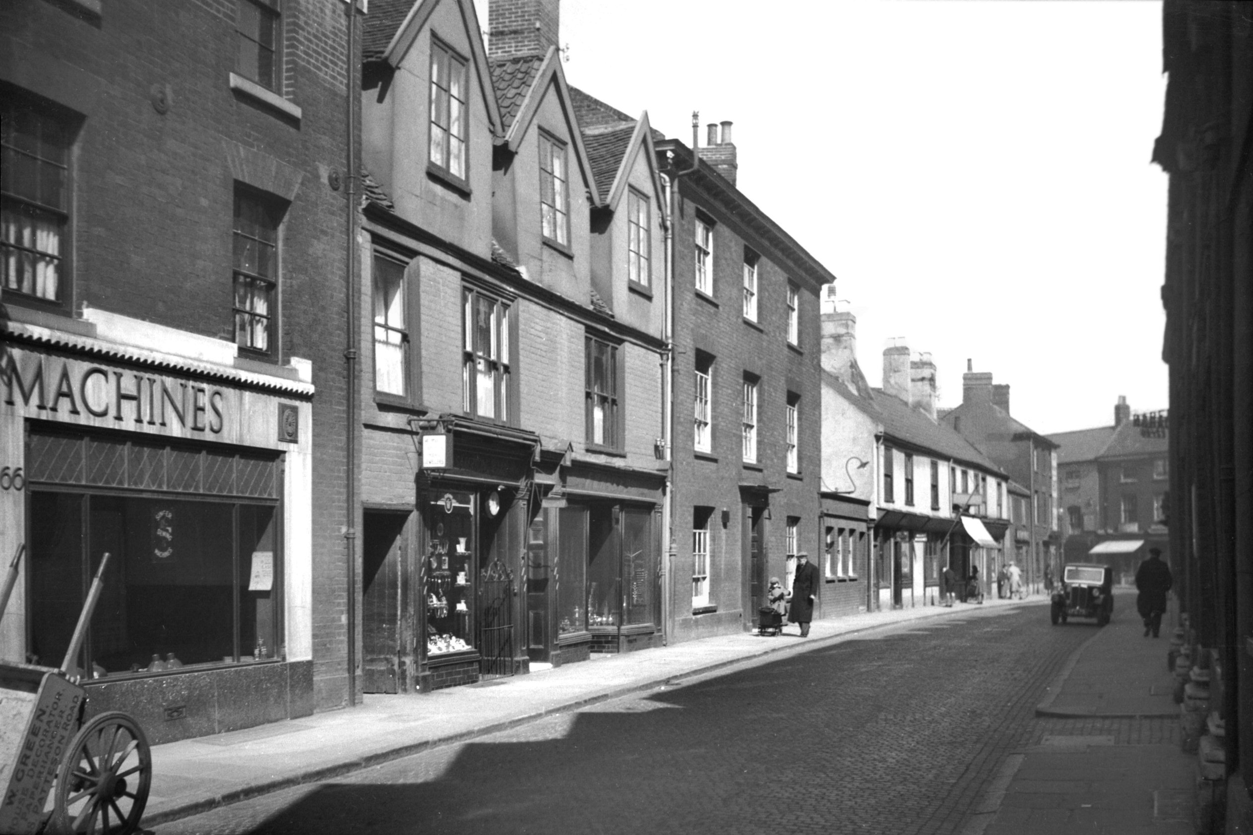
Orford St SE side [6685] 1991-05-20
A tablet on the centre building at first floor level says
"Orford Place 1809". |
|
Oxford St: |
| |
From
Unthank Rd to Kimberley St |
|
|
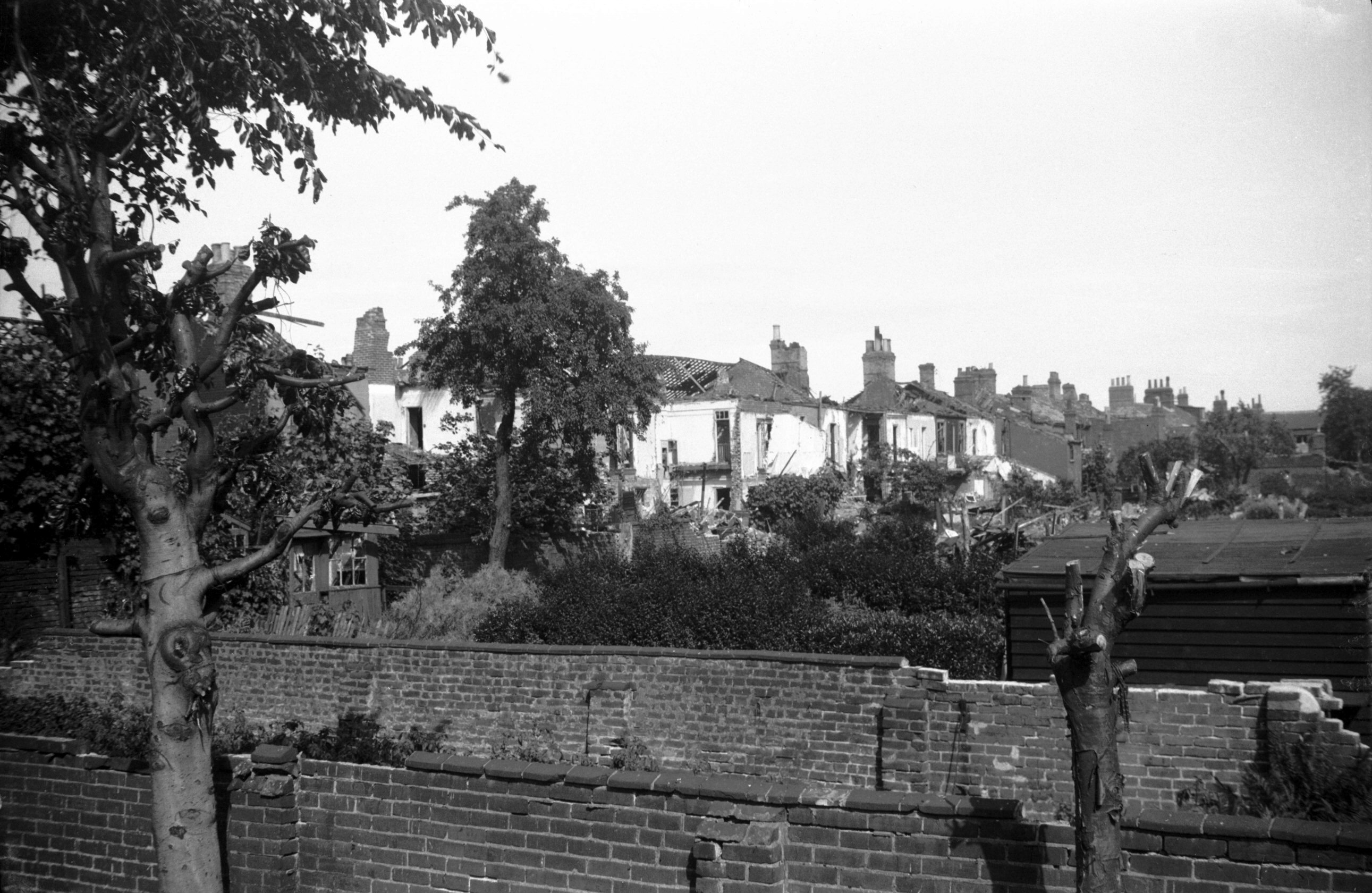
Oxford St south side rear air raid damage [3594]
1942-07-06
|
|
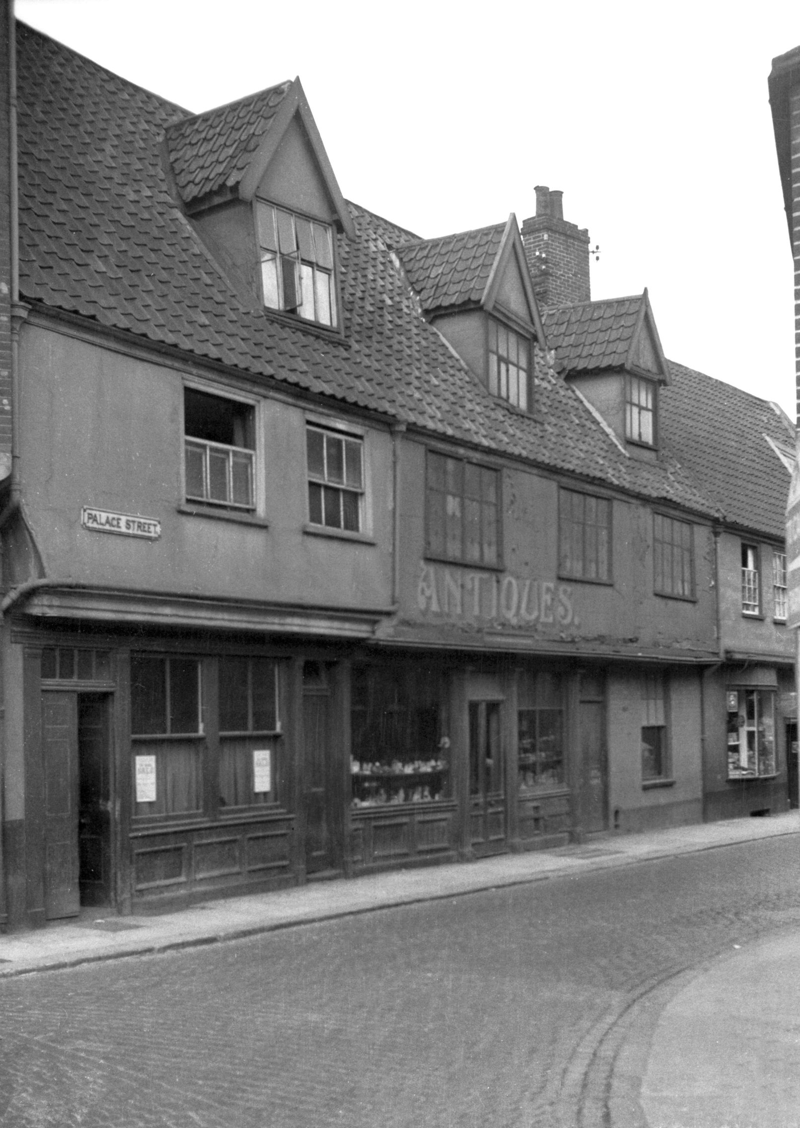
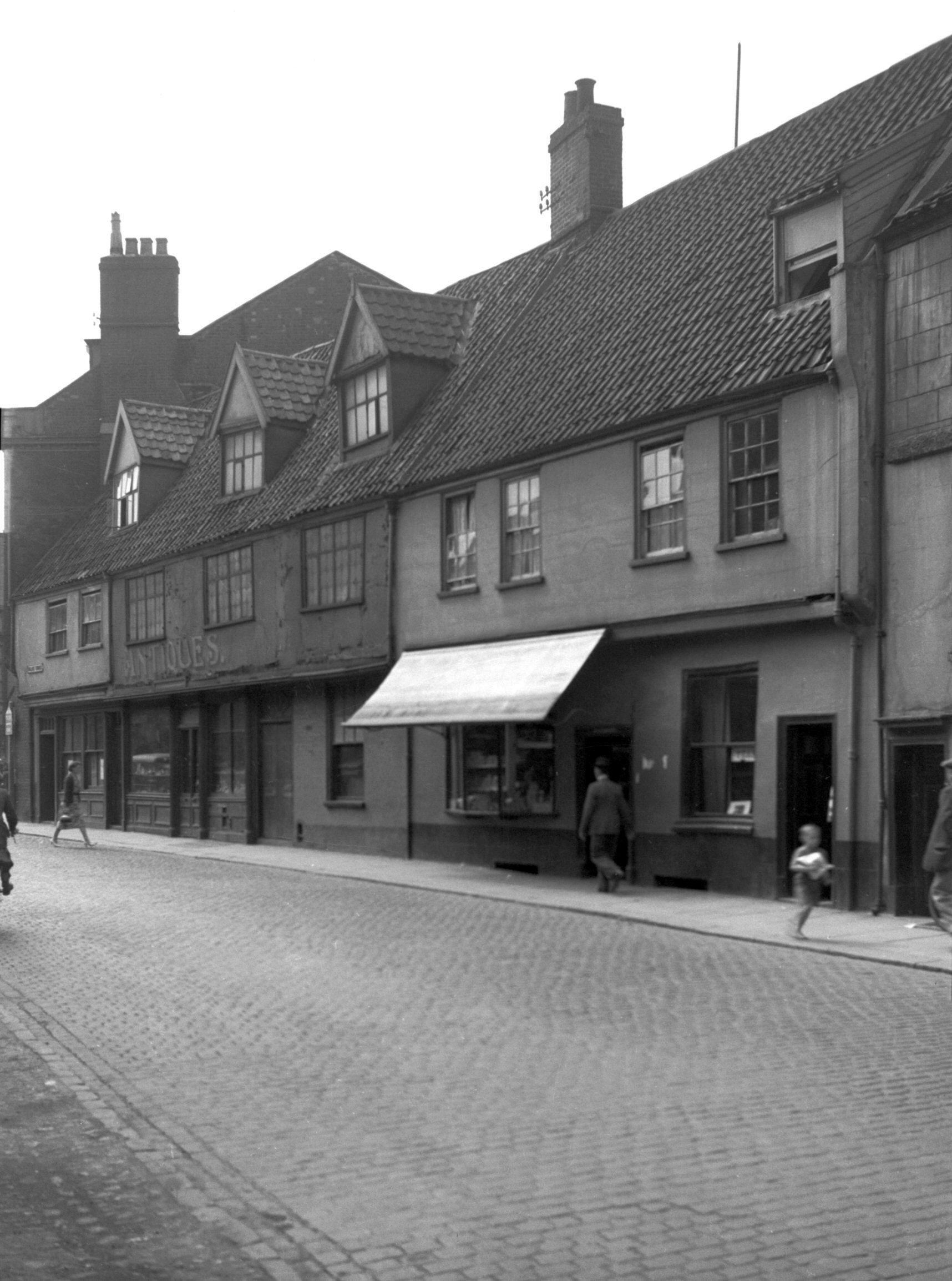
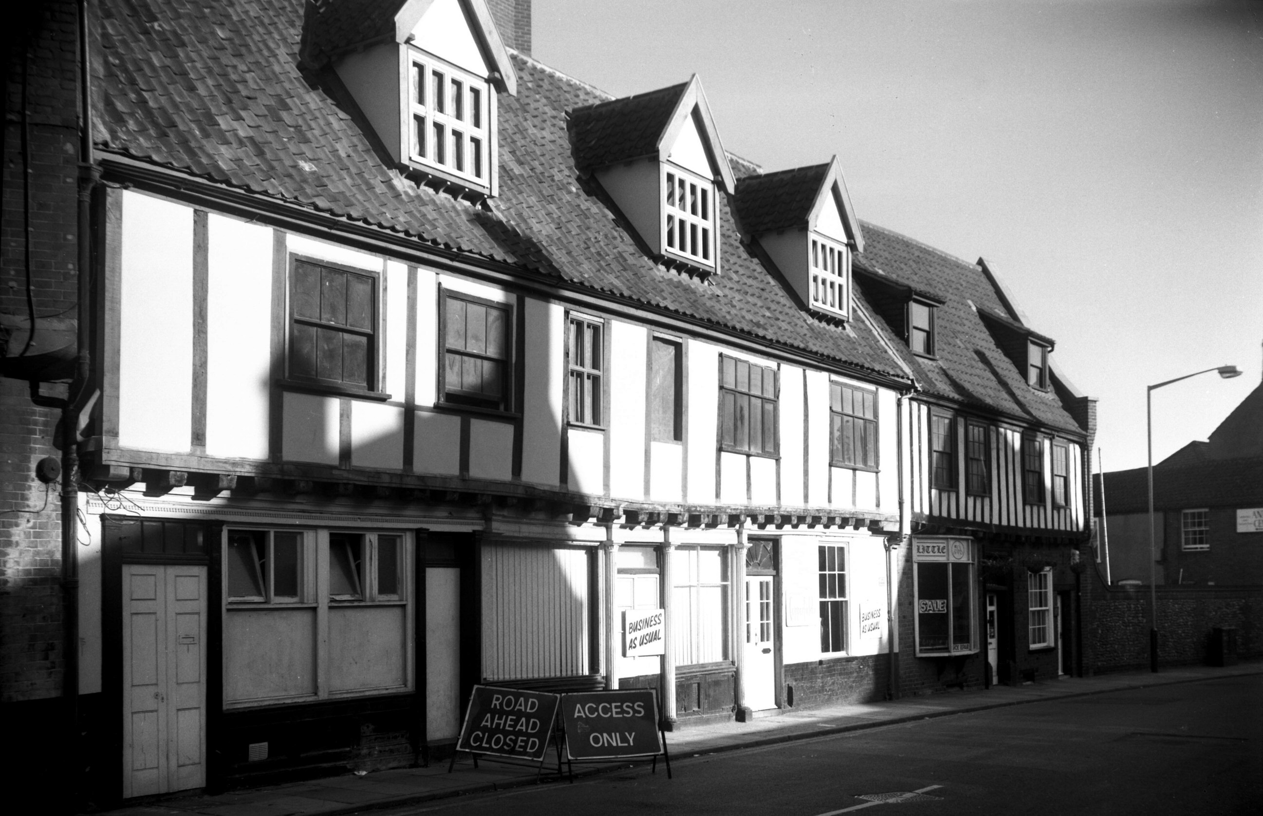
Palace St: |
| |
From
Tombland / Wensum
St to St Martin's Palace
Plain
passing Pigg Lane
North side |
|
|
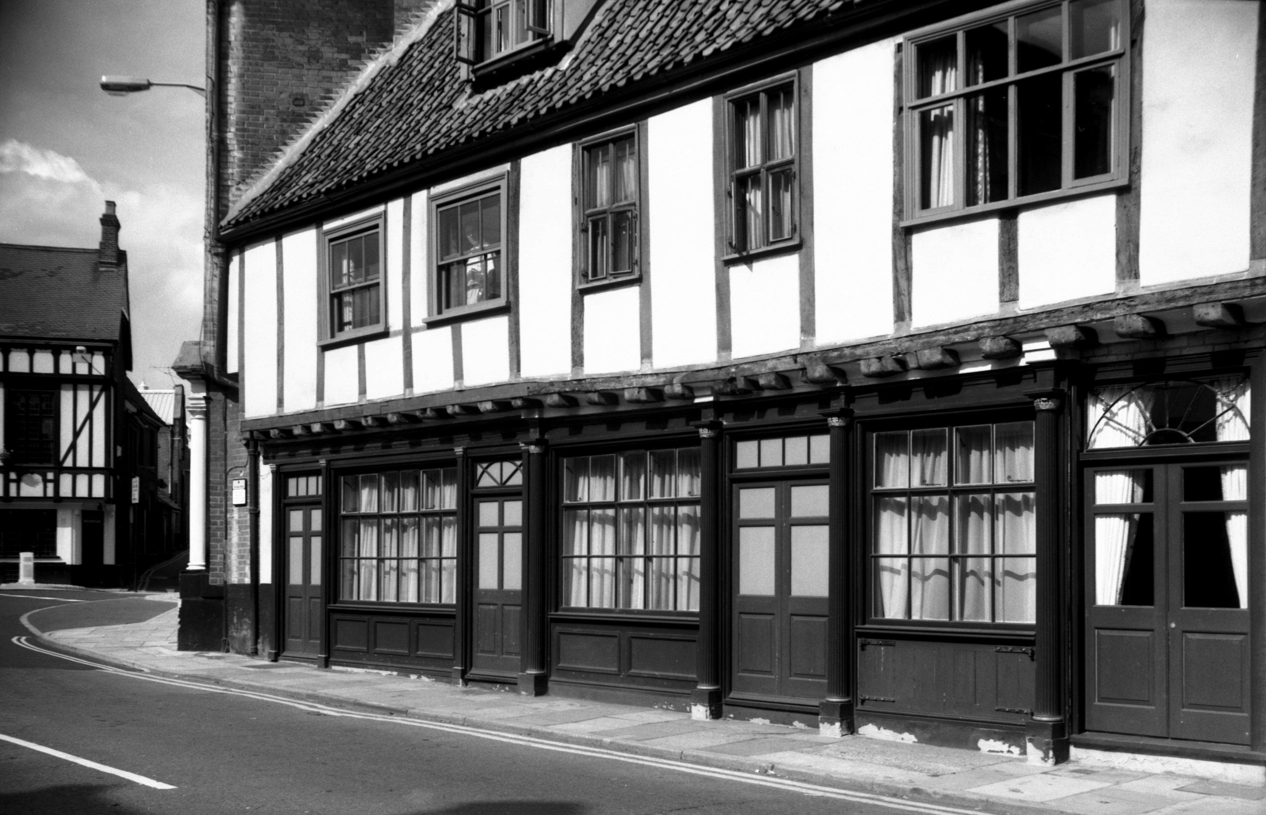
Palace St 1 to 3 late Georgian shop front [3893]
1950-06-29
|
|
|
Palace St 1 to 3 Regency shop front [6535] 1989-03-25
|
|
|
Palace St 1 to 3 shop front restored [7040]
1993-07-25
|
|
|
Palace St 1 to 5 [2775] 1938-09-02
|
|
|
Palace St 1 to 7 [2734] 1938-08-24
|
|
|
Palace St 1 to 7 restored [6528] 1988-08-29
|
|
|
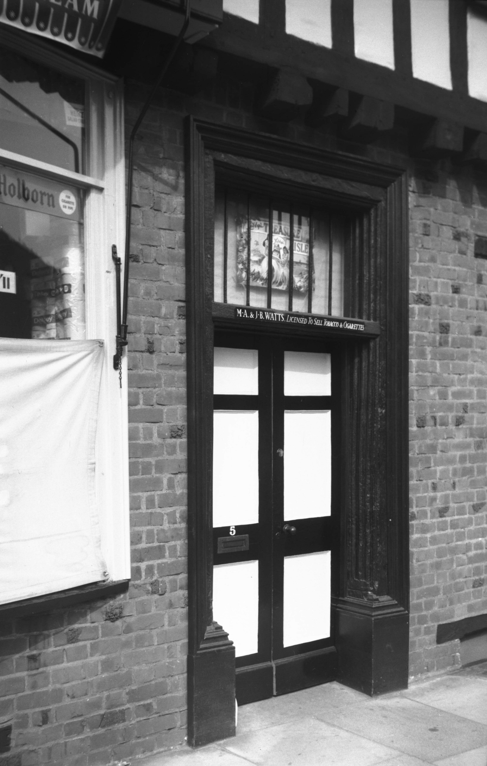
Palace St 5 16c doorway [4713] 1962-09-09
|
|
|
Palace St 5 to 7 [4719] 1962-09-14
|
|
|
Palace St 9 to 13 [1674] 1937-06-03
|
|
|
Palace St 13 [4253] 1954-05-27
|
|
|
Palace St 15 [1449] 1936-09-22
|
|
|
Palace St 15 [6465] 1987-05-25
|
|
|
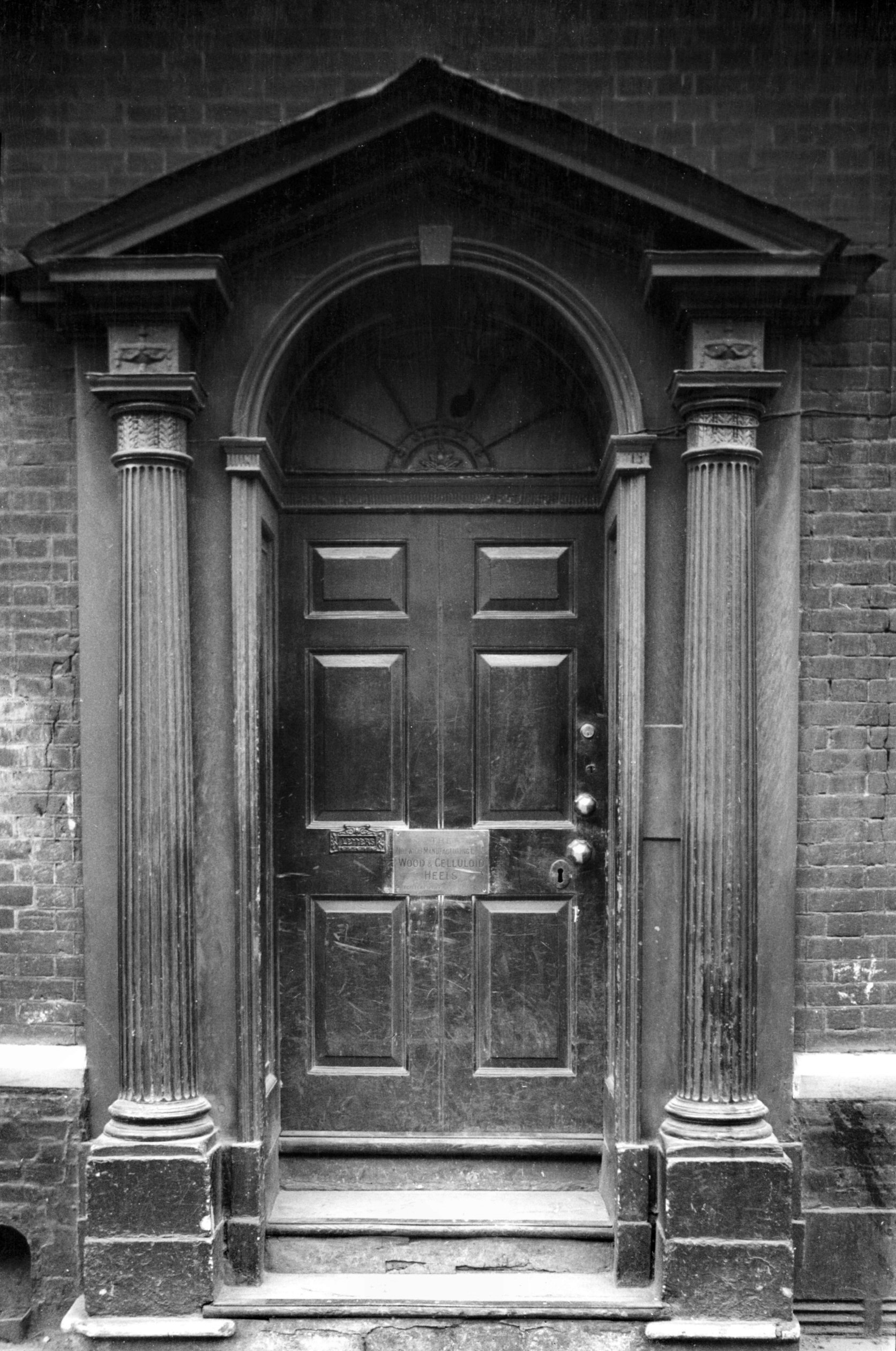
Palace St 15 Georgian doorway [0459] 1935-04-19
|
|
|
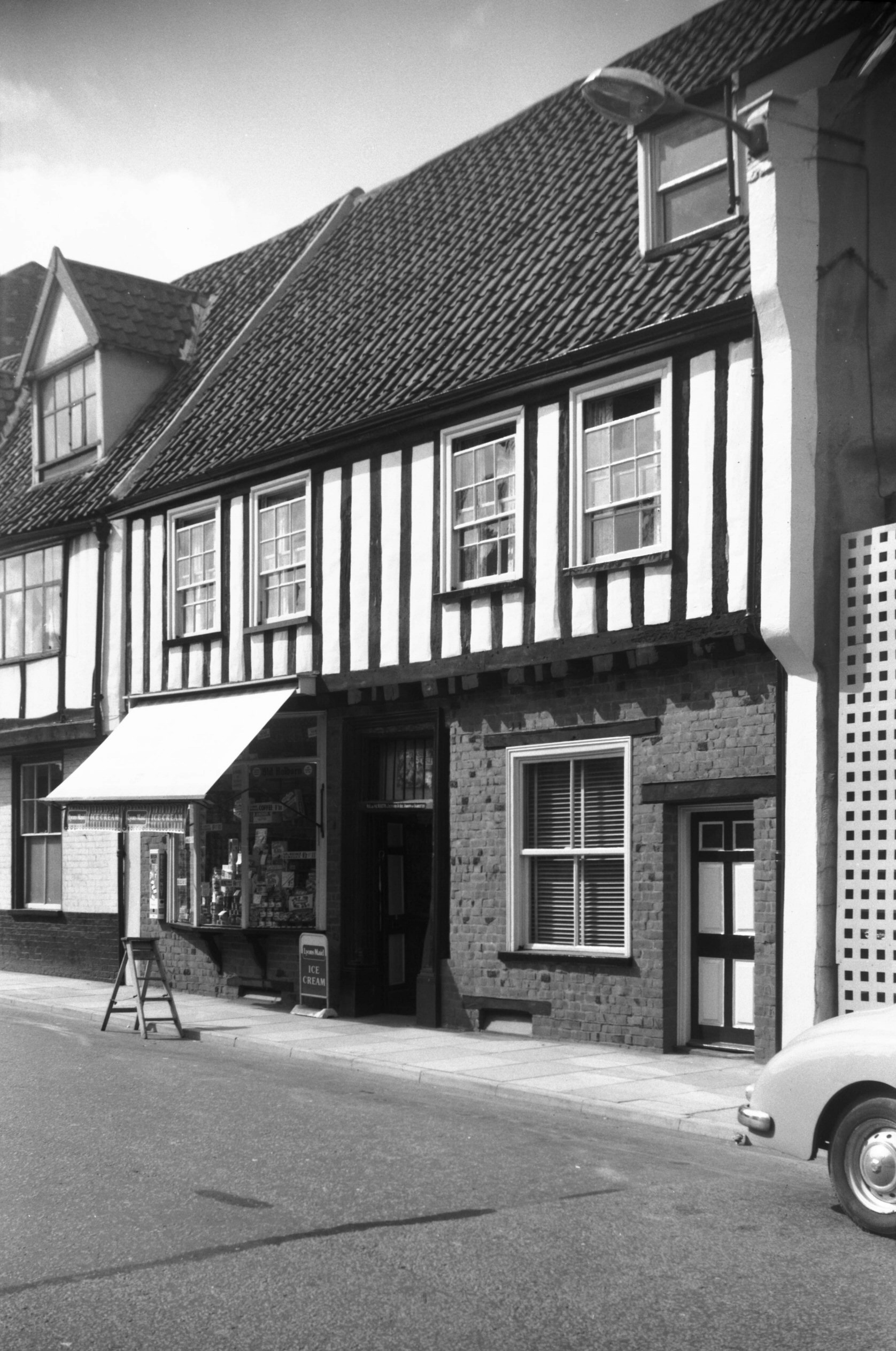
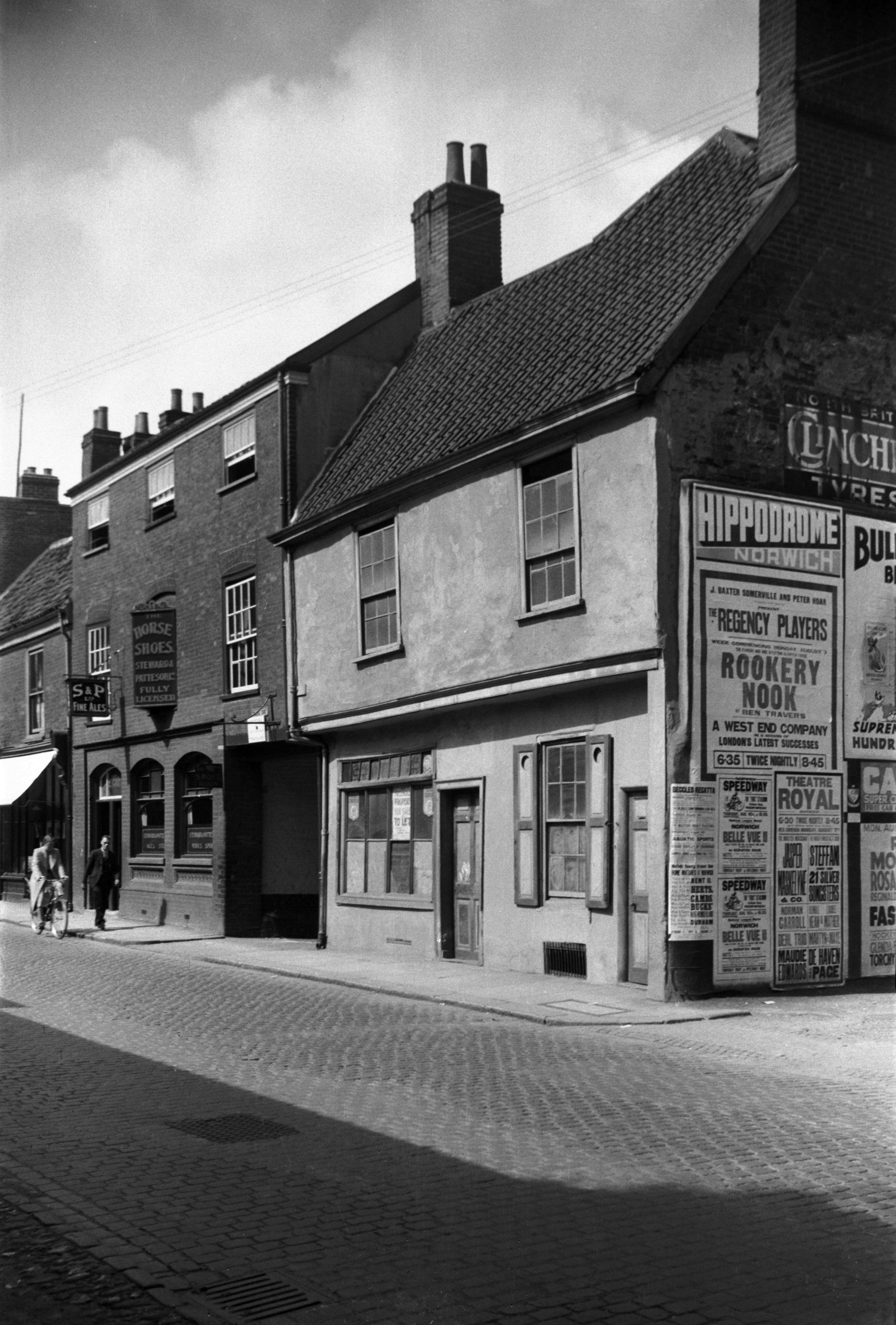
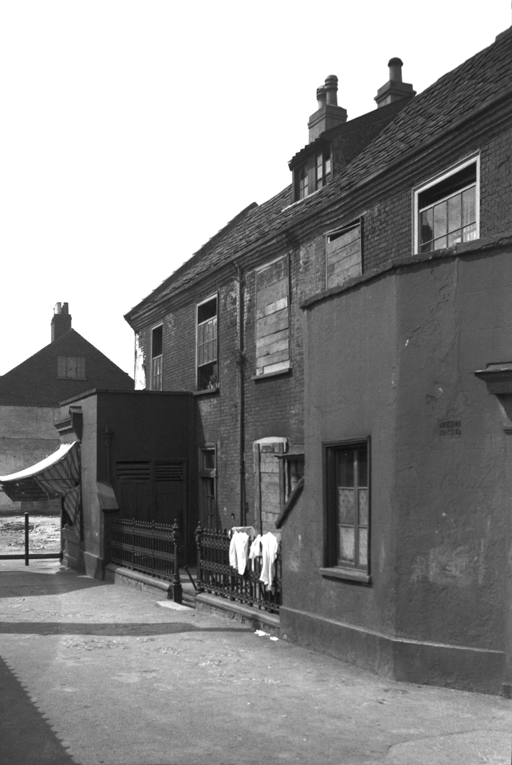
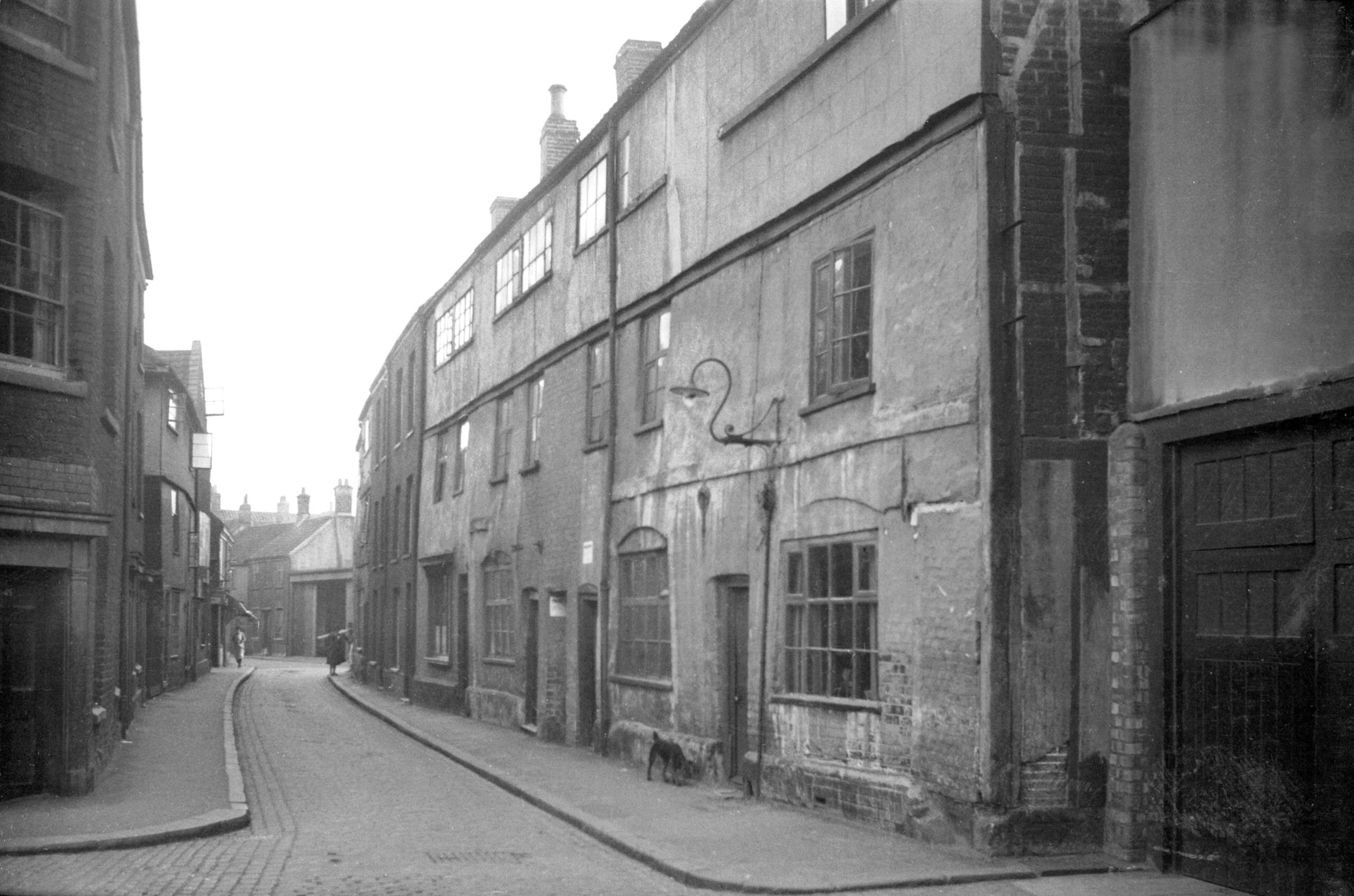
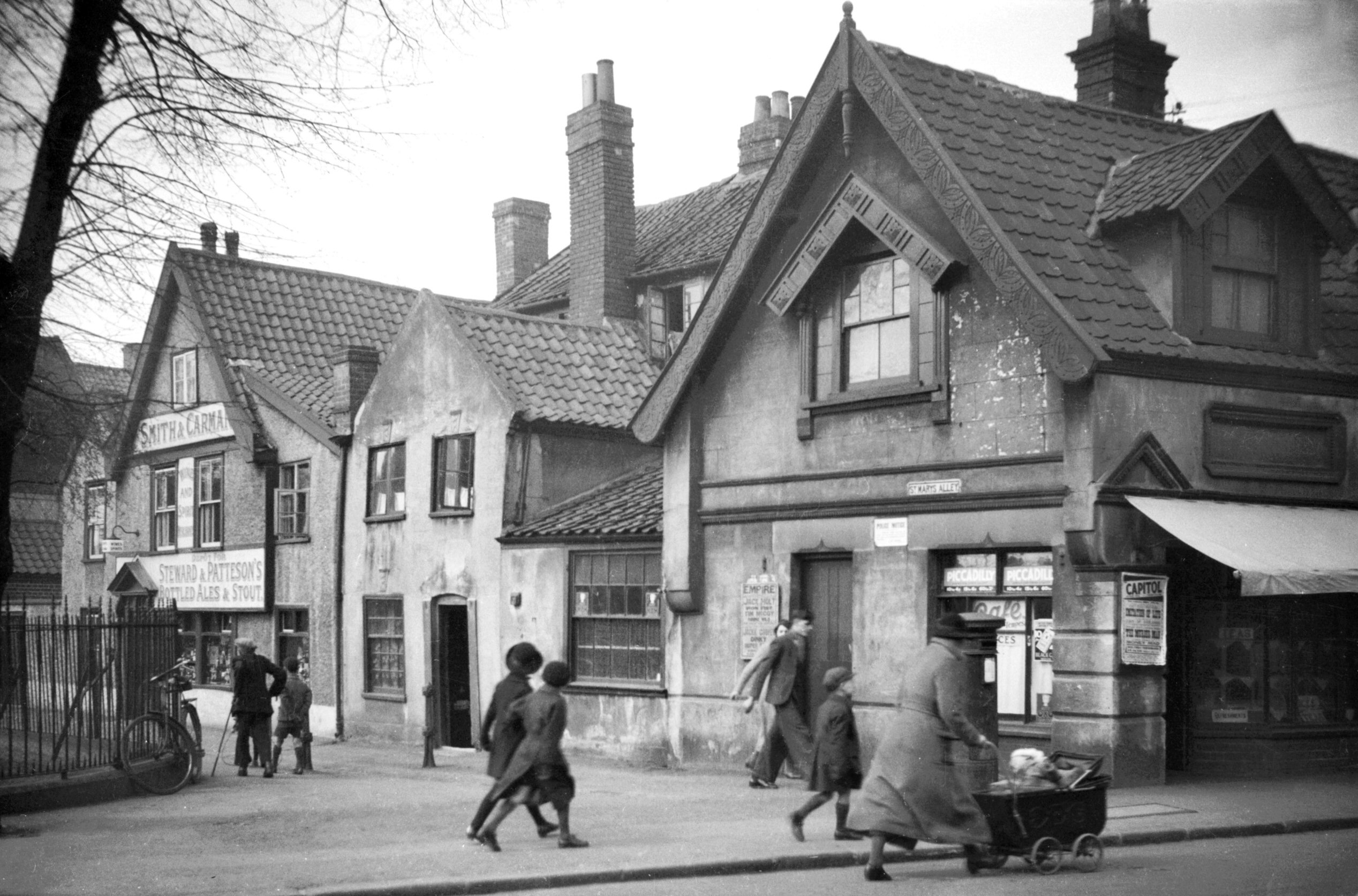
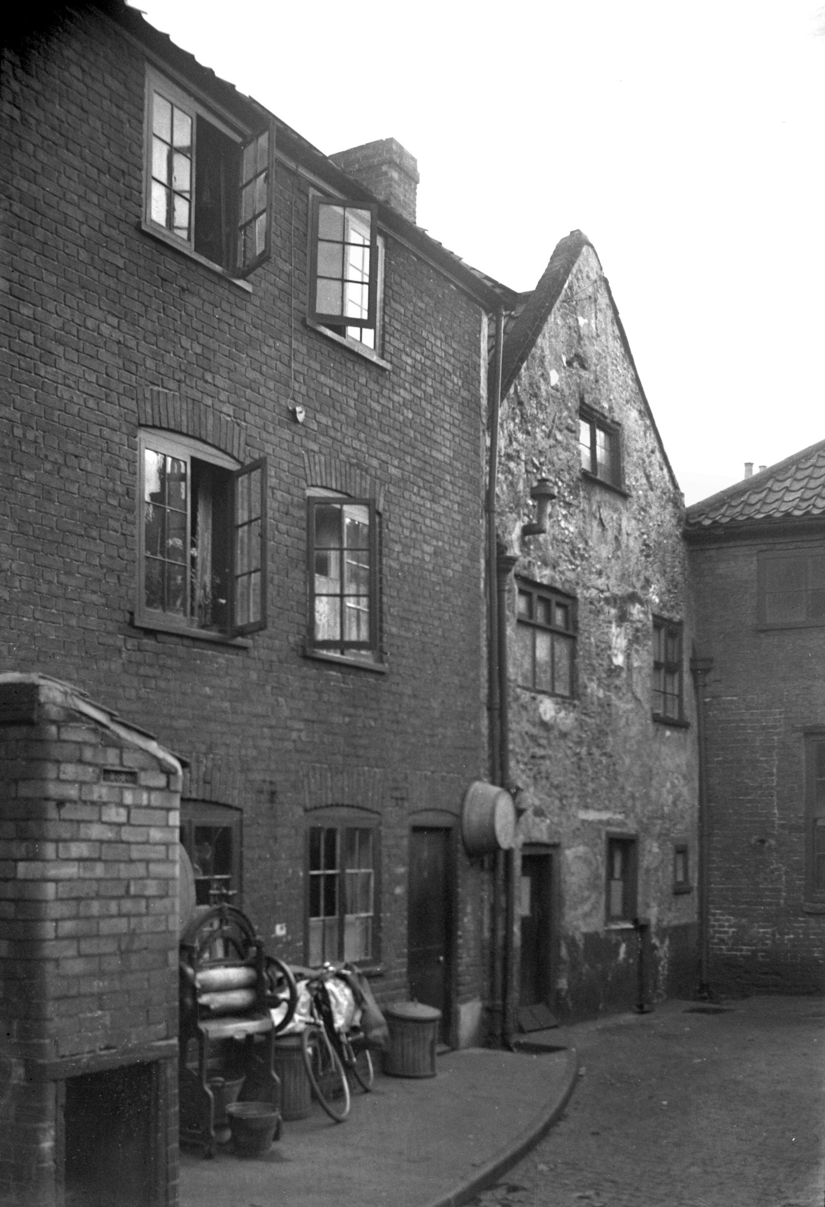
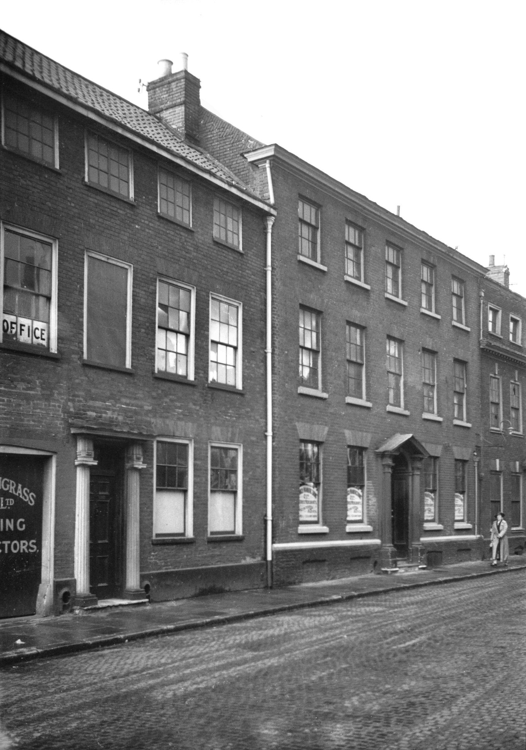
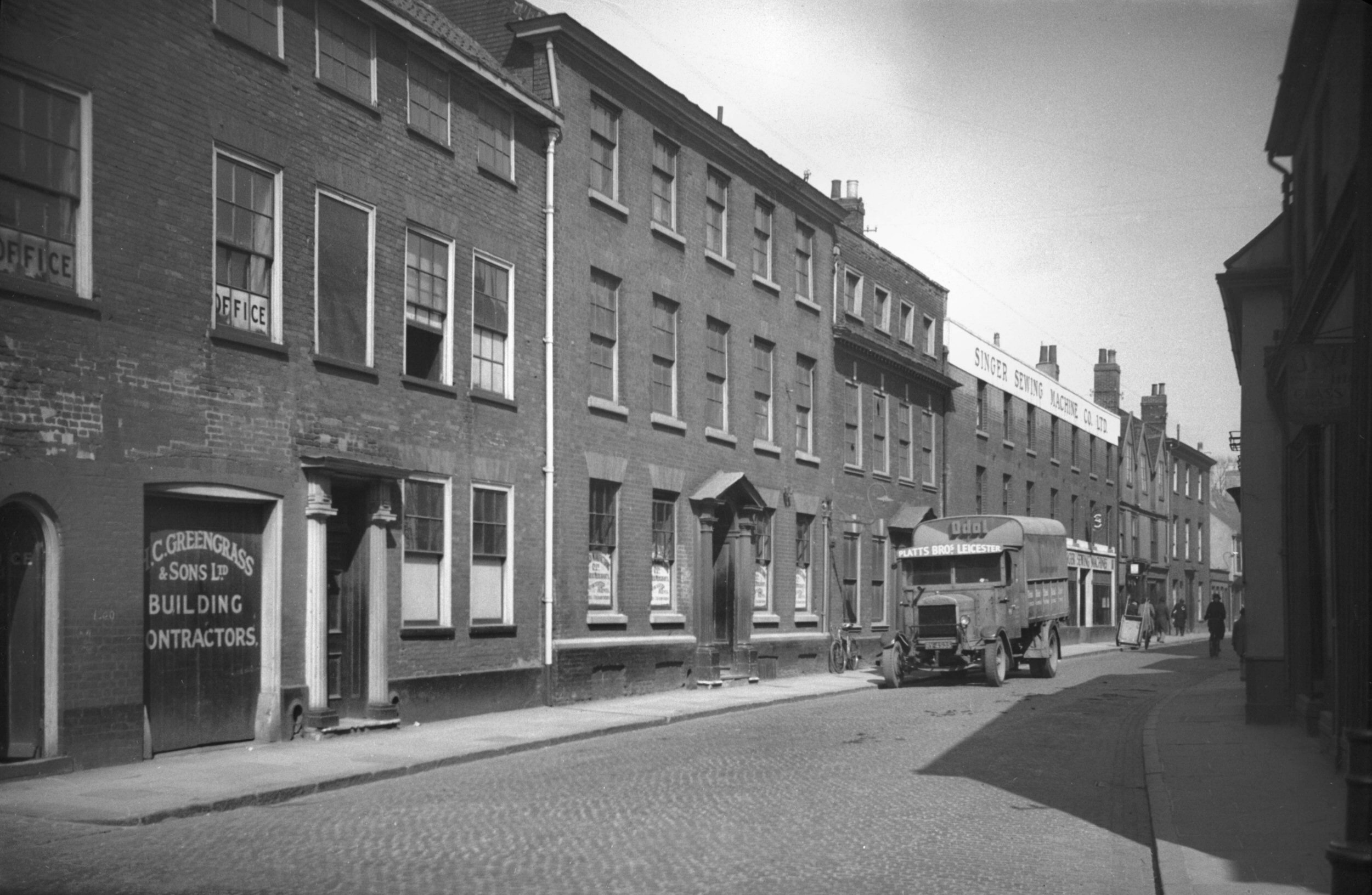
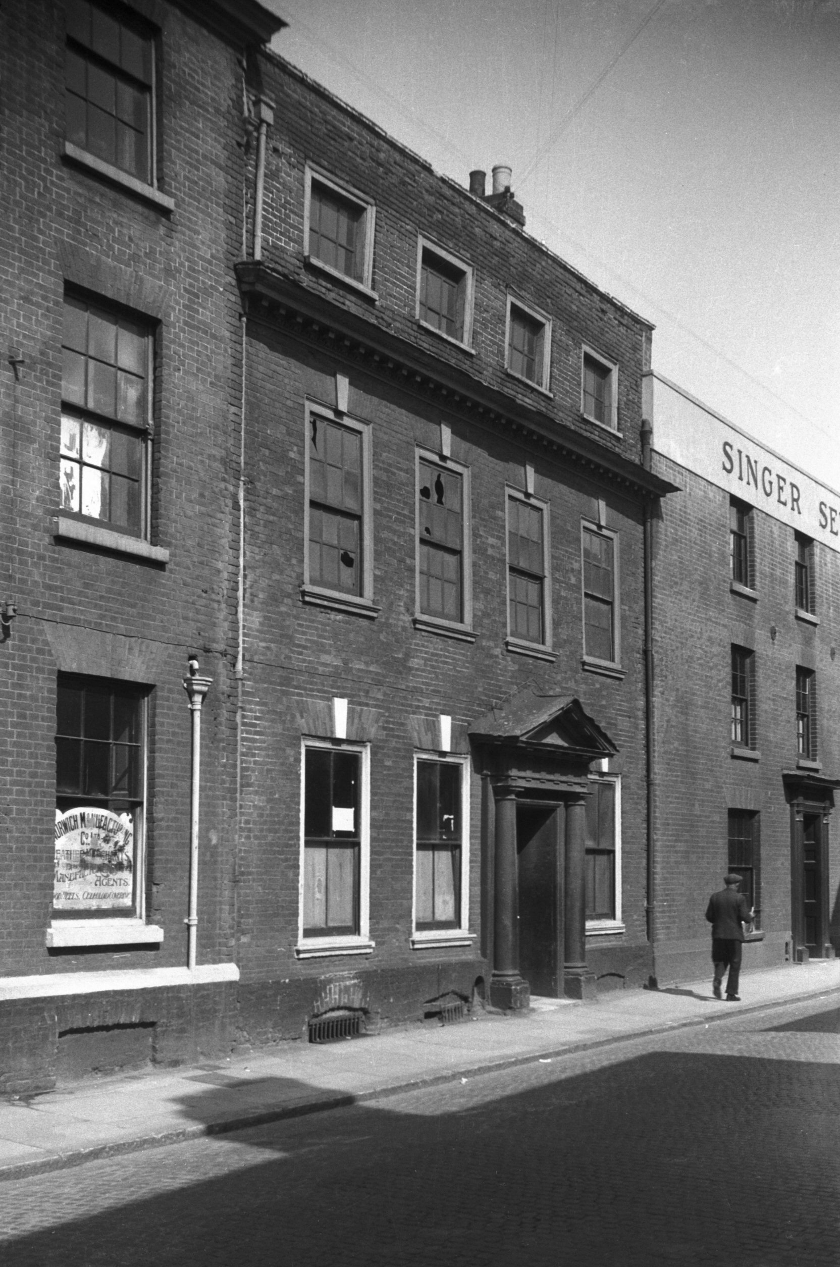
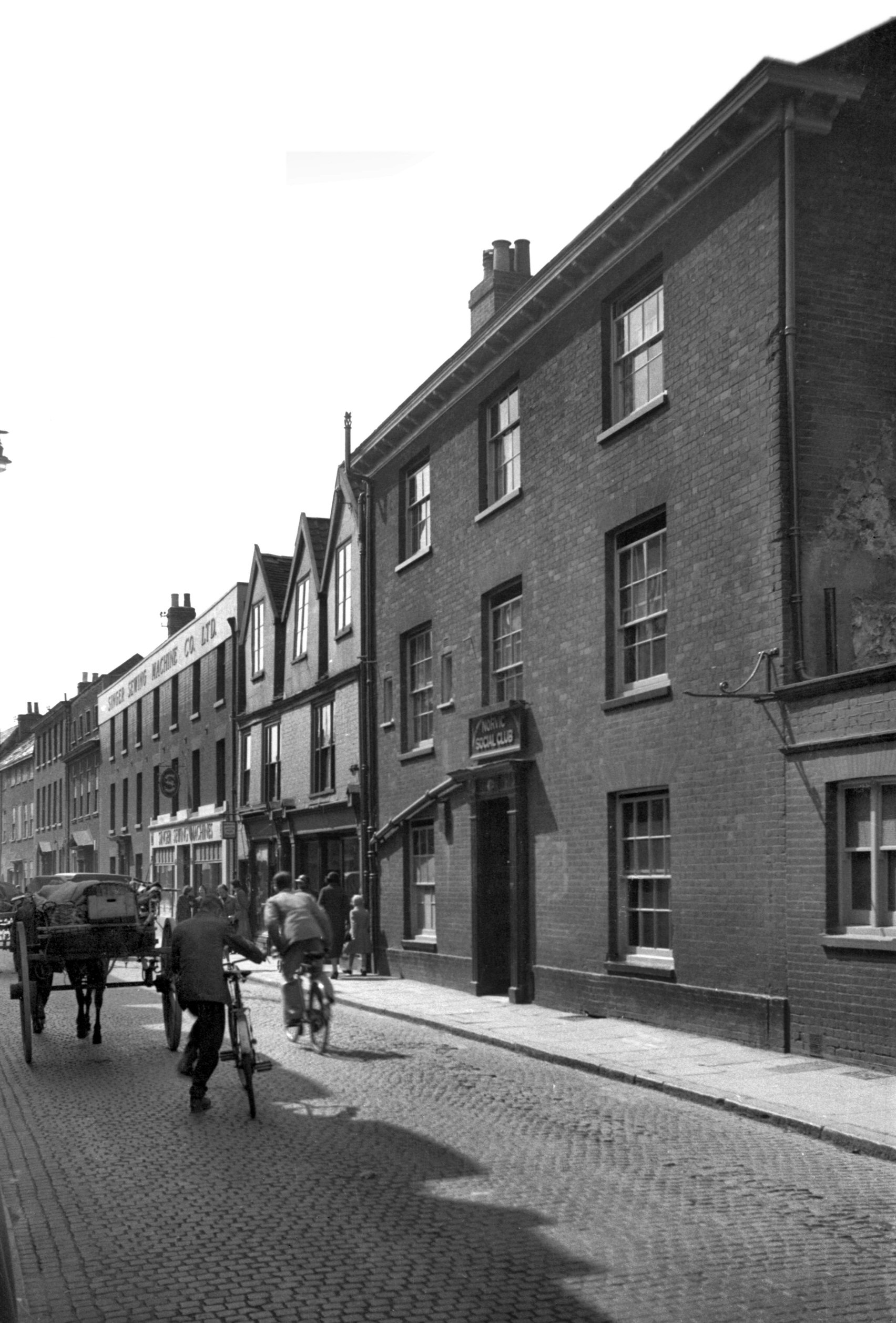
Palace St 21 Horse Shoes PH to 23 [3215] 1939-08-07
Palace St connects Tombland to St Martin-at-Palace Plain.
At No 23 once stood a timber-framed building deemed to be
17c. The upper floor was slightly jettied and the entire
facade was faced with plaster. Its listing as Grade 3
under the Housing Act, 1949, did nothing, unfortunately,
to prevent its demolition some years later.
Next door at No 21 the Horse Shoes public house (pictured
with No 23), a building of three storeys, seemed much
later. In fact it had been re-fronted late in the 18c
disguising a 17c core of brick and flint. This too has
been demolished.
For 39 Palace St see 1 to 4 St
Martin's Palace Plain. |
|
Park Lane: |
| |
From
Earlham Rd to Unthank Rd
West side |
|
|
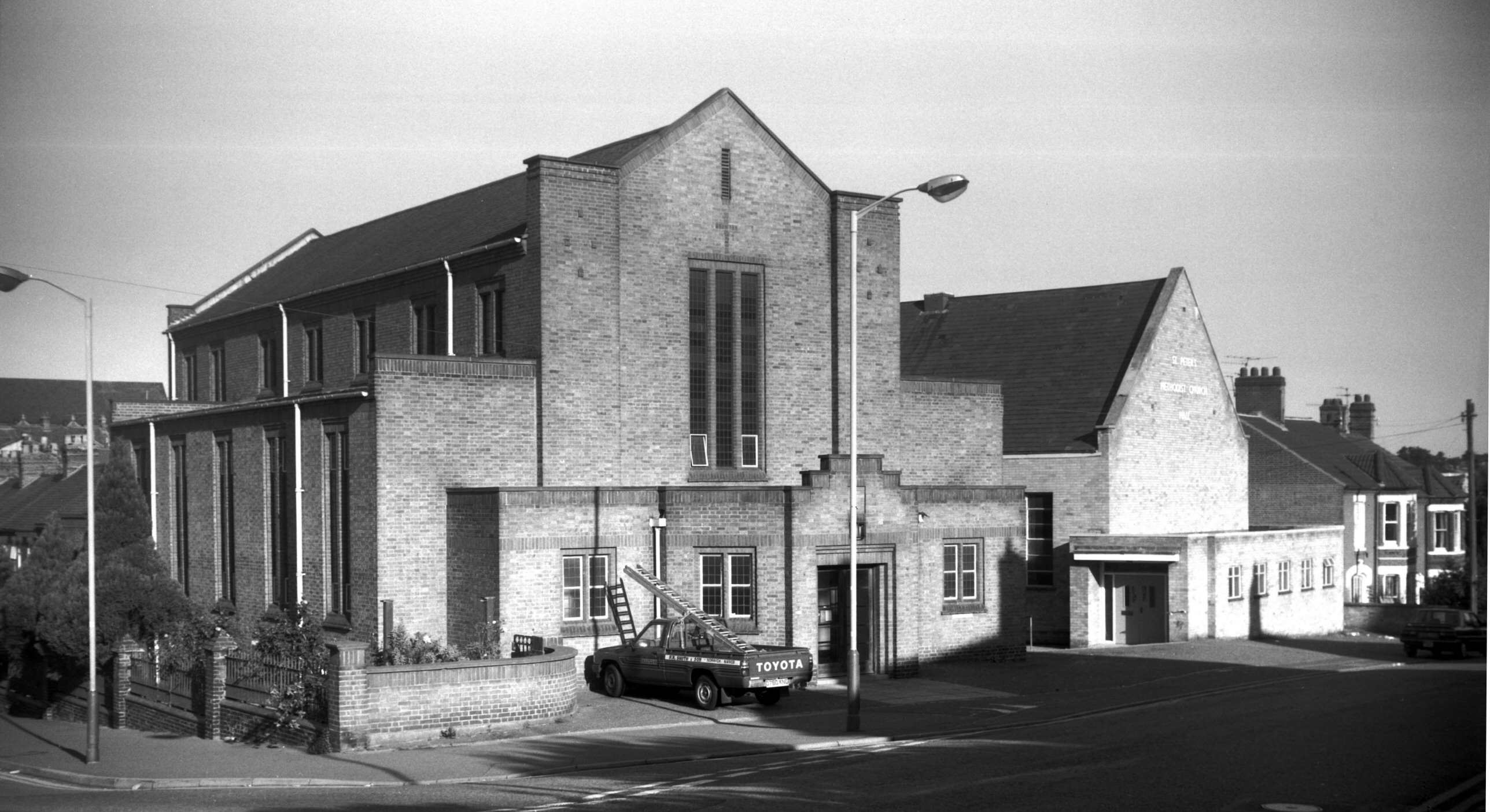
Park Lane St Peter's Methodist church [6527]
1988-08-29
Built 1938-39, architects E.Boardman and sons. |
|
|
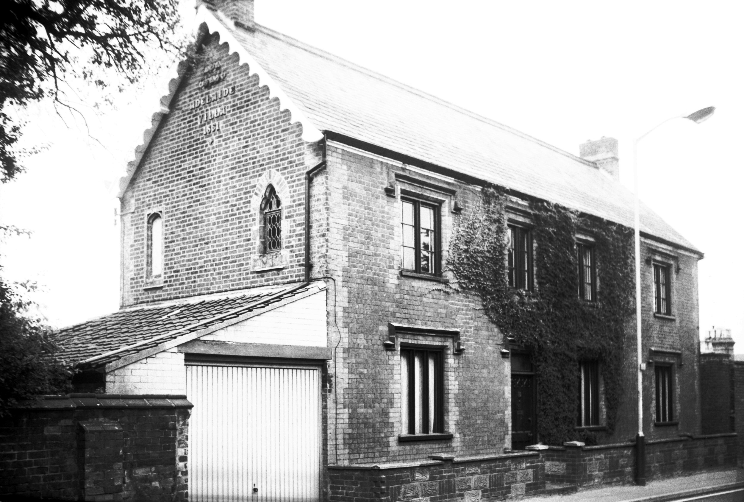
Park Lane 83 Adelaide Villa [7465] 1997-07-16
Built 1861. |
|
Peacock St: |
| |
From
Fishergate to Cowgate
passing St Saviour's Lane, Barrack
St (part south of St Crispin's Rd renamed Blackfriar's St)
East side |
|
|
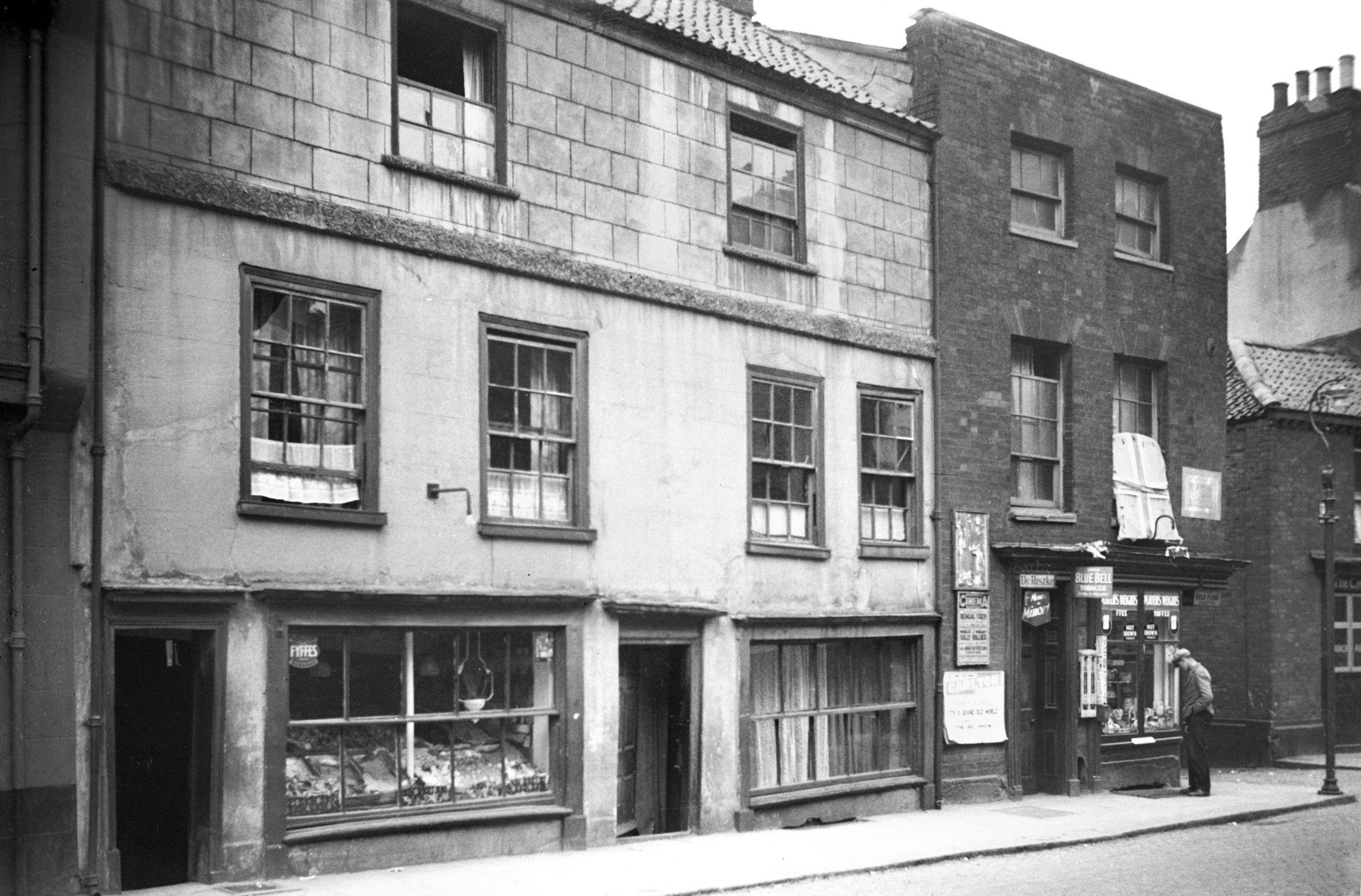
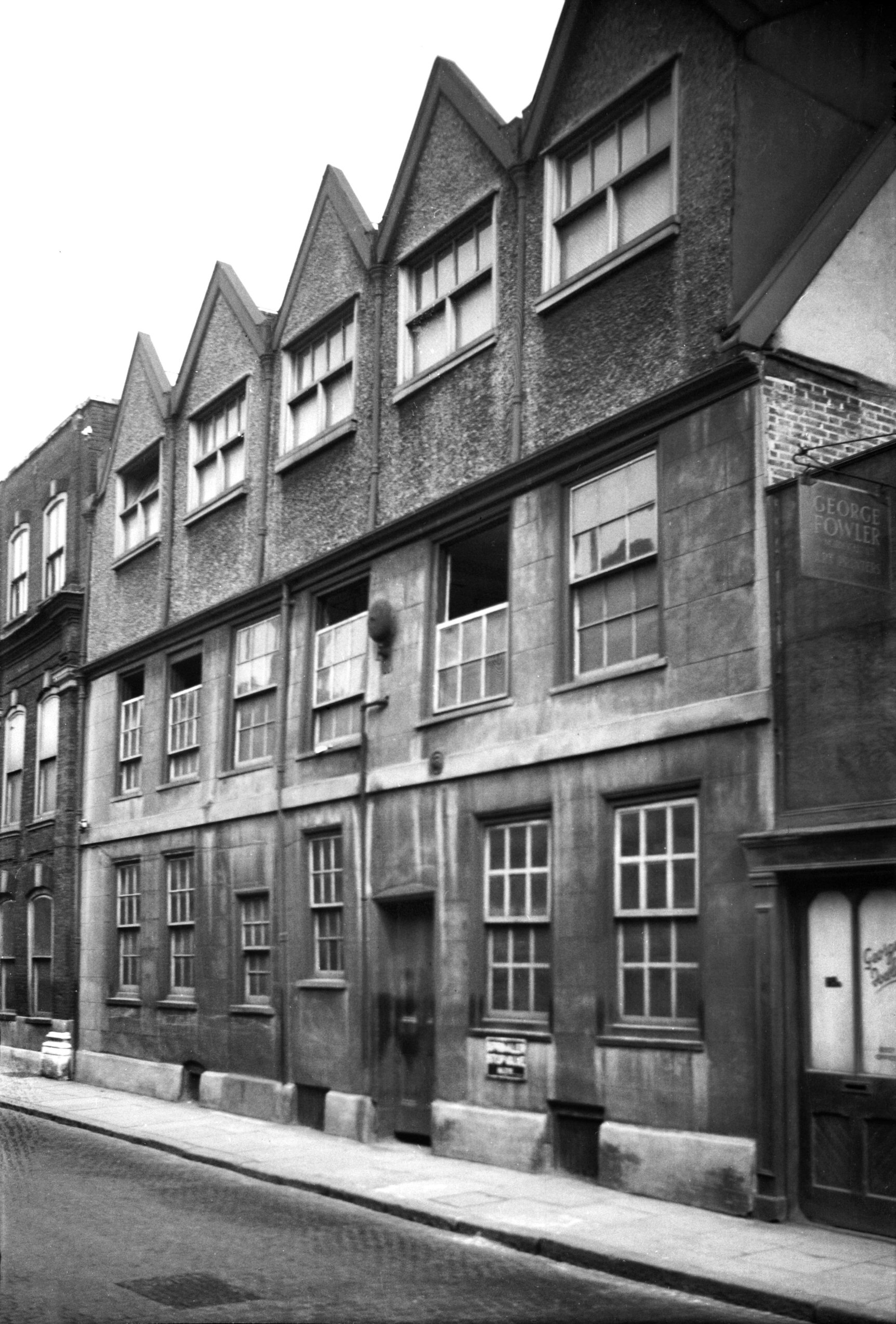
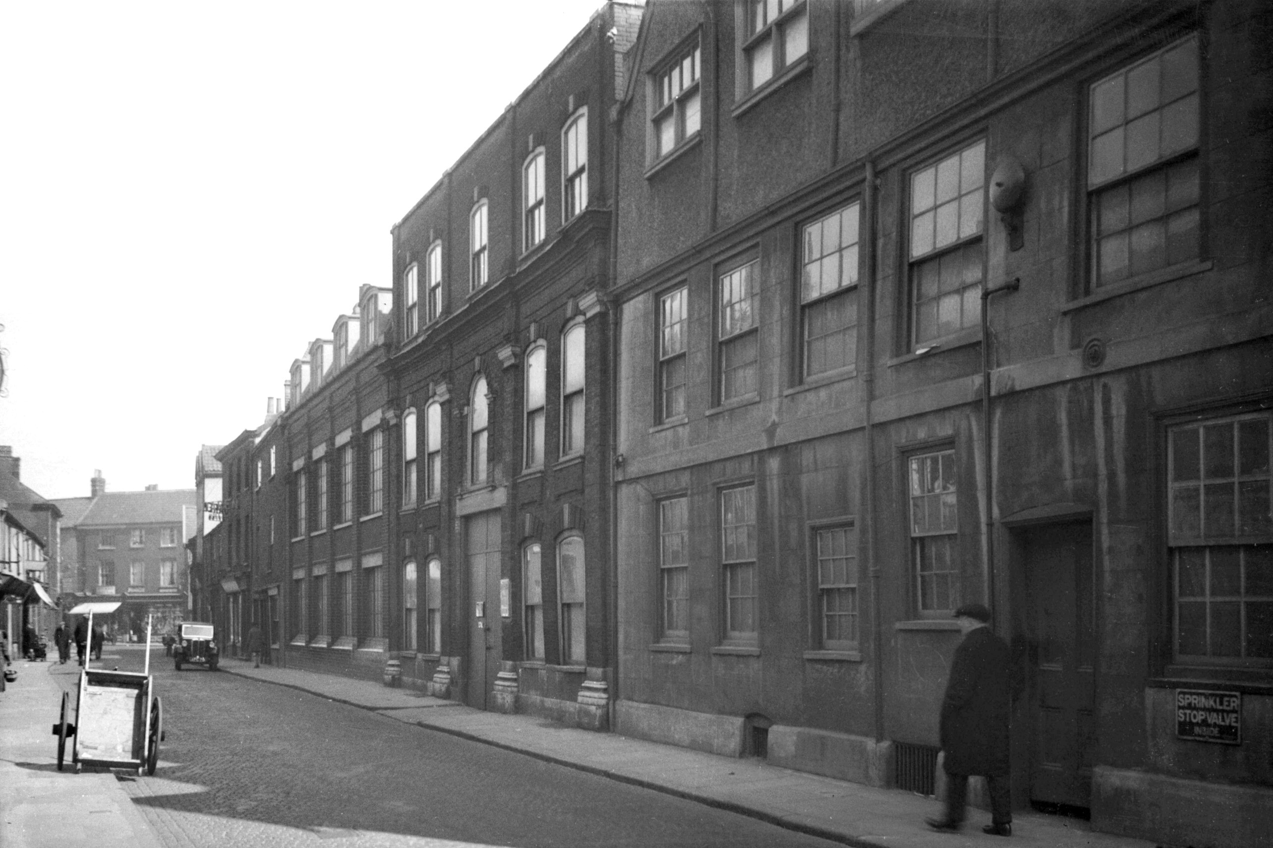
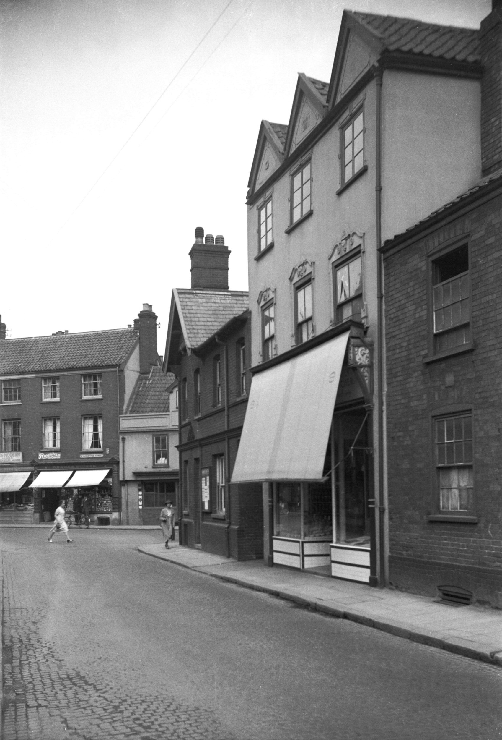
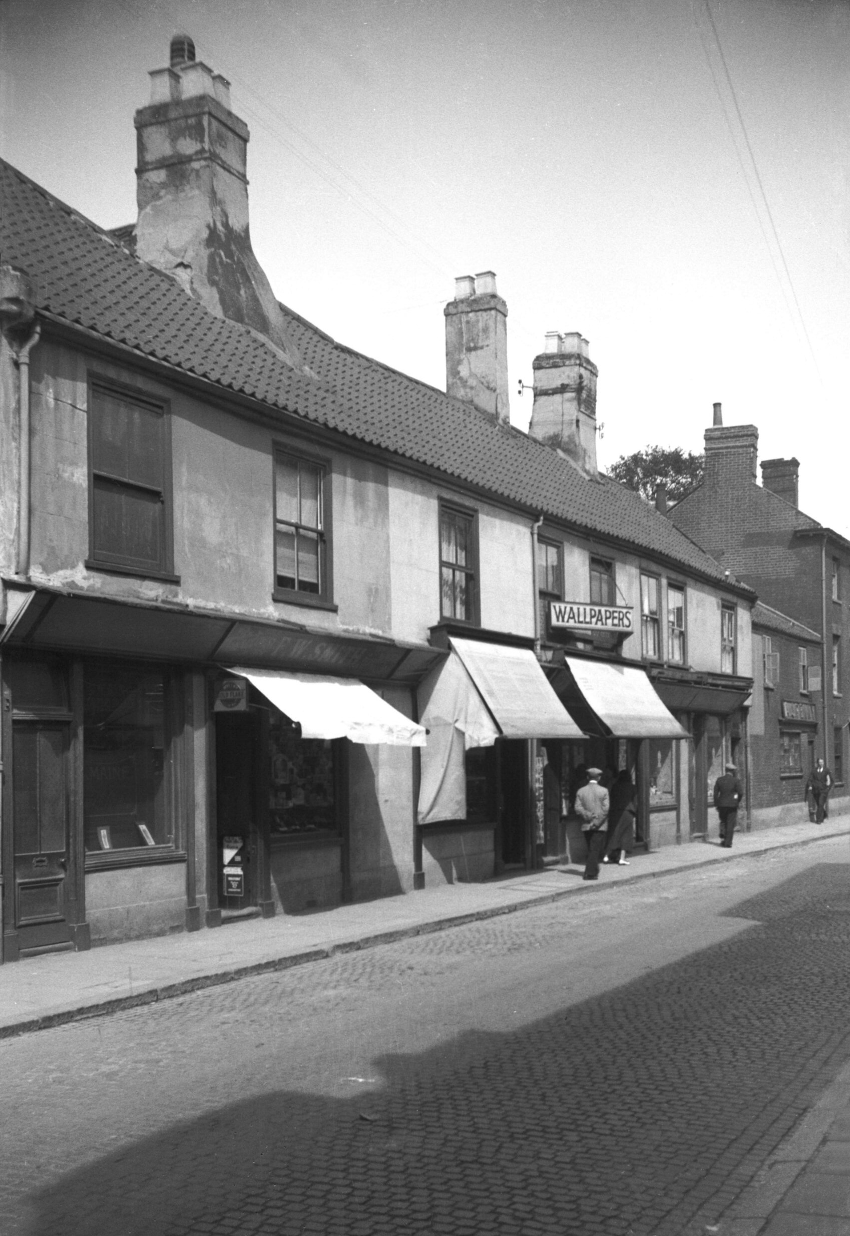
Peacock St 7 to 13 [0780] 1936-03-05
|
|
|
Peacock St 13 to 21 [2711] 1938-08-15
|
|
|
Peacock St 23 to 29 [0950] 1936-05-12
|
|
|
Peacock St St Paul's Opening view west [2712]
1938-08-15
|
|
|
Peacock St 33 to 37 [2103] 1938-03-03
|
| |
West
side |
|
|
Peacock St 14 to 18 [0907] 1936-05-01
|
|
|
Peacock St 34 36 and St Saviour's Lane 29 [0908]
1936-05-01
|
|
|
Peacock St 36 to 42 [0911] 1936-05-01
|
|
|
Peacock St 78 to 88 [2050] 1937-10-12
|
|
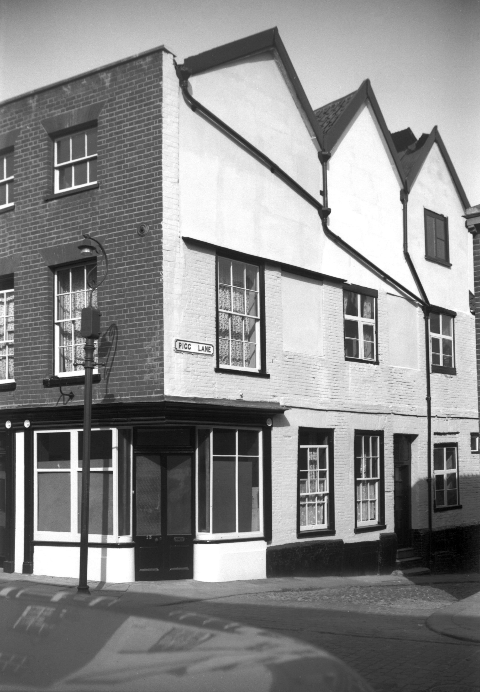
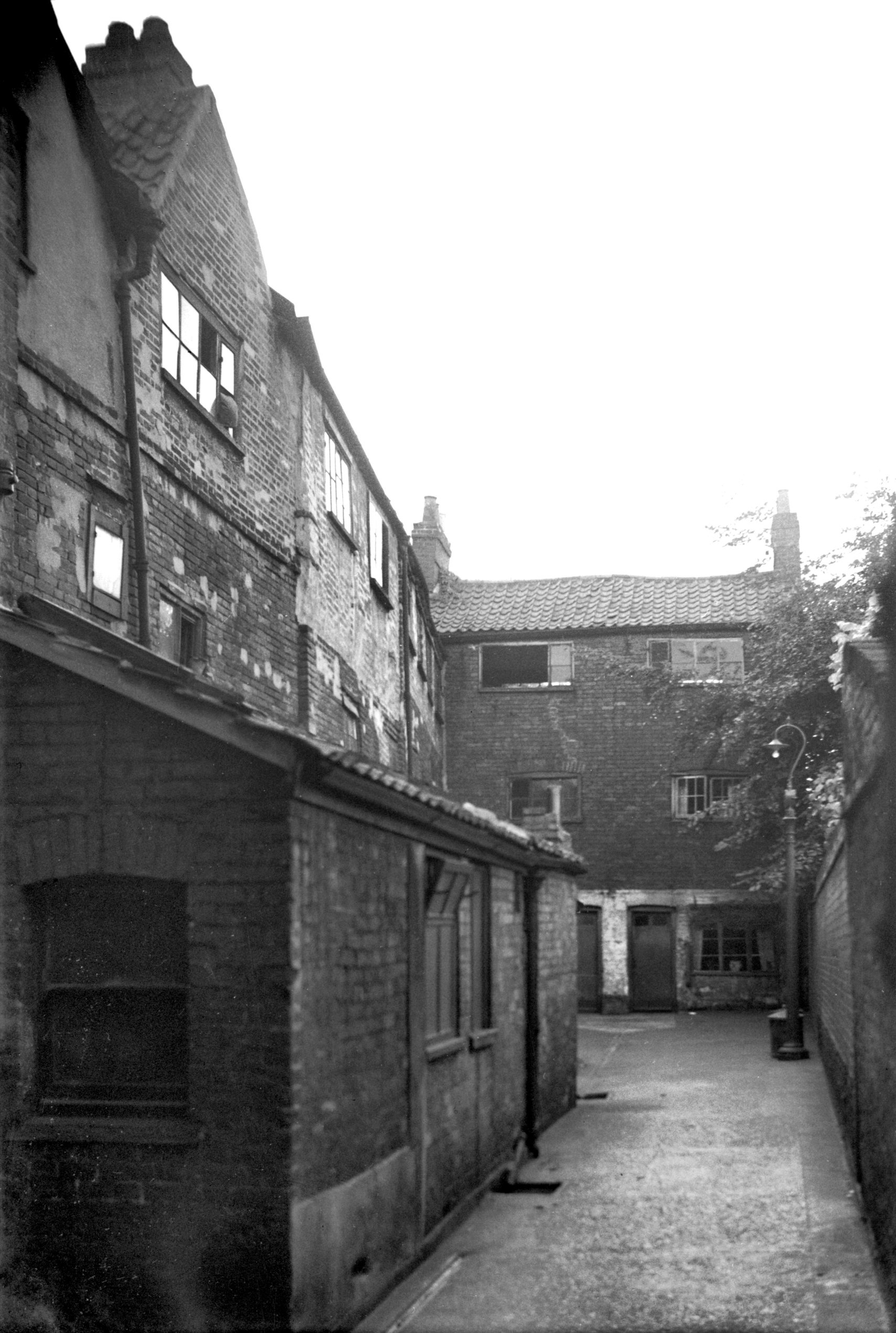
Pigg Lane: |
| |
From
Palace St to Quayside |
|
|
Pigg Lane 9 to 12 [2744] 1938-08-27
|
|
|
Pigg Lane 2 to 4 [0969] 1936-05-17
|
|
Pilling Park Rd: |
| |
From
Morse Rd to Wellesley Avenue (Plumstead Rd) |
|
|
Pilling Park Rd Mousehold House from SW [4878]
1964-11-28
|
|
|
Pilling Park Rd Mousehold House west side [4877]
1964-11-28
|
|
|
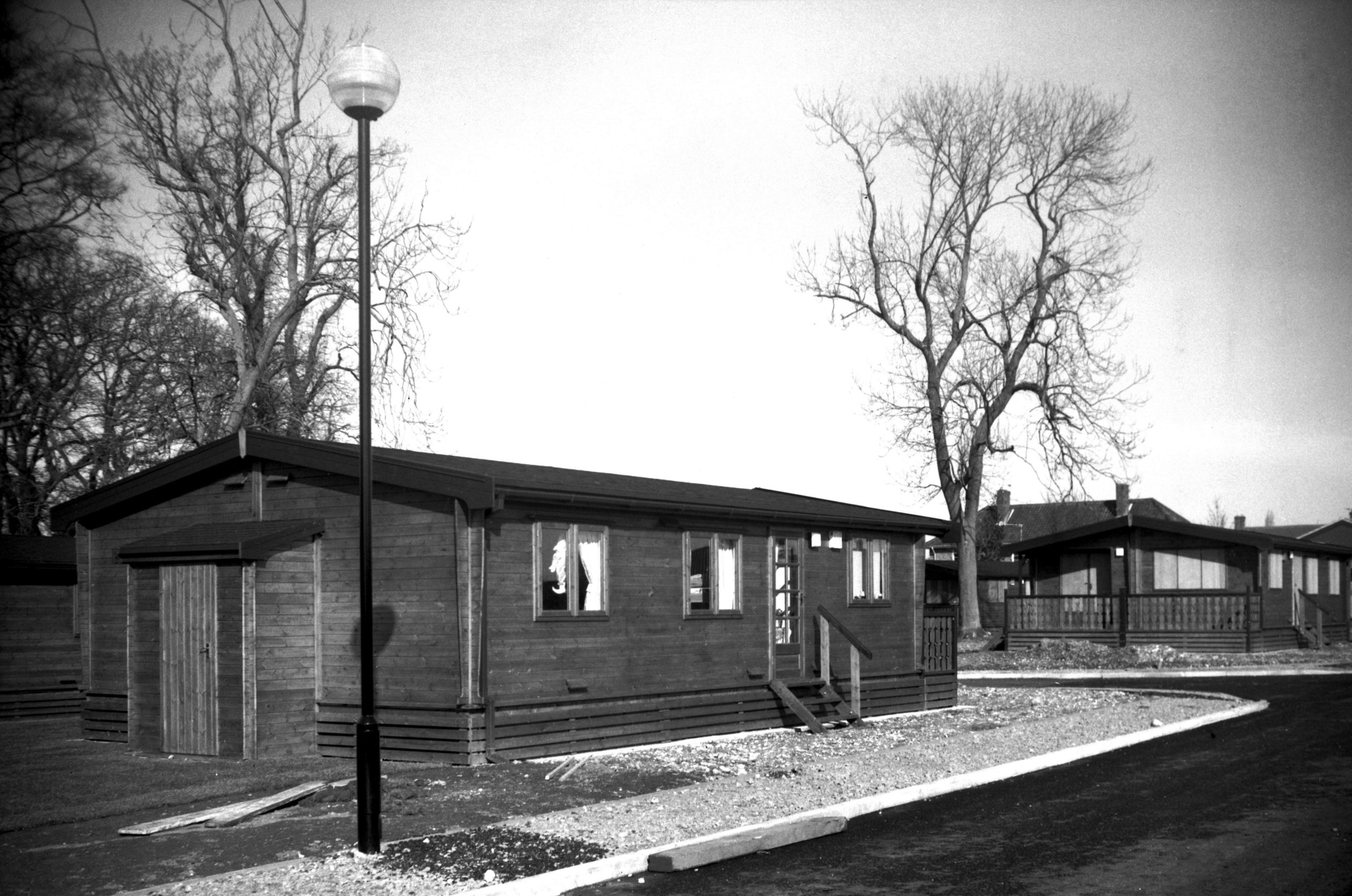
Woodrow Pilling Park temporary chalets [6594]
1990-03-14
Temporary wooden chalets 1990 to house tenants of
neighbouring estate whilst their permanent homes were
being underpinned. |
|
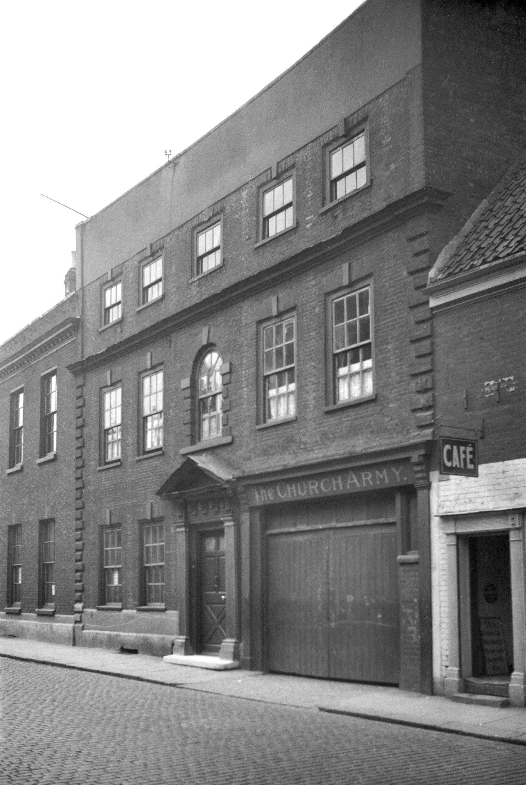
Pitt St: |
| |
From
St
Crispin's Rd (formerly from Muspole St / Duke
St / St Mary's Plain) to Gildencroft / St Augustine's St / Botolph
St
formerly passing St Martin's Lane
East side |
|
|
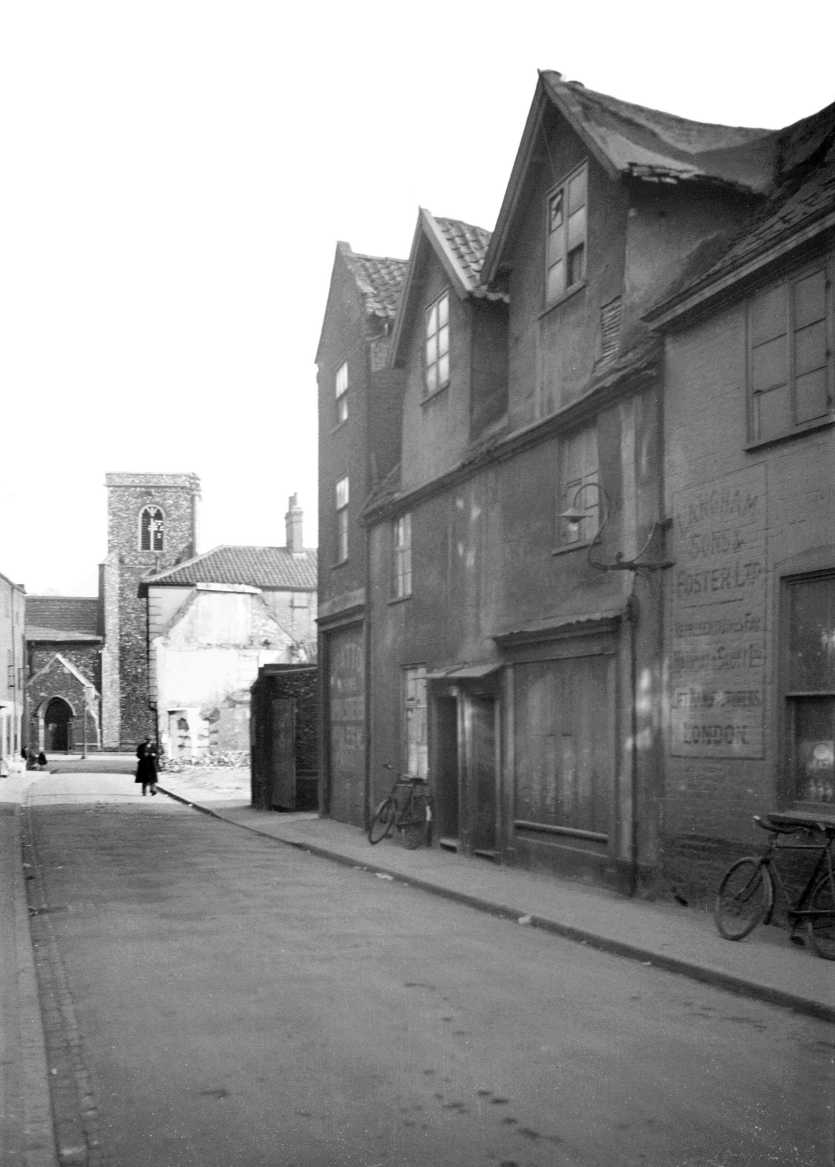
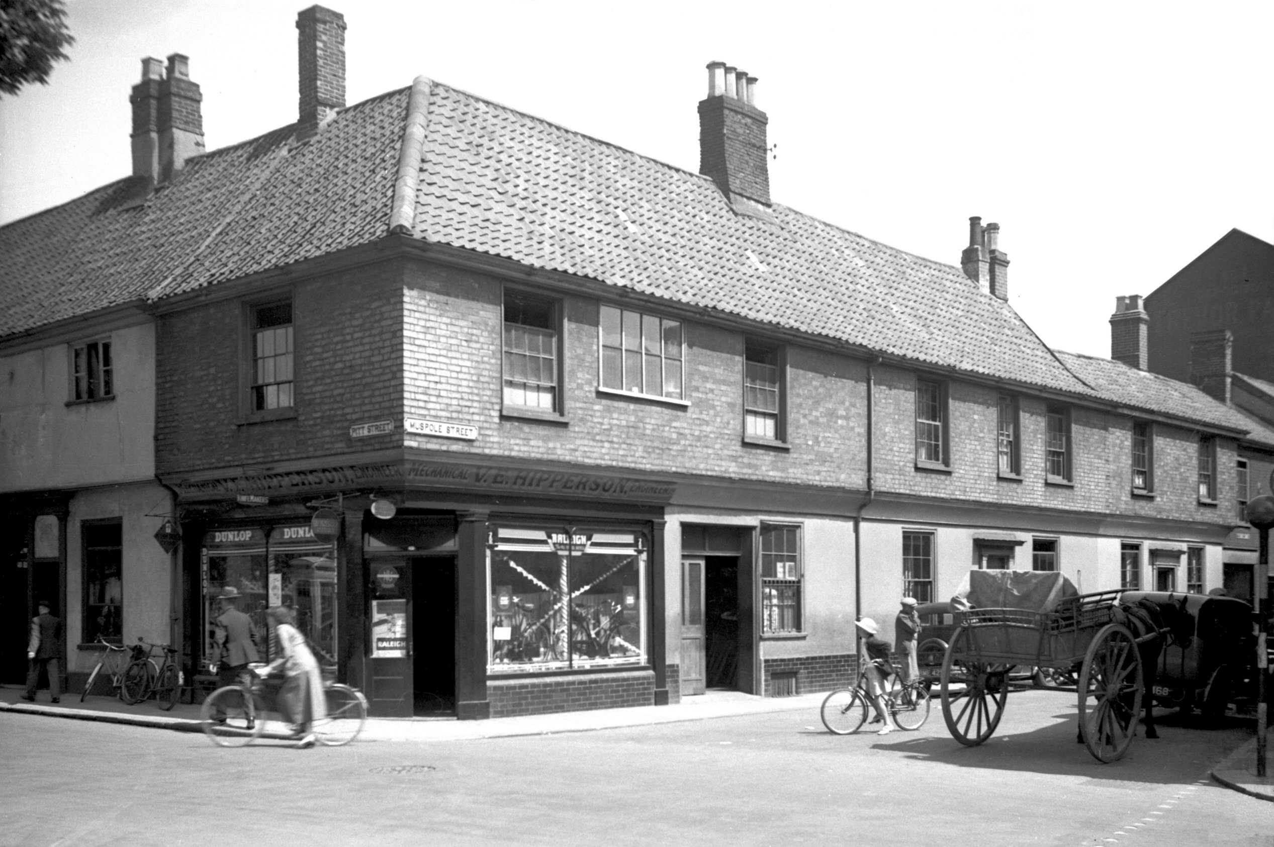
Pitt St 1 Muspole St 31 to 33 [1679] 1937-06-05
31 to 33 Muspole St on the right. |
|
|
Pitt St 1 to 3 [4422] 1956-03-27
|
|
|
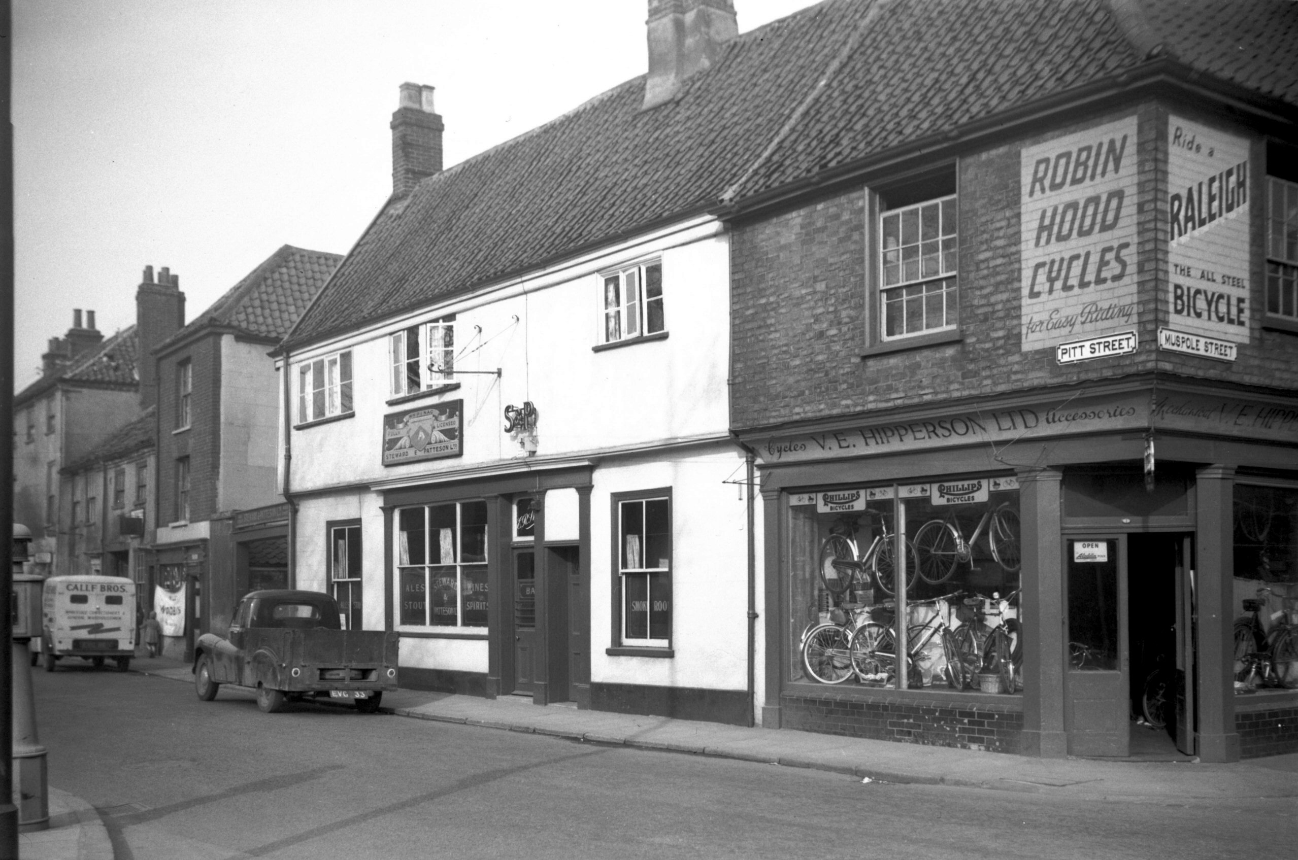
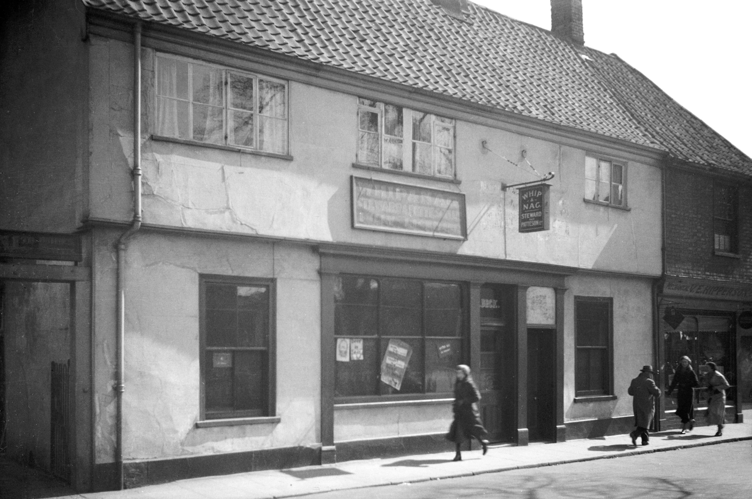
Pitt St 3 Whip and Nag PH [0845] 1936-04-09
This portion of Pitt St has since been added to Duke St.
See 69 to 89 Duke St for
later pictures. |
|
|
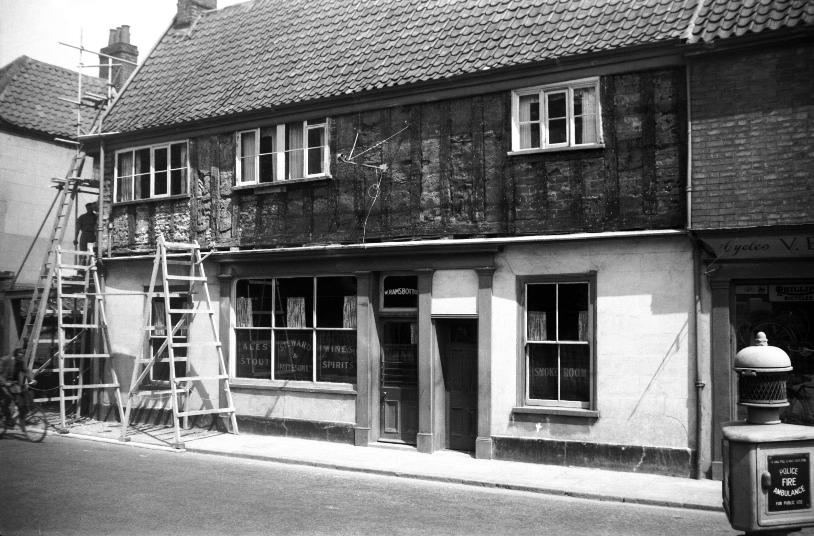
Pitt St 3 during repairs [4251] 1954-05-26
Half-timber and brick exposed during repairs, May 1954. |
|
|
Pitt St 17 to 23 [2737] 1938-08-24
|
|
|
Pitt St 27 to 31 [1444] 1936-09-22
|
|
|
Pitt St 27 to 35 view north [0871] 1936-04-10
|
|
|
Pitt St 33 to 35 [0895] 1936-04-12
Shortly before the war the idea was mooted of having a
more direct road linking Thorpe and City Stations,
following much the same route as that since adopted by St
Crispin's Rd. To this end a start was made by
constructing a short length of carriageway between St
George's St and Pitt St, coming out opposite St Martin's
Lane.
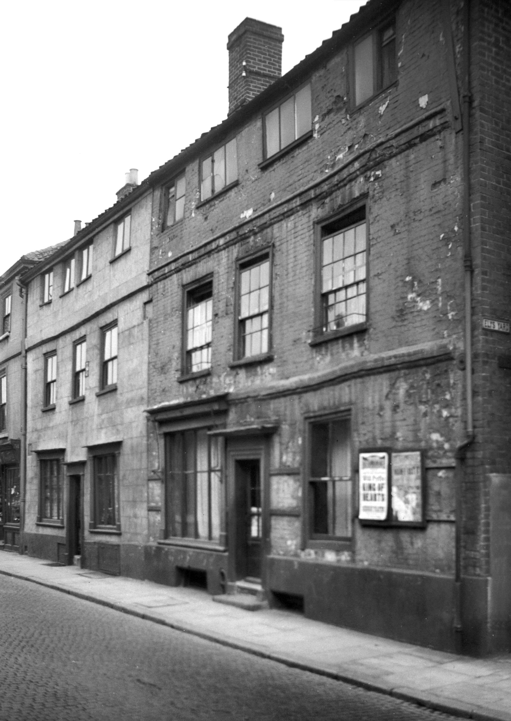
There, until demolished in September 1937, stood a
pleasing pair of semi-detached Georgian cottages, Nos 33
and 35 Pitt St. A central doorway gave access to a
covered passageway that led to a small chapel at the
rear. In 1754 the Reverends John and Charles Wesley paid
their first visit to Norwich, but it was not until 1769
that their followers built this as their first settled
place of worship in the city. Later acquired by the
Baptists, it was enlarged in 1818 when a stone tablet was
placed over the doorway inscribed "MDCCCXVIII
Providence Chapel". |
|
|
Cherry Lane south side [0835] 1936-03-31
Next to 35 Pitt St. |
|
|
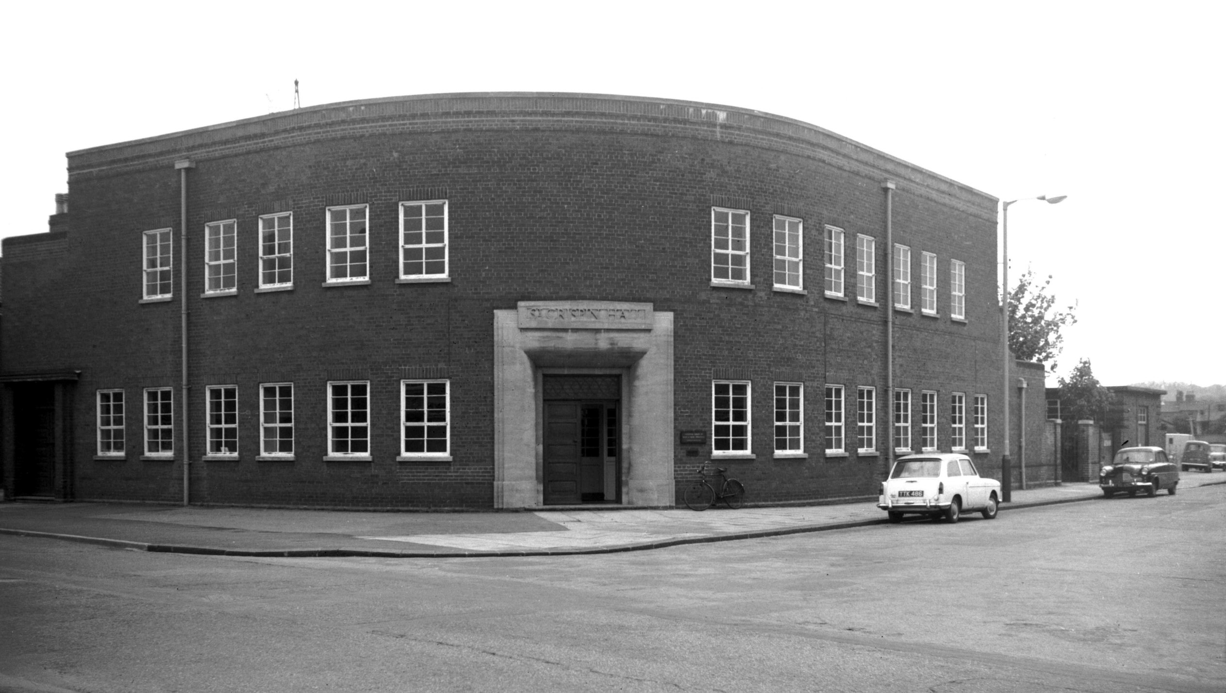
Pitt St St Crispin's Hall [5144] 1967-05-20
Opened 12th September 1939. |
|
|
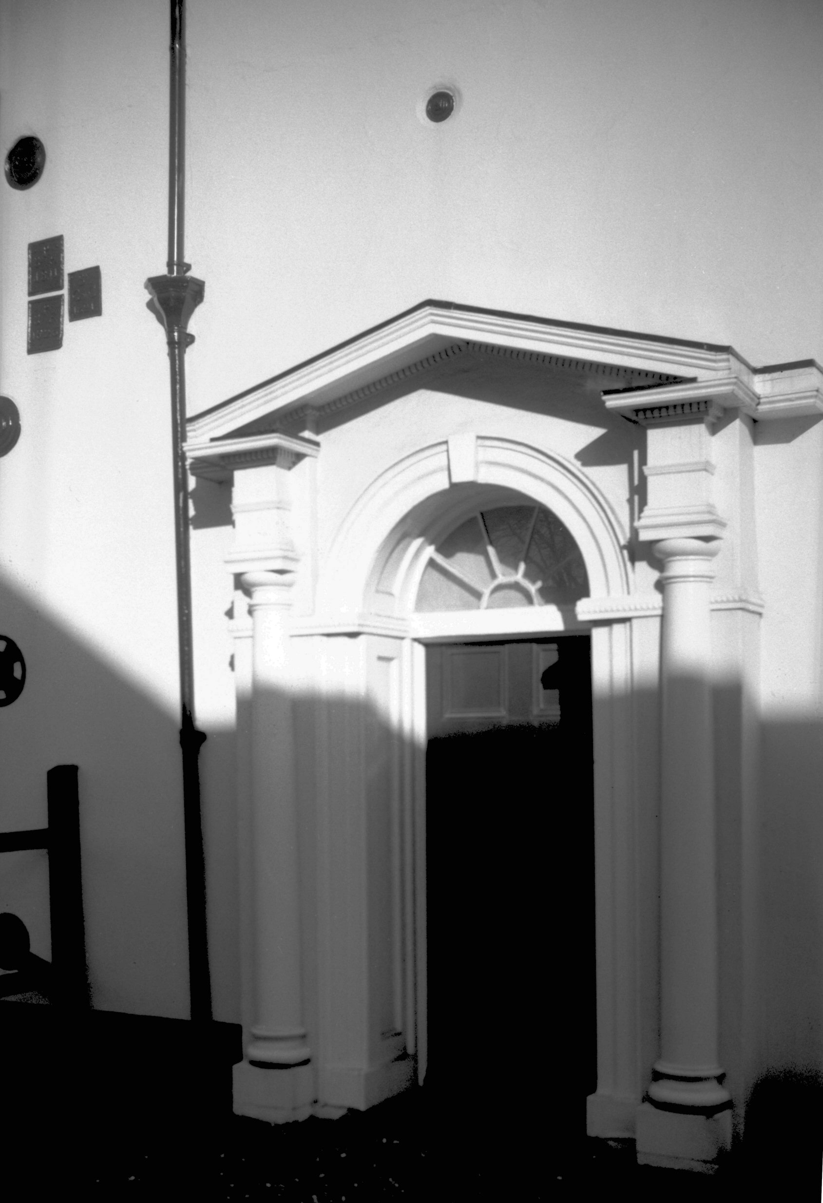
Pitt St 53 Georgian doorway [7729] 2000-02-11
|
|
|
Pitt St 63 [1445] 1936-09-22
|
|
|
Pitt St 63 to 65 view north [0869] 1936-04-10
|
|
|
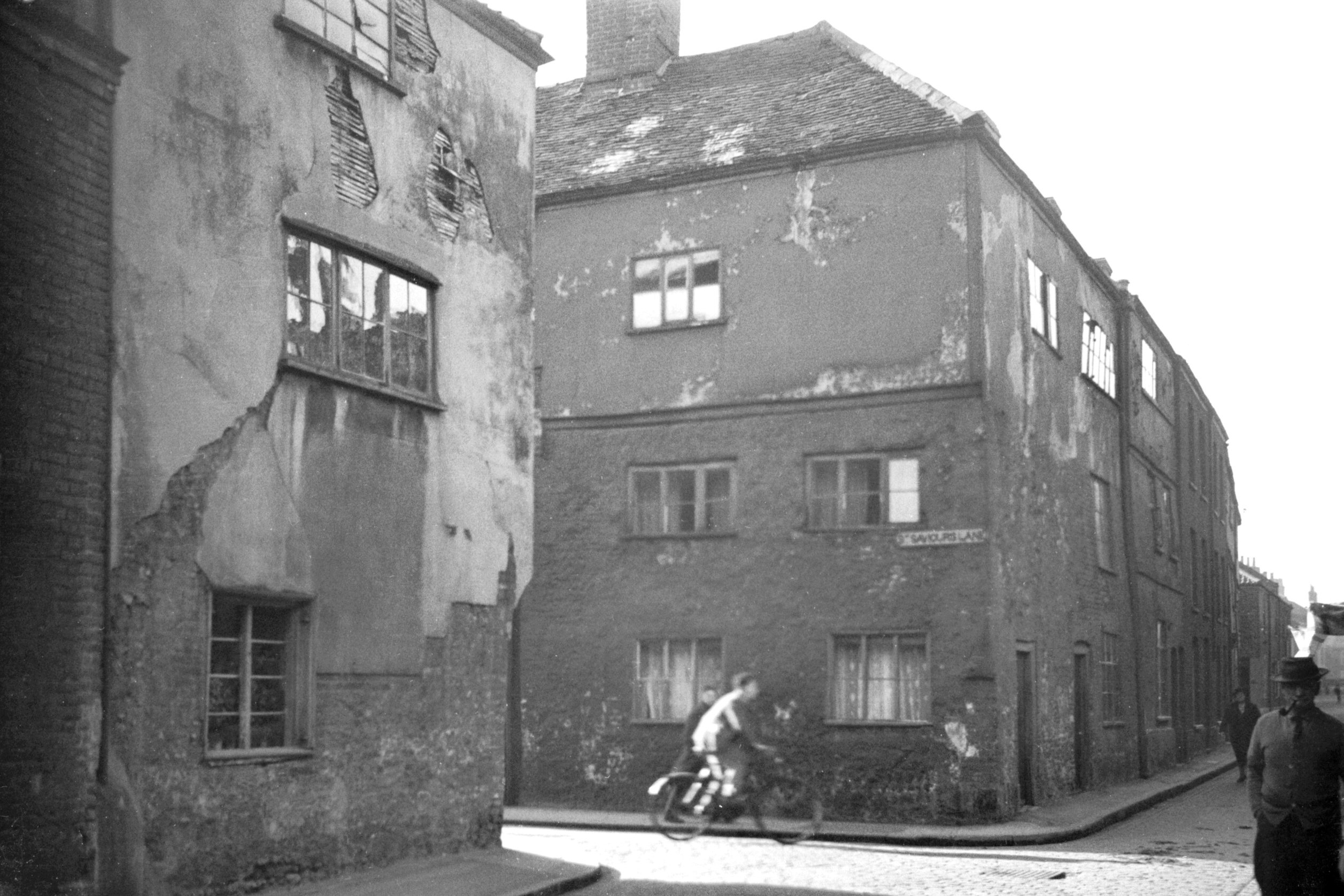
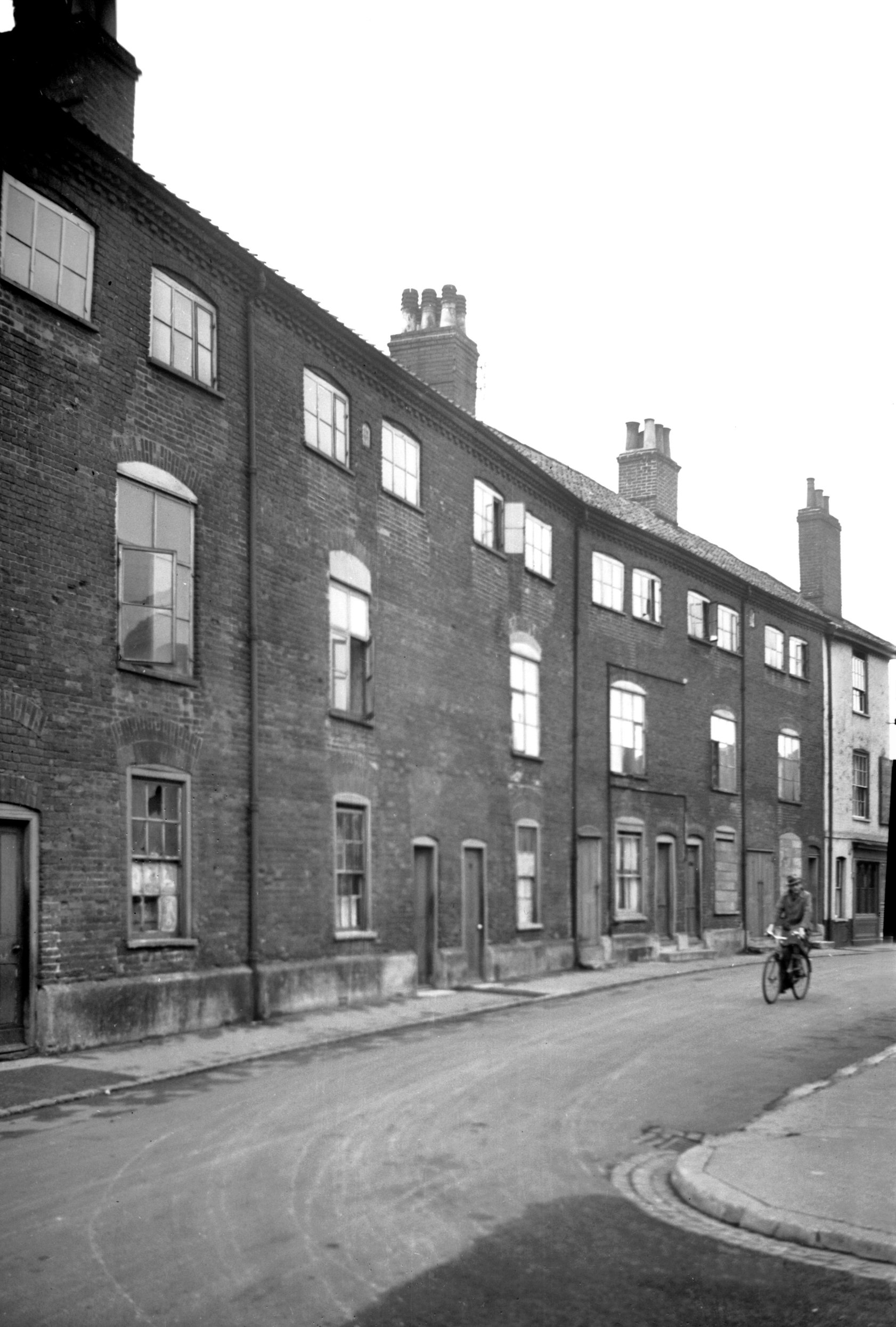
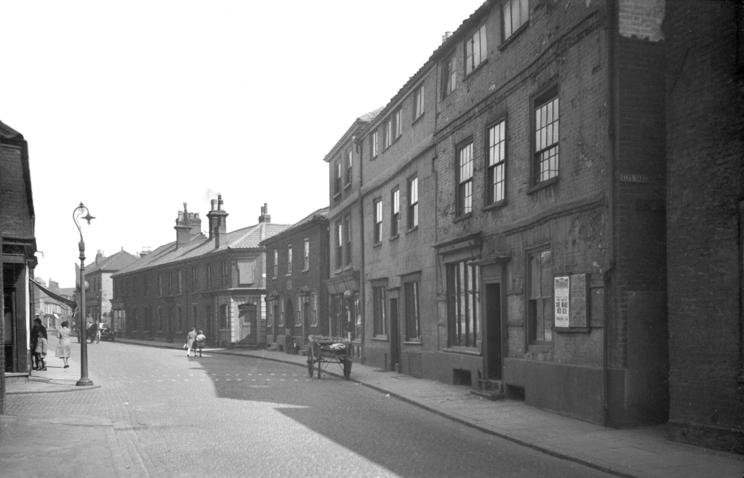
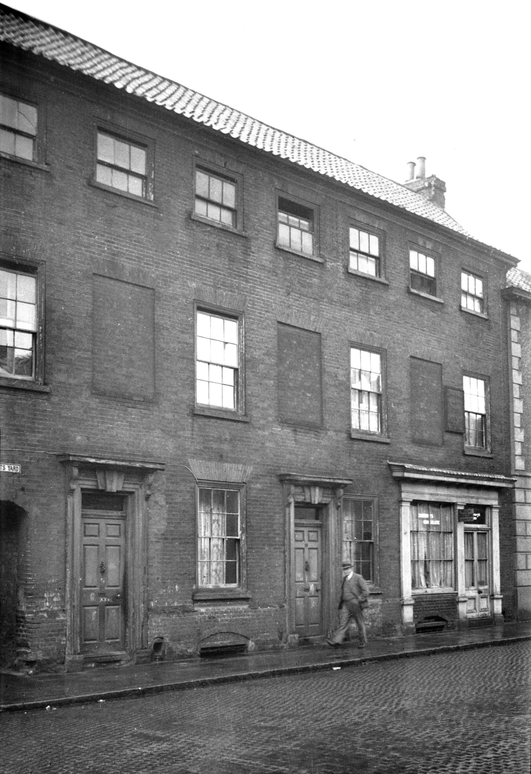
Pitt St 65 [1446] 1936-09-22
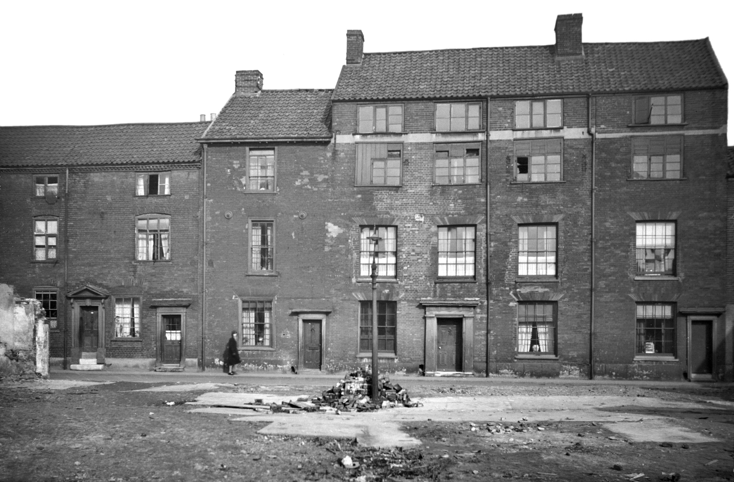
Pitt St until quite recent times was lined with houses
typical of the 18c, mostly of two main storeys, with an
attic floor above, and with a pillared doorway providing
one of the main external features. War damage,
redevelopment and street widening have all since taken
their toll, however, and the last of these mansions, No
67, was demolished in June 1973. This house had in its
latter years been occupied as a shoe factory and its
front doorway had been removed to provide loading
facilities in what had formerly been the entrance hall.
It had, however, retained several interesting features,
including some good internal woodwork. Externally the
facade was divided into sections by four brick pilasters
having stone caps and bases, which supported a wide
cornice below attic level. All the sash windows had
nicely curved heads, each with a small central keystone. |
|
|
Pitt St 81 [2713] 1938-08-15
|
| |
West
side |
|
|
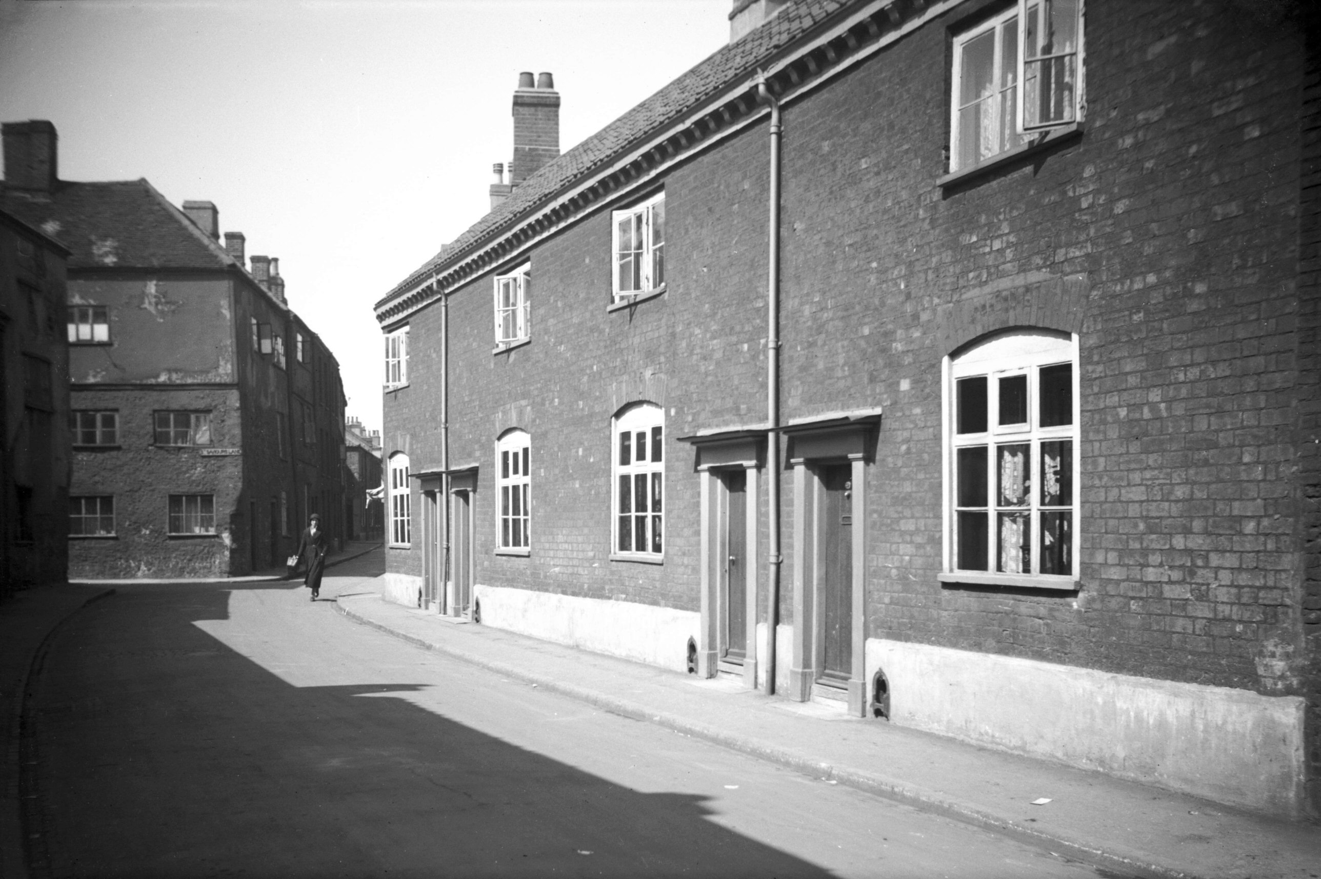
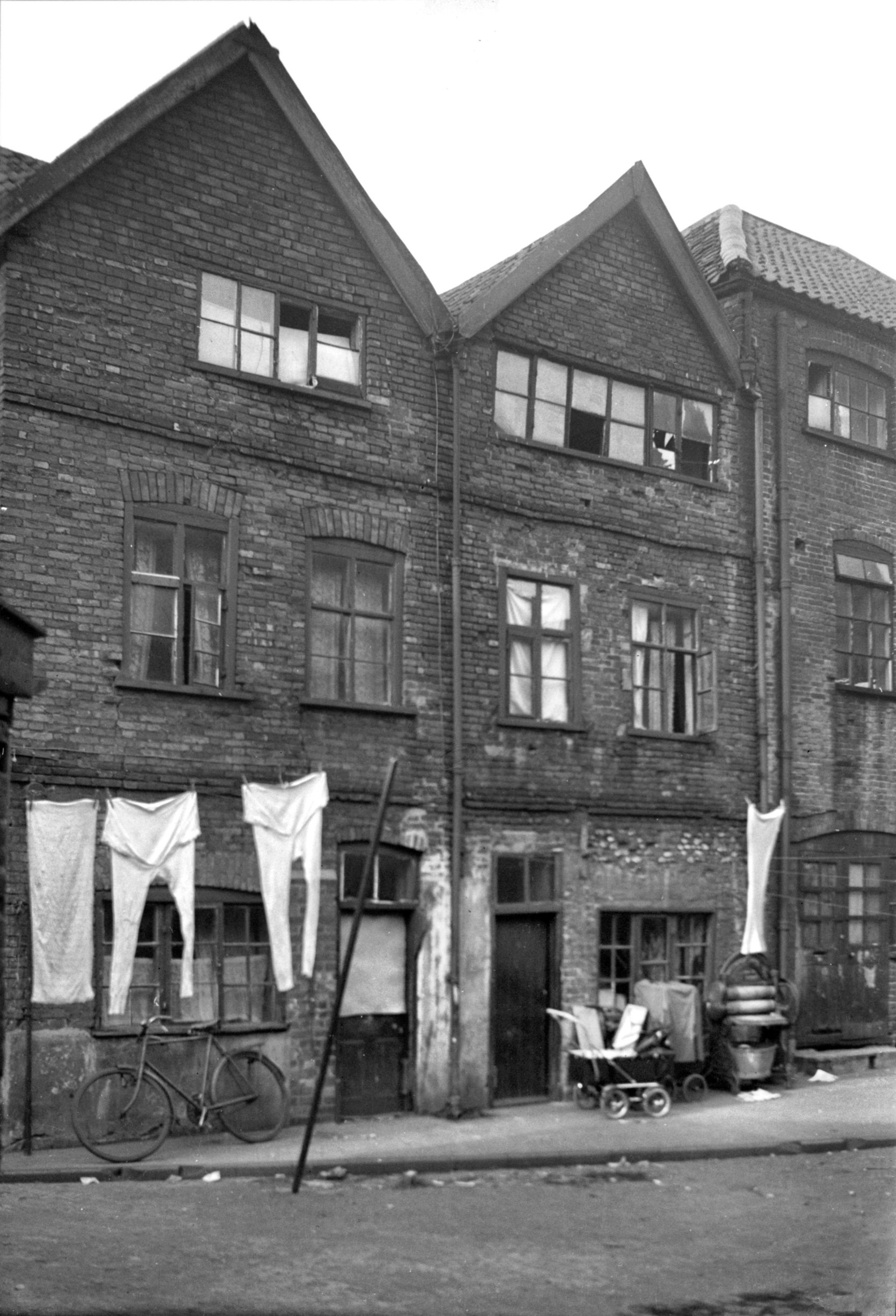
Pitt St 6 to 8 and L St Mary's Alley 1 to 2 [0844]
1936-04-09
|
|
|
Pitt St Blakeley's Yard north side [1721] 1937-06-17
|
|
|
Pitt St Blakeley's Yard south side [1722] 1937-06-17
|
|
|
Pitt St Cattermoul's Yard south side [1720]
1937-06-17
|
|
|
Pitt St 16 [4067] 1952-03-20
|
|
|
Pitt St 50 to 54 [1497] 1936-10-06
|
|
|
Pitt St 58 to 60 [1462] 1936-09-27
|
|
|
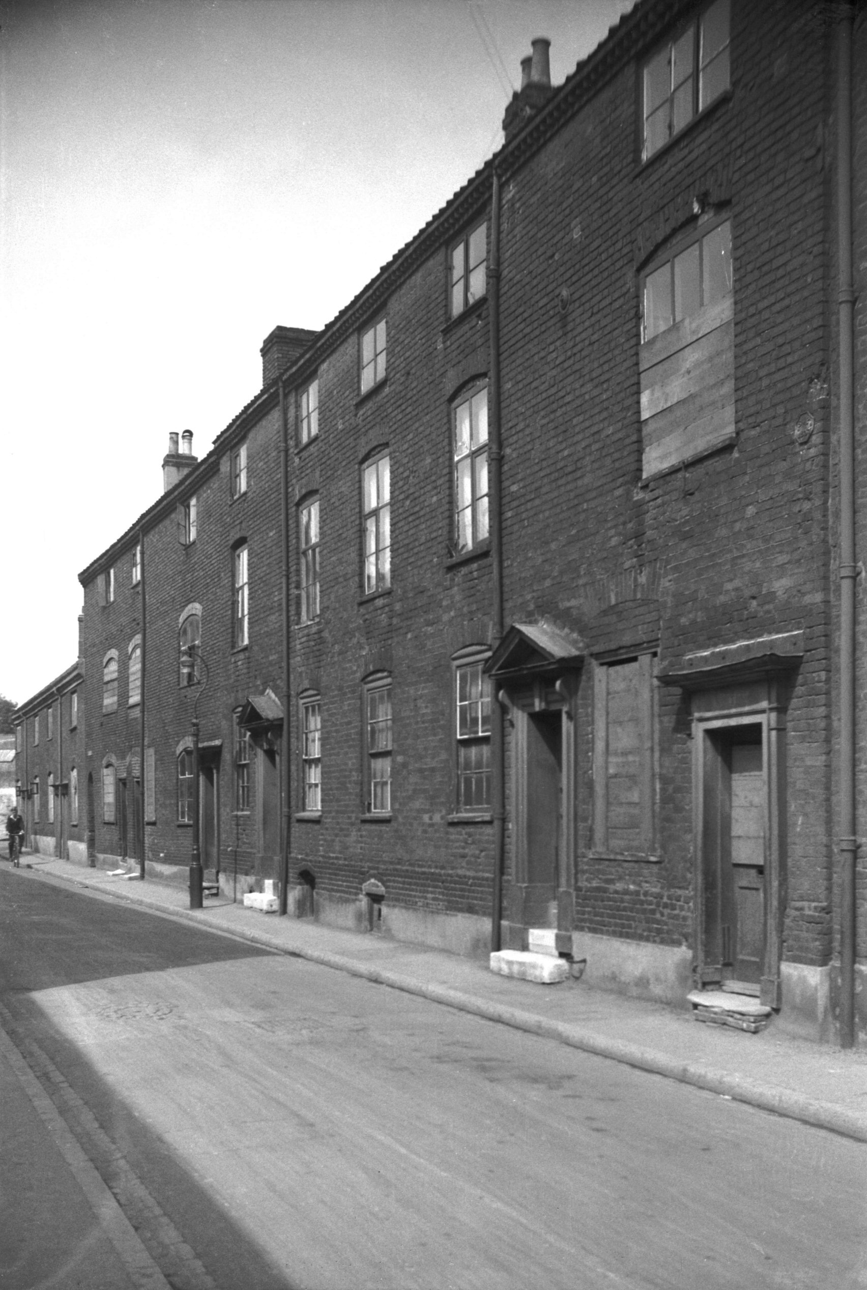
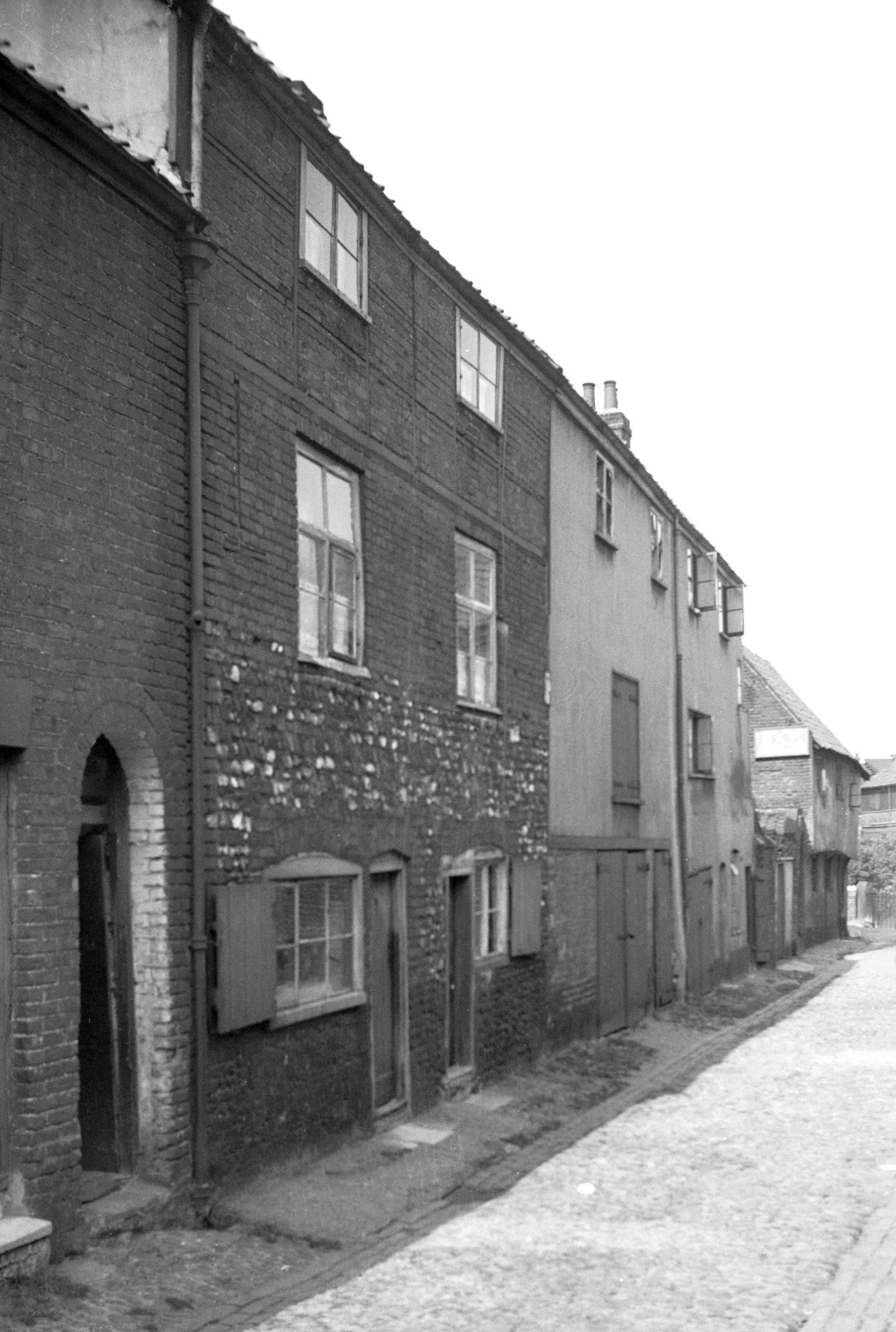
Pitt St 58 to 62 [0868] 1936-04-10
Since being bisected by the Inner Link road, the southern
part of Pitt St has been renamed as part of Duke St. That
part retaining the name, from the Inner Link road to St
Augustine's St, has changed greatly. My photograph of its
western side taken in 1936 shows a continuous row of 18c
houses similar in style but varied in detail,
particularly in regard to their rooflines and front
doorways. Nos 60 and 62, in the centre of the picture,
were both victims of the raids of 27th and 29th April
1942. |
|
|
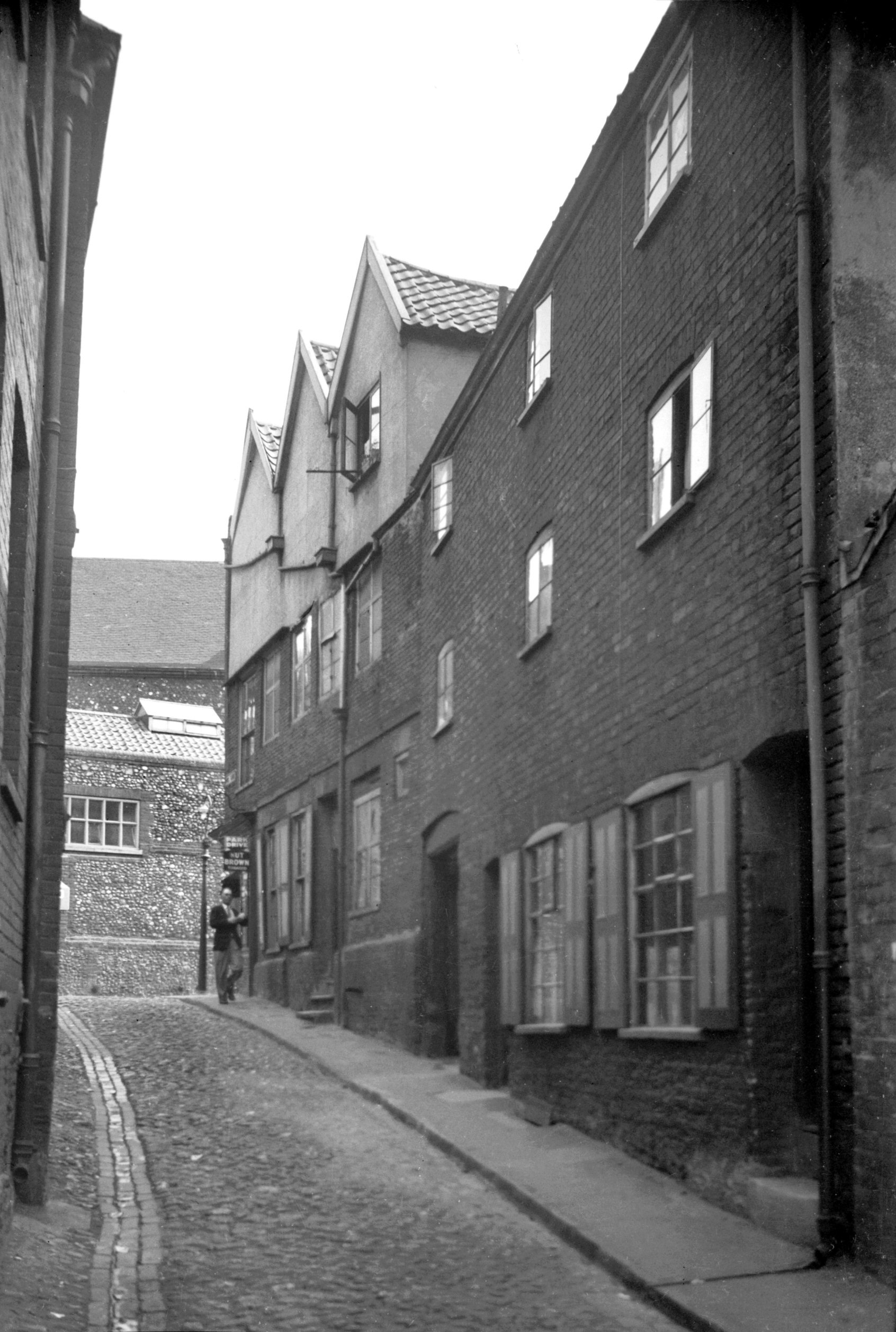
Pitt St 60 Georgian doorway [0585] 1935-05-18
No 60 appeared to be of a rather later date than its
neighbour, with the pillars flanking its doorway carved
in a style made popular by the Adams brothers and their
followers. Although the doorway of No 62 seemed earlier,
it had a "lion-head" doorknocker, probably
added during the Regency period, when a considerable
number of such knockers made their appearance as a symbol
of patriotism. Inside the house its main feature was the
staircase, a highly ornate one with hand-carved
"barley sugar" banisters and elaborate consoled
step-ends.
At the time of Henry VIII the part still known as Pitt St
was known as St Olave's St, from a church of that name
situated to the north of Cherry Lane. The historian
Francis Blomefield recorded that the church was commonly
called "St Tooley's" and that it was demolished
in 1546 when the parish was united to that of St George
Colegate. The street's present name was derived not as
one might imagine from the great statesman but simply
from the presence of an open pit here, at the west end of
St Olaves' churchyard. It is said to have been filled in
at the beginning of the 18c.
At about that time, too, the former churchyard was known
as the Cherry Ground, a name perpetuated by Cherry Lane
but no longer by a public house. The Cherry Tree was
renamed the Golden Sovereign some years ago; it has since
been closed down. |
|
|
Pitt St 62 [3207] 1939-08-07
|
|
|
Pitt St 62 Georgian doorway [3208] 1939-08-07
|
|
|
Pitt St 64 to 66 [2720] 1938-08-20
|
|
|
Pitt St 66a to 68 [1466] 1936-09-27
|
|
|
Pitt St 68 to 70 view north [0870] 1936-04-10
|
|
|
Pitt St 70 [2721] 1938-08-20
|
|
|
Pitt St 74 to 84 [2722] 1938-08-20
|
|
Plumstead Rd: |
| |
From
Britannia
Rd / Kett's Hill to Heartsease Lane / Harvey Lane
passing Knox Rd, Wellesley Avenue (Pilling Park Rd)
South side |
|
|
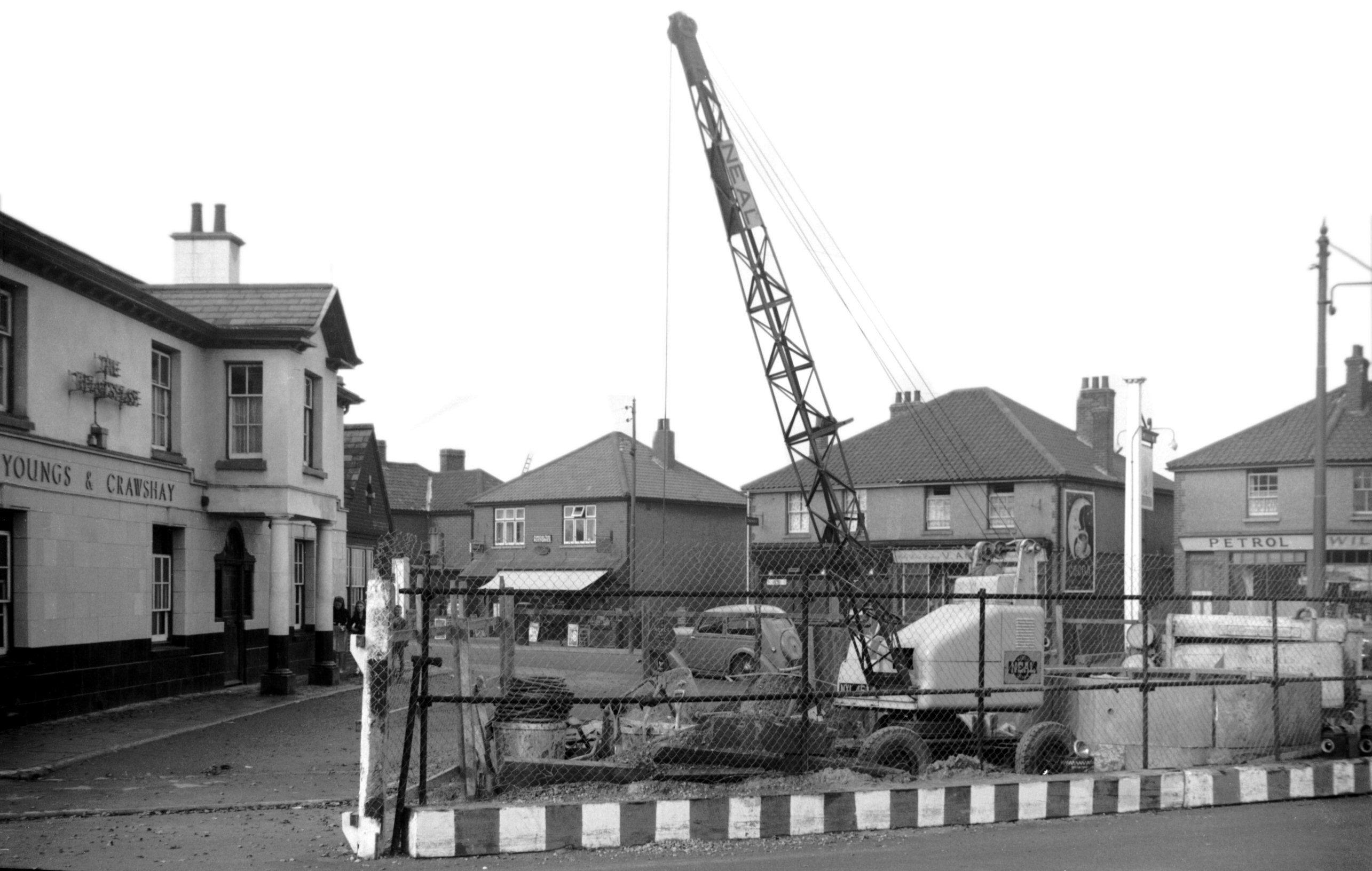
Plumstead Rd Heartsease PH surface drainage [4226]
1953-10-25
|
|
|
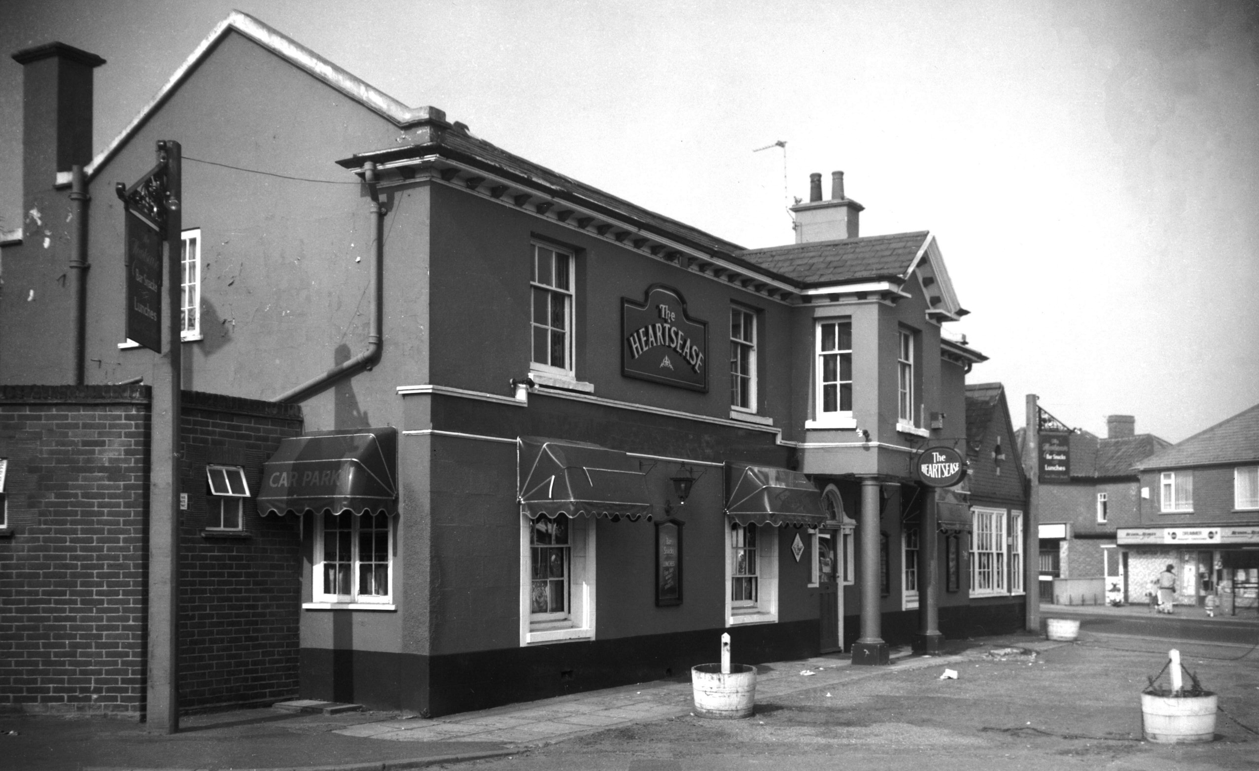
Plumstead Rd 180 Heartsease PH [6495] 1988-04-18
|