|
Wall Rd: |
| |
From
Sprowston
Rd to St Clement's Hill
passing Constitution Hill |
|
|
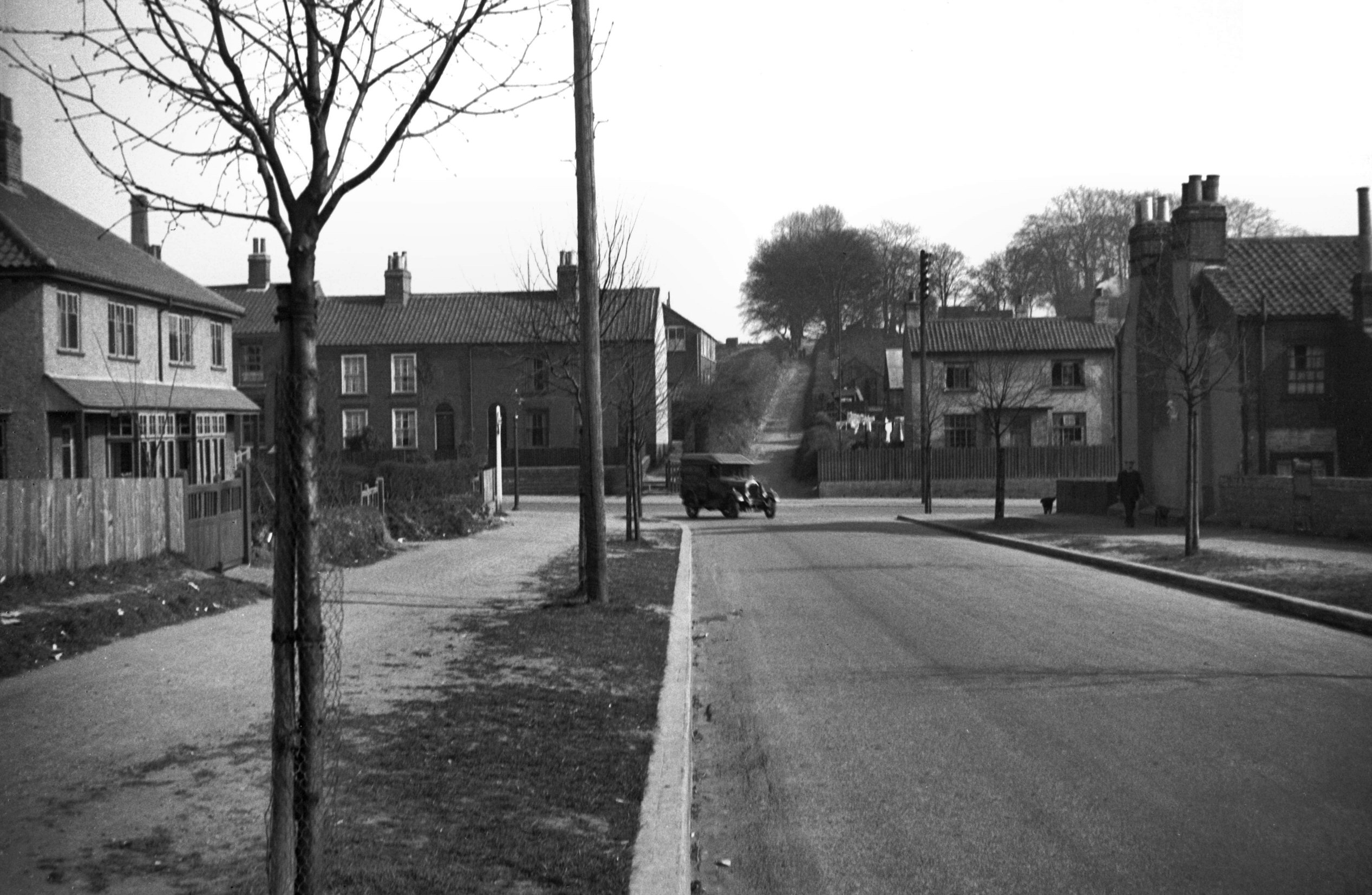
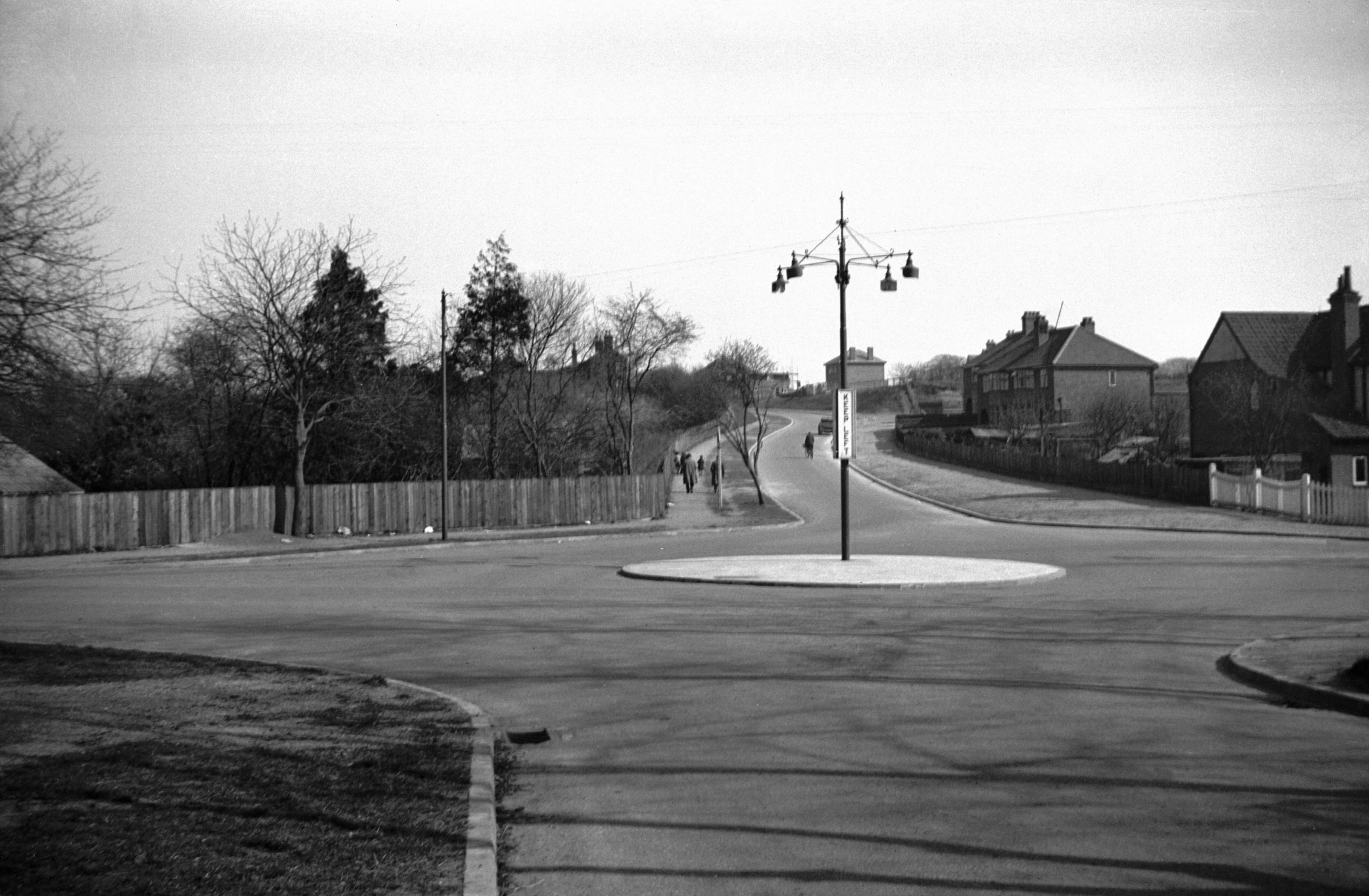
Wall Rd at Sprowston Rd [0080] 1934-04-05
|
|
|
Wall Rd at Constitution Hill [0079] 1934-04-05
|
|
Waterloo Park Avenue: |
| |
Off
Aylsham Rd |
|
|
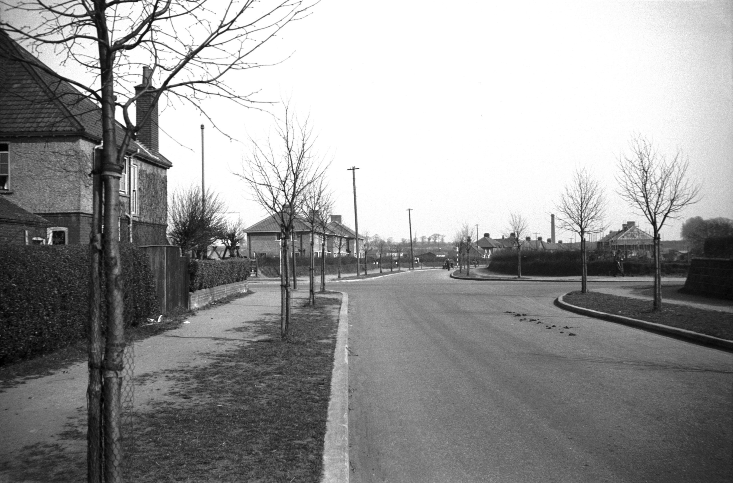
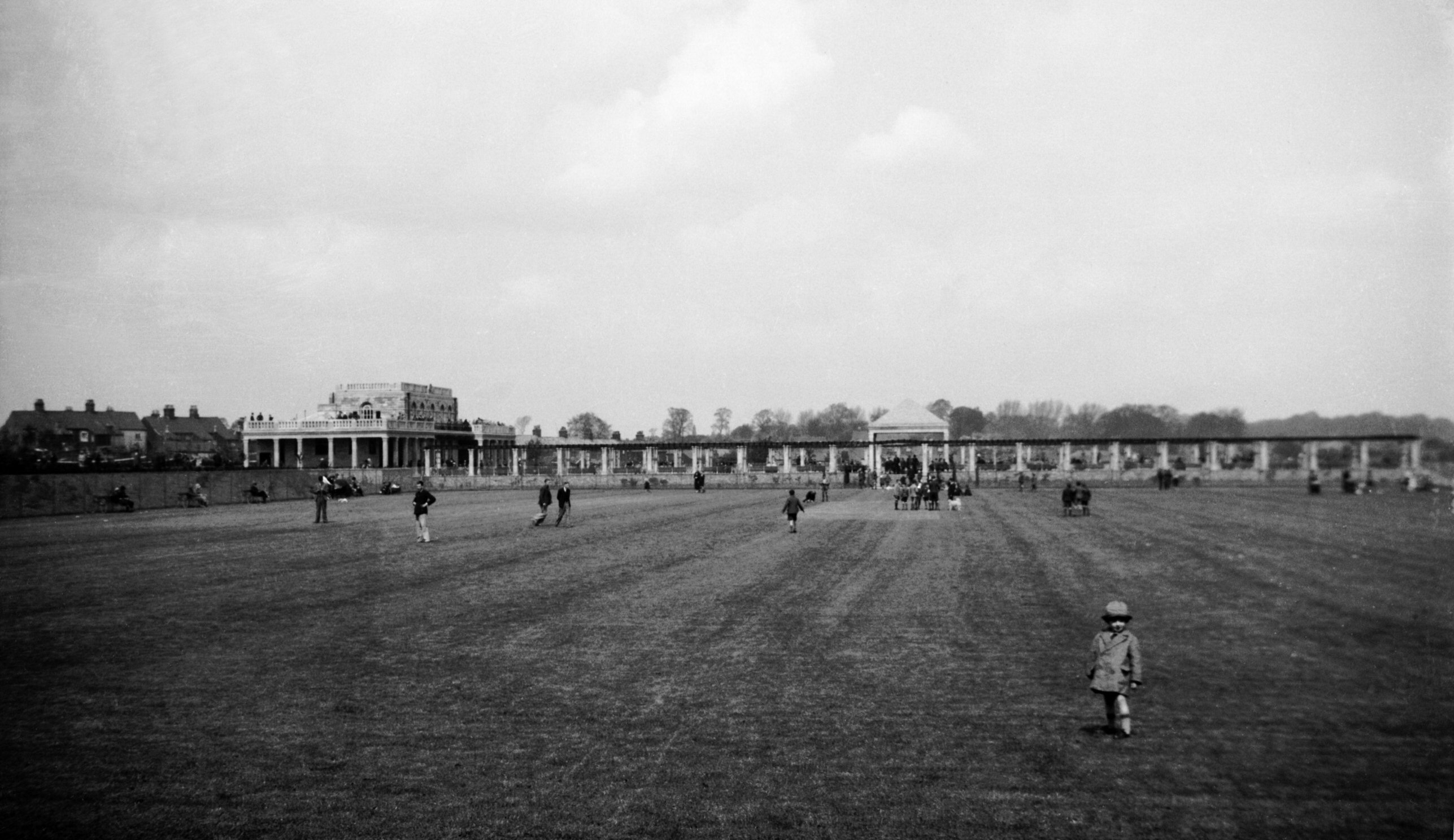
Waterloo Park avenue approach Angel Rd [B552]
1933-04-30
Formally opened 29th April 1933. Photographed the next
day. |
|
|
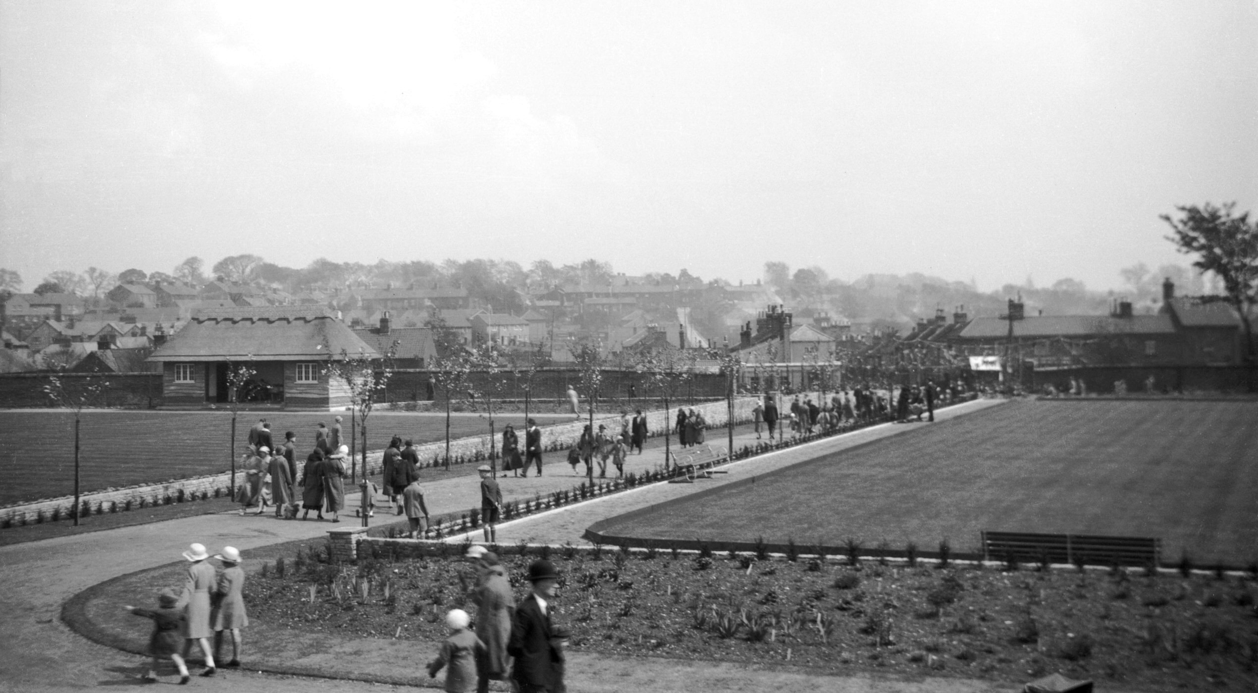
Waterloo Park bandstand and pavilion [B553]
1933-04-30
|
|
|
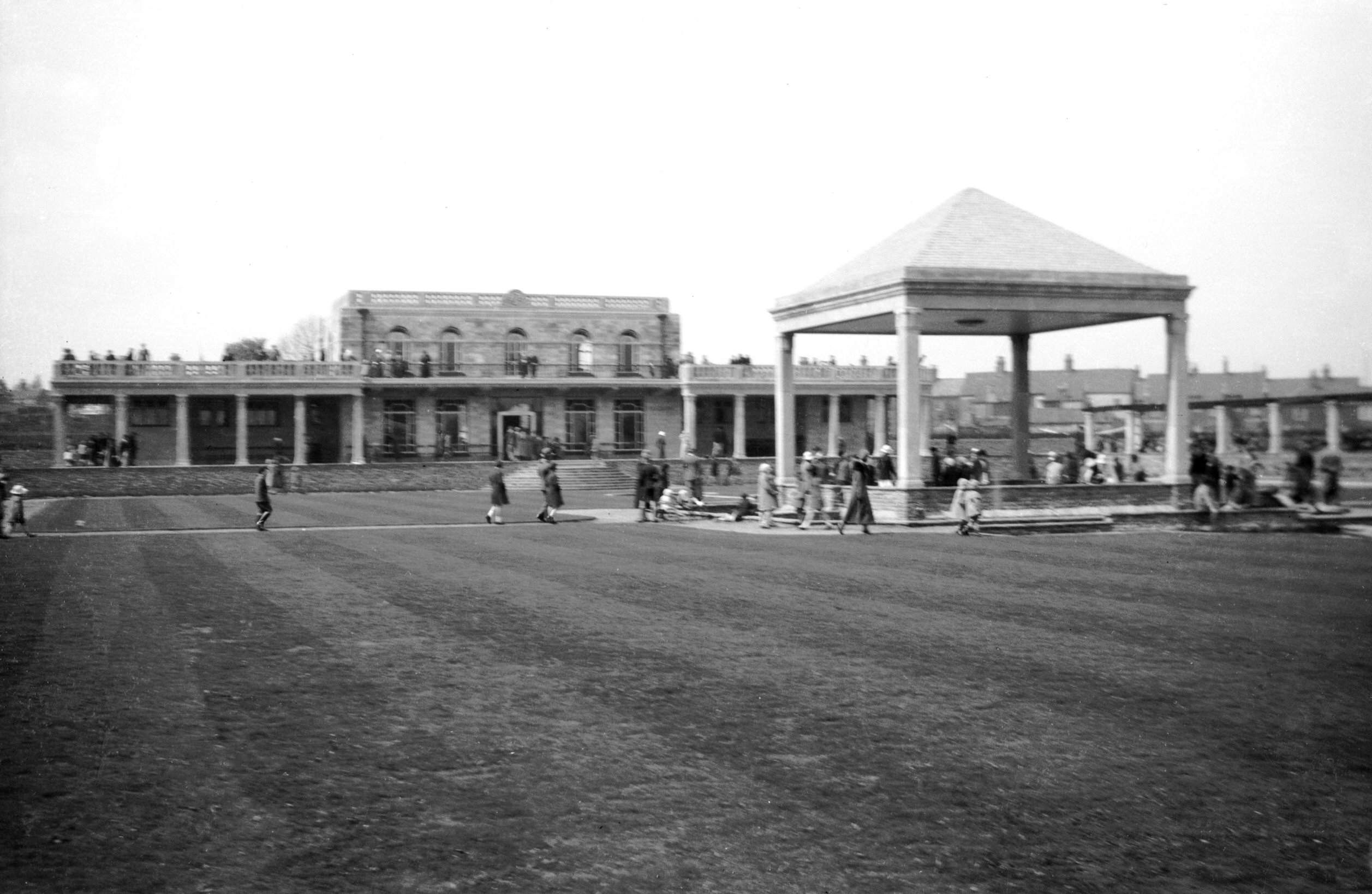
Waterloo Park pavilion and colonnade [B554]
1933-04-30
|
|
|
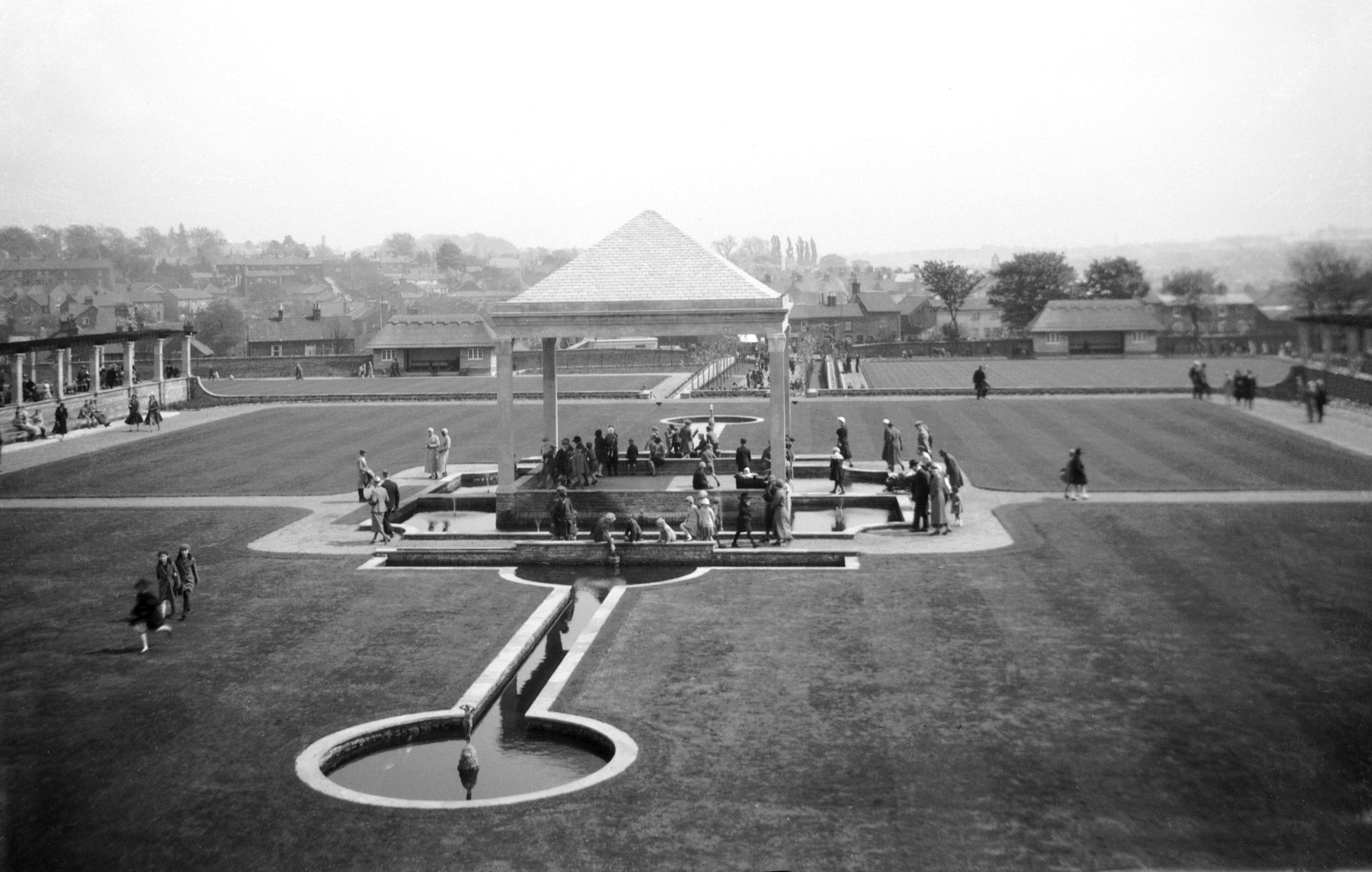
Waterloo Park bandstand from pavilion roof [B555]
1933-04-30
|
|
|
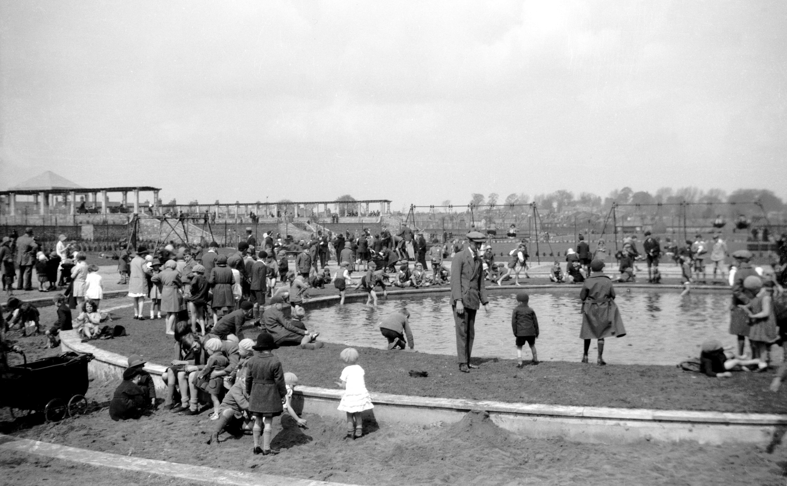
Waterloo Park paddling pool and sandpit [B556]
1933-04-30
|
|
Waterworks Rd: |
| |
From
Dereham Rd to Heigham St
passing Turner Rd
North side |
|
|
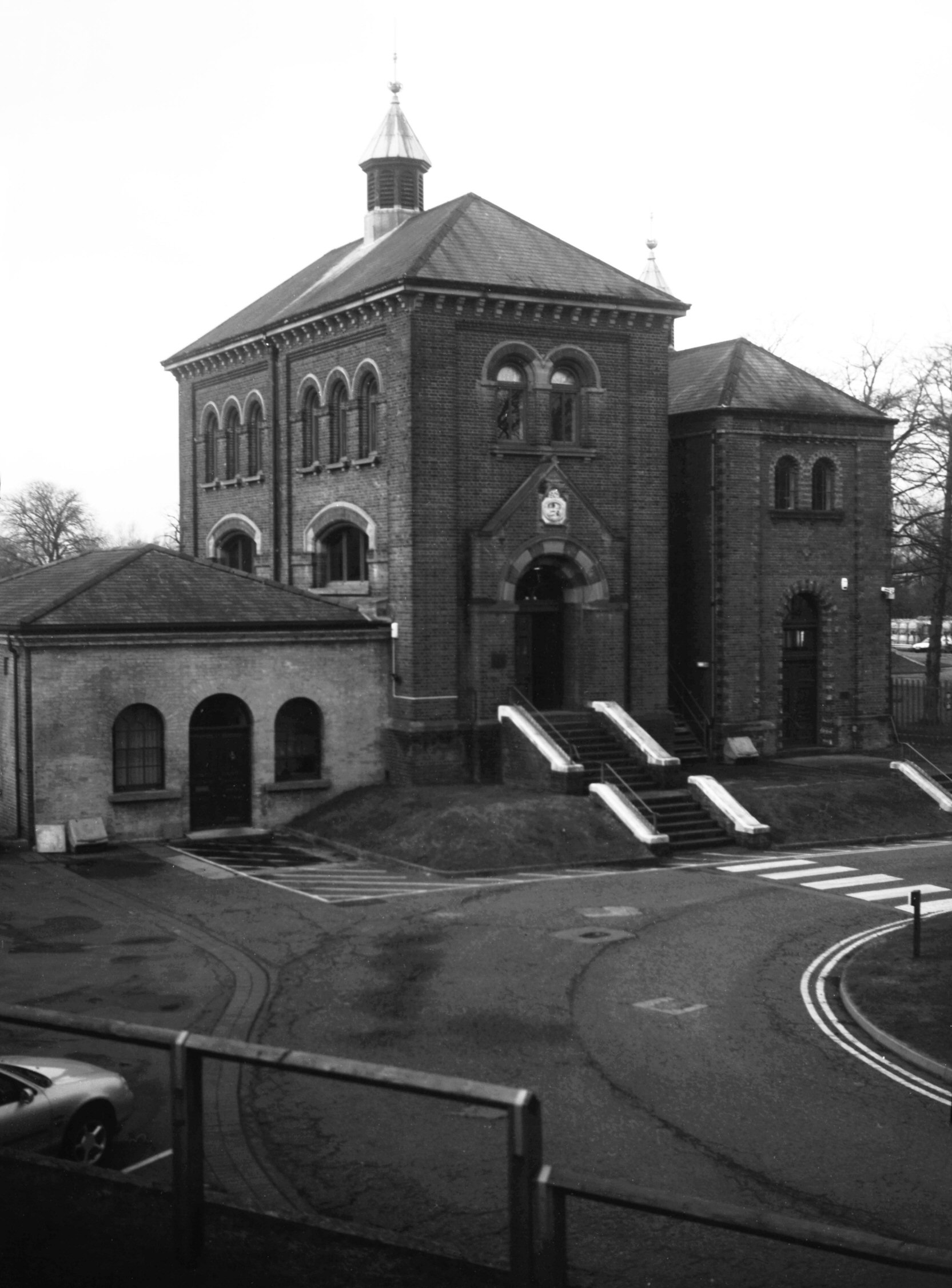
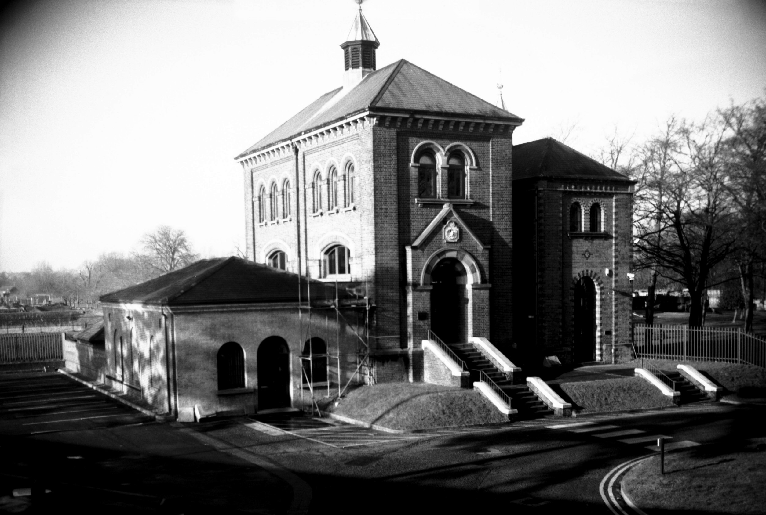
Waterworks Rd water offices [7789] 2000-12-11
|
|
|
Waterworks Rd water offices [7794] 2001-01-28
|
|
|
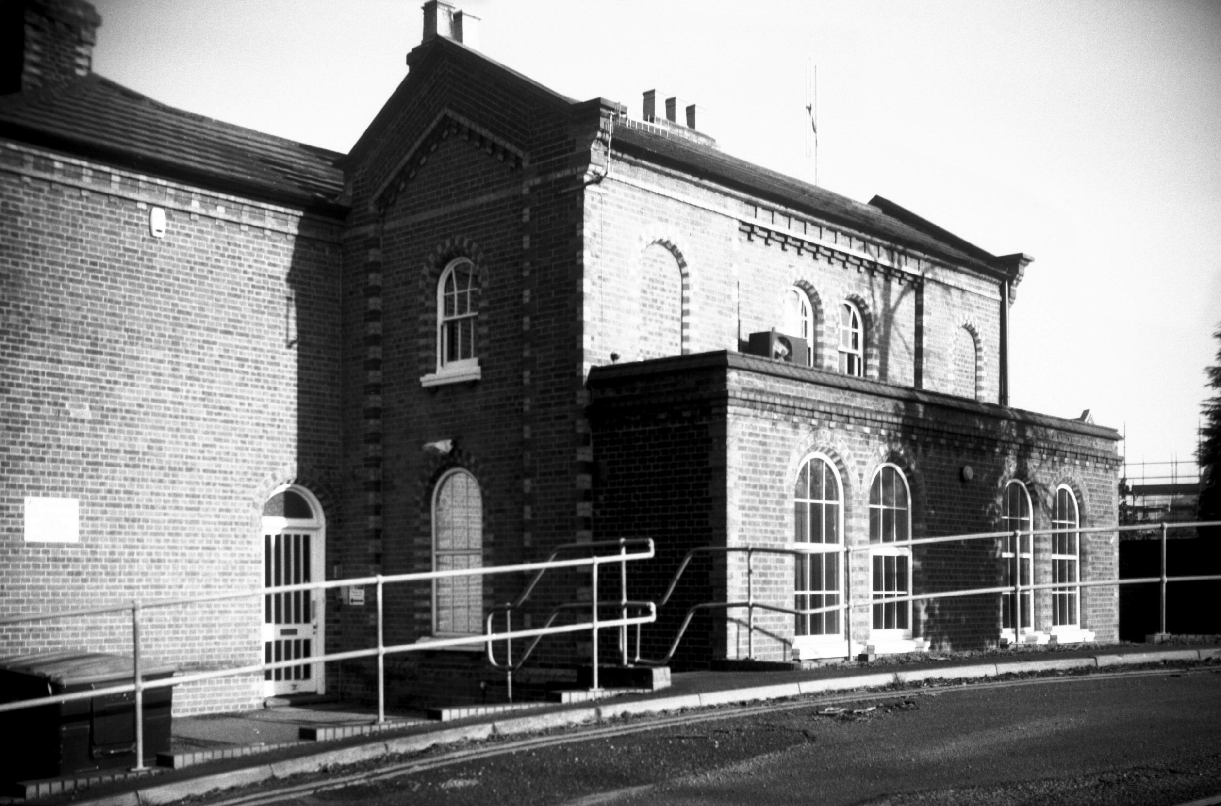
Waterworks Rd water pump house [7788] 2000-12-11
|
|
|
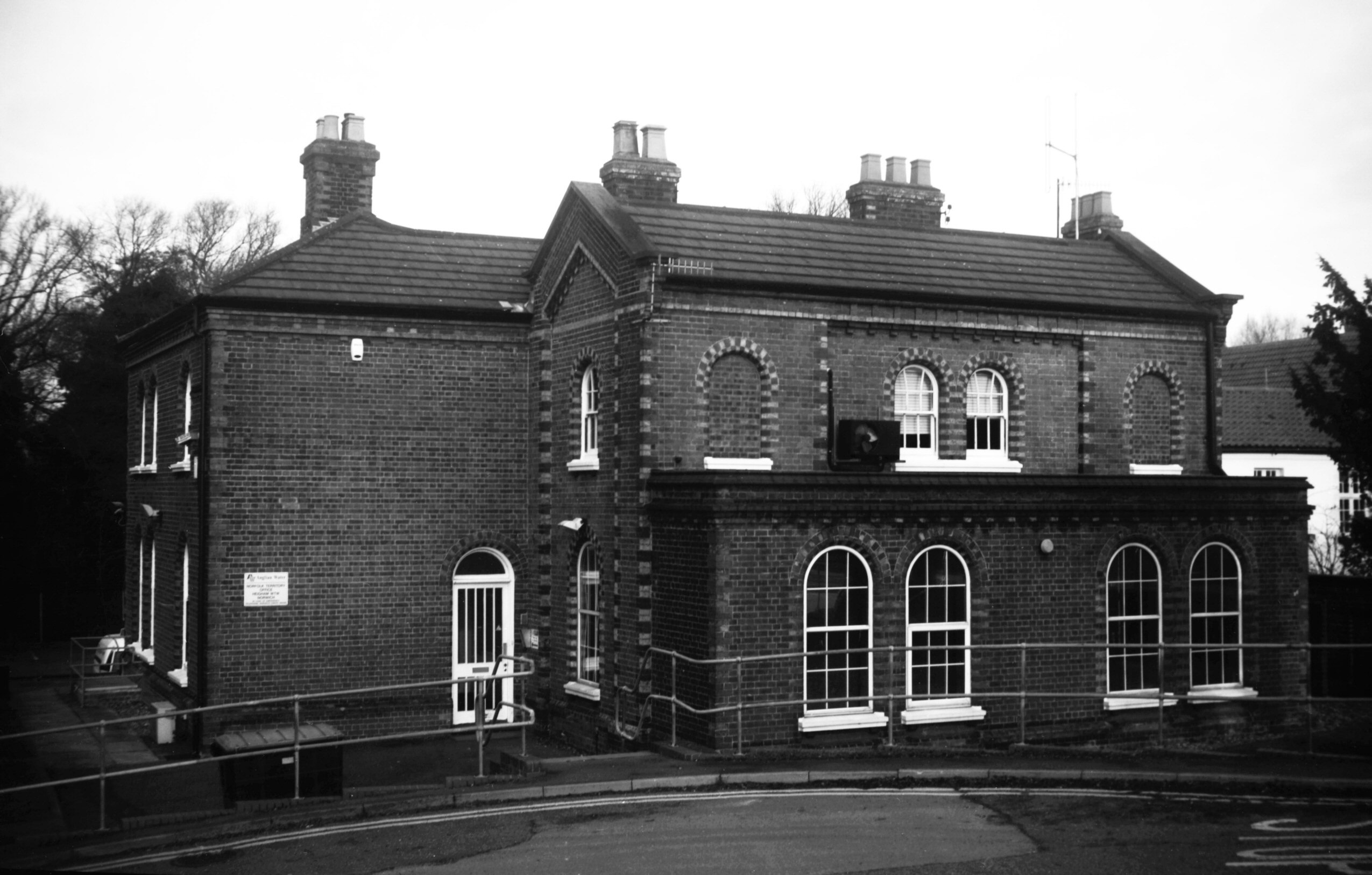
Waterworks Rd water pump house [7793] 2001-01-28
Built c1880. The old Sultzer, Patteson and Bacon steam
driven beam engines were scrapped in 1929 and replaced by
electrically-driven pumps totalling 964hp. |
|
Wellington Lane: |
| |
From
St Giles'
St to St Benedict's St (formerly only to Pottergate, lower part formerly Duck Lane) |
|
|
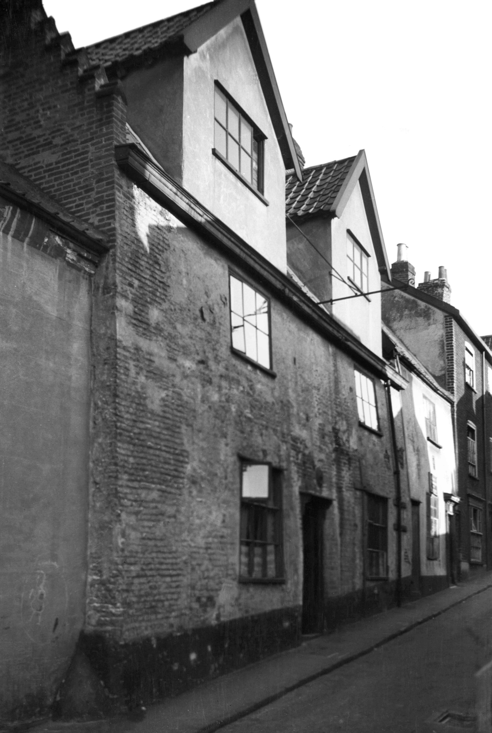
Wellington Lane 10 [1374] 1936-09-03
|
|
|
Wellington Lane 14 to 16 [1330] 1936-08-26
Former Wellington PH, built 1647. |
|
|
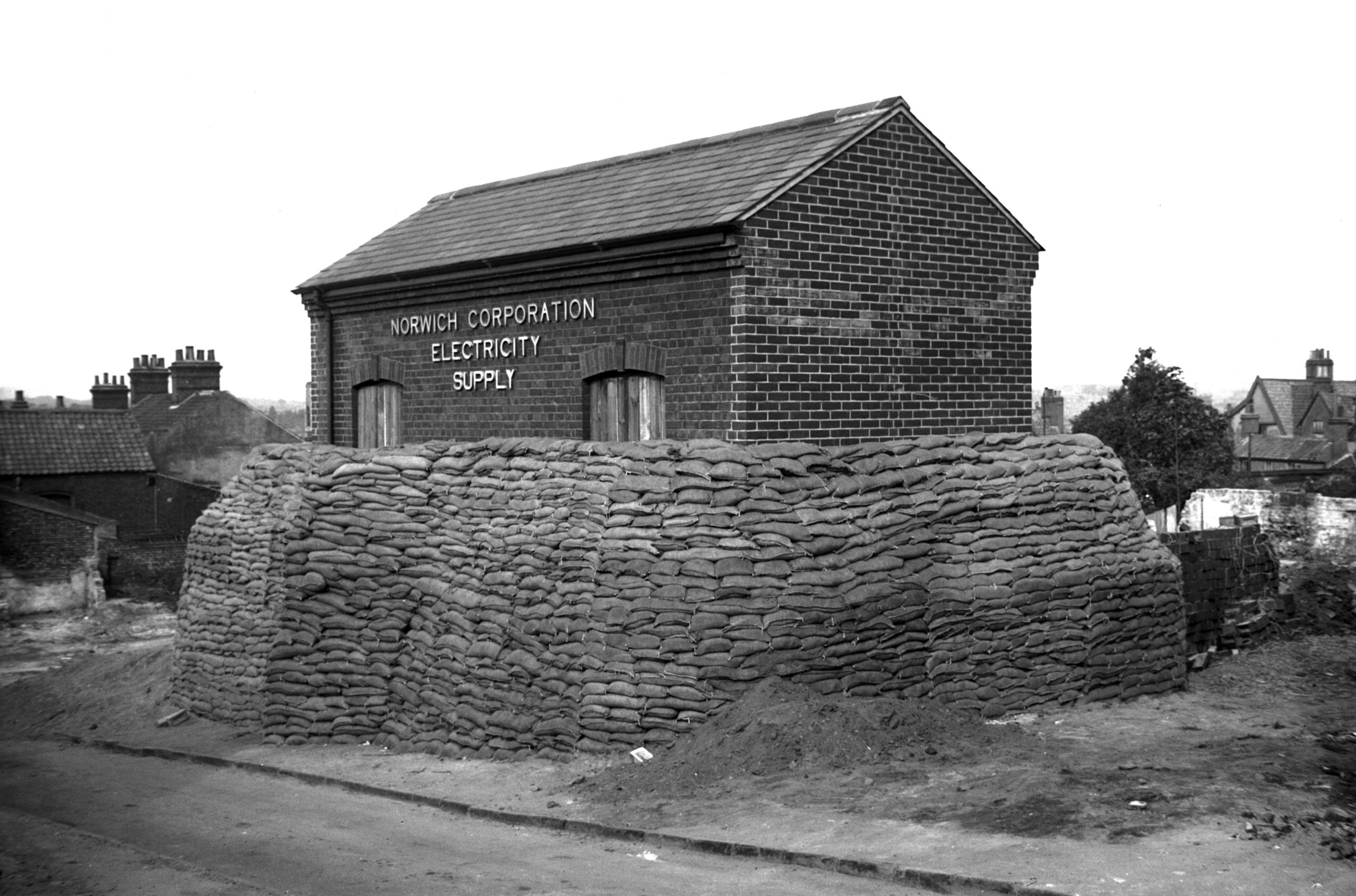
Wellington Lane air raid precaution [3260] 1939-09-09
Sandbagged electricity sub-station. |
|
|
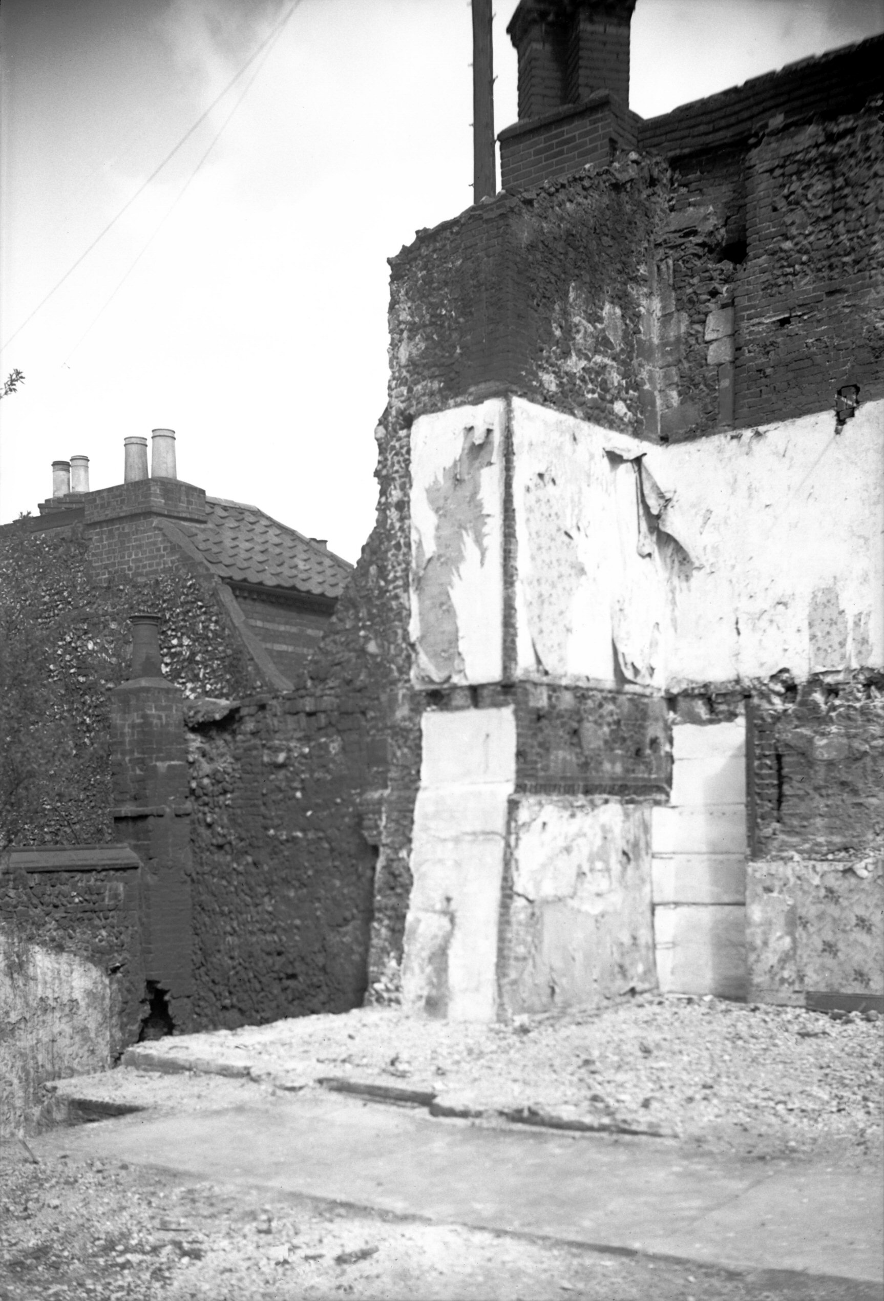
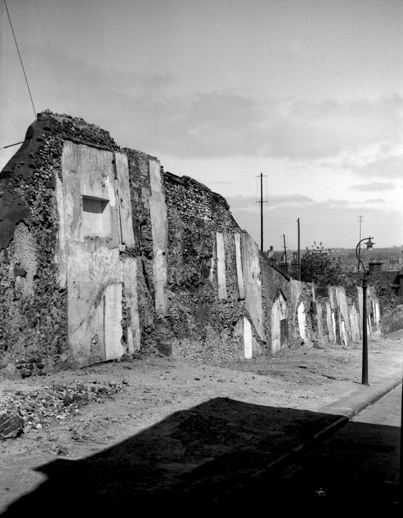
Upper Wellington Lane tower [2283] 1938-04-10
Small square tower possibly Tudor and unique for the
Norwich wall. |
|
|
Upper Wellington Lane tower [2879] 1939-02-23
Although St Giles' Gate was pulled down in 1792, a long
section of the city wall remained to the north, forming
the backs of cottage on Wellington Lane. When these were
pulled down just before the Second World War, along with
two or three others backing on them near the top of
Grapes Hill, the lofty remains of one of the towers was
brought to light. This was square in plan, unlike the
others in the series, which were either round or
horseshoe shaped.
About the year 1711 the historian John Kirkpatrick wrote
an account of the walls as then existing, in which he
recorded that it was 50 paces "from St Giles' gate
to ye next tower, wch. is a new square tower, on it an
inscription". This inscription does not seem to have
been copied, but a chequered pattern of flint and stone
could be made out on the southern face of the tower.
Later reduced in height to a few feet only, this tower
and the adjoining wall as far as Pottergate were
completely cleared away when Grapes Hill was widened,
although its site (but not that of the tower) have since
been marked out with pebbles along the grass verge at the
side of the road. |
|
|
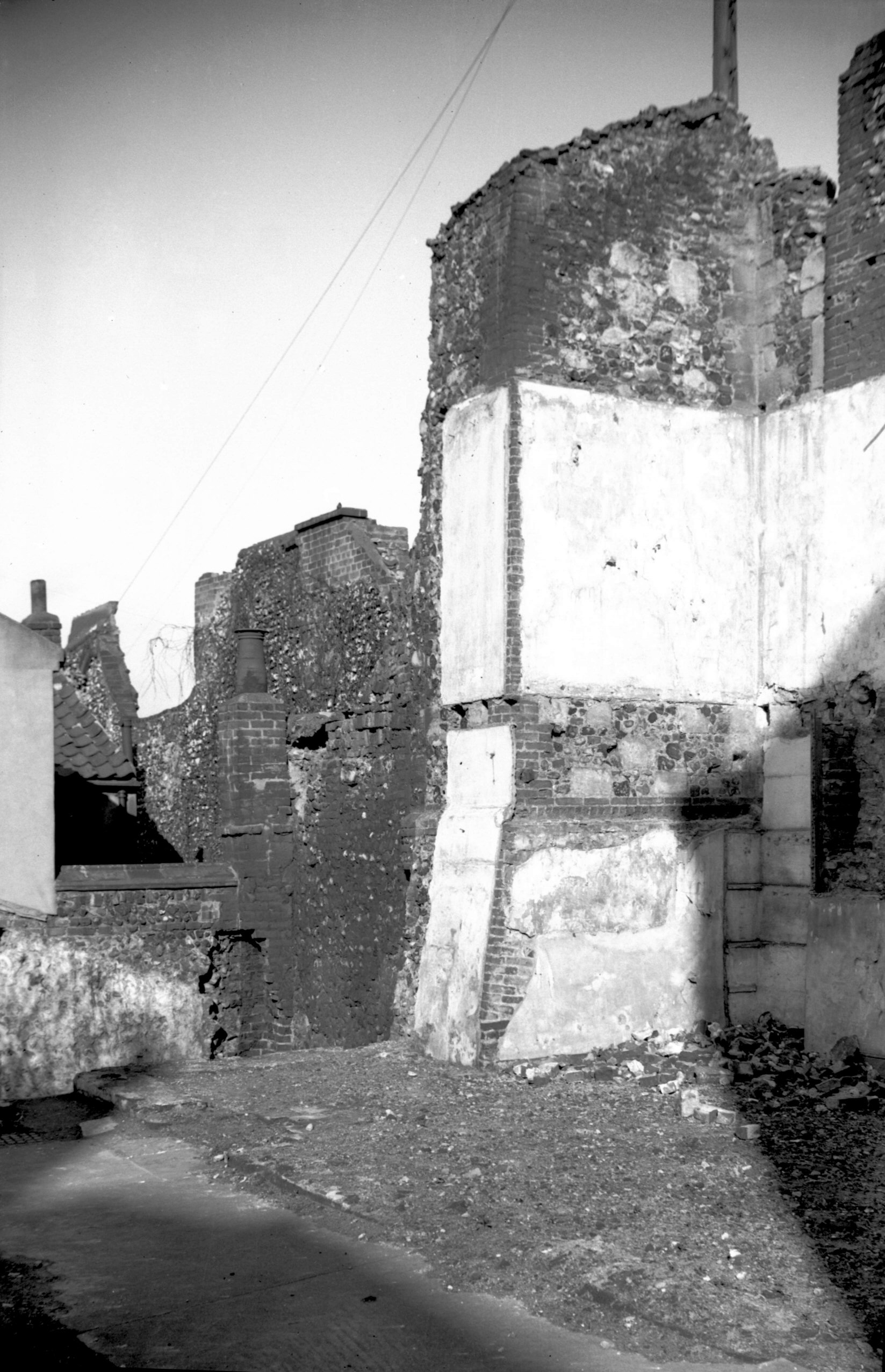
Upper Wellington Lane tower [3024] 1939-05-29
|
|
|
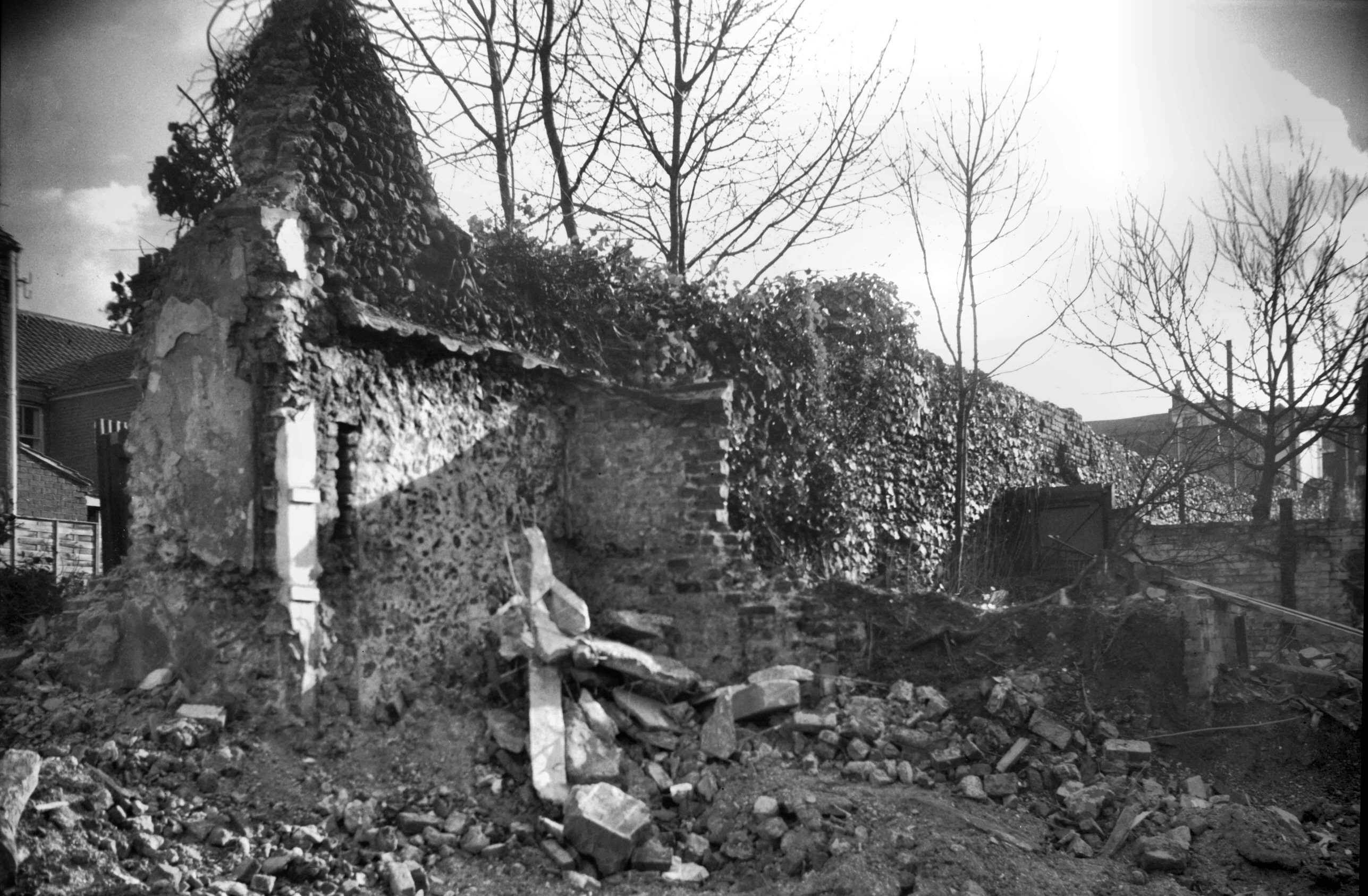
Wellington Lane wall from inside city [3023]
1939-05-29
From south-east. |
|
|
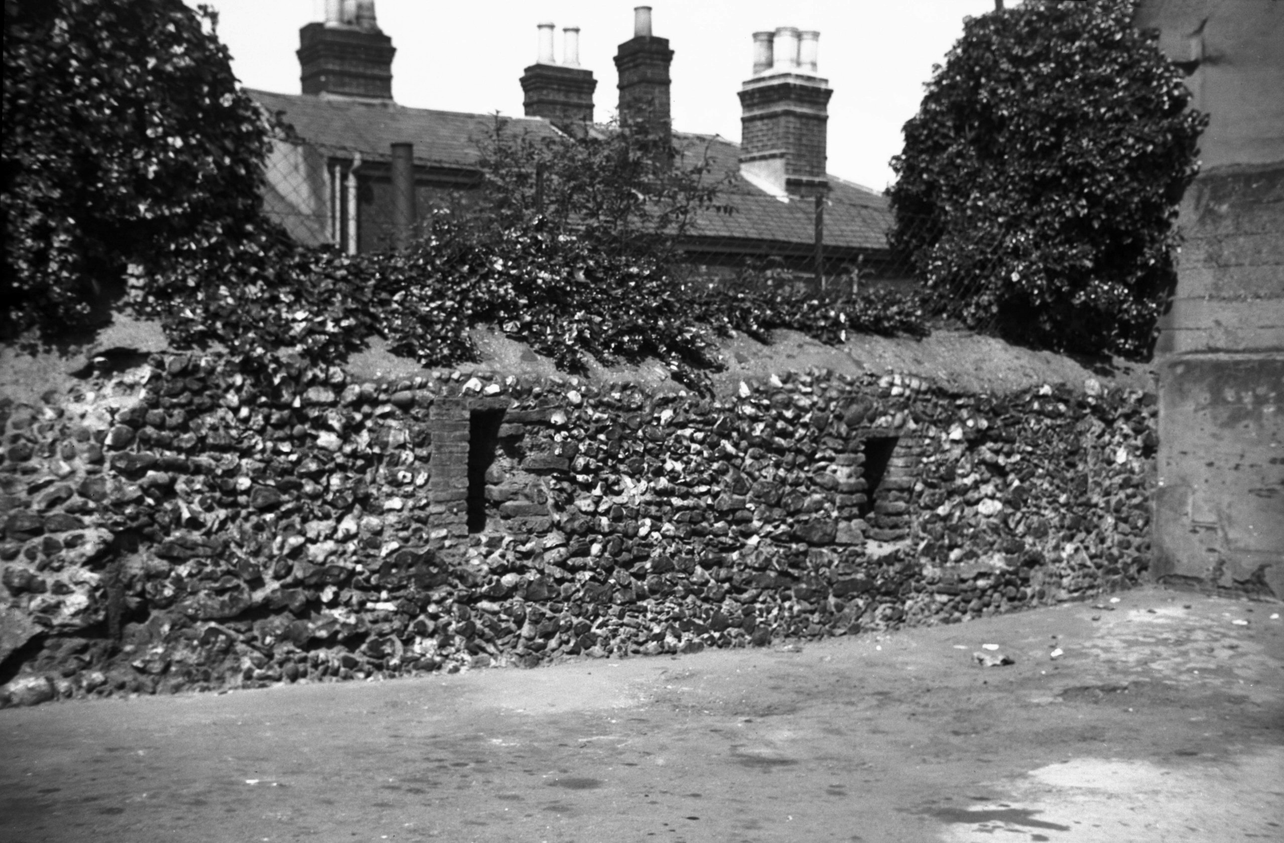
Wellington Lane wall from outside city [5289]
1970-02-08
Just south of Pottergate. |
|
|
Wellington Lane wall with arrowslits [3025]
1939-05-29
Just south of Pottergate. See also Duck Lane. |
|
Wensum St: |
| |
From
Palace St / Tombland to Fyebridge St / Quayside
passing Elm Hill
East side |
|
|
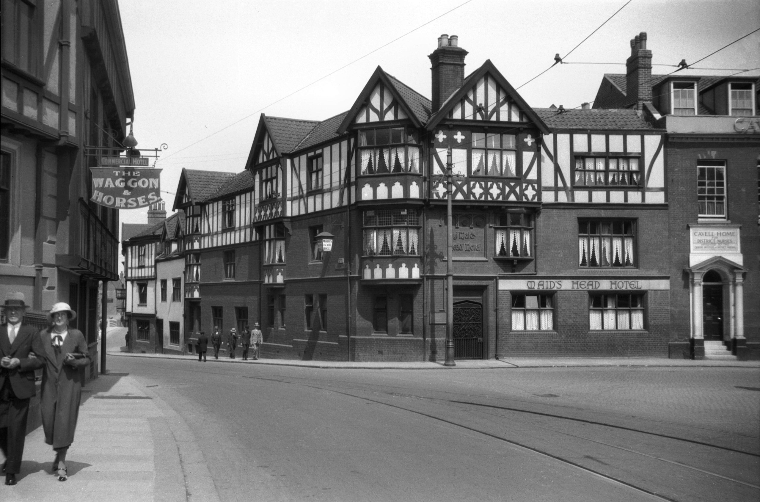
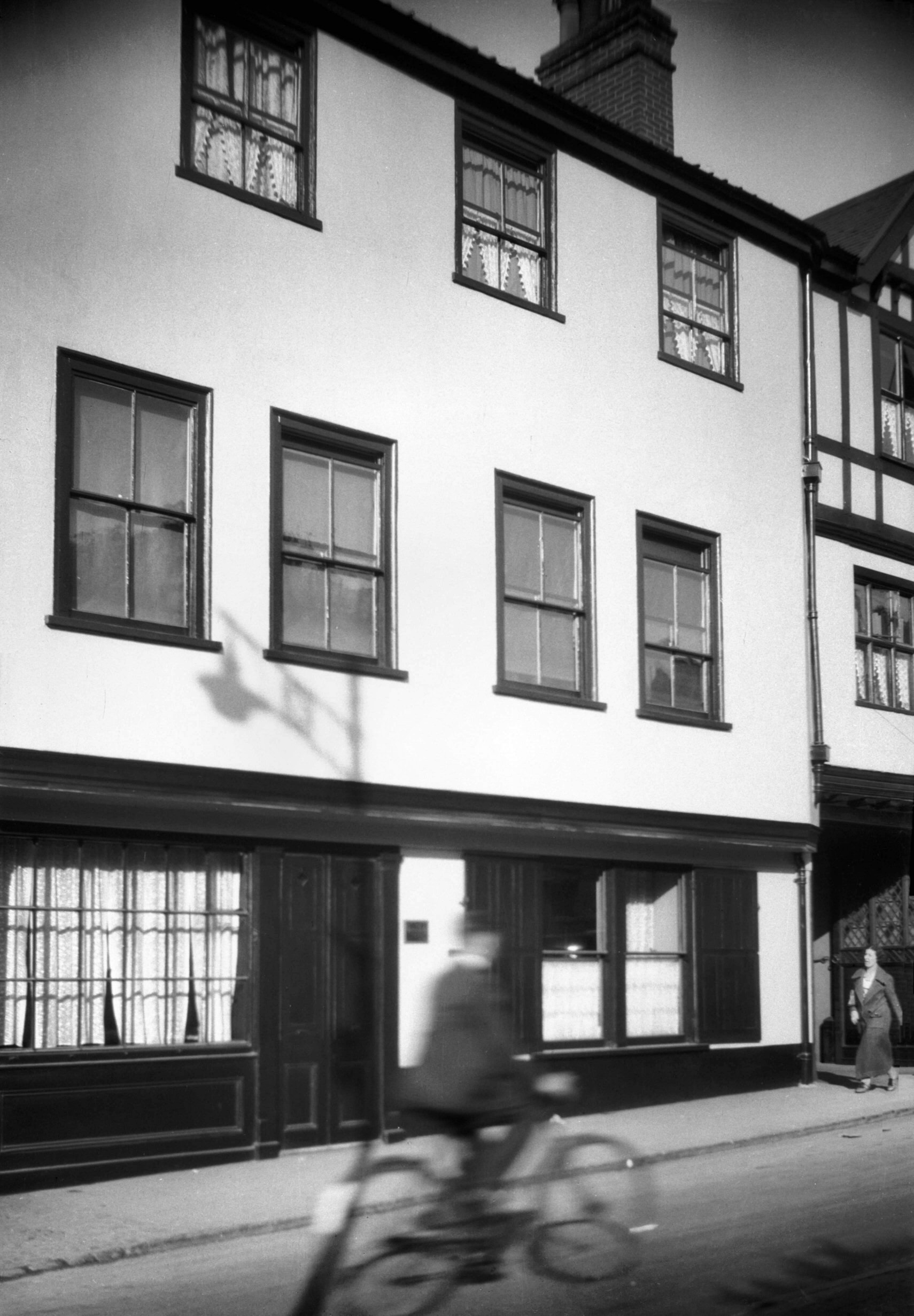
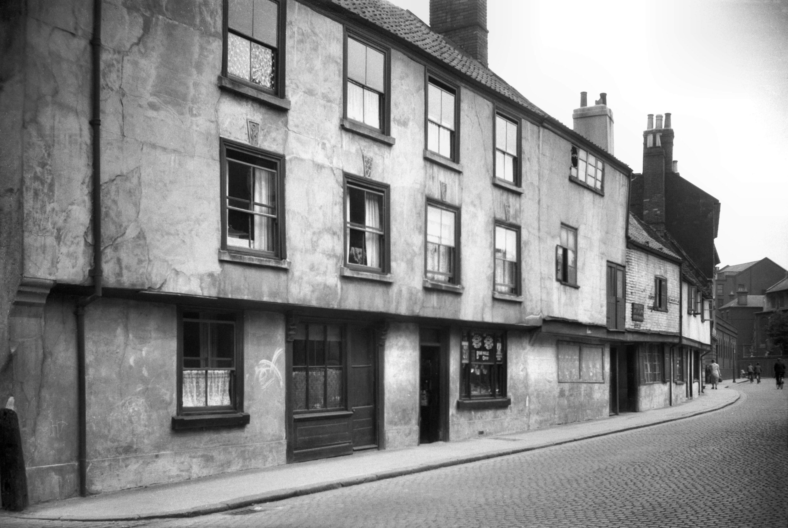
Wensum St Maid's Head Hotel south side [0119]
1934-06-10
Possibly dates back to 1287 in which year the records
mention "the tavern in Cook Rowe" (the former
name for Wensum St). It was anciently the Molde-fish or
Murtil-fish Tavern, but is referred to as the Maid's Head
in the Paston Letters. The whole building was restored in
the 1890's but the interior retains the oak beams,
panelling, fireplaces etc of the 15c or early 16c. |
|
|
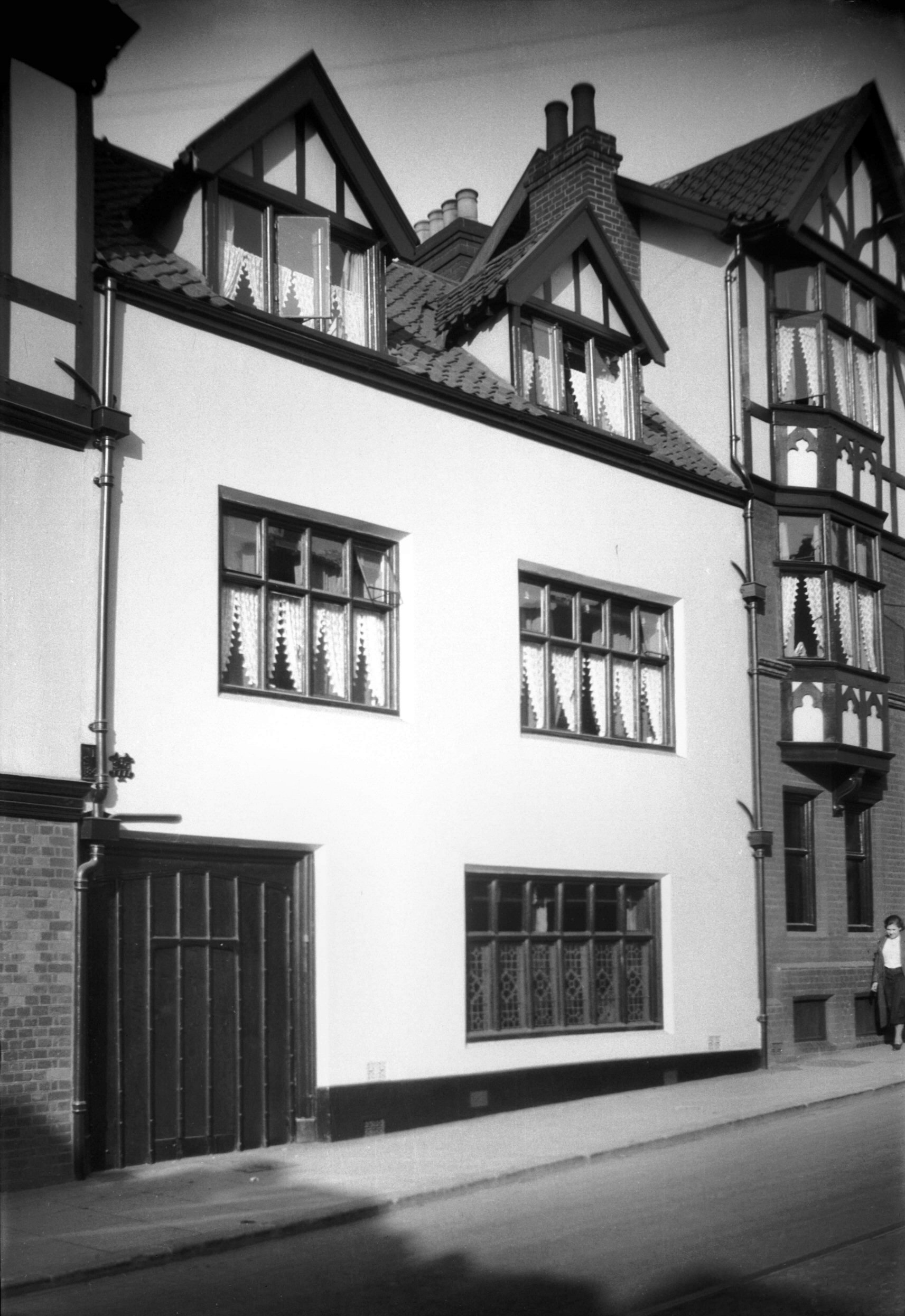
Wensum St 1 to 9 Maid's Head Hotel [0975] 1936-05-18
|
|
|
Wensum St 1 to 9 Maid's Head Hotel [0976] 1936-05-18
|
|
|
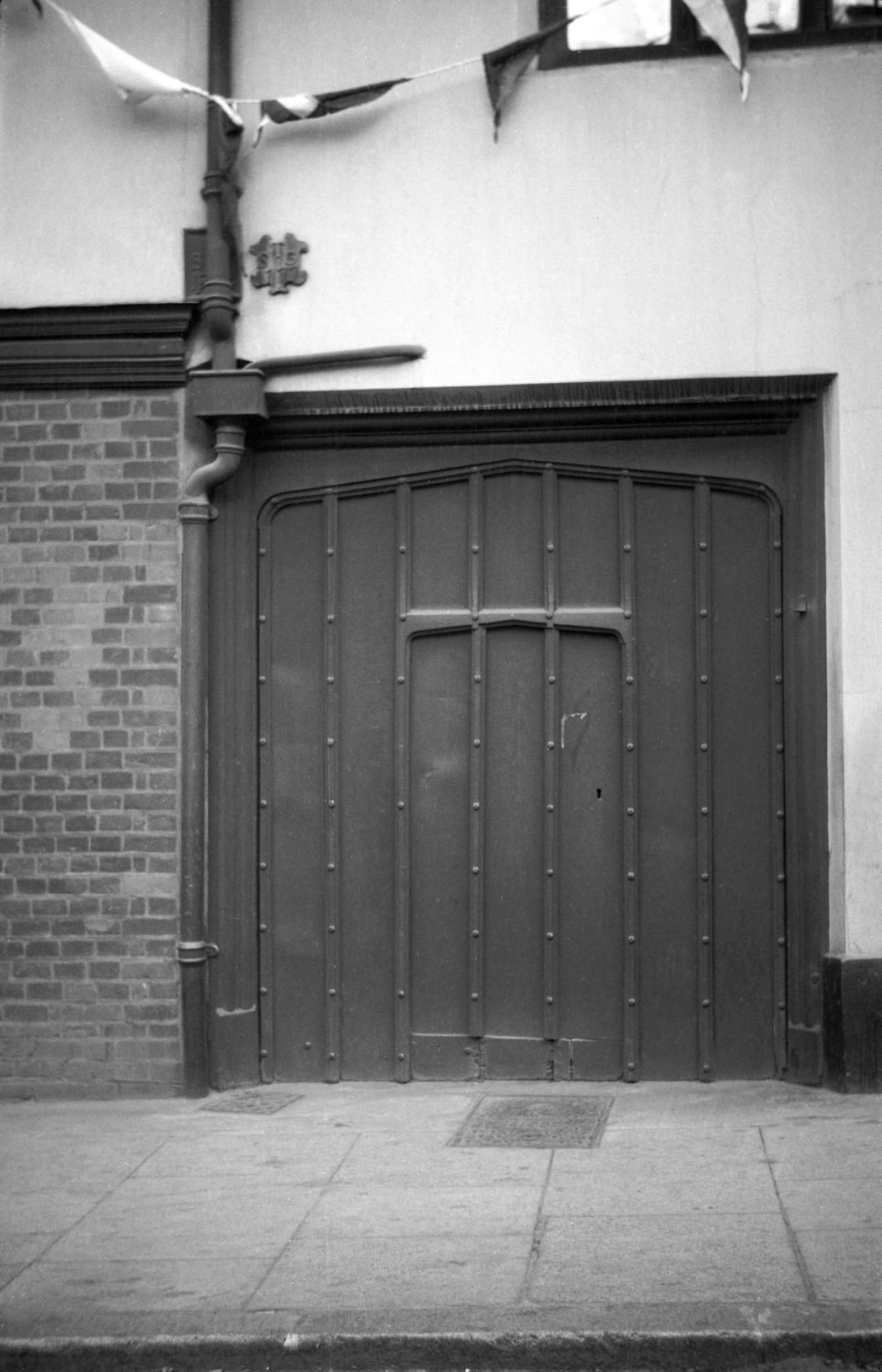
Wensum St Maid's Head Hotel 16c style door [0578]
1935-05-11
|
|
|
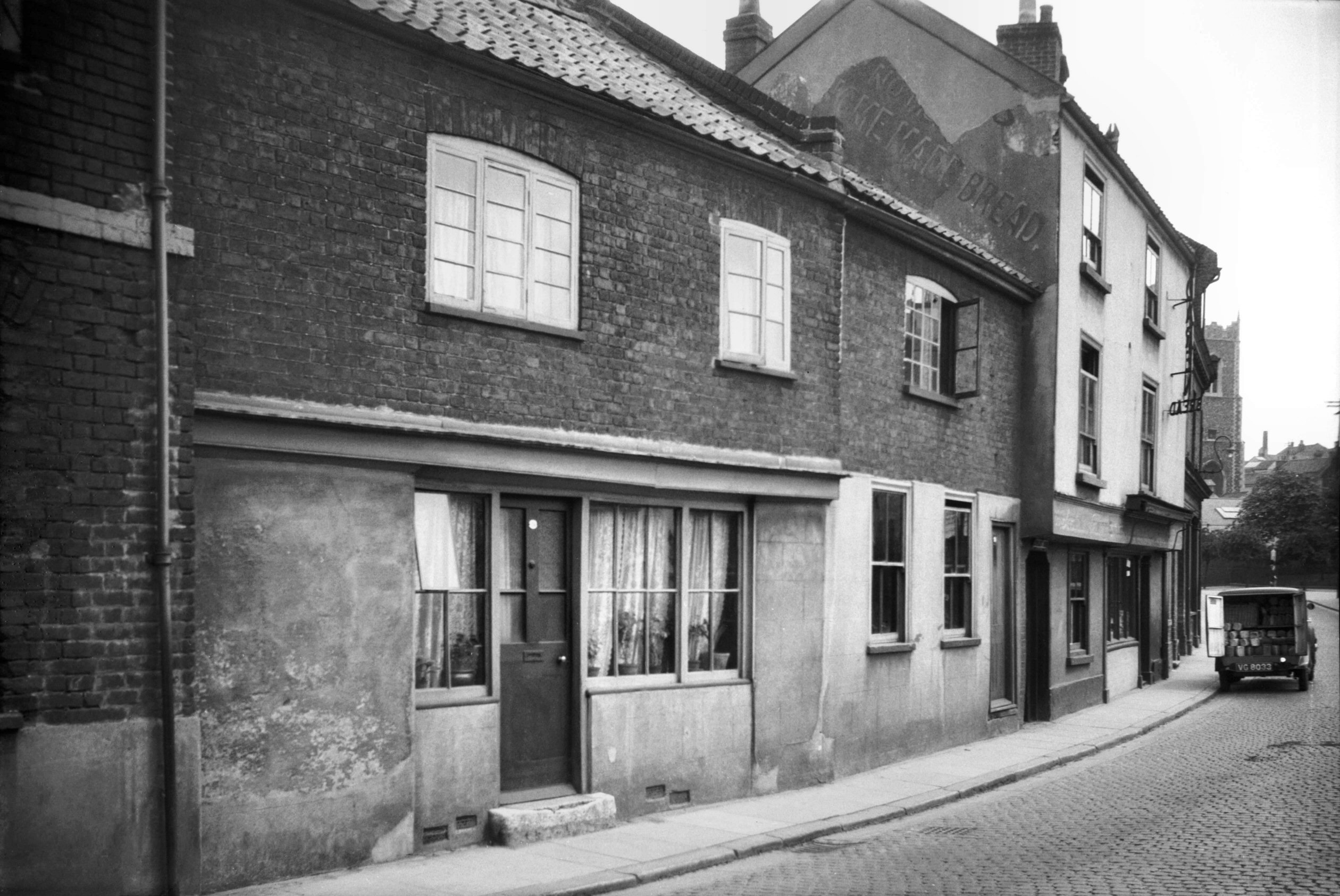
Wensum St 11 to 13 [2774] 1938-09-02
|
|
|
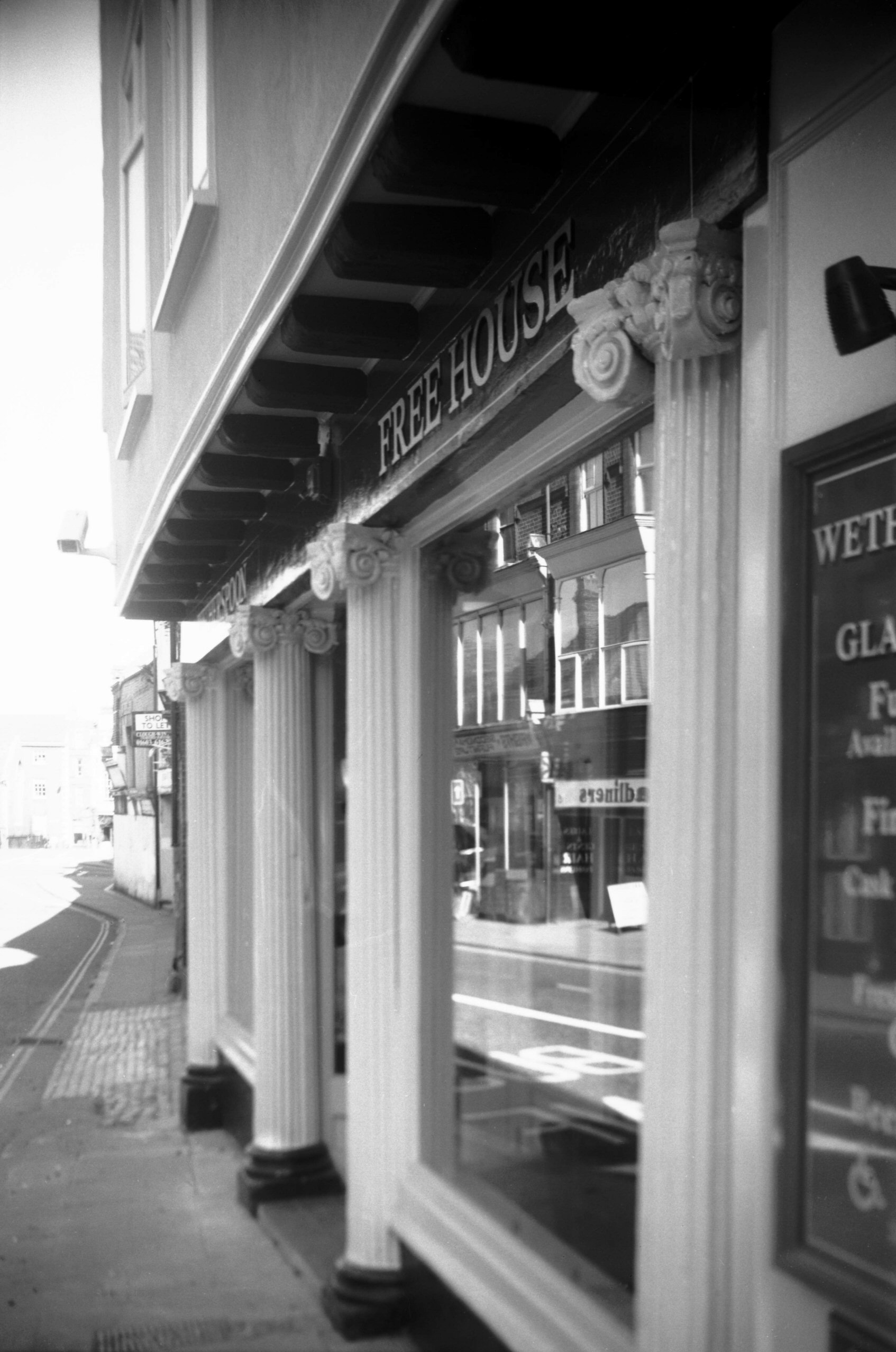
Wensum St 13 shop front Ionic pillars [7874]
2002-04-06
Glass House PH. |
|
|
Wensum St Flowers Court [2104] 1938-03-03
|
|
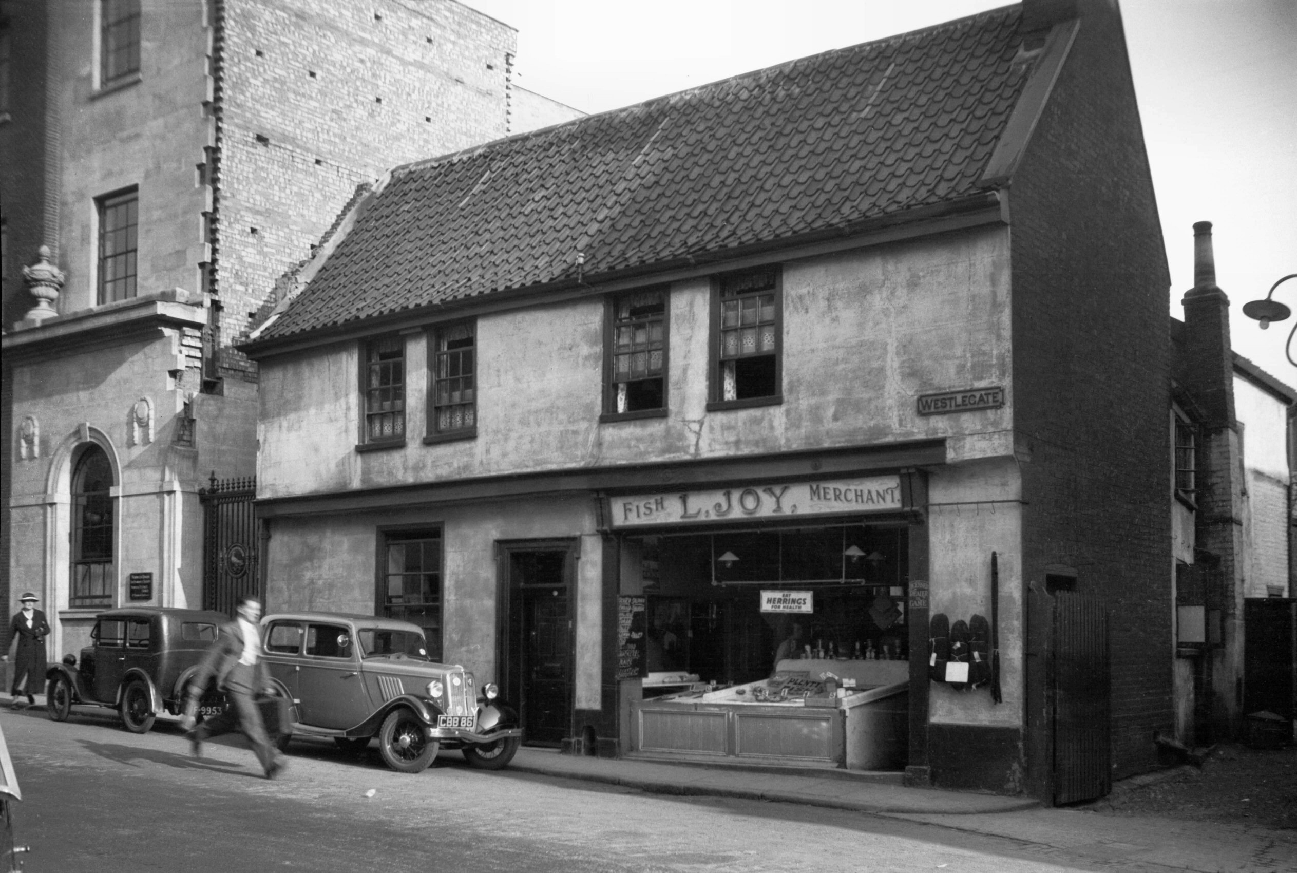
West Pottergate: |
| |
From
Grapes Hill to Earlham Rd / Heigham Rd
South side |
|
|
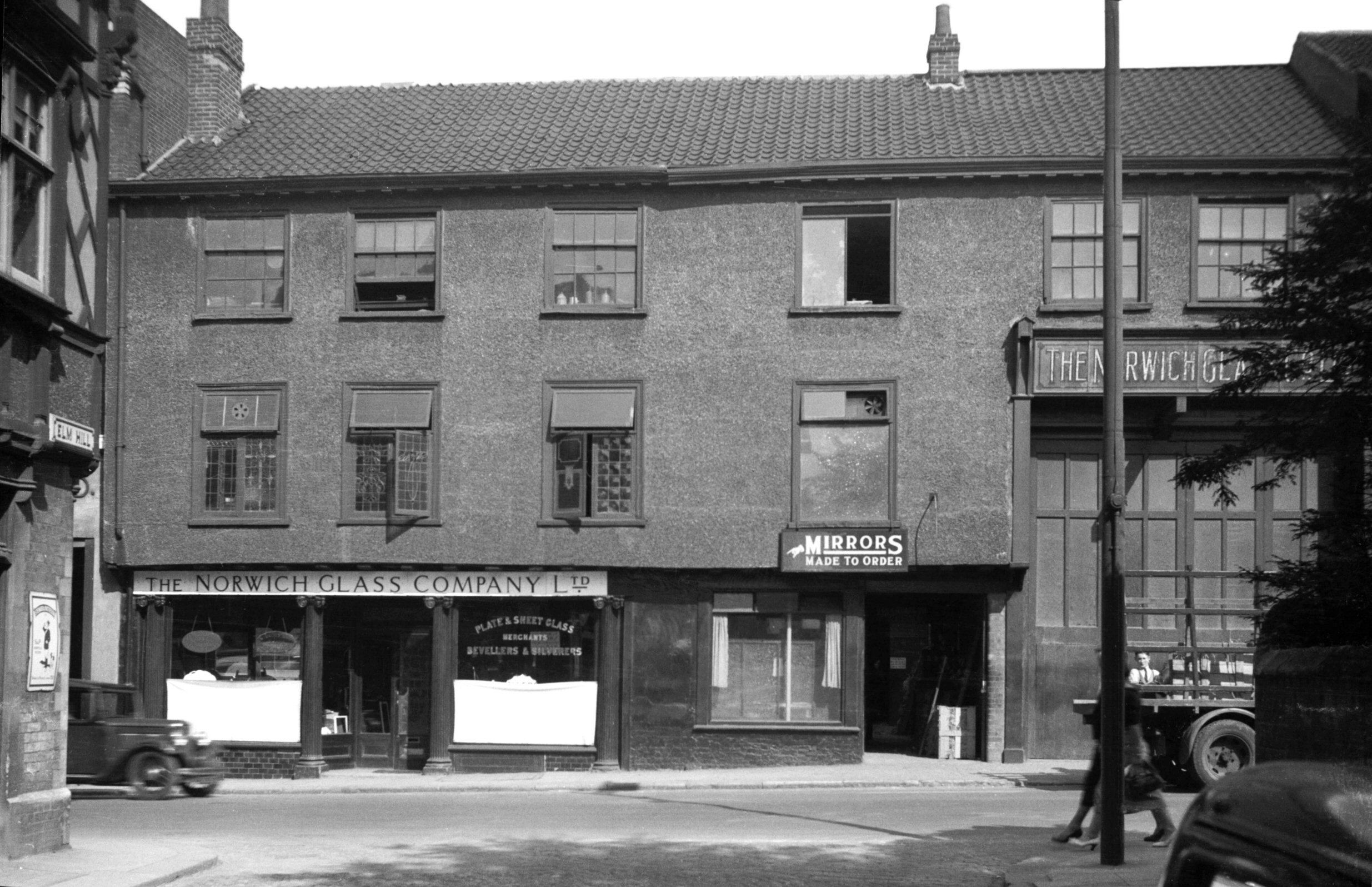
West Pottergate 68 to 78 Pye's Alms houses [4661]
1962-03-28
Here the Inner Link road and the redevelopment west of it
have wrought much change, including the demolition of a
row of six former almshouses at Nos 68-78 West
Pottergate. Pye's almshouses, originally established near
St Gregory's church, were given in 1614 by Thomas Pye to
house six poor people, whether married or single, above
the age of 50. In 1827 those houses were given by the
Corporation to one, Joseph Bexfield in exchange for these
six newly-built cottages, together with the sum of £200,
which was to be invested to be applied towards keeping
the houses in repair. The six people chosen were to be
selected, two from each of the parishes of St Michael
Coslany, St Giles and St Peter Mancroft; and to avoid any
error, above each pair of doorways was a stone tablet
inscribed with the name of the parish concerned.
Although not meeting the standards set by old people's
homes of the present day, the appearance they presented
to the street was a pleasant one and in this respect at
least their loss is much to be regretted. |
|
Westlegate: |
| |
From
St
Stephen's St / Rampant Horse St / Red
Lion St to All Saints Green
South side |
|
|
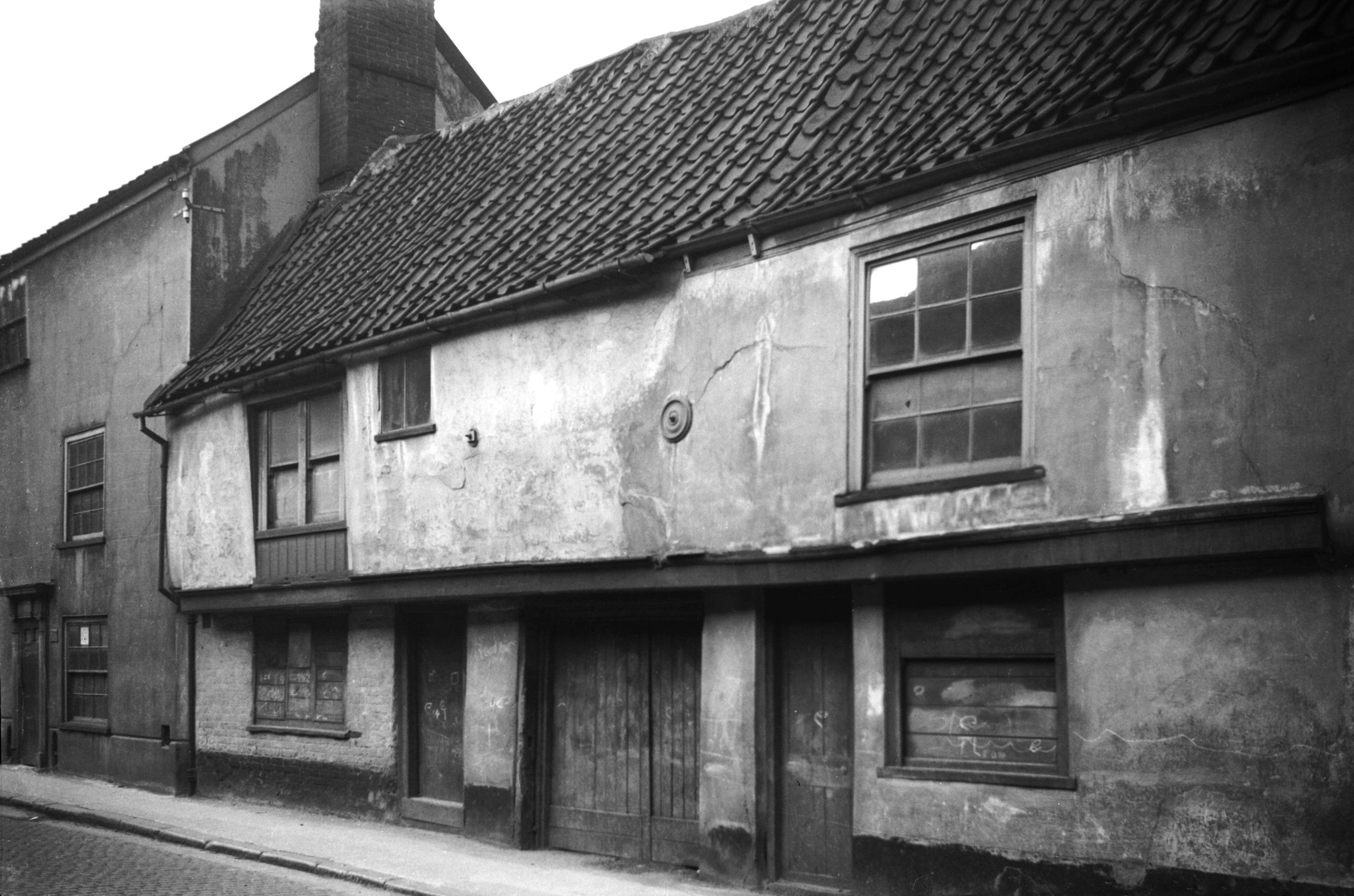
Westlegate 1 [1038] 1936-06-20
|
|
|
Westlegate 5 to 7 [1031] 1936-06-16
|
|
|
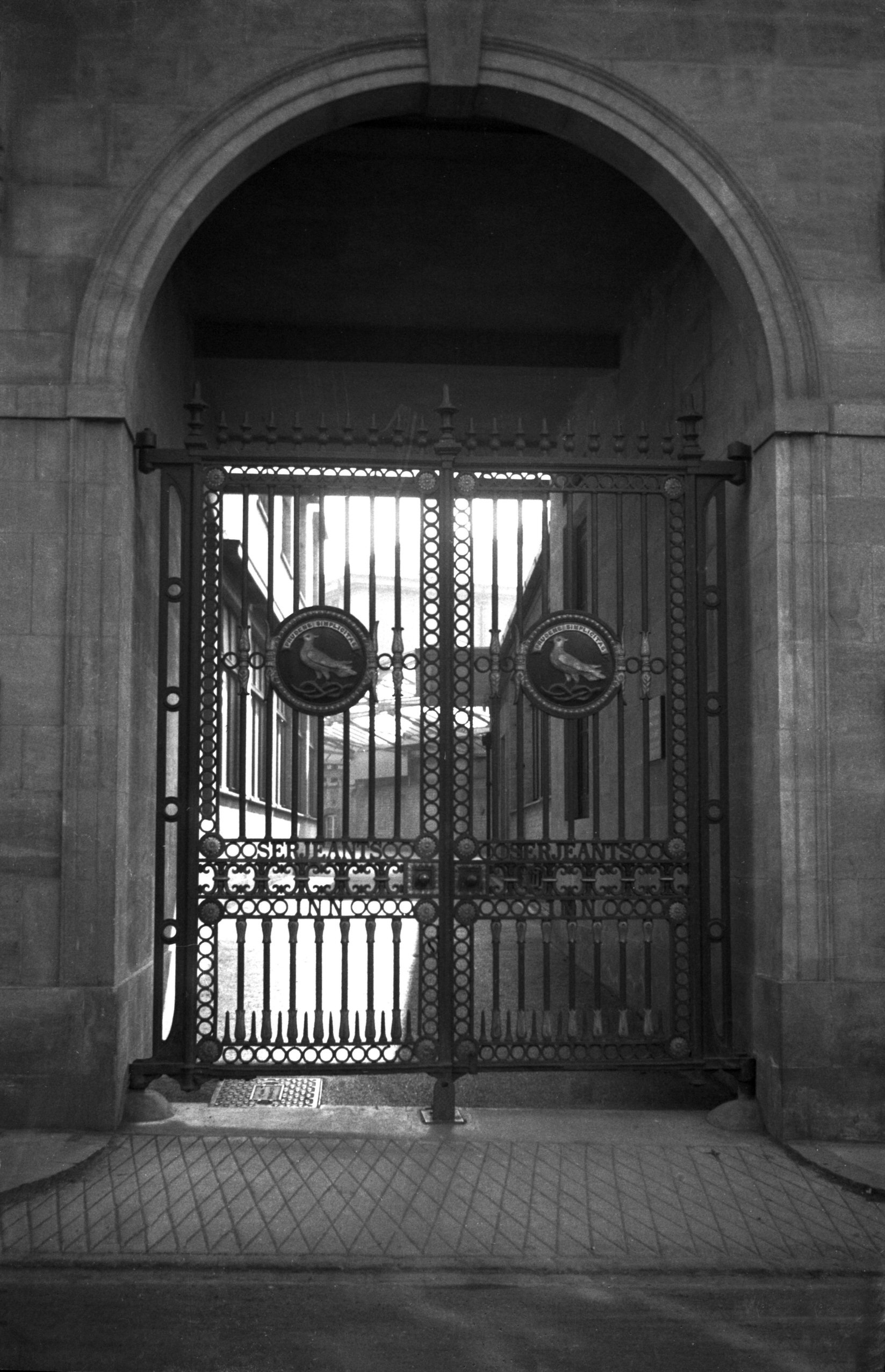
Westlegate Norwich Union iron gates [2118] 1938-03-06
Old Amicable Insurance Society's Gates, from Serjeants
Inn London c1842, moved to Westlegate 1937. |
|
|
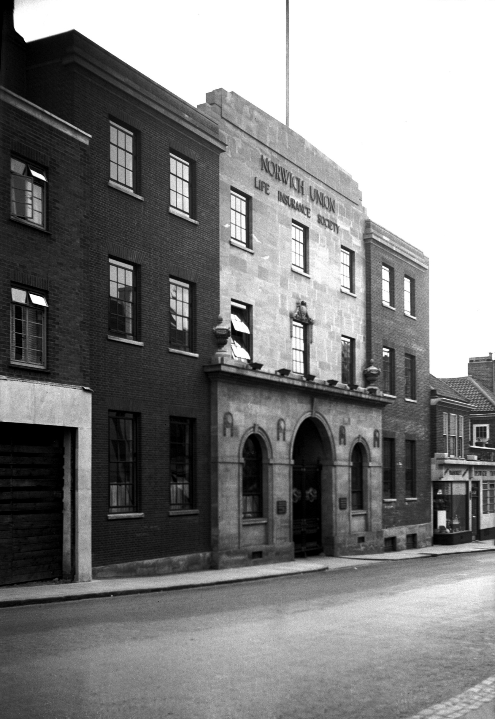
Westlegate Norwich Union Life office [2432]
1938-05-29
Erected 1937. |
| |
North
side |
|
|
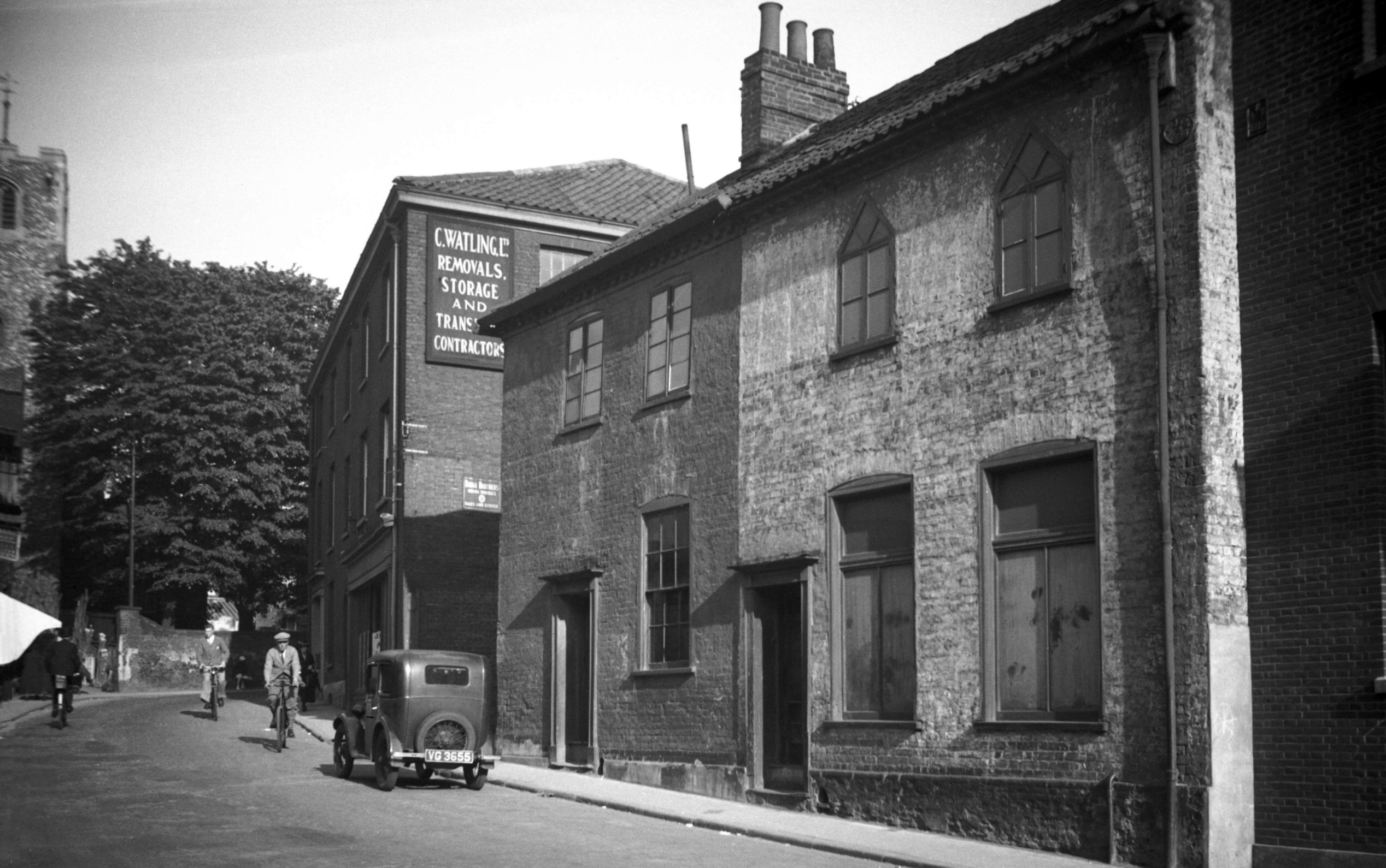
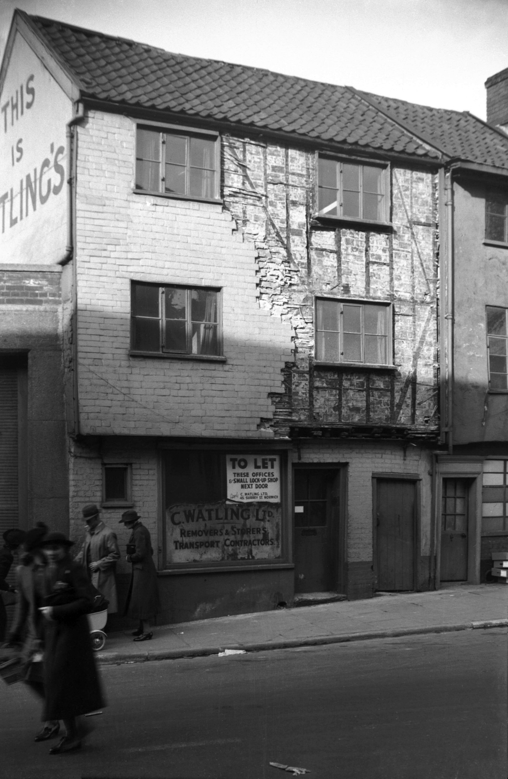
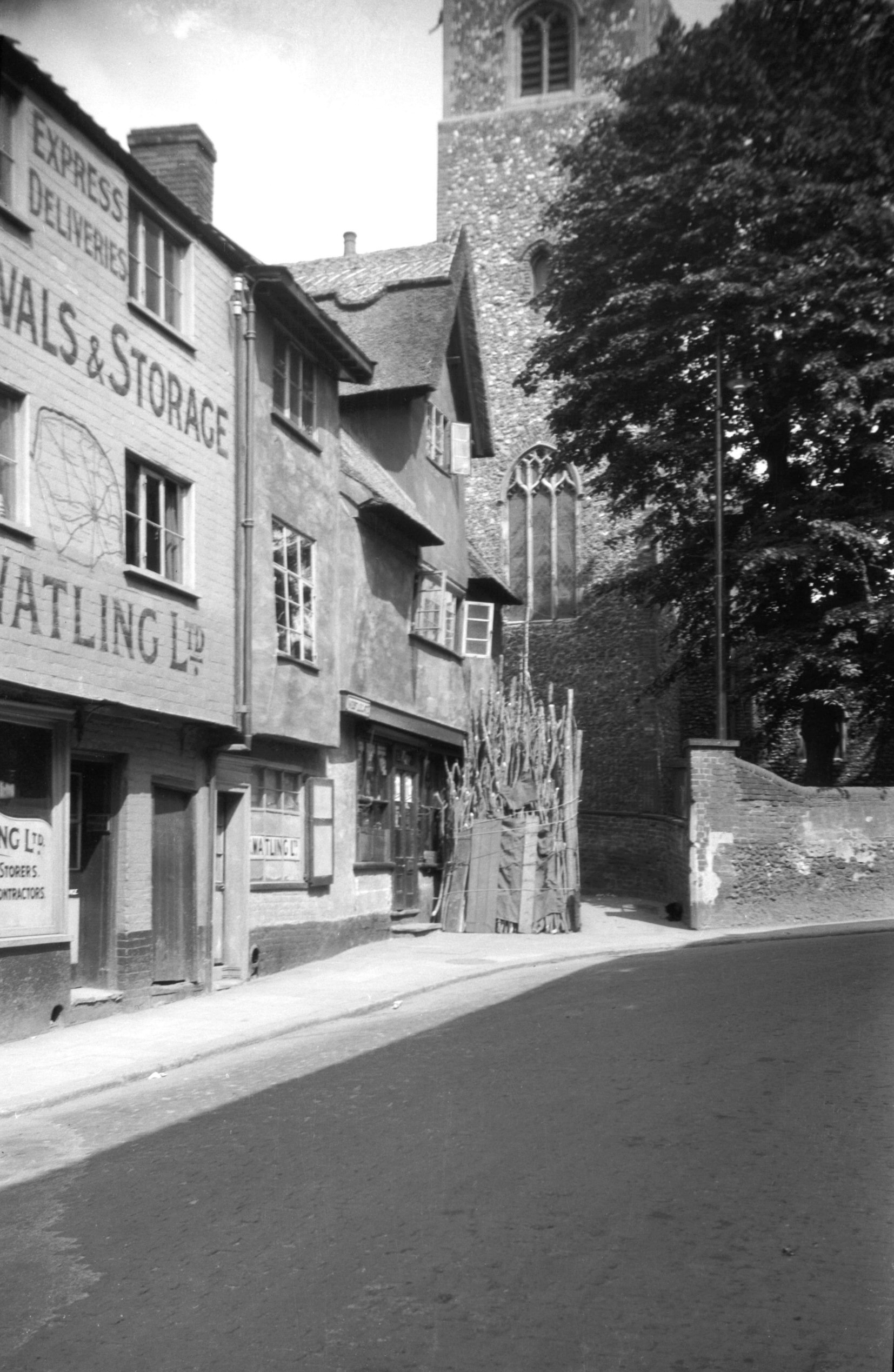
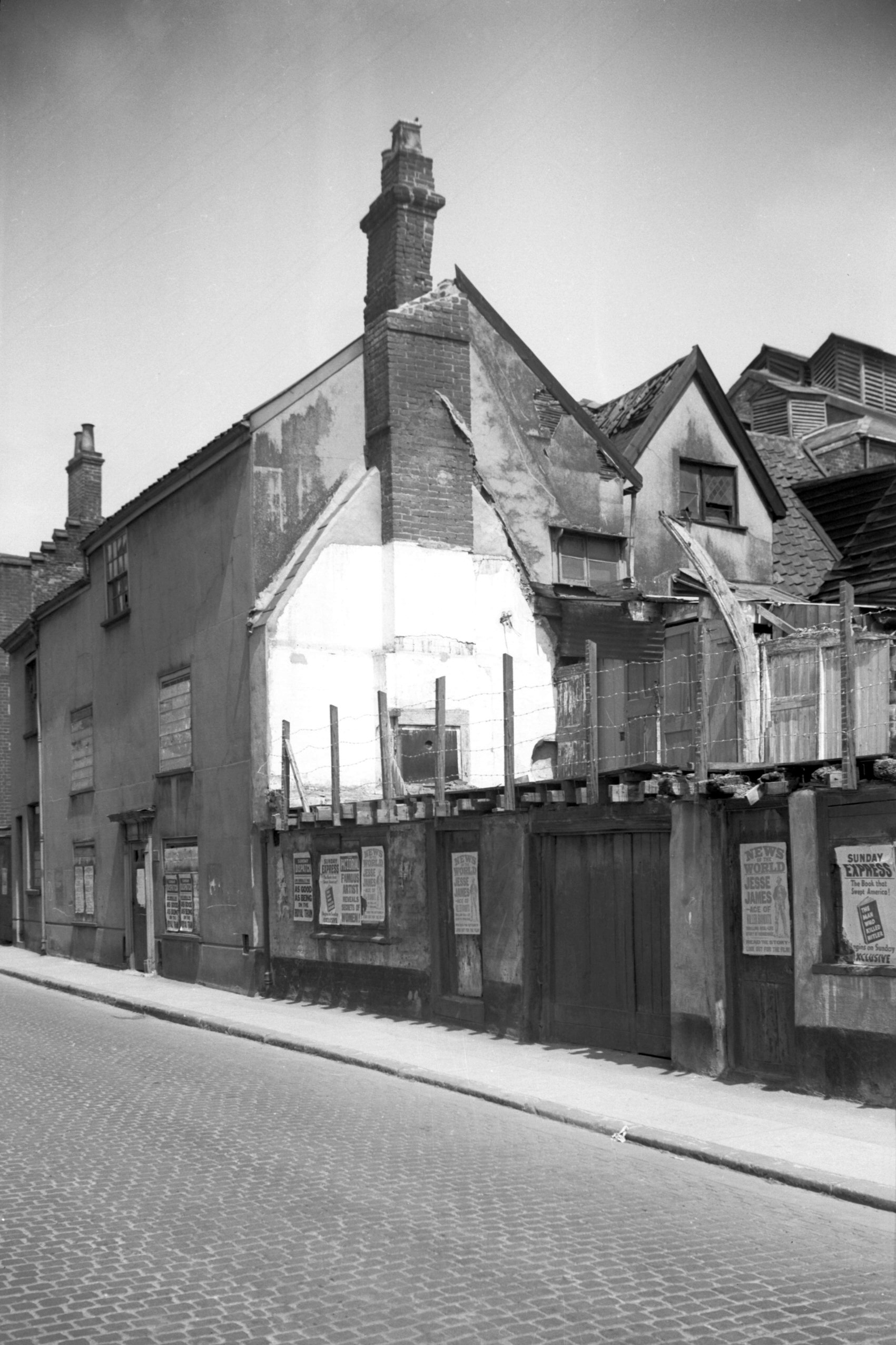
Westlegate 16 [3347] 1940-03-23
In Westlegate stood for several centuries a three-storey
building comprising Nos 16 and 18. They adjoined the west
side of the existing thatched house, familiar in days
gone by as the Barking Dickey public house, but to later
generations first as a greengrocer's and then as a bank.
In the 1920s No 16 with its adjoining premises was
occupied by Charles Watling, acting as agent for Carter
Paterson, the carriers. In 1940 when my photograph was
taken it had become vacant and was being offered to let,
but a discouraging feature to any intending lessee was
the state of the upper frontage, interesting though it
may have been to any student of architecture. A small
jetty overhanging the ground floor by a foot or so
supported the front wall of the upper floors, which had
at some time been faced with hanging tiles. Unfortunately
the greater part of these had recently fallen away to
reveal the timber framework. Repairs were later carried
out and in the middle 1950s the shop was occupied by
Charles Cubitt, an antiques dealer. This turned out to be
only a temporary arrangement, for the site was soon
acquired and cleared by property developers who in
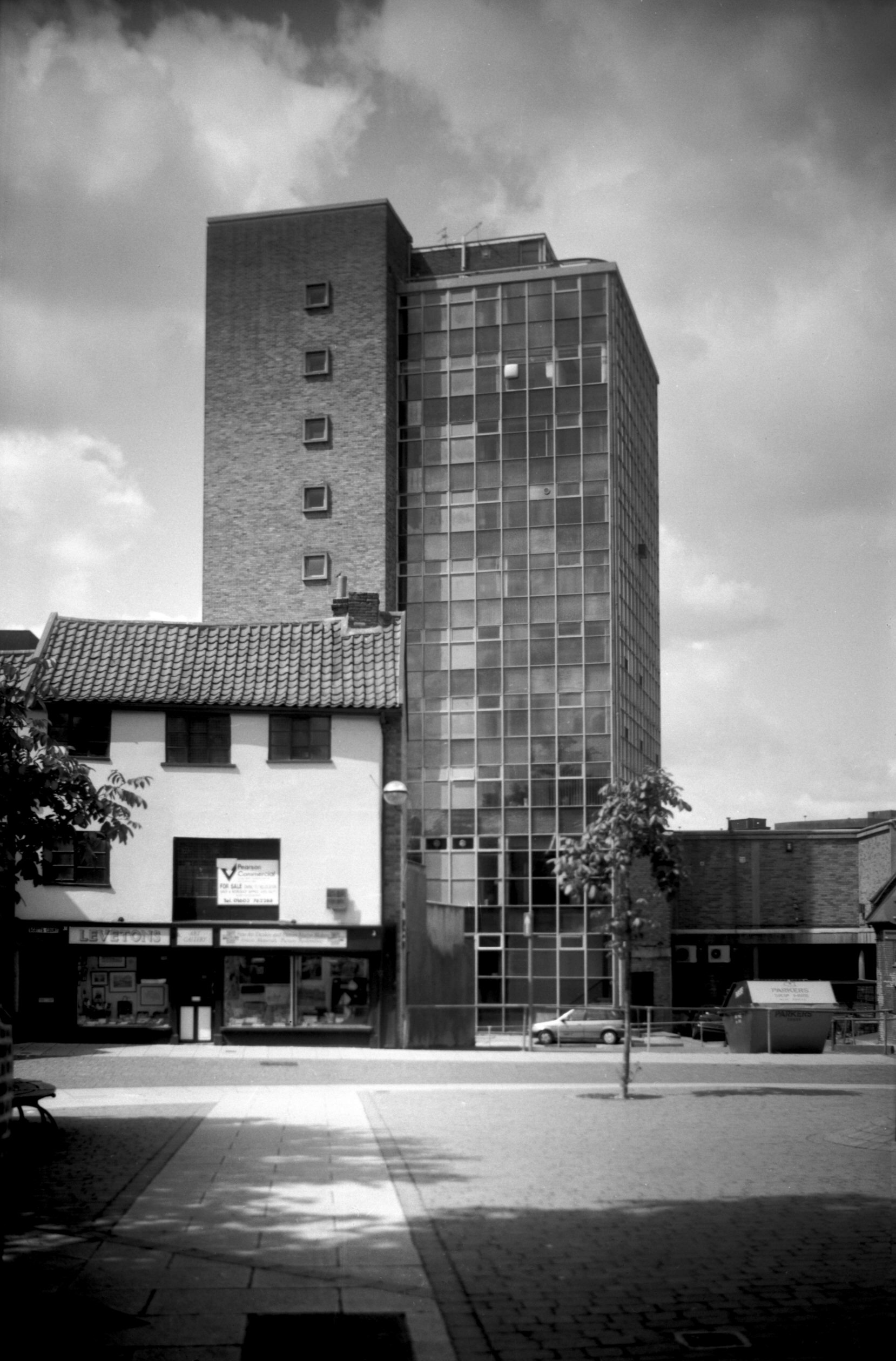
1960-61 erected in its place Westlegate House, known
locally as the Glass Tower - the first or several
multi-storey office developments to be built in the city. |
|
|
Westlegate 18 to 20 thatched Barking Dickey [0129]
1934-06-17
|
|
|
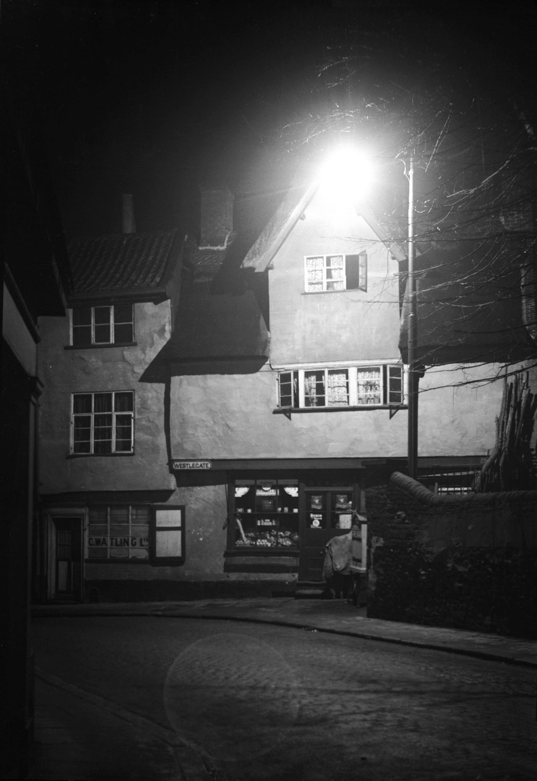
Westlegate 20 Barking Dickey by night [0380]
1935-02-28
|
|
|
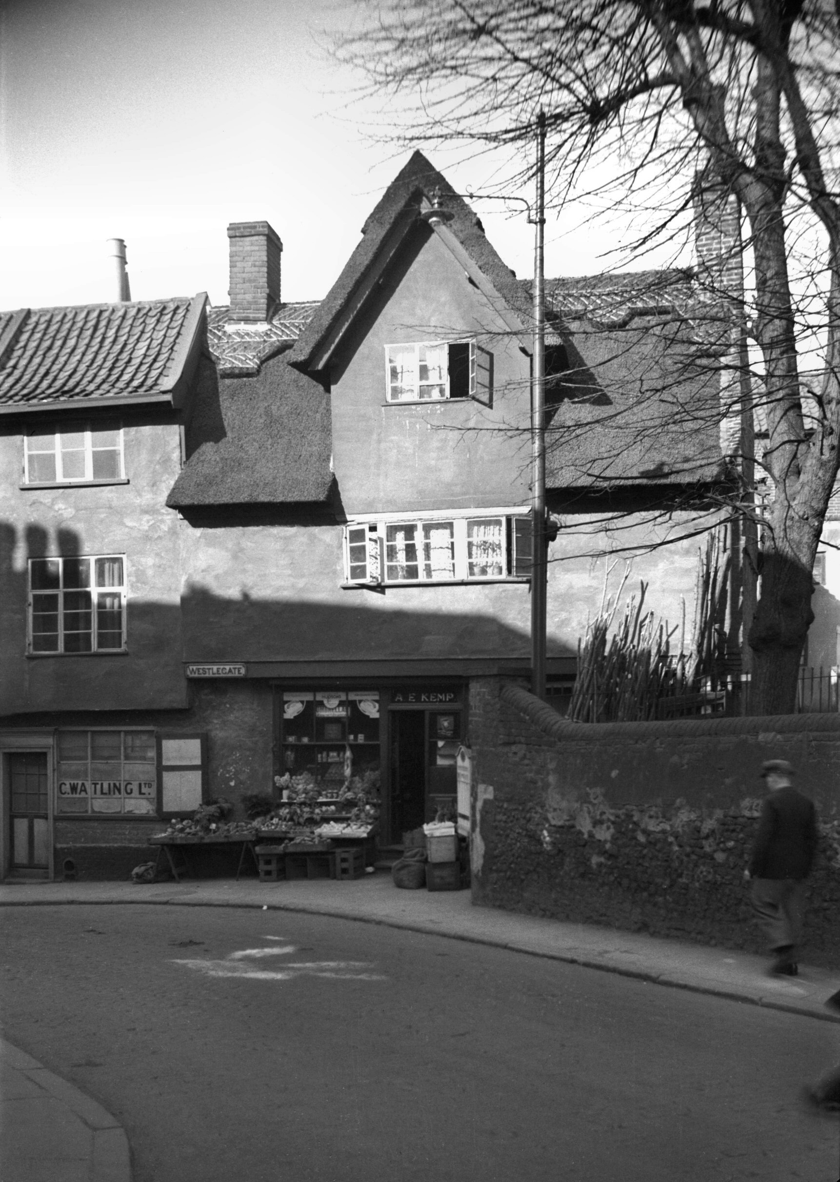
Westlegate 20 thatched Barking Dickey [0387]
1935-03-12
The former Barking Dickey PH probably derived its name
from a former name which was the Light Dragoon. The Light
Dragoon's mount on the painted sign, with open jaws,
resembling a donkey braying or "barking" more
than anything else. |
|
|
Westlegate 20 Barking Dickey Inn COLOUR [2957]
1939-04-12
|
|
|
Westlegate 20 former Barking Dickey rear [4614]
1961-06-18
|
|
|
Westlegate Westlegate House construction [4590]
1961-04-16
"Glass Tower" from All Saints Green. Under
construction 1960-61, architect E.G.Burgoine of Chaplin
and Burgoine. |
|
|
Westlegate Westlegate House from Timberhill [7353]
1996-07-07
|
|
|
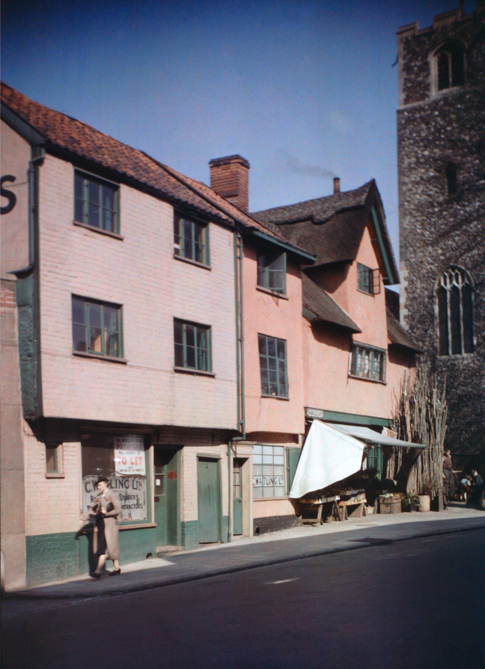
All Saints Alley east end [1764] 1937-07-10
It seems almost incredible that well within living memory
Westlegate was a narrow cobble-paved street not unlike
Elm Hill, lined with houses ranging in date from Tudor to
Victorian times. Now it is one of the city's main traffic
arteries, the sole reminder of its past being the
thatched and gabled building which until recently
provided a rather unusual setting for a bank. Earlier in
the century it was a greengrocer's shop and before that a
public house with the sign of the Light Dragoon, known
more familiarly as the Barking Dickey (dickey being the
dialect word for a donkey). To the right of this house
All Saints' Alley hugs the wall to the west and north of
the church from which it takes its name, another branch
of the alley leading into Lion and Castle Yard and thence
to Timberhill. Until cleared away for redevelopment this
row of quaint gabled houses stood facing the church from
the north side of the alley. These were mainly of the
17c, brick built, but mostly faced with cement. |
|
|
All Saints Alley west end [1763] 1937-07-10
|
|
|
All Saints south side from All Saints Green [B100]
1931-00-00
|
|
|
All Saints south side from All Saints Green [2183]
1938-03-19
|
|
|
All Saints tower from Westlegate [3289] 1939-10-22
|
|
|
All Saints interior view east [1864] 1937-08-09
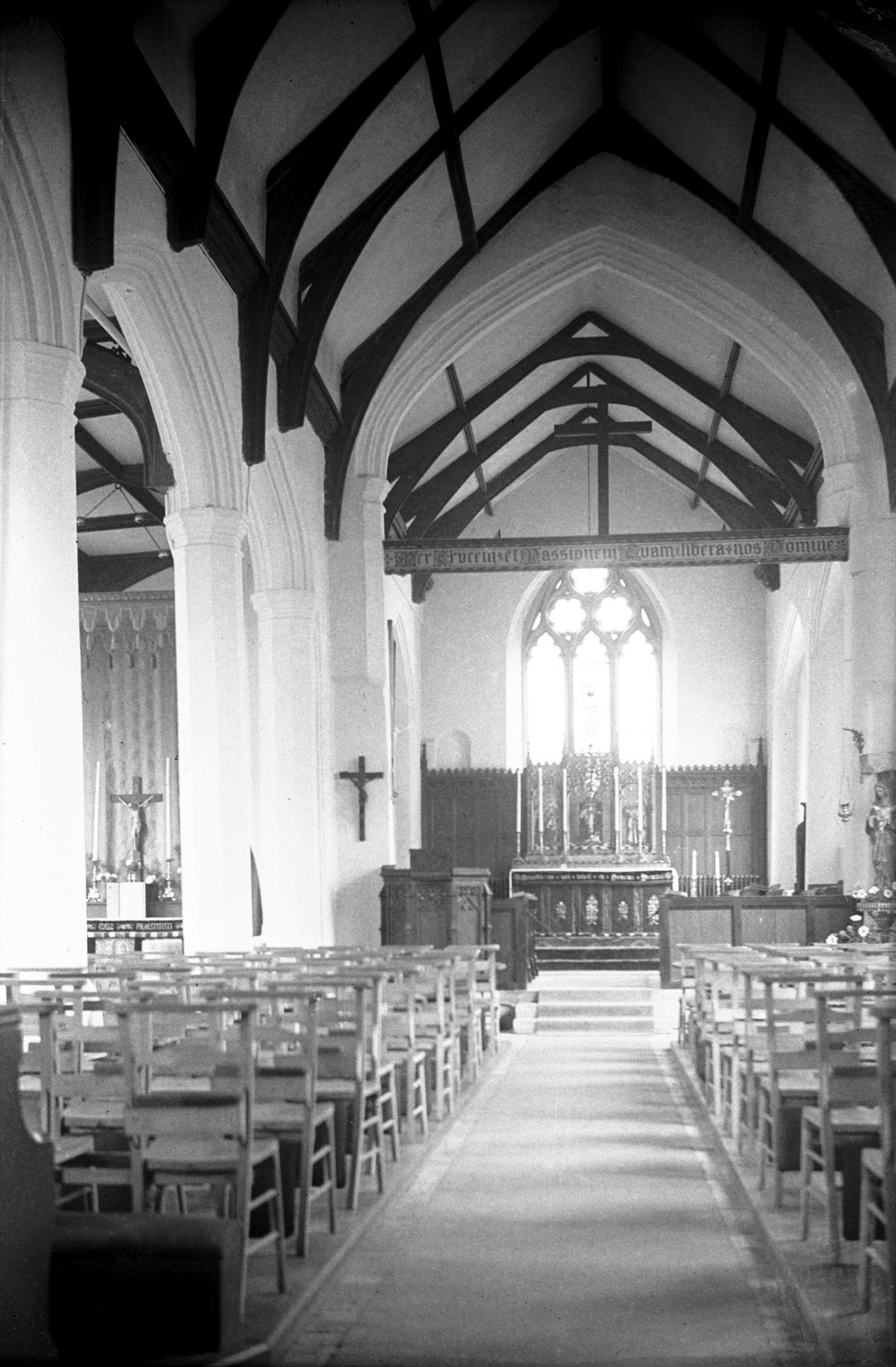
Nave arcade 16c. Chancel 14c. |
|
|
All Saints 15c font [1872] 1937-08-12
Octagonal. Apostles and Evangelists around the bowl and
other saints around the shaft. Since transferred to the
rebuilt St Julian's church. |
|
Westwick St: |
| |
From
Charing
Cross to Barn Rd / Heigham
St
passing St Swithin's Alley, New
Mills Yard
South side |
|
|
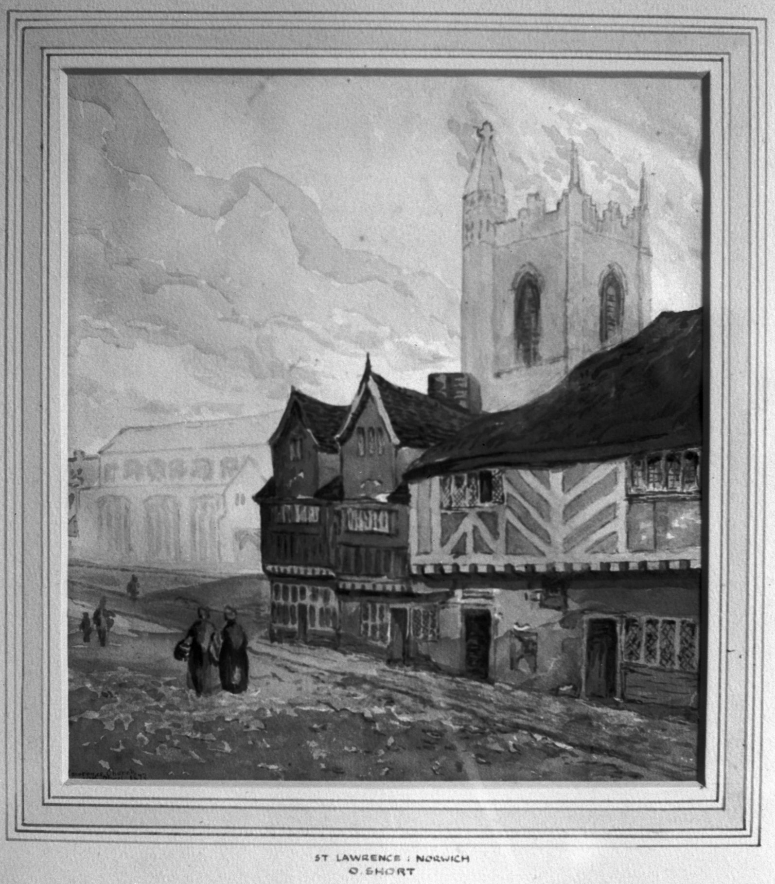
Westwick St watercolour by Obadiah Short [3045]
1939-06-03
|
|
|
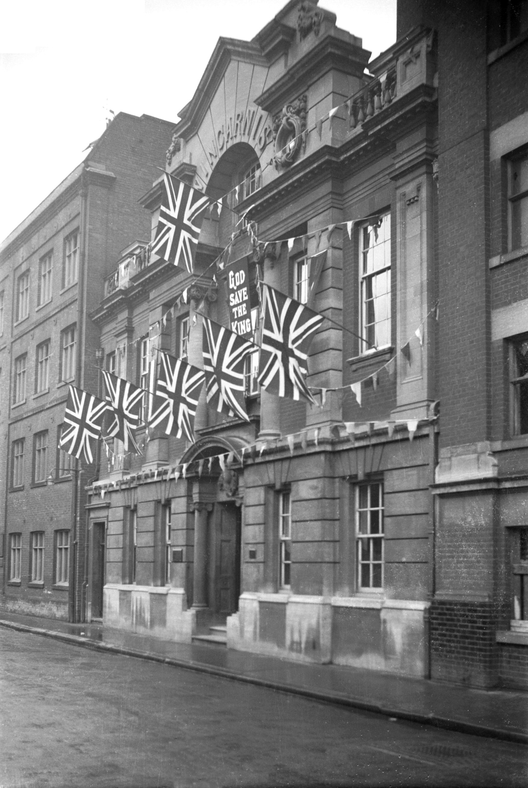
Coronation Westwick St Wincarnis works [1623]
1937-05-13
Wincarnis Works, Westwick St, very highly commended
business premises. 1937 coronation decorations. |
|
|
Westwick St Maidment shoe factory post-fire [B455]
1932-11-13
Frank Maidment's shoe factory, two days after being
gutted by fire. |
| |
North
side |
|
|
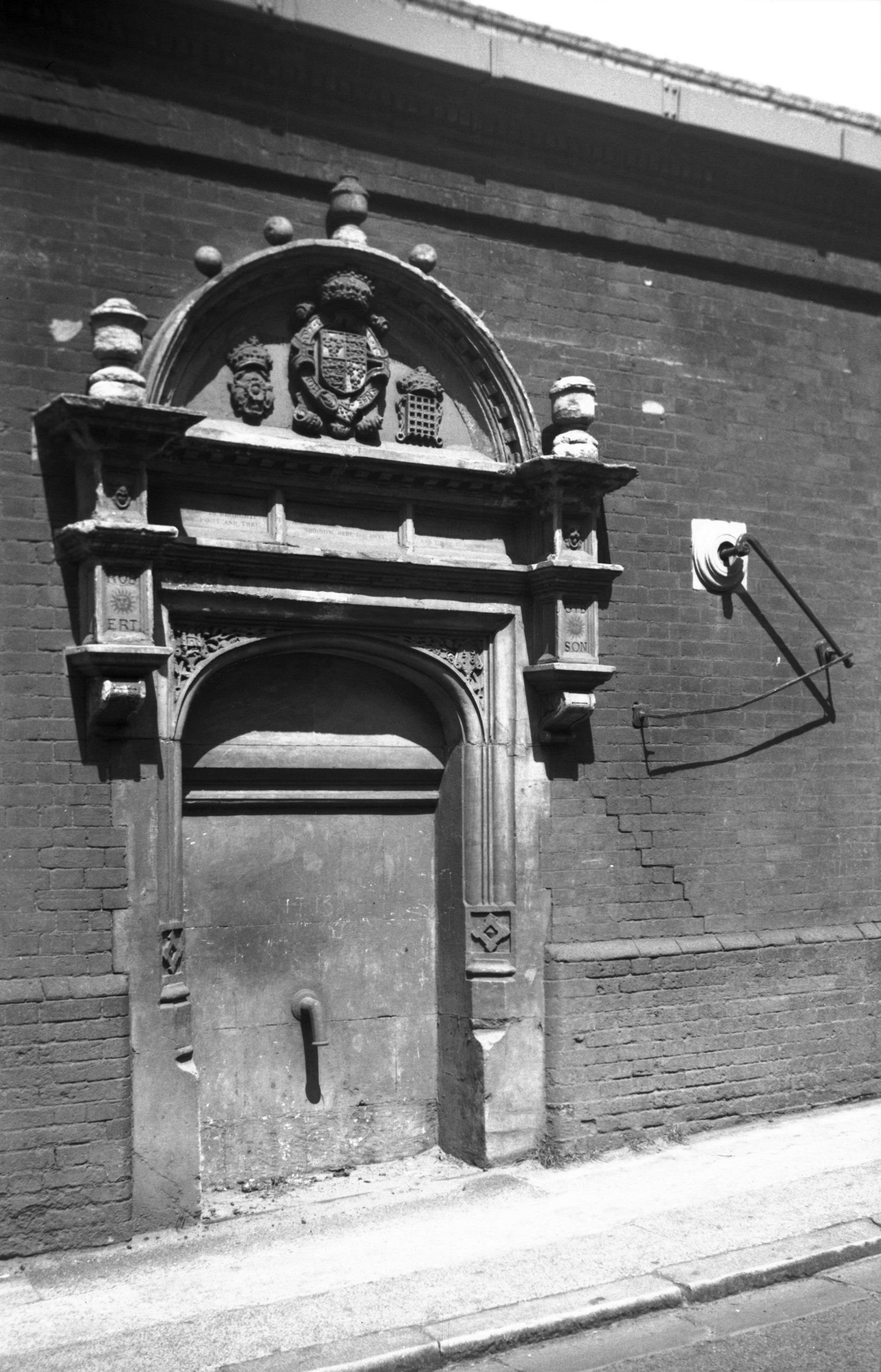
Westwick St Gibson's pump [0114] 1934-06-08
At the east end of Westwick St only a short distance away
from another at St John Maddermarket, is an old pump
known as known as Gibson's Conduit. This was for many
years set into the boundary wall of Bullard's brewery
facing Westwick St. After the conversion of the property
into flats and offices, however, it was dismantled and
re-erected on the other side of the wall, where it now
faces the Anchor Quay development and is set off to much
better advantage.
It appears that St Lawrence's well, known to have existed
here since the time of Edward I, was granted in 1547 to
the parishioners, together with a lane leading to it from
the street, on condition that they erected a door at the
south end of the lane, to be open by day and closed at
night. In 1576 this well and lane were granted to a beer
brewer, Robert Gibson (Sheriff in 1596), on condition
that he brought the water from the well by a pipe to the
public street, there to erect a pump at his own expense.
This he did two years later, and had a verse inscribed on
the stonework extolling his goodness for carrying out the
work.
Unfortunately it seems that Gibson was an irascible
person, which led him into trouble on more than one
occasion. In 1590, for instance, he abused the newly
elected Mayor, Thomas Pettus, both privately and in open
court. Things seem to have been smoothed over, but in
1602 the Mayor, Thomas Lane, was similarly abused, and
this led to Gibson being removed from the aldermanic
bench. He was also disenfranchised "of and from the
freedom and liberties of this city and forever henceforth
to be a foreigner and so continue" - the penalty for
failing to he "buxom to the Mayor". Gibson died
in 1606, presumably still disenfranchised, and was buried
in the chancel of St Lawrence's Church. |
|
|
Westwick St Gibson's pump [4435] 1956-05-21
|
|
|
Westwick St Gibson's pump [4436] 1956-05-21
|
|
|
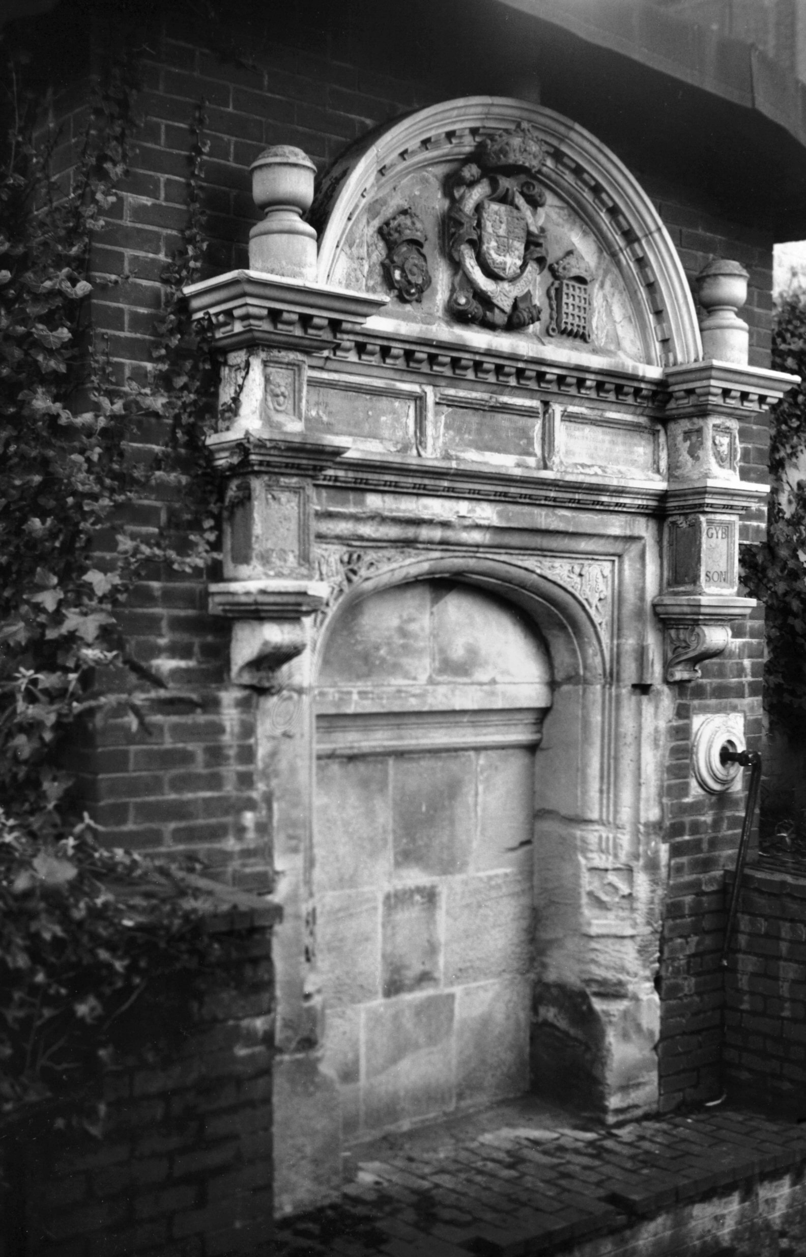
Westwick St Gibson's pump [4447] 1956-06-13
A public spring rose near this spot in the time of Edward
I, and in 1576 it was granted to Robert Gibson on
condition that he piped the water to the street and there
erected a pump at his own expense. Photographed 1956 in
the wall of Bullard's brewery. |
|
|
Westwick St Gibson's pump resited [7605] 1998-12-13
Photographed 1998 facing north towards Anchor Quay. |
|
|
Westwick St 26 to 28 before demolition [0779]
1936-03-05
|
|
|
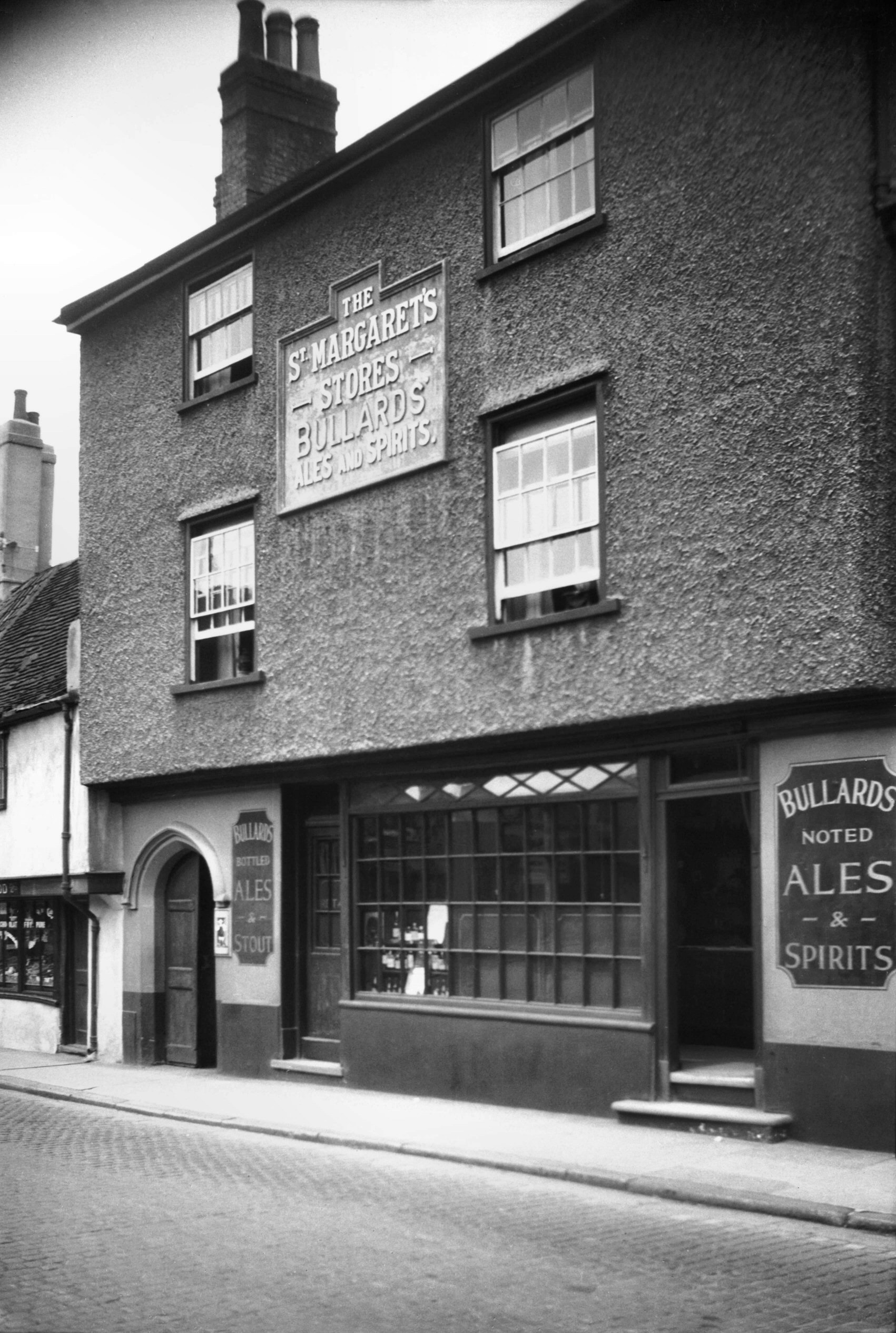
Westwick St 46 to 48 St Margarets Stores PH [1085]
1936-07-07
|
|
|
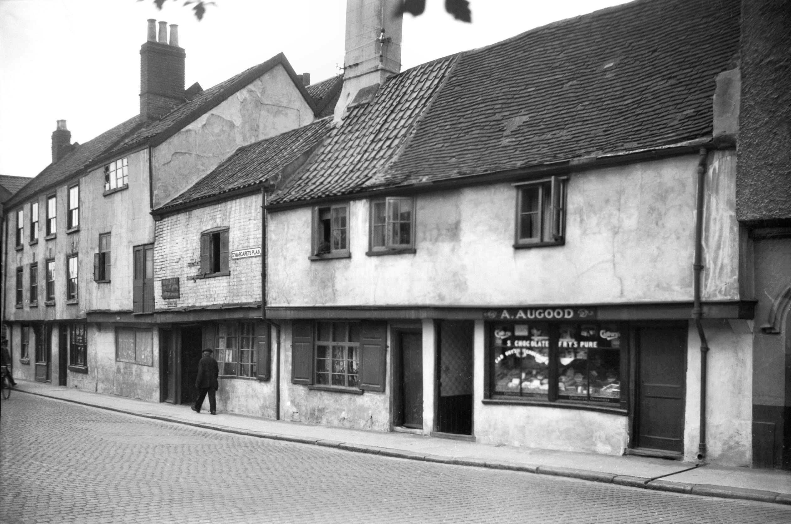
Westwick St 50 to 52 [1080] 1936-07-06
In Westwick St, St Margaret's Plain is the name given to
a widening opposite the church of that name, and here on
its north side were Nos 50 and 52, pulled down two or
three years before the war. There was nothing
particularly striking about their appearance, it is true,
but they could be quoted as typical examples of Norwich
Tudor dwellings; they probably resembled some of the
restored houses in Oak St before the latter were
furnished with their commodious attics about the time of
Cromwell. In the Westwick St building one of the
attractions was the retention of a considerable part of
the ancient pin-tiled roofing. |
|
|
Westwick St Waterman's Yard east side [2056]
1937-11-19
|
|
|
Westwick St Waterman's Yard west side [2055]
1937-11-19
|
|
|
Westwick St Waterman's Yard west side rear [1079]
1936-07-06
|
|
|
Westwick St 54 to 58 [1086] 1936-07-07
|
|
|
Westwick St 68 to 72 [1087] 1936-07-07
|
|
|
Westwick St 86 [1078] 1936-07-06
|
|
|
Westwick St 86 to 88 partially demolished [3036]
1939-05-29
|
|
|
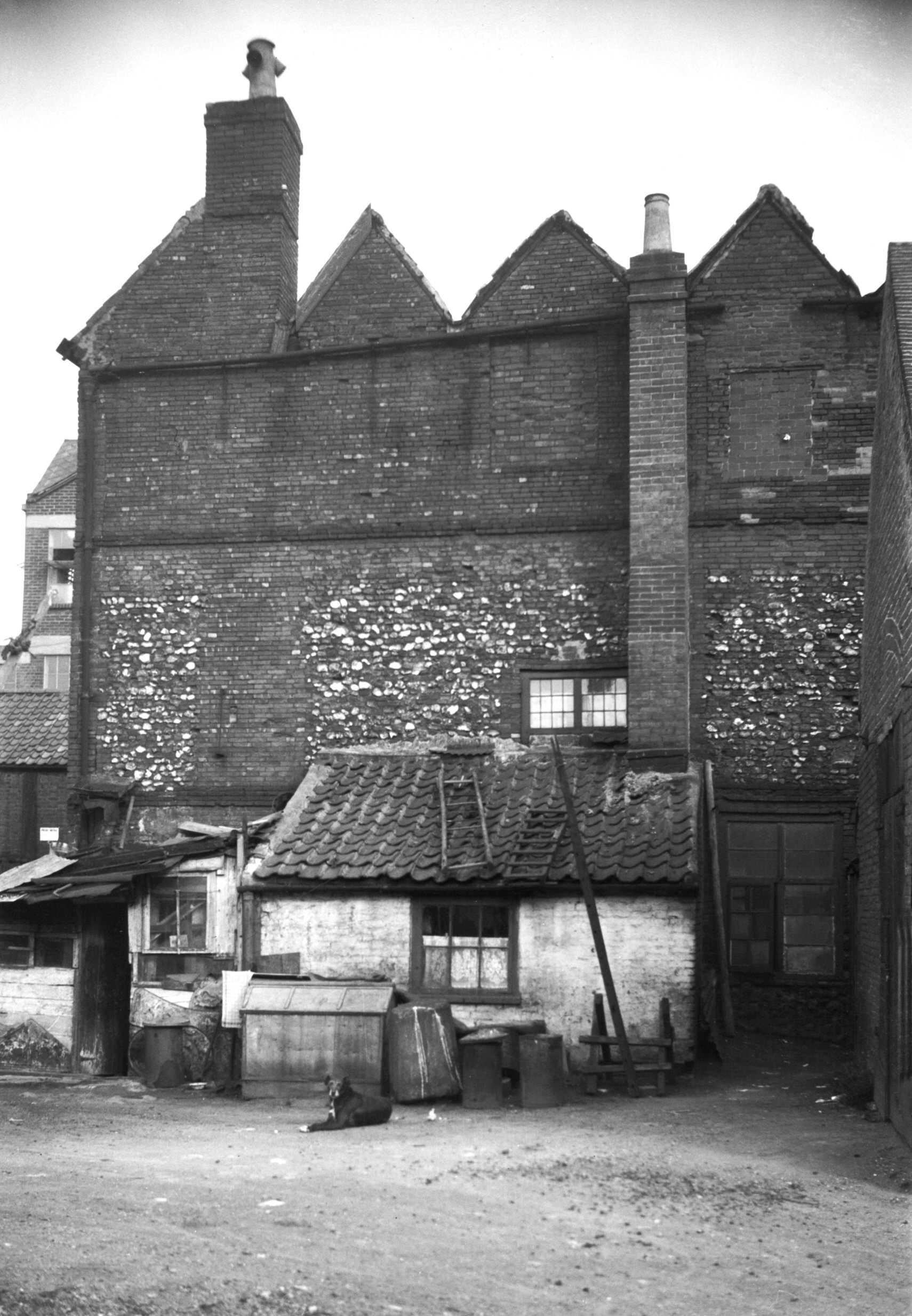
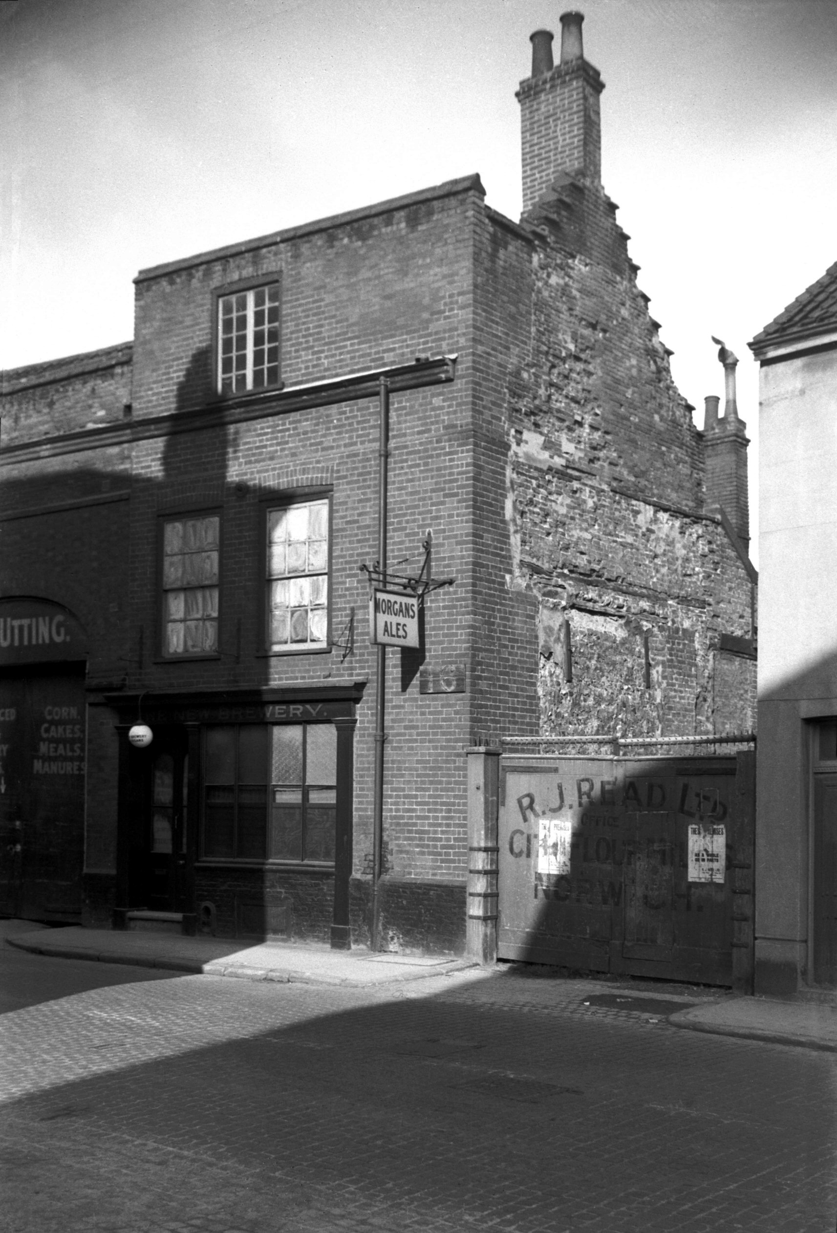
Westwick St 90 New Brewery PH [3292] 1939-10-22
No 90, the New Brewery Tavern, fell victim to the bombing
in April 1942. Its photograph clearly shows the manner in
which many an old house in the city such as this one was
re-fronted in modern times; but unless either of the side
walls is visible, as it was in this case, the outside
observer has no idea of its antiquity. A similar example
can be seen in Fyebridge St, in the house once inhabited
by Edmund Wood, the Mayor in 1548. The Westwick St house
was not quite as old; the eastern gable had corbie or
crow-steps, a popular architectural feature of the 17c. |
|
|
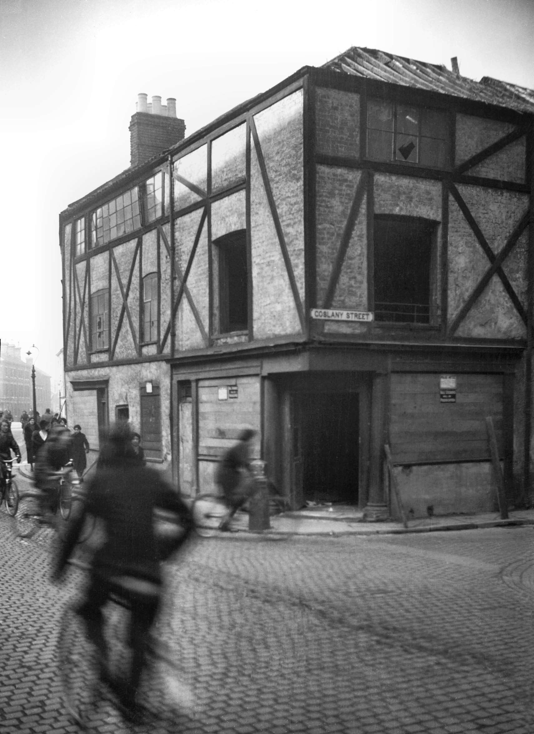
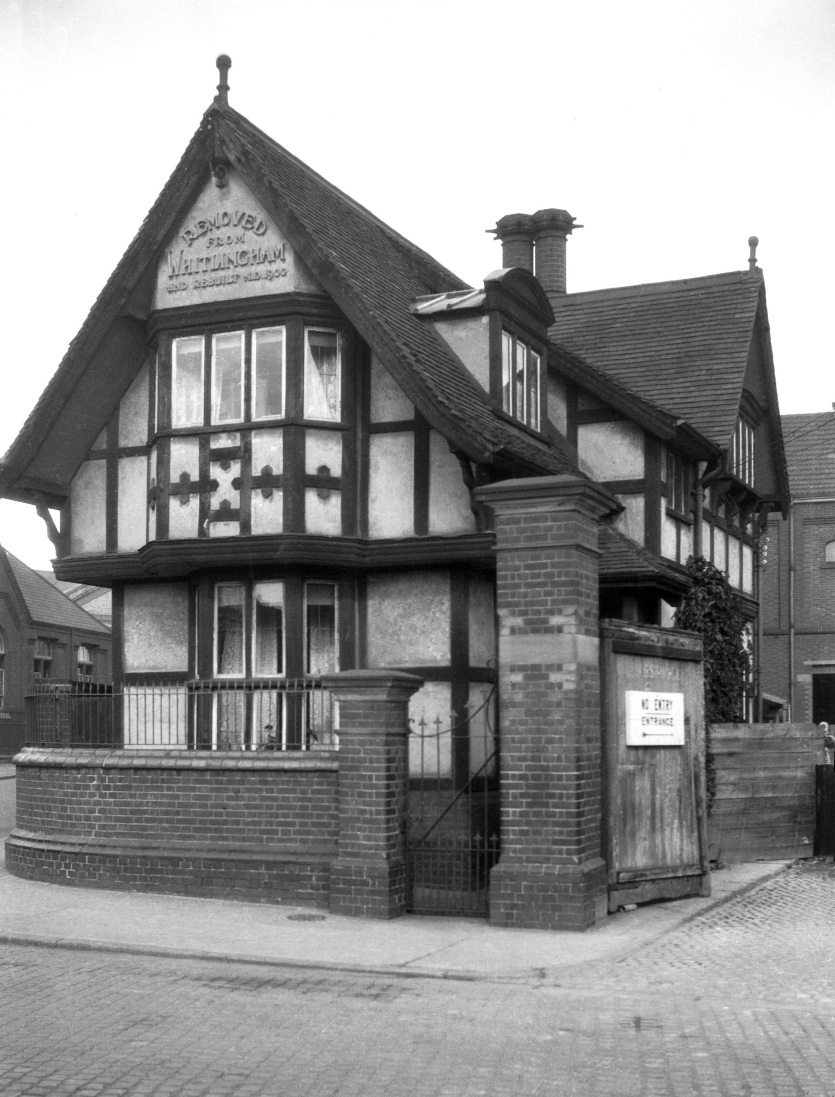
Westwick St Monkey House corporation depot [0301]
1934-09-25
At the end of the street, on the corner of Station Rd
(now widened as a continuation of Barn Rd), stood the
Norwich Corporation's Westwick Depot. In its yard,
looking slightly out of place, was a timber-framed house
on whose gable was the inscription "Removed from
Whitlingham and Rebuilt A. D. 1900". The site upon
which it had been re-erected was that of the mediaeval
city wall adjacent to Heigham Gate and adjoined that of
the Cow and Hare public house. This was also a
timber-framed building with several gables, but it was
demolished in 1881-2 in order to make way for an access
road to the new City Station. A sketch of this old inn
showing a piece of the city wall adjoining it was
published in C.J.W.Winter's book Norfolk Antiquities.
The house from Whitlingham (known as the "Monkey
House"), which later replaced it, was burned down in
the air raids of April 1942. |
|
|
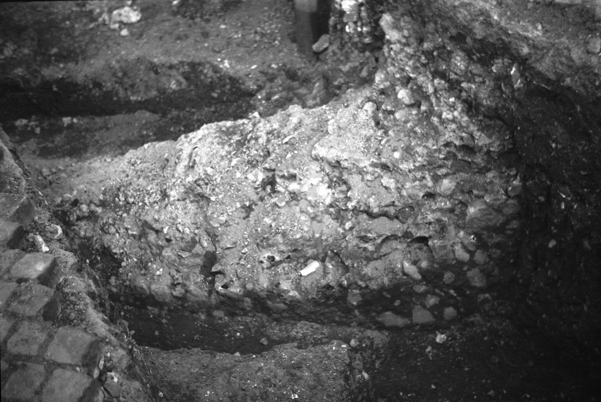
Westwick St wall excavated foundations 1 [0581]
1935-05-17
Wall foundations exposed opposite the corporation depot
by a drainage scheme trench 1935. |
|
|
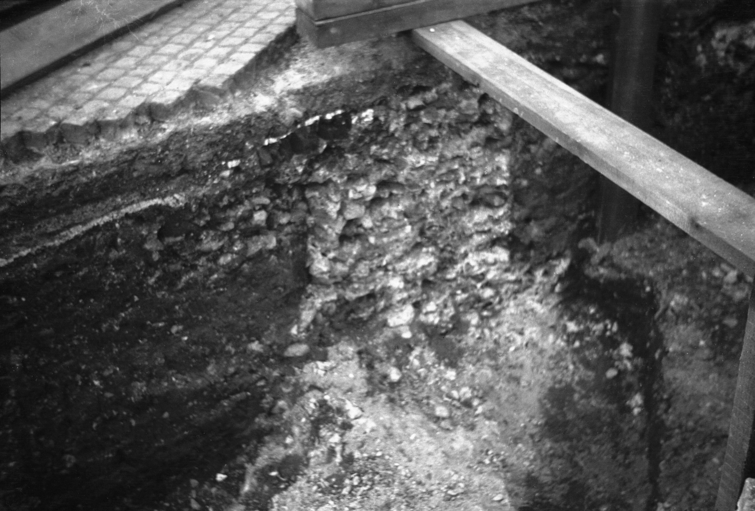
Westwick St wall excavated foundations 2 [0582]
1935-05-17
|
|
Wherry Rd: |
| |
Off
Koblenz
Avenue |
|
|
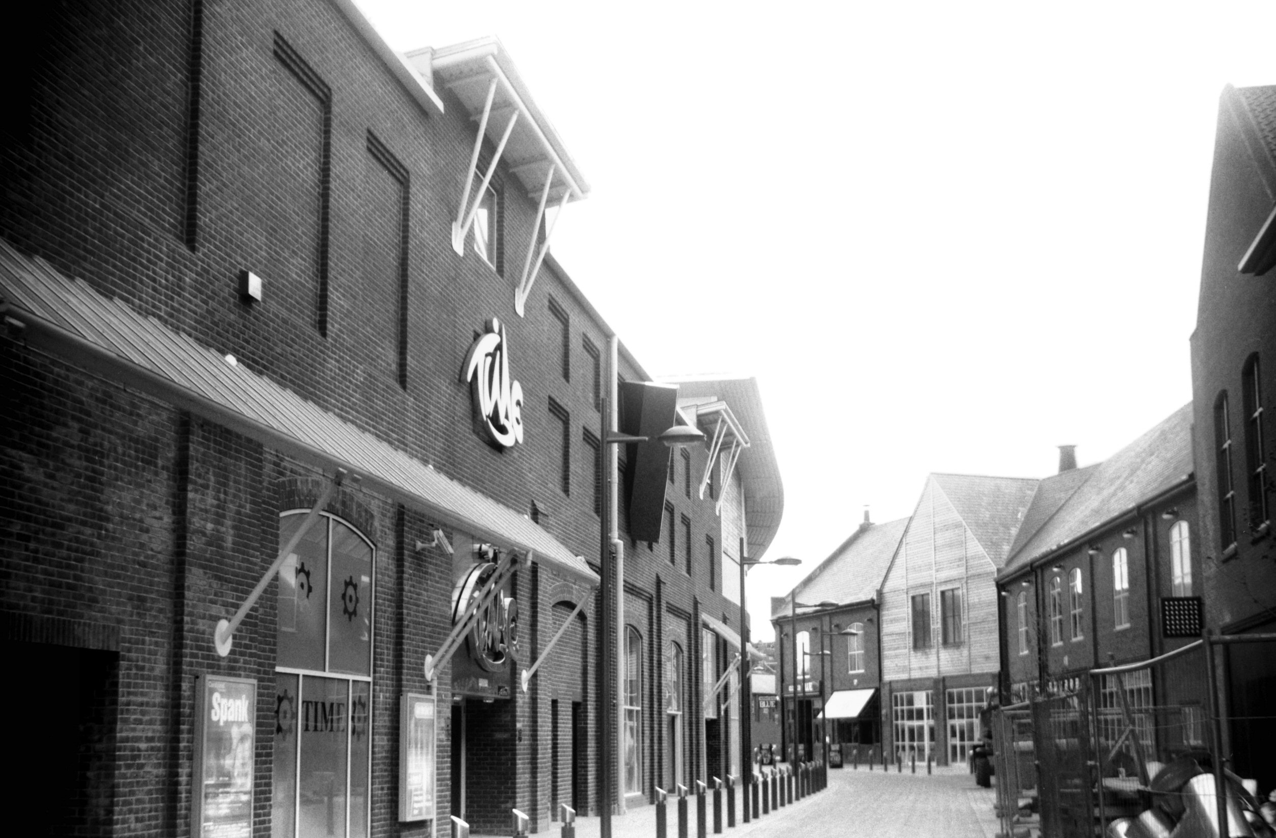
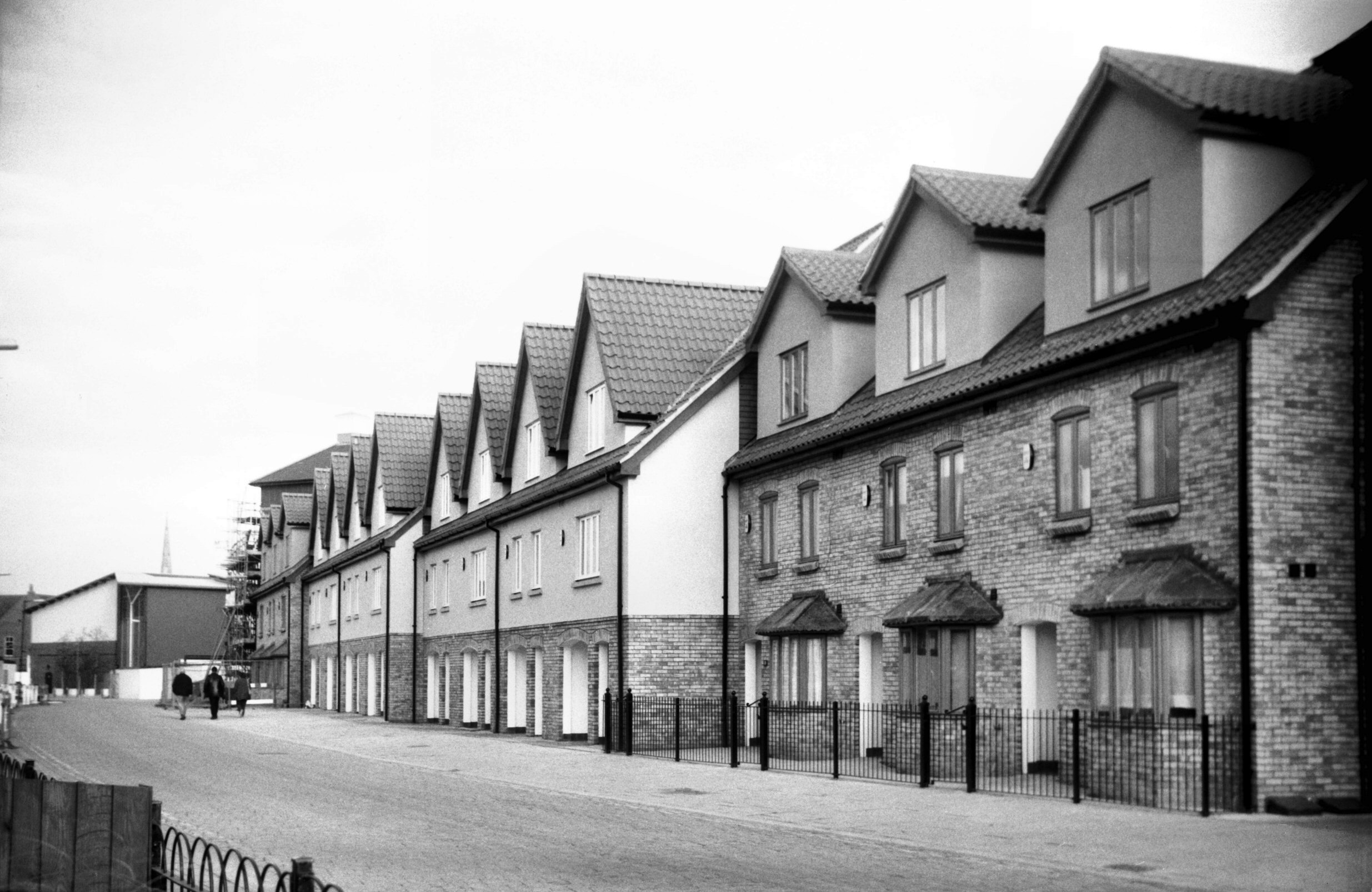
Wherry Rd Riverside view south [7820] 2001-05-04
|
|
|
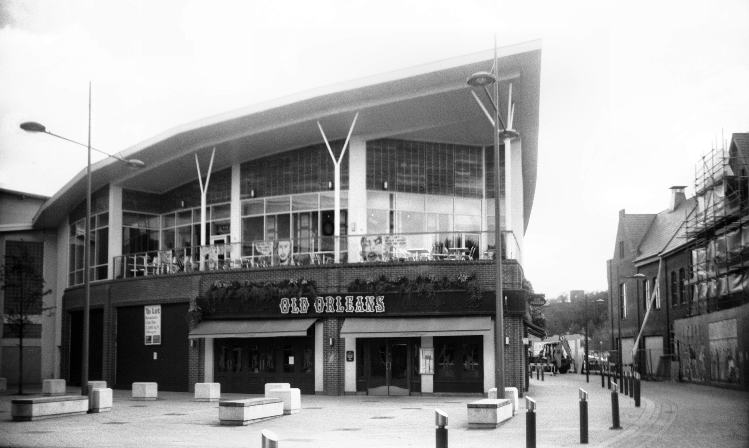
Wherry Rd Riverside Old Orleans restaurant [7821]
2001-05-04
|
|
|
Wherry Rd Riverside Walk terrace [7863] 2001-11-04
|
|
|
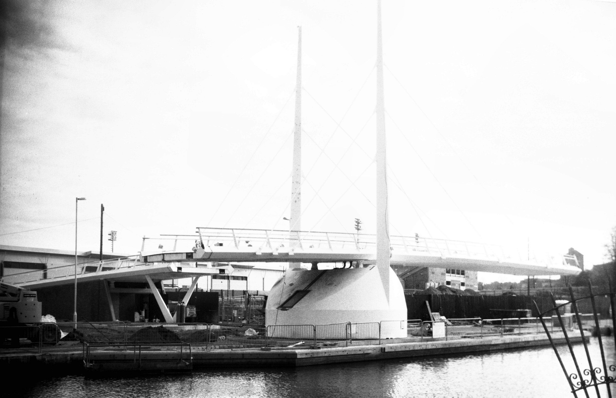
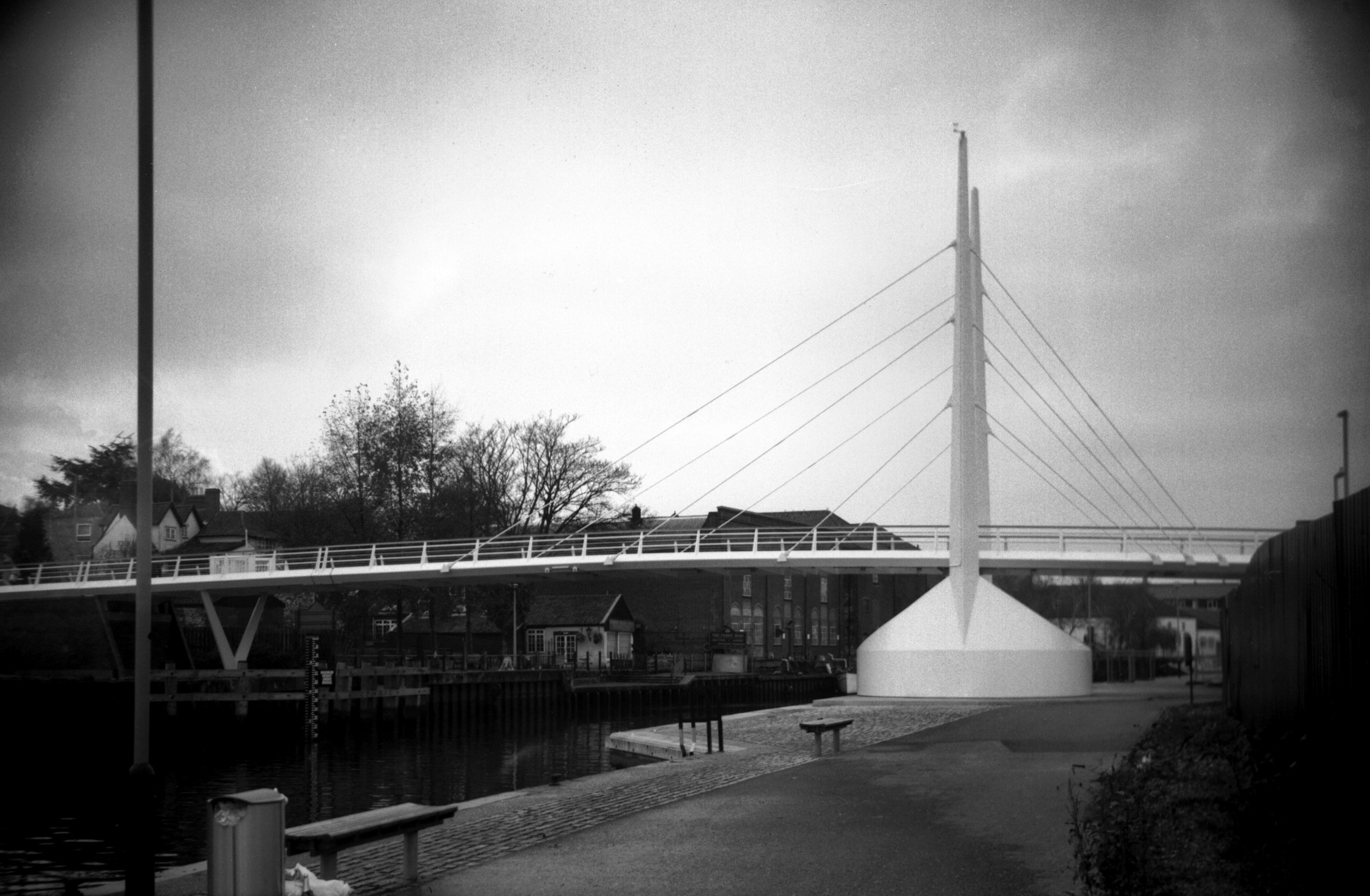
Wensum Friendship Bridge view downstream [7864]
2001-11-04
A pedestrian swing bridge linking the Riverside to Rouen
Rd. Constructed 2001 by May Gurney and named to
commemorate the twinning of Norwich with Novi Sad,
Serbia. Opened 12th November 2001 by the Ambassador in
the presence of the Mayor of Novi Sad and Keith
Ratcliffe, Lord Mayor of Norwich. |
|
|
Wensum Friendship Bridge view upstream [7865]
2001-12-09
|
|
|
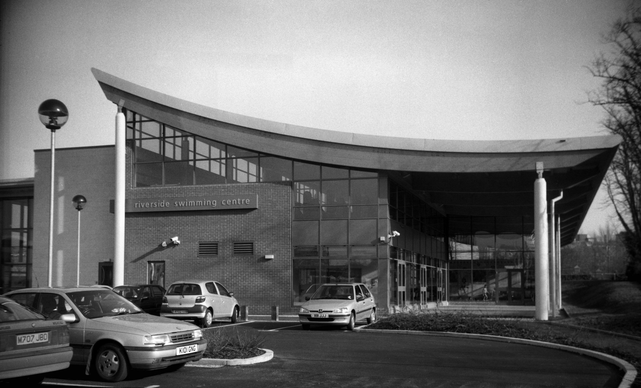
Wherry Rd Riverside Swimming pool [7921] 2003-03-15
Opened 7th March 2003, architects Charter Partnership,
Ipswich. |
|
White Lion St: |
| |
From
Haymarket / Market
Place to Red Lion St / Orford
Hill
passing Royal Arcade, Back
of the Inns
North side |
|
|
White Lion St 13 Claude Benton shop front [0351]
1935-02-12
|
|
|
White Lion St 13 Claude Benton shop interior [0376]
1935-02-27
|
|
|
White Lion St 13 Claude Benton in his shop [0378]
1935-02-27
|
| |
South
side |
|
|
White Lion St 2a to 6b view east [5125] 1967-03-18
|
|
|
White Lion St 2a to 6b view west [3201] 1939-08-07
|
|
|
White Lion St 4 to 6b rear [5121] 1967-02-25
From side entrance to Royal Arcade. |
|
|
White Lion St 8 10 Haymarket PH to 16 [3202]
1939-08-07
|
|
|
White Lion St 20 [6574] 1989-07-21
|
|
|
White Lion St 22 to 24 rear York Alley [7855]
2001-10-05
|
|
Whitefriars: |
| |
From
St Martin's
Palace Plain to St Crispin's Rd / Cowgate / Barrack
St
(formerly only to
Whitefriar's bridge, the road beyond being part of
Cowgate)
passing Fishergate
East side |
|
|
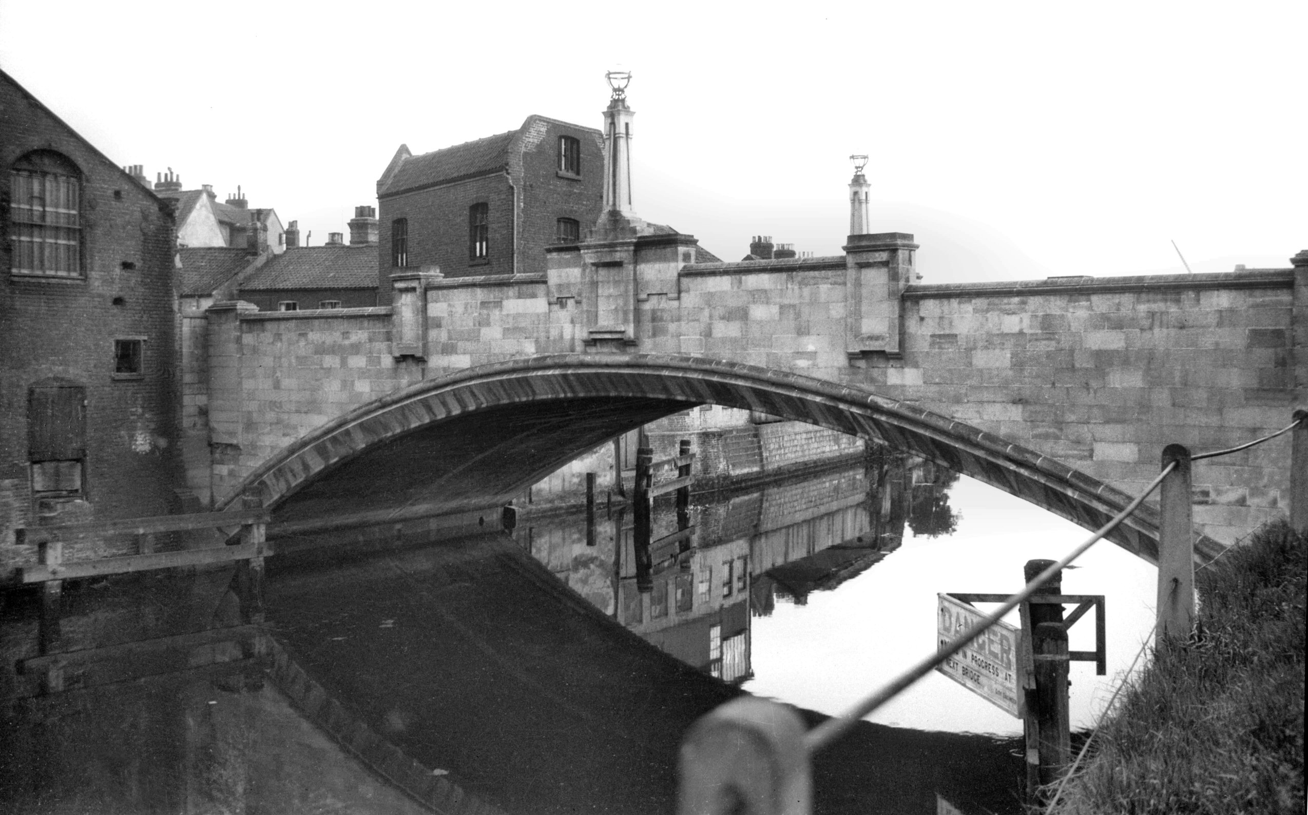
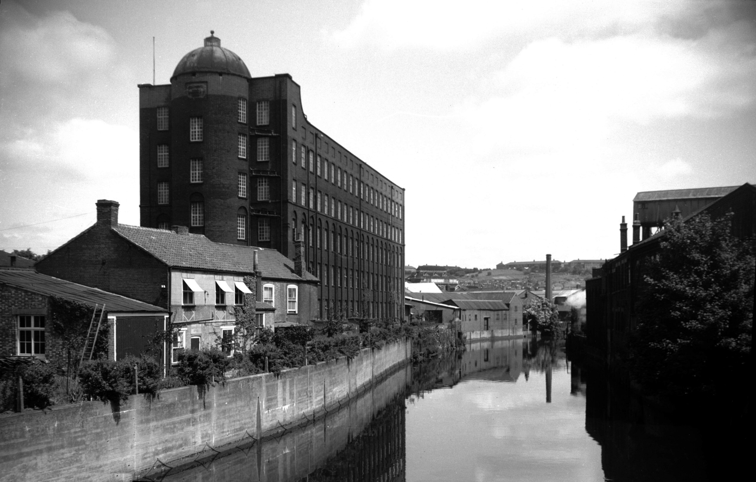
Wensum Whitefriars Bridge east side [B630] 1933-07-18
Whitefriars Bridge is one of several in Norwich rebuilt
during the 20c. Formerly known as St Martin's bridge, it
is first mentioned in a grant made by King Henry I to
Bishop Herbert de Losinga shortly after 1100. In 1290 it
was washed away by a great flood, and there are records
of it having to be rebuilt at different times throughout
the centuries. The earlier ones would have been wooden
constructions; during Kett's rebellion in 1549, we are
told, the bridge was deliberately demolished with the
dual purpose of impeding the rebels and using its timbers
to strengthen the nearby city gates.
In 1591 a more permanent edifice was built of stone, with
a single pointed arch. This survived until replaced by
the present bridge designed by Arthur E.Collins, City
Engineer, and built by unemployed labour under a skilled
foreman. It is of concrete reinforced by 1.5 inch steel
bars and faced with mica quartz and white cement. The
first half was opened to traffic on 19th February 1925.
Its span of about 80 feet is some 50 feet wider than that
of its predecessor.
It was said at the time that the stones of the old bridge
would be marked in order that it could be re-erected on a
different site, but this was never done. Several
suggestions have been put forward as to their fate, one
of the least plausible being "that they happened to
fall into a wherry as it passed under the bridge"
and were conveyed by water to Wroxham and Horning to be
used as foundations for riverside bungalows. It sees more
likely that some at least were taken from the bridge to
the Corporation Depot at Infirmary Square (now Starling
Rd), and were later moved to another store at St Martin
at Oak Wall Lane, finally ending up as foundations for
roadworks on Aylsham Rd. |
|
|
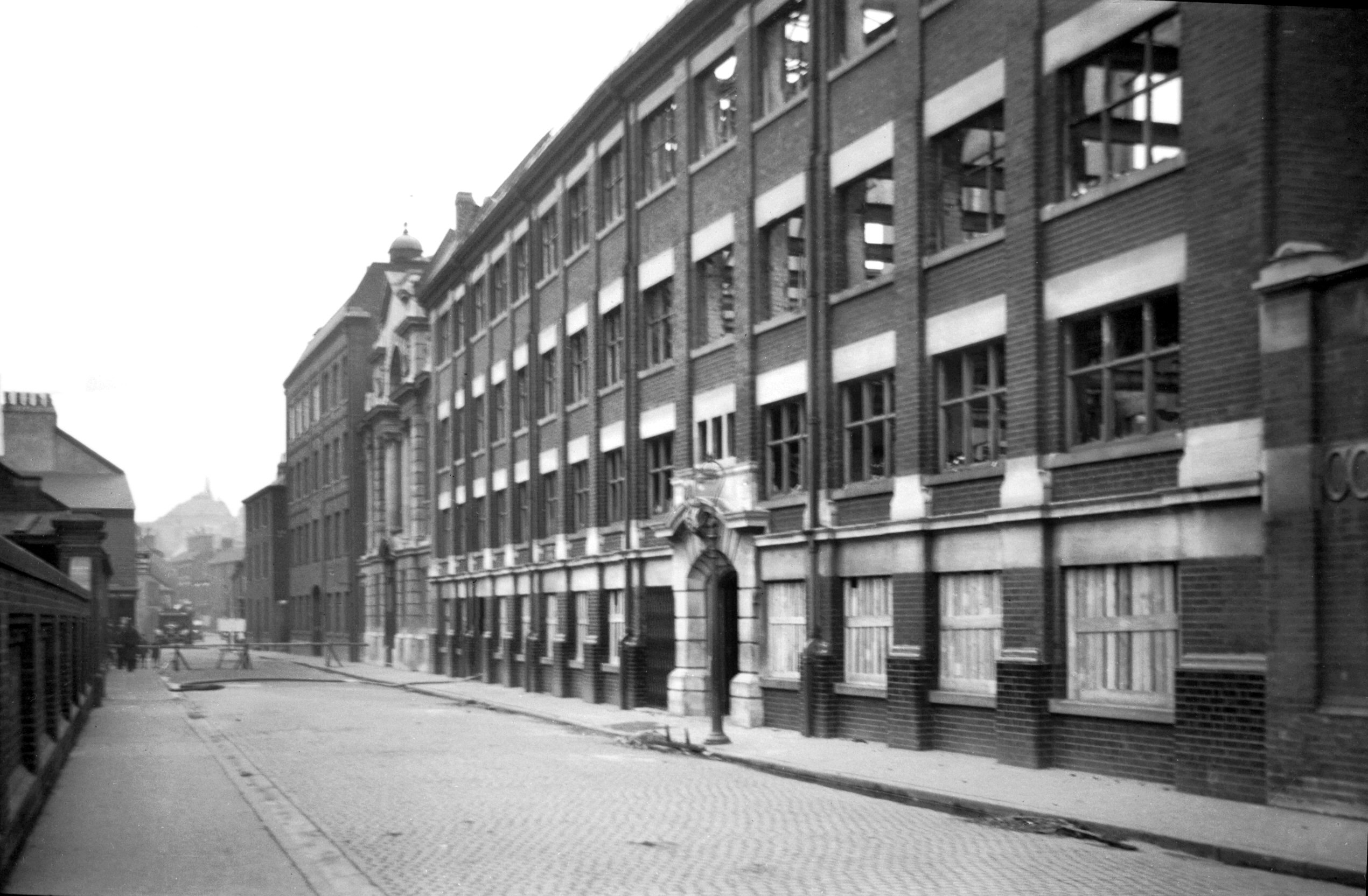
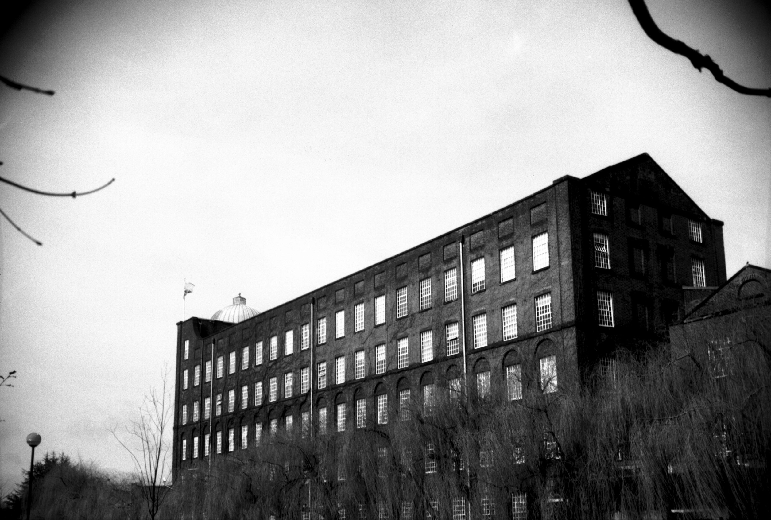
Whitefriars Yarn factory now Jarrold's [3786]
1949-06-12
1836-7, architect John Brown. |
|
|
Whitefriars Yarn factory now Jarrold's [7813]
2001-04-01
See also Cowgate 131 to 141 |
|
|
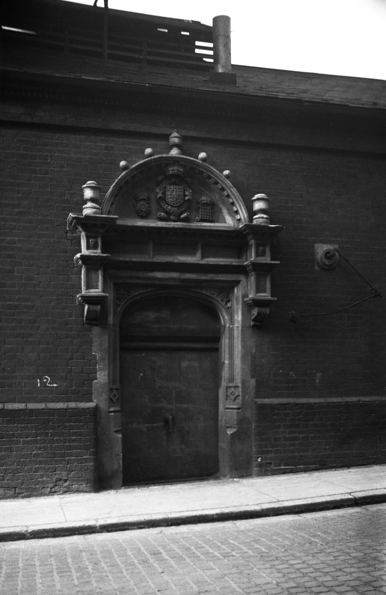
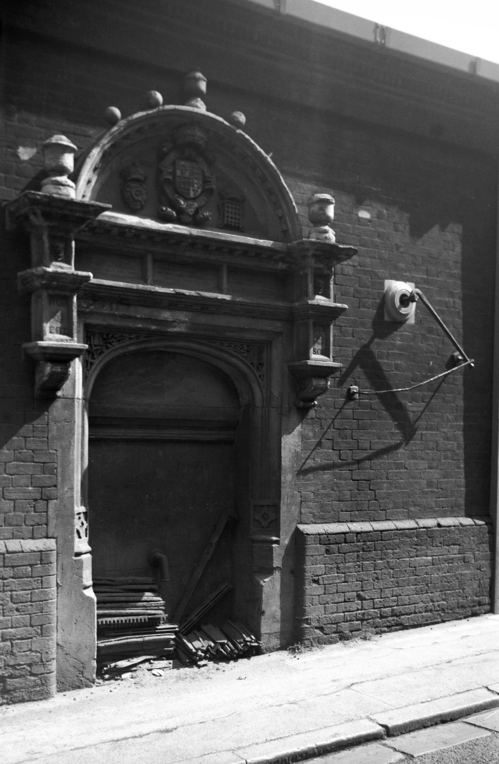
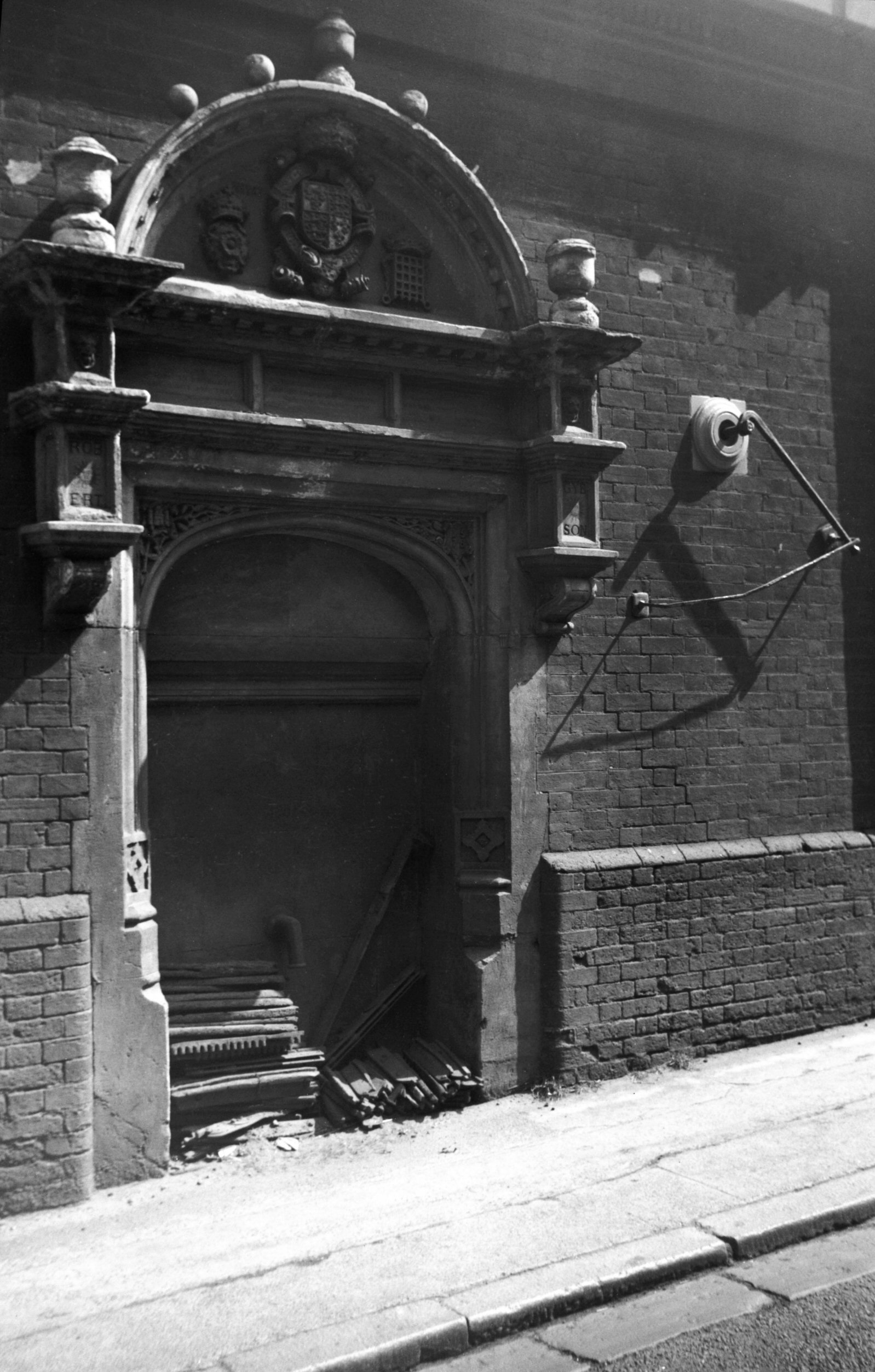
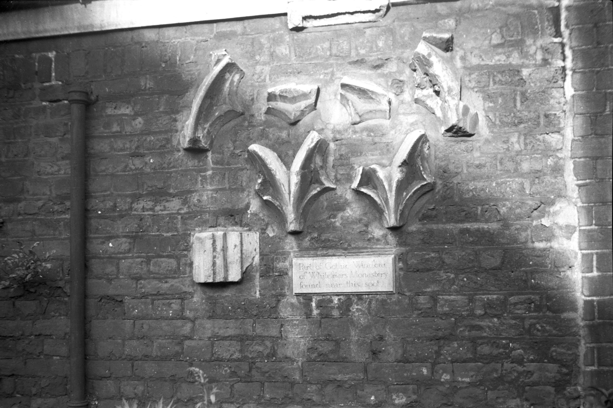
Whitefriars Cowgate Factory Yard tracery [1651]
1937-05-29
On the east side of the road, with the river to the
south, stands the great Yarn Factory, built in 1836-37,
now part of Jarrolds' printing works. Until the
Reformation much of the land on this side of what was
formerly part of Cowgate had been occupied by the
monastery of the Carmelites or Whitefriars.
Richard Taylor in his Index Monasticus describes
how in about 1256 one Philip de Cowgate settled lands
there upon William de Calthorpe, alias Suffield,
"upon condition that the brethren of Mount Carmel
should enter and dwell there without any molestation, for
ever, and serve God therein". In addition to the
founder, who was buried there in 1283, Taylor lists many
other benefactors, including Sir Oliver de Ingham,
Clement Paston, and Joan the wife of John Fastolf. With
the money thus received the friars were able to build a
magnificent church, partially completed by 1343 and
eventually consecrated in 1382.
Despite the founder's decree that the Carmelites were to
dwell there forever, King Henry VIII had other ideas; the
friary was dissolved in 1542, and the site was granted to
Richard Andrews and Leonard Chamberlayn. Shortly
afterwards the land was divided up into many different
ownerships.
Although the dimensions of the church and cloisters are
known, having been copied from another source by the
historian John Kirkpatrick in his Religious Houses
&c. in Norwich, little is known of the actual
layout of the friary. Most of our information comes from
artefacts found on necessarily limited archaeological
digs or when foundations have been dug for new buildings.
In 1904 certain foundations were uncovered, and about
1920 six pieces of window tracery were found and built
into a wall at Factory Yard, to be cleared away later
when Jarrolds extended their works. Two coffins each
containing a skeleton were found in 1958; they probably
dated back to the 14c. And in 1960 a Gothic arch, which
had been filled in with bricks and incorporated in a
later building, was uncovered; this has now been opened
out and forms an attractive feature near the entrance to
Jarrolds' works. At about the same time a dilapidated
flint wall adjoining the bridge was taken down as not
being worth preserving - a modern tablet identified it as
having once formed part of an anchorage attached to the
friary.
The most important surviving feature on the site is a
vaulted undercroft of two bays, adapted by Jarrolds as a
small museum of obsolete printing machinery. In 1978 at
Jarrolds' invitation the Norwich Survey team investigated
the building, and details of their findings were
published in Norfolk Archaeology Vol.37. Its
position seems to have been to the north of what was
probably the original cloister complex; it may have
served as an entrance parlour to the cloister.
Another important relic, not in its original position, is
what has become known as the Arminghall arch. This
elaborately carved 14c archway has had a series of moves
since it was taken down at the Dissolution and re-erected
at Arminghall Old Hall, just a few miles south of the
city. There it remained until the hall was demolished;
the late Russell Colman then acquired it and transferred
it to his grounds at Crown Point. From there it has
recently been taken to be installed in the new
Magistrates Court, just across the bridge from its
original position. Now protected from the weather, it
should survive for many years to come. |
|
|
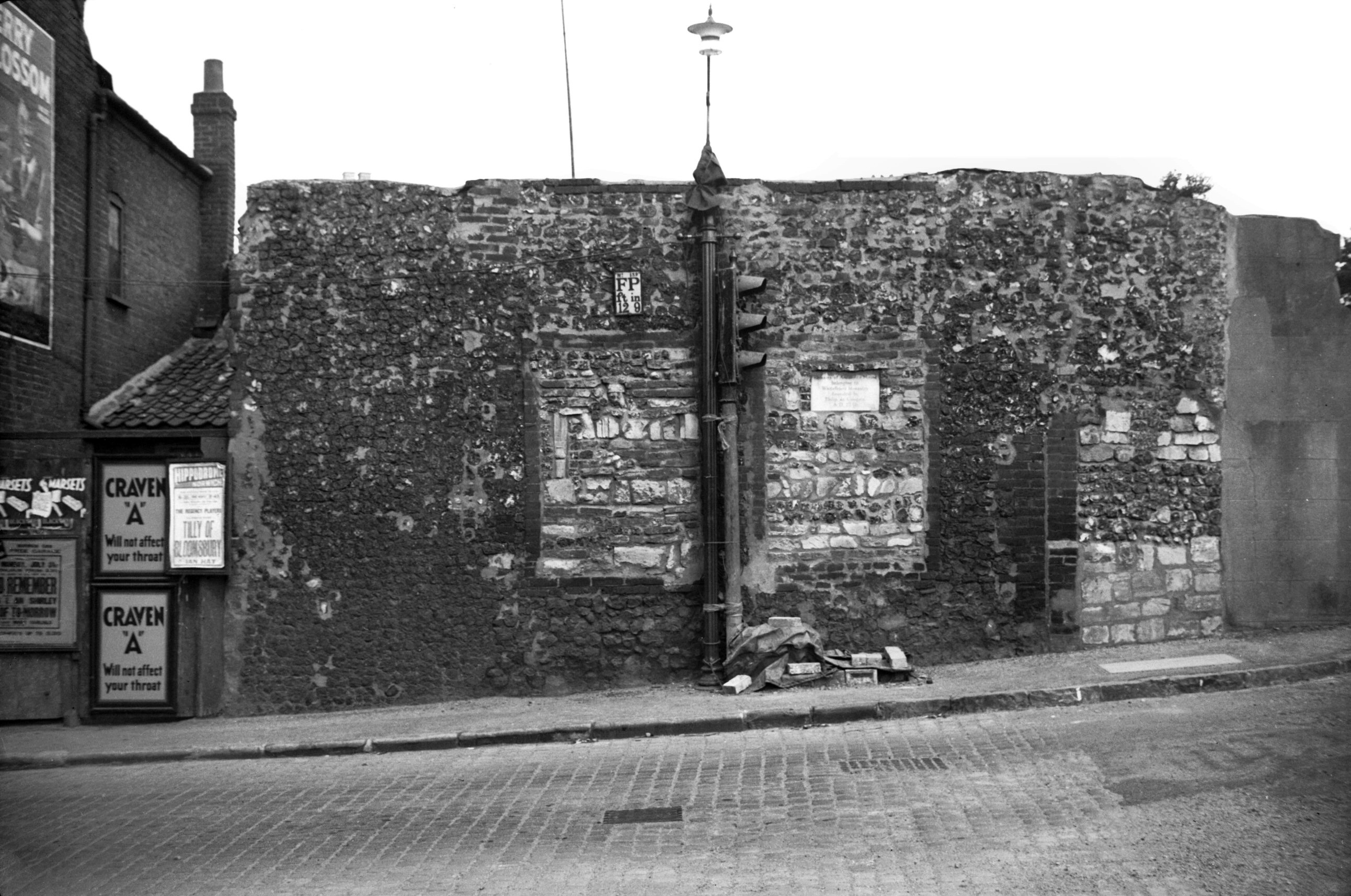
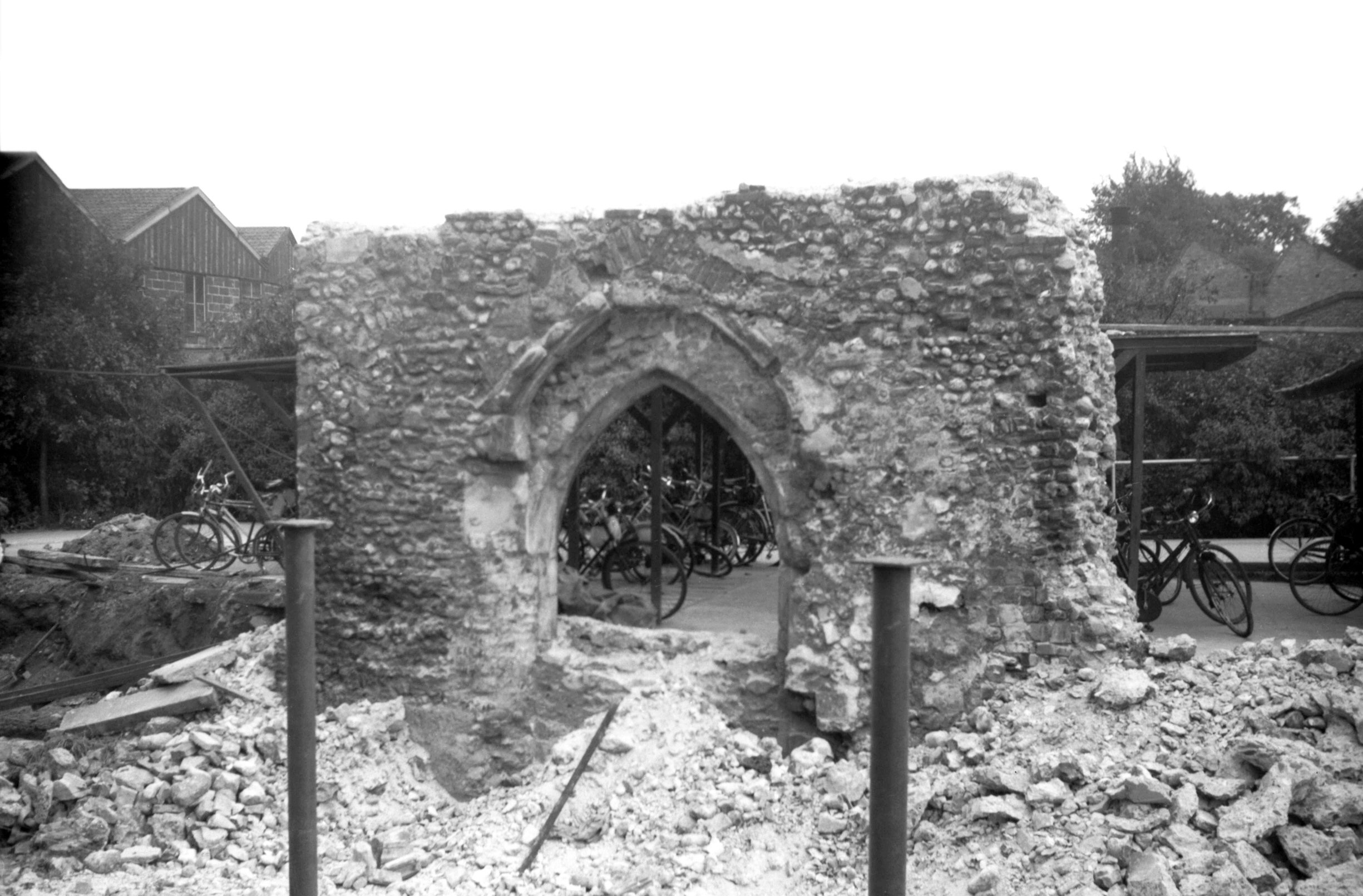
Whitefriars Cowgate flint wall [3187] 1939-07-30
Wall to the north-east of Whitefriars bridge which once
formed part of an anchorage attached to the adjoining
Whitefriars Monastery. Founded by Philip de Cowgate c1256
and suppressed in 1543. |
|
|
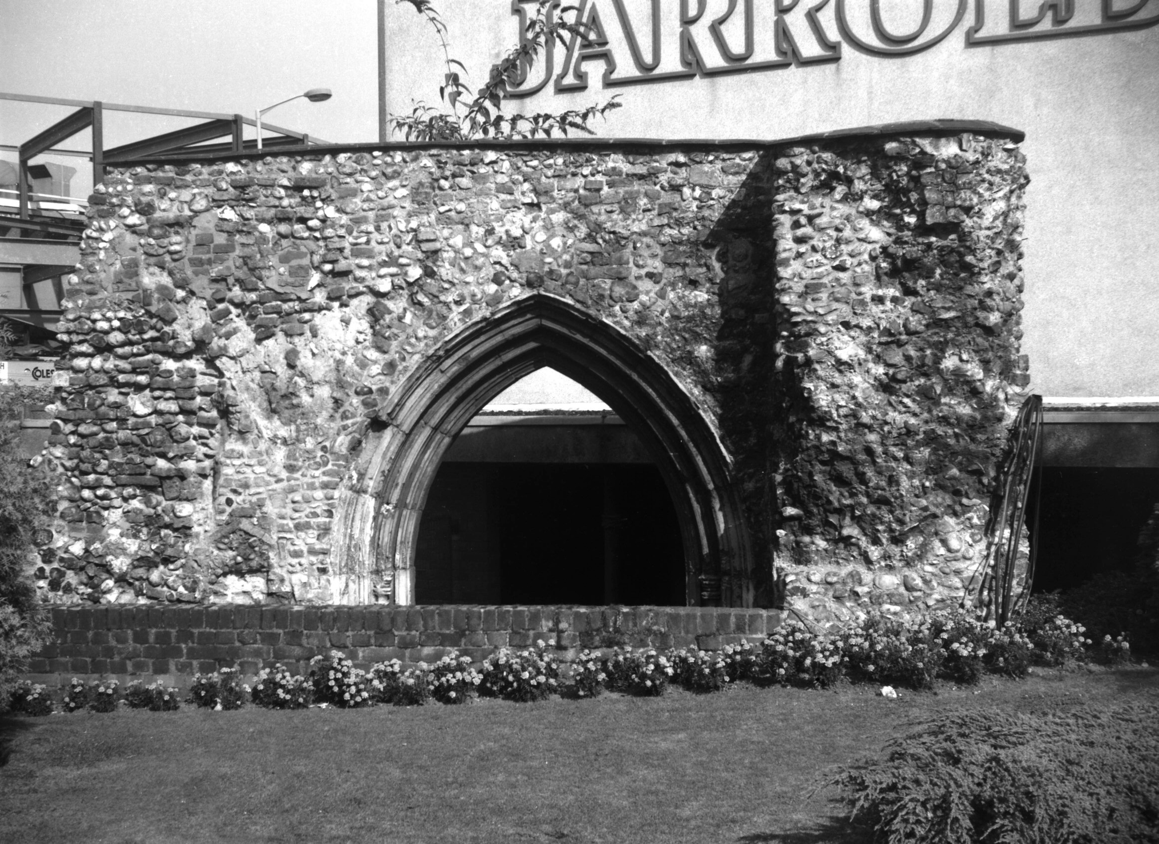
Whitefriars Cowgate friary doorway W side [4615]
1961-07-07
Uncovered in 1961 it stood adjacent to the anchorage. |
|
|
Whitefriars Cowgate friary doorway E side [6512]
1988-08-17
|
|
|
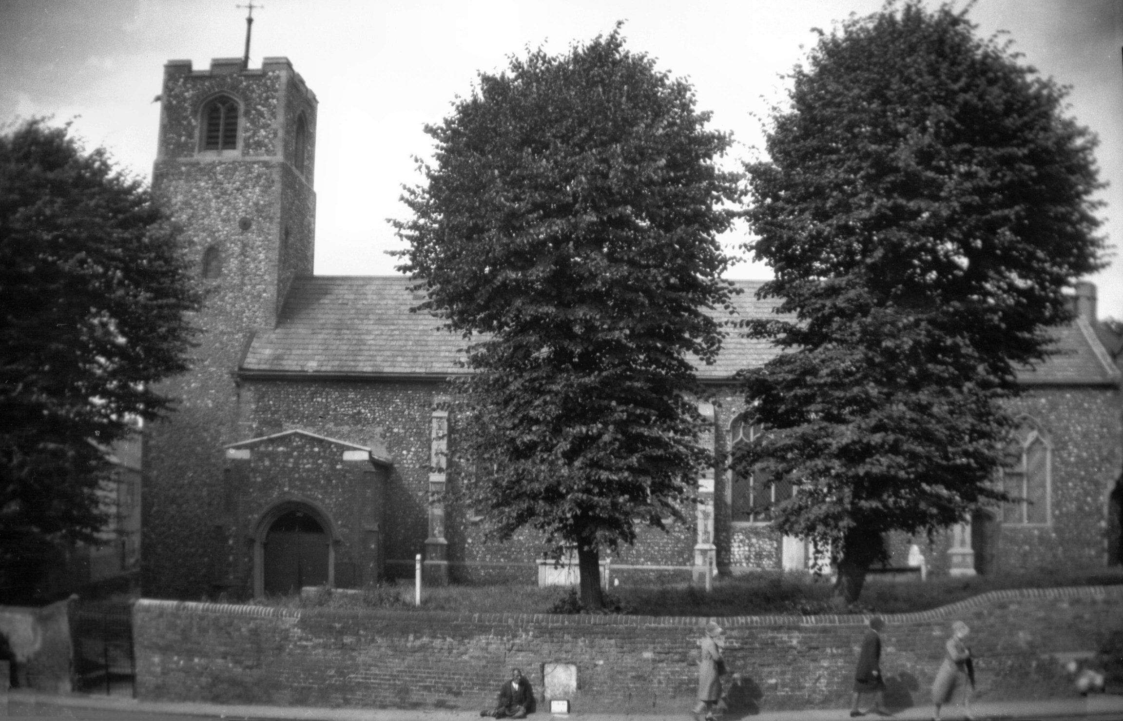
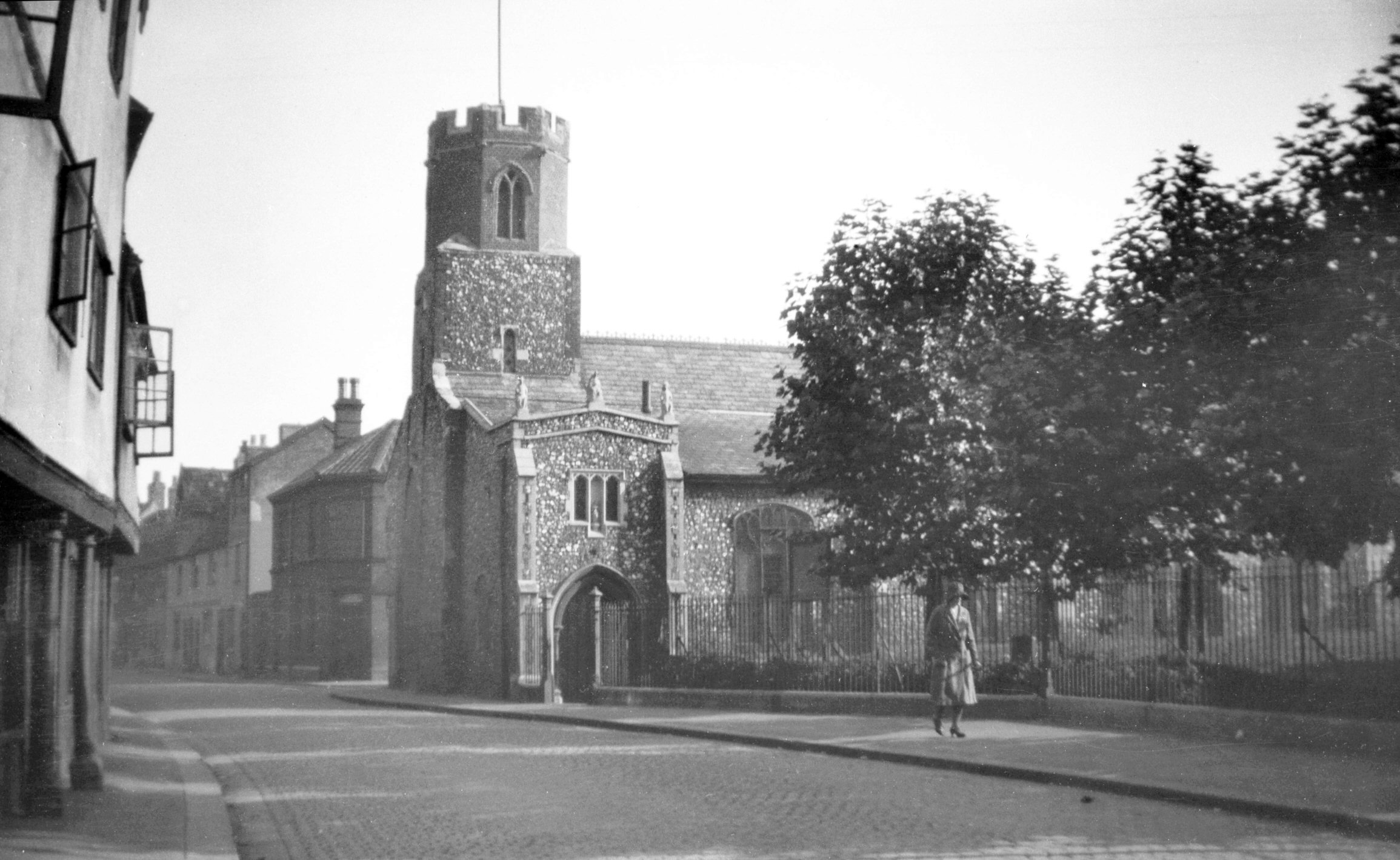
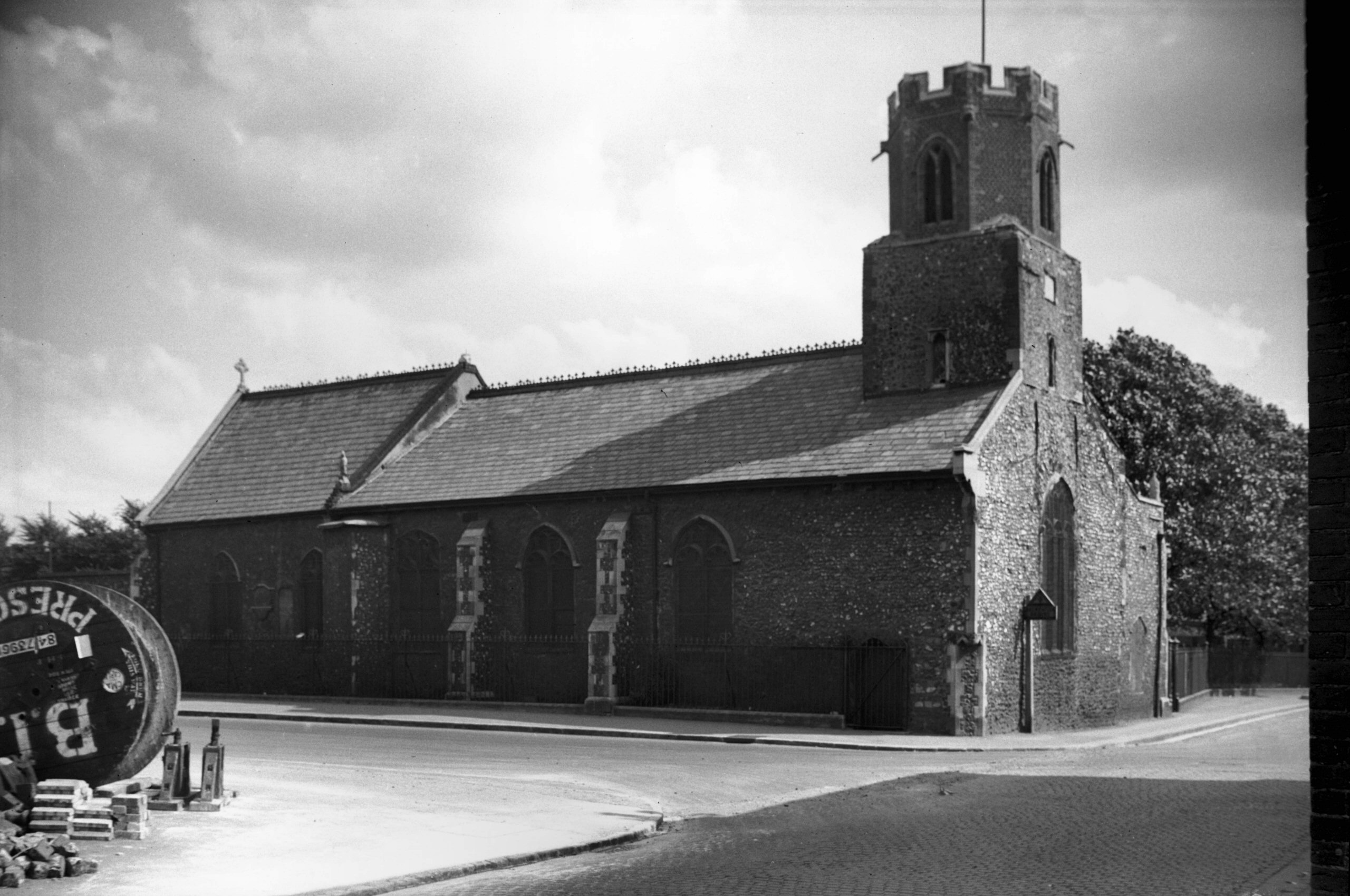
St James' south side from Cowgate [B113] 1931-00-00
|
|
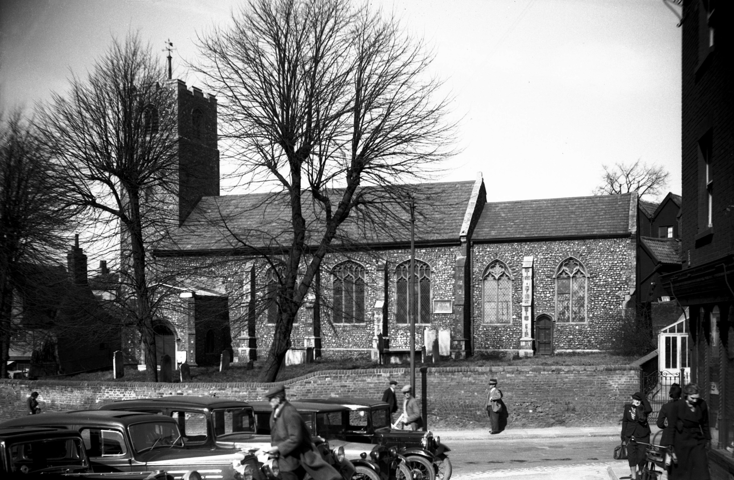
|
St James' south side from Cowgate [2266] 1938-04-07
|
|
|
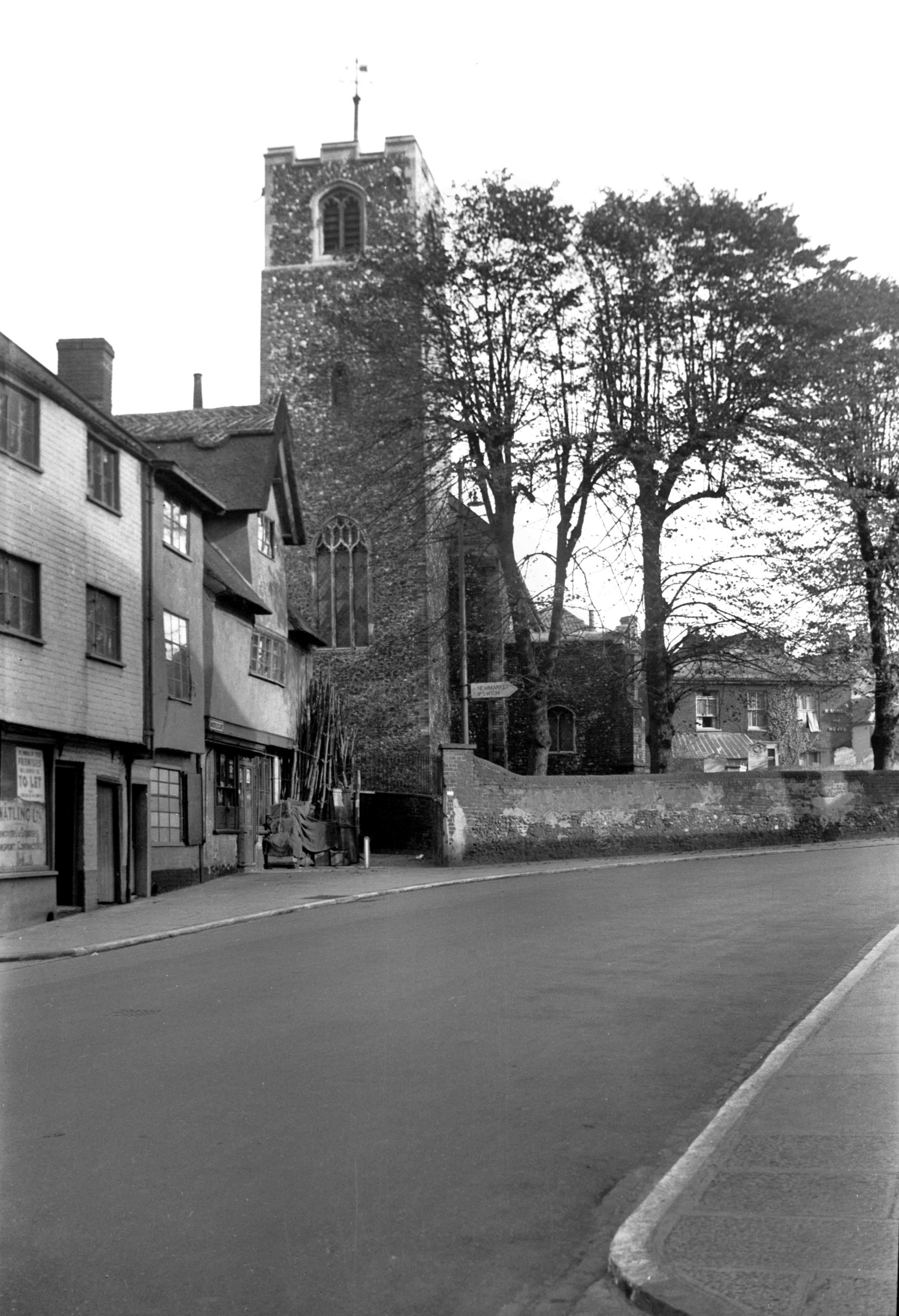
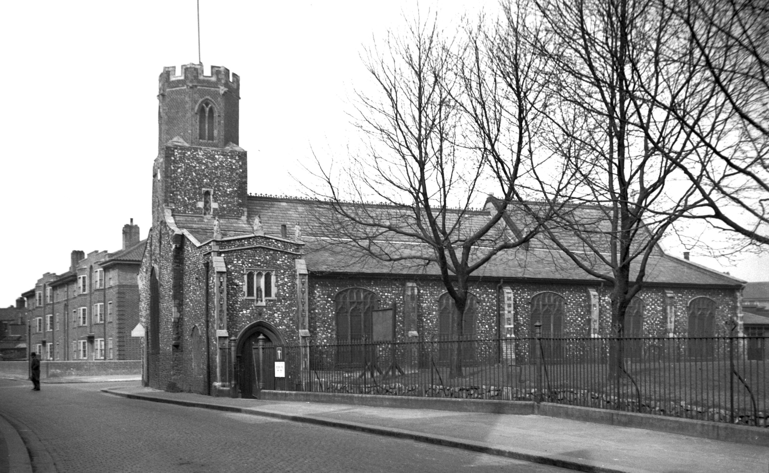
St James' north side [3193] 1939-07-30
The tower stands in the body of the church on arches,
only the west wall being solid. |
|
|
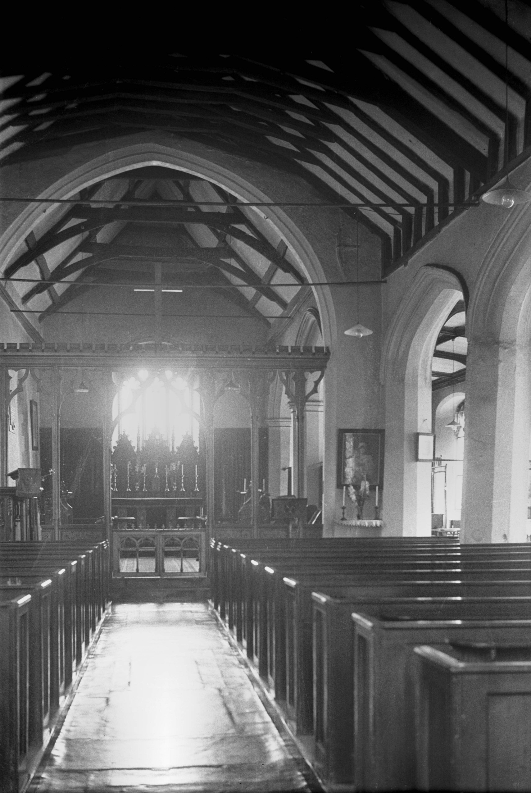
St James' interior view east [1884] 1937-08-16
|
|
|
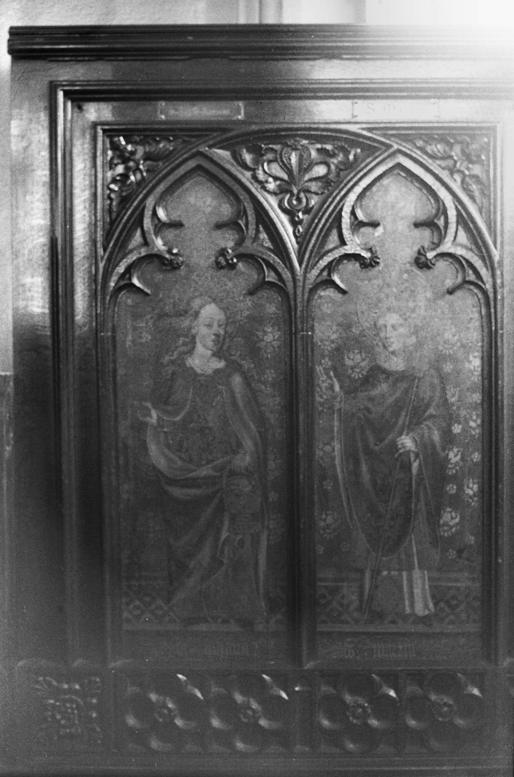
St James' old rood screen panels [1885] 1937-08-16
Two of the ten surviving panels from the old rood screen.
They now flank the north wall of the chancel. The present
rood screen is modern. |
|
|
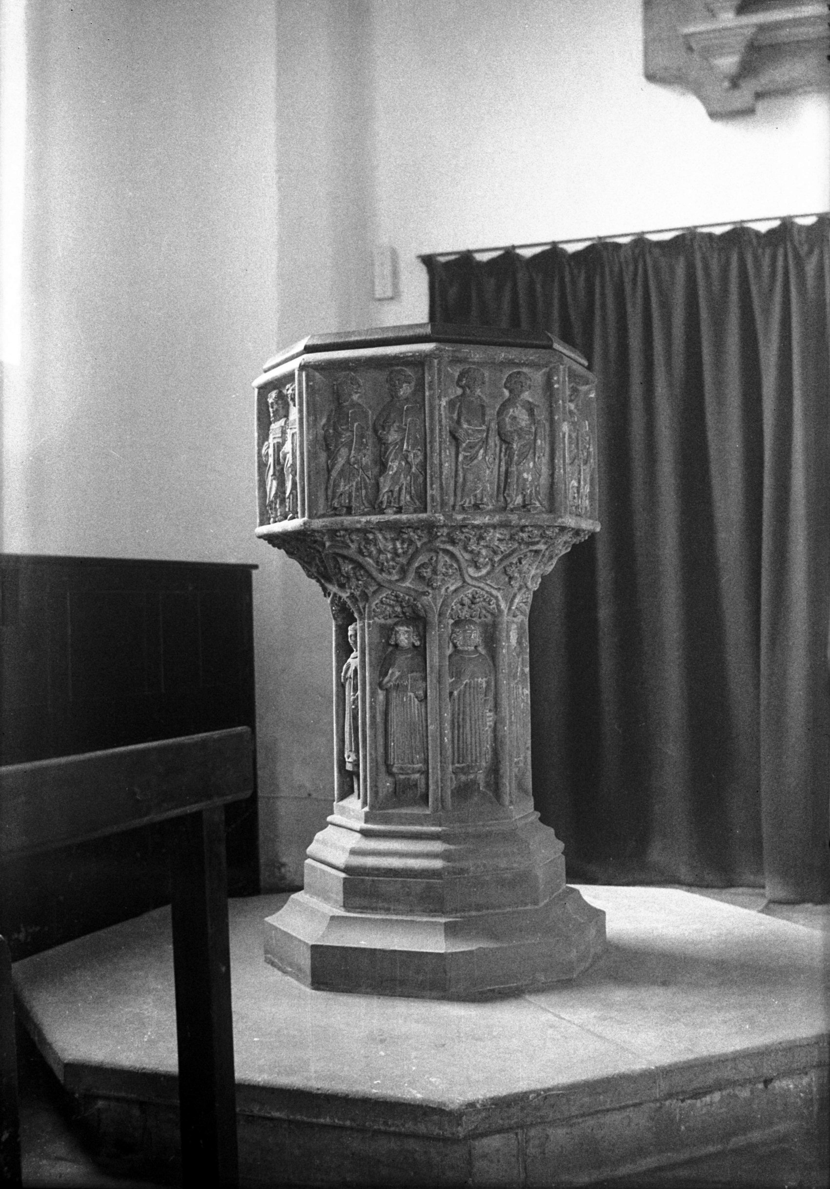
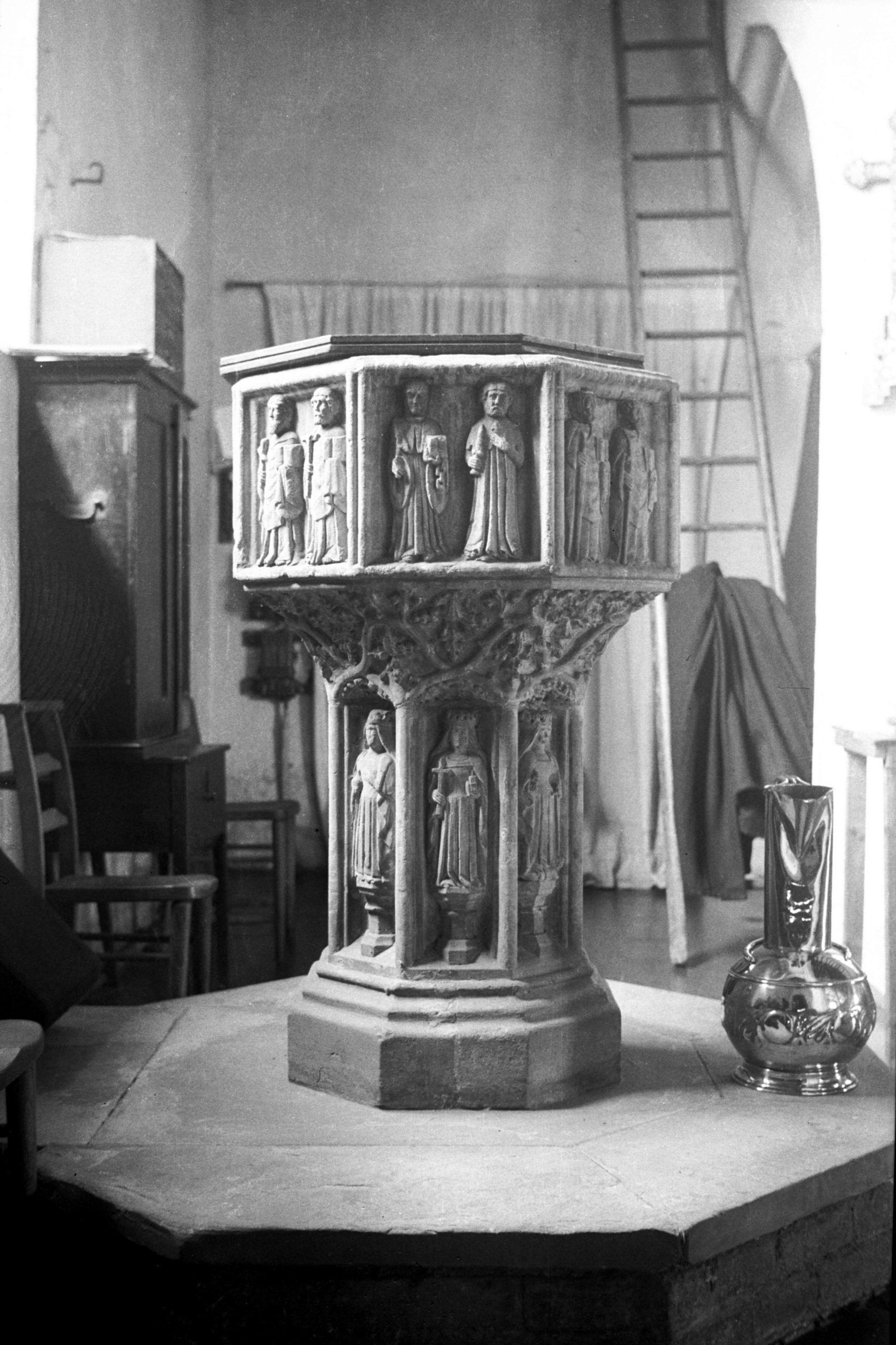
St James' 14c font [1883] 1937-08-16
Octagonal. Figures of the Apostles and Evangelists, and
eight female saints. |
| |
West
side |
|
|
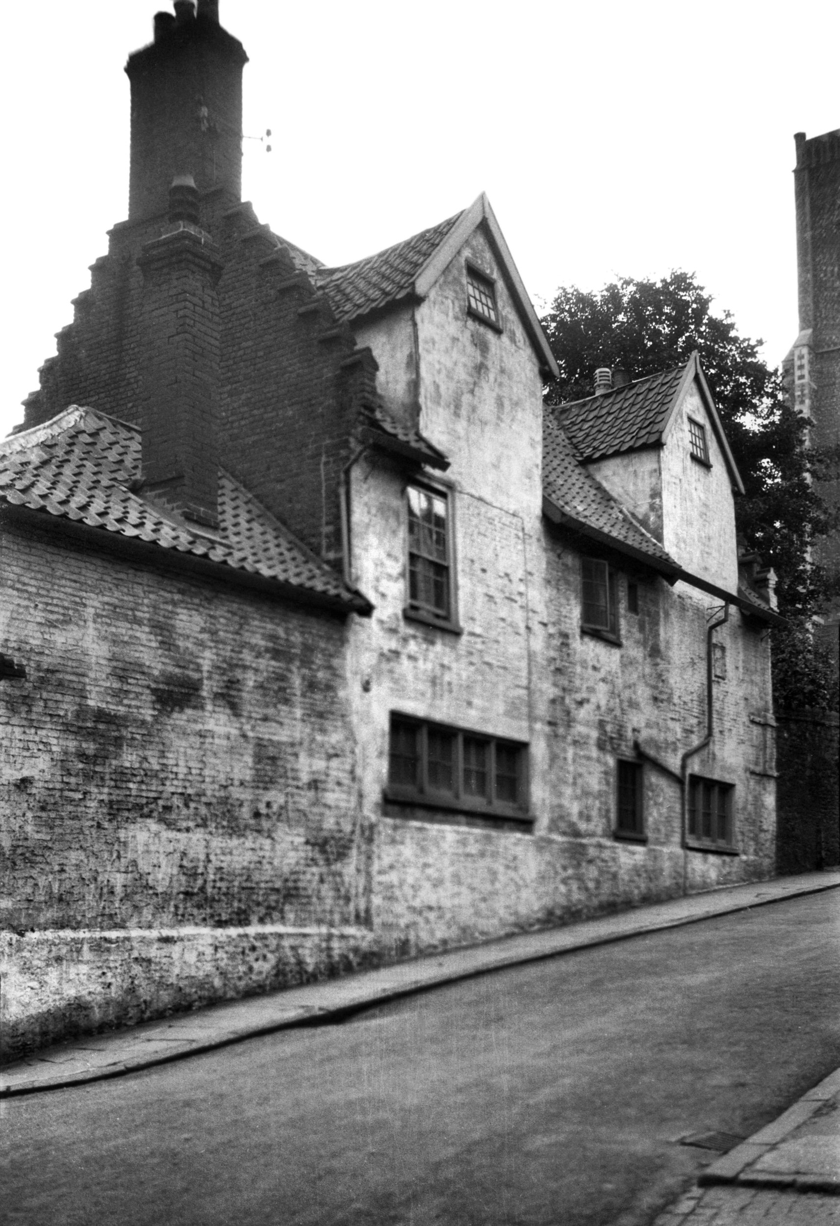
Whitefriars St west side cottages [0968] 1936-05-17
See also Cowgate 106 |
|
Whitlingham Lane: |
| |
From
near Trowse
Millgate towards Whitlingham |
|
|
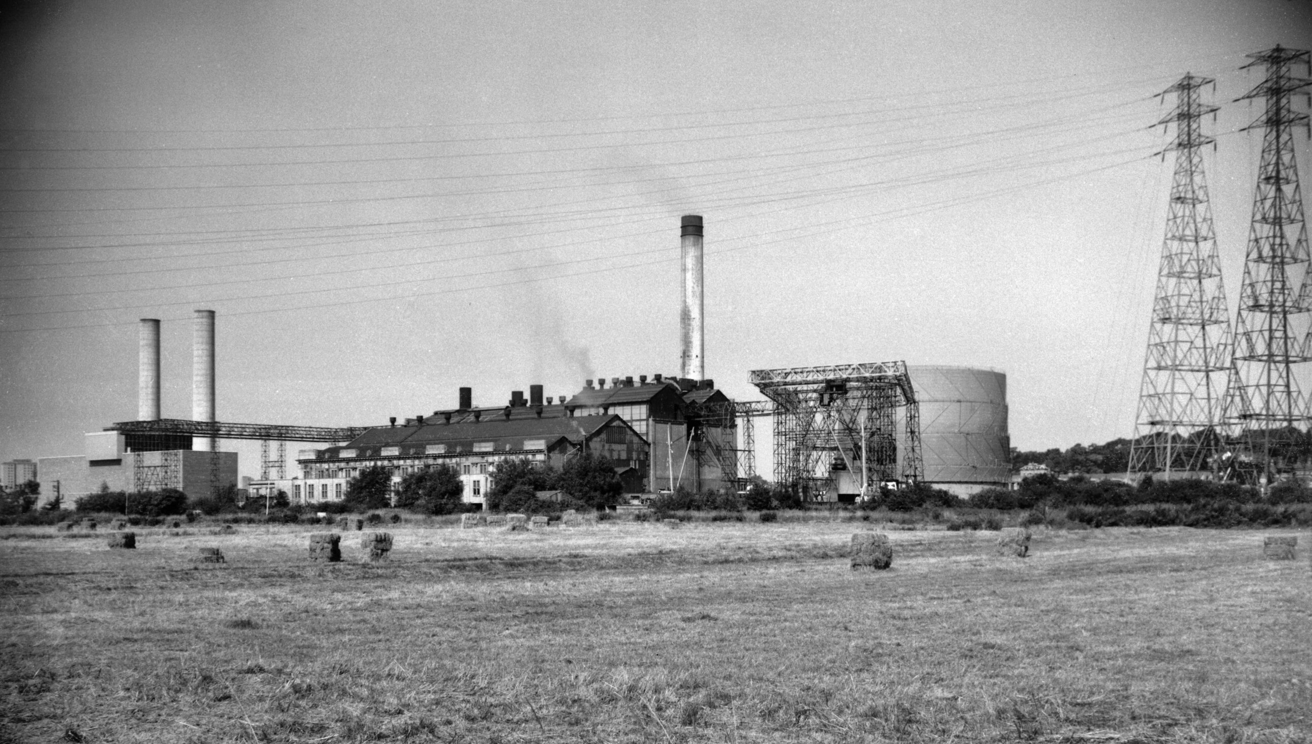
Whitlingham Lane Electric power station [5080]
1966-08-20
Opened 1926. |
|
William Booth St: (formerly Church St) |
| |
From
Rampant
Horse St / Theatre St to Haymarket |
|
|
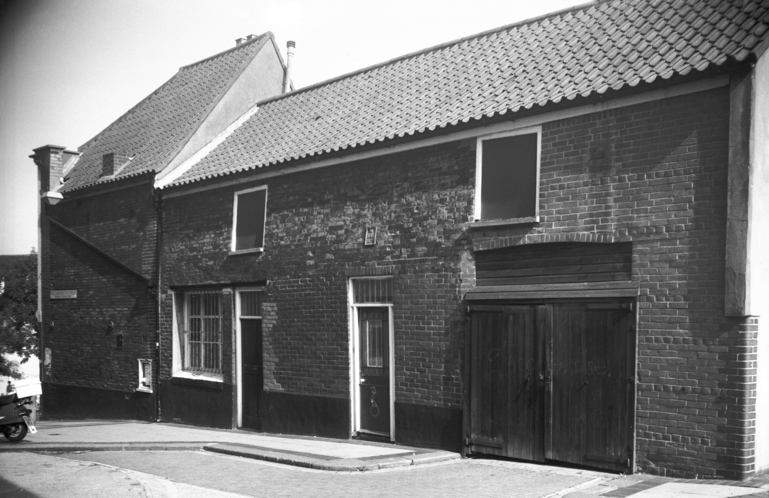
William Booth St George and Dragon stables [6584]
1989-09-18
Formerly called Church St. |
|
Willow Lane: |
| |
From
St Giles'
St to Cow Hill
North-east side |
|
|
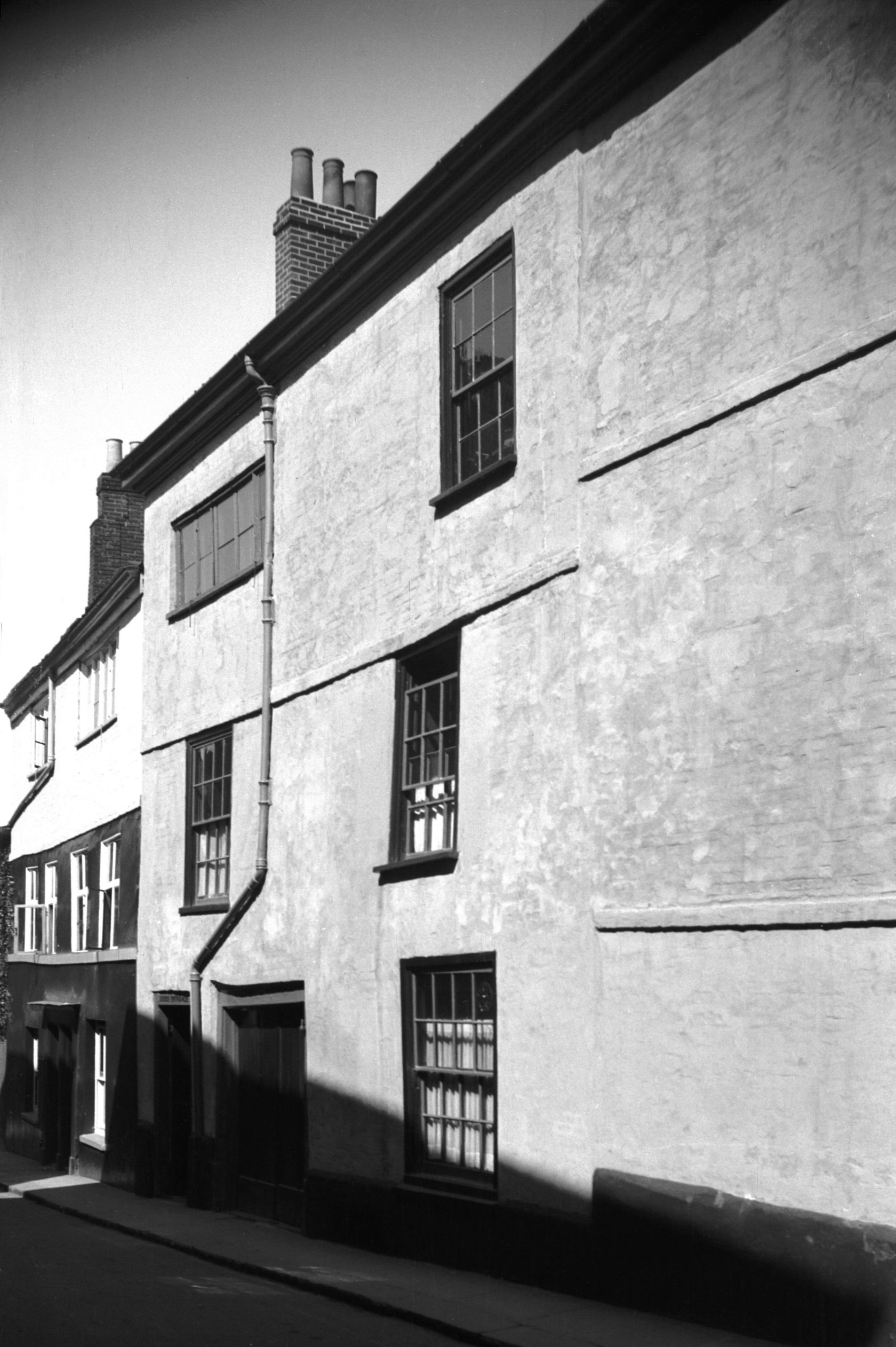
Willow Lane 1 [2781] 1938-09-02
|
|
|
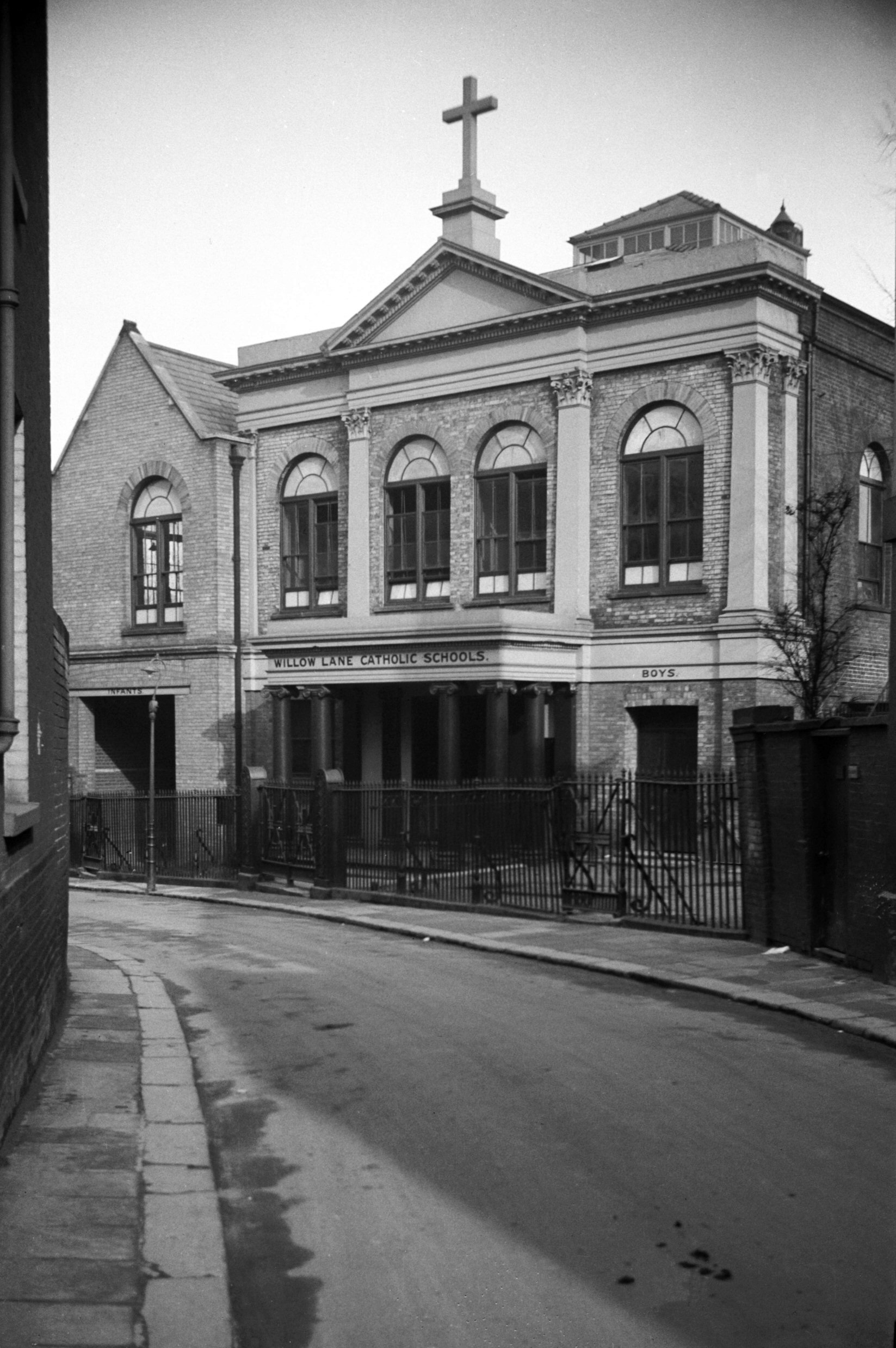
Willow Lane RC school formerly chapel [0383]
1935-03-03
Built as a chapel by the Jesuits in 1828, architect
J.T.Patience. |
|
|
Willow Lane 9 [1345] 1936-08-29
|
|
|
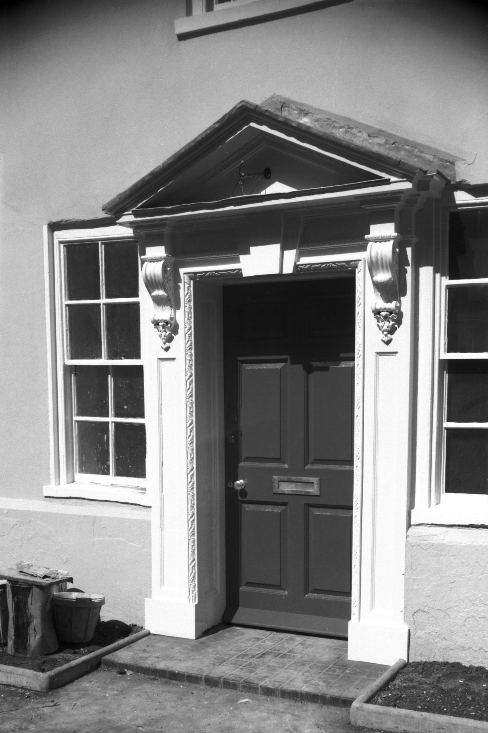
Willow Lane 9 Georgian doorway [5042] 1966-05-15
|
|
|
Willow Lane 11 to 13 [1346] 1936-08-29
|
|
|
Willow Lane 17 [1368] 1936-09-03
|
|
|
Willow Lane 19 [1370] 1936-09-03
|
|
|
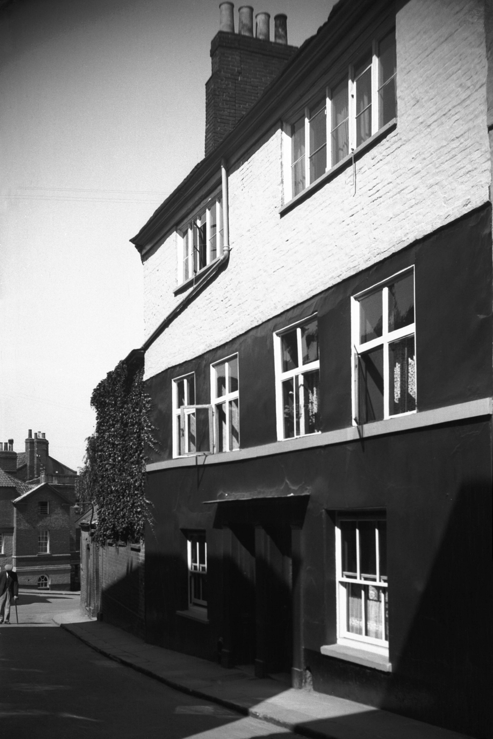
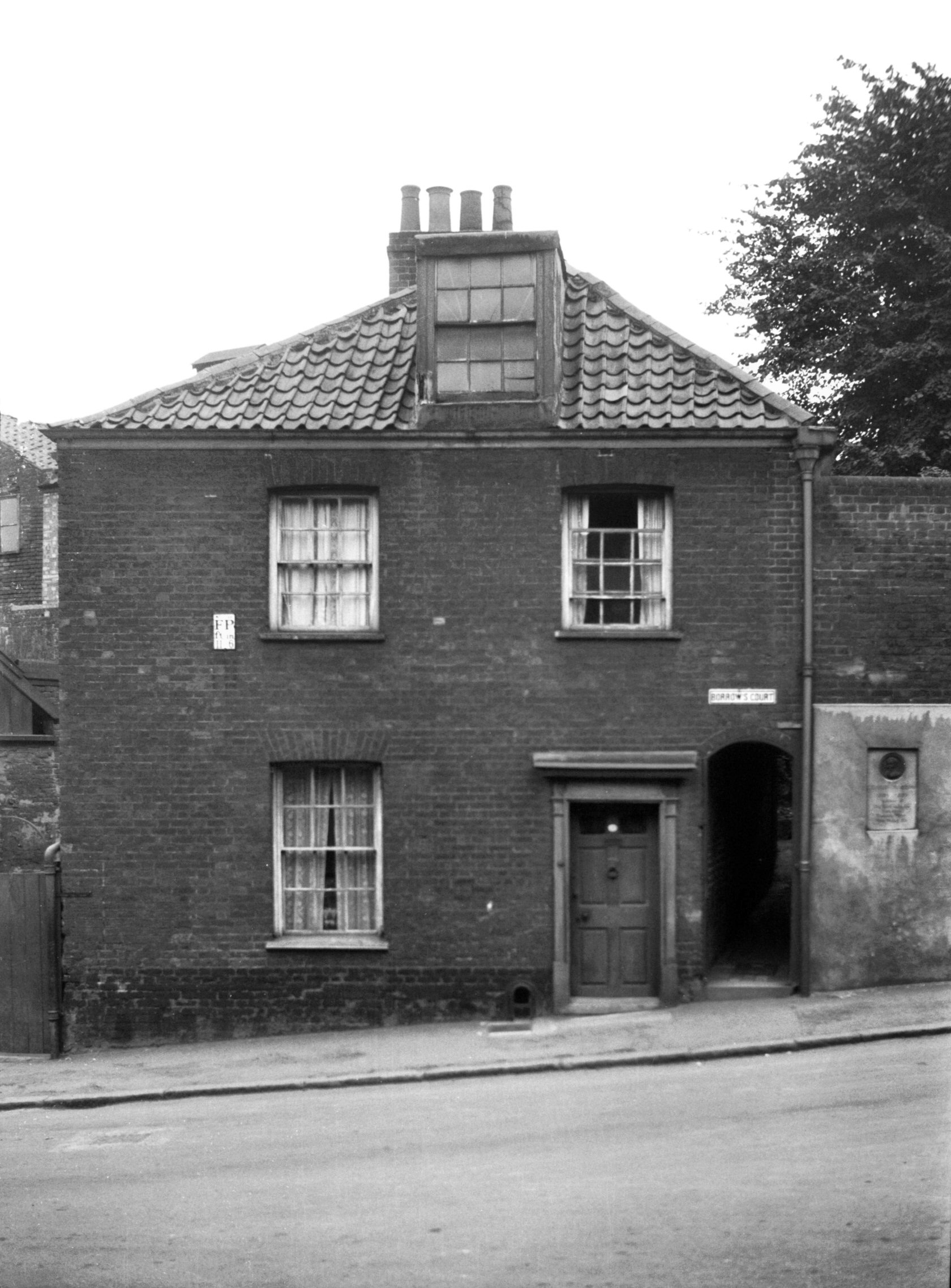
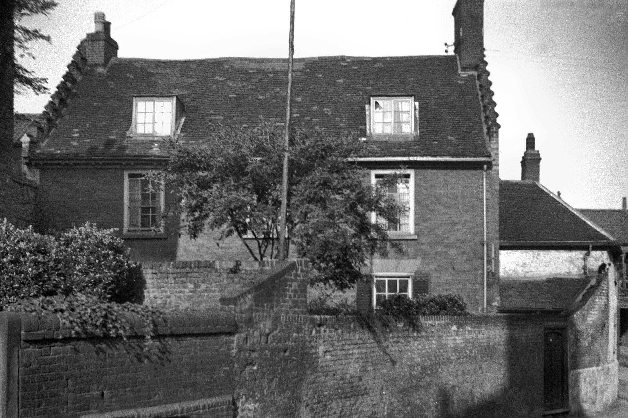
Willow Lane Borrow's Court Borrow House [1369]
1936-09-03
In his youth the author George Borrow lived here with his
father, Captain Borrow. The house was opened as a
"Borrow Museum" in 1913 by Arthur Michael
Samuel. |
|
|
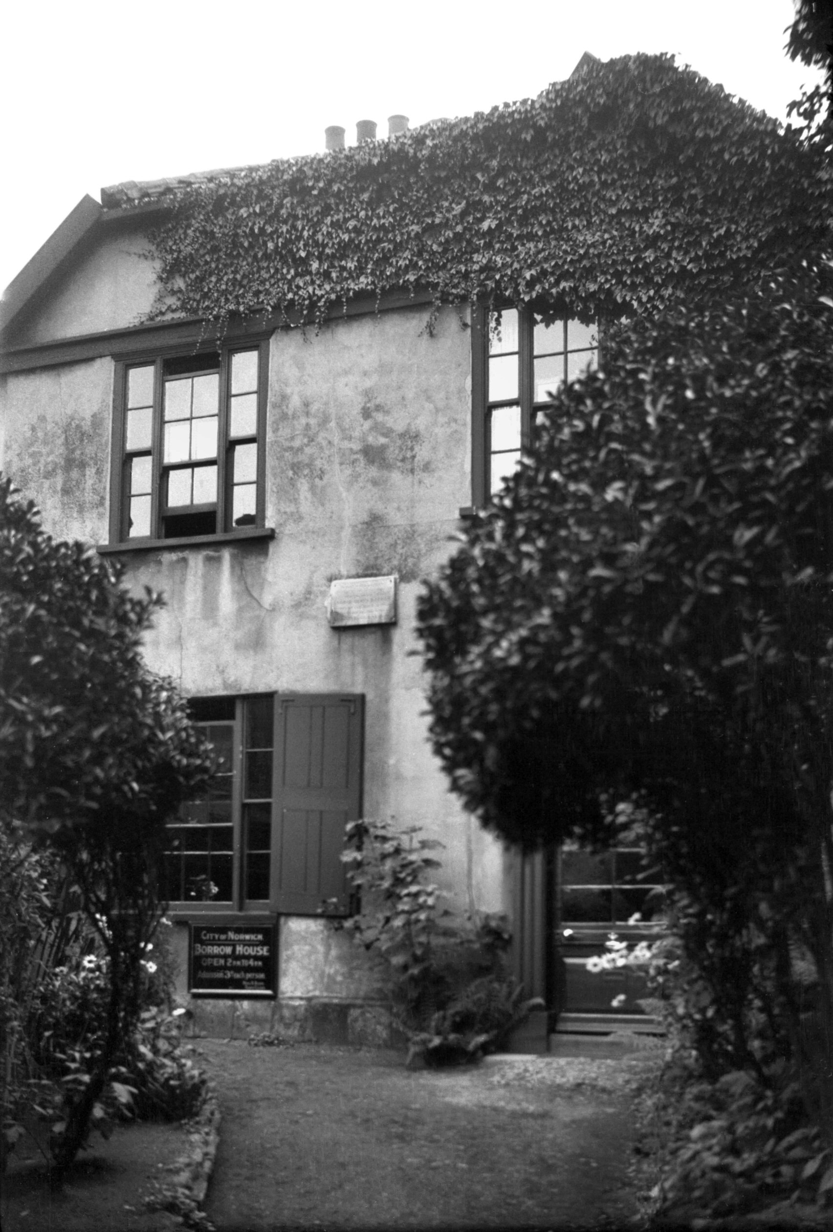
Willow Lane Borrow's Court Borrow House [5041]
1966-05-15
|
| |
South-west
side |
|
|
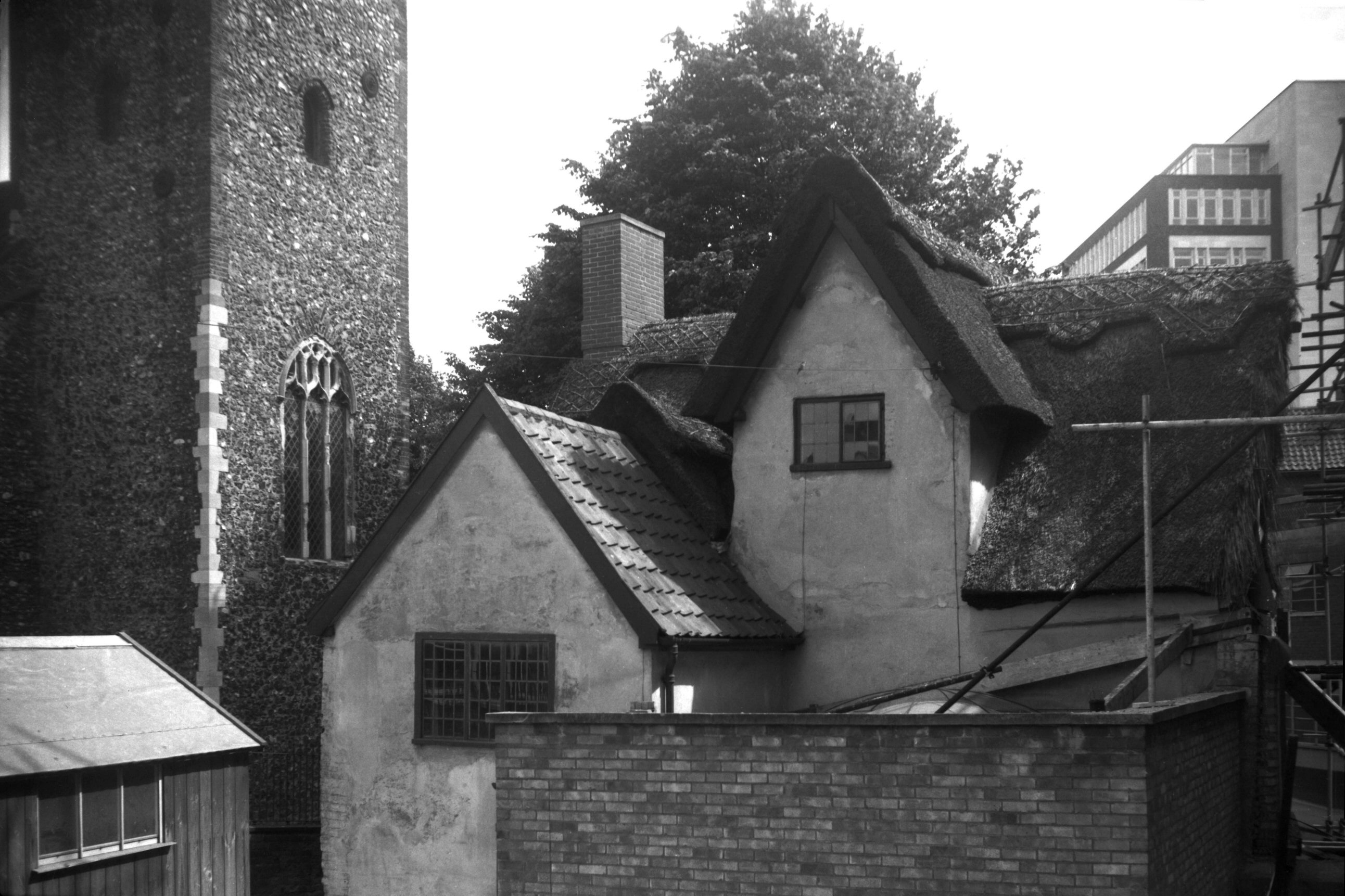
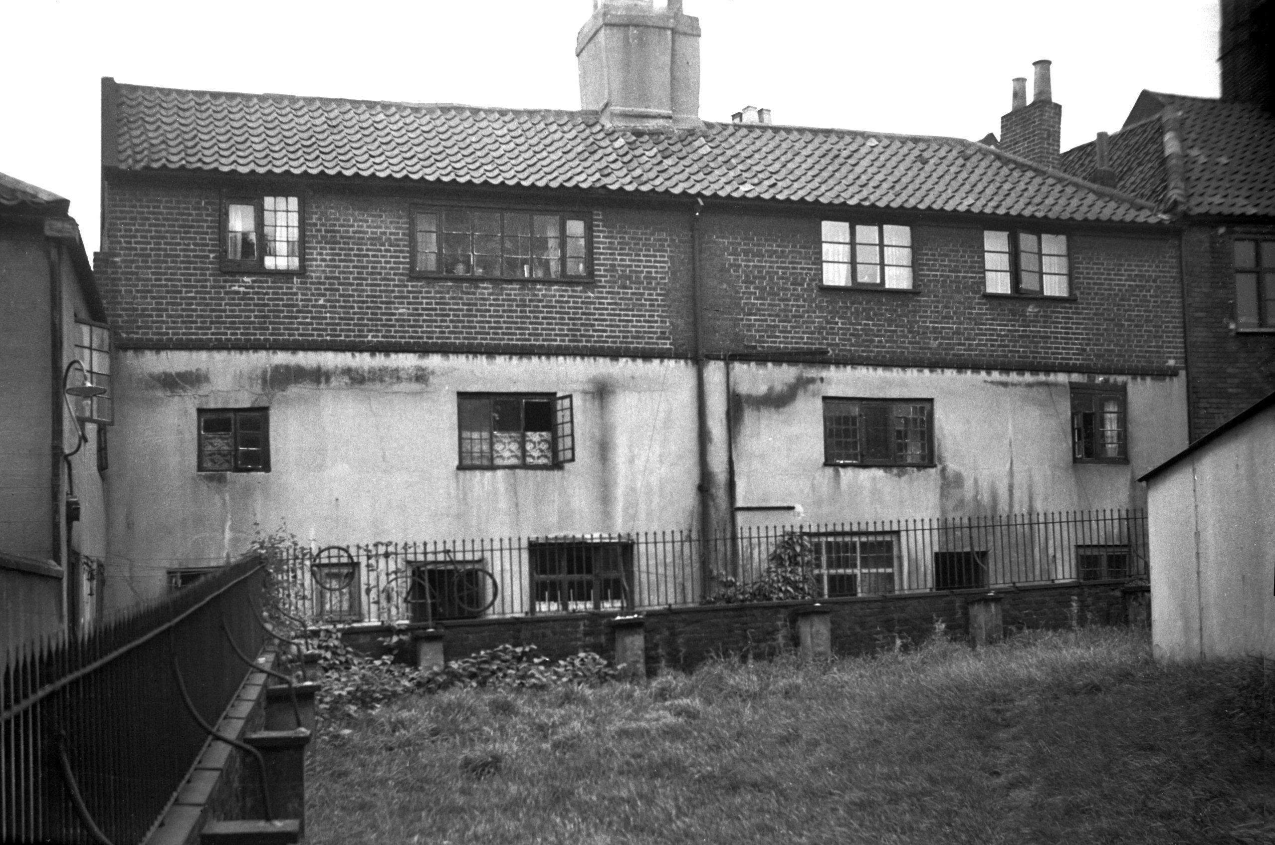
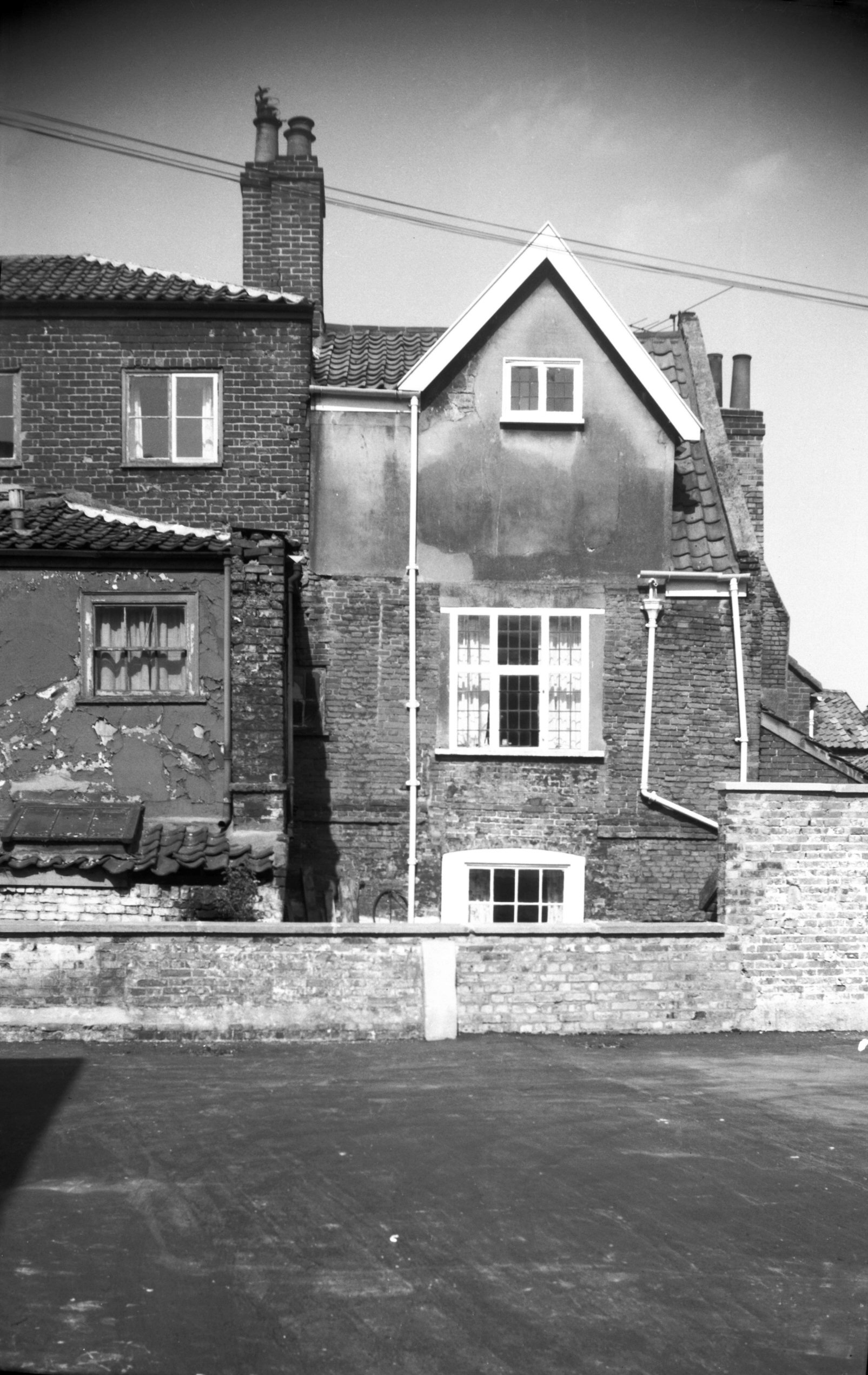
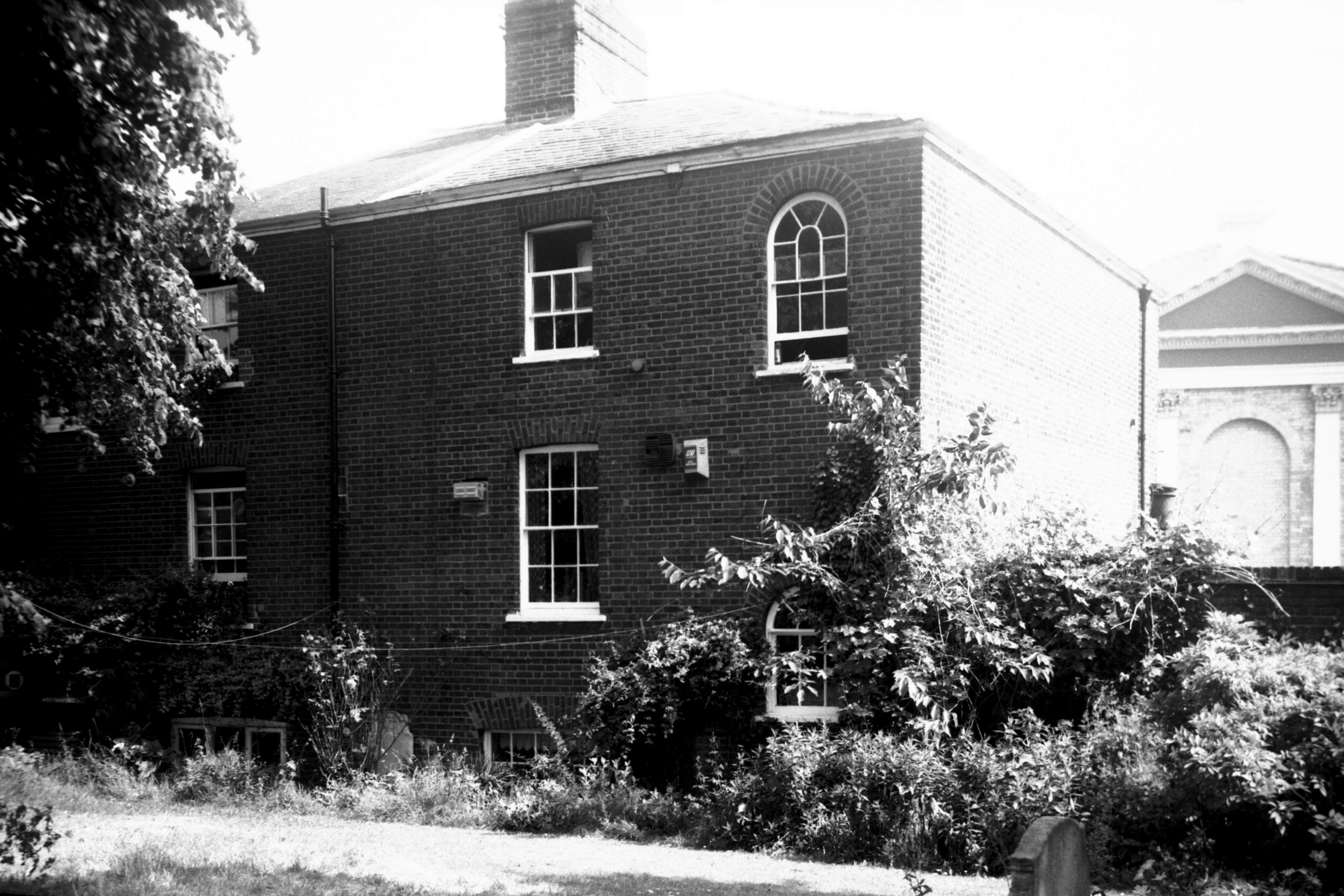
Willow Lane south side rear [7830] 2001-06-26
From St Giles' churchyard. |
|
|
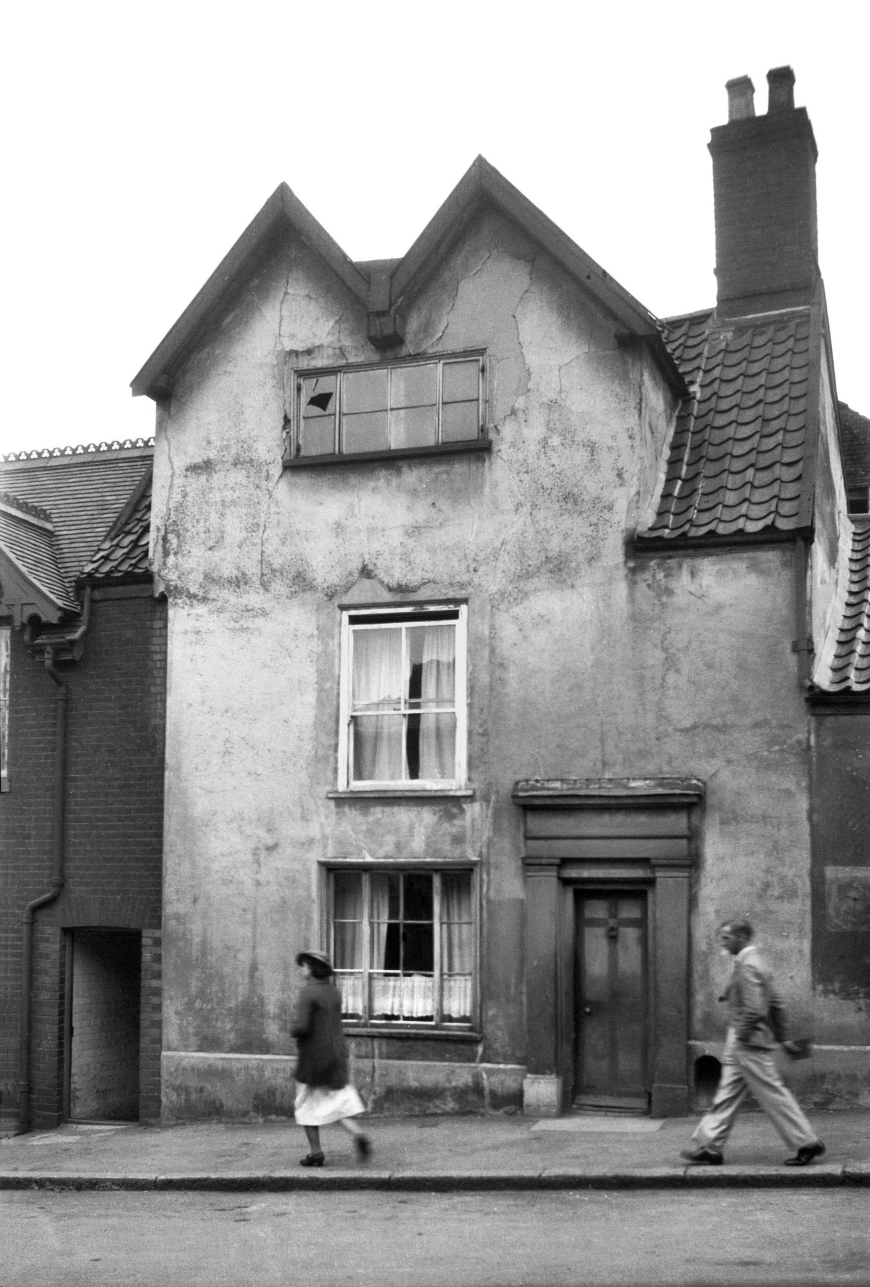
Willow Lane 18 [2787] 1938-09-03
|
|
|
Willow Lane 18 rear from Cow Hill [1366] 1936-09-03
|
|
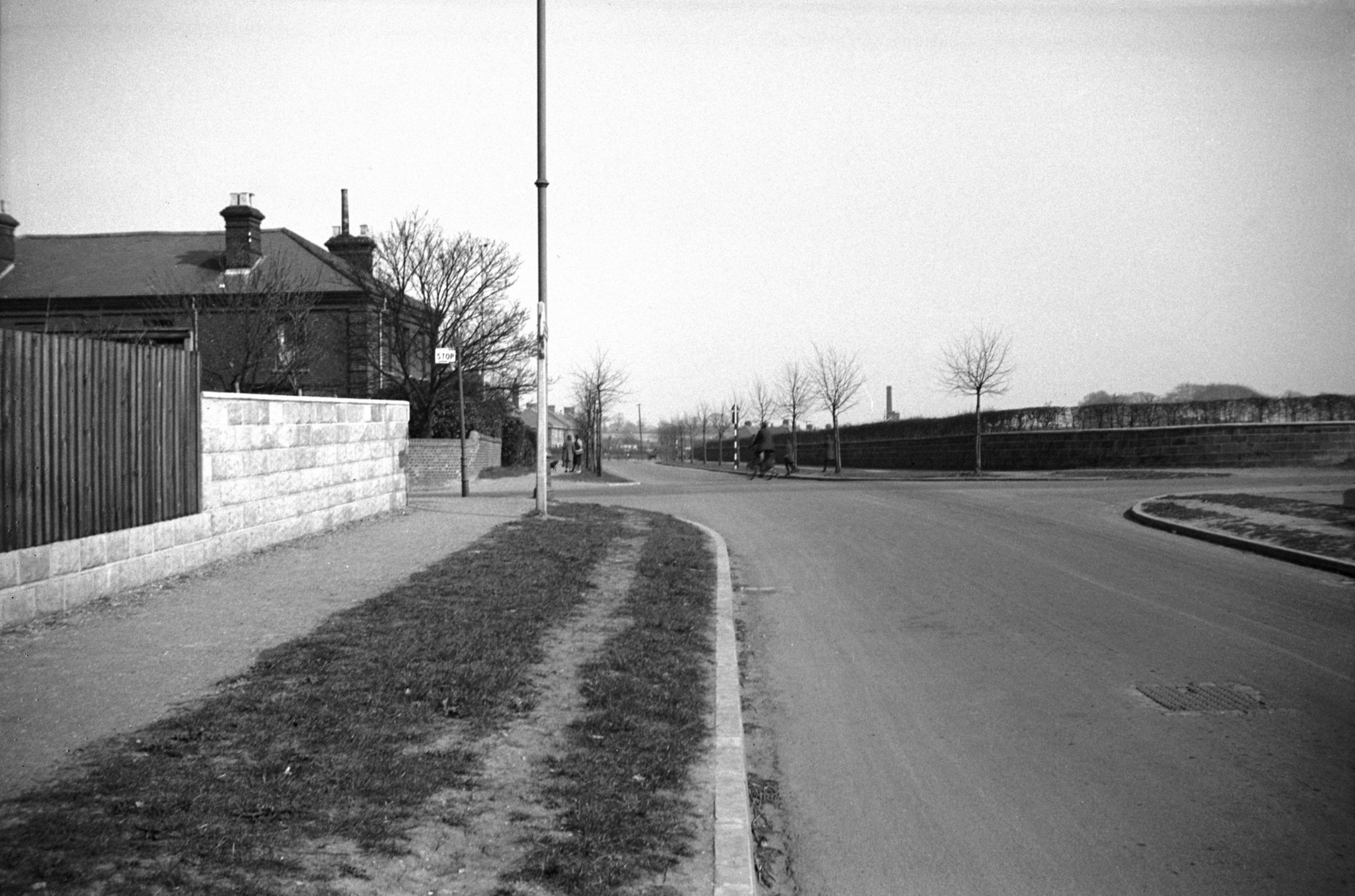
Woodcock Rd: |
| |
From
St
Clement's Hill / Wall Rd to Aylsham Rd
passing Catton Grove
Rd (Old
Grove Court) |
|
|
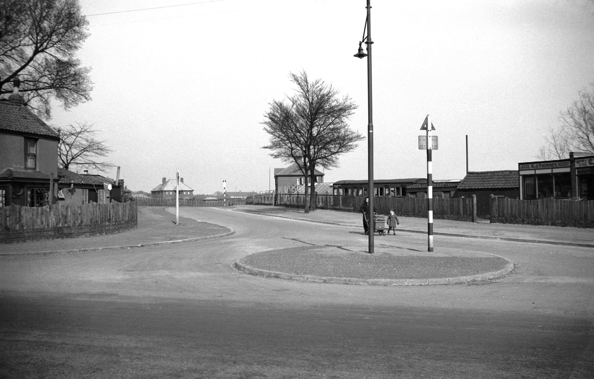
Woodcock Rd Wall Rd at St Clement's Hill [0078]
1934-04-05
|
|
|
Woodcock Rd at Catton Grove Rd [0077] 1934-04-05
|
|
|
Woodcock Rd at Aylsham Rd [0076] 1934-04-05
|