|
Gas Hill: |
| |
From
Riverside
Rd / Bishopgate / Bishop
Bridge Rd to St Leonard's Rd / Telegraph
Lane |
|
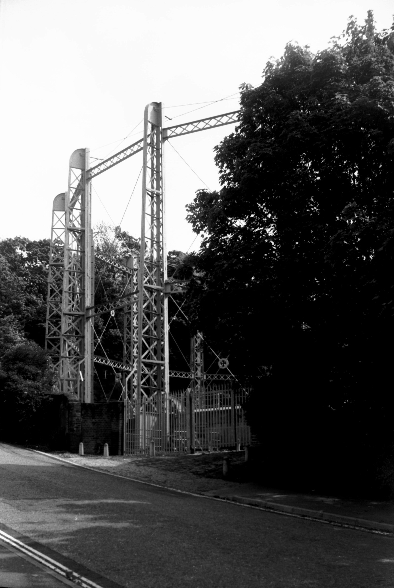
|
Gas Hill gas holder view SE [7628] 1999-05-09
Built c1880. |
|
|
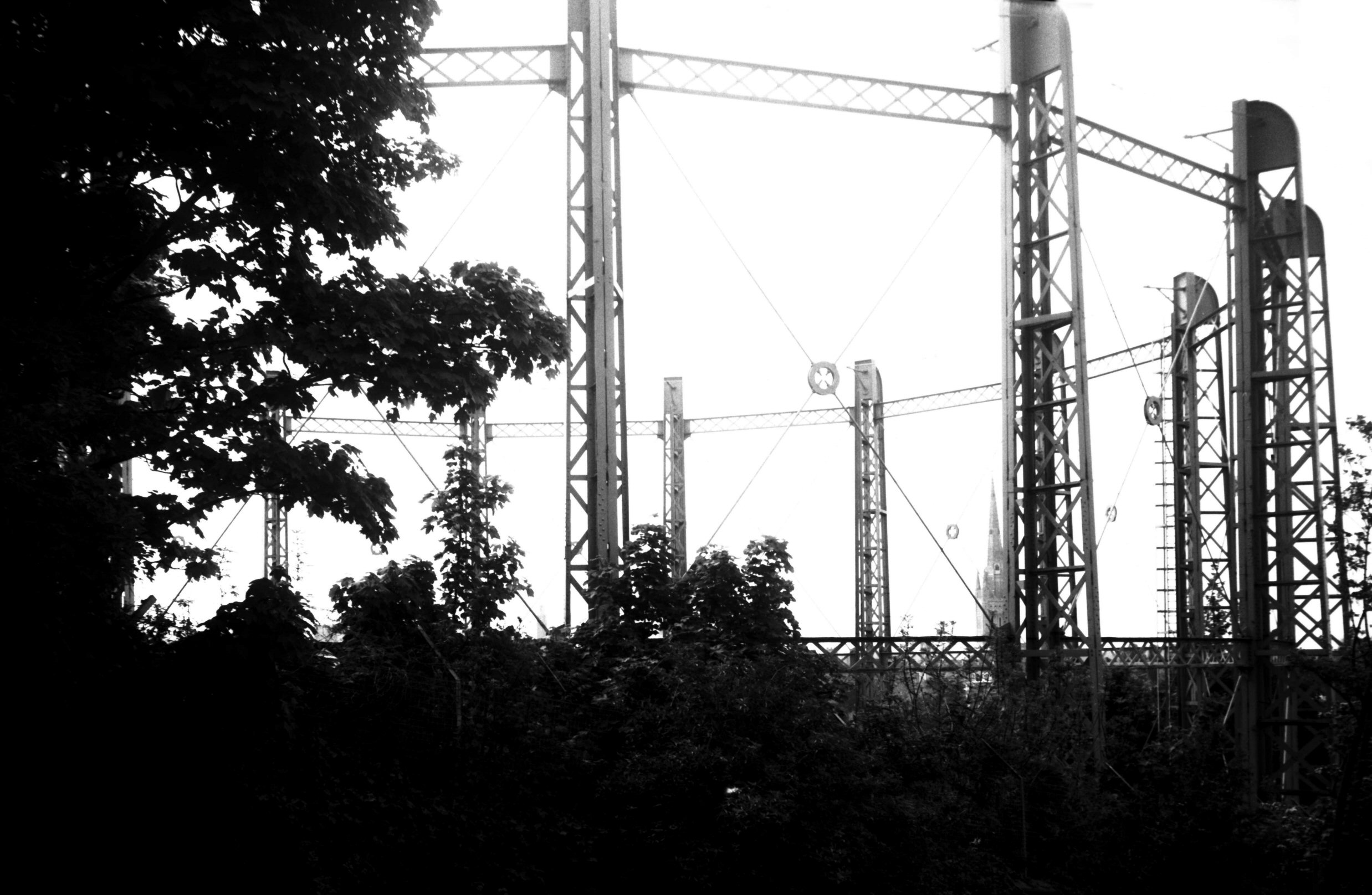
Gas Hill gas holder view SW [7625] 1999-05-09
|
|
Gildencroft: |
| |
From
St
Augustine's St / Botolph St / Pitt
St to Quakers Lane
South side |
|
|
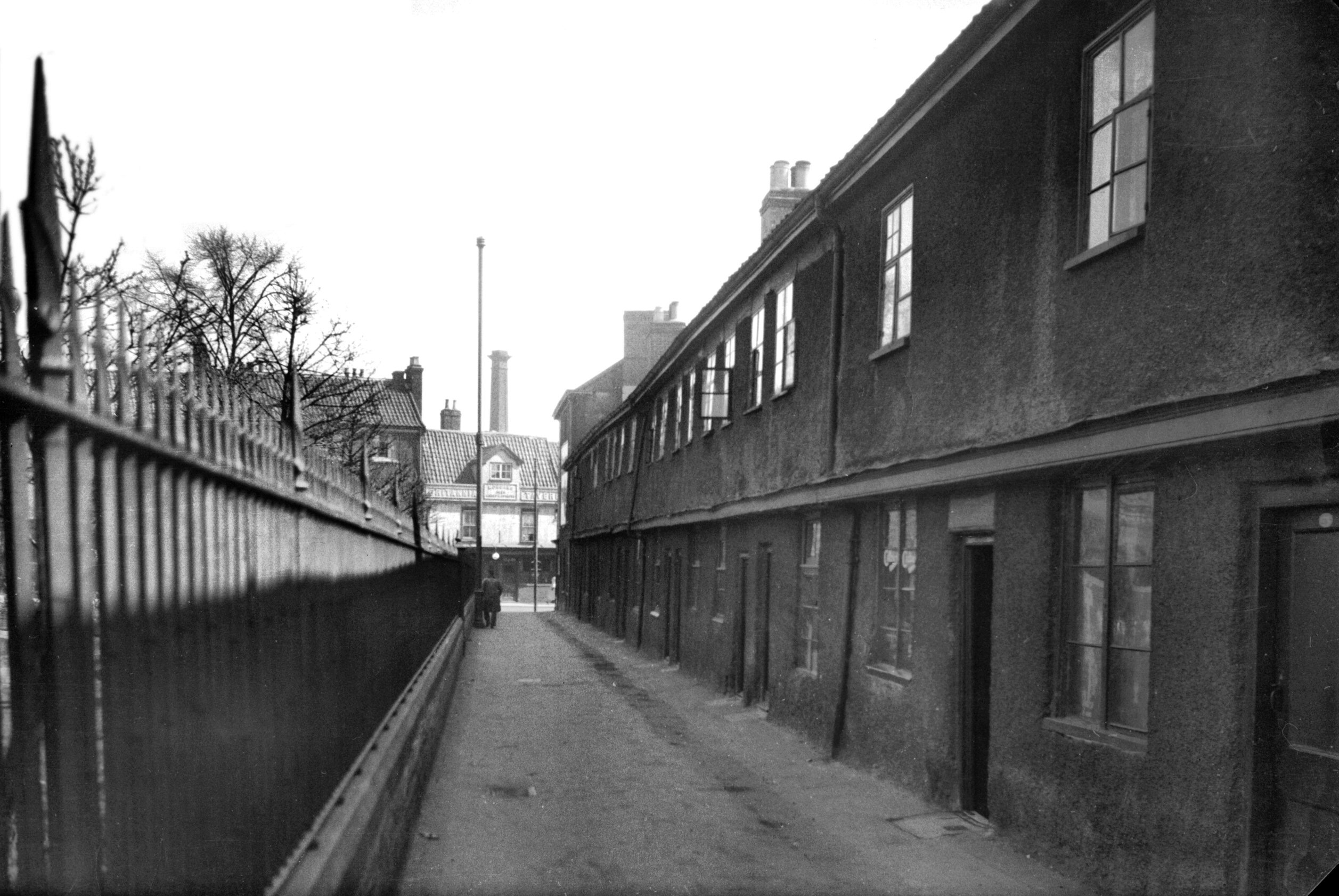
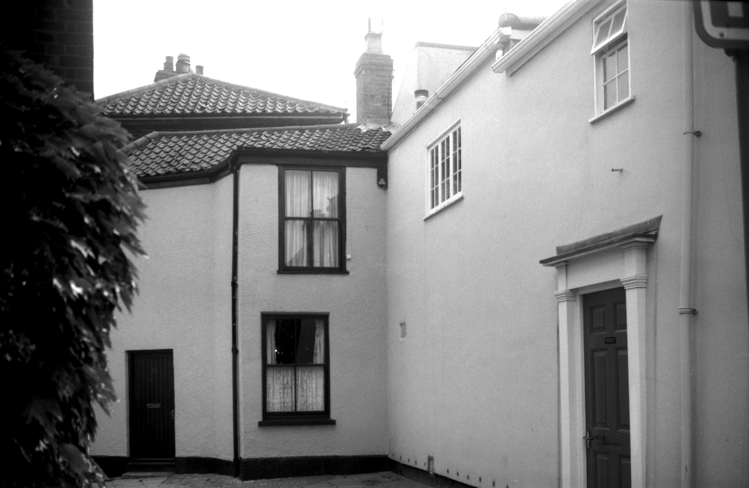
Gildencroft 2 to 24 old cottages view east [0872]
1936-04-10
|
|
|
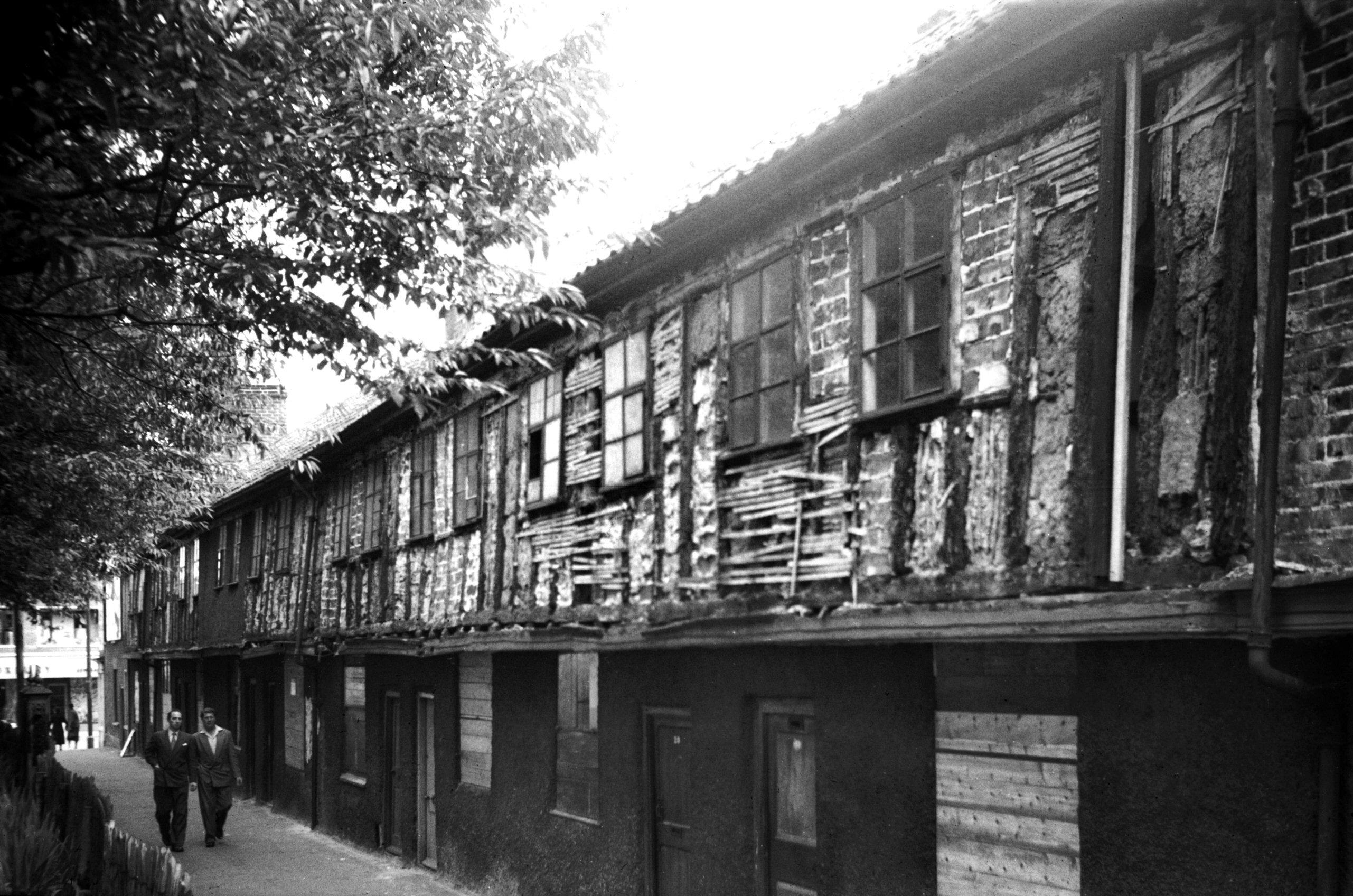
Gildencroft south side prior to restoration [4471]
1956-09-09
After removal of plaster facing. |
|
|
Gildencroft south side front restored [4479]
1958-06-14
|
|
|
Gildencroft south side 2 to 12 rear [5055] 1966-09-03
|
|
|
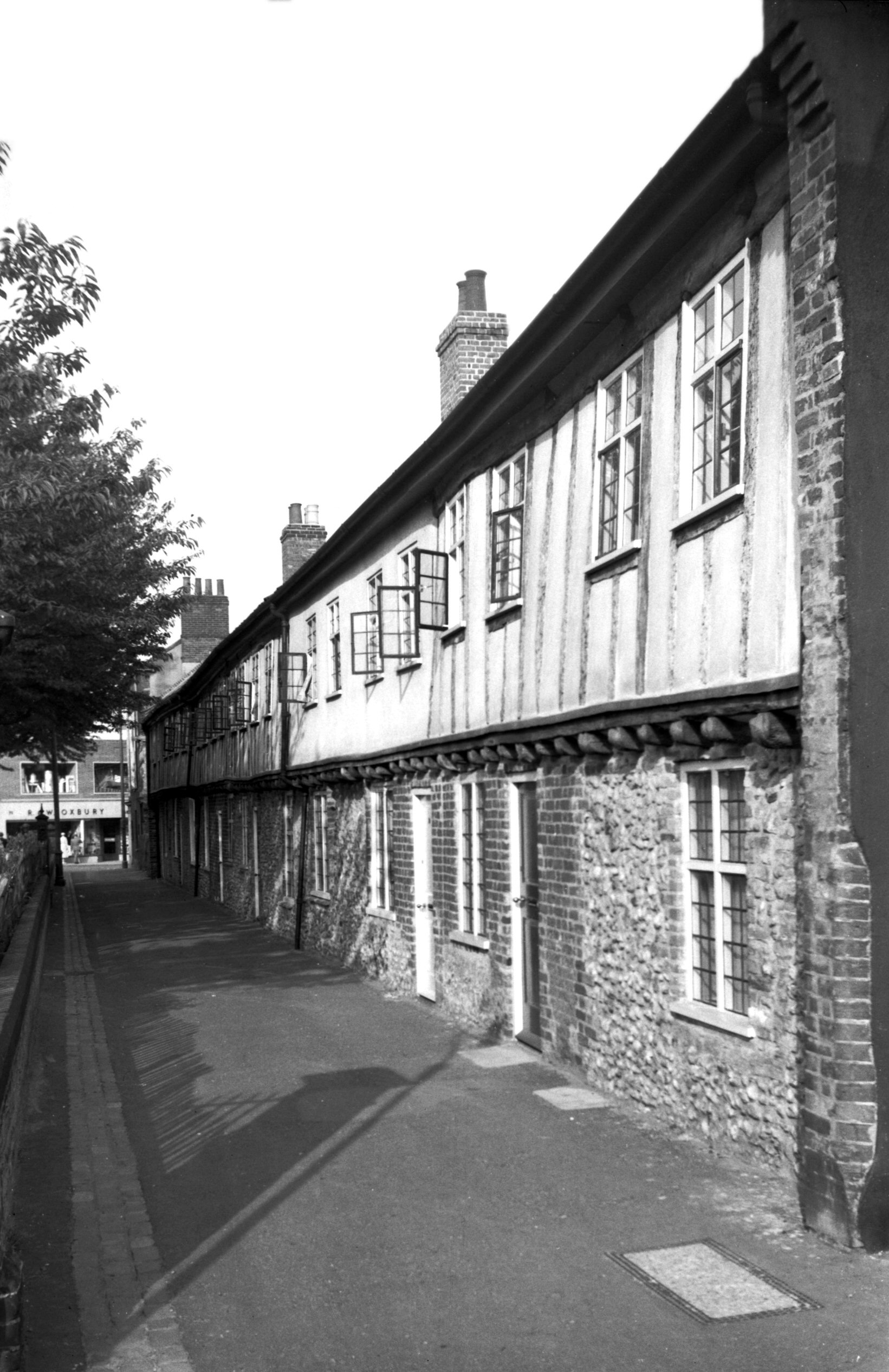
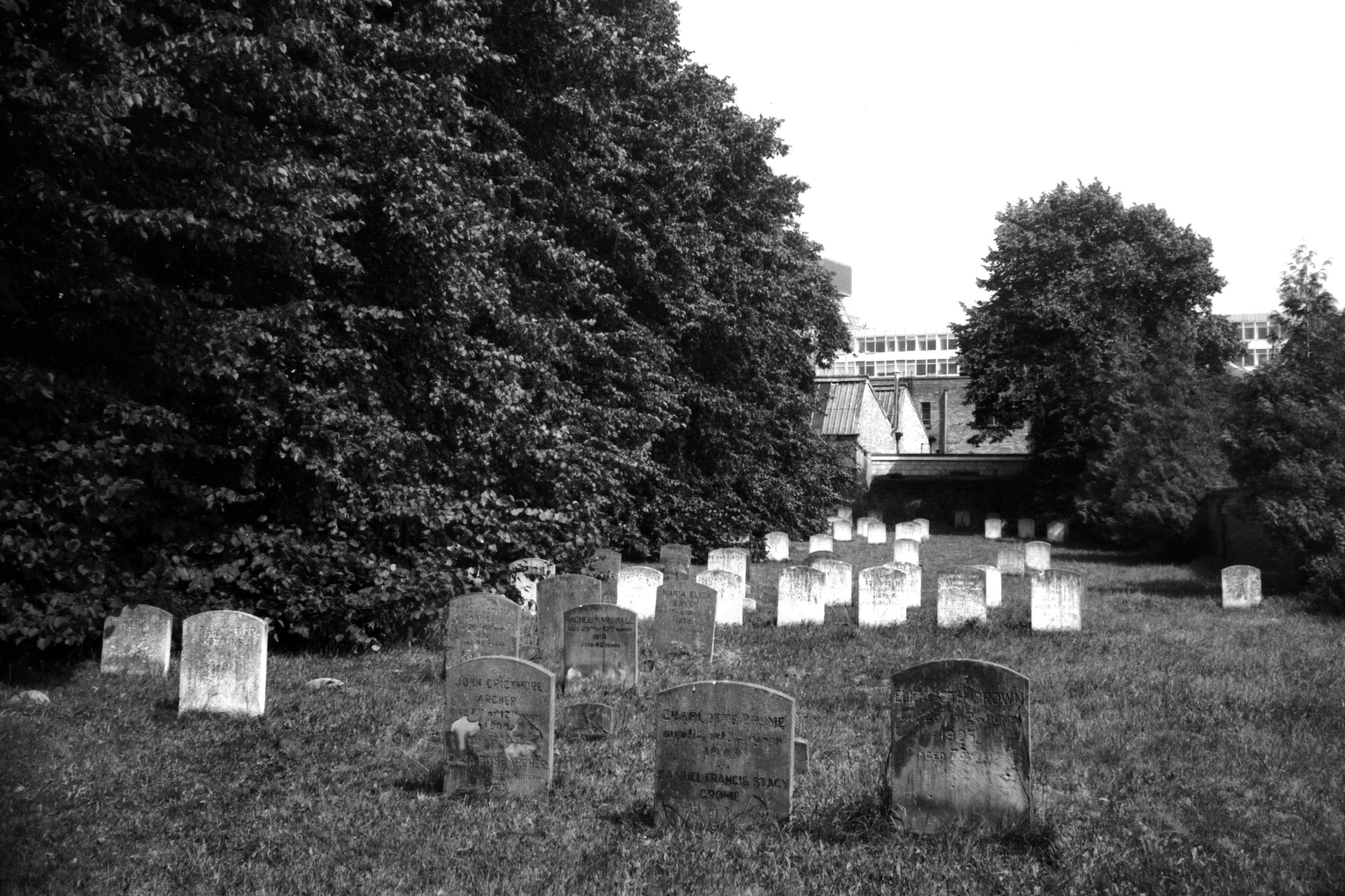
Gildencroft Friends' meeting house [0294] 1934-09-23
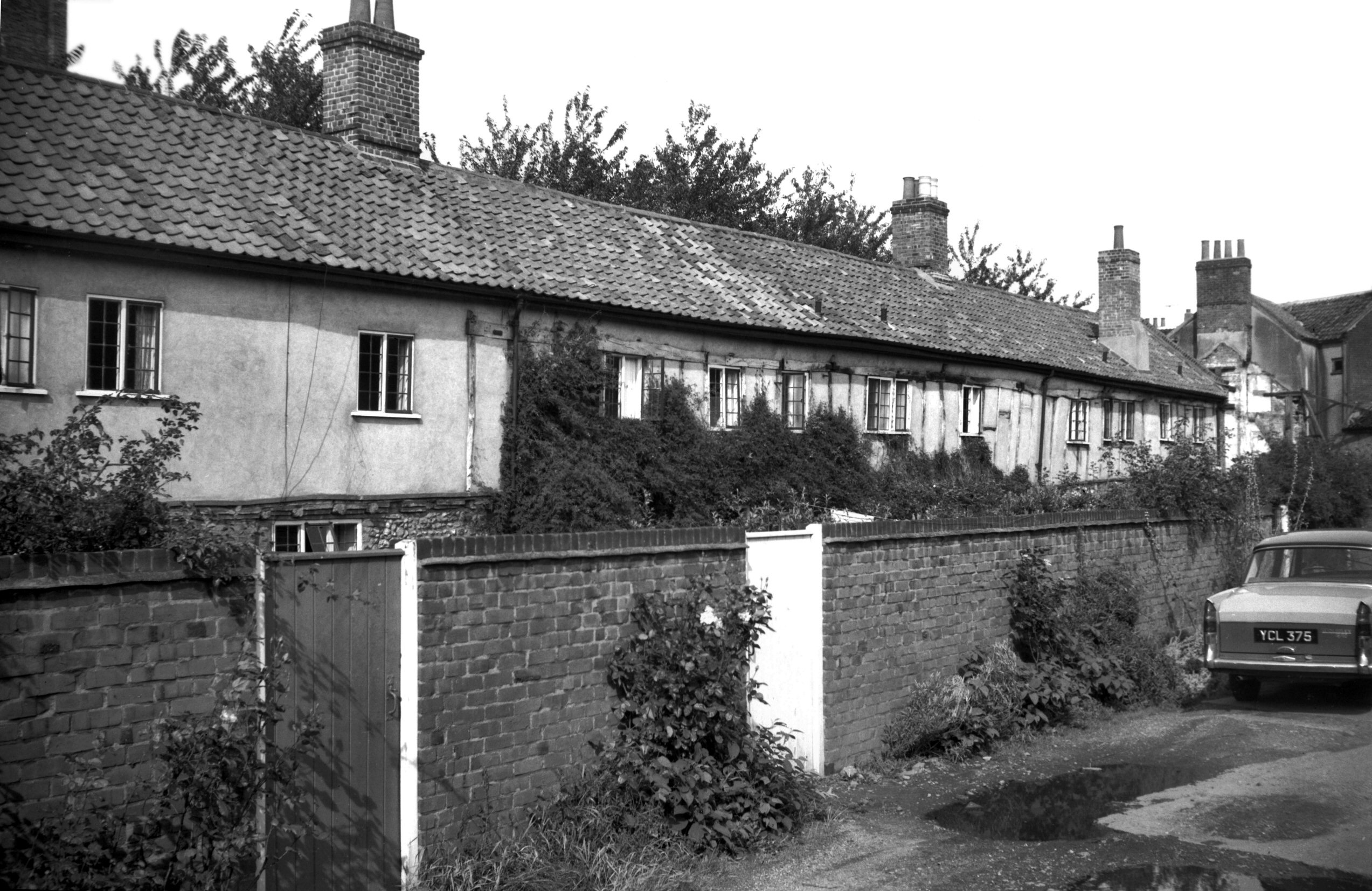
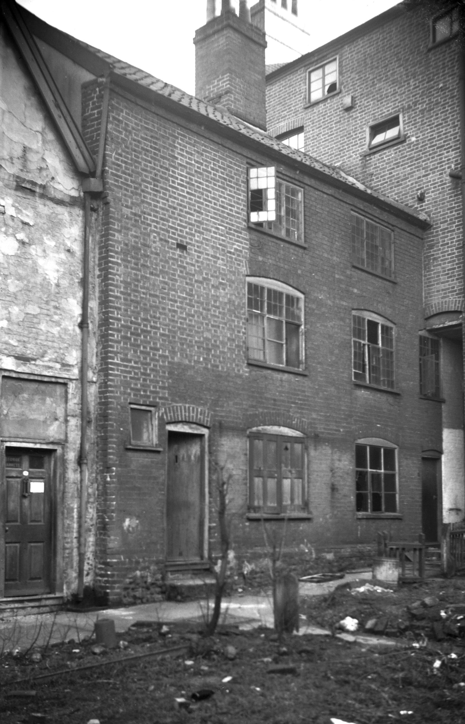
Leading from the northern end of Pitt St is Gildencroft,
with St Augustine's Church on the one hand and a row of
Tudor cottages, restored by the City Council in 1956, on
the other. When arguments for and against their
renovation were being put forward it was claimed that
they constituted one of the longest complete rows of that
type and period in the country, exceeding as they did 200
feet in length. While renovation was being carried out,
however, the first three cottages were taken down to
improve the road junction at that point.
It was at the western end of the Gildencroft that in
February 1699, the Society of Friends first opened their
Meeting House. The burial ground that it adjoined had
been purchased by them in 1670 for £72. The rectangular
building was of plain but pleasing design, with its red
brick walls supported externally by pilasters of the same
material. The roof was covered by English plain tiles and
was hipped, the central part flat and supported
internally by two tall oak pillars, each hewn from a
single tree. A double row of casement windows lit the
interior, which had a gallery at either end.
The building, which was completely gutted by fire during
an air raid in April 1942, was erected by the Quakers
because their original house in Goat Lane had become too
small. However, it was superseded as their principal
place of worship in Norwich in 1826 when a new building
was erected in Upper Goat Lane by the builder/architect
J.T.Patience. Towards the end of the 19c the Gildencroft
building was leased for a time to the Particular
Baptists, but the Friends continued to use the burial
ground for their interments, as indeed they still do. In
1958 they erected on the old site a much smaller single
storey building that incorporates in its structure parts
of the original meetinghouse.
For many years the only way by which wheeled traffic such
as a funeral cortege could reach the Meeting House was by
a narrow thoroughfare leading from St Martin's Lane,
about 80 yards long and widened at the burial ground end
to allow carriages to turn round. Since Chatham St has
been extended to join up with Gildencroft it is reached
much more conveniently by way of Sussex St. |
|
|
Gildencroft Friends' meeting house modified [5196]
1968-05-23
Reconstructed in modified form 1958. |
|
|
Gildencroft Friends' burial ground [6220] 1981-08-04
|
|
Gipsy Lane: |
| |
From
Earlham Rd
passing Bowthorpe Rd
North side |
|
|
Gipsy Lane Five Ways PH [2984] 1939-05-19
|
|
Golden Ball St: |
| |
From
Ber St / Timberhill to Farmers Avenue / Cattlemarket St / Rouen
Rd (formerly Rising Sun Lane)
passing Castle Mall
East side |
|
|
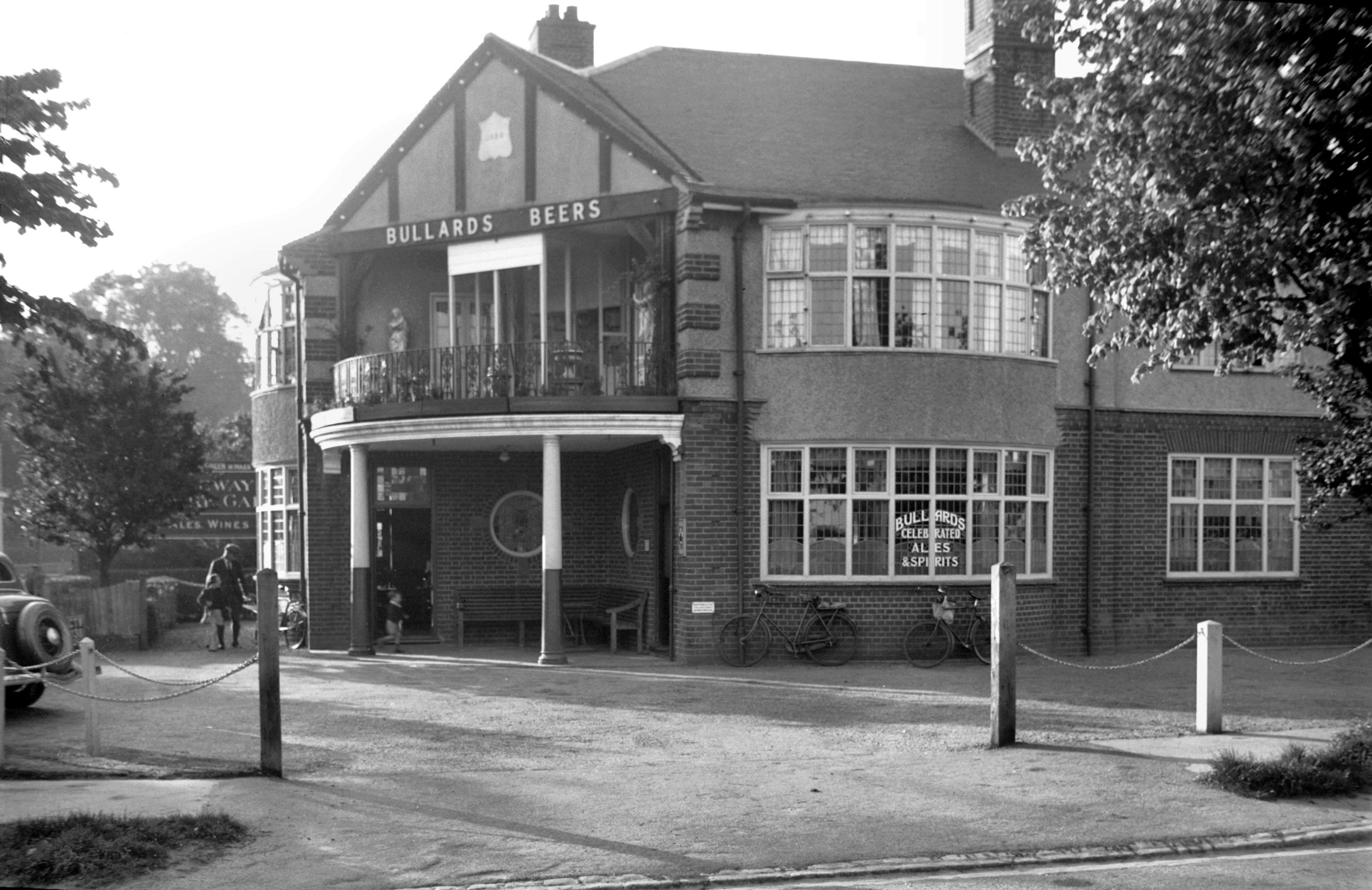
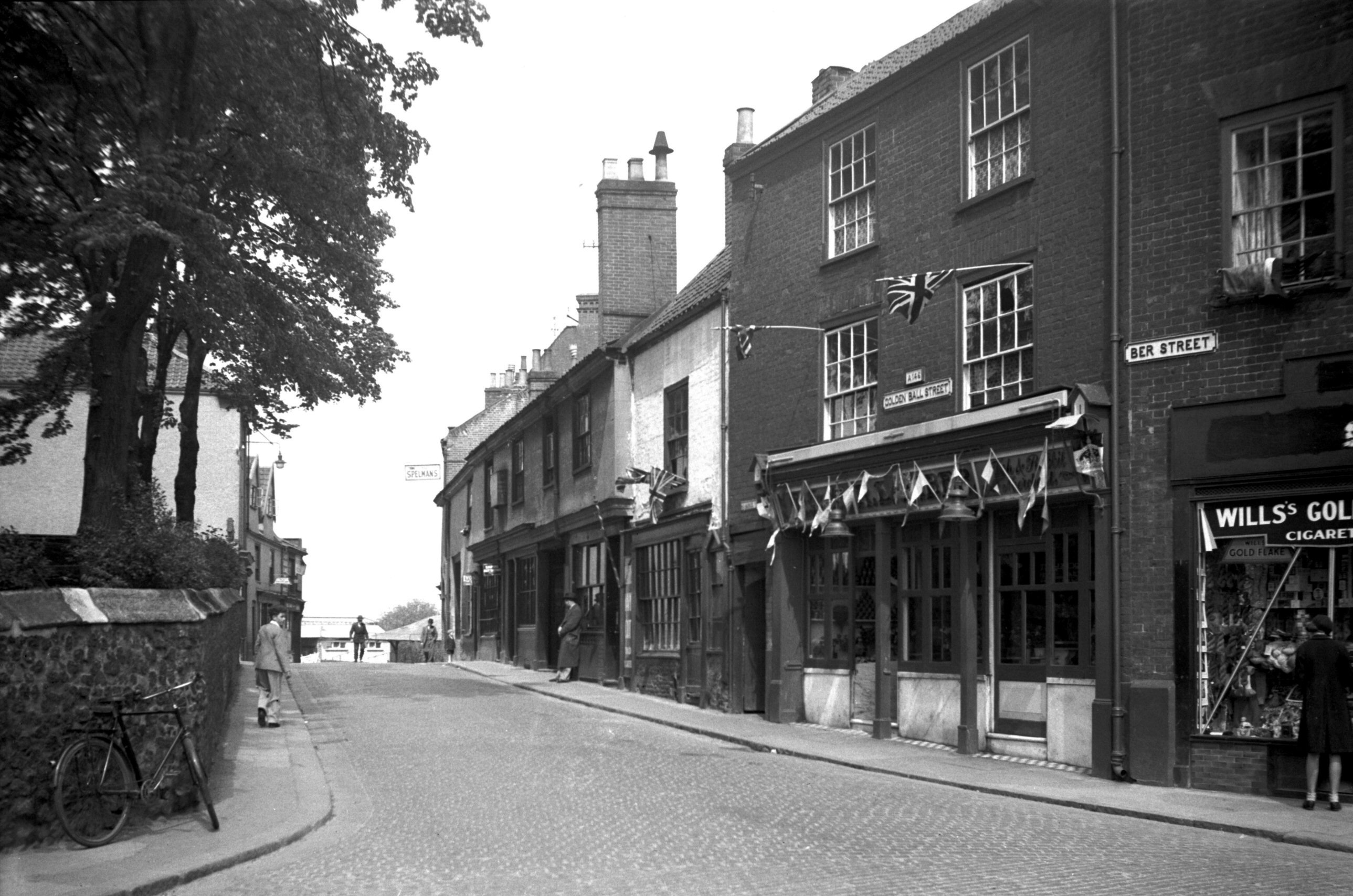
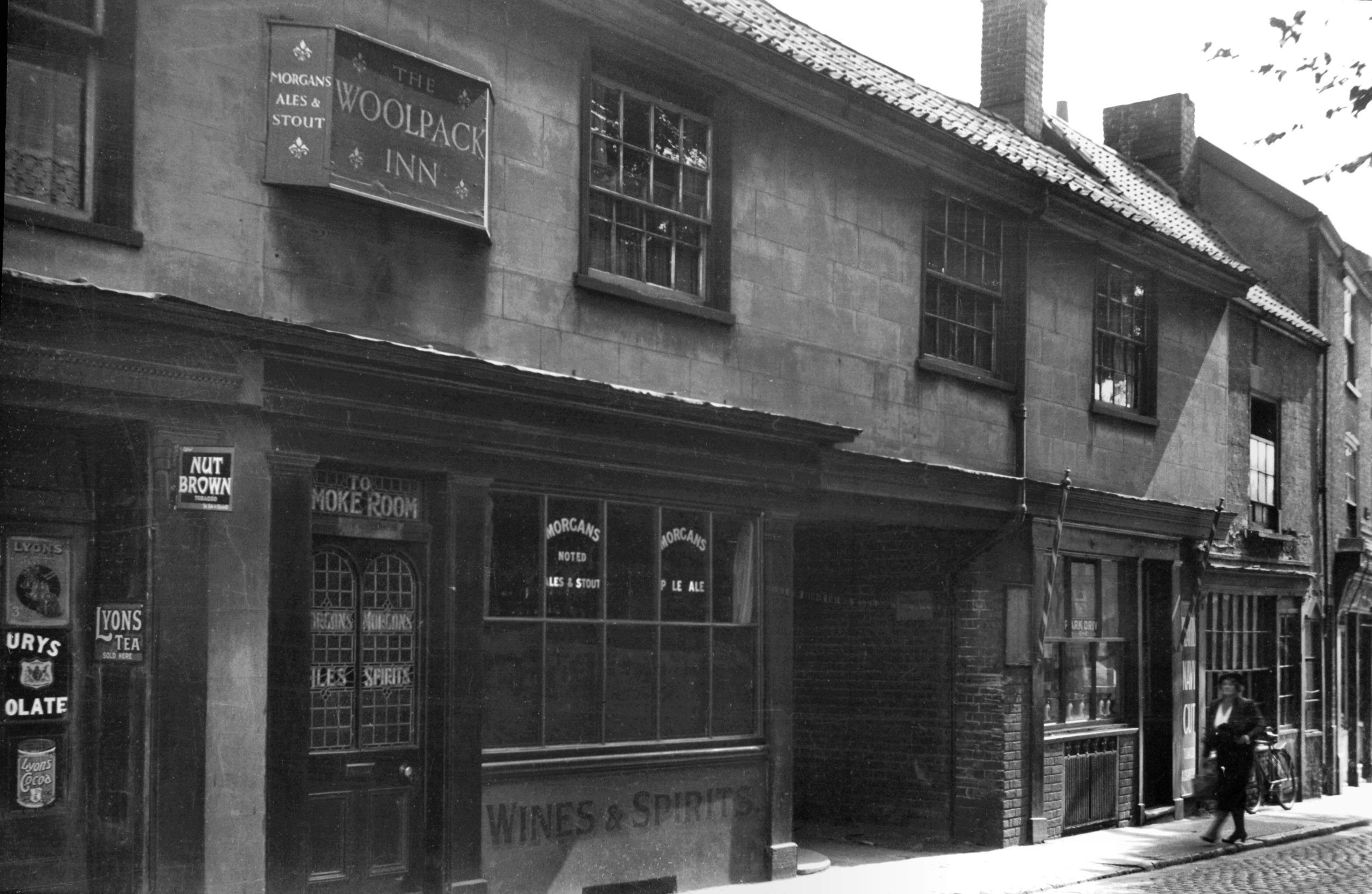
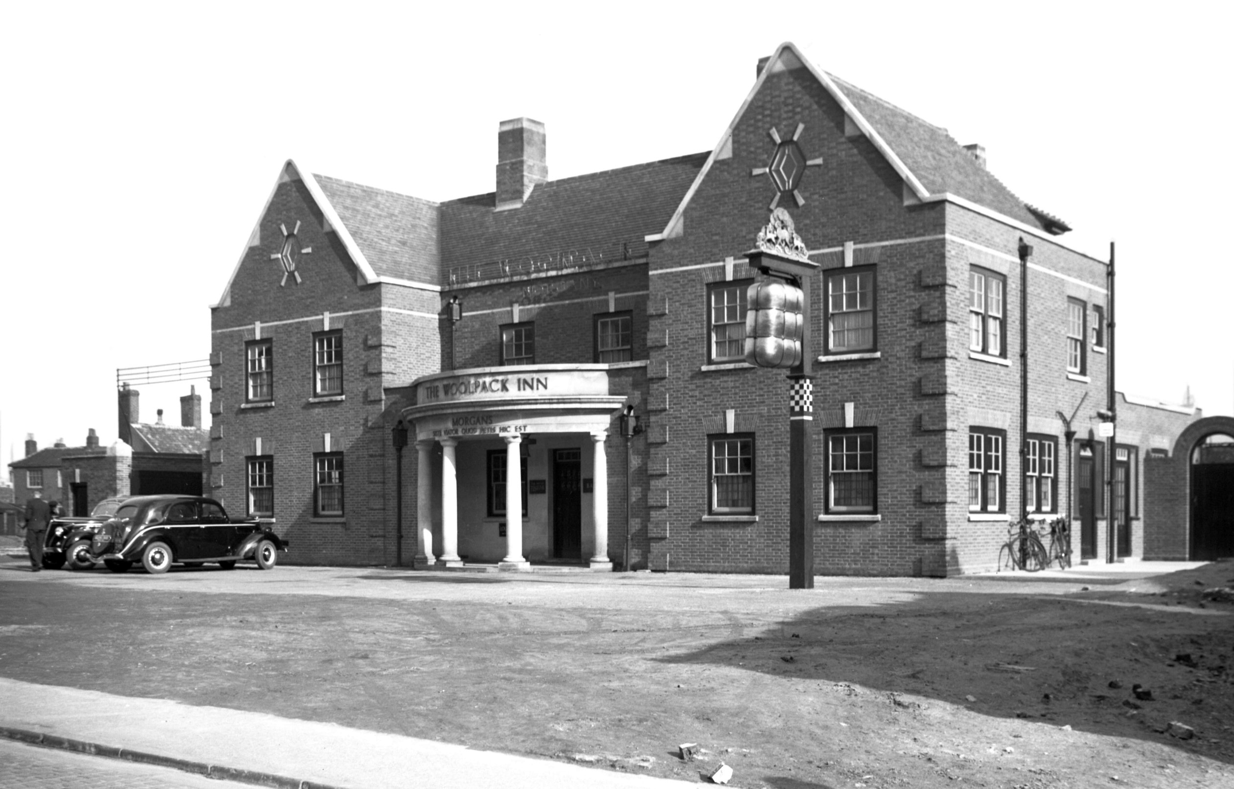
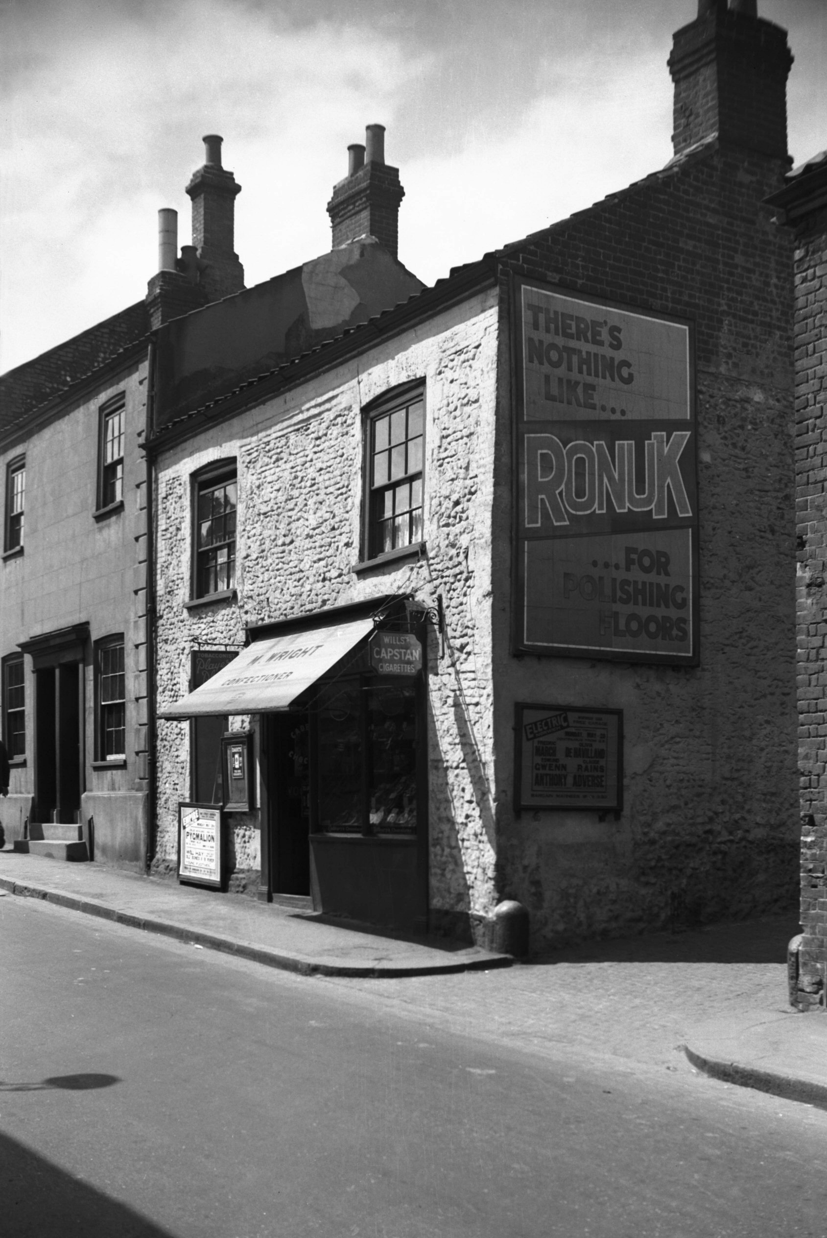
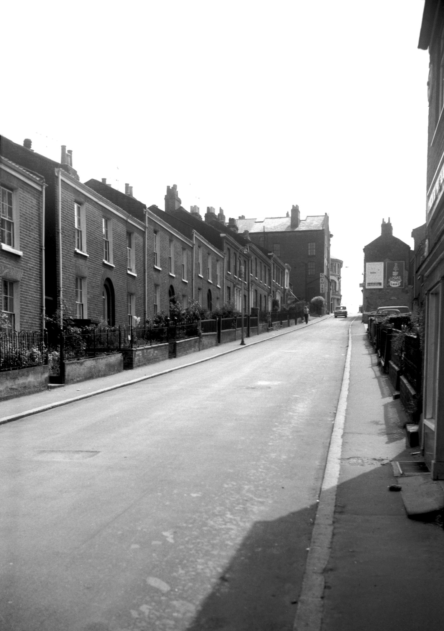
Golden Ball St 1 to 9 [1647] 1937-05-23
Golden Ball St, in the early 1930s, was about as narrow
as Westlegate then was. It was early in 1936 when the
traffic problem was becoming acute that a scheme was
approved for widening both streets and their connecting
link, All Saints' St, providing an alternative route from
the cattle market and St Stephen's into Ber St. By
October 1938, the old Woolpack inn at No 9 Golden Ball
Street was being demolished, along with neighbouring
property - a new public house having already been built
at the back. Because of delays caused by the outbreak of
war, however, it was not until April 1940, that the last
new kerbstones were laid.
Although the old Woolpack and its neighbour at No 7, a
hairdresser's shop, were Tudor timber-framed buildings
and probably formed a single property originally, they
were not of sufficient importance to arouse protests when
it was decided that they would have to be demolished. |
|
|
Golden Ball St 7 to 9 Woolpack PH [1263] 1936-08-13
|
|
|
Golden Ball St 9 Woolpack PH rear [1785] 1937-07-13
|
|
|
Golden Ball St 9 Woolpack PH [2889] 1939-03-09
|
| |
West
side |
|
|
Golden Ball St 18 [1170] 1936-07-27
|
|
|
Golden Ball St 18 restored [7731] 2000-02-11
|
|
|
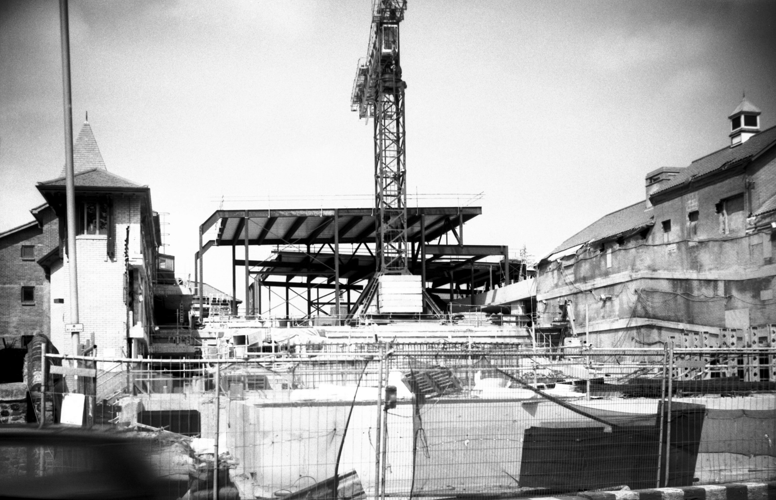
Golden Ball St cinema construction [7617] 1999-05-02
From Golden Ball St. |
|
|
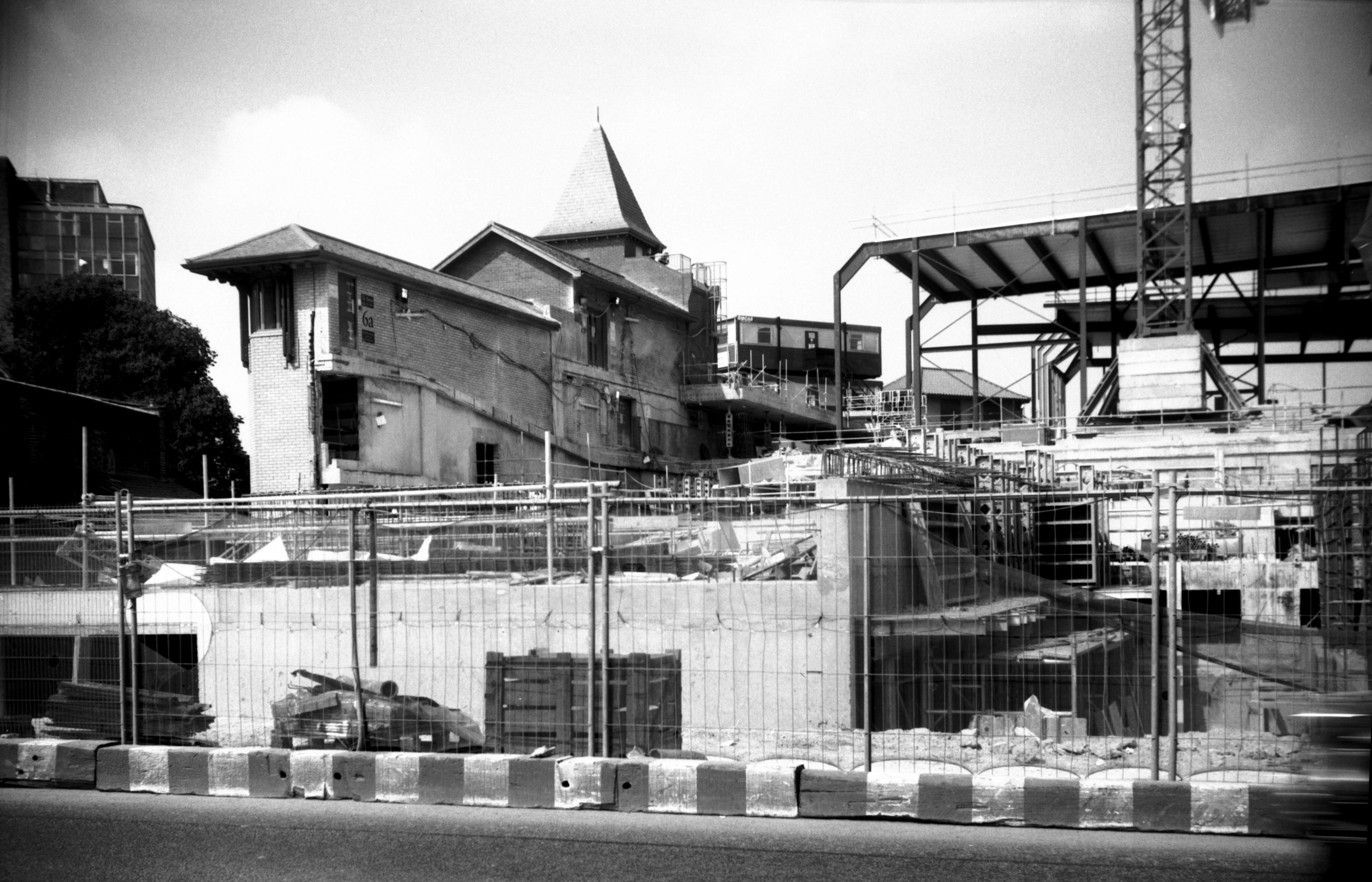
Golden Ball St cinema construction [7618] 1999-05-02
|
|
Golden Dog Lane: |
| |
From
Calvert St to Magdalen St
North side |
|
|
Golden Dog Lane 15a to 17 [2699] 1938-08-08
|
|
|
Golden Dog Lane 19 [2700] 1938-08-08
|
| |
South
side |
|
|
Golden Dog Lane 20 Old Town House to 22 [7564]
1998-07-19
|
|
|
Golden Dog Lane view east to Magdalen St [0883]
1936-04-12
|
|
Grapes Hill: |
| |
From
St Giles'
St / Chapel Field Rd / Earlham
Rd to Dereham Rd / Barn
Rd / St Benedict's St
passing Pottergate, West
Pottergate
West side |
|
|
Grapes Hill view north from St Giles' Gates [4808]
1964-08-11
Site of Inner Link road. |
|
|
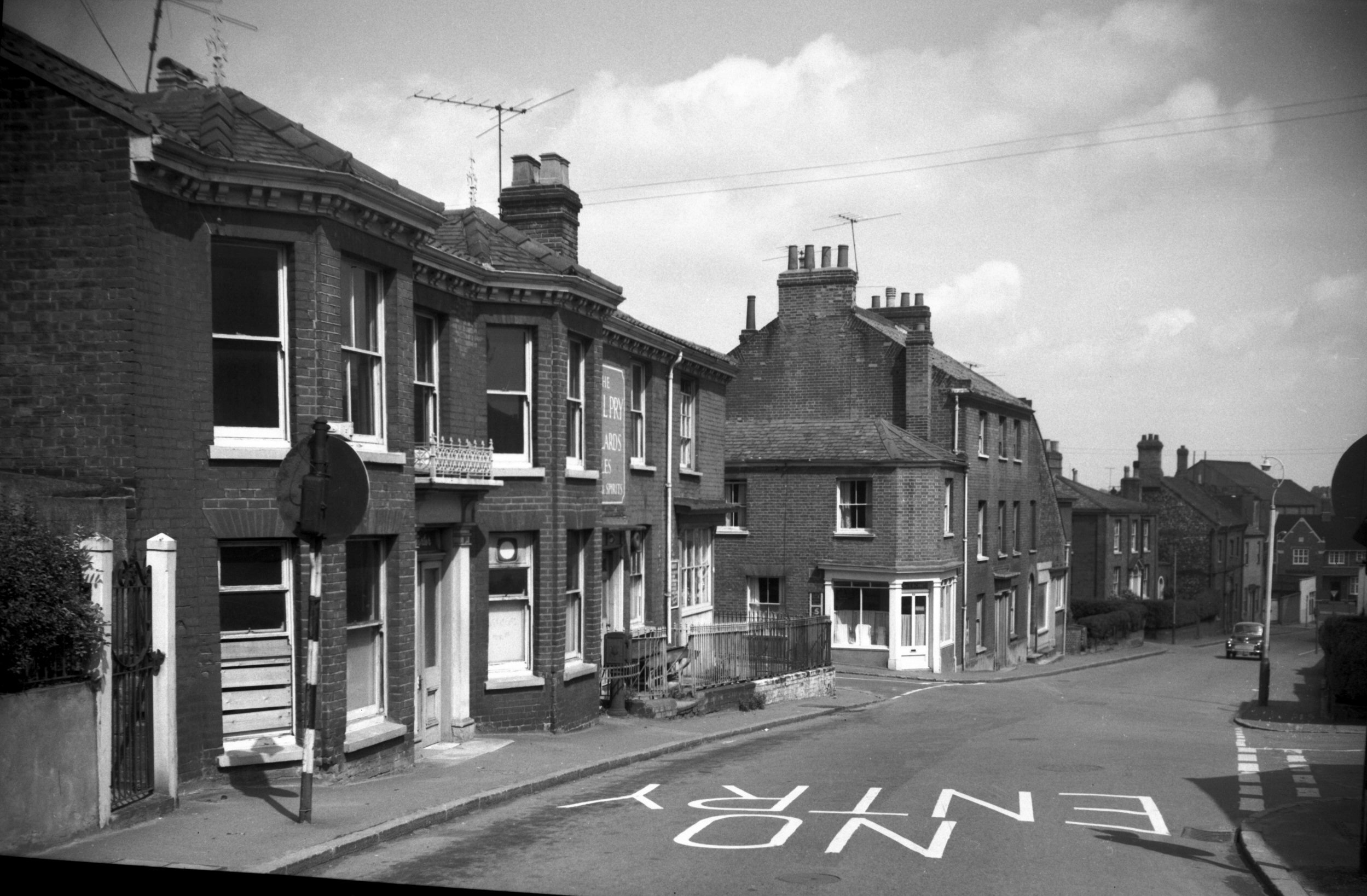
Grapes Hill 45 Paul Pry PH to 53 [5147] 1967-05-29
Site of Inner Link road. |
|
|
Grapes Hill 65 [3031] 1939-05-29
|
| |
East
side |
|
|
Grapes Hill 4 to 6 [2079] 1938-02-18
|
|
|
Grapes Hill 8 [1329] 1936-08-26
|
|
|
Grapes Hill 10 to 12 [2078] 1938-02-18
|
|
|
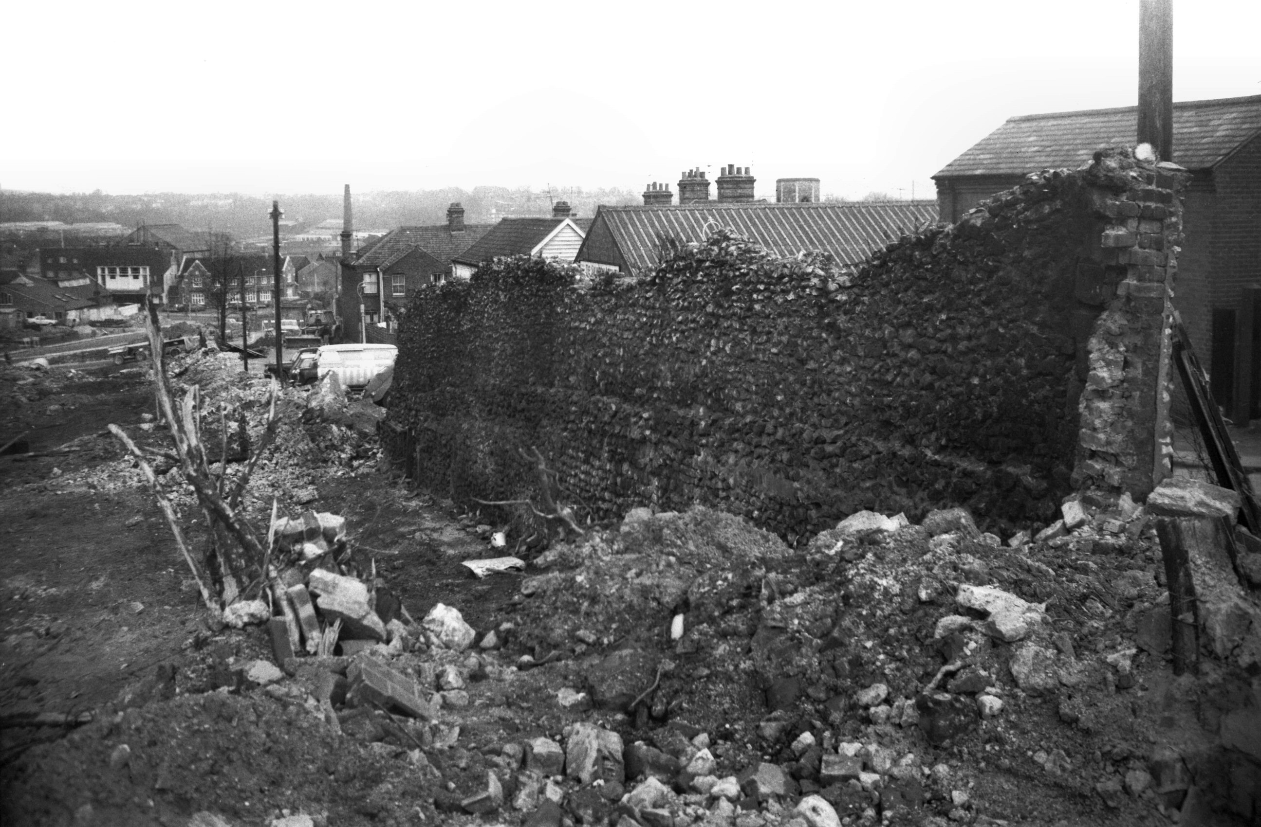
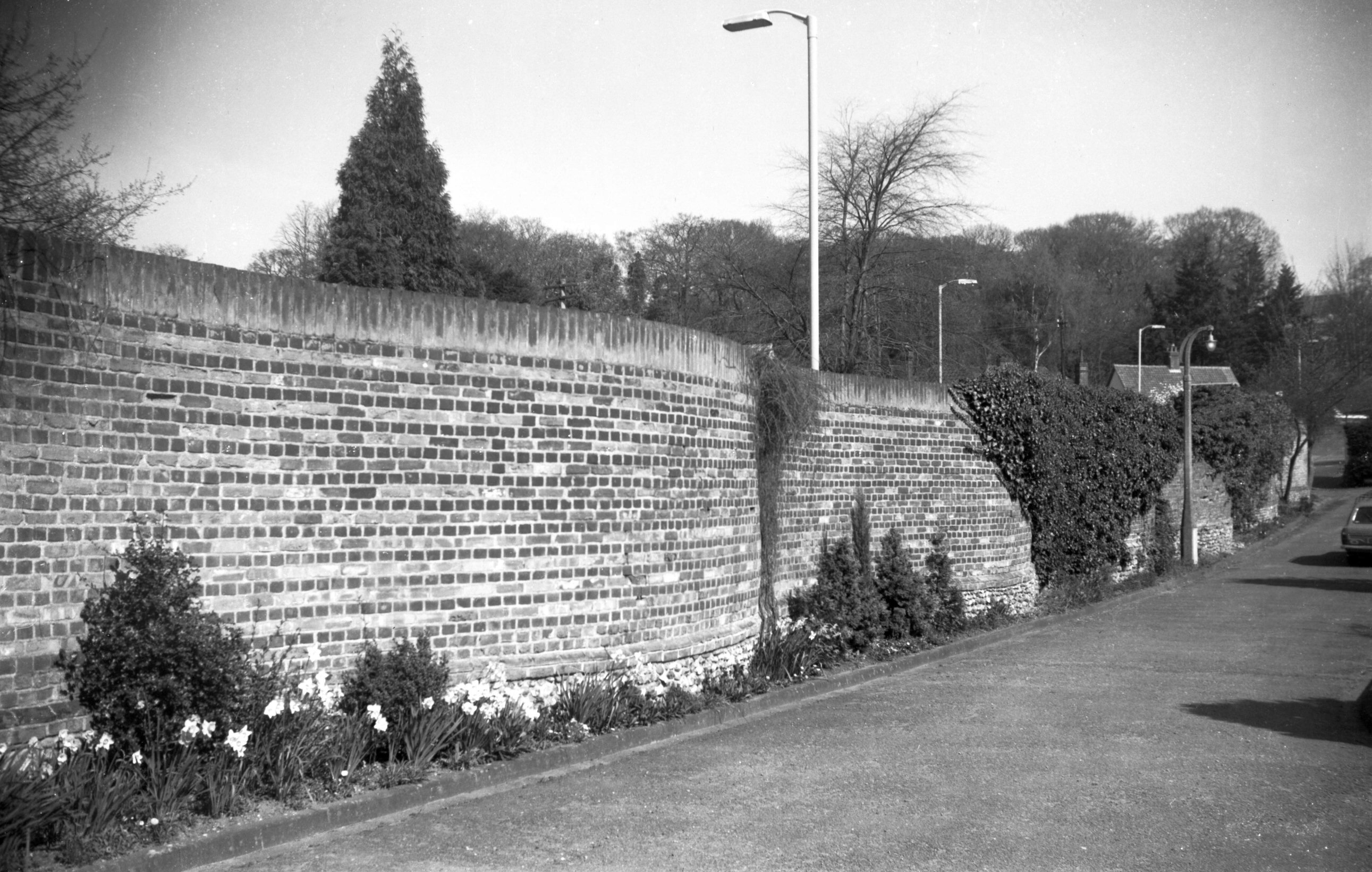
Grapes Hill 12a to 30 [4804] 1964-08-05
It was in 1931 that Robert Atkinson F.R.I.B.A., referring
to the City Wall, said "in almost every position are
slum dwellings put up during the last 50 years. It would
be a great adventure to clear them all out and open up
the road following the wall which has always been a
natural highway. Do this, and you will have a wonderful
circulating boulevard all round the city and its cost
would be comparatively nothing." It was not until
after the Second World War that a start was made upon the
construction of this "inner link" road, by
which time the cost had risen considerably! |
|
|
Grapes Hill 18 wall outside city view north [5291]
1970-02-08
Prior to demolition. |
|
|
Grapes Hill 18 wall outside city view south [5292]
1970-02-08
|
|
|
Grapes Hill 20 wall outside city view south [5290]
1970-02-08
|
|
|
Grapes Hill upper wall outside city view NE [5299]
1970-03-19
Prior to demolition for Inner Link road. |
|
Grove Rd: |
| |
From
Ipswich Rd / Newmarket
Rd / St Stephen's Rd to Queen's Rd / All Saints Green
passing Grove Walk, Southwell
Rd
North side |
|
|
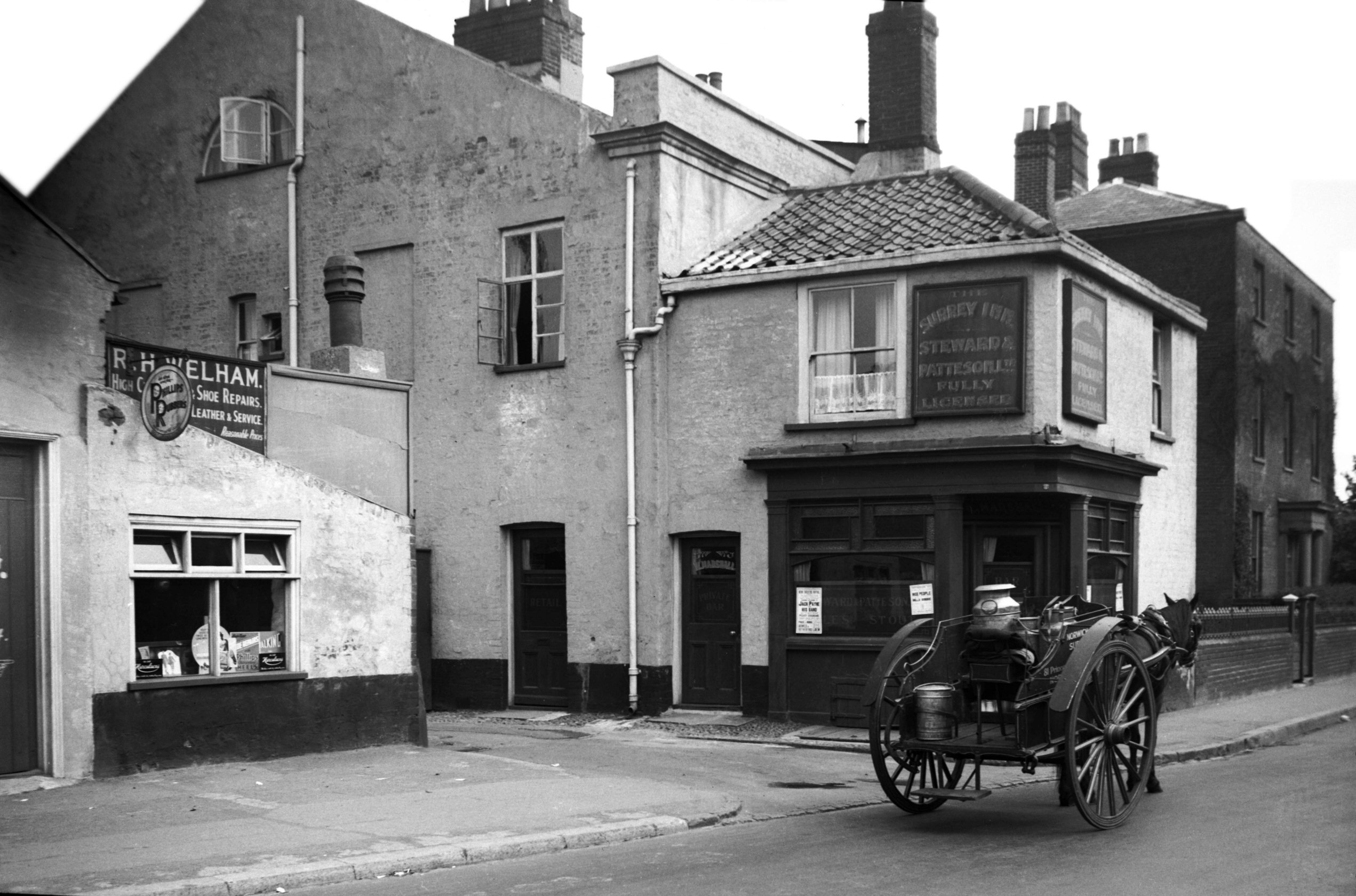
Grove Rd 74 Surrey Inn [3021] 1939-05-29
Grove Rd is the site of another wartime casualty, the
Surrey inn at No 74, a Steward and Patteson house. On
A.W.Morant's map of Norwich (1873) the major part of All
Saints' Green, to which Grove Road forms an extension,
was marked as Upper Surrey Str, and it was from this, no
doubt, that the public house took its name.
A newspaper report recording the destruction of the inn
in April 1942, referred to its longstanding link with
Norwich Hill. It was here in the extensive yards at the
rear of the house that large numbers of cattle destined
for the market were sheltered overnight before railway
and motor transport took the herds off the roads.
My photograph, taken in May 1939, shows something else
which has vanished in recent years - the horse-drawn milk
float with its large churn and smaller container from
which the milk would be ladled in pint and half-pint
measures directly into the customer's jug. |
|
|
Grove Rd 76 to 78 [3022] 1939-05-29
|
|
Grove Walk: |
| |
From
Grove Rd to Cecil Rd
passing Eleanor Rd
East side |
|
|
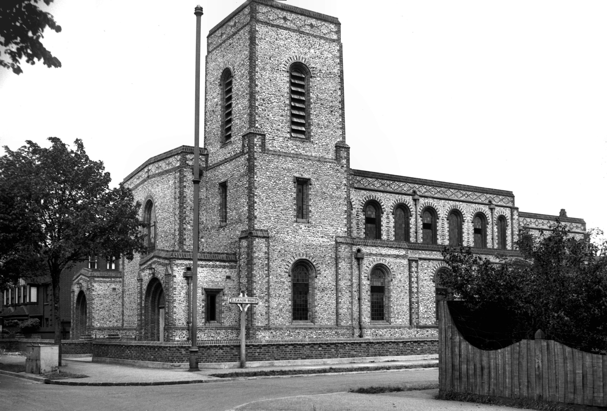
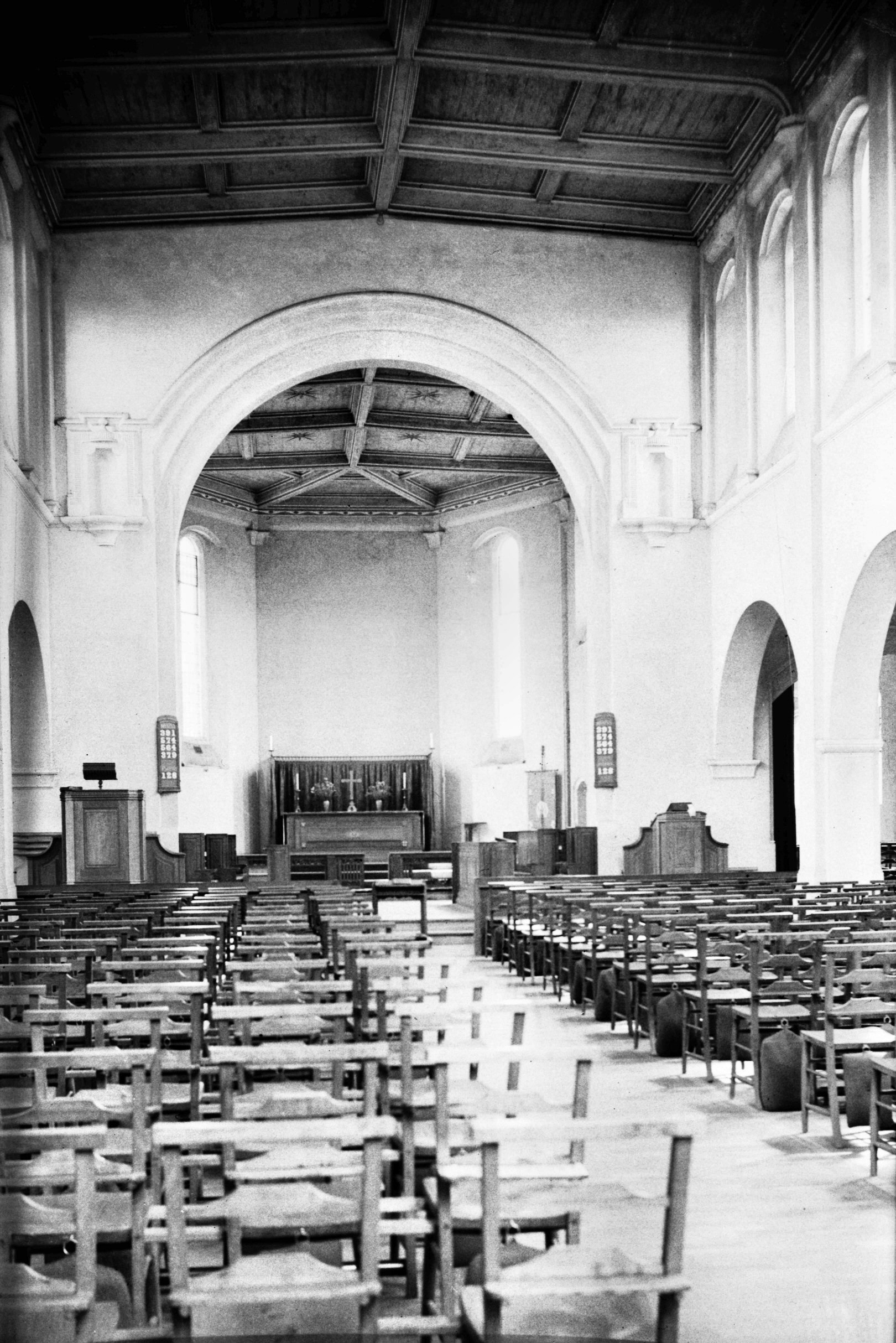
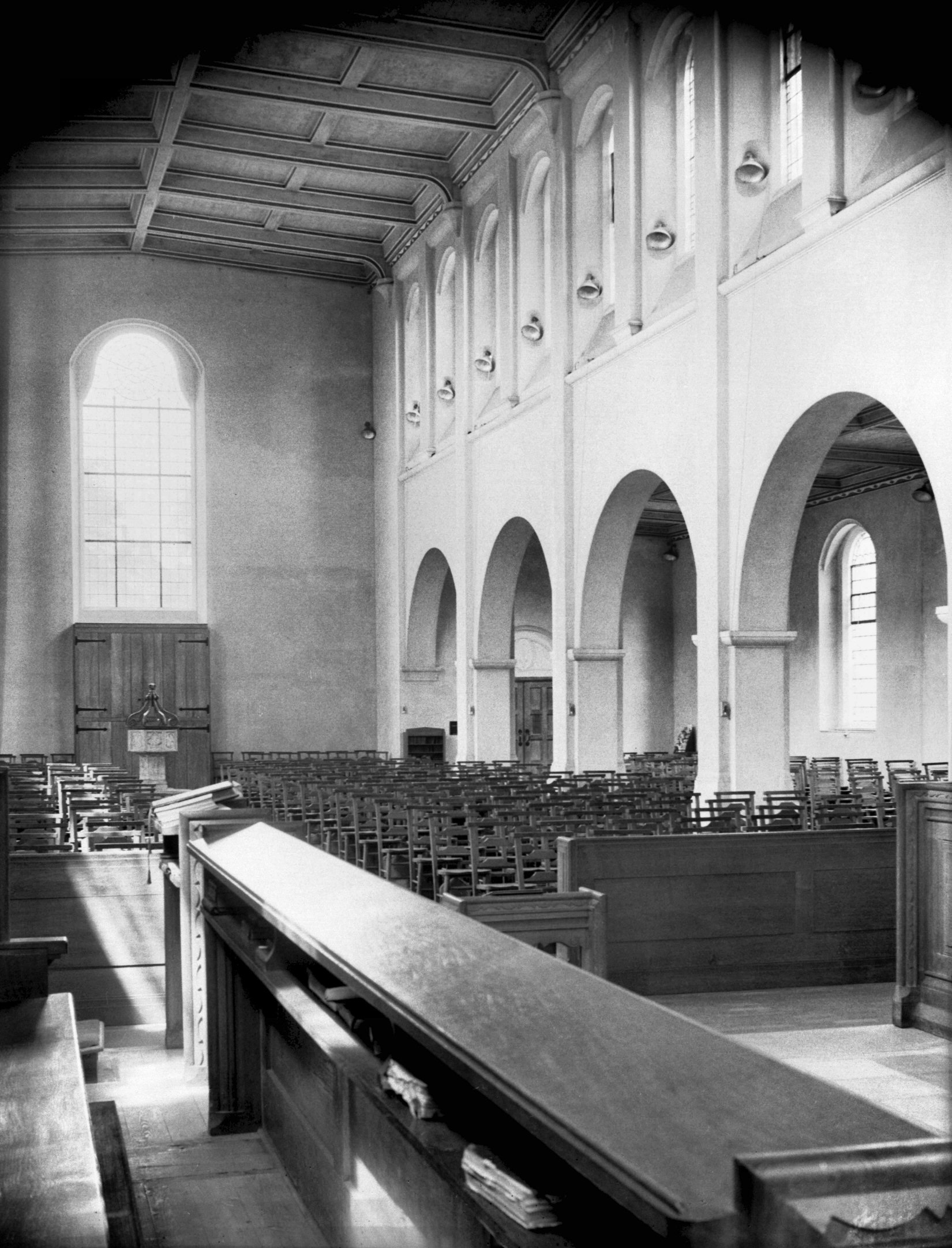
St Alban's Lakenham from Grove Walk [2476] 1938-06-18
Foundation stone laid 4th August 1932. Consecrated 20th
May 1937. Architect Cecil Upcher. |
|
|
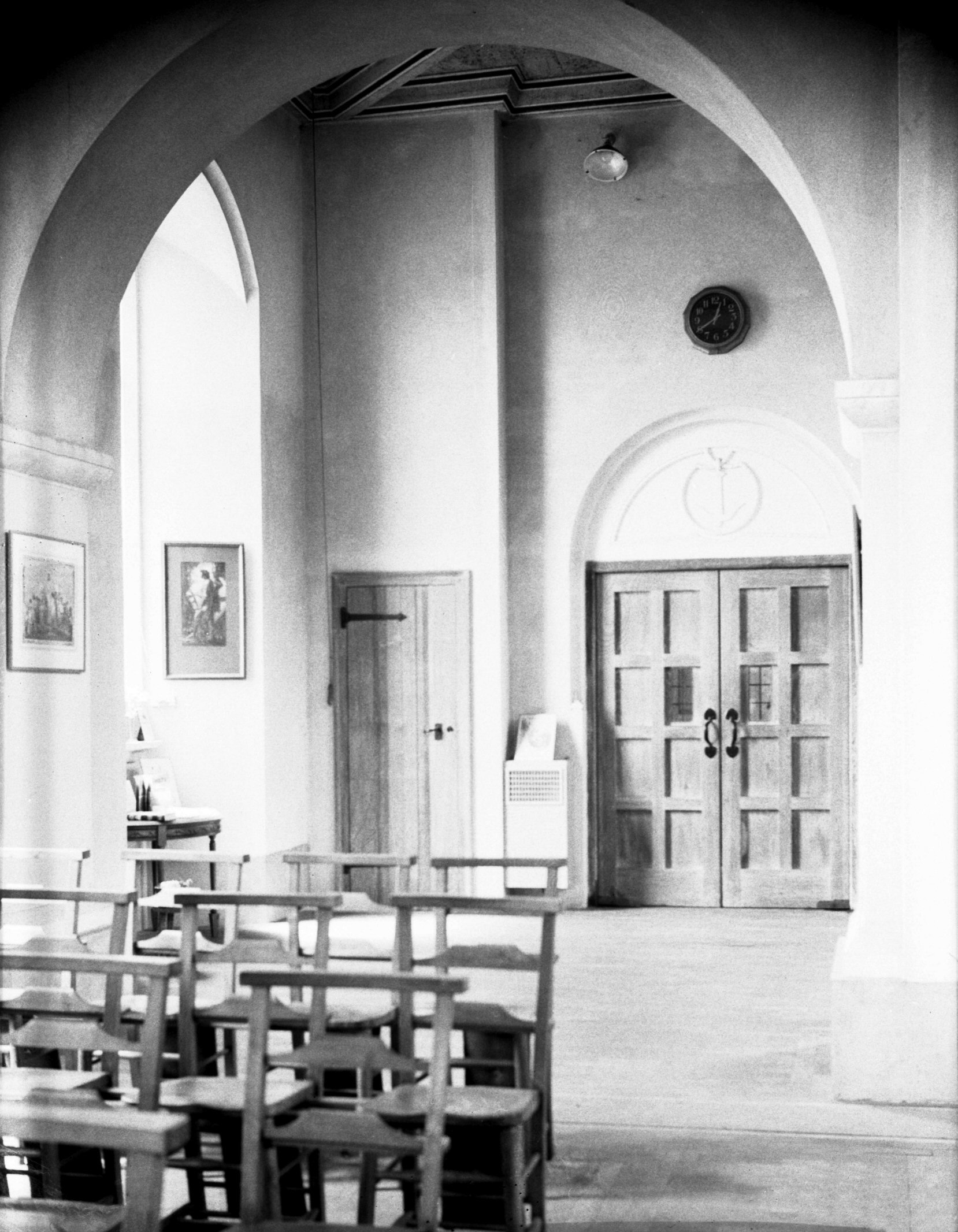
St Alban's Lakenham interior view east [2499]
1938-06-25
|
|
|
St Alban's Lakenham interior view west [2503]
1938-06-25
|
|
|
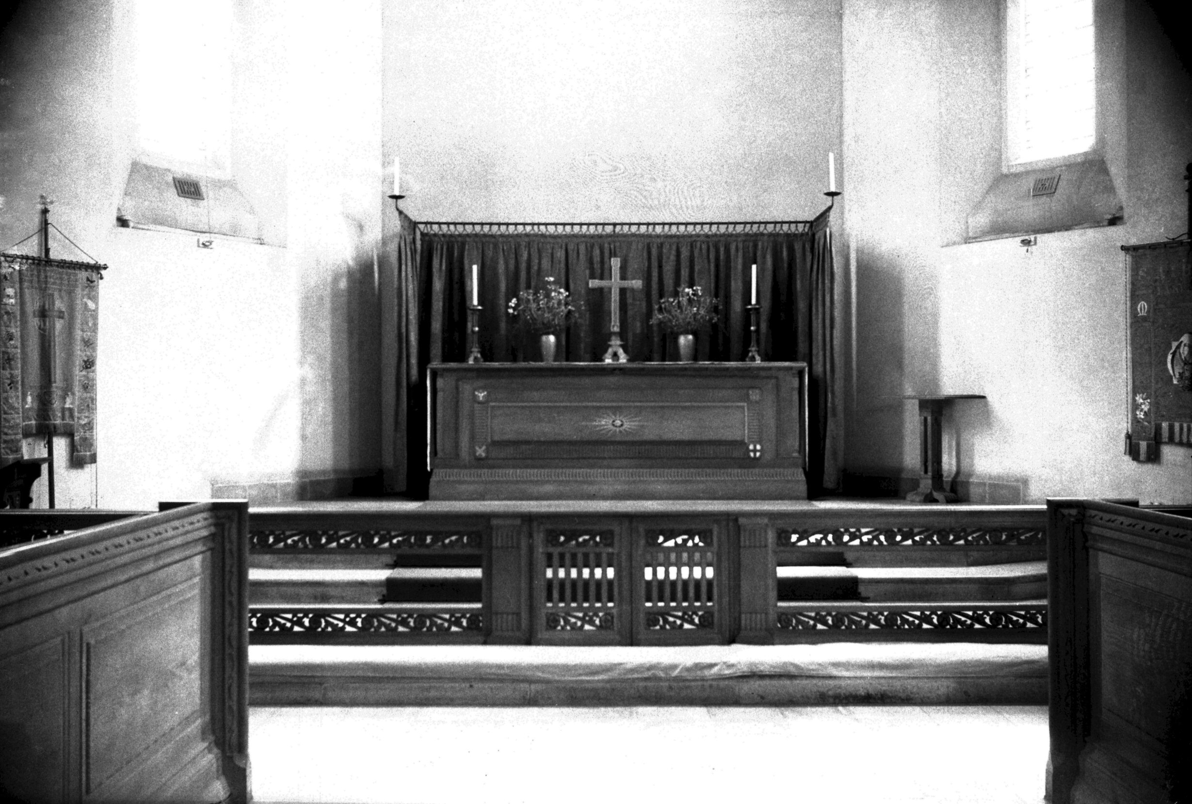
St Alban's Lakenham sanctuary [2504] 1938-06-25
|
|
|
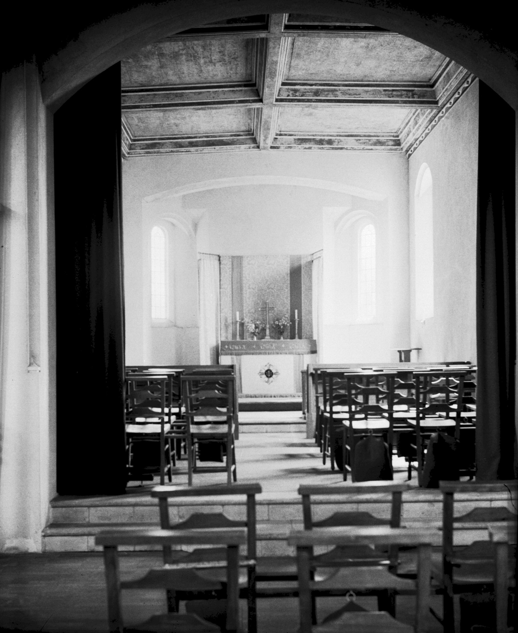
St Alban's Lakenham south aisle east end [2502]
1938-06-25
|
|
|
St Alban's Lakenham south aisle from north [2506]
1938-06-25
|
|
|
St Alban's Lakenham south aisle west end [2501]
1938-06-25
|
|
|
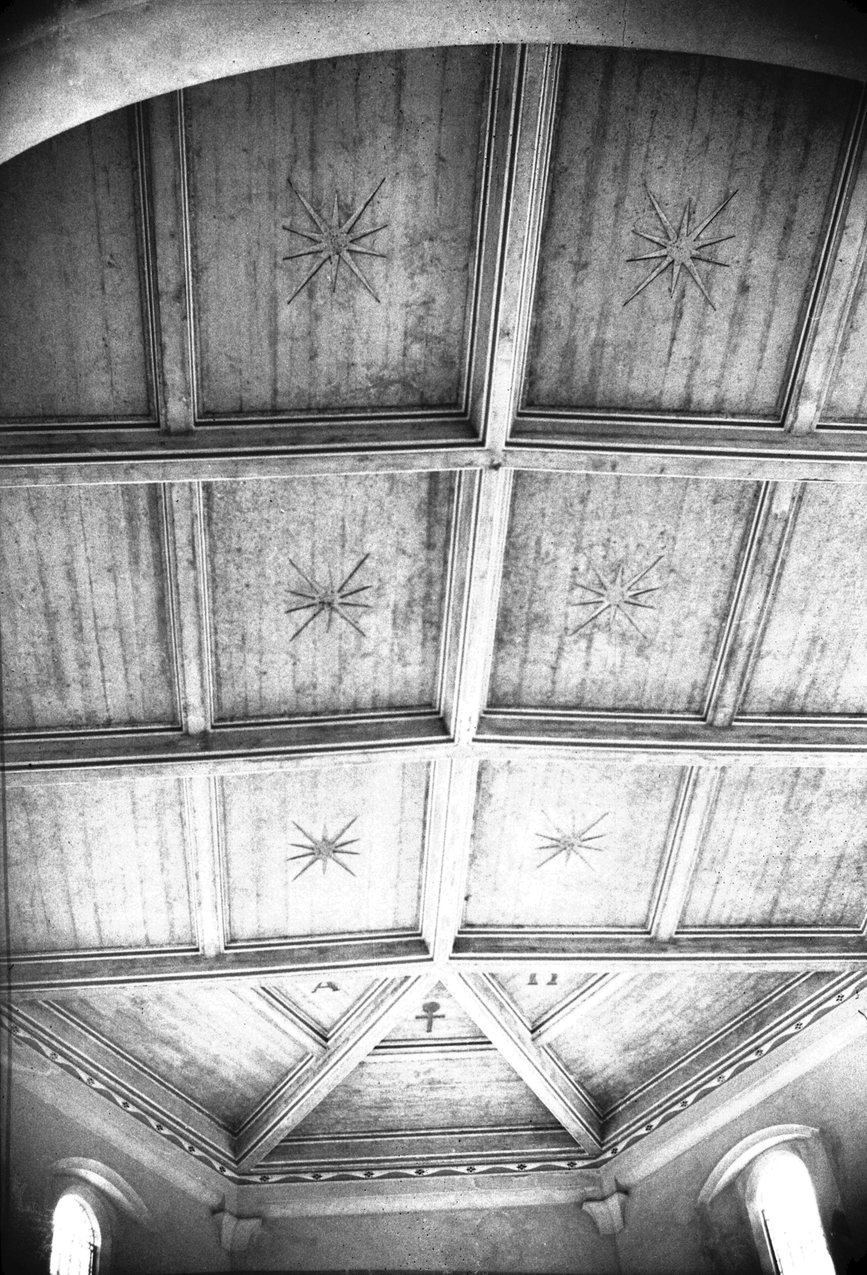
St Alban's Lakenham chancel roof [2505] 1938-06-25
Painted concrete. |
|
|
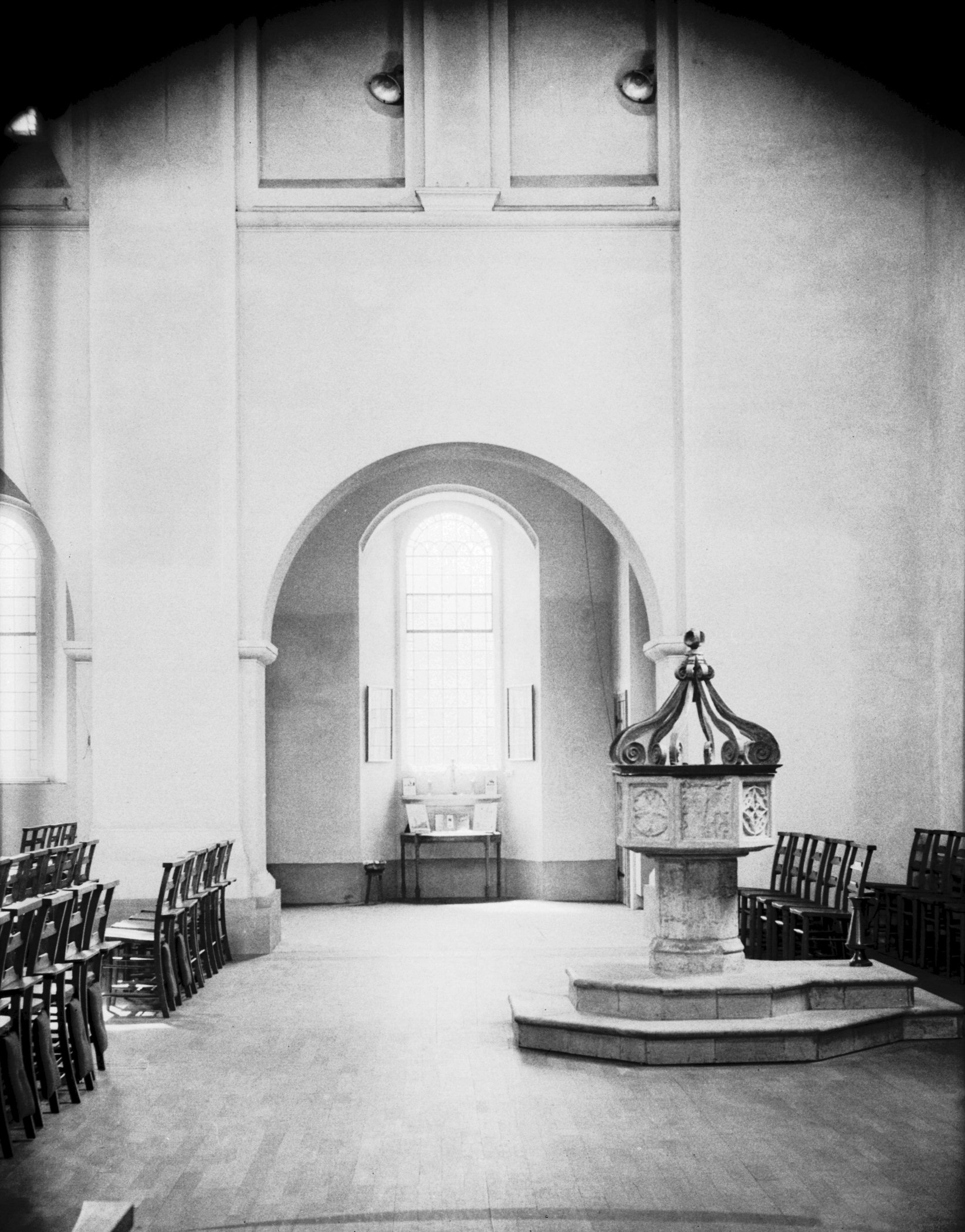
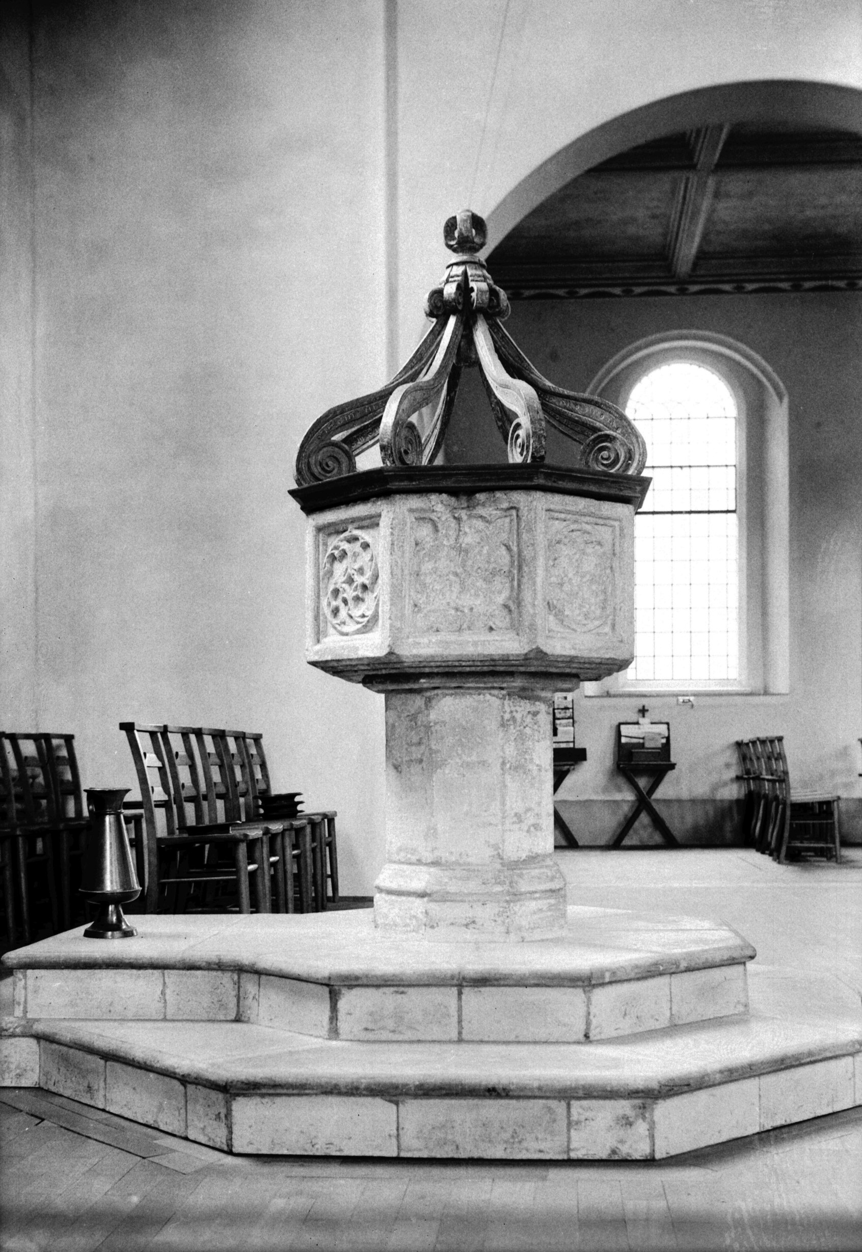
St Alban's Lakenham 15c font Jacobean cover [2500]
1938-06-25
15c font and restored Jacobean Cover from Knettishall
church Suffolk. It retains a portion of the old lock. |
|
Guardian Rd: |
| |
From
Bowthorpe
Rd / Farrow Rd to Dereham Rd / Sweet Briar Rd |
|
|
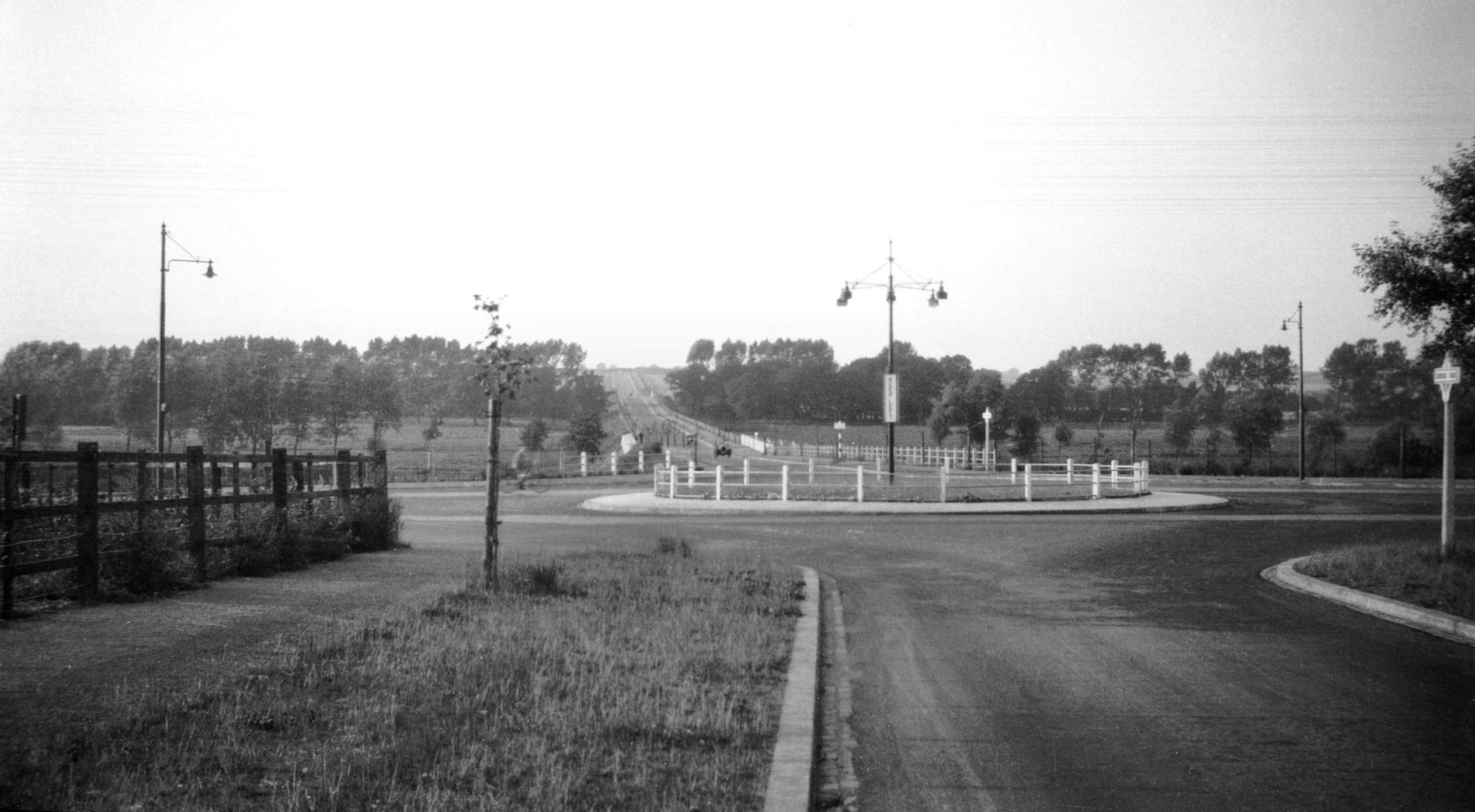
Guardian Rd at Dereham Rd [B652] 1933-08-05
Sweet Briar Rd beyond. Work was commenced on the new road
between Bracondale and Newmarket Rd towards the end of
the 1920's, a scheme designed with a view to relieving
unemployment. At about the same time work was also taking
place on that section of the road between Guardian Rd and
Sweet Briar Lane. This was commenced in 1930. |
|
Gurney Rd: |
| |
From
Kett's Hill / Bishop
Bridge Rd / Barrack St to Mousehold Lane / Salhouse Rd / Heartsease
Lane
passing Spitalfields, Britannia
Rd, Mousehold Avenue, Valley
Drive |
|
|
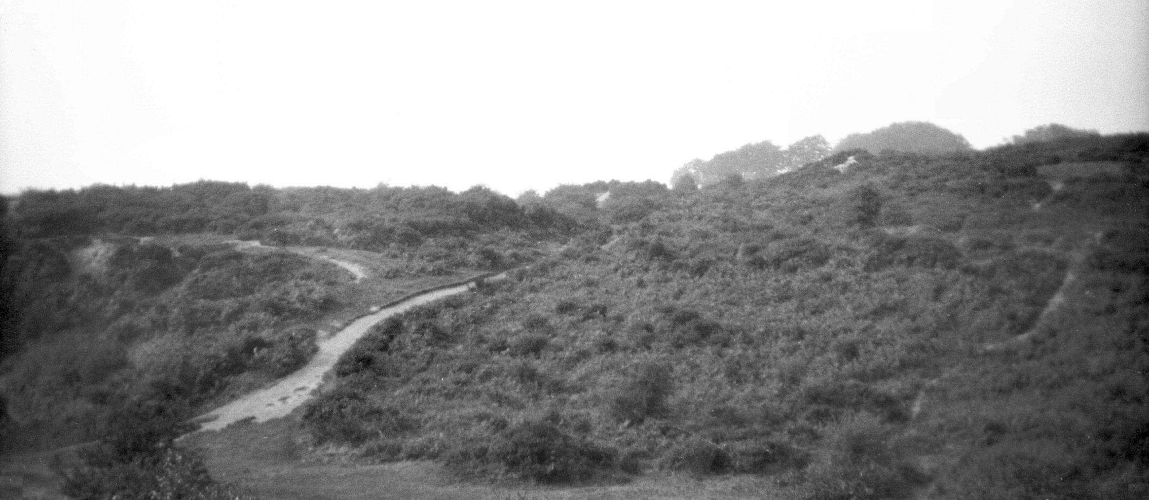
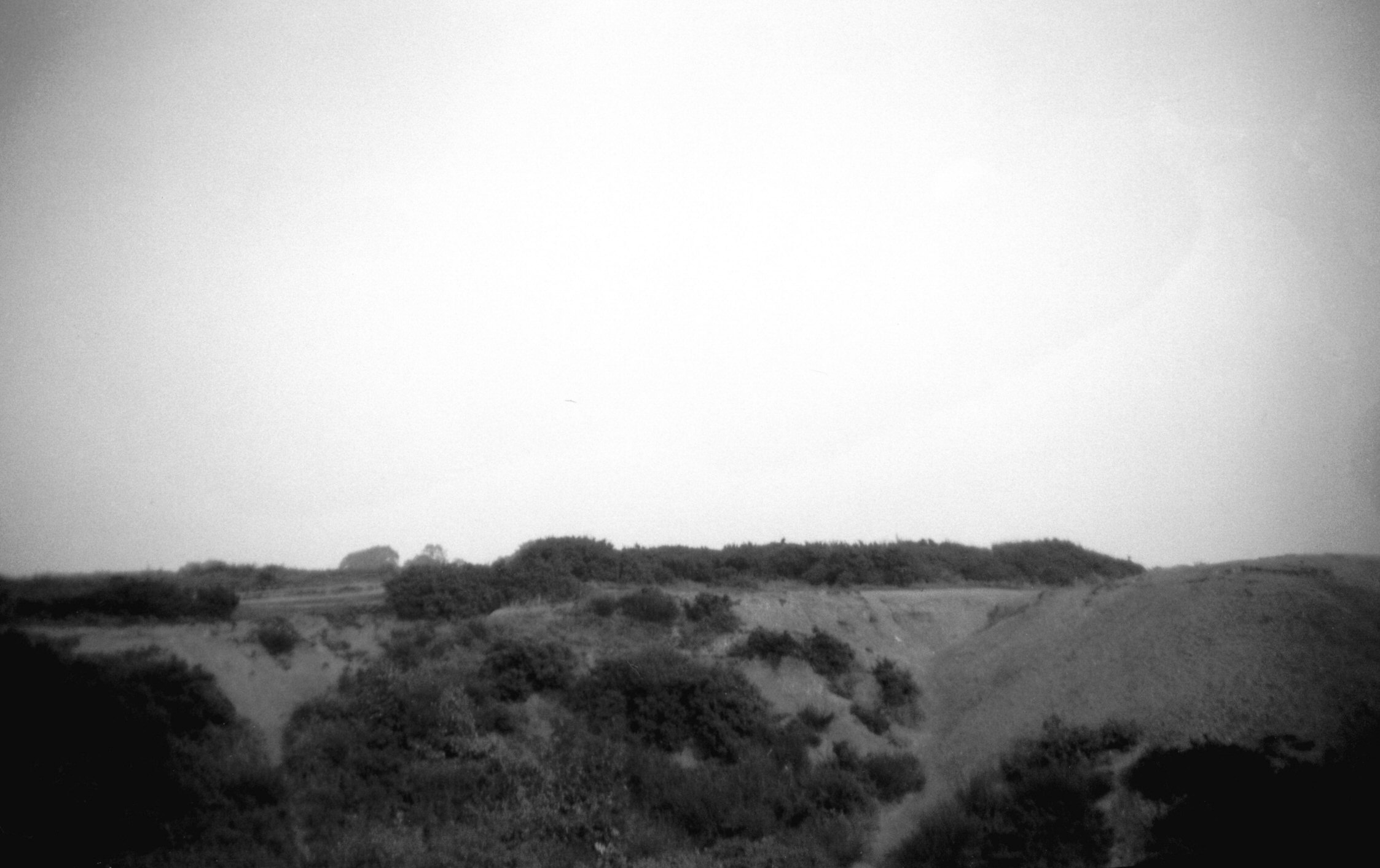
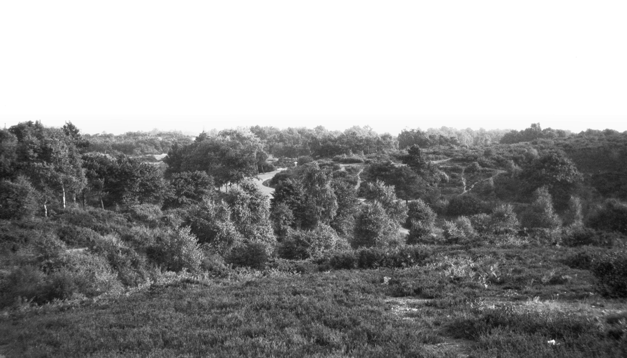
Mousehold general view [B180] 1931-00-00
The wild atmosphere of this most valuable open space,
full of historic memories, has been carefully preserved.
Conveyed by the Dean and Chapter of Norwich to Norwich
Corporation in 1880 it was dedicated to the free use of
the people by the Mayor John Gurney in 1886. |
|
|
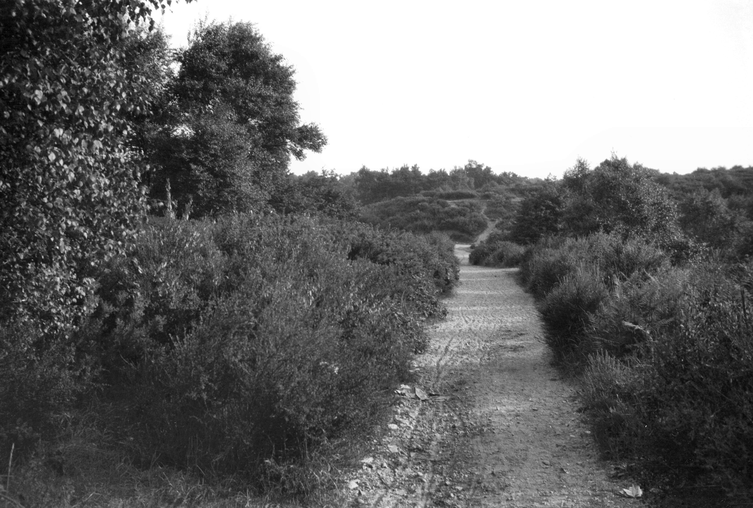
Mousehold sand hills [B176] 1931-00-00
|
|
|
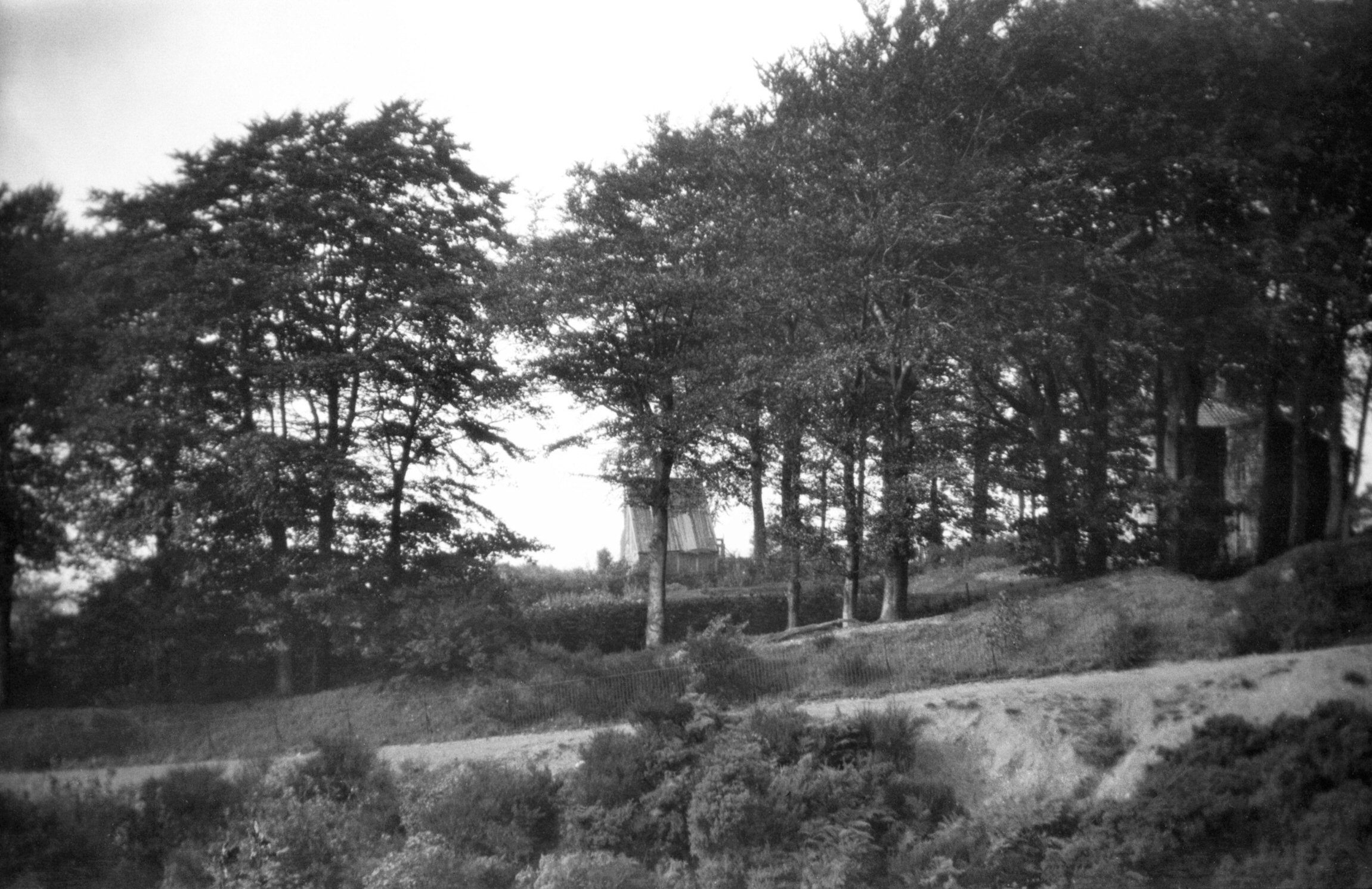
Mousehold trees near Gilman Rd [B177] 1931-00-00
|
|
|
Mousehold view north from Gilman Rd [B178] 1931-00-00
|
|
|
Mousehold football pitch Gilman Rd [B179] 1931-00-00
|
|
|
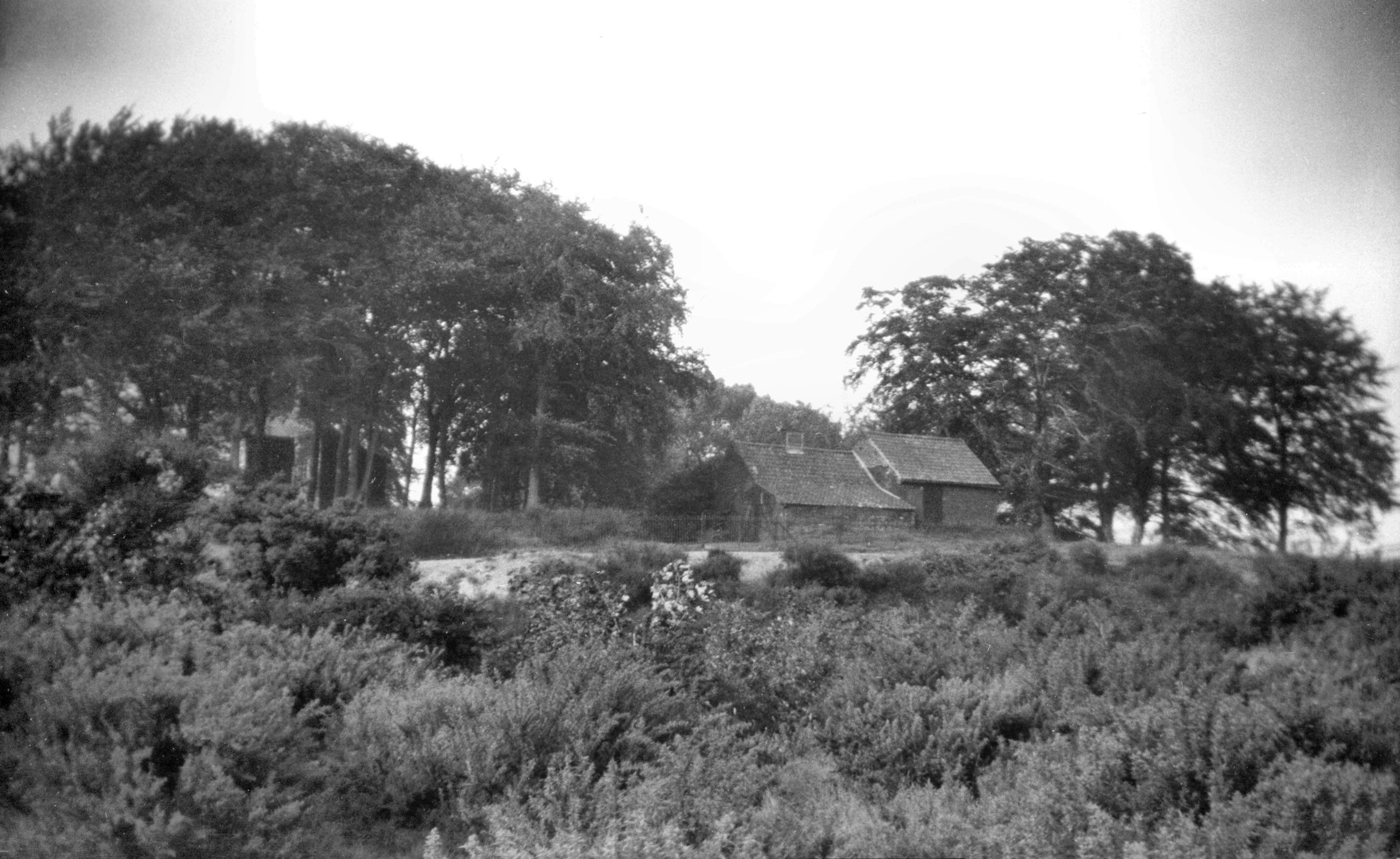
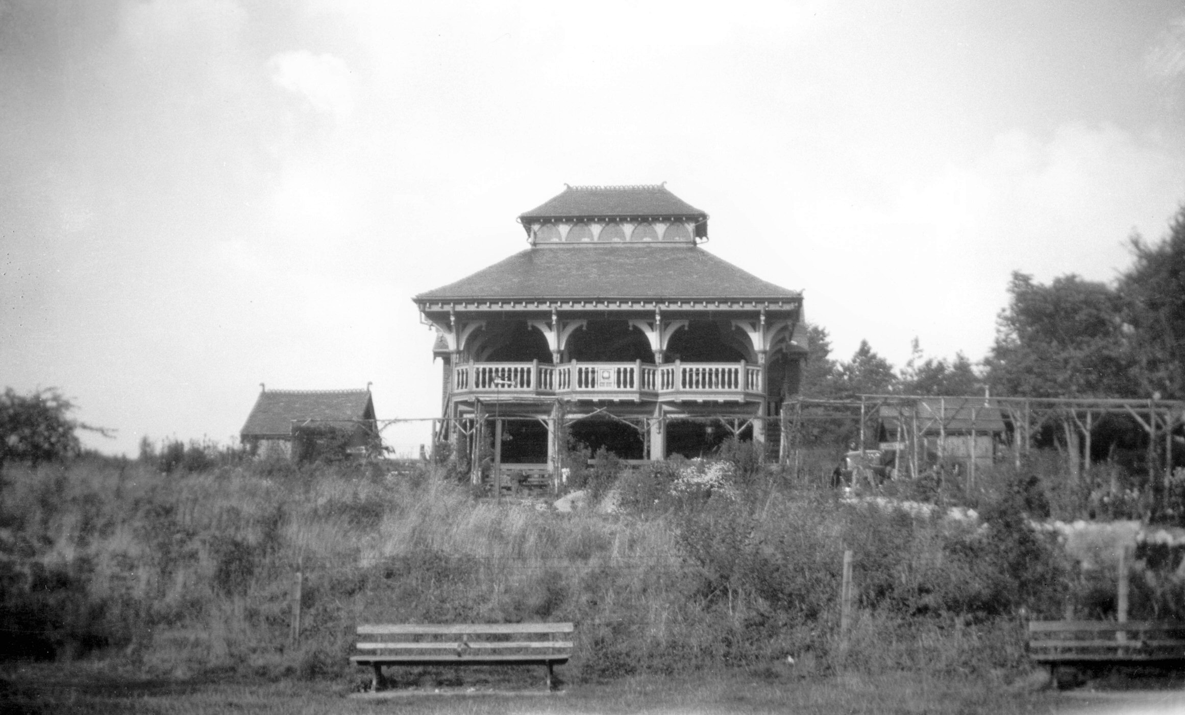
Mousehold tea pavilion Gurney Rd [B181] 1931-00-00
|
|
|
Mousehold view SW near Gurney Rd [B576] 1933-06-07
|
|
|
Mousehold gravel path parallel to Gurney Rd [B577]
1933-06-07
|
|
|
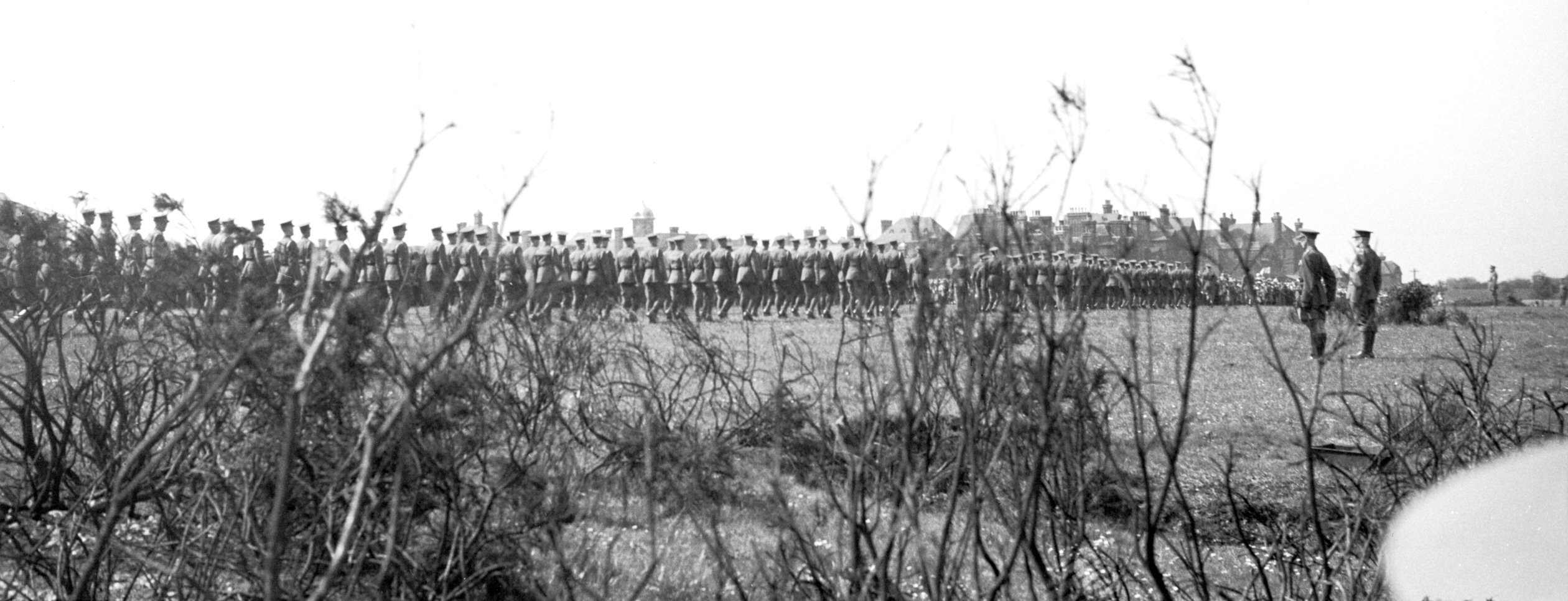
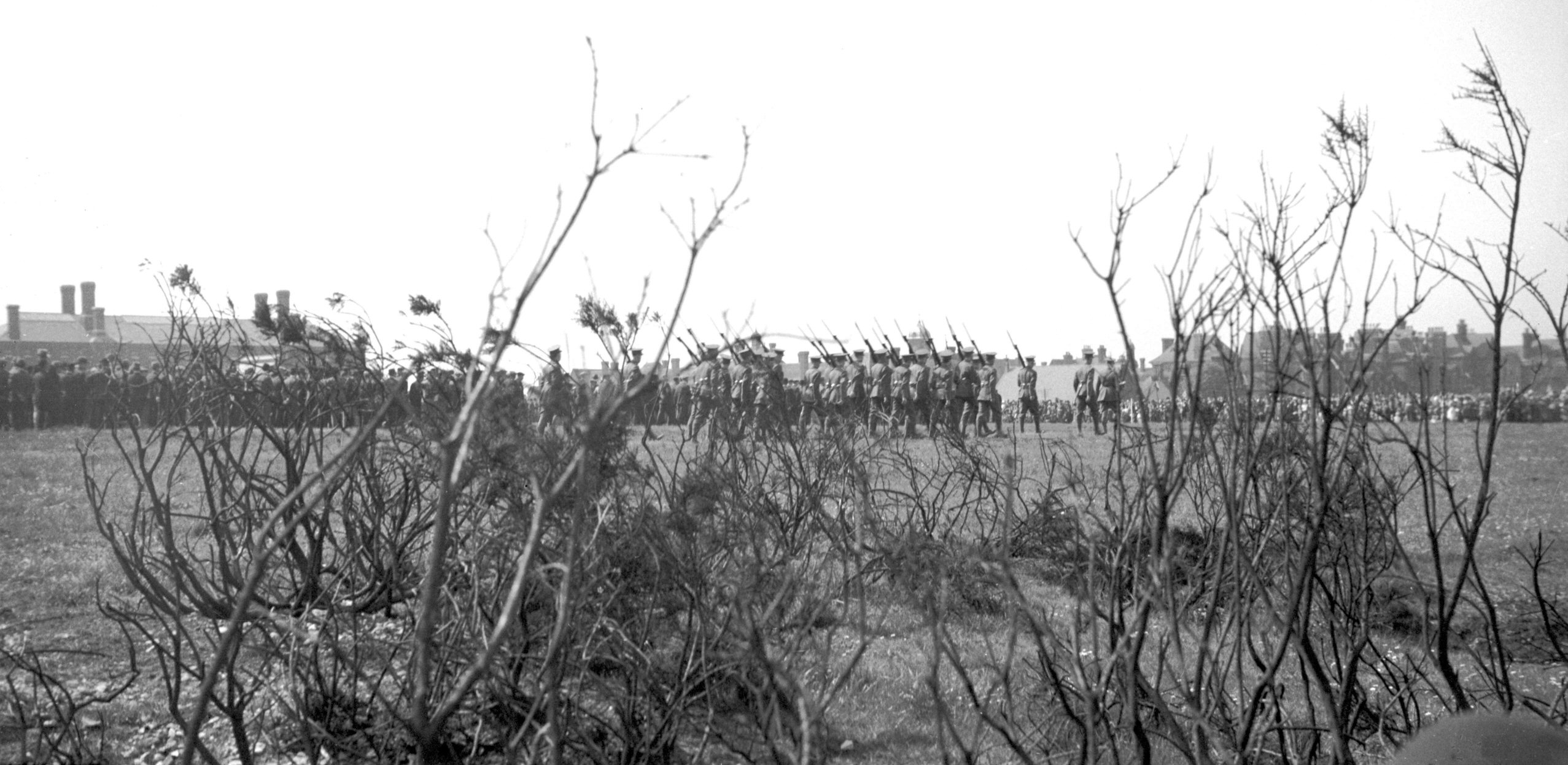
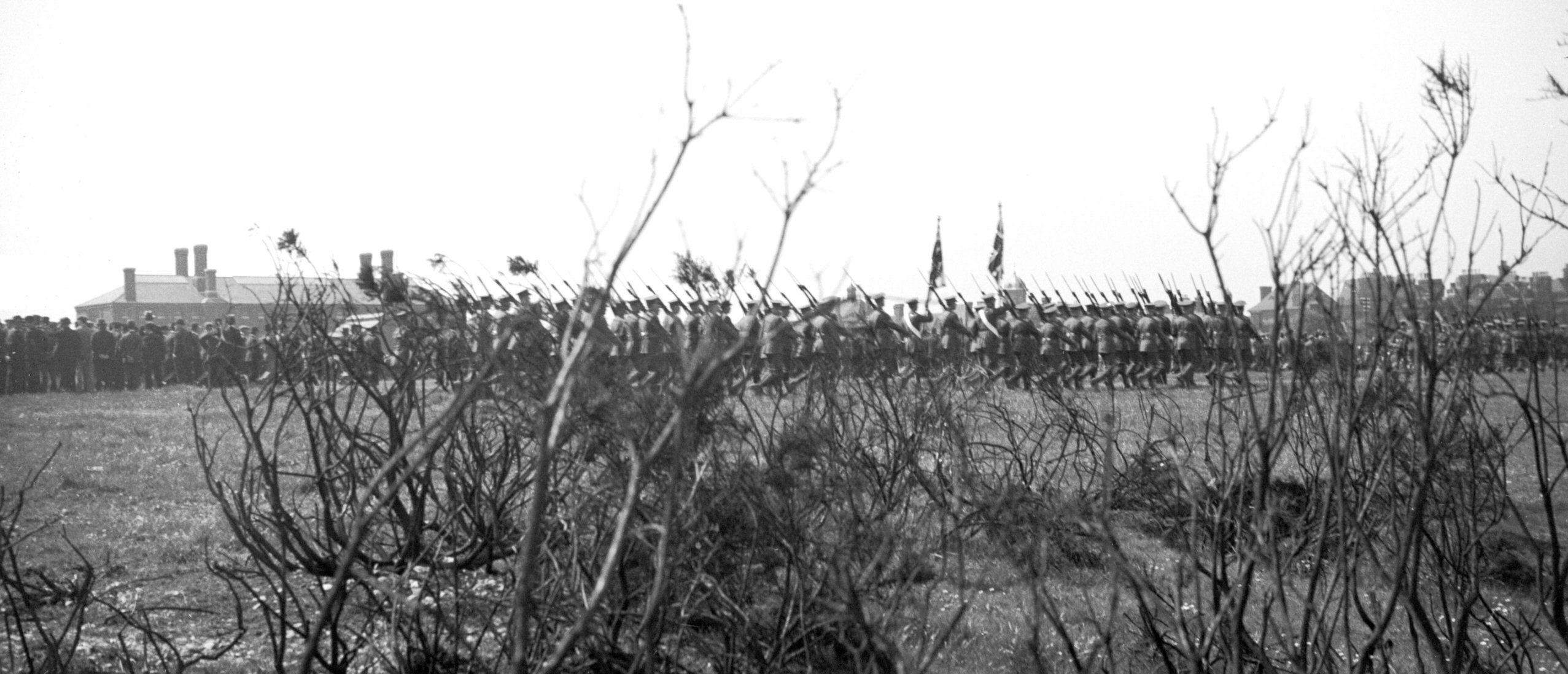
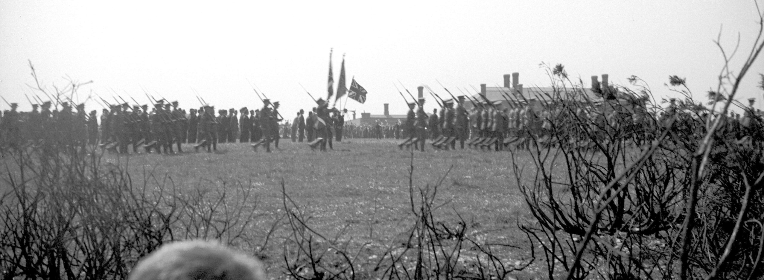
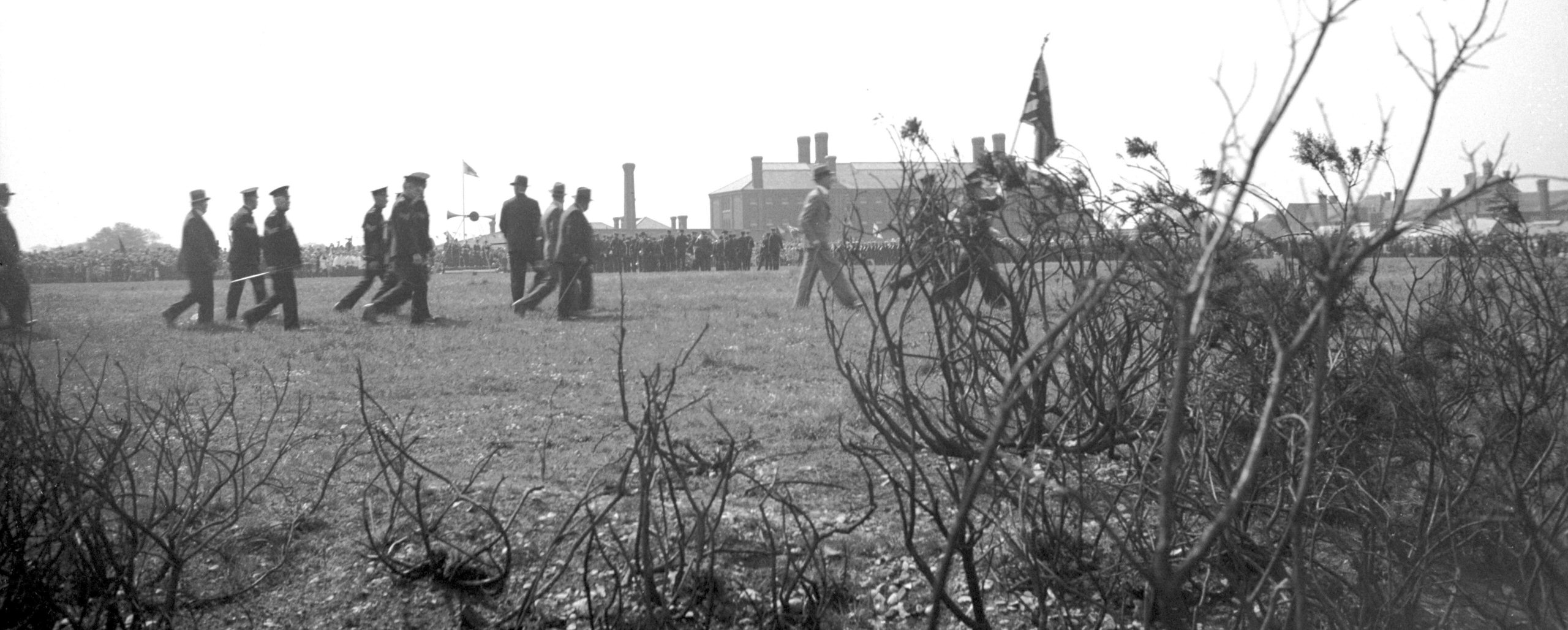
Silver Jubilee Mousehold troop review 1 [0541]
1935-05-06
The official celebrations commenced on Monday 6th May
with a review of troops by H.M.Lieutenant of Norfolk
(Russell J.Colman J.P.) on the football field behind
Britannia Barracks. Also present were the Lord Mayor
(P.W.Jewson J.P.) and the Sheriff (Councillor W.E.Walker
J.P.). |
|
|
Silver Jubilee Mousehold troop review 2 [0542]
1935-05-06
|
|
|
Silver Jubilee Mousehold troop review 3 [0543]
1935-05-06
|
|
|
Silver Jubilee Mousehold troop review 4 [0544]
1935-05-06
|
|
|
Silver Jubilee Mousehold troop review 5 [0545]
1935-05-06
|
|
|
Silver Jubilee Mousehold troop review 6 [0546]
1935-05-06
|
|
|
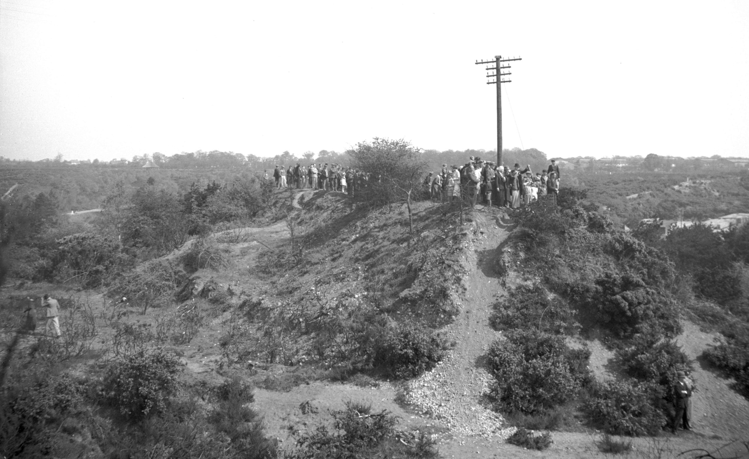
Silver Jubilee Mousehold troop onlookers [0547]
1935-05-06
Every available vantage point was used by the interested
spectators. |
|
|
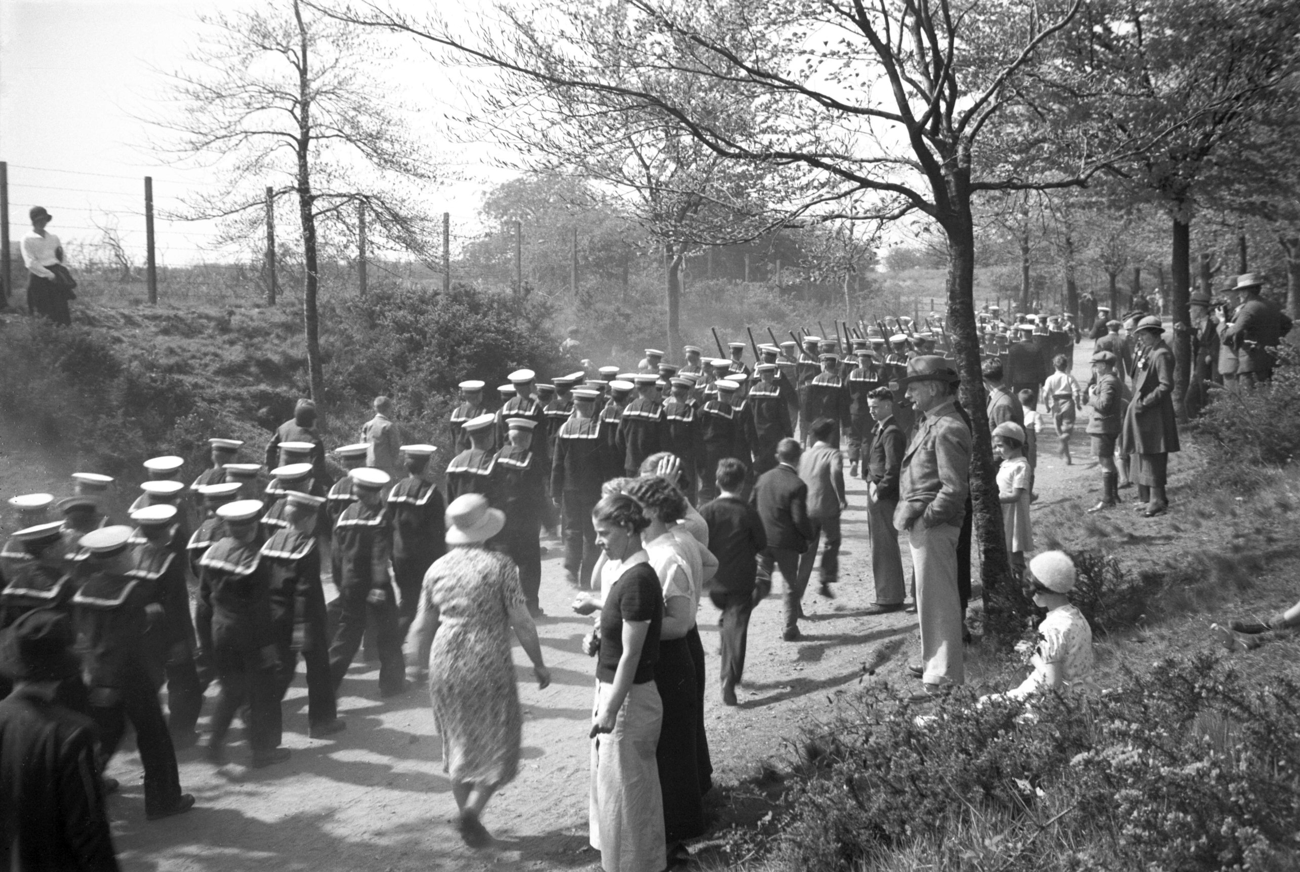
Silver Jubilee Mousehold Watts' Sea Cadets [0548]
1935-05-06
Lads of the Watts' Naval School leaving the parade
ground. Chestnut Avenue, Mousehold. |
|
|
Silver Jubilee St James' Hill view W [0549]
1935-05-06
|
|
|
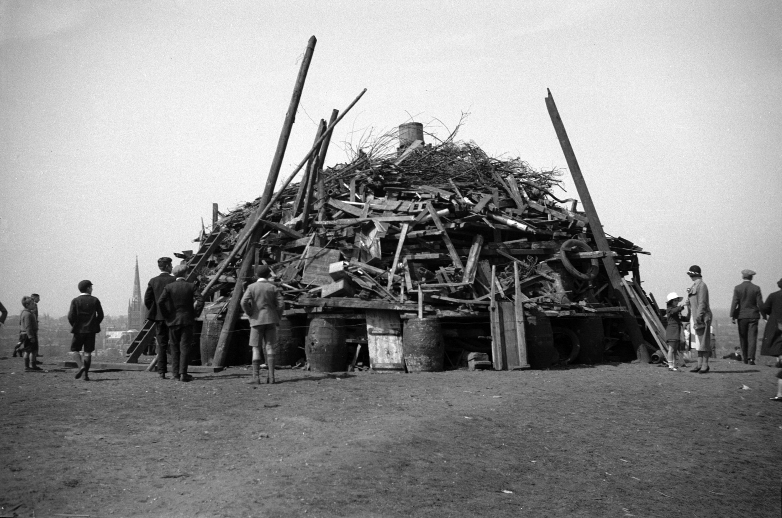
Silver Jubilee St James' Hill bonfire unlit [0550]
1935-05-06
St James' Hill bonfire built by Norwich Scouts . |
|
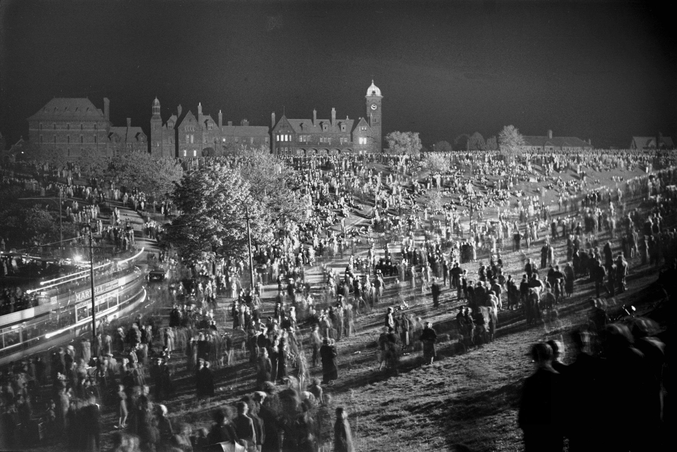
|
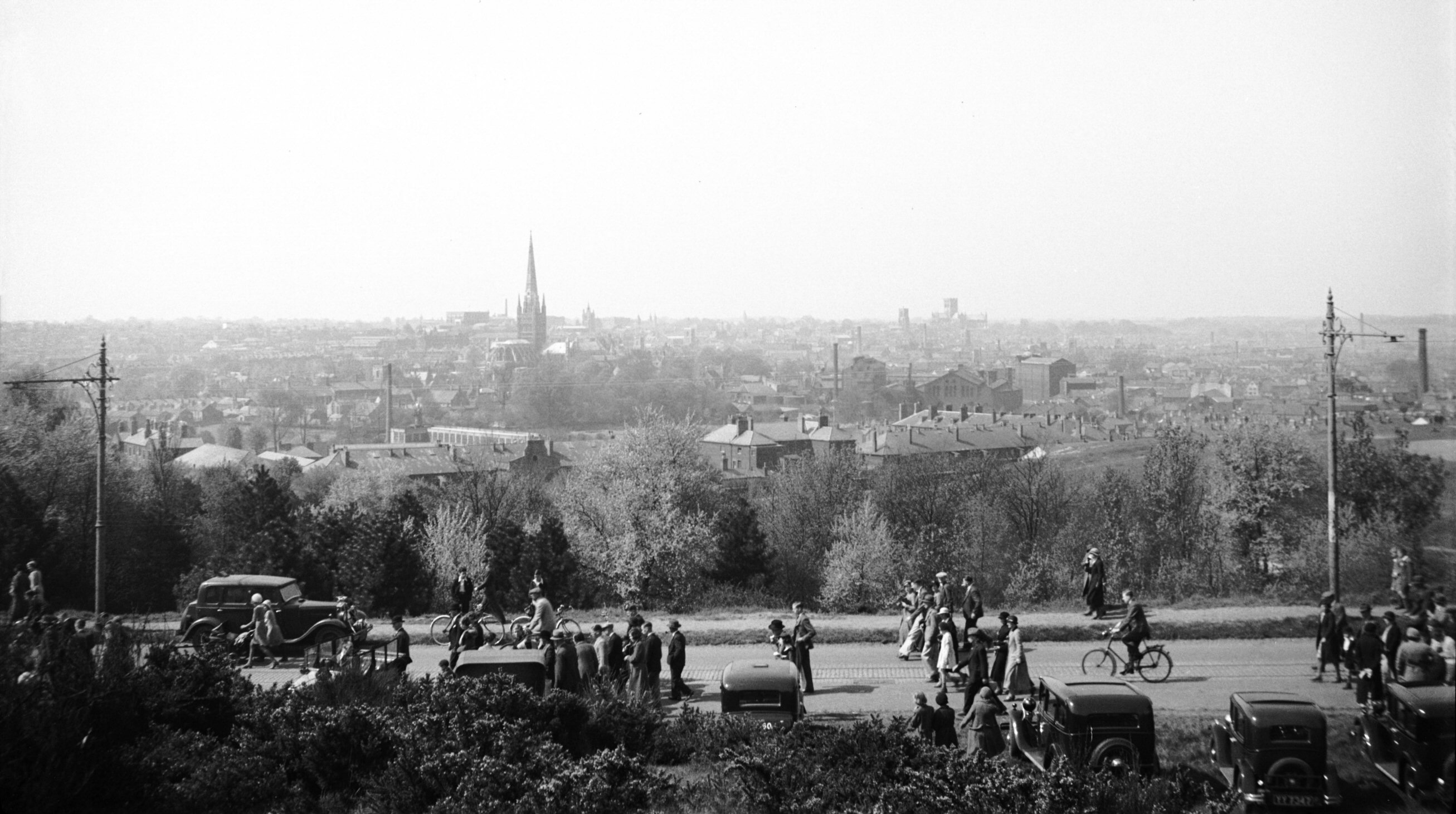
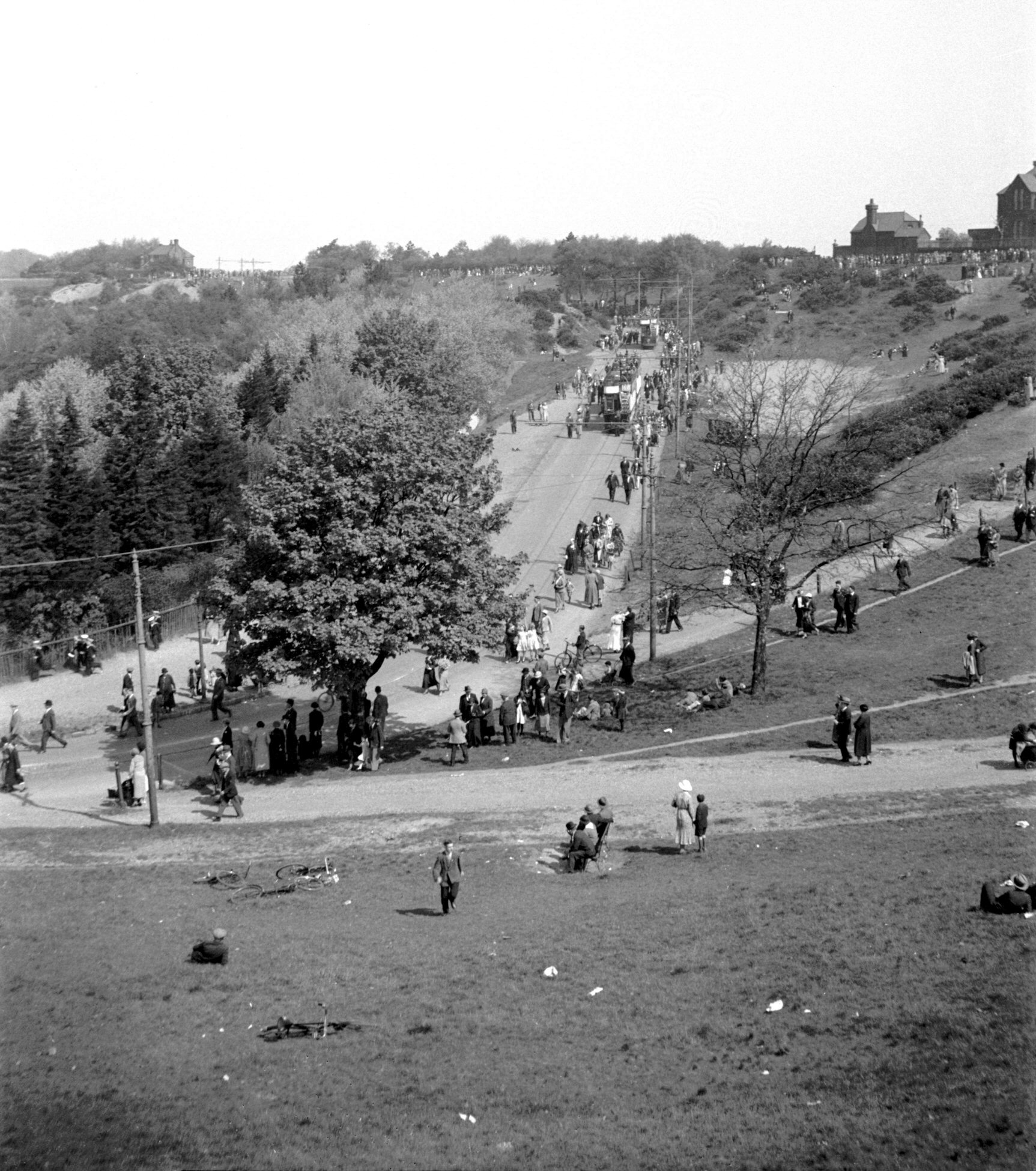
Silver Jubilee Gurney Rd spectators trams [0551]
1935-05-06
Spectators returning to the city after watching the
Review of Troops. |
|
|
Silver Jubilee St James' Hill bonfire 1 [0537]
1935-05-06
|
|
|
Silver Jubilee St James' Hill bonfire 2 [0538]
1935-05-06
|
|
|
Silver Jubilee St James' Hill bonfire 3 [0539]
1935-05-06
|
|
|
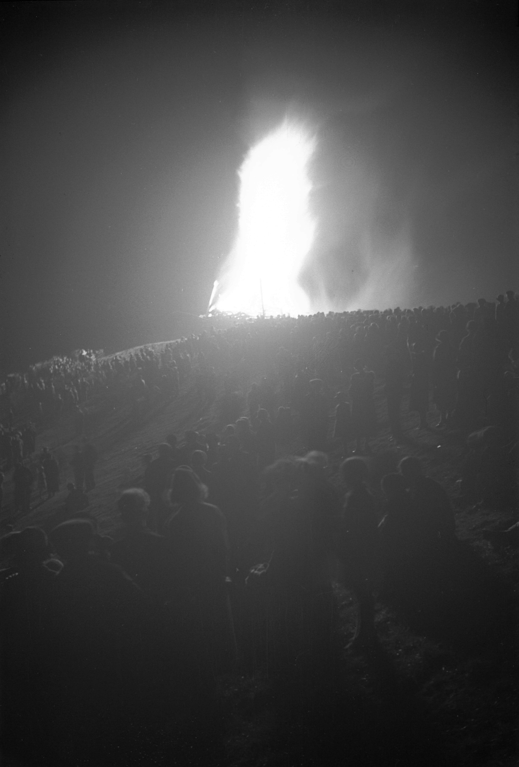
Silver Jubilee St James' Hill bonfire crowd [0540]
1935-05-06
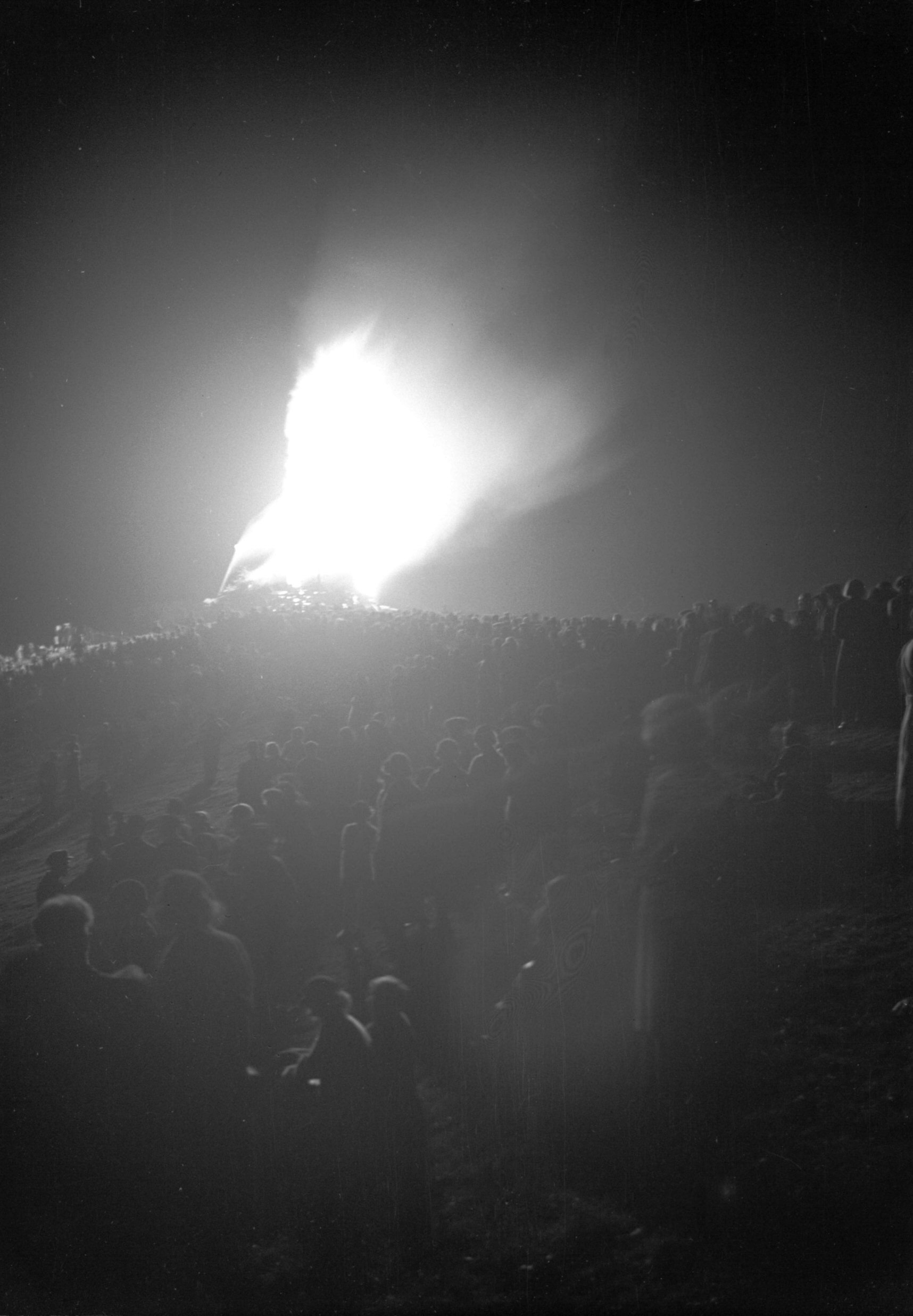
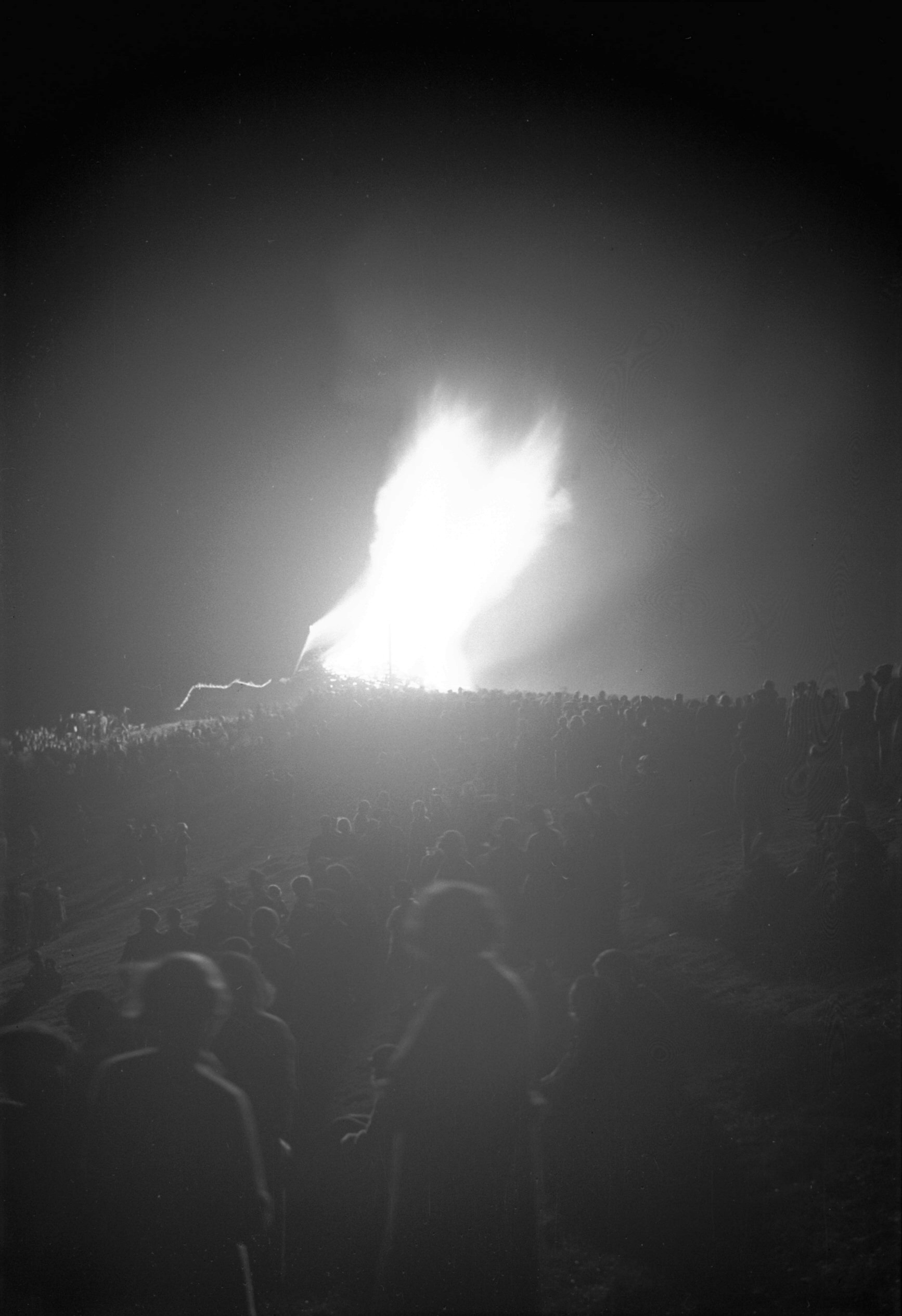
The Beacon, built on St James' Hill near the Britannia
Barracks by the Norwich Boy Scouts was lit at 10pm by the
Lord Mayor as his last official act on Jubilee Day. This
was one of a large chain of beacons throughout the
County, and at the time of lighting it a rocket of the
Scout colours - yellow green and red - was fired. The
fire blazed to a great height and could be seen from many
parts of the city. The event itself attracted a vast
crowd of many thousands to the hill, and as the beacon
got well alight it became bright enough for the smallest
newspaper print to be read on practically any part of the
hill where the fire cast its glare. |
|
|
Coronation St James' Hill beacon before lit [1564]
1937-05-09
Built by the Norwich Boy Scouts from slum-clearance
materials. |
|
|
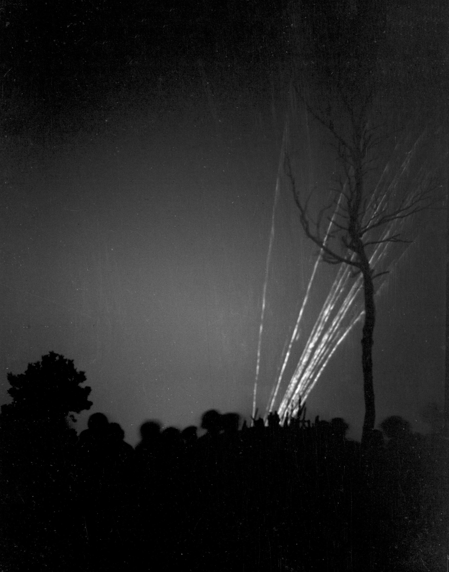
Coronation St James' Hill rockets [1612] 1937-05-12
At 9:30pm the Diamond Fireworks Company of Ipswich gave a
display on St James' Hill which lasted for about an hour.
Unfortunately, owing to rain penetrating the tent in
which they had been stored, some of the set-pieces did
not completely light up. Nevertheless the display was
greatly appreciated. The beacon, which had been built by
the Norwich Boy Scouts, was lit by the Acting Lord Mayor
at 10:30pm as the concluding item of an eventful day. |
|
|
Coronation St James' Hill beacon [1613] 1937-05-12
|
|
|
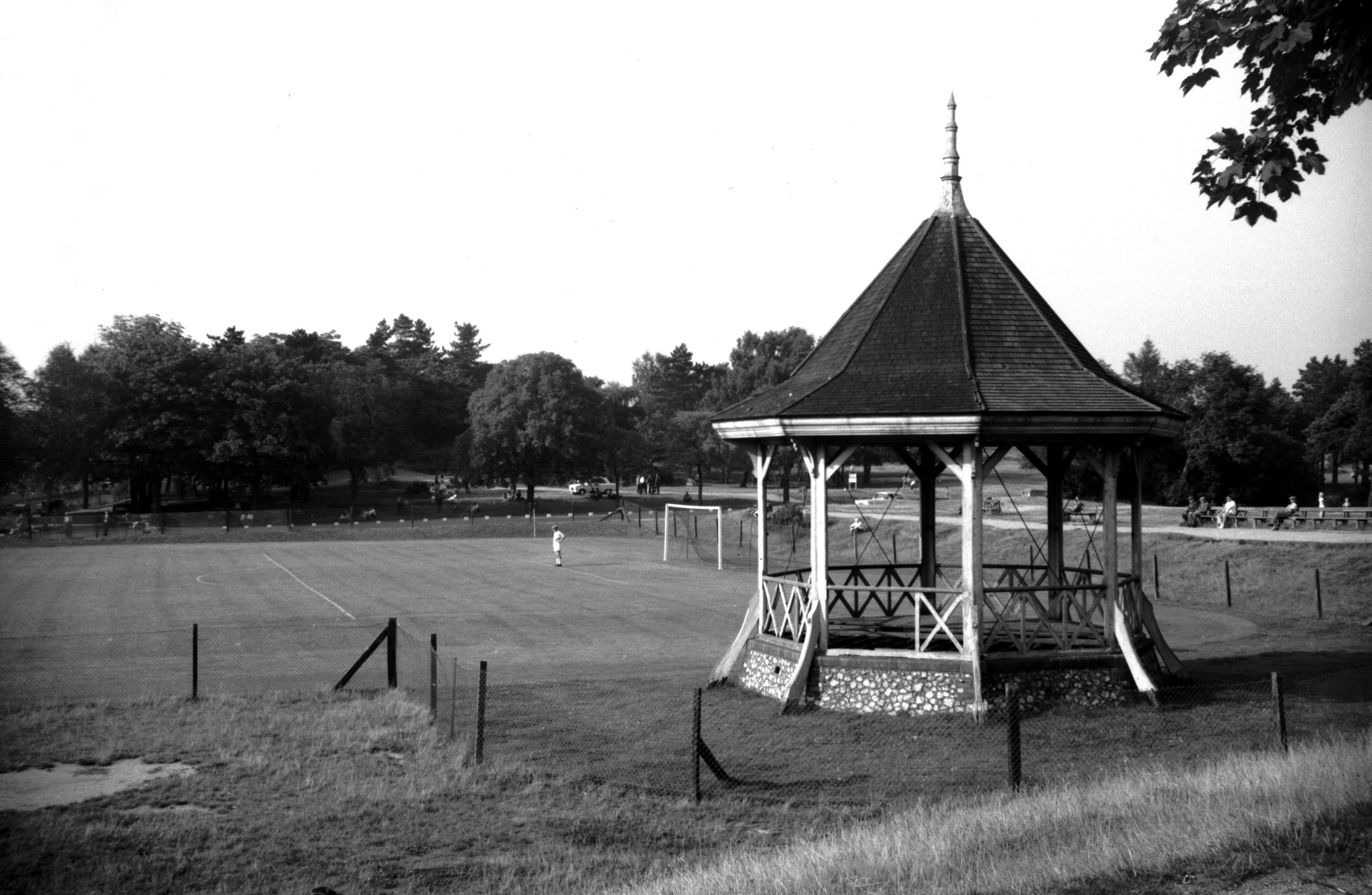
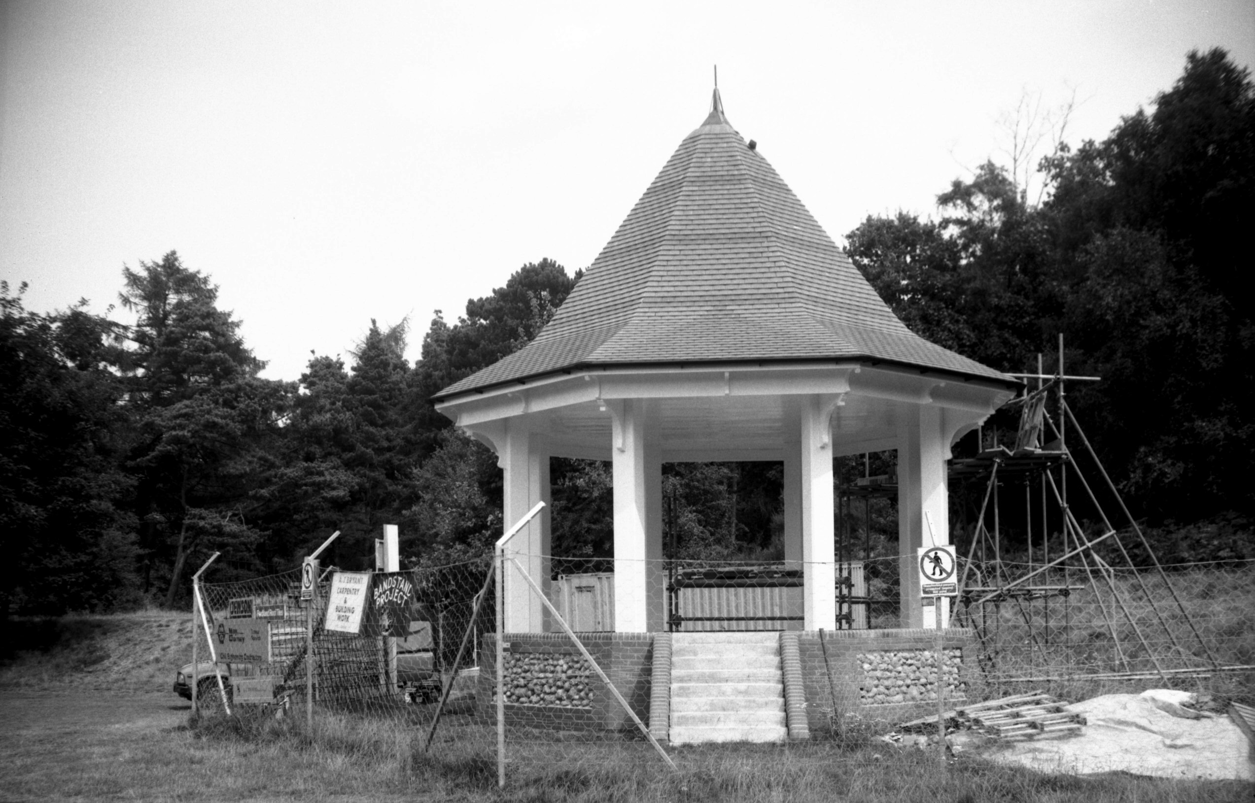
Mousehold bandstand before demolition [4642]
1961-09-02
Erected in Victorian times, it was decided in 1961 that
the band stand would have to be demolished as Chapel
Field Gardens was then said to be the only place in the
city where people would attend to listen to a band.
Rebuilt in 1992 from subscriptions raised by the
Mousehold Heath Defenders. |
|
|
Mousehold tea pavilion Gurney Rd [6478] 1987-07-01
|
|
|
Mousehold bandstand construction [6903] 1992-08-10
|
|
Hall Rd: |
| |
From
Queen's Rd to Ipswich Rd
passing Southwell Rd, Hospital
Lane, Mansfield Lane, Barrett
Rd, Lakenham Rd, Sandy
Lane
East side |
|
|
Hall Rd Barrett Rd Tuckswood Inn [B516] 1933-04-08
|
|
|
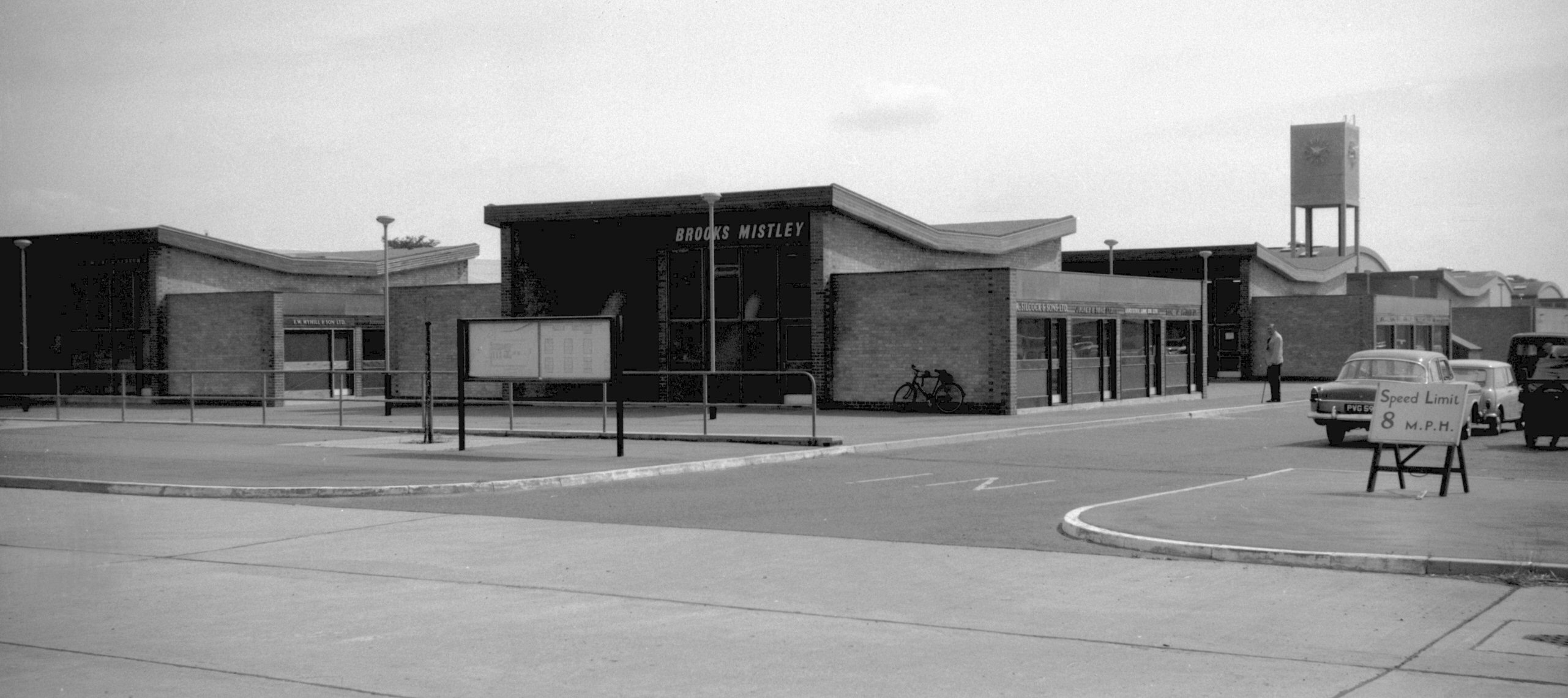
New Cattle Market view from entrance [4682]
1962-06-23
Opened at Harford, 1st July 1960. |
|
|
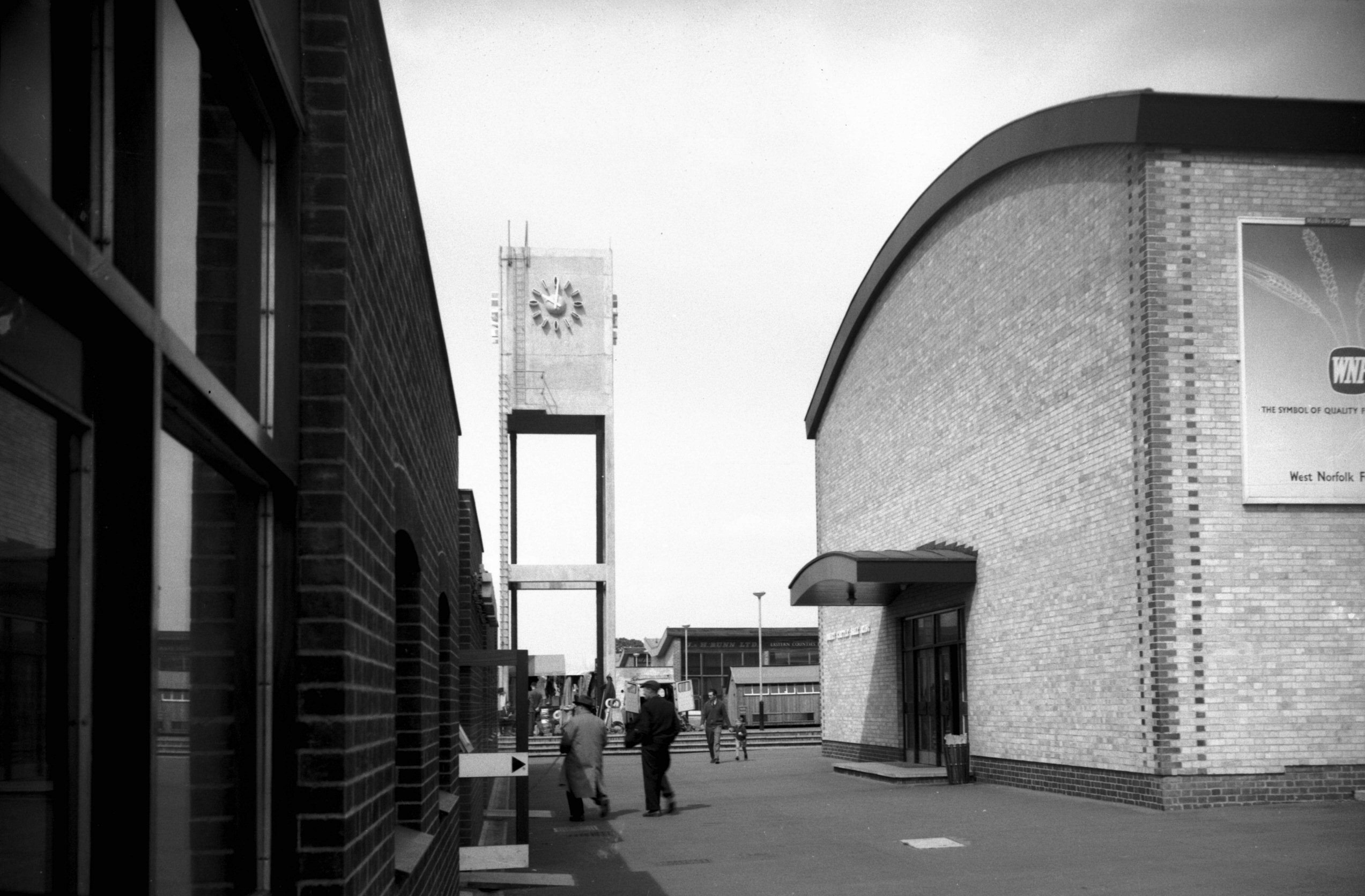
New Cattle Market clock tower and sale ring [4681]
1962-06-23
Dairy cattle sale ring. |
|
|
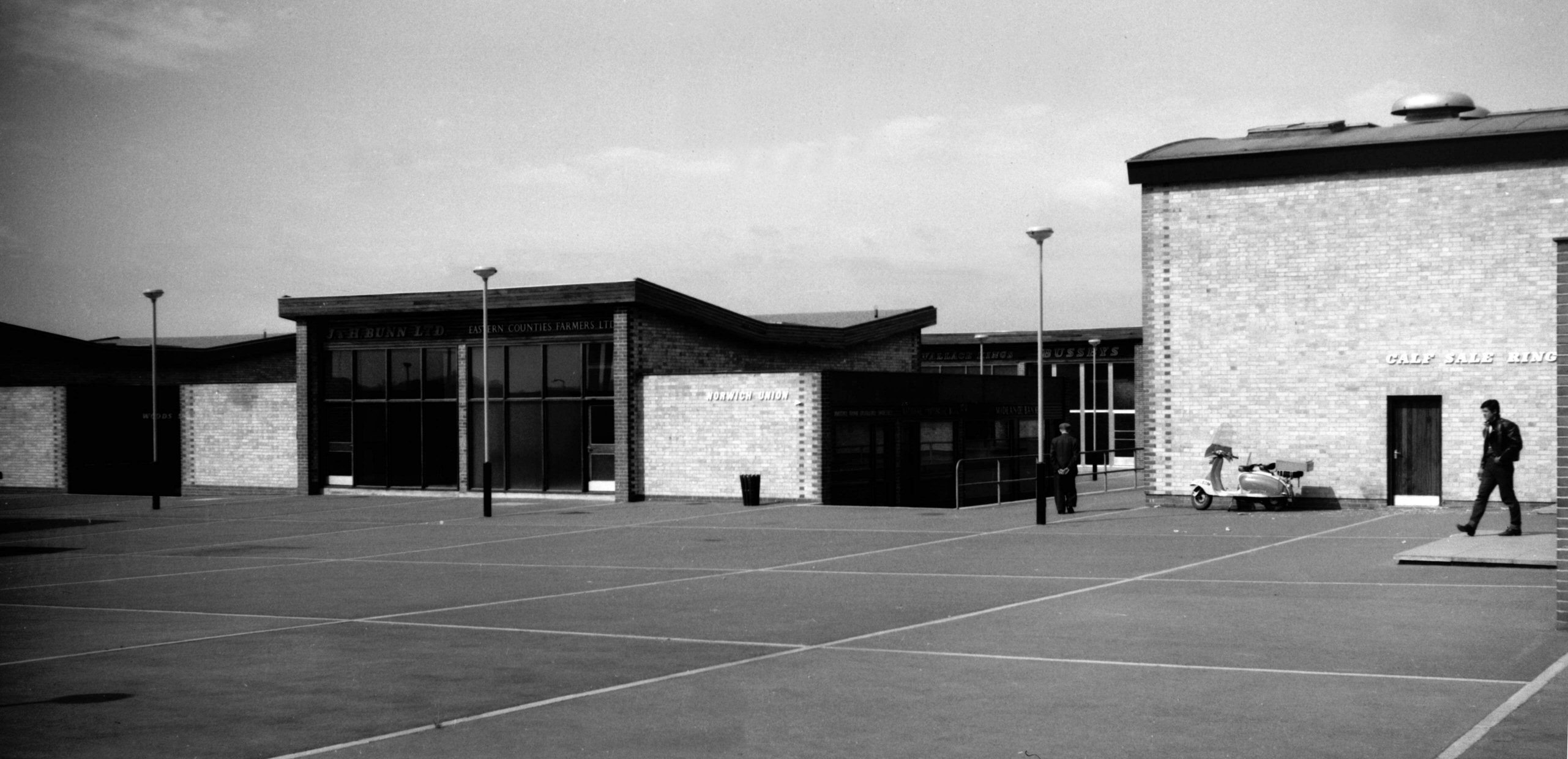
New Cattle Market shops and offices [4680] 1962-06-23
|
|
|
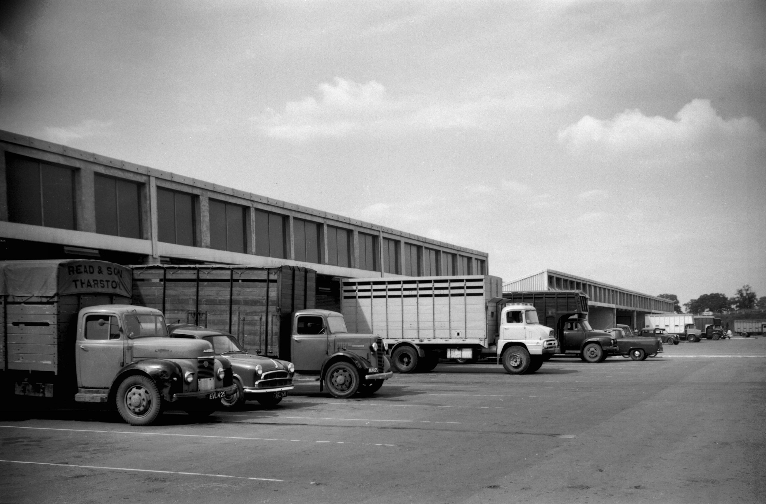
New Cattle Market trucks at unloading bays [4679]
1962-06-23
|
|
|
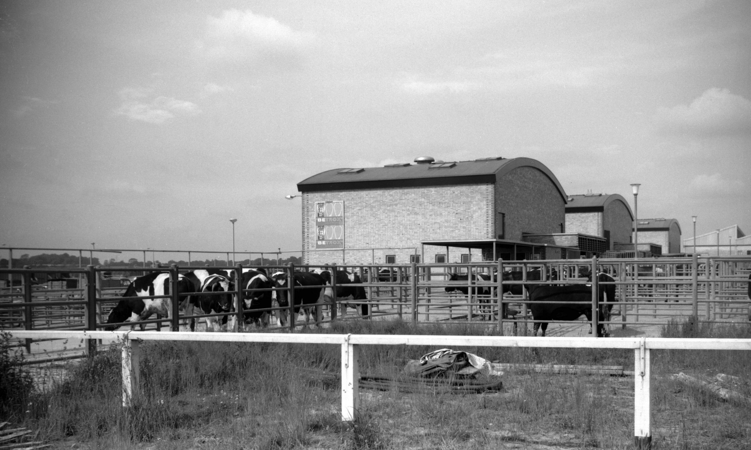
New Cattle Market cattle pens [4678] 1962-06-23
Store and fat cattle sale rings, behind the cattle pens. |
|
Hardy Rd: |
| |
From
Carrow Rd
East side |
|
|
Hardy Rd Railway Cottages 9 to 12 [6471] 1987-06-05
Built 1860 to house workers on the adjoining railway. |
|
|
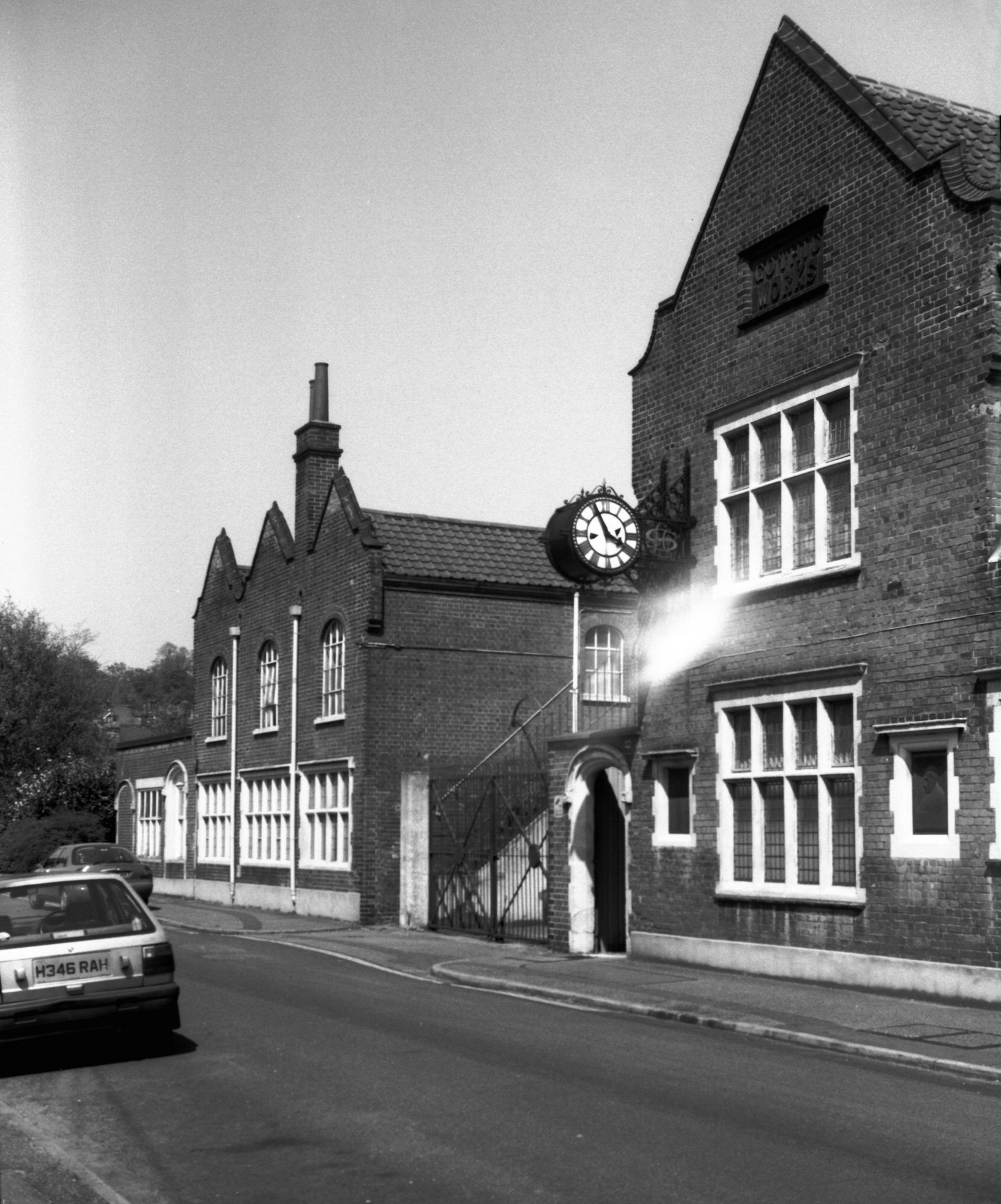
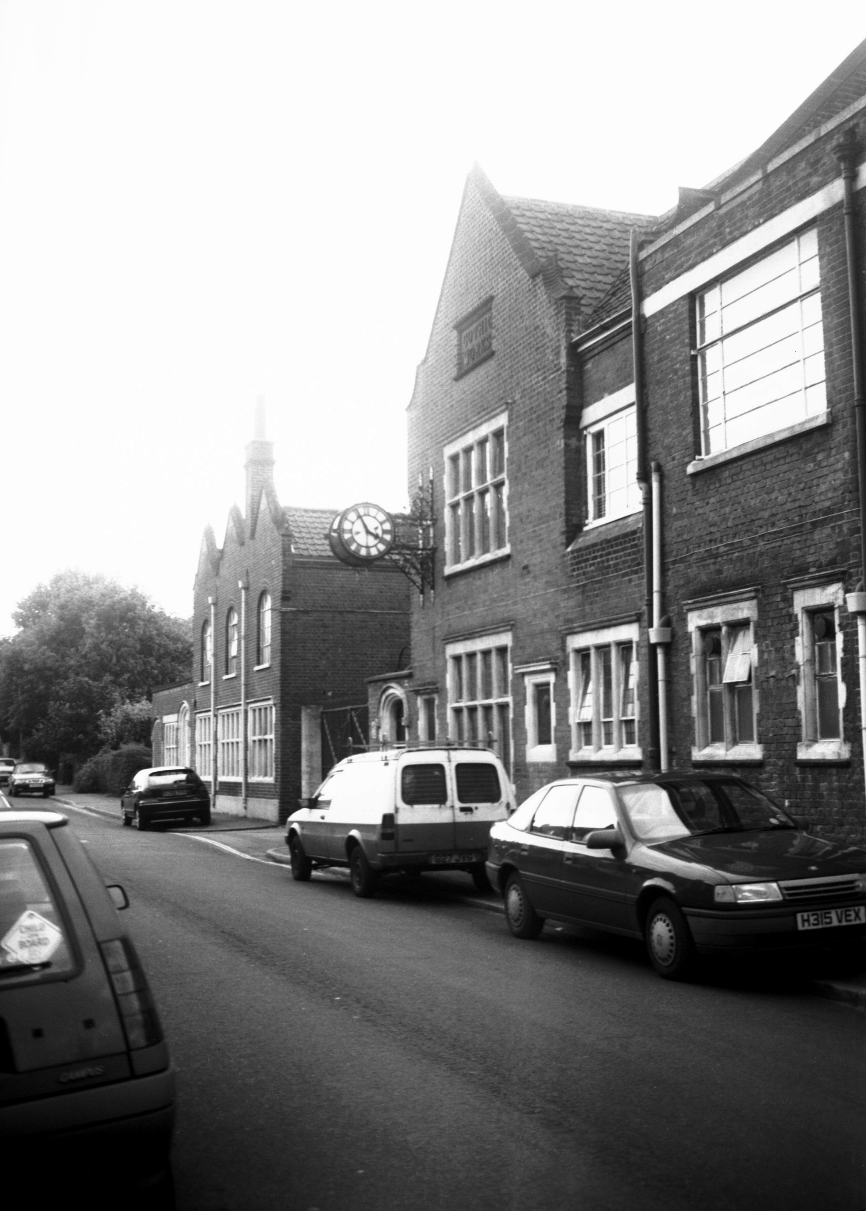
Hardy Rd Laurence Scott Gothic Works [7823]
2001-05-10
|
|
|
Hardy Rd Laurence Scott Gothic Works [7825]
2001-05-20
Opened 1898. |
|
|
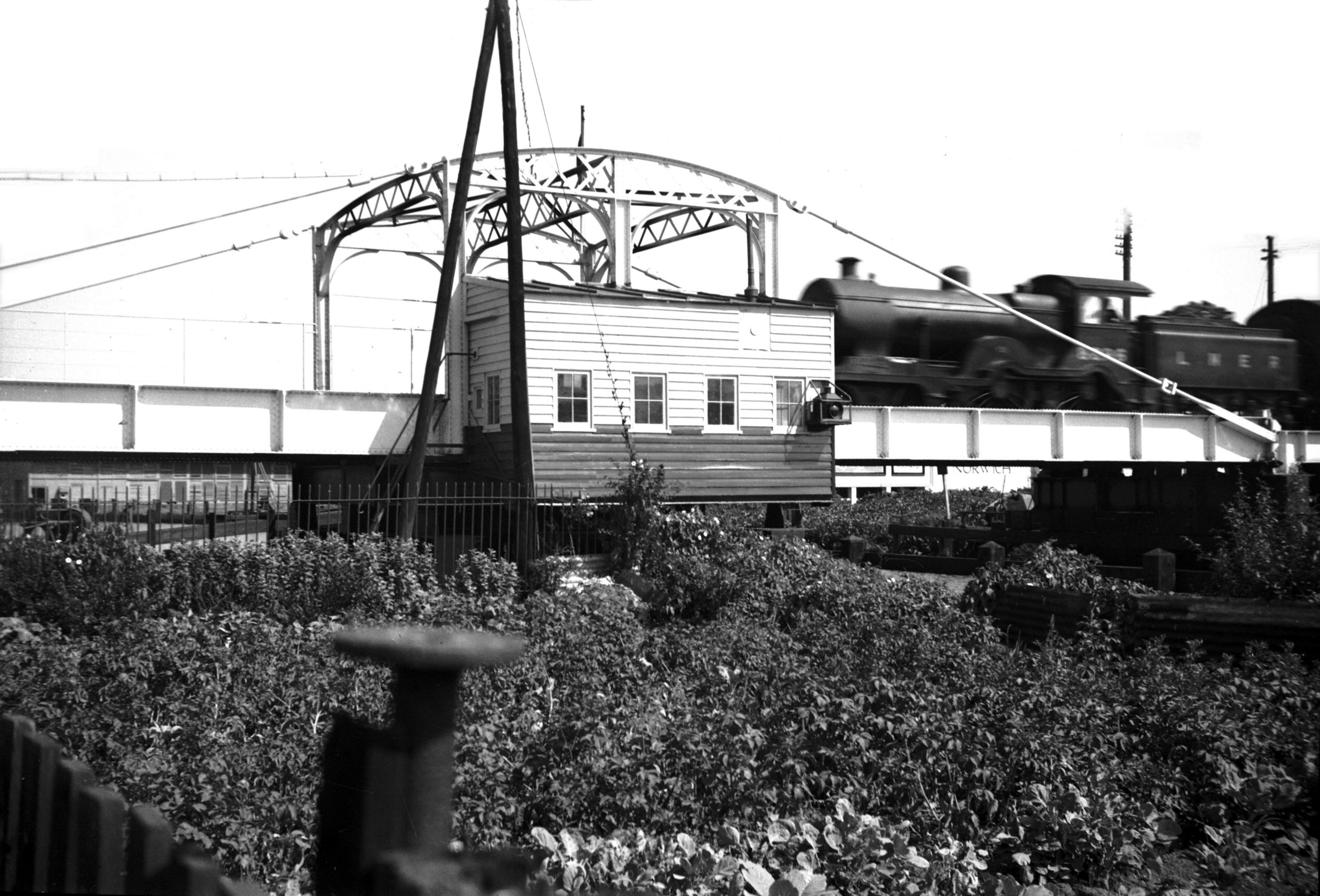
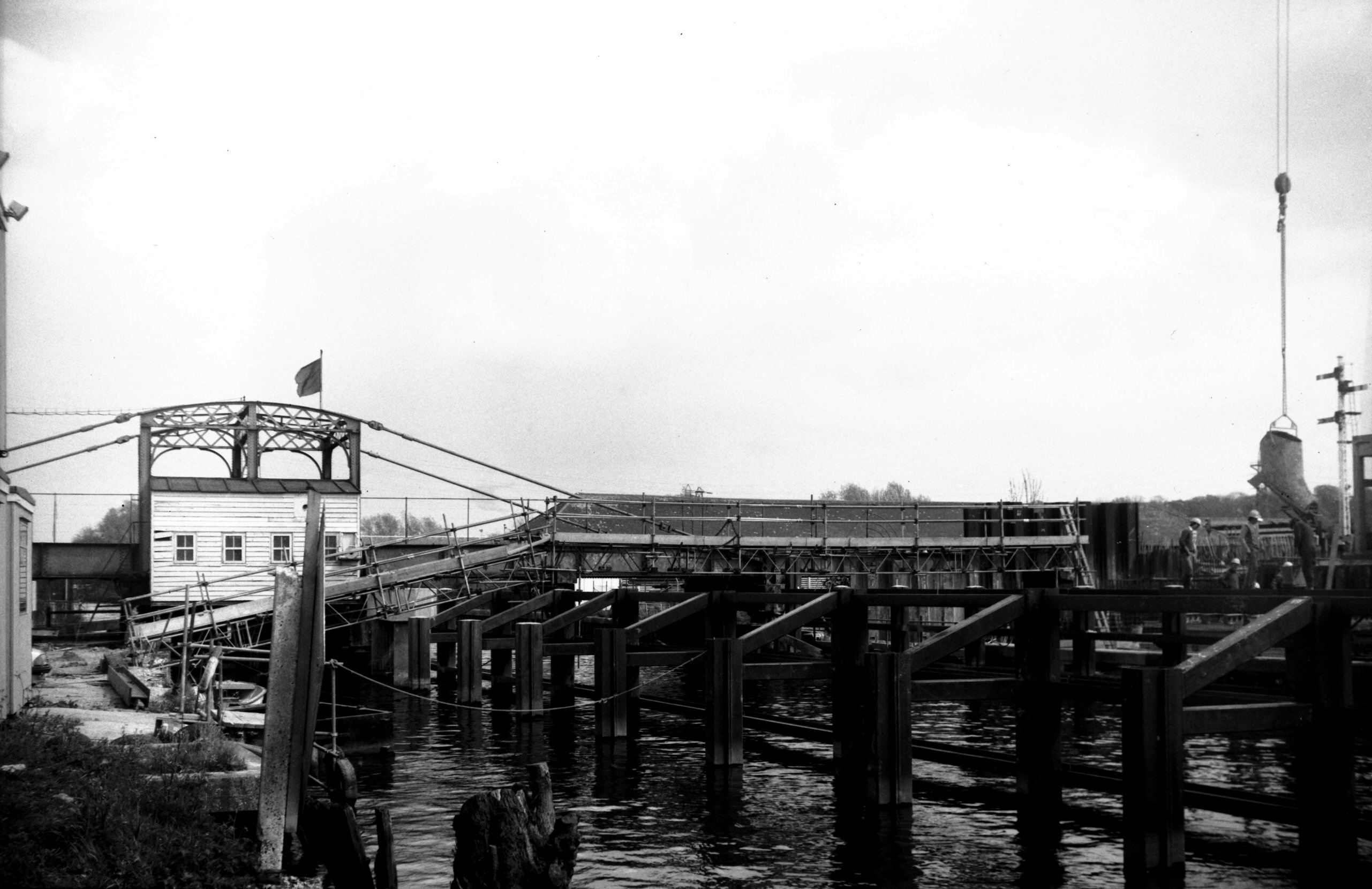
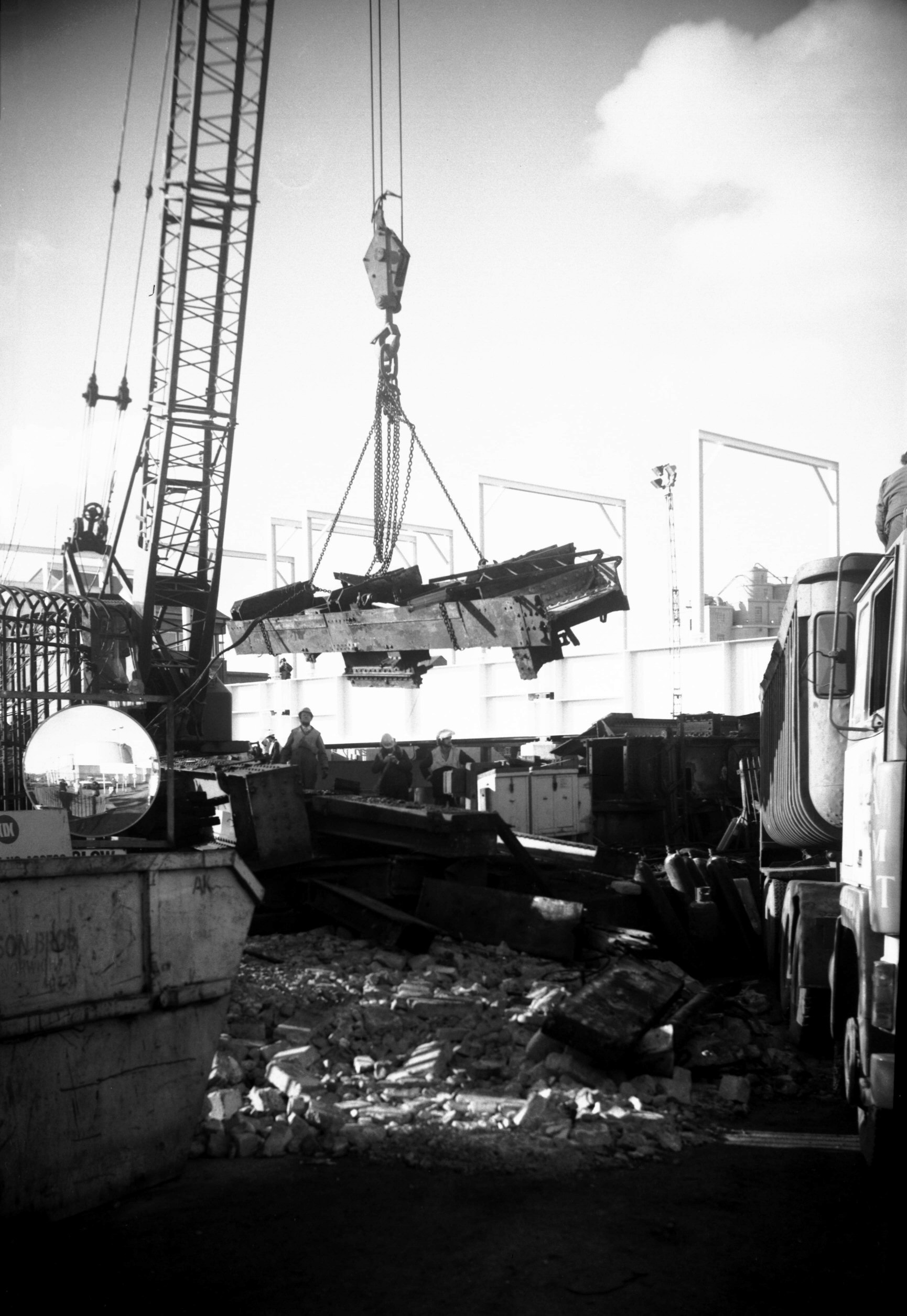
Wensum Trowse rail bridge with train [0605]
1935-08-05
The first through line to London via Brandon and Ely was
opened on 30th July 1845. Owing to some delay in the
completion of the single-line swing bridge, the first
train started from Trowse. A later double-track structure
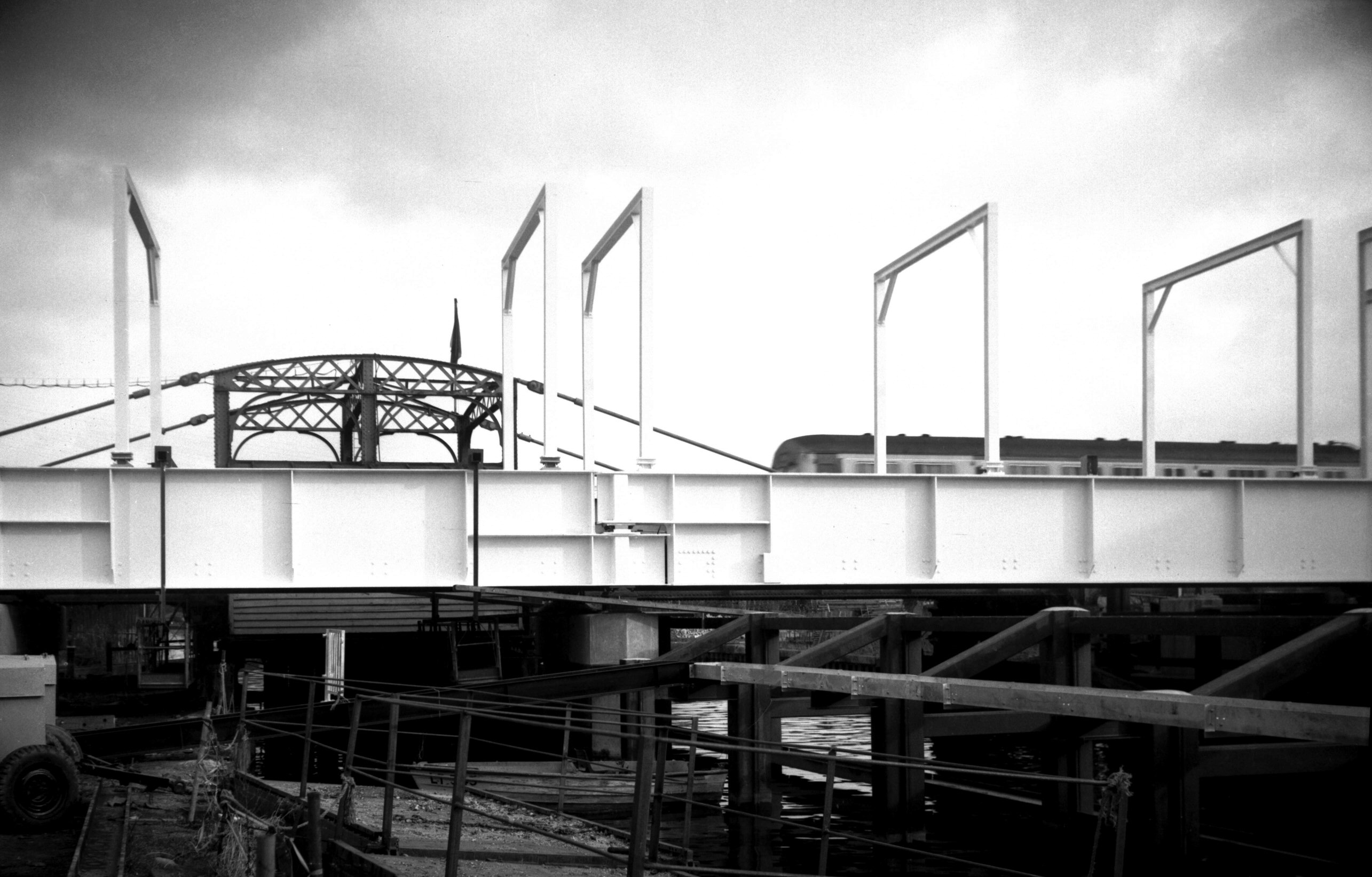
was opened in 1905. The present swing bridge was built in
connection with the electrification of the line from
London in 1986-7. Its specially designed swing-deck is
the only one in the world capable of carrying 25000 Volt
overhead cables. It has a single track allowing trains to
travel at 40 mph instead of the 15 mph restriction of the
previous bridge. The first train (drawn by a diesel
locomotive) crossed on 15th February 1987. |
|
|
Wensum Trowse rail bridge construction [6360]
1986-05-08
|
|
|
Wensum Trowse rail bridge construction [6361]
1986-05-08
|
|
|
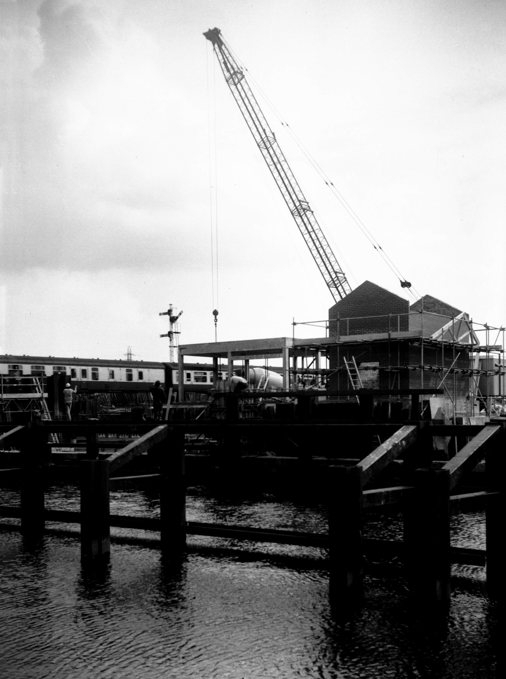
Wensum Trowse rail bridge construction [6430]
1987-02-07
|
|
|
Wensum Trowse rail bridge construction [6431]
1987-02-07
|
|
|
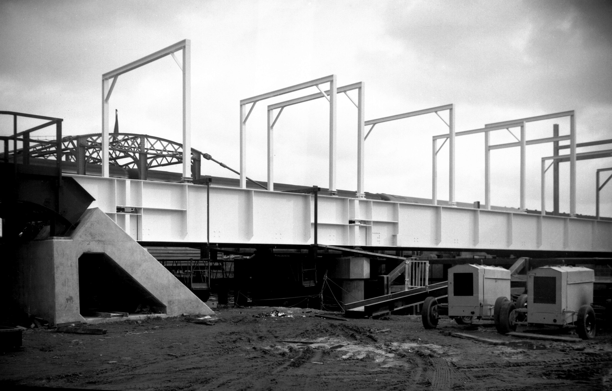
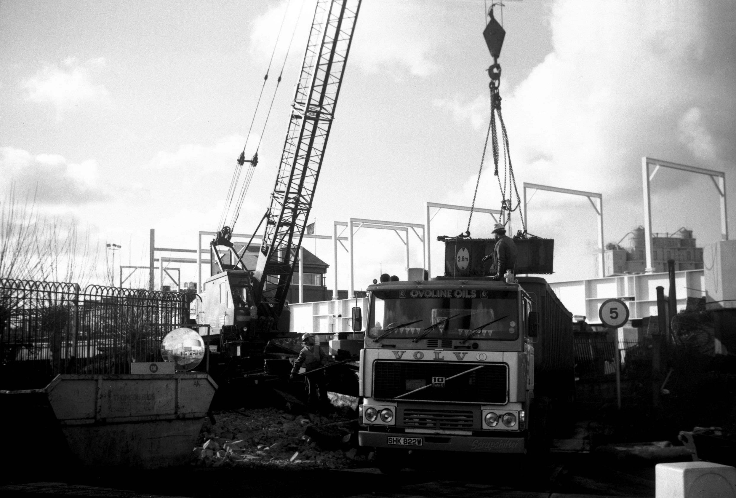
Wensum Trowse old rail bridge demolition [6433]
1987-02-15
|
|
|
Wensum Trowse old rail bridge demolition [6434]
1987-02-15
|
|
|
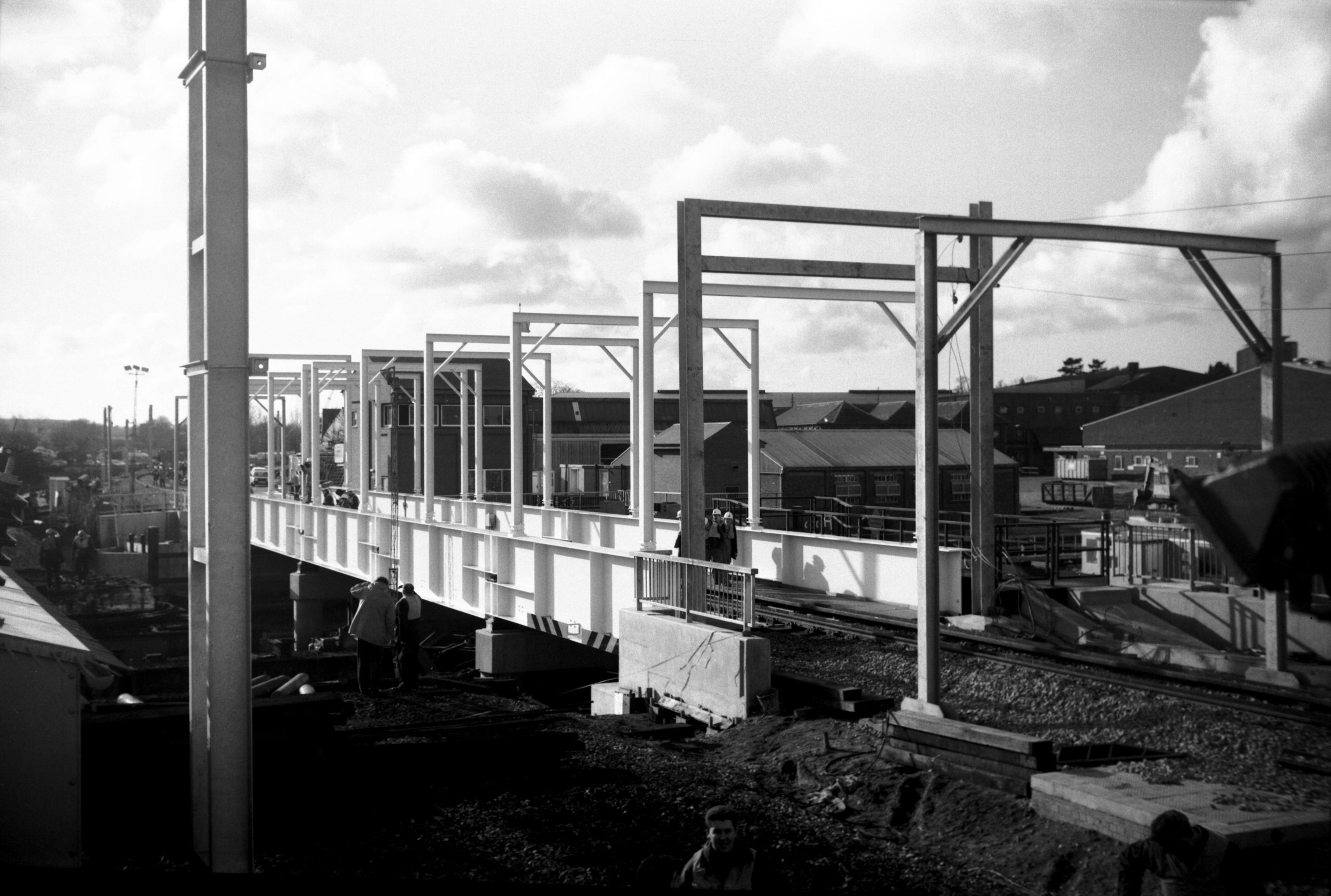
Wensum Trowse new rail bridge [6435] 1987-02-15
|
|
Hardley Cross: |
|
|
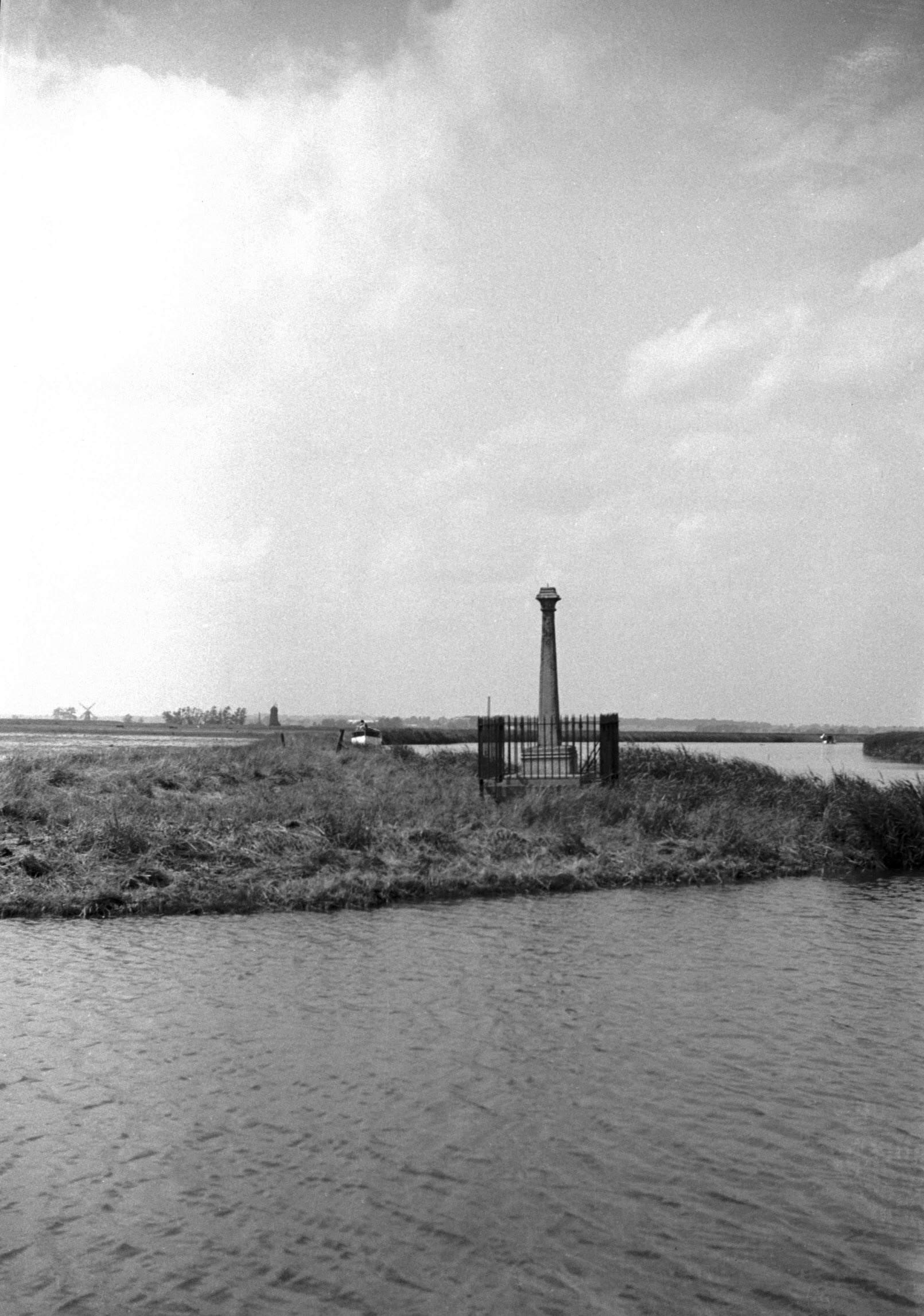
Yare river Hardley Cross [1765] 1937-07-11
Hardley Cross: at the junction of the river Chet with the
Yare. It marks the limit of the jurisdiction of the City
of Norwich. Probably settled in the 15c as a result of a
dispute between the City and Great Yarmouth. Shaft may
date from 1676 when it was restored.
Other Norwich boundary crosses (not photographed) were
at:
Trowse Bridge Cross: stated to be "in ye myddes of
Trous brigge".
Carrow Cross: at the junction of Bracondale and King St
"where Carrow stocks once stood".
Malkeny's or Our Lady's Cross: probably between Hall Rd
and Grove Rd.
Needham Cross: "right south of the towne agenst
Nedeham Houses" (Nedeham Gates were St Stephen's
Gates).
Nether Erlam Cross.
Catton Cross: "in the highway towards Catton".
Sprowston or Magdalen Cross: on the north of the hospital
of St Mary Magdalen (the Lazar house).
Thorpe Wood Cross: "in a certain way below a wood
called Thorpe Wode which leads from Norwich to Possewyk
over the hill called 'Leonardes Hyll'". |
|
Harvey Lane: |
| |
From
Thorpe Rd to Plumstead Rd / Heartsease Lane
passing Thorpe St
Andrew
West side |
|
|
Harvey Lane at Thorpe Rd [B774] 1933-09-10
Because of the railway, river and extensive industrial
development, the south-eastern section had to take a
devious route via Thorpe Rd, Carrow Rd, King St and
Bracondale. |
|
|
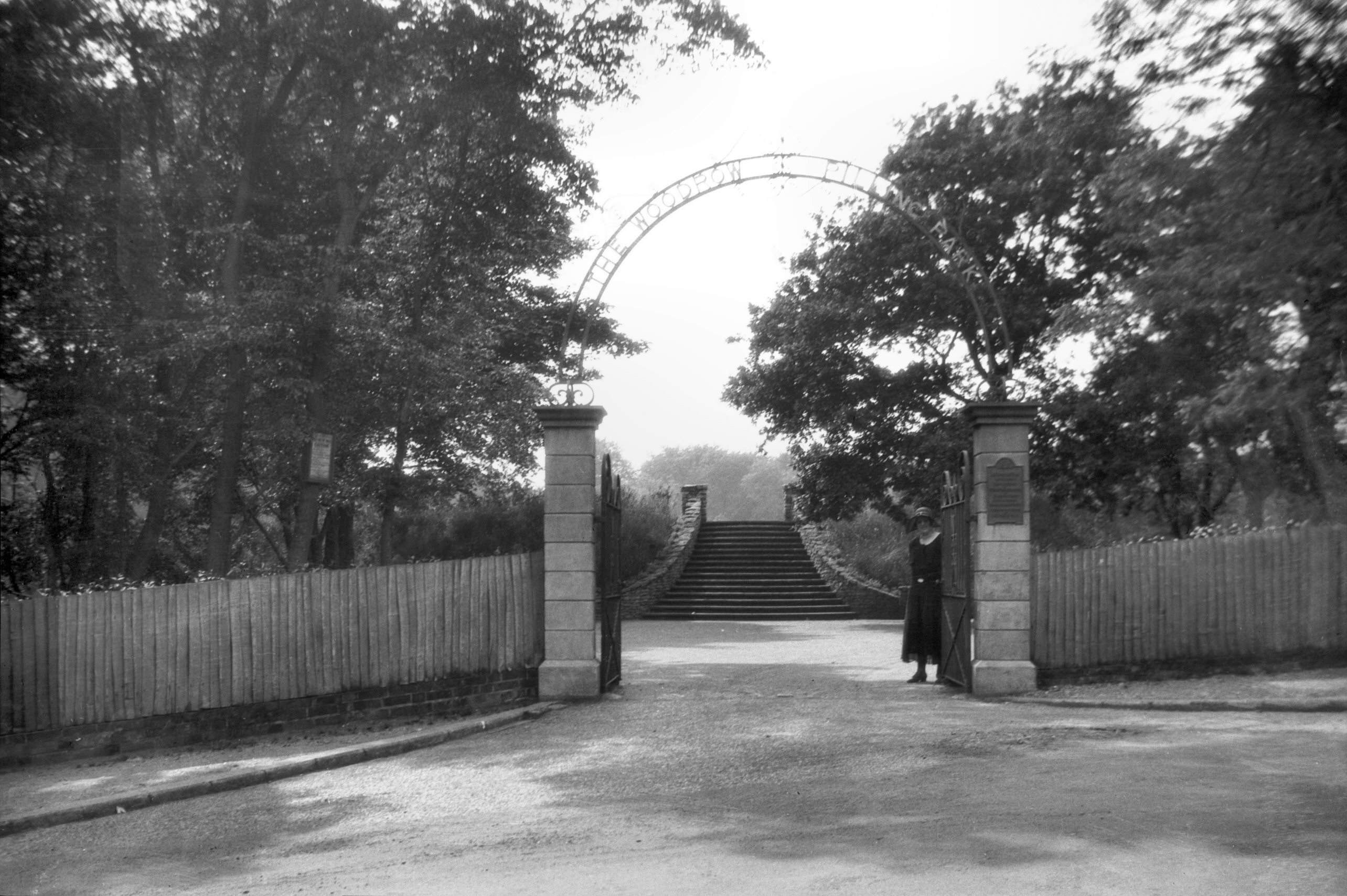
Woodrow Pilling Park Harvey Lane entrance [B313]
1932-06-11
Presented by Mrs Pilling in memory of her father,
Jeremiah Woodrow, a freeman of the City. Opened by
H.R.H.Princess Mary 29th June 1929. |
|
|
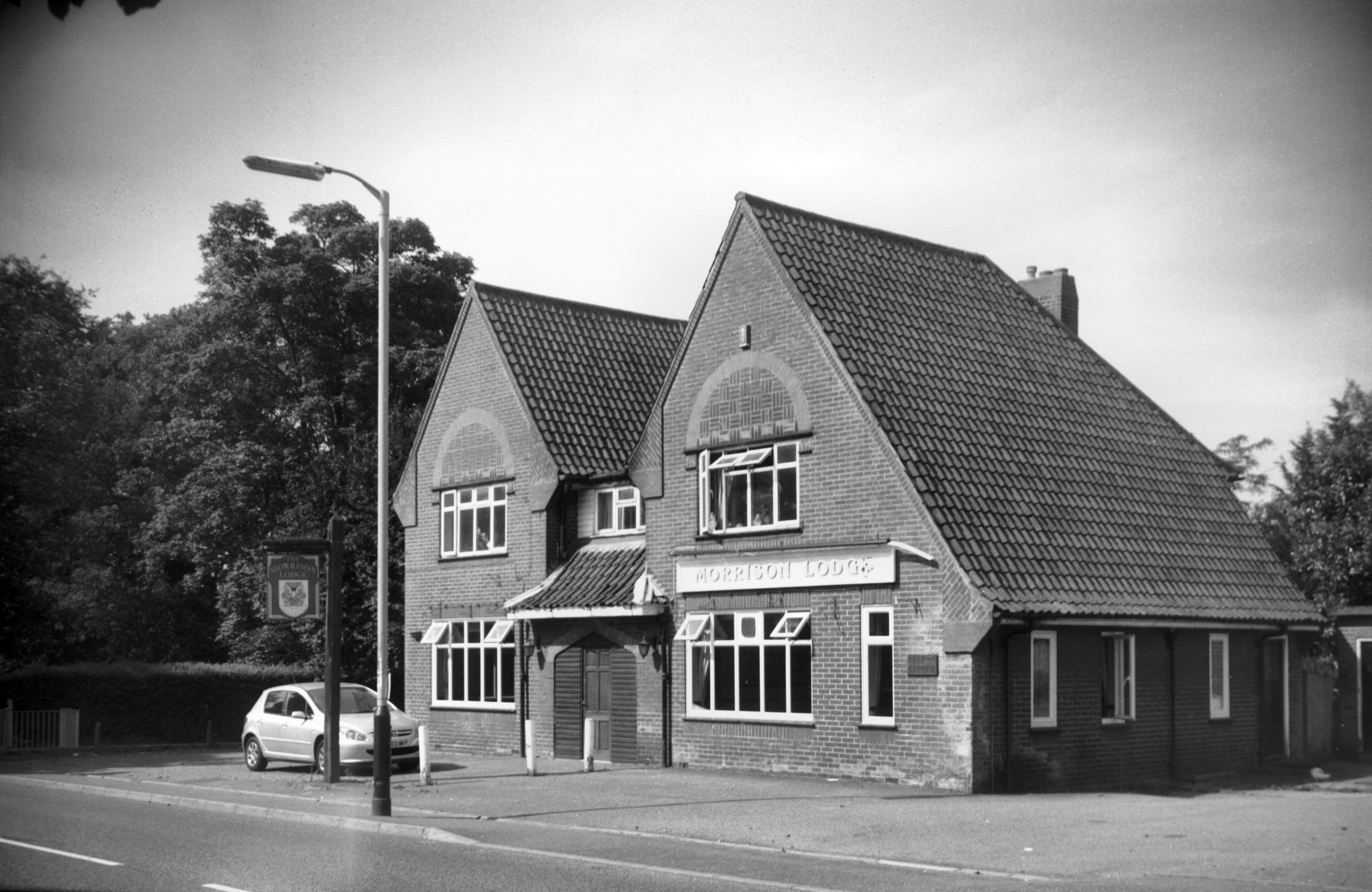
Harvey Lane 19 Morrison Lodge PH [7949] 2004-06-08
|
|
|
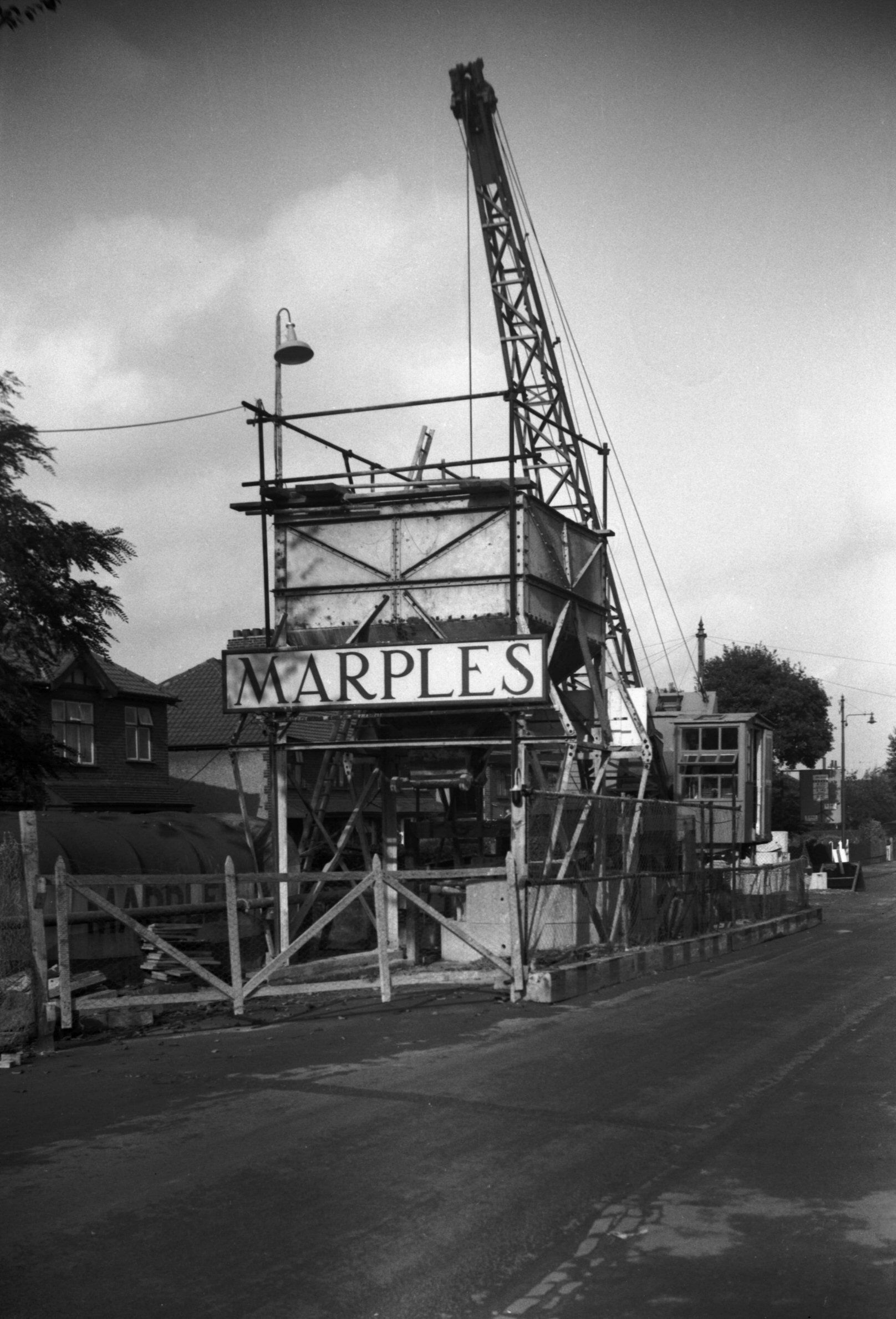
Harvey Lane Heartsease surface drainage [4225]
1953-10-25
As it was seen that all the land available in the city
for house-building would be utilised within a few years,
and area to the north-east (including the old Mousehold
Aerodrome site) was in 1950 brought within the city
boundary. Before houses could be erected, arrangements
for linking the site with the sewerage system had to be
made, and in 1953 tunnelling began in Harvey Lane for the
surface drainage. Cranes in Harvey Lane were at the heads
of shafts connecting with the tunnel, and were used in
the removal of earth, and the lowering of the pre-cast
concrete segments used in the formation of the drain
walls. |
| |
East
side |
|
|
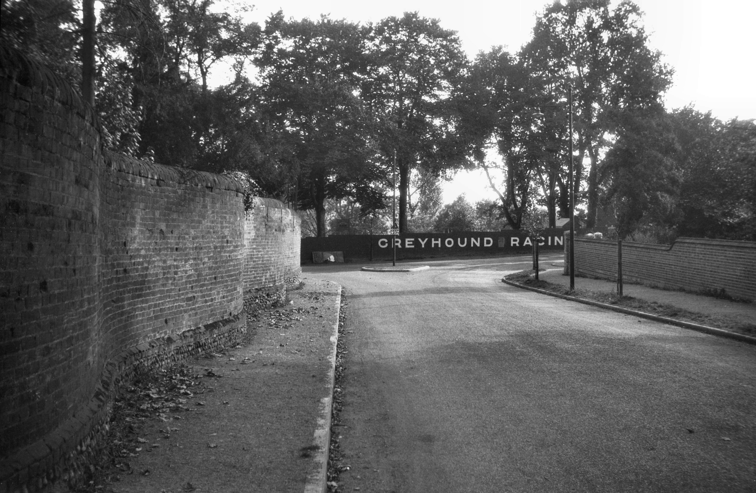
Harvey Lane serpentine wall from Eden Close [6289]
1984-04-24
"Crinkle-crankle" wall, formerly the boundary
of Thorpe Lodge. |
|
|
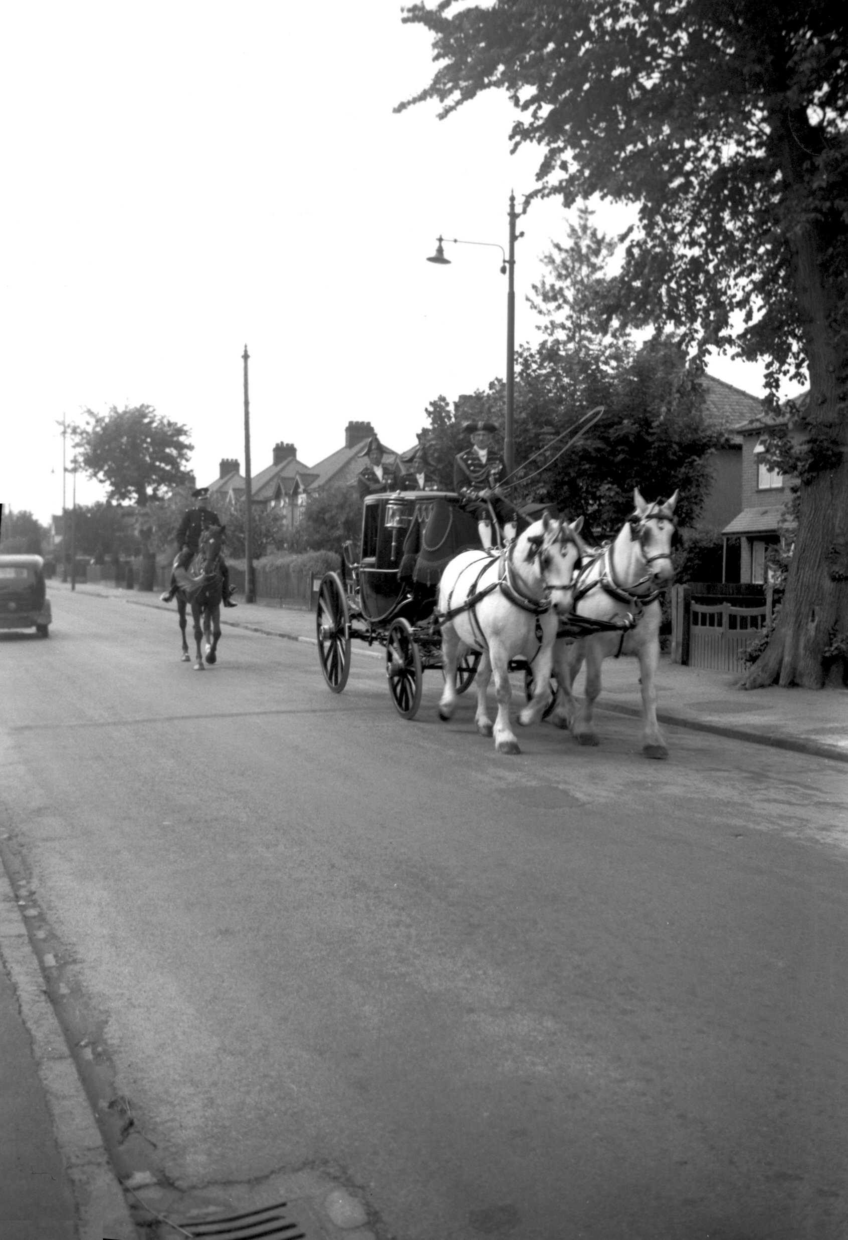
Civic visit Lord Mayor's coach Harvey Lane [4254]
1954-06-06
Civic visit to Cathedral 6th June 1954:
Coach arriving to collect Lord Mayor Councillor H.Allen. |
|
|
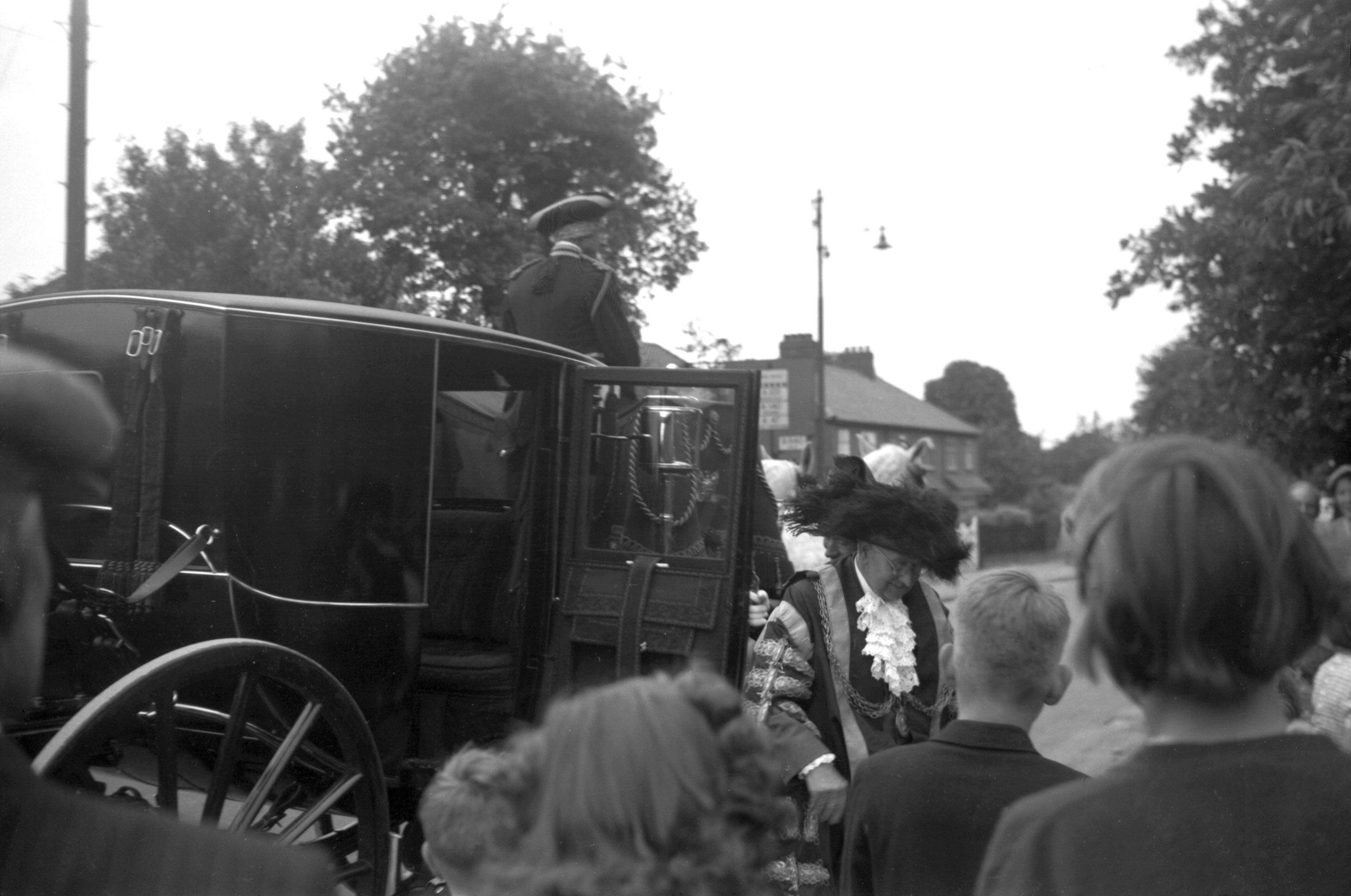
Civic visit Lord Mayor boarding coach [4255]
1954-06-06
|
|
|
Civic visit Lord Mayor returning home [4258]
1954-06-06
|
|
|
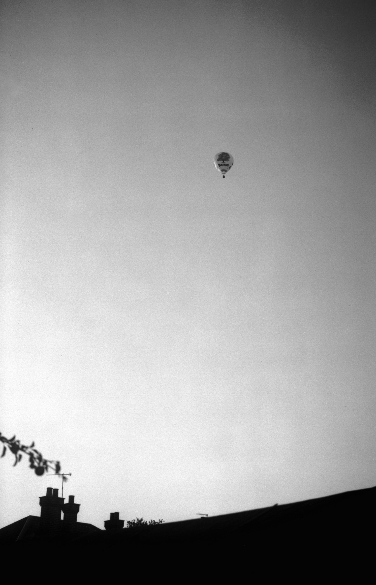
Hot air balloon [6051] 1979-09-15
Floating over the Harvey Lane area. |
|
|
Hot air balloon [6052] 1979-09-15
|
|
|
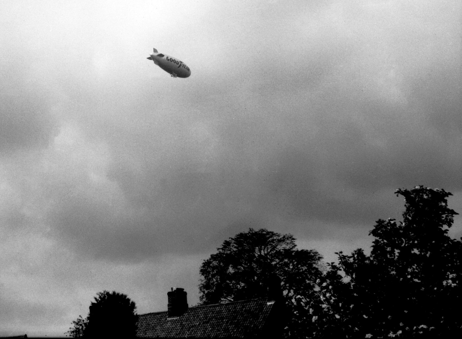
Goodyear airship Europa [6174] 1981-05-14
Floating over the Harvey Lane area. |
|
|
Goodyear airship Europa [6175] 1981-05-14
|