|
Oak St: |
| |
From
Colegate / Coslany
St to St Martin's Rd / Bakers
Rd
passing St Miles Alley, St
Mary's Plain, New Mills Yard, St
Martin's Lane, St Crispin's Rd (formerly Station Rd), Jenkins Lane, Sussex
St, St Martin at Oak Wall
Lane
West side |
|
|
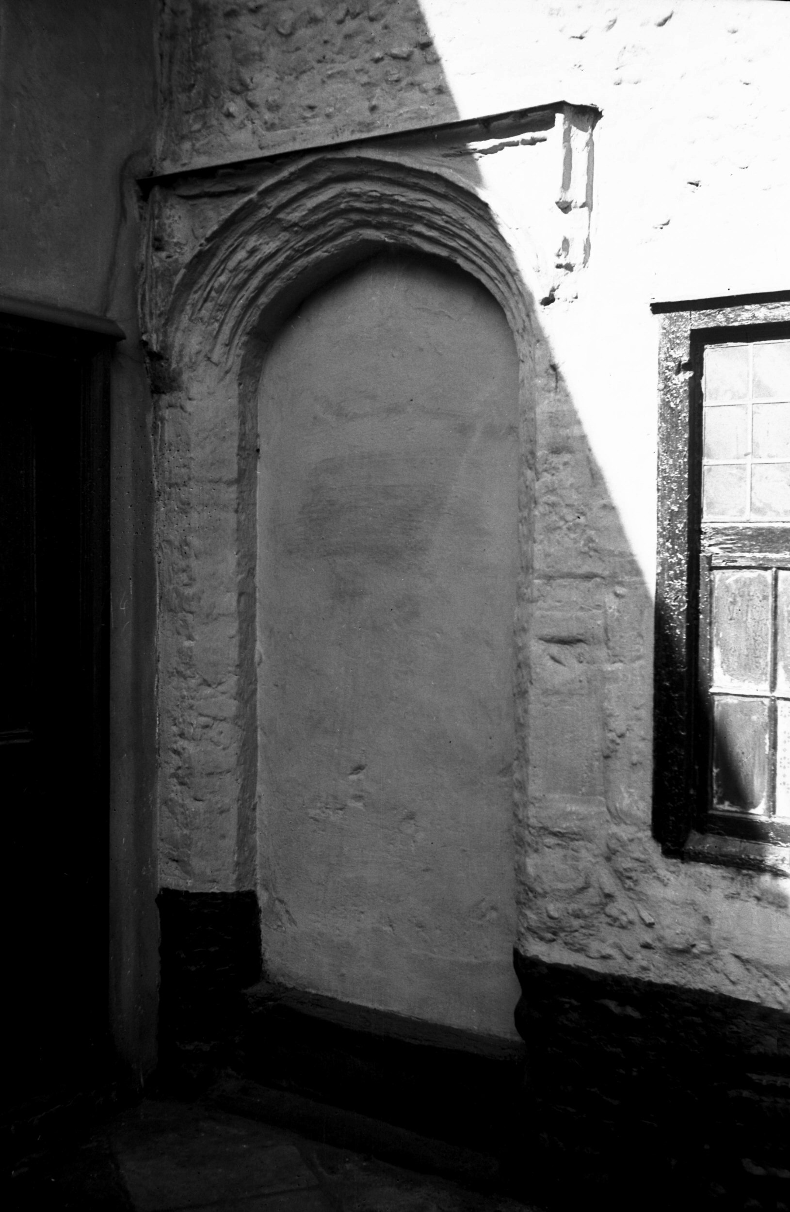
Oak St 1 blocked Tudor doorway [2146] 1938-03-09
|
|
|
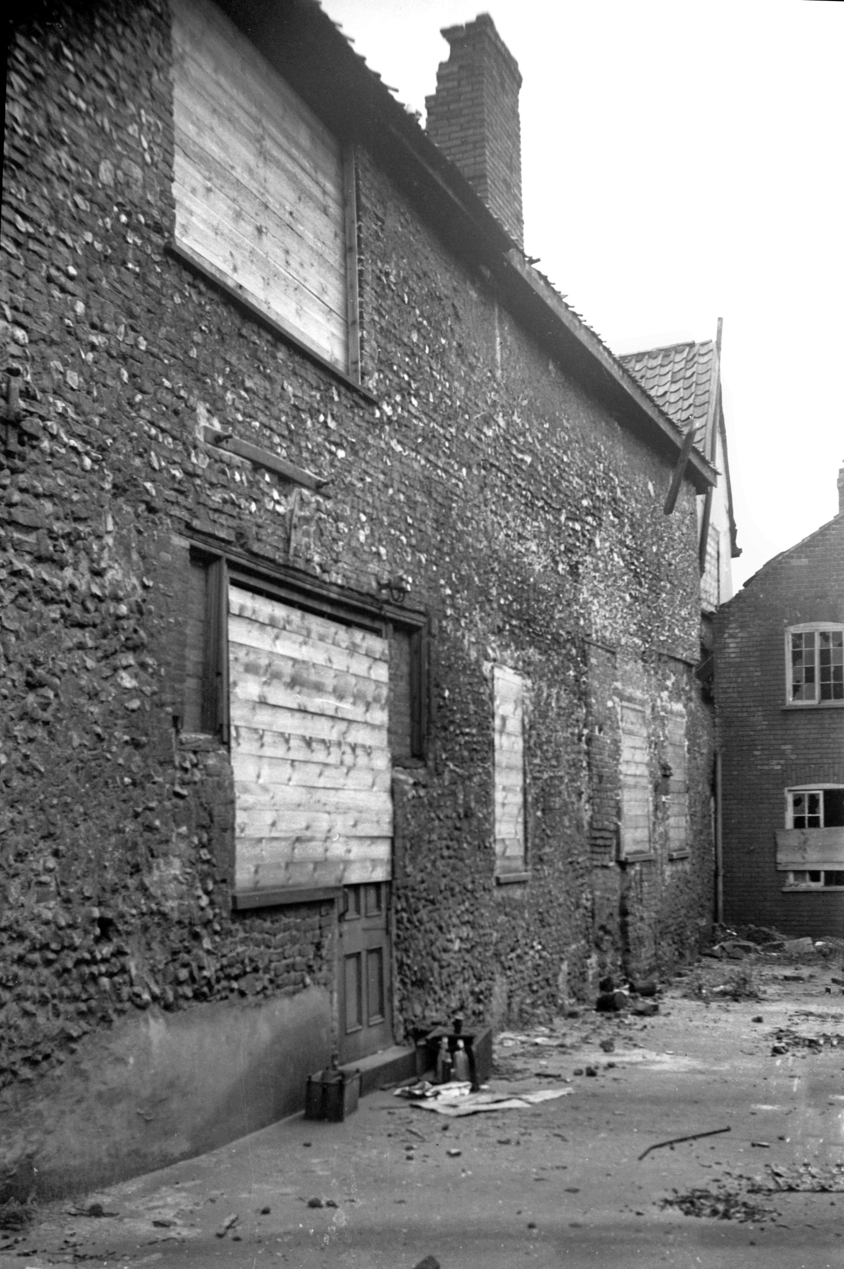
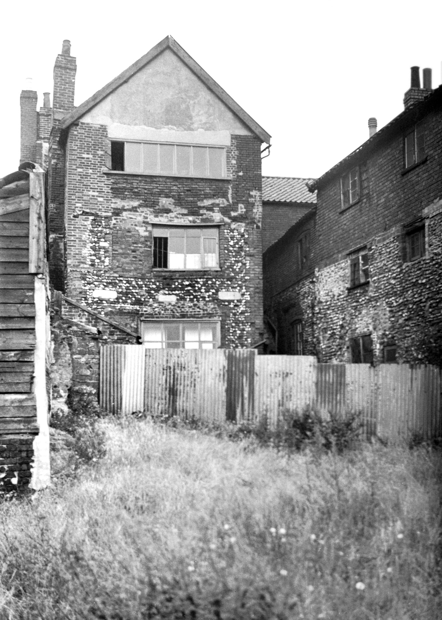
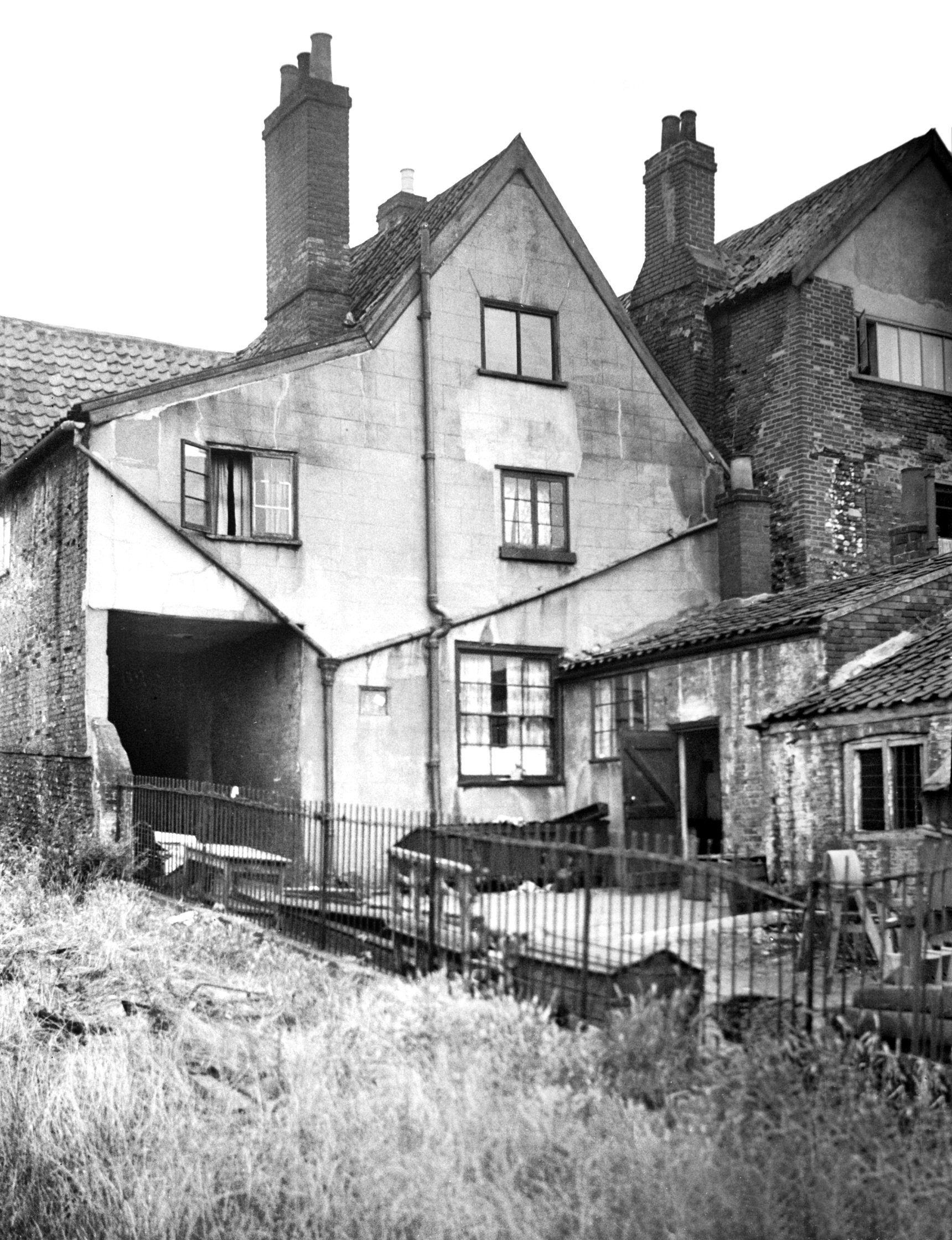
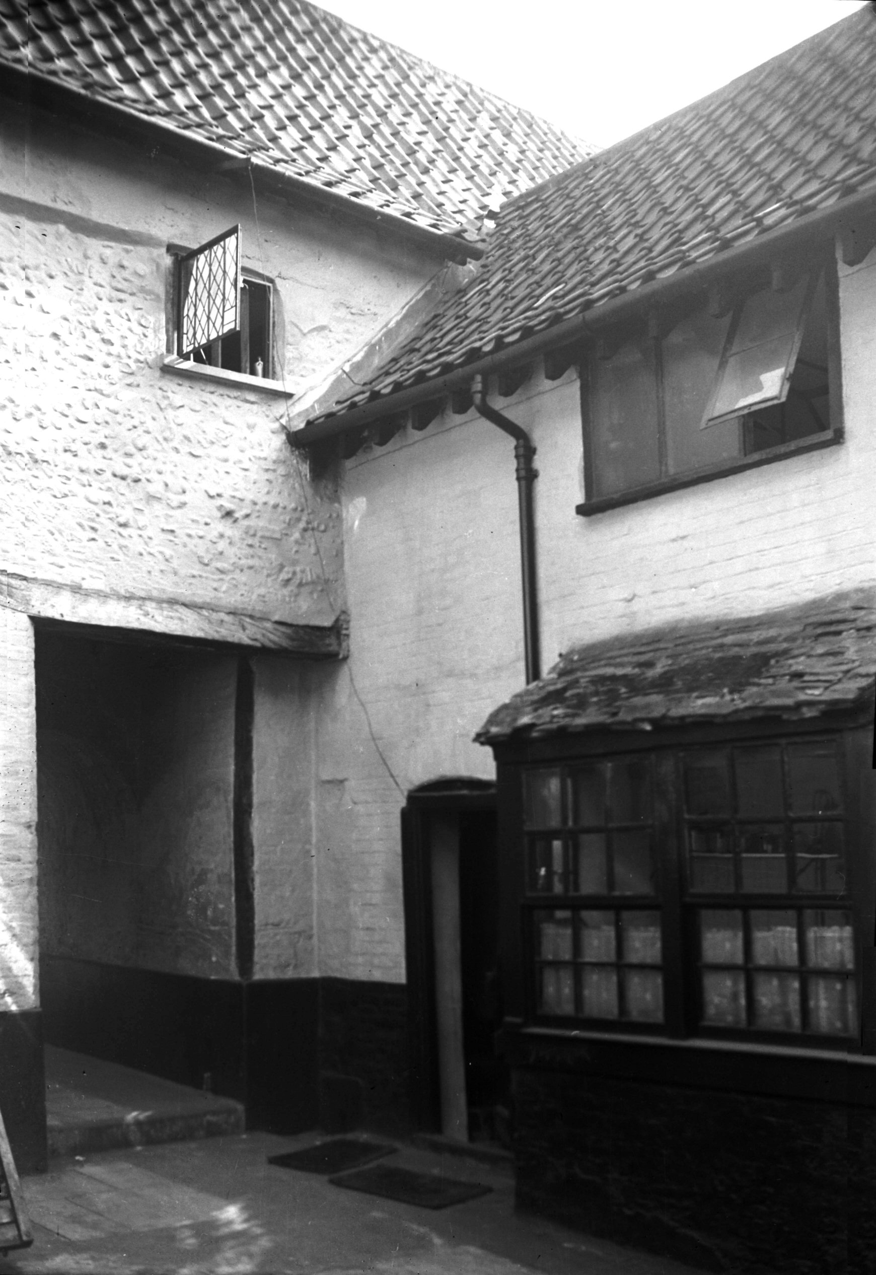
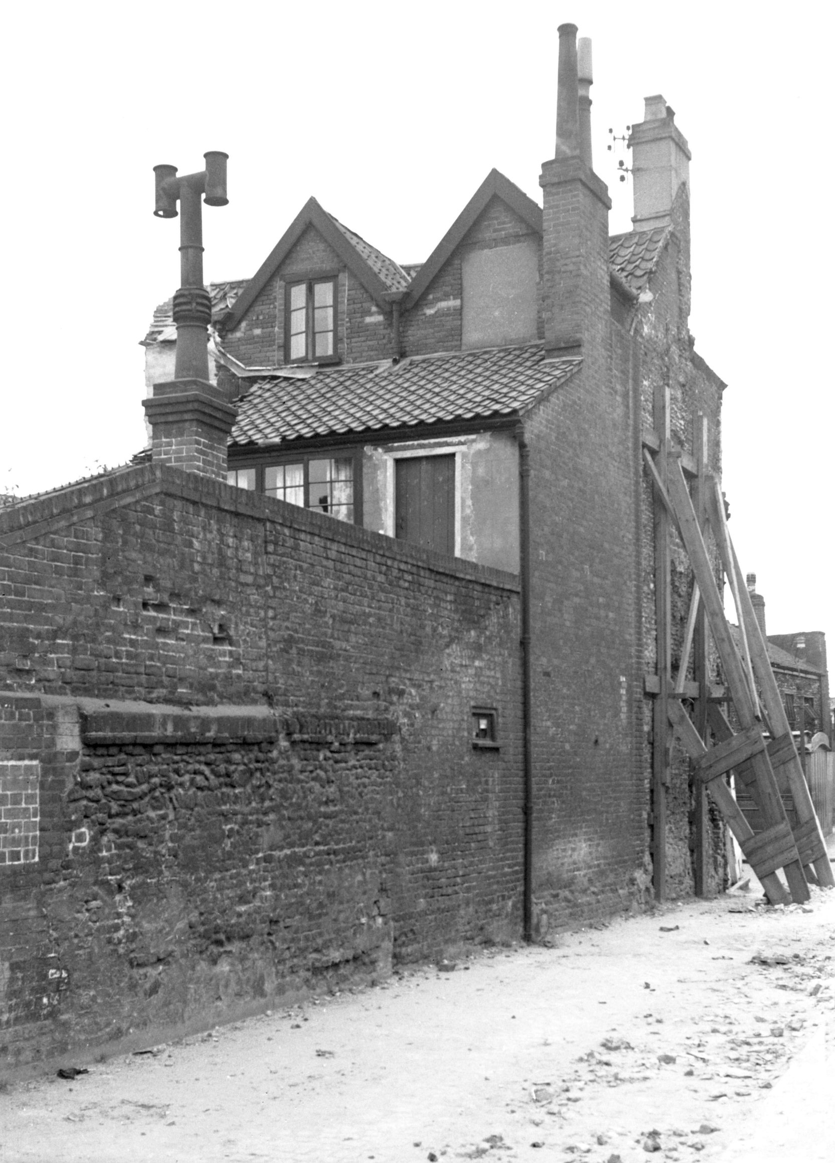
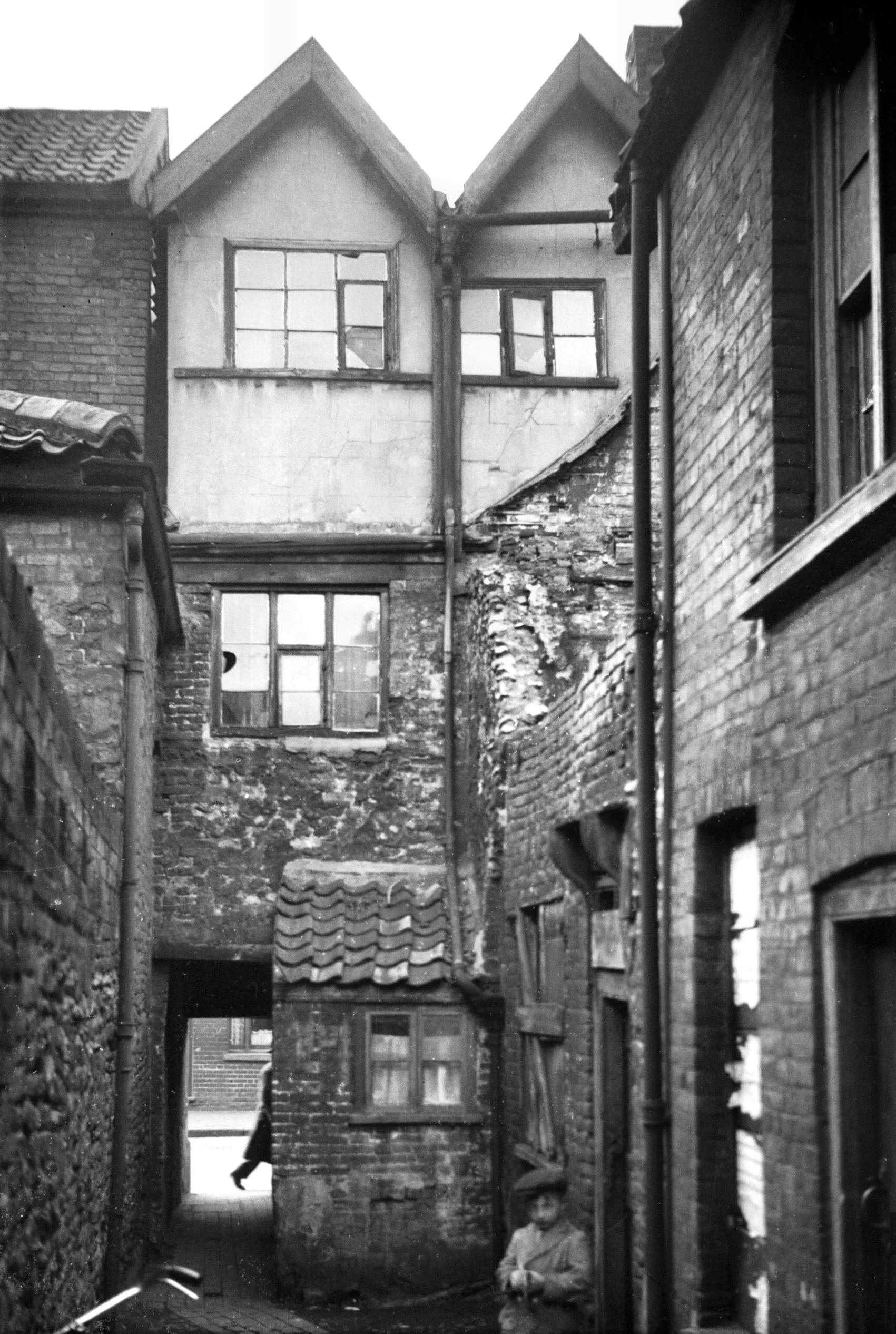
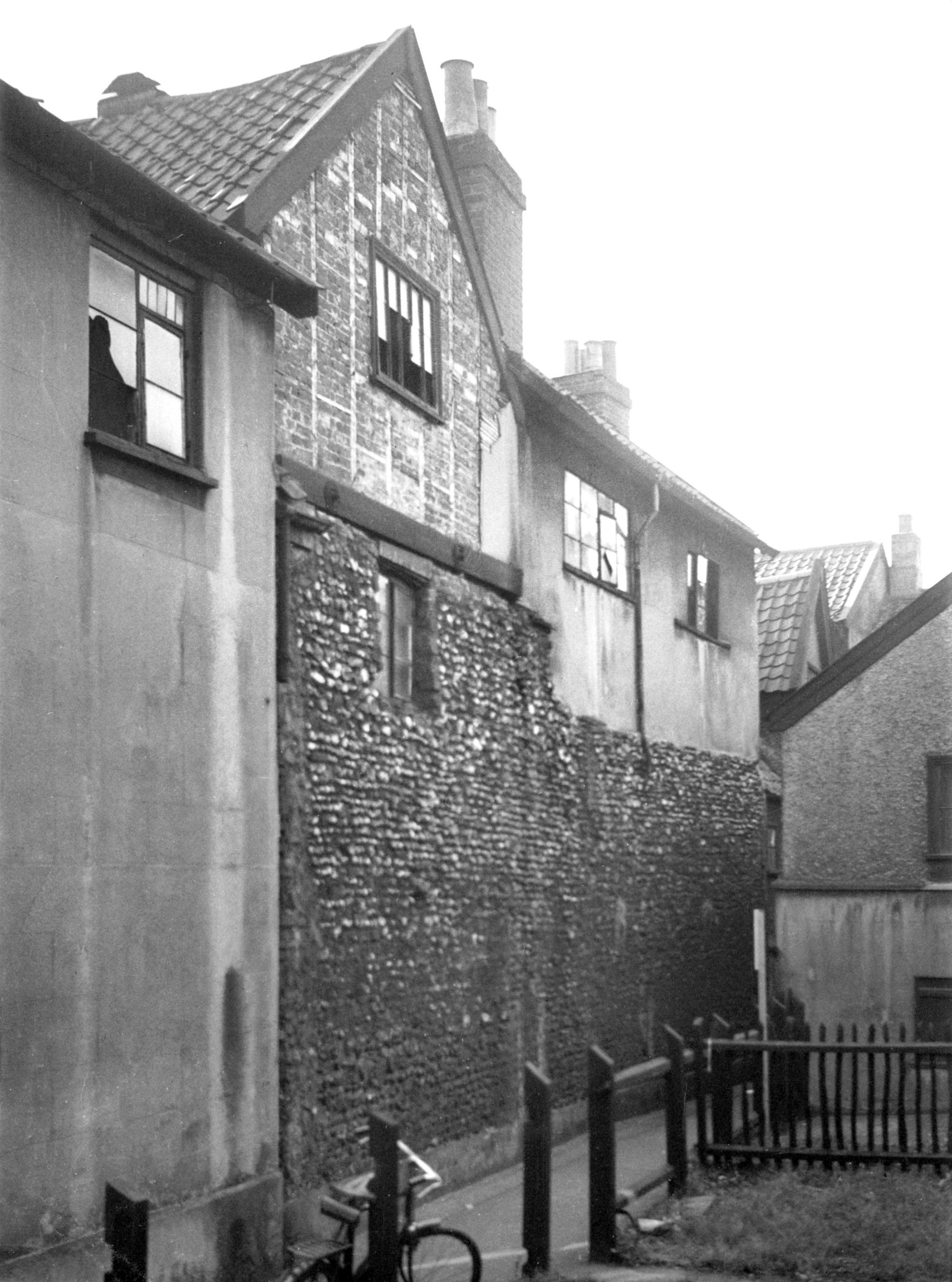
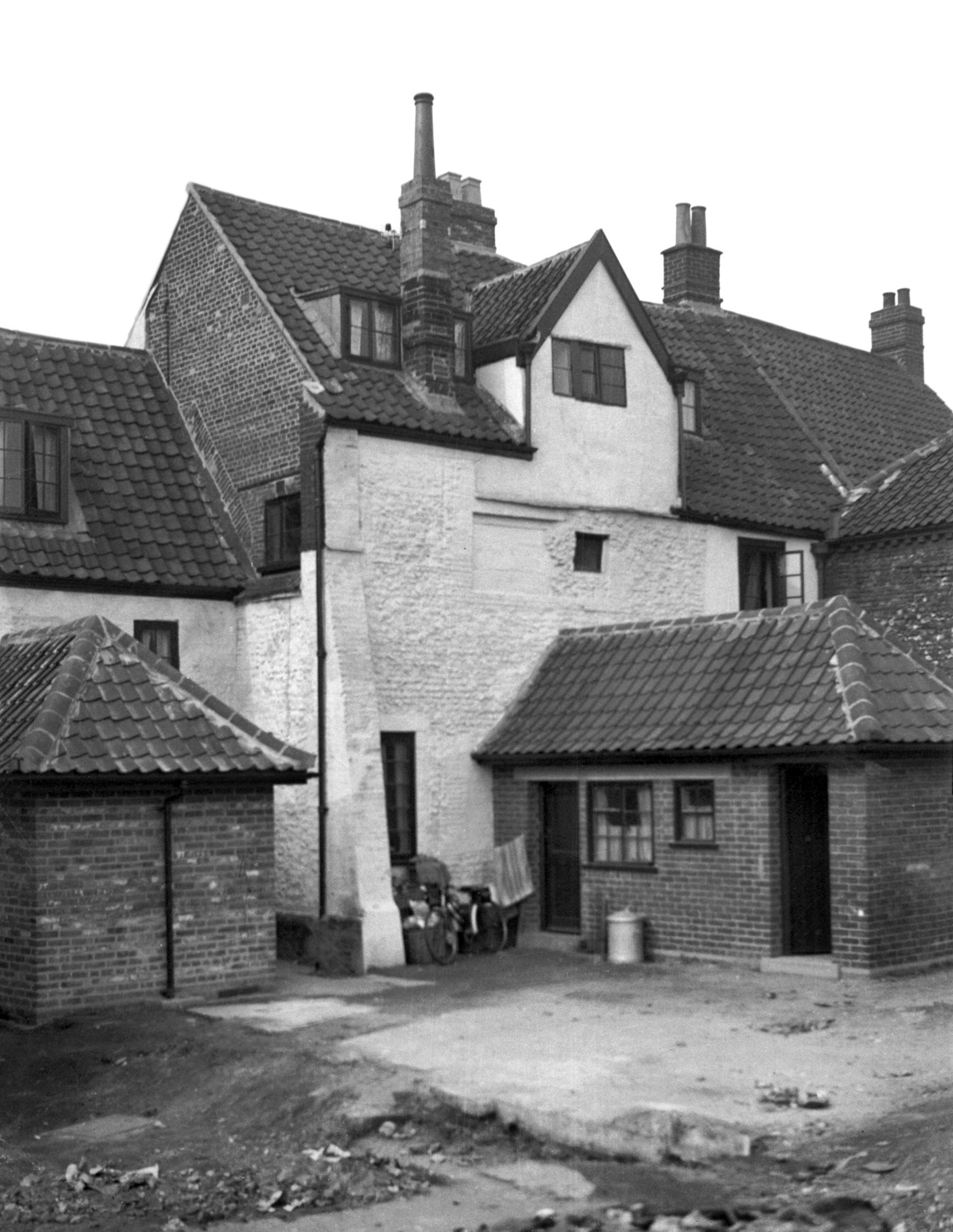
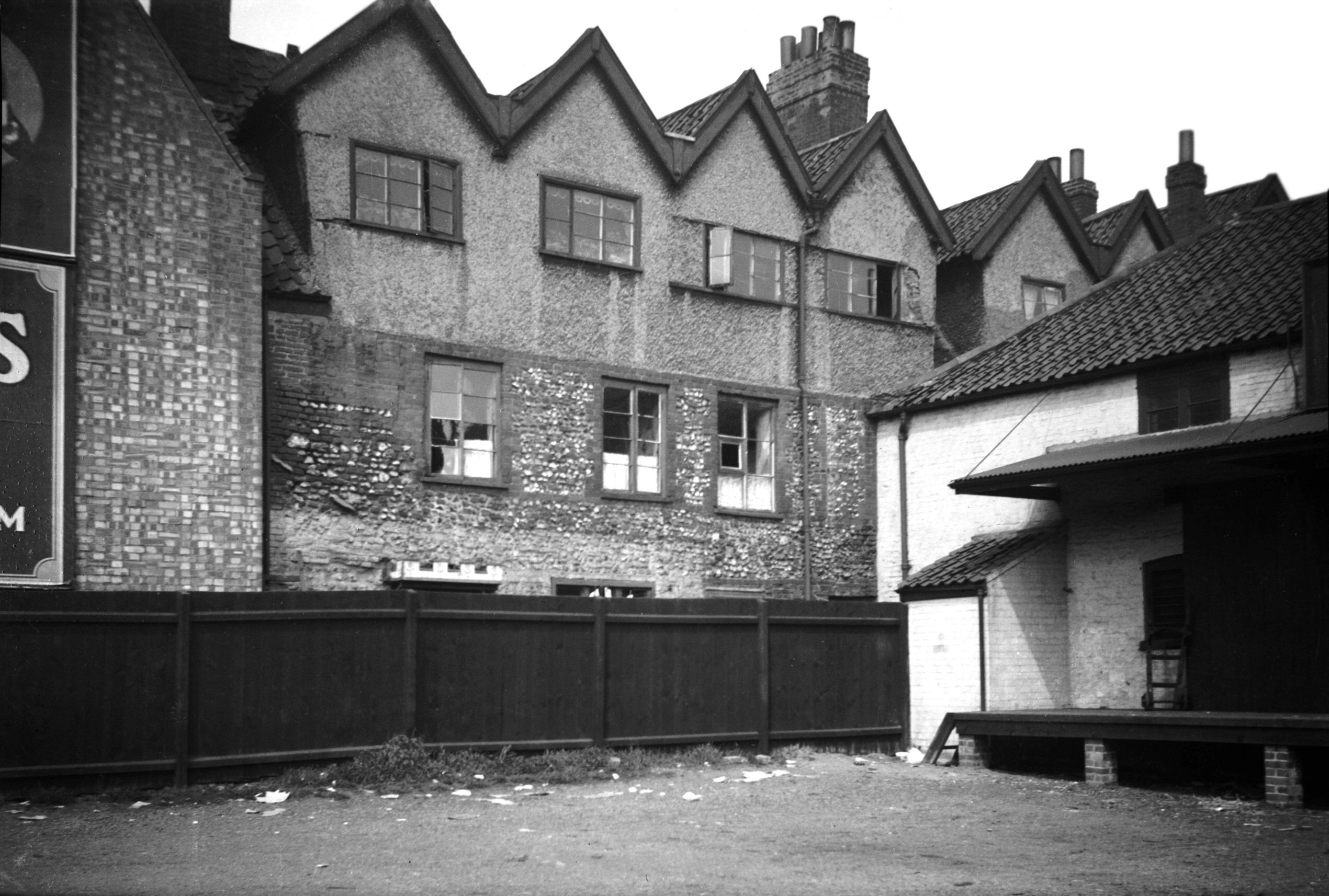
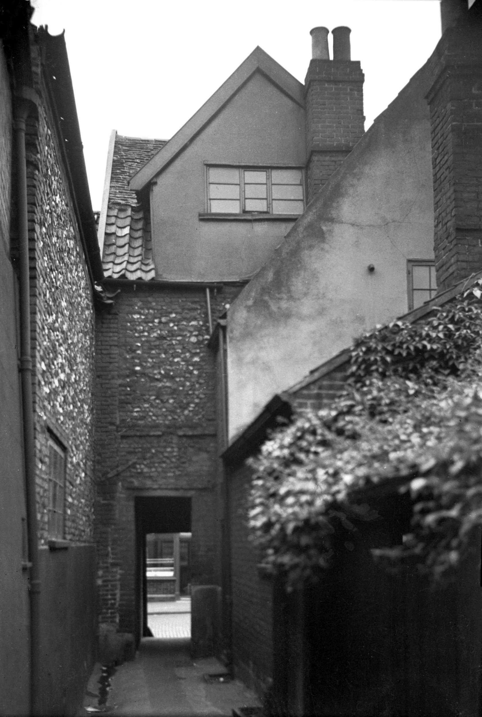
Oak St Dial Yard north side view west [1640]
1937-05-18
Showing the remains of a mansion once the home of Gregory
Clerk (Sheriff of Norwich in 1497 and 1505) and his wife
Agnes who afterwards married Robert Thorp. The principal
chamber was once lined from floor to ceiling with richly
carved panels of ribbon design. |
|
|
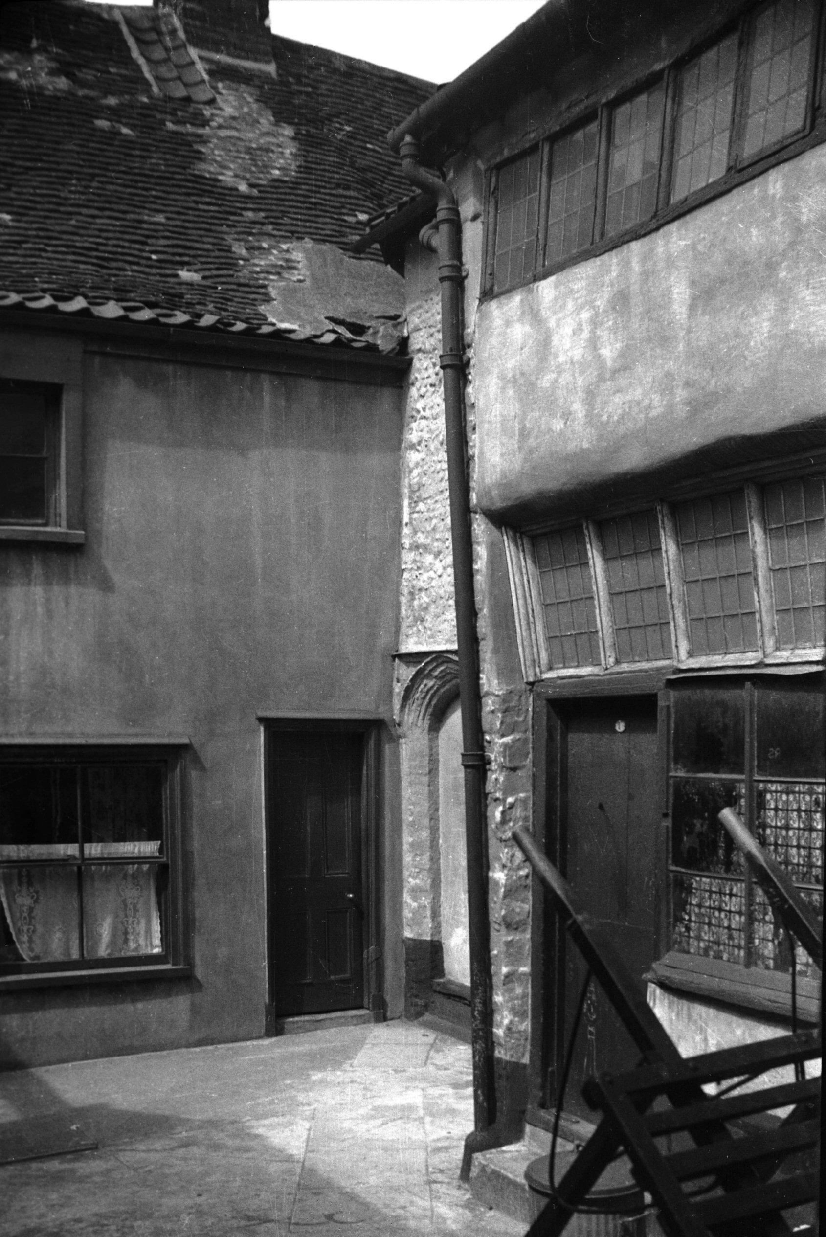
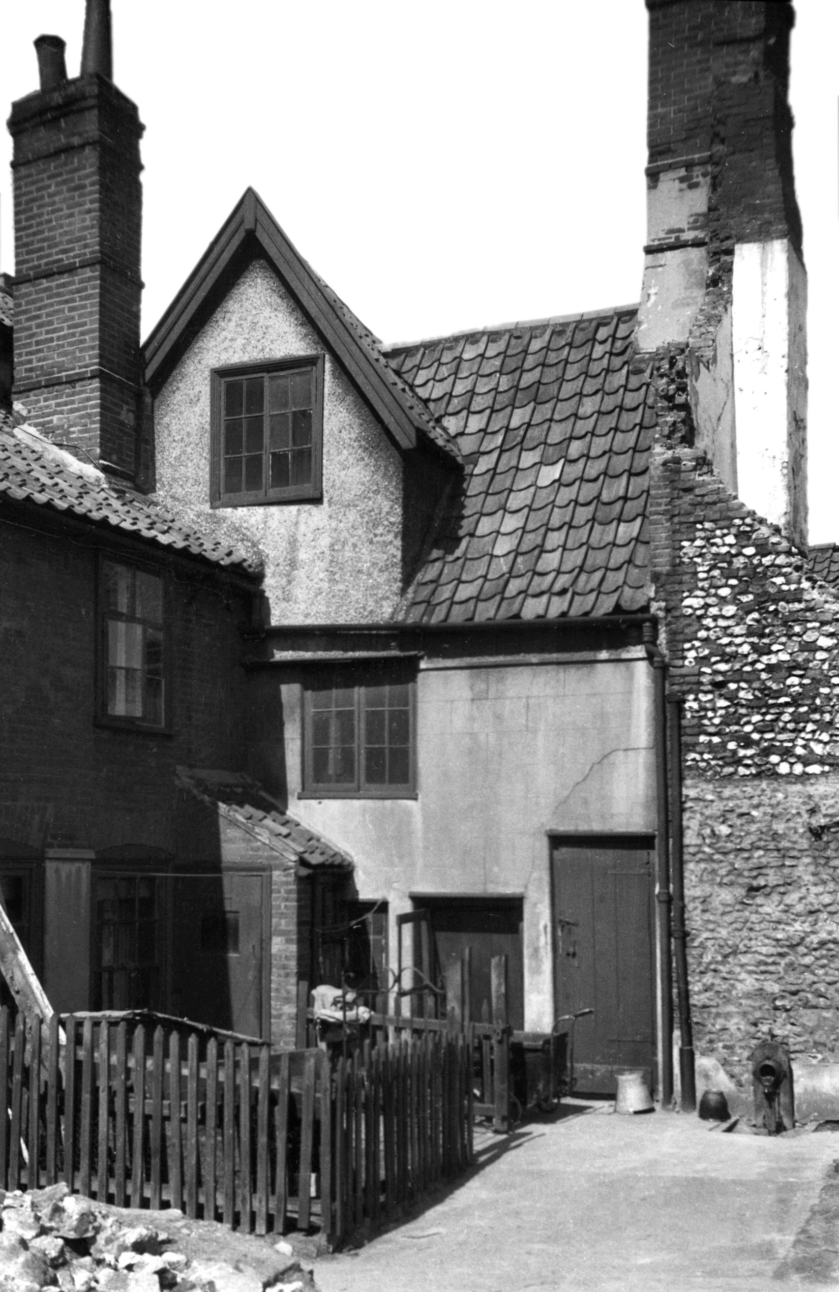
Oak St Dial Yard north side view west [1644]
1937-05-23
Part of Gregory Clerk's house. |
|
|
Oak St Dial Yard view east [1643] 1937-05-23
|
|
|
Oak St Dial Yard south side view east [2872]
1939-02-16
|
|
|
Oak St Dial Yard south side view west [2873]
1939-02-16
|
|
|
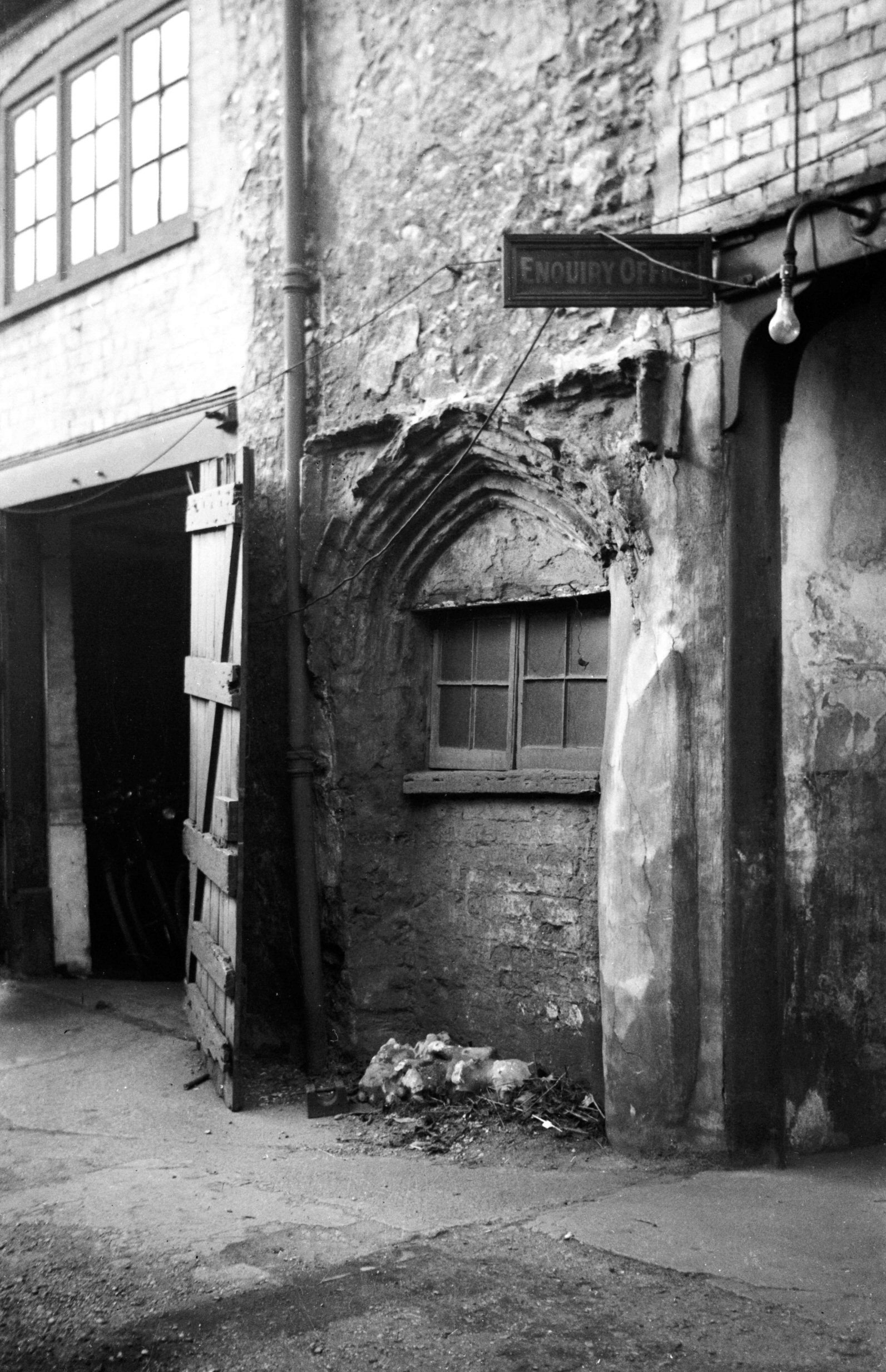
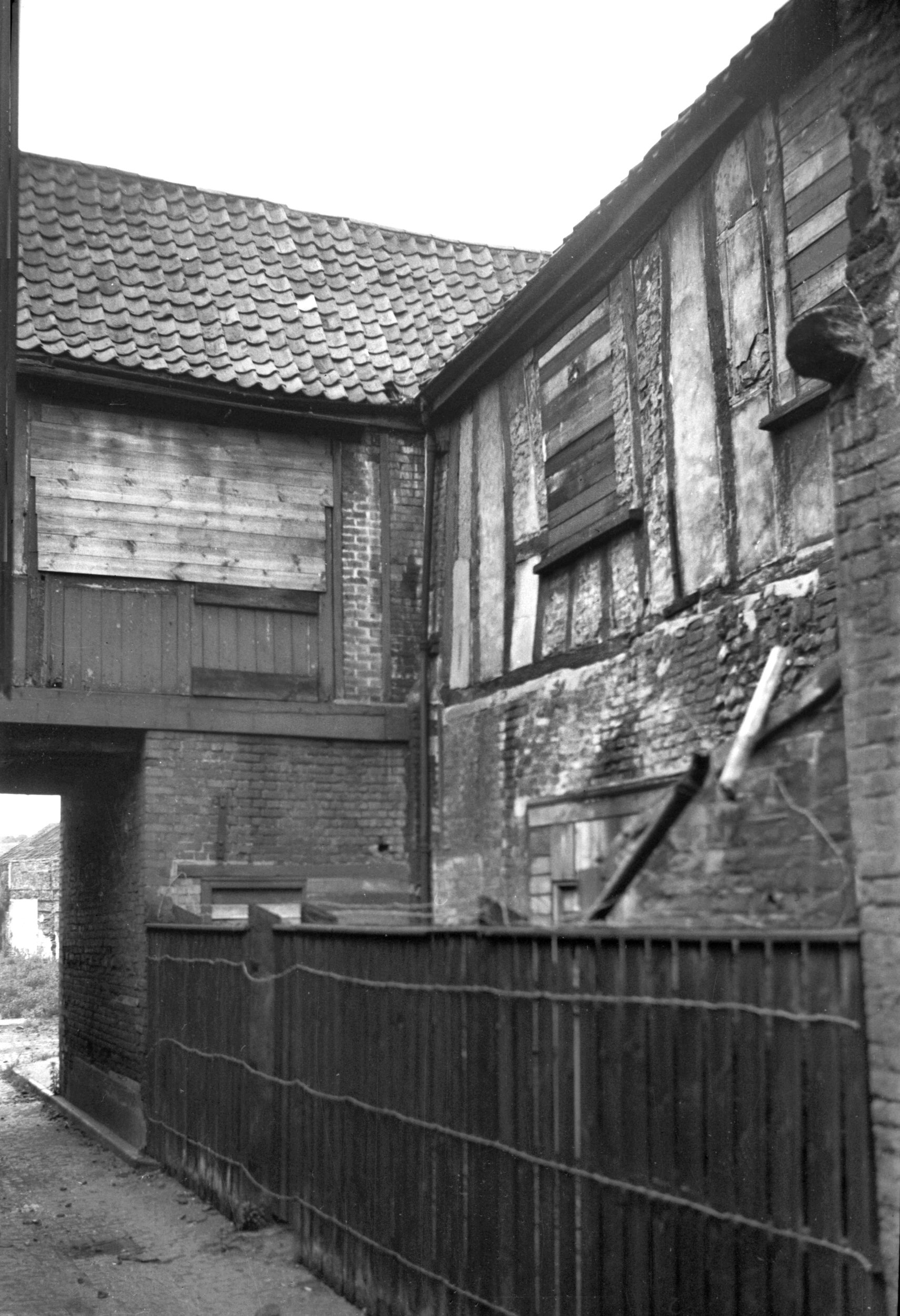
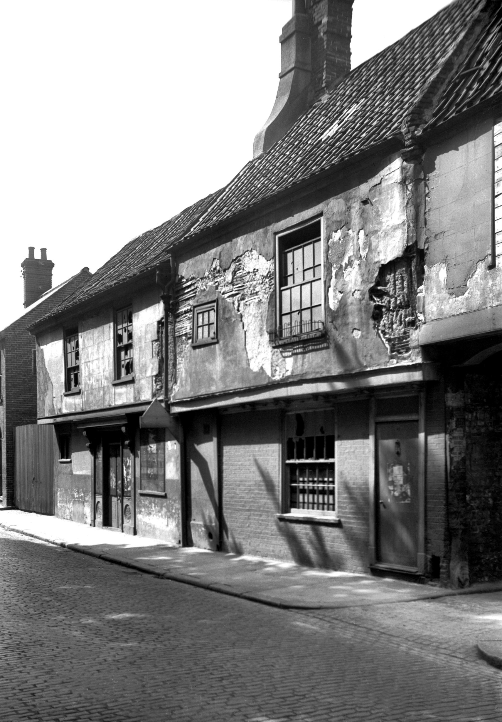
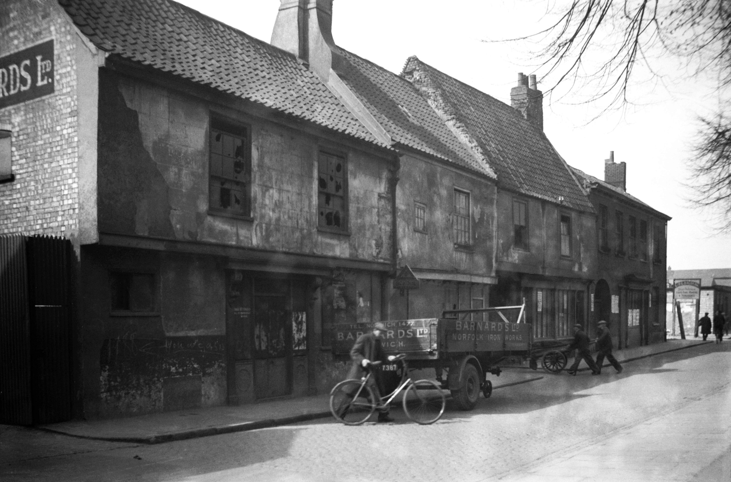
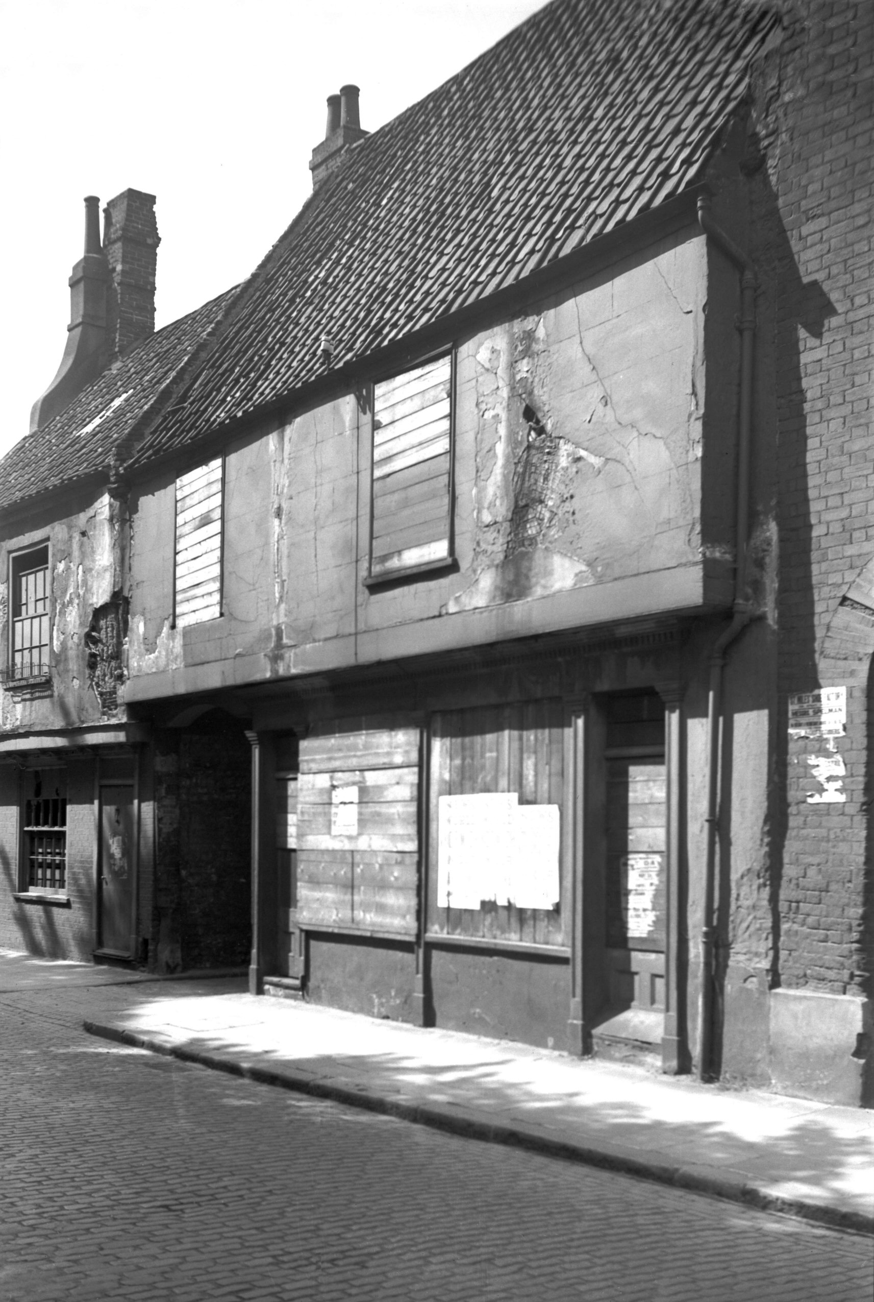
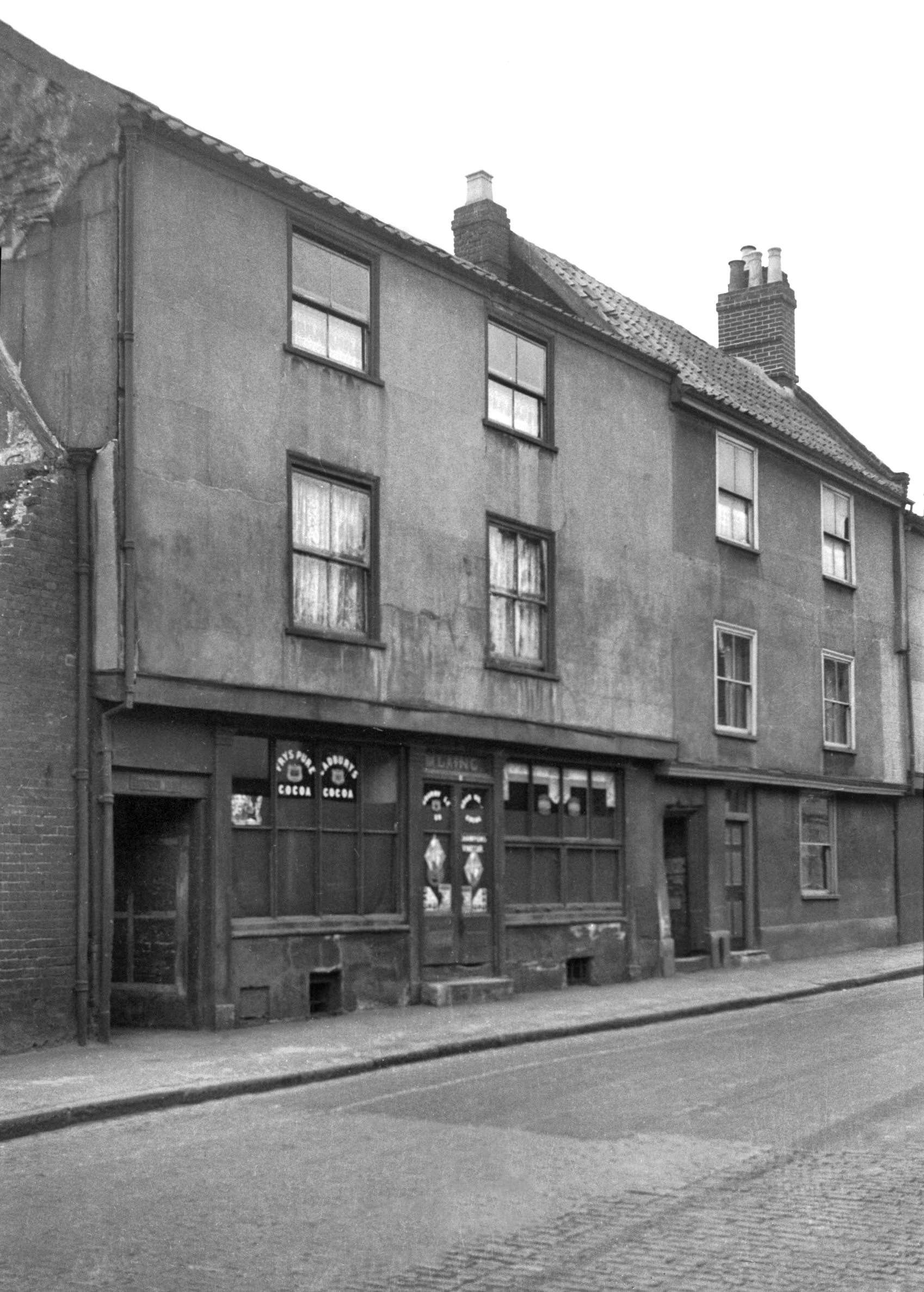
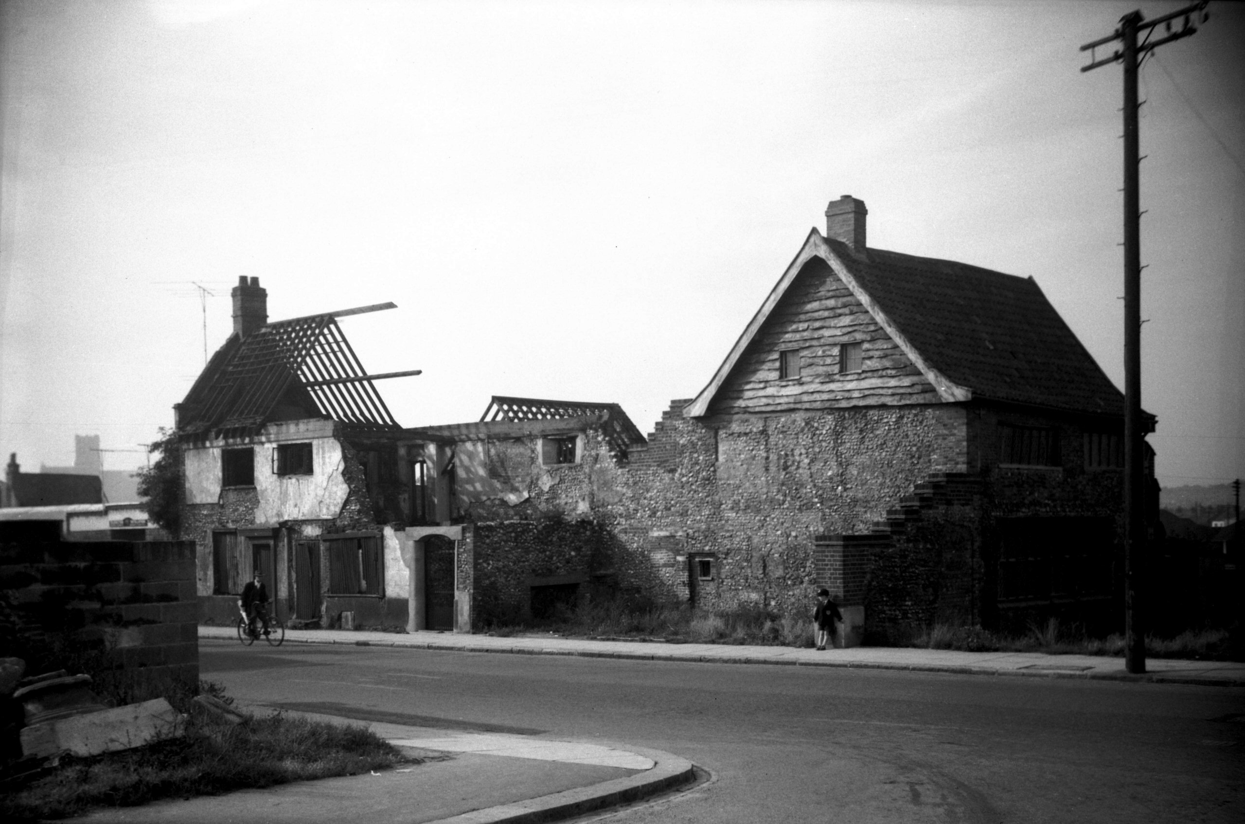
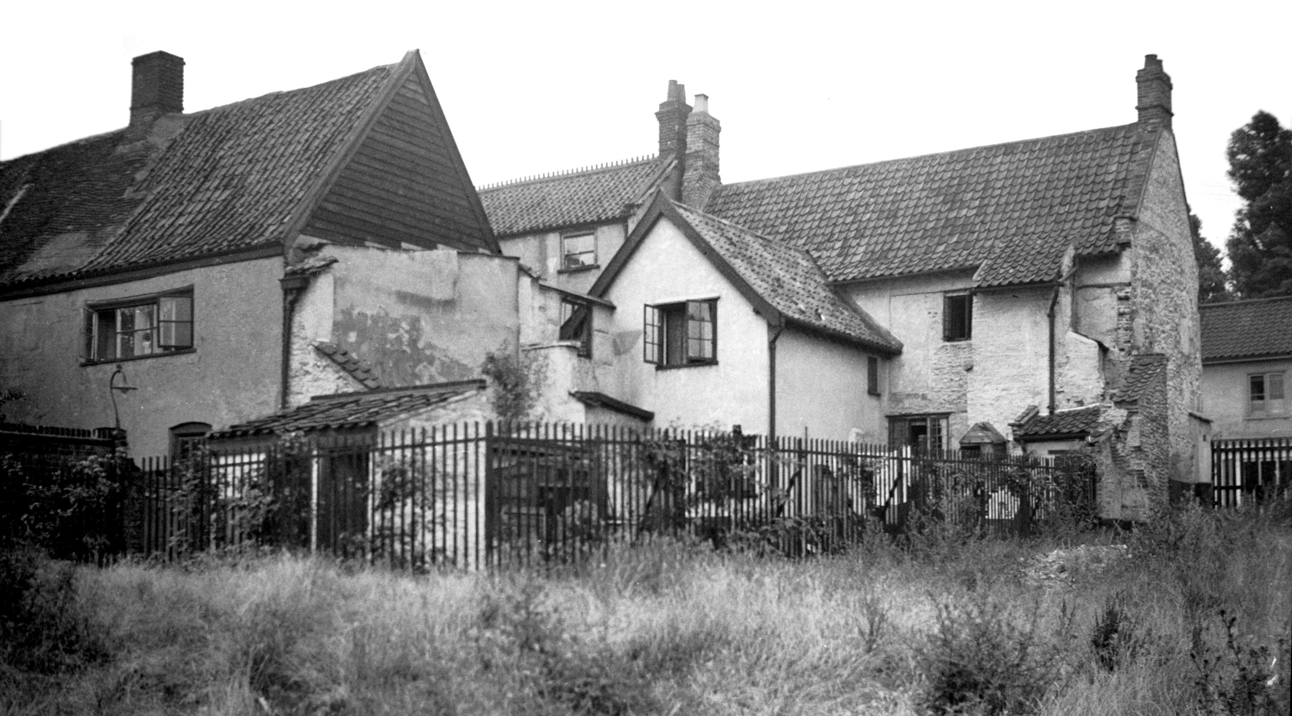
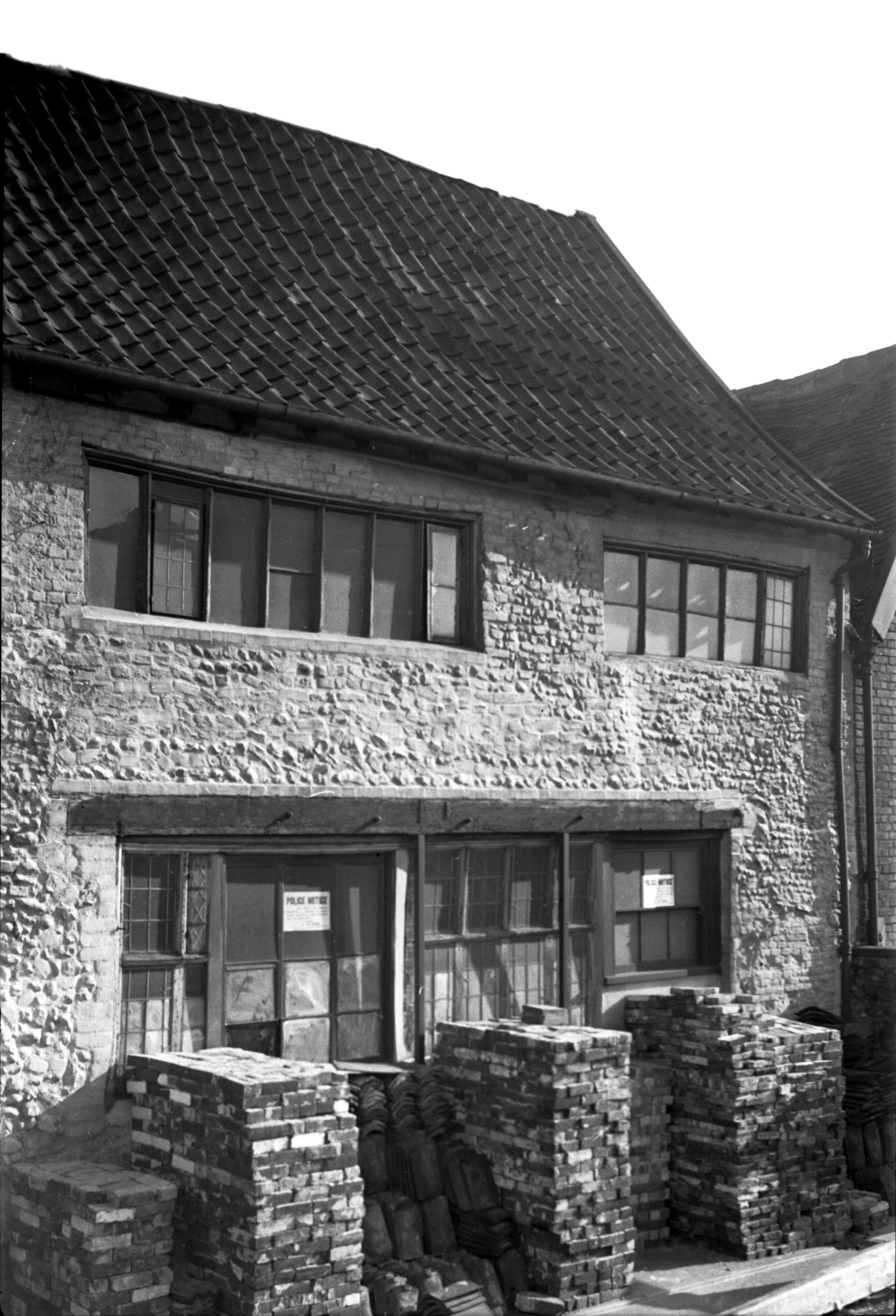
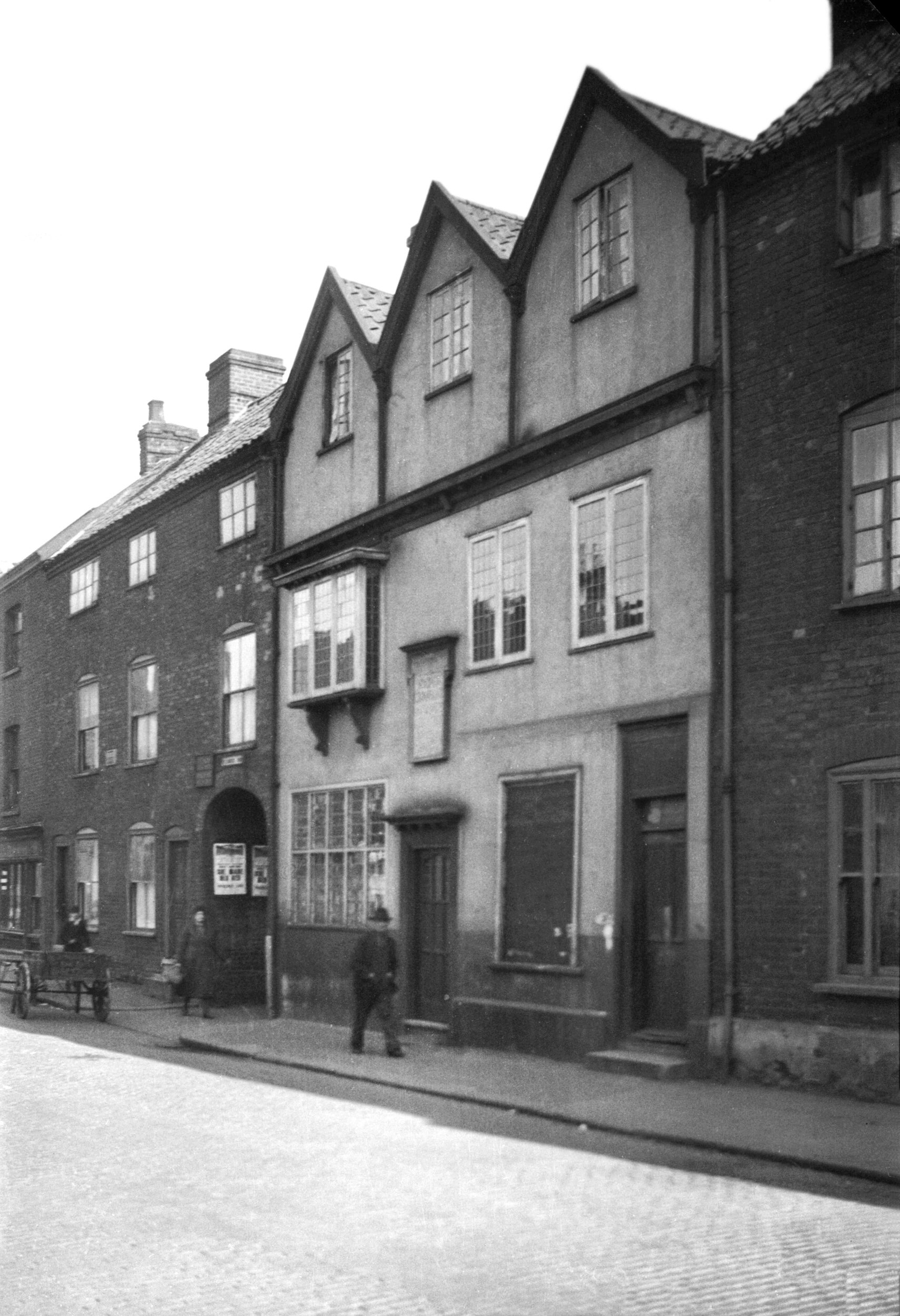
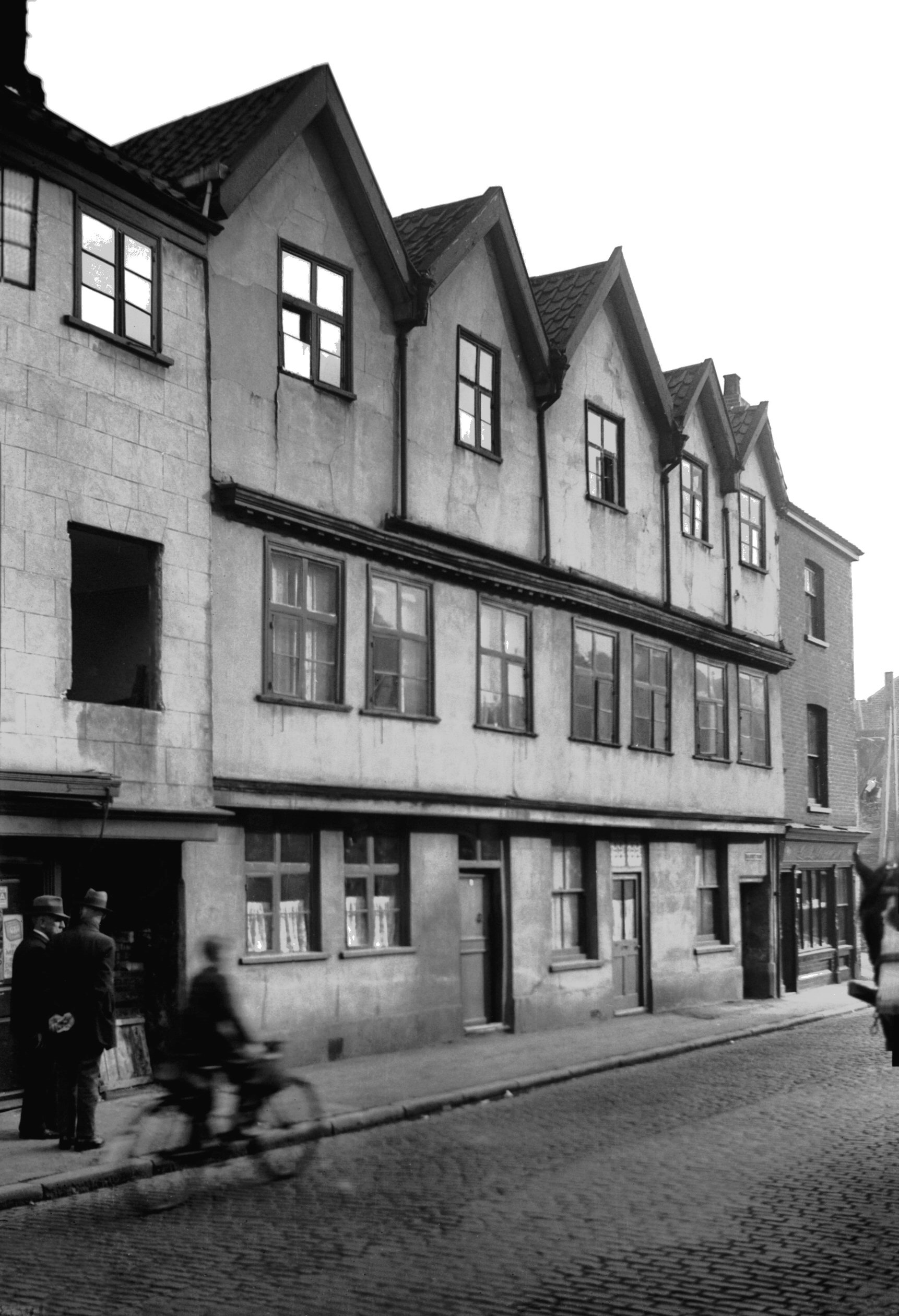
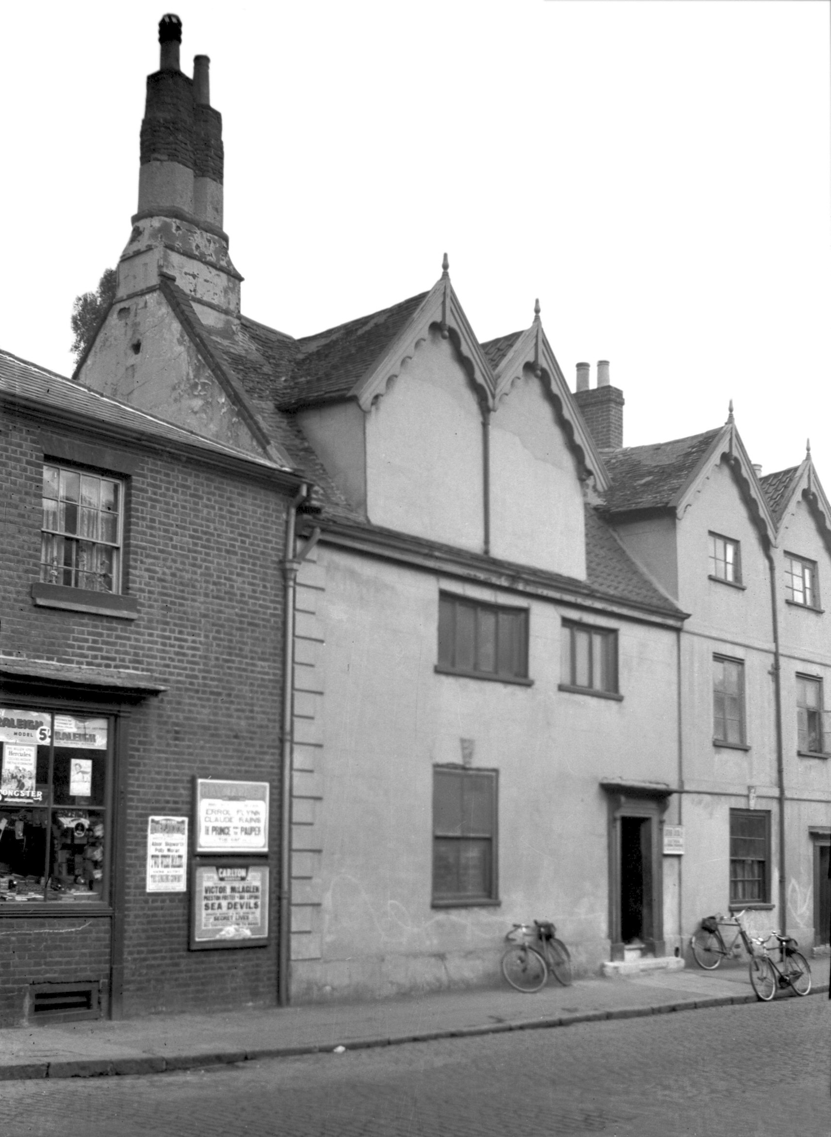
Oak St 3 former Pheasant Cock PH [2536] 1938-07-10
Until the Second World War on the west side of Oak St,
opposite St Miles' church stood an interesting row of
Tudor houses, Nos 1-9. These were the usual two-storeyed
type, timber framed and faced with plaster, the upper
floors projecting slightly over the street. When I
photographed them in 1938 they ware boarded up and in a
derelict condition, with the plaster falling off in
places, revealing a little of the wattle and daub
construction beneath. Here was once the Pheasant Cock
public house - not a unique name as far as Norwich was
concerned, for another was still serving its customers
until quite recently at "Richmond Hill", the
junction of Queens Rd and Bracondale.
Behind was a building of which White in his Norfolk
Directory (1883) wrote "In Dial Yard, St Martin's
are the remains of what was the grand old mansion of
William Coe, Mayor of Norwich". No such name appears
on the mayoral roll and it seems that White was really
referring to William Coo, mercer, who was admitted to the
freedom of the city in the fourth year of Henry VIII's
reign after having been apprenticed to Gregory Clerk. The
latter had been Sheriff in 1497 and Mayor in 1505 and
1514, and both he and his father (also Gregory) had
previously lived here.
Coo seems to have acquired the property through marrying
his master's daughter, Agnes Clerk and what some
considered to be their initials, the merchant's mark and
the arms of the Mercer's Company added enrichment to
ribbon-patterned-panelling which once lined a room here
from floor to ceiling. Sold many years ago to Lord
Stafford, much of the panelling was later acquired by
J.J.Colman, and subsequently by Dr Philip Nelson of
Liverpool. Sketches of just four of the panels were
published in 1886-88 by the local artist C.J.W.Winter in
a series entitled Norfolk Antiquities; in the
accompanying letterpress he agreed with W.C.Ewing in
ascribing the initials and merchant's mark to Gregory
Clerk senior (Sheriff in 1477) and his wife Agnes.
Gregory Clerk now lies buried in the south aisle of St
Miles' Church, as does his wife Agnes who survived him.
She subsequently married Robert Thorp, the founder of the
Thorp Chapel with its beautiful flint flushwork on the
exterior. |
|
|
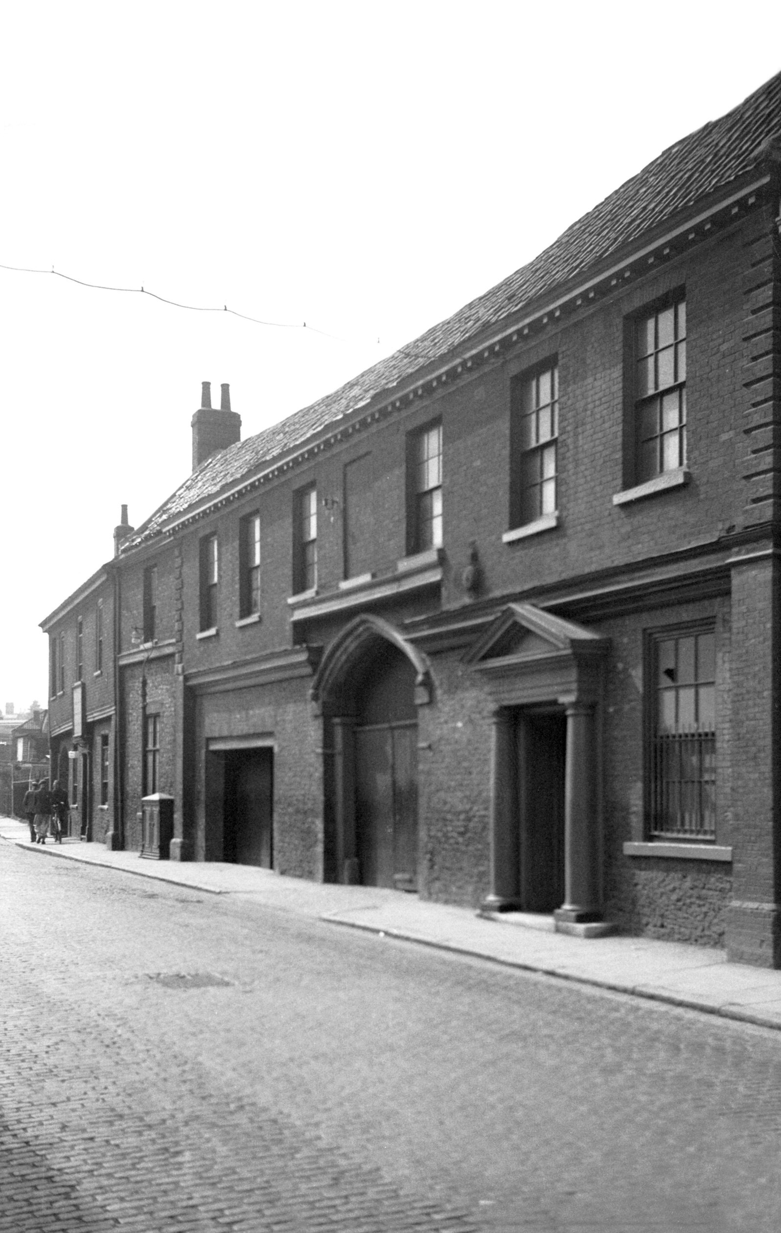
Oak St 3 to 5 [2537] 1938-07-10
|
|
|
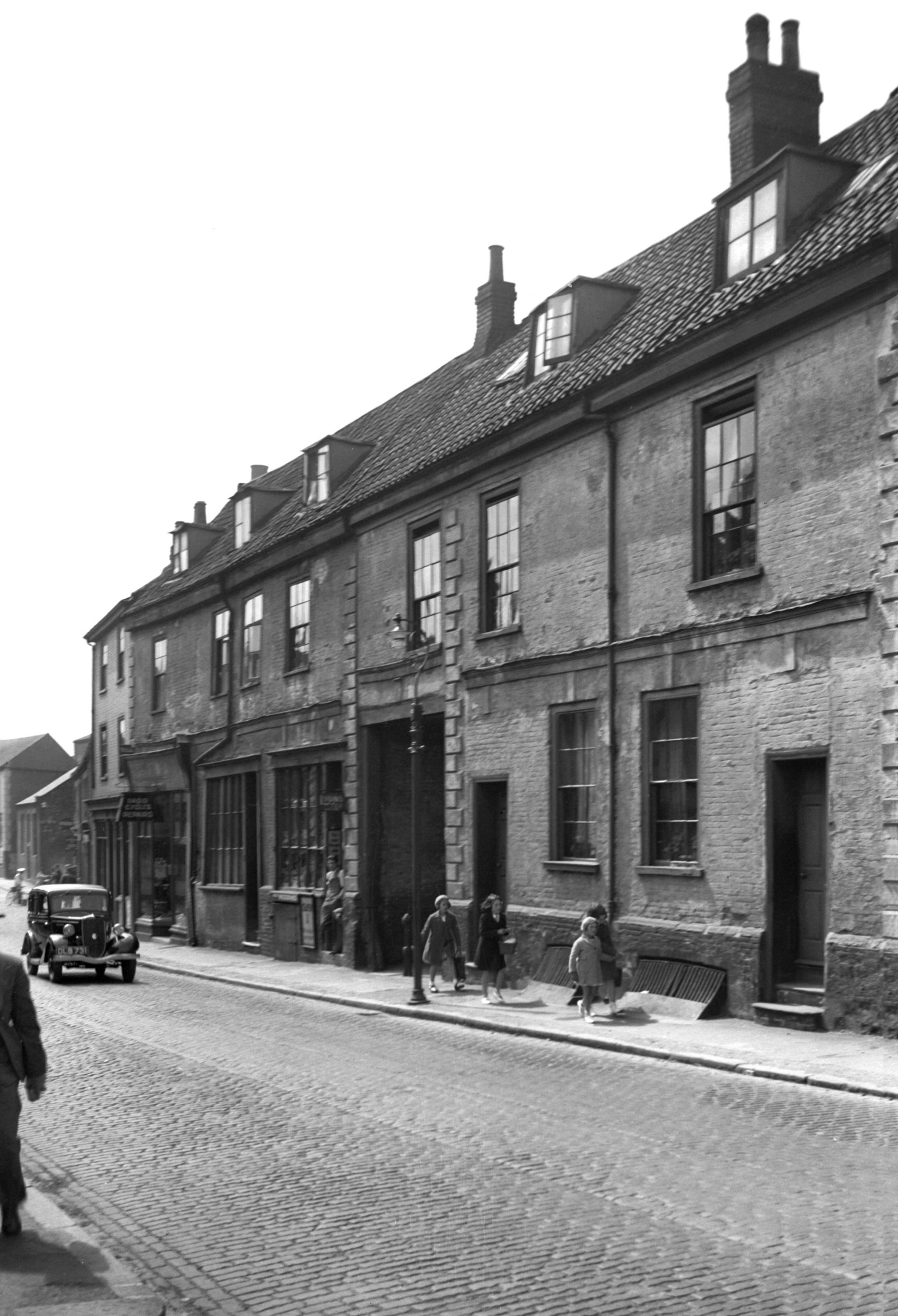
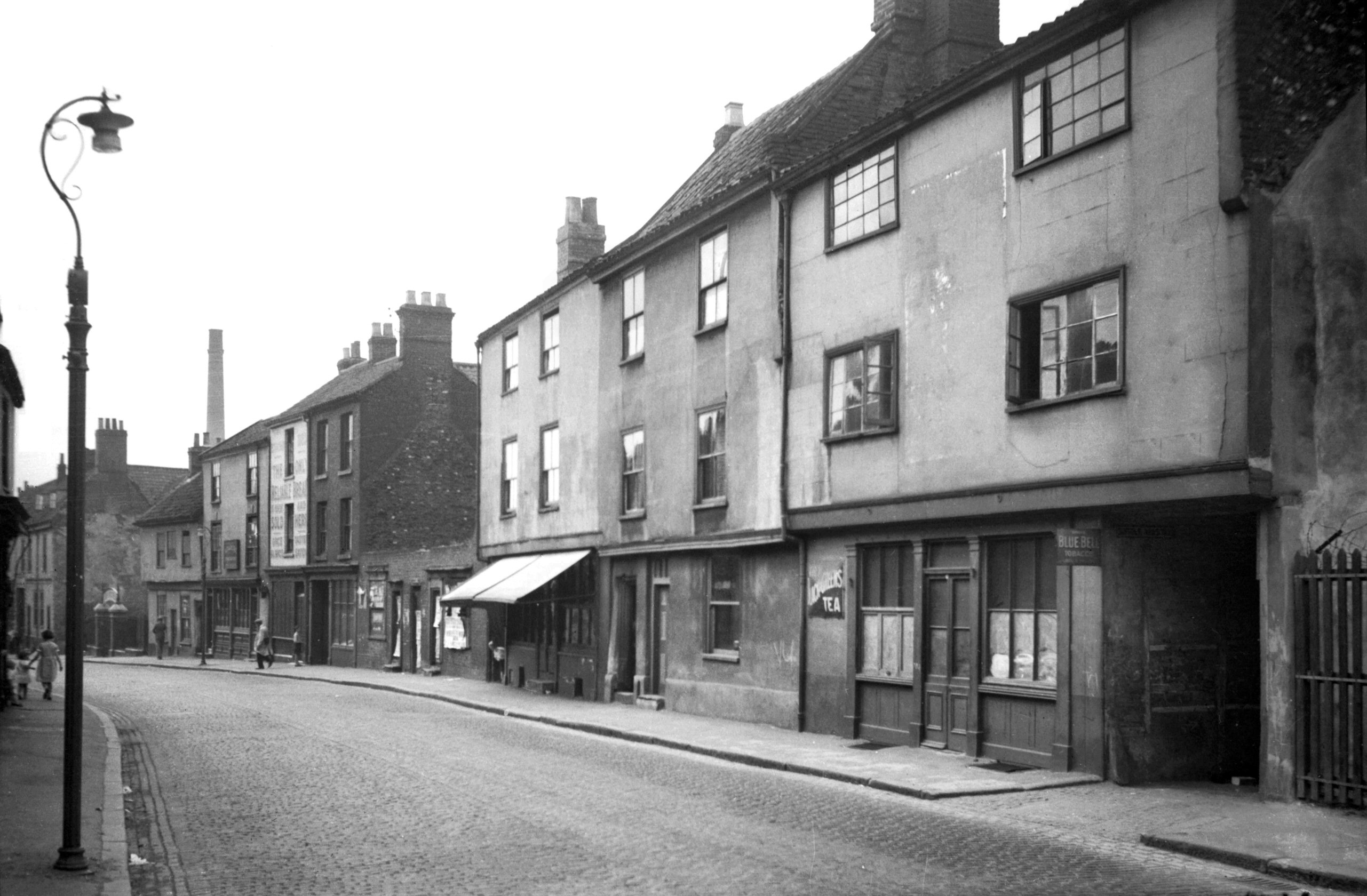
Oak St 3 to 13 [0847] 1936-04-09
|
|
|
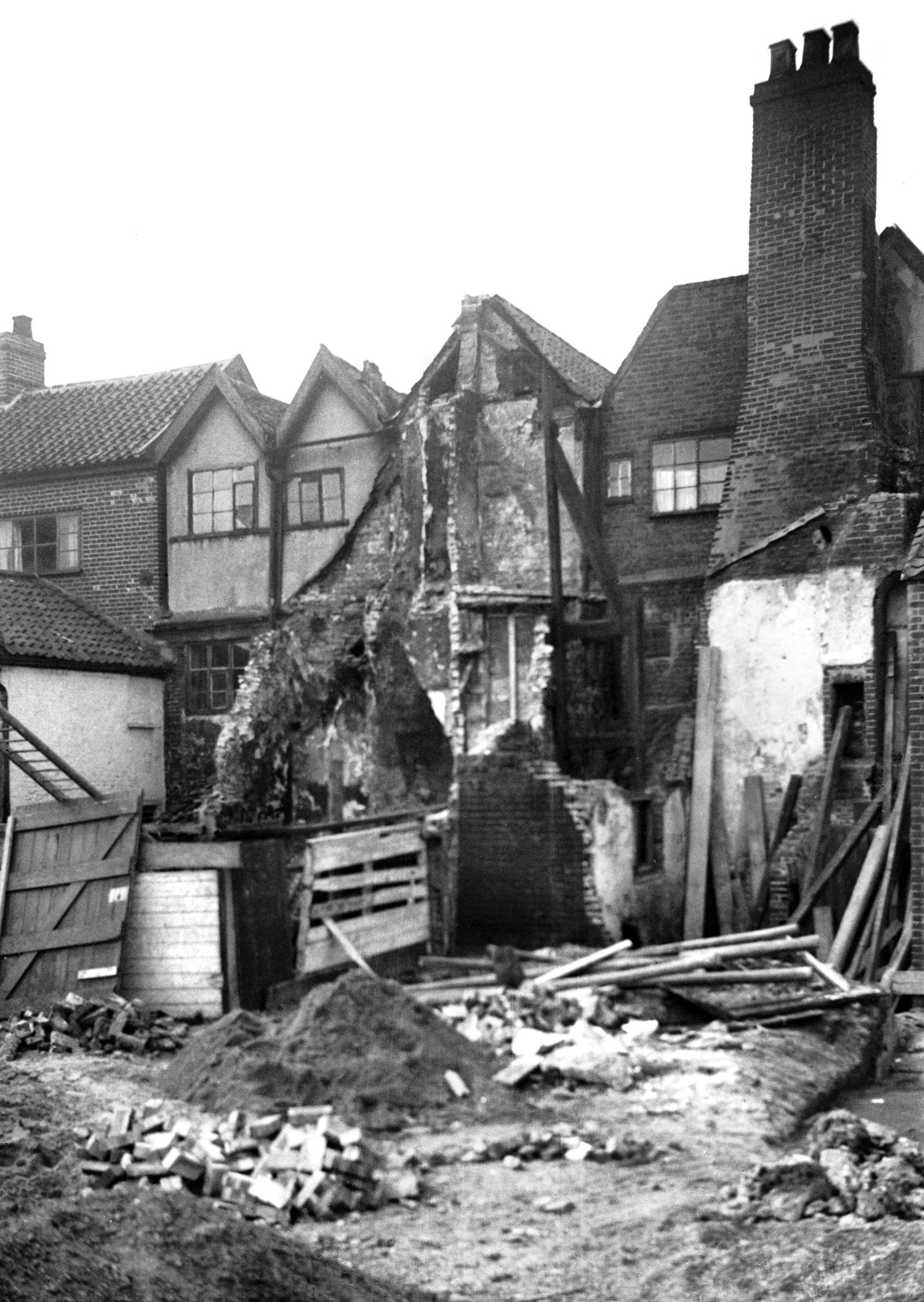
Oak St Tuns Yard south side [1645] 1937-05-23
Part of Gregory Clerk's house. |
|
|
Oak St 7 to 9 [2535] 1938-07-10
|
|
|
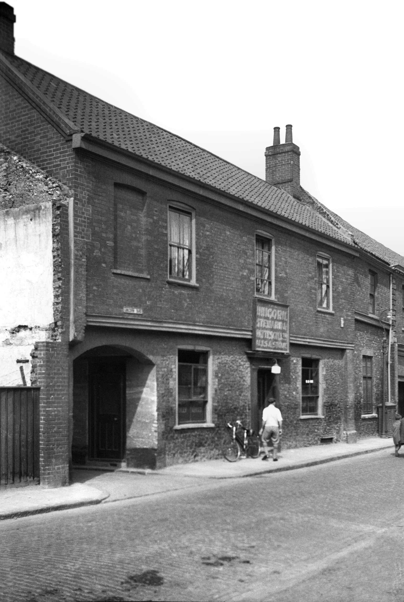
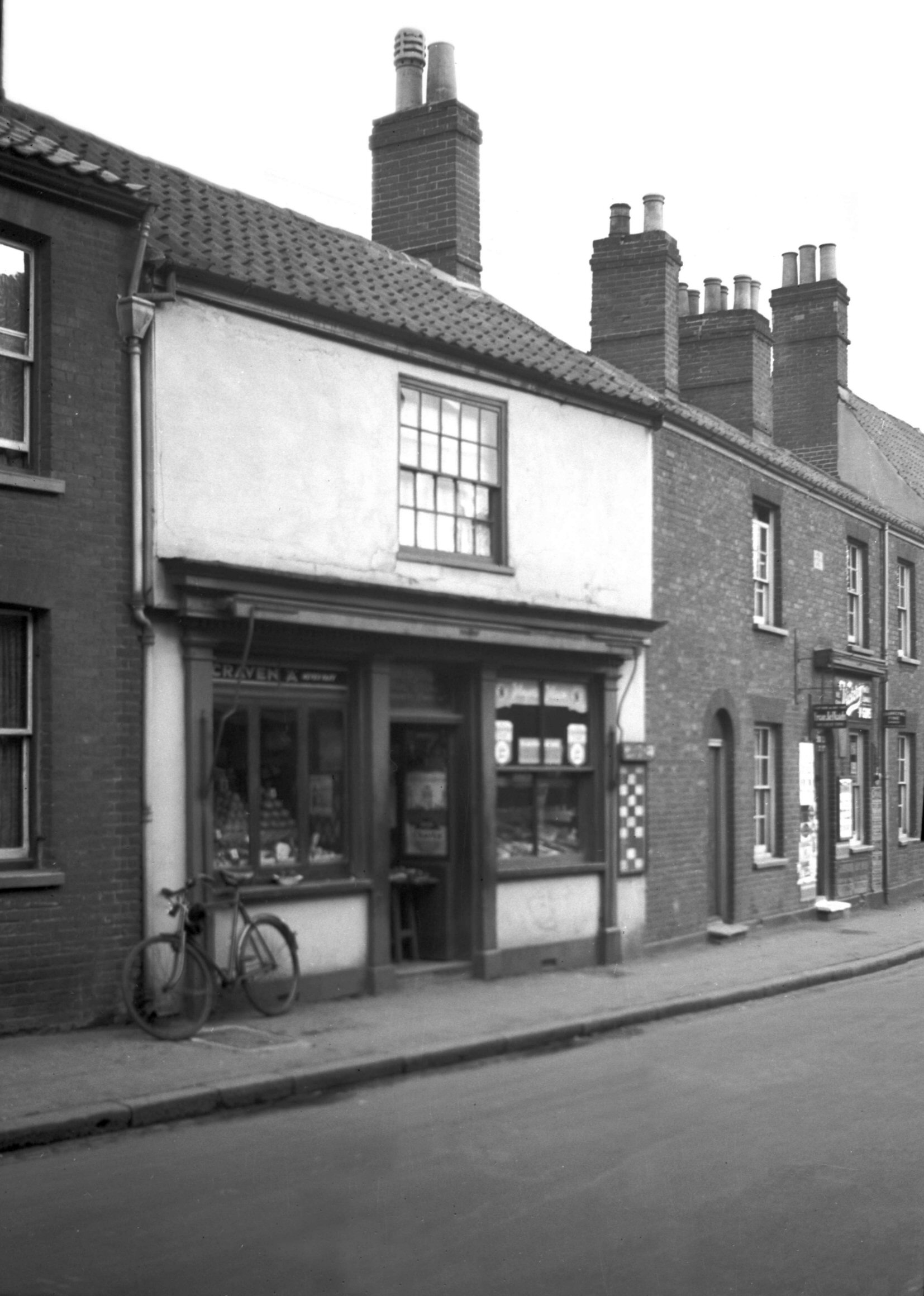
Oak St 39 Unicorn PH [2694] 1938-08-06
|
|
|
Oak St 41 [2693] 1938-08-06
|
|
|
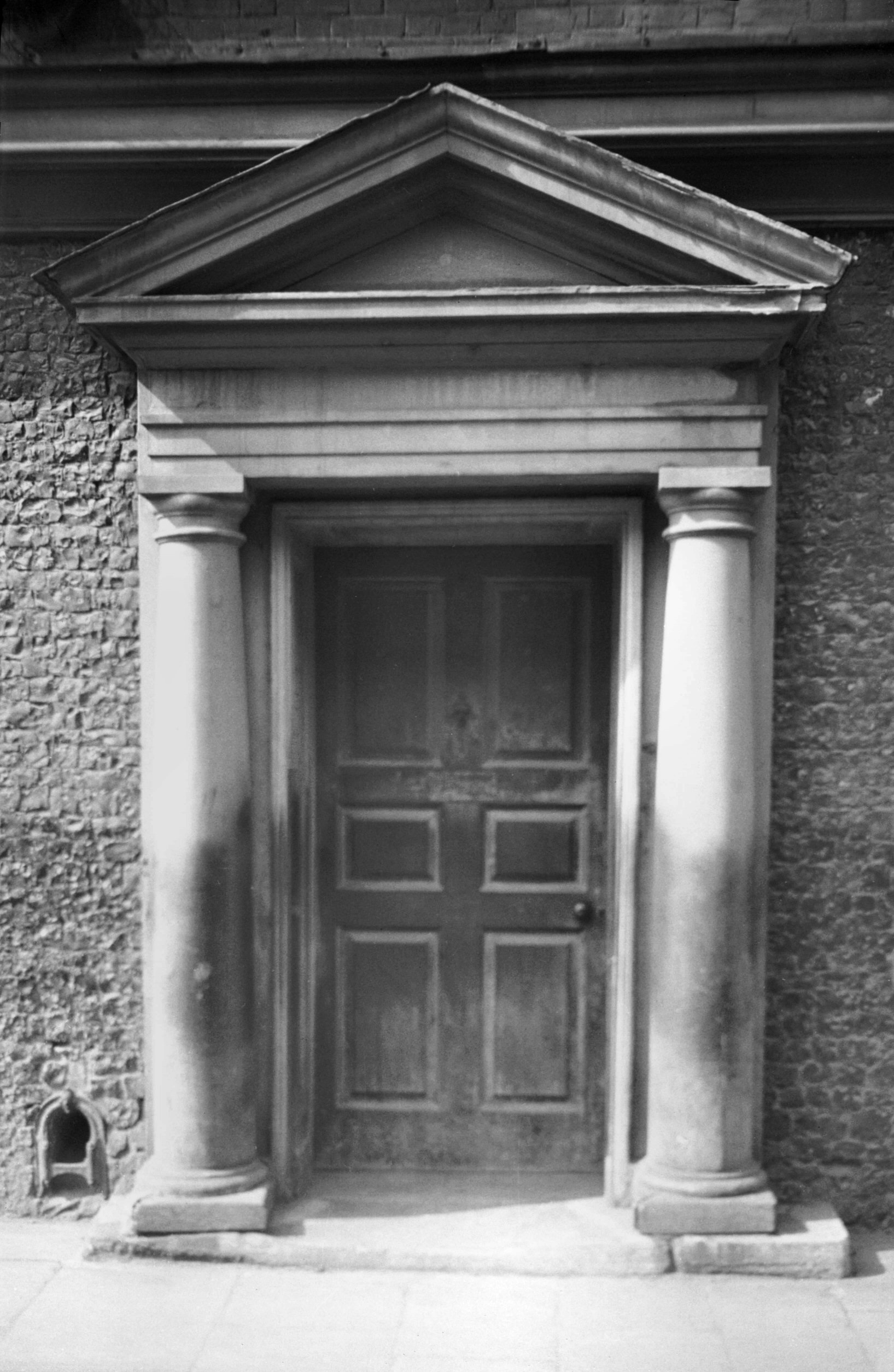
Oak St 41 Georgian doorway [0476] 1935-04-20
|
|
|
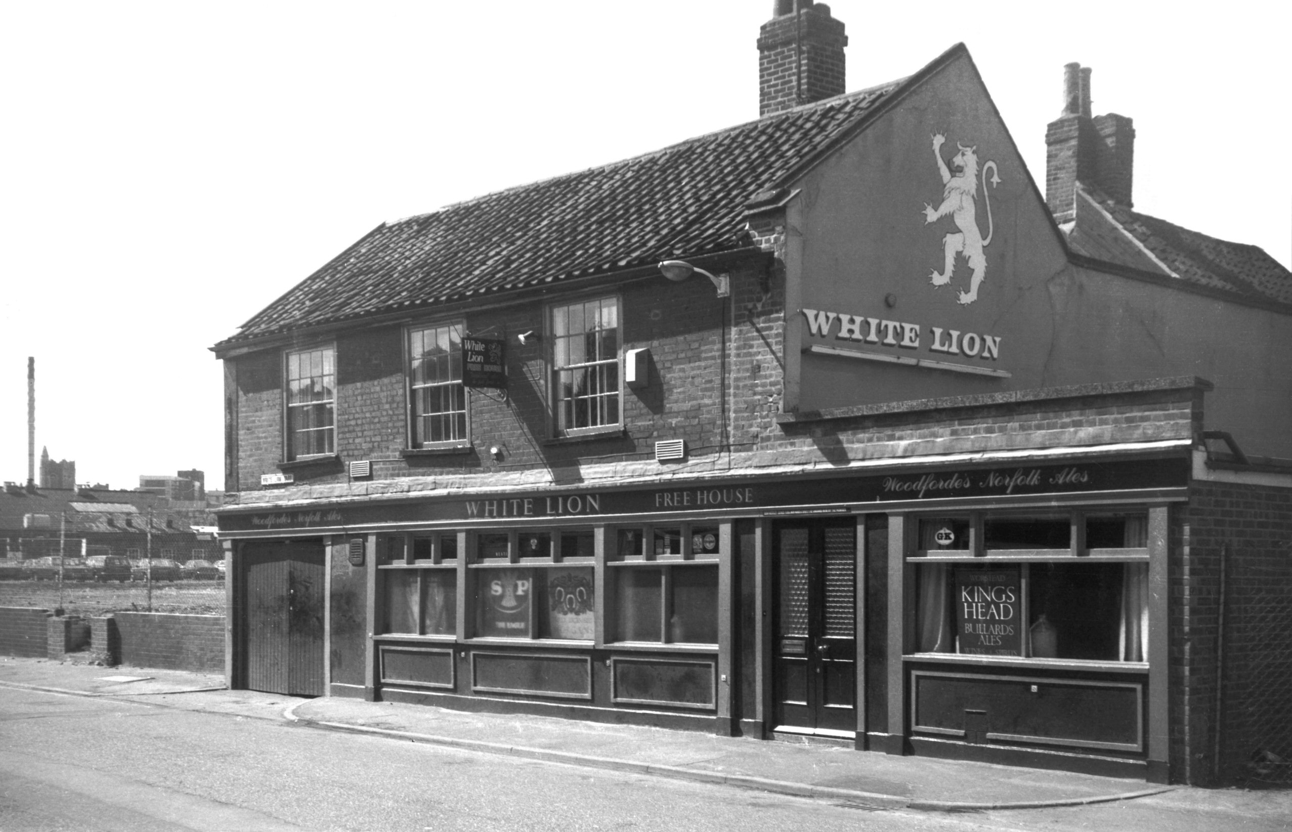
Oak St 73 White Lion PH [6383] 1986-06-12
|
|
|
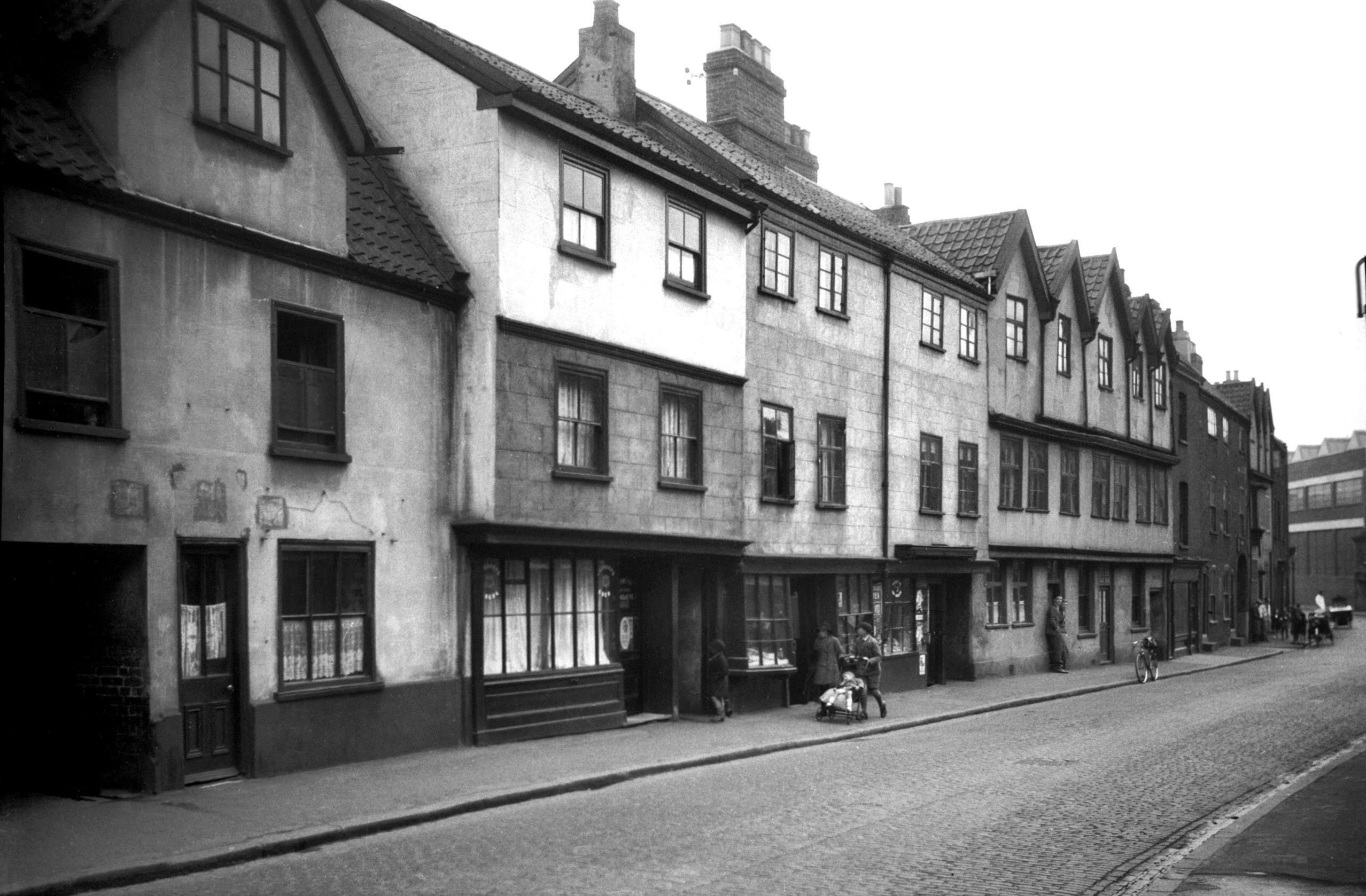
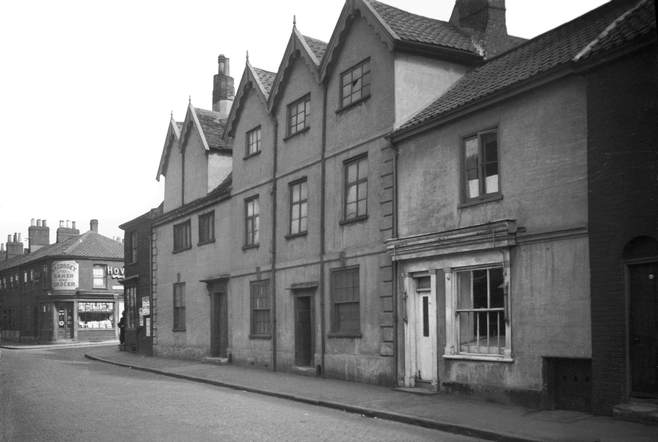
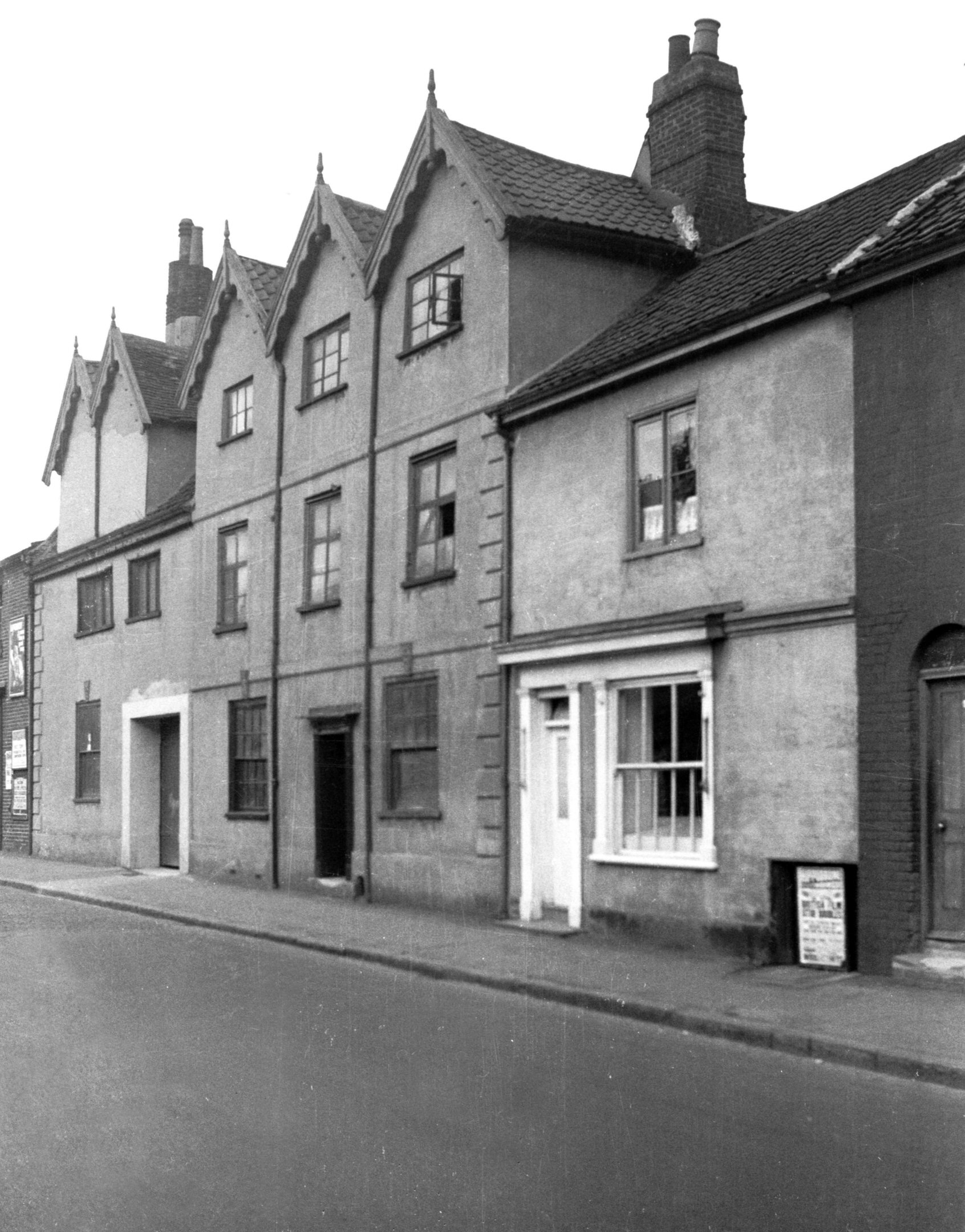
Oak St 93 to 101 [0856] 1936-04-10
At 93-101 Oak St, on the west side just north of the
Inner Link road was a rather run-down block of shops and
tenements occupying what had been a mansion of
considerable size. Built of brick late in the 17c, it was
of two main storeys, with a basement and attics.
Rusticated quoins, small keystones above the windows, and
a stringcourse marking the division between the two
floors relieved an otherwise austere facade. An opening
wide enough to admit carriages divided the ground floor
into two unequal parts and gave access to Bath House Yard
at the rear.
This house is depicted in the top right-hand corner of
James Corbridge's plan of Norwich. It then had a front
doorway to the left or the opening and a row of six
dormers to light the attics. These dormers had at some
time during the 19c been replaced by casement windows of
a much more modest design. Corbridge identified the house
as the residence of Thomas Newton, who was a brewer,
Sheriff in 1716 and Mayor in 1722. His wife who was
Rebecca Tawell, died on 8th February 1737-38, and he died
on 1lth July following. Principal parishioners for many
years, they were buried in the Church of St
Martin-at-Oak, where a monument on the south wall of the
chancel testifies to their memory.
The house, although listed as Grade 2 under Section 3 of
the Housing Act, 1949, was cleared away some years after
the Second World War. |
|
|
Oak St 93 to 101 [3033] 1939-05-29
|
|
|
Oak St Bath House Yard north side [1463] 1936-09-27
|
|
|
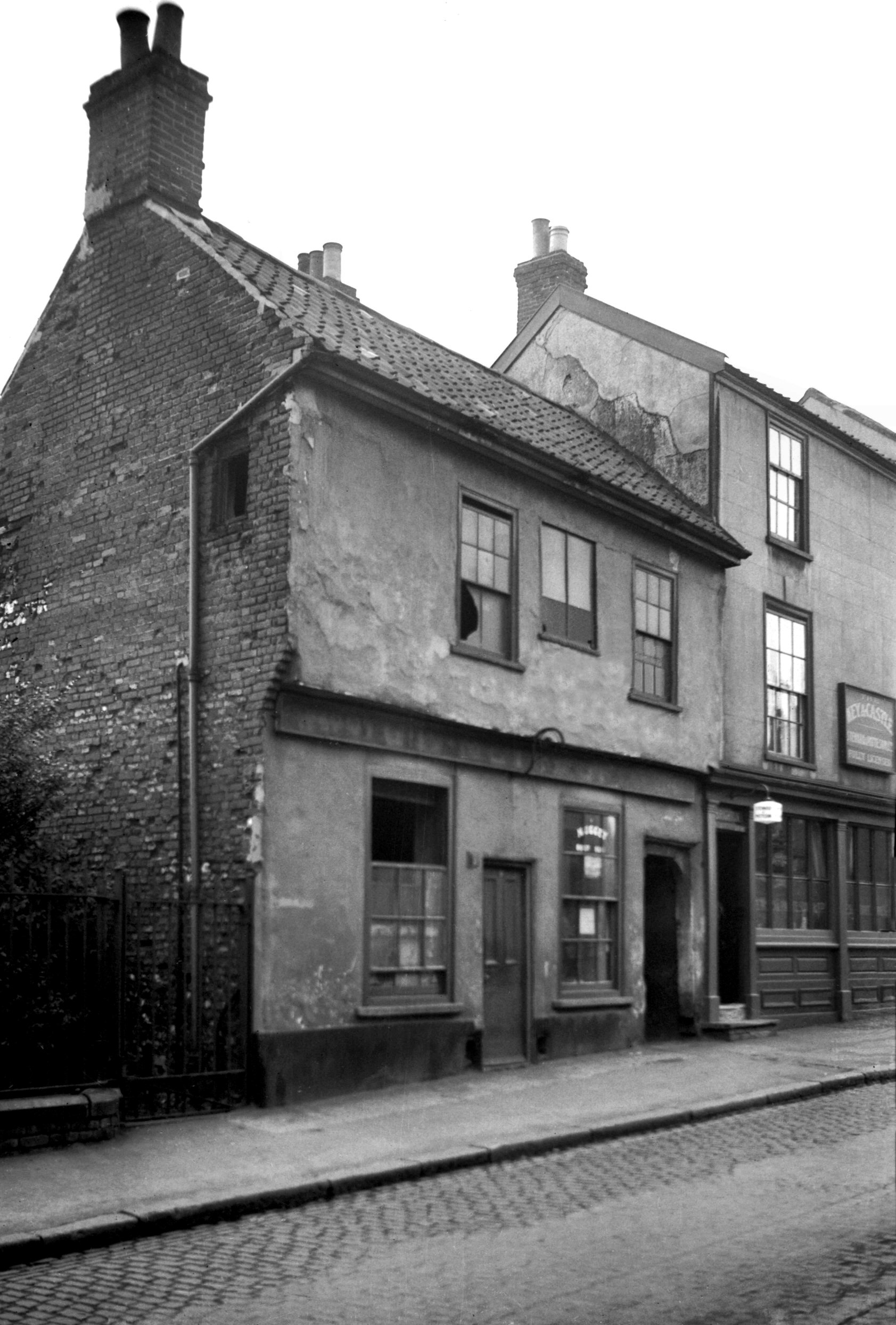
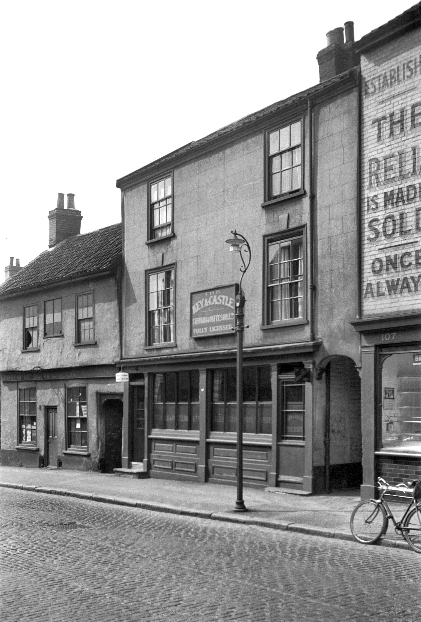
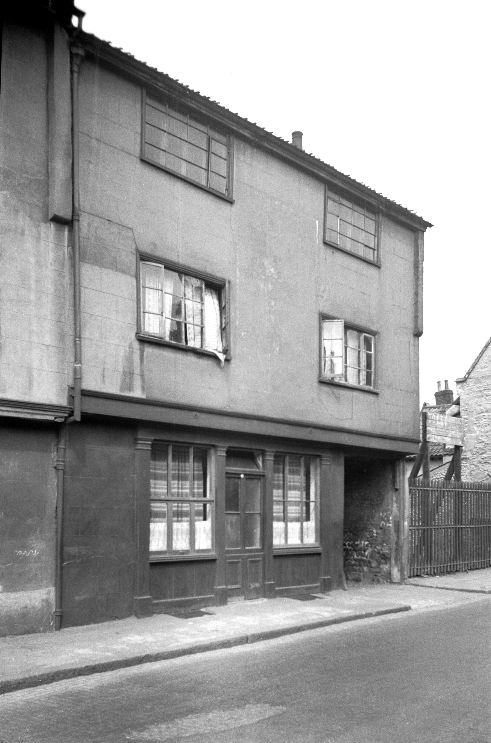
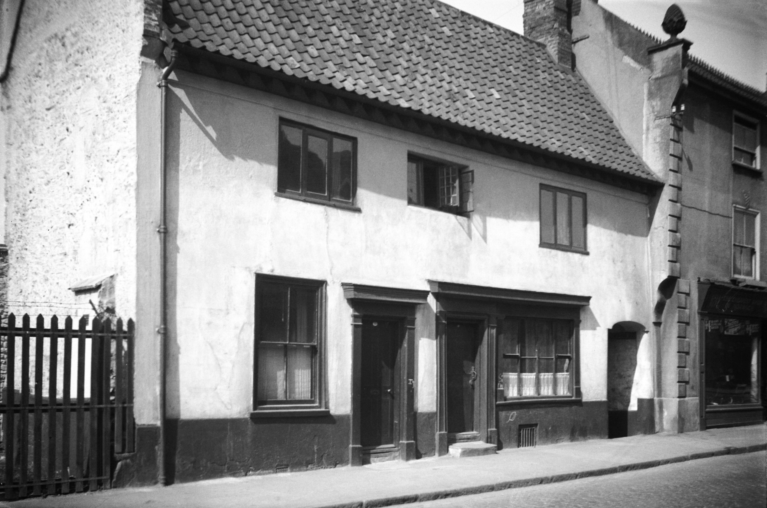
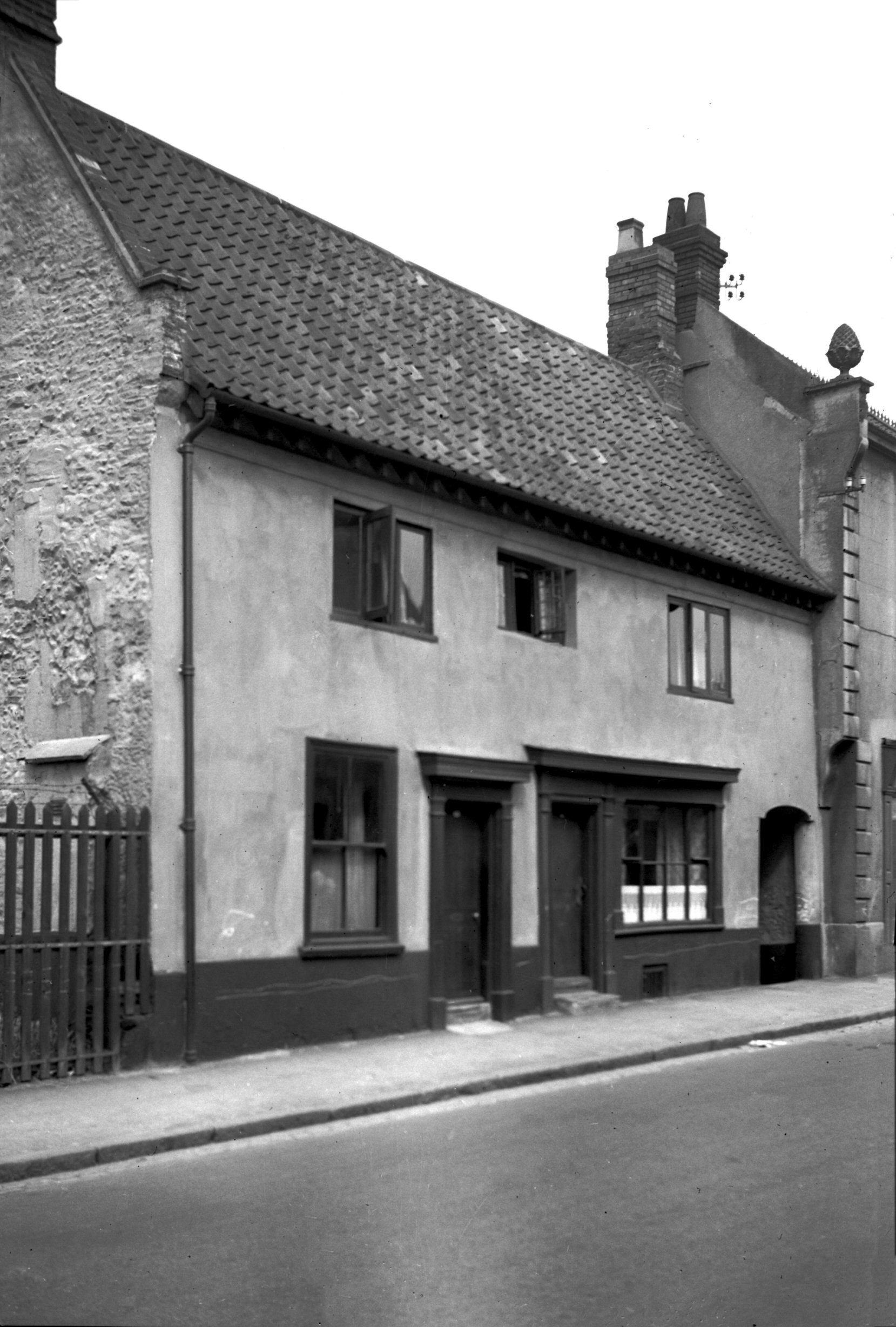
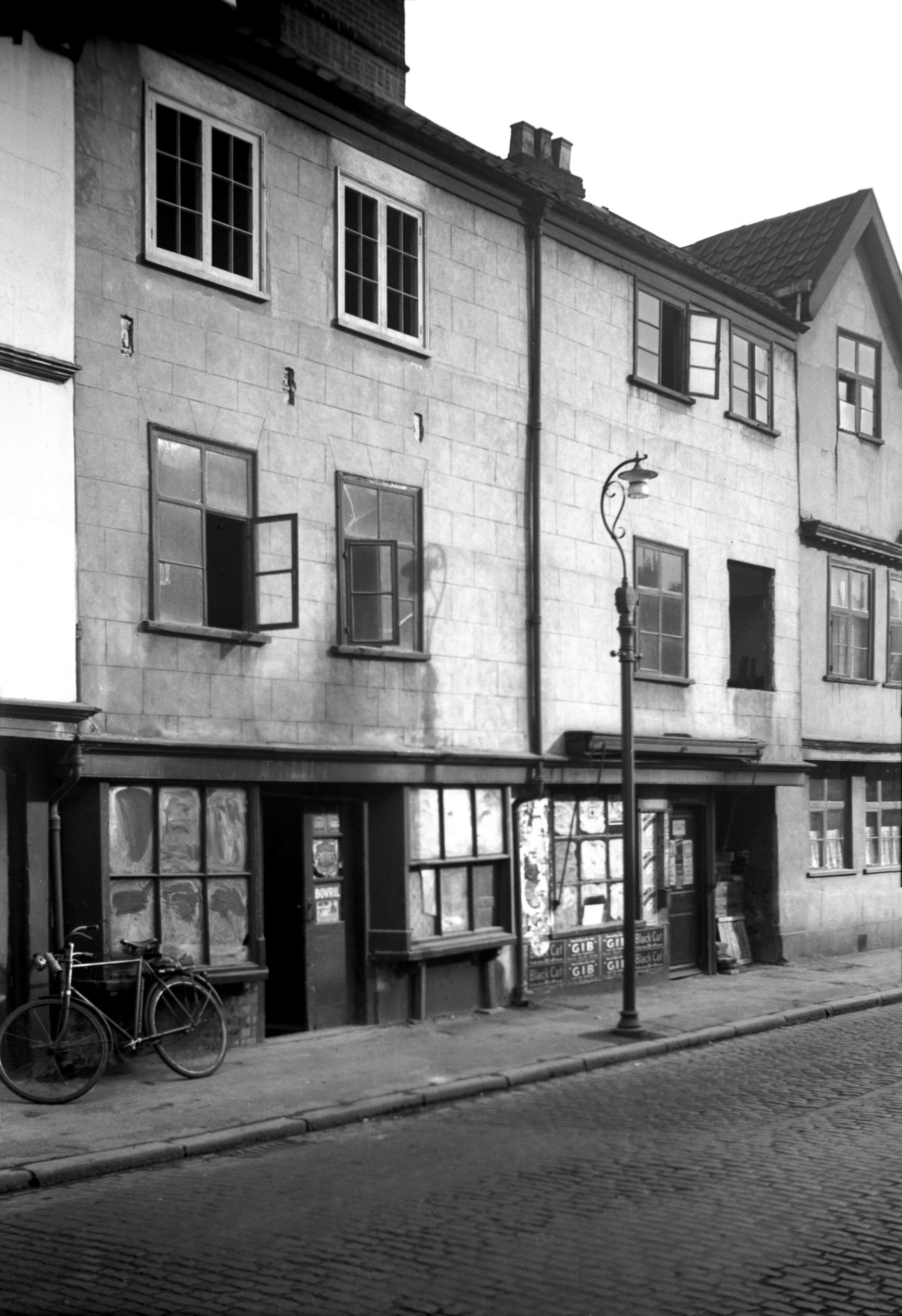
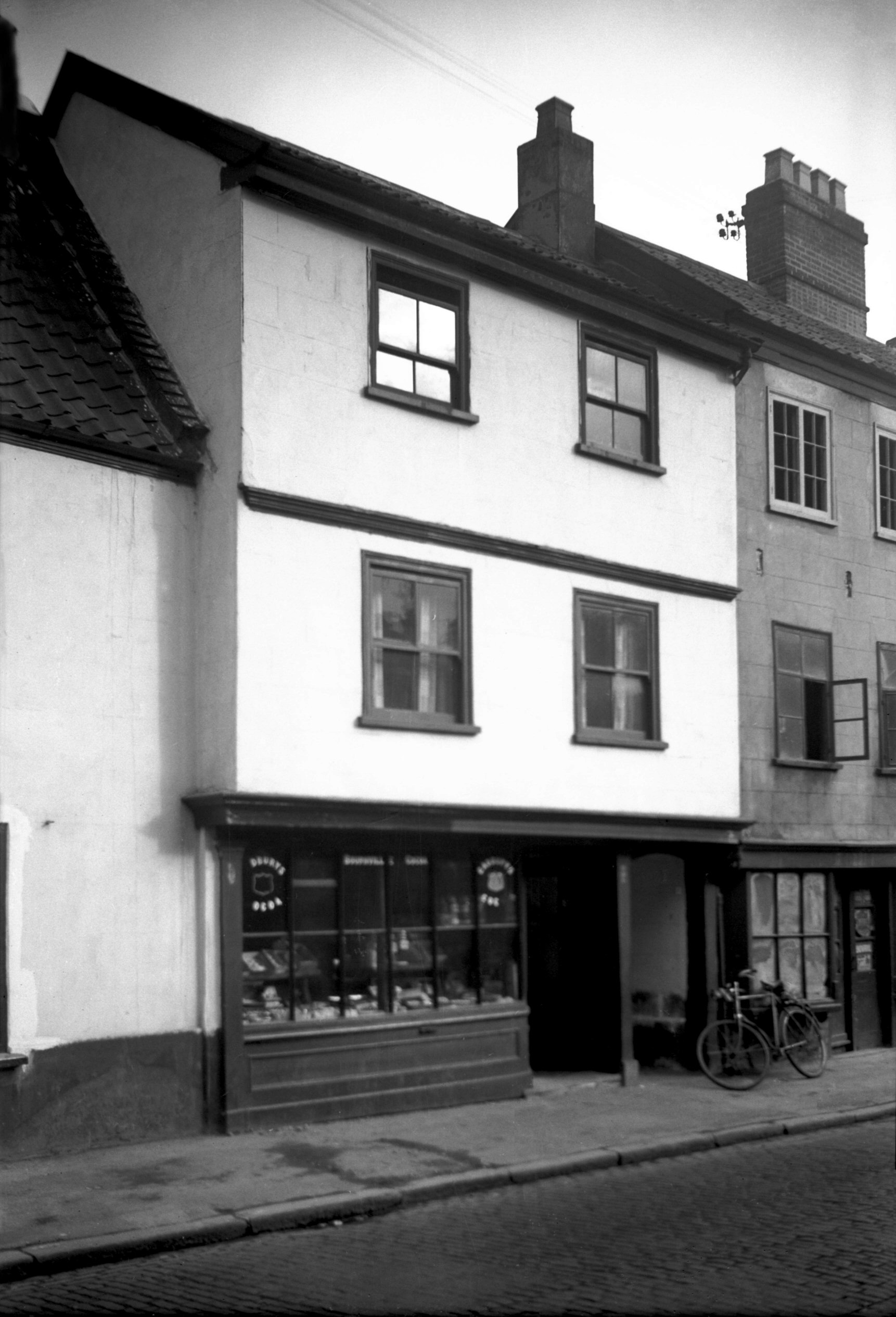
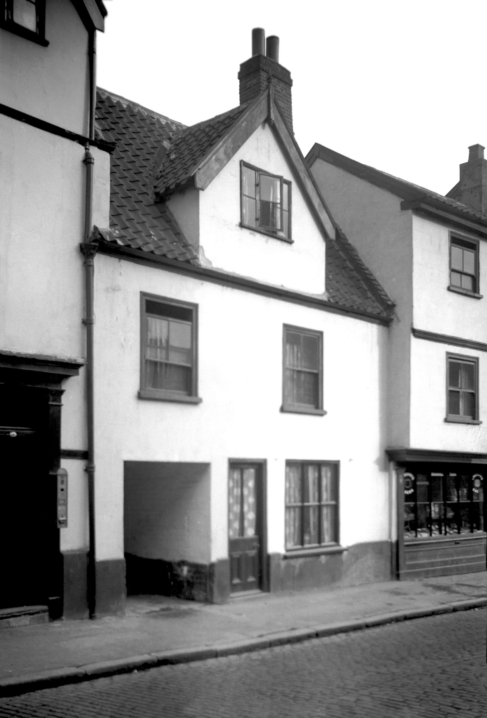
Oak St 103 [2041] 1937-10-11
No 103 Oak St, next door to the Key and Castle, was a
small timber-framed building with a slight overhang to
the first floor. It had long been in an extremely
dilapidated condition and the raids of April 1942, served
only to hasten an end that had already appeared
inevitable. In the front wall of the ground floor were
two sash windows from the 18c with slightly bowed frames.
To the right a decayed wooden Tudor arch spanned a
covered passageway leading to a court at the rear. This
was known as the Ragged School Yard because during the
19c a Sunday School primarily for the benefit of poor
people's children was maintained in a room here. |
|
|
Oak St Ragged School Yard south side [1773]
1937-07-12
|
|
|
Oak St Ragged School Yard view east [1769] 1937-07-12
|
|
|
Oak St 103 to 105 Key and Castle PH [2692] 1938-08-06
|
|
|
Oak St 105 rear from Key and Castle Yard [1774]
1937-07-12
|
|
|
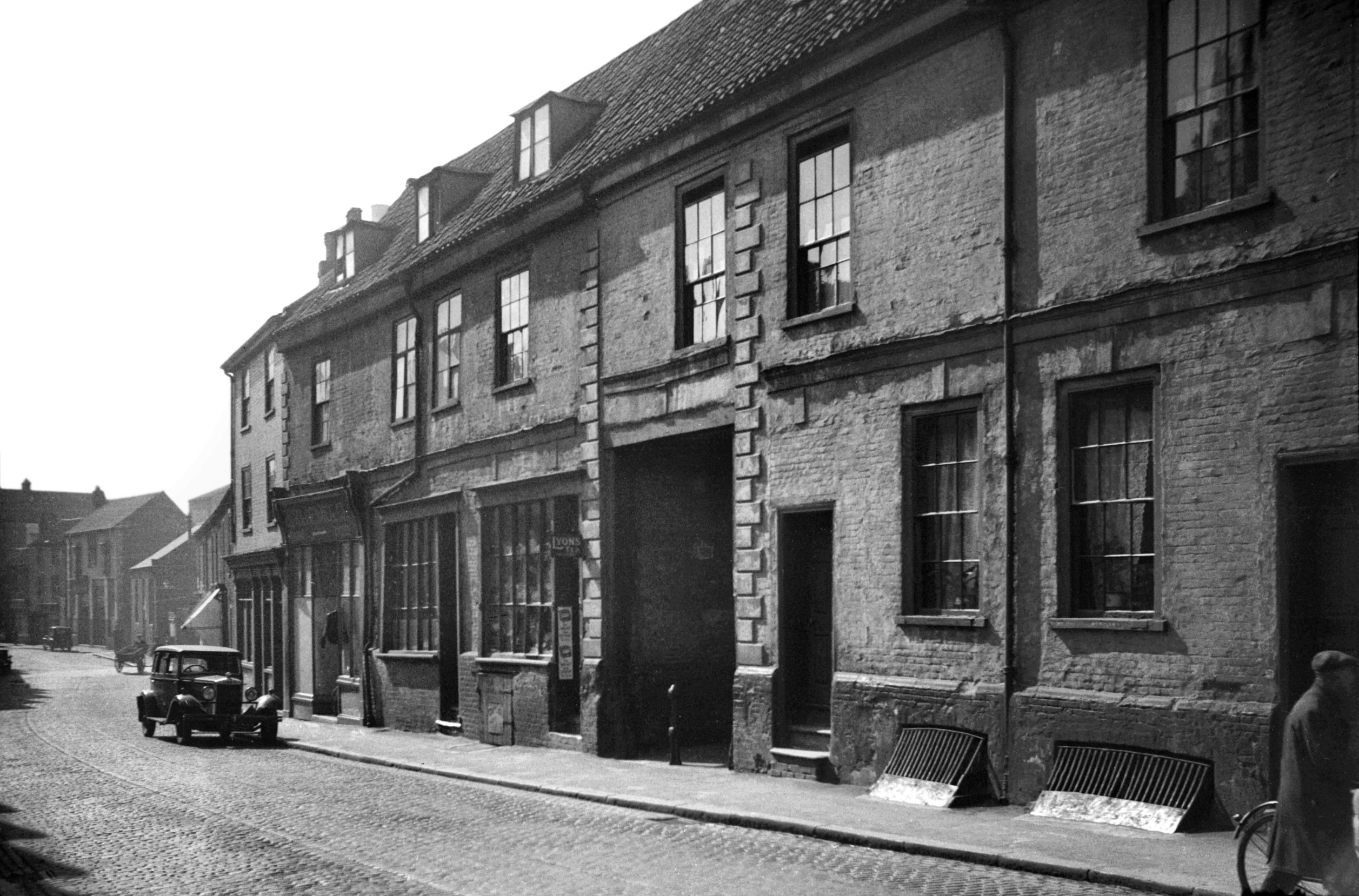
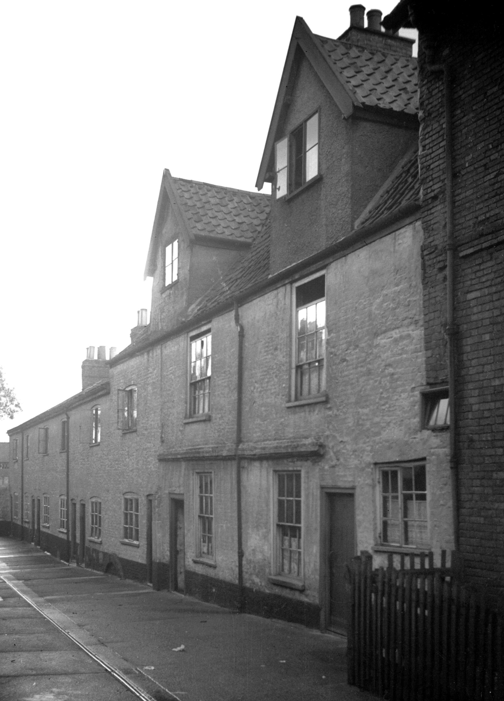
Oak St 103 to 119 view north [0854] 1936-04-10
|
|
|
Oak St 103 to 119 view south [1066] 1936-06-28
In between Nos 103 and 119 were located no fewer than
seven yards: Ragged School Yard, Key and Castle Yard,
Robinson's Yard, Horton's Yard, Saddler's Yard, Suffolk
Arms Yard and Smith's Yard. Some were named after
neighbouring public houses, while others no doubt
commemorated early residents or owners.
The landlord of the Key and Castle at No 105 was at one
time William Sheward, who in January 1869, confessed to
having murdered his wife some 18 years earlier while
living in Tabernacle St (now the west end of Bishopgate).
At the time of the crime portions of an adult female body
were found in various outlying parts of the city and it
was thought that some medical students at the hospital
were perpetrating a hideous joke in order to terrify
people. Sheward was subsequently hanged at the old City
Gaol at St Giles' Gates on 20th April 1869 - the first
execution to be held in private in Norwich. As to the
city's last public execution, there is a popular belief
that this took place on the Castle Hill on 21st April
1849, when the double murderer James Blomfield Rush was
hanged. Although the notoriety of the case attracted
enormous crowds, augmented by many coming by rail on
cheap day excursions from as far afield as London, this
occasion did not mark the end of such grim spectacles. In
fact three more public hangings took place in Norwich
after that date, the last on 26th August 1867, when
22-year-old Hubbard Lingley was executed for the murder
of his uncle. |
|
|
Oak St 115 to 117 [2561] 1938-07-21
|
|
|
Oak St 117 rear from Saddler's Yard [1772] 1937-07-12
|
|
|
Oak St 119 [2691] 1938-08-06
|
|
|
Oak St 119 rear from Suffolk Arms Yard [1771]
1937-07-12
|
|
|
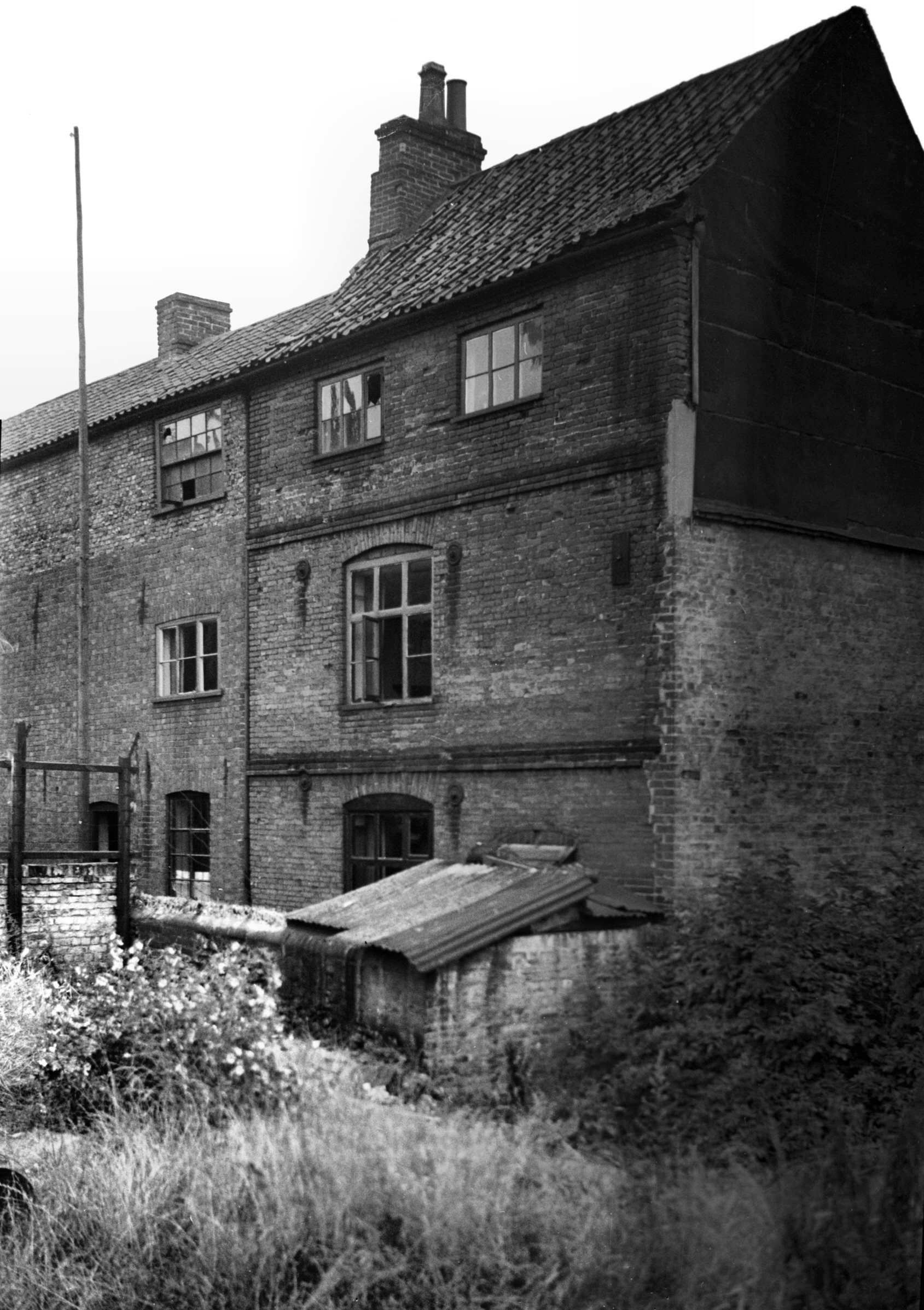
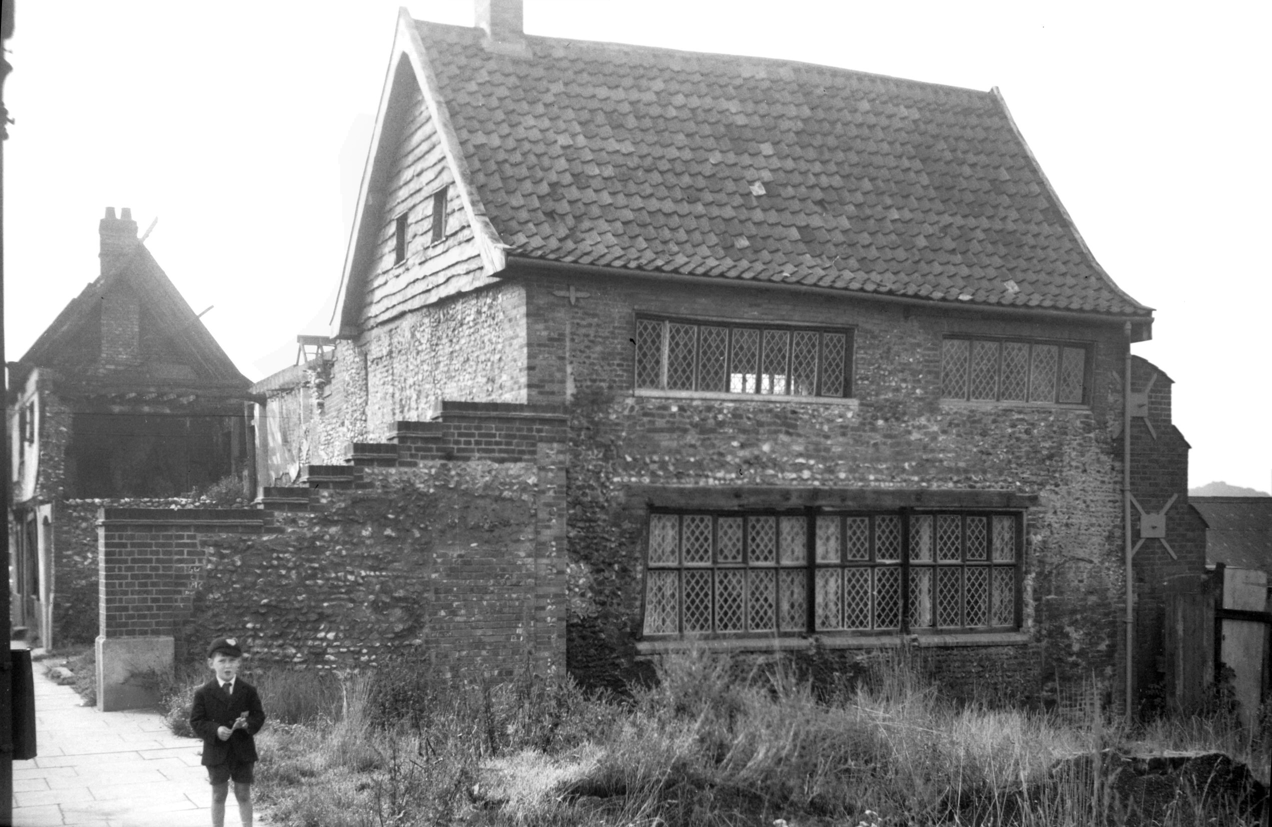
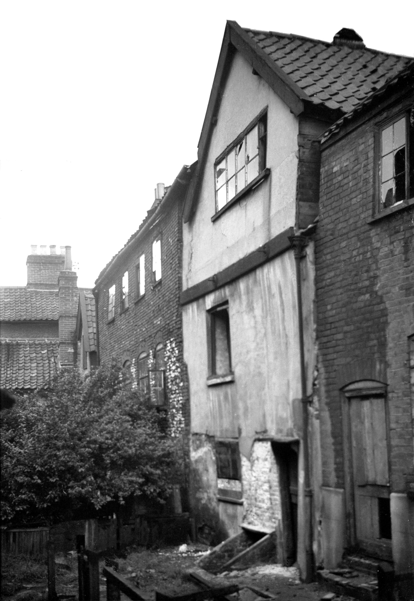
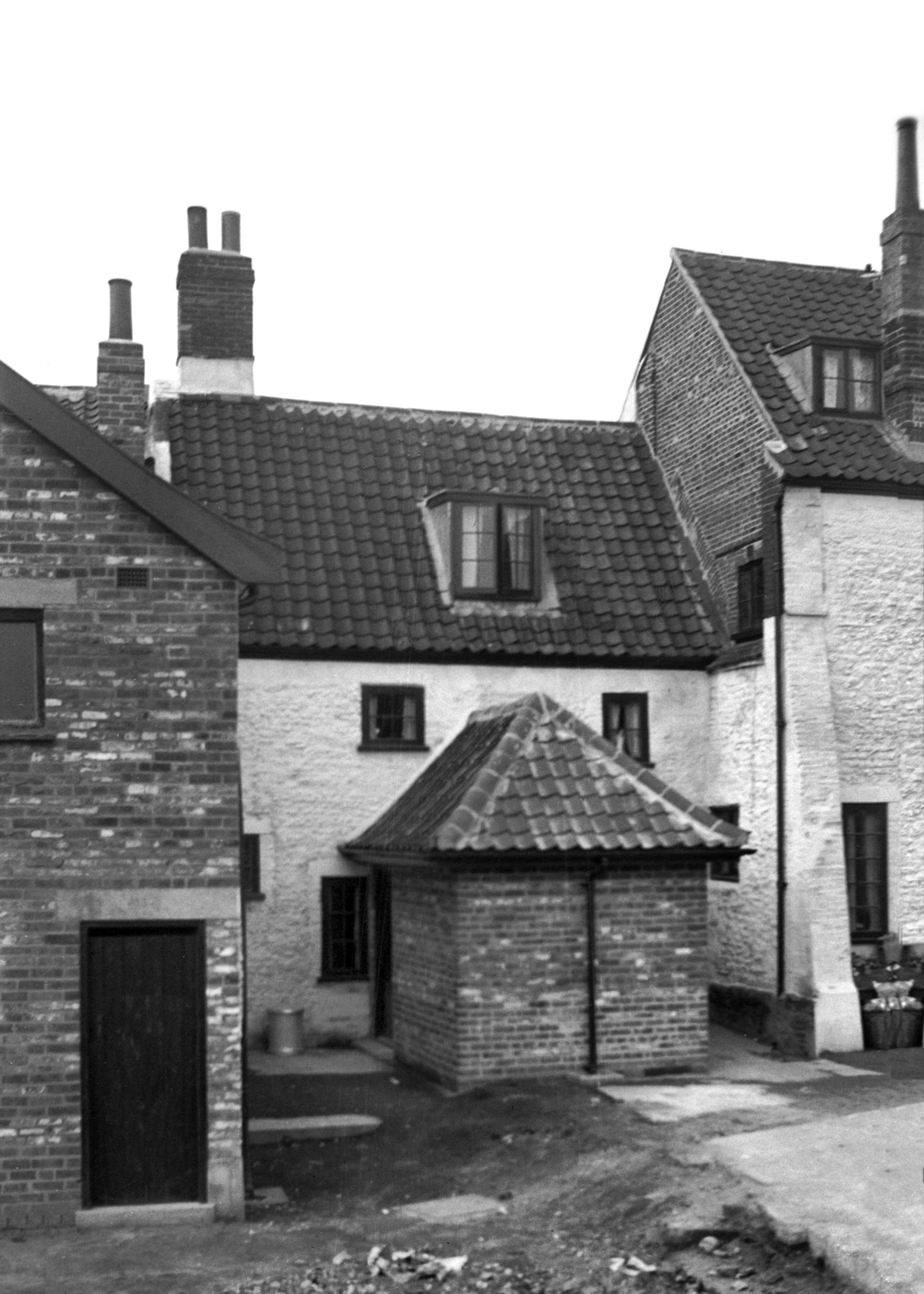
Oak St 125 to 127 Flower Pot Yd Great Hall [4386]
1955-09-24
Partially destroyed in air raid of April 1942. |
|
|
Oak St 125 to 127 former Flower Pot PH [0859]
1936-04-10
|
|
|
Oak St 125 to 127 former Flower Pot PH [2507]
1938-06-26
|
|
|
Oak St 125 to 127 rear and Flower Pot Yard [1770]
1937-07-12
From the south-west. |
|
|
Oak St Flower Pot Yard west side house rear [1775]
1937-07-12
|
|
|
Oak St Flower Pot Yard view W from street [2044]
1937-10-11
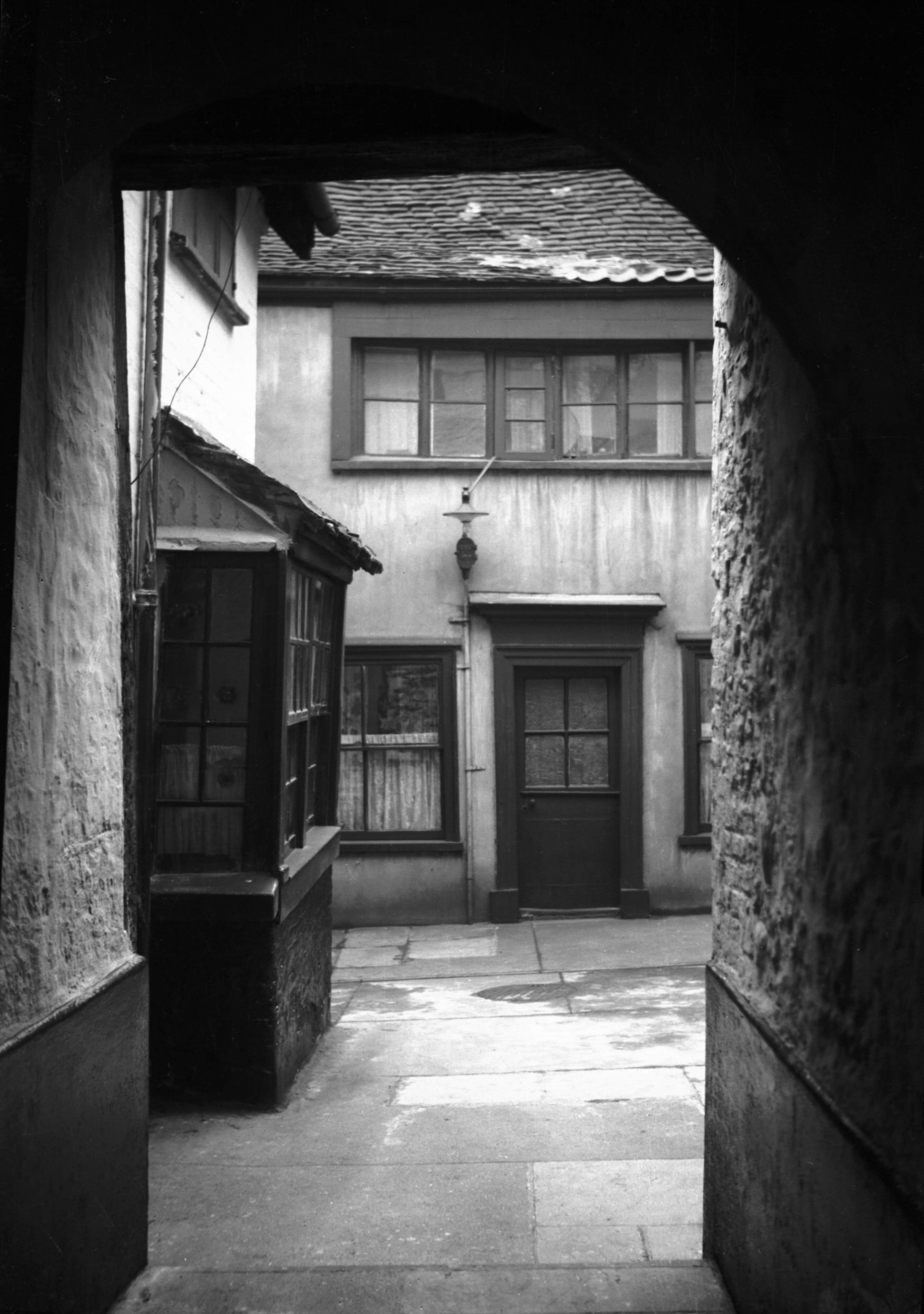
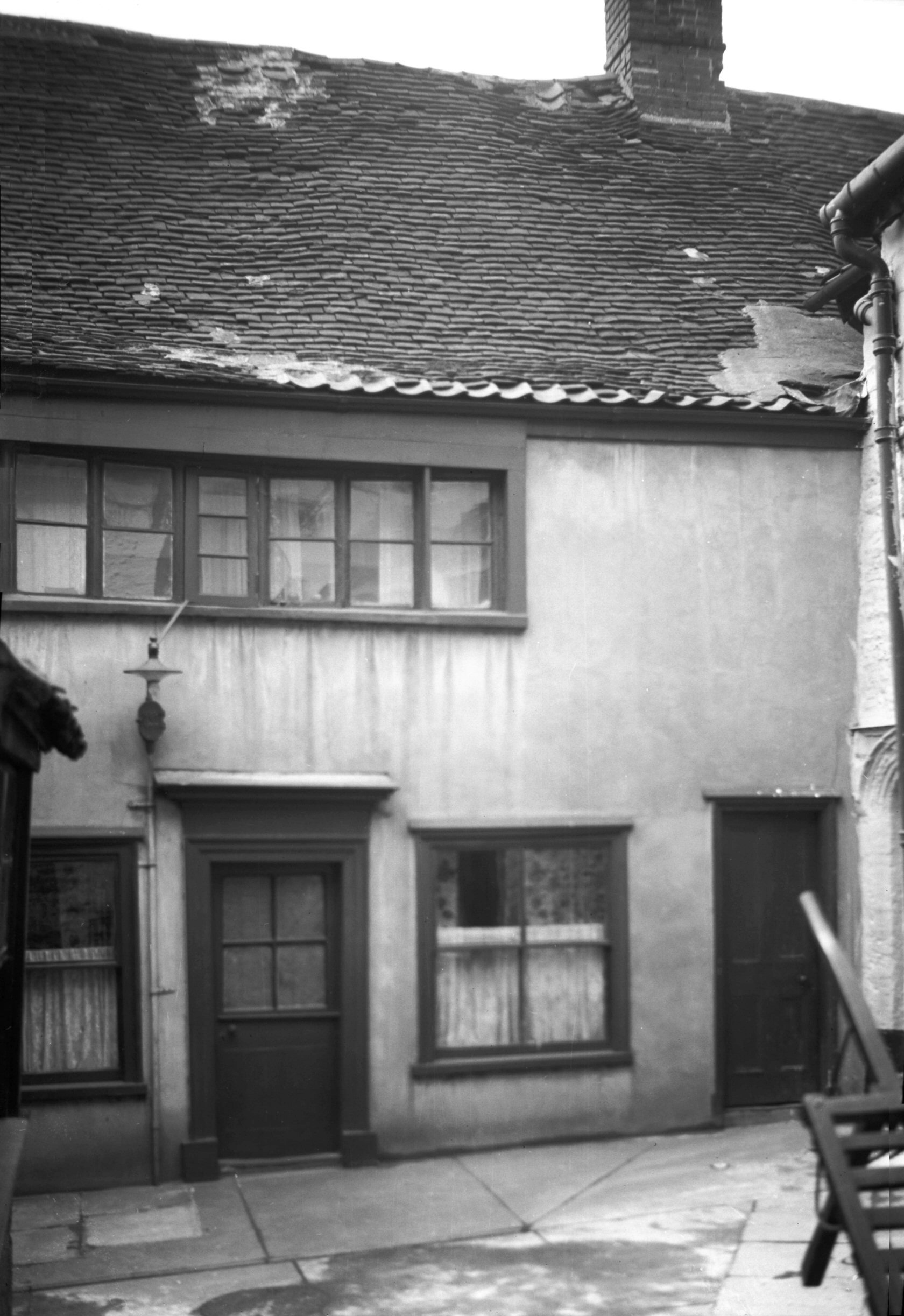
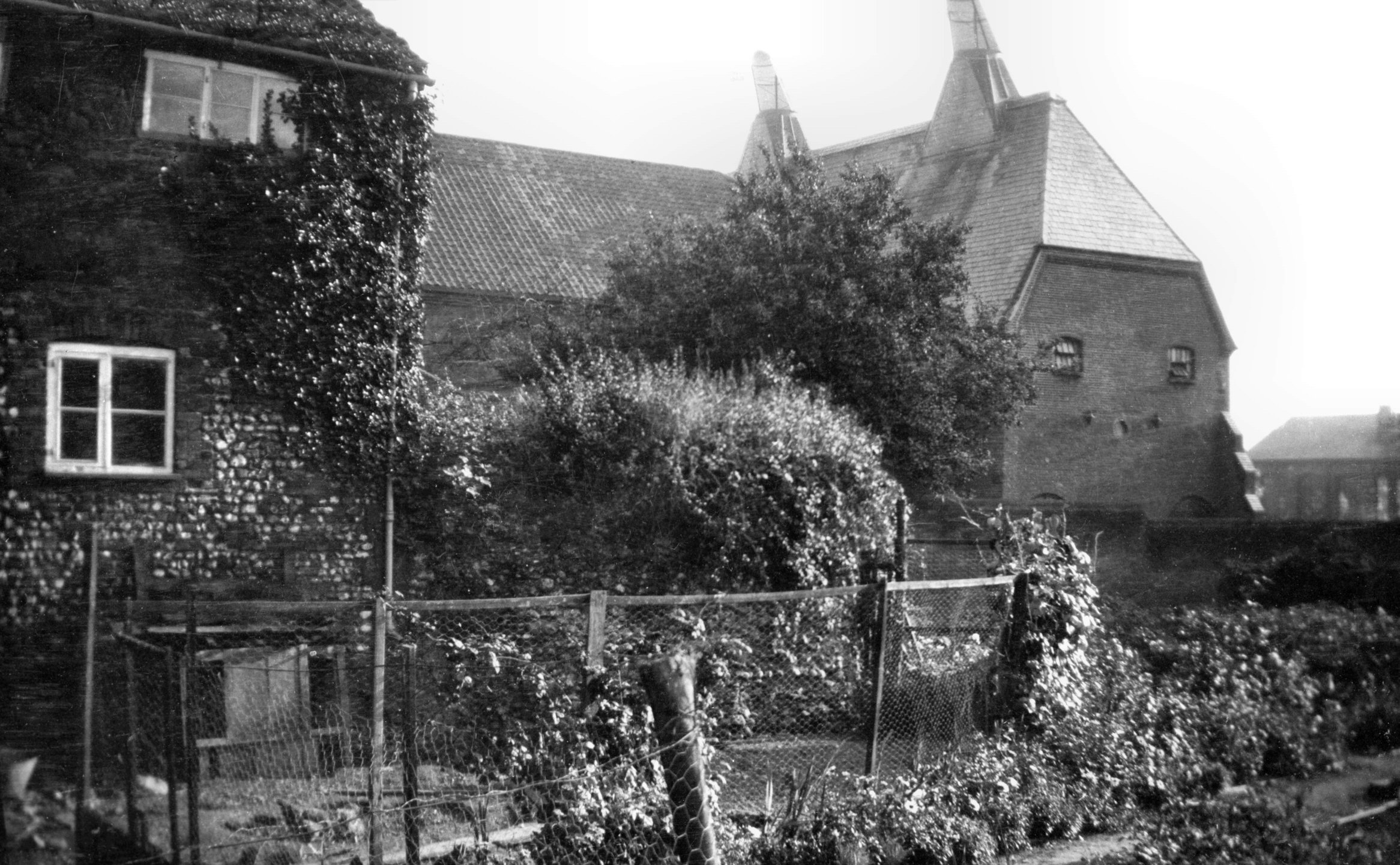
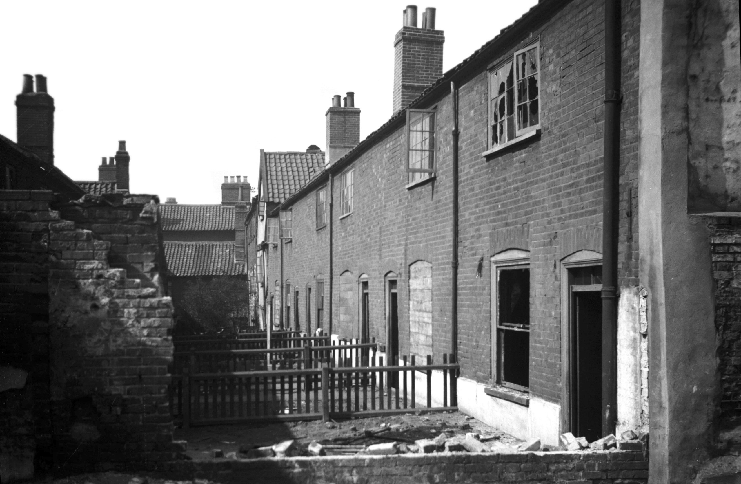
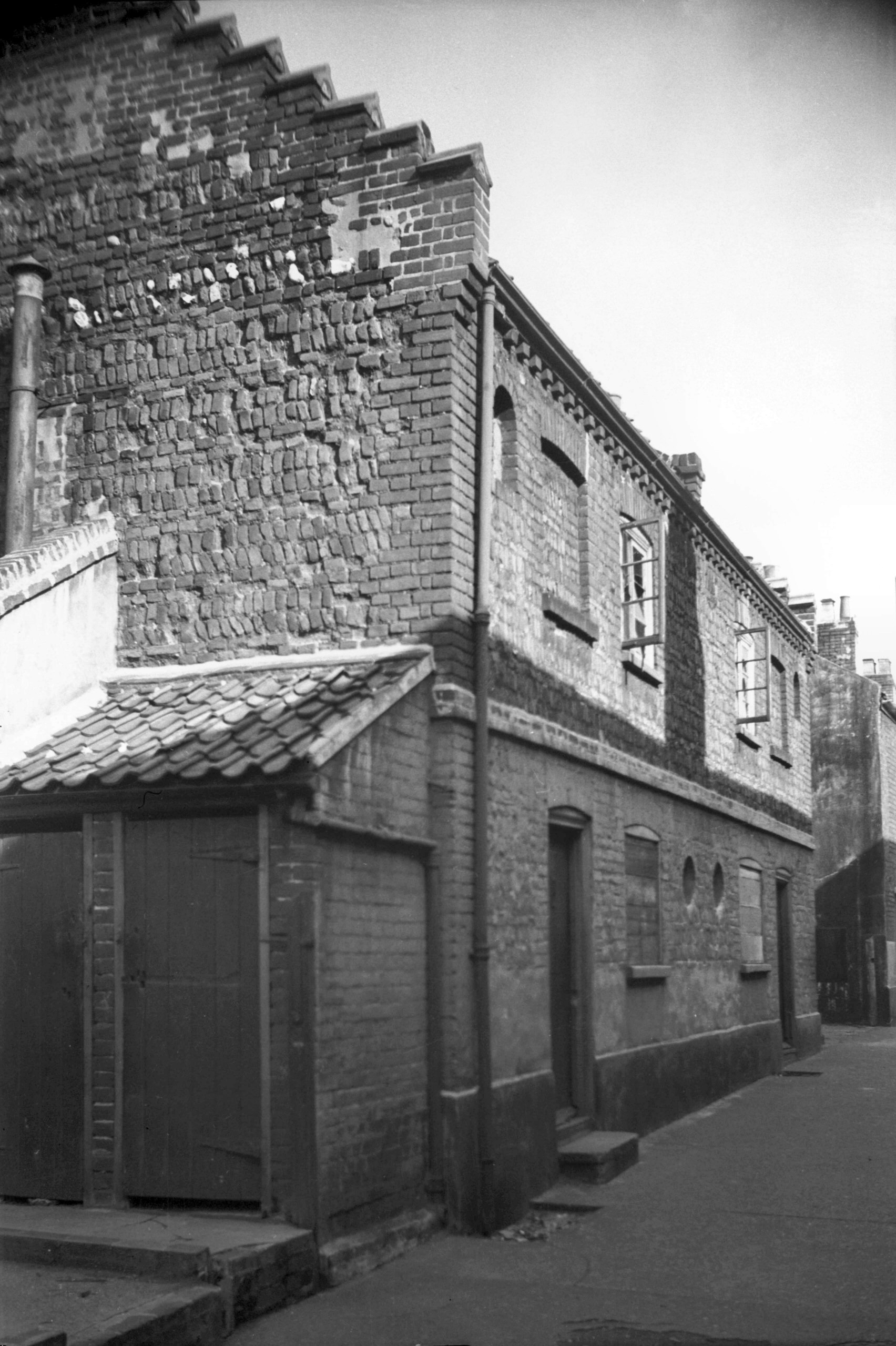
A little further south is Flower Pot Yard - or what
remains of it. This picturesque piece of old property,
which has a Great Hall dating from about 1480, was
condemned in the early 1930s as the "worst slum in
Norwich", but was subsequently acquired by Major
(later Lieutenant-Colonel) S.E.Glendenning to demonstrate
that old houses, originally well built, could be
reconditioned for a further span of useful life even
after years of neglect.
The building with the little bay window to the left of
the courtyard entrance was during the 19c a public house
known as the Flower Pot - or more accurately as the Pot
of Flowers - where, according to Walter Wicks, early
flower shows were held over a century ago. Tulips
apparently were the chief attraction. This and the house
at the back of the yard were wrecked both by fire and
high explosive during the raids. The Great Hall however,
(out of sight on the right) was rather more fortunate and
some years later was once more restored. Like its
contemporary, the old Rosemary Tavern on St Mary's Plain,
it had had a floor put in during the 16c, half way up the
building, and a fireplace and chimney added. It is
possible that during the time of the Huguenots the room
was used for weaving, for there was evidence that it had
contained looms. |
|
|
Oak St Flower Pot Yard west side [2043] 1937-10-11
|
|
|
Oak St Flower Pot Yard Great Hall doorway [2148]
1938-03-12
Blocked doorway on south side, which led to Screen's
Passage of the Great Hall. Dating from c1490 it may have
been a residence of Sir John Fastolff, although his
principal residence was in Fastolff Place in Cowgate. |
|
|
Oak St Flower Pot Yard south side [2149] 1938-03-12
|
|
|
Oak St Flower Pot Yard NW corner Great Hall [3223]
1939-08-07
Corner of yard showing south side of Great Hall. |
|
|
Oak St Flower Pot Yard Great Hall from NE [4387]
1955-09-24
|
|
|
Oak St Holl's Yard Great Hall north side [1739]
1937-07-03
|
|
|
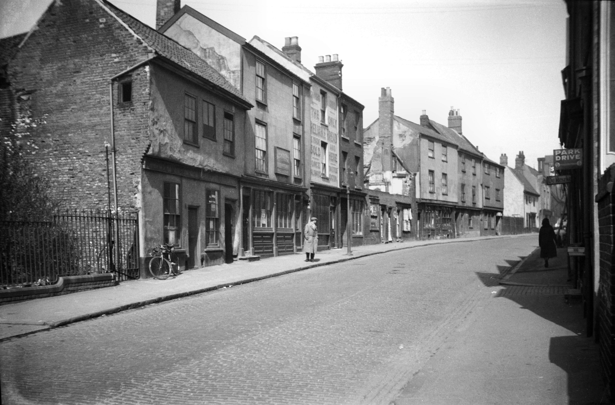
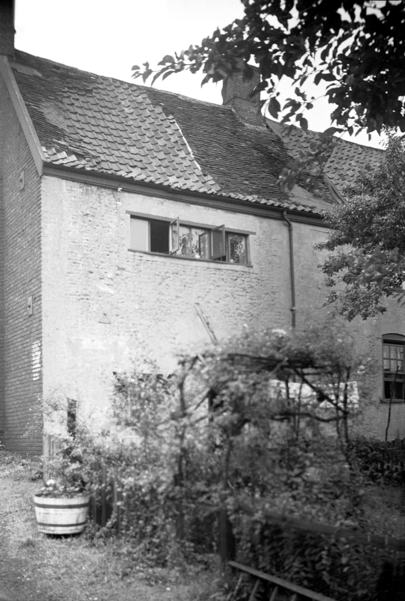
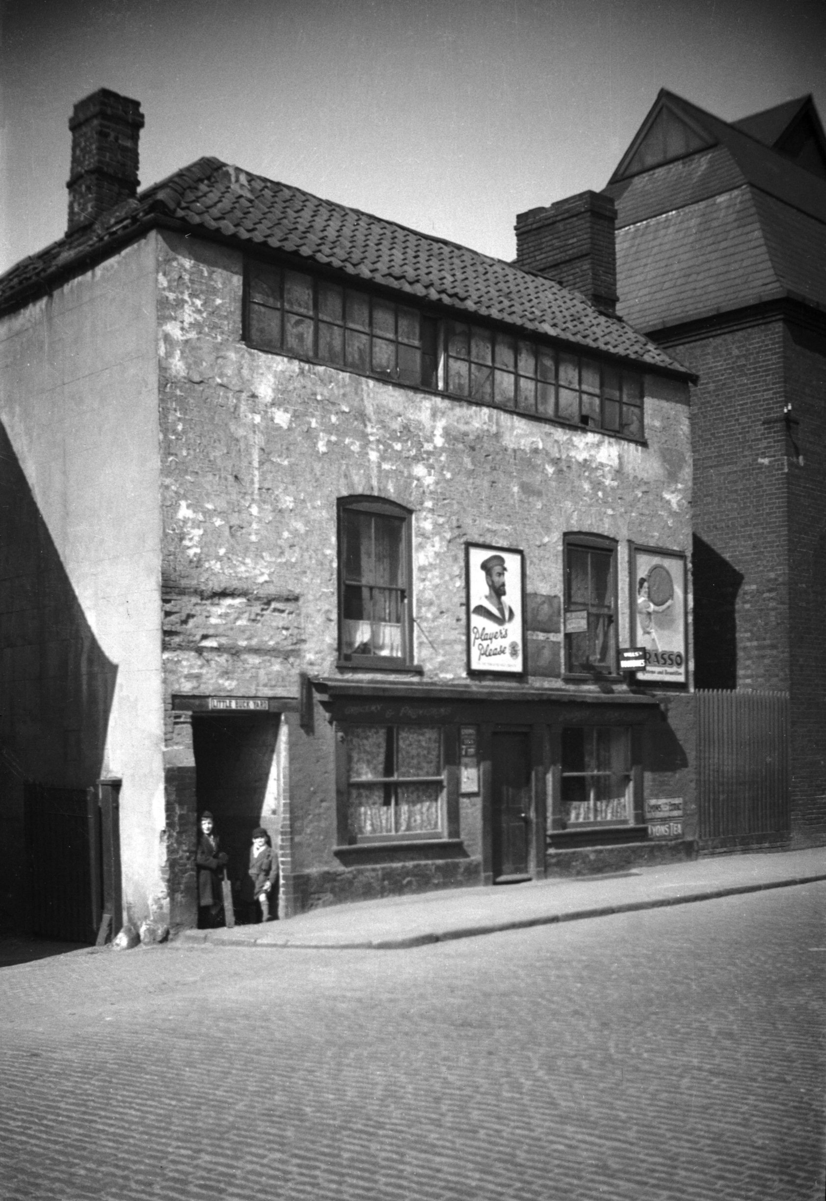
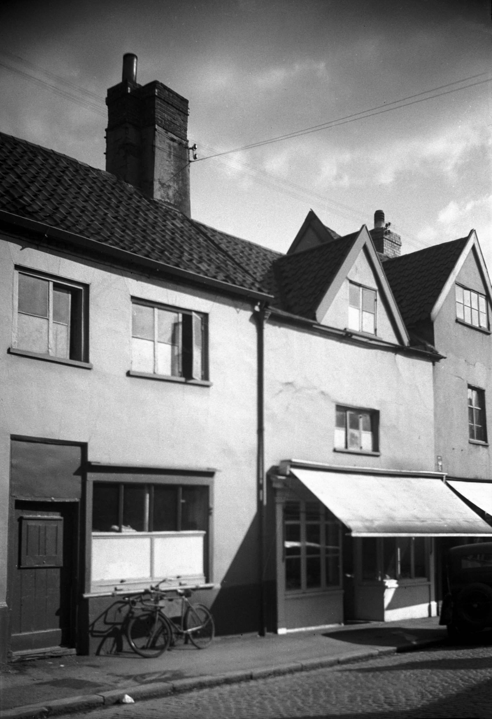
Oak St 141 with weavers' window [0860] 1936-04-10
Oak St was the scene of considerable change during the
20c. Some of this was caused by enemy action,
particularly on the nights of the 27th and 29th April
1942, when no doubt the nearby City Station was one of
the intended targets. No 141, which faced up Sussex St,
was one casualty. An 18c brick-built house, three storeys
high, it had a typical range of weavers' windows to light
the top floor. A covered passageway to the south led to
Little Buck Yard, while its neighbour on the north was
Steward and Patteson's maltings. |
|
|
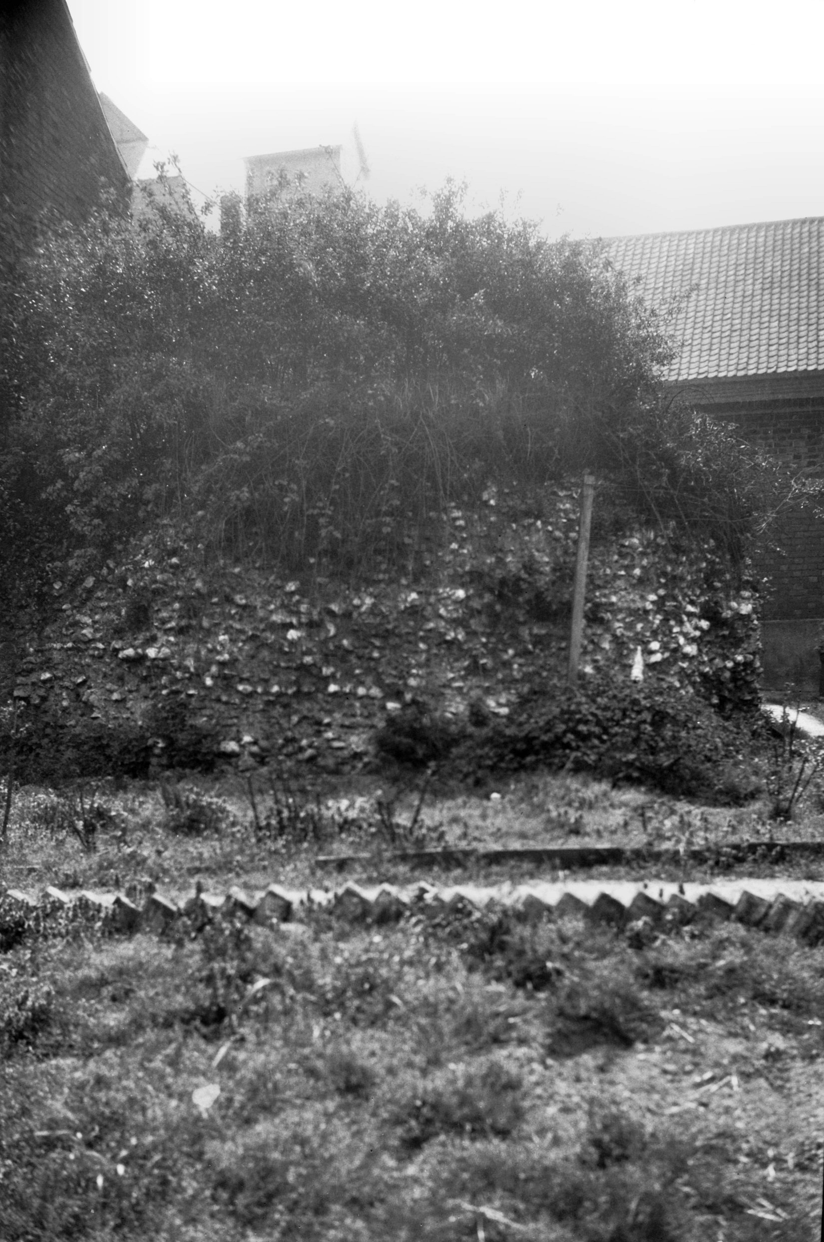
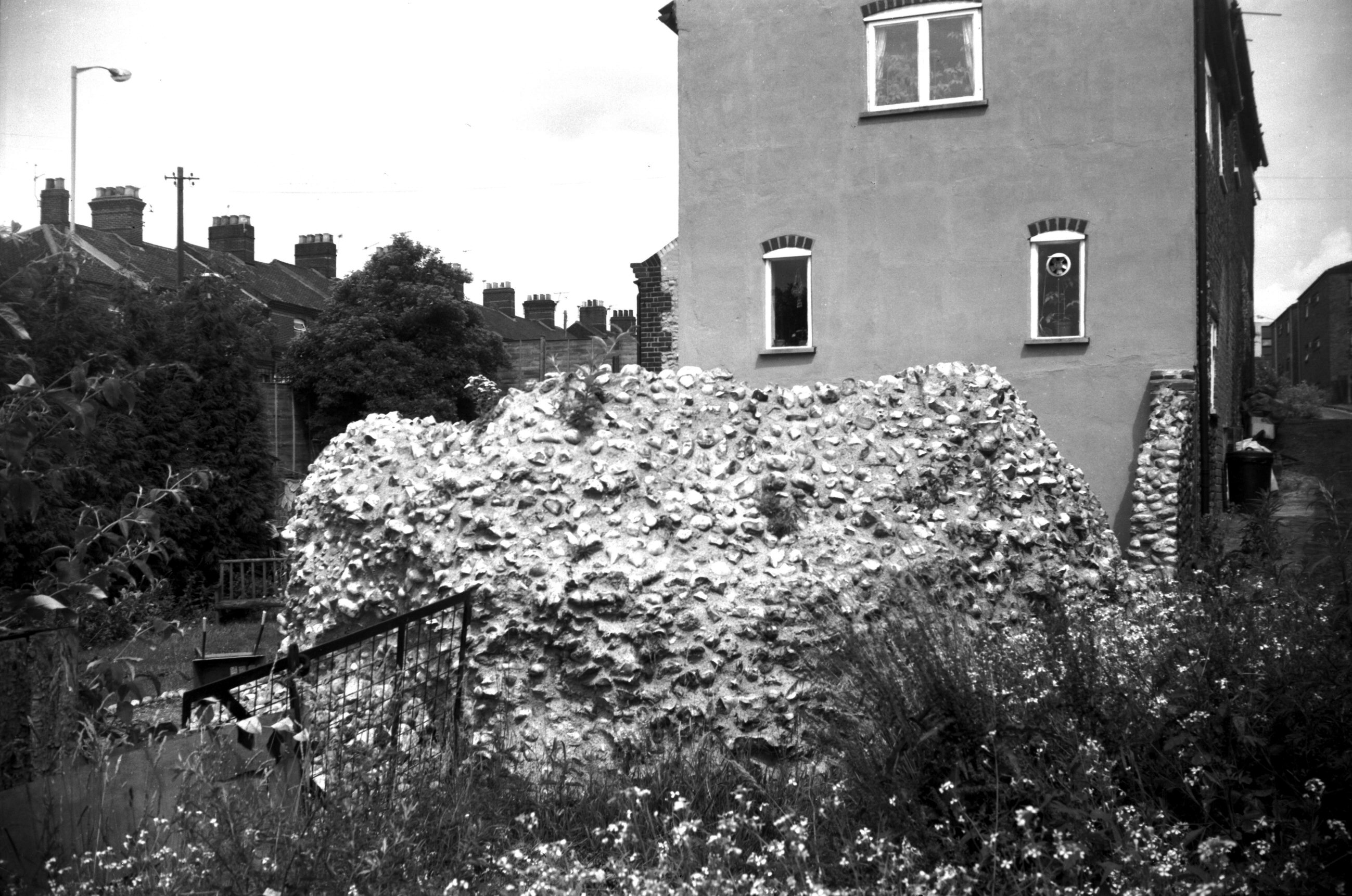
Oak St 167 tower behind Dun Cow PH [5367] 1974-03-30
Former Dun Cow PH, adjacent to remains of a city wall
tower. |
|
|
Oak St 167 tower behind Dun Cow PH [B097] 1931-00-00
Remains of round terminal tower. |
|
|
Oak St 167 tower behind Dun Cow PH view SW [0575]
1935-05-11
|
|
|
Oak St 167 tower behind Dun Cow PH [6233] 1982-07-05
|
| |
East
side |
|
|
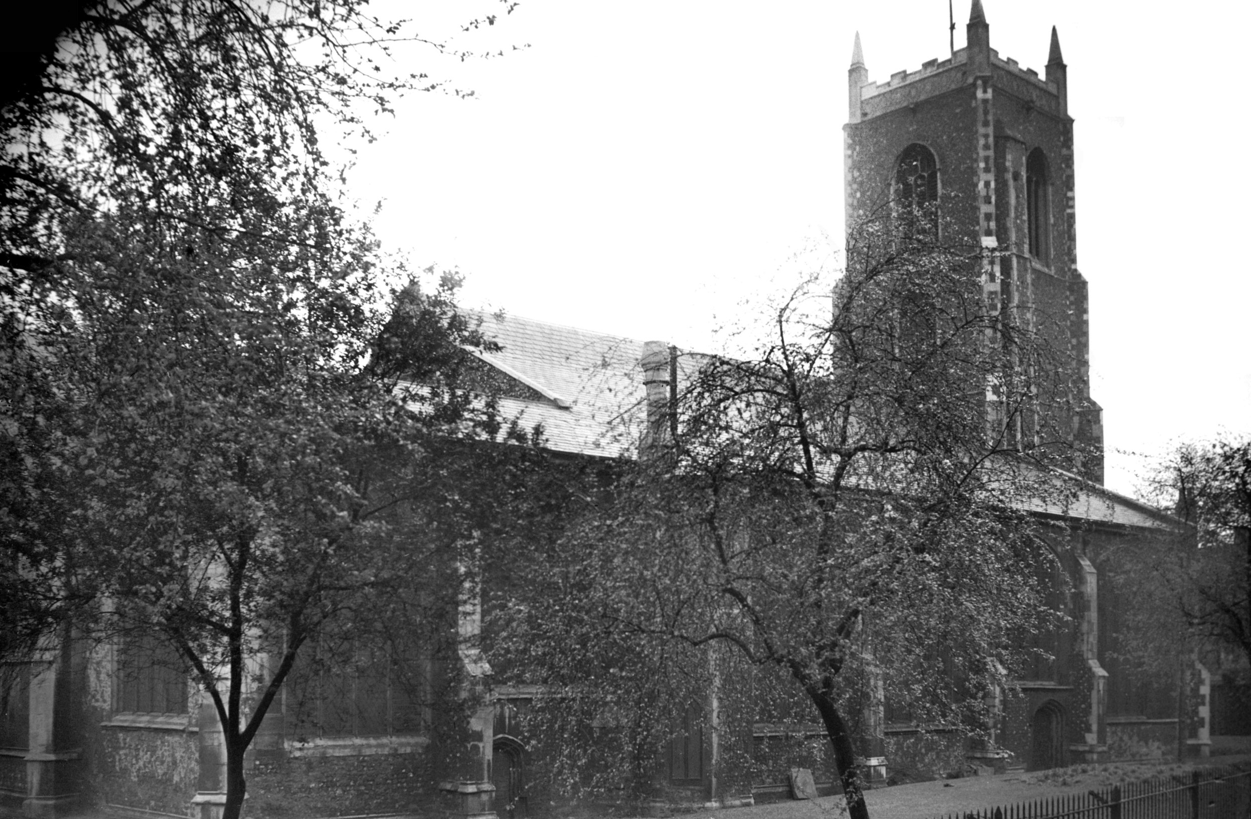
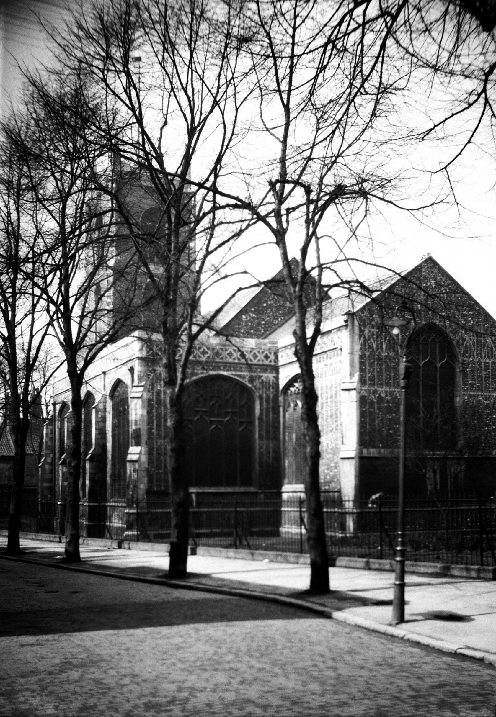
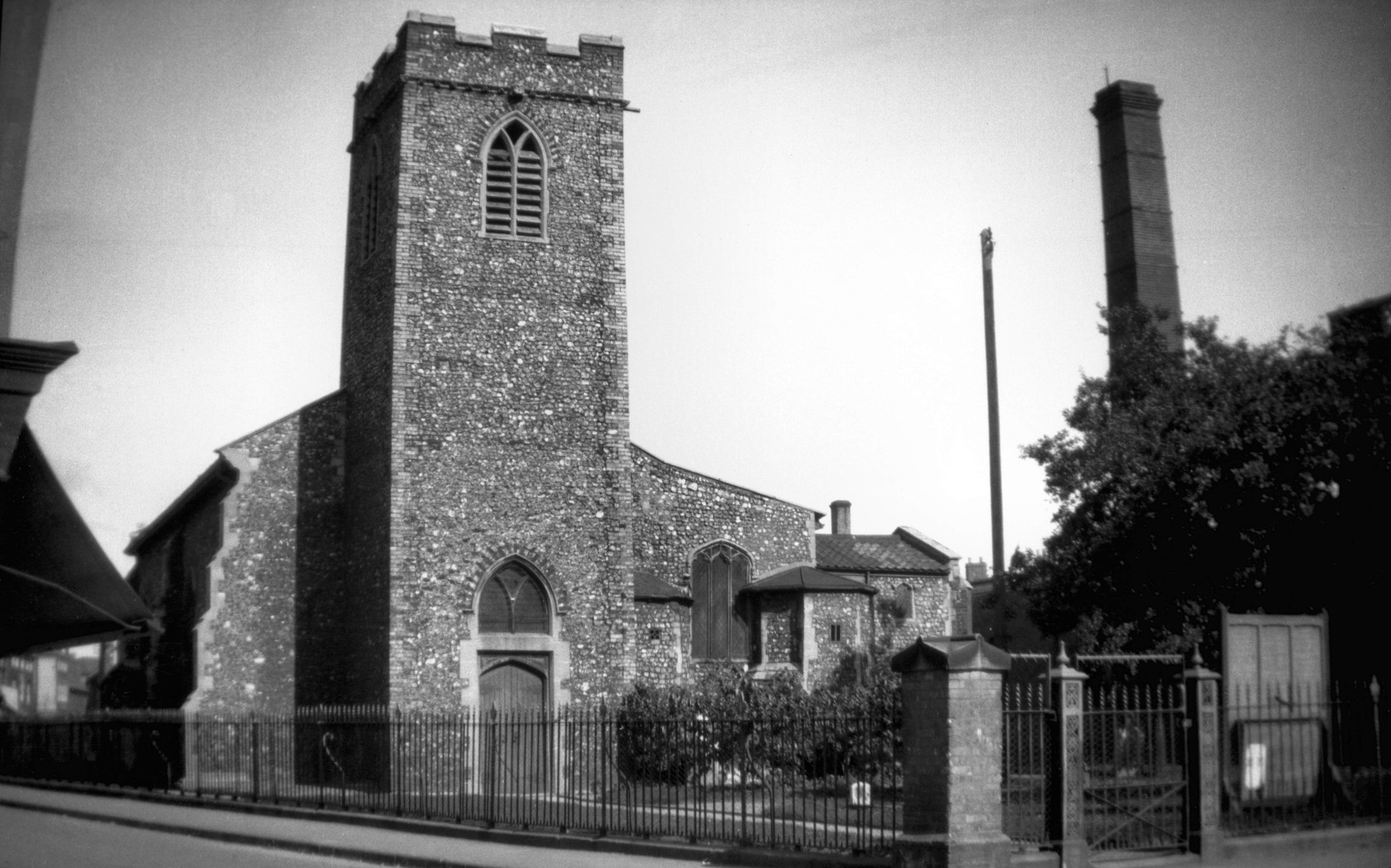
St Michael at Coslany from NE [2262] 1938-04-07
Mostly Perpendicular. |
|
|
St Michael at Coslany from SE [0896] 1936-04-12
|
|
|
St Michael at Coslany south aisle east end [0346]
1934-12-26
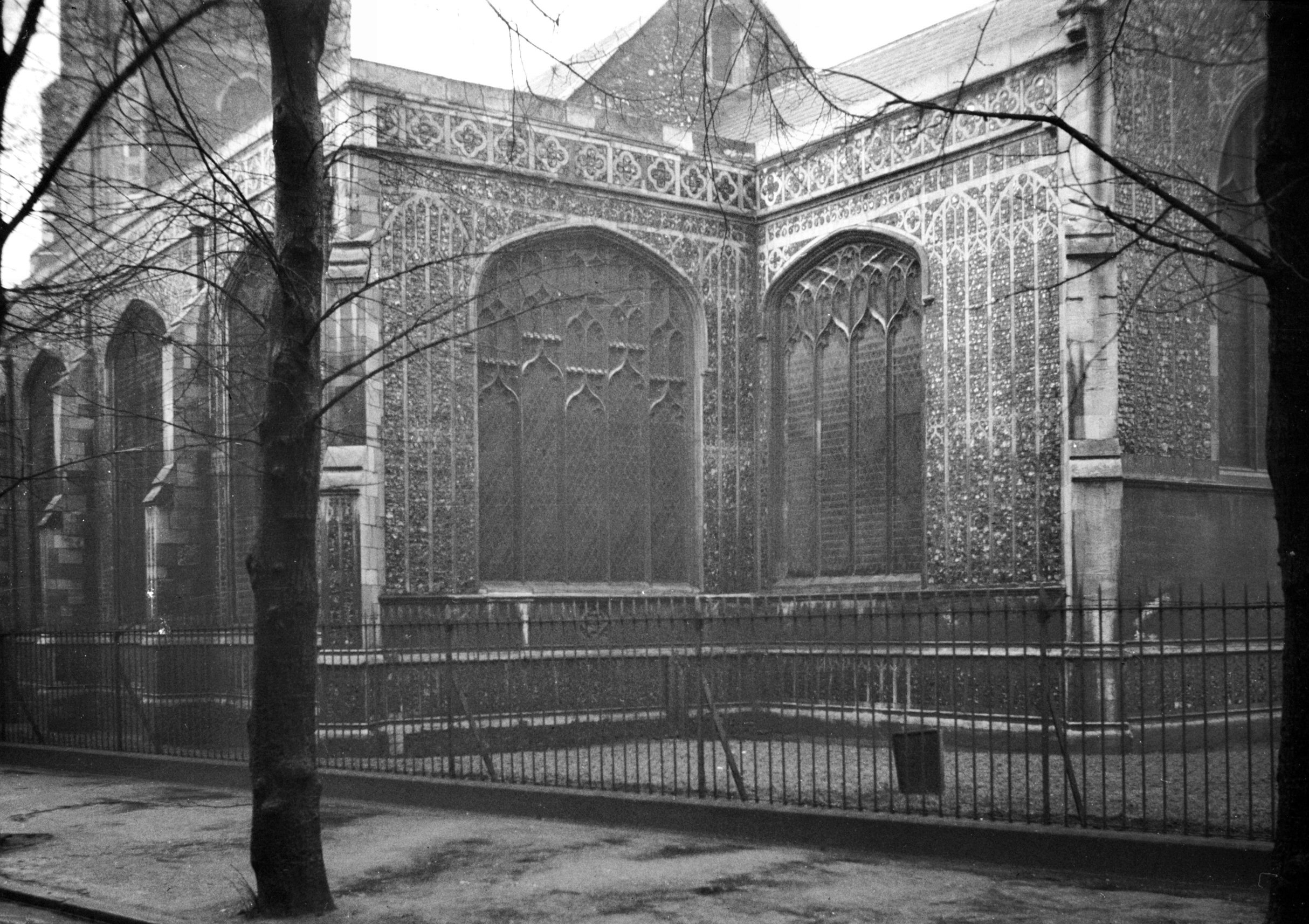
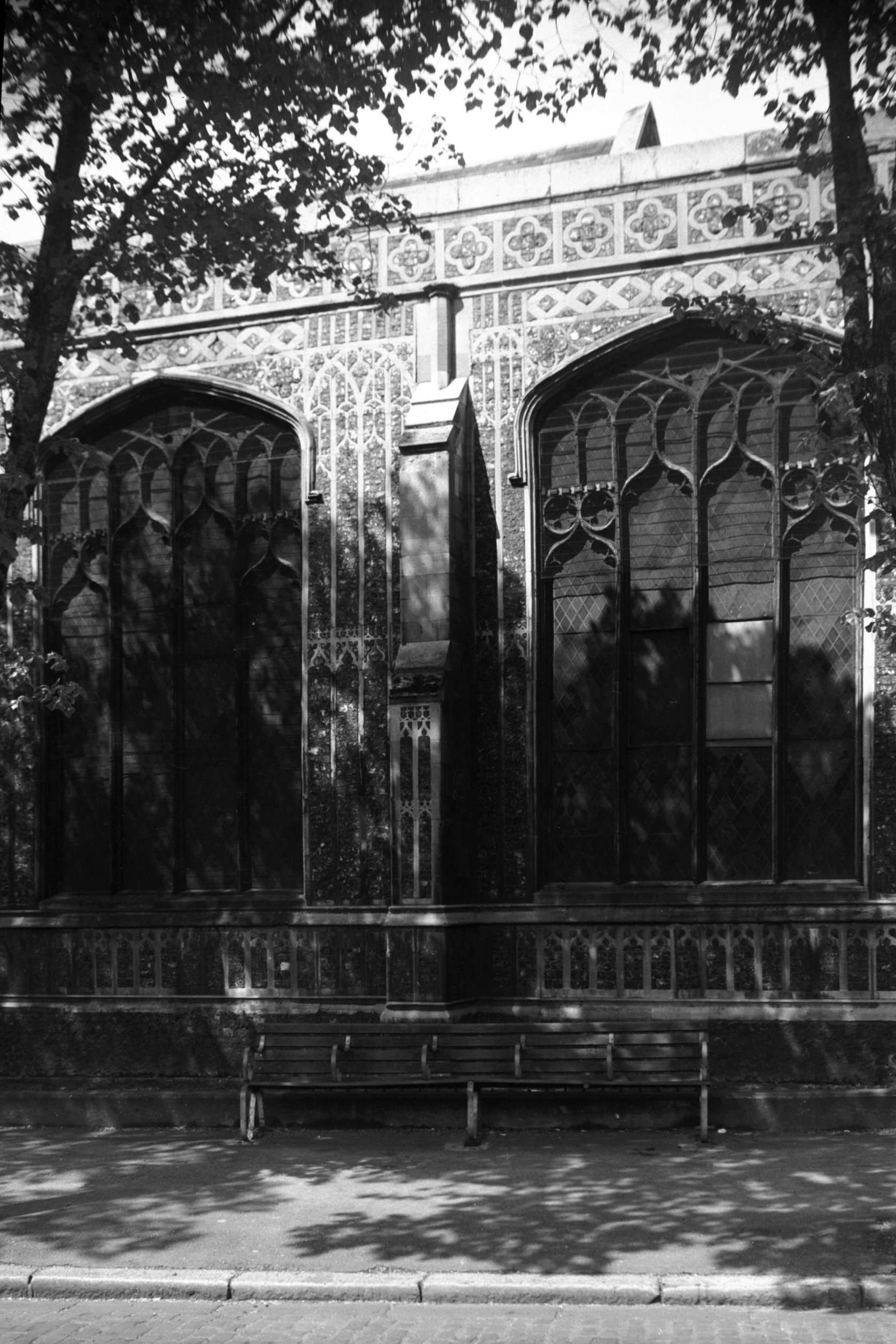
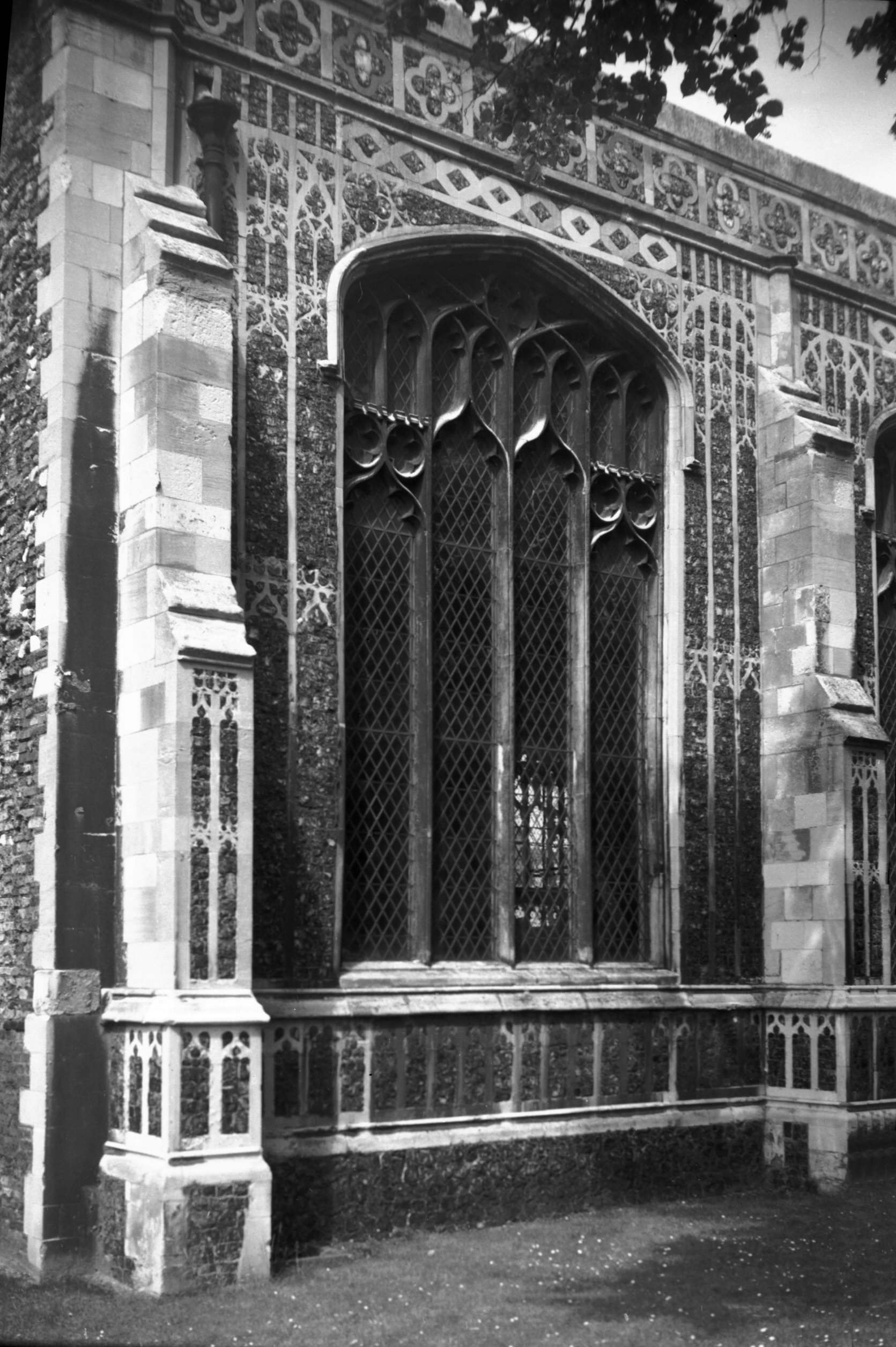
At the east end of the south aisle is the Thorpe Chapel
dedicated to the Virgin Mary. It was founded and endowed
by Robert Thorpe in the reign of Henry VII. Its exterior
has the finest example in the country of flint and stone
panelling, known as flush work. The chancel was refaced
as a copy of this in 1883. |
|
|
St Michael at Coslany south aisle flushwork [3771]
1949-04-29
|
|
|
St Michael at Coslany south aisle flushwork [6234]
1982-07-05
|
|
|
St Michael at Coslany tower south side [2242]
1938-03-31
|
|
|
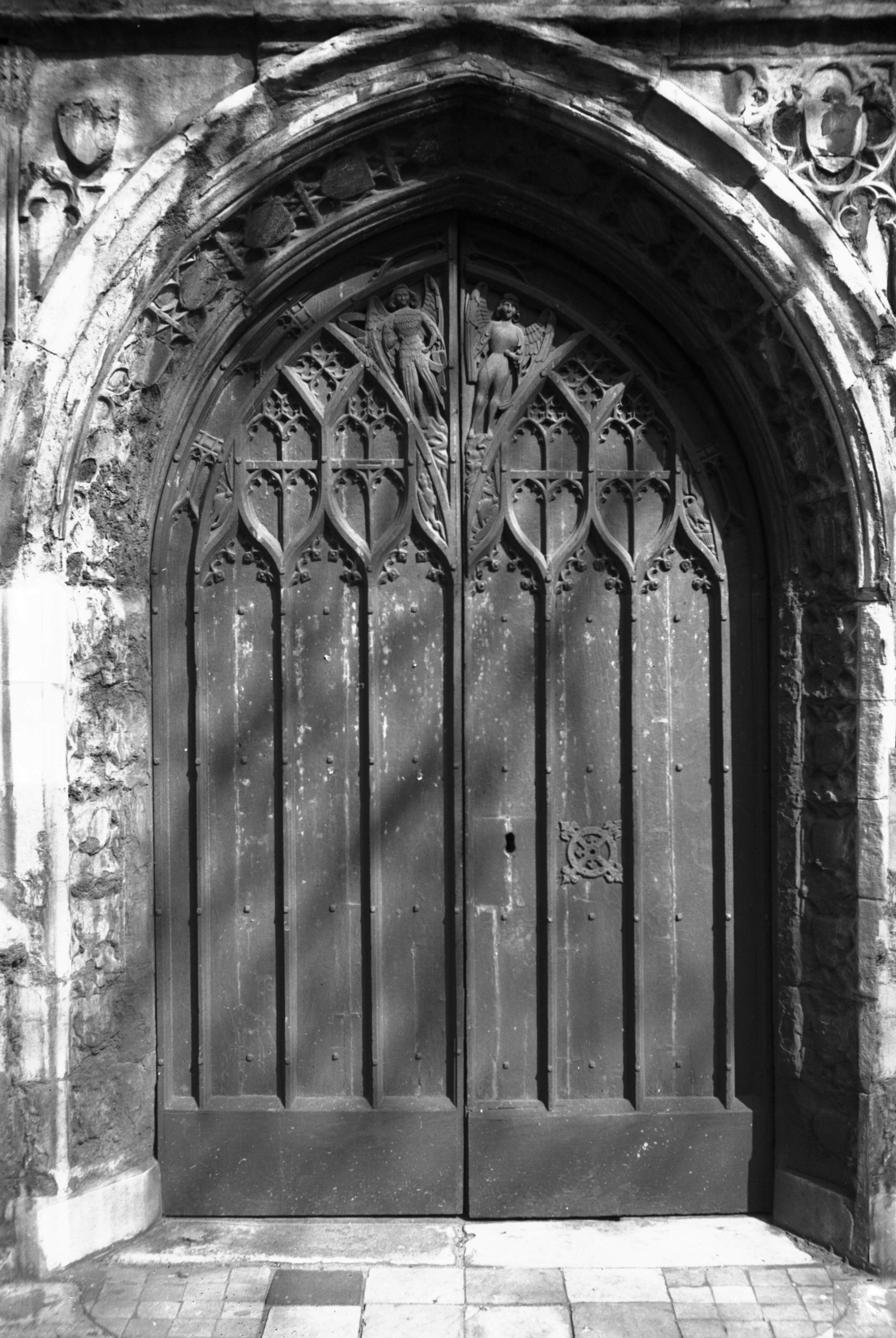
St Michael at Coslany west doors [2241] 1938-03-31
15c with traceried and carved panel and traceried jamb
mould. |
|
|
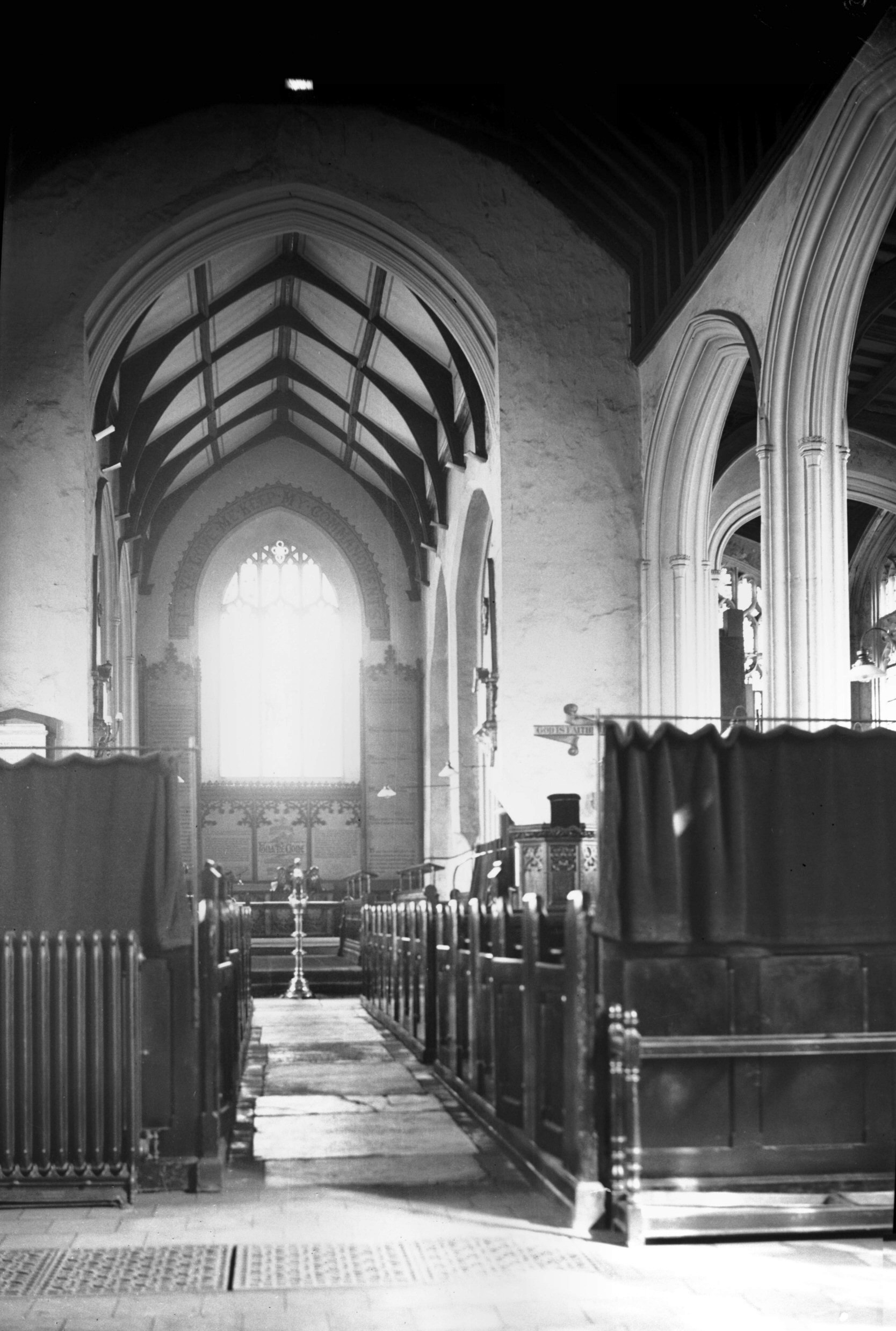
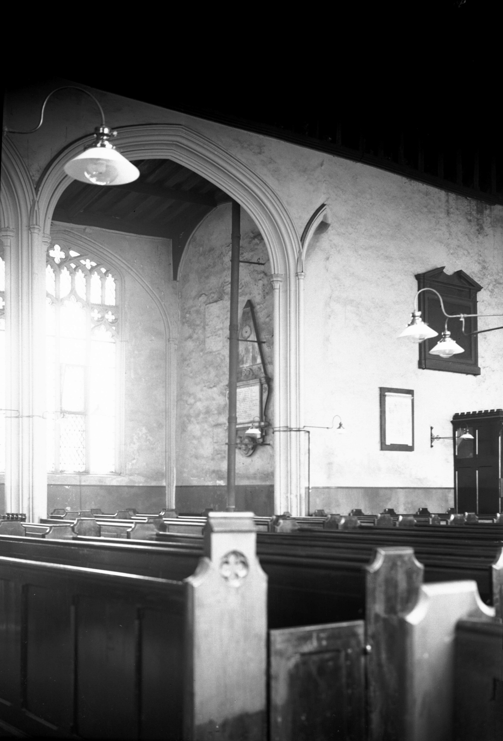
St Michael at Coslany interior view east [2235]
1938-03-31
The nave was rebuilt by John and Stephen Staton who were
Sheriffs in 1511 and 1512 during which period the
rebuilding was completed. |
|
|
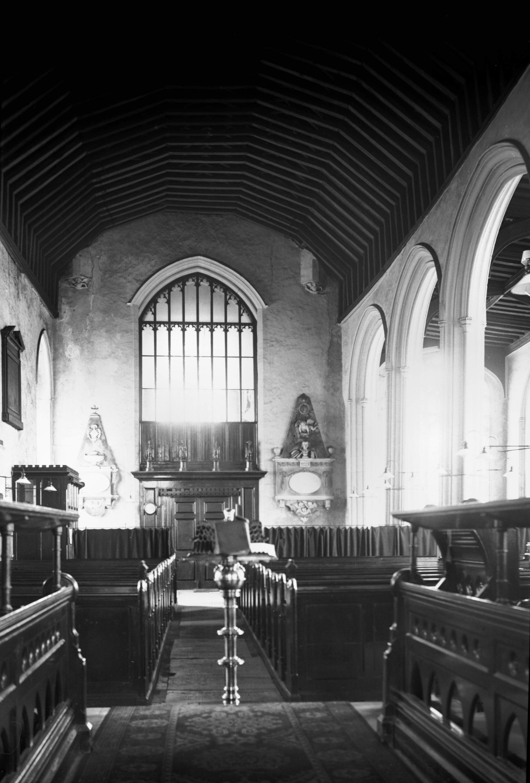
St Michael at Coslany interior view west [2236]
1938-03-31
|
|
|
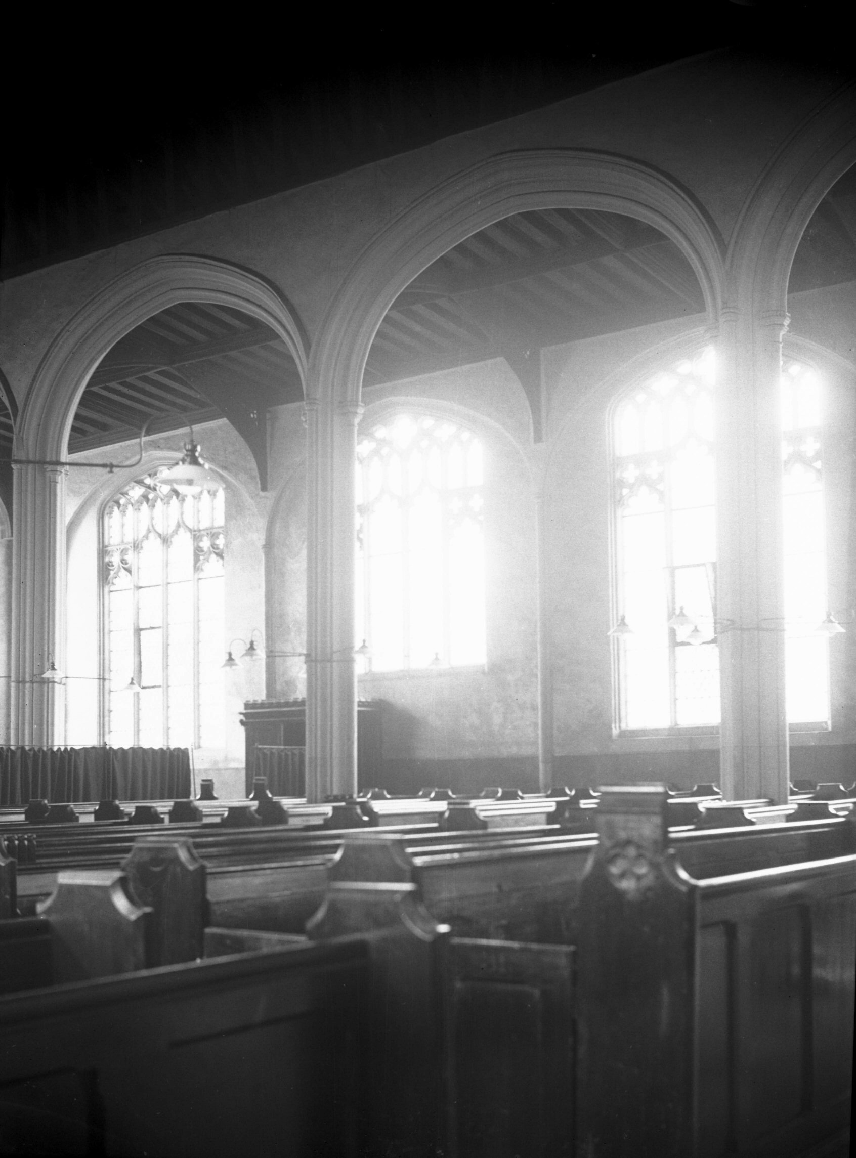
St Michael at Coslany interior north aisle [2239]
1938-03-31
Arcade early 16c. |
|
|
St Michael at Coslany interior south aisle [2238]
1938-03-31
Begun by Alderman Gregory Clark and finished by his son
who was Mayor in 1514. |
|
|
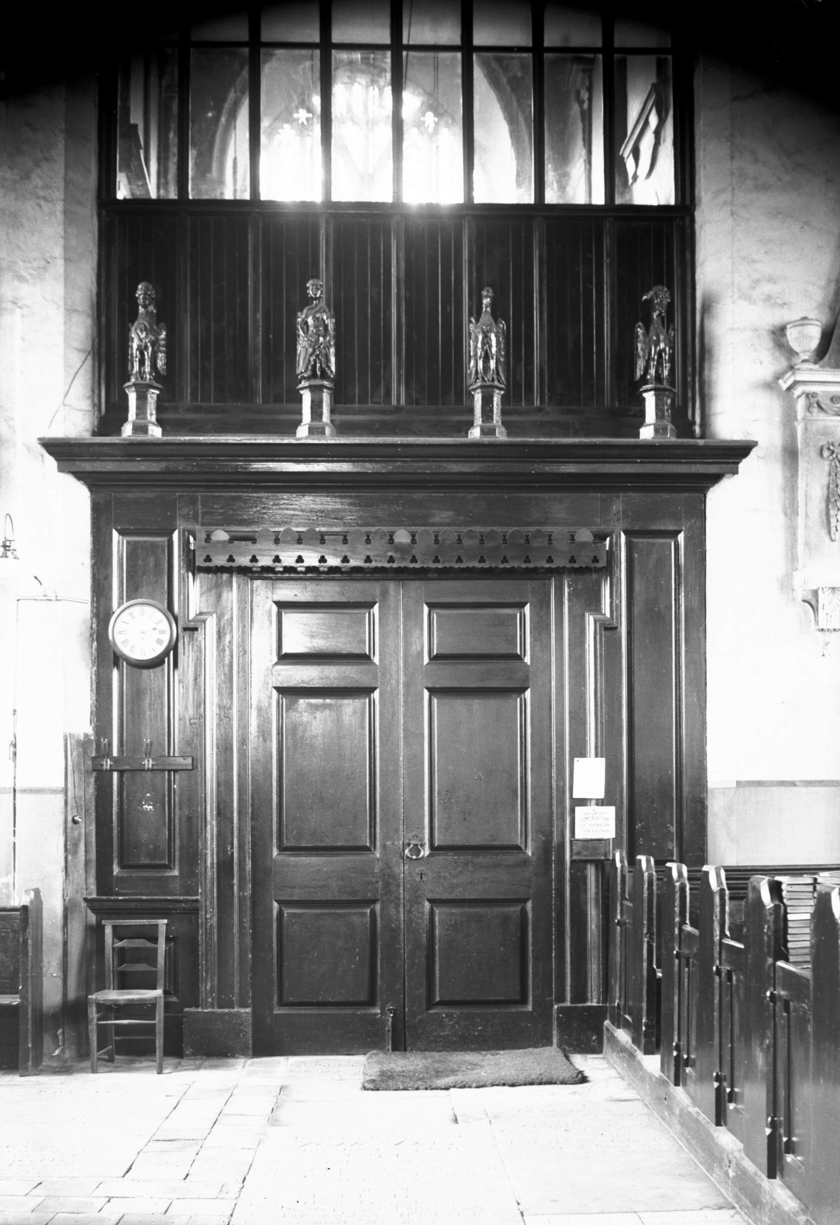
St Michael at Coslany interior west door [2240]
1938-03-31
Entrance from nave into tower with carved wooden figures
above cornice. |
|
|
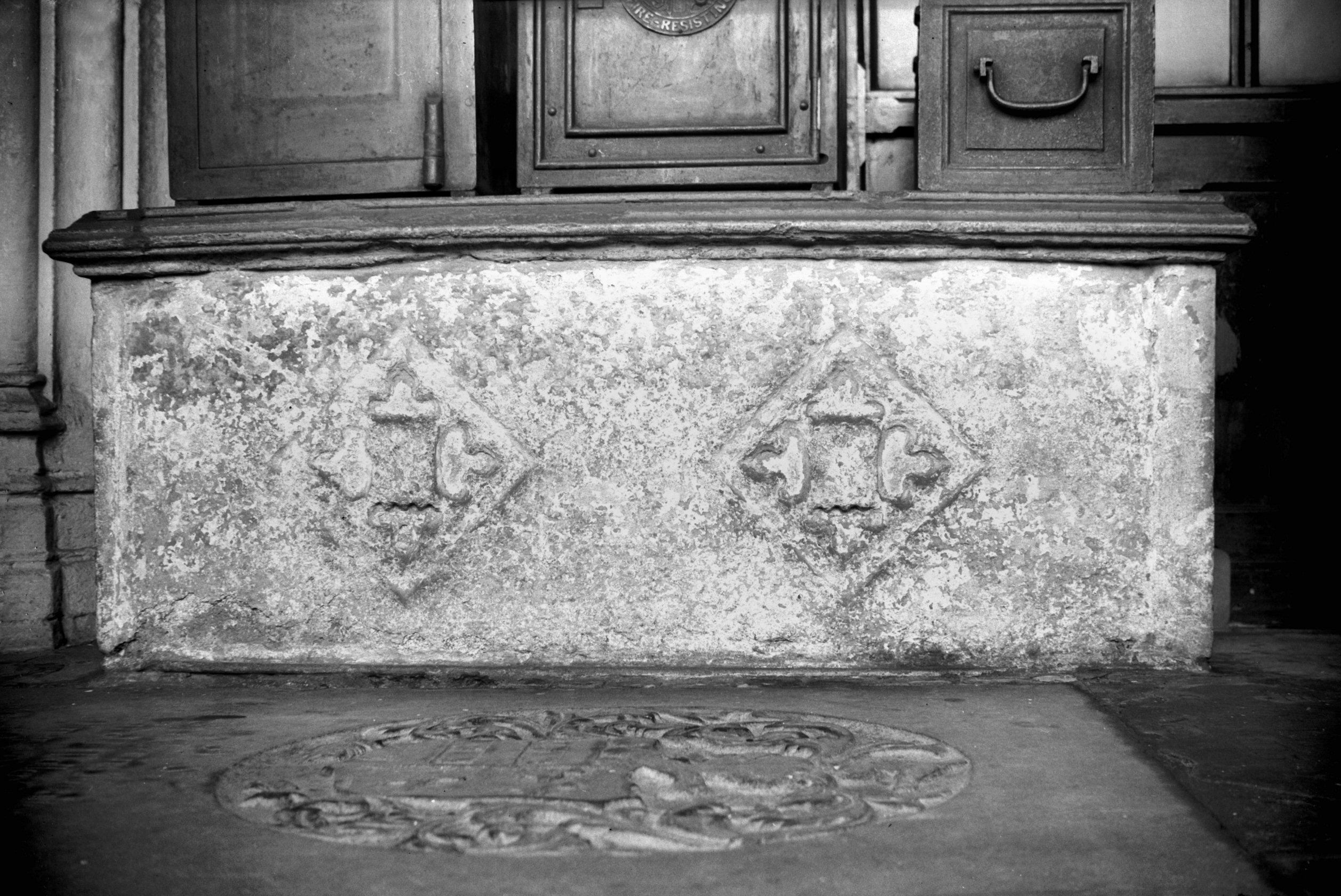
St Michael at Coslany interior altar tomb [2237]
1938-03-31
William Ramsey, Mayor 1502 and 1508. He built the north
aisle with its chantry chapel dedicated to Saint John the
Baptist in which he lies buried. |
|
|
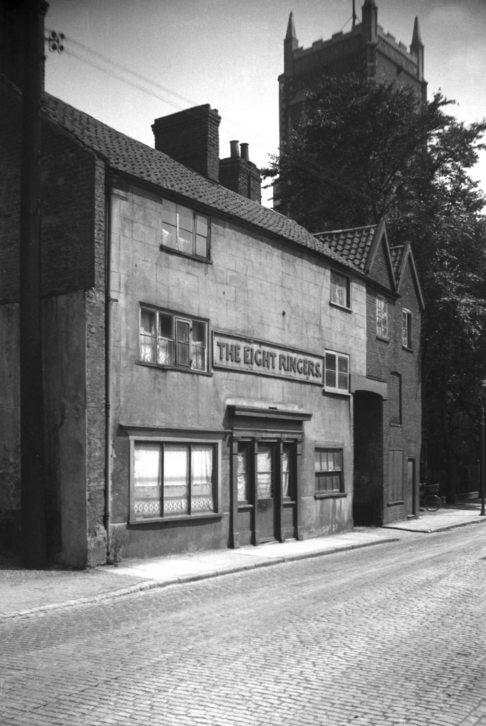
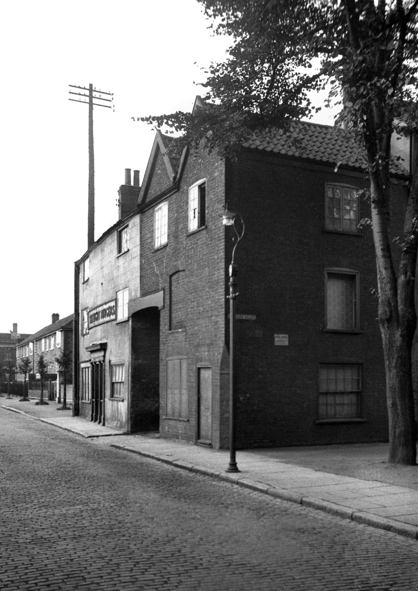
Oak St 12 to 14 former Eight Ringers PH [2555]
1938-07-19
The adjacent church of St Michael at Coslany has a ring
of eight bells. |
|
|
Oak St 12 to 14 view NE [2706] 1938-08-08
|
|
|
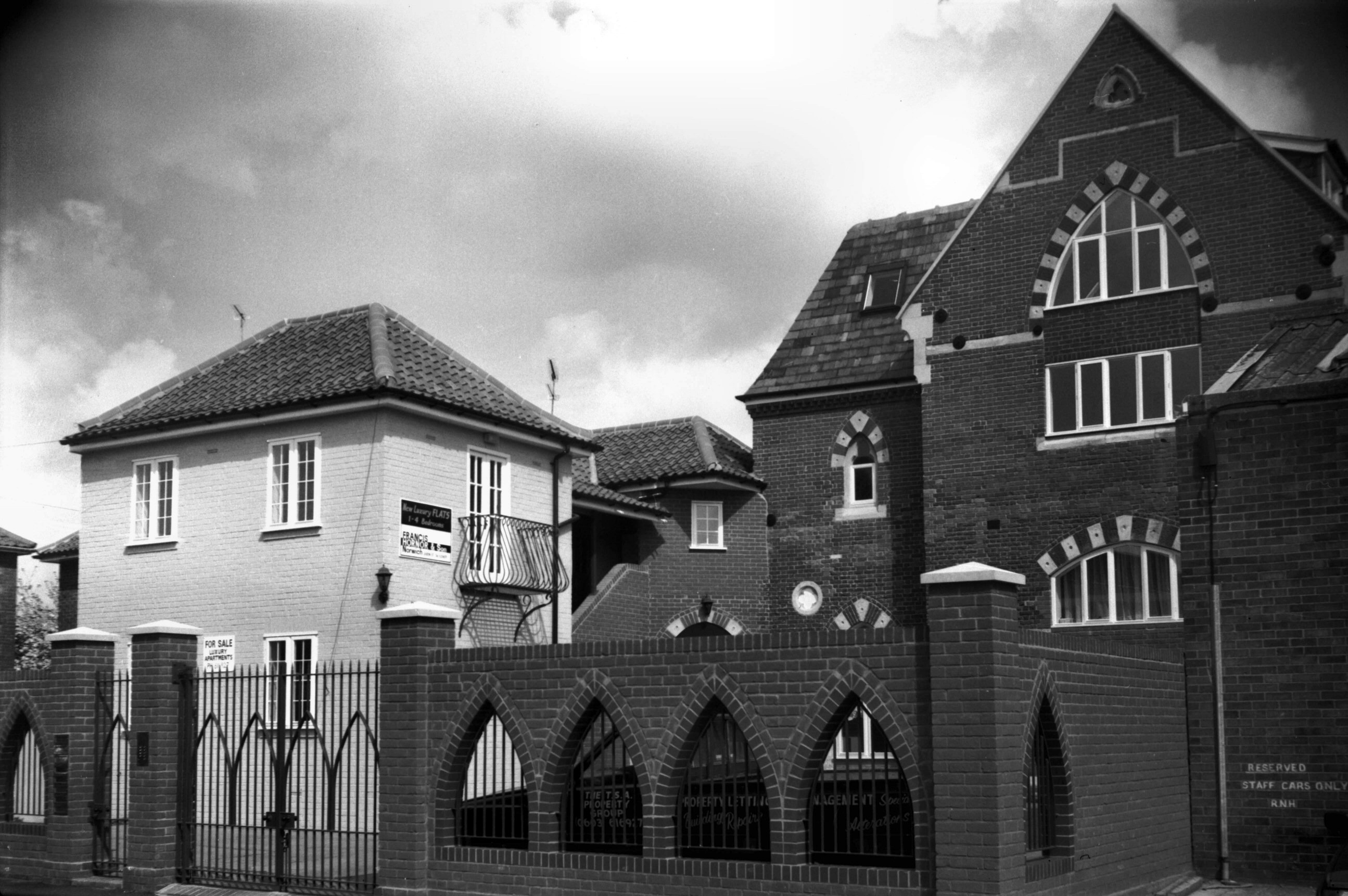
Oak St Scholars Court St Miles School [6601]
1990-04-14
Formerly St Miles School. |
|
|
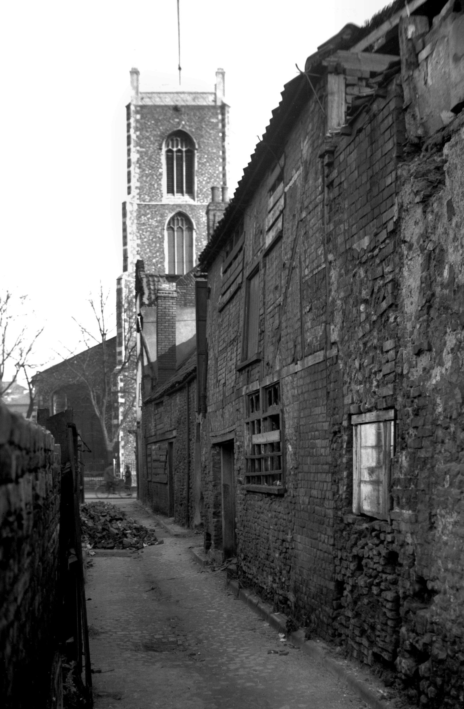
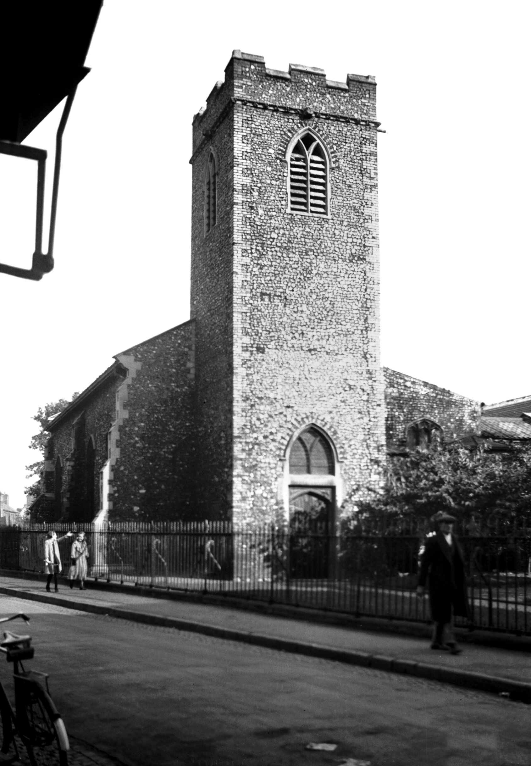
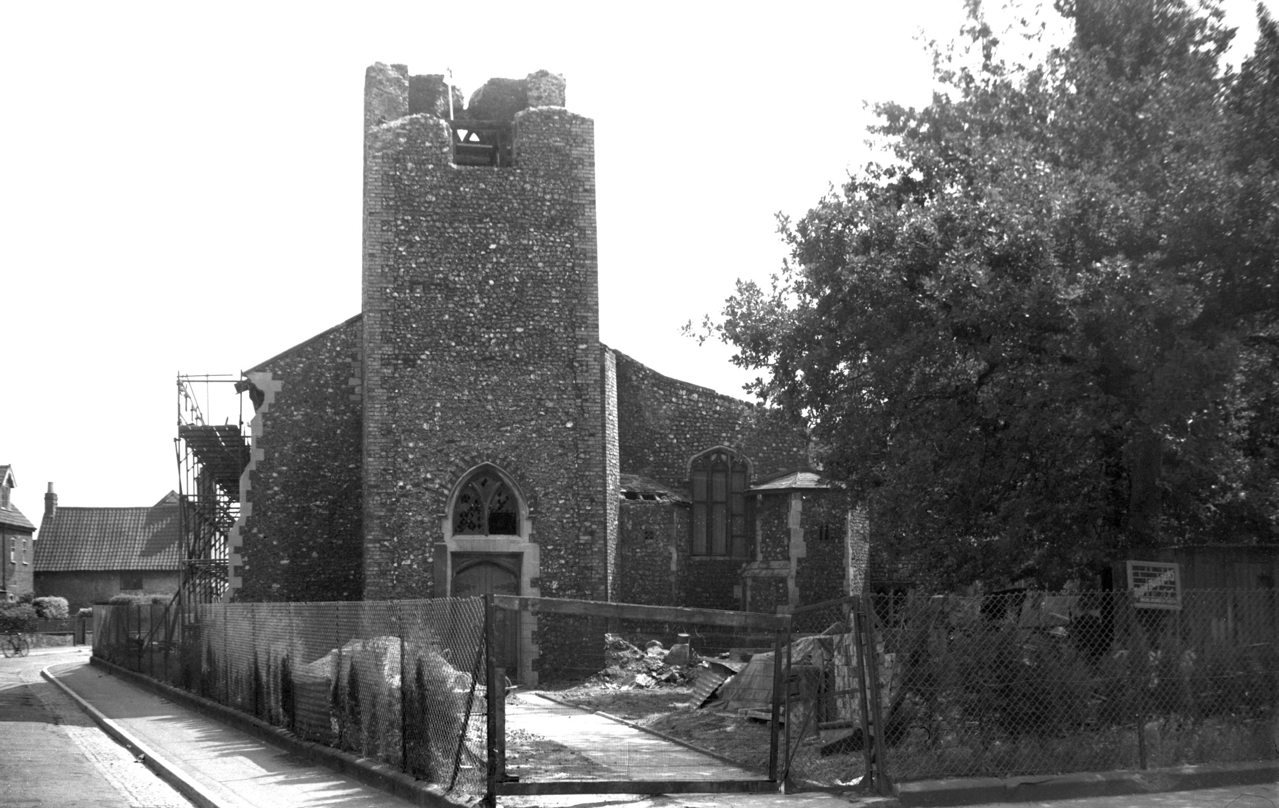
St Martin at Oak west side from Oak St [B138]
1931-00-00
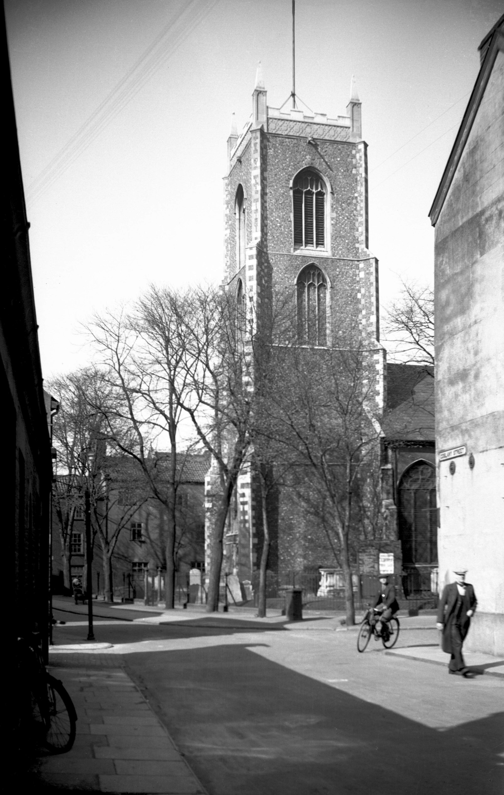
Oak street is named from the church of St Martin-at-Oak.
In its churchyard formerly grew an oak tree bearing an
image of Our Lady, visited with great reverence in
pre-Reformation days. St Martin-at-Oak is a redundant
church, whose belfry was destroyed during the war. The
tower has since been taken down to the level of the nave
roof and now serves as a porch. During the course of the
alterations some of the stringcourse of carved stonework
that had formed a base to its battlemented top was
re-used lower down in the reconstruction.
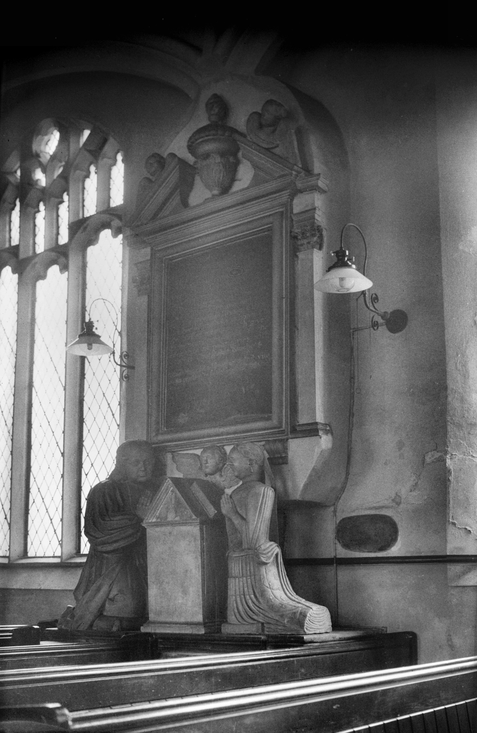
After serving for a time as the parish hall, St Martin's
was for some years in use as a night shelter. Among the
monuments here the most elaborate in that to Jeremiah
Revans and his wife; the former died in 1727, the latter
in 1711. They are represented as near-lifesize kneeling
figures, one on each side of a reading desk. The
furnishings were mostly modern, but there was a very nice
Jacobean priest's chair. |
|
|
St Martin at Oak tower from west [2047] 1937-10-12
The base forms a western porch. |
|
|
St Martin at Oak tower air raid damage [4079]
1952-07-06
|
|
|
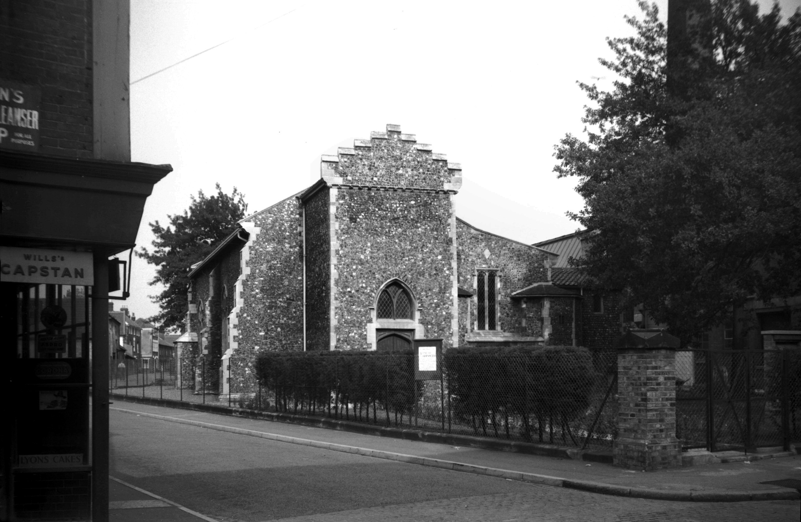
St Martin at Oak with truncated tower [4363]
1955-08-20
Tower after restoration and conversion of the building
into a parish hall, 1955. |
|
|
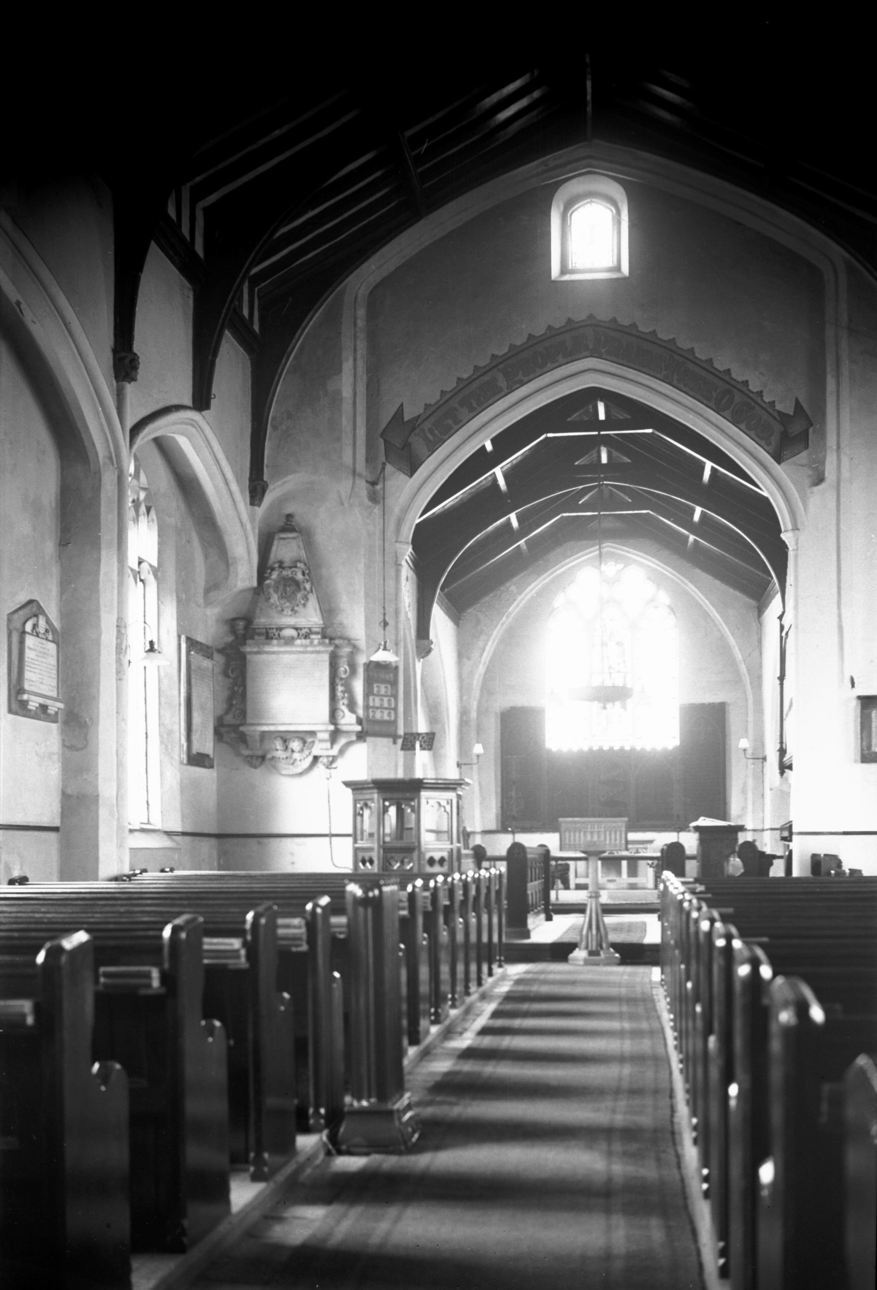
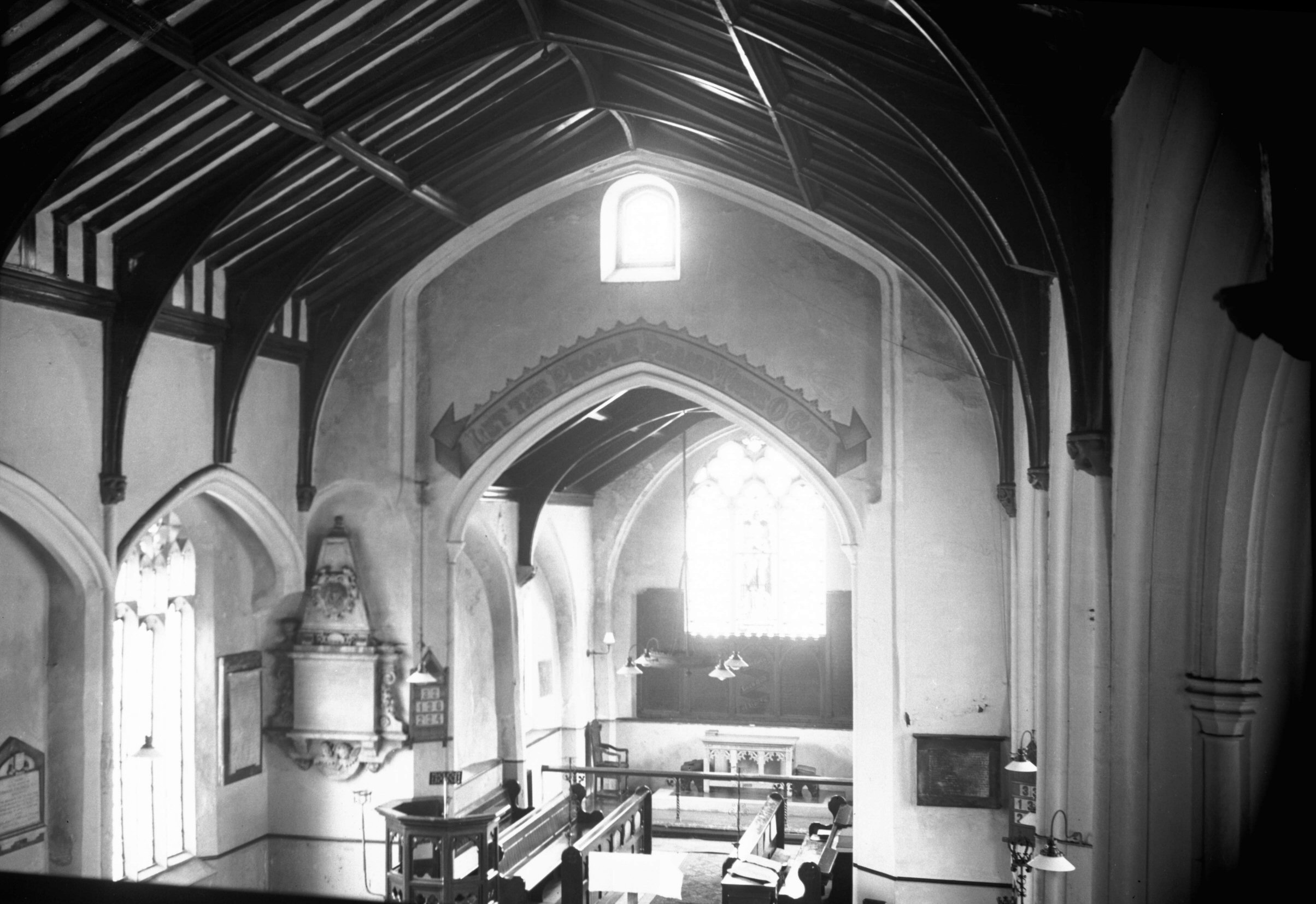
St Martin at Oak interior view east [2244] 1938-04-01
|
|
|
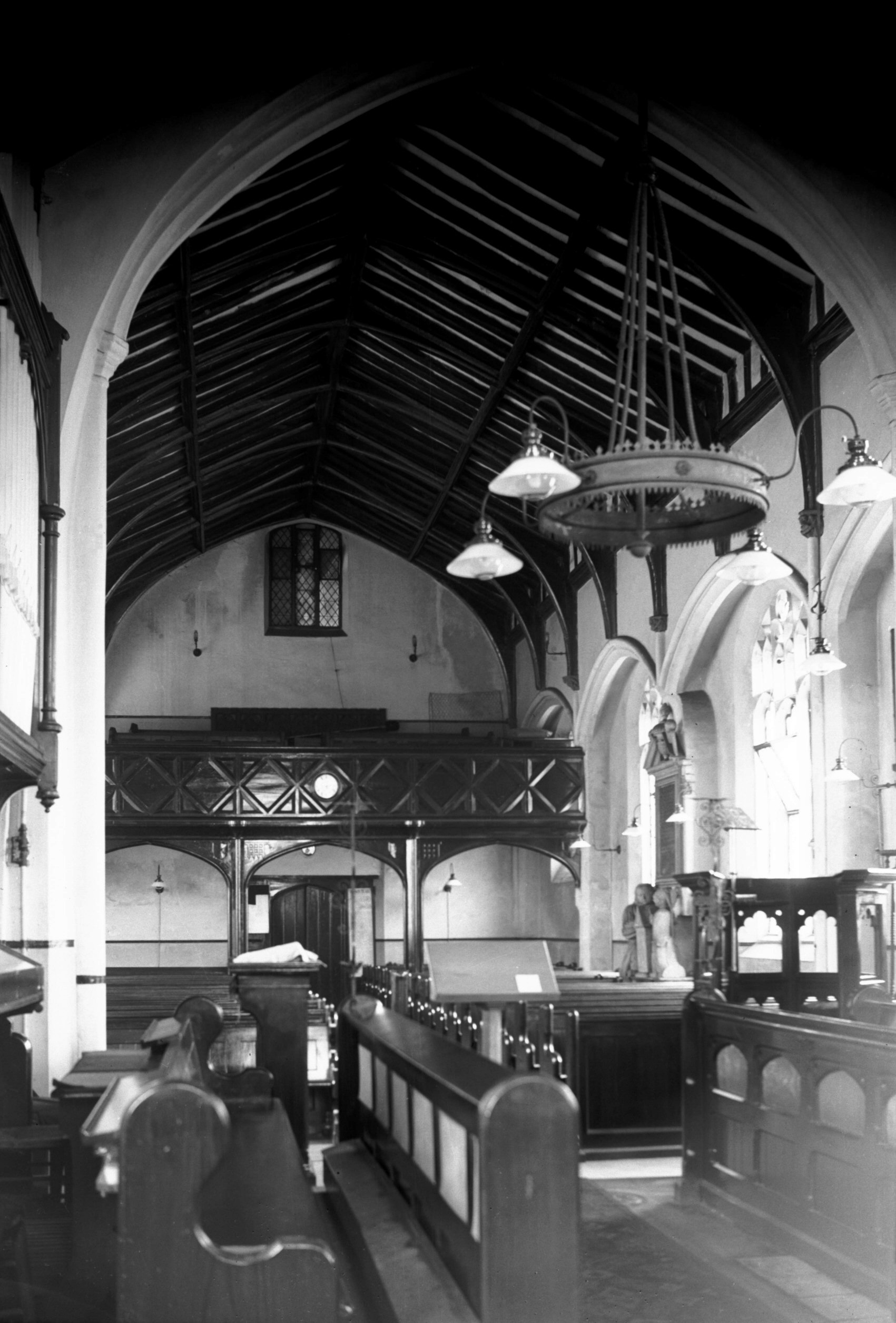
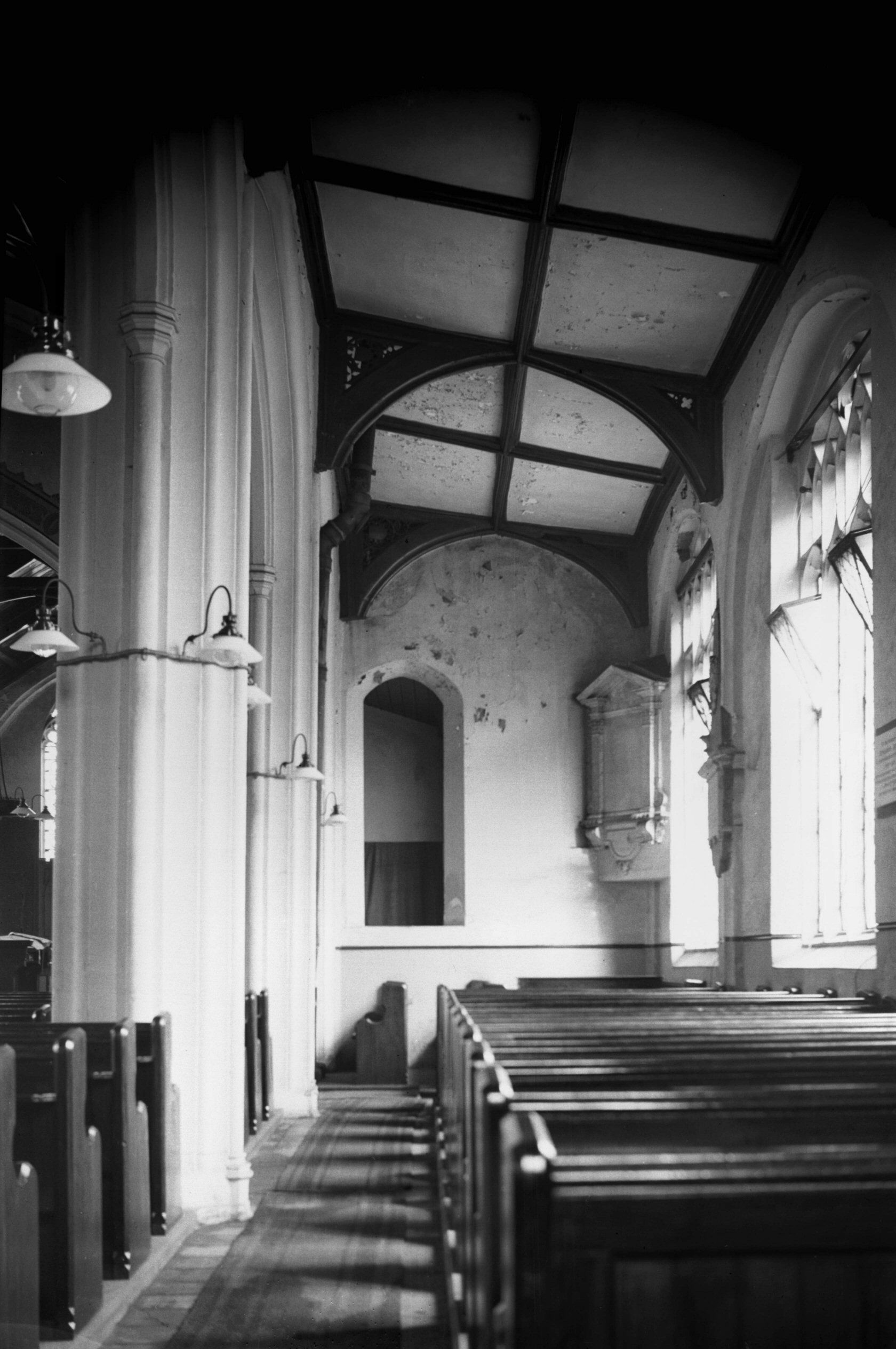
St Martin at Oak interior view west [2246] 1938-04-01
|
|
|
St Martin at Oak interior gallery view [2250]
1938-04-01
|
|
|
St Martin at Oak south aisle [2249] 1938-04-01
|
|
|
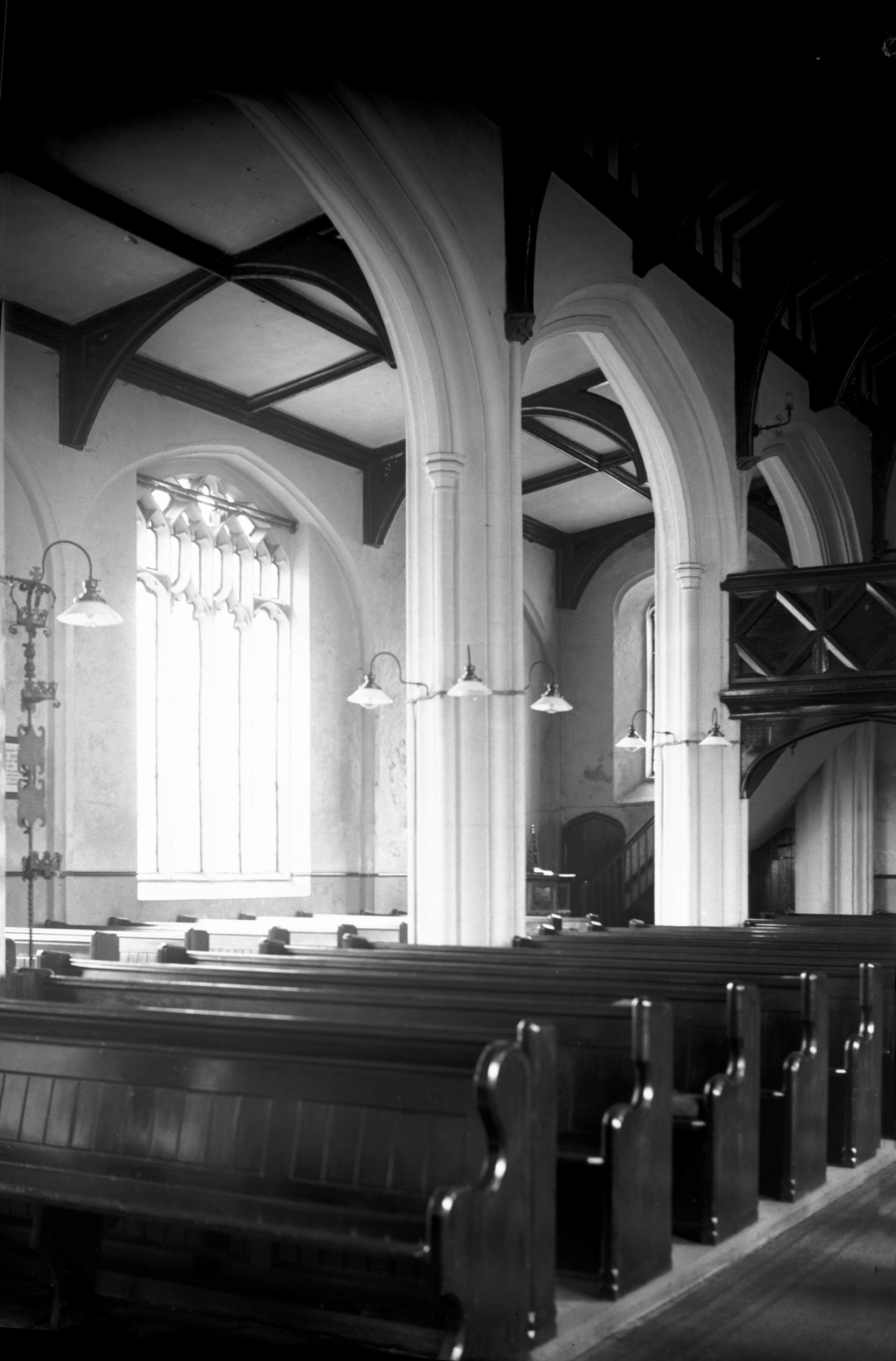
St Martin at Oak south arcade [2245] 1938-04-01
Slender and refined late Perpendicular piers. |
|
|
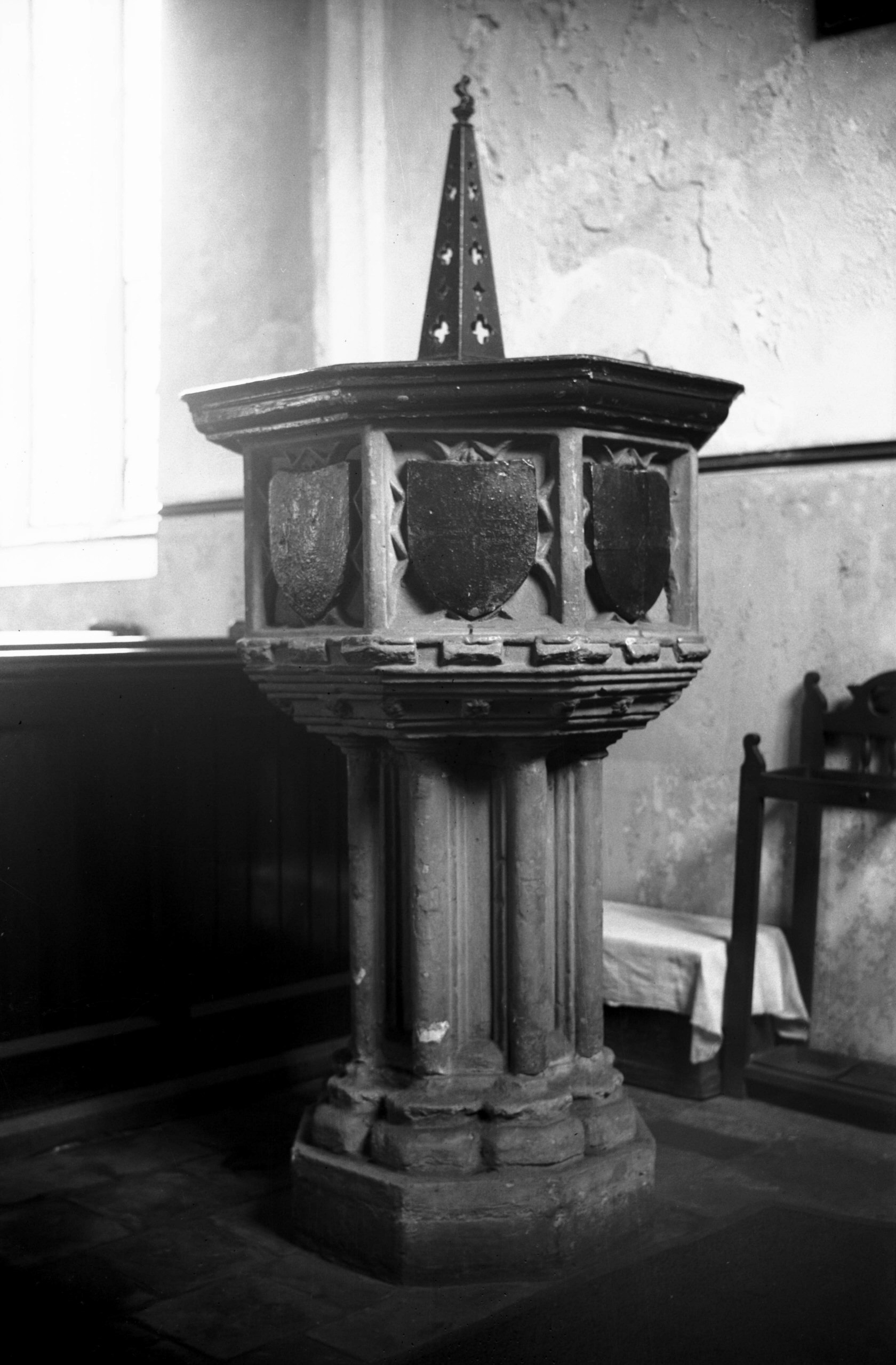
St Martin at Oak 15c font [2248] 1938-04-01
|
|
|
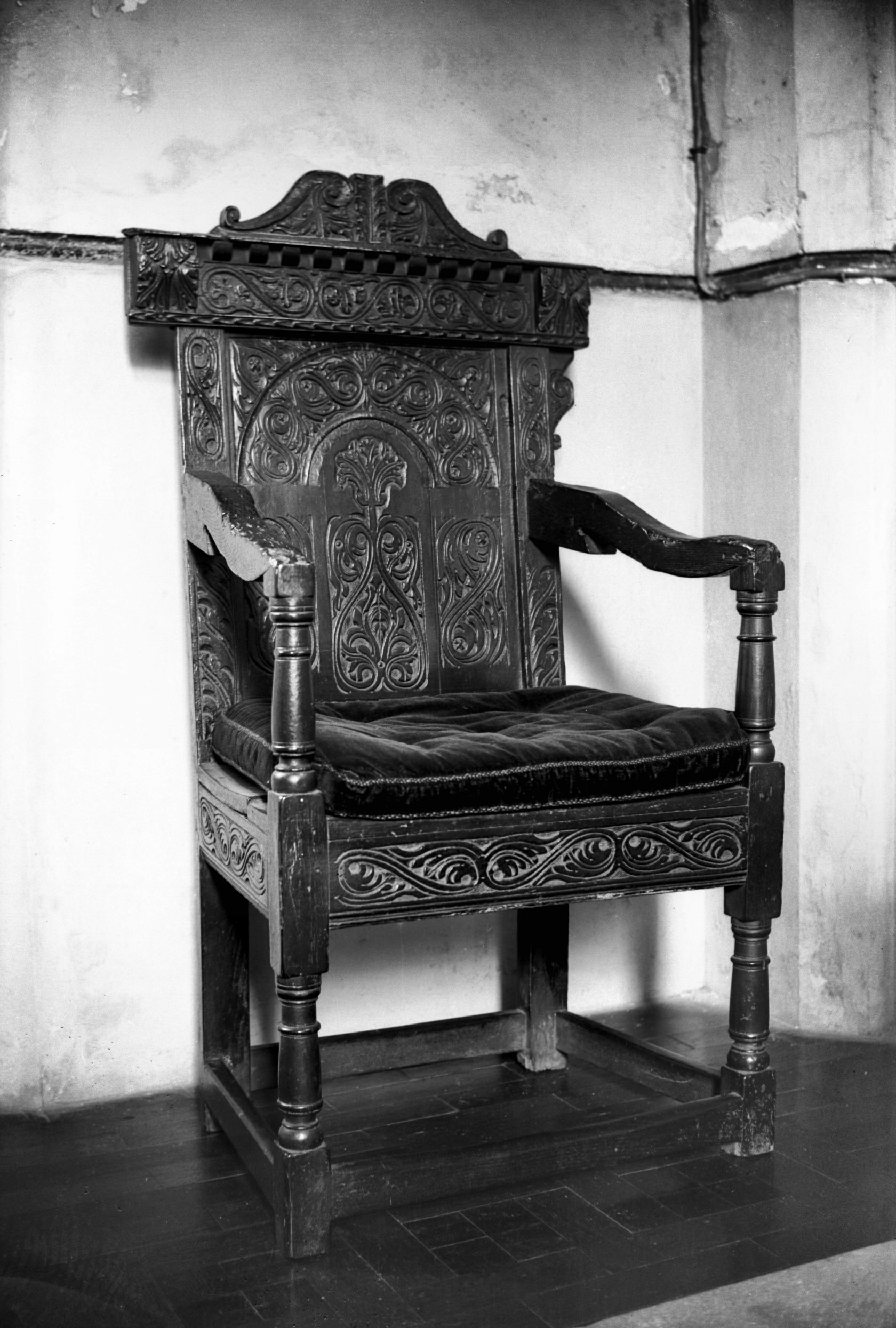
St Martin at Oak Jacobean priest's chair [2247]
1938-04-01
|
|
|
St Martin at Oak Jeremiah Revans monument [2243]
1938-04-01
Jeremiah Revans and wife, died 1727 and 1711. |
|
|
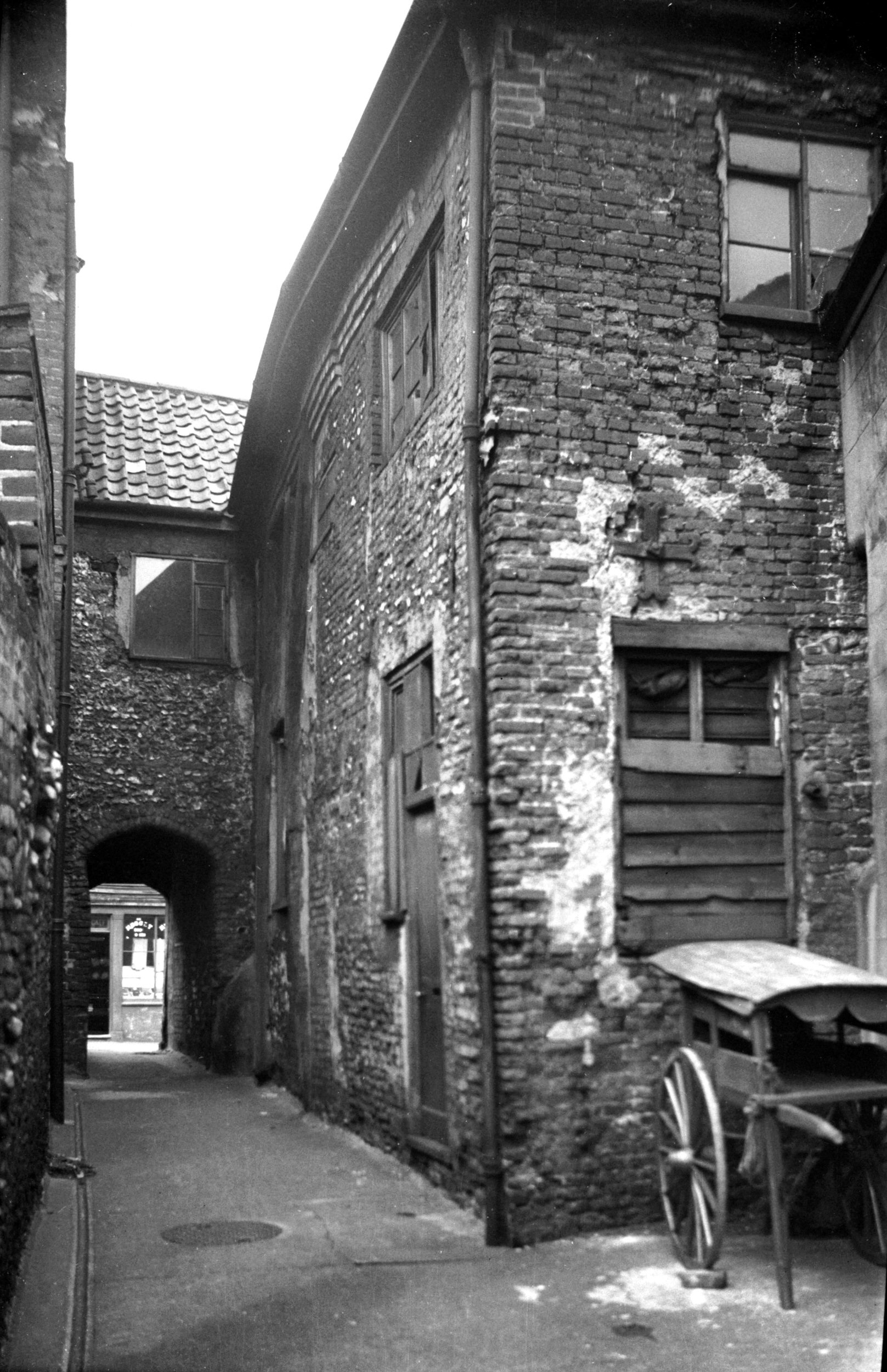
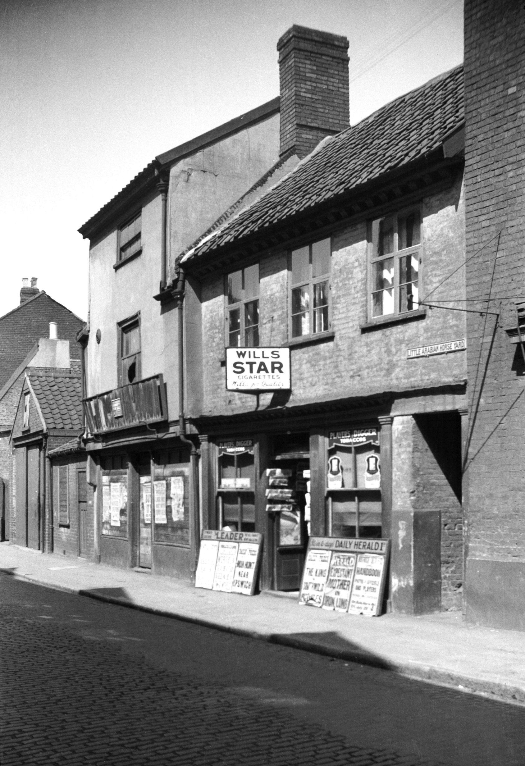
Oak St Arabian Horse Yard view east [1768] 1937-07-12
Showing rear of 65 to 67 St Martin's Lane. See also St Martin's Lane 61 to 69. |
|
|
Oak St 70 rear from Arabian Horse Yard [1767]
1937-07-12
|
|
|
Oak St 72 to 74 [2686] 1938-08-03
|
|
|
Oak St 80 former Bess O' Bedlam PH [0852] 1936-04-10
At No 80 Oak St was what had been described
(unavailingly) as "a modest little bit of Tudor work
which should be preserved if possible". Somewhat
similar to those houses higher up the street that were
retained, it was plaster-faced and jettied at the front,
with a dormer overlooking the yard to the south. Here was
formerly a public house with the sign of the Bess o'
Bedlam, making a twin with Tom o' Bedlam, also in St
Martin-at-Oak, a reminder of the days when mentally
deranged folk were largely uncared for and left to roam
the streets.
Modern council flats now occupy the site between St
Mary's Plain and St Miles' (otherwise known as St
Michael-at-Coslany) church. Here were formerly Sun Yard
and Greenland Fishery Yard, whose houses were declared
unfit very early in the city's programme of slum
clearance. The latter yard was named after an adjacent
public house whose sign seems to have been a
comparatively rare one. Larwood and Hotten make no
mention of it; according to Walter Wicks it originated
with the Greenland whale fishery, once based both at
Yarmouth and Lynn, which ceased about 1821. |
|
|
Oak St 90 Fellmonger PH [2130] 1938-03-06
|
|
|
Oak St 90 Fellmonger PH [2871] 1939-02-16
|
|
|
Oak St 90 Railway Arms PH to 94 [0851] 1936-04-10
Among the many old properties formerly lining either side
of Oak St was the Railway Arms tavern at No 90 (pictured
with 92 and 94). It stood almost opposite the modern
Station Rd that was constructed as an approach to City
Station (1882), the terminus of the Midland and Great
Northern Joint Railway. The public house was an old one,
and before the coming of the railway its sign had been
that of the Fellmongers' Arms. This name continued to be
preserved in the yard whose entrance was spanned by the
property adjoining it to the north until early in 1937,
when slum clearance took its toll and rendered the site
void. When shortly afterwards the old inn, too, was
demolished a more commodious building was erected to
replace it, to which was given the older name of the
Fellmonger. Although the architect, possibly as a
concession to its antique surroundings, designed the new
building with a pleasing series of gables, it never
seemed to be at one with its neighbours and would have
appeared to better advantage on an outlying estate where
a garden could have surrounded it. Its life was a
comparatively brief one, for it was gutted by fire during
the raids of April 1942. St Crispin's (Inner Link) road
now crosses the site.
When the bisection of Oak St by Inner Link road took
place, it was proposed that the southern part should be
renamed Coslany St, of which it forms a continuation; but
objections were raised by affected traders and the idea
was dropped. However, according to an 1883 street
directory the dividing line between the two at that time
was at St Mary's Plain and not at Colegate as at present,
so the change had it come about would not have been quite
such a revolutionary one as some people thought. |
|
|
Oak St 90 Railway Arms PH east side [1752] 1937-07-04
|
|
|
Oak St 98 to 100 [2038] 1937-10-11
These were once one house and still had a central
staircase intact. The lower storeys dated from c1550, the
upper storey 17c. There was also a cellar. Formerly the
residence of a woollen merchant, it was divided into two
dwellings in 1800. |
|
|
Oak St 98 to 100 rear [2019] 1937-10-02
|
|
|
Oak St 98 to 100 rear from Baldwin's Yard [1493]
1936-10-05
|
|
|
Oak St 98 to 108 Tudor houses [0586] 1935-05-19
|
|
|
Oak St 102 to 104 [2037] 1937-10-11
|
|
|
Oak St Goat Yard [1465] 1936-09-27
|
|
|
Oak St Goat Yard rear from Dog Yard [1474] 1936-10-03
|
|
|
Oak St 104 rear Goat Yard [1541] 1937-04-24
|
|
|
Oak St 104 to 106 from Dog Yard [2022] 1937-10-02
|
|
|
Oak St Dog Yard N side Georgian cottages [0862]
1936-04-10
|
|
|
Oak St Dog Yard south side rear of cottages [0863]
1936-04-10
|
|
|
Oak St Dog Yard N side Georgian cottages [1492]
1936-10-05
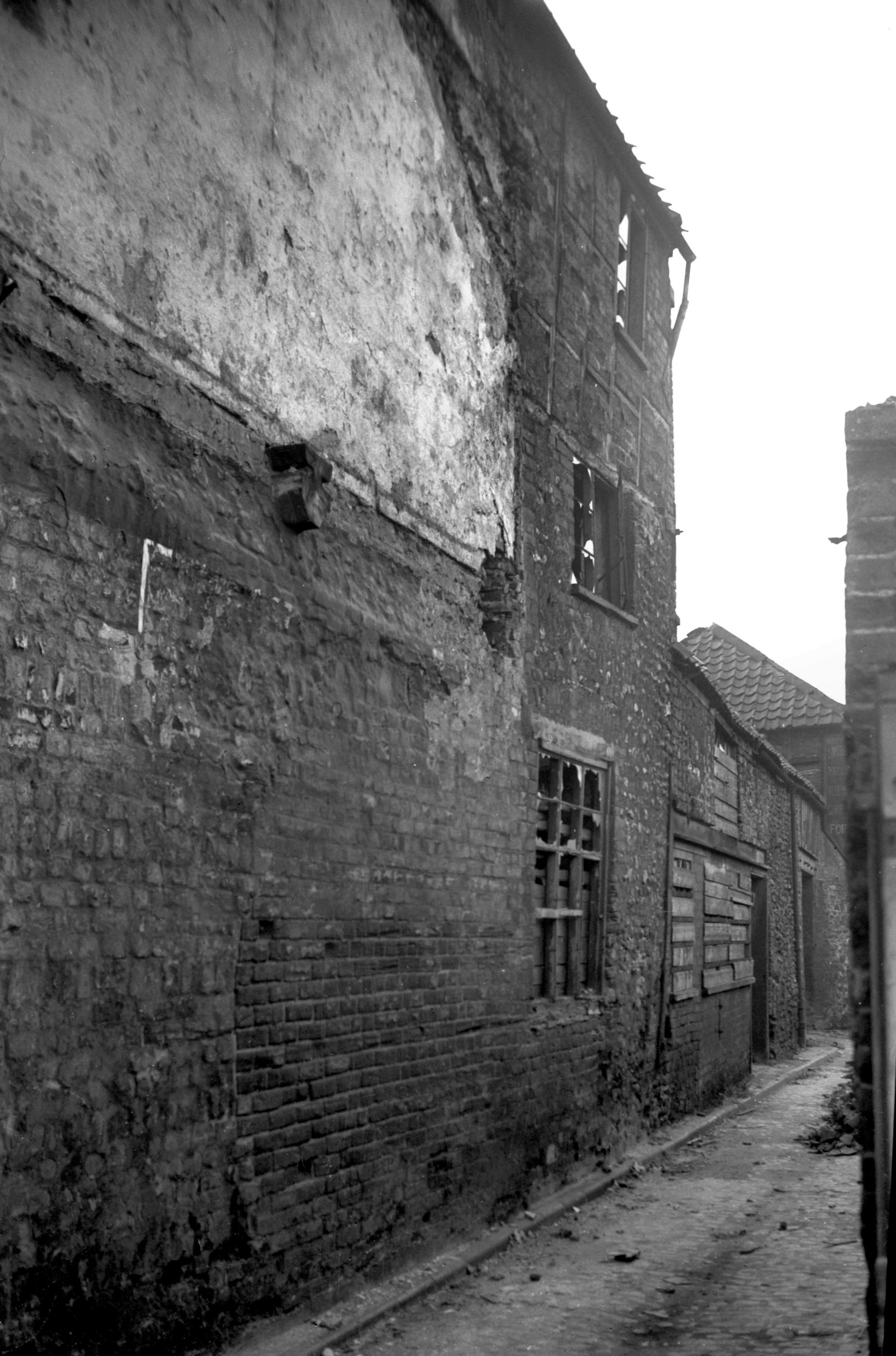
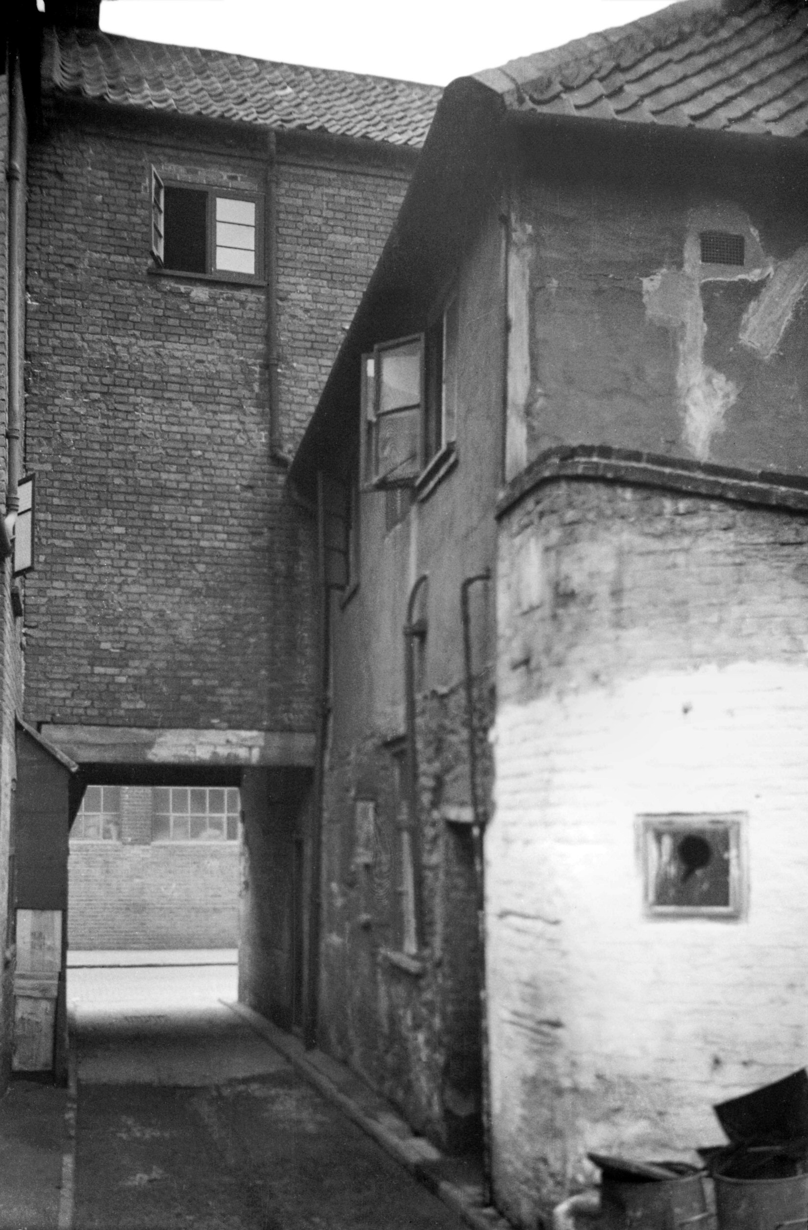
Before the conservation of 98 to 114 Oak St took place,
four courtyards occupied the former garden ground at the
rear, reached from the street through covered passageways
between the houses. They were Baldwin's Yard, Goat Yard,
Dog Yard and Talbot Yard. Most of the cottages they
contained originated in the earlier part of the 19c, but
in Dog Yard stood a rather unusual semidetached pair of
perhaps more than a century earlier. Of brick and tile
construction, they had a plain stringcourse at first
floor level, and while much of the brickwork was
constructed in the orthodox manner, the crow-stepped end
walls had double courses of stretchers alternating with
double courses of bricks standing on end. At the angles
the orthodox brickwork was "tenoned" into the
unorthodox in a kind of saw-edge pattern. The cottages
were demolished towards the close of 1936, apparently not
being considered sufficiently unusual to be retained. |
|
|
Oak St 106 [2036] 1937-10-11
|
|
|
Oak St 106 to 108 rear [2021] 1937-10-02
|
|
|
Oak St 106 to 114 [0853] 1936-04-10
|
|
|
Oak St 108 [2035] 1937-10-11
|
|
|
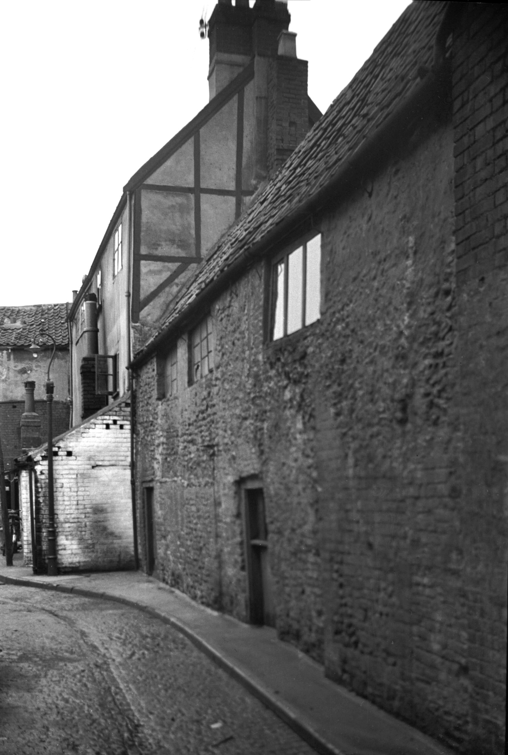
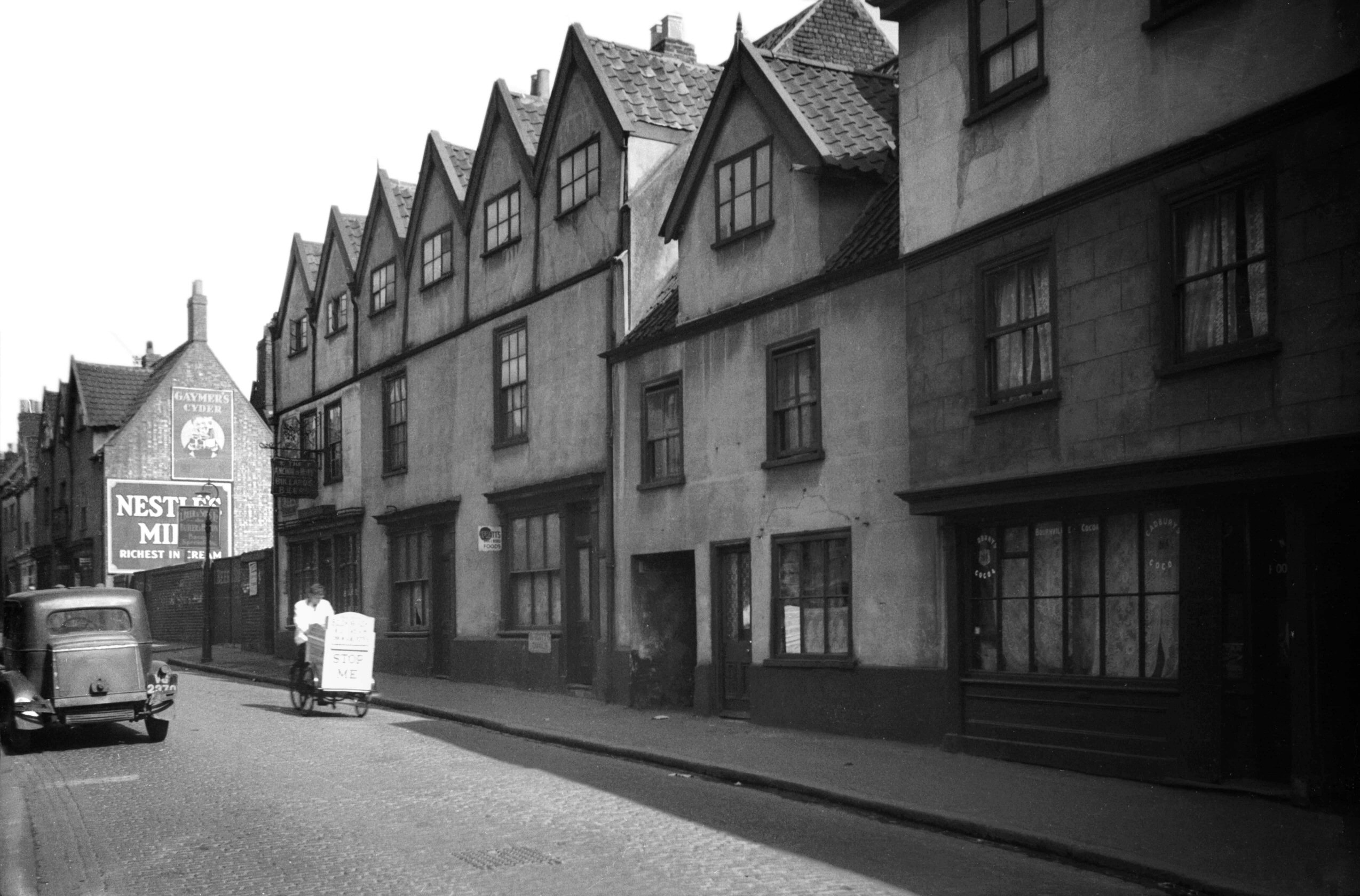
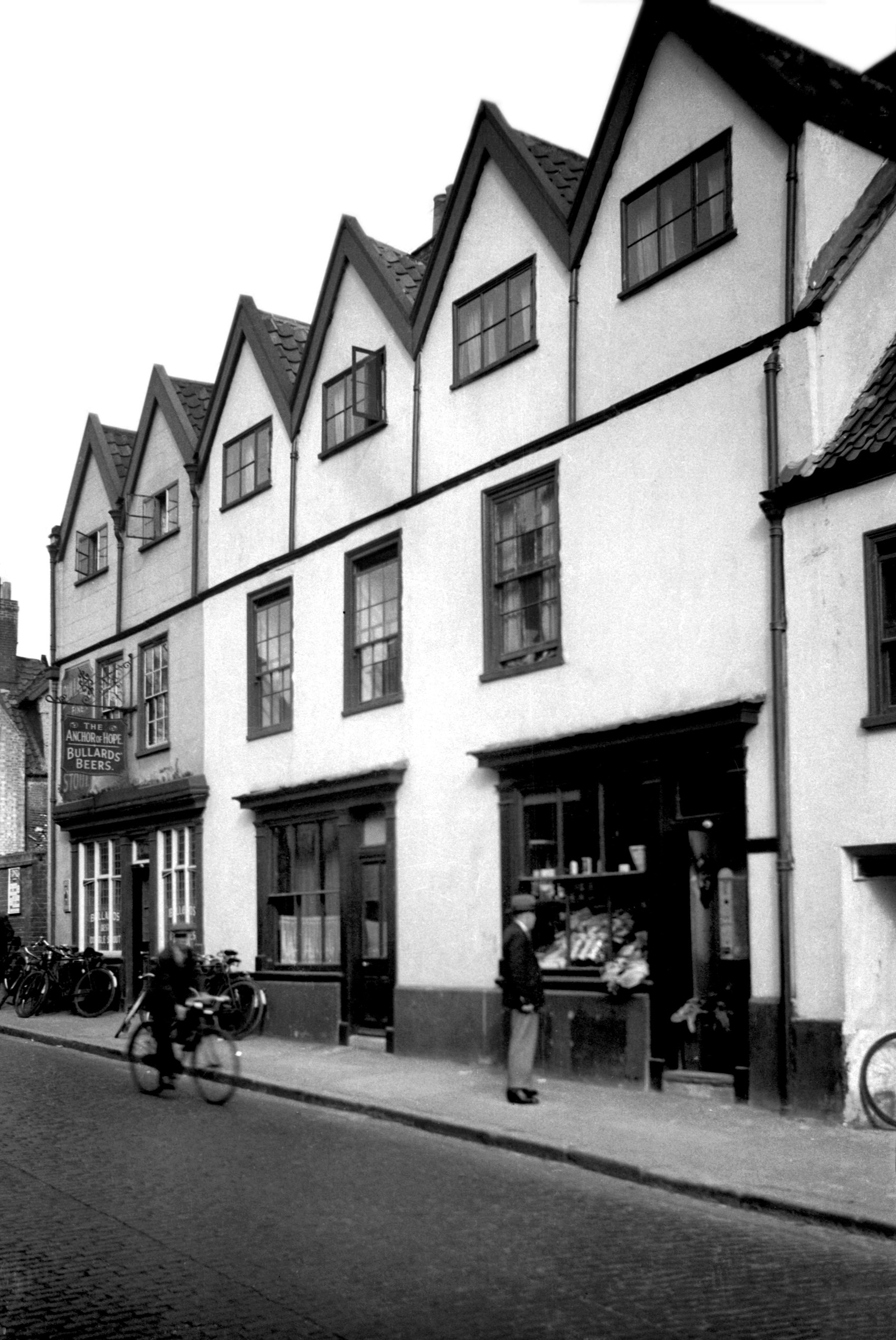
Oak St 110 to 114 Anchor of Hope PH [2033] 1937-10-09
Immediately adjoining Jenkins Lane on the south, Nos
110-114 Oak St came at the end of a picturesque terrace
of Tudor dwellings. In February 1935, the whole row (with
the exception of No 114, the Anchor of Hope public house)
was the subject of an inquiry held at the Guildhall under
the Housing Acts of 1925 and 1930. It was then agreed
that the Norwich Amenities Preservation Society should be
permitted to acquire the buildings, providing that they
made them fit to the satisfaction of the Medical Officer
of Health, and acquired additional land at the rear for
air space. This undertaking was accepted and the property
subsequently thoroughly overhauled.
During the April raids in 1942, unfortunately, No 114 was
completely burned out and Nos 110 and 112 so severely
damaged that all three had later to be demolished.
Luckily the remainder of the block, Nos 98-108, received
comparatively minor damage; standing as they do now by
the busy Inner Link road, their brightly colour-washed
walls make an attractive feature in an otherwise rather
plain setting. |
|
|
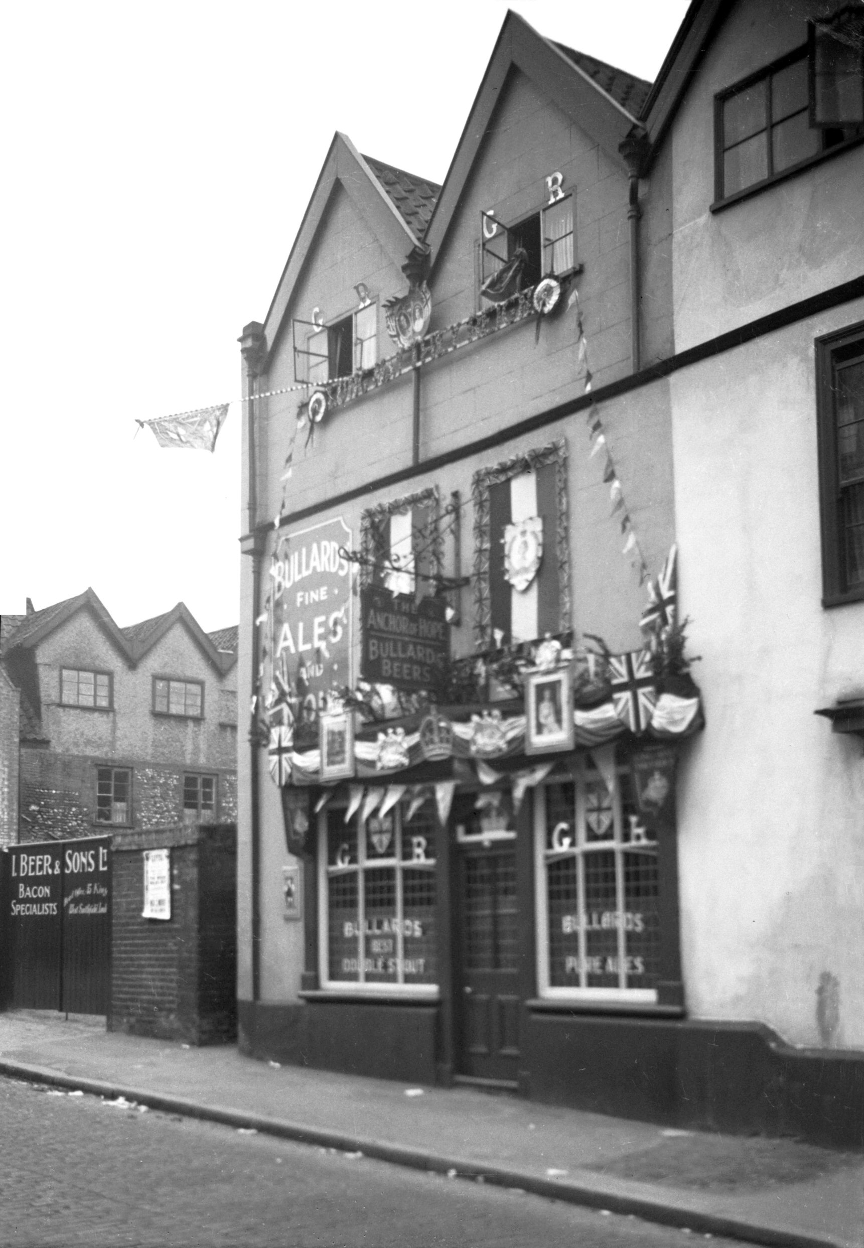
Coronation Oak St 114 Anchor of Hope PH [1566]
1937-05-09
Anchor of Hope Inn, 114 Oak St, good business premises
award for the 1937 coronation decorations. |
|
|
Oak St 110 to 112 rear [2020] 1937-10-02
|
|
|
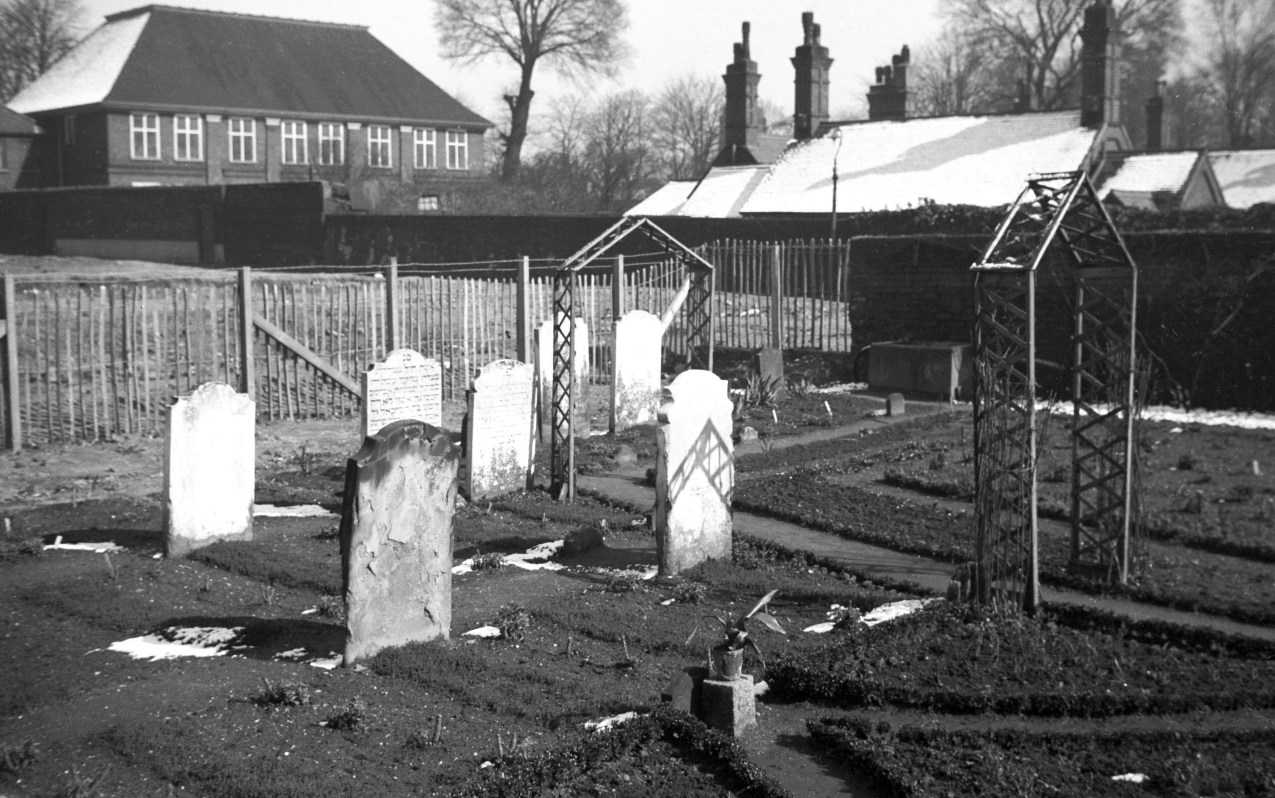
Oak St Talbot Square Hebrew Cemetery [1514]
1937-03-26
When slum property was being cleared away between Oak St
and Quakers Lane in 1936 a little-known Jewish cemetery
was brought to view. Although no longer used for burials
it was still being attractively gardened by a caretaker
appointed by the city's Jewish community. Ten headstones,
some with Hebrew inscriptions, testified to the one-time
use of this small plot, which was opened for burials in
1813 and closed in 1856 when the Corporation cemetery at
Bowthorpe Rd was opened. There had been an earlier
cemetery on a site at the top of Mariners Lane, Ber St,
granted by the Corporation early in the 18c. This
cemetery had been used by the whole of the eastern
counties until closed about a century later, but on the
other hand this one at Oak St, adjoining Talbot Square,
was used by the Norwich Community only. |
|
|
Oak St 122 to 128 [0855] 1936-04-10
|
|
|
Oak St 124 to 126 rear from Old Brew Yard [1777]
1937-07-12
A few yards to the south of the Royal Oak was Old Brew
Yard. This, one of the widest yards then existing in the
city, took its name from an early nearby brewery, as also
did Little Brew Yard next door. The houses on the south,
which divided one yard from the other, probably dated
from the 17c, but their walls had since been cement
rendered, and the fine row of gables roughcast. The
photograph shows the west side of the yard, formed by the
houses facing Oak St. No 126, on the right, was the
oldest, having flint and brick rubble walls and an old
English plain tiled roof.
Beyond Little Brew Yard is Jenkins Lane, a narrow alley
that leads past the site of 19c Oak Terrace and
eventually to the Gildencroft. It was once popularly
known as "Chafe Lug Alley", being barely a yard
wide at its entrance, but since the demolition of
adjoining property its nickname has fallen into disuse. |
|
|
Oak St Old Brew Yard rear of south side [0943]
1936-05-12
|
|
|
Oak St 128 to 130 [1467] 1936-10-03
|
|
|
Oak St 130 to 136 [0944] 1936-05-12
|
|
|
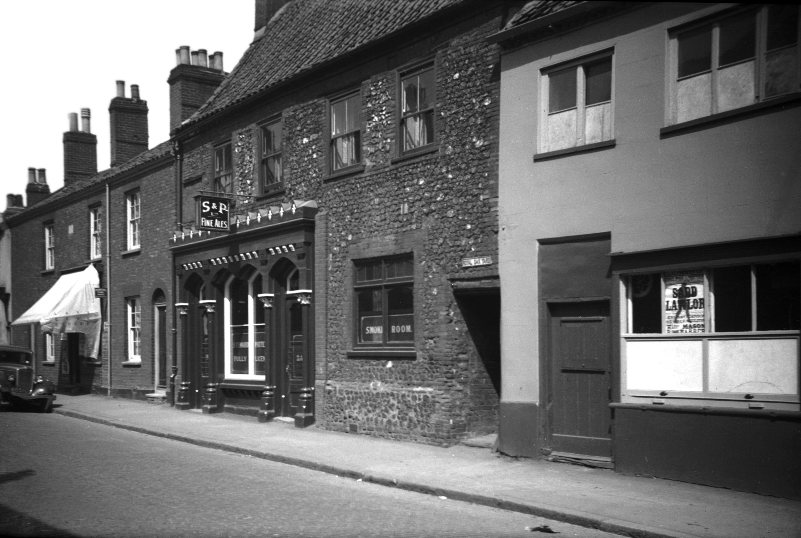
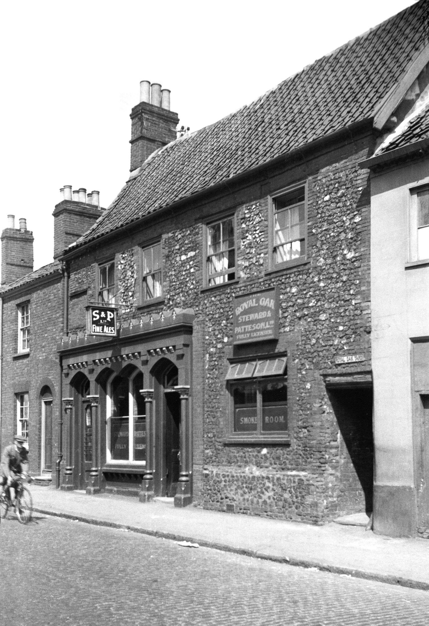
Oak St 132 Royal Oak PH [2687] 1938-08-03
At No 132 stood the Royal Oak public house, another of
the several domestic buildings in Norwich whose front
walls at least were of knapped flint. Here at the Royal
Oak those of the rear wall were unknapped. Probably of
the late 16c or early 17c, the fine street frontage had
been somewhat spoiled by the insertion of a discordant
florid shop front of apparently Victorian vintage. The
roof had red pantiles except at the back, where some of
the original old English plain tiles remained. On this
side, too, was a dormer giving light to the commodious
attic storey. After the 1942 blitz only the walls, joists
and roof beams remained, to be cleared away shortly after
the war.
The sign of the inn commemorated the escape of Charles II
when he secreted himself in the oak tree at Boscobel. It
is not from this that the street is named, however, but
from the church of St Martin-at-Oak which stands further
south. |
|
|
Oak St 132 rear from Royal Oak Yard [1776] 1937-07-12
|
|
|
Oak St 140 [2040] 1937-10-11
|
|
|
Oak St 154 to 158 and Sussex St entrance [0858]
1936-04-10
|
|
|
Oak St 154 to 158 view NE [2709] 1938-08-13
|
|
|
Oak St 156 to 158 view SE [2039] 1937-10-11
Almost opposite to Flower Pot Yard stood Nos 156-158, a
centuries-old building of which one of the most notable
features was the chimneystack, since there are few old
ones in Norwich showing any attempt at ornamentation. It
was of brick, both shafts being octagonal and sharing a
neat base. The windowless dormers were not so attractive,
however, and gave rather a vacant appearance to the
building. Perhaps the Window Tax had something to do with
this.
Shortly before the war No 158 underwent a most
regrettable metamorphosis. Double doors to admit motor
traffic replaced the street door, the dormers were
removed together with the old English plain tiles and the
chimneystack, and the roof was covered with white
asbestos sheeting. The result was a building devoid of
all architectural interest, an effect which would have
been heightened were it not for the fact that the
adjoining house (No 156) remained unchanged.
From their similarity of appearance one might have
thought that these two dwellings formed one large
residence originally. At the time of the blitz, however,
much of the plaster fell away from the front of both
houses, revealing that No 156 was of flint rubble
construction and No 158 entirely of brick. The raids did
such extensive damage to this property that it was found
necessary to clear the whole site shortly afterwards.
It was not only the raids that were responsible for the
changes here. Slum clearance also took its toll. For very
many years this had been one of the poorer areas of the
city. The larger houses which lined the streets, many of
them of Tudor origin, had become divided up into small
tenements and otherwise neglected, while their former
gardens had become built over with little brick cottages
to form narrow crowded yards - their names being the only
picturesque thing about them. |