Previous street: Martineau Lane
Midland St: |
||
| From Dereham Rd to Heigham St | ||
|
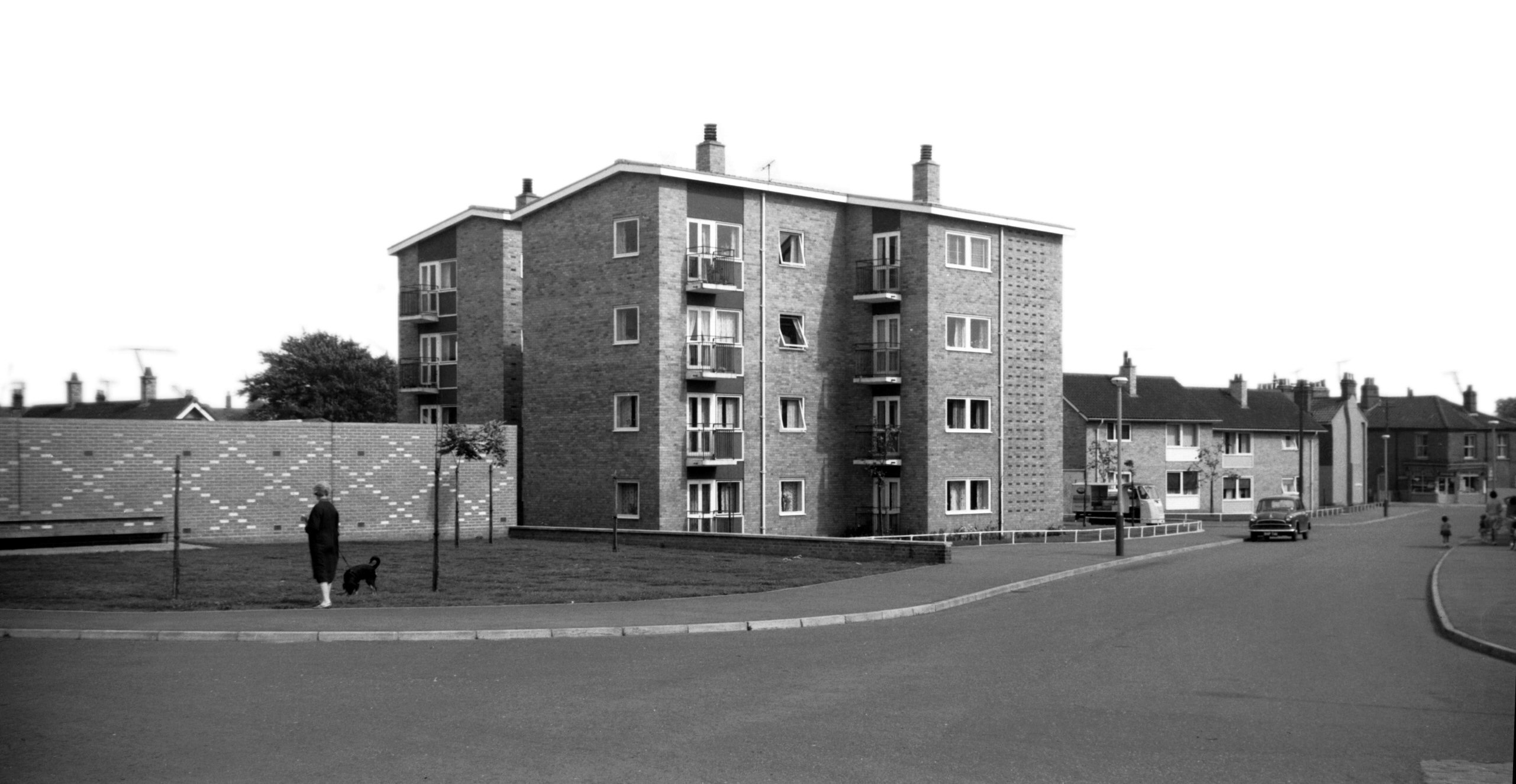
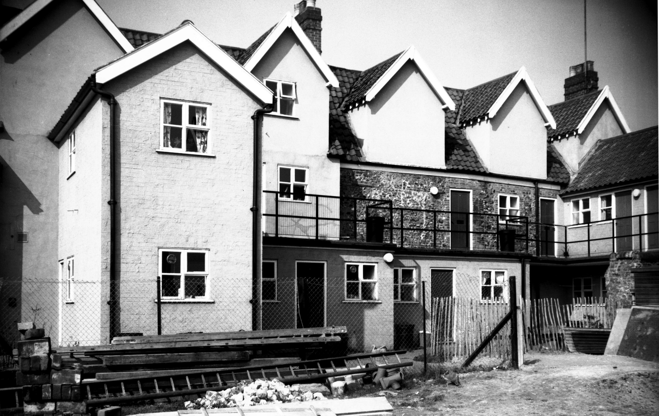
Midland St four-storied corporation flats [4717]
1962-09-09 |
|
Mile Cross Rd: |
||
| From
Heigham St / Nelson
St to Aylsham Rd passing Drayton Rd |
||
|
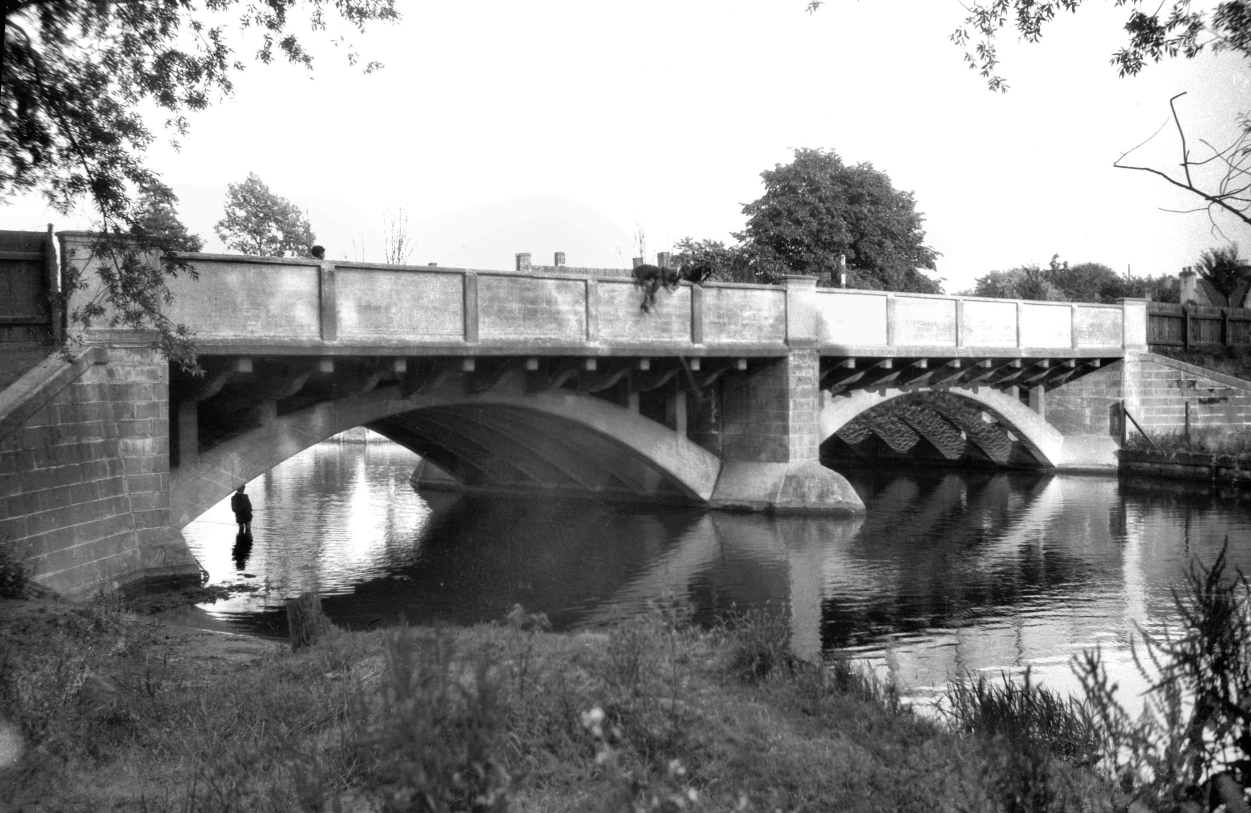
Wensum Mile Cross Rd Bridge west side [B621]
1933-07-11 No previous bridge existed on this site. The present bridge and thoroughfare were constructed as an unemployment scheme, the Dolphin footbridge having become inadequate after the building of the Drayton Rd and Mile Cross housing estates. The bridge has a double span of about 75 feet with arches of reinforced concrete ribs supporting pillars carrying the deck beams and deck. The estimated cost was £47,000. It was first opened to traffic in 12th September 1923 by Sir H.P.Maybury. |
|
Mile End Rd: |
||
| From
Newmarket
Rd / Daniels Rd to Unthank Rd / Colman Rd passing Church Avenue Eaton |
||
|
Mile End Rd at Unthank Rd [B771] 1933-09-10 Colman Rd beyond. |
|
Mountergate: |
||
| From
King St / Stepping
Lane to Rose Lane / Prince
of Wales Rd passing Synagogue St North side |
||
|
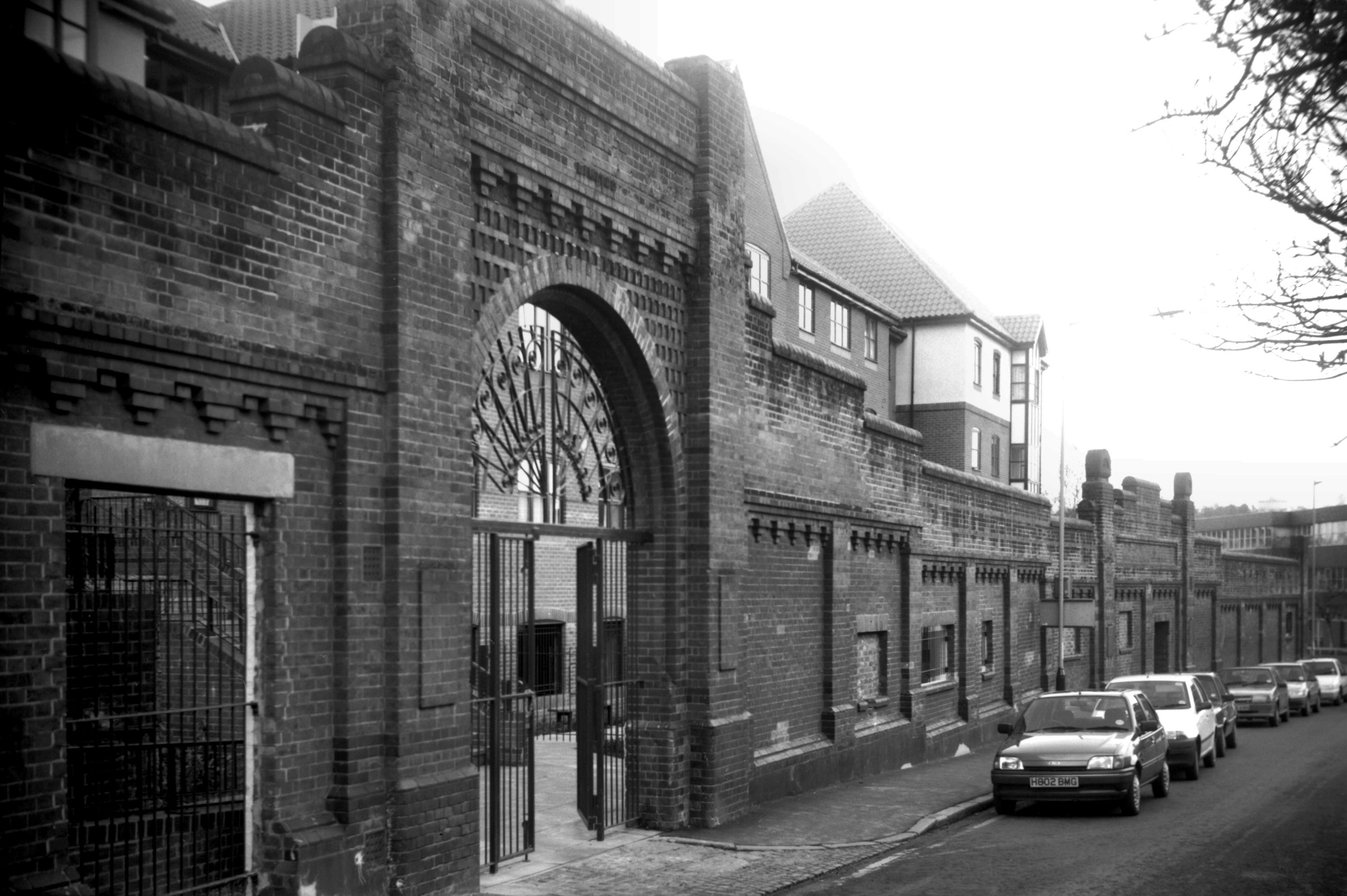
Mountergate Coop shoe factory wall [7530] 1998-03-01 Retained as a baffle against traffic noise for Parmentergate Court. |
|
|
Fish Market Mountergate general view [6231]
1981-08-22 Wholesale Fish Market. Moved here in 1914 from St Peter's St. |
|
|
Fish Market Mountergate SW corner [6225] 1981-08-13 |
|
| South side | ||
|
Mountergate old house east of Synagogue St [5198]
1968-05-30 There have been several changes of st name in the area. St Vedast St was formerly Cathedral St South and Mountergate is shown on Hochstetter's Map of the City, dated 1789, as part of St Faith's Lane. How it came to be so called is explained by Hudson as follows: "In Norwich the name Vaast (the original form of Vedast) being locally pronounced Vaist, or Faist, became confused with Faith, owing to the familiarity of the people with the name of St Faith through the popular horse and cattle fair at Horsham St Faith's, near Norwich, called St Faith's Fair." Until quite recent times the name continued to be perpetuated in Mountergate by the St Faith's Tavern, which stood at the corner of this and Synagogue St. As to the name "Mountergate" this derives from the parish in which it is situated, long known as St Peter Permountergate, but now more correctly as Parmentergate after the leatherdressers, skinners or parchment makers who traded there. |
|
|
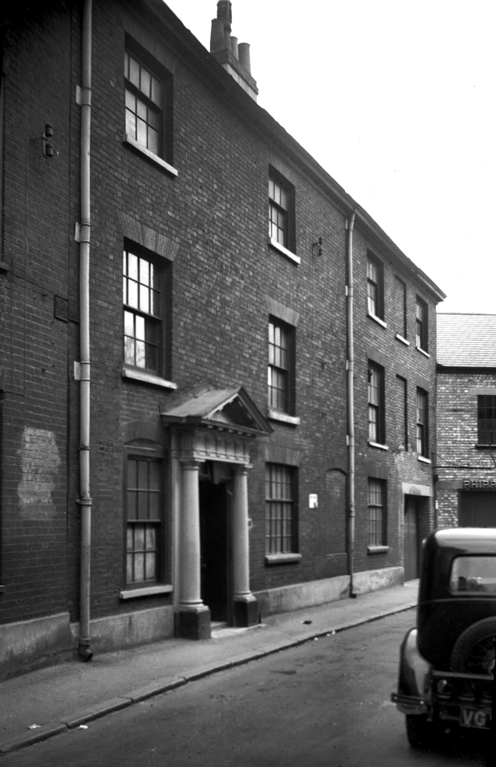
Mountergate St Faith's House [1168] 1936-07-27 From site of Spring Gardens. |
|
|
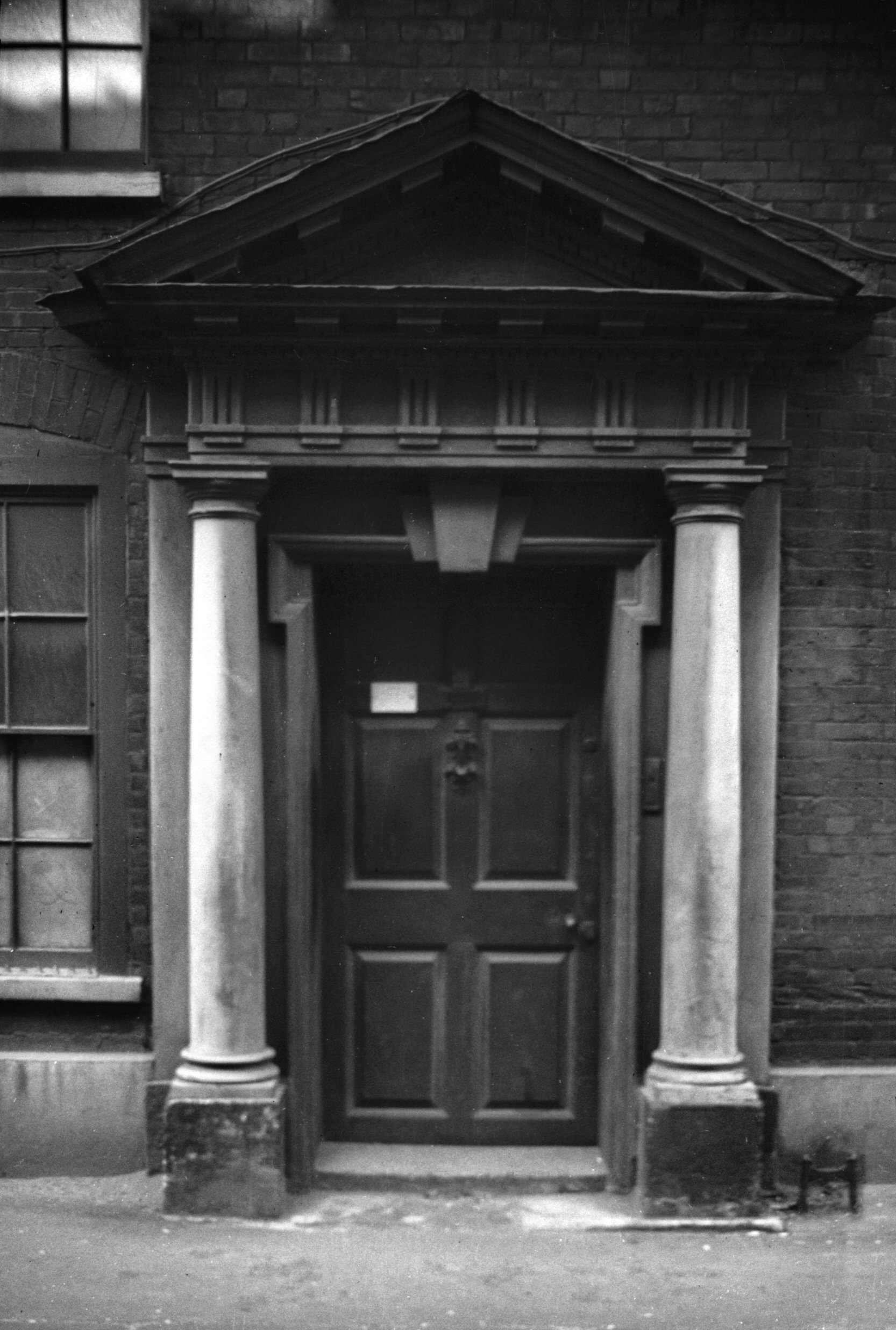
Mountergate St Faith's Ho Georgian doorway [1169]
1936-07-27 |
|
|
Mountergate warehouse Spring Gardens site [0289]
1934-09-13 Erected 1933 on the site of Spring Gardens. |
|
|
Mountergate houses SE side weavers' window [1290]
1936-08-16 |
|
|
Mountergate old weavers' building rear [6299]
1984-05-11 From site of Spring Gardens, south-east side of Mountergate. |
|
Mousehold Avenue: |
||
| From Silver Rd to Gurney Rd | ||
|
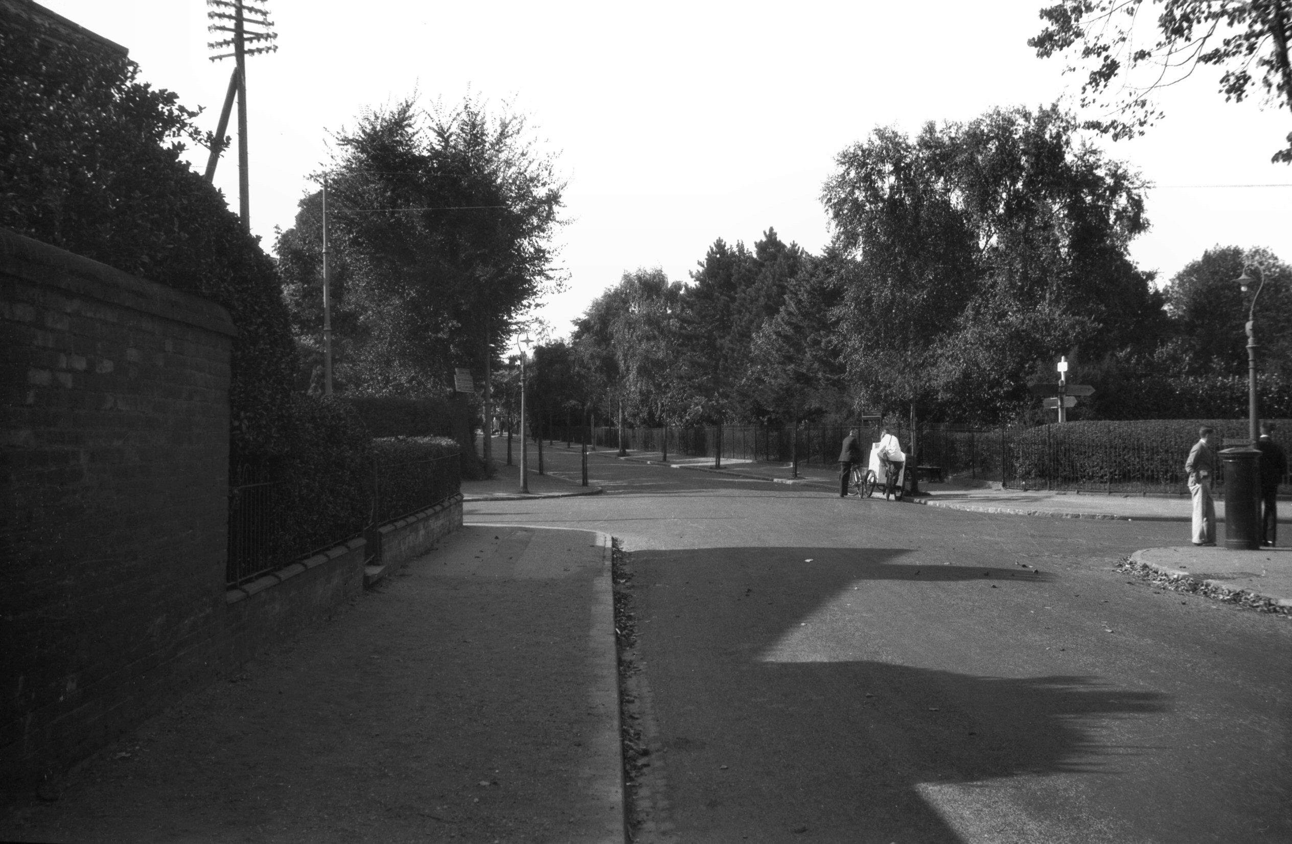
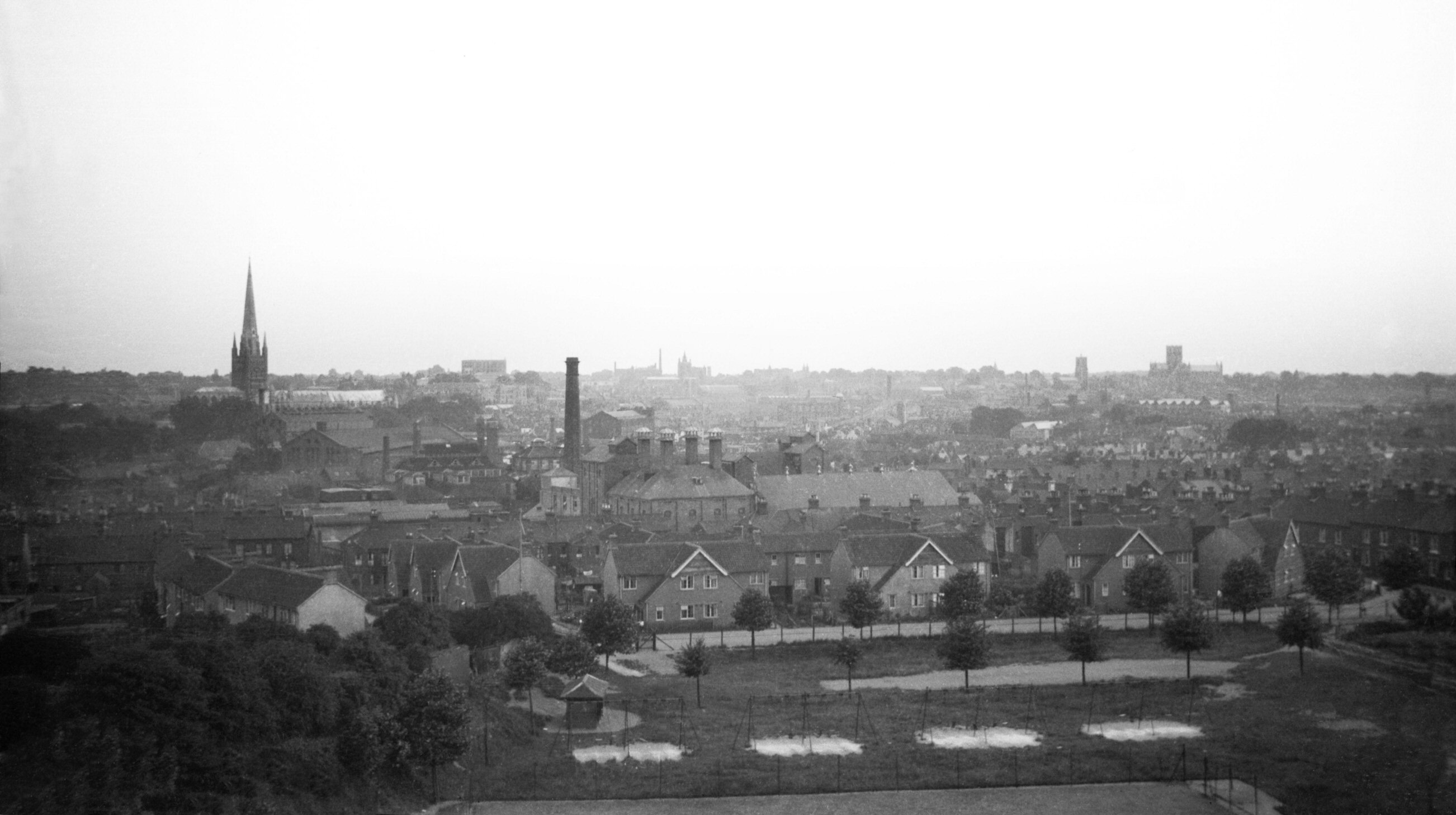
Mousehold view S from Mousehold Ave [B616] 1933-07-08 |
|
Mousehold Lane: |
||
| From
Sprowston
Rd to Salhouse Rd / Heartsease
Lane / Gurney Rd passing Sprowston |
||
|
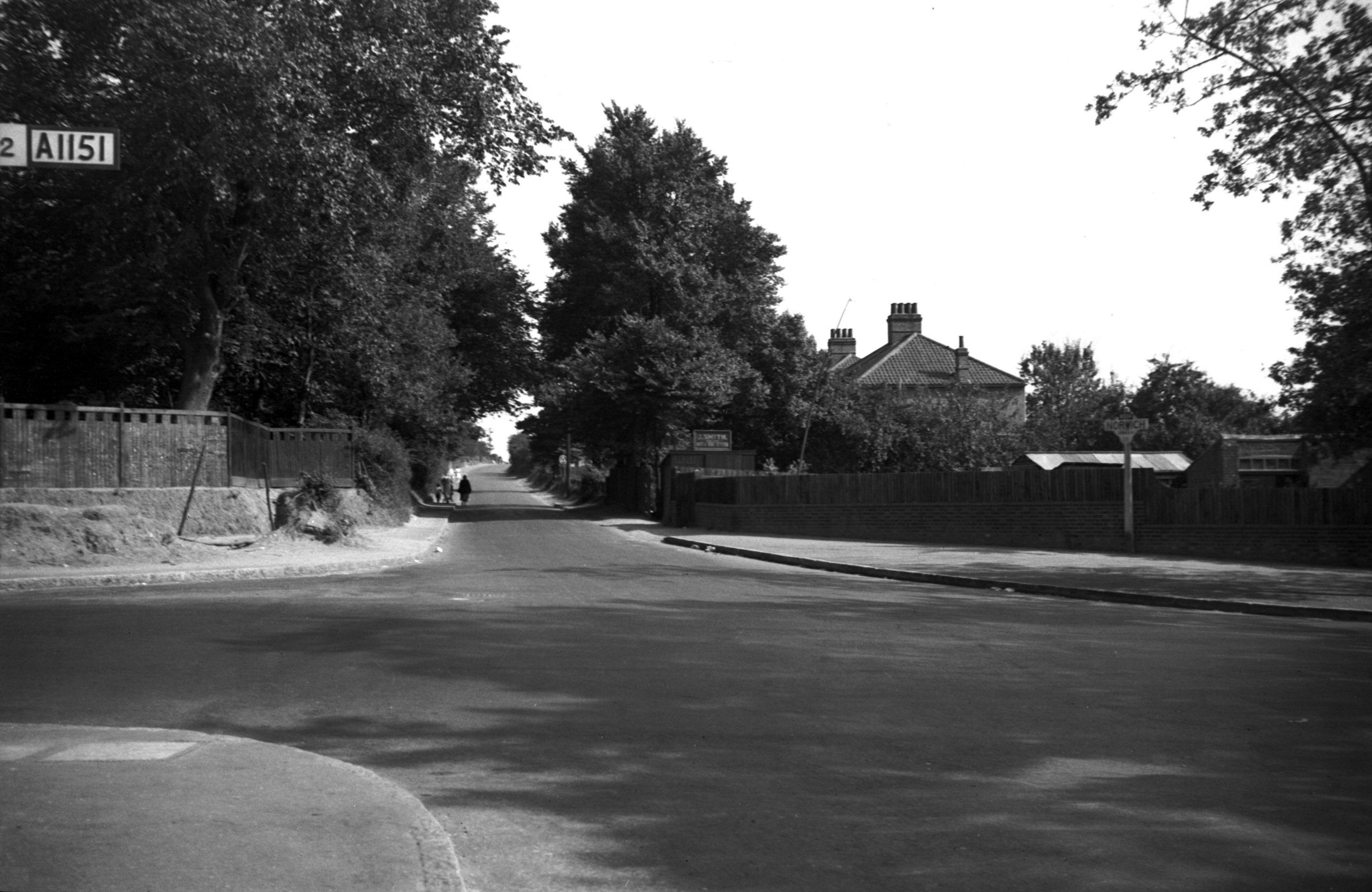
Mousehold Lane at Sprowston Rd [0611] 1935-08-05 The year 1949 saw the widening (on its south side) of a small part of Mousehold Lane. From Sprowston Rd to the Duke of Norfolk Public House (a distance of about one-eighth of a mile) the overall width was increased from 28 feet to 50 feet, the carriageway being widened from 19 feet to 30 feet. In 1963 the widening of Mousehold Lane was completed. |
|
|
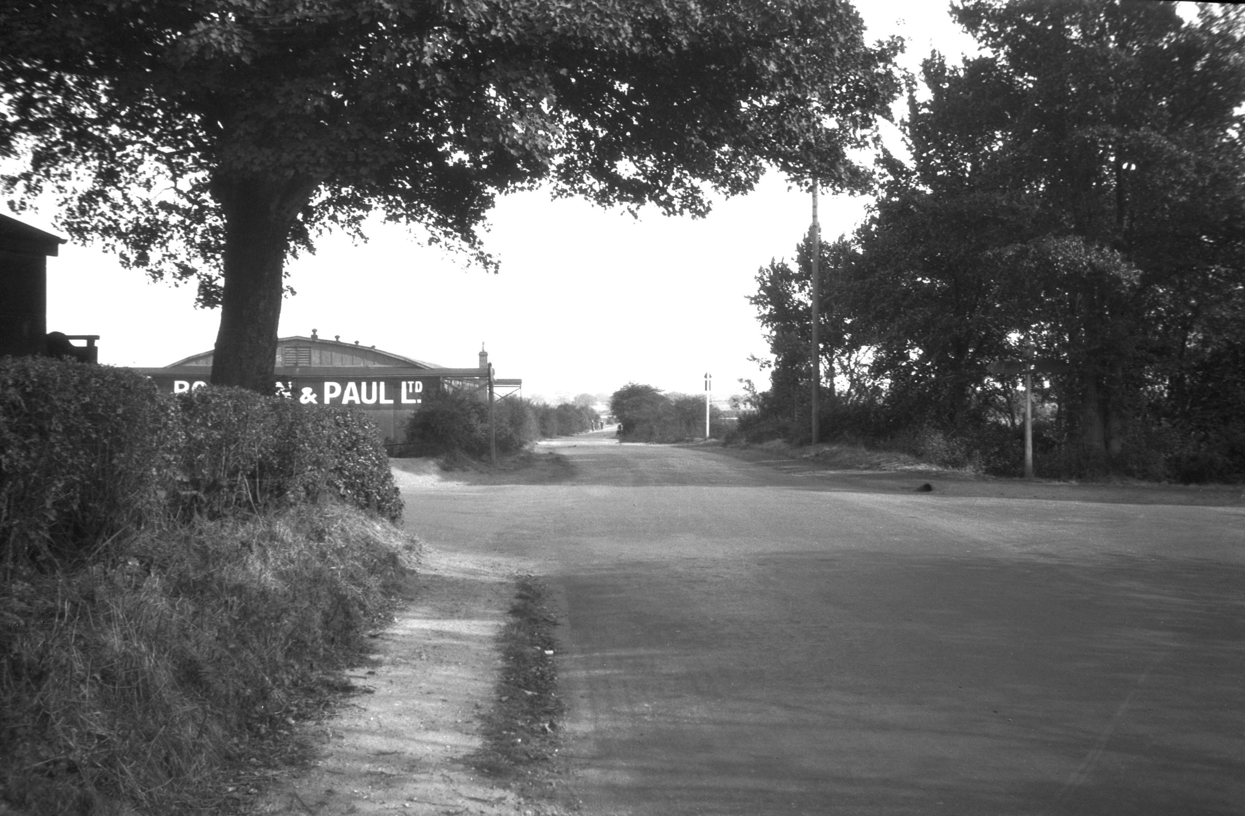
Mousehold Lane at Salhouse Rd [B773] 1933-09-10 Heartsease Lane beyond. Gurney Rd right. |
|
Muspole St: |
||
| From
Colegate to Duke St / St Mary's Plain / Pitt
St East / north side |
||
|
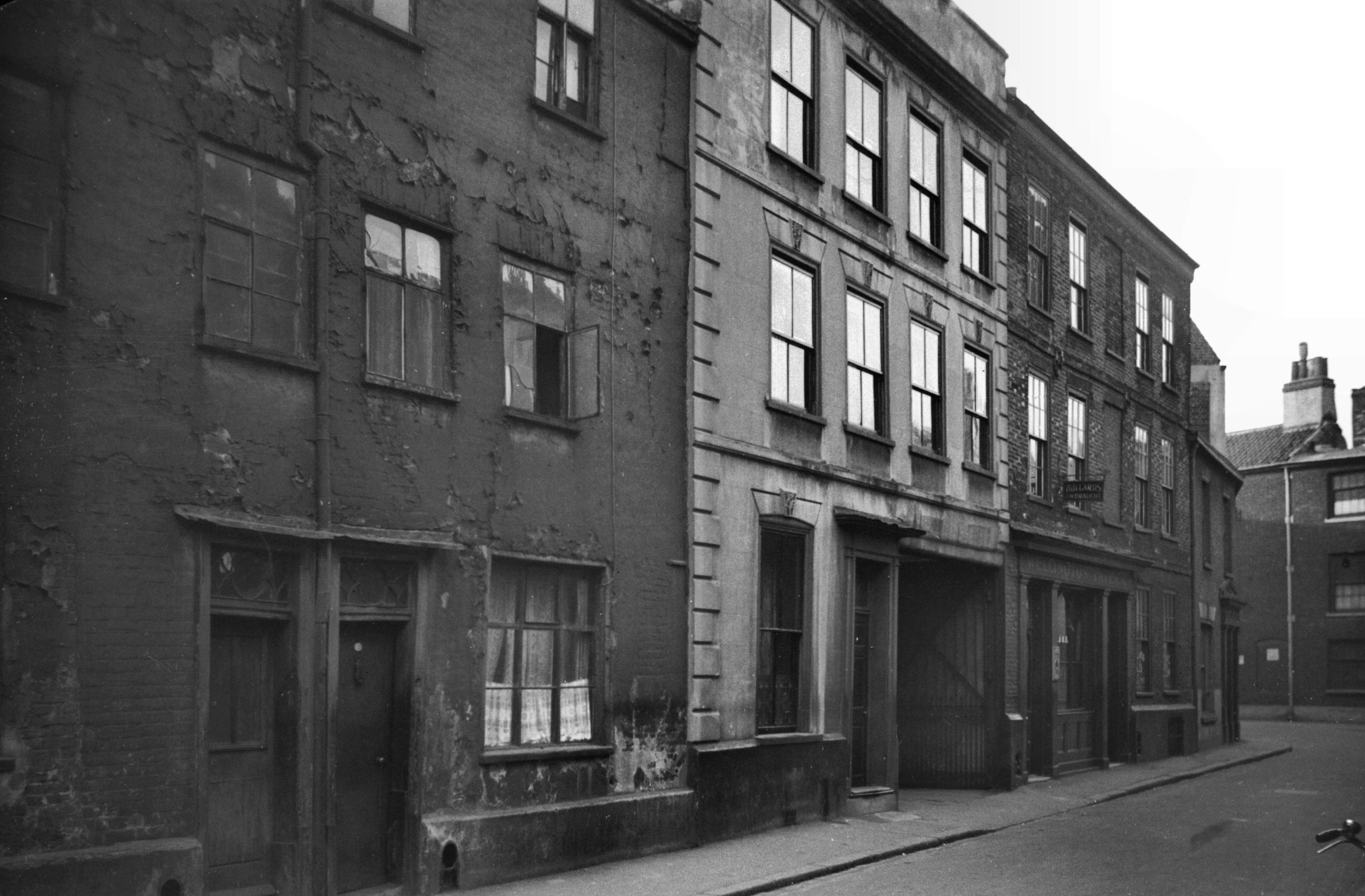
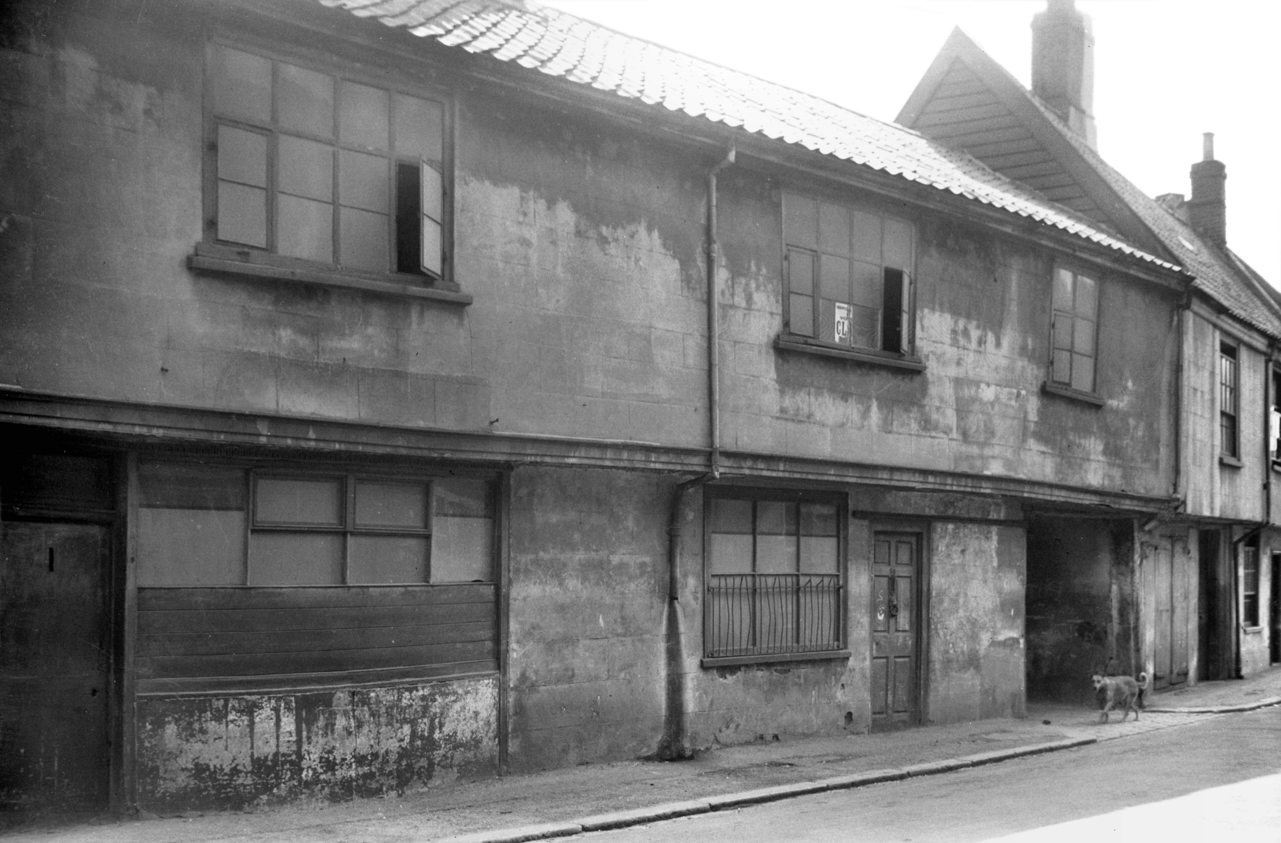
Muspole St 1 to 9 [0832] 1936-03-24 |
|
|
Muspole St 3 to 9 rear [5892] 1978-04-19 |
|
|
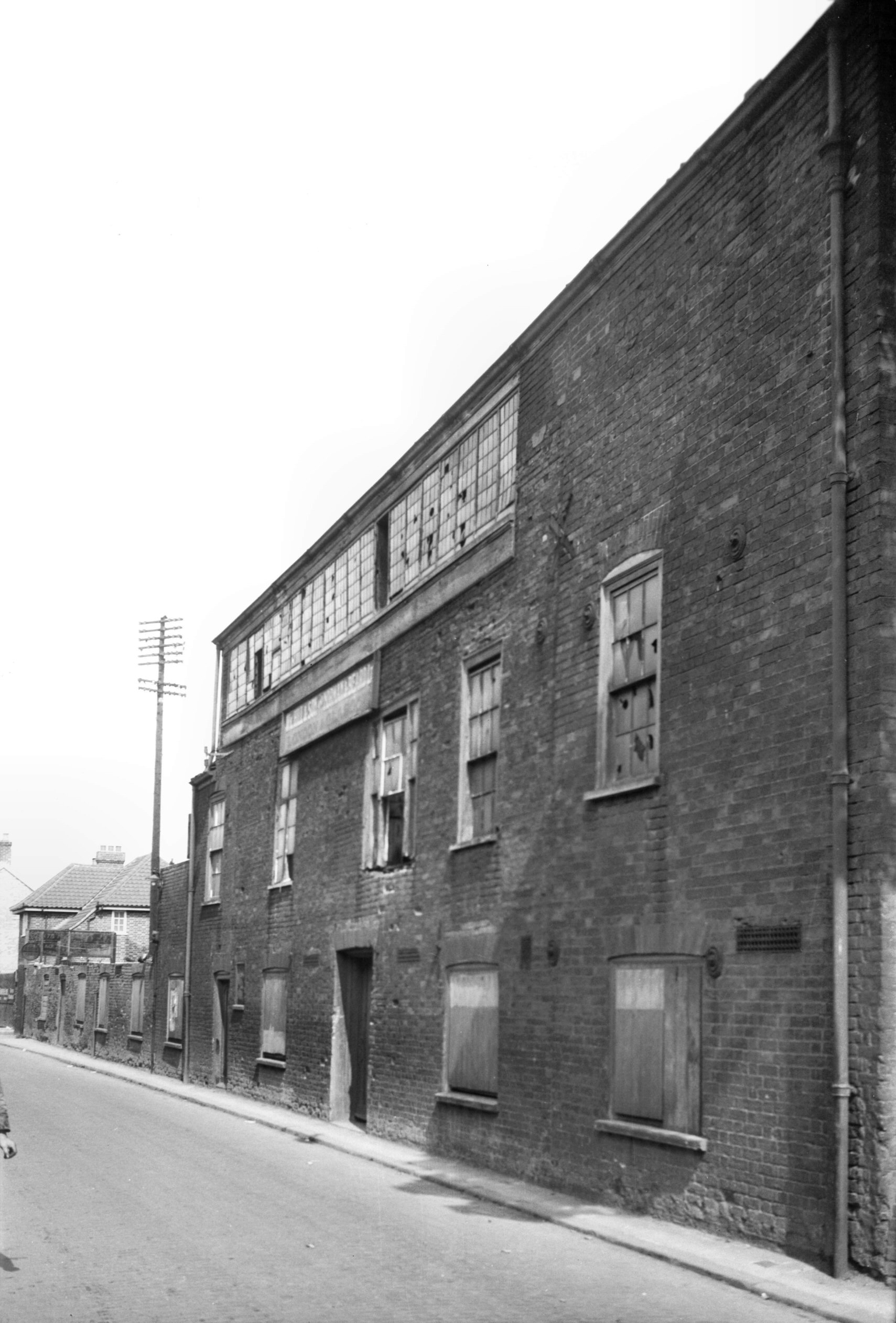
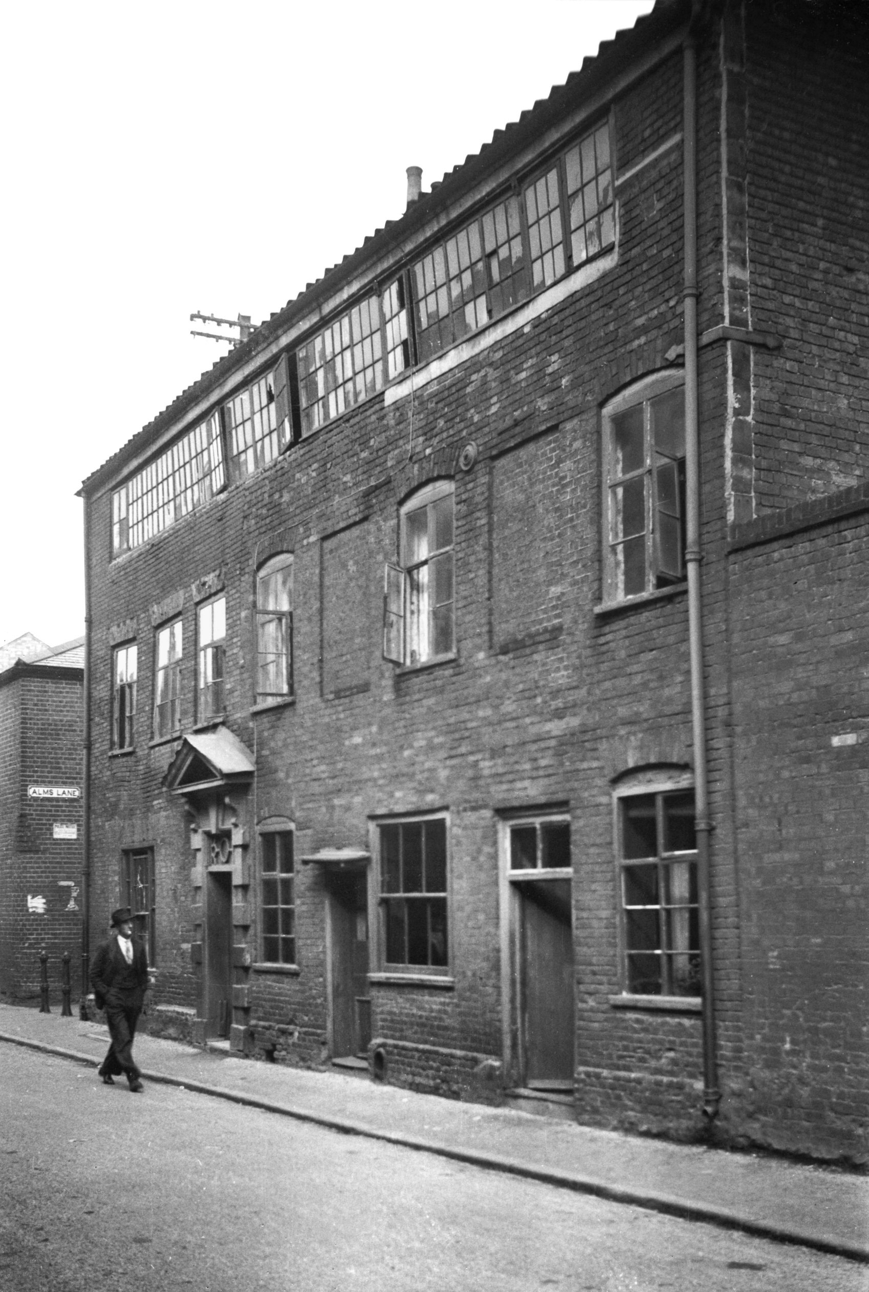
Muspole St 11 with weavers' window [1443] 1936-09-22 The street's curious twisting plan possibly still outlines the borders of the old Mus Pool - "A pit or pool", so the historian John Kirkpatrick tells us, "whereof there were many in the city, but whether so-called from mus a mouse, or from moss, quere?" No 11, which stood on the east side of the street on the south corner of Alms Lane was demolished a few years before the war in a slum clearance scheme. Apparently built in the 18c, it was of three storeys and had in its topmost floor, running the entire length of the building, a splendid example of a weavers' or thoroughlight window, once so common a feature of the city, but now quite rare. Another fine specimen was to be seen in the building formerly standing at the southwest corner of Surrey St. |
|
|
Muspole St 19 to 21 [2313] 1938-04-15 |
|
|
Muspole St 21 Georgian doorway [0429] 1935-03-28 |
|
|
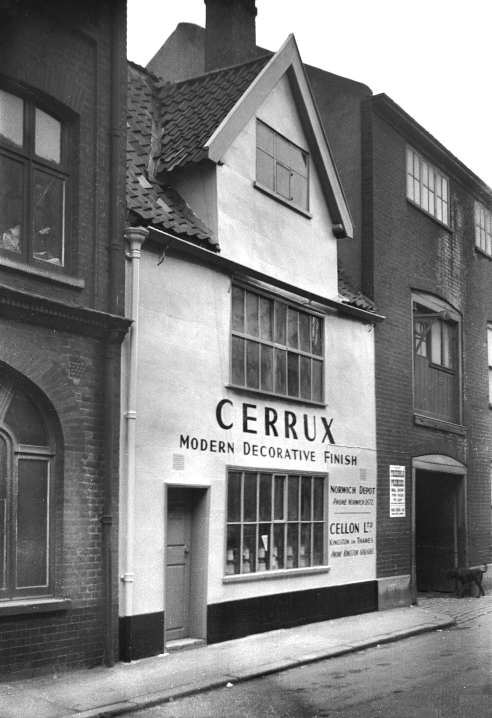
Muspole St 23 [0794] 1936-03-16 For 31 to 33 Muspole St see 1 Pitt St and 69 to 89 Duke St. |
|
| West / south side | ||
|
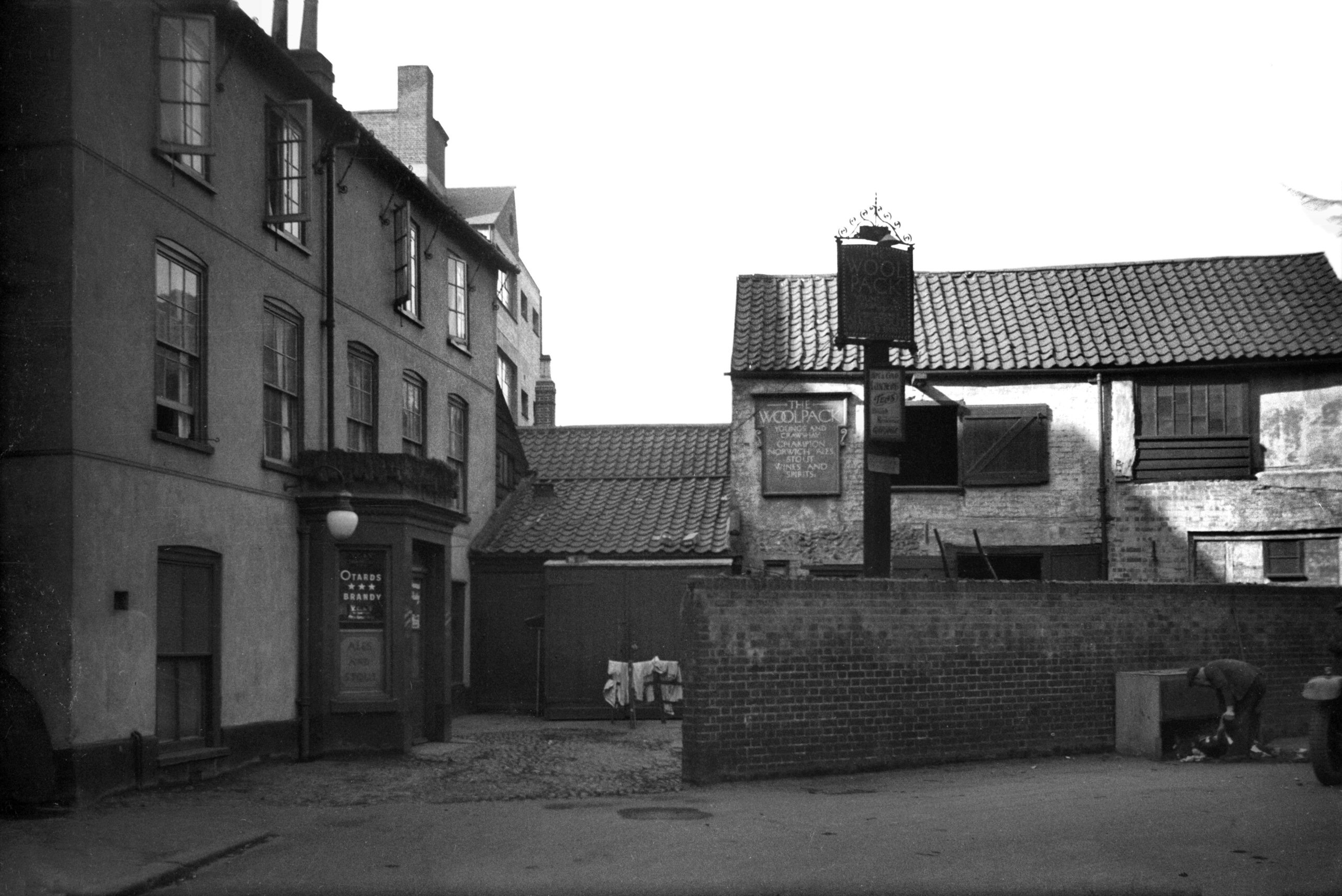
Muspole St 2 Woolpack PH and stables [0831]
1936-03-24 |
|
|
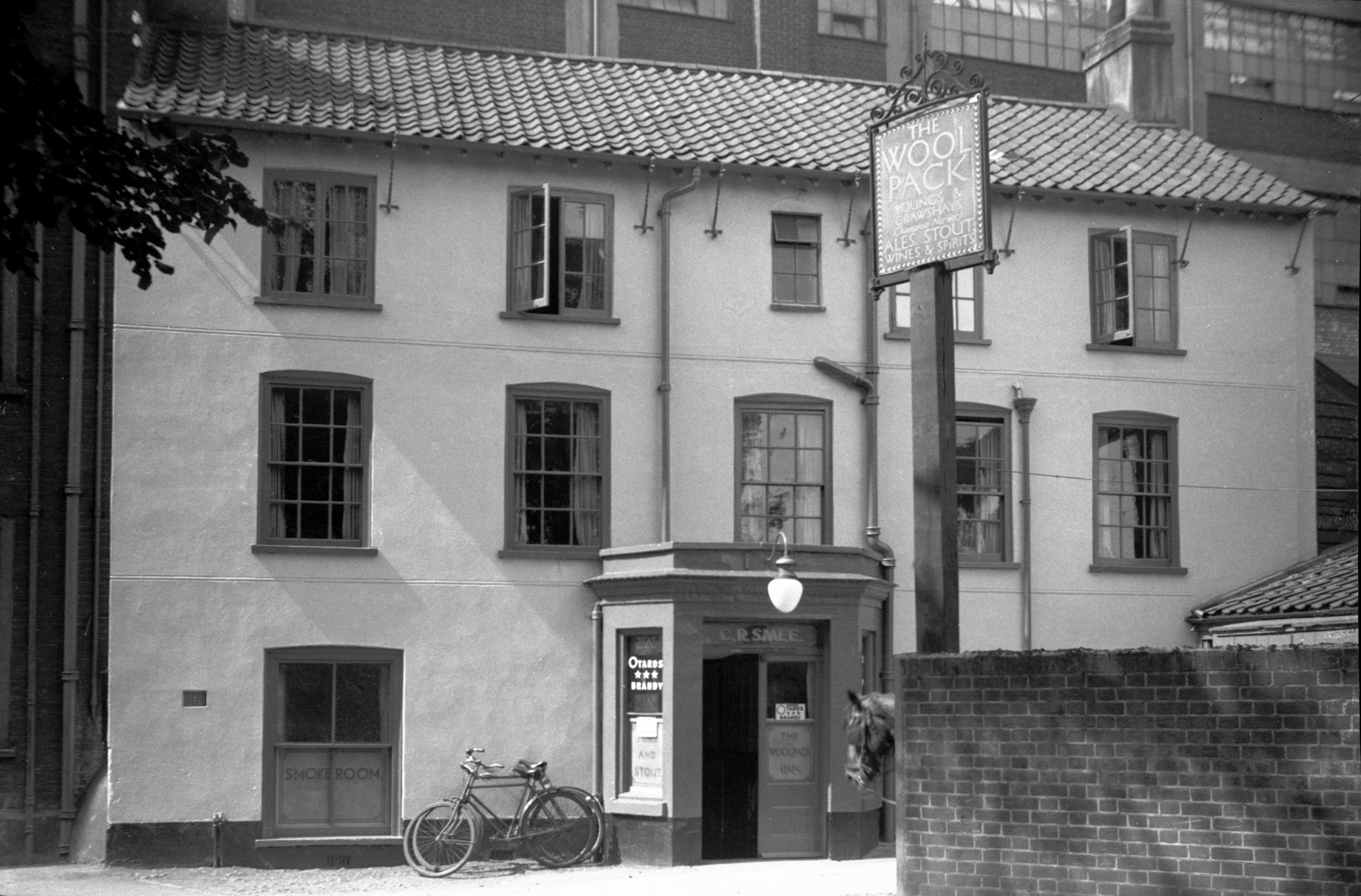
Muspole St 2 Woolpack PH [2719] 1938-08-20 |
|
|
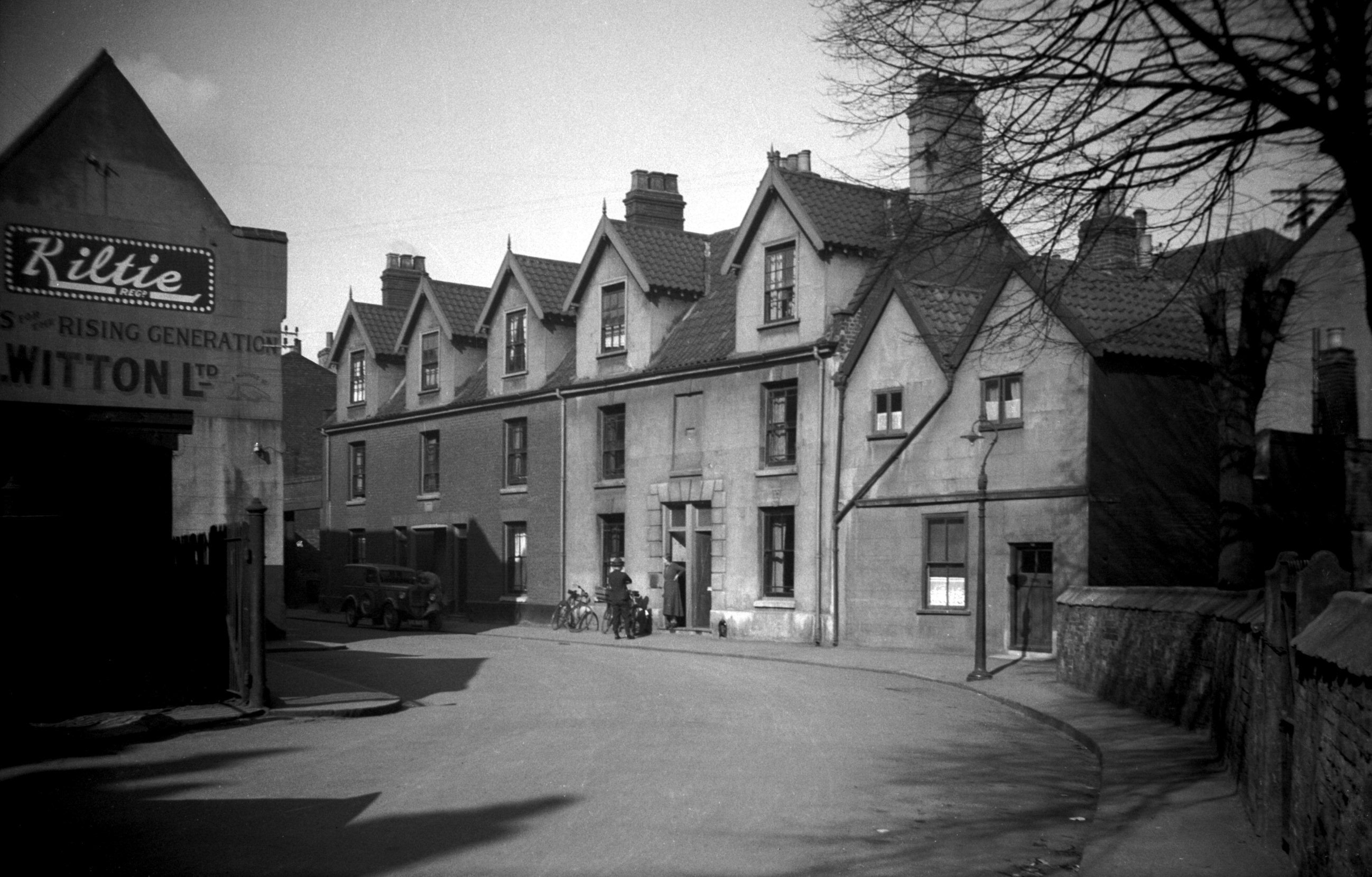
Muspole St 8 Witton's [2509] 1938-06-26 |
|
|
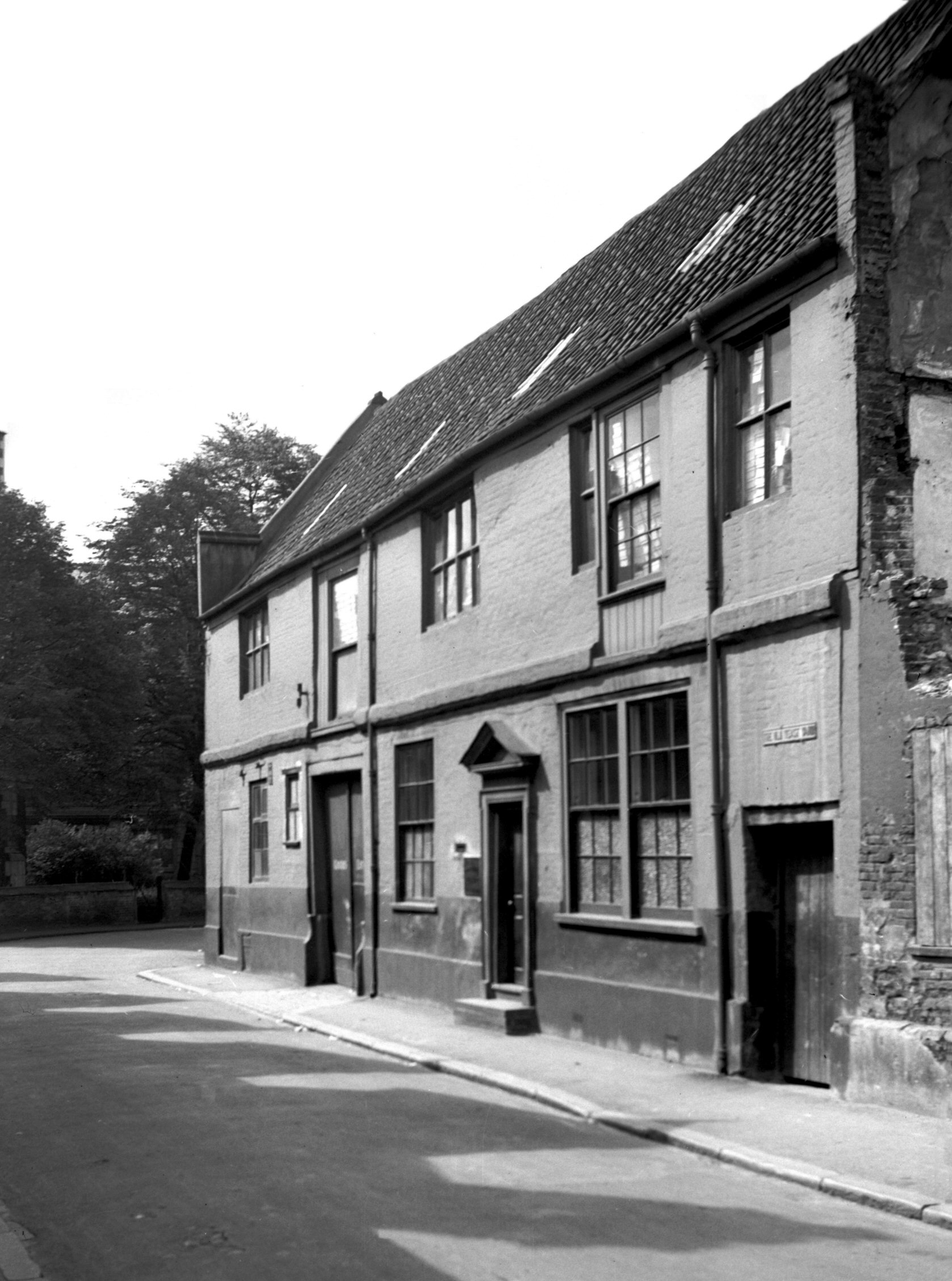
Muspole St 12 to 18 [0824] 1936-03-19 |
|
|
Muspole St 16 [2696] 1938-08-06 |
|
|
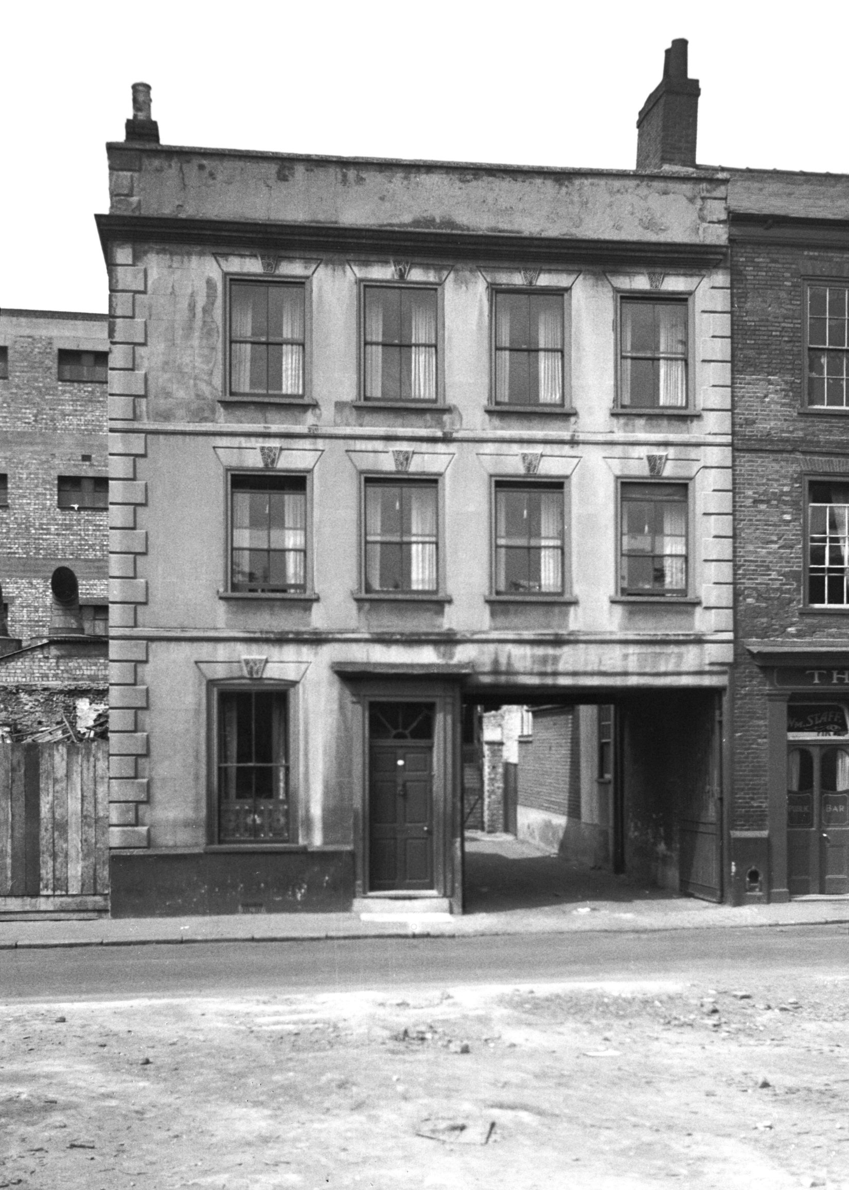
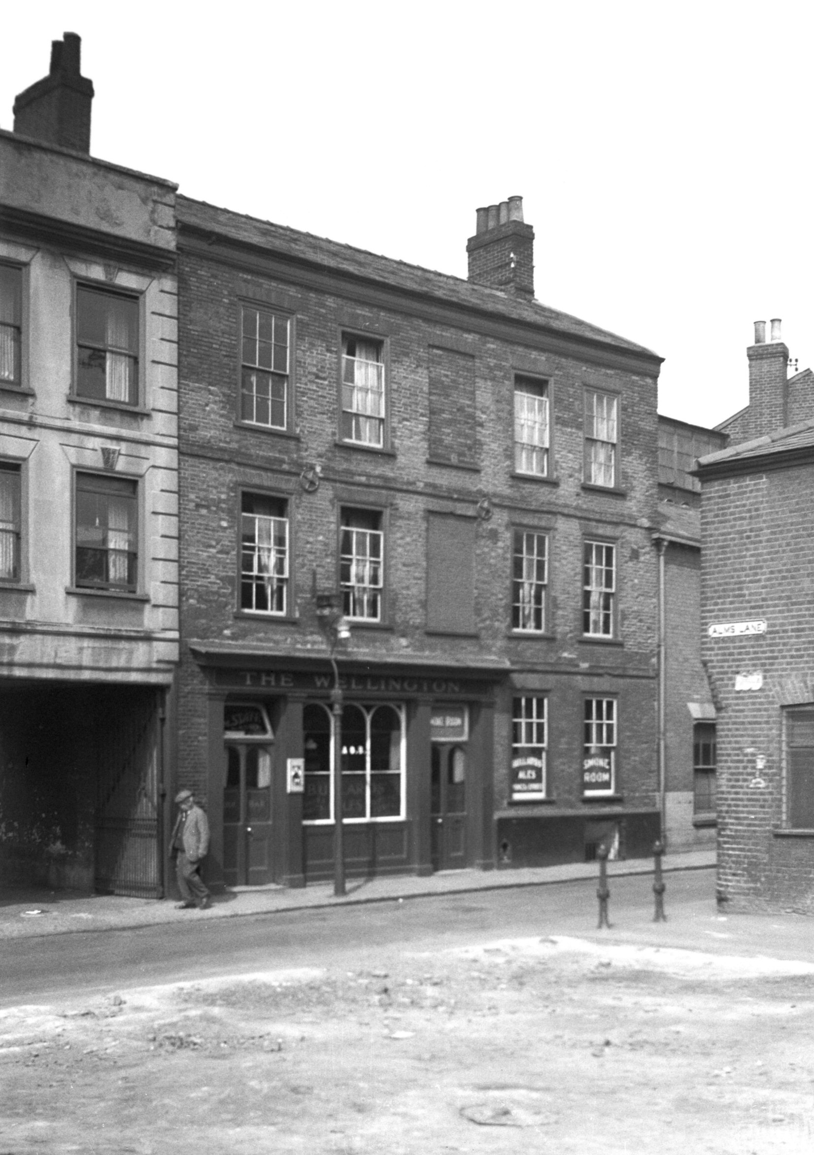
Muspole St 18 Wellington PH [2695] 1938-08-06 |
|
|
Muspole St 26 to 28 [6414] 1986-07-07 |
|
|
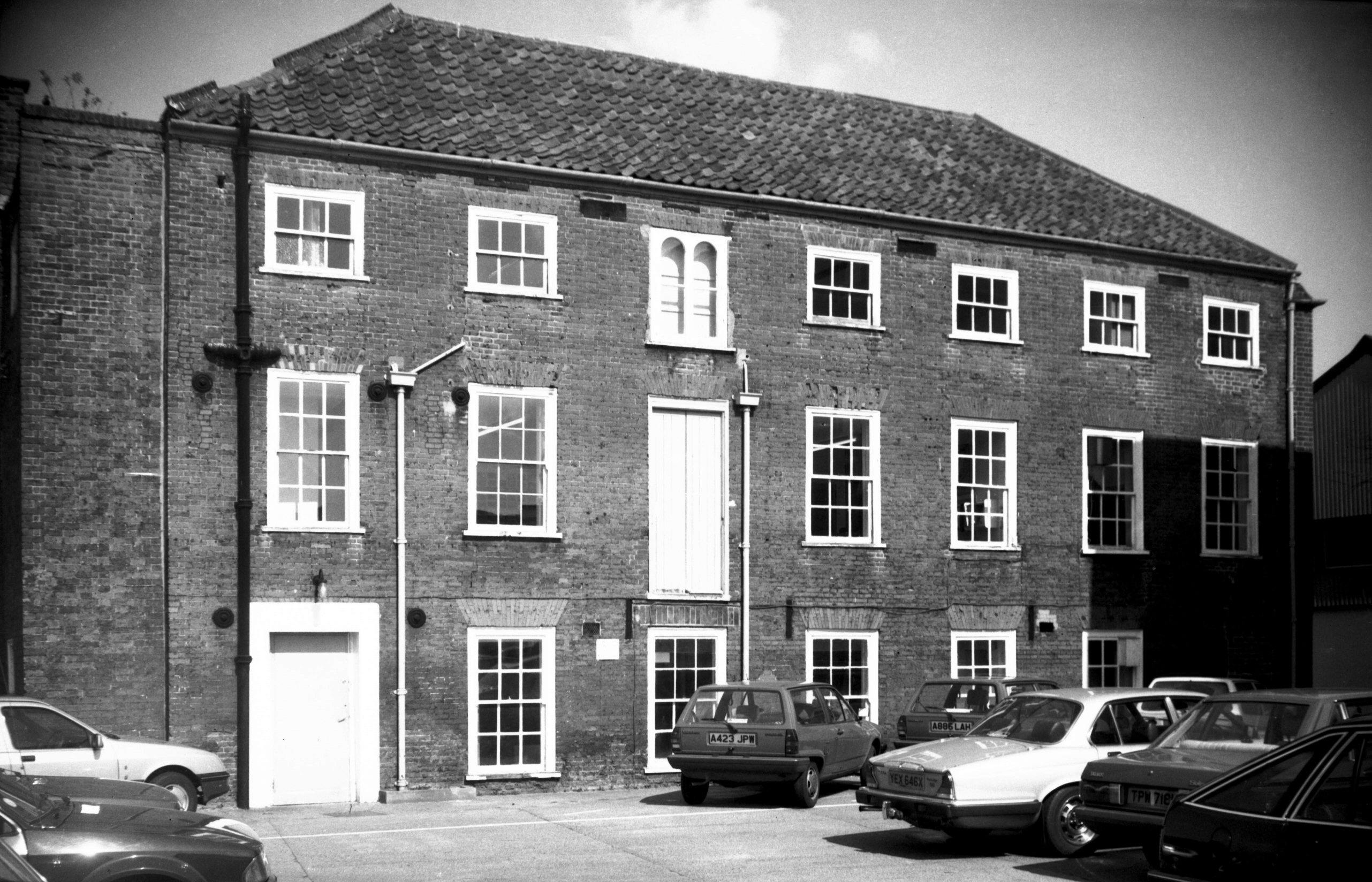
Muspole St 34 to 36 and right Duke St 67 [0839]
1936-03-31 |
|
|
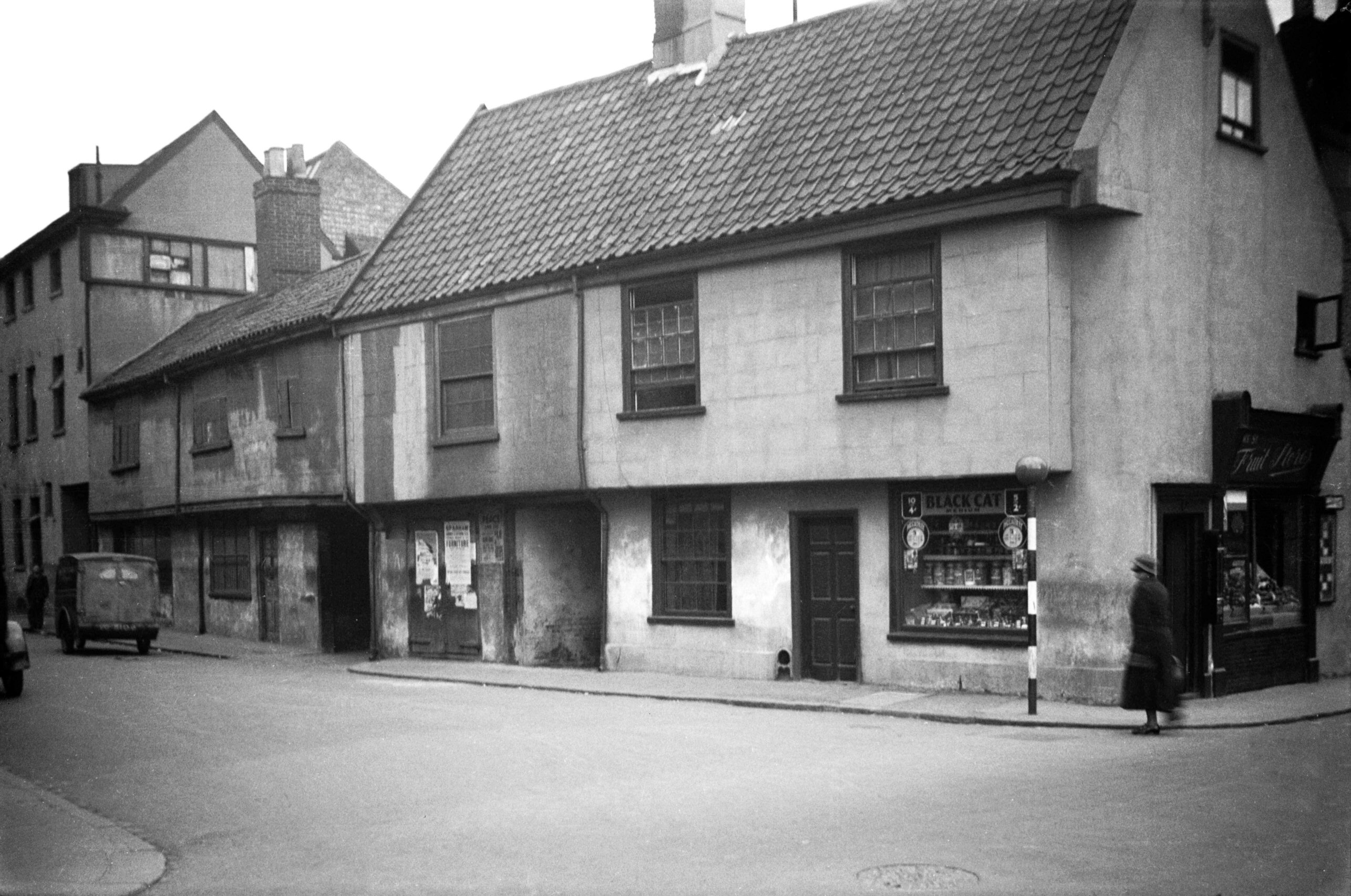
Muspole St 34 to 36 former Cock and House [3191]
1939-07-30 PH. |
|
Nelson St: |
||
| From
Dereham Rd to Heigham St / Mile Cross Rd West side |
||
|
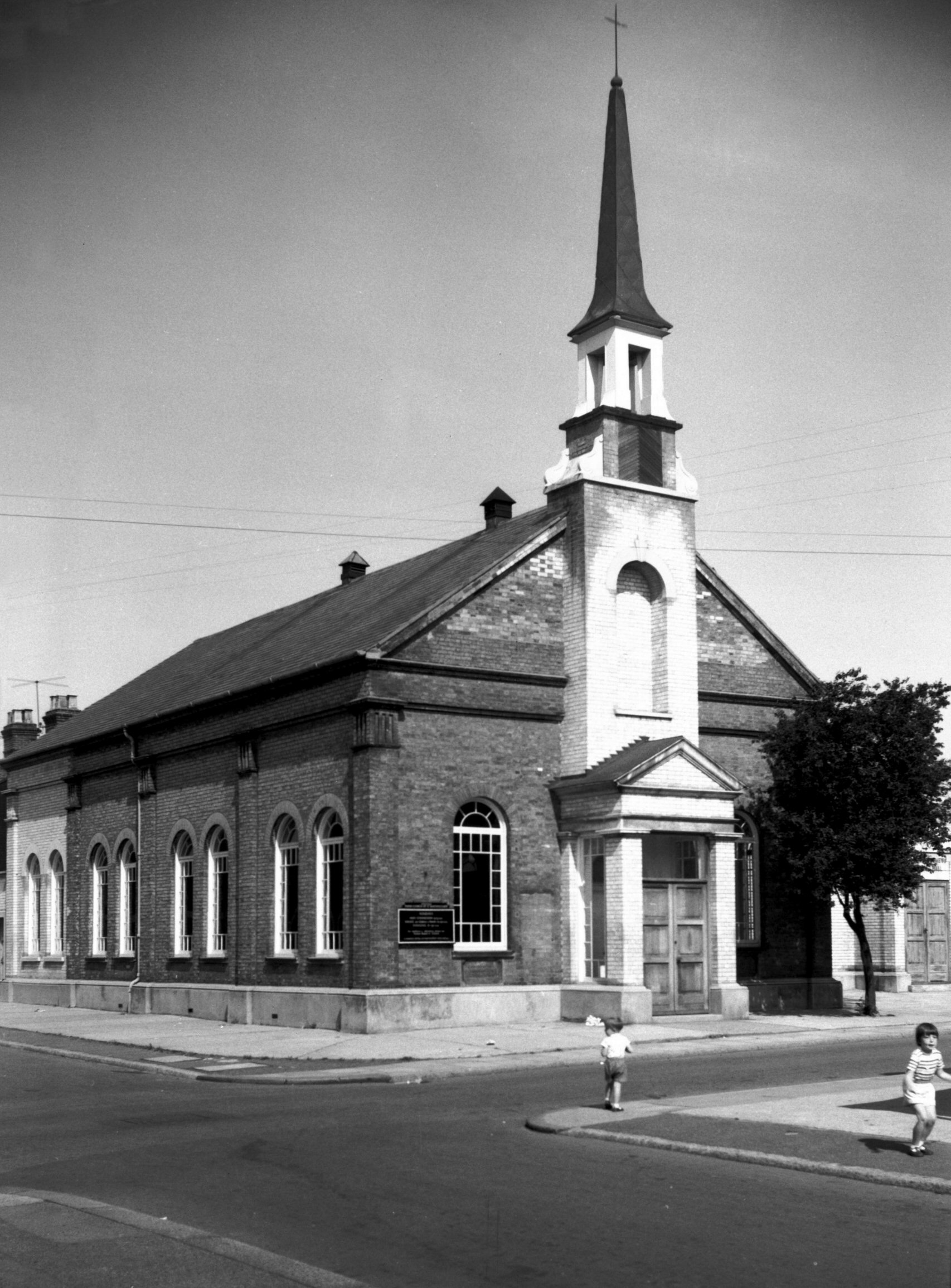
St Bartholomew's N Heigham from Nelson St [4688]
1962-06-30 Built as Methodist Chapel in 1878. Adapted as a parish church 1956 by architect J.P.Chaplin. |
|
New Mills Yard: |
||
| From Westwick St to Oak St | ||
|
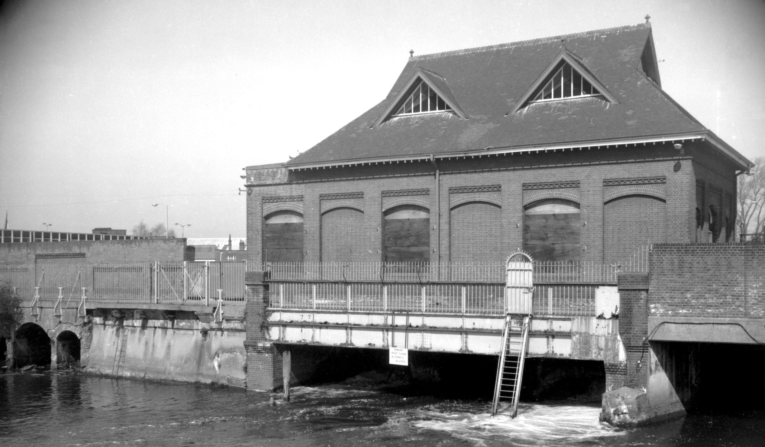
Wensum New Mills Bridge south side [B632] 1933-07-18 Constructed 1896. |
|
|
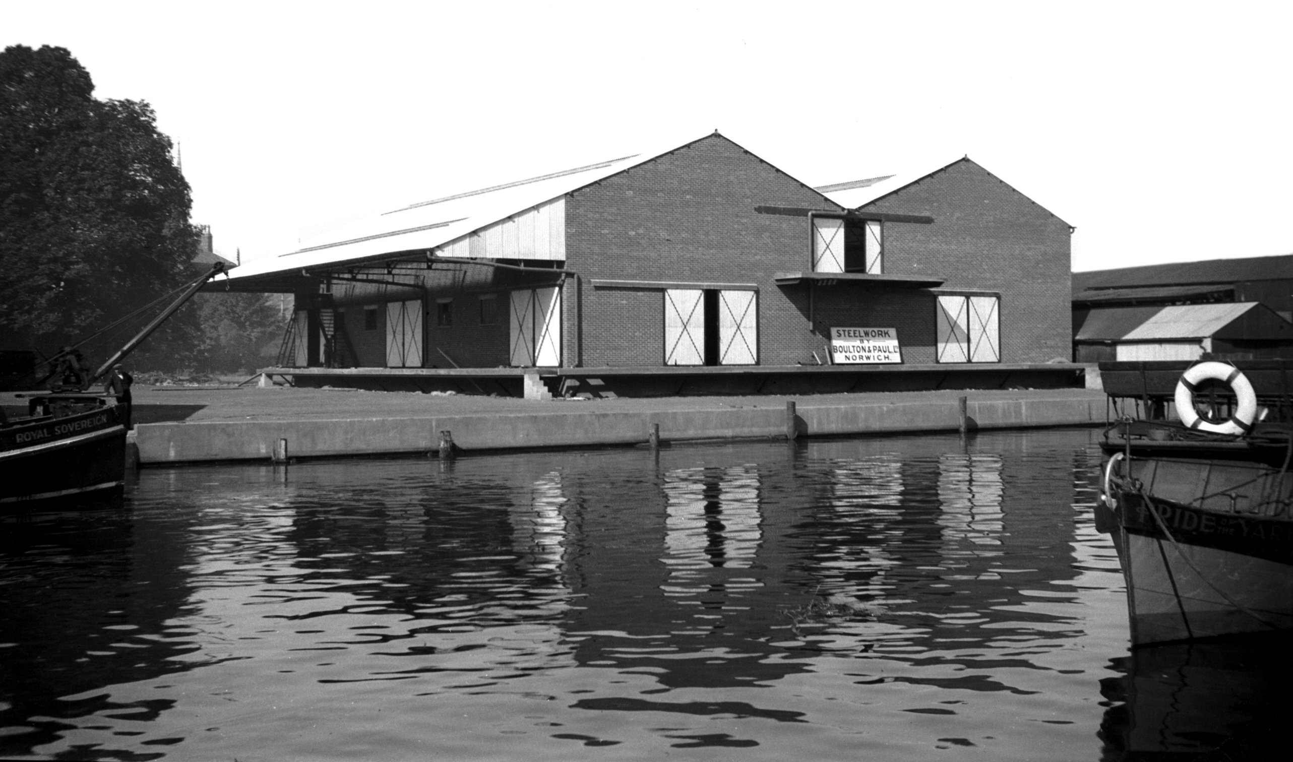
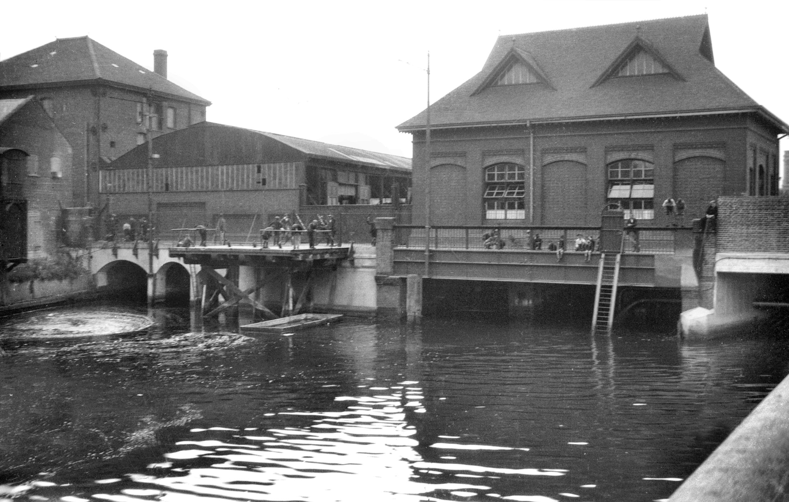
New Mills Yard New Mills [6294] 1984-04-24 Records of mills on this site go back at least to the 14c. Formerly known as Chese's, Bumpstede's and the Appleyard's Mills, they became known as the "New" Mills after being rebuilt in 1430. Corn was ground here up to and during the 19c but in 1897 Norwich Corporation erected the present building as an Air Compressor Station. Downstream from here the river level is tidal; but the upstream level is maintained by gates on the other side of the building. At low tide, a sufficient head of water could drive turbines set in the arches under the building. The turbines could then drive the air compressors. At times when there was no head of water, steam was generated in an adjacent building (destroyed during the war) using the City's rubbish as fuel, to drive a steam engine connected to the air compressors. The compressed air was piped underground around the City and used for a variety of purposes such as driving lathes and other machinery in the City Technical College (later the Art School) and other Council workshops. However its main use was to power eight 'Shones Ejector' underground sewage pumps, located around the City. This unique system was closed in 1972. |
|
|
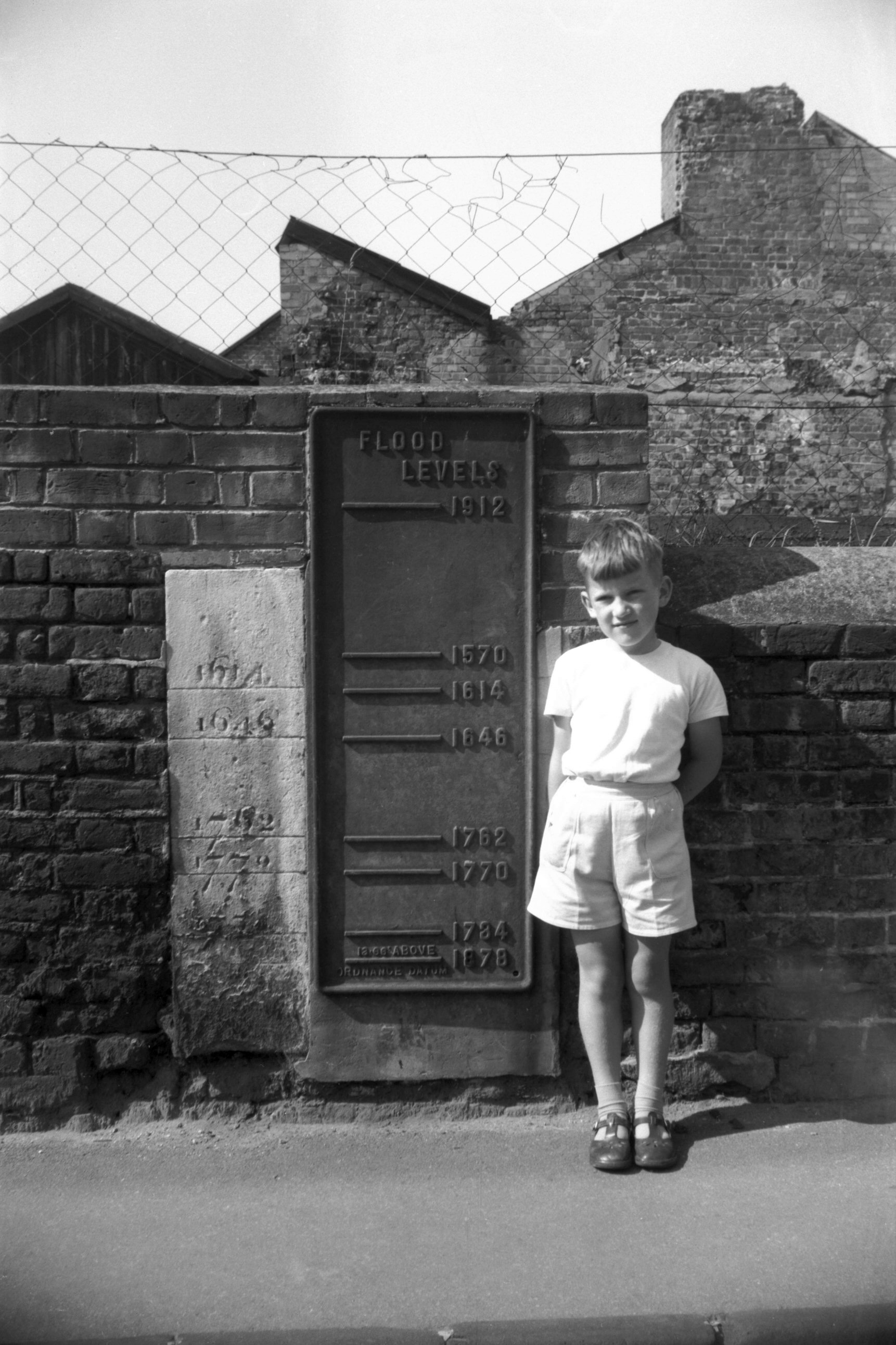
Flood level gauges New Mills Yard [4640] 1961-08-27 Recording Norwich Flood levels 1570-1912. Boy's height 4 feet. [The photographer's younger son, Jonathan, aged 6] |
|
Newmarket Rd: |
||
| From
St
Stephen's Rd / Grove Rd / Ipswich
Rd towards Cringleford passing Daniels Rd, Mile End Rd, Unthank Rd, Eaton St |
||
|
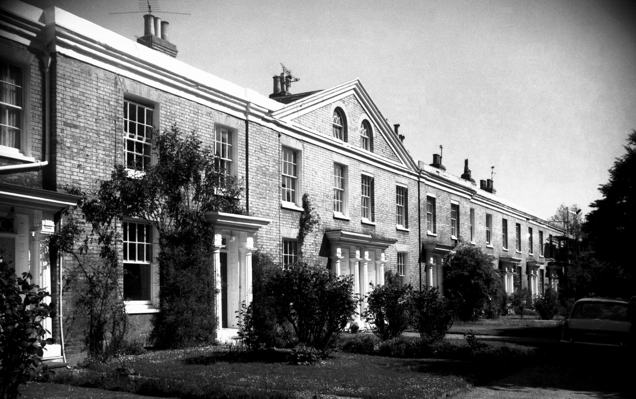
Newmarket Rd 49 to 59 Regency terrace [6323]
1985-05-31 Late Regency. |
|
|
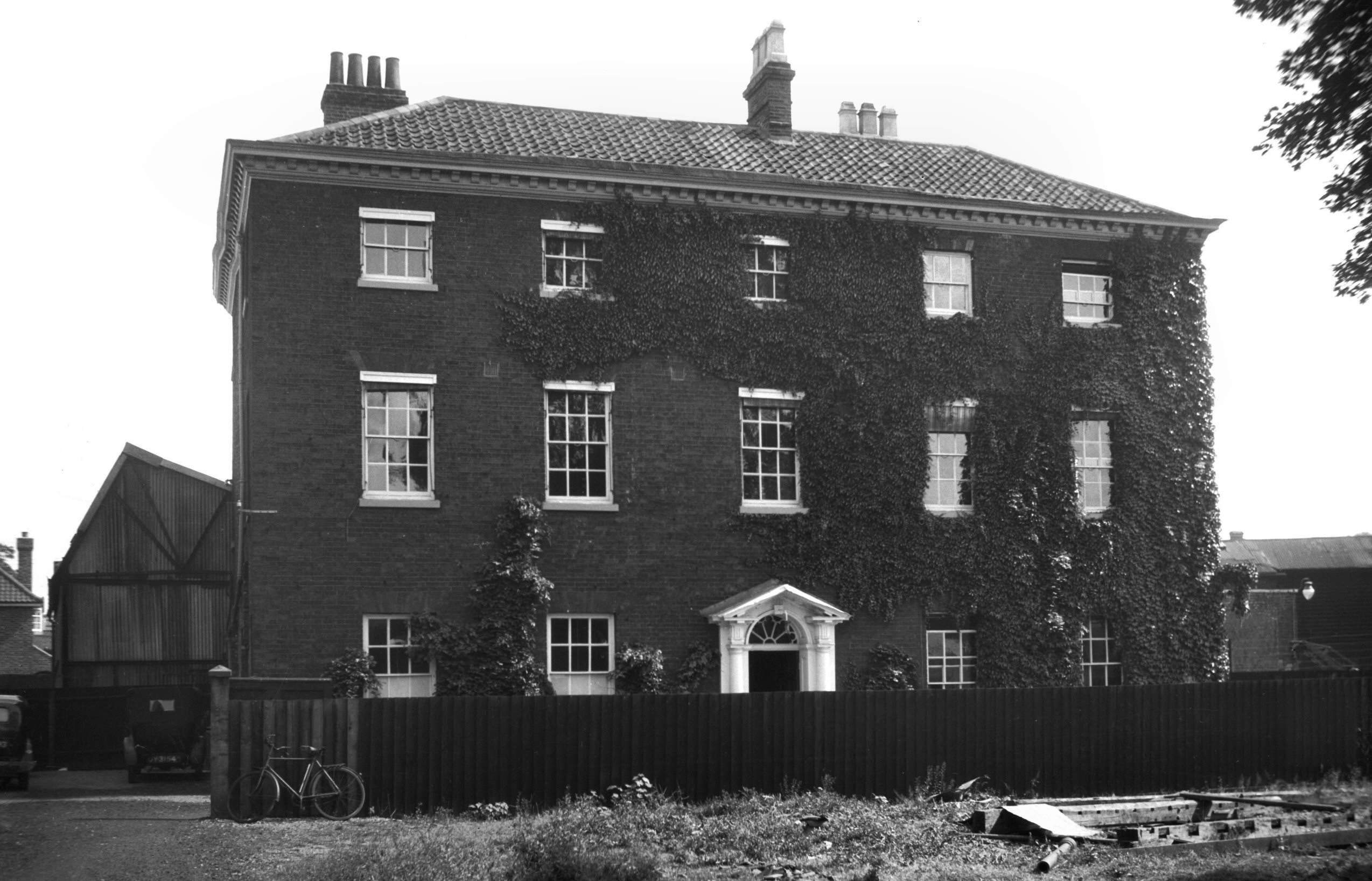
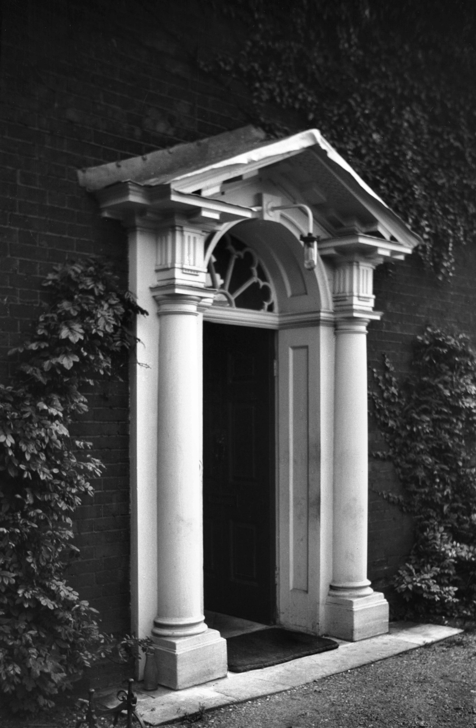
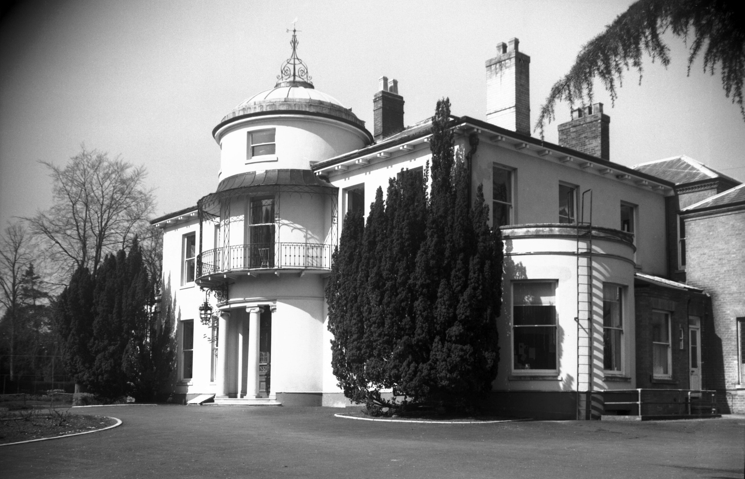
Newmarket Rd 95 Eaton Grove [6543] 1989-04-15 Built 1820 by Sir John Harrison Yallop. |
|
|
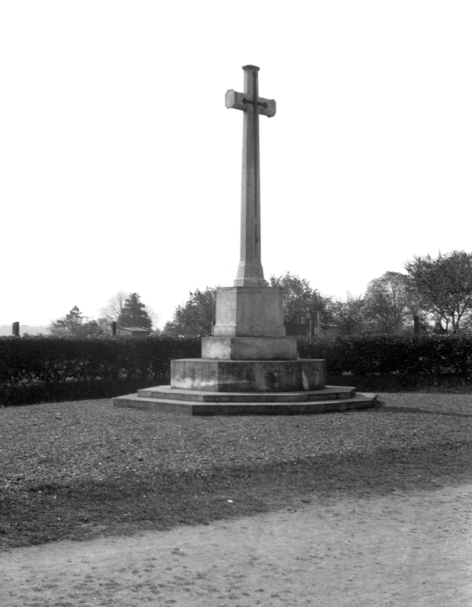
Newmarket Rd Eaton Great War memorial [B535]
1933-04-14 |
|
|
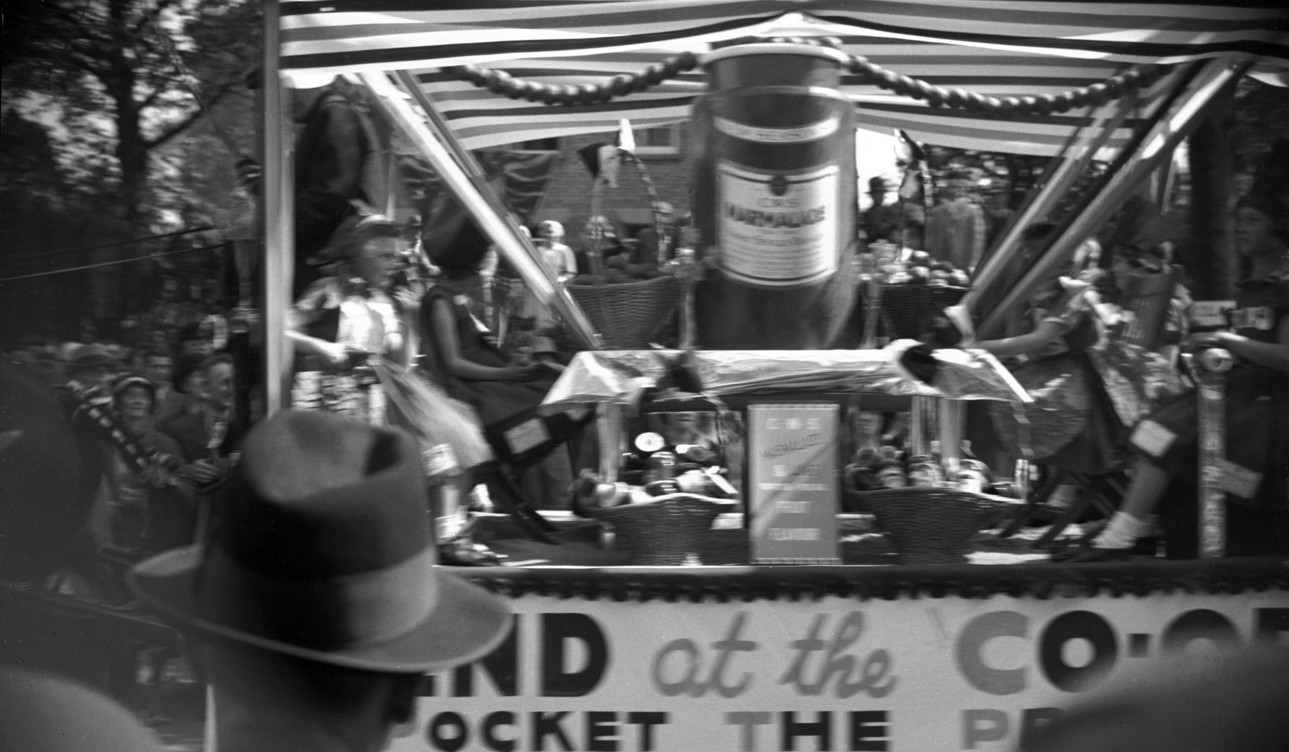
Silver Jubilee procession Co-op float [0557]
1935-05-06 Commencing at 2:45pm the Street Procession left Newmarket Rd for its tour of the City. Prizes were awarded for best entries. |
|
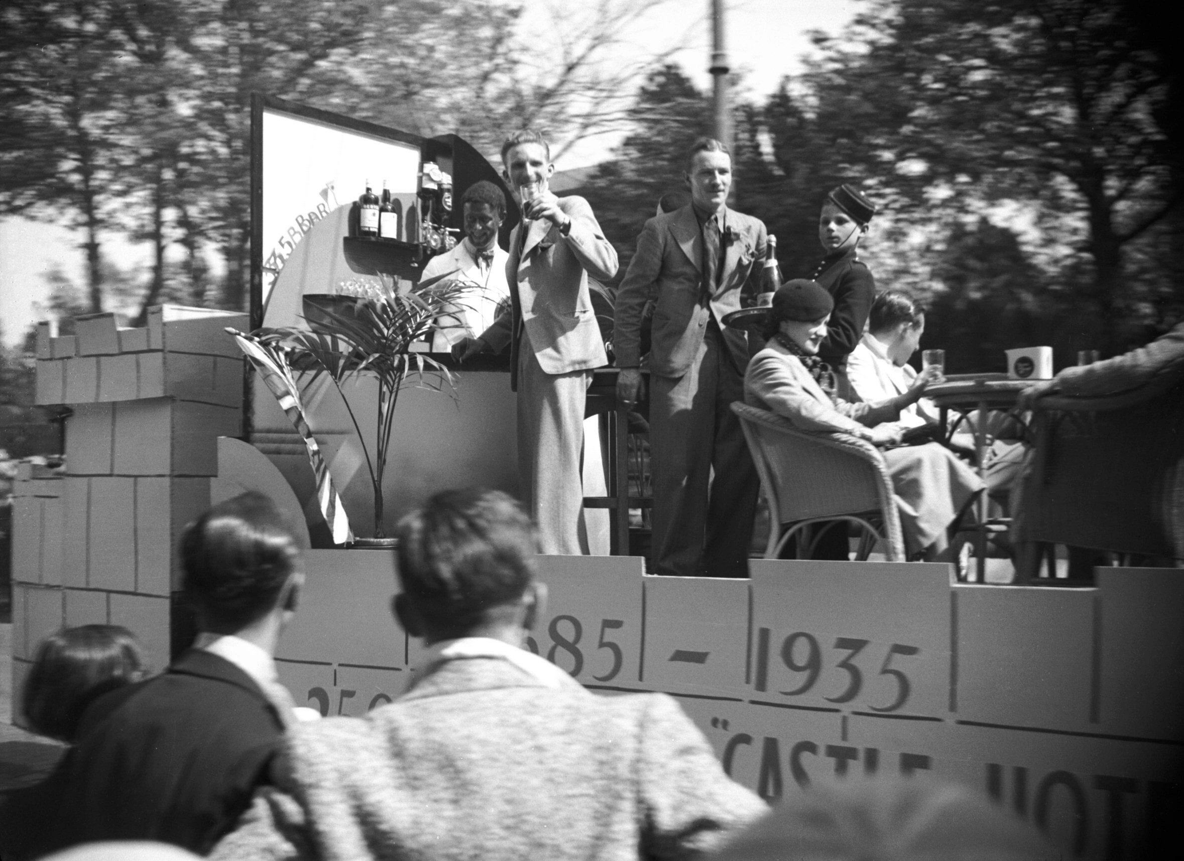
|
Silver Jubilee procession Castle Hotel [0558]
1935-05-06 |
|
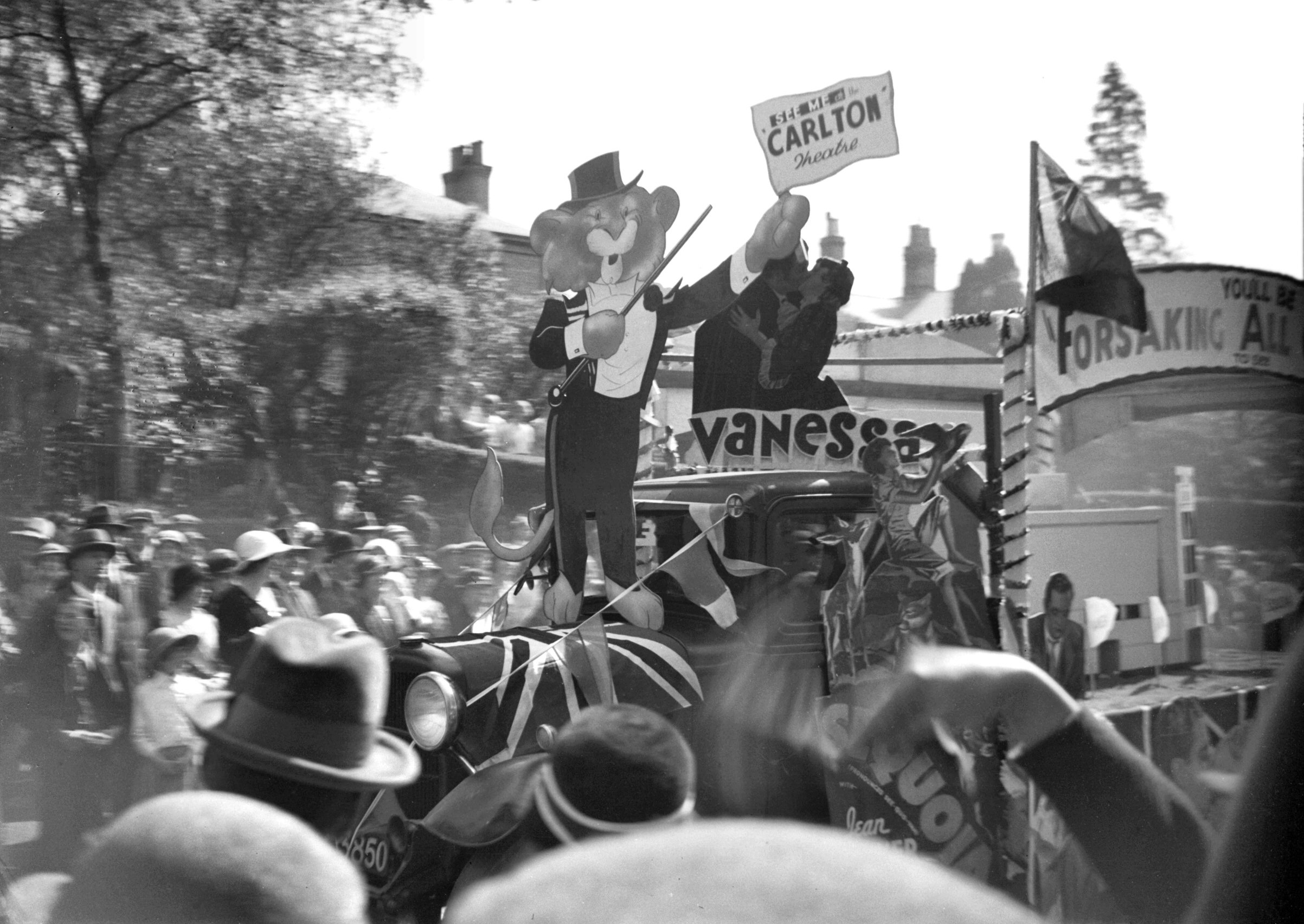
|
Silver Jubilee procession Carlton cinema [0559]
1935-05-06 |
|
|
Silver Jubilee procession Marconi dealers [0560]
1935-05-06 |
|
|
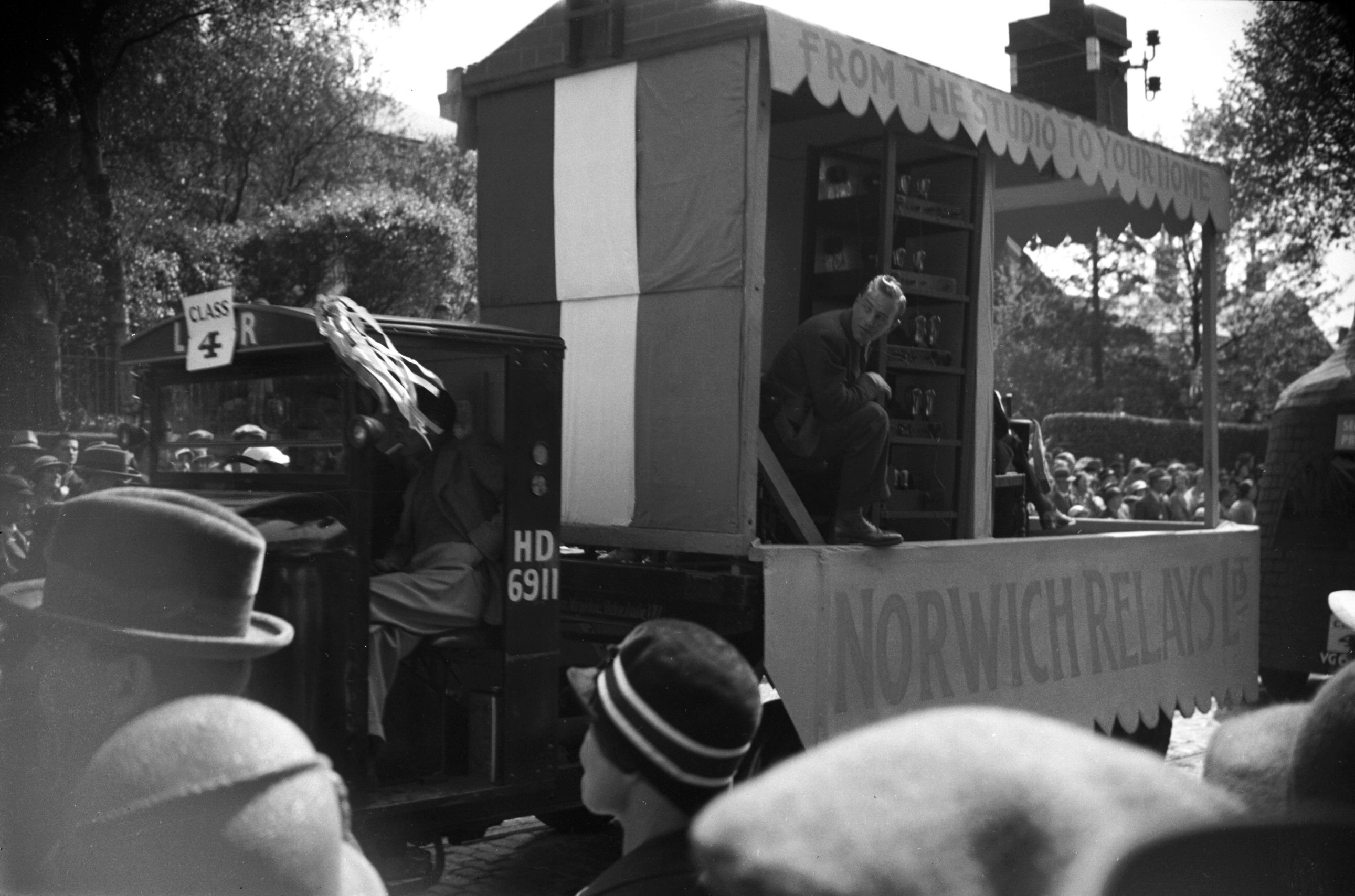
Silver Jubilee procession Norwich Relays [0561]
1935-05-06 Norwich Relays Ltd provided some of the music en route. |
|
|
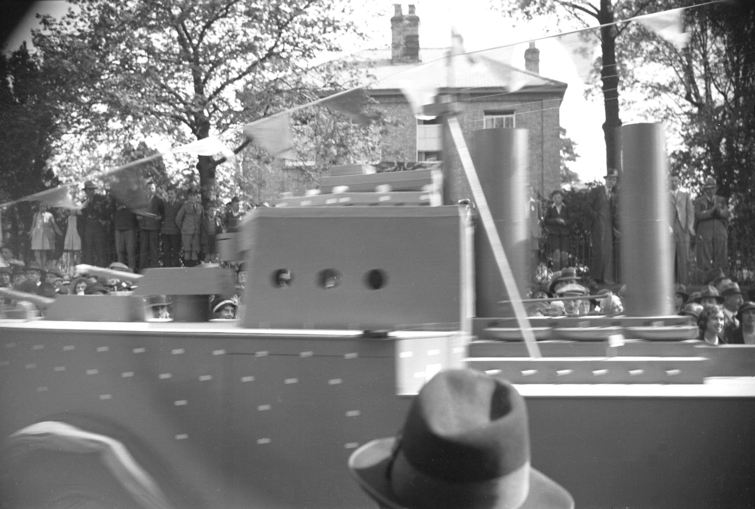
Silver Jubilee procession battleship model [0562]
1935-05-06 Mann Egerton's, H.M.S. King George V battleship model, first prize trades tableaux. |
|
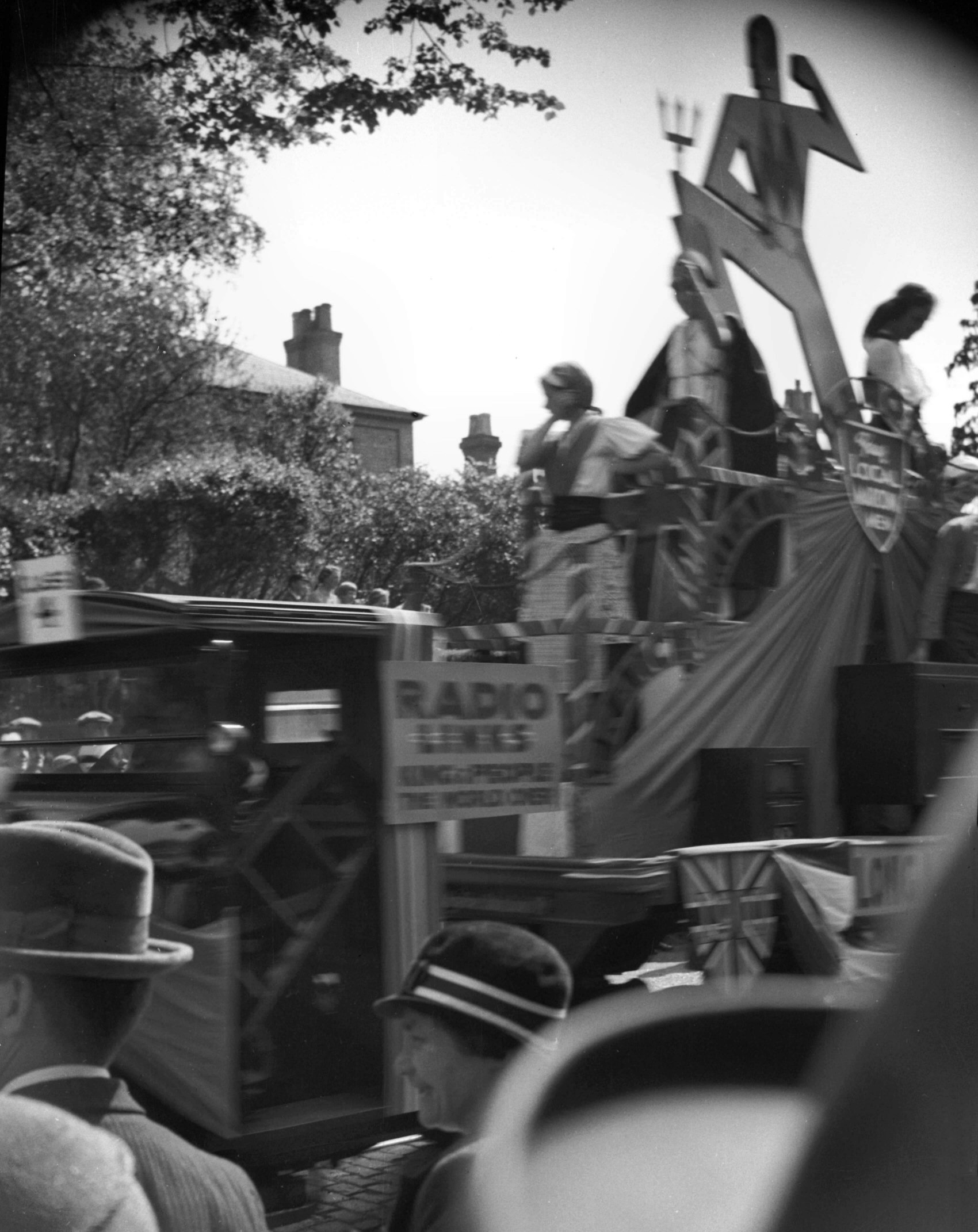
|
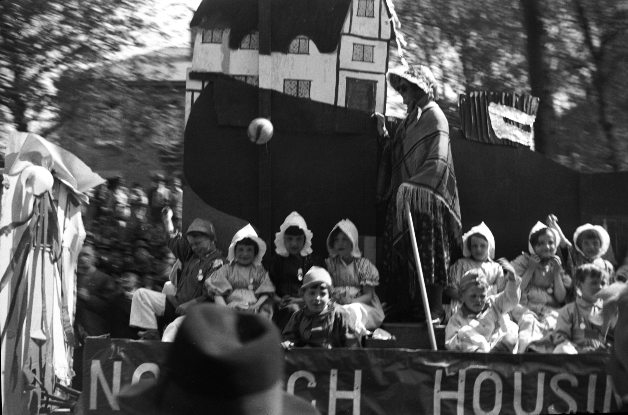
Silver Jubilee procession Housing Society [0563]
1935-05-06 "The Housing Problem", prize for schools tableaux. |
Next street: Oak St
Text and photographs copyright George Plunkett