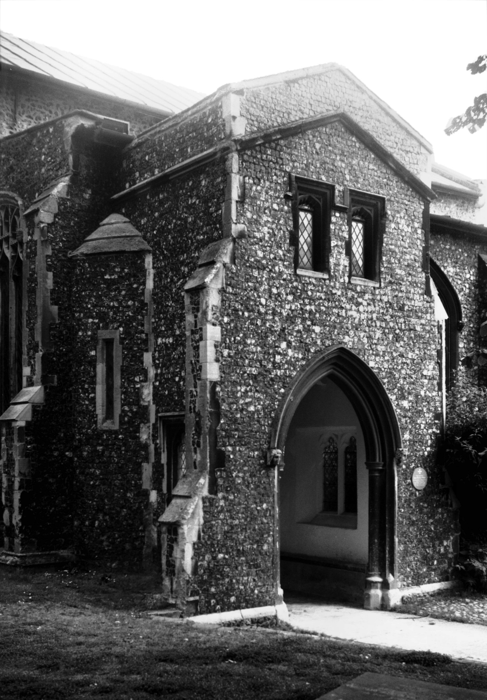
|
St John Maddermarket: |
| |
From
Lobster
Lane / Pottergate to Charing Cross / Duke St / St
Andrew's St
passing St John's Alley
East side |
|
|
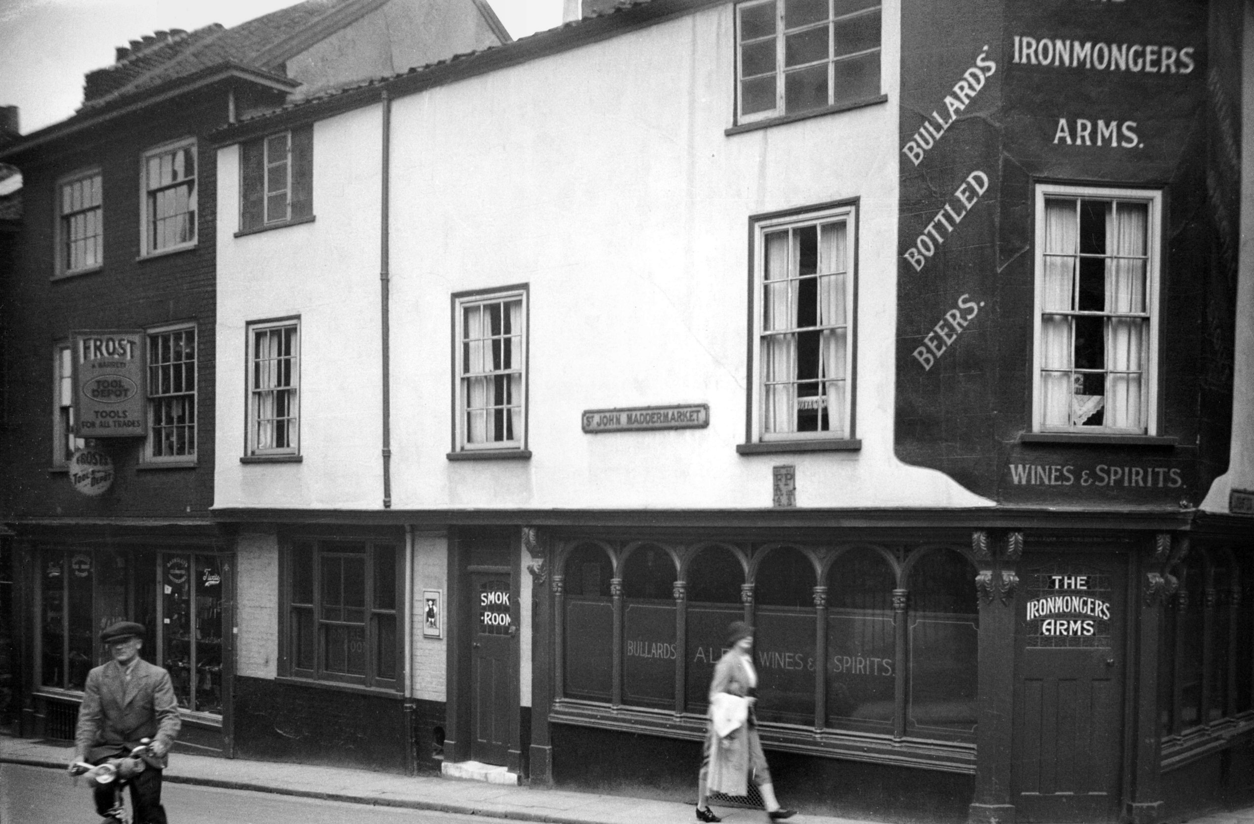
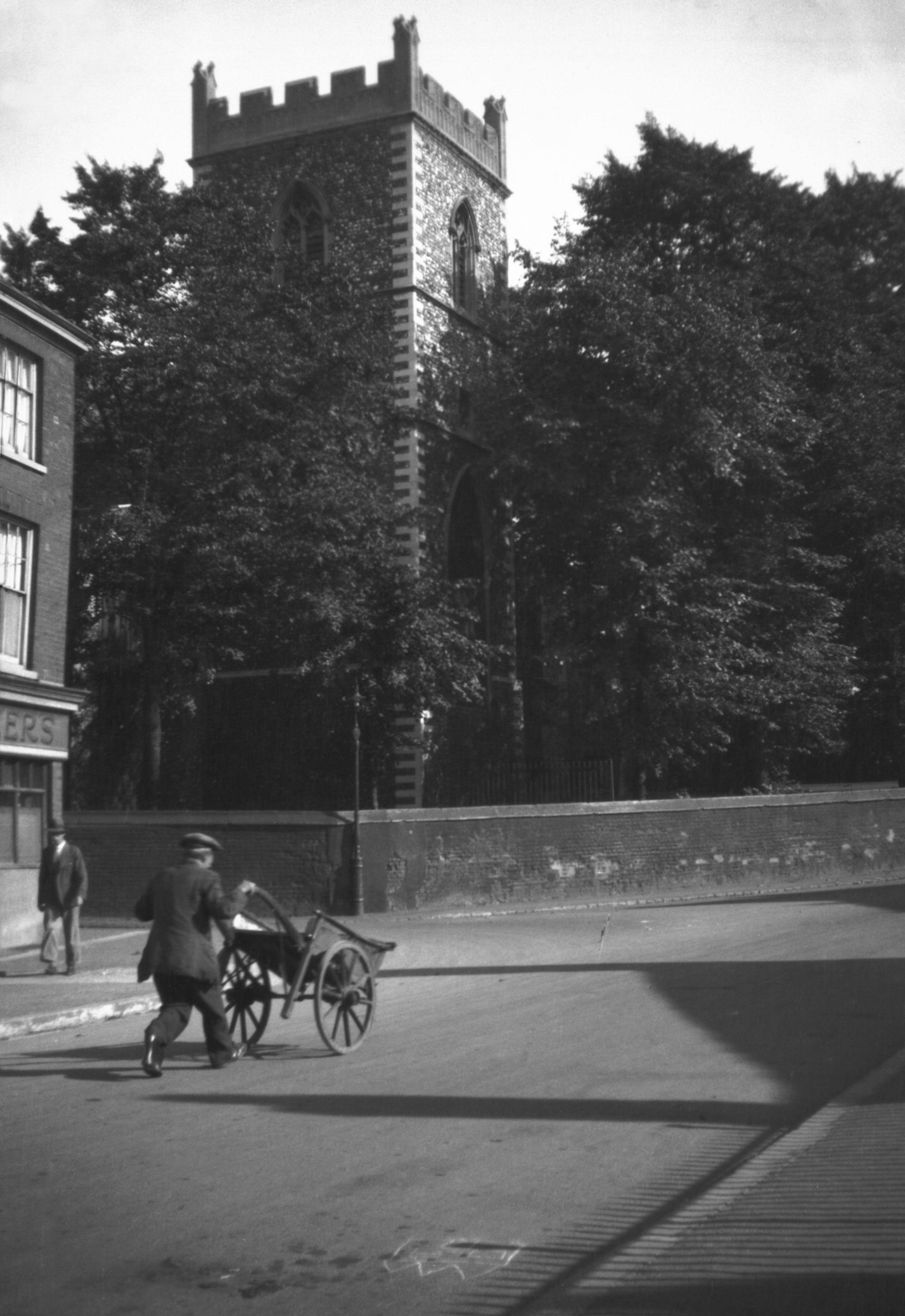
St John Maddermarket 1 Ironmongers' Arms PH [1136]
1936-07-16
|
|
|
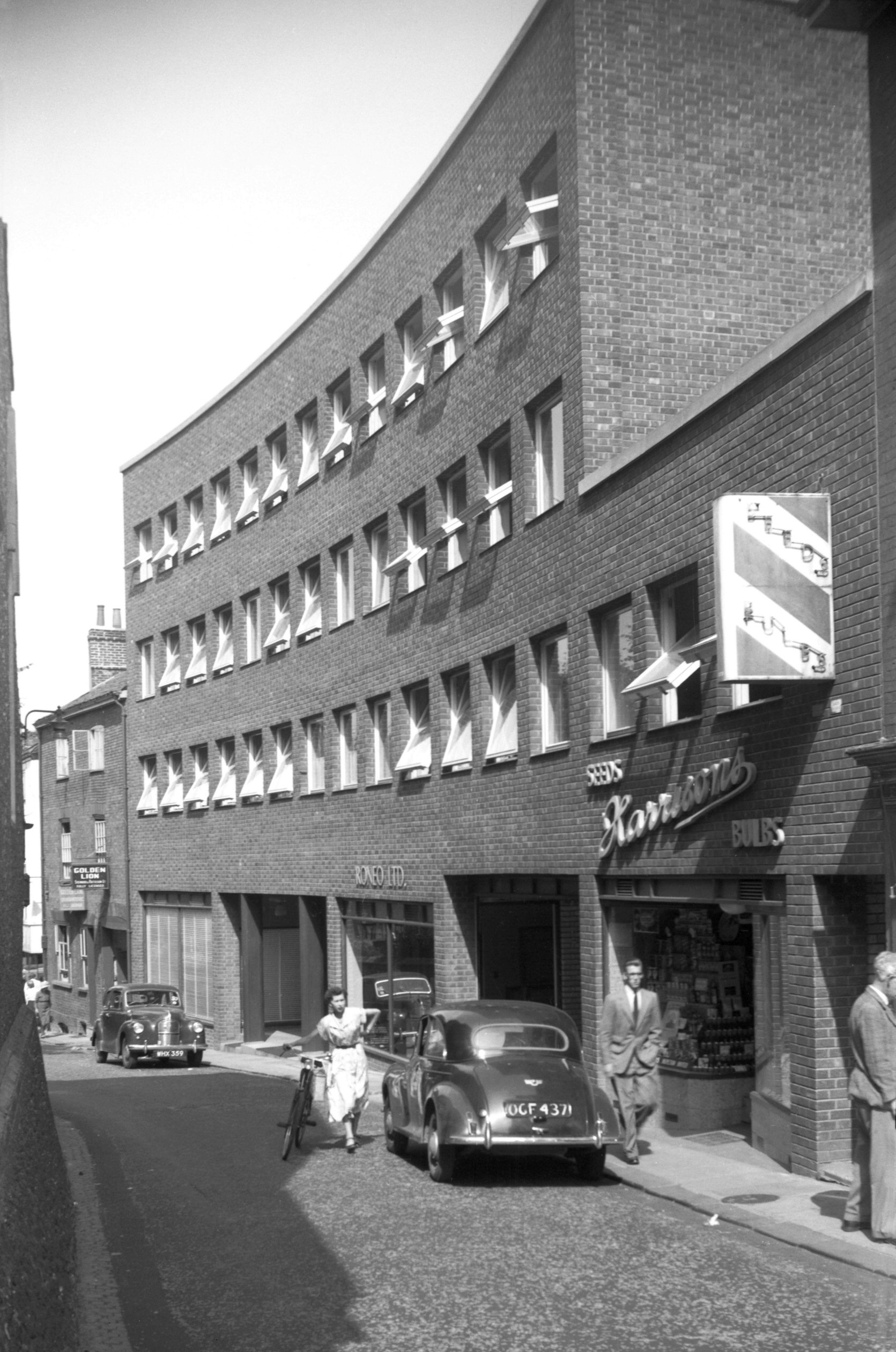
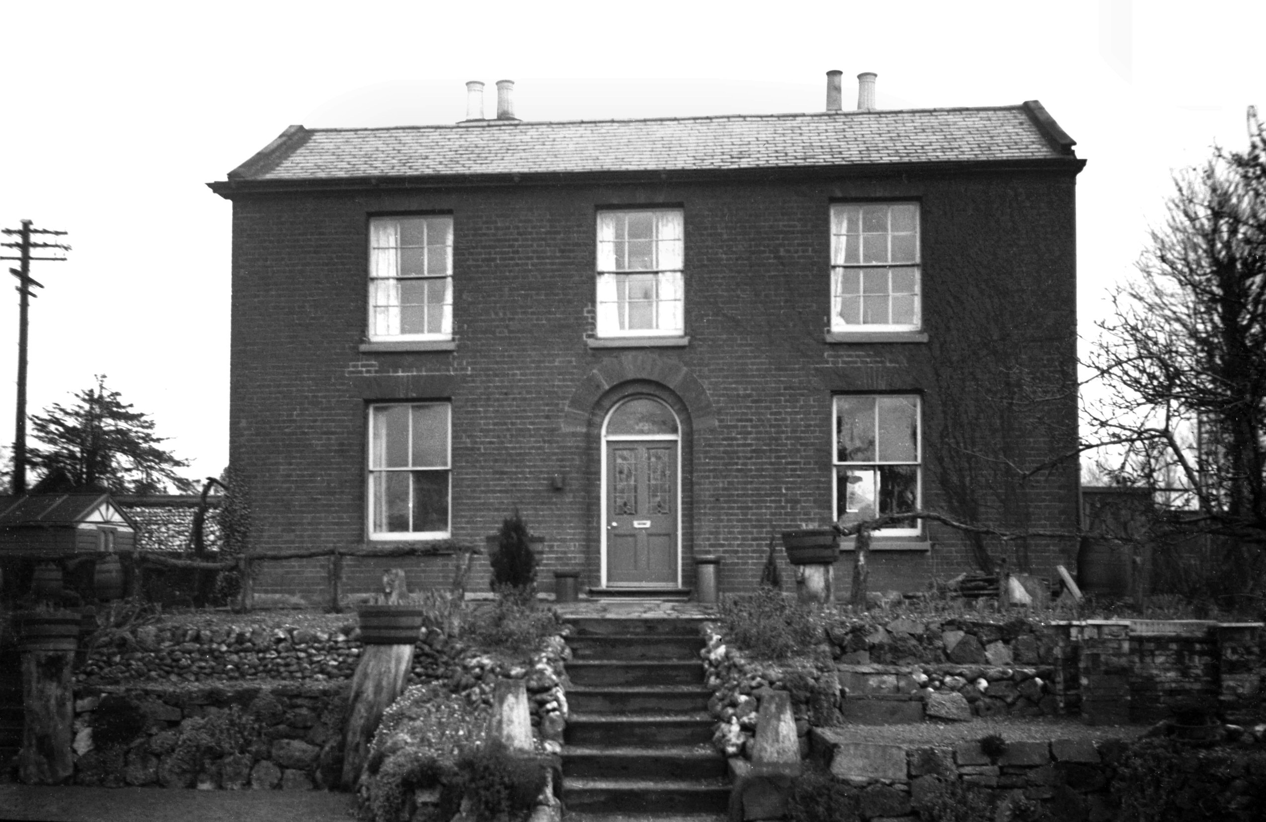
St John Maddermarket Norfolk House W side [4367]
1955-08-24
|
|
|
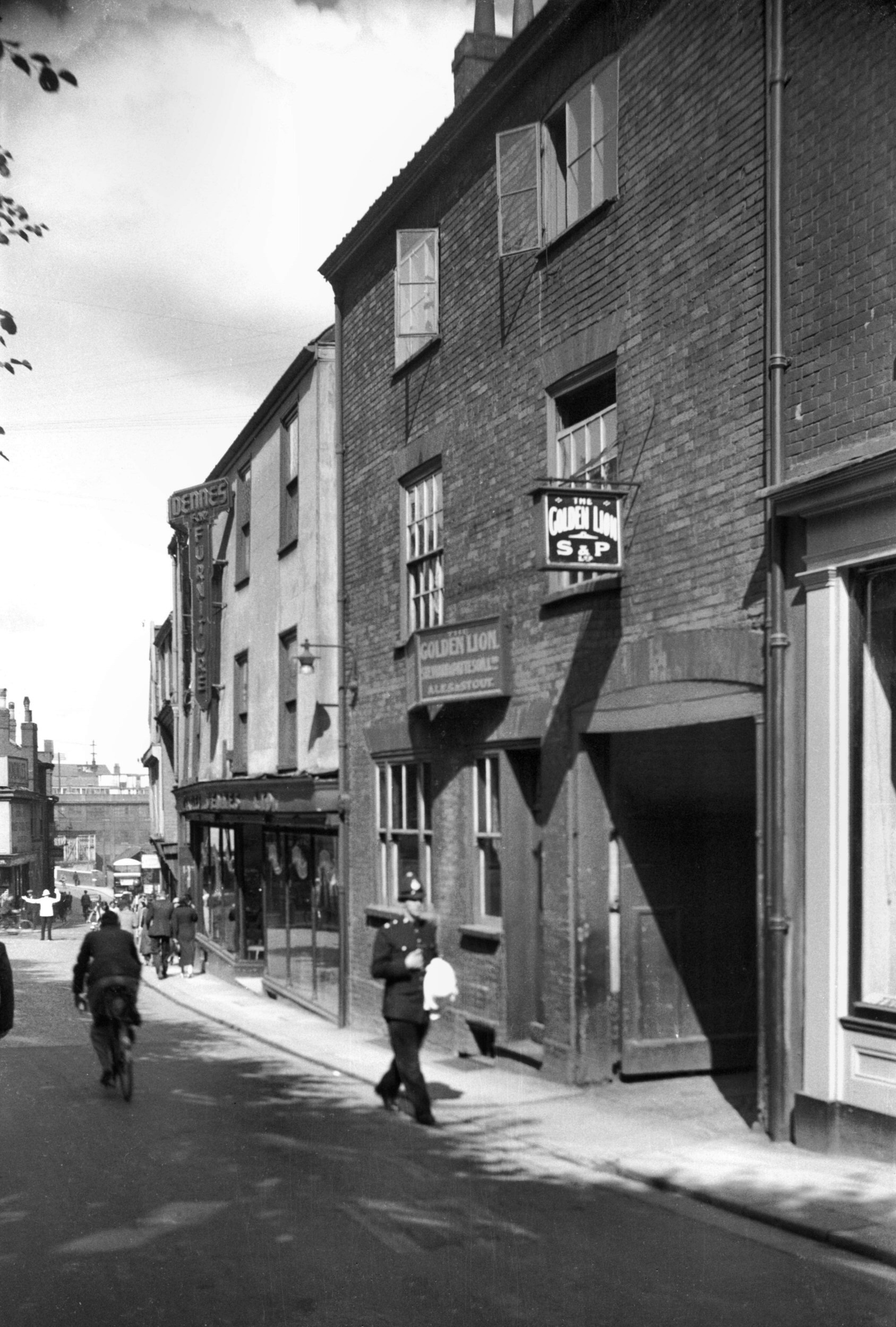
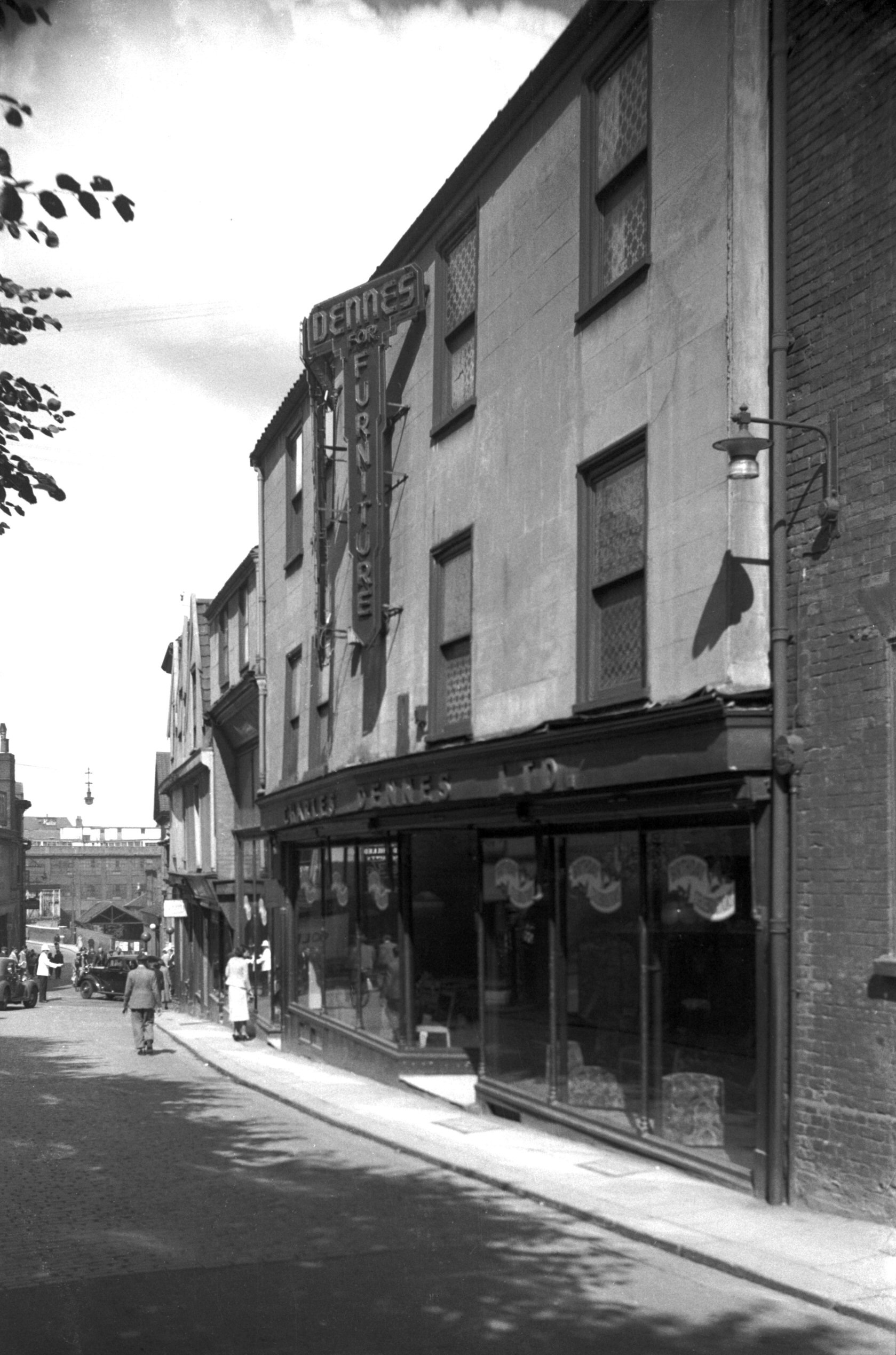
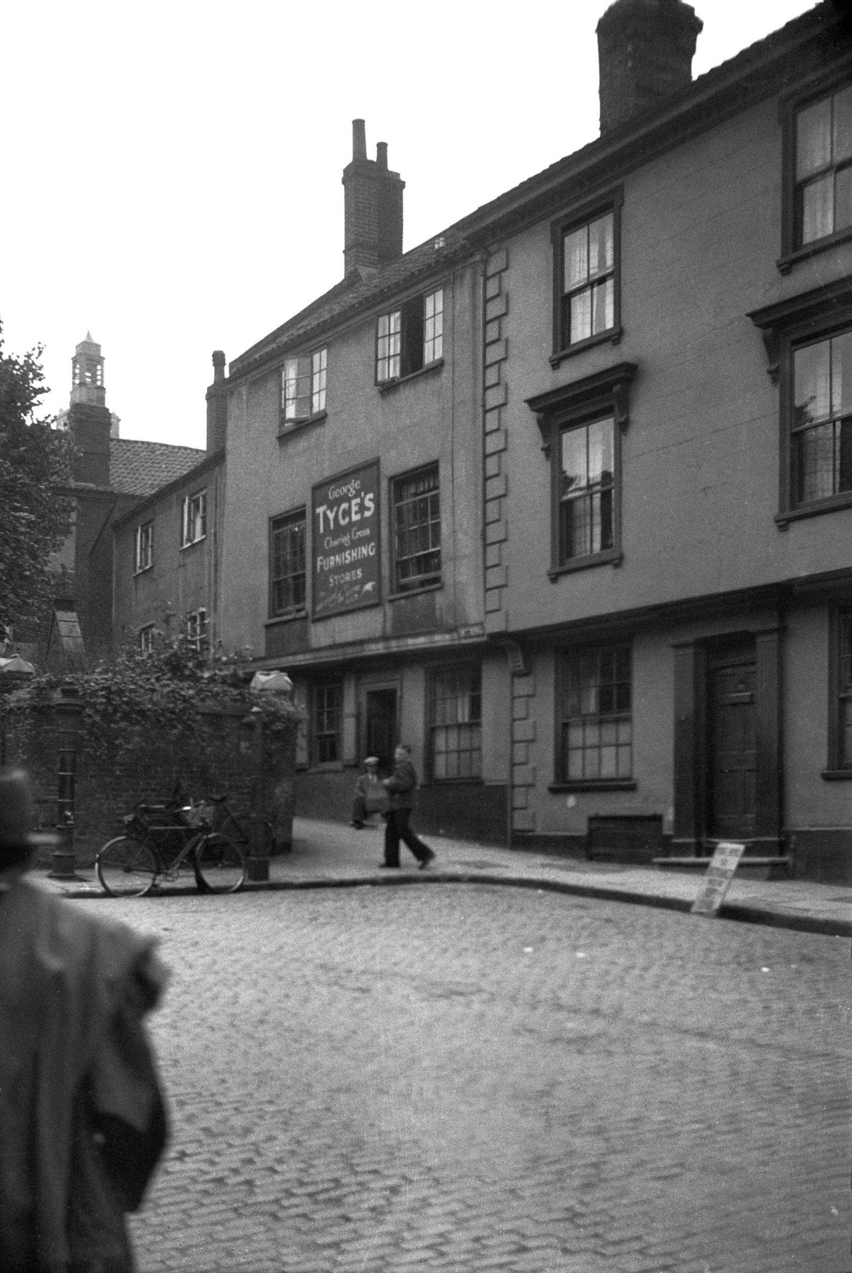
St John Maddermarket 15 Golden Lion PH [2789]
1938-09-05
|
|
|
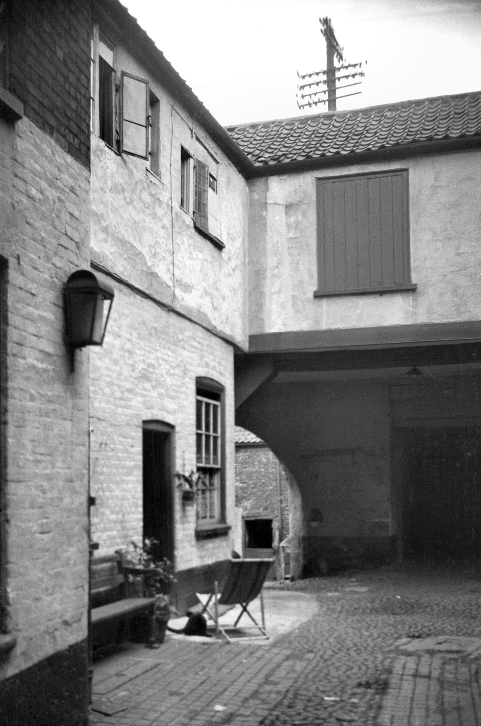
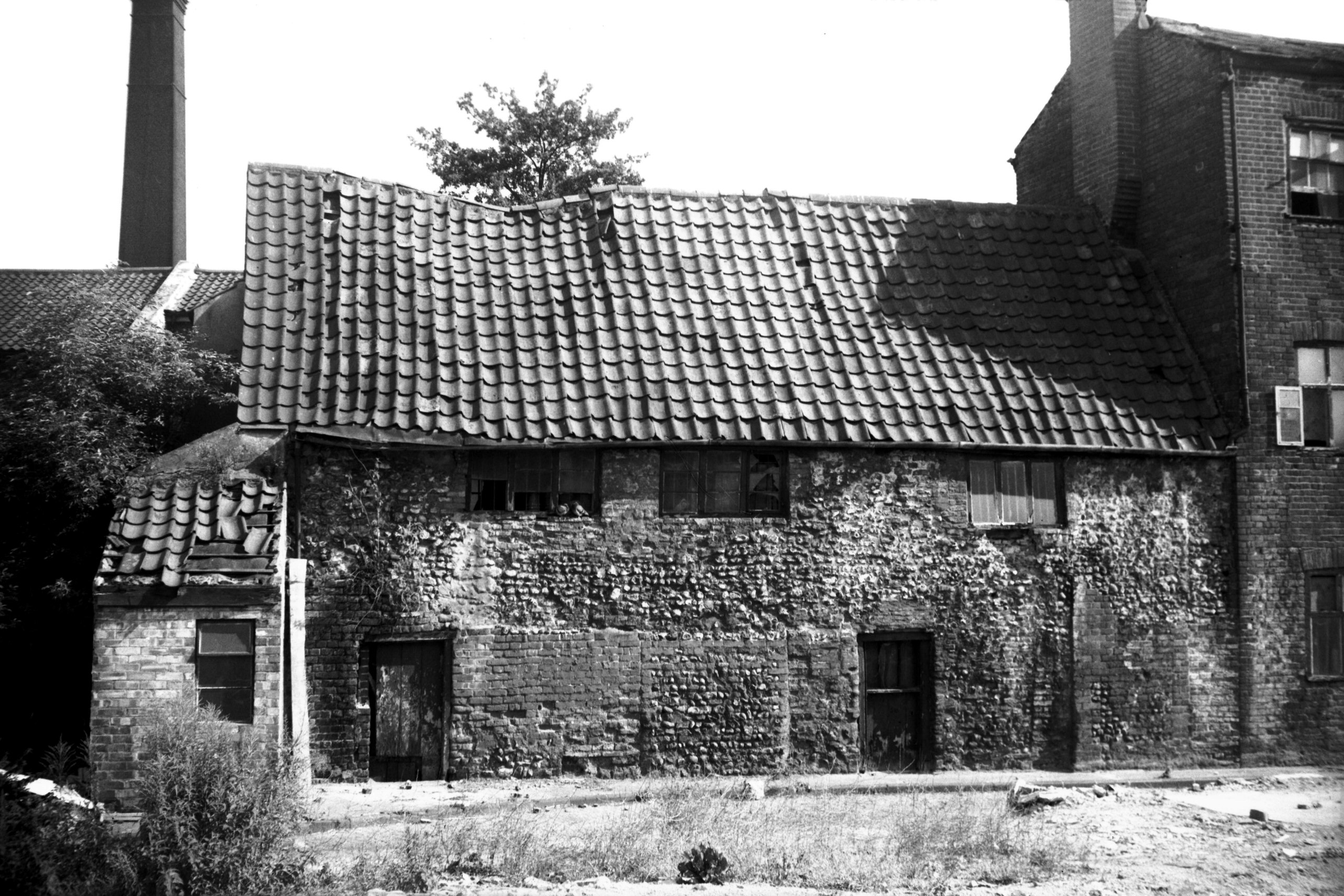
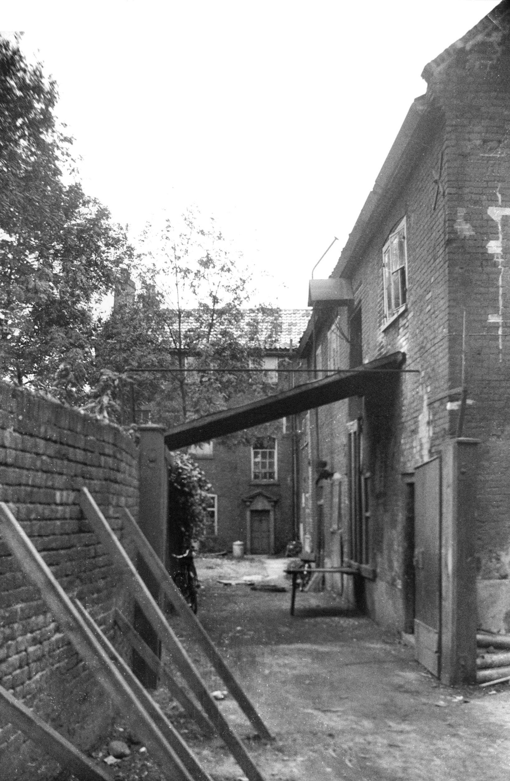
St John Maddermarket 15 S side from Yard [1139]
1936-07-16
|
|
|
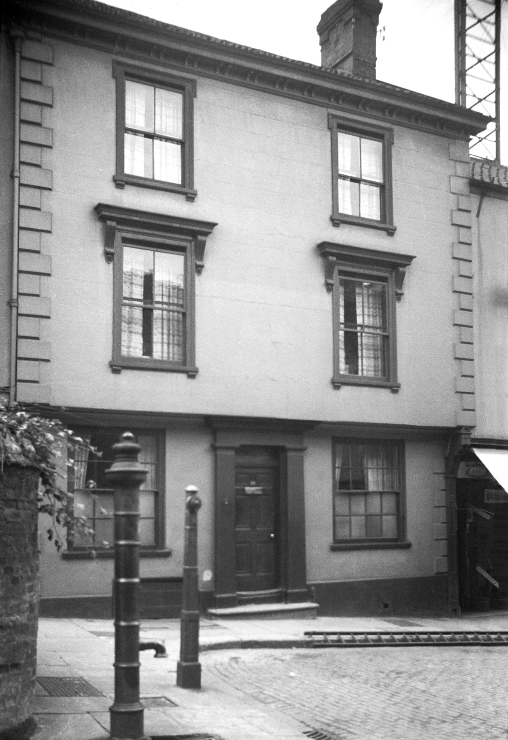
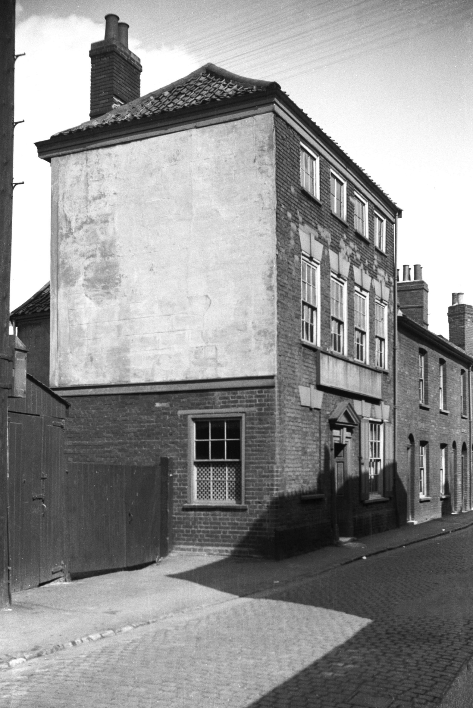
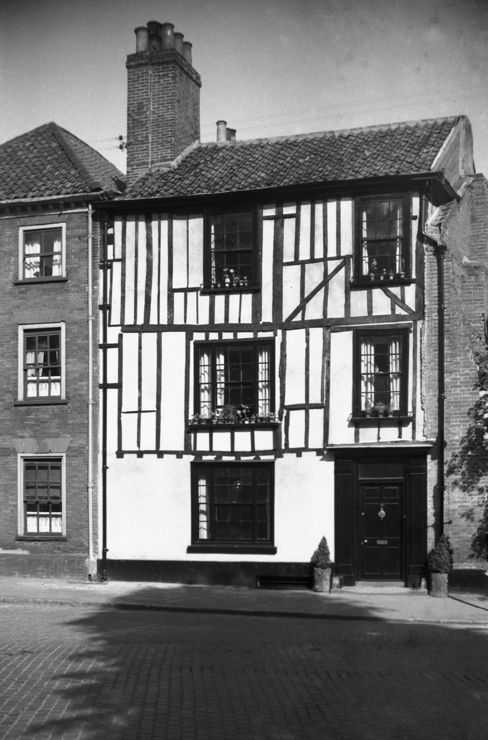
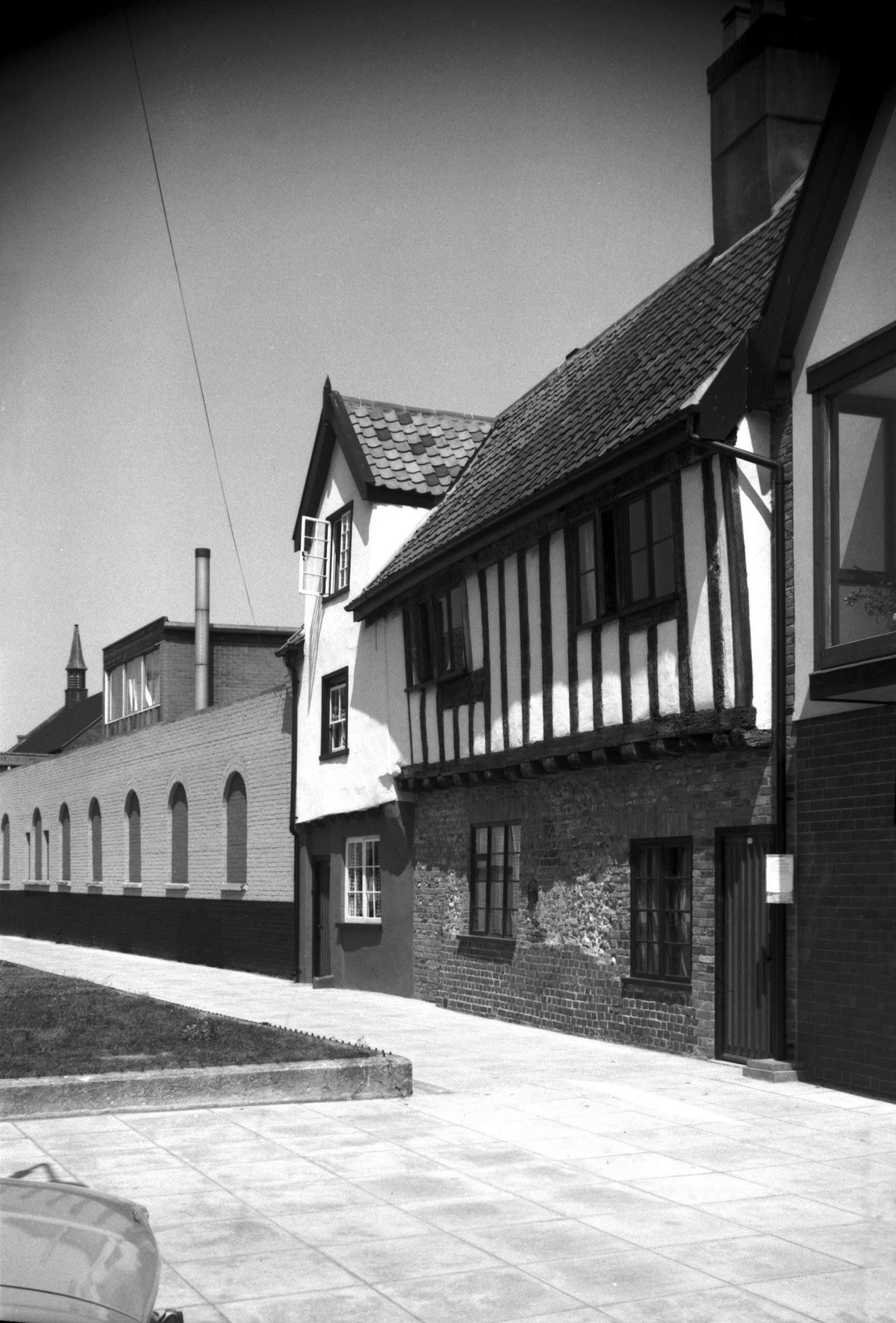
St John Maddermarket 17 [2790] 1938-09-05
|
|
|
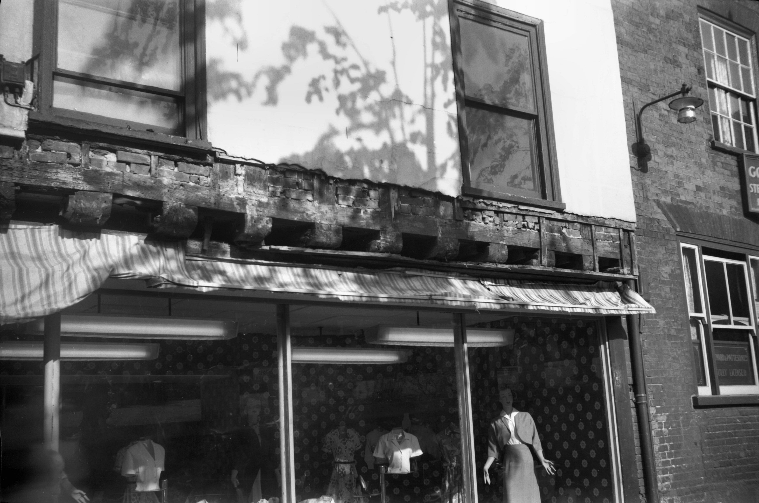
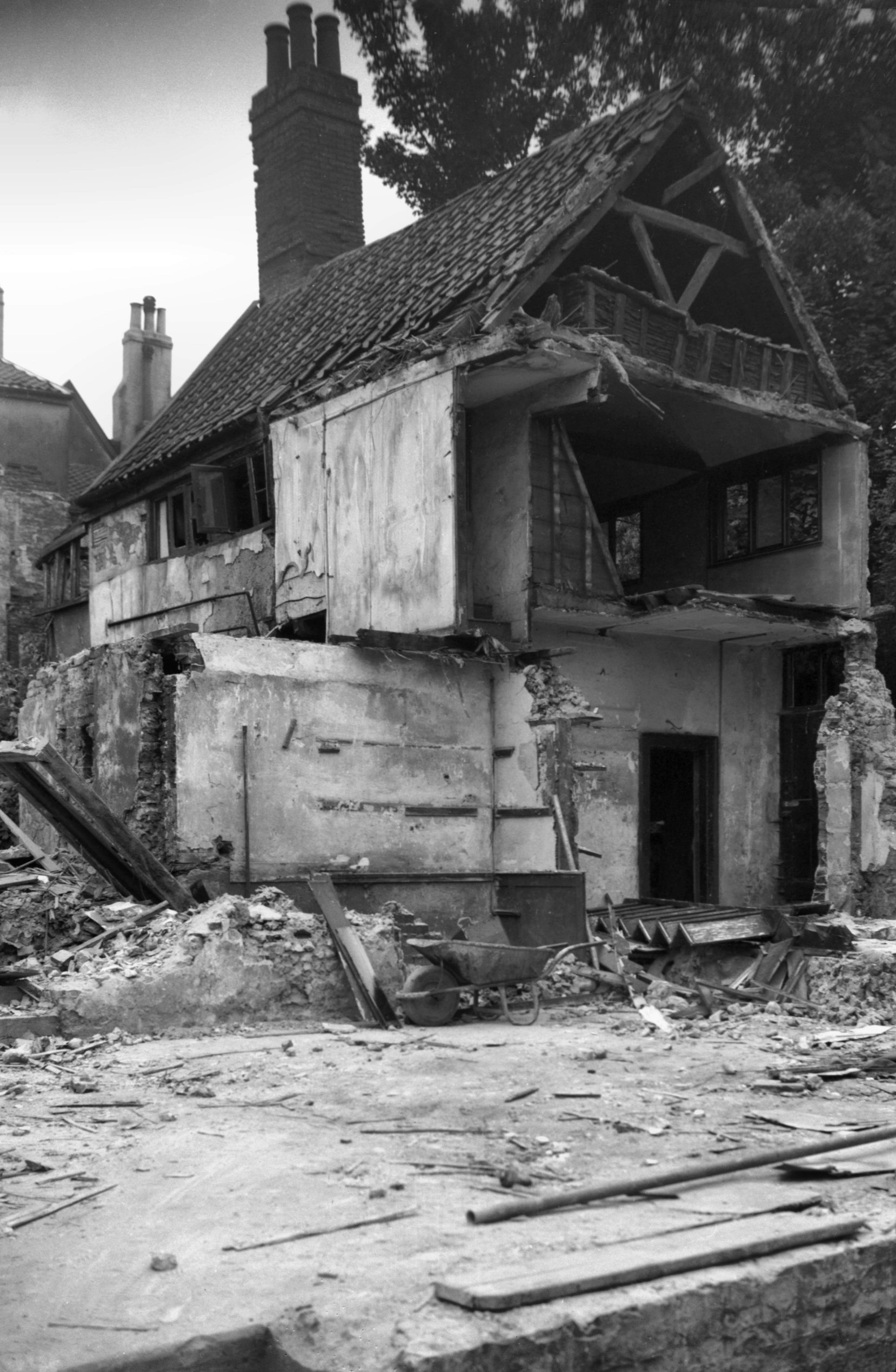
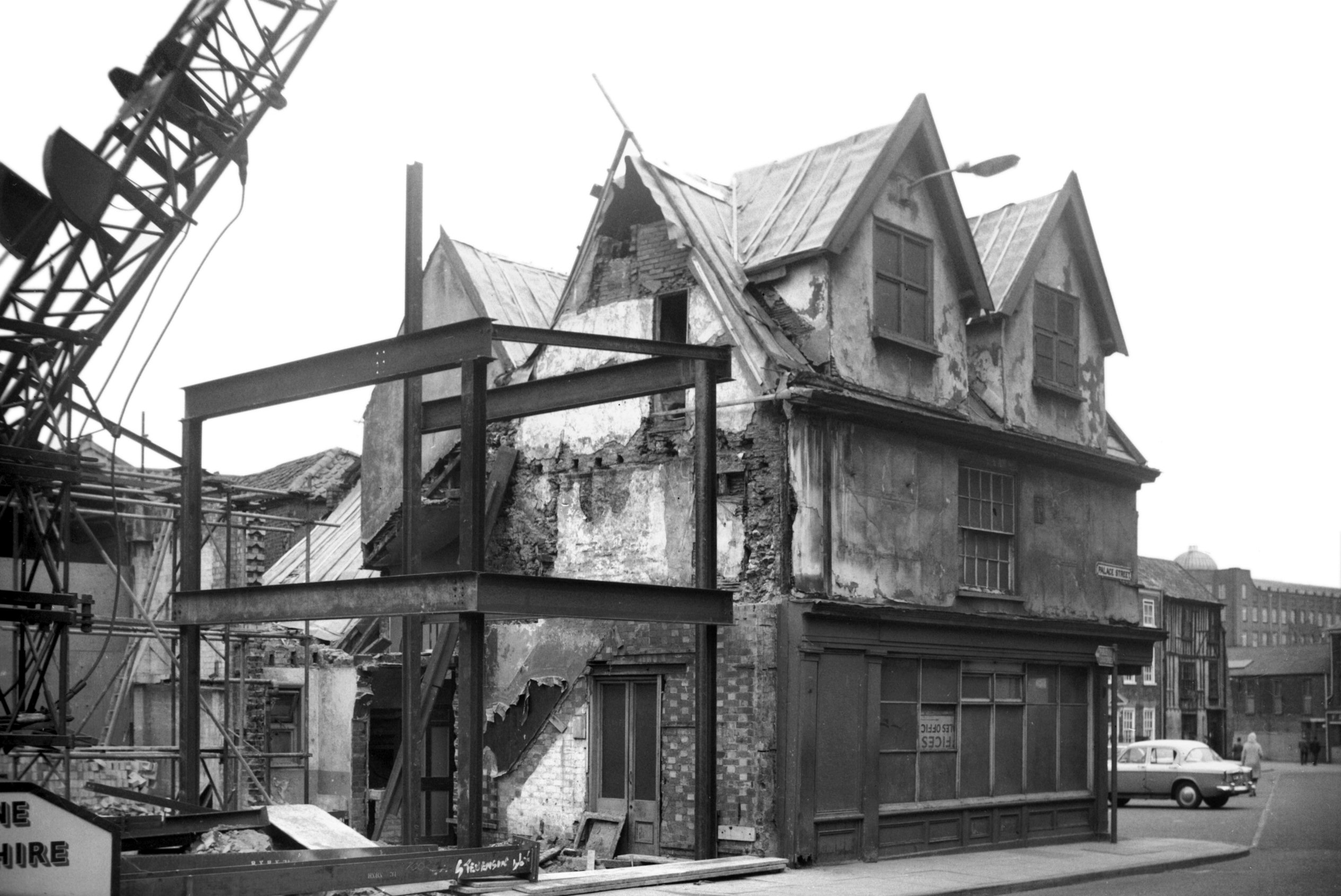
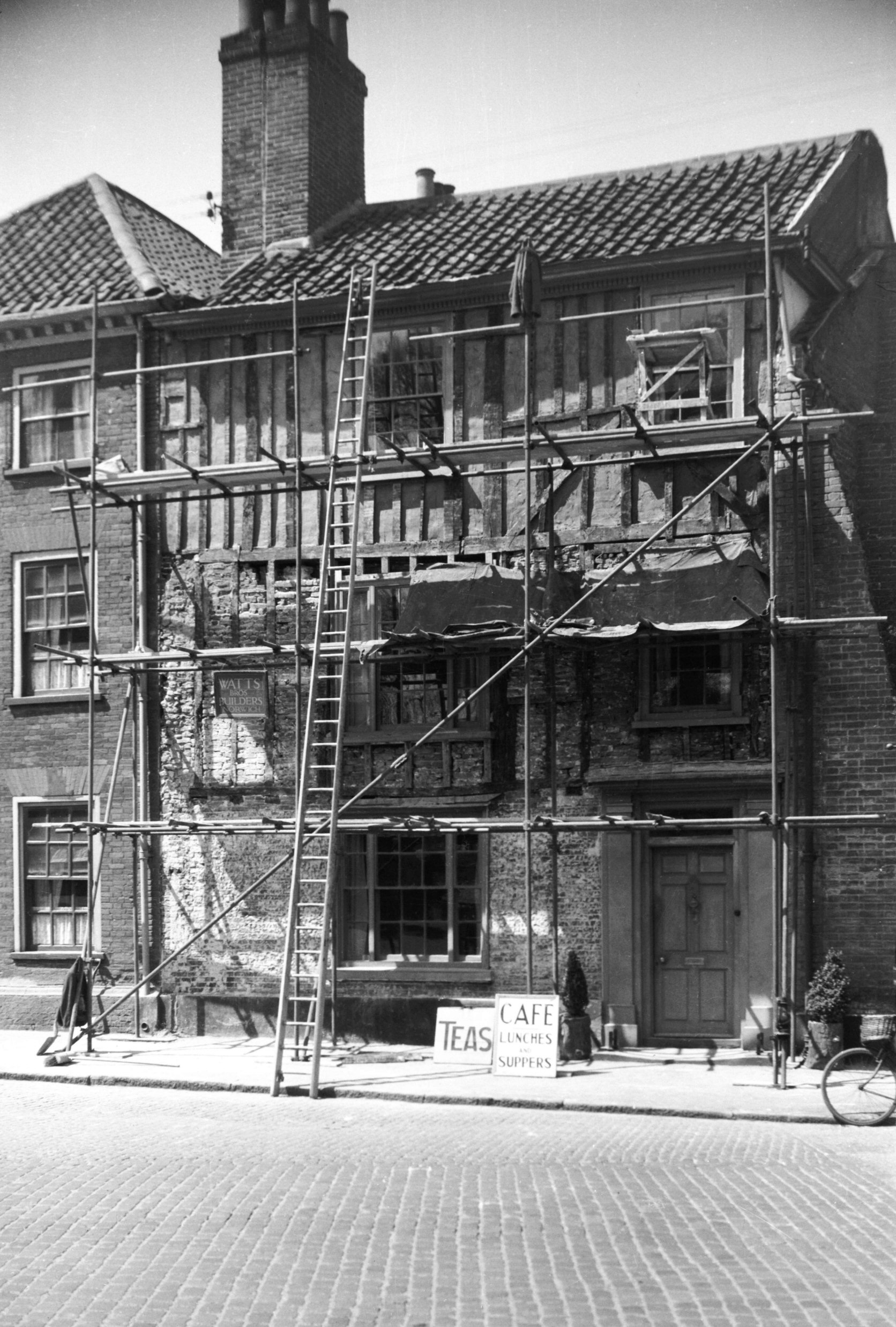
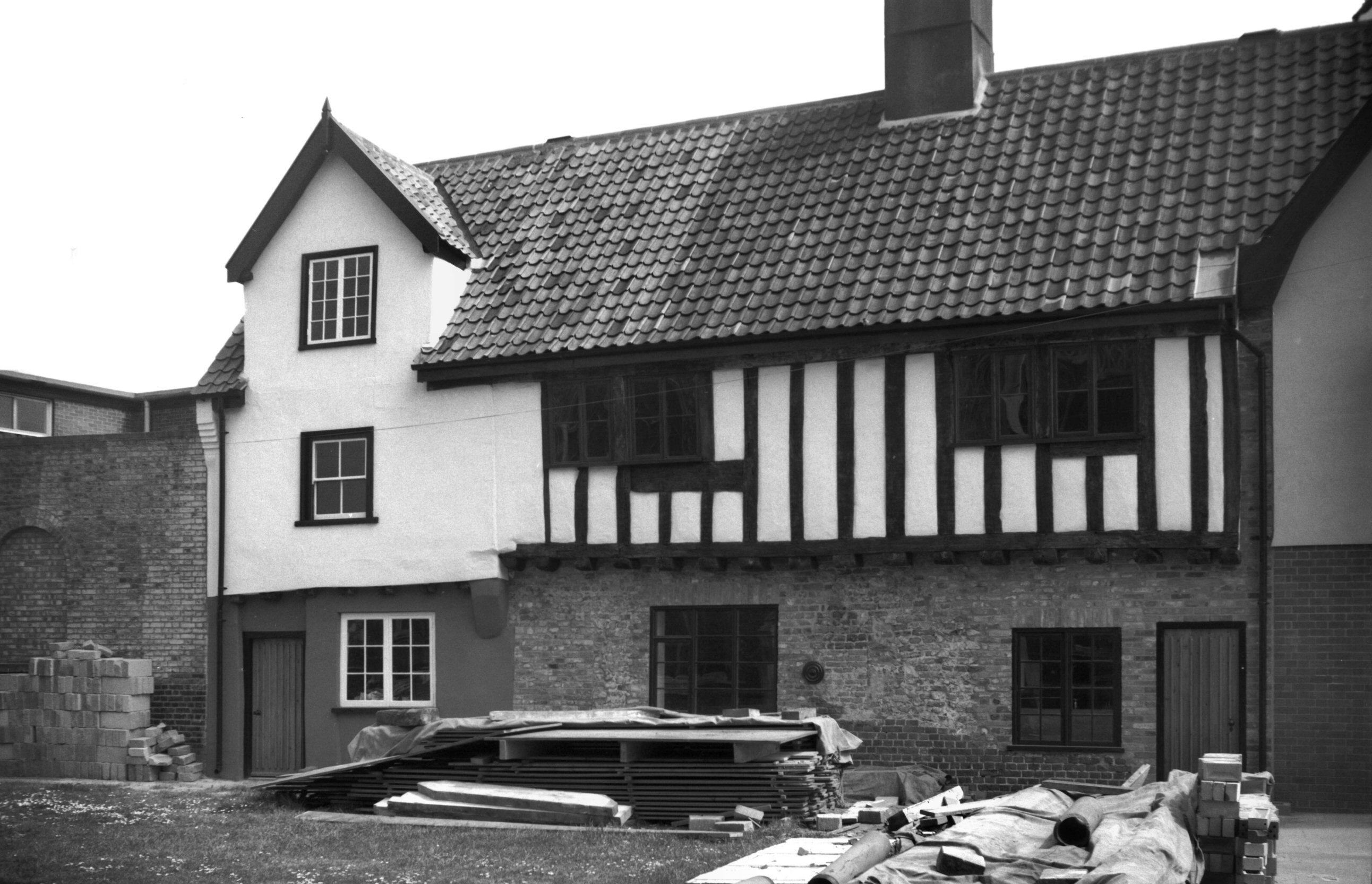
St John Maddermarket 17 during repairs [4252]
1954-05-26
Mediaeval timber jetty to first floor revealed during
1954 repairs. |
|
|
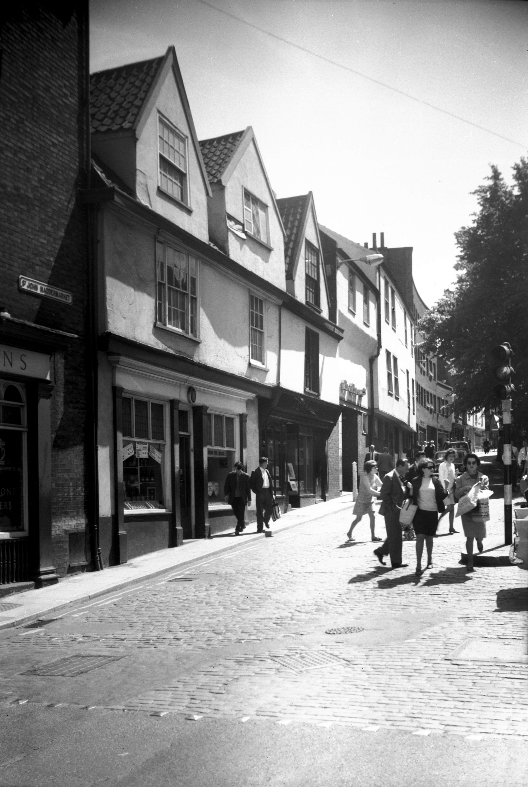
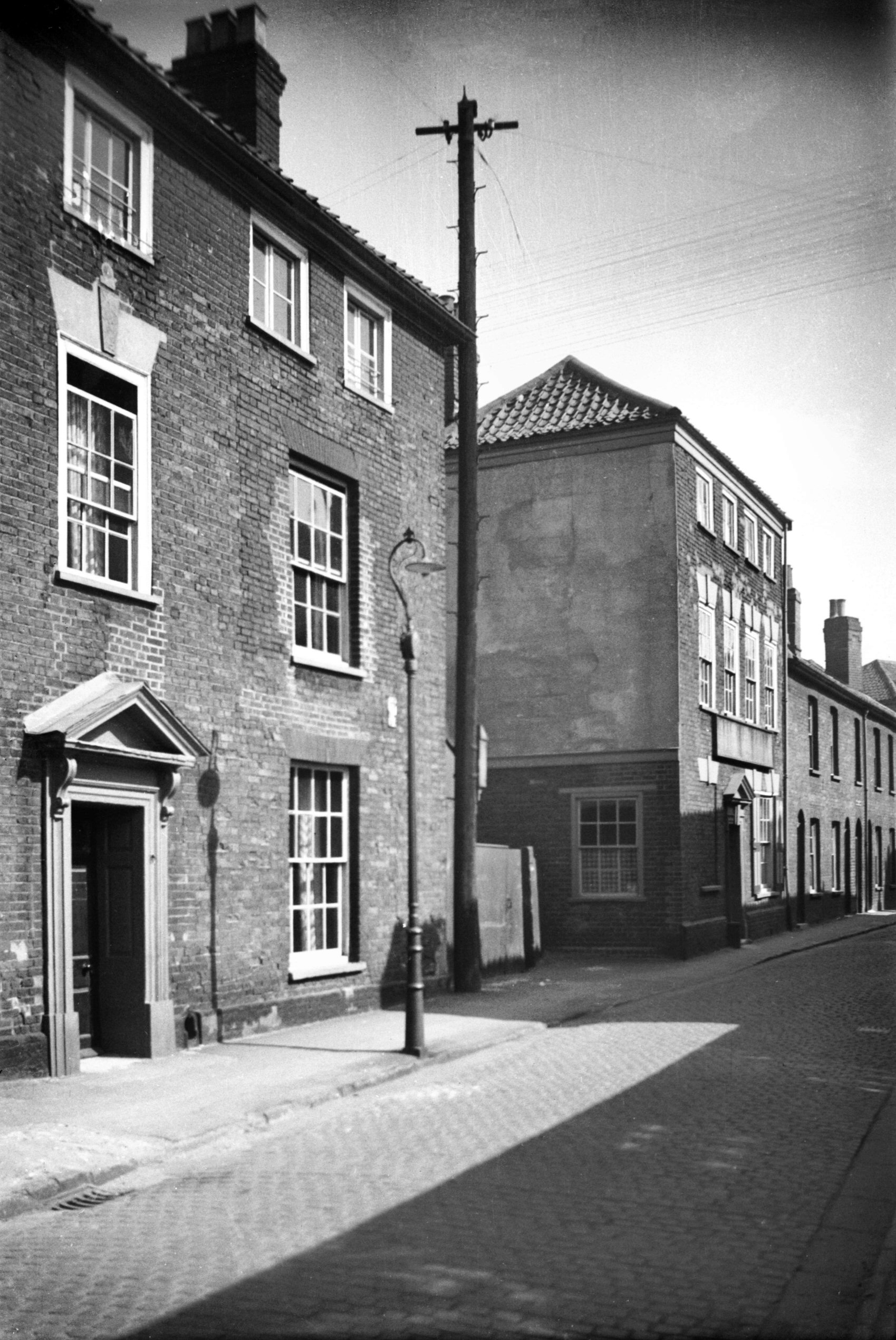
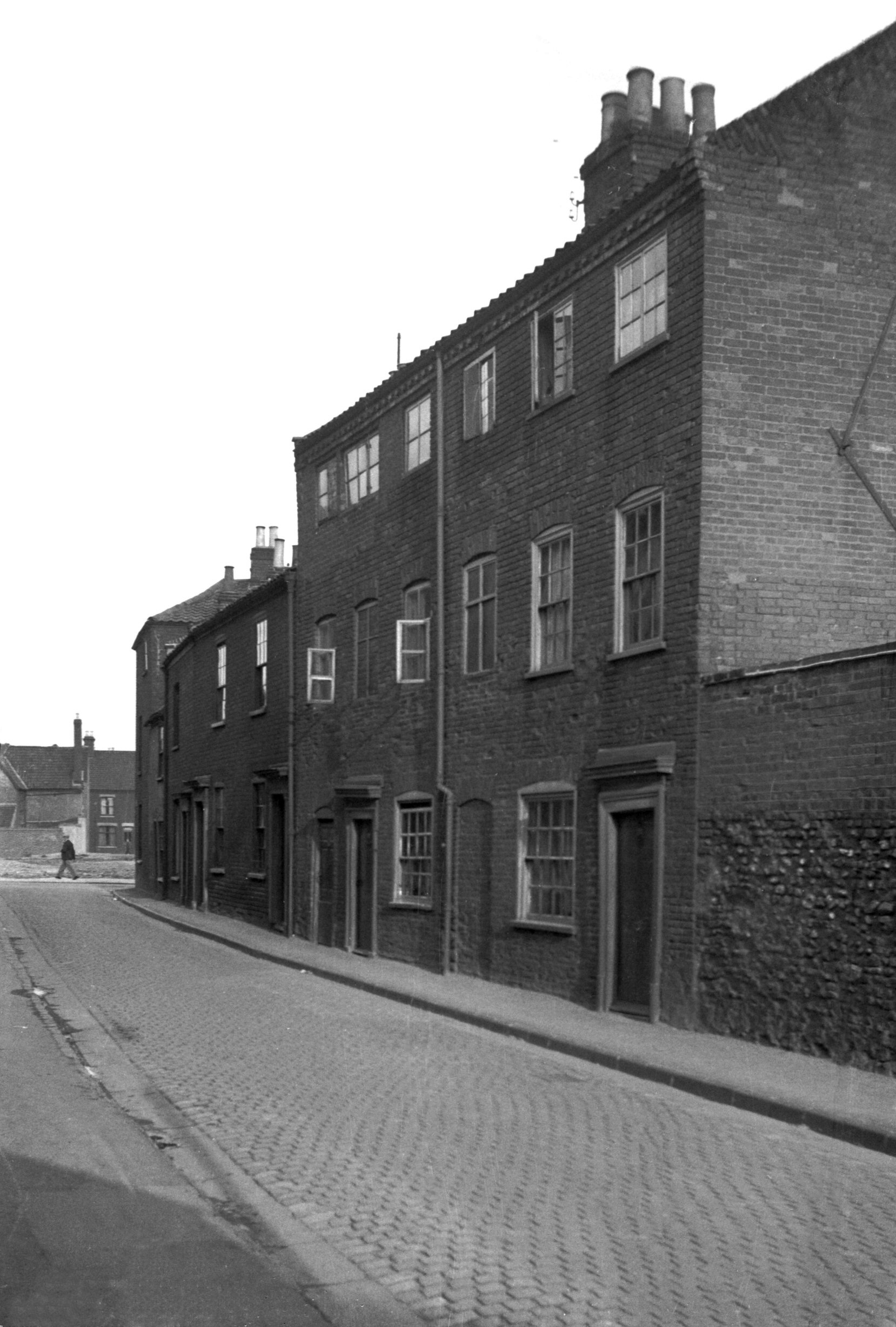
St John Maddermarket 19 to 23 [5209] 1968-06-12
|
|
|
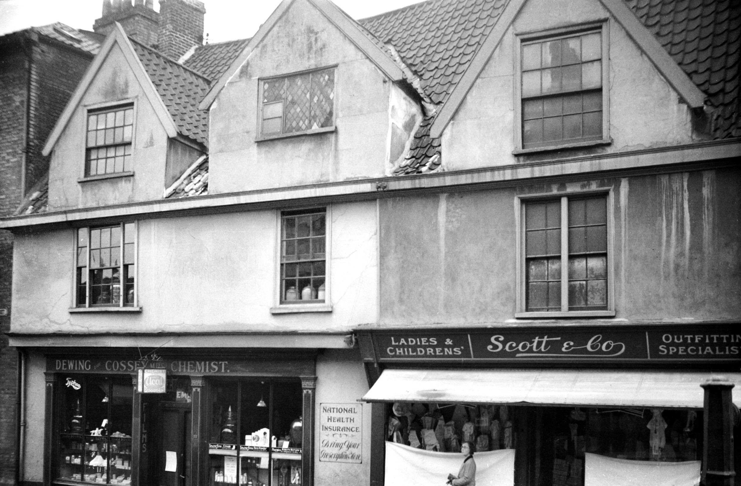
St John Maddermarket 21 to 23 [1137] 1936-07-16
|
| |
West
side |
|
|
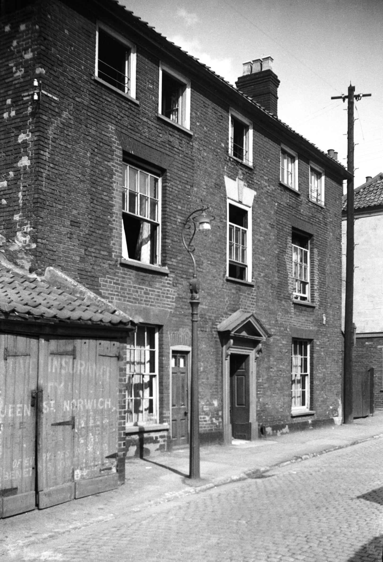
St John Maddermarket 20 [1138] 1936-07-16
|
|
|
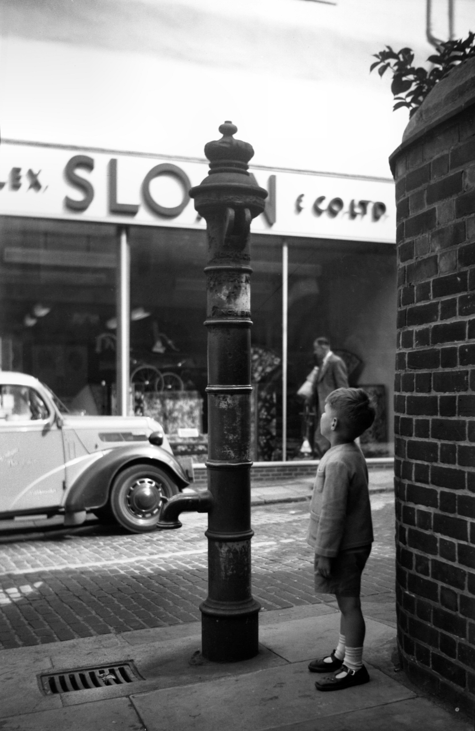
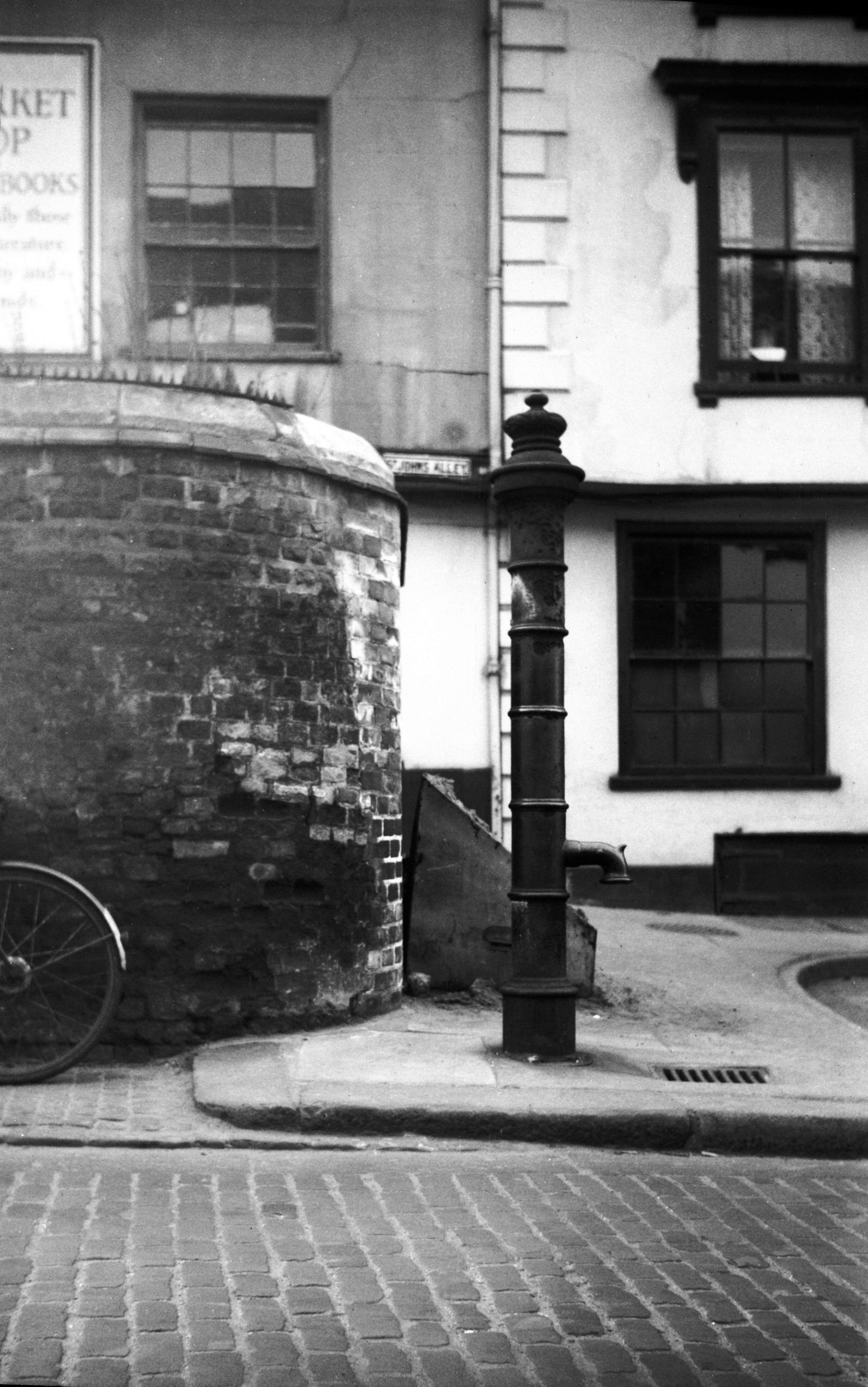
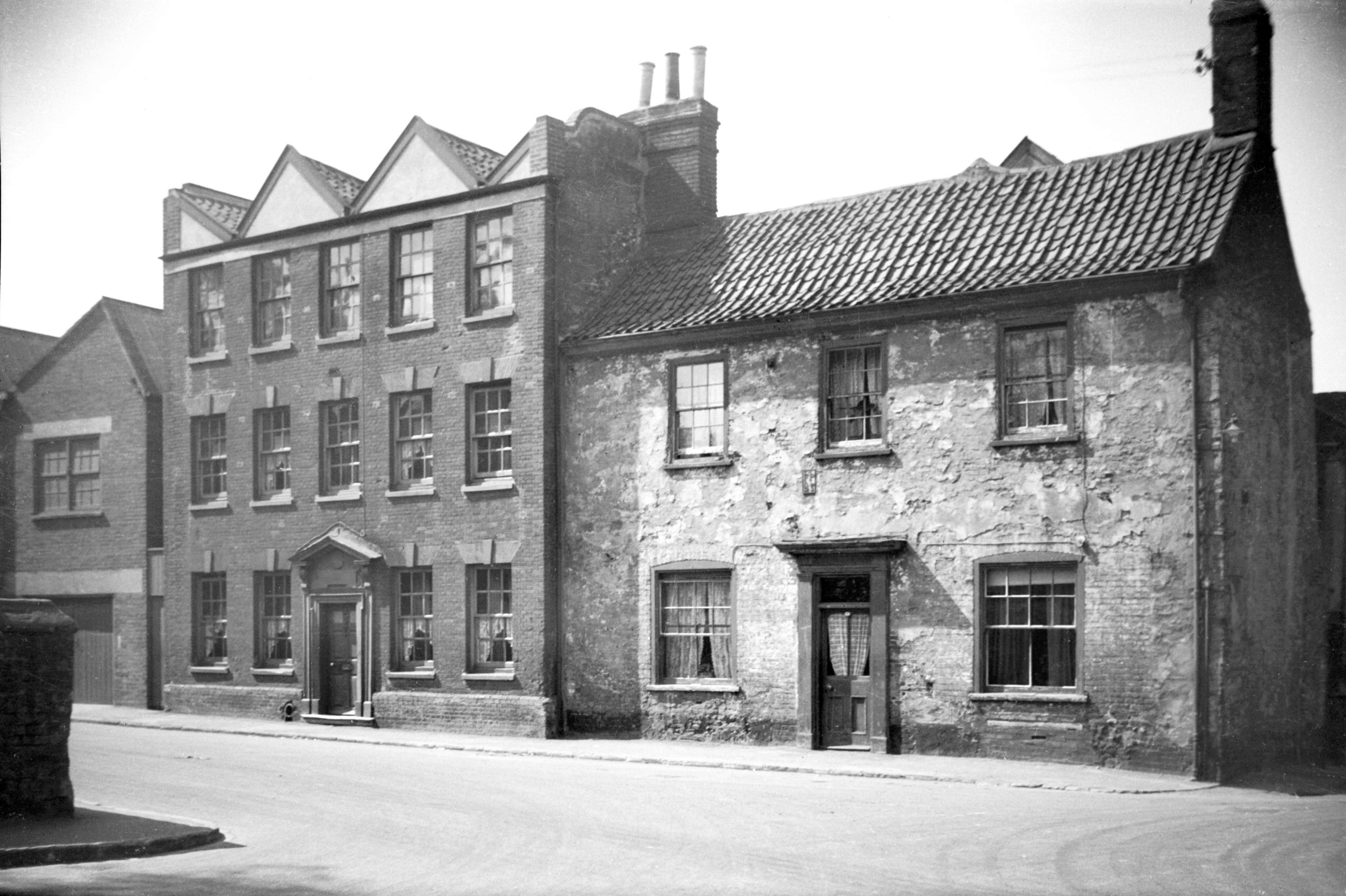
St John Maddermarket Shalders' pump [4344] 1955-07-30
At the foot of St John Maddermarket's churchyard still
stands a relic of former times - the parish pump. The
inscription giving the maker's name is now badly
corroded, but it appears to have been a fountain pump
patented by one Shalders, whose business was situated in
nearby Redwell St. Similar pumps once lined the roads
between Cringleford and Wymondham. These were placed
there at the beginning of the 19c by the Turnpike
Trustees; their specific purpose was to provide water for
experiments in roadmaking as well as for laying the dust.
Although there is no evidence that they were provided
with troughs, it is possible that adjoining ditches were
flooded to enable drovers to water their cattle on the
long journey to the London market.
The significance of the situation of this one at the
Maddermarket, with the land sloping towards it from the
adjoining burial ground, was not lost on a former city
analyst; he described it as "pure essence of
churchyard". |
|
|
St John Maddermarket Shalders' pump [4421] 1956-03-27
Common pump, "Shalder's Patent Fountain Pump",
c1836. |
|
St John's Alley: |
| |
From
Pottergate to St John Maddermarket
West side |
|
|
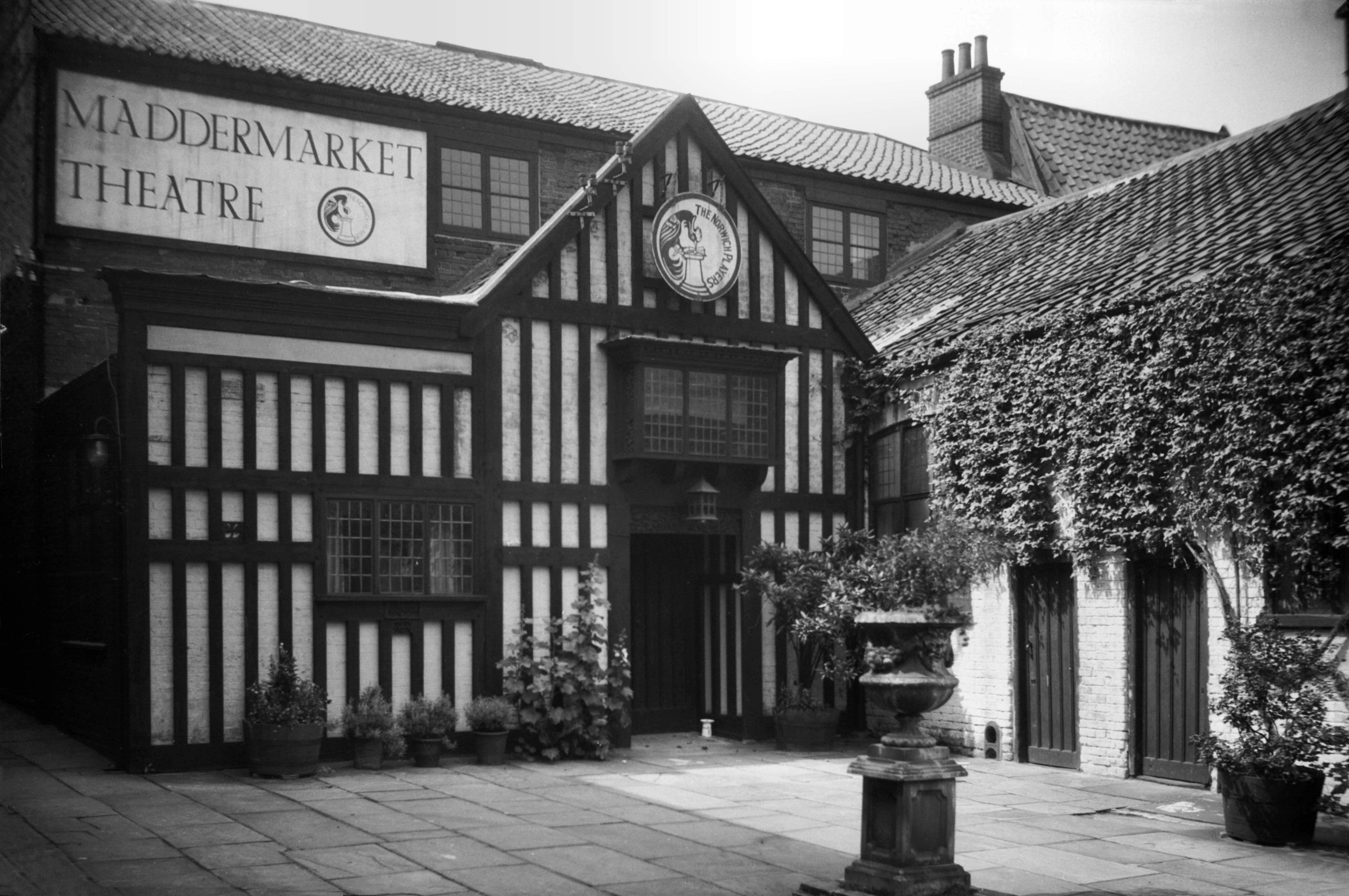
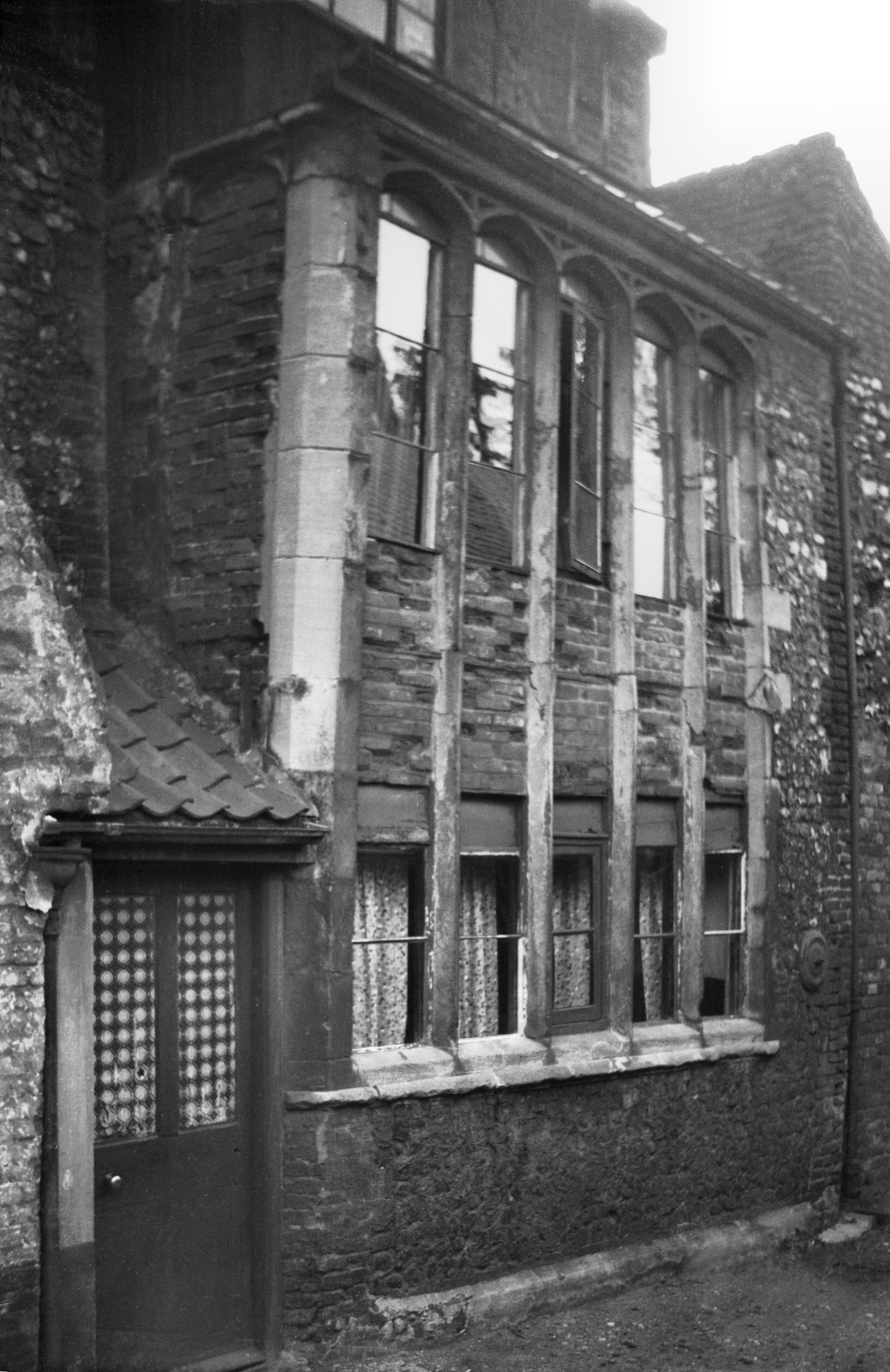
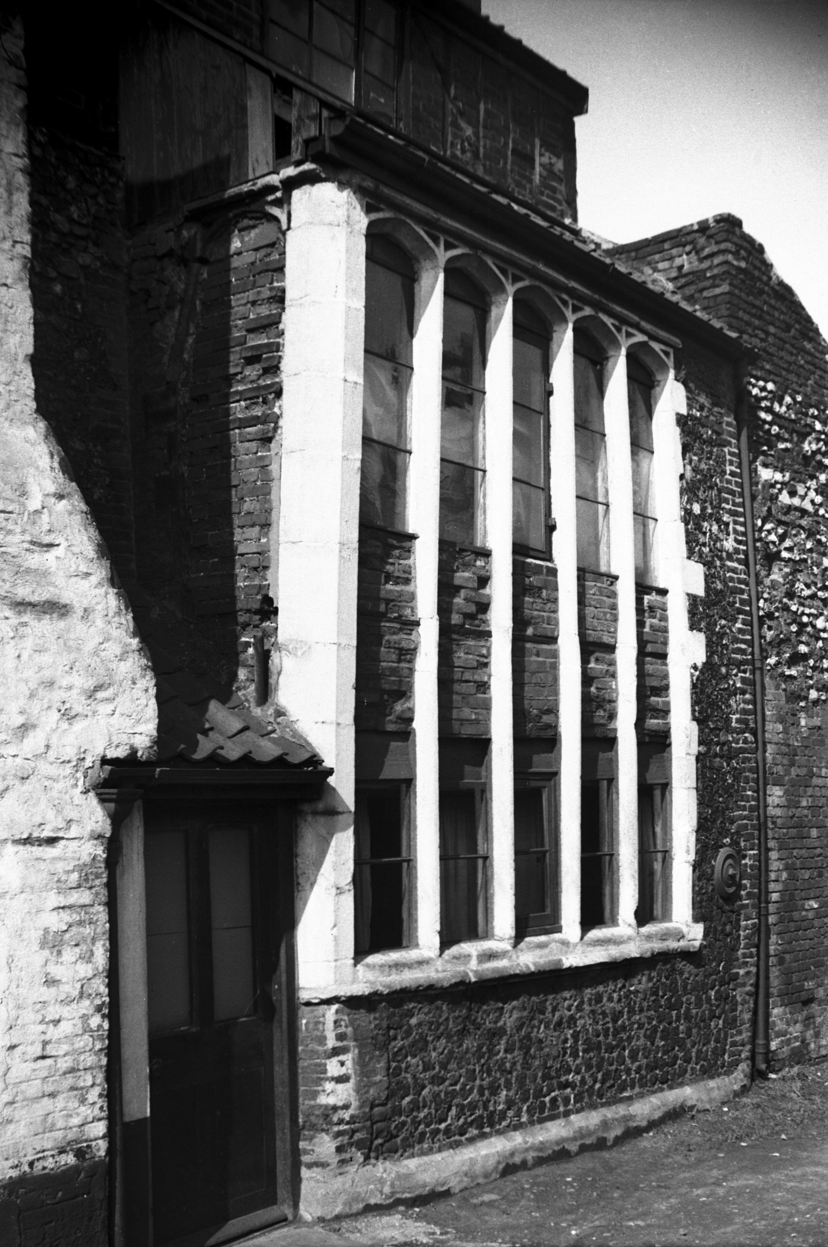
St John's Alley Maddermarket Theatre [1150]
1936-07-21
Built as a Roman Catholic Chapel three years after the
Catholic Relief Act of 1791 and later used by the
Salvation Army. The building was converted into an
Elizabethan Theatre by Nugent Monck in 1921. His Norwich
Players, founded 1911, moving from the Music House in
King St. |
|
|
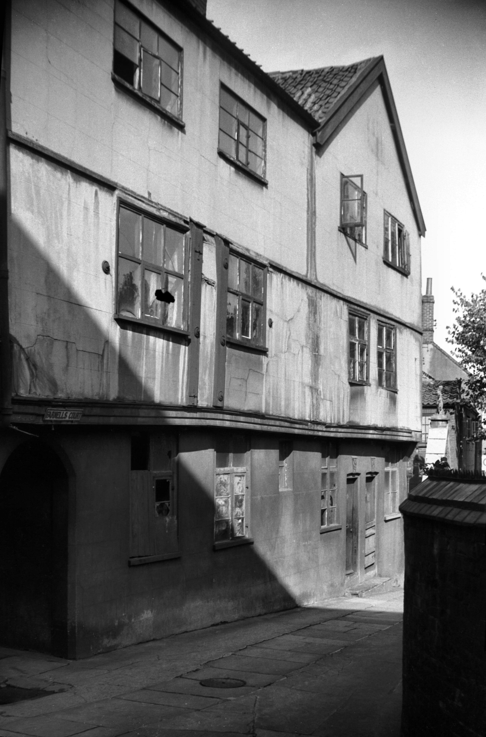
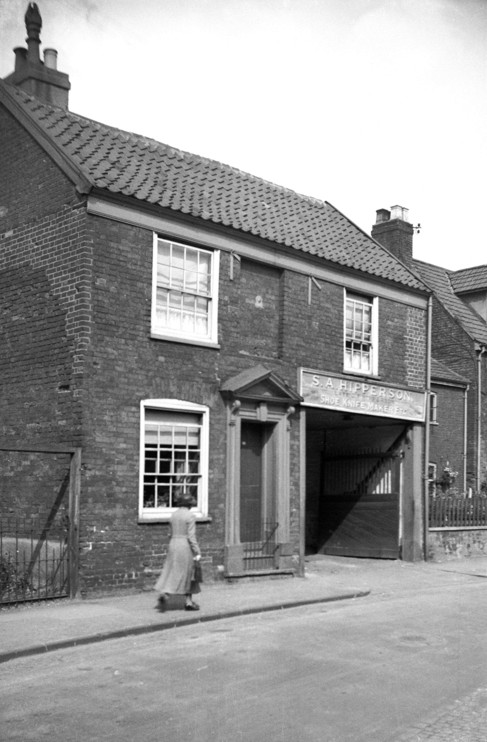
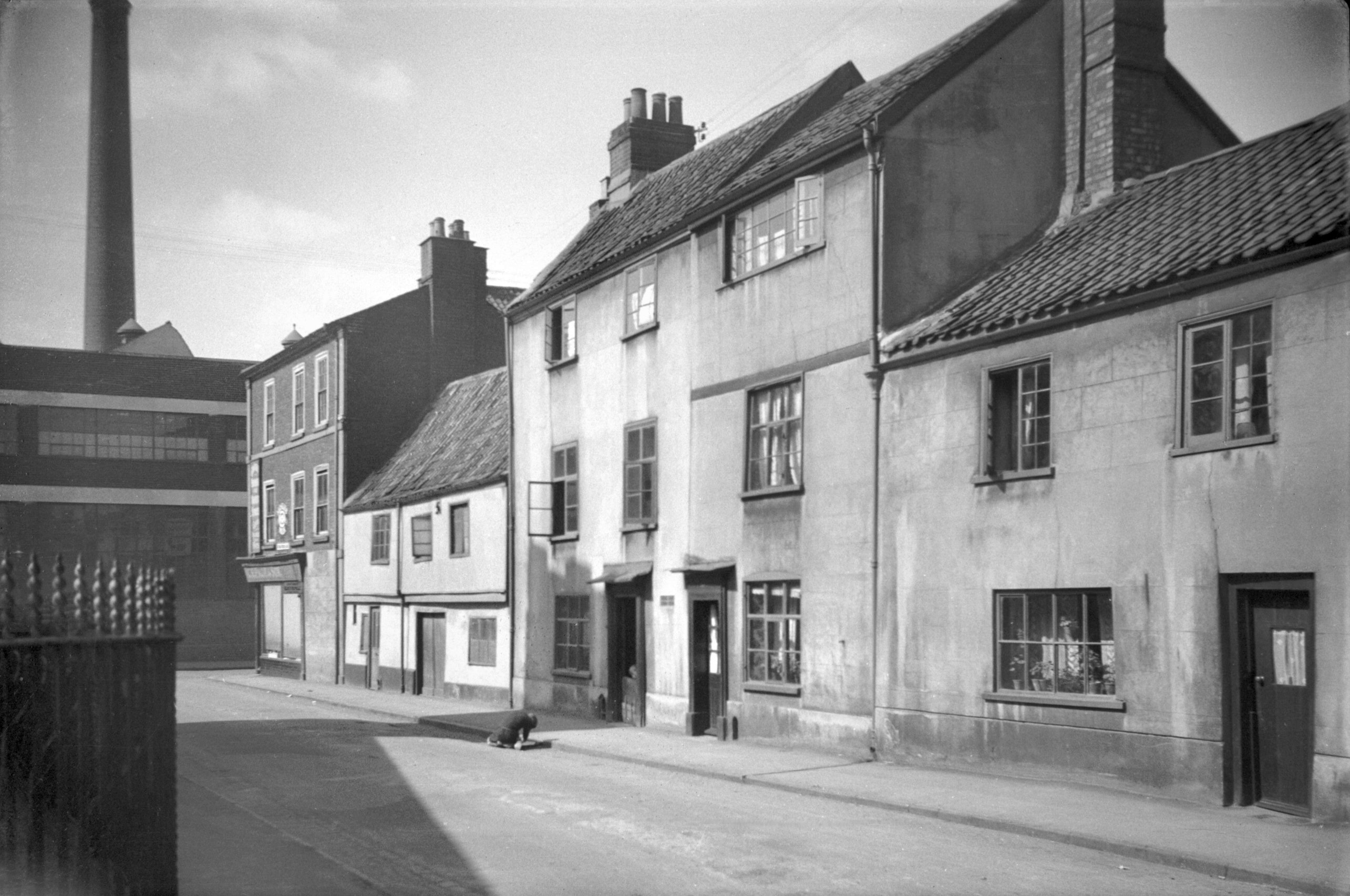
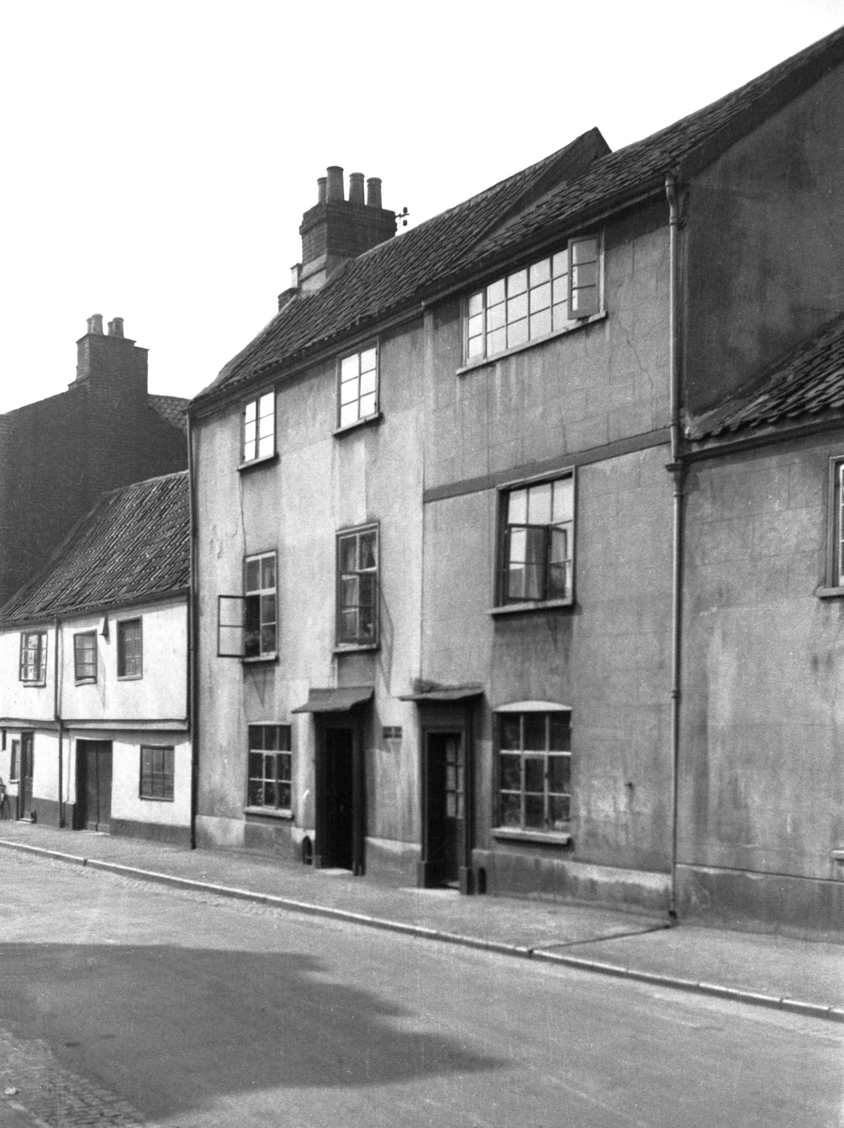
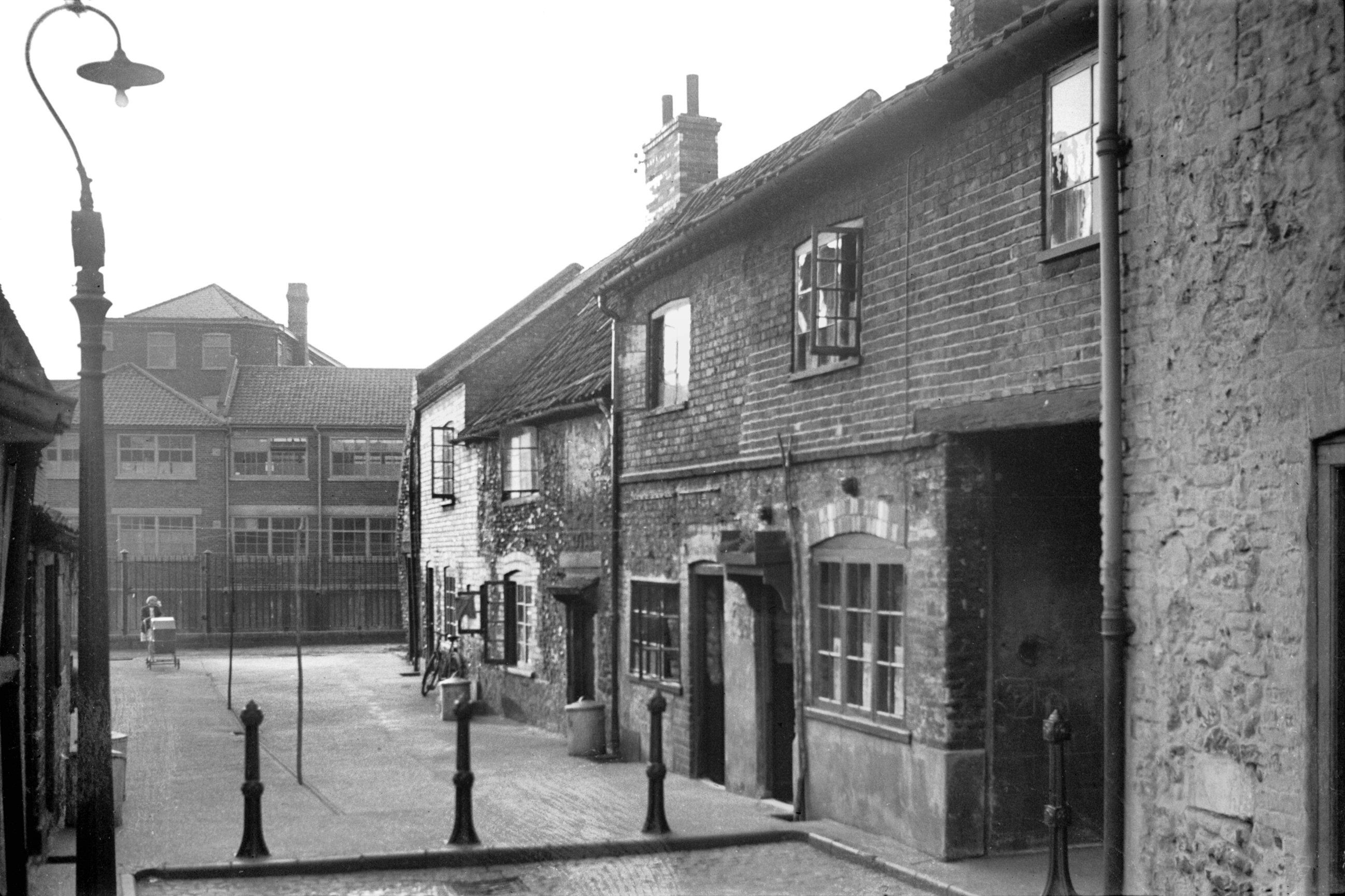
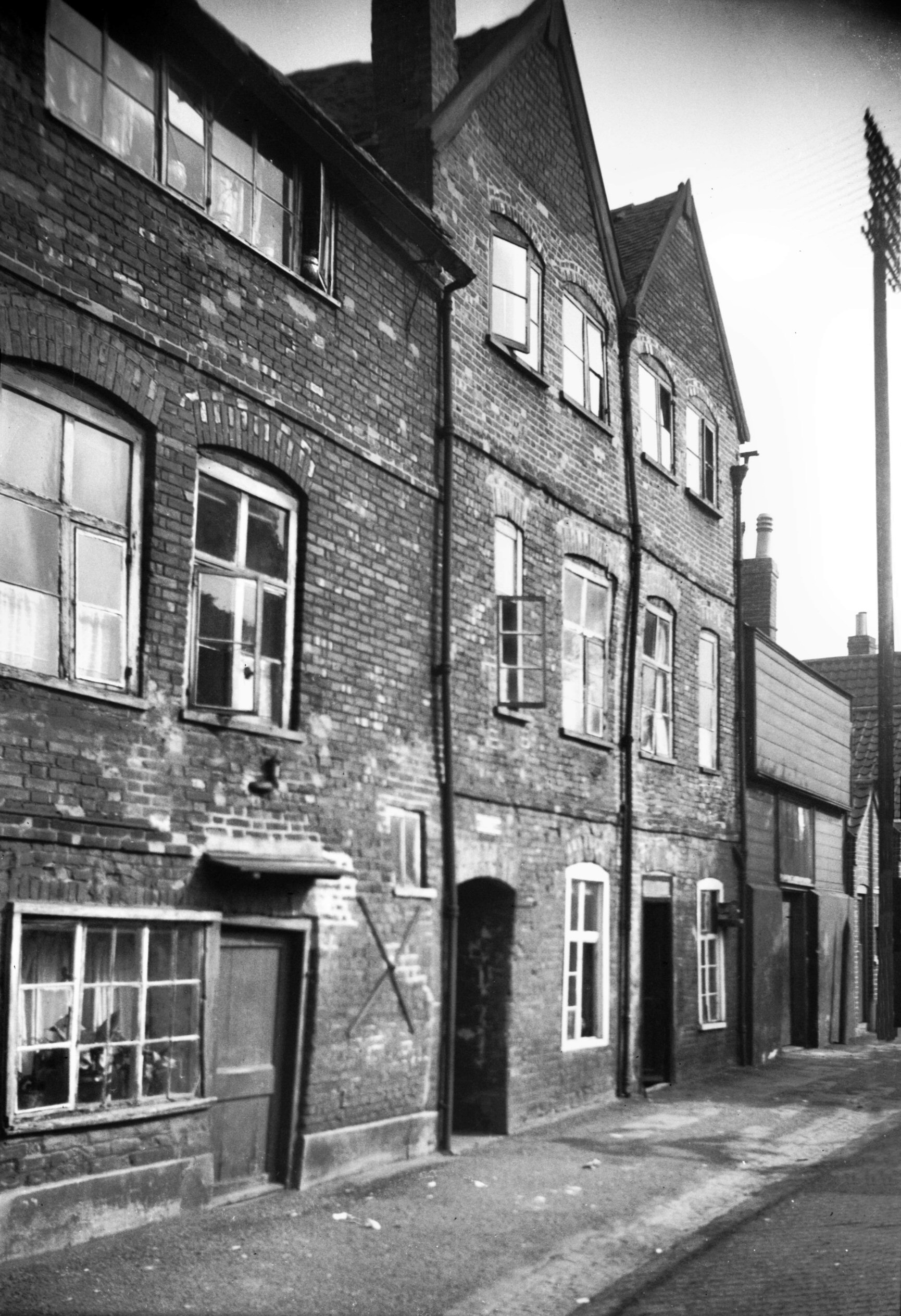
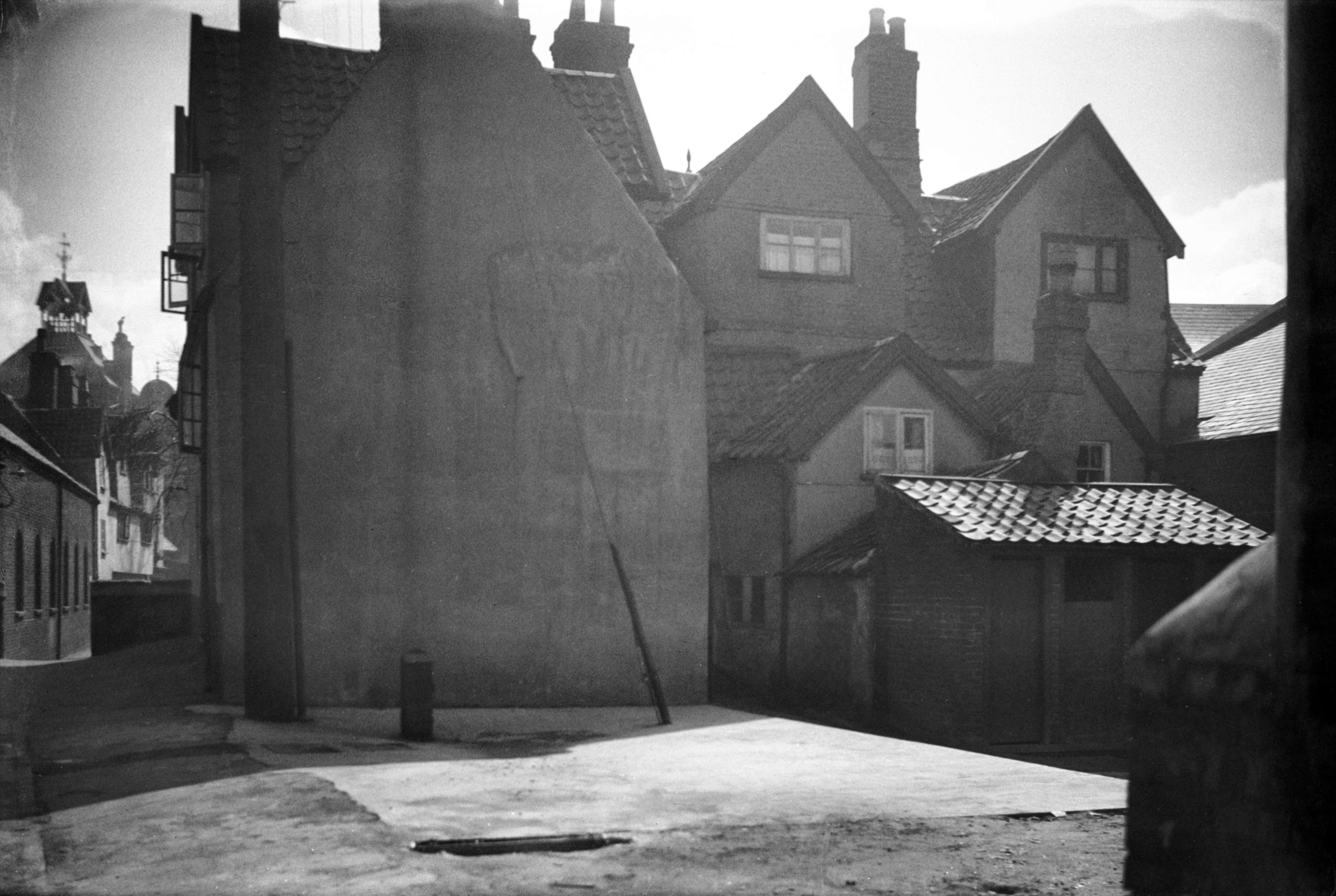
St John's Alley 4 to 5 [3279] 1939-10-08
Here in 1939, just beyond the Maddermarket theatre, I
photographed a row of three-storey timber-framed
dwellings (Nos 4-5) whose first floor projected slightly
over the alley. Writing about the parish in 1921, Leonard
Bolingbroke described how, coming from Pottergate and
"passing under the tower of the church, we get a
glimpse of those once very picturesque cottages standing
in the church alley. Unfortunately they have been
recently sadly defaced by a coating of cement".
A passageway between two of the houses led to a wide
yard, surrounded on all sides by equally tall dwellings,
some of early Georgian date. This was known as Farnell's
Court, named after one who, a century or more ago, had
kept a school here. Described as a fine penman, Farnell
produced copybooks, which were said to have been used in
many of the Norwich schools. |
|
|
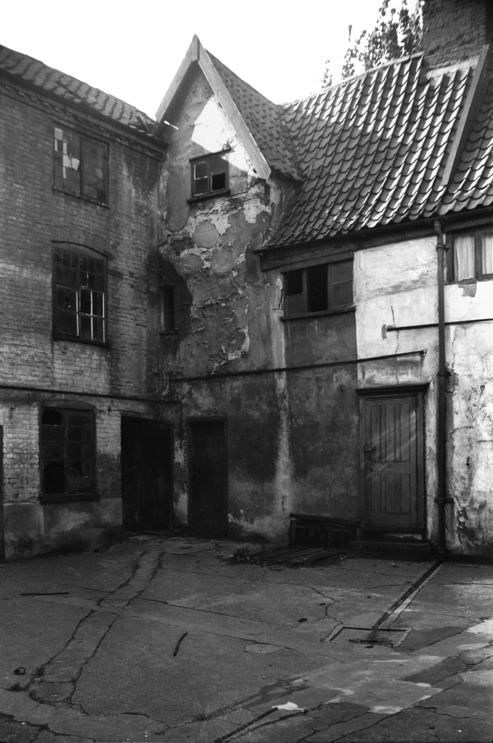
St John's Alley Farnell's Court west side [3280]
1939-10-08
|
|
|
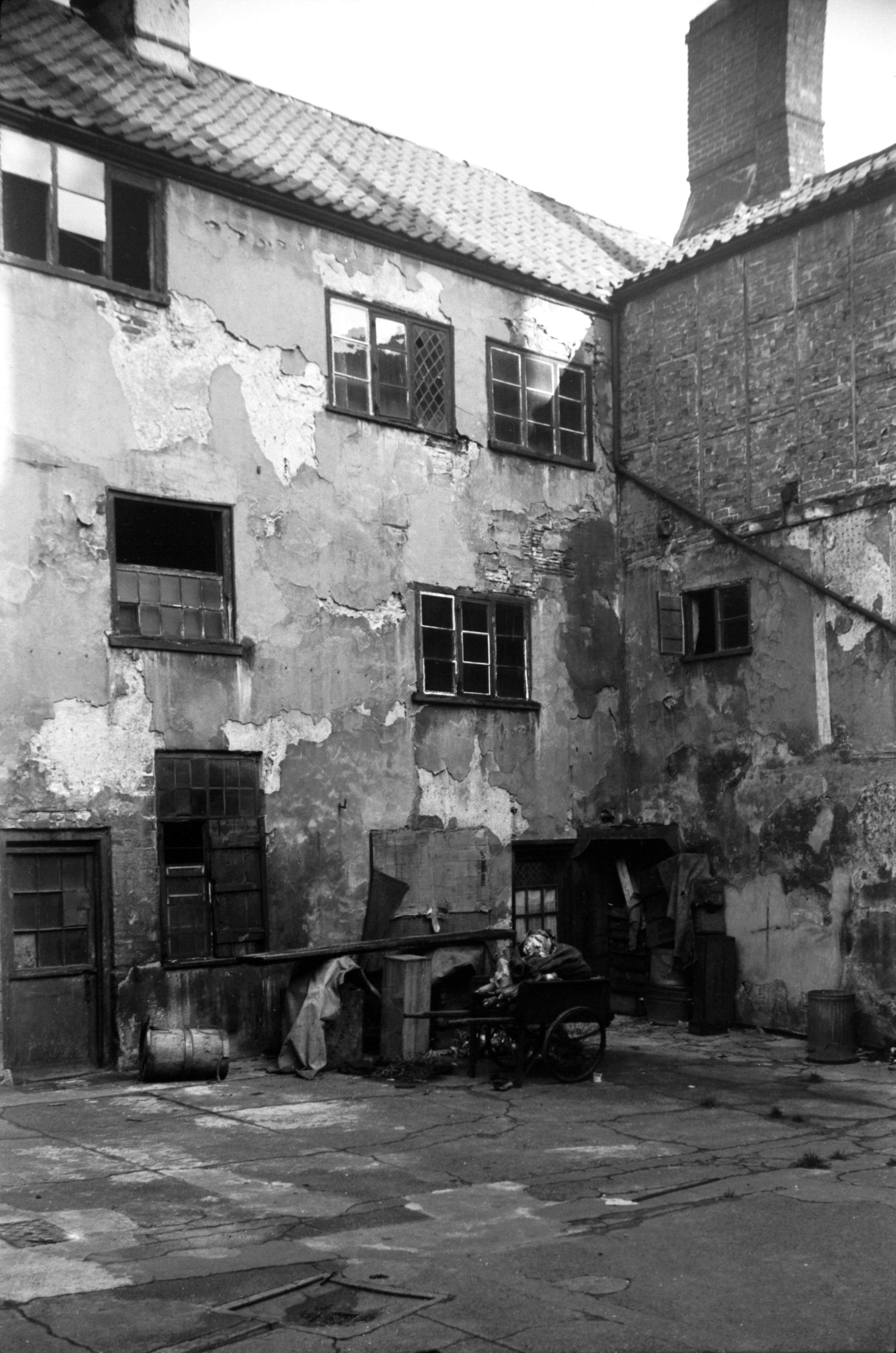
St John's Alley Farnell's Court NE corner [3281]
1939-10-08
|
|
|
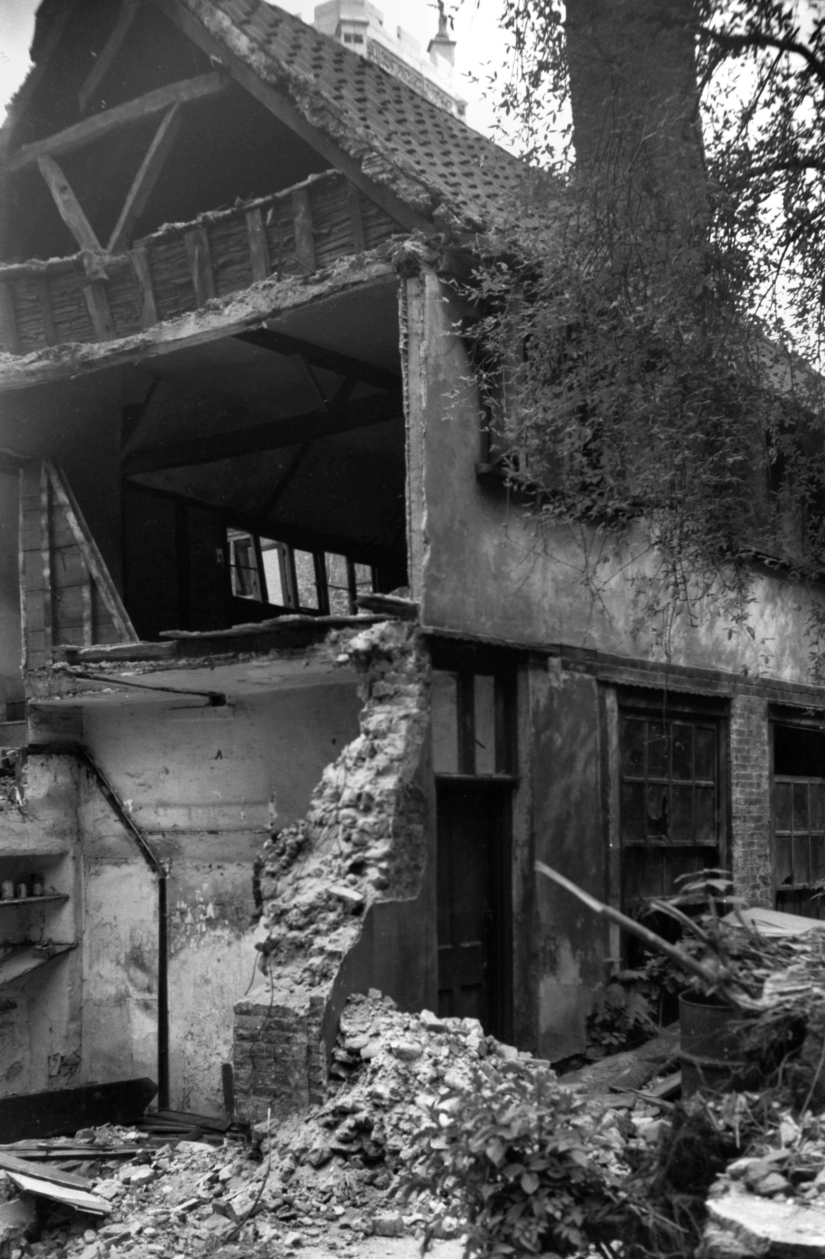
St John's Alley Farnell's Court demolition [4203]
1953-08-15
Timber-framed house adjoining court being demolished for
extension to Maddermarket Theatre. |
|
|
St John's Alley Farnell's Court demolition [4204]
1953-08-15
|
|
|
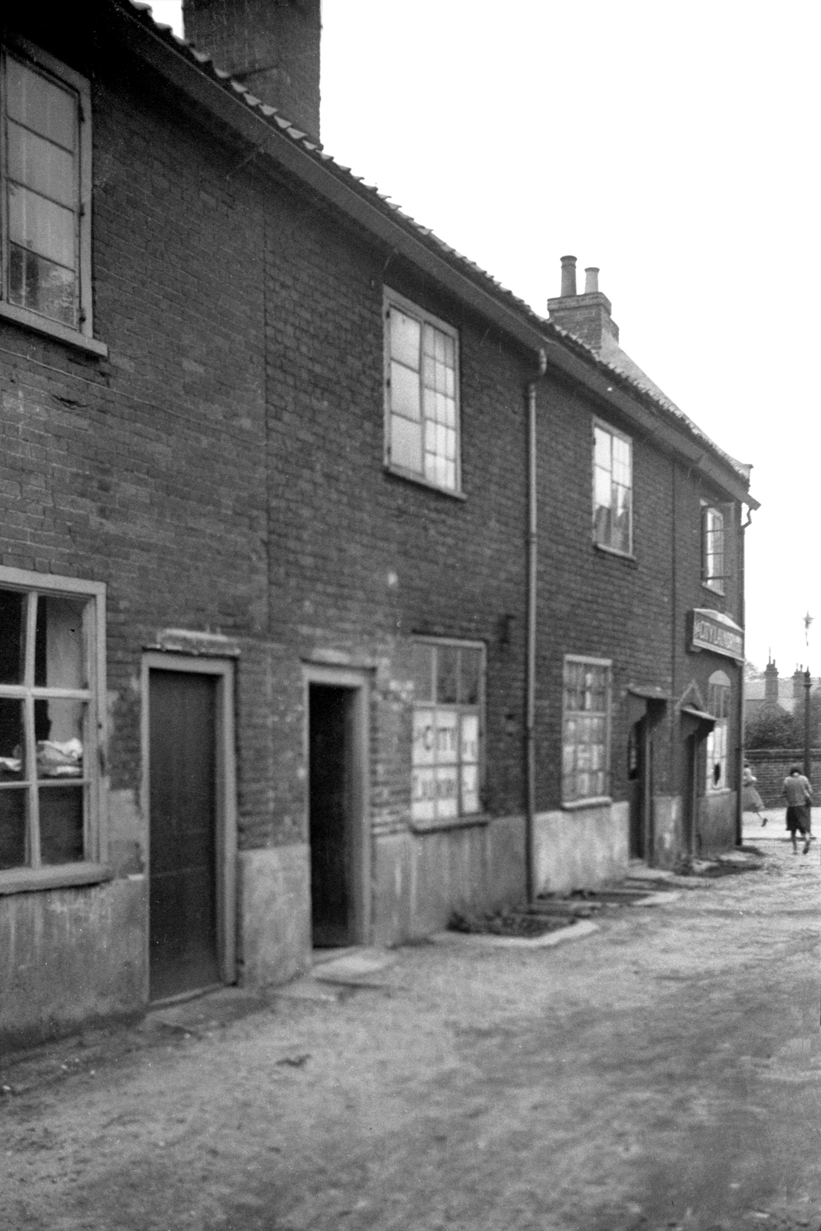
St John's Alley 7 St John Maddermarket 20 [2795]
1938-09-10
|
|
St Julian's Alley: |
| |
From
King St to Rouen Rd (formerly to
St Julian St) |
|
|
St Julian's Alley 1 [3217] 1939-08-07
Apart from the destruction of St Julian's church, most of
the damage in this area during the war was confined to
modern business premises. The quaint Tudor dwelling which
stood by the south corner of St Julian's Alley with King
St, however, was not so fortunate as its more illustrious
neighbours, the Old Barge inn, Howard House and the Music
House, and was wrecked at the same time as the adjacent
church. |
|
|
St Julian's Alley north side [2802] 1938-09-10
|
|
|
St Julian's south side of tower [B129] 1931-00-00
Opposite Old Barge Yard and Dragon Hall in King St is one
of the two entrances to St Julian's Alley. The other
"arm" of the lane is a few yards further south
and skirts the east end of the churchyard before linking
up with the main part to the north of the church. It now
opens directly into modern Rouen Rd, but before the area
was cleared it led to St Julian's St, the centre of a
network of 19c terraced houses.
Many of the buildings around King St were demolished
under slum clearance or other redevelopment schemes.
Enemy action, however, was the cause of the destruction
of St Julian's Church.
To which of the saints named Julian the church is
dedicated is uncertain - the parishioners at different
times seem to have adopted the one which suited their
purpose best.
Ian Hannah, following Blomefield's errors called it
"St Julian King and Confessor", but this is
really a contraction of the title "St Julian with St
Edward King and Confessor". A church of St Edward
formerly stood between this one and that of St
Etheldreda, the two rectories being united at some time
between 1269 and 1305. After the Dissolution St Edward's
fell into disuse, and although early in the 18c its ruins
were still visible all traces of it have long since
vanished.
Before the Second World War St Julian's consisted of an
aisleless nave and chancel, north porch, south vestry and
a round western tower, the latter considered to be of
Saxo-Norman date. In 1940 when a visit was paid by the
Norfolk and Norwich Archaeological Society, Arthur
Whittingham pointed out how its walls were levelled up
every foot or so instead of being coursed. Other typical
features of that period included blocked circular windows
to the east and west and traces of a round-headed west
doorway. Although the body of the church appeared to have
been rebuilt several centuries later, inspection revealed
that the plan and much of the fabric remained from the
earlier period. St Julian's, therefore, was probably one
of the 29 new churches mentioned in Domesday as having
been built in the city between 1065 and 1086.
Most of the interior fittings were of modern date,
including the screen, which was made a little too long
and had to be set in the chancel arch slightly askew. The
original round-headed Saxon or Norman chancel arch was
destroyed in about 1460, when it was replaced by one in
the contemporary pointed style. At about this time, too,
the finely carved bosses of the chancel ceiling were
made.
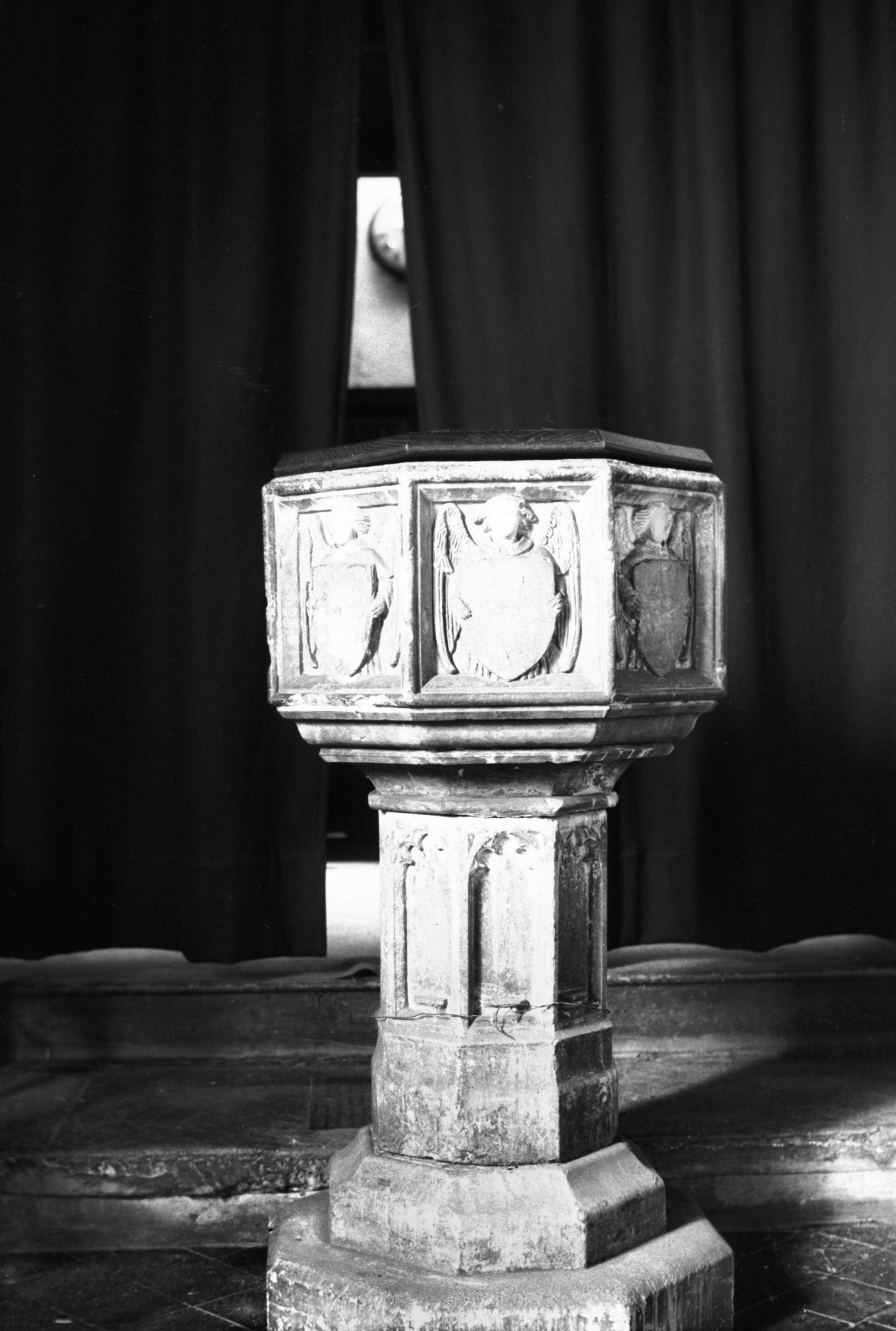
The small octagonal font was of some interest. Dating
from the Perpendicular period, it had suffered a certain
amount of mutilation at different times. The shaft was
covered with shallow panels, once probably containing
figures of saints, while the eight panels of the bowls
had angels holding shields. These formerly bore painted
coats-of-arms, but all traces of these disappeared in
1845 when workmen scraped off numerous coats of whitewash
and with them the remains of the figures around the stem.
Inside the tower was one bell inscribed AVE GRACIA PLENA
DOMINUS TECUM. On its crown were three shields, the mark
of the 15c bellfounder Richard Brayser.
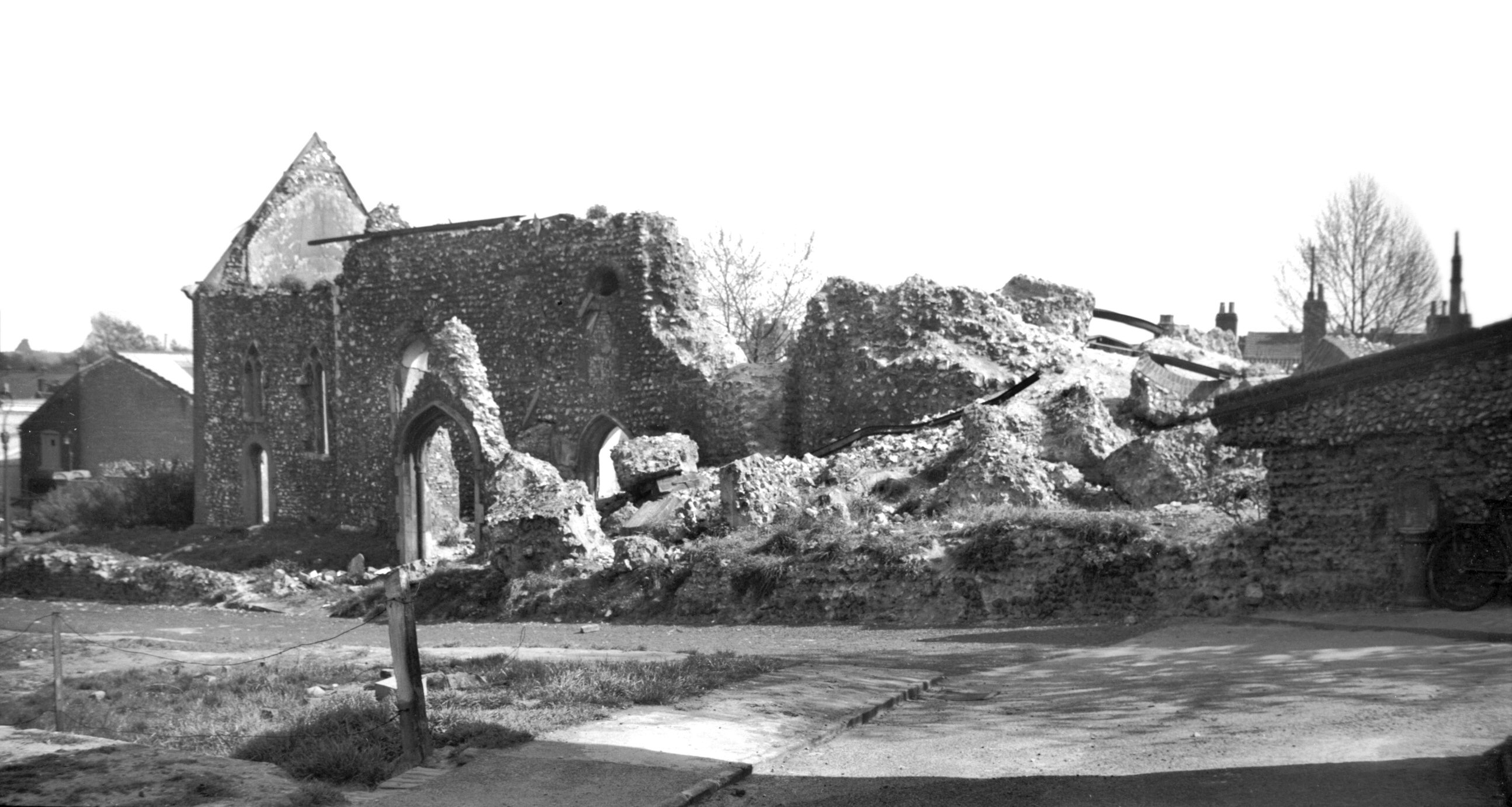
During the early hours of Saturday morning, 27th June
1942, German raiders flew over the city causing
widespread damage, mainly by fire, particularly in the St
Stephen's St and Ber St area. In King St high-explosive
bombs caused the destruction of St Julian's. A shapeless
heap of rubble was all that was left of the tower; of the
remainder of the church only the north and east walls
were left standing.
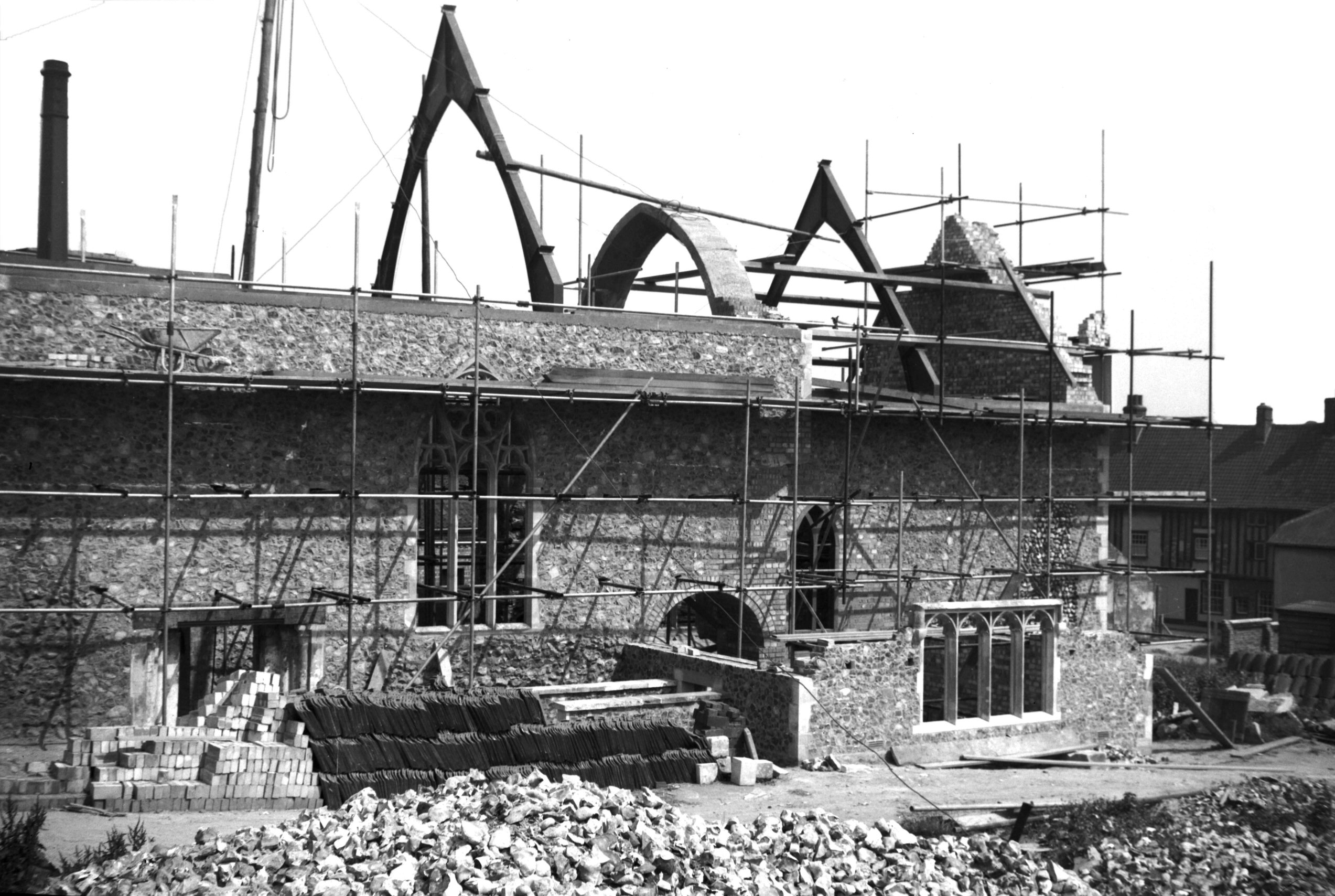
Thus did it remain until nearly ten years later, when
work was put in hand to clear away the rubble and rebuild
the church. As much as possible of the surviving fabric
was retained, in particular the north wall of the nave
with its circular Norman window. A 15c font brought from
the redundant All Saints' church took the place of that
which had been broken beyond repair, while a Norman
doorway from the neighbouring church of St
Michael-at-Thorn, gutted during the same raid, replaced
one of similar date, which had been sketched and etched
by John Sell Cotman. This now gives access from the nave
to a sacristy built on foundations, laid bare in 1906, of
what was thought at the time to have been the cell of
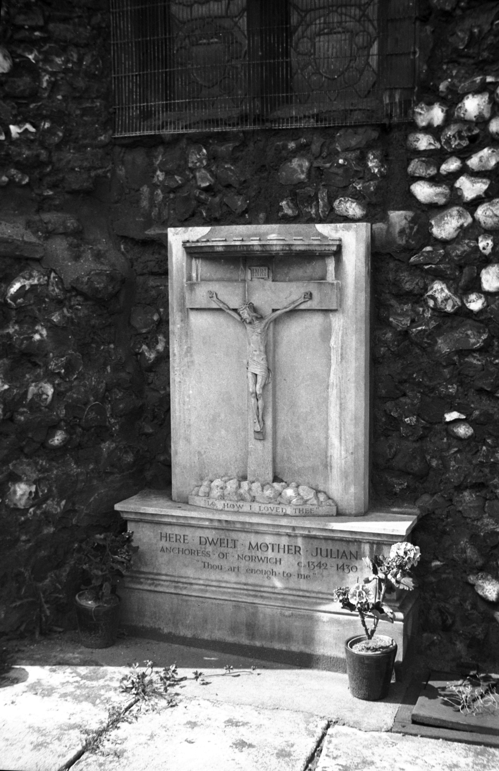
Dame Julian, the 14c anchoress or religious recluse,
famous for the series of visions vouchsafed to her.
Descriptions of these visions have been published in
several editions under the title of Revelations of Divine
Love. |
|
|
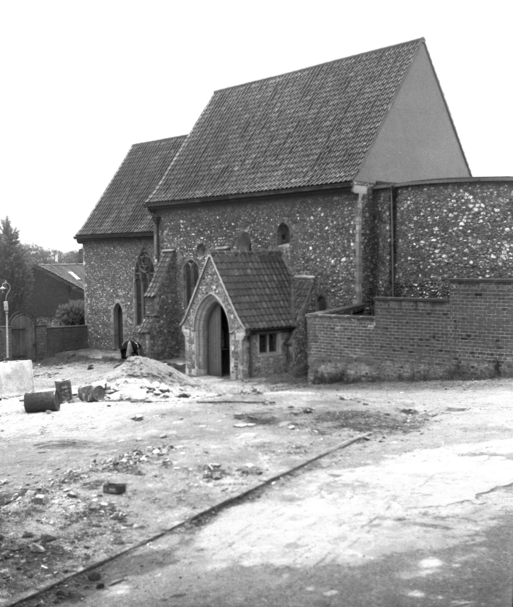
St Julian's tower south side [0154] 1934-07-05
Pre-conquest round tower. |
|
|
St Julian's King St from NE [0155] 1934-07-05
Norman except for modern upper part to east wall. |
|
|
St Julian's Mother Julian memorial tablet [0163]
1934-07-08
Commemorating The Anchoress Julian, who lived in a cell
attached to the church c1342-1430. |
|
|
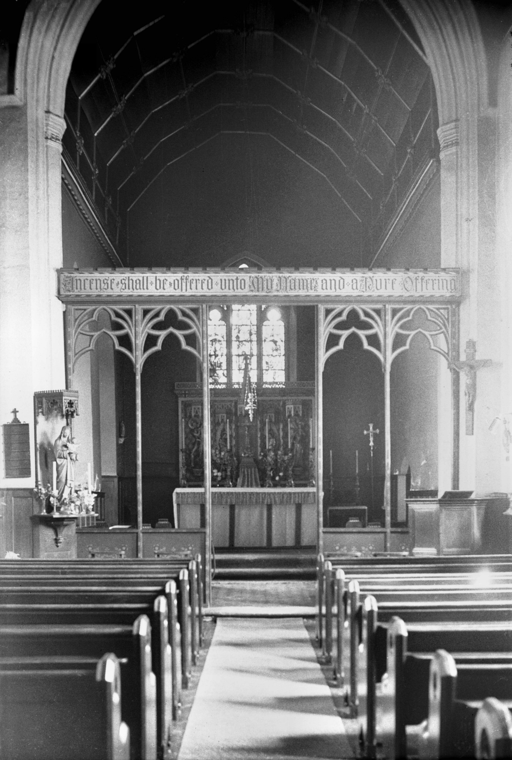
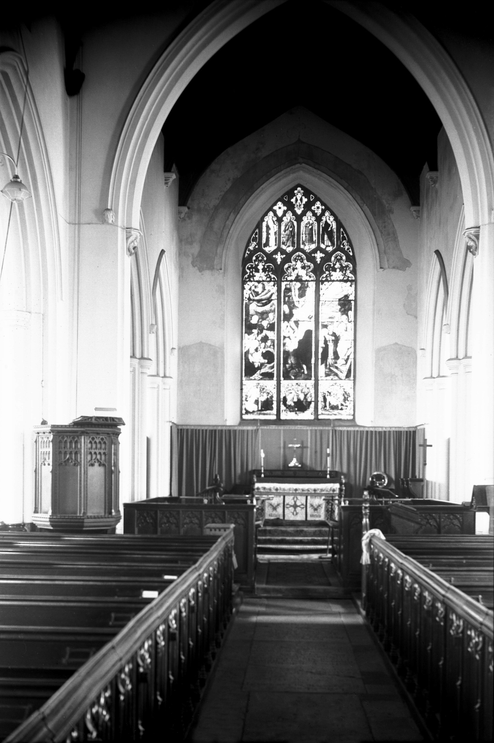
St Julian's interior view east [1870] 1937-08-12
Screen is modern. |
|
|
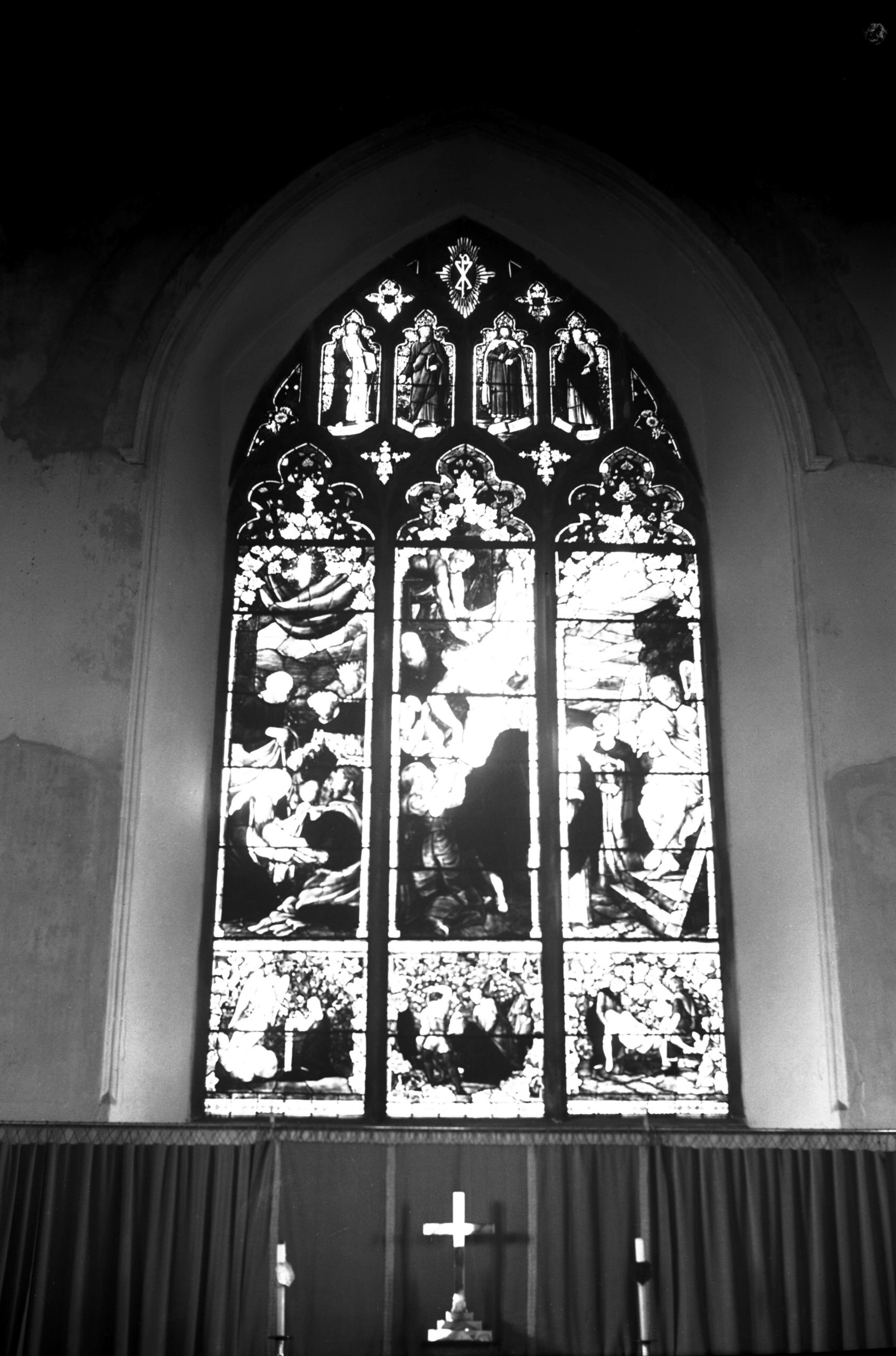
St Julian's 15c font [1871] 1937-08-12
|
|
|
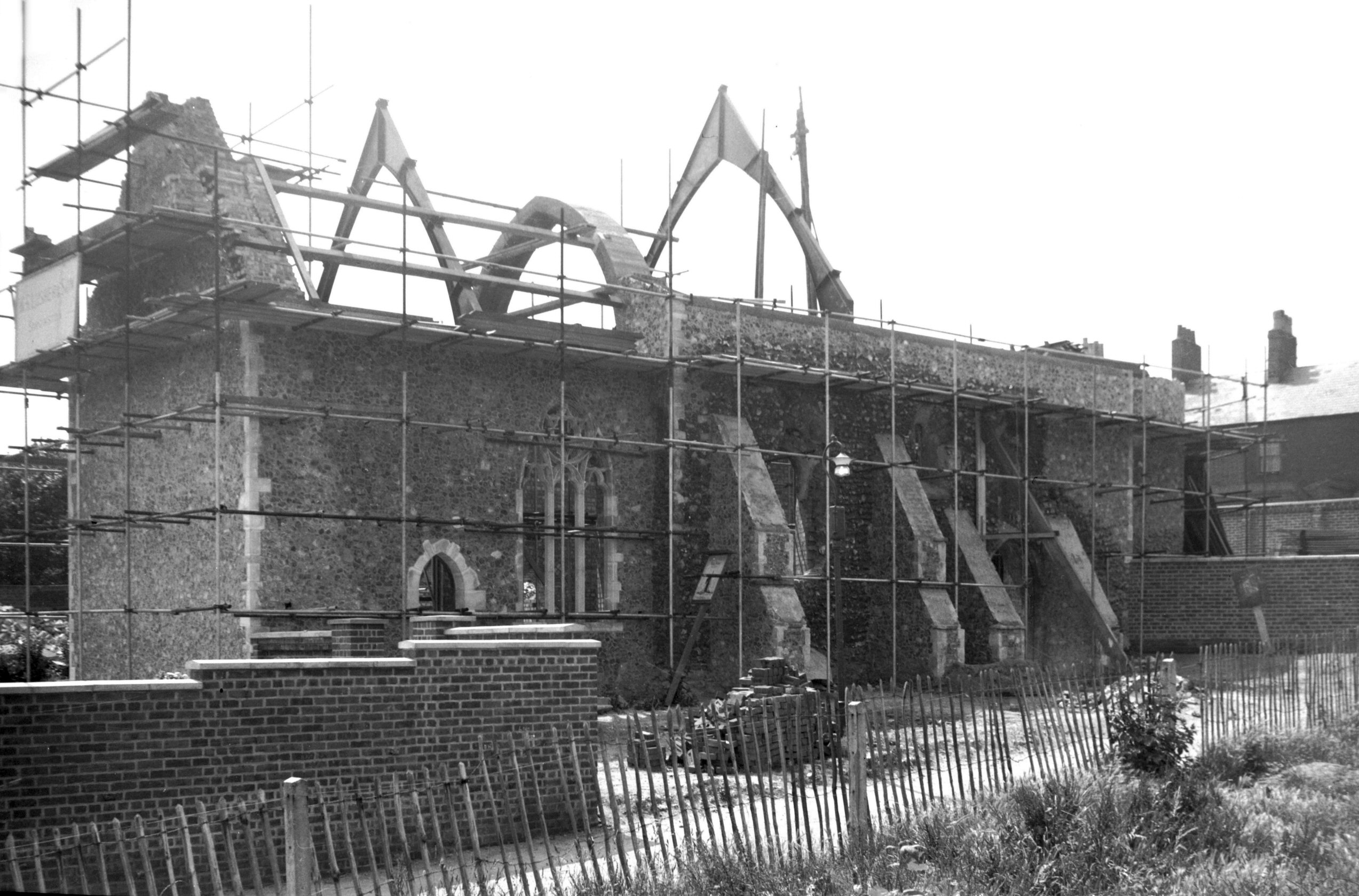
St Julian's air raid damage [3626] 1946-04-21
Partial destruction in the blitz of 27th June 1942. |
|
|
St Julian's reconstruction south side [4078]
1952-07-06
|
|
|
St Julian's reconstruction north side [4080]
1952-07-06
Much of the original north wall and lower stages of the
tower were retained in the 1952 reconstruction. |
|
|
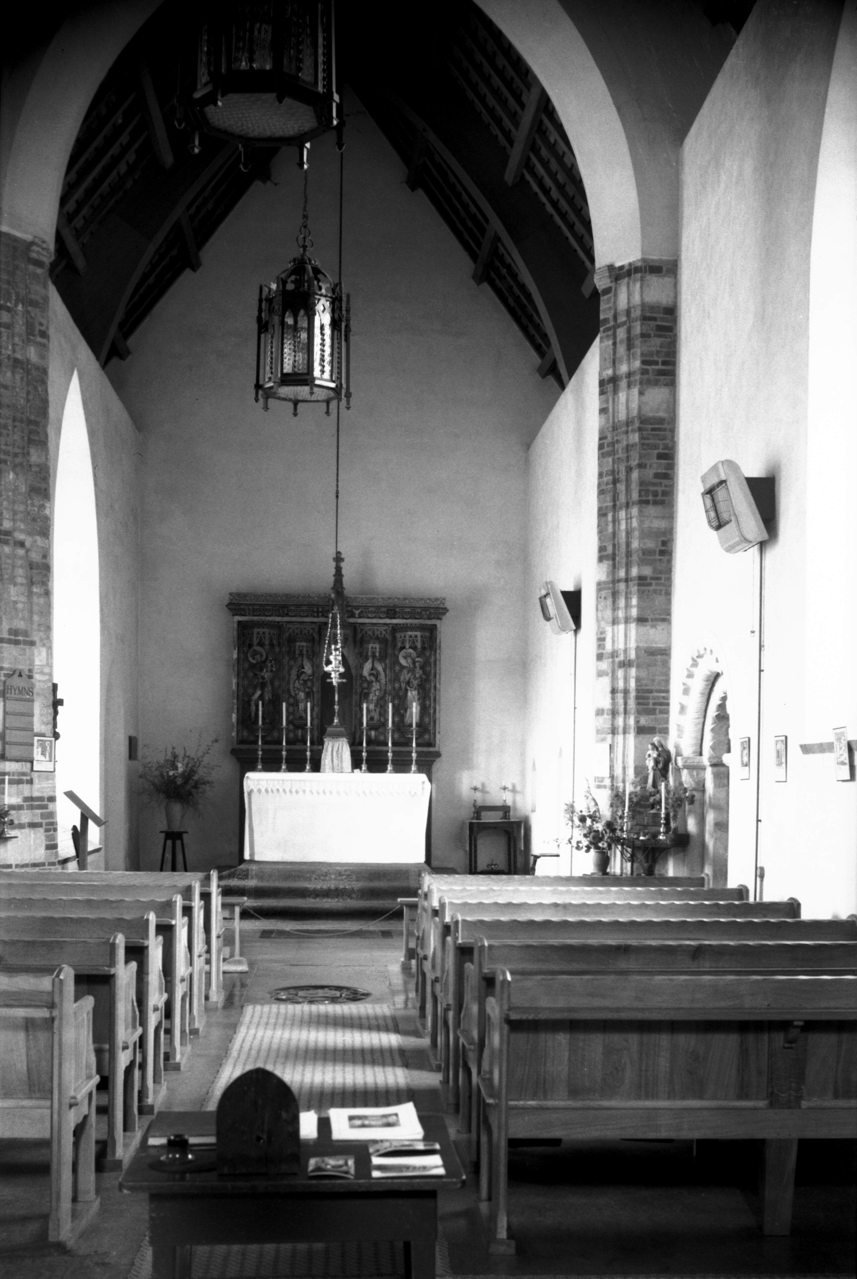
St Julian's reconstructed interior view E [4568]
1960-08-06
With Norman doorway taken from blitzed church of St
Michael at Thorn. |
|
|
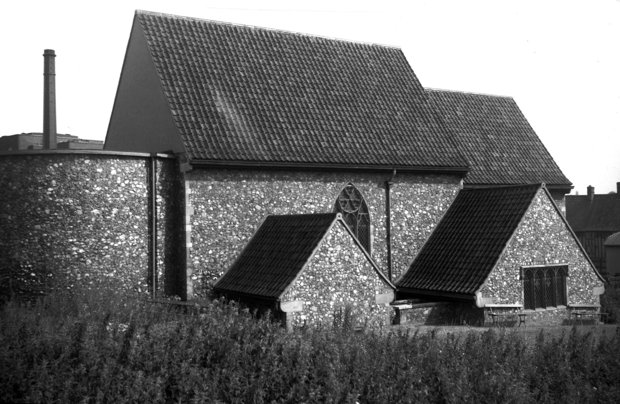
St Julian's reconstructed from SW [4572] 1960-08-13
|
|
|
St Julian's reconstructed from SE [4573] 1960-08-13
|
|
|
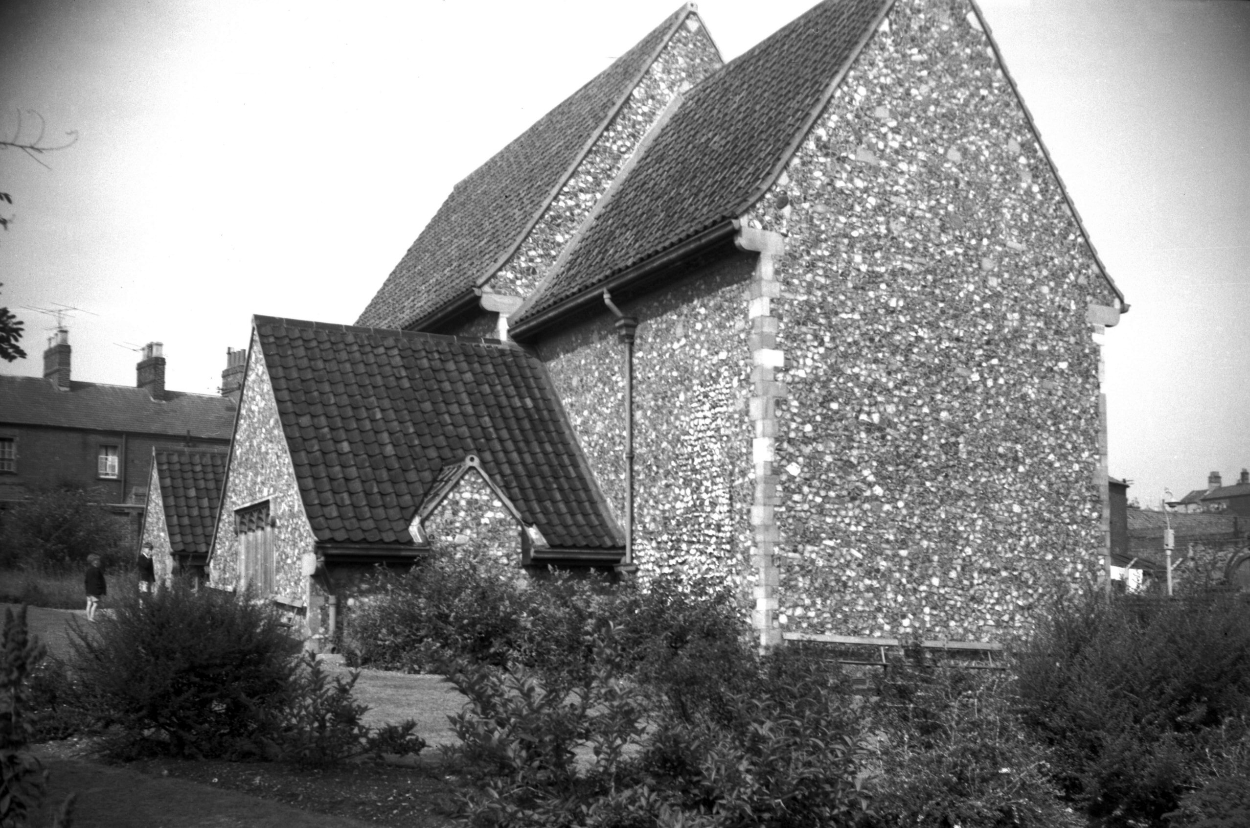
St Julian's reconstructed from north [4670]
1962-06-11
|
|
St Leonard's Rd: |
| |
From
Rosary Rd to Wolfe Rd
passing Gas Hill, Telegraph
Lane |
|
|
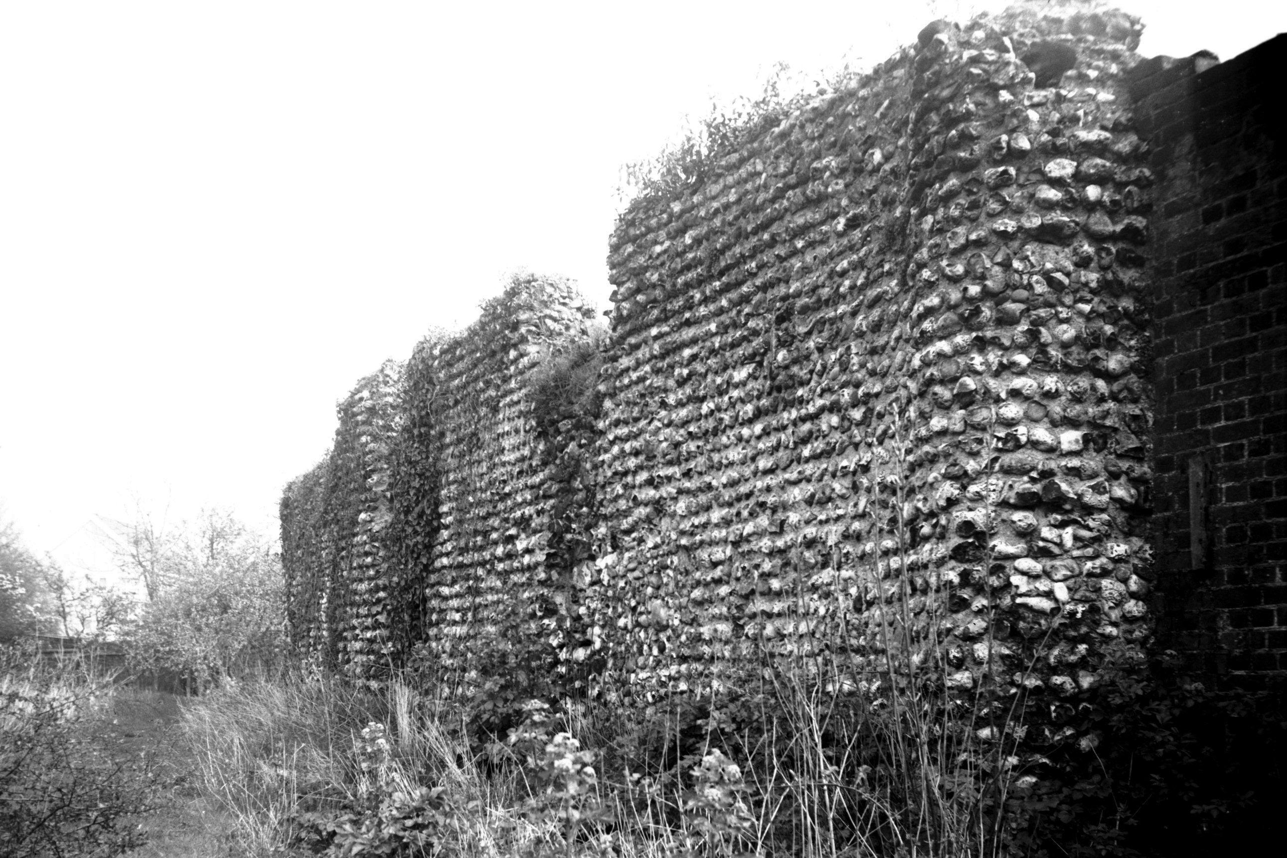
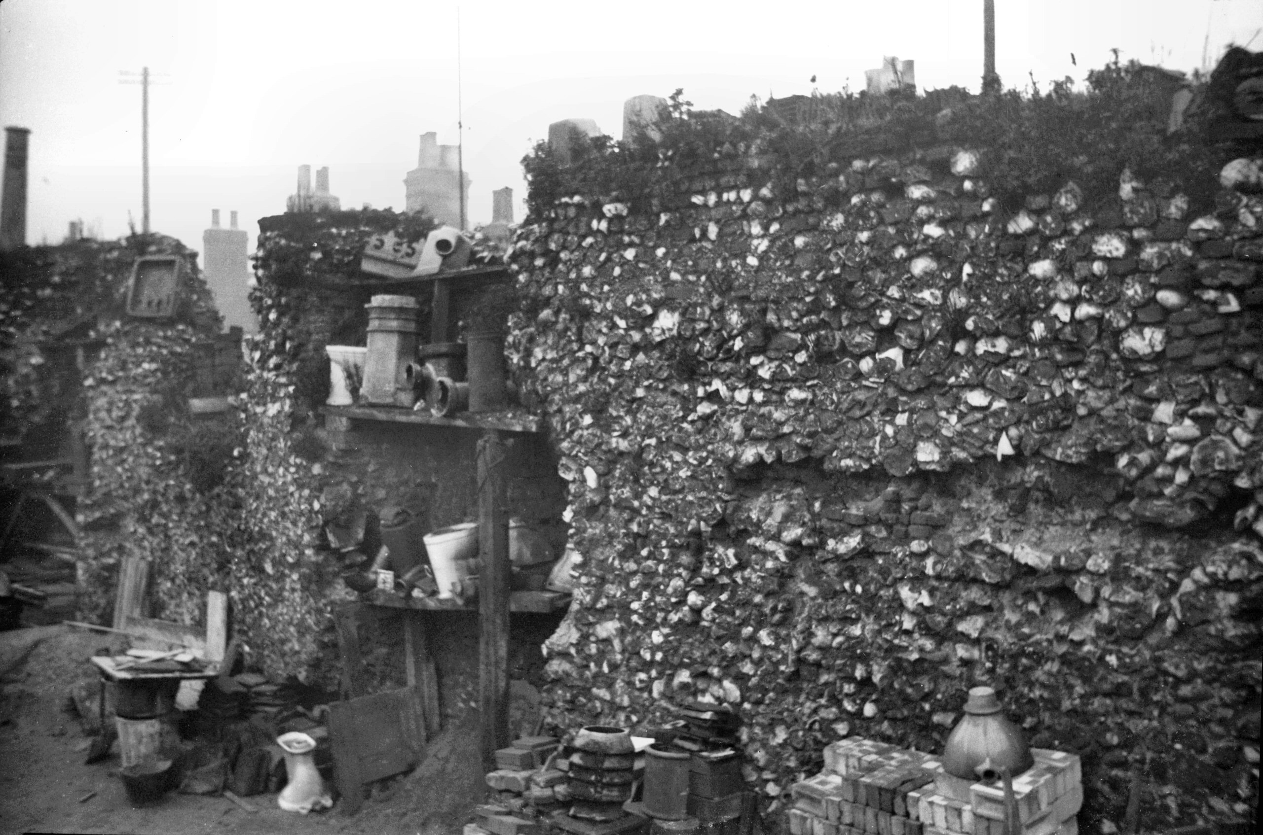
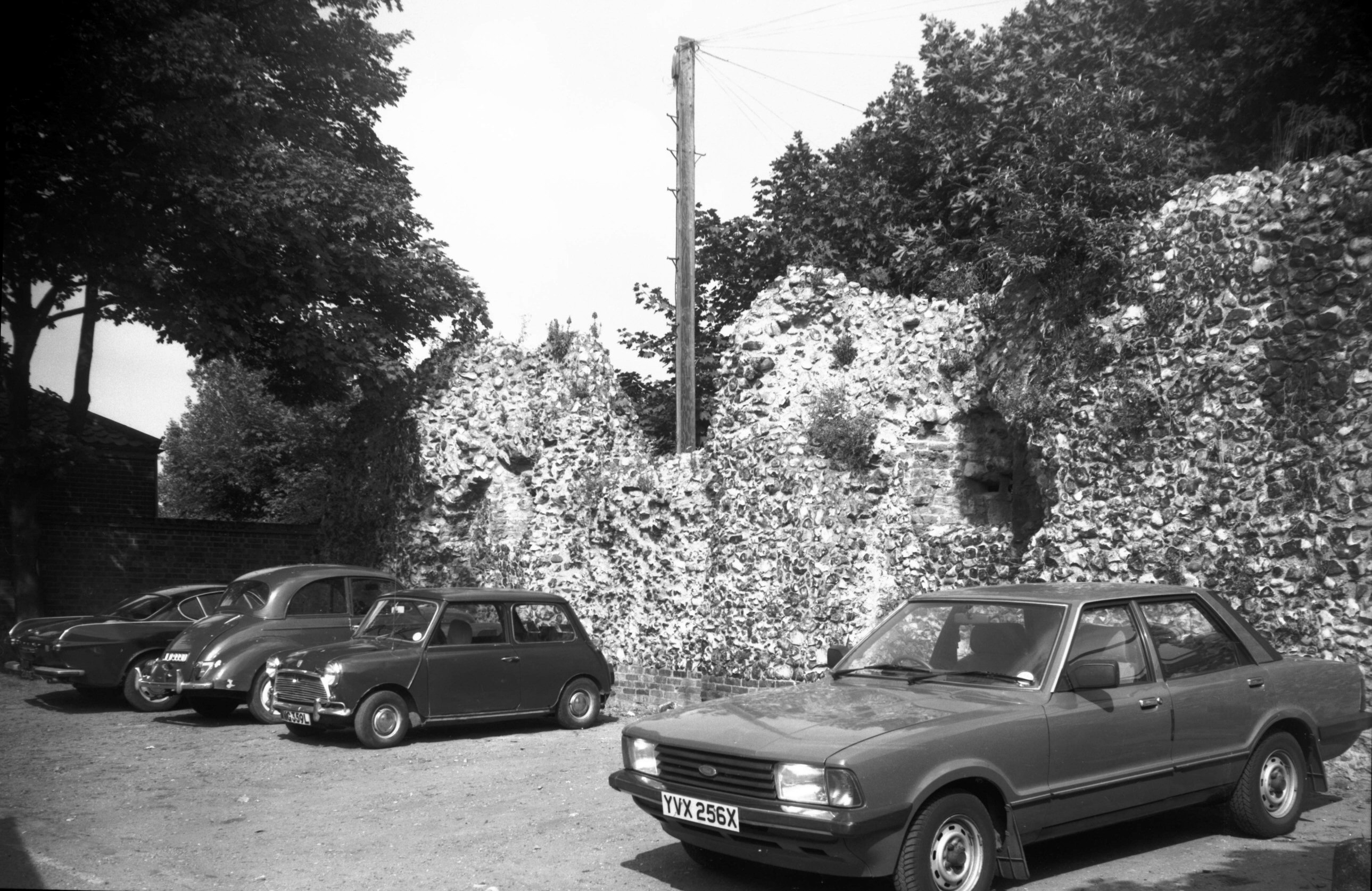
St Leonard's Priory flint wall Kett's Hill [6454]
1987-04-25
A wildlife park known as Kett's Heights has recently been
formed on a hillside between Kett's Hill and Gas Hill,
overlooking Bishop Bridge and the Cathedral. Here at its
highest point a flint wall is all that remains of the
chapel of St Michael-on-the-Mount. According to the
Registrum Primum of Norwich Cathedral Priory, in 1101
Herbert de Losinga, the first Bishop of Norwich, was
granted the manor of Thorpe and Thorpe wood by Henry I.
There he built the church and priory of St Leonard and,
nearby, the chapel of St Michael. The latter was to
replace a church on Tombland having the same dedication,
which the monks had pulled down in order to make an
entrance to the Cathedral monastery.
St Leonard's priory was a cell to the Cathedral, and
while certain of the monks were placed here permanently
others were here only while the cathedral church was
being built. One of their duties was to perform daily
service in St Michael's chapel; out of their revenues
they had to find a scholar and pay for an exhibition for
him at one of the universities.
At the dissolution of the monasteries Henry VIII granted
the priory to Thomas, Duke of Norfolk, whose son the Earl
of Surrey built a magnificent mansion here known as Mount
Surrey. He did not live long to enjoy it, for after
falling out of favour he was beheaded in 1547.
Two years later Robert Kett (illustrated in bronze on one
of the City Hall doors) and his rebels encamped here. The
priory they largely destroyed, but Mount Surrey they used
as a place of detention for their more important
captives. Little now remains of the priory. Walter Rye,
who owned the site at the beginning of the 20c, carried
out excavations there and uncovered the entrance to the
gate tower, but he found very little else. Of St
Michael's Chapel, later familiarly known as Kett's
Castle, only the flint wall remains - tidied up from the
rugged appearance it presented when made the subject of a
painting by John Sell Cotman in 1810. Supported on one
side by a brick wall, once part of a greenhouse, it now
stands isolated and a prominent reminder of the city's
past. |
|
|
St Leonard's Priory flint wall Gas Hill [1504]
1937-03-25
|
|
|
St Leonard's Rd 113 priory garden archway [5086]
1966-09-15
|
|
|
St Leonard's Rd 34 site of priory [1502] 1937-03-25
|
|
St Martin at Oak Wall Lane: |
| |
From
Oak St to St Augustine's St |
|
|
St Martin at Oak Wall Lane former Swan PH [0946]
1936-05-12
West end of lane. |
|
|
St Martin at Oak Wall Lane view north [0023]
1934-01-28
|
|
|
St Martin at Oak Wall Lane from inside city [6387]
1986-06-19
|
|
St Martin's Lane: |
| |
From
Pitt St to Oak St
passing Quakers Lane
North side |
|
|
St Martin's Lane 9 [2772] 1938-09-02
|
|
|
St Martin's Lane 9 to 11 [0867] 1936-04-10
|
|
|
St Martin's Lane 11 [2771] 1938-09-02
|
|
|
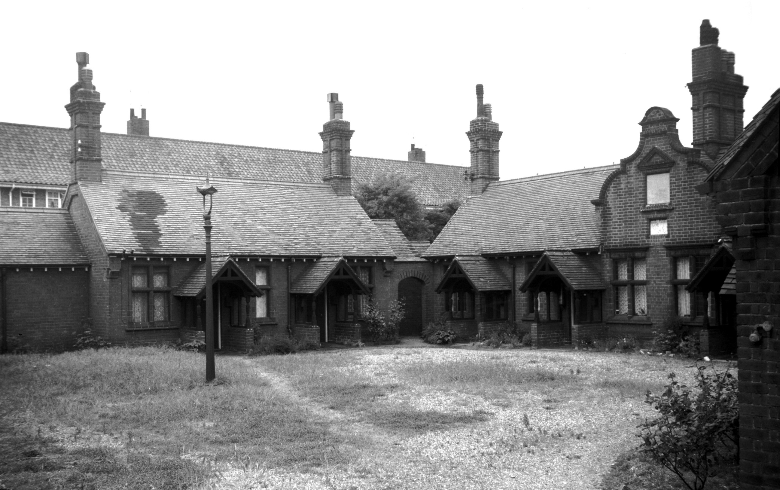
St Martin's Lane Cooke's Hospital [4665] 1962-06-11
Originally built by Robert and Thomas Cooke at Rose Lane
in 1692. Transferred here 1892. |
|
|
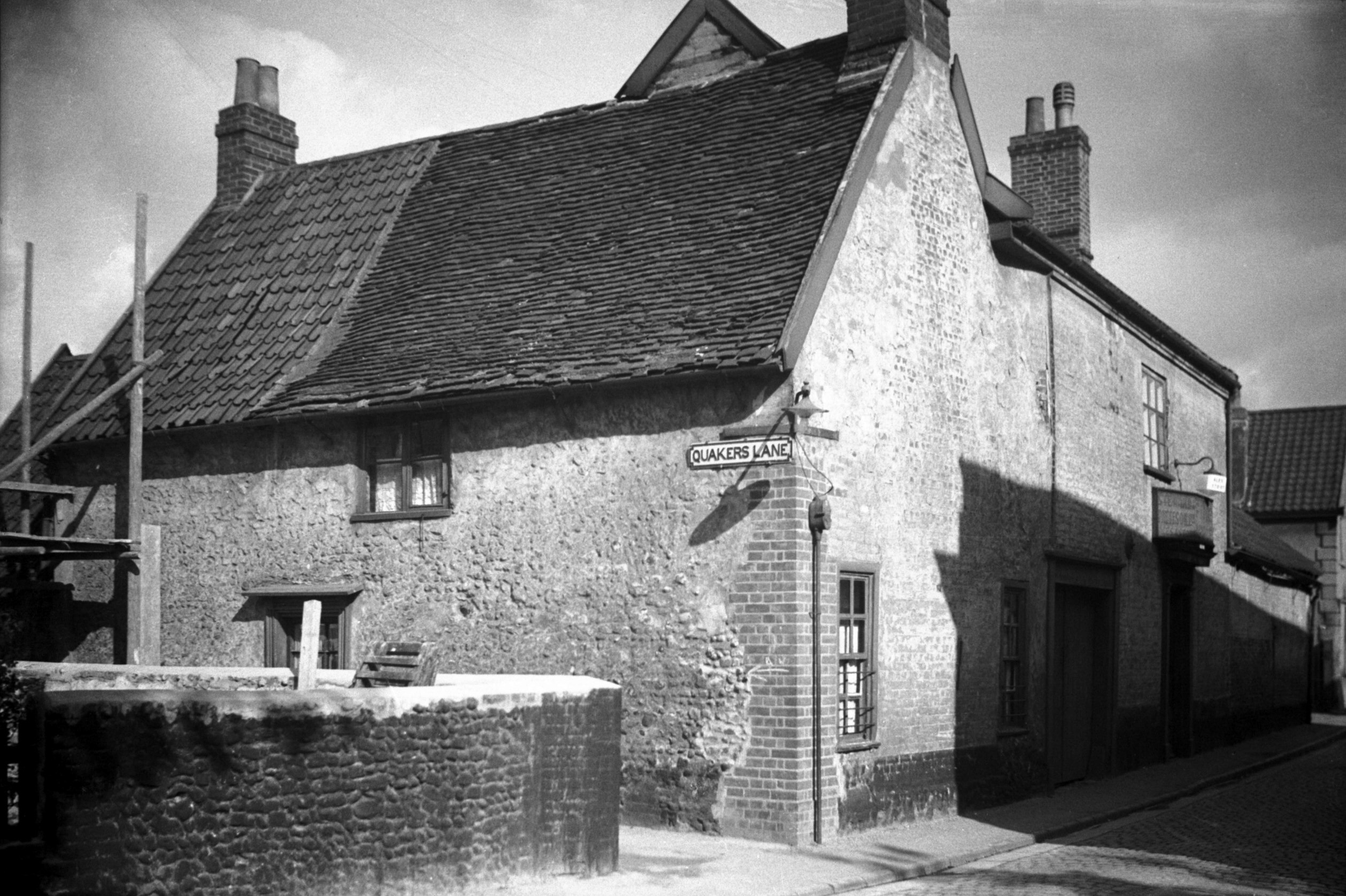
St Martin's Lane 47 and Quaker Lane E side [1491]
1936-10-05
Former Pineapple PH at 47 St Martin's Lane (right). 17c
weavers' cottages in Quaker Lane (left). |
|
|
St Martin's Lane 47 during restoration [5363]
1974-01-06
|
|
|
St Martin's Lane 47 rear and Quakers Lane [5364]
1974-01-06
Former Pineapple PH (left) and 17c weavers' cottages
(right) being restored. |
|
|
St Martin's Lane 49 to 55 [0866] 1936-04-10
|
|
|
St Martin's Lane 59 [2770] 1938-09-01
|
|
|
St Martin's Lane 61 to 69 [0865] 1936-04-10
|
|
|
St Martin's Lane 63 to 69 [2768] 1938-09-01
|
|
|
St Martin's Lane 69 [2769] 1938-09-01
To the north of St Martin's church in Oak Street lies St
Martin's Lane, where an archaeological excavation was
carried out in 1977 by the Norwich Survey team on the
corner opposite the churchyard. Documentary evidence
established that site fronting this end of the lane had
been occupied by at least 1300, when it was described as
a messuage with buildings belonging to Thomas de
Lingcole, a tanner. No doubt the inscription in St Mary's
church to Thomas de Lingcole commemorates the same
person. By the mid-14c it had become a textile-working
tenement, and towards the end of the 15c it was owned by
Gregory Clerk, a mercer who was Sheriff in 1477. This was
not his residence, for he lived in a mansion that
survived in nearby Dial Yard until about 1940. His widow
bequeathed "her dwelling place" and the St
Martin's Lane property to her son, also Gregory, who was
Mayor in 1505 and died in 1516. Archaeological evidence
suggested that this was rebuilt, probably after the death
of the younger Gregory, to survive as 67-69 St Martin's
Lane.
Occupied by weavers in the 17c, the building had become
vandalised and derelict by 1980, and concern was
expressed that steps should be taken to restore it. In
support of restoration it was said that whereas 200 years
ago Norwich had over 4000 such cottages, now there were
only five of the kind left in the city. Nevertheless, it
was decided that deterioration had gone too far, that it
would cost over £40,000 to put the property in order,
and that it would have to be virtually rebuilt. In July
1981, therefore, it was agreed that it should be
demolished; it was cleared away soon after. |
|
|
St Martin's Lane 69 rear [5599] 1976-07-26
From site of Arabian Horse Yard, Oak St. See also Oak St. |
| |
South
side |
|
|
St Martin's Lane 6 to 12 [2786] 1938-09-02
|
|
|
St Martin's Lane Springfield's Court view N [2796]
1938-09-10
West side. |
|
|
St Martin's Lane Springfield's Court view S [2797]
1938-09-10
West side. |
|
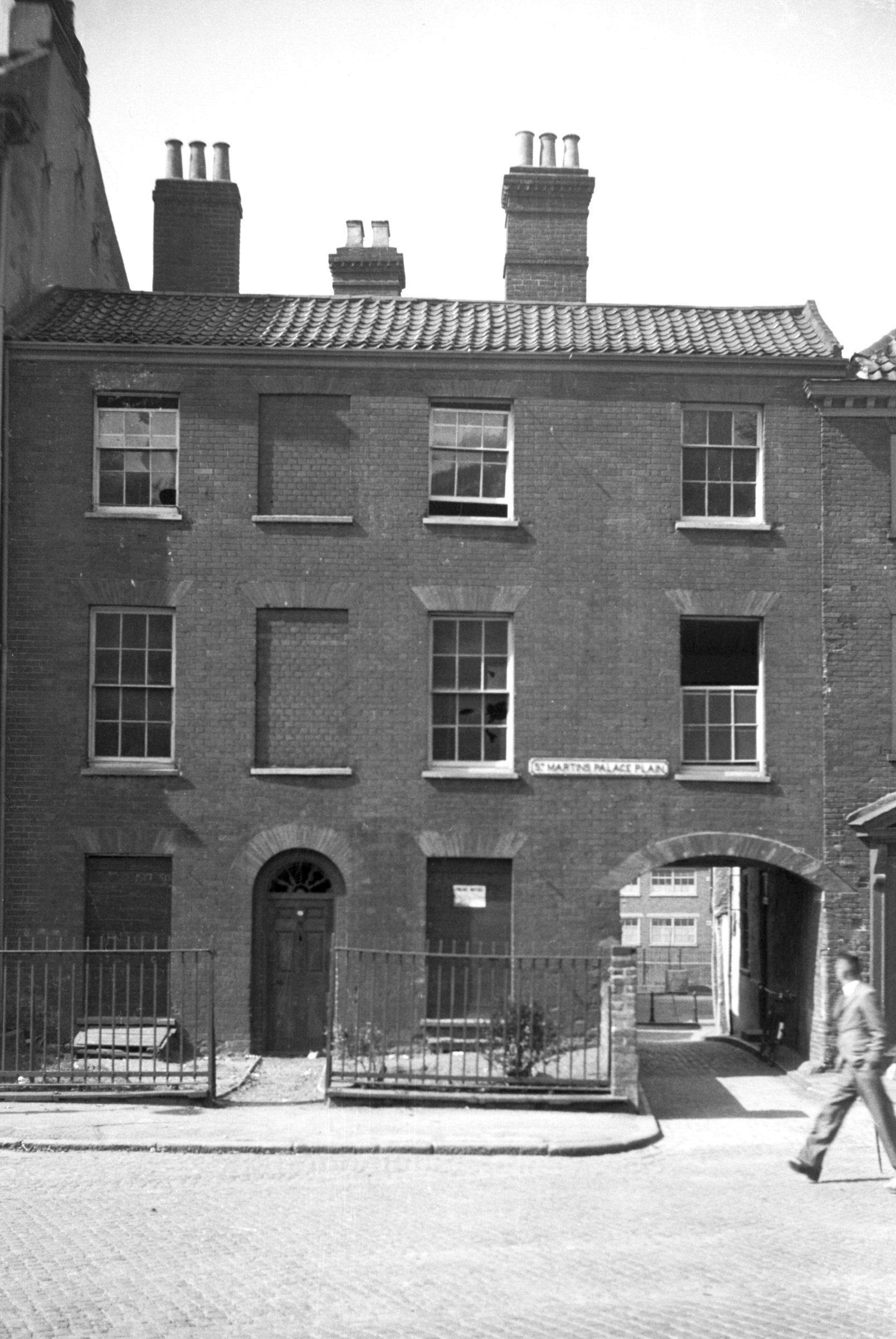
St Martin's Palace Plain: |
| |
From
Palace St to Bishopgate
passing Whitefriars
North side |
|
|
St Martin's Palace Plain 1 [5194] 1968-05-23
|
|
|
St Martin's Palace Plain 1 to 4 [0965] 1936-05-17
39 Palace St on left. |
|
|
St Martin's Palace Plain 1 to 7 [5221] 1968-07-04
|
|
|
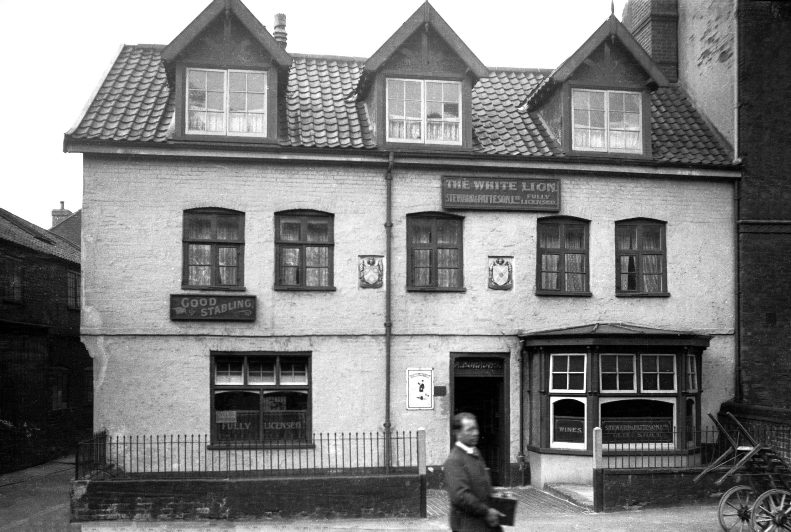
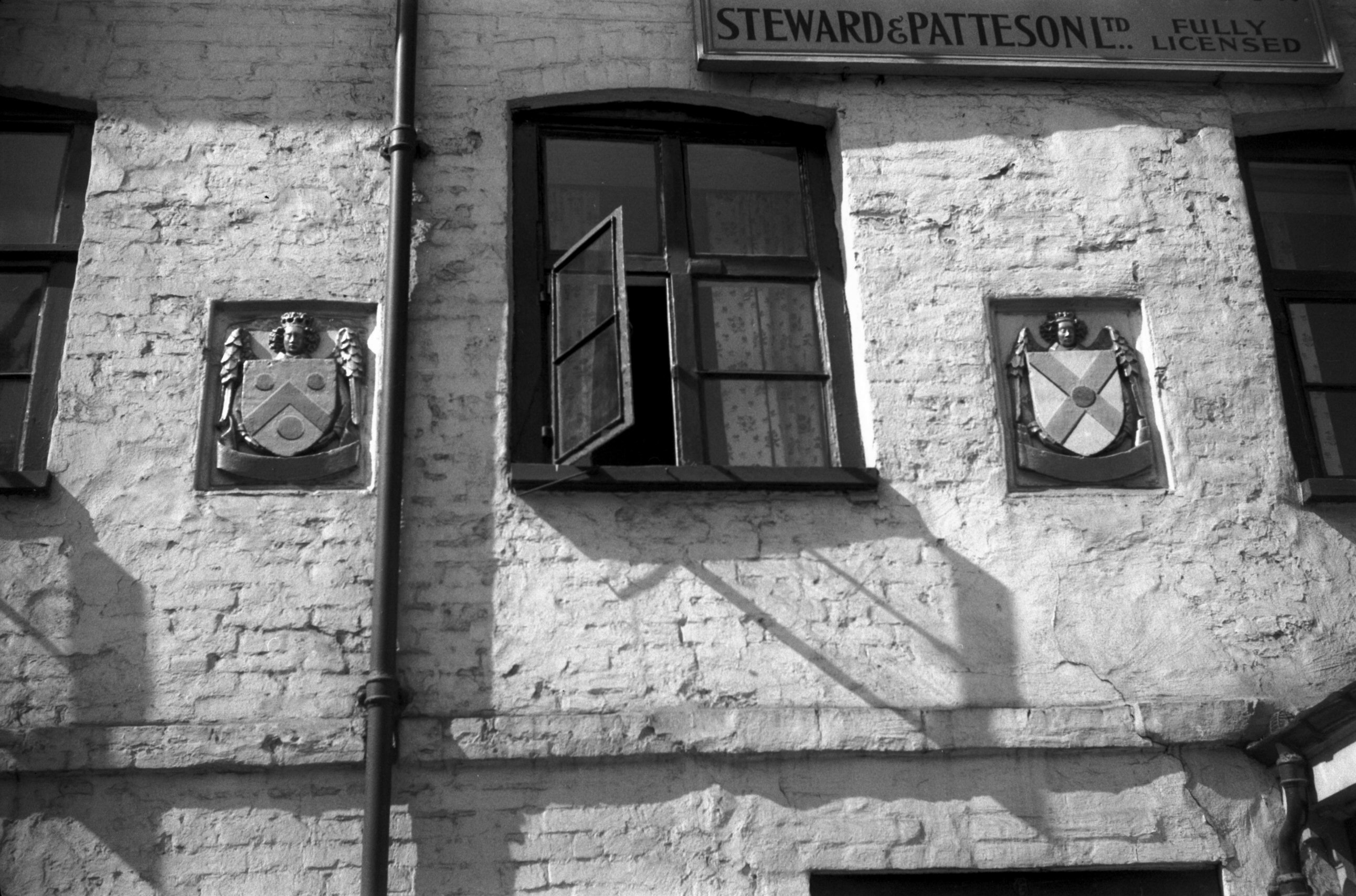
St Martin's Palace Plain 6 White Lion PH [2776]
1938-09-02
The Wig and Pen public house (formerly the White Lion)
presents a little puzzle. On either side of the
first-floor centre window are two shields, illustrated
and described in Muskett's Remnants of Antiquity in
Norwich as follows:
"Two stone carvings of angels, supporting
escutcheons, in front of the White Lion public house, on
St Martin's Palace Plain. The shields are quite plain,
having neither arms nor date; their history cannot
therefore now be traced."
Charles Muskett published his book in 1845, and at some
time after that date the shields were given the arms that
they now bear. I took my photograph in 1955; wondering
whose arms they were and how they came to be put up, I
made inquiries of Steward and Patteson, the brewers who
then owned the house. They were unable to help except to
say that they appeared on a photograph of the house of
about 1890 that they possessed. |
|
|
St Martin's Palace Plain 6 shields of arms [4375]
1955-09-02
Stone carvings angels holding Shields of Arms of Glenham
(left) and Yorke (right). |
|
|
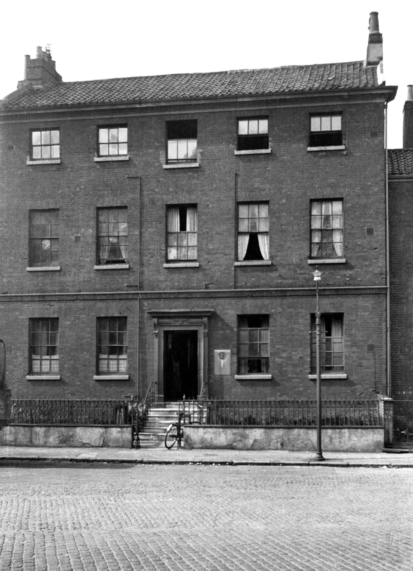
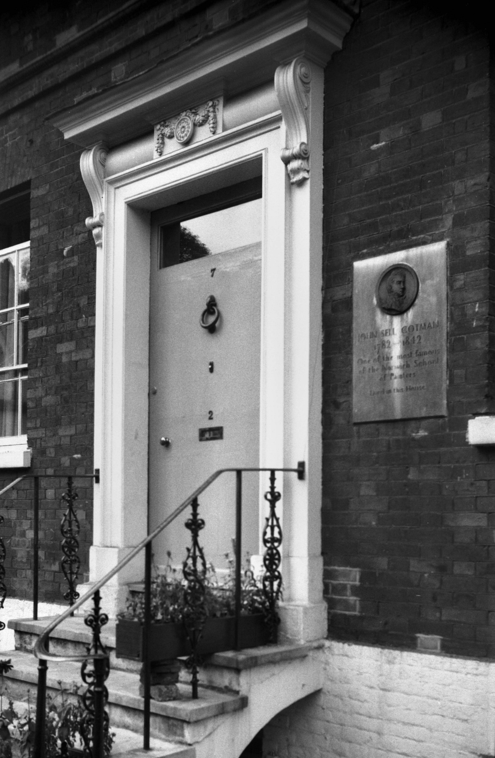
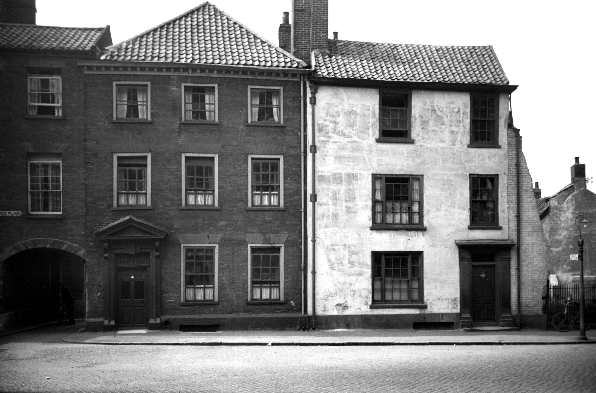
St Martin's Palace Plain 7 Cotman House [2777]
1938-09-02
John Sell Cotman 1782-1842, one of the most famous of the
Norwich School of Painters, lived in this house for some
years. |
|
|
St Martin's Palace Plain 7 Georgian doorway [4374]
1955-09-01
|
|
|
St Martin's Palace Plain 7 to 9 rear [5220]
1968-07-03
From Pye's Yard, Bedding Lane. |
|
|
St Martin's Palace Plain 8 [2778] 1938-09-02
|
|
|
St Martin's Palace Plain 8 to 9 rear [6604]
1990-04-24
From Pye's Yard. |
|
|
St Martin's Palace Plain 9 rear Pye's Yard [1687]
1937-06-05
|
|
|
St Martin's Palace Plain 9 to 10 [0967] 1936-05-17
|
|
|
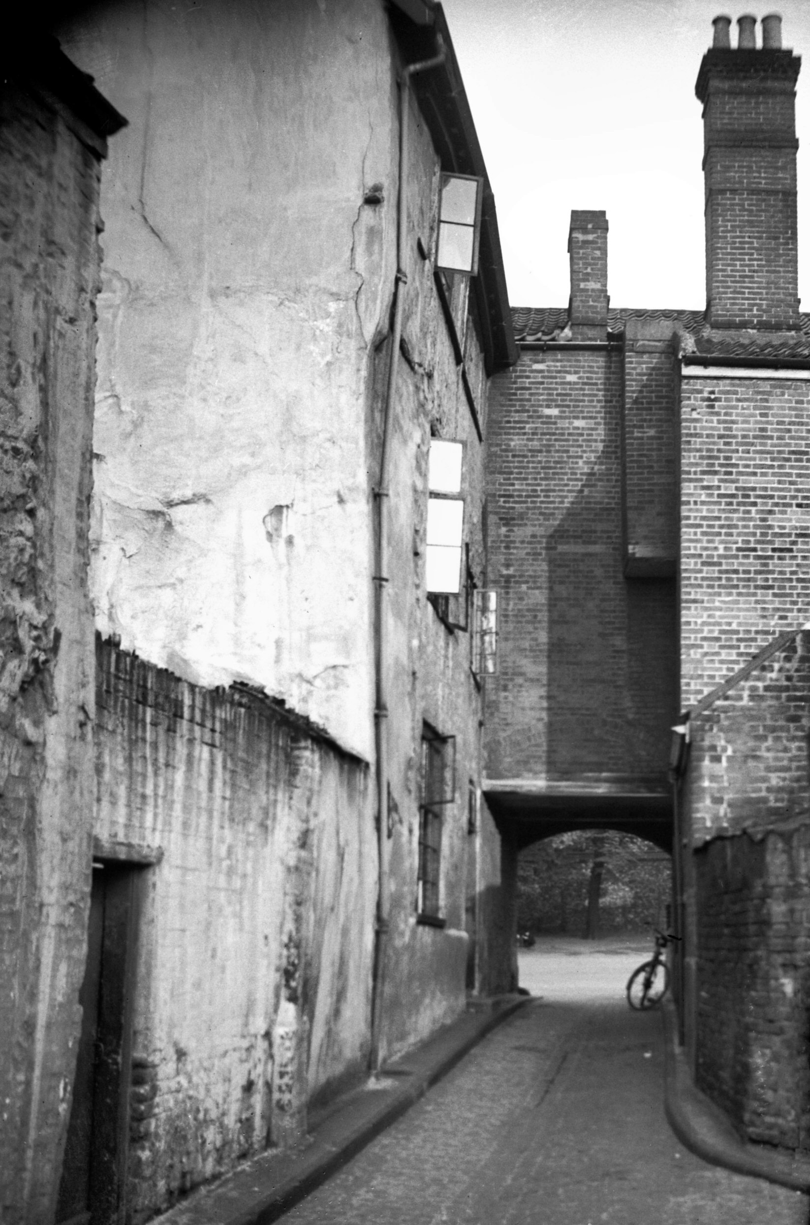
St Martin's Palace Plain Pye's Yard E side [1686]
1937-06-05
View north. |
|
|
St Martin's Palace Plain 10 restoration [3990]
1951-05-12
|
|
|
St Martin's Palace Plain 10 restored [4011]
1951-06-29
Renovated 1951. Timber framework revealed by removal of
plaster facing. |
|
|
St Martin's Palace Plain 10 oriel window [5430]
1975-06-15
In 1962 when 17 and 18 Palace Plain were demolished, the
stone oriel was carefully dismantled and stored, to be
re-erected some eight years later in the gable wall of No
10, but a stone's throw from its original position.
Further light was shed on the history of the site when in
1981 the Norfolk Archaeological Unit carried out
excavations here. Details of the findings were published
in Digging under the Doorstep. It is sufficient to
say here that when the footings of Calthorpe House were
located "the building proved to be but one wing of a
larger, earlier structure built in the late 14c above
substantial flint foundations". Digging yet deeper,
the archaeologists made a completely unexpected discovery
- the lower part of a rectangular Norman house (c1140-70)
situated at right angles to the street and measuring
externally 17 by 9 metres (56 by 30 feet). So important
was this find considered, that arrangements were made for
it to be preserved within a basement under the new
Magistrates' Courts. |
|
|
St Martin's Palace Plain 17 to 18 [0957] 1936-05-12
To the north of St Martin's Church where the Magistrates'
Courts now stand, were Beehive Yard and the Beehive
public house - an interesting little group of buildings.
No 17 was a three-storeyed Georgian mansion with an
unusual gabled roof line, while Nos 18 and 18a (once the
Beehive tavern) were of mixed origin. The portion facing
the church was of the 18c, two storeyed, its walls a
mixture of flint and brick, at one time rendered over
with cement; sash windows, three above and two below,
with a modest central doorway, and pantiled roof. In the
yard to the east, however, was quite a different picture.
Here was a large Tudor oriel of stone extending through
two storeys - once part of a mediaeval house. Writing of
this in the Local Miscellany column of the Eastern
Evening News in 1938, "S.E.G." (Colonel S.
E. Glendenning) stated:
"the big mullioned window is evidently the oriel of
a "Great Hall", and it is probable that the
structure of the hall is incorporated in the present
house, much of which is ancient. The late Mr W.R.Rudd,
who was careful about his facts, used to refer to this as
the city house of the well-known Calthorpe family, who,
according to Blomefield, held property here in 1492
onwards. Jane, the wife of "Sir Phylyppe", a
virtuous lady, who "Gave to the Poore and prayd for
the Rytche", was buried in the church in 1550." |
|
|
St Martin's Palace Plain Beehive Yard oriel [0995]
1936-06-09
|
|
|
St Martin's Palace Plain Beehive Yard oriel [3370]
1940-04-21
|
|
|
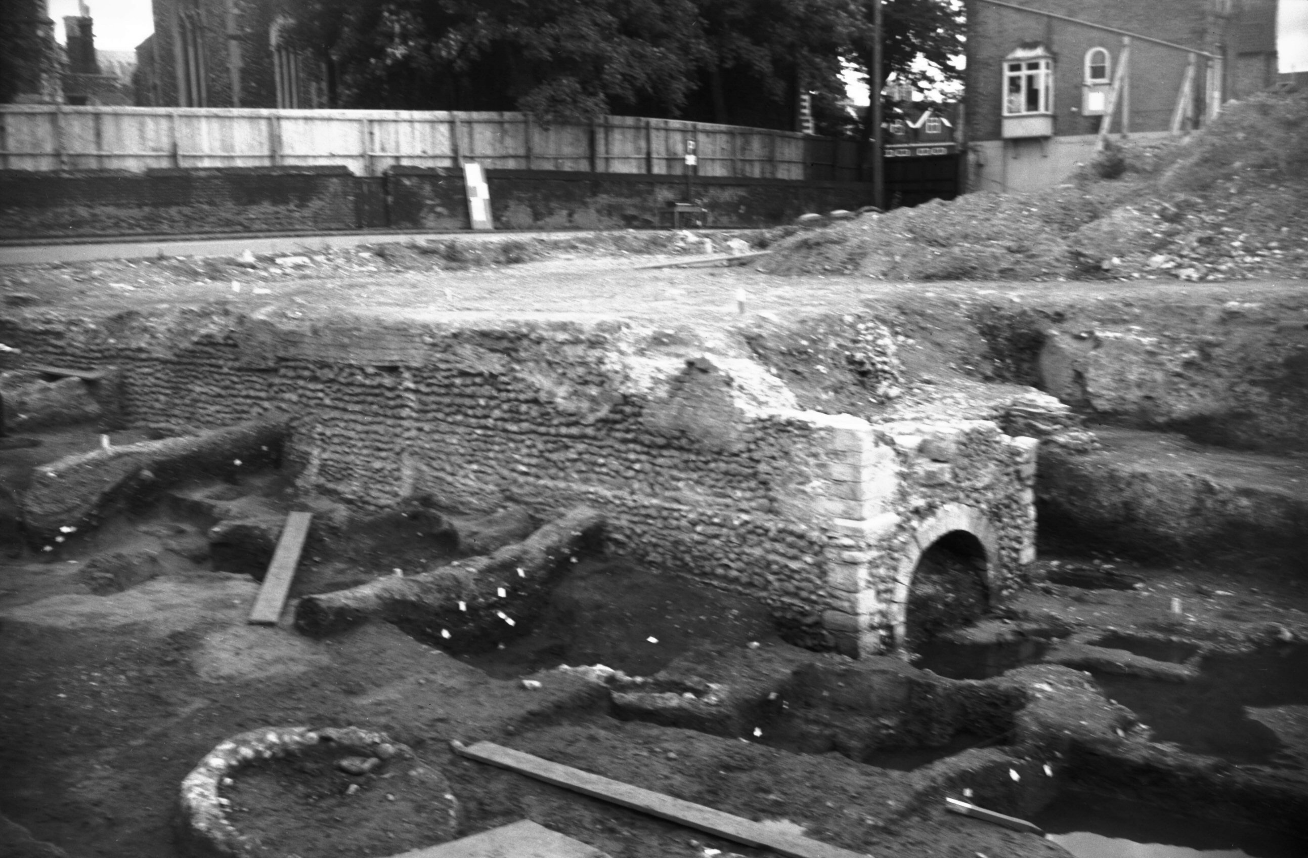
St Martin's Palace Plain 17 excavations [6208]
1981-07-18
In 1981 a dig brought to light a wall of coursed flint
rubble 55 feet long going west from limestone quoins .It
appears to have formed part of a Norman stone building
with its gable end to the river. The arched opening was
at the base of a cesspit turret. |
|
|
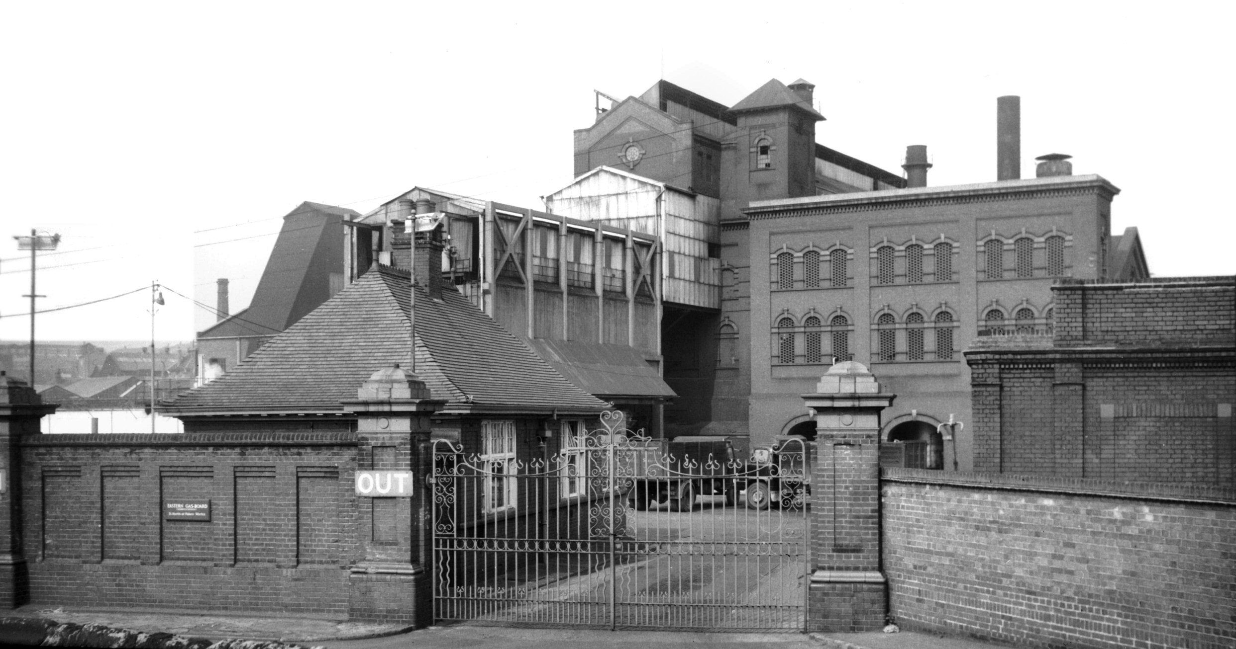
St Martin's Palace Plain view of Gas Works [4904]
1965-05-01
19c. |
|
|
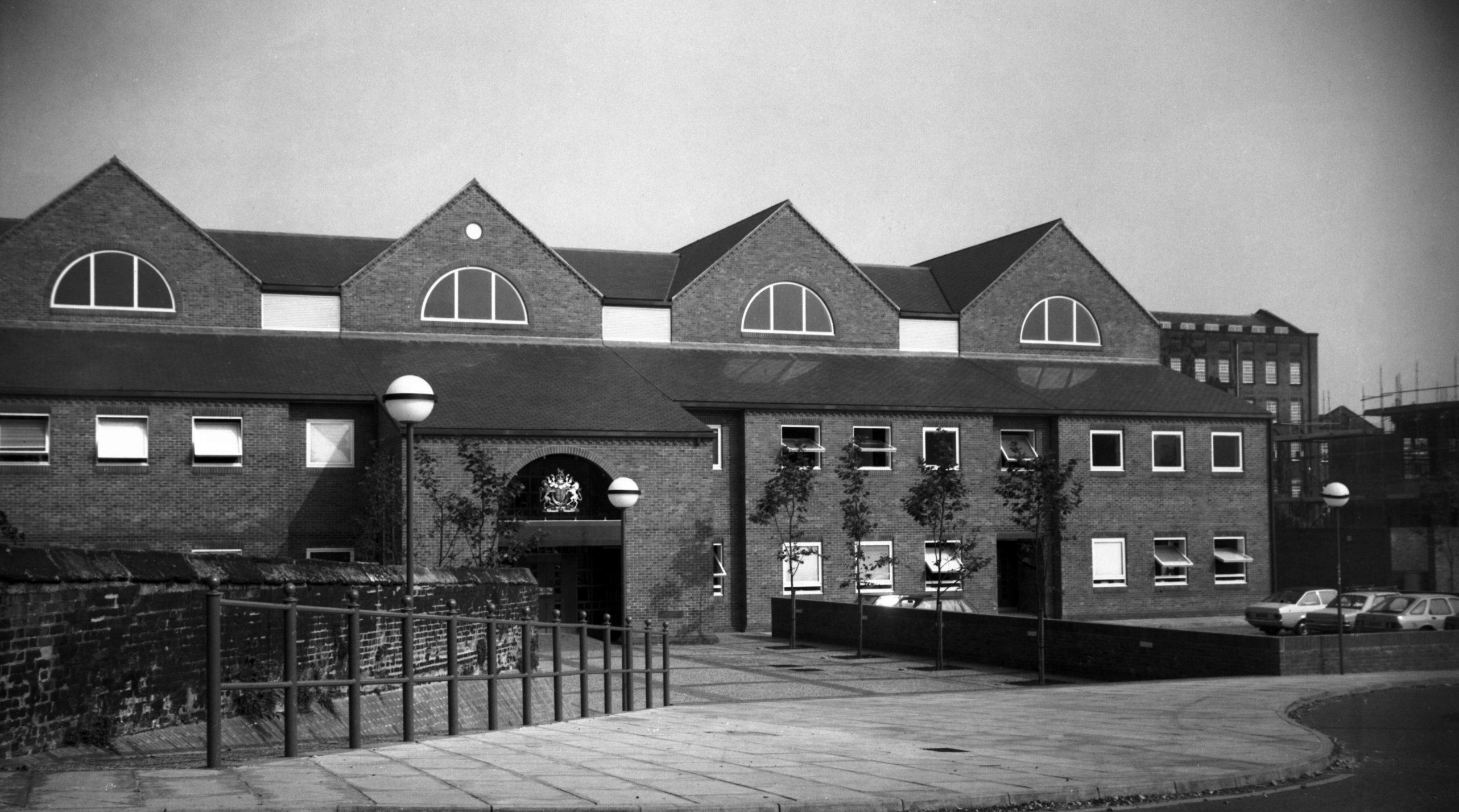
St Martin's Palace Plain Magistrates' Court [6417]
1986-07-16
Erected 1985. Designed by Frank Tucker, County Architect. |
|
|
St Martin's Palace Plain 23 Cupid Bow PH [2102]
1938-03-03
Former Cupid and Bow Inn. |
|
|
St Martin's Palace Plain east side vicarage [0956]
1936-05-12
|
|
|
St Martin at Palace south side [0021] 1934-01-21
The neighbouring church of St Martin-at-Palace was
another victim of redundancy, and after some interior
reorganisation was officially opened as the Norfolk
Probation Centre on 16th February 1990. Mentioned in the
Domesday Survey of 1086, St Martin's retains some
long-and-short work in the eastern angles of the chancel
that probably dates from that time. Apart from this, the
church was largely rebuilt in the 15c, the work
supposedly being completed by Walter Lyhart, Bishop of
Norwich from 1446 to 1472. Dr J.C.Cox, writing in 1911,
mentioned that Lyhart's rebus appeared on the south
doorway, but it does so no longer.
The church now consists of a square western tower, a nave
with north and south aisles, a south porch with room
above, and a chancel. The upper part of the tower fell in
1783, and all but one of the five bells were sold to pay
for the repairs. Sillett's view of the church in 1828
shows it much as it is today, except that the tower was
then somewhat lower; it was raised to its present height
in 1874. |
|
|
St Martin at Palace east end [4066] 1952-03-20
|
|
|
St Martin at Palace east end [6634] 1990-08-22
Saxon "long and short" work in the angles of
the Chancel. |
|
|
St Martin at Palace east end [6700] 1991-07-07
|
|
|
St Martin at Palace from NW [B140] 1931-00-00
|
|
|
St Martin at Palace south porch [6701] 1991-07-07
|
|
|
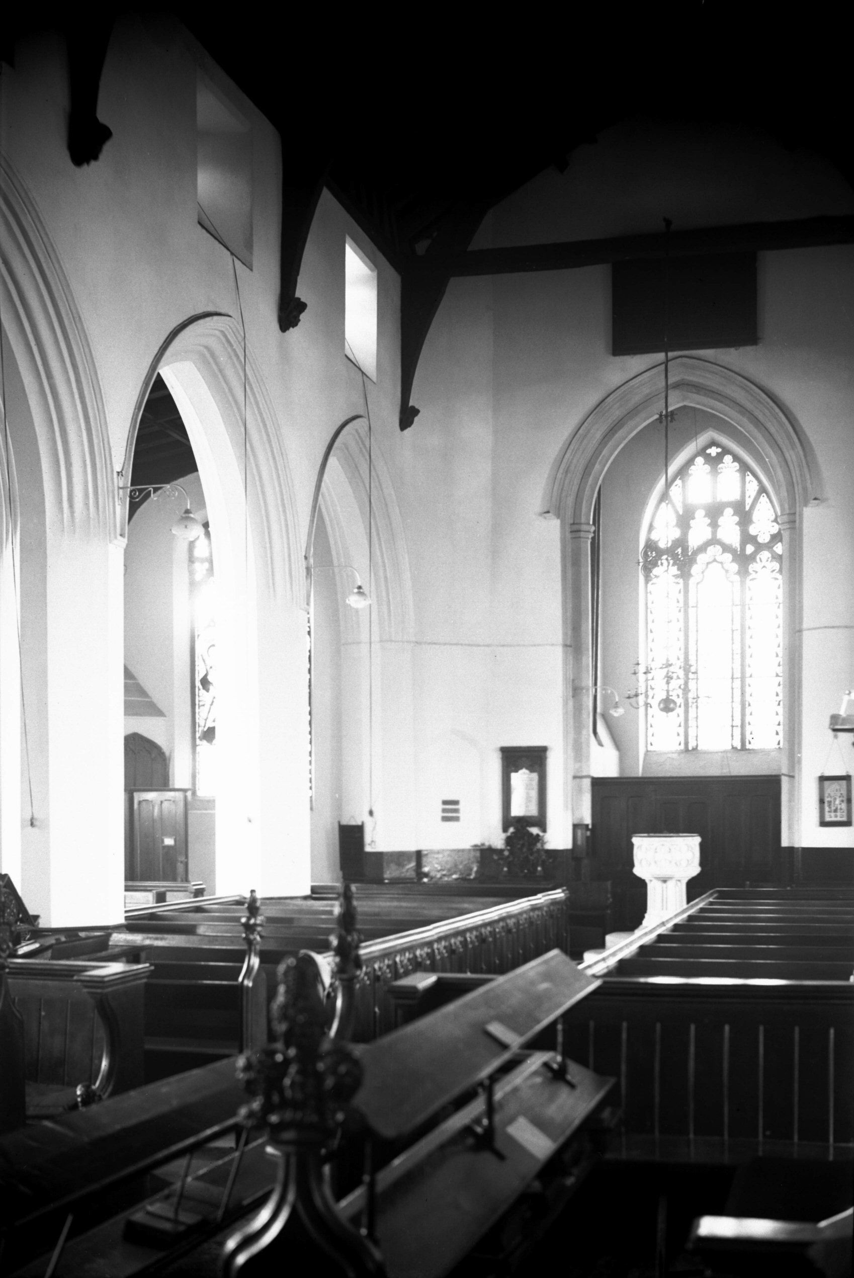
St Martin at Palace interior view east [2199]
1938-03-26
|
|
|
St Martin at Palace east window [2203] 1938-03-26
|
|
|
St Martin at Palace interior view west [2202]
1938-03-26
During the Second World War the building sustained some
damage, chiefly to its stained glass. This was later
repaired, and some of the old figures went into the new
windows. On 3rd July 1952, Bishop Herbert officiated at a
service of dedication to mark the completion of the
restoration and the installation of some new furnishings.
By 1973, the parish having been united with that of
neighbouring St James's, services were no longer being
held here and the organ was transferred to the church of
St Mary and St Andrew at Horsham St Faith. This was
probably the same organ that was purchased in 1863 for
£90 and renovated and enlarged in 1887. The single bell
was at a later date sent to St Mary's church,
Happisburgh, who in 1985 had it recast into a treble.
The interior of the church, well kept when I took
photographs here in 1938, had a number of features of
interest to the visitor. |
|
|
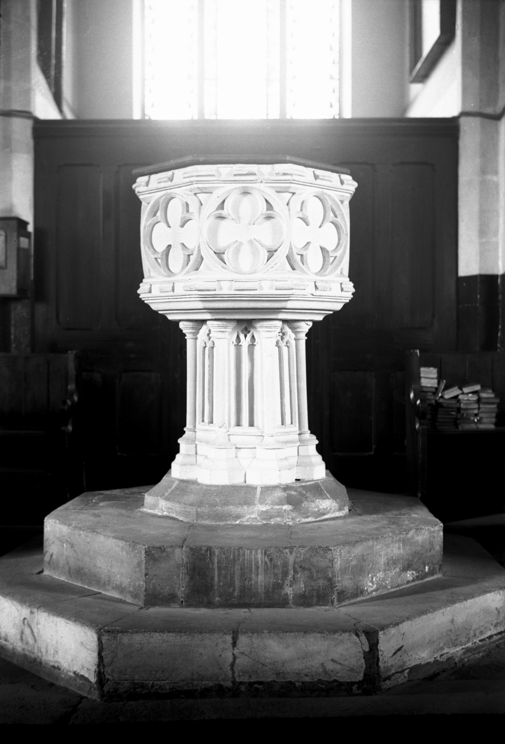
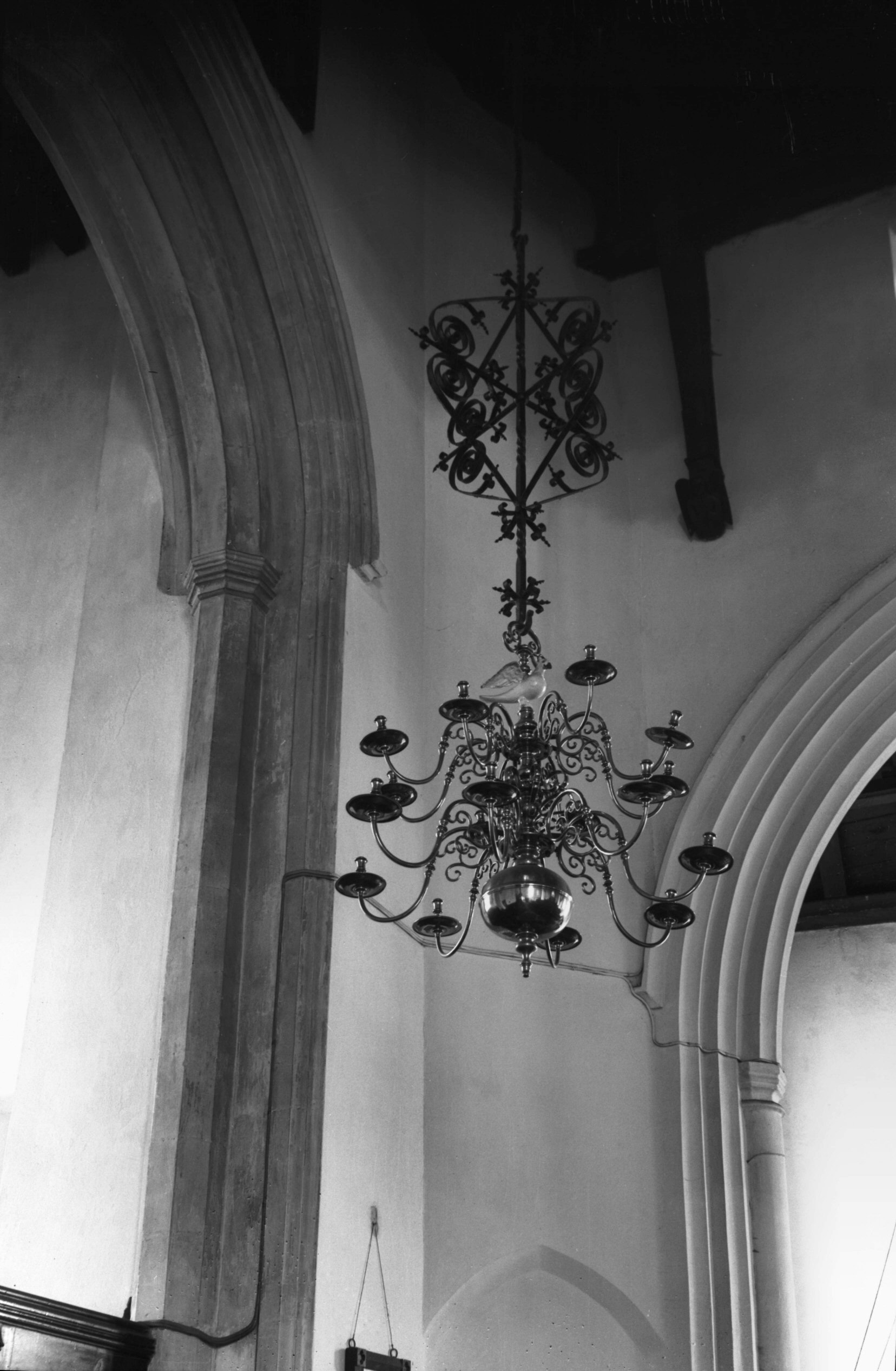
St Martin at Palace early 15c font [2200] 1938-03-26
The early 15c font at the west and of the nave had an
octagonal bowl with traceried panels and a stem supported
by eight engaged shafts. Above it hung a splendid 17c
spider candelabrum of brass. |
|
|
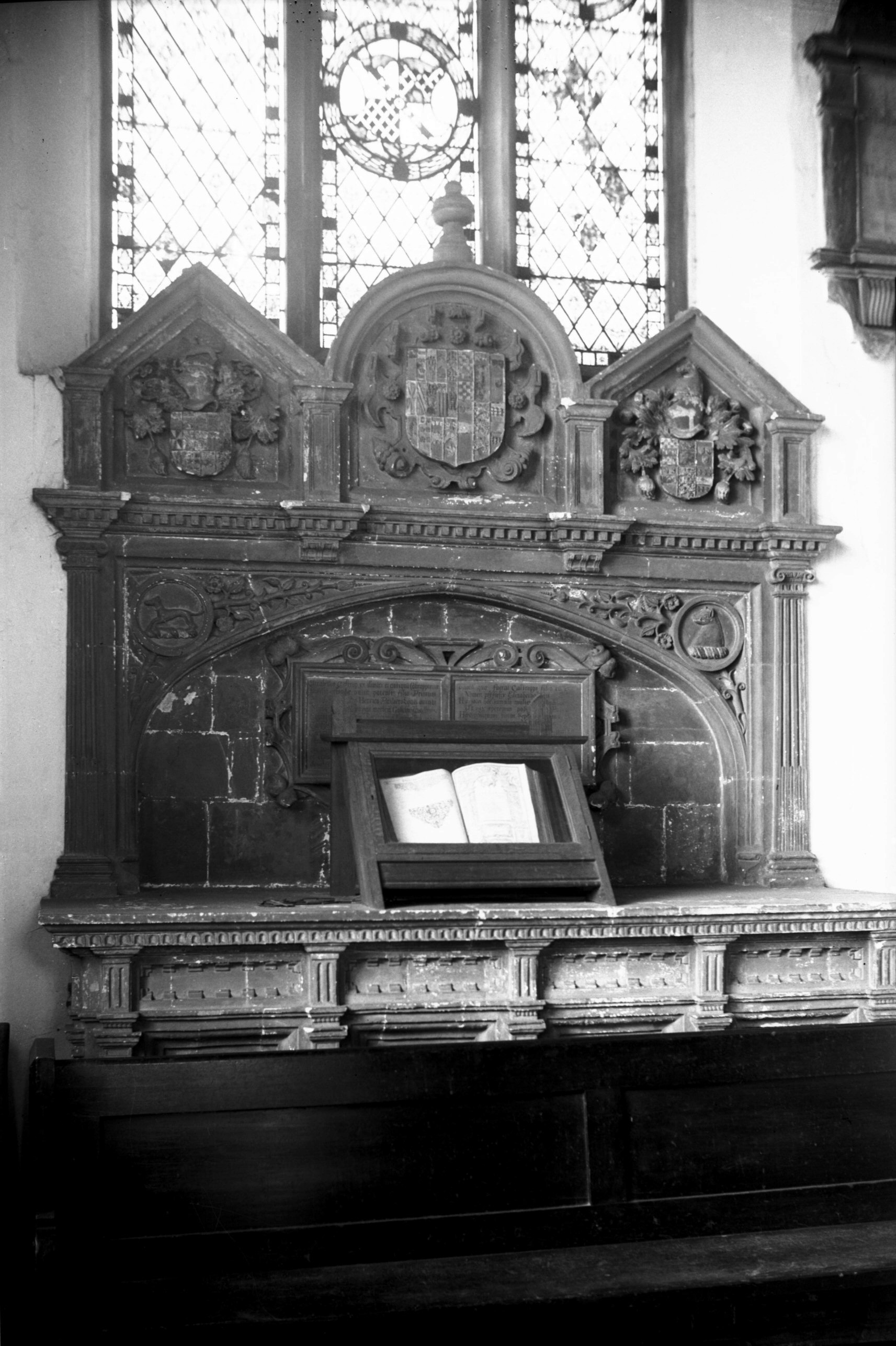
St Martin at Palace Calthorpe tomb [2201] 1938-03-26
At the east end of the north aisle was, and still is, the
altar tomb of Elizabeth Calthorpe with its several
coats-of-arms showing her connection with many leading
Norfolk families, including that of Anne Boleyn. In a
glass case on its altar top was a great rarity, a chained
book. |
|
|
St Martin at Palace candelabrum over font [2204]
1938-03-26
On leaving the church we may spare a thought for the men
buried here who were killed during the skirmishes of
Kett's rebellion in 1549. Among them was Lord Sheffield,
four of whose knights were buried in the chancel of the
neighbouring church of SS Simon and Jude. A tablet on the
opposite side of the road was positioned to mark the spot
where Lord Sheffield fell. |
|
St Martin's Rd: |
| |
From
Bakers Rd / Oak
St to Aylsham Rd
passing Drayton Rd
West side |
|
|
St Martin's Rd 58 to 62 [0945] 1936-05-12
|
|
|
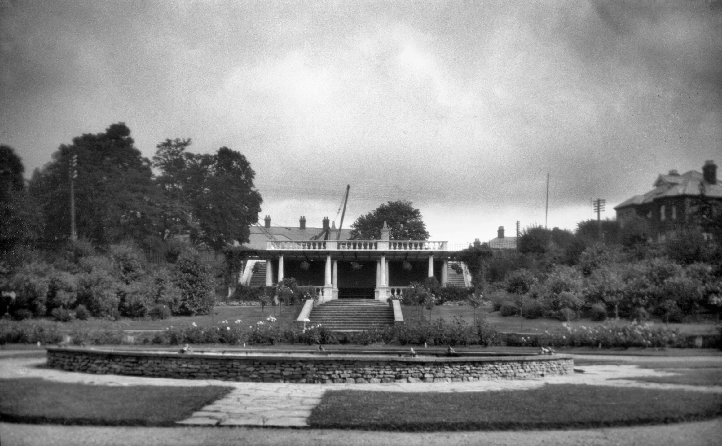
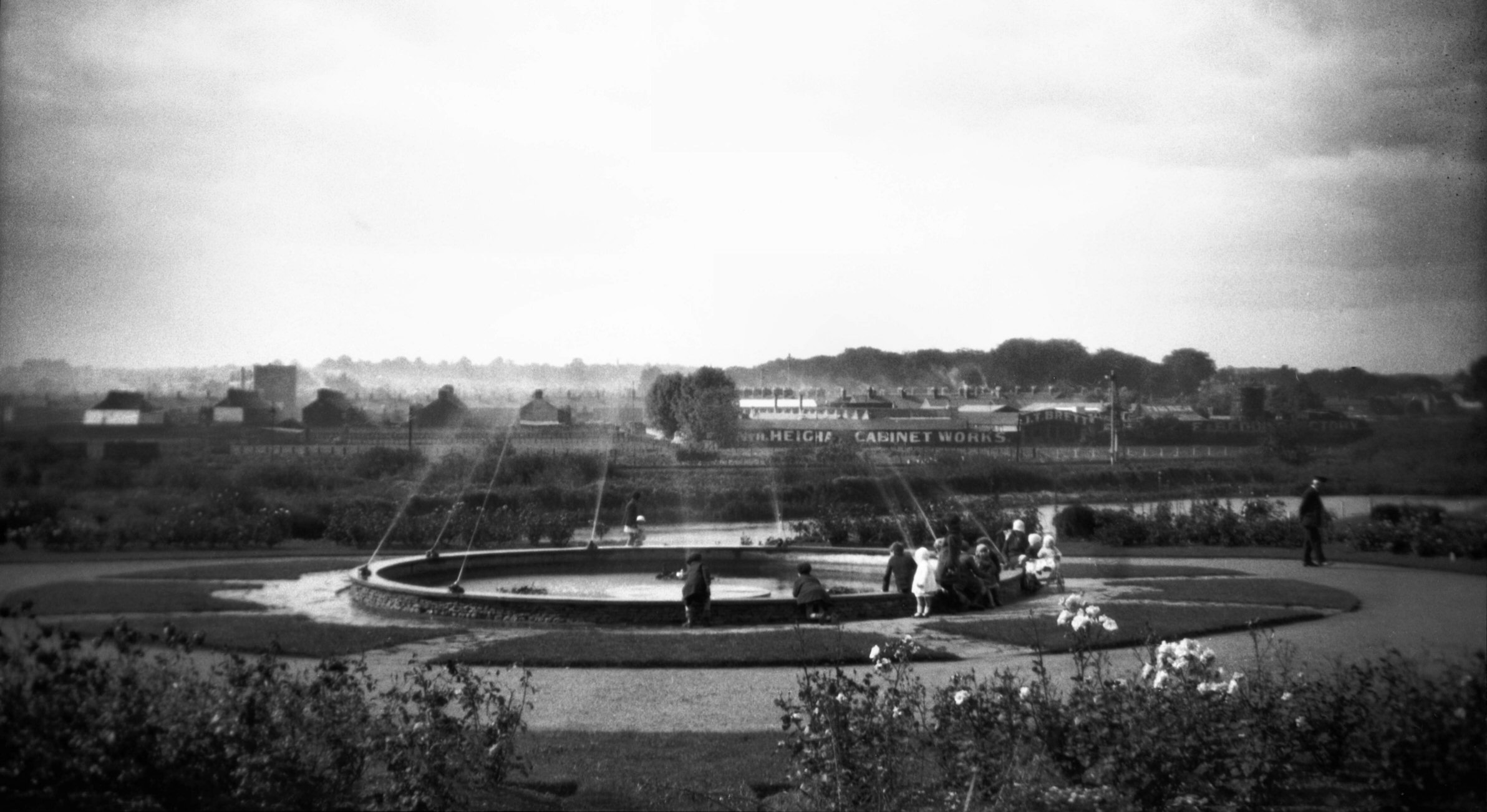
Wensum Park fountain and shelter [B155] 1931-00-00
Originally a refuse tip, then laid out with formal
gardens and opened 9th September 1925. |
|
|
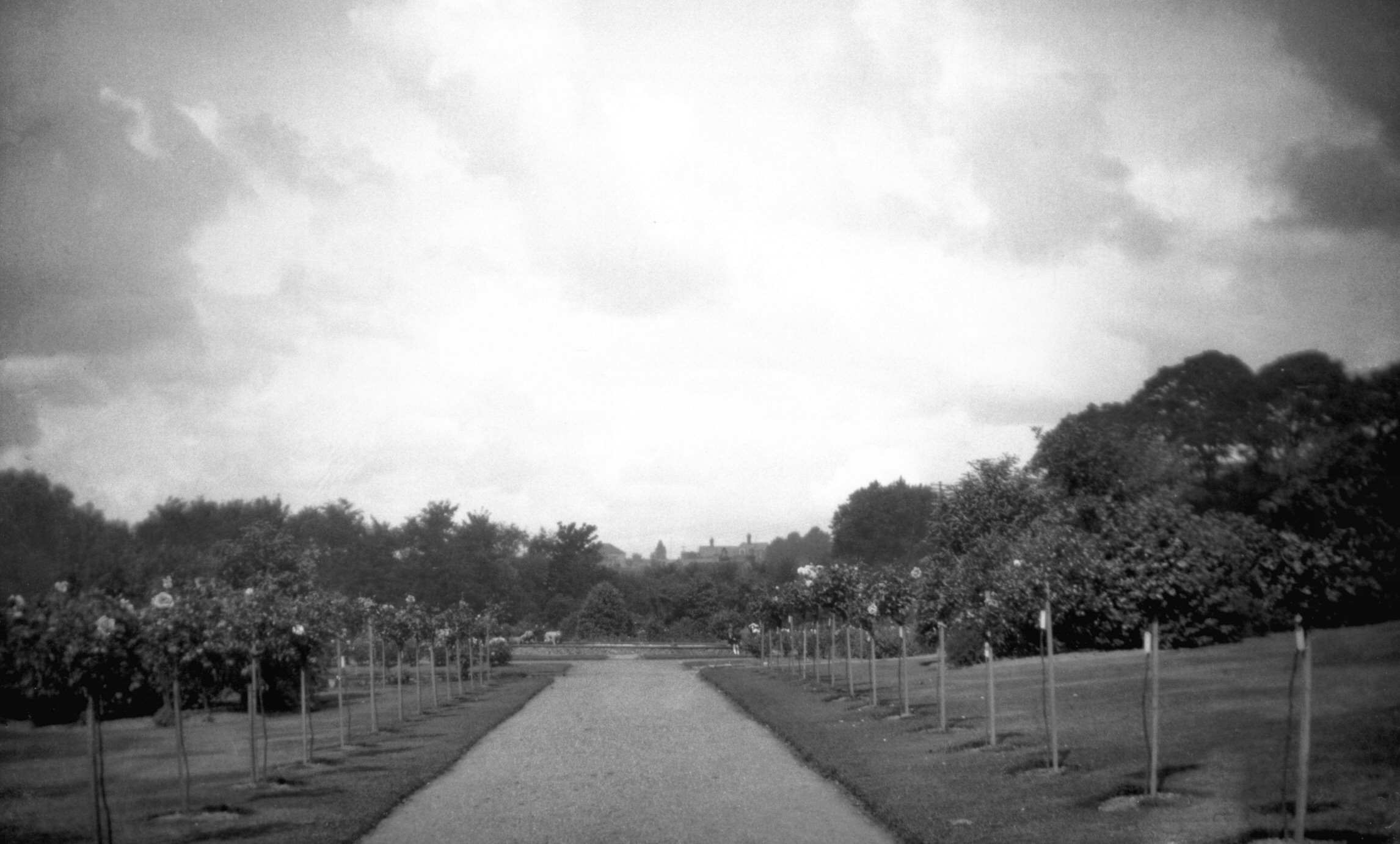
Wensum Park pathway and roses [B156] 1931-00-00
|
|
|
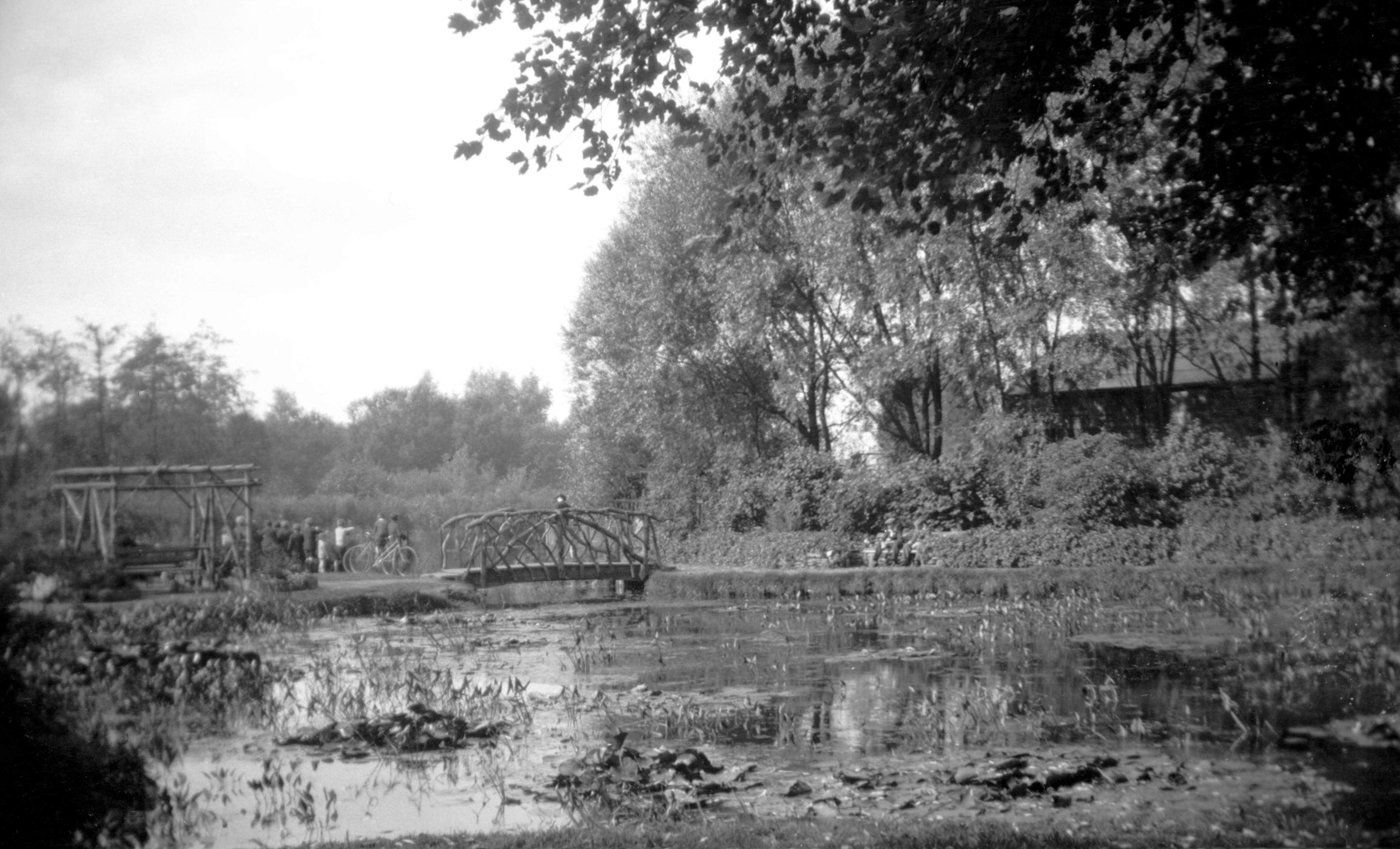
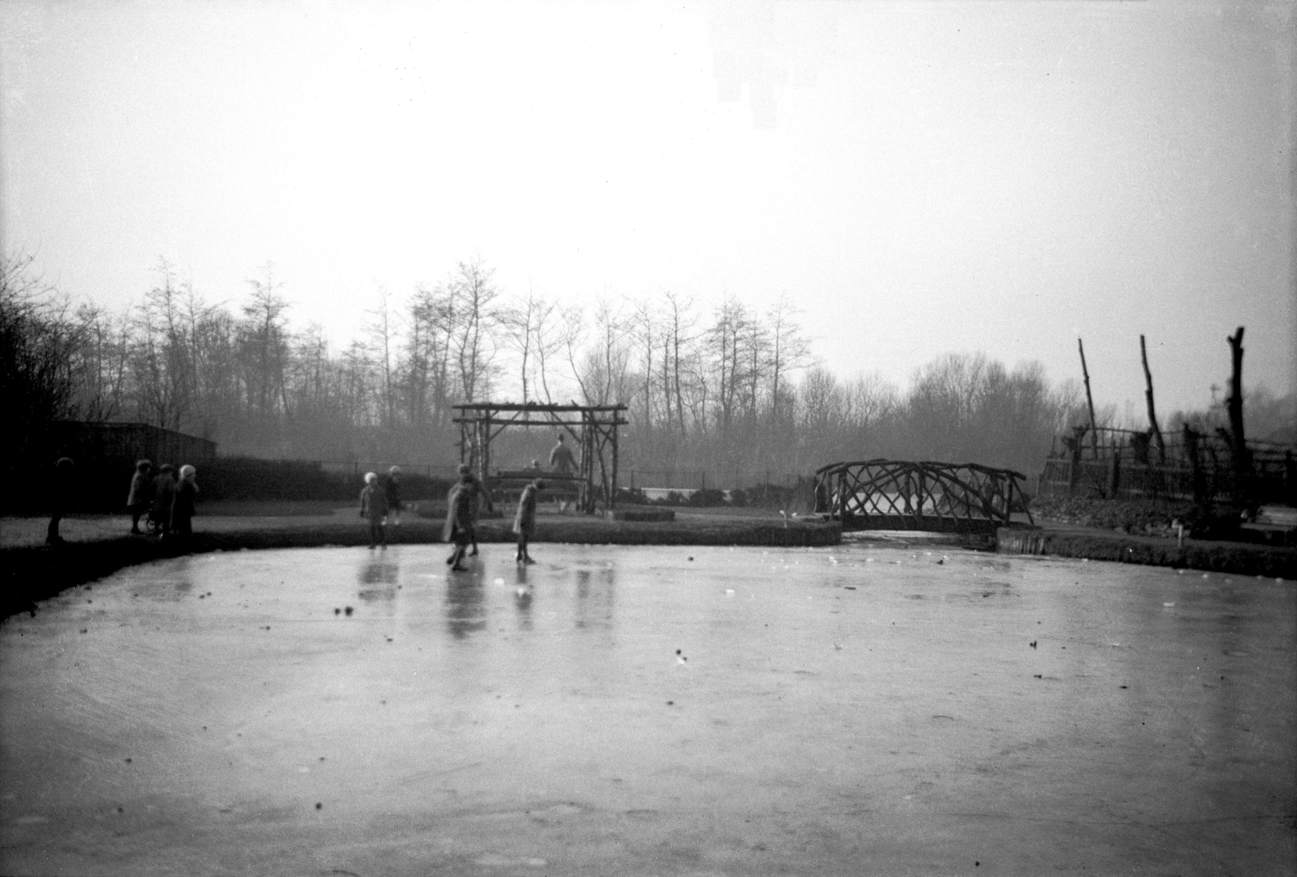
Wensum Park lily pond with rustic bridge [B163]
1931-00-00
|
|
|
Wensum Park fountain view towards N Heigham [B164]
1931-00-00
|
|
|
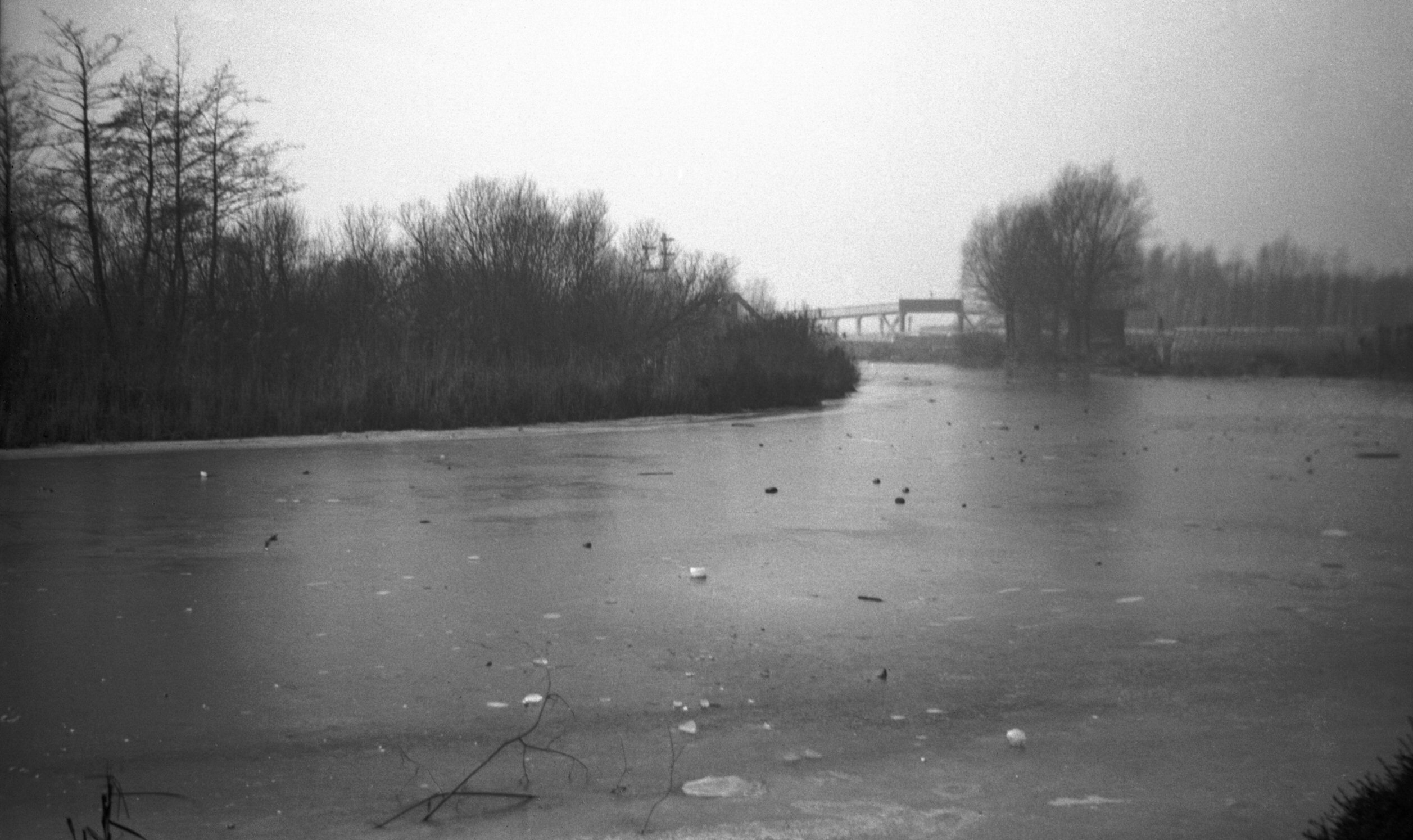
Wensum Park frozen lily pond [B471] 1933-01-29
|
|
|
Wensum frozen over at Wensum Park [B472] 1933-01-29
|
|
St Mary's Plain: |
| |
From
Pitt St / Muspole
St / Duke St to Oak St
passing Rosemary Lane
South side |
|
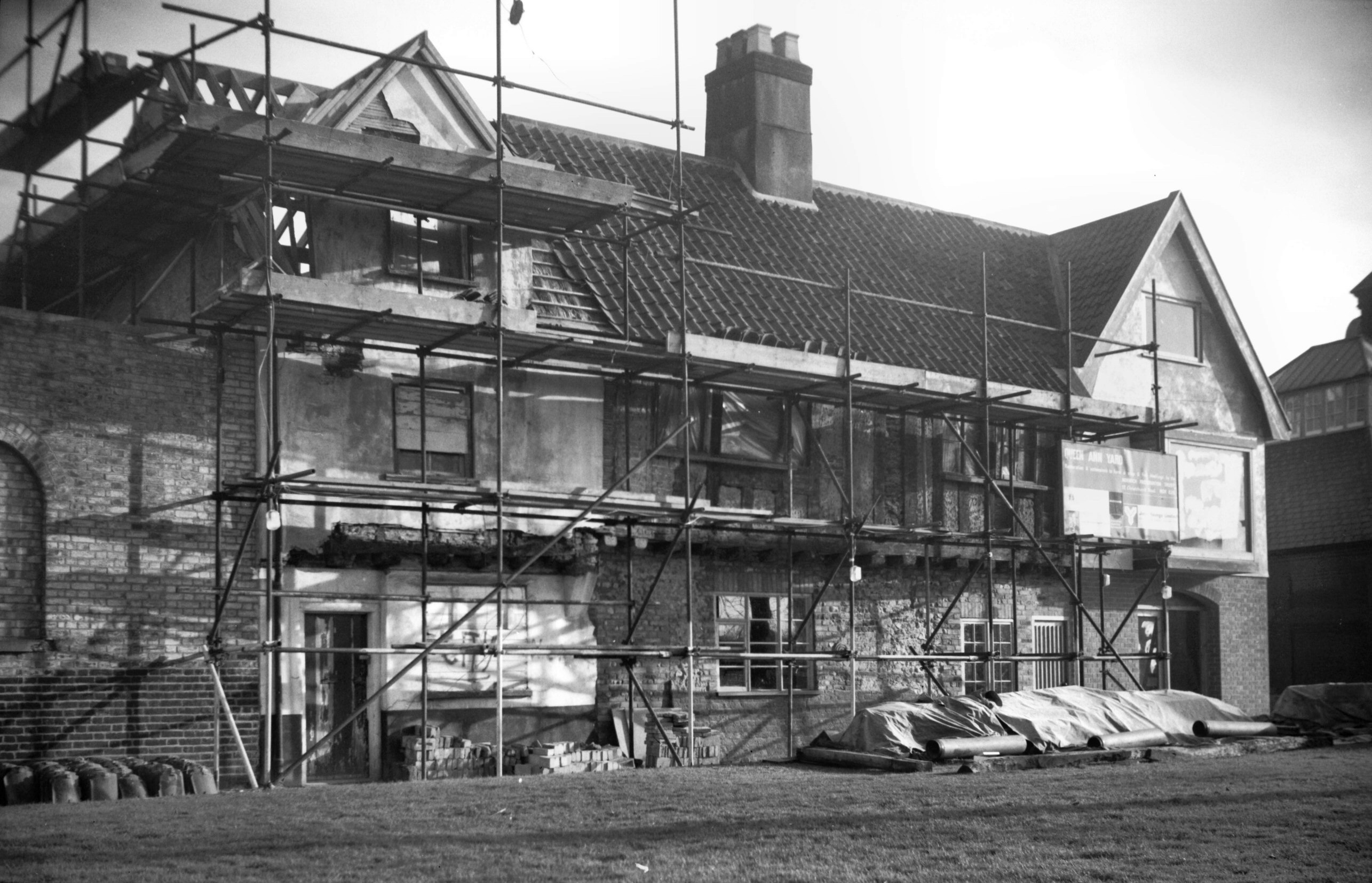
|
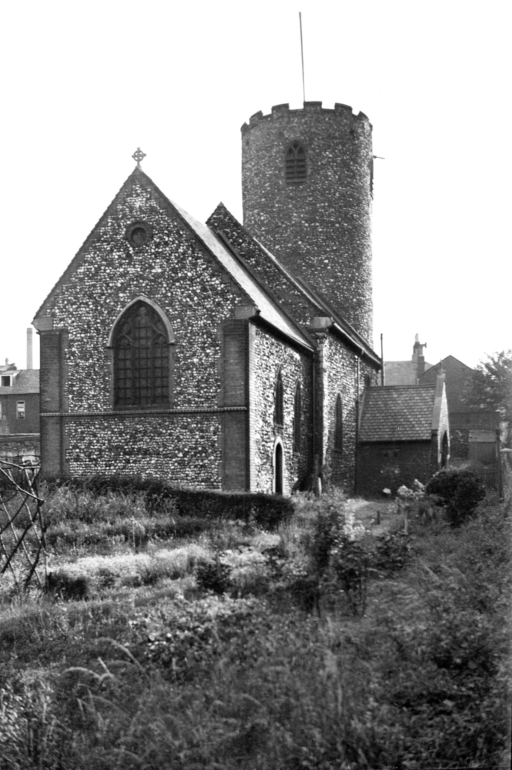
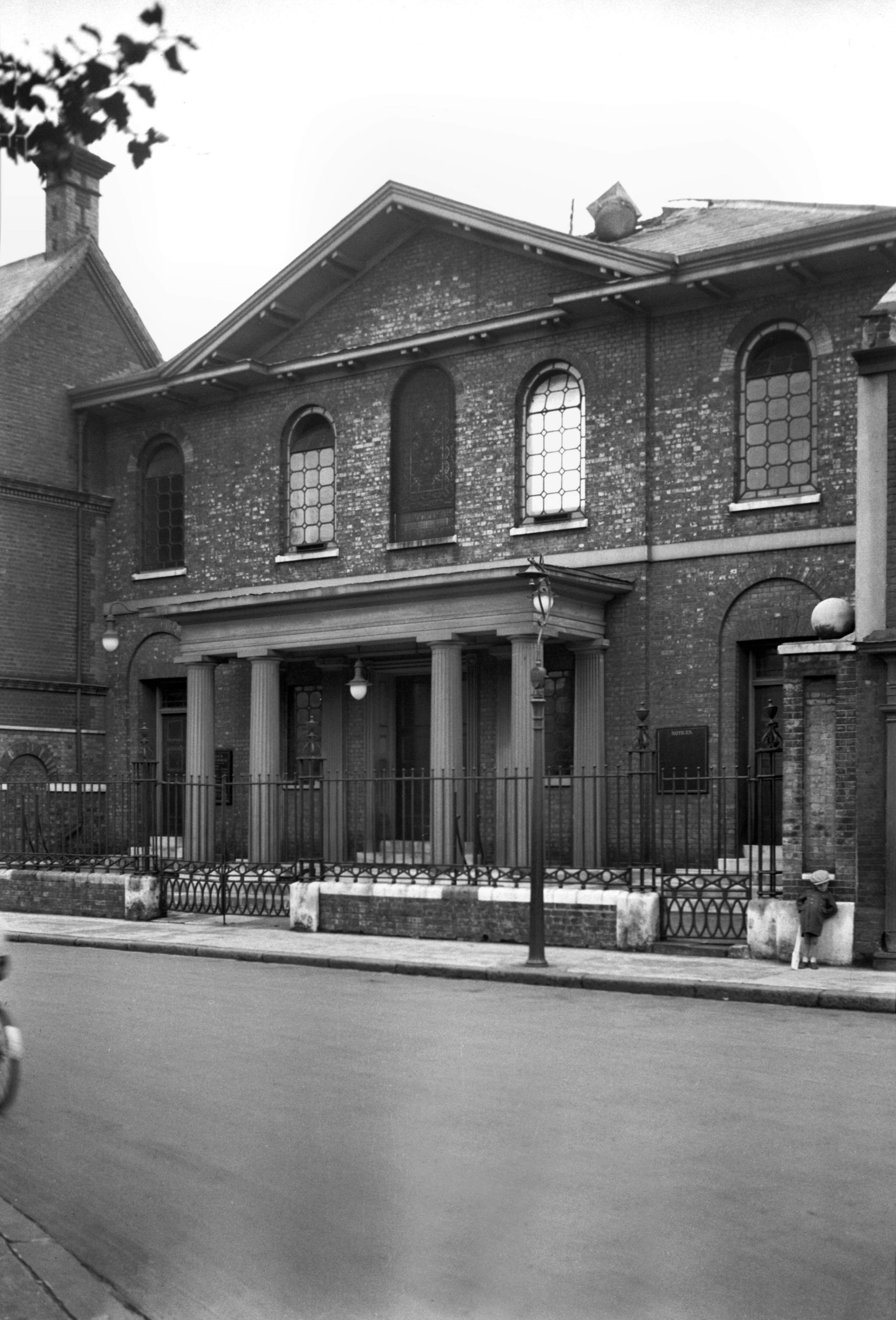
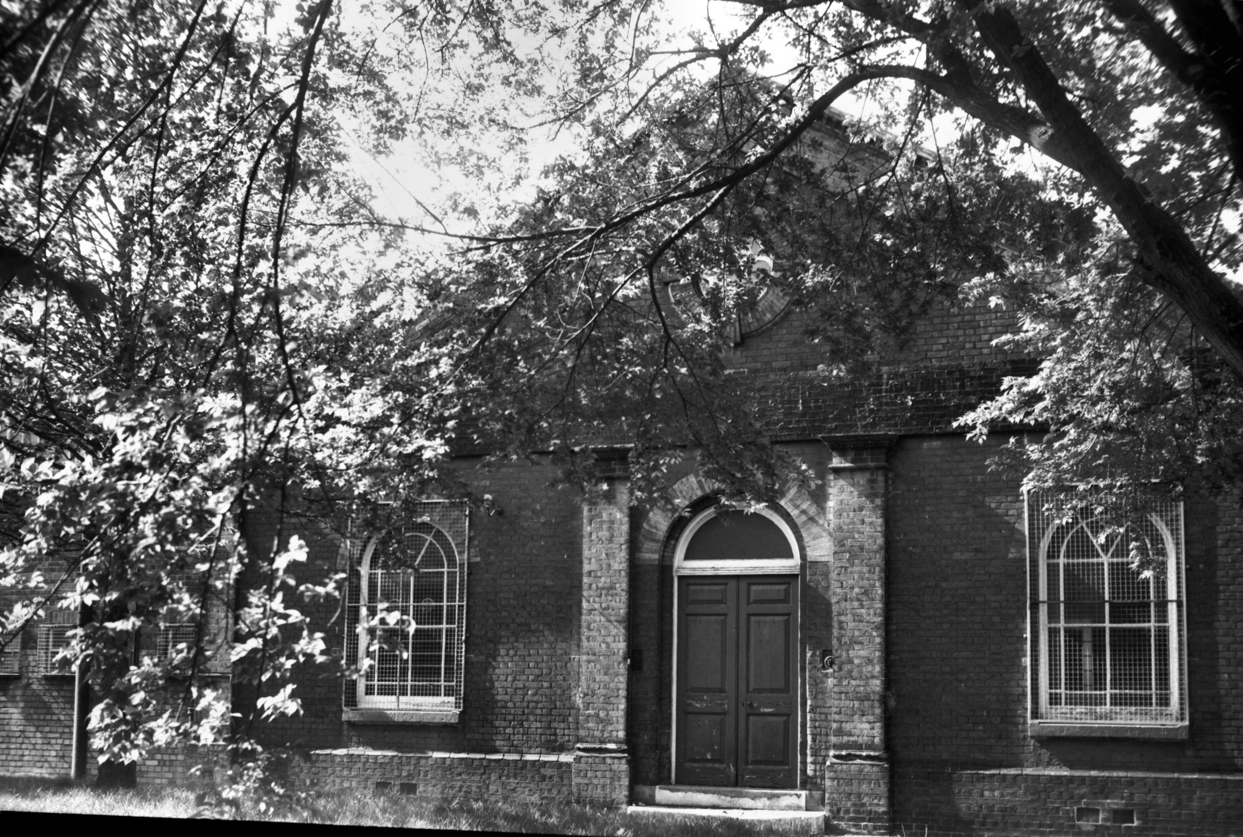
St Mary's Plain St Mary's Baptist chapel [3261]
1939-09-12
St Mary's Plain with its ancient round-towered church and
grassy churchyard provides a welcome oasis in this
semi-industrial, semi-residential area. Although both
church and adjacent Pykerell's house suffered damage
during the war, both have since been well restored.
Less fortunate was St Mary's Baptist church on the south
side of the plain, whose history is an interesting one.
It was during the 17c that the Baptist movement first
came into being, at a time when the Free Churches could
neither own property nor indeed have any legal existence,
meetings having to be held in private houses under the
cloak of secrecy. With the passing of the Toleration Act
of 1689, however, premises were hired for the purpose
until 1744, when the community of 50 poor men and women
purchased the present site in St Mary's parish, a brick
and flint meeting house adapted from existing buildings
being opened there for worship in the following year. In
1812 under Joseph Kinghorn's pastorship a new chapel took
its place, this chapel being enlarged in 1839 under
William Brock and again in 1886. Other notable 19c
ministers included George Gould and J.H.Shakespeare,
neither of whom could have witnessed such troubled scenes
in the building's history as occurred during the ministry
of the Reverend Gilbert Laws.
About one hour after the close of the morning service on
Sunday, 10th September 1939, a fire spread from the organ
gallery by way of the choir pews to the fine vaulted
ceiled roof. This very soon crashed down, damaging the
pulpit (one of the treasures of the church) and many of
the pews. Sufficient of the building remained, however,
to enable it to be reconstructed to its original design,
Stanley Wearing being appointed architect for the work.
Such furniture as had to be replaced was also made to
harmonise with the older work, pitchpine being used to
match the old materials. The reopening of the church took
place on Sunday, 22nd September 1940, a new organ being
dedicated on 22nd February 1941.
The life of the rebuilt chapel was a very brief one, for
during the early morning of 27th June 1942, it shared the
fate of many other well-known city buildings and was
totally gutted by fire. The adjoining schoolrooms were
also destroyed. After this event arrangements were made
for Sunday services to be held in the Stuart Hall,
arrangements which continued until 1950 when services
were transferred to the newly built school hall in Duke
St. On 5th July 1951, the Reverend Gilbert Laws laid the
foundation stone of the new church (Stanley Wearing was
again the architect) and the opening service was held one
year later on Saturday, 27th September 1952. |
|
|
St Mary's Plain St Mary's Baptist chapel [6467]
1987-05-28
Rebuilt 1951-52, architect Stanley J.Wearing. |
|
|
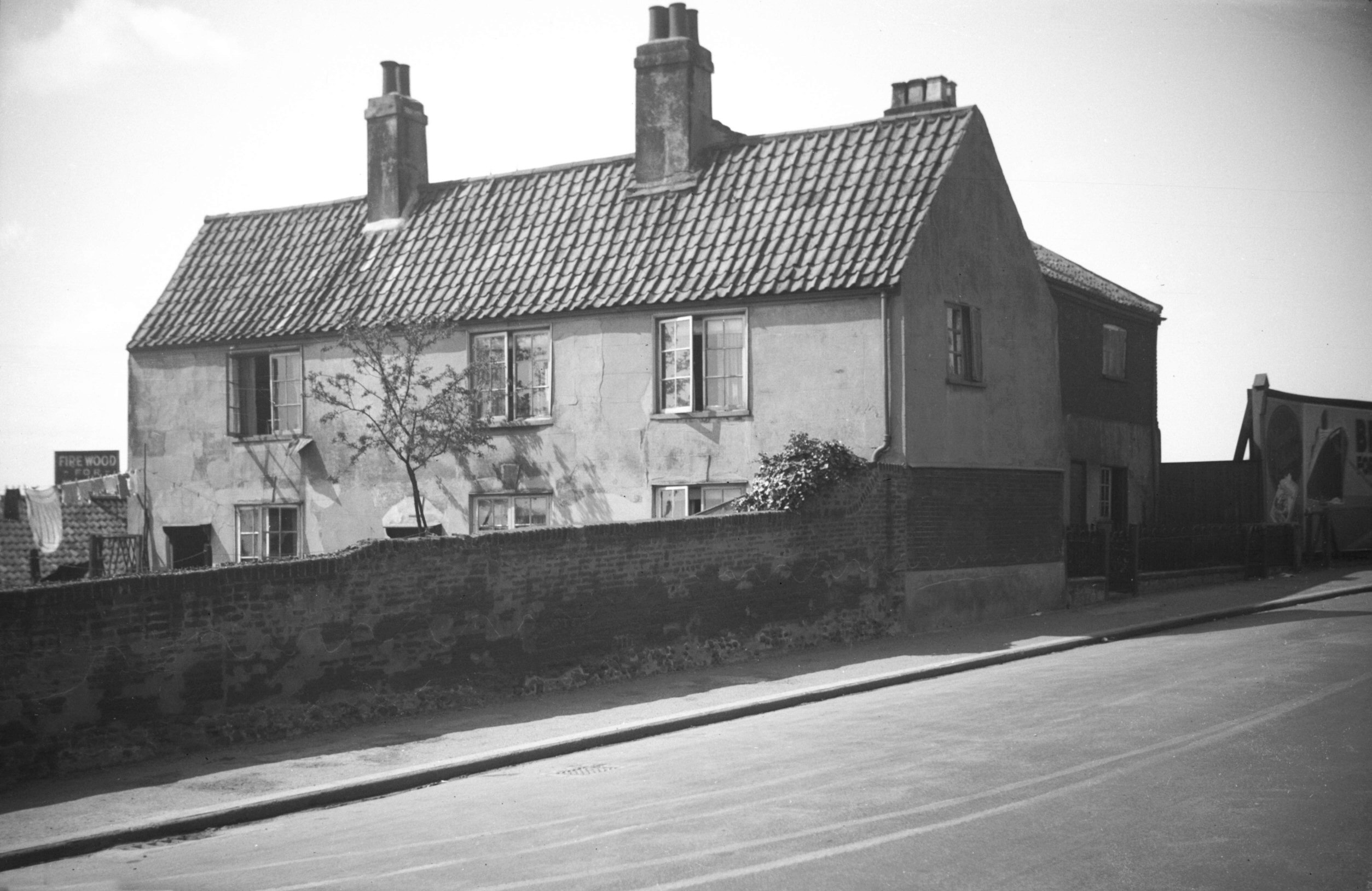
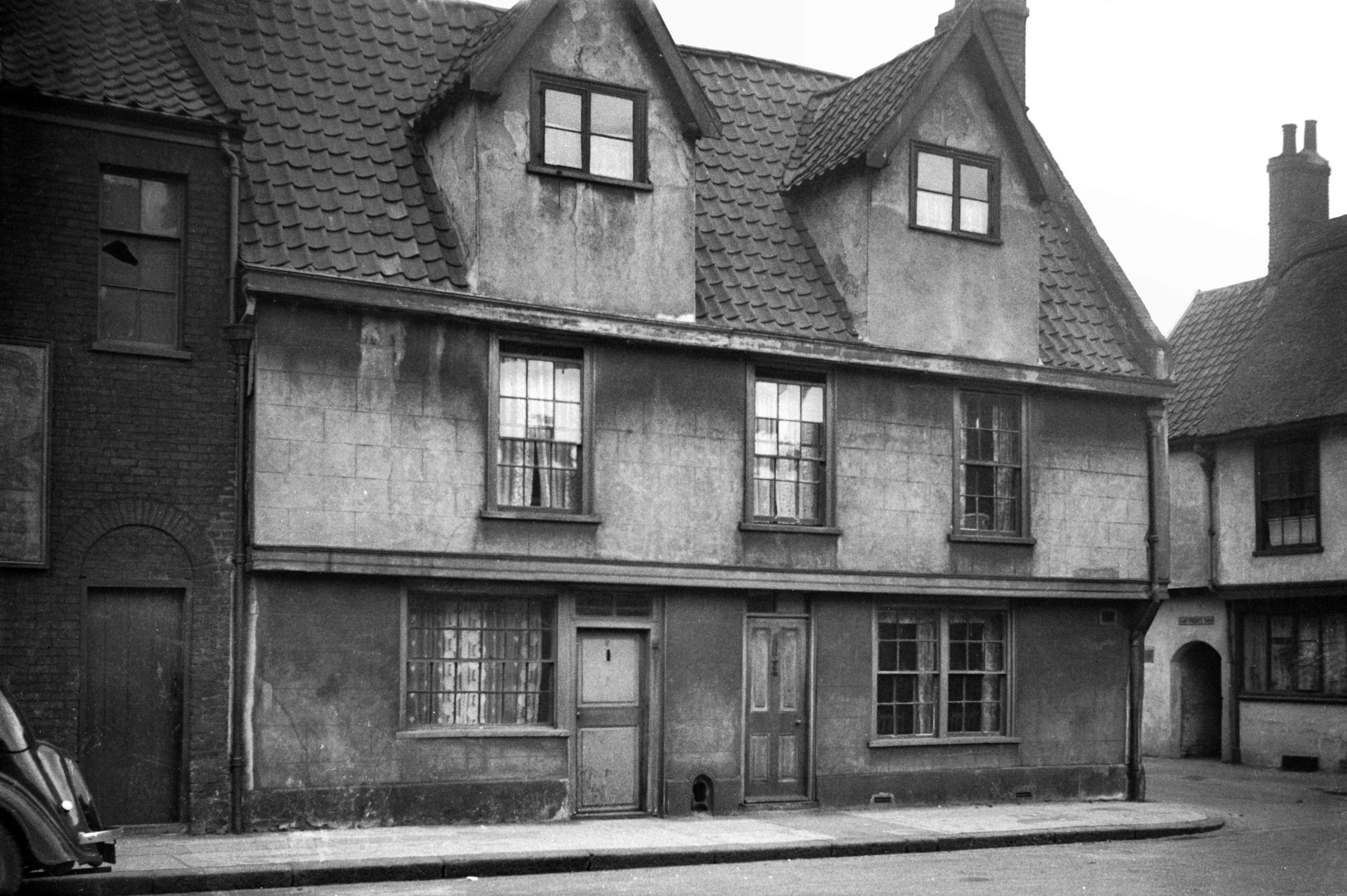
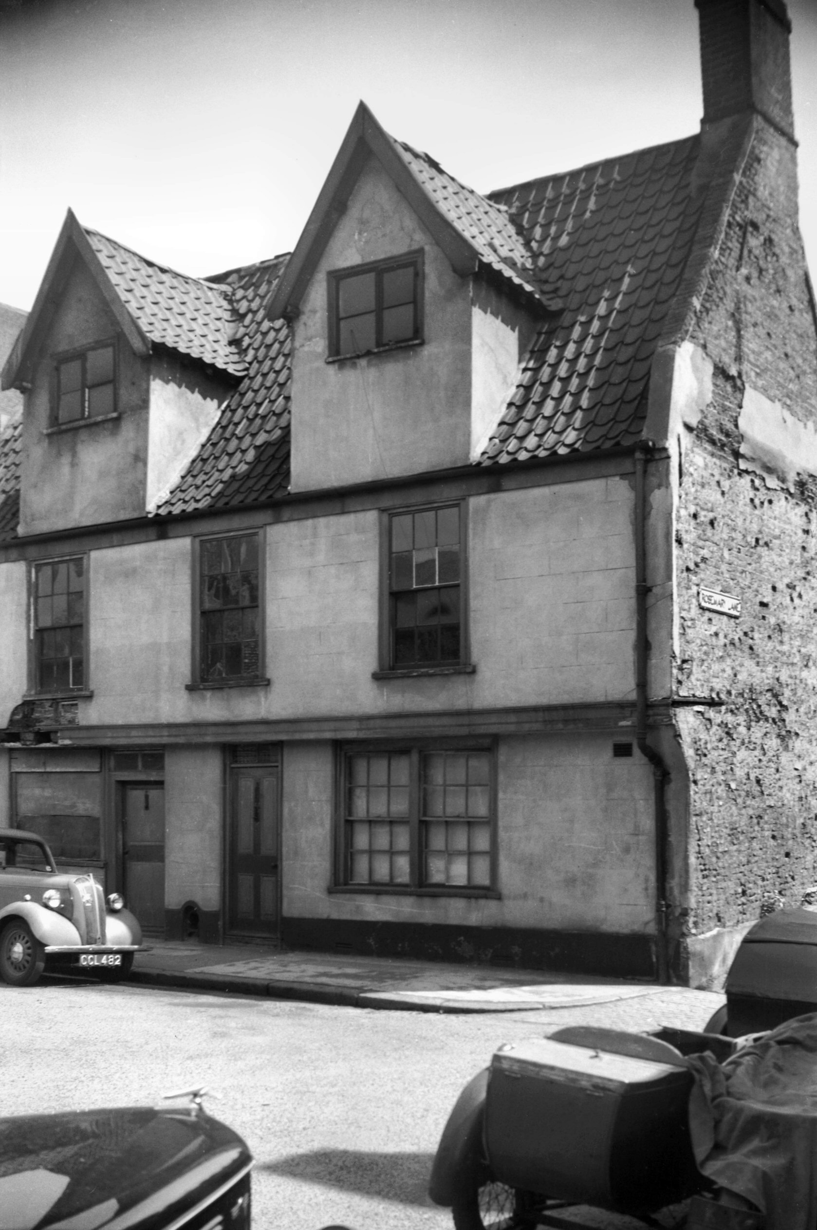
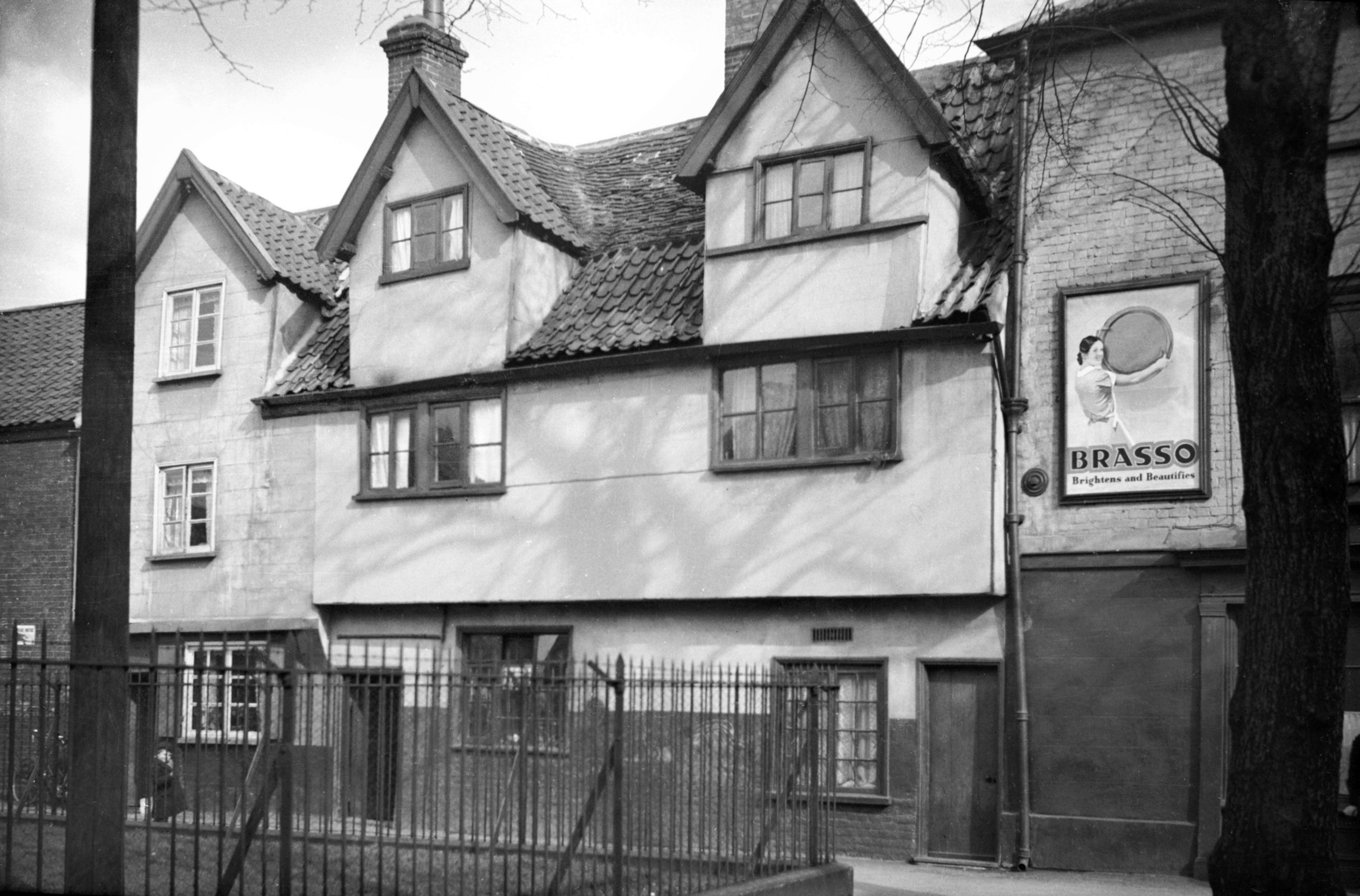
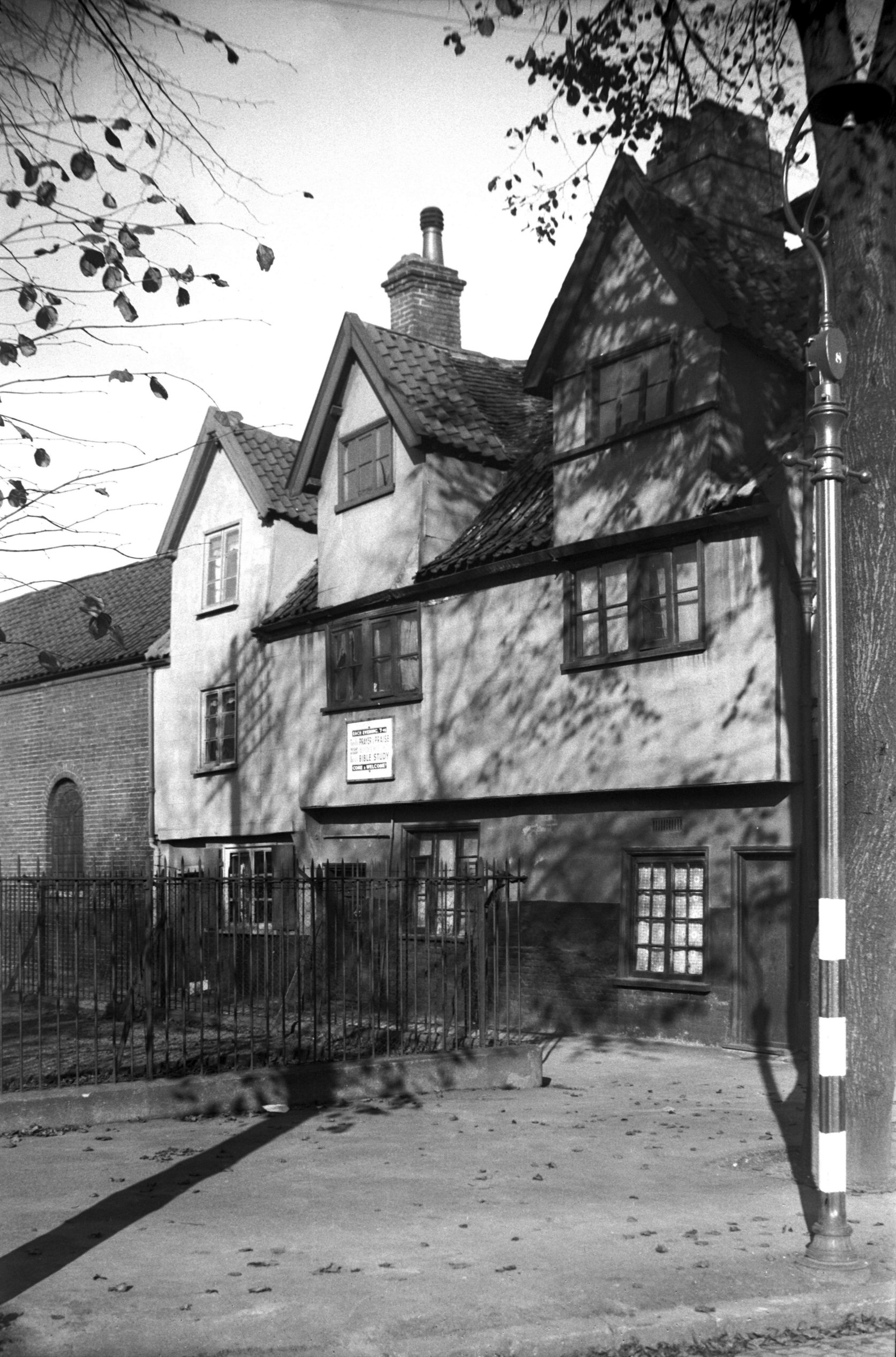
St Mary's Plain 7 to 9 [0840] 1936-03-31
For Pykerell's House see Rosemary
Lane. |
|
|
St Mary's Plain 7 to 9 from NW [4250] 1954-05-26
|
|
|
St Mary's Plain 7 to 9 from SW [4249] 1954-05-26
Showing timber frame with mud infill. |
| |
North
side |
|
|
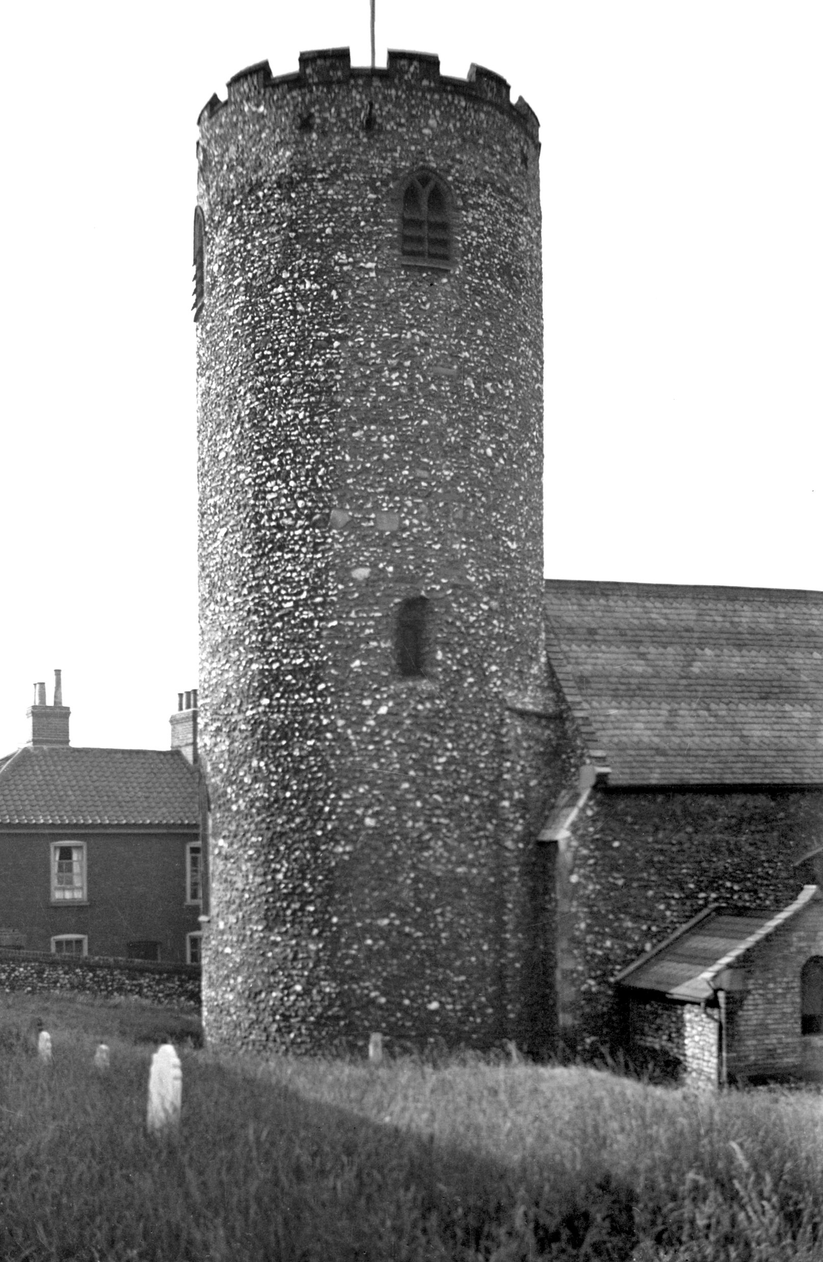
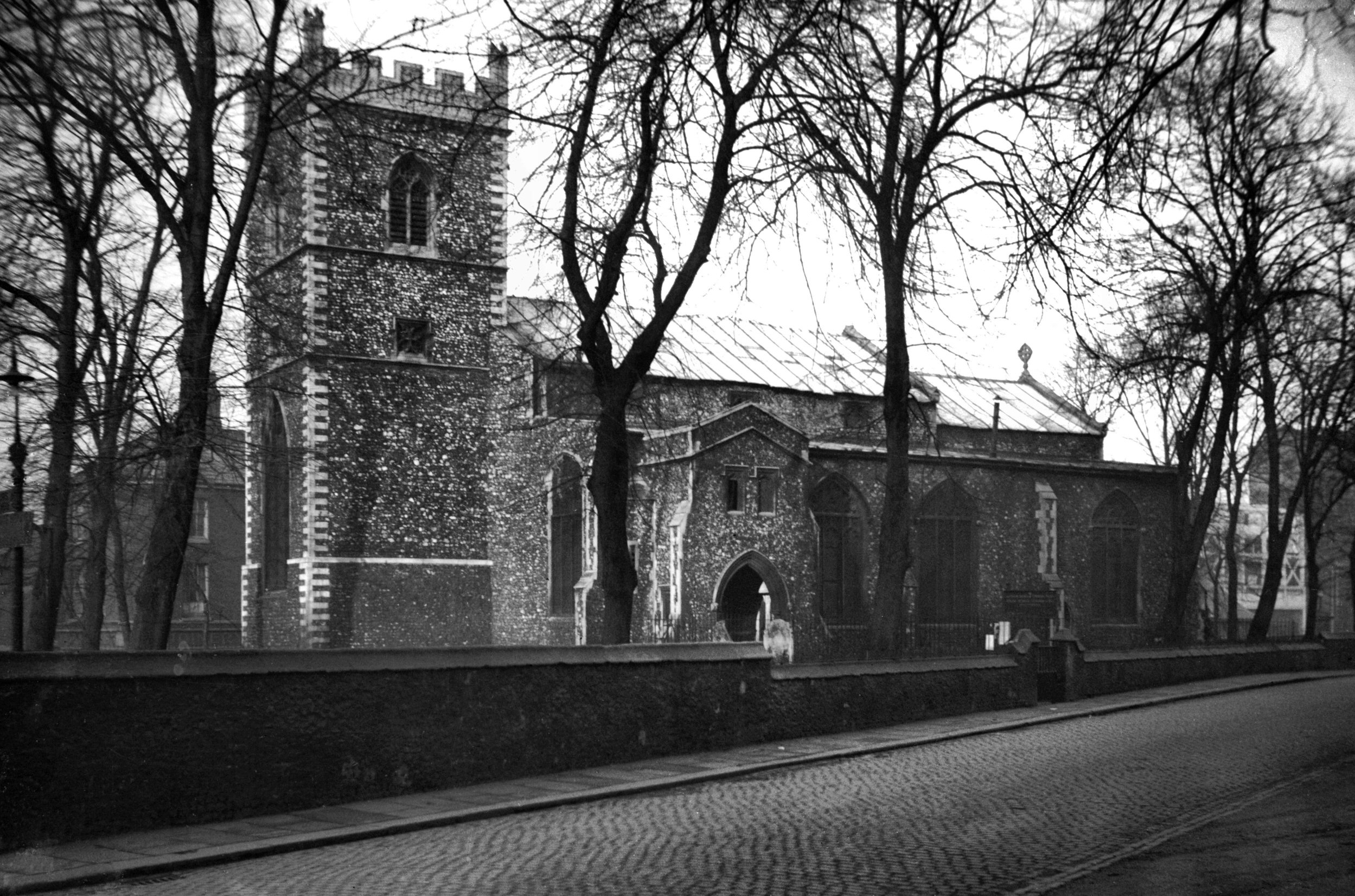
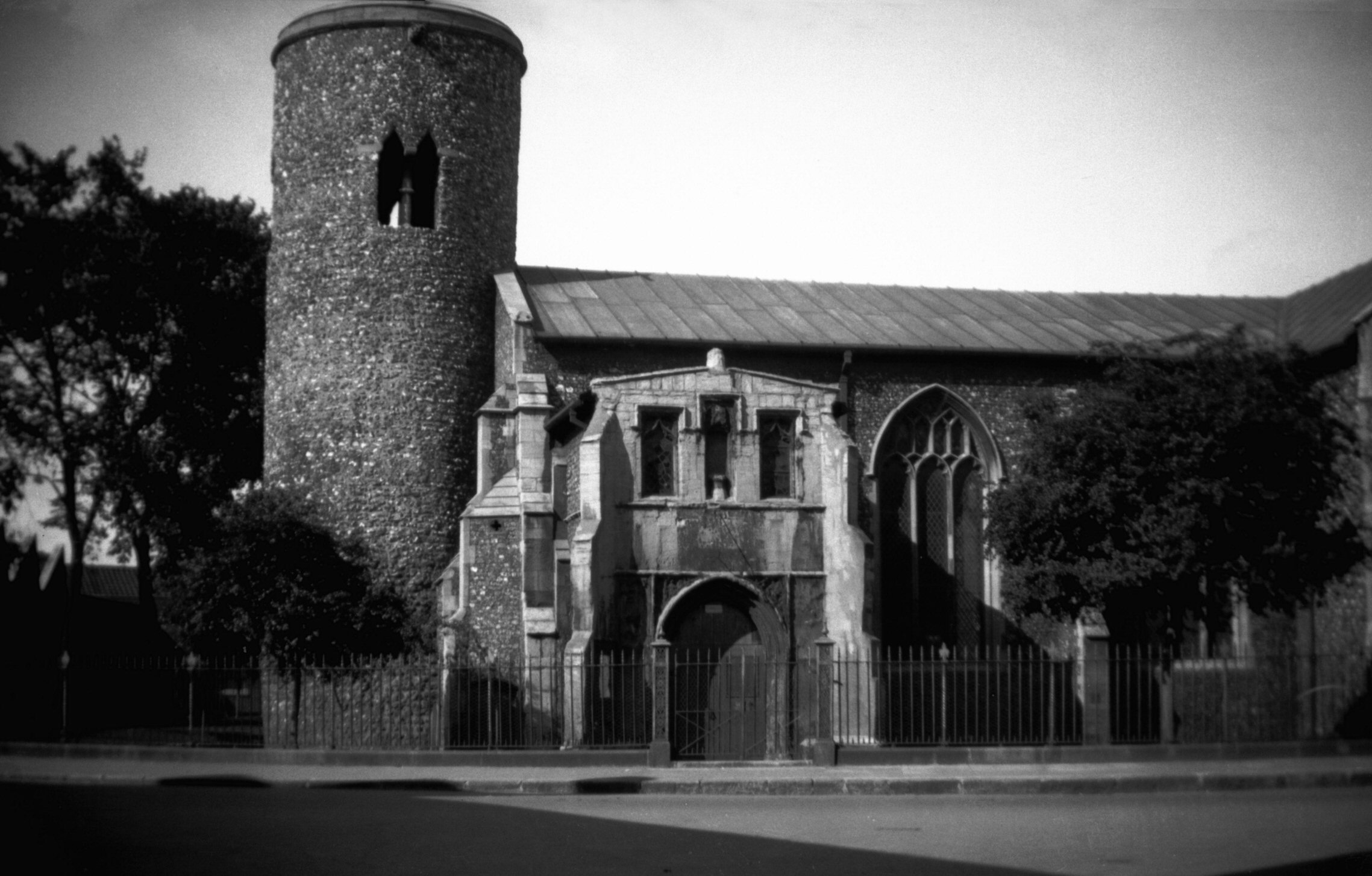
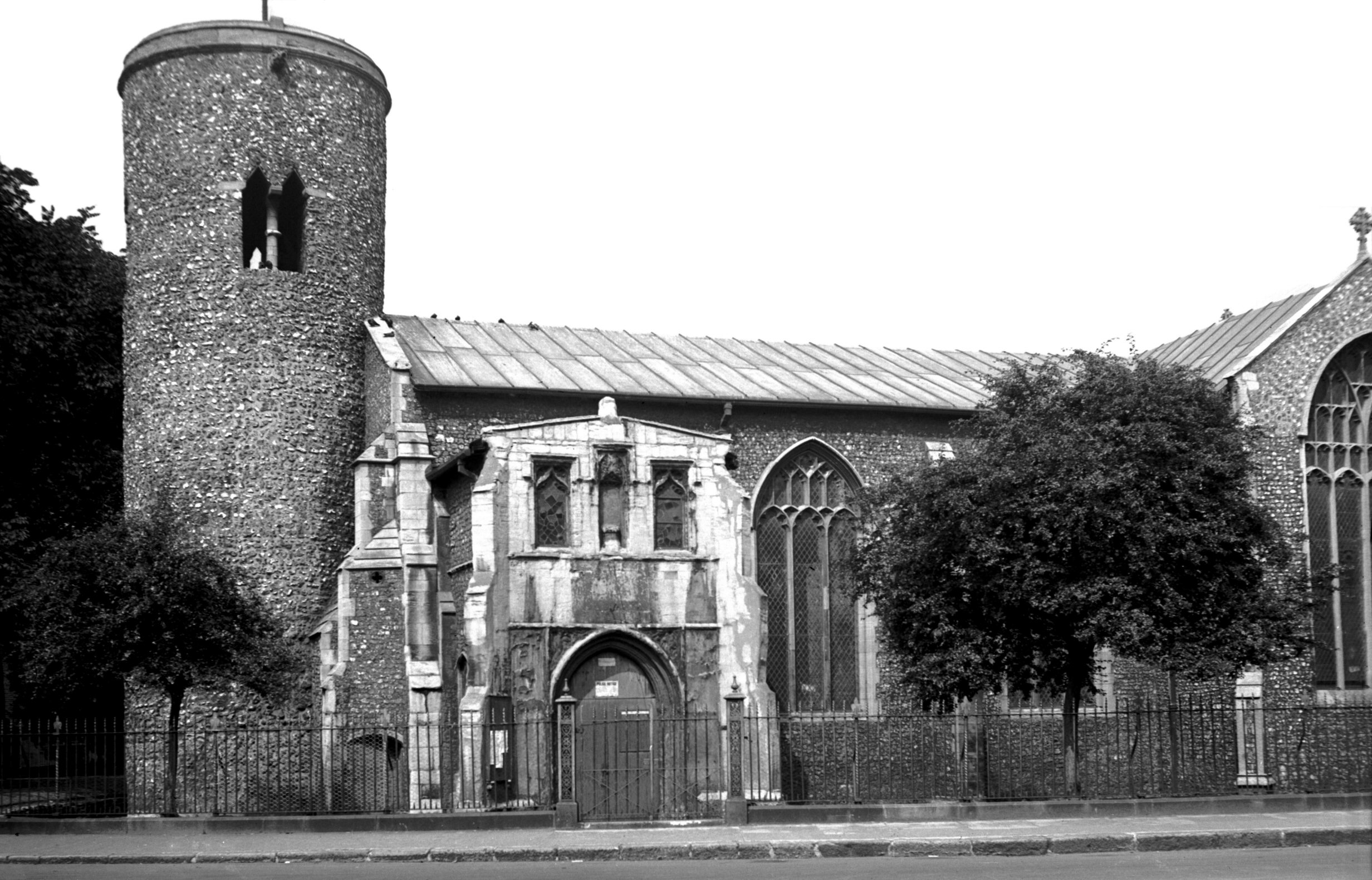
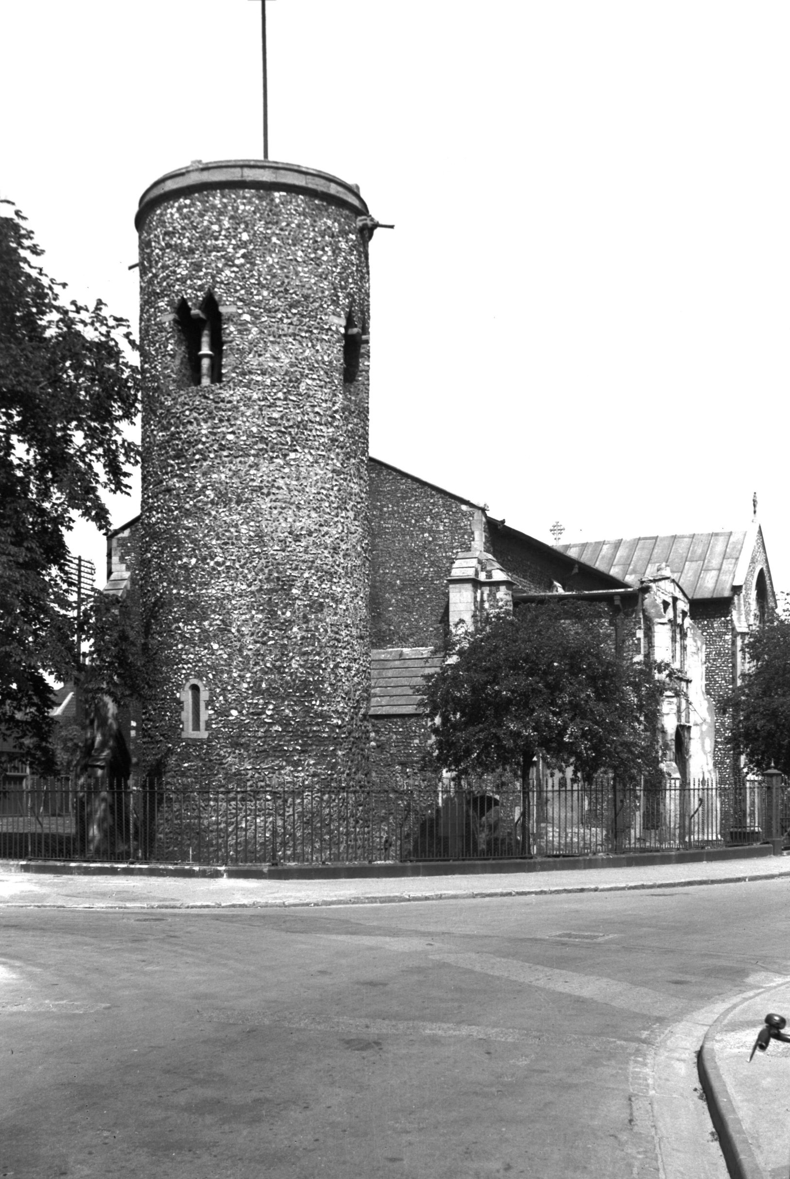
St Mary Coslany S side from St Mary's Plain [B137]
1931-00-00
|
|
|
St Mary Coslany S side from St Mary's Plain [1922]
1937-08-24
In addition to the Baptist church and a Zoar chapel there
is, on the north side, a parish church. The latter is by
far the oldest of the three; its round tower built by
Saxon labour some 900 years ago, though the remainder of
the church was largely rebuilt about 400 years later.
The future of St Mary's church has been placed in
jeopardy on a number of past occasions. At the end of the
19c it had been allowed to fall into such a state of
disrepair that services were held only irregularly, and
it is said that in rainy weather umbrellas were a
necessity inside as well as outside the church. When the
Norfolk and Norwich Archaeological Society visited there
in 1898 it was, according to their annual report,
"sad to see the state of ruin into which this fine
building has been allowed to fall, and the hope was
expressed that it would soon be re-opened for the benefit
of the large population amidst which it stands".
Some ten years later that hope had been achieved: the
stonework had been repaired, the roof put in order and
the semi-collapsed 14c belfry taken down. At the same
time the true date of the tower was revealed when the
four original belfry windows were discovered and
unblocked, revealing double-angular heads supported on
round central shafts. |
|
|
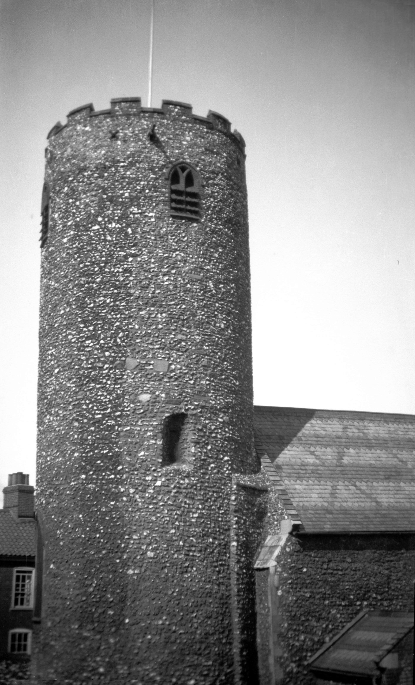
St Mary Coslany circular tower [3425] 1940-05-19
Pre-conquest round tower. |
|
|
St Mary Coslany from NE [1719] 1937-06-17
Another occasion when St Mary's was in danger came on 2nd
August 1942, when in the early hours of the morning fire
bombs ignited the roof timbers at the
"crossing" of nave and transepts. The blaze was
fortunately extinguished before too much damage had been
done, and after repairs had been carried out and the
walls colourwashed a re-opening service was held in June
1950. After that, the church was seldom used for its
original purpose, and in 1974 it was declared redundant.
In 1979 plans were drawn up to convert the church into a
theatre, to be named the Luke Hansard playhouse after the
reporter of parliamentary proceedings who was baptised
here, but because of lack of support this idea was not
taken up. A year later the Friends of Norwich Churches
decided to rent St Mary's from the Norwich Historic
Churches Trust for their new headquarters. They hoped to
keep it as a "church of mediaeval times" and to
hold concerts, meetings and exhibitions. It was
officially opened as such in June 1981, by Lady Harrod,
but after only two years the Friends had to give it up on
financial grounds. Eventually towards the end of 1985 the
building was opened as a craft and design centre, which
use not only enables the public to patronise local
initiative but permits them to enjoy the surroundings of
one of the city's most delightful churches. This use is
perhaps all the more appropriate because a number of the
Norwich School of Painters have had connections with the
church. John Crome was married here in 1792, and several
of his children were baptised here. John Sell Cotman was
also baptised here in 1782, and Robert Ladbroke was
buried in its churchyard in 1843. |
|
|
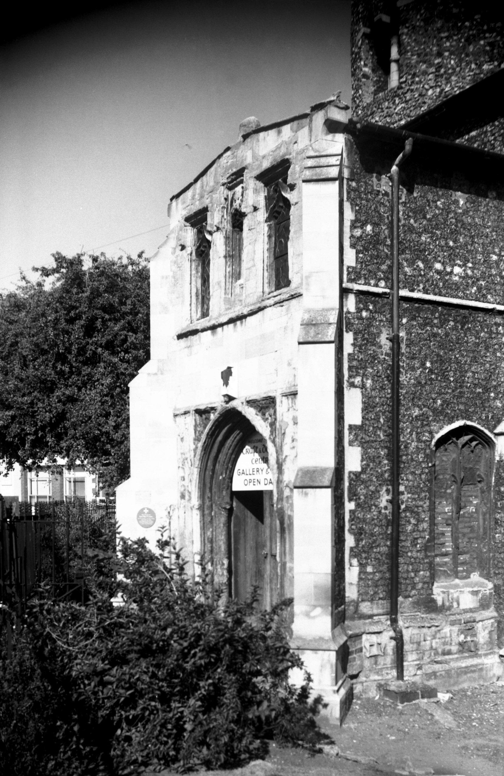
St Mary Coslany south porch [6638] 1990-09-03
|
|
|
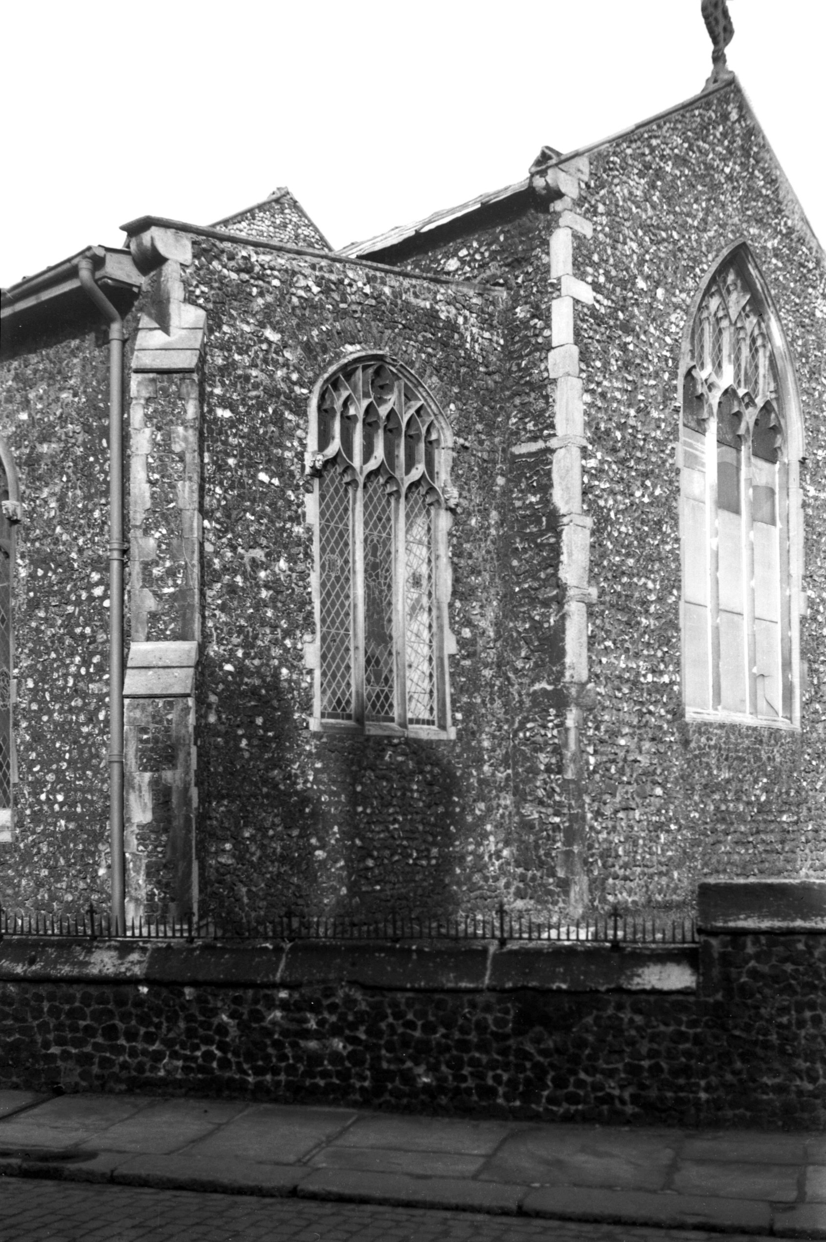
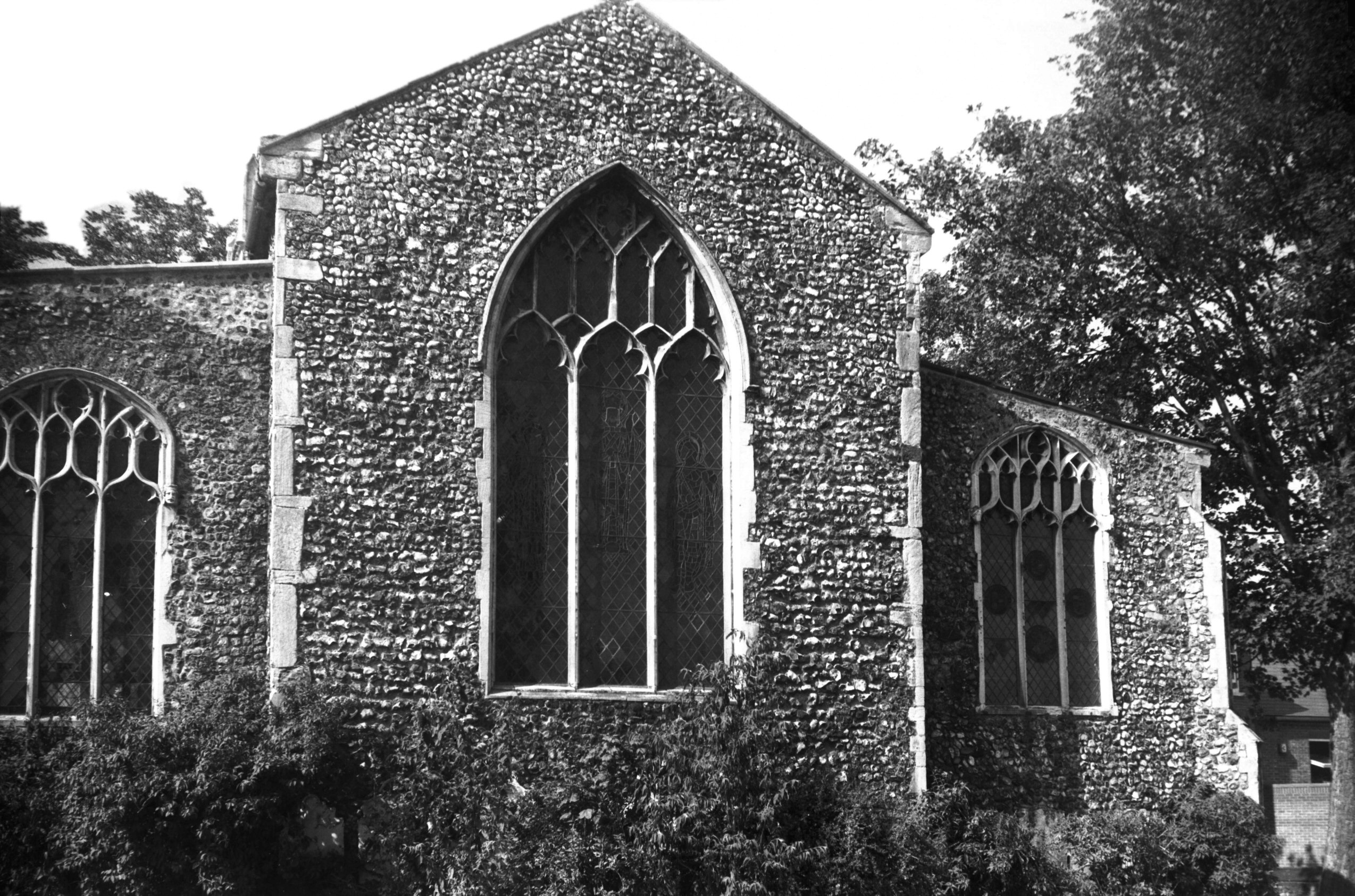
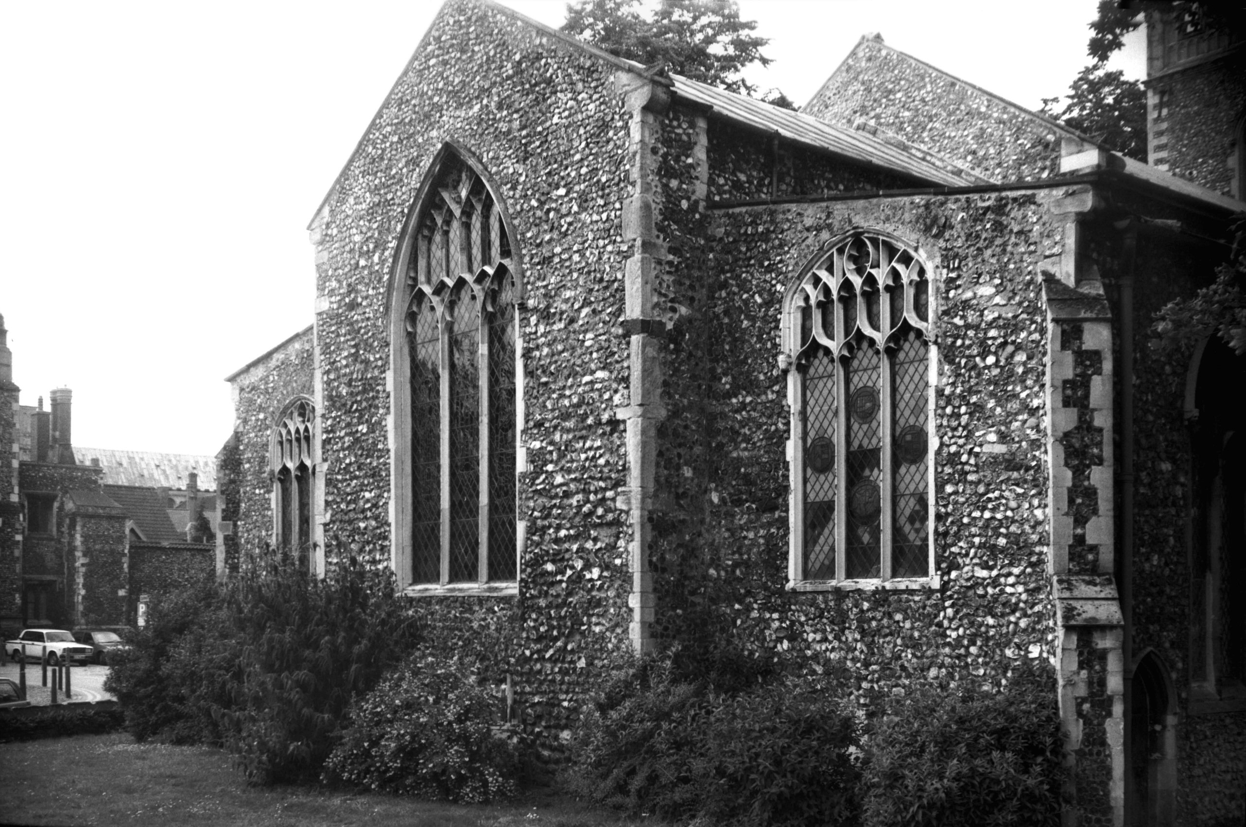
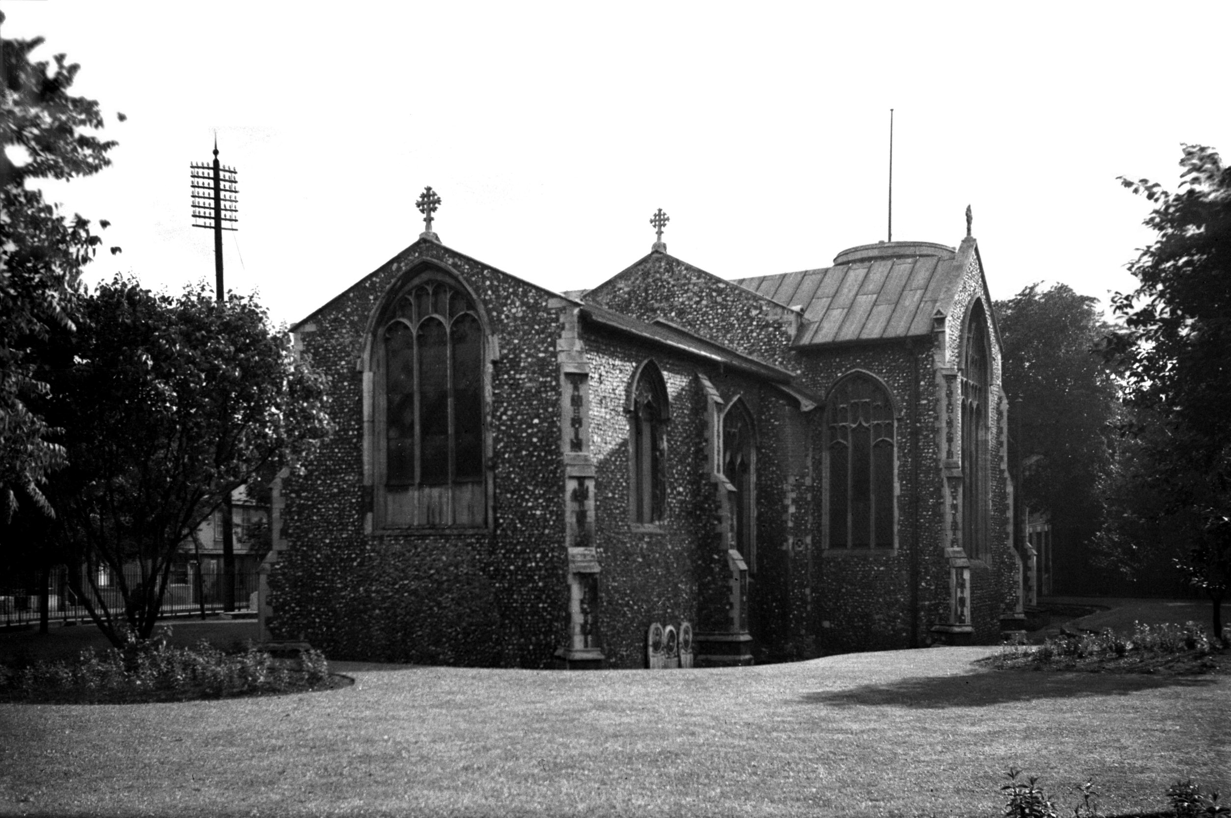
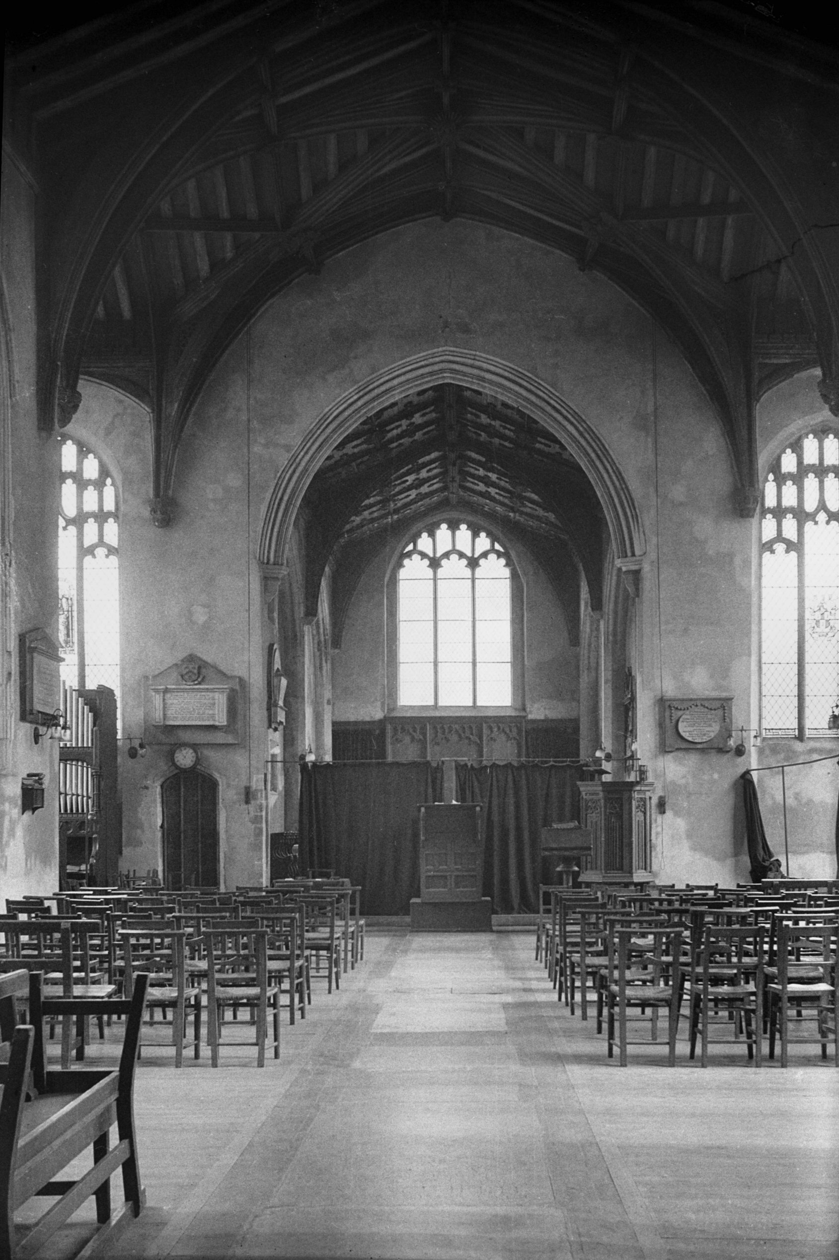
St Mary Coslany interior view east [1907] 1937-08-21
26 feet 3 inches wide with archbraced roof. |
|
|
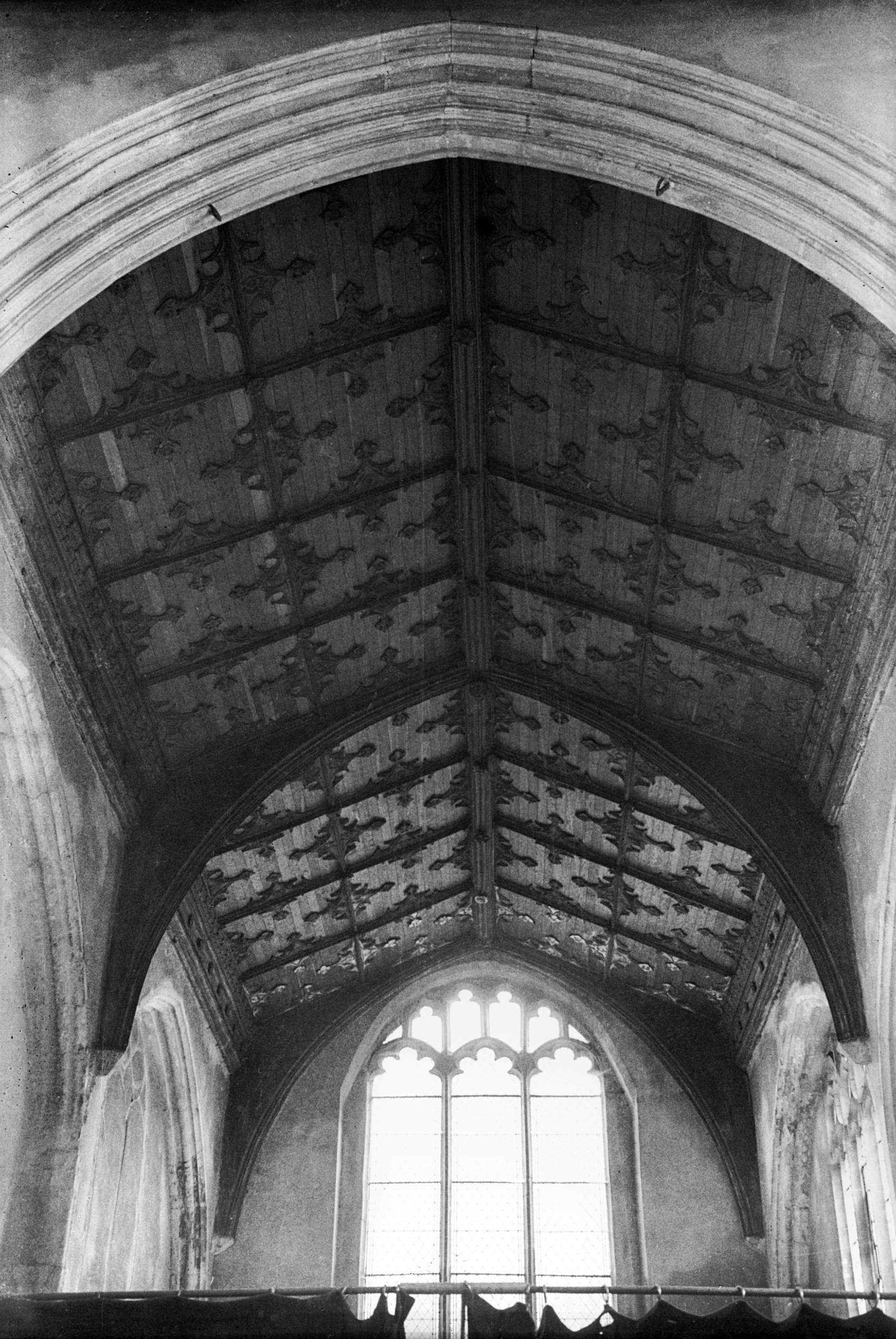
St Mary Coslany panelled chancel roof [1909]
1937-08-21
Of outstanding interest are the archbraced chancel roof,
with its traceried panels, gilded on the bay over the
altar, and the fine 15c roof over the
"crossing", with its remarkable arrangement of
timbers adorned with carved angels and bosses. |
|
|
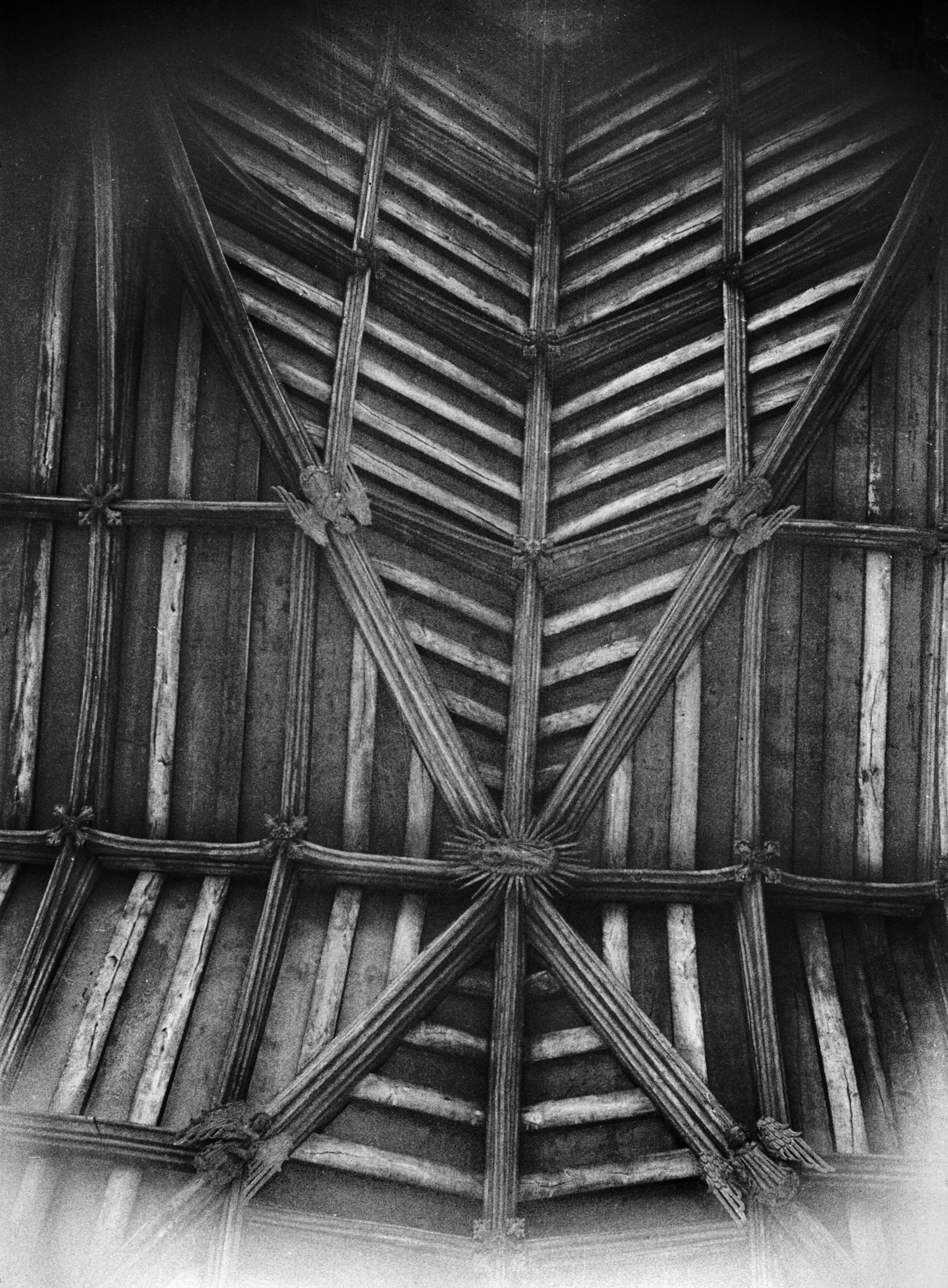
St Mary Coslany crossing roof [1911] 1937-08-21
Intersection of nave and transept roofs with great cross
ribs. Central boss of rayed figure of the Virgin. |
|
|
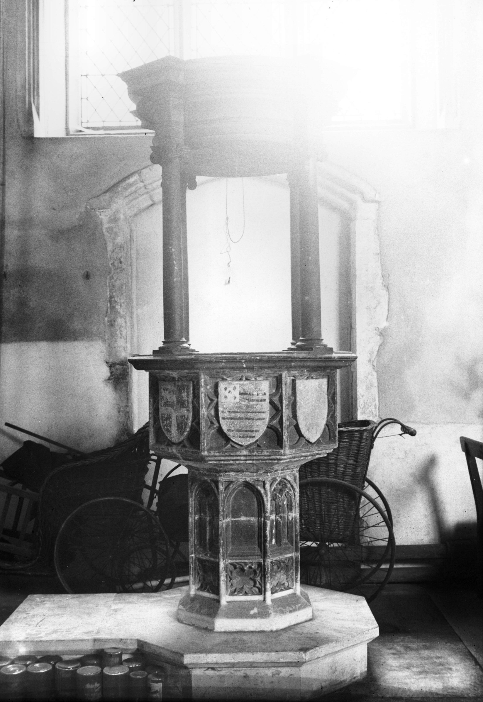
St Mary Coslany font and 18c cover [1906] 1937-08-21
Octagonal. |
|
|
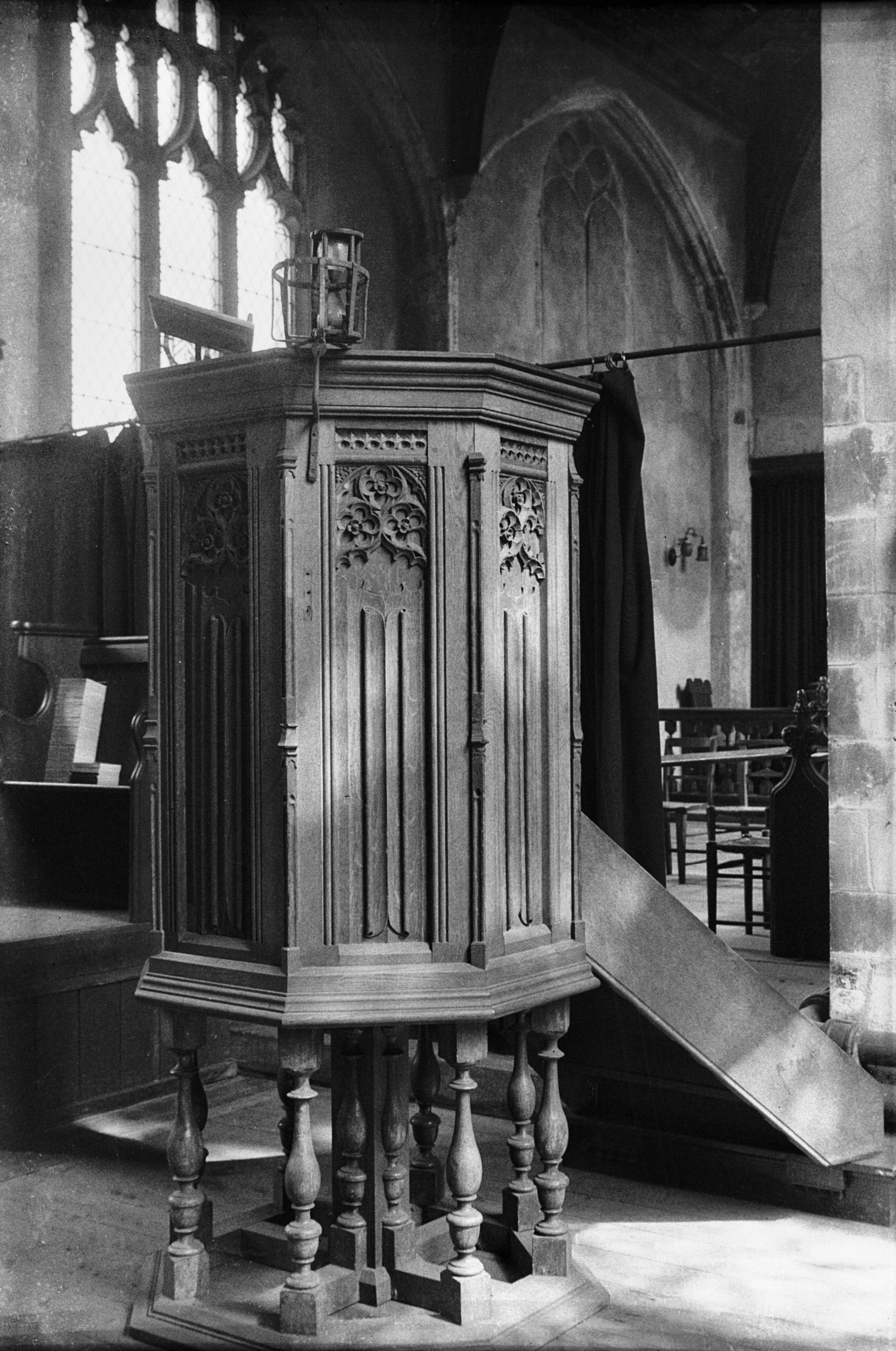
St Mary Coslany pulpit with hourglass [1908]
1937-08-21
15c pulpit. |
|
|
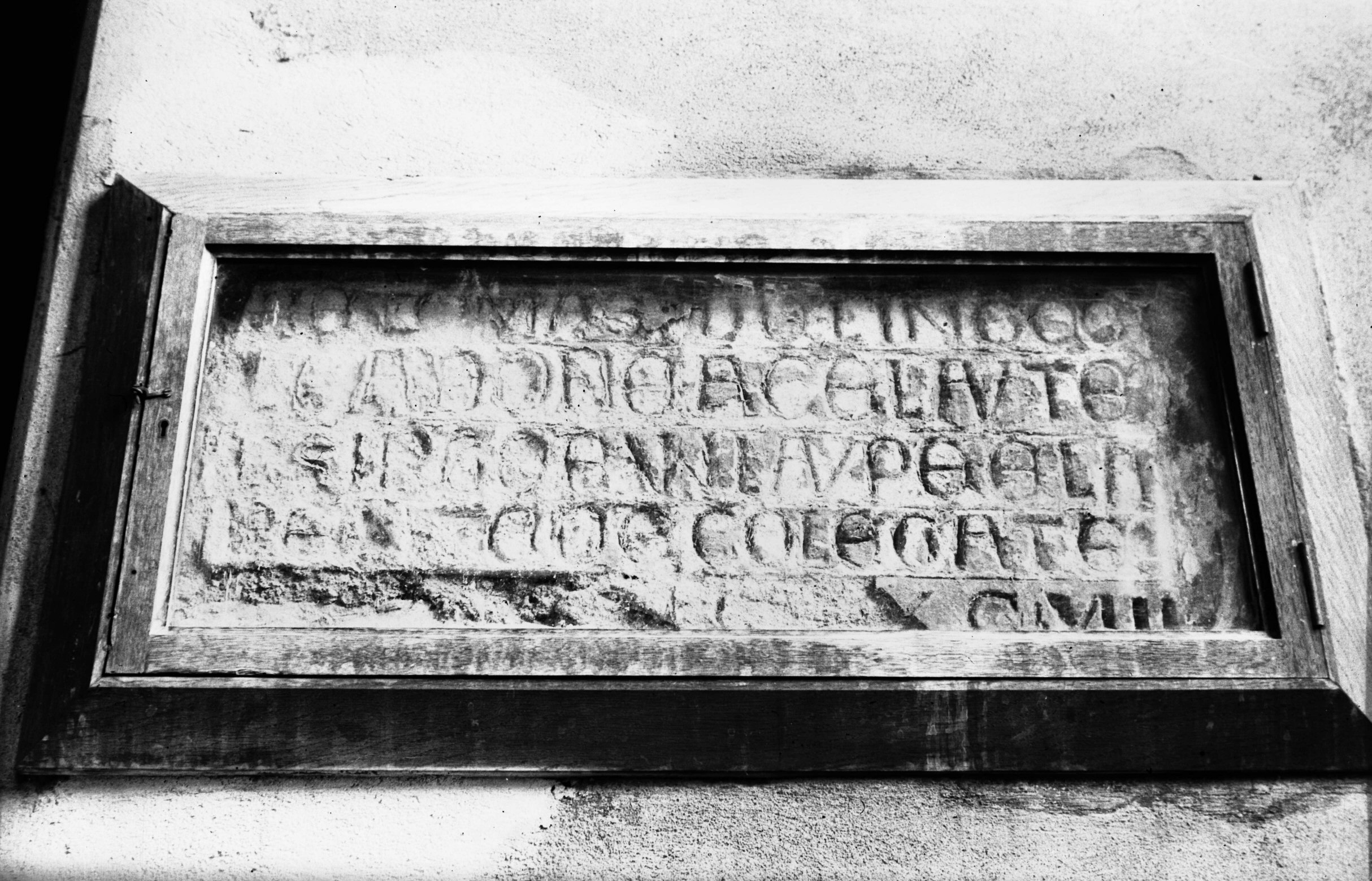
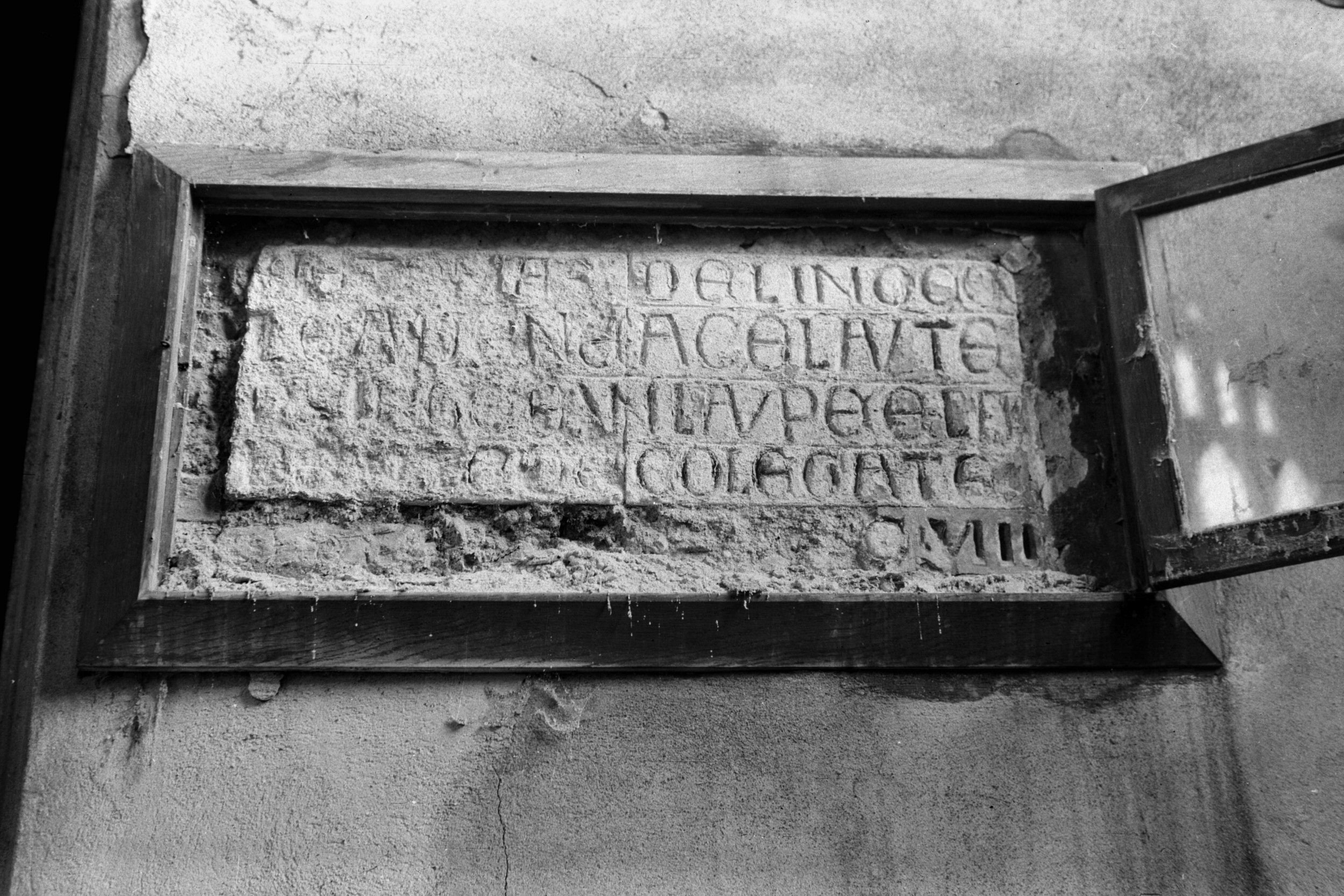
St Mary Coslany Thomas de Lingcole tablet [1905]
1937-08-21
|
|
|
St Mary Coslany Thomas de Lingcole tablet [3767]
1949-04-28
When I took photographs here in 1937 my attention was
particularly drawn to the 15c pulpit, carved with the
linen-fold pattern and supporting an hourglass; to the
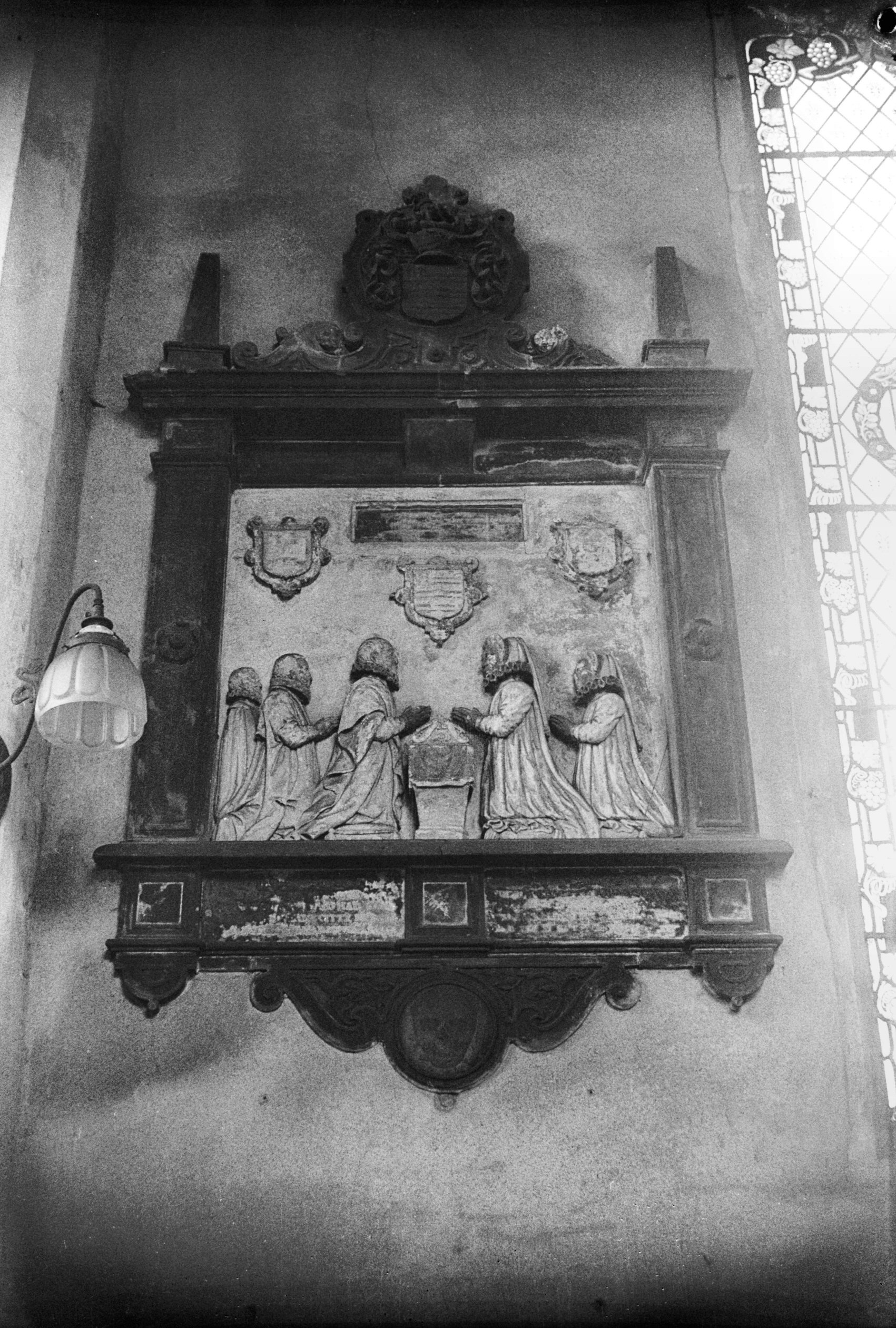
mural tablet on the south wall of the chancel depicting
Clement Hyrne, who died in 1596, his wife and three
children; and to a much older inscription on the west
wall of the nave which was then in a sadly deteriorating
condition in spite (or perhaps because) of a protective
glass frame placed over it earlier in the 20c. This old
inscription records in Norman-French that Thomas de
Lingcole had given a wax taper and a lamp to the altar of
the Holy Trinity; he was a tanner and bailiff of the city
who died in 1298. |
|
|
St Mary Coslany Clement Hyrne mural tablet [1910]
1937-08-21
Clement Hyrne, died 23 September 1596. |
|
|
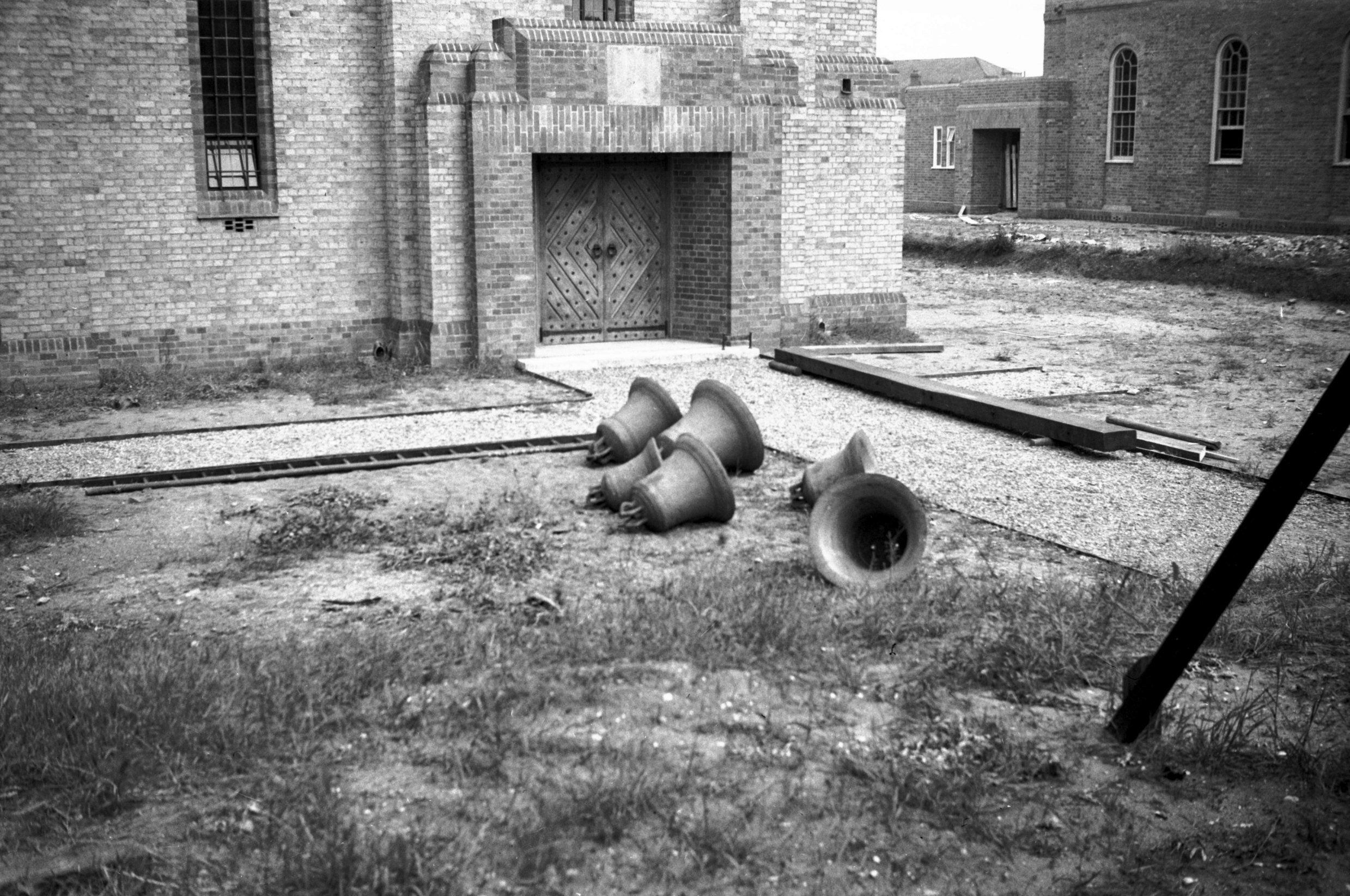
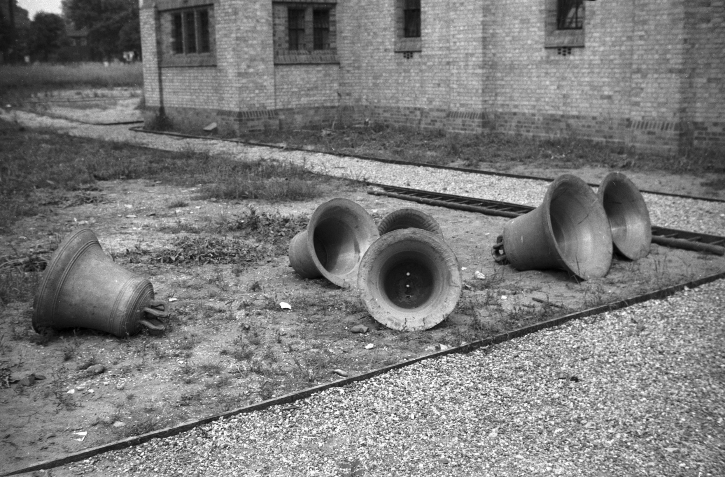
St Mary Coslany bells St Catherine's Mile X [1731]
1937-06-26
The six bells which were formerly here were all cast in
Norwich. The two largest were late pre-Reformation; two
others were made by John Brend in 1640 and the other two
by Brasyer. Because of their unusually small size they
have been called a "toy" peal. From 1909 until
1939 the church was in regular use for Sunday school and
children's services, but the bells were not used; in
November 1936, an application was made to the Norwich
Consistory Court to have them sold to the modern church
of St Catherine, Mile Cross. There they have been hung
"dead"; that in to say, they may be chimed but
not swung. It is unlikely they will provoke the local
inhabitants into wishing upon the ringer a fate once
desired for the Mancroft campanologists, whose activities
led an old parish clerk to record the following lines:
Ye rascally ringers - inveterate foes,
Disturbers of those who are fond of repose;
I wish, for the peace and quiet of these lands,
That ye had round your necks what ye pull with your
hands. |
|
|
St Mary Coslany bells St Catherine's Mile X [1732]
1937-06-26
|
|
|
St Mary's Alley 3 to 4 [1430] 1936-09-20
For 1 to 2 St Mary's Alley see 6 to 8 Pitt St. |
|
|
St Mary's Alley 5 St Mary's House [3192] 1939-07-30
One-time residence of Thomas Osborn Springfield,
silk-throwster, Sheriff 1827, Mayor 1829 and 1836. |
|
|
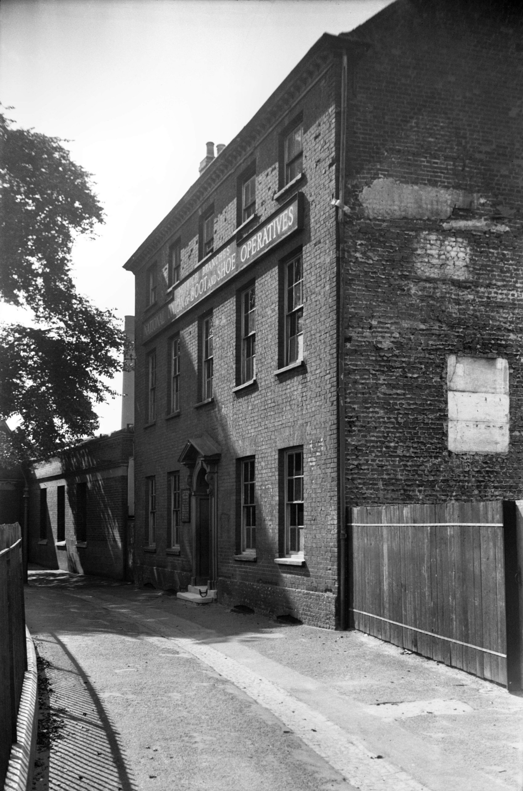
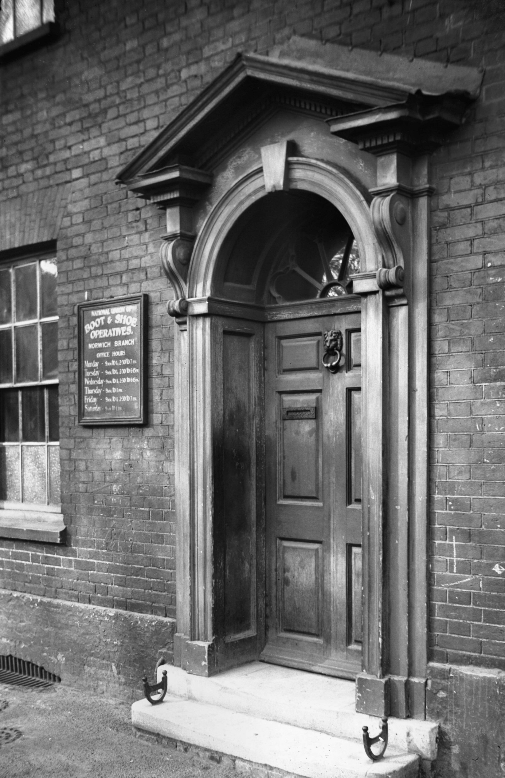
St Mary's Alley 5 Georgian doorway [2090] 1938-02-24
Since being bisected by the Inner Link road, Pitt St,
which runs parallel to St George's, has had its southern
section renamed as part of Duke St. On its western side
St Mary's churchyard forms a pleasant open space, once
overlooked on the north by a mansion occupied earlier in
the 20c by the Norwich branch of the Boot and Shoe
Operatives' Union. Built in the 18c, the three-storey
house of brick and pantile construction, with a
comparatively modest-looking pedimented doorway, was
typical of the period.
Perhaps its most notable resident was Thomas Osborn
Springfield, Sheriff in 1827 and Mayor in 1829 and again
in 1836, when he became the first Mayor under the new
charter. Born in 1782, he rose from being a small watch
and clock maker in Colegate to becoming the head of a
large firm of silk manufacturers with establishments in
both Norwich and London. After a somewhat colourful
career in local politics he died on 24th April 1858, aged
75 and was buried in the Rosary cemetery. His likeness,
painted by Philip Westcott, is one of the many civic
portraits in the city's unrivalled collection, mainly
housed in St Andrew's and Blackfriars' Halls. |
|
St Miles Alley: |
| |
From
Colegate to Oak St
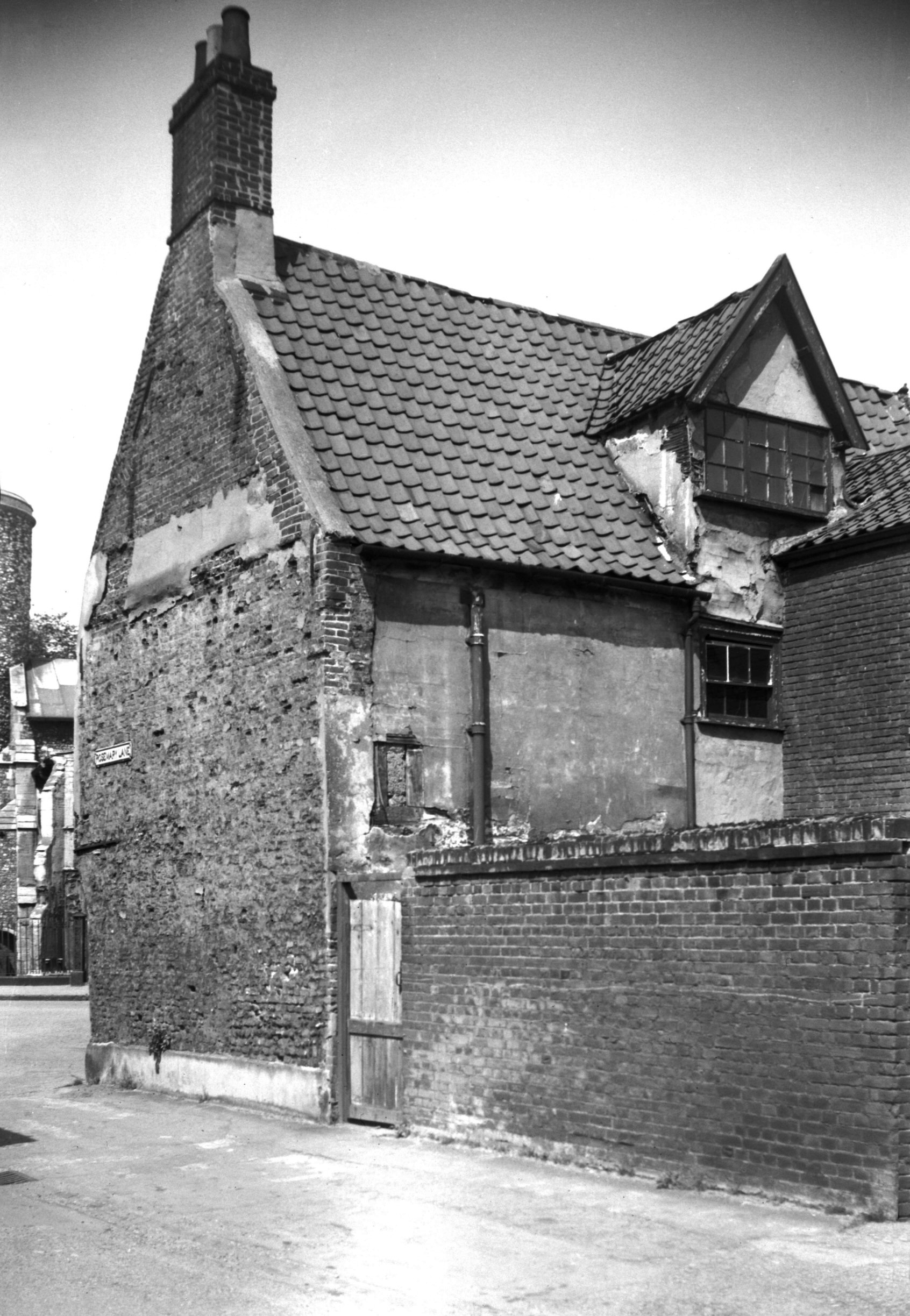
passing Rosemary Lane |
|
|
St Miles Alley 1 [0789] 1936-03-07
|
|
|
St Miles Alley 1 [3290] 1939-10-22
|
|
|
St Miles Alley 1 during restoration [5361] 1974-01-06
|
|
|
St Miles Alley 1 restored [5372] 1974-05-27
|
|
|
St Miles Alley 1 restored [5434] 1975-07-03
|
|
|
St Miles Alley 2 to 4 south side [0793] 1936-03-16
|
|
|
St Miles Alley 2 to 4 [6419] 1986-08-06
|
|
|
St Miles Alley 2 to 4 rear from Rosemary La [0843]
1936-04-09
|
|
|
St Miles Alley 19c Mission Hall [7748] 2000-05-05
|