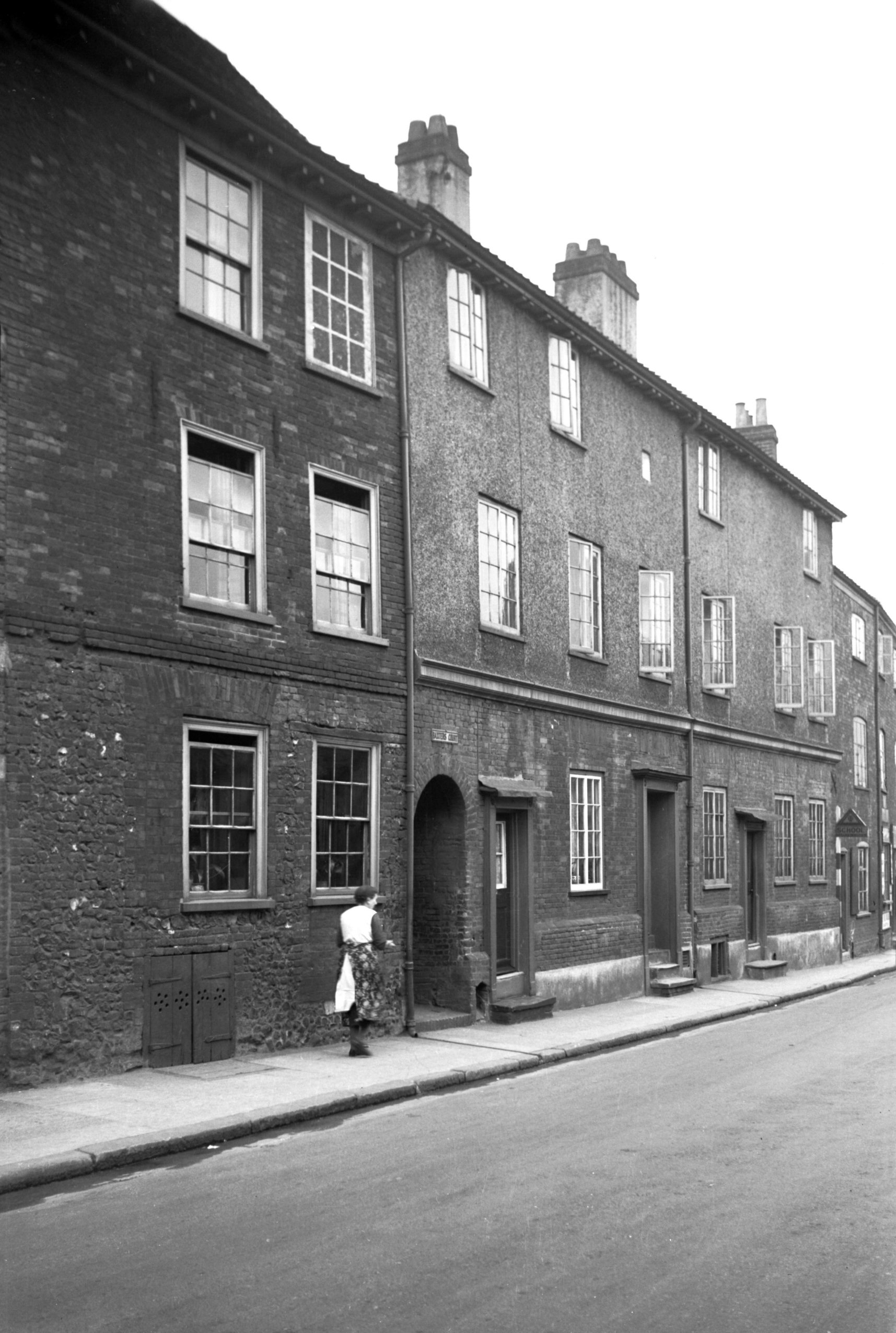
|
King St: |
| |
From
Agricultural
Hall Plain / Upper King St / Prince
of Wales Rd to Bracondale
passing Rose Lane, Cattlemarket
St, Mountergate, Stepping
Lane, Thorn Lane, St
Julian's Alley, Rouen Rd, Carrow
Rd, Carrow Hill
East side |
|
|
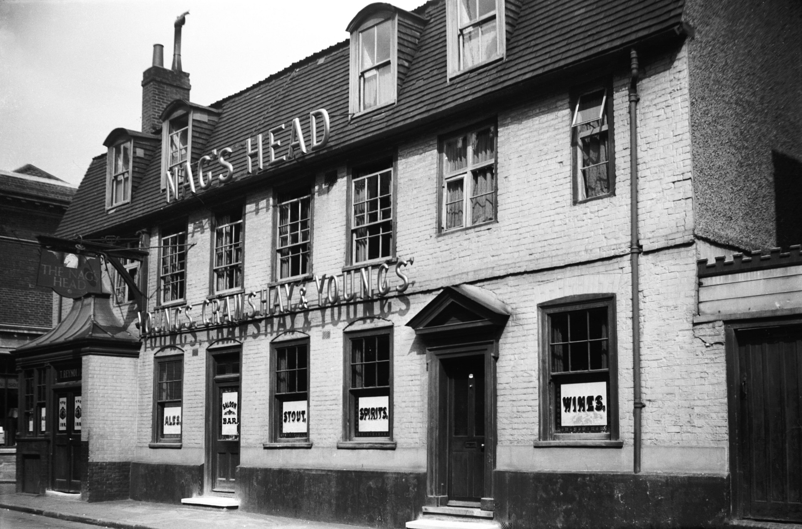
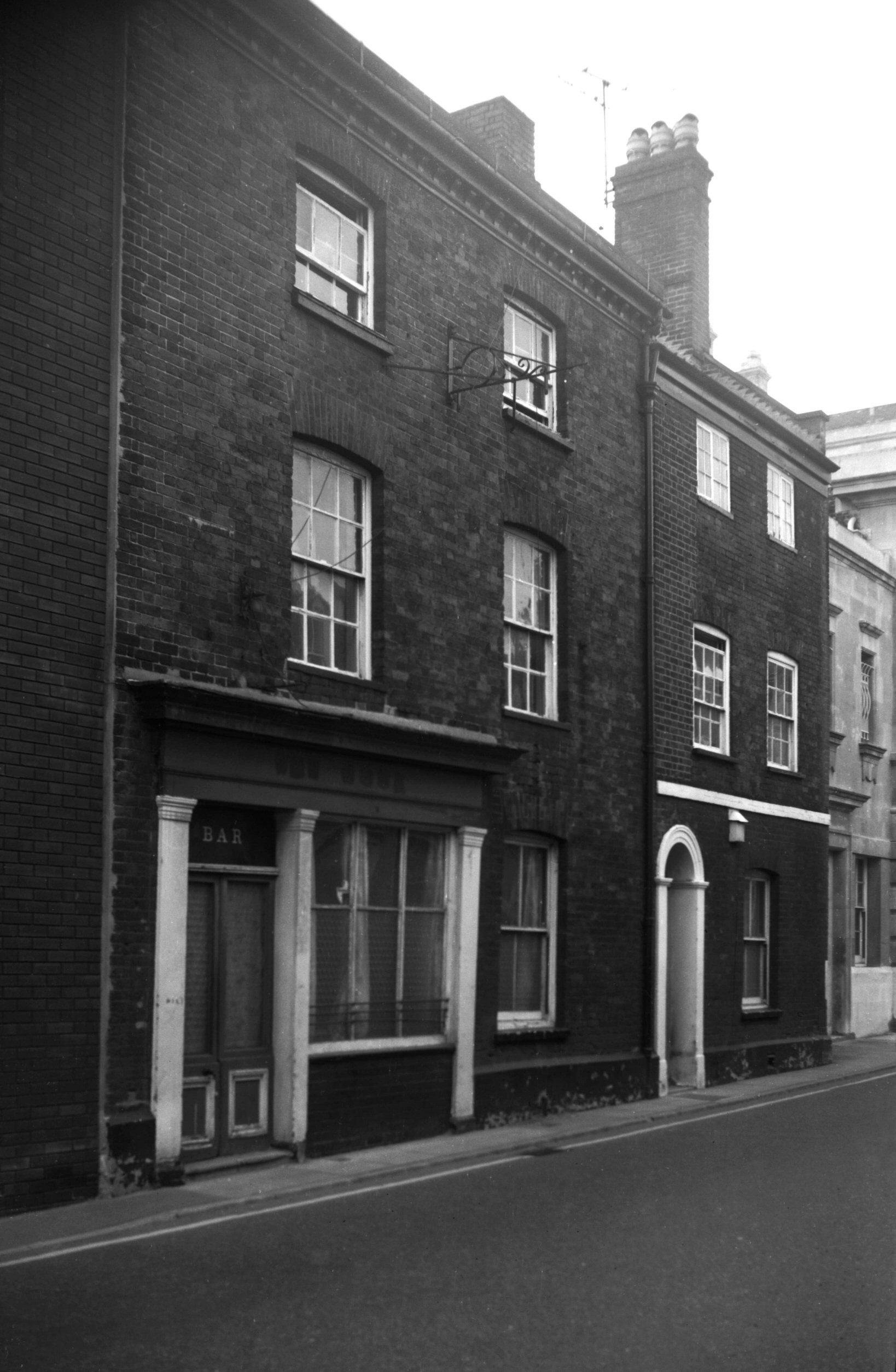
King St 27 to 29 Nag's Head PH [1266] 1936-08-13
|
|
|
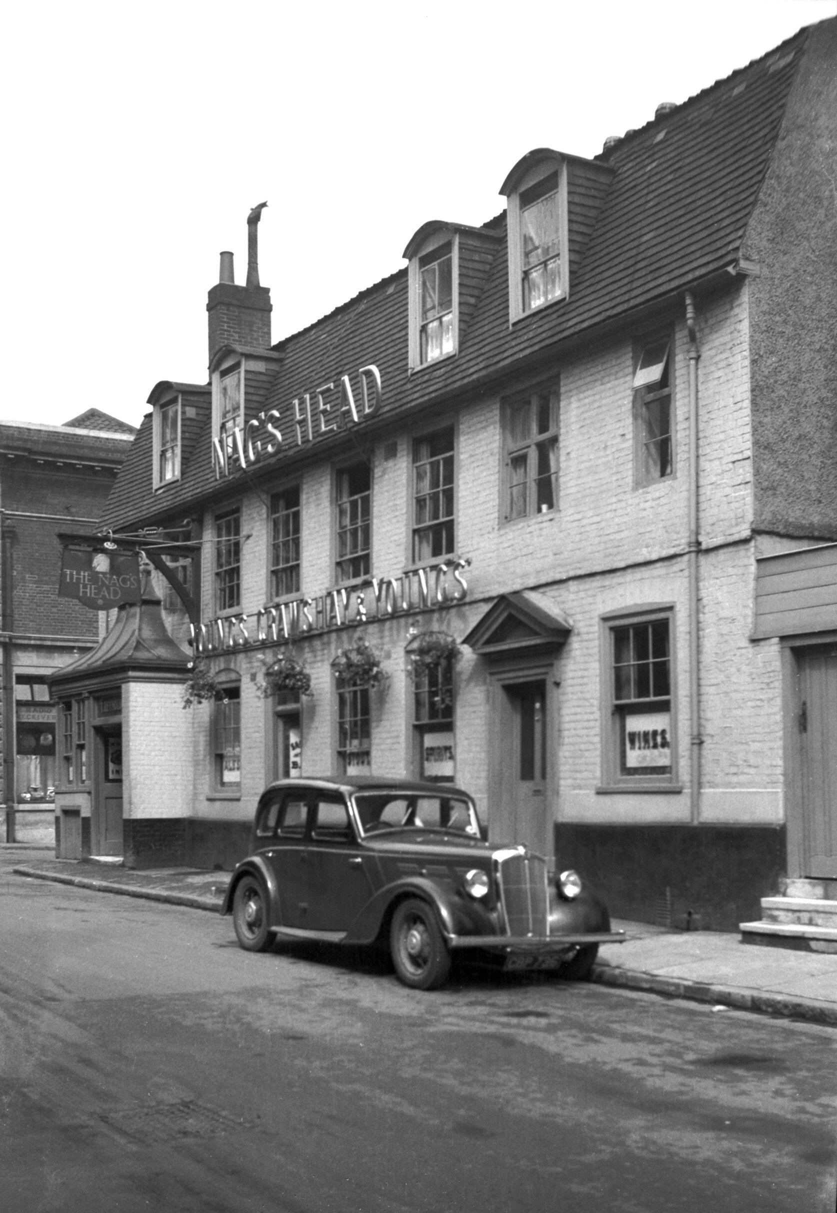
King St 27 to 29 Nag's Head PH [2730] 1938-08-22
|
|
|
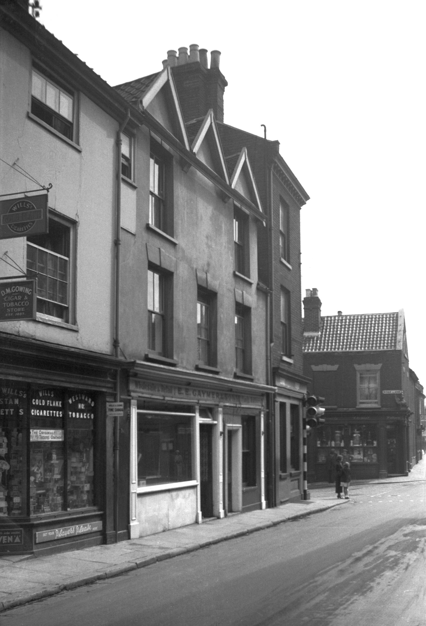
King St 37a to 41 [2729] 1938-08-22
|
|
|
King St 43 [1316] 1936-08-25
|
|
|
King St 43 classical shop front [6561] 1989-07-05
|
|
|
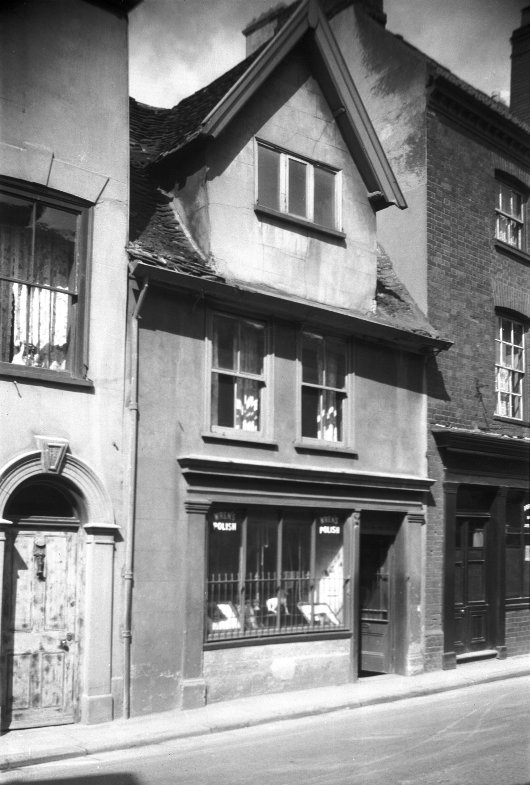
King St 45 [6480] 1987-08-21
|
|
|
King St 45 to 51 [2728] 1938-08-22
|
|
|
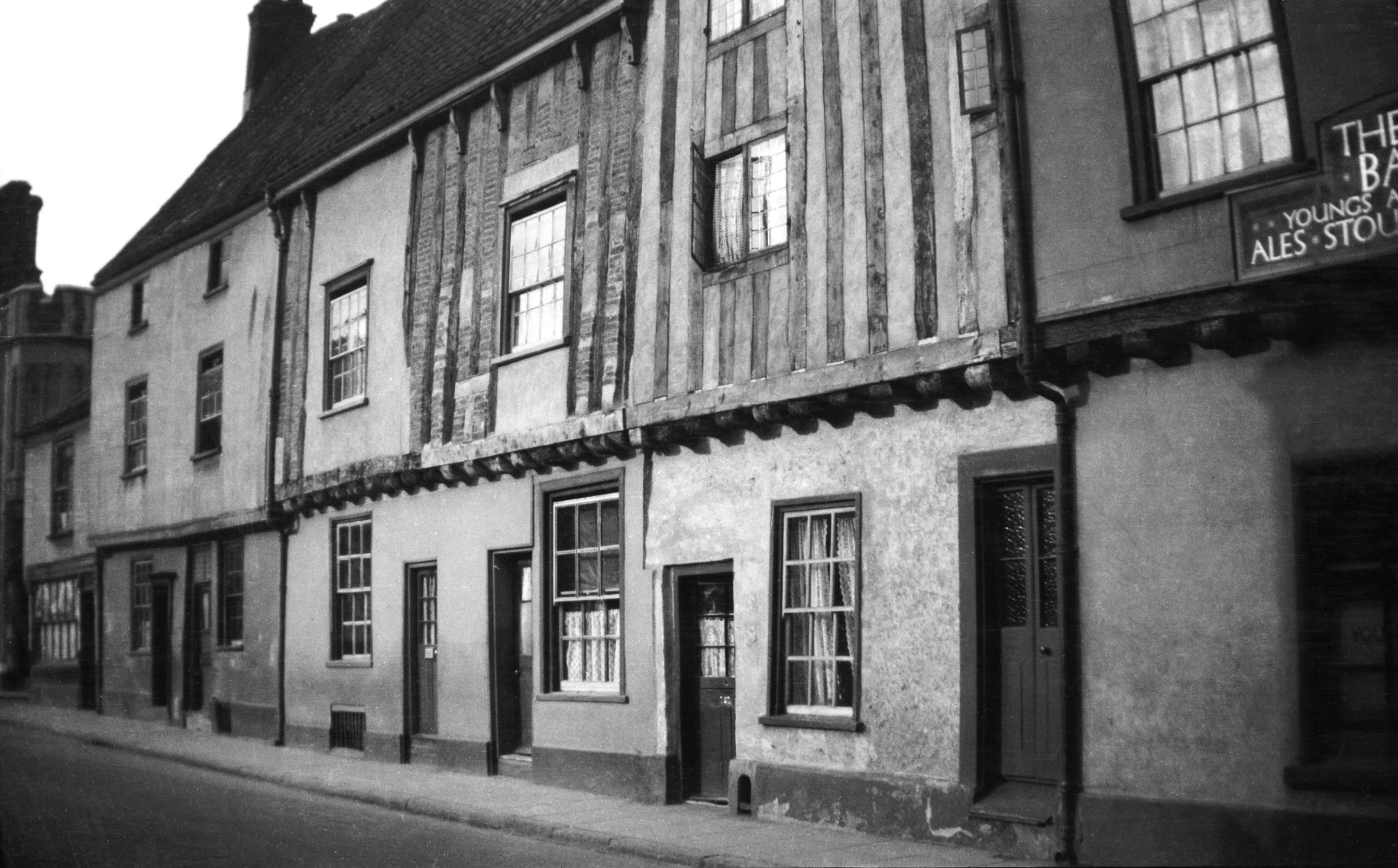
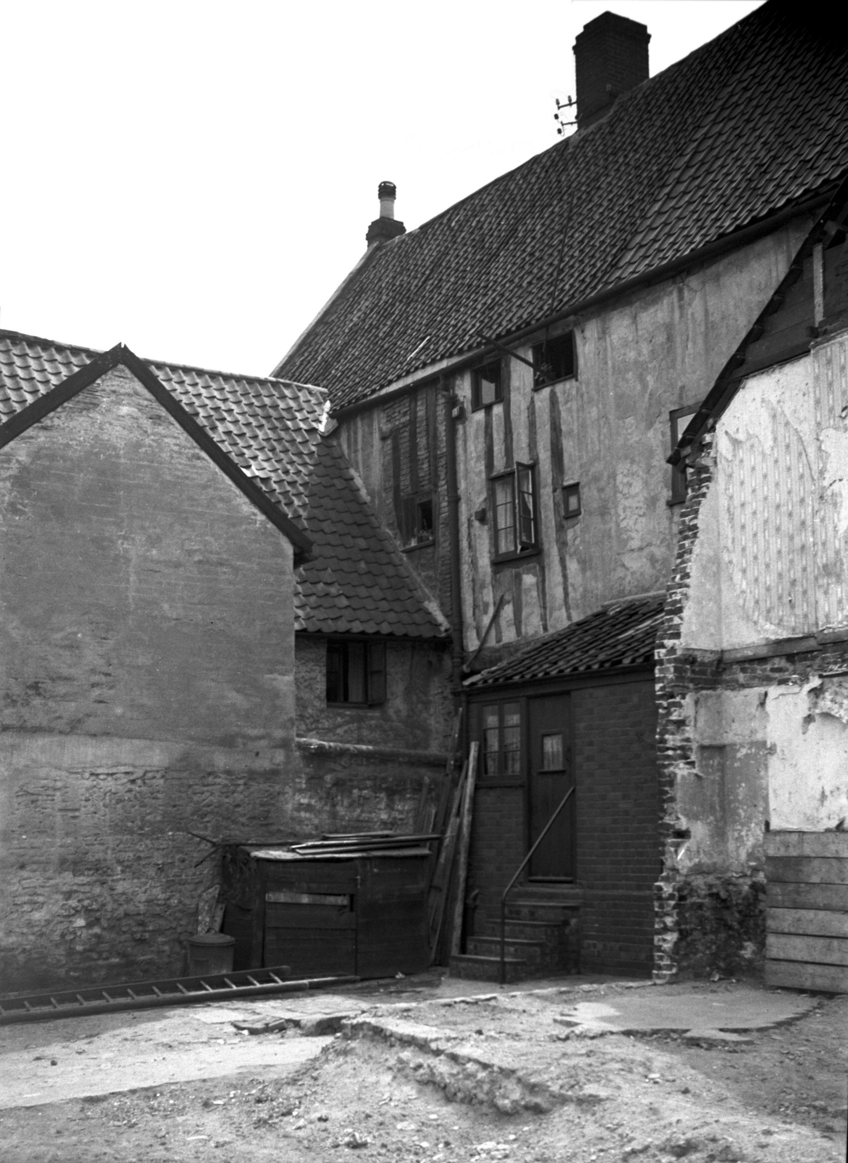
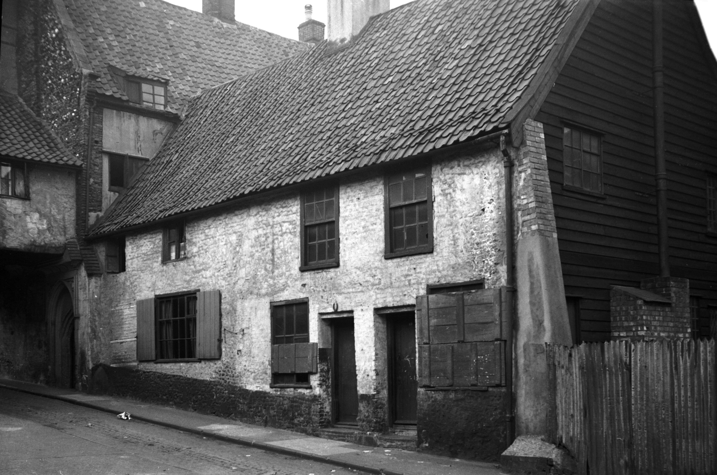
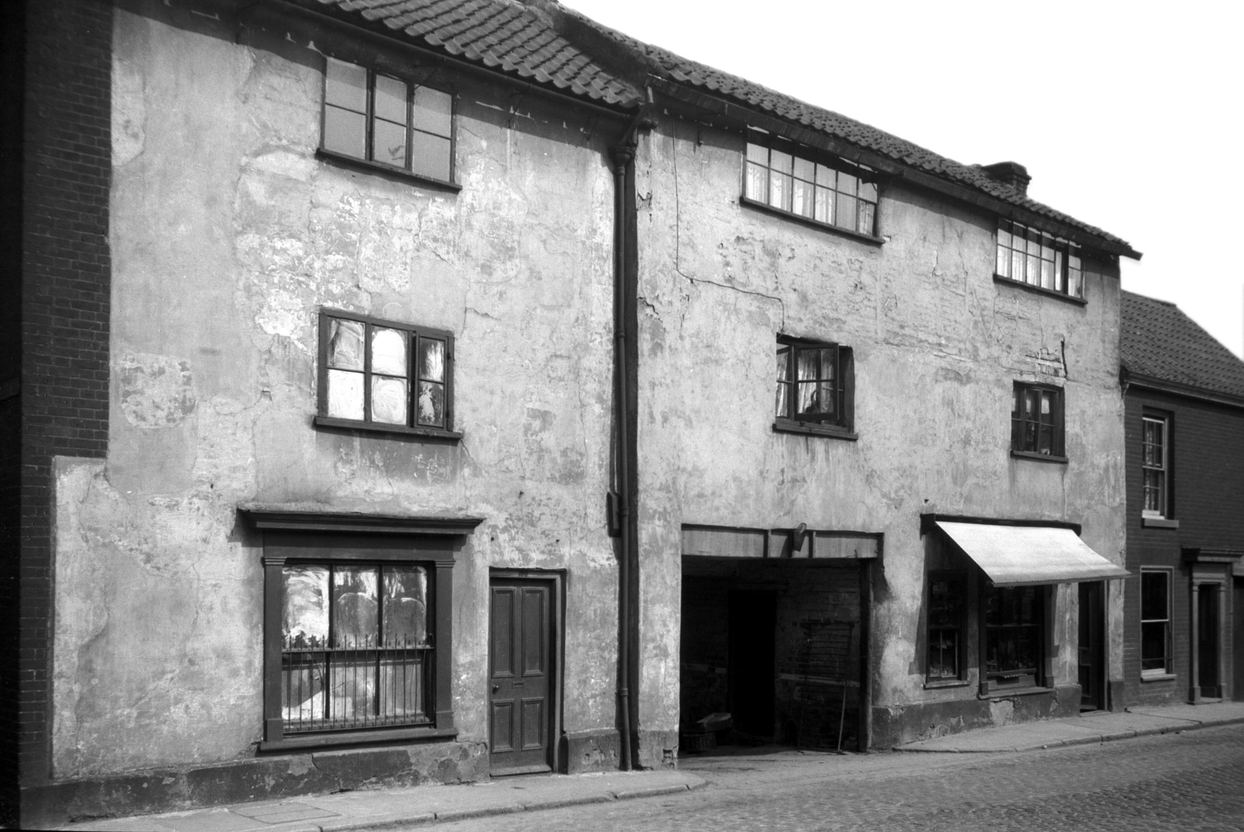
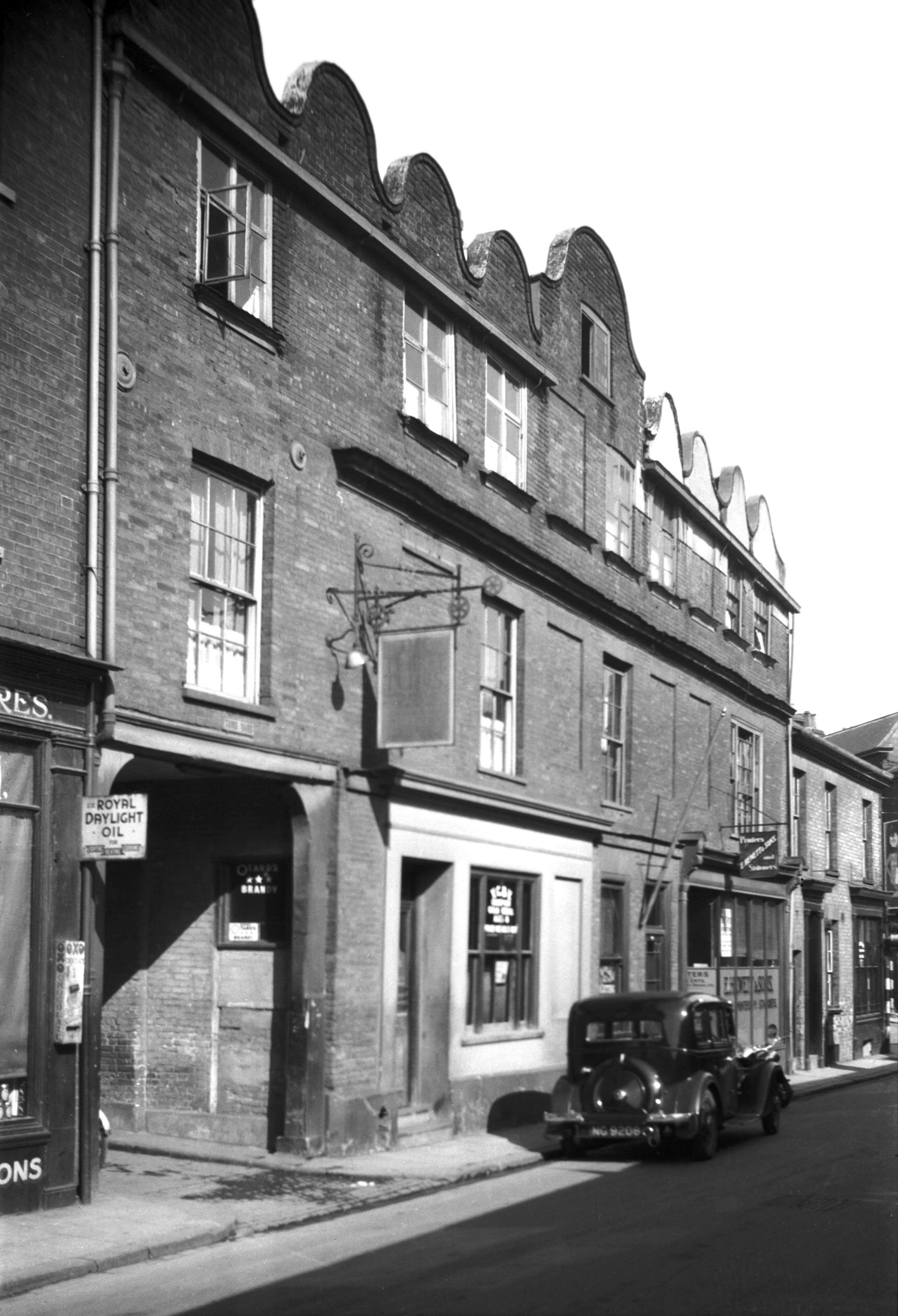
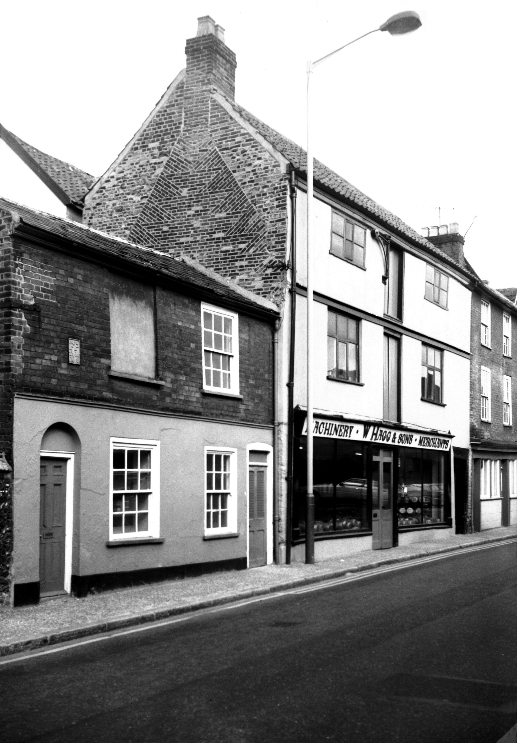
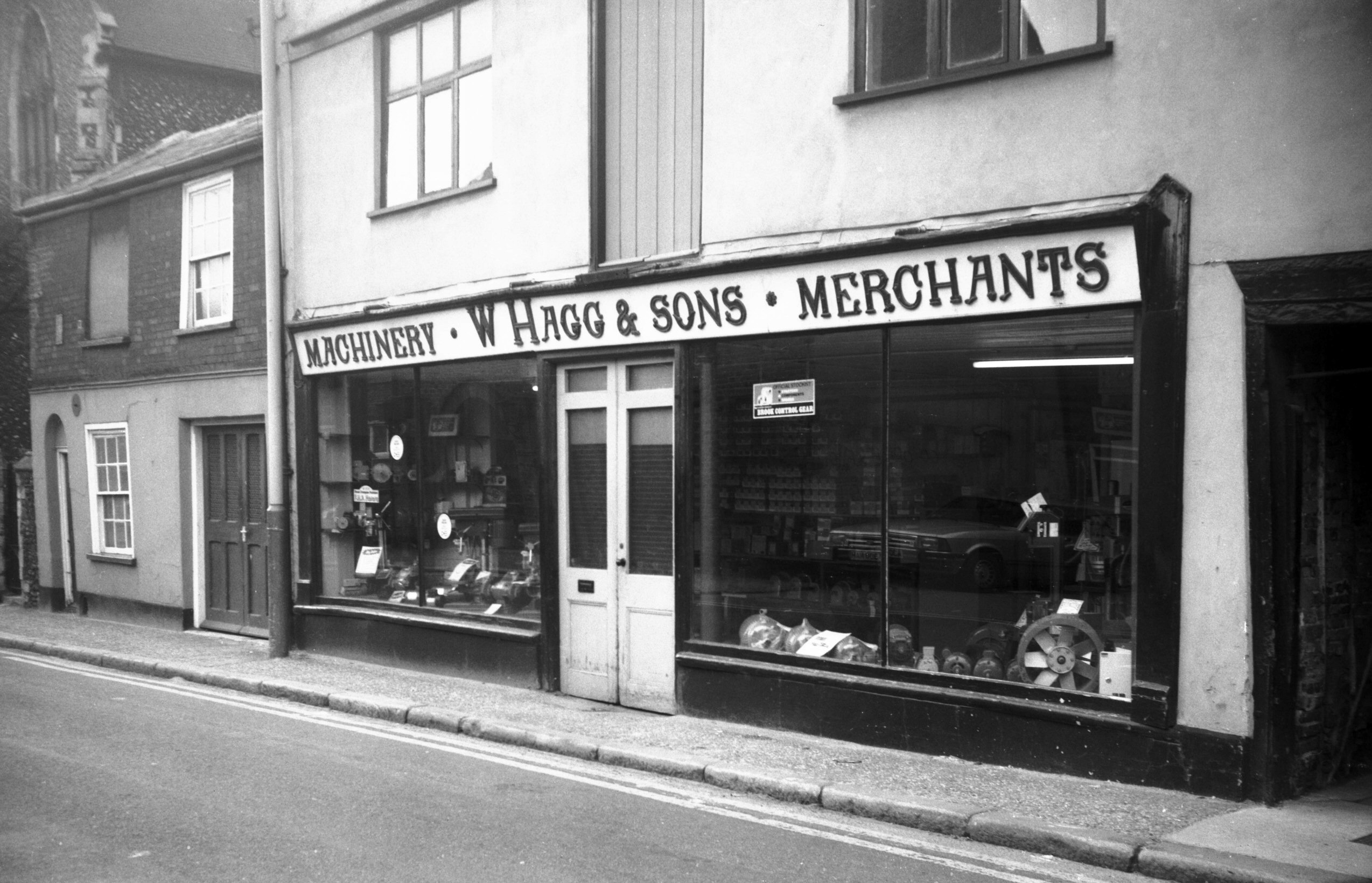
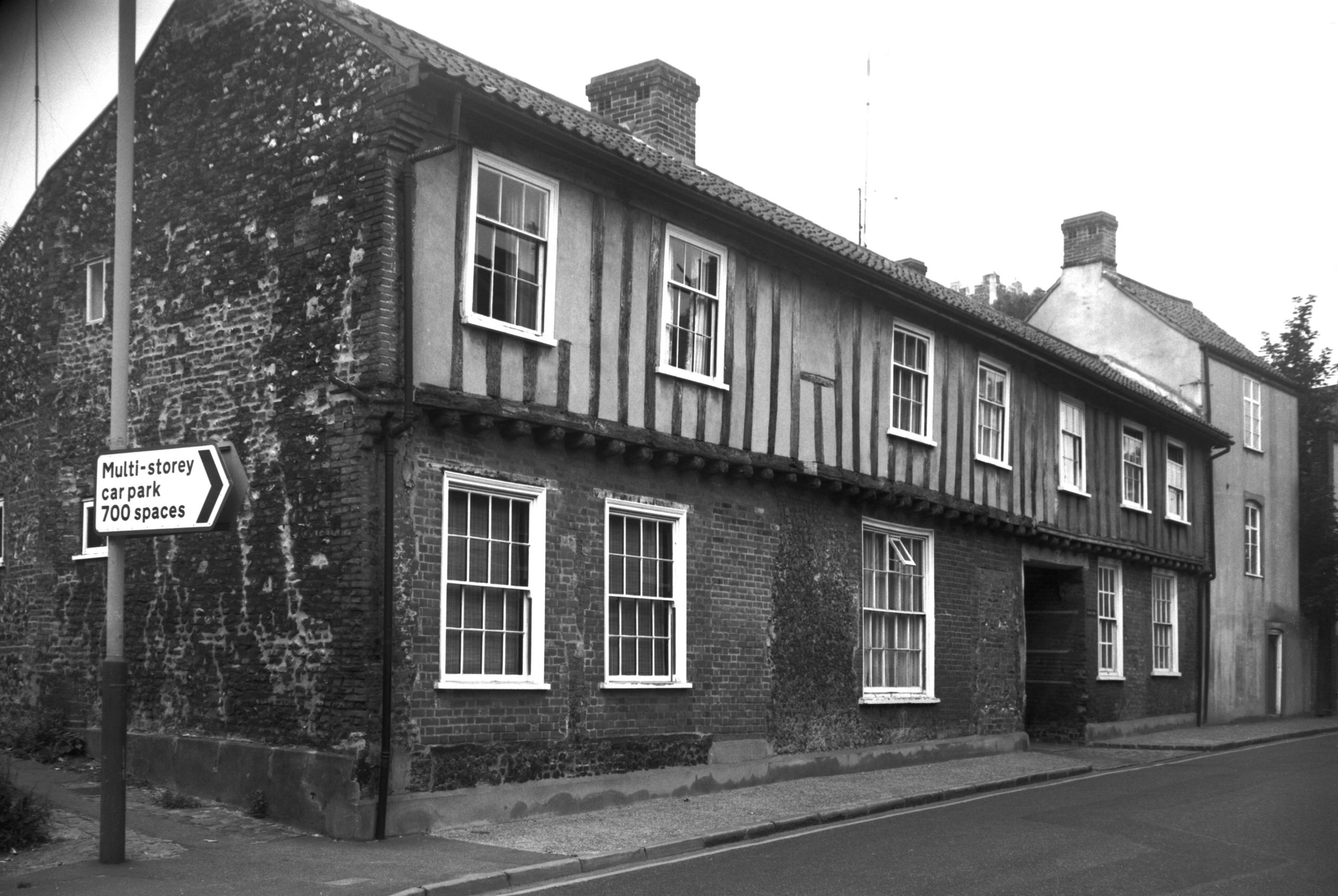
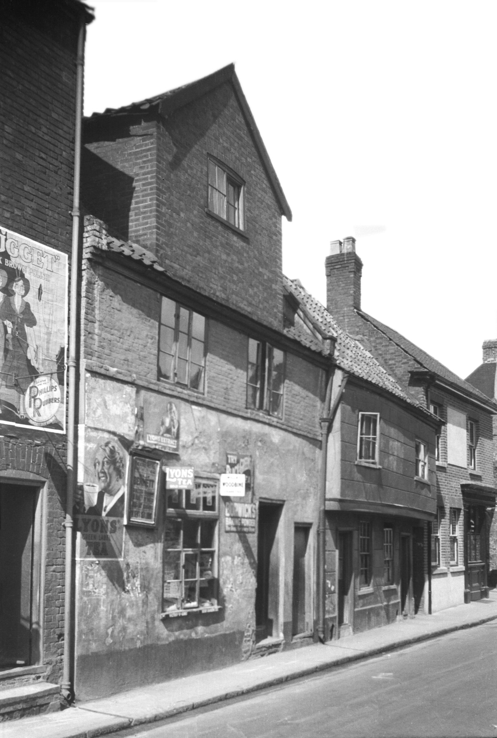
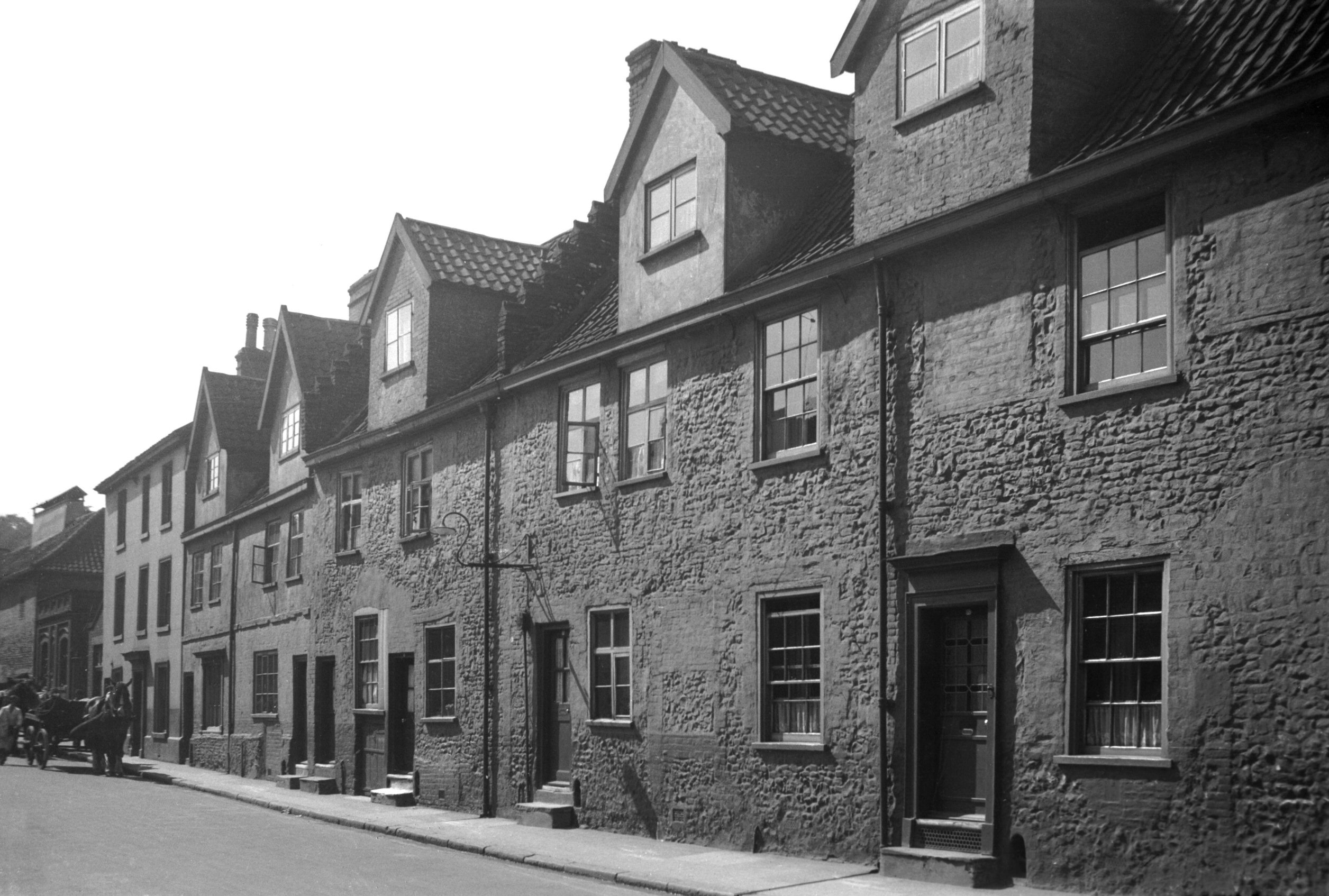
King St 47 to 51 [1264] 1936-08-13
Nos 47-51 King St formerly bounded Murrell's Yard. Of
these Walter Rye wrote in 1916 that they were
"noticeable for having portions of some of the
original open shop fronts and a little late Gothic window
upstairs…I should date the block about 1450".
Some time before 1936 however, when the photograph was
taken, some disaster had befallen No 51 resulting in the
loss of its upper storey, and all three shops have since
been swept away. No 45, a separate structure to the
north, still stands, and is timber framed (as were its
neighbours), with its plastered upper front jettied out
slightly over the pavement. It probably dates from the
16c and later, although the present shop front is of
course modern. |
|
|
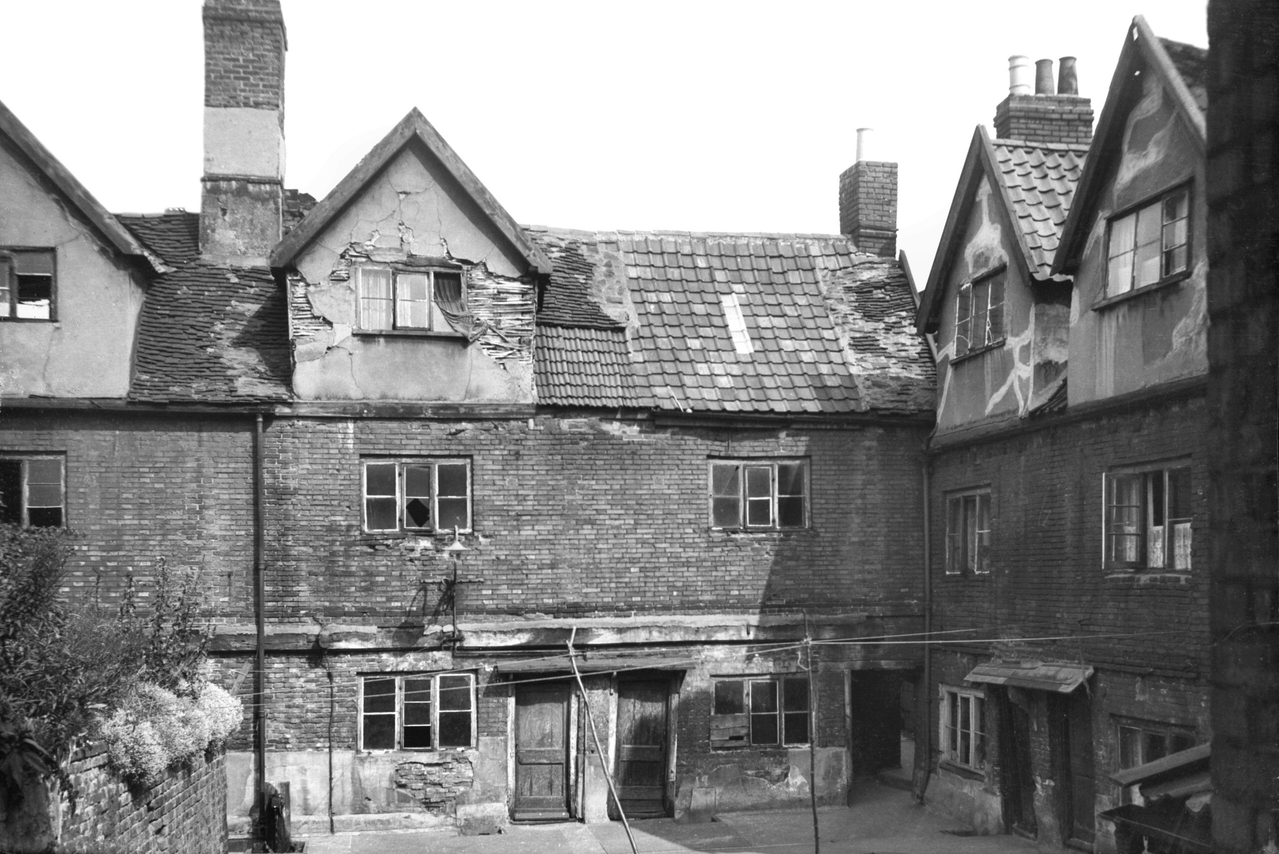
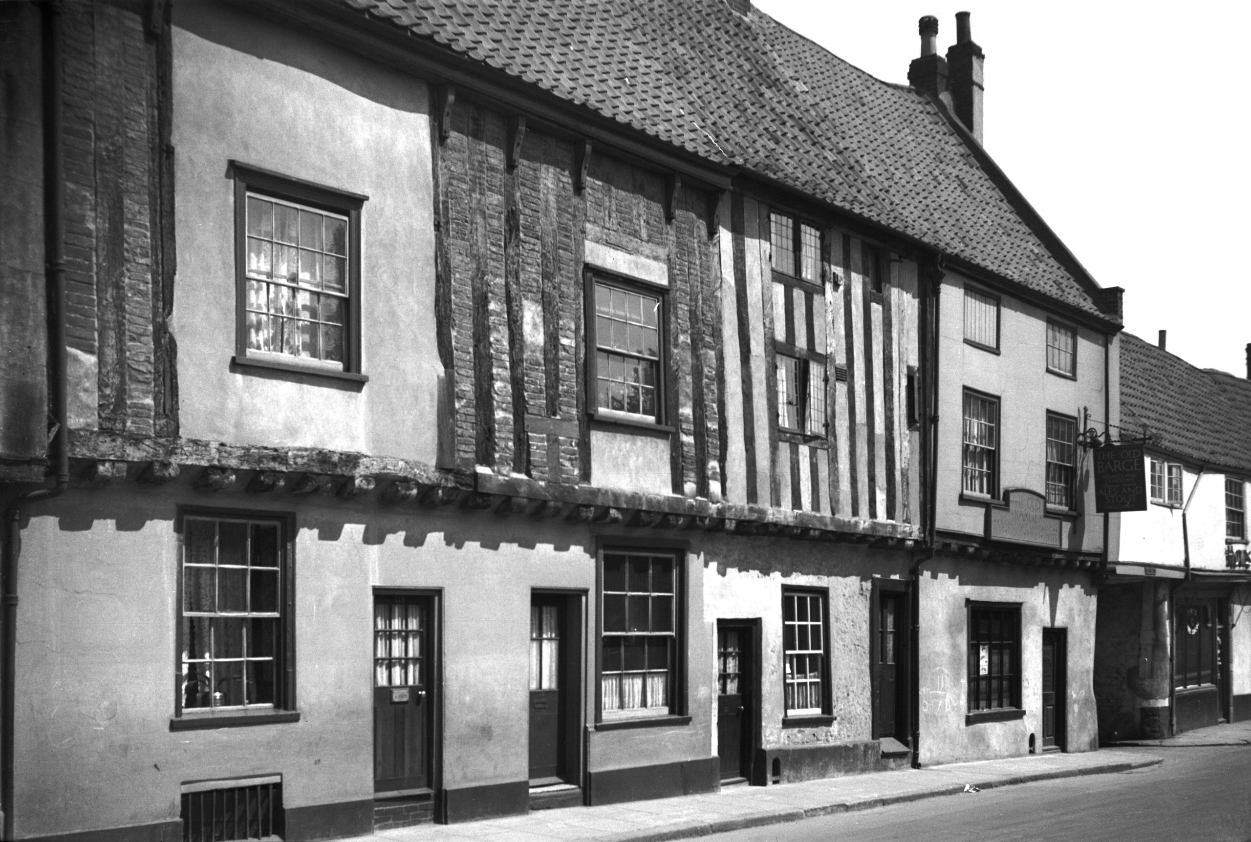
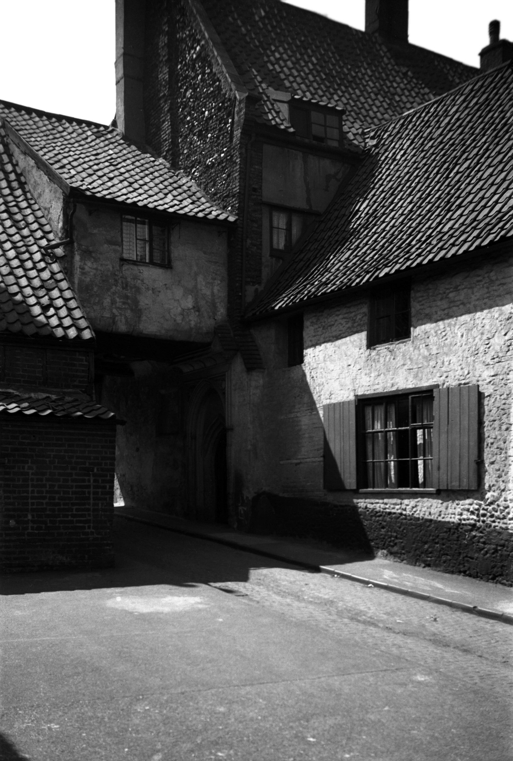
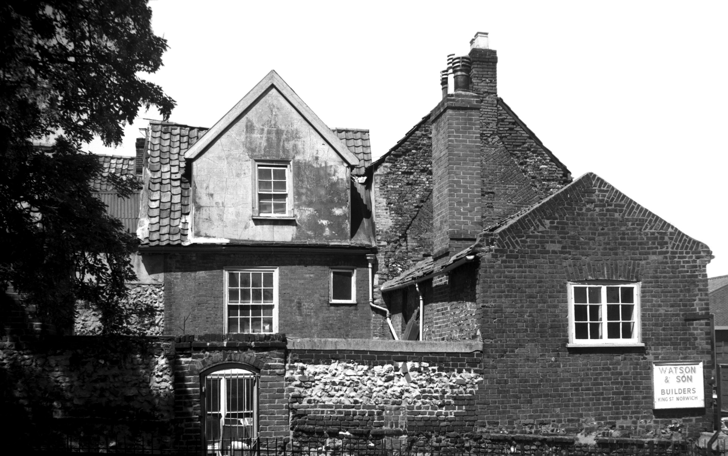
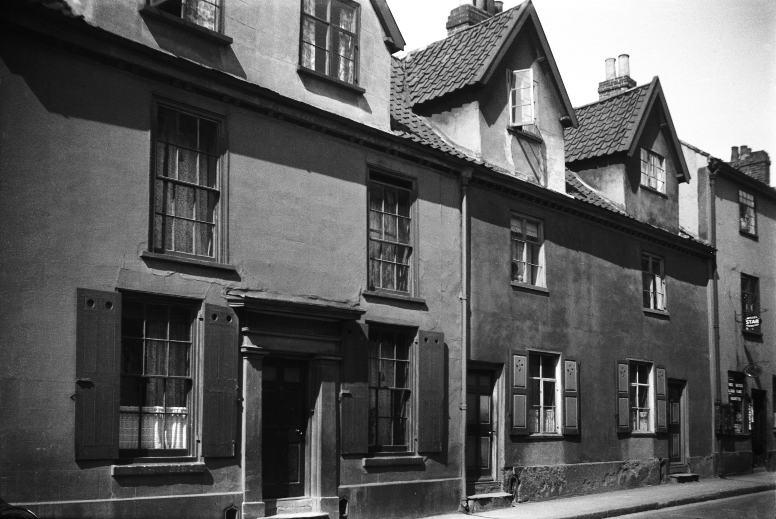
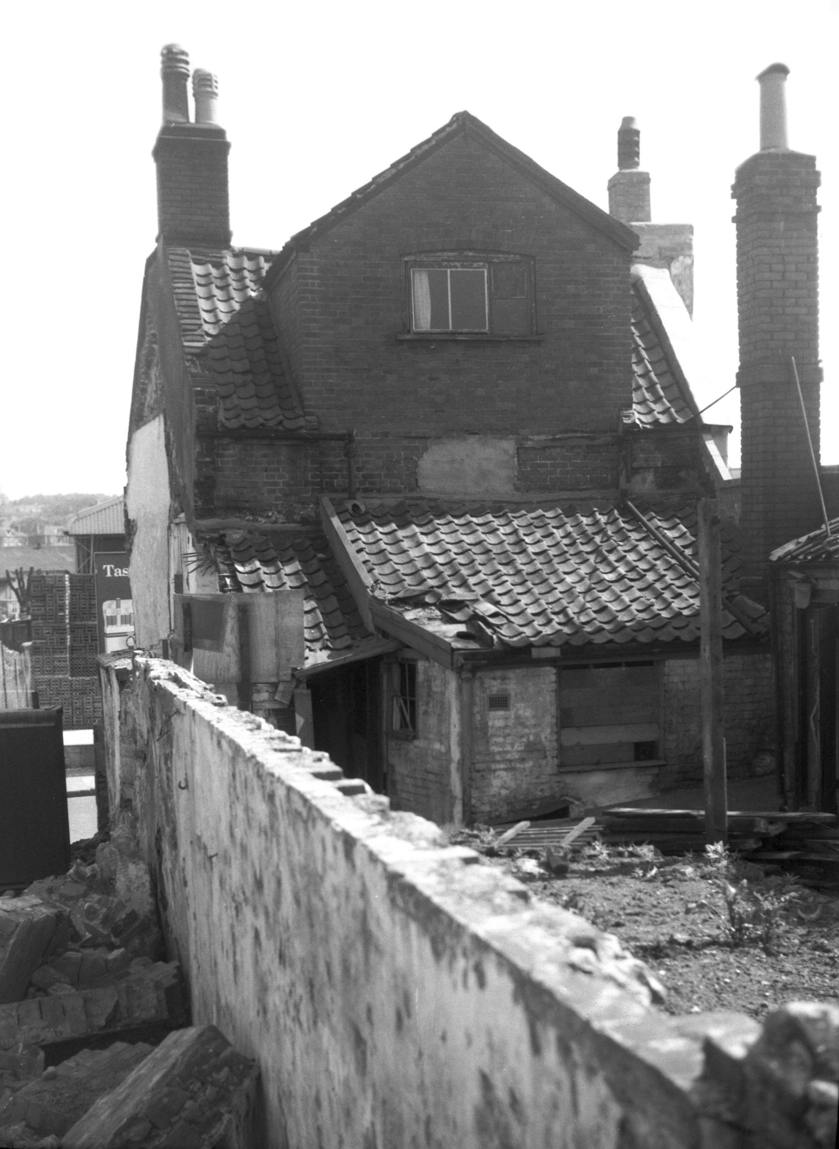
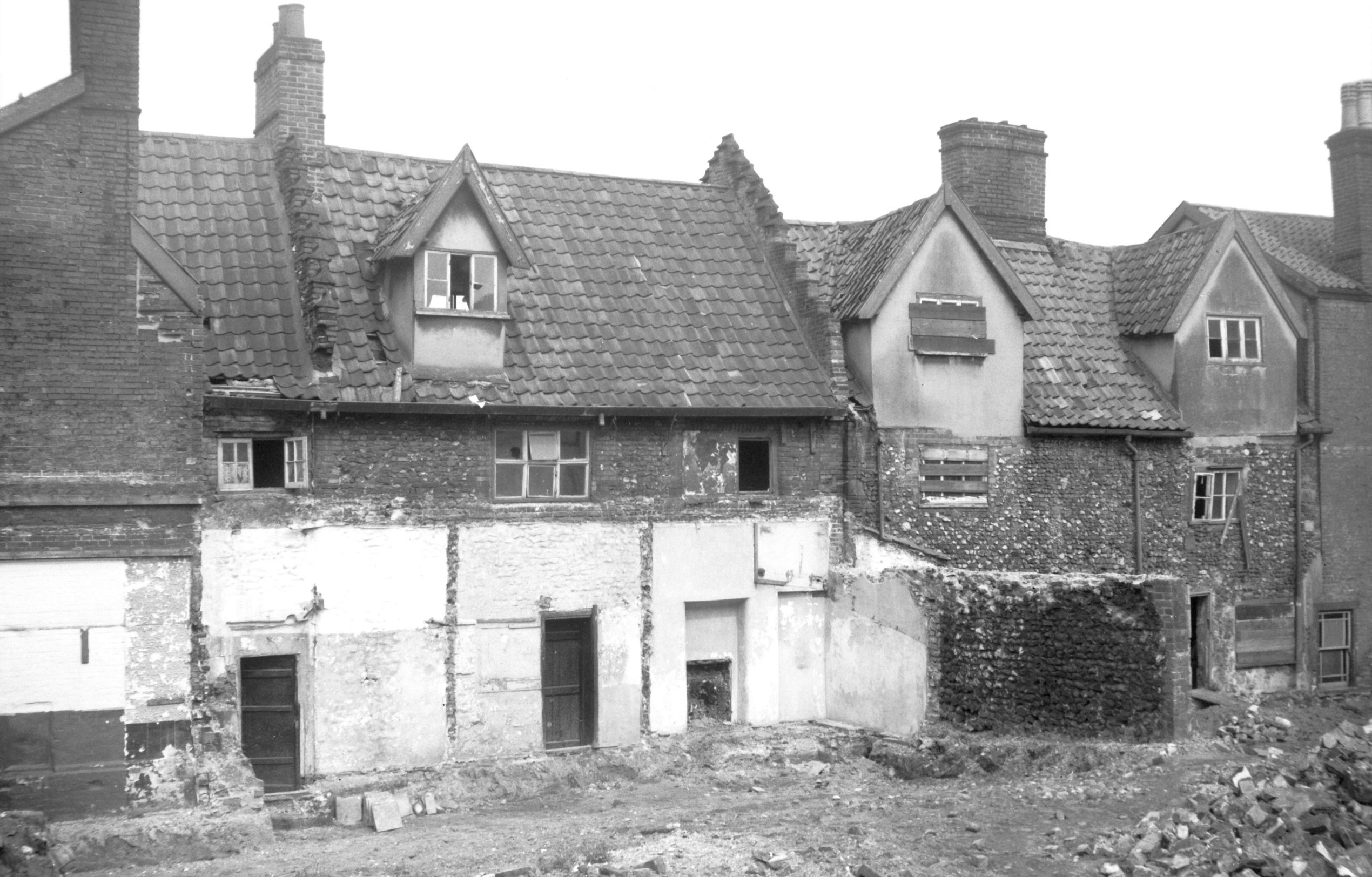
King St Murrell's Yard [1265] 1936-08-13
Murrell's Yard itself was formerly approached through an
opening spanned by a wooden archway, sketched by John
W.Howard c1890, and which he described as "ancient
but rather ugly". Within the yard stood another
doorway that he also sketched, the spandrels of which are
understood to have been transferred to the Norwich Castle
museum c1926. It had the arms of East Anglia in one
spandrel, and in the other a bell in a letter
"R" - the rebus of Robert Bell, who was
admitted to the freedom of the city in the reign of King
Henry VII. At the time of Edward VI the property belonged
to Henry Humphrey, a draper. The houses seen here were of
17c origin, brick with lath and plaster dormers and
having roofs made up of a patchwork of English plain
tiles and more modern pantiles. All were demolished in
May 1939, and for a while a brick air raid shelter
occupied the site. |
|
|
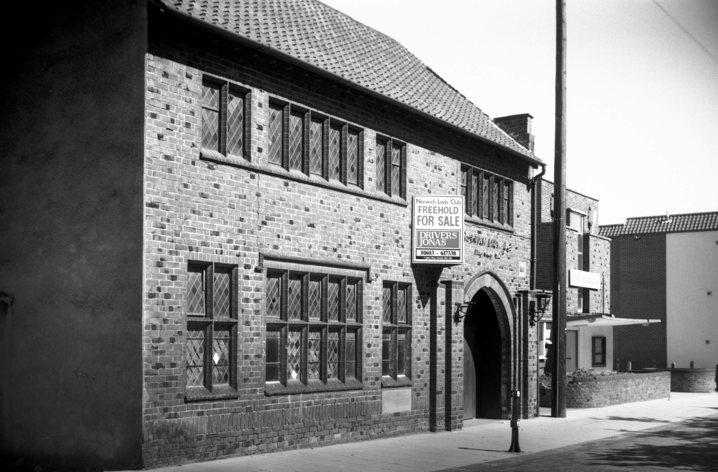
King St Lads' Club George V Memorial Hall [7453]
1997-06-01
Built 1937. |
|
|
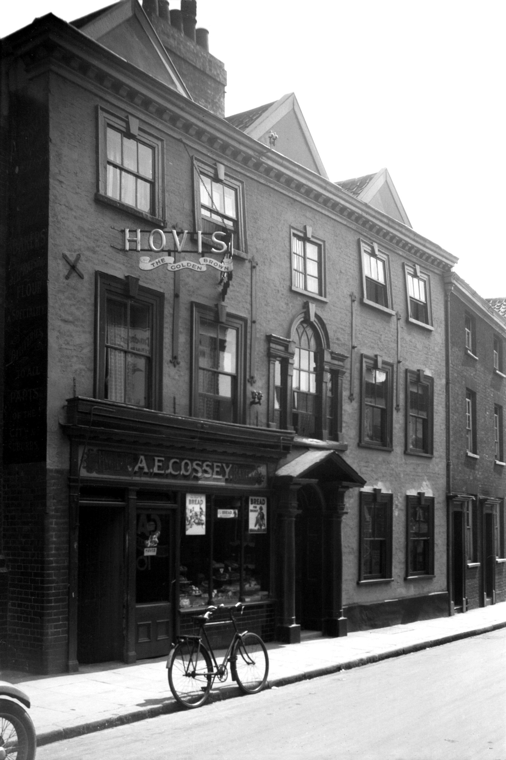
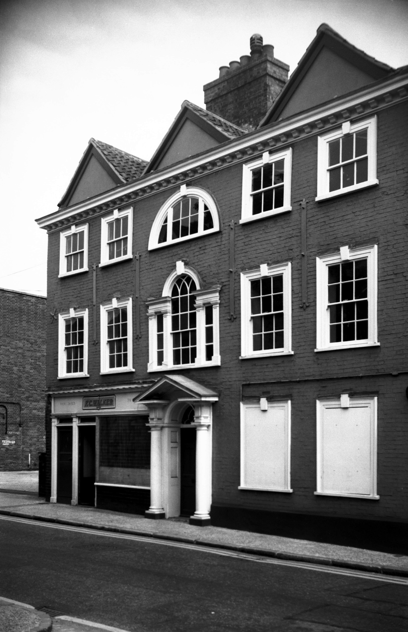
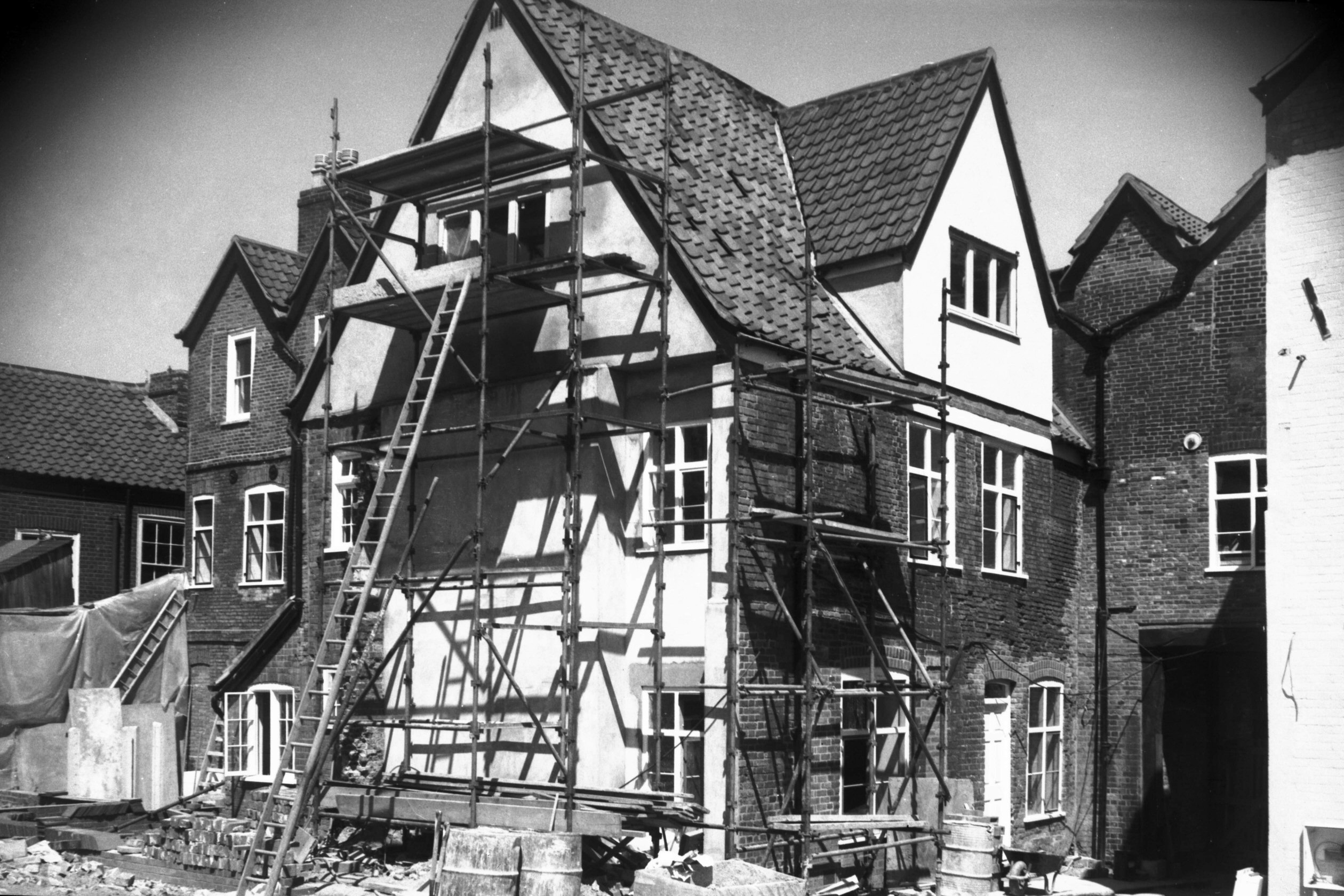
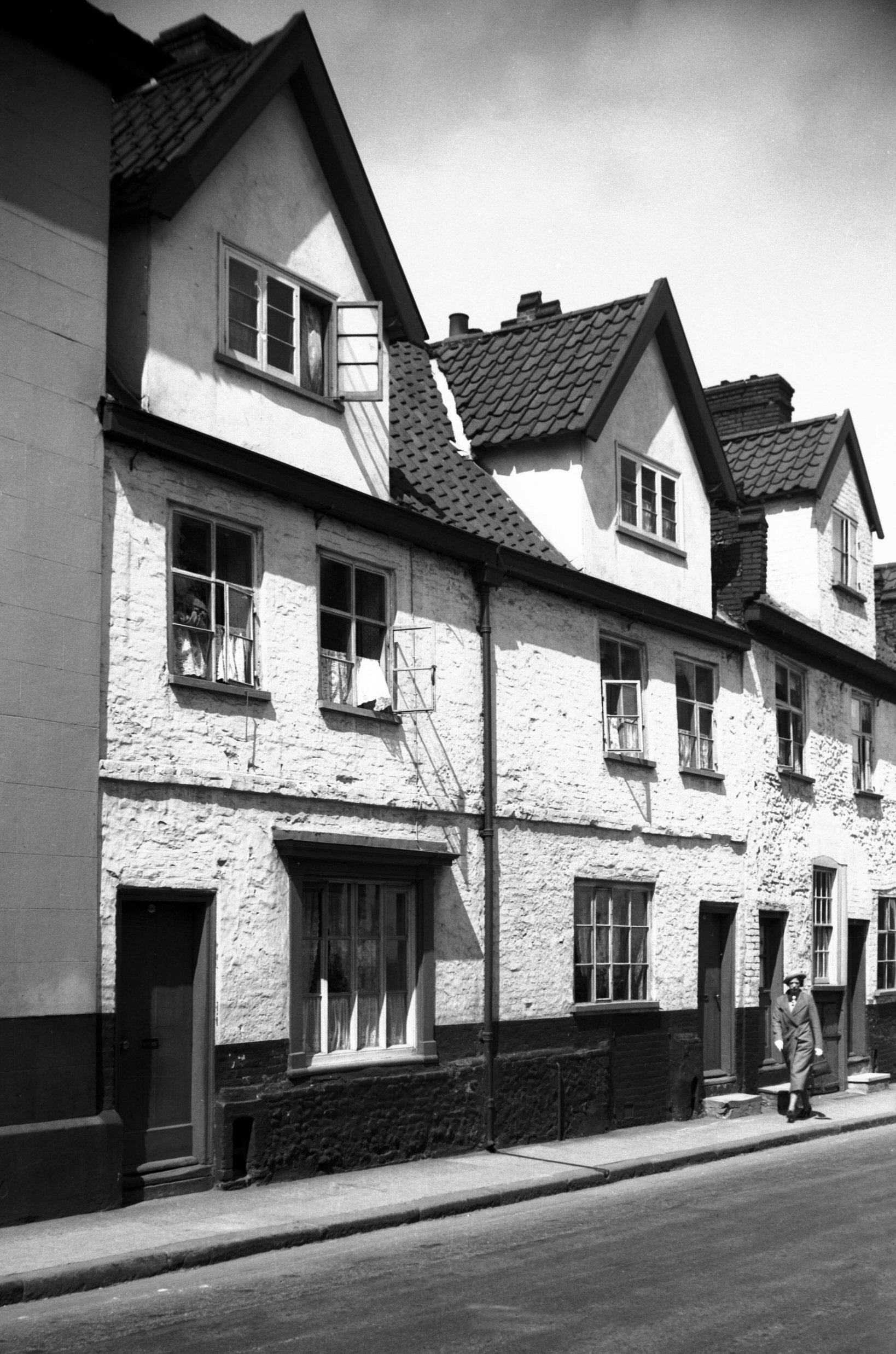
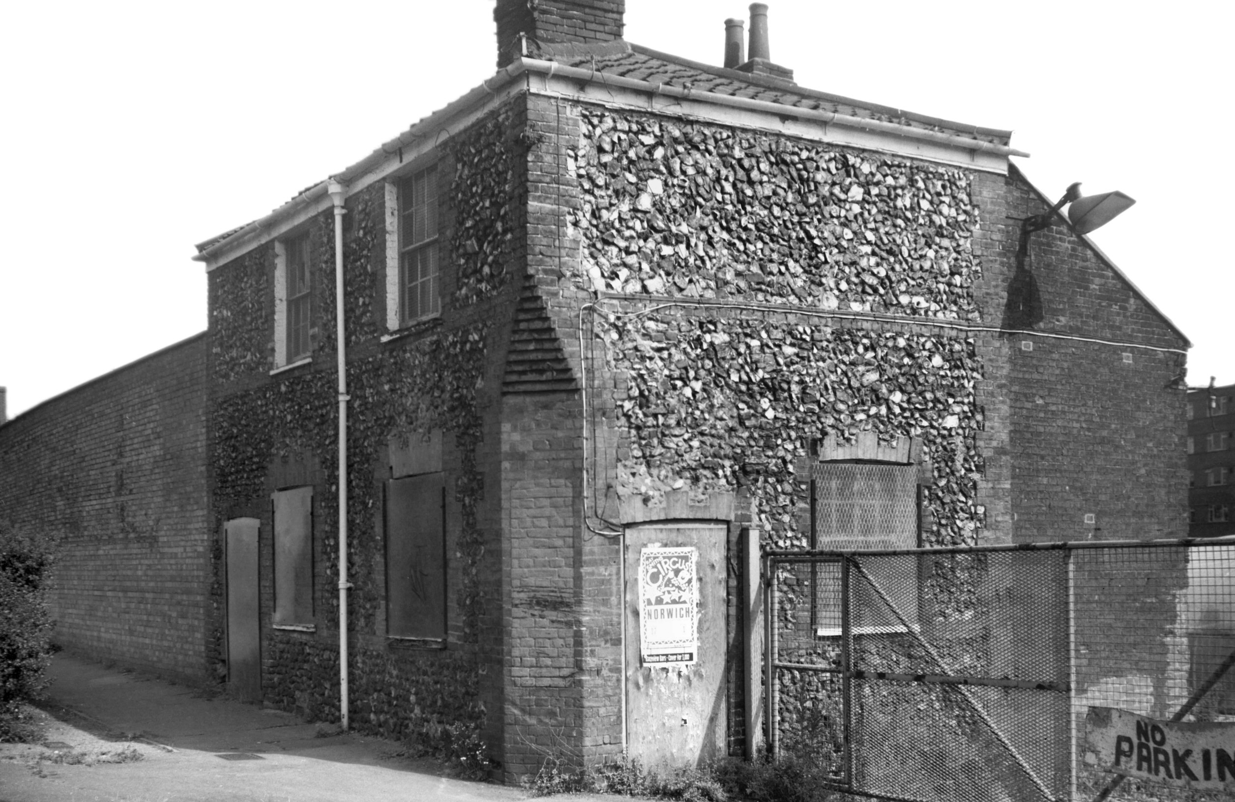
King St 79 [1299] 1936-08-22
|
|
|
King St 79 [6223] 1981-08-13
|
|
|
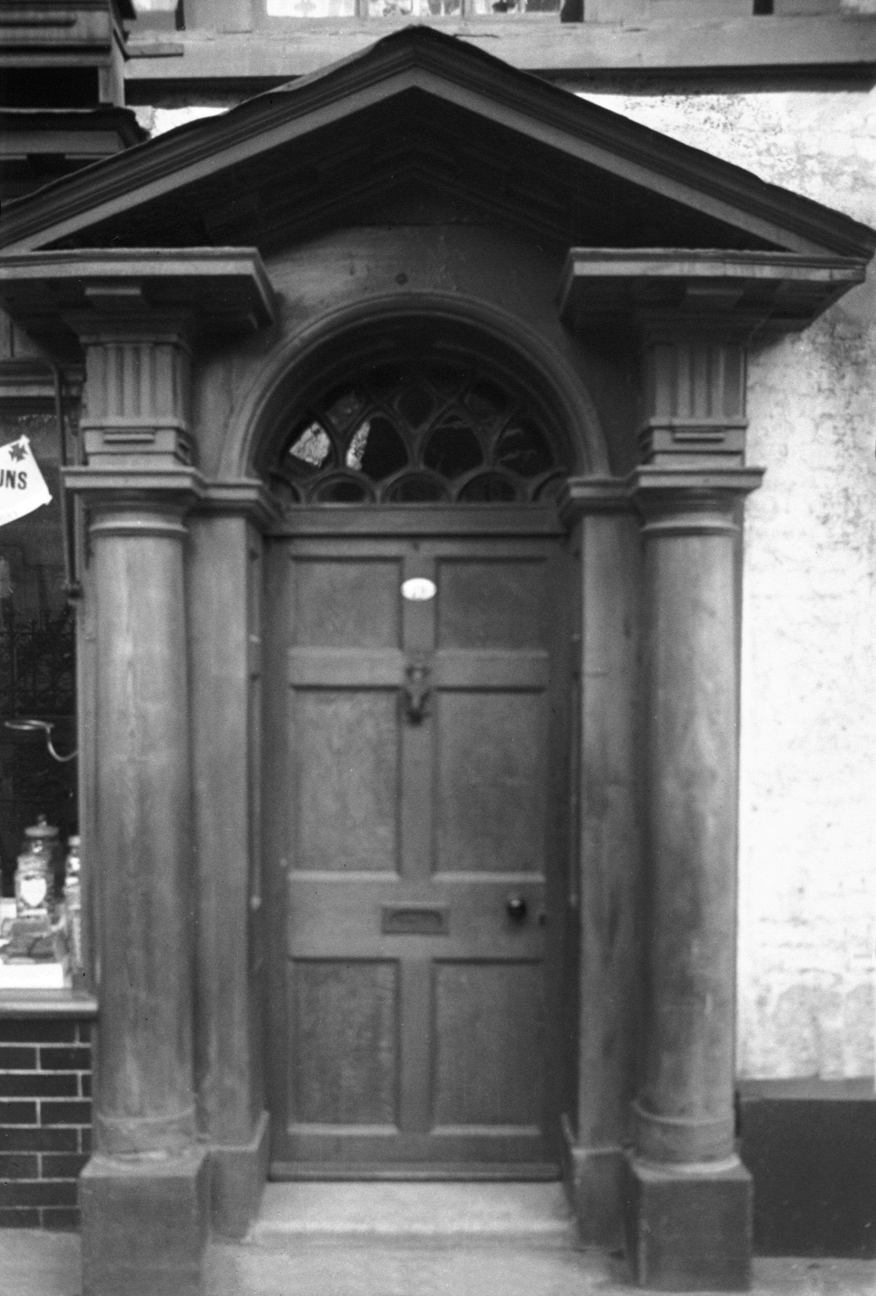
King St 79 Georgian doorway [0464] 1935-04-19
|
|
|
King St 81 to 83 rear Lanes Yard [6559] 1989-06-30
|
|
|
King St 83 to 87 [6328] 1985-06-02
|
|
|
King St 83 to 87 restoration [6523] 1988-08-26
|
|
|
King St 87 to 89 rear Lanes Yard [6560] 1989-06-30
|
|
|
King St 95 [6786] 1992-05-16
|
|
|
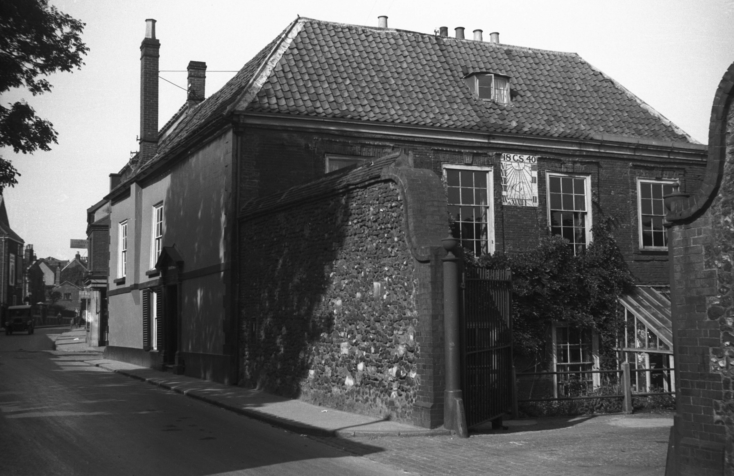
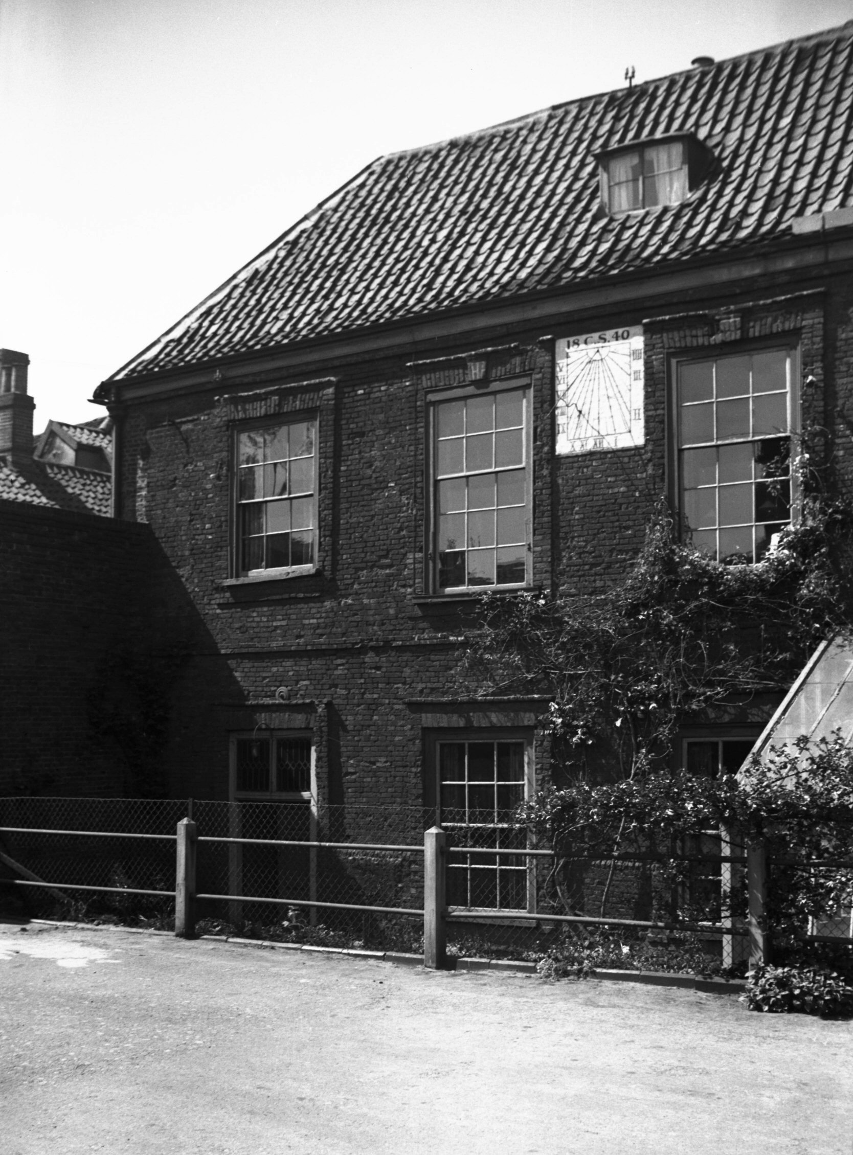
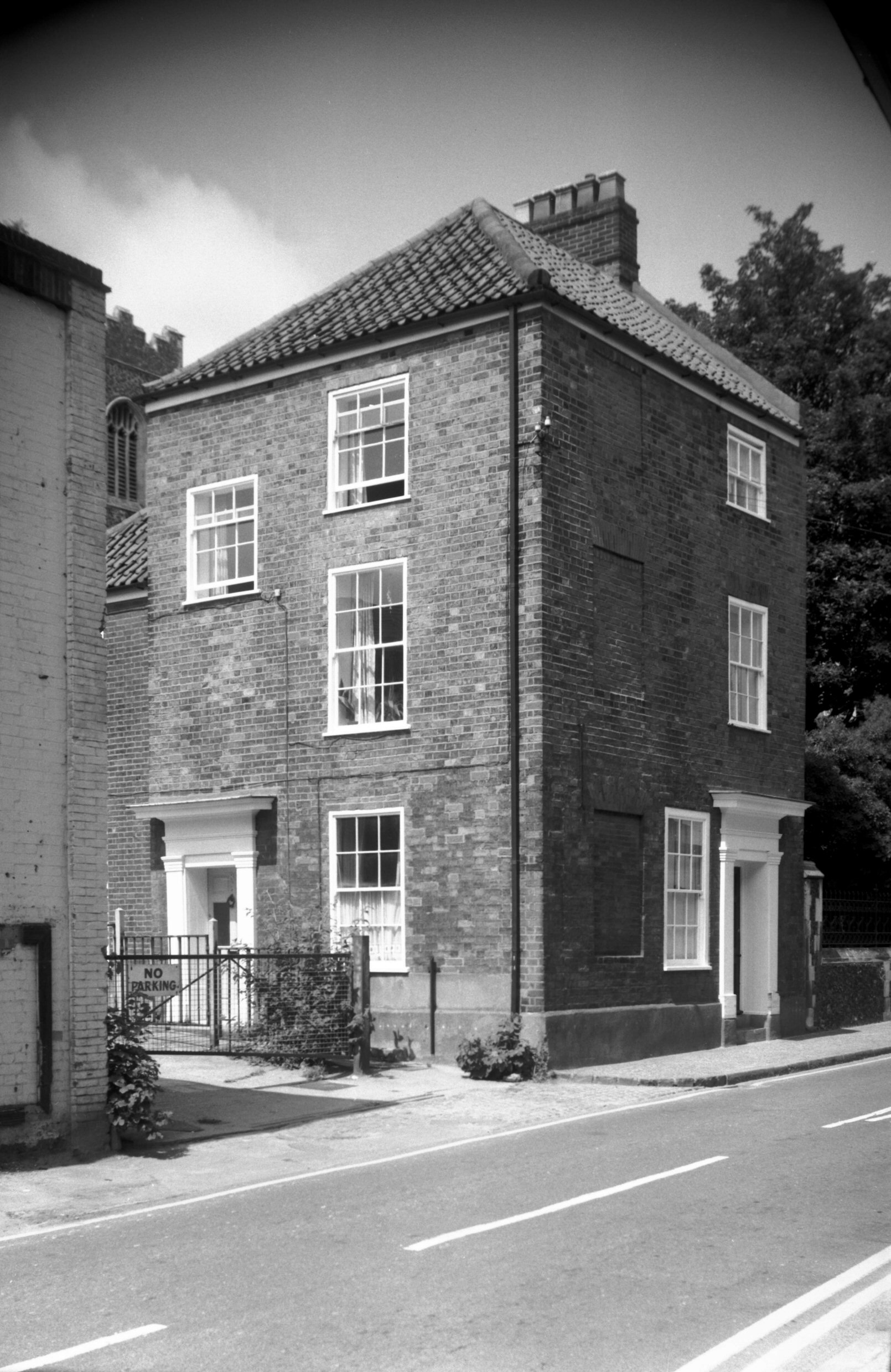
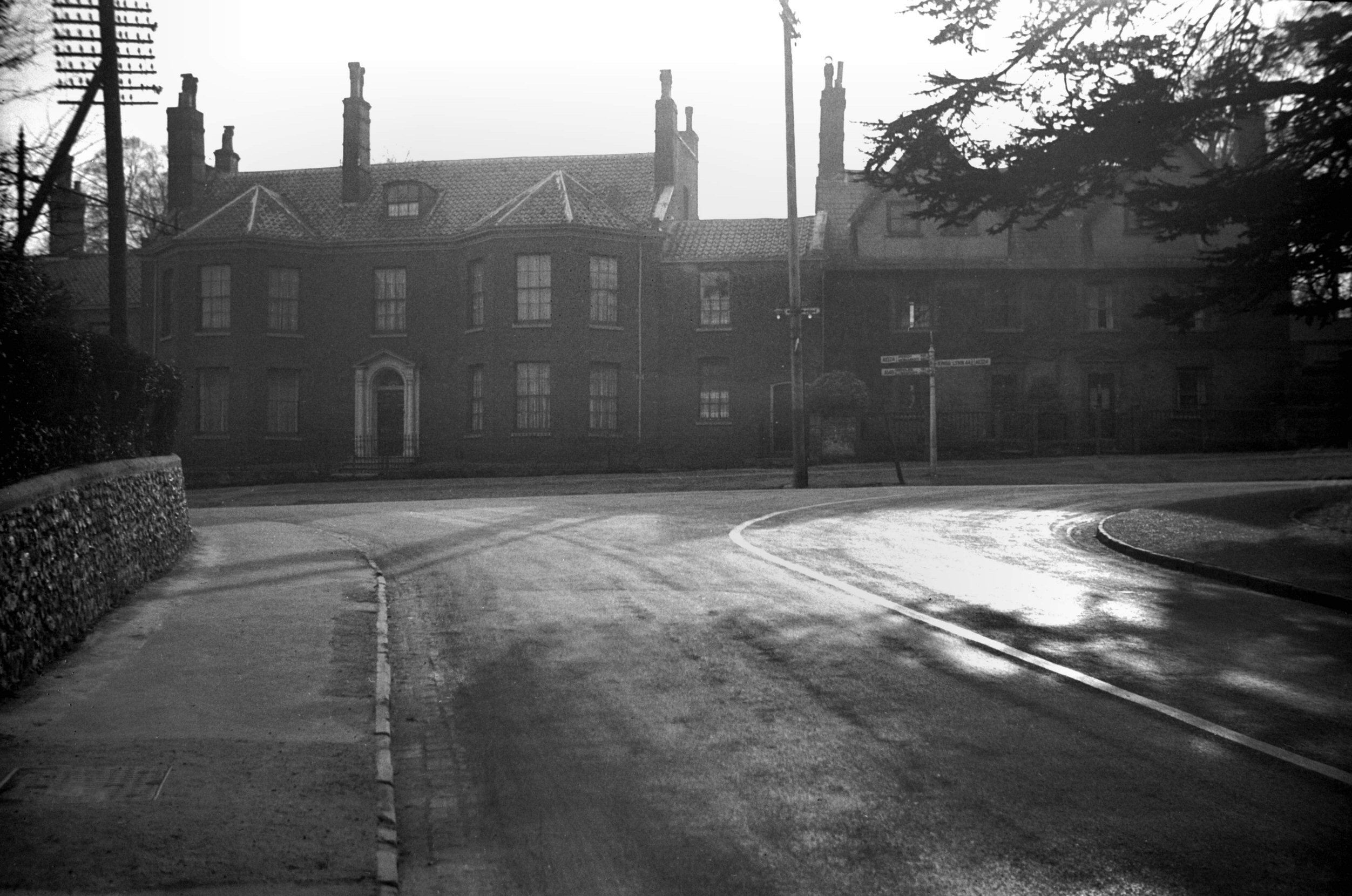
King St 97 Howard House from NW [6226] 1981-08-17
The site of the church, known as St Michael-in-Conesford,
is shown by the historian Francis Blomefield in his plan
of the city as being midway between St Anne's Lane and
Mountergate. Records concerning it date back to 1183,
when it was possessed by the Abbot of St
Benet's-at-Holme, but from 1293 onwards the Austin Friars
gradually acquired adjoining land and houses; by about
1360 they had taken over the whole of the parish on that
side of the St. The demolition of the church soon
followed, and it was replaced by "a noble Cloister
and Conventional Church ... inclosed … with a high
wall".
Seized by Henry VIII at the time of the Dissolution it
subsequently passed through many hands. In the mid-17c
the site was owned by Henry Howard who afterwards became
Lord Howard of Castle Rising. He it was, who about 1660
built the existing house, whose chief feature is its
remarkable staircase. Described as one of the most
elaborate of its kind in England, this staircase has
openwork panels in strapwork designs instead of
balusters. On the south front of Howard House a sundial
dated 1840 bears the initials C.S. - those of Dr
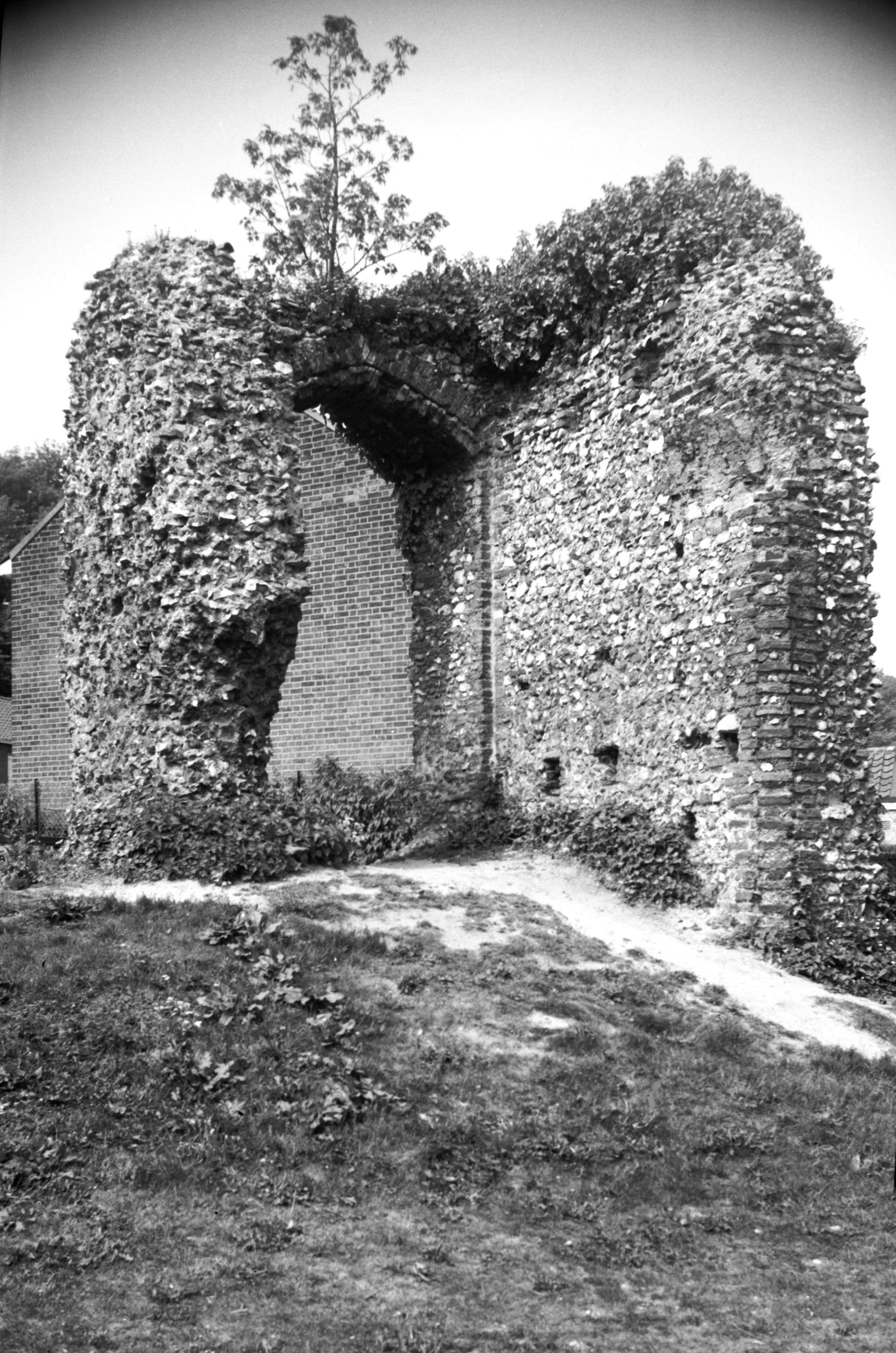
Christopher Spencer, the owner - while immediately
adjoining the house the remains of a substantial flint
wall may well be a surviving fragment of the old precinct
wall of the Friary. When the house was first built the
adjoining grounds were laid out as "a place of
walking and recreation", and a century later were
still being referred to as "My Lord's Gardens". |
|
|
King St 97 Howard House [0288] 1934-09-13
The garden wall is probably the original boundary wall of
the Austin Friars friary precint. |
|
|
King St 97 Howard House from south [3413] 1940-05-16
|
|
|
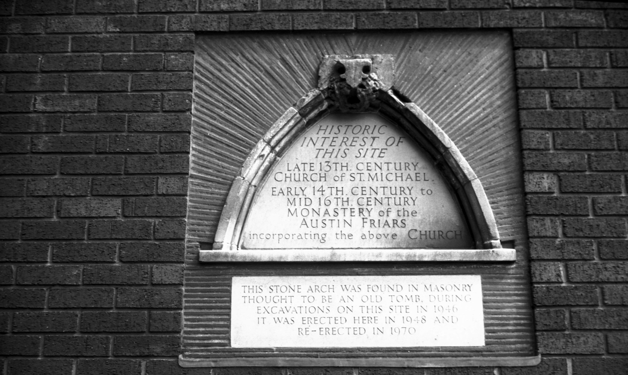
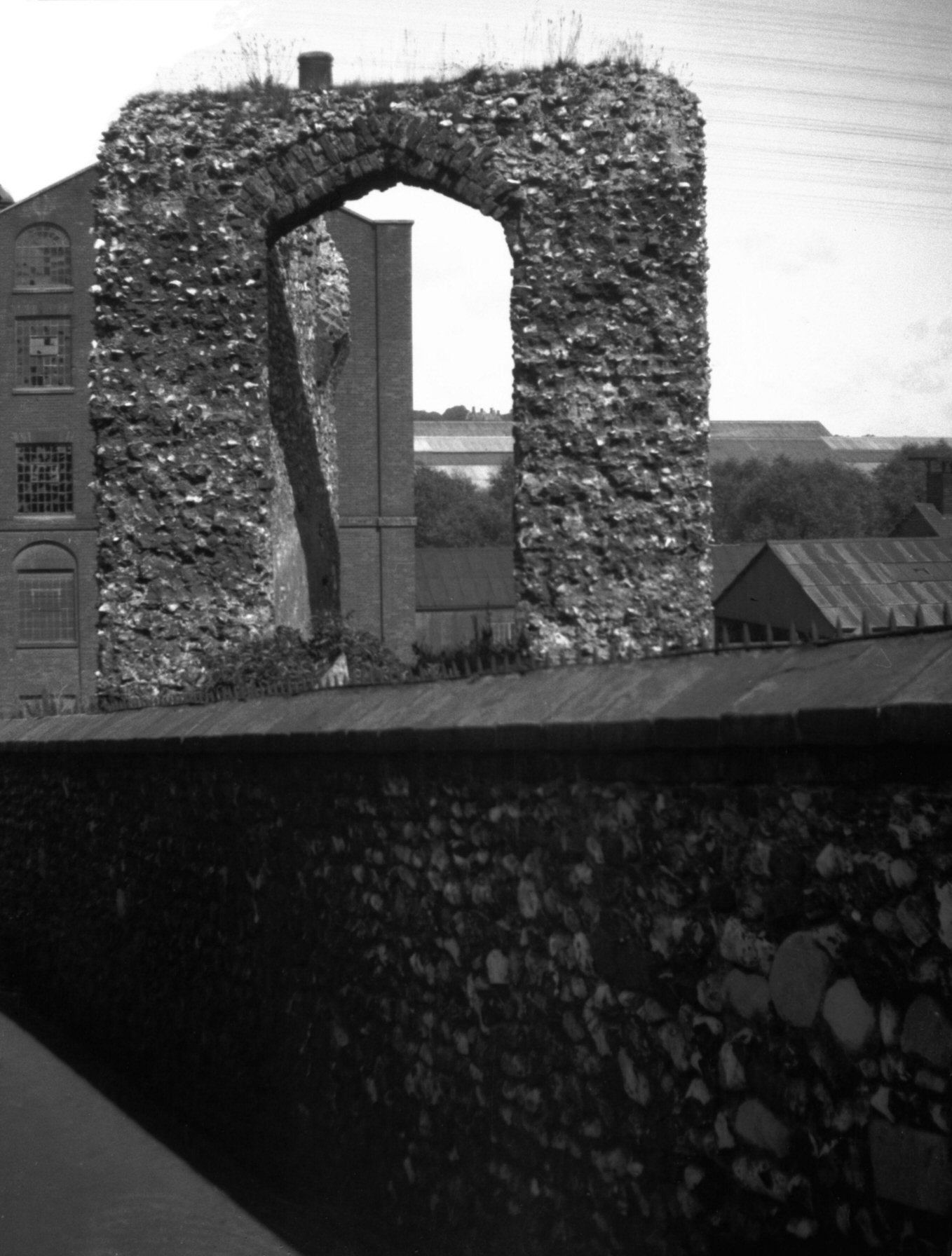
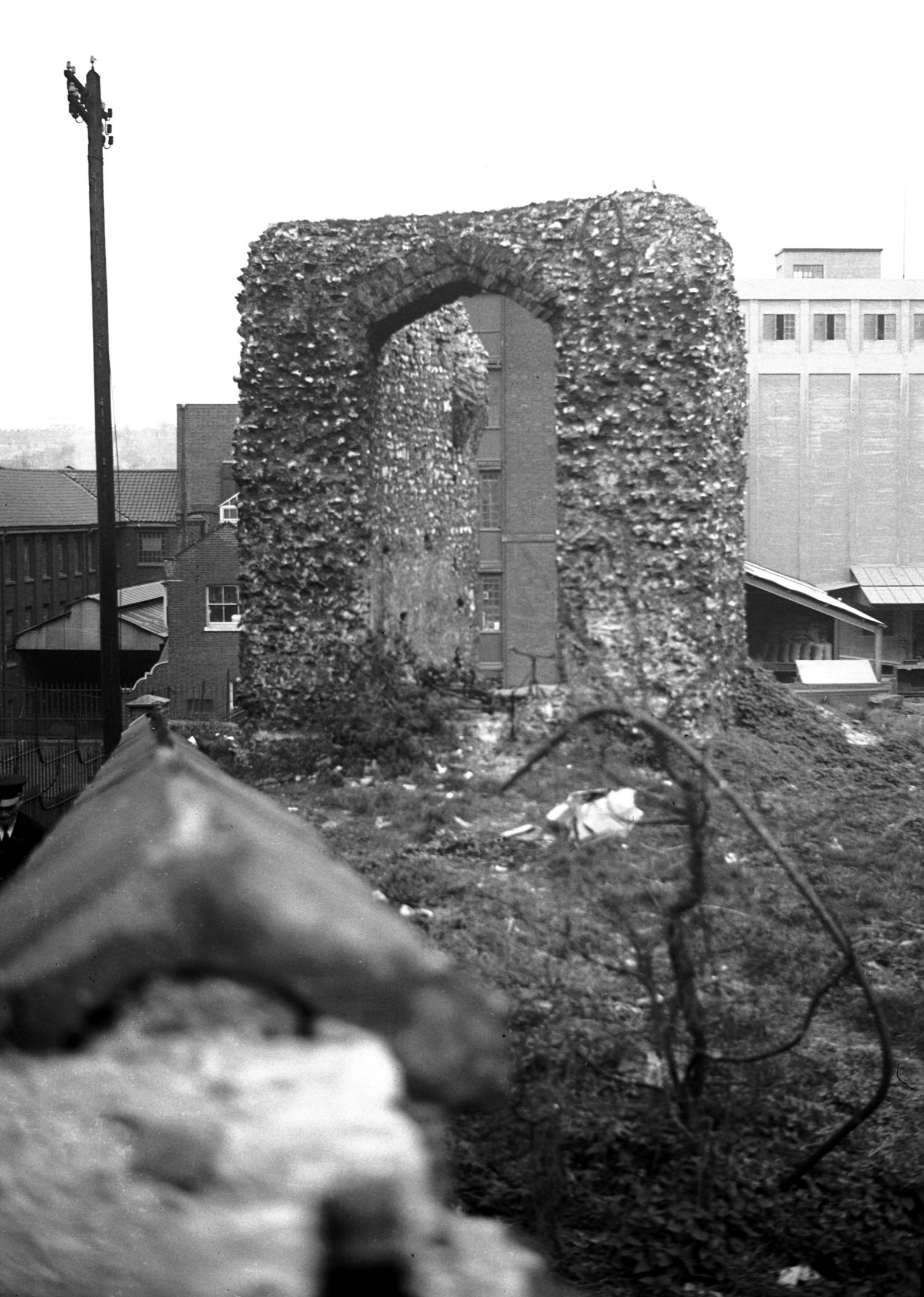
Austin Friars King St stone arch [3785] 1949-06-12
The first Charter of foundation for the Austin Friars in
King St is dated 1293. In 1360, having obtained the
parish church of St Michael-in-Conesford and most of the
land between Mountergate and the river, the friars pulled
down the church and built a noble convent, cloister and
conventual church. |
|
|
Austin Friars King St stone arch [6224] 1981-08-13
Built into a wall on the east side of the street in what
was Morgan's brewery are some fragments of stone with
these inscriptions: "Historic Interest of this Site.
Late 13c church of St Michael. Early 14c to mid 16c
Monastery of the Austin Friars incorporating the above
Church". "This Stone Arch was found in masonry
thought to be an old Tomb, during excavations on this
Site in 1946. It was erected here in 1948 and re-erected
in 1970." |
|
|
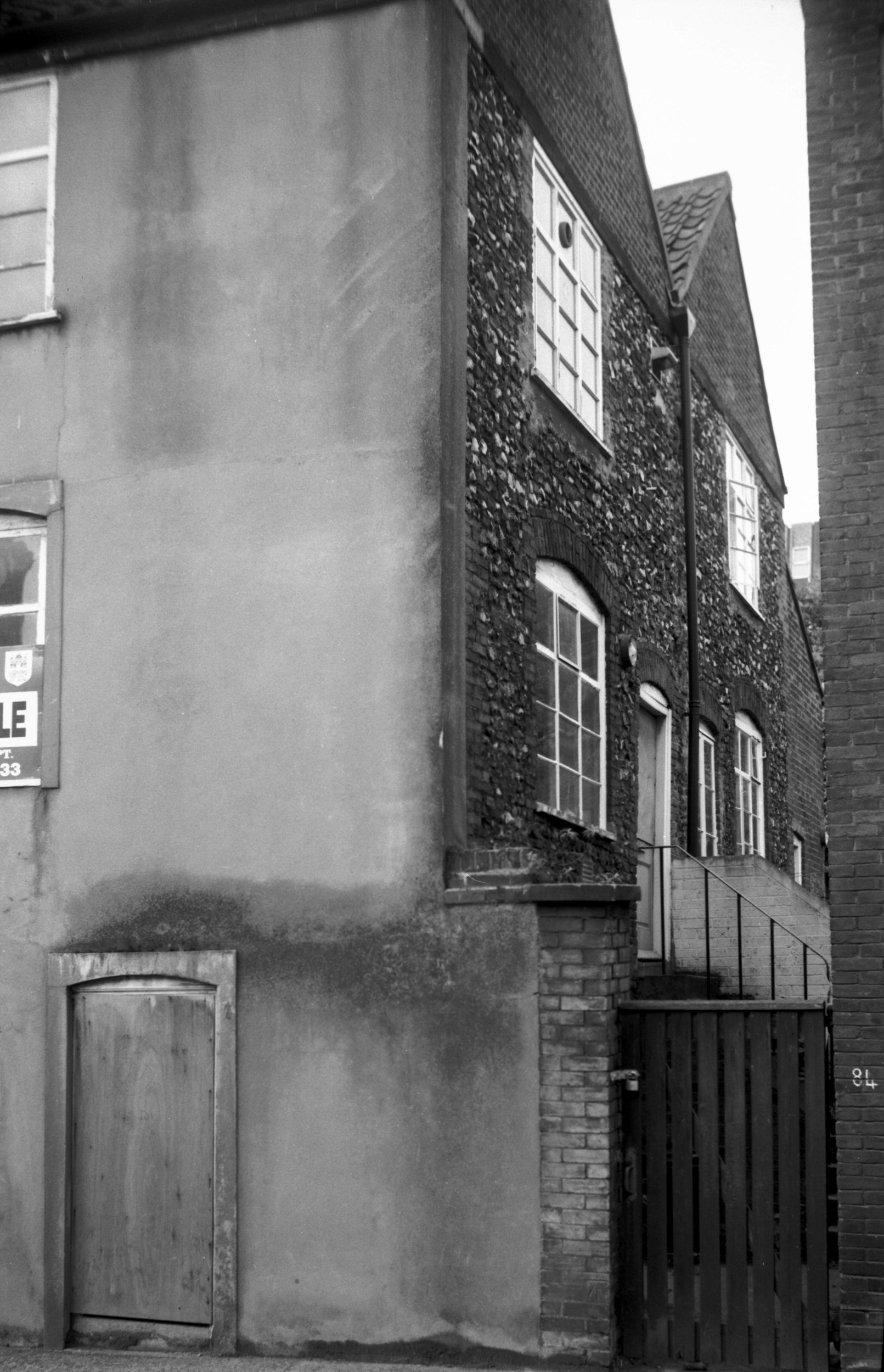
King St 113 to 119 [3245] 1939-08-13
|
|
|
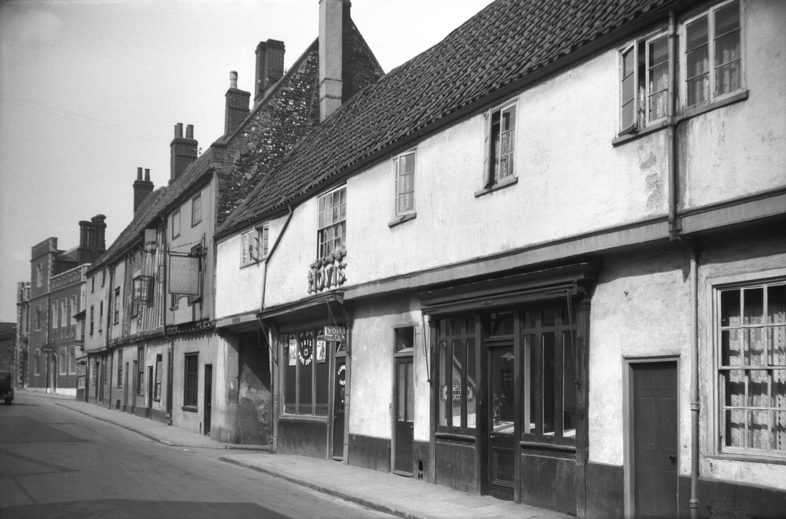
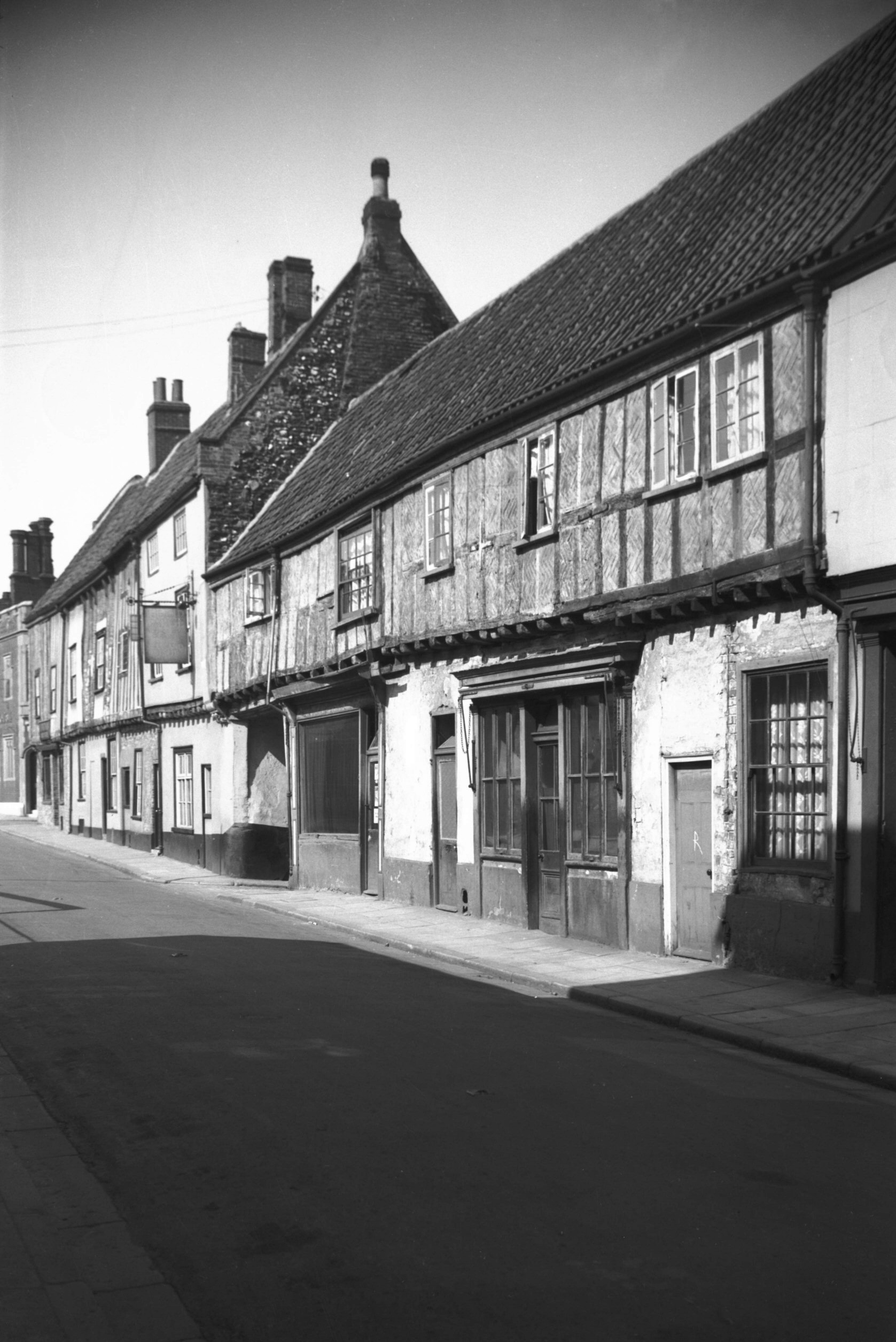
King St 113 to 123 [B090] 1931-00-00
An inn here in the 18c was known as the "Three Merry
Wherrymen". |
|
|
King St 113 to 123 The Old Barge Inn [0590]
1935-05-26
On this site in the 14c was Meddyz Inn, home of Roger
Midday, Bailiff of Norwich. |
|
|
King St 113 to 123 15c roof spandrel [6209]
1981-07-18
|
|
|
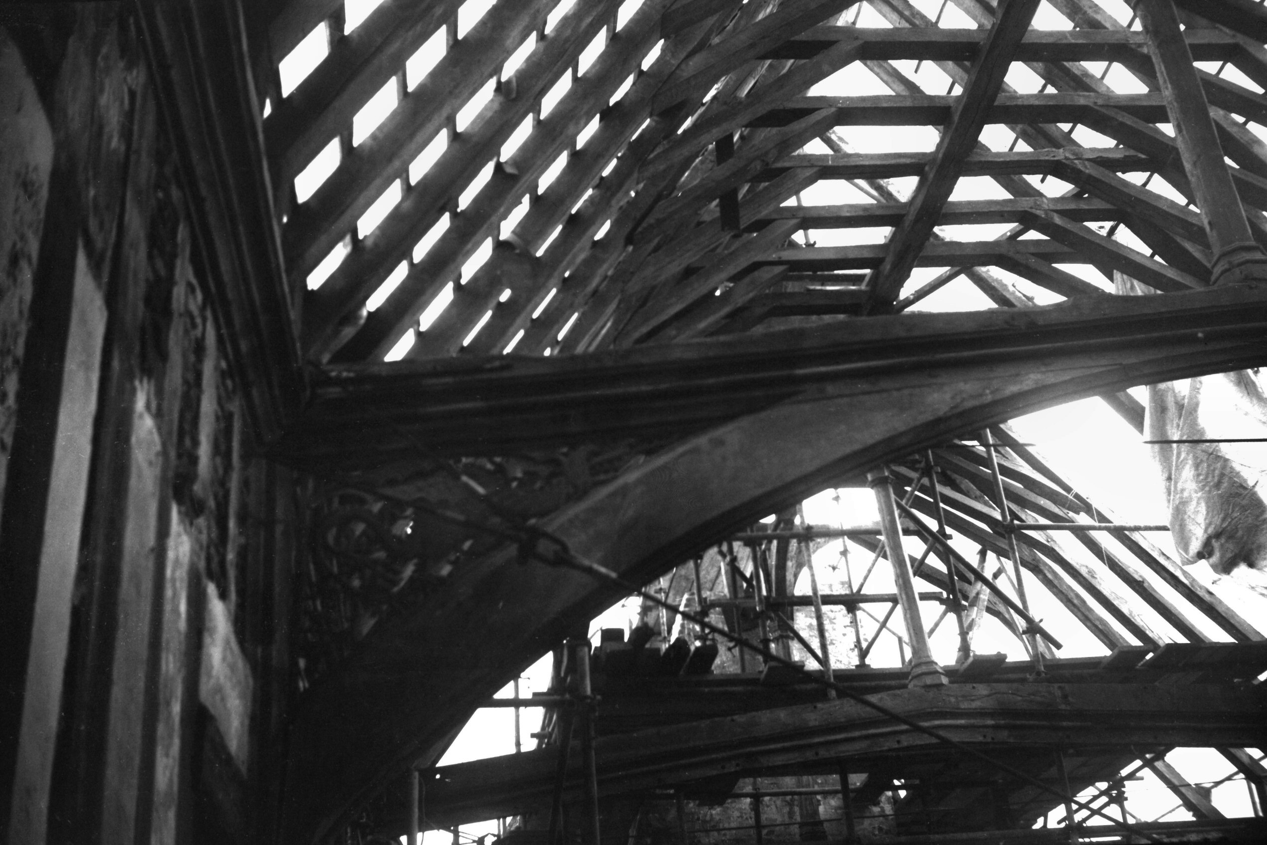
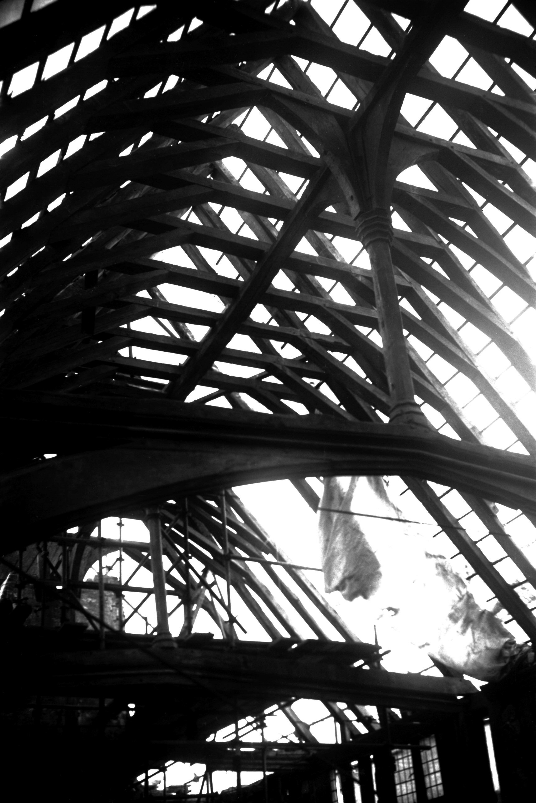
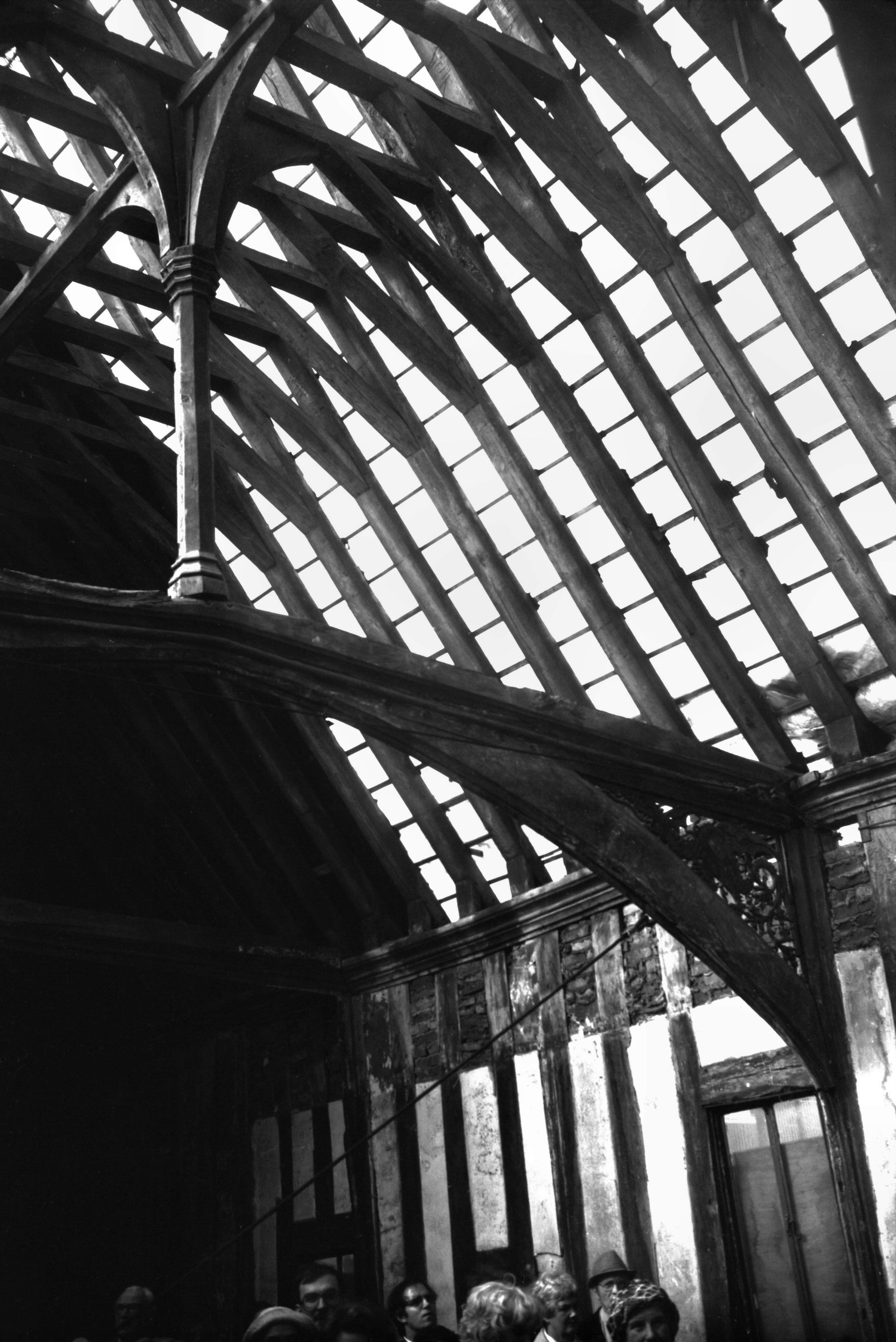
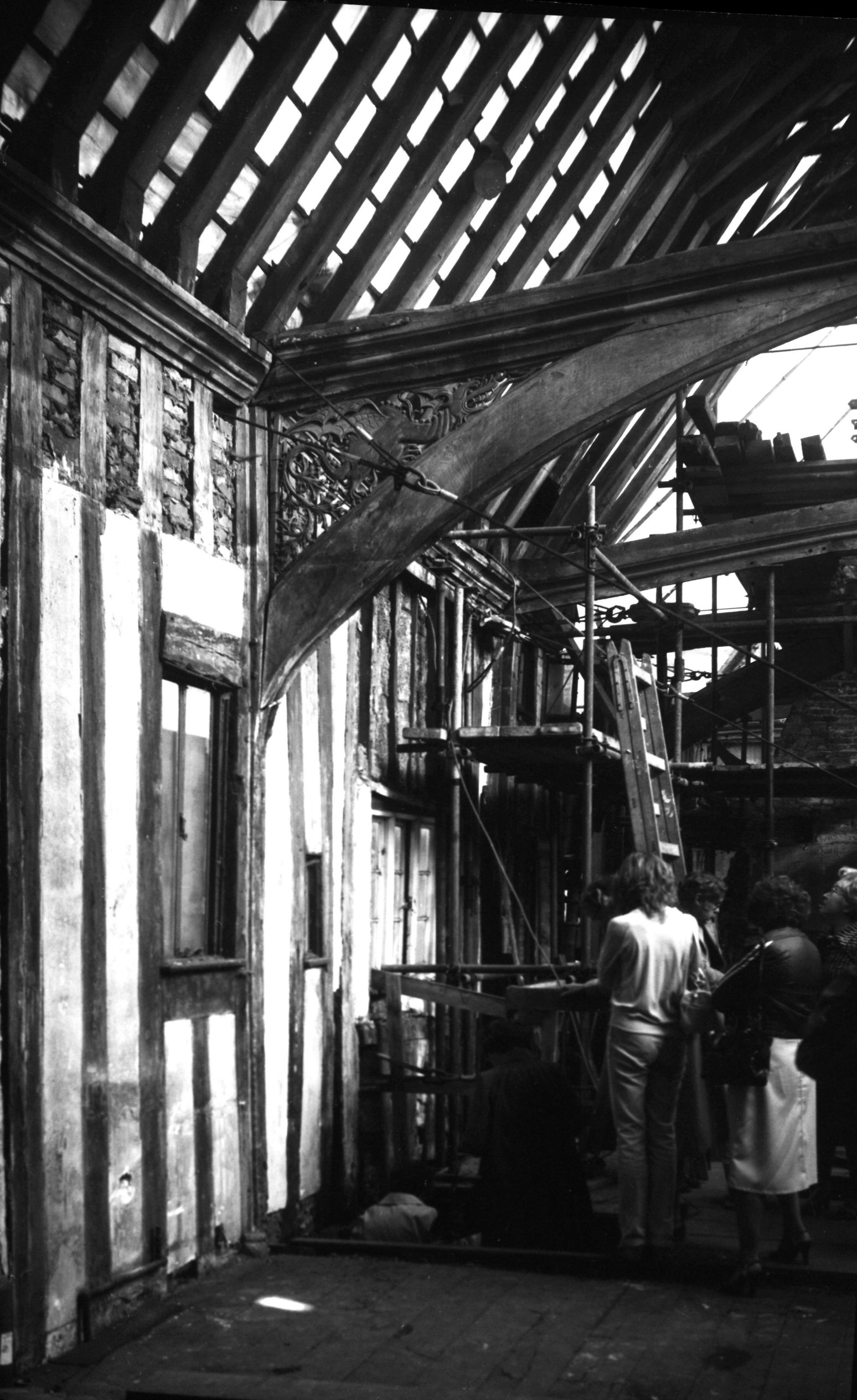
King St 113 to 123 15c roof crown post [6210]
1981-07-18
The 15c crown-post roof. The Great Hall was built c1450
by Robert Toppes, a leading textile trader and four times
Mayor of Norwich, above an earlier masonry ground floor.
The whole building was later divided into six tenements
with an additional floor inserted. |
|
|
King St 113 to 123 15c roof view north [6212]
1981-07-18
|
|
|
King St 113 to 123 15c roof dragon spandrel [6213]
1981-07-18
|
|
|
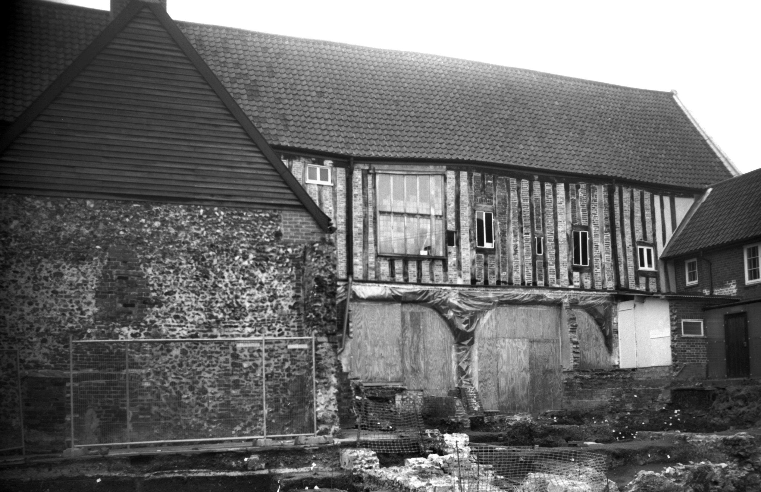
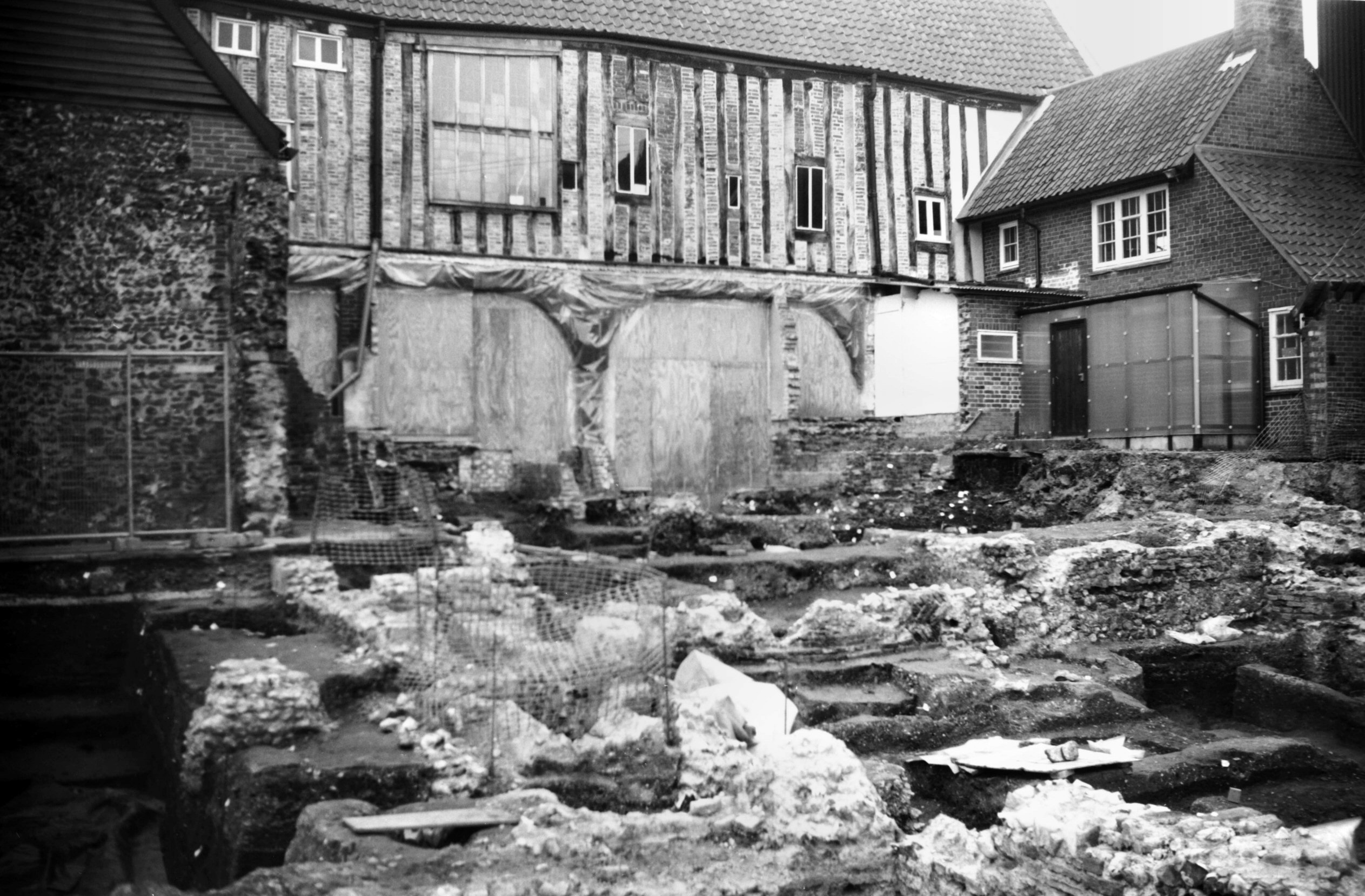
King St 113 to 123 Dragon Hall rear from SE [7531]
1998-03-01
|
|
|
King St 113 to 123 Dragon Hall excavations [7532]
1998-03-01
1998 excavations. |
|
|
King St 123 rear from Old Barge Yard [0591]
1935-05-26
|
|
|
King St 123 Old Barge Inn rear [1783] 1937-07-13
|
|
|
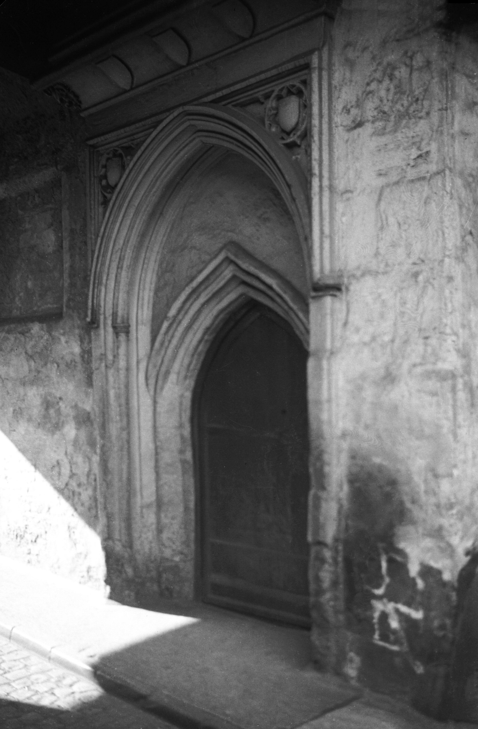
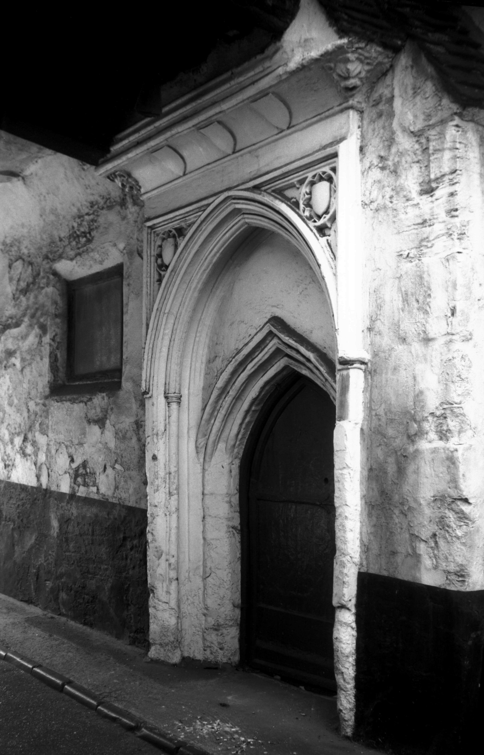
King St 123 14c doorway 15c decoration [0421]
1935-03-24
|
|
|
King St 123 14c doorway 15c decoration [5926]
1978-07-25
|
|
|
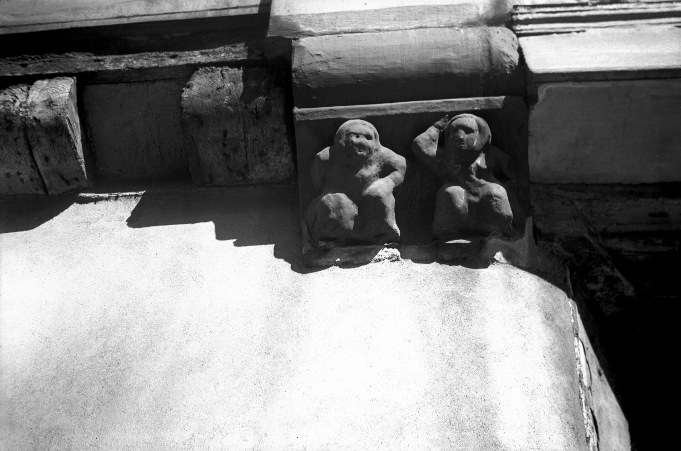
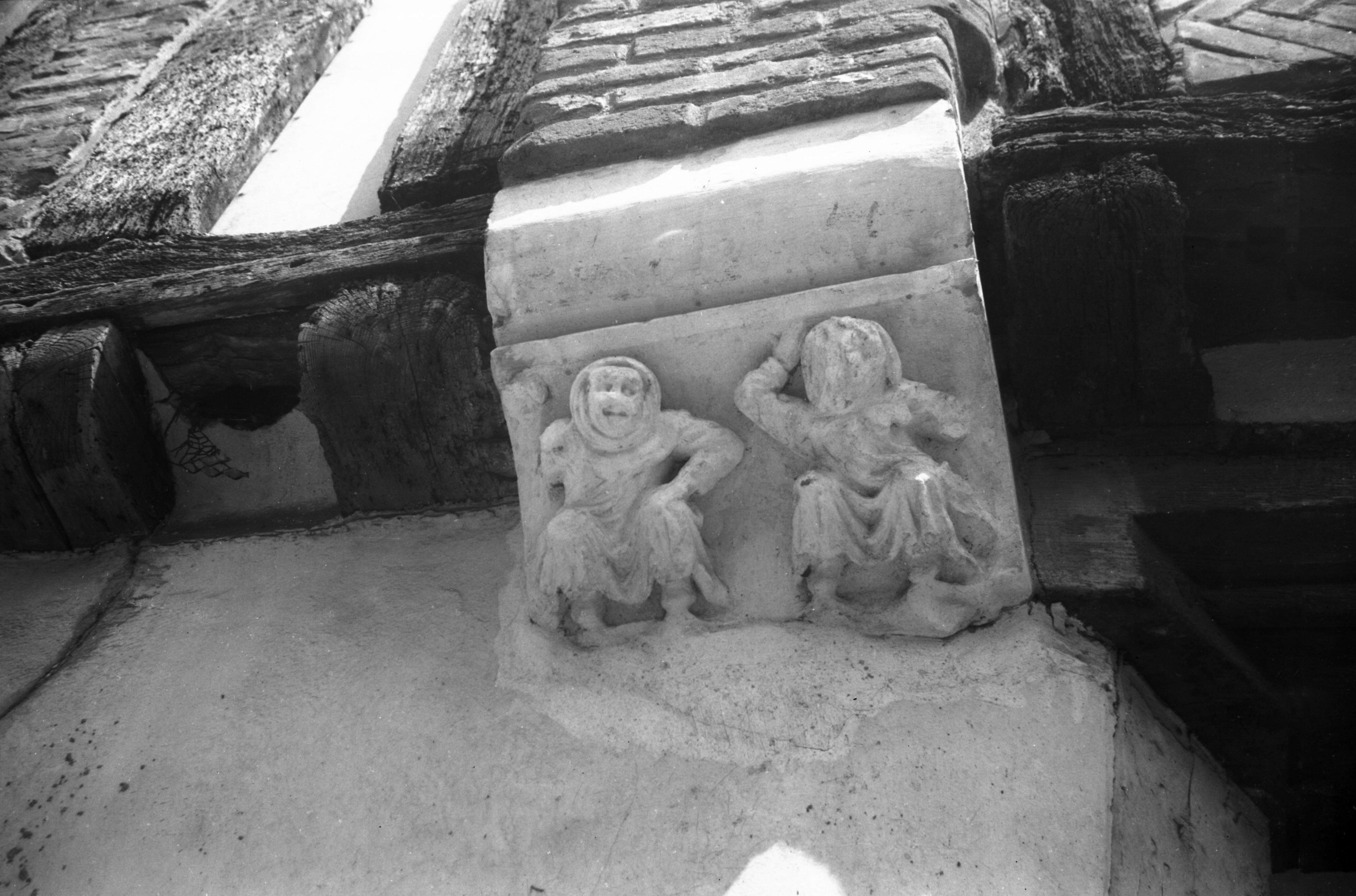
King St 123 carved bracket [2163] 1938-03-14
Bracket at south end of first floor jetty. |
|
|
King St 123 carved bracket restored [6260] 1983-06-06
|
|
|
King St Old Barge Yard east end view NE [1780]
1937-07-13
|
|
|
King St Old Barge Yard east end view NW [1779]
1937-07-13
|
|
|
King St Old Barge Yard west end [1781] 1937-07-13
|
|
|
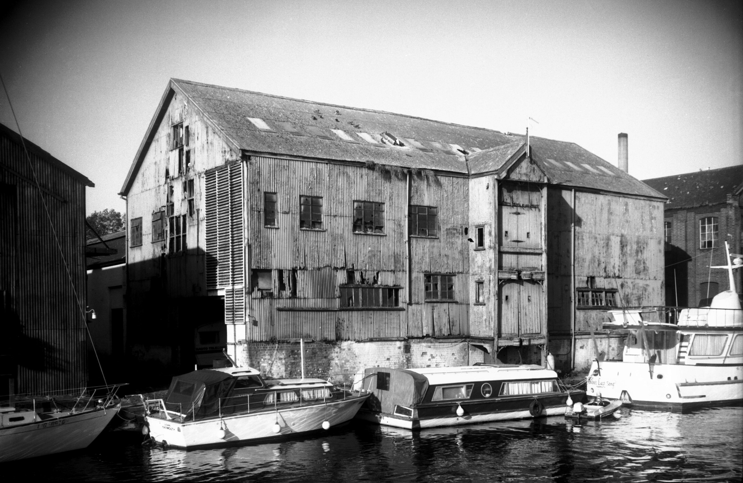
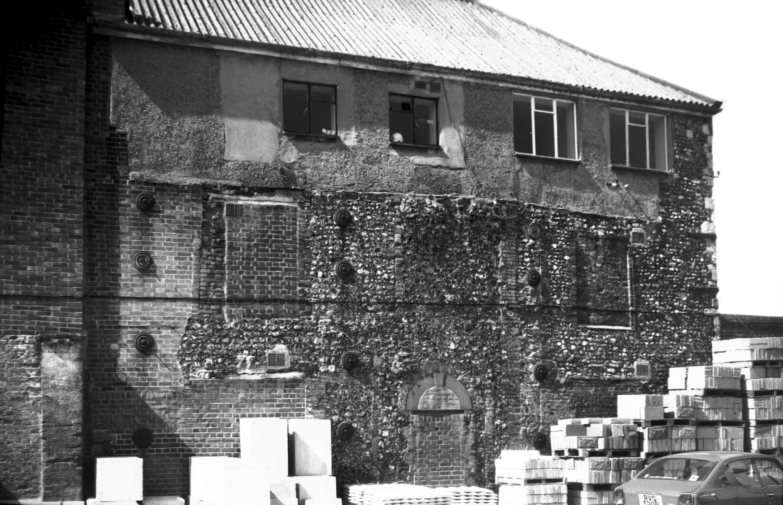
King St River Wensum old grain warehouse [6348]
1985-10-19
Timber frame and corrugated iron. |
|
|
King St 125 to 129 [1289] 1936-08-16
Adjacent, and to the south of the renowned Dragon Hall,
is another building of note, that comprising Nos 125-129.
When photographed in 1936 its half-timbered upper storey
had for long been hidden under plaster, but some ten
years later the plaster was removed to reveal its sturdy
construction of timber and brick. After a few more years
its owners chose to rip out the entire ground floor,
replacing the modest 19c shop fronts with a continuous
range of plate glass and leaving the medieval first floor
suspended as it were mid-air. |
|
|
King St 125 to 129 plaster removed [3625] 1946-04-21
|
|
|
King St 129 house at rear [5905] 1978-05-25
|
|
|
King St 131 former Green Man PH [1288] 1936-08-16
In his book If Stones Could Speak Ralph Mottram
remarked upon the scarcity of flint-faced houses in
Norwich, by which he no doubt meant knapped flints as
opposed to flint rubble. On the east side of King St at
No 131 stood one such, to which added interest was given
by a small dormer with its hood-like eaves. Here was
formerly an inn with the sign of the Green Man,
commemorating the green men or woodwoses of ancient days
who, garbed in leaves, played a prominent part in the
pageants staged by the various trade guilds.
Occasionally, however, Robin Hood was depicted. The
building was converted into a dwelling house in the early
1920s, but shortly before the war it fell into decay and
was demolished some years later. |
| |
|
|
|
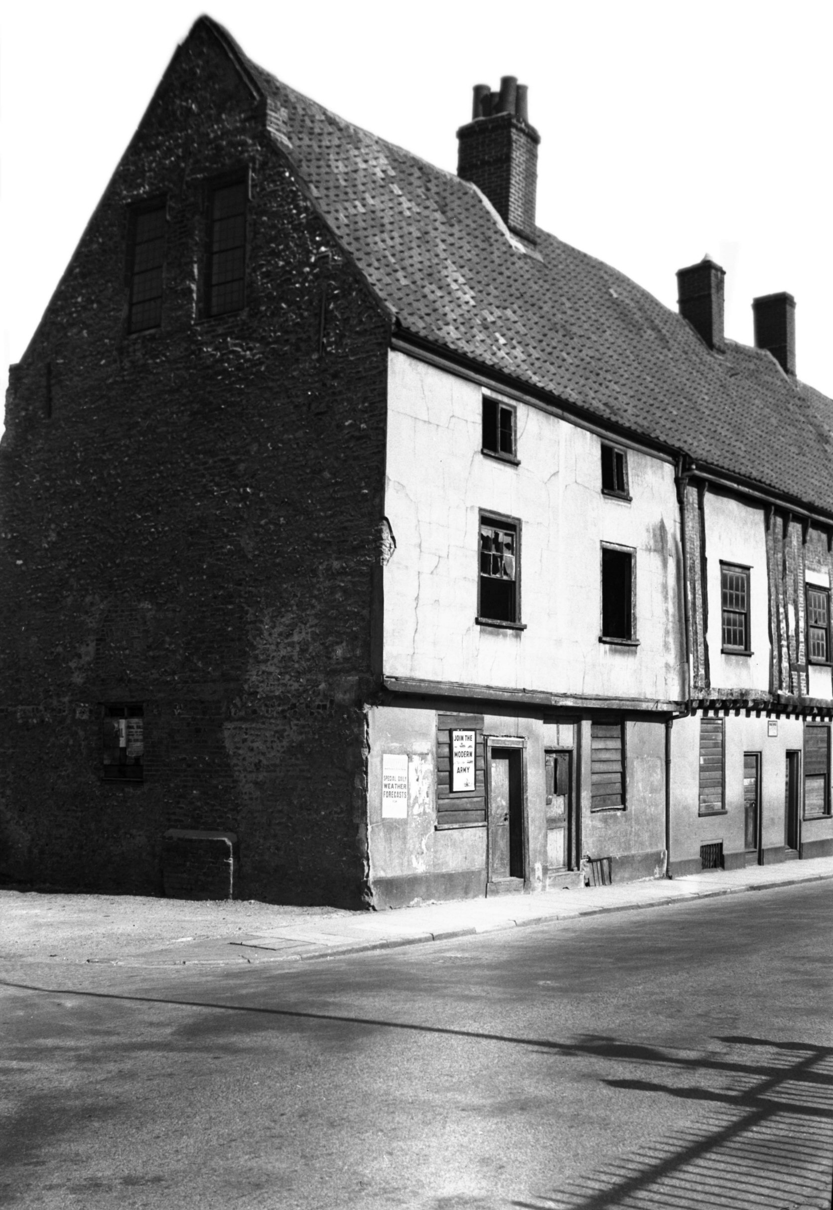
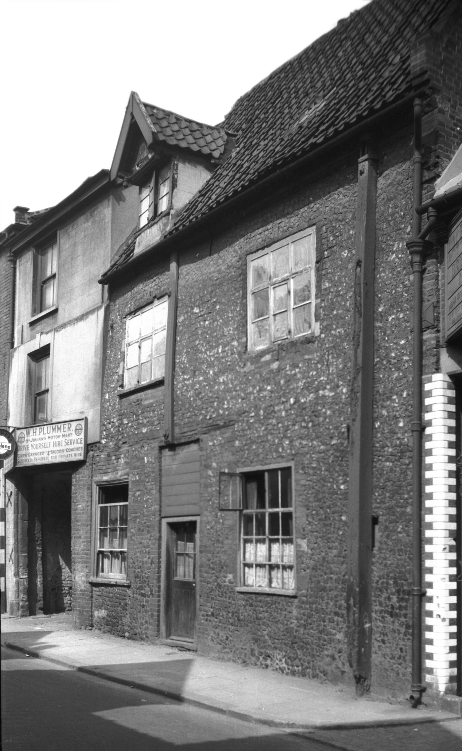
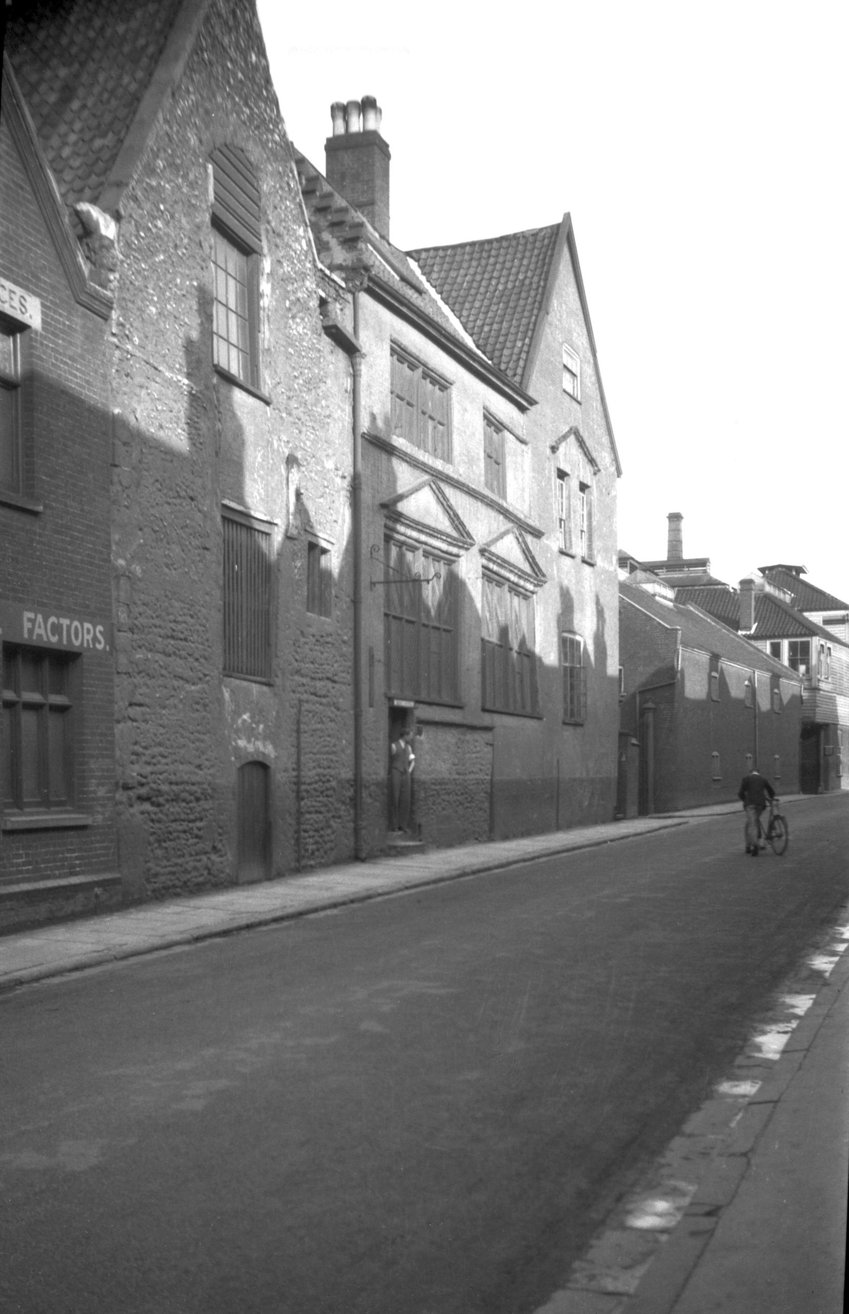
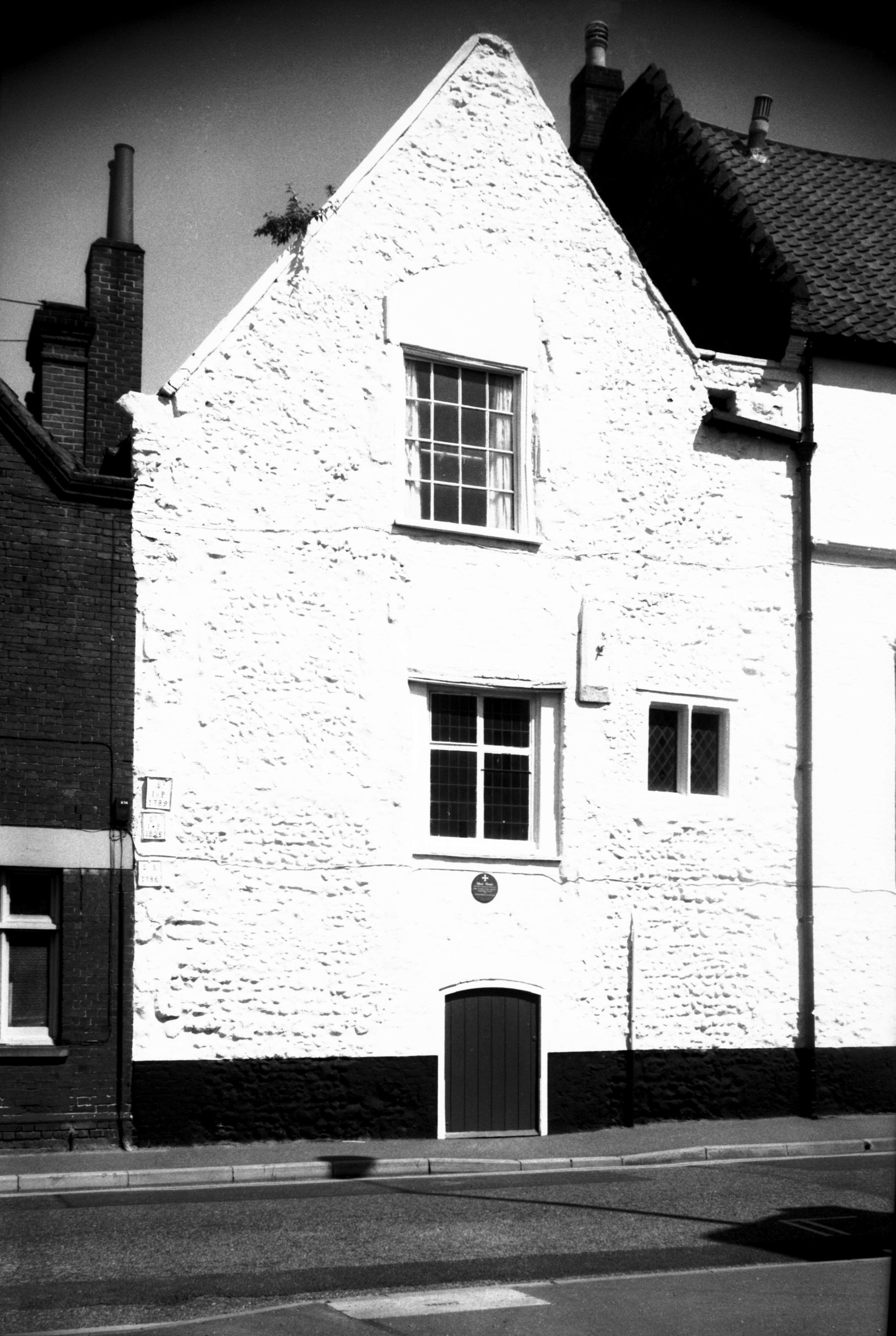
King St 167 Music House [B089] 1931-00-00
|
|
|
King St 167 Music House view south [0138] 1934-06-28
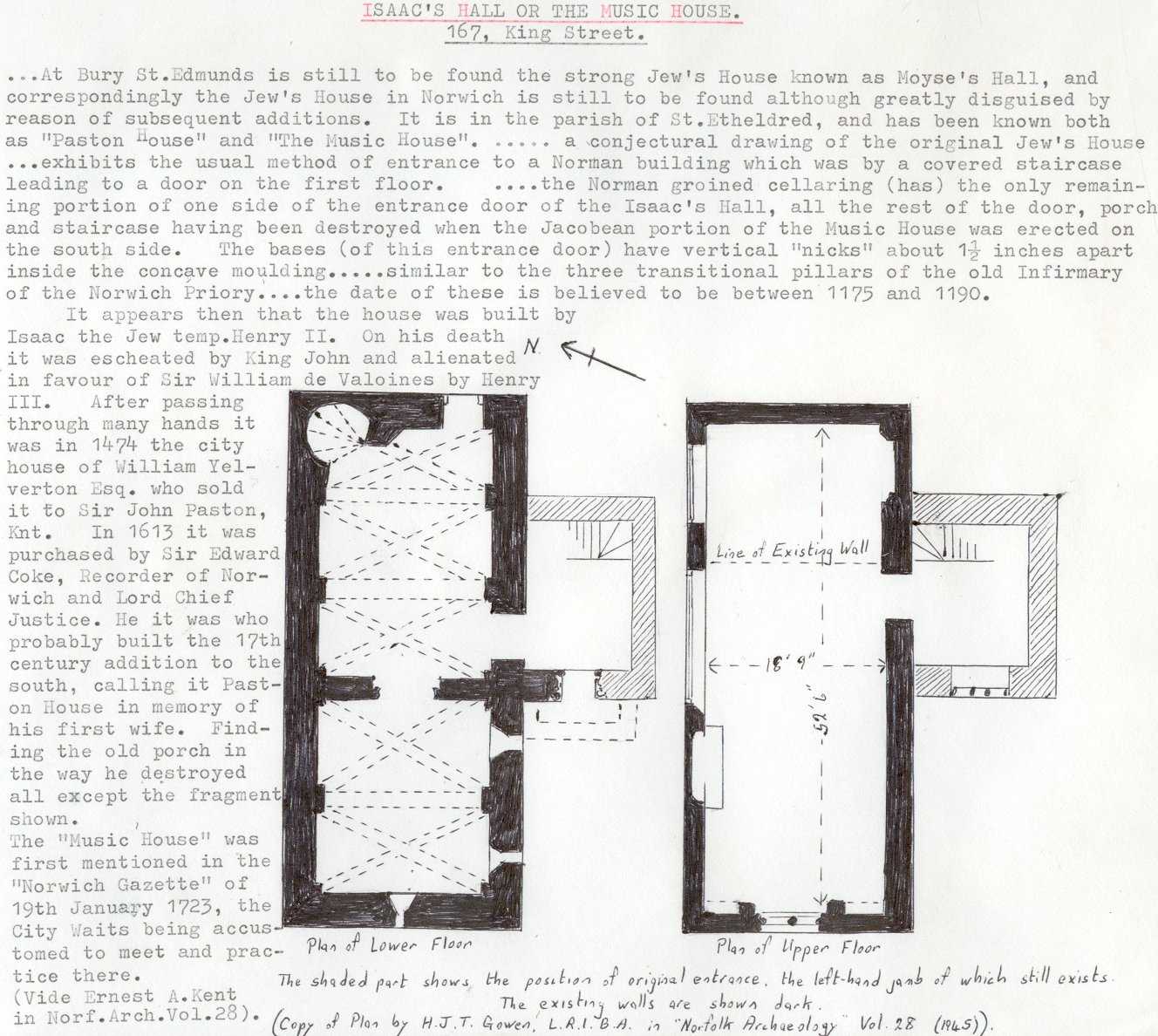
Isaac's Hall or the Music House King St.
"... At Bury St Edmunds is still to be found the
strong Jew's House known as Moyse's Hall, and
correspondingly the Jew's House in Norwich is still to be
found although greatly disguised by reason of subsequent
additions. It is in the parish of St Etheldred, and has
been known both as "Paston House" and "The
Music House". ... a conjectural drawing of the
original Jew's House ... exhibits the usual method of
entrance to a Norman building which was by a covered
staircase leading to a door on the first floor. ... the
Norman groined cellaring (has) the only remaining portion
of one side of the entrance door of the Isaac's Hall, all
the rest of the door, porch and staircase having been
destroyed when the Jacobean portion of the Music House
was erected on the south side. The bases (of this
entrance door) have vertical "nicks" about 1.5
inches apart inside the concave moulding ... similar to
the three transitional pillars of the old Infirmary of
the Norwich Priory ... the date of these is believed to
be between 1175 and 1190.
"It appears then that the house was built by Isaac
the Jew temp. Henry II. On his death it was escheated by
King John and alienated in favour of Sir William de
Valoines by Henry III. After passing through many hands
it was in 1474 the city house of William Yelverton esq
who sold it to Sir John Paston Knt. In 1613 it was
purchased by Sir Edward Coke, Recorder of Norwich and
Lord Chief Justice. He it was who probably built the 17th
century addition to the south, calling it Paston House in
memory of his first wife. Finding the old porch in the
way, he destroyed all except the fragment shown. The
"Music House" was first mentioned in the Norwich
Gazette of 19th January 1723, the City Waits being
accustomed to meet and practice there." (Ernest
A.Kent in Norfolk Archaeology Vol.28, 1945). |
|
|
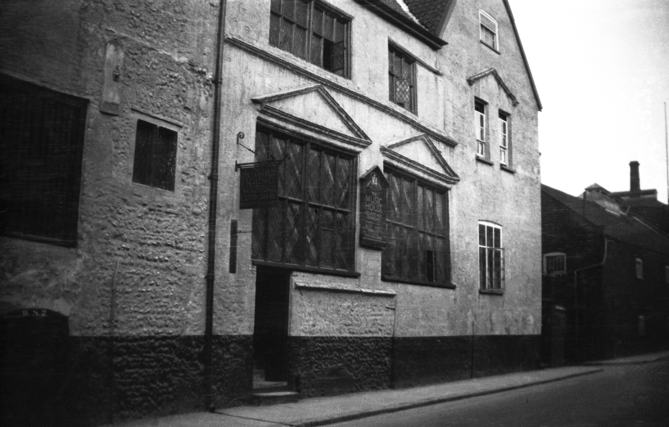
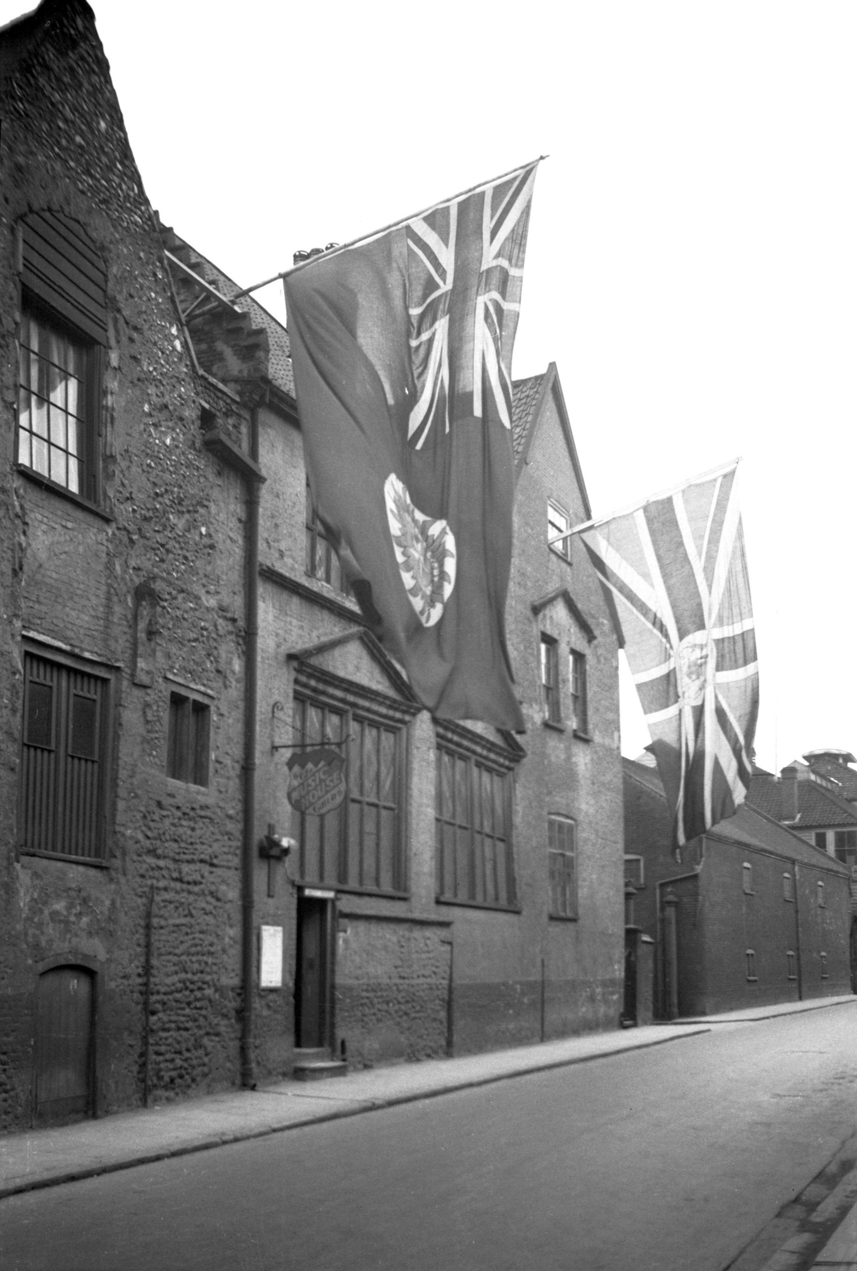
Coronation King St 167 Music House [1562] 1937-05-09
1937 coronation decorations. |
|
|
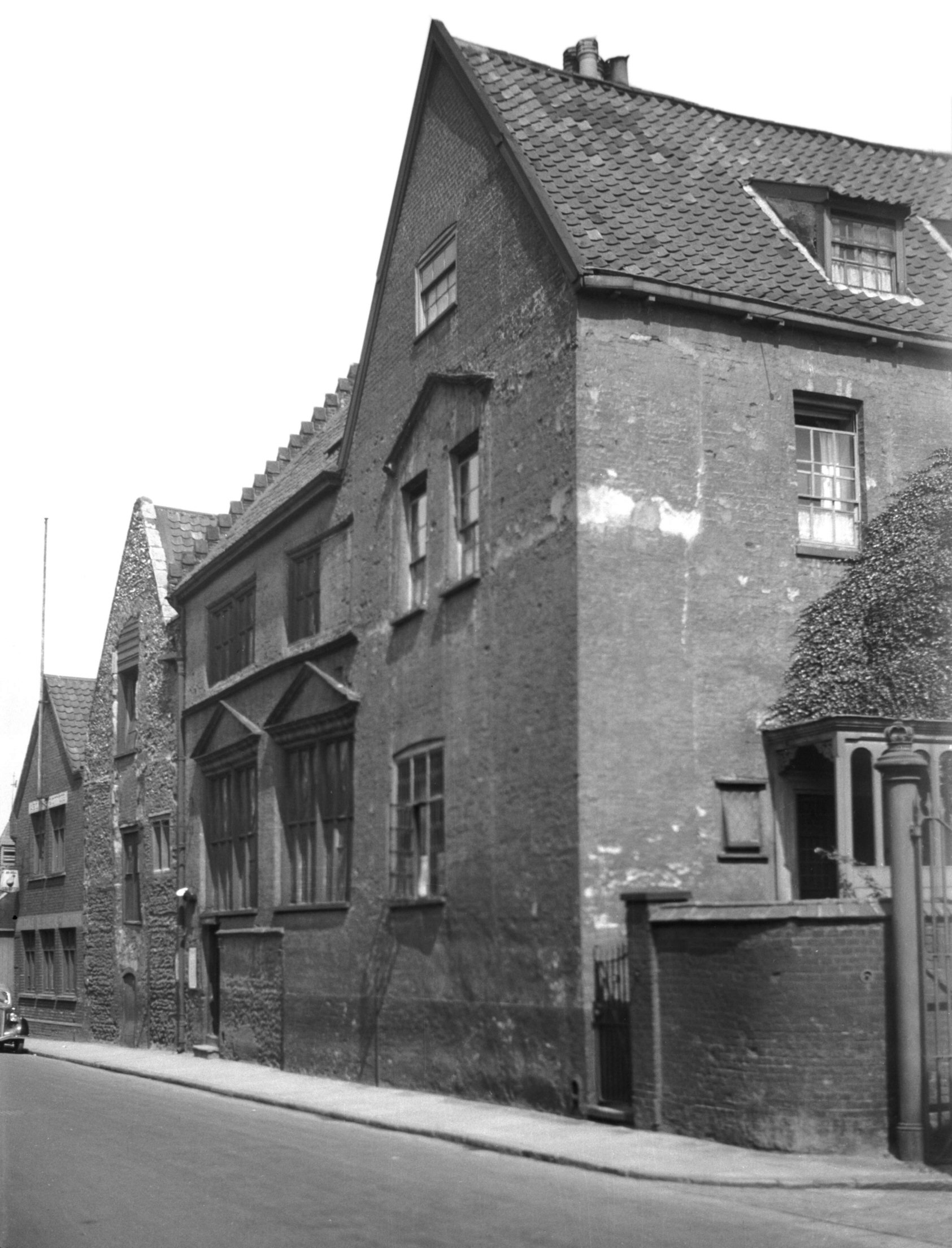
King St 167 Music House view north [1297] 1936-08-22
|
|
|
King St 167 Music House 17c south part [5936]
1978-08-01
Added in 17c probably by Sir Edward Coke who purchased
the property from the Pastons. |
|
|
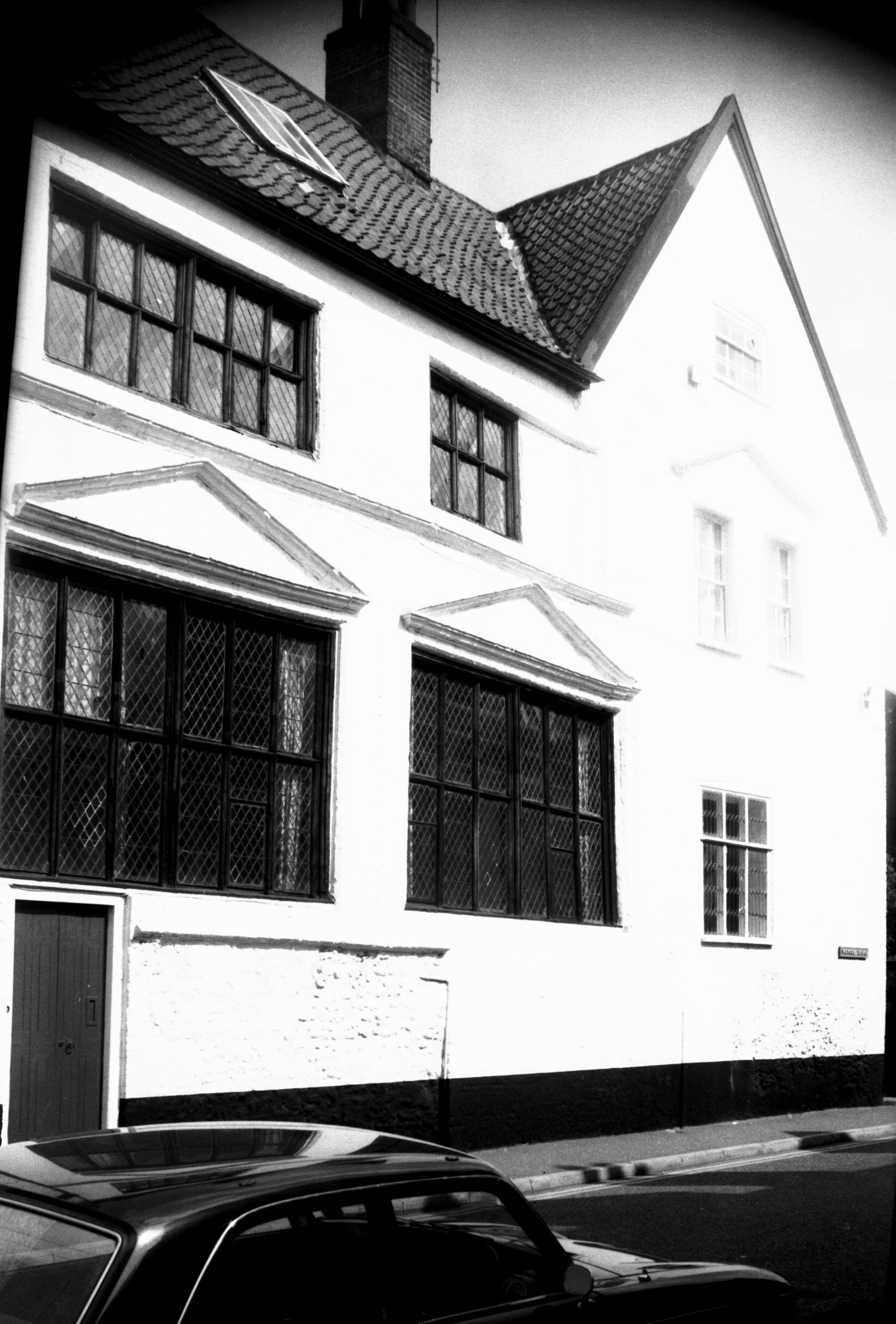
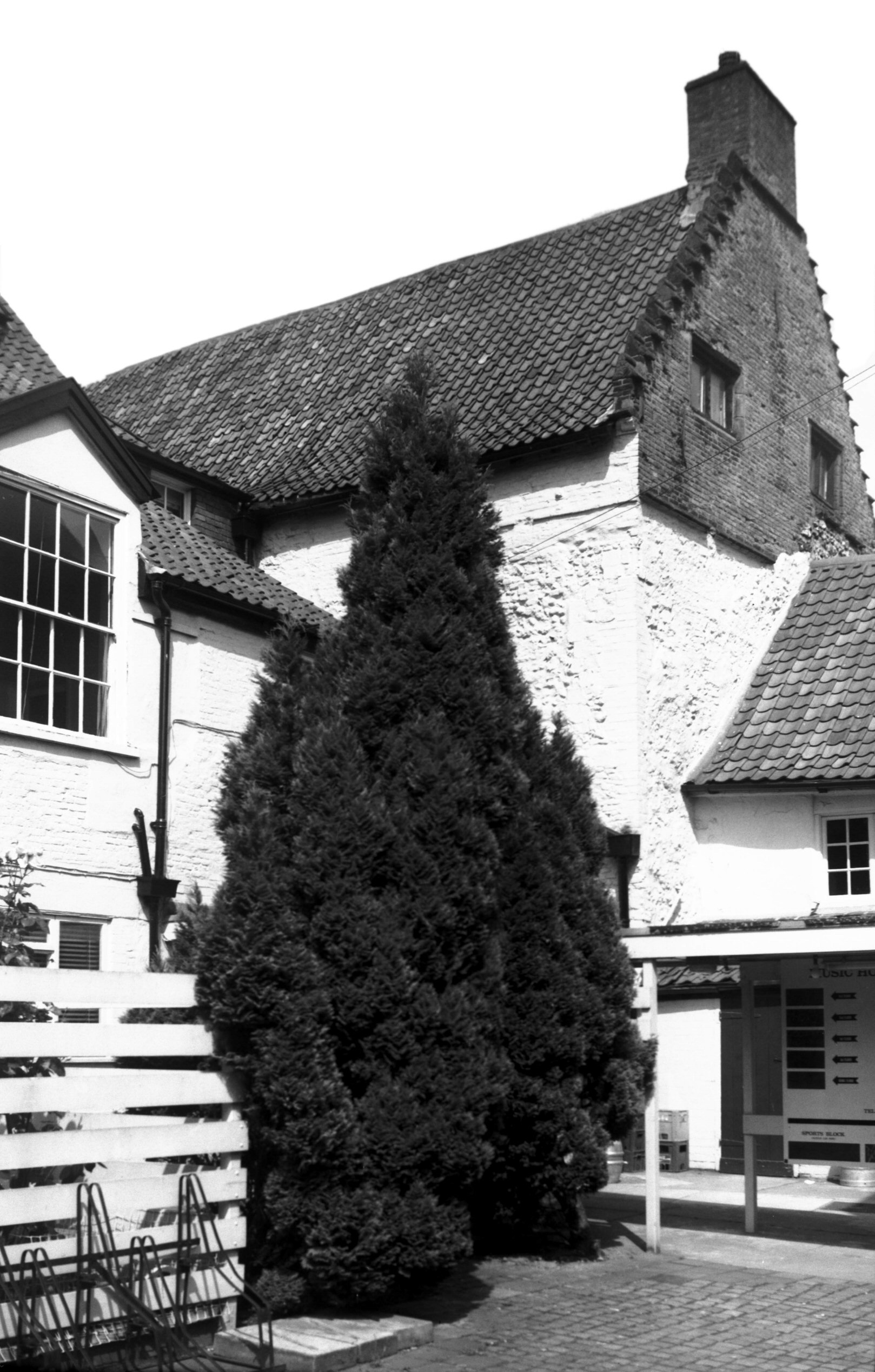
King St 167 Music House north part [5927] 1978-07-25
Of Norman origin with groined undercroft of that date.
Built by Isaac the Jew. |
|
|
King St 167 Music House rear [6558] 1989-06-24
|
|
|
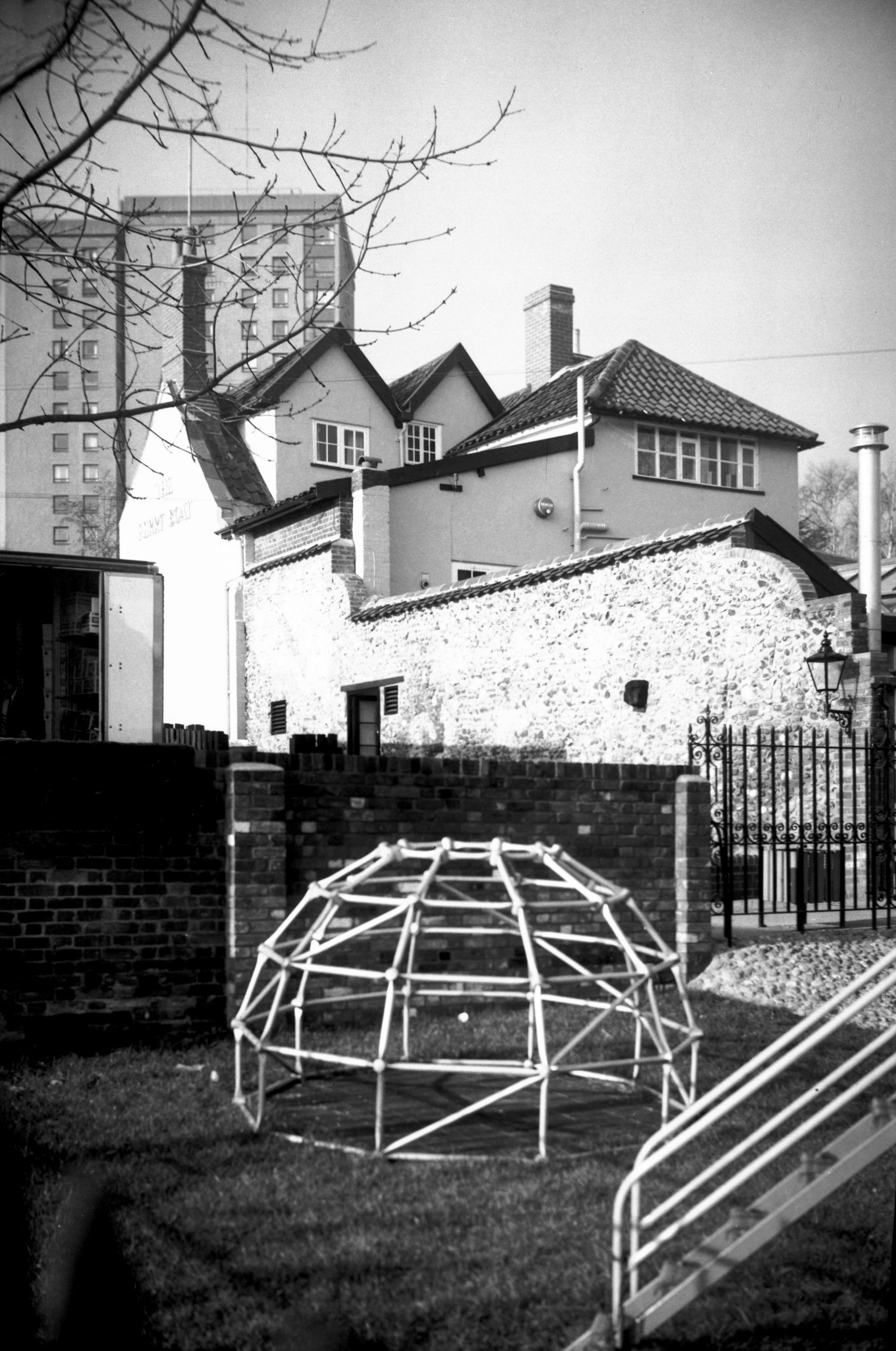
King St 191 Ferry Boat Inn [1286] 1936-08-16
The Ferry Boat Inn, formerly the Ferry Inn, and in
earlier times the Steam Packet. |
|
|
King St 191 Ferry Boat Inn from SE [6432] 1987-02-12
|
|
|
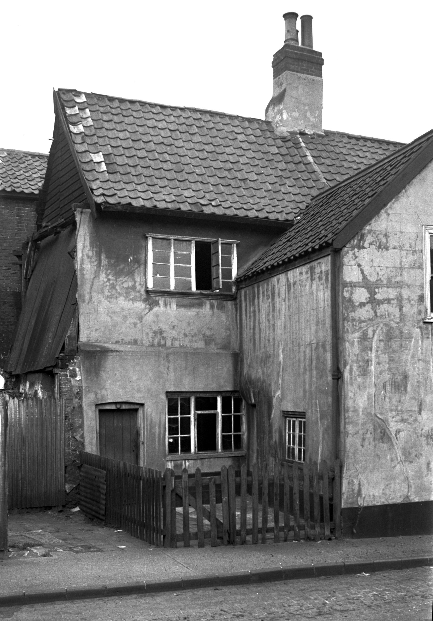
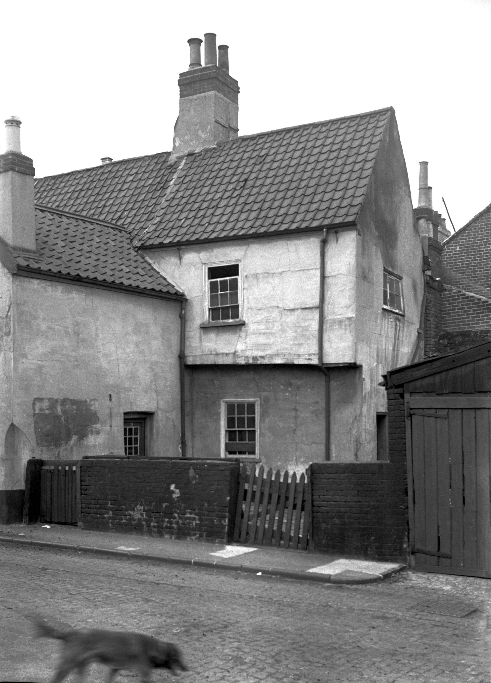
King St 195 to 197 [1287] 1936-08-16
Opposite to where Rouen Rd now merges with King St and
just south of the Ferry inn, known until about 1930 as
the Steam Packet, stood these buildings. Nos 195-197 King
St were of no particular architectural merit, although
the latter was notable in having two ranges of weavers'
or "thorough-light" windows to illuminate the
attic floor. The exterior was plaster-cast and the roof
covered with pantiles. Modern shop fronts had replaced
the original casement windows on the ground floor. |
|
|
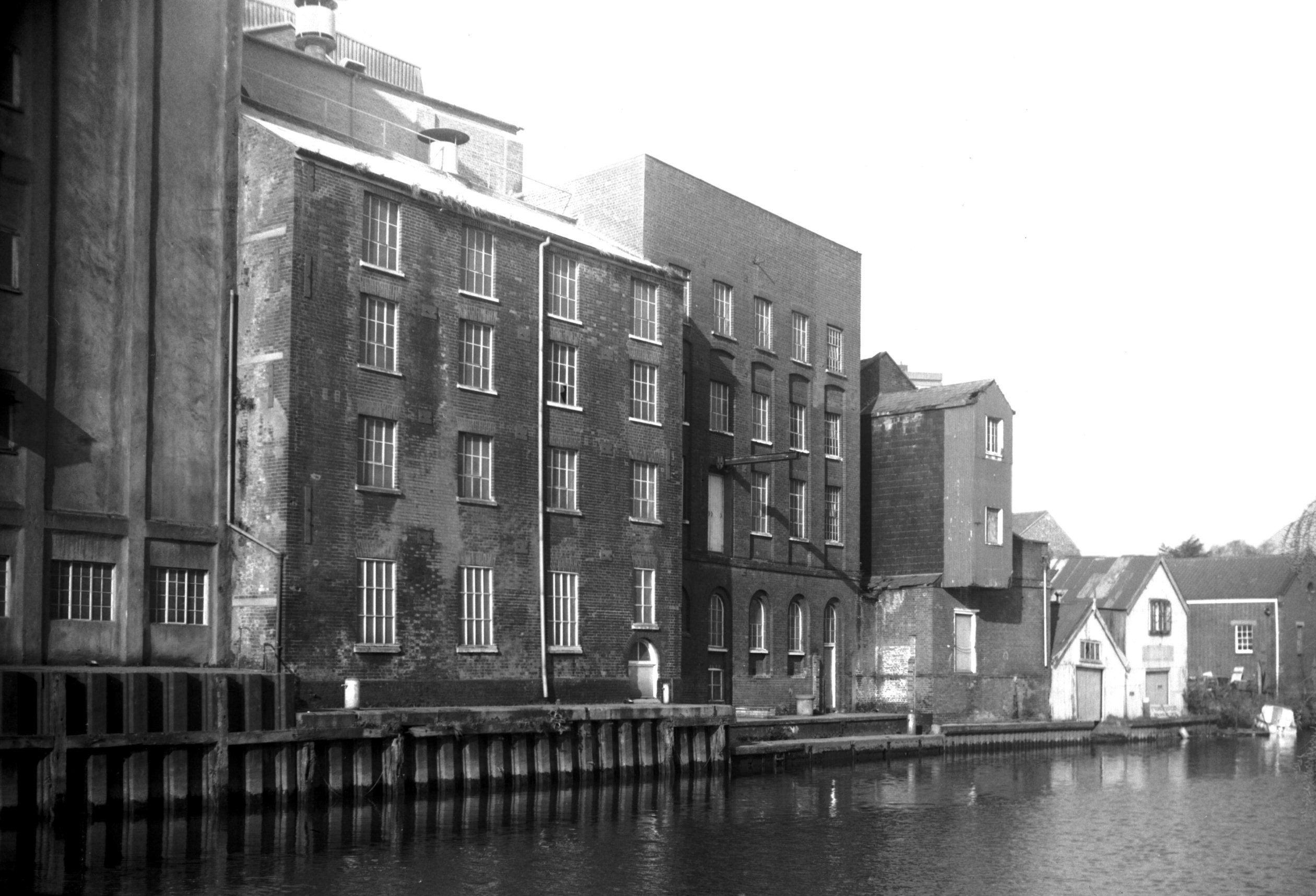
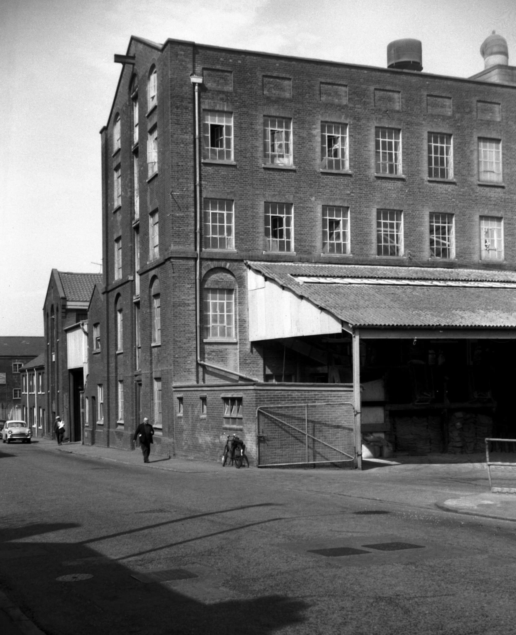
King St 237 Read's flour mills across river [6597]
1990-03-18
Near Carrow Road and overlooking the river, stands a tall
building, erected as the Albion spinning mill in 1837 for
making worsted silk and mohair. It was afterwards
converted for making confectionery until 1934, and for
many years served as the Read Woodrow flourmill. It will
hopefully enjoy a new lease of life, converted into
flats. |
|
|
King St 237 Read's flour mills Albion mill [5192]
1968-04-18
|
|
|
King St 249 to 251 Kingsway PH [2525] 1938-07-07
|
|
|
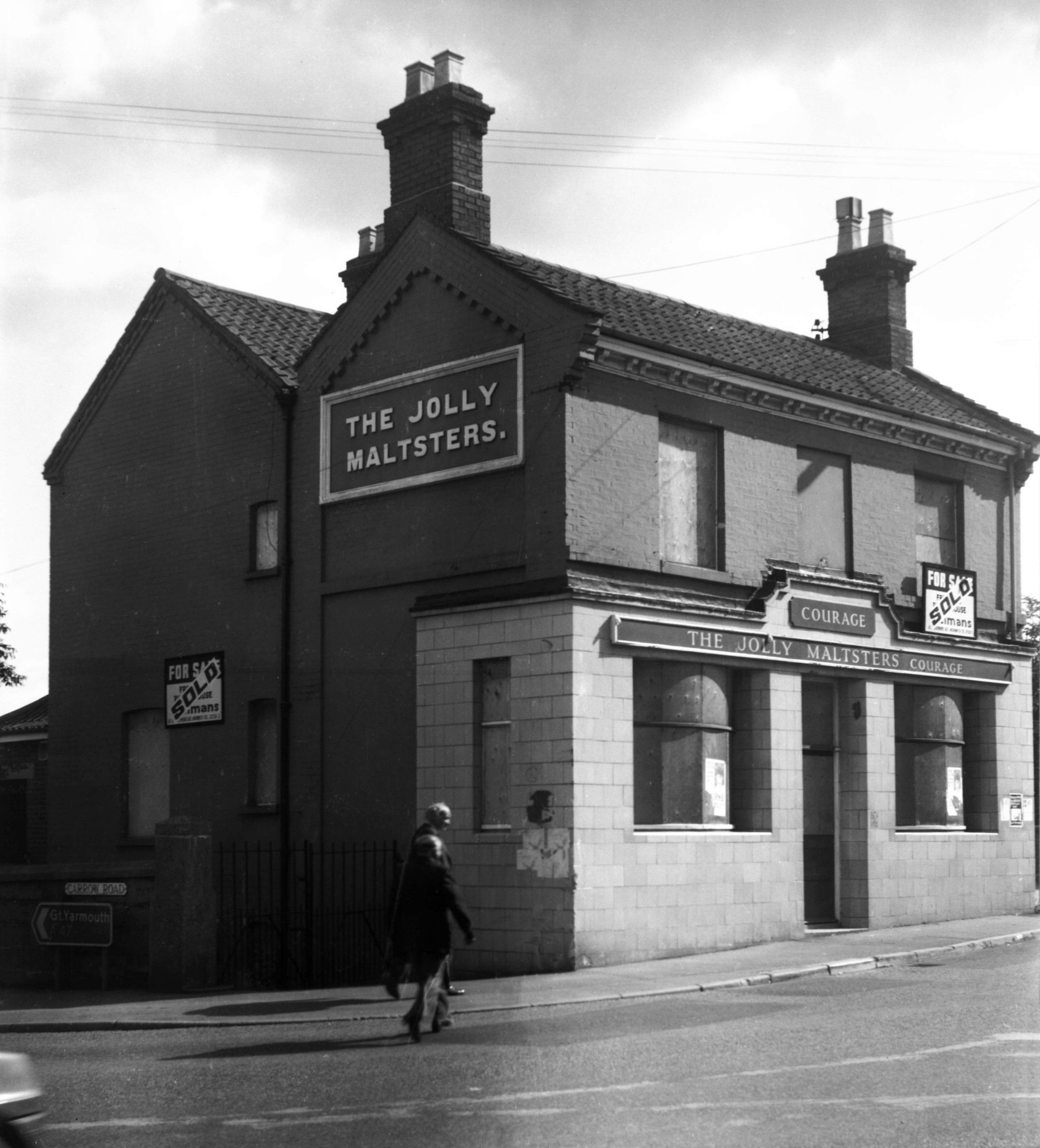
King St 255 Jolly Maltsters PH [6281] 1983-09-19
|
| |
|
|
|
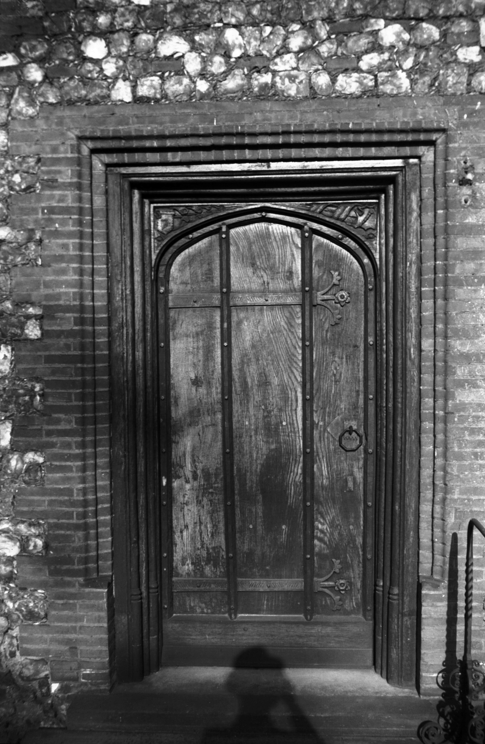
King St Carrow Abbey 16c doorway [3422] 1940-05-16
This doorway was removed from a house in Bedford St
opposite Swan Lane towards the end of the 19c. It bears
the date 1596 and initials F.T.C. In 1978 it was moved
once more this time to Bacon House 31 Colegate where it
may now be seen at the east end of the south front. See Colegate. |
|
|
King St Carrow Abbey 16c doorway head [3423]
1940-05-16
|
|
|
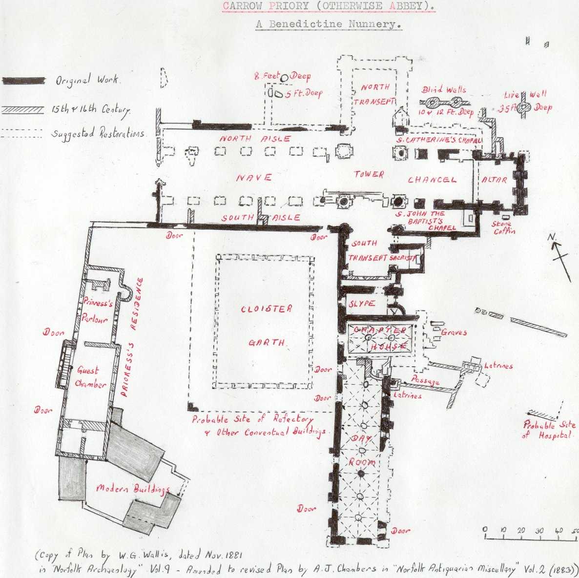
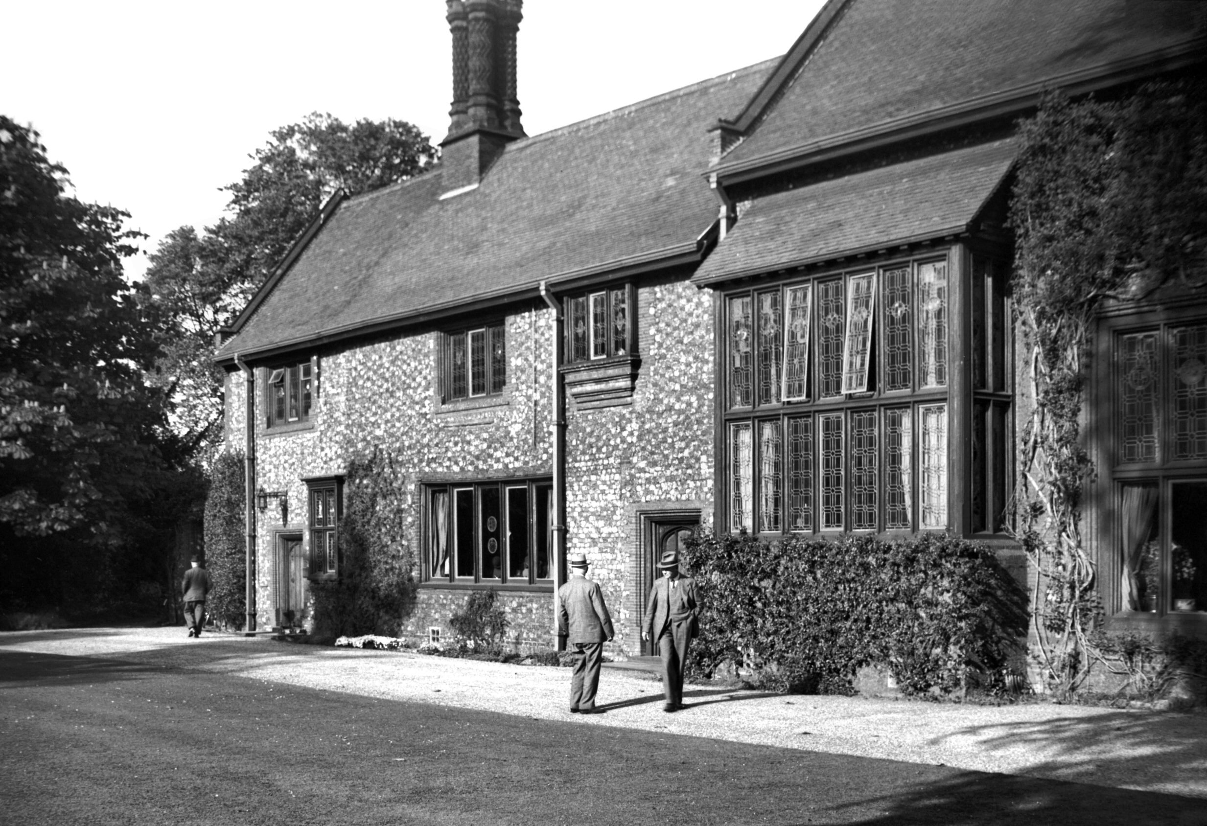
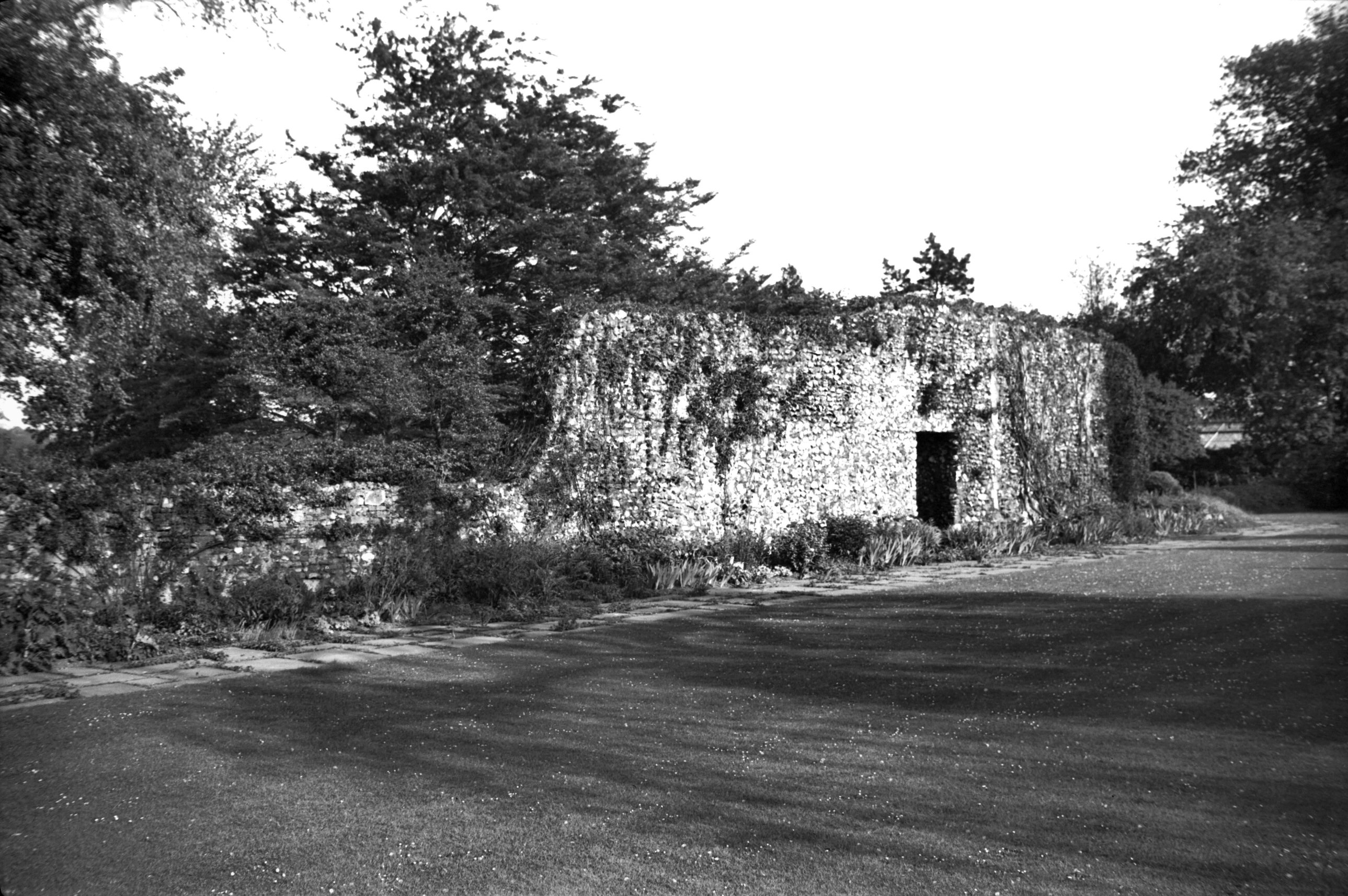
Carrow Priory Prioress' parlour [3416] 1940-05-16
West side of parlour and guest chamber, early 16c. This
Benedictine Nunnery was founded by two sisters, Seyan and
Leftelina, in 1146. After the Dissolution, it was granted
in 1538 to Sir John Shelton, Knt. In 1821 Mr Philip
Meadows Martineau was the owner. In 1878 the property was
purchased by the Colman family. |
|
|
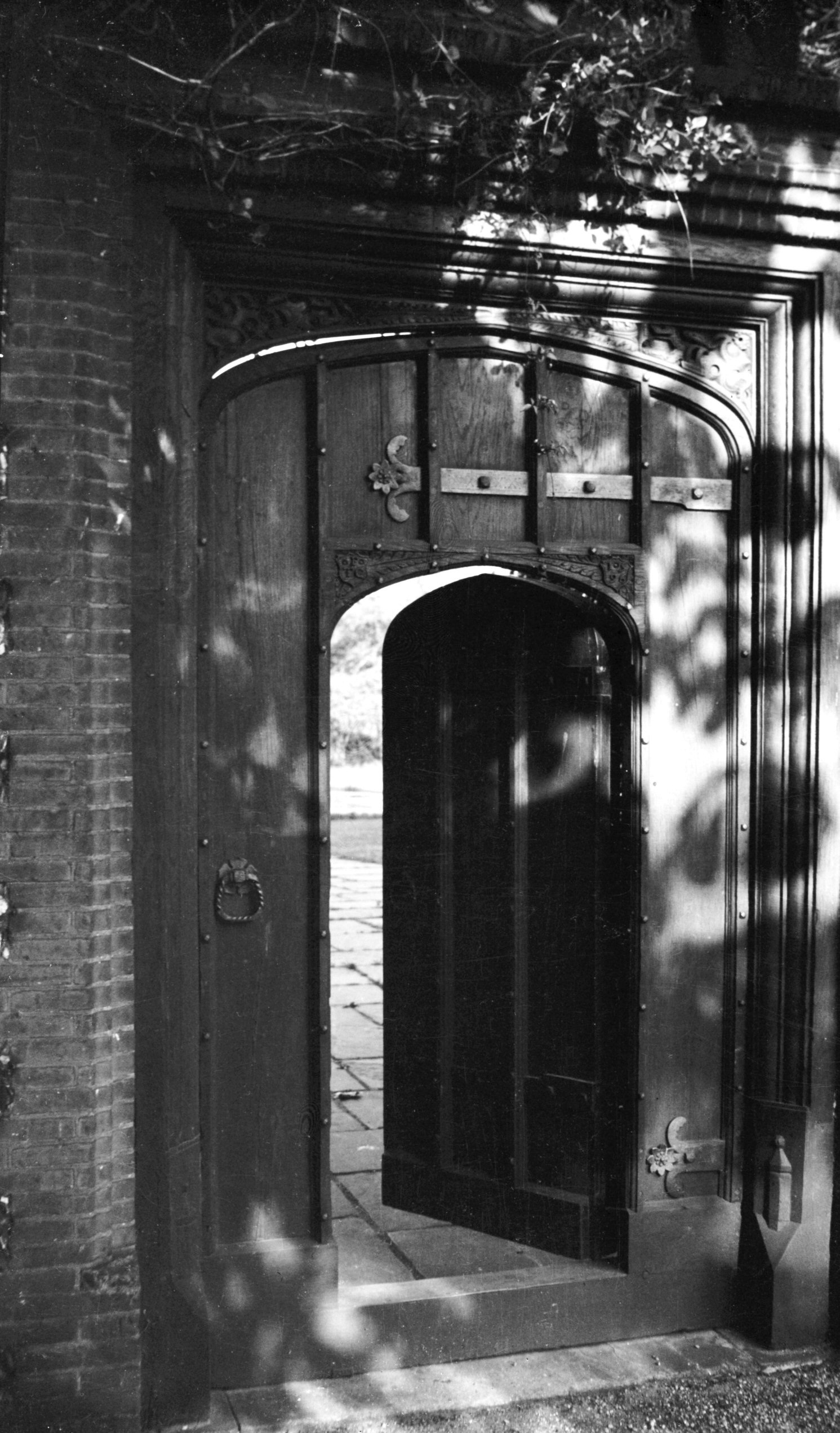
Carrow Priory Prioress' parlour doorway [3424]
1940-05-16
Early 16c. In the spandrels are a "Y" and a
Gun, the rebus of Isabella Wygun, the last but one
Prioress here. |
|
|
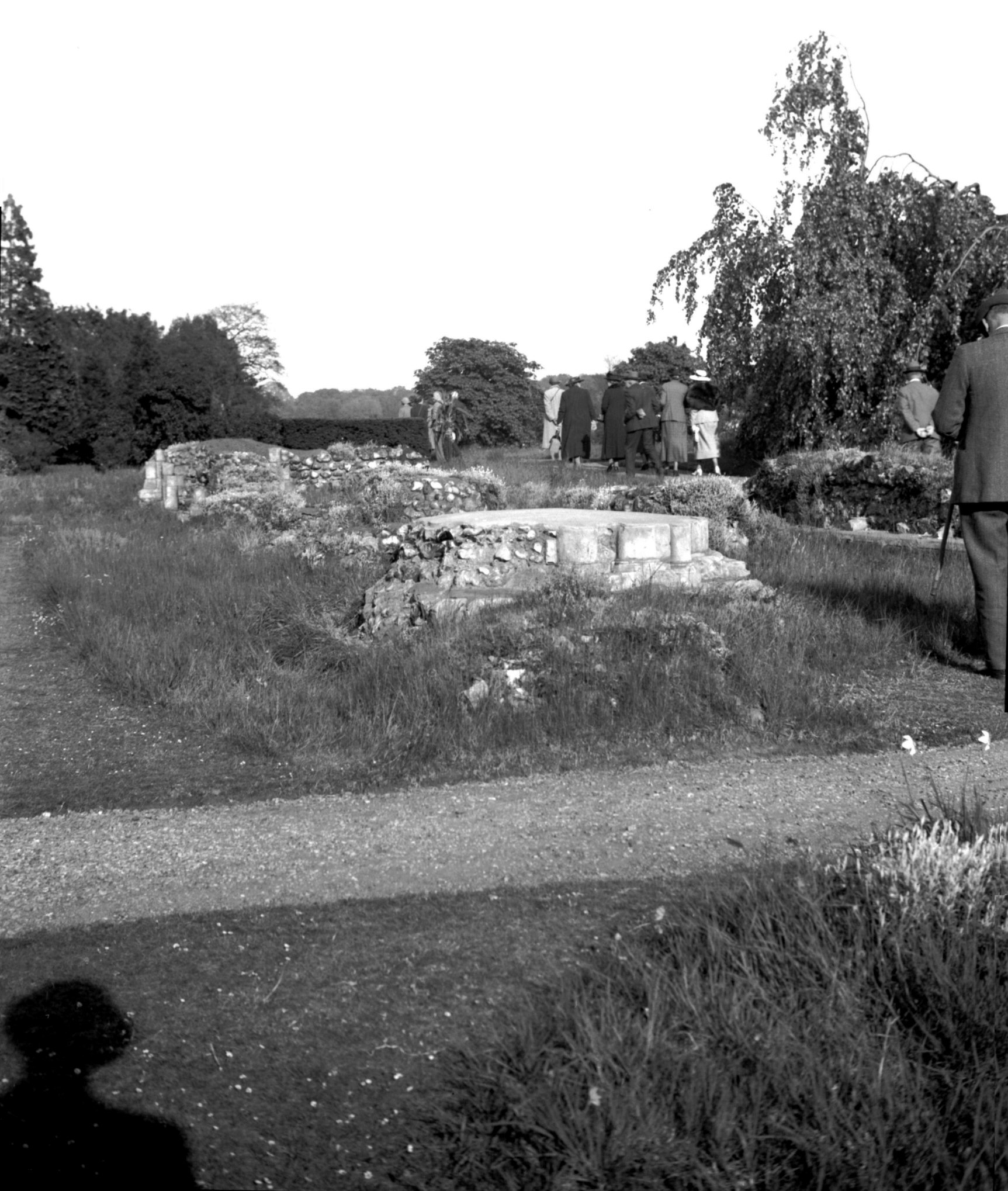
Carrow Priory cloister east wall [3417] 1940-05-16
|
|
|
Carrow Priory cloister NE angle piscina [3421]
1940-05-16
|
|
|
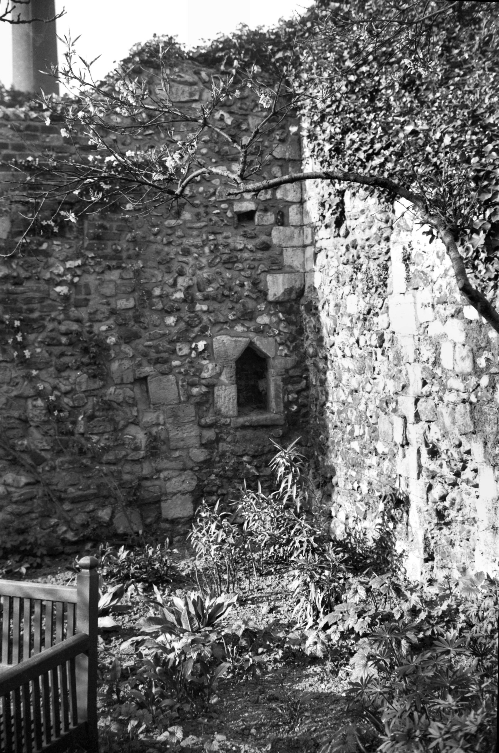
Carrow Priory east end column bases [3419] 1940-05-16
Marks on the bases of the columns seem to identify the
mason as the same who was responsible for the building of
the Infirmary at Norwich Cathedral Priory, and the Jew's
House (Isaac's Hall or the Music House) in King St. |
|
|
Carrow Priory east end from south transept [3418]
1940-05-16
|
|
|
Carrow Priory south transept wall base [3420]
1940-05-16
|
| |
West
side |
|
|
King St 32 former Cock Inn [6236] 1982-07-05
|
|
|
King St 34 [1171] 1936-07-27
|
|
|
King St 42 to 44 [6227] 1981-08-17
|
|
|
King St 56 to 58 rear from Three Tuns Yard [6352]
1985-10-30
|
|
|
King St 56 to 60 Three Tuns PH [1164] 1936-07-27
Beneath are some ancient vaults, part of the mansion of
the Erpingham family. |
|
|
King St 56 to 60 rear from Three Tuns Yard [6327]
1985-06-02
|
|
|
King St 68 to 74 [6228] 1981-08-17
|
|
|
King St Swan Yard north side [7631] 1999-05-18
|
|
|
King St 70 to 74 [6230] 1981-08-22
The gable brickwork shows the second floor to be a later
addition. |
|
|
King St 70 shop front with metal lettering [6486]
1987-08-28
Cast metal lettering on fascia board. |
|
|
King St 70 rear and Swan Yard [5211] 1968-06-13
From St Peter Parmentergate churchyard. |
|
|
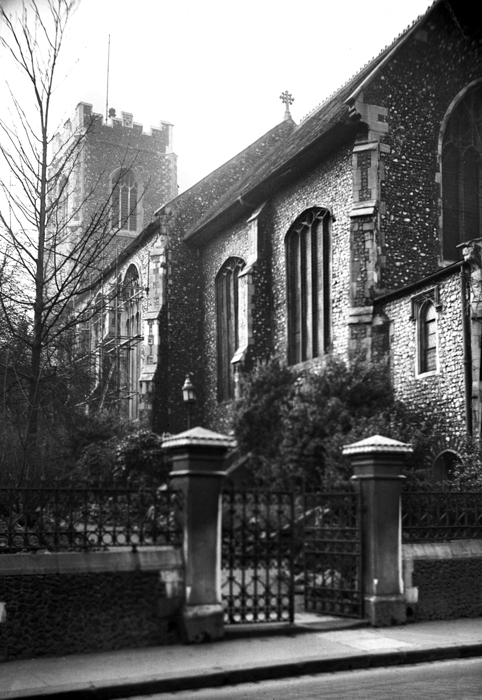
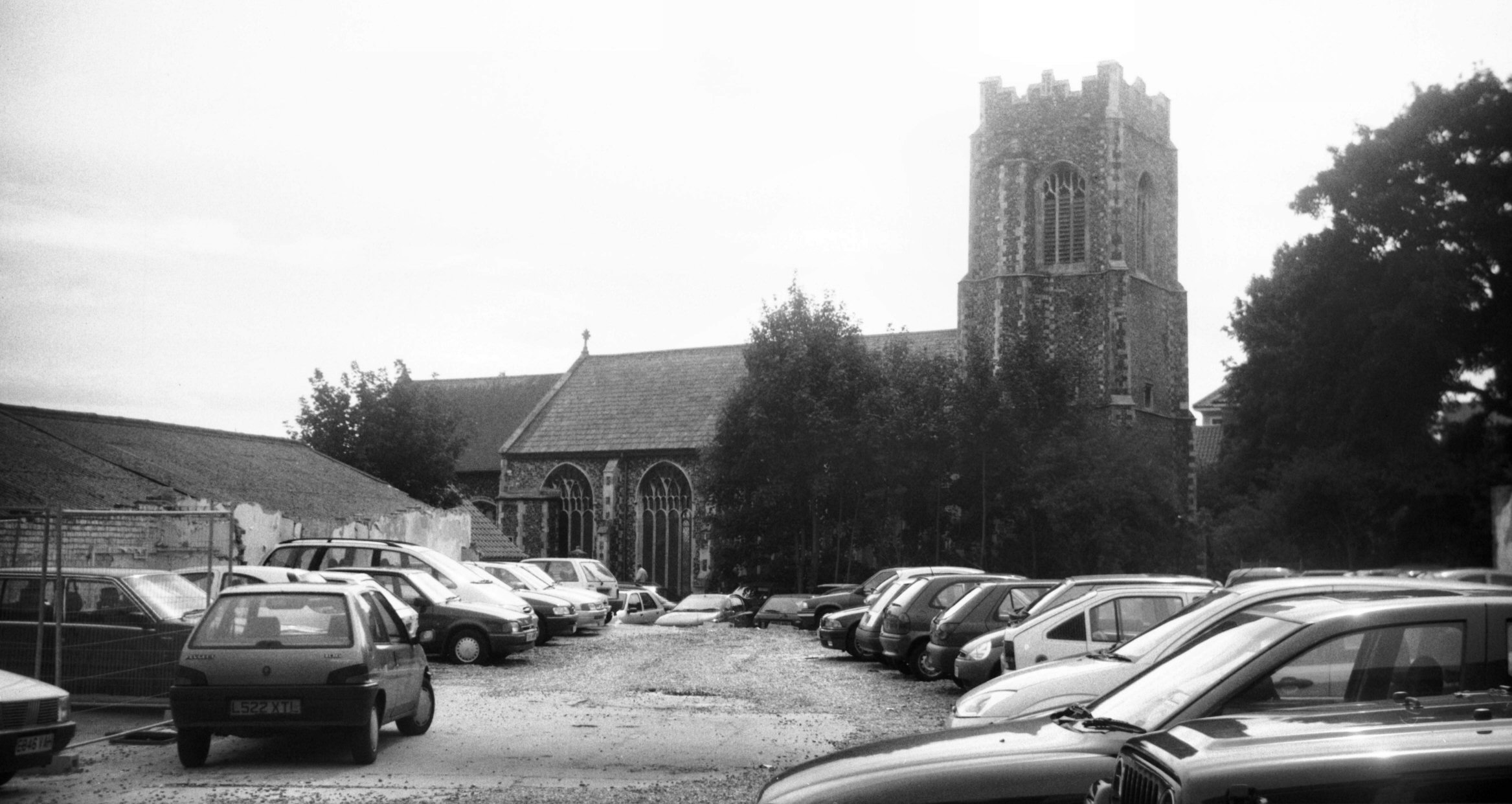
St Peter Parmentergate from SE [B130] 1931-00-00
|
|
|
St Peter Parmentergate from SE [2134] 1938-03-07
Probably wholly rebuilt late 15c. |
|
|
St Peter Parmentergate from building site [4648]
1961-09-10
From site of Norman's Buildings. |
|
|
St Peter Parmentergate from north [7852] 2001-09-13
|
|
|
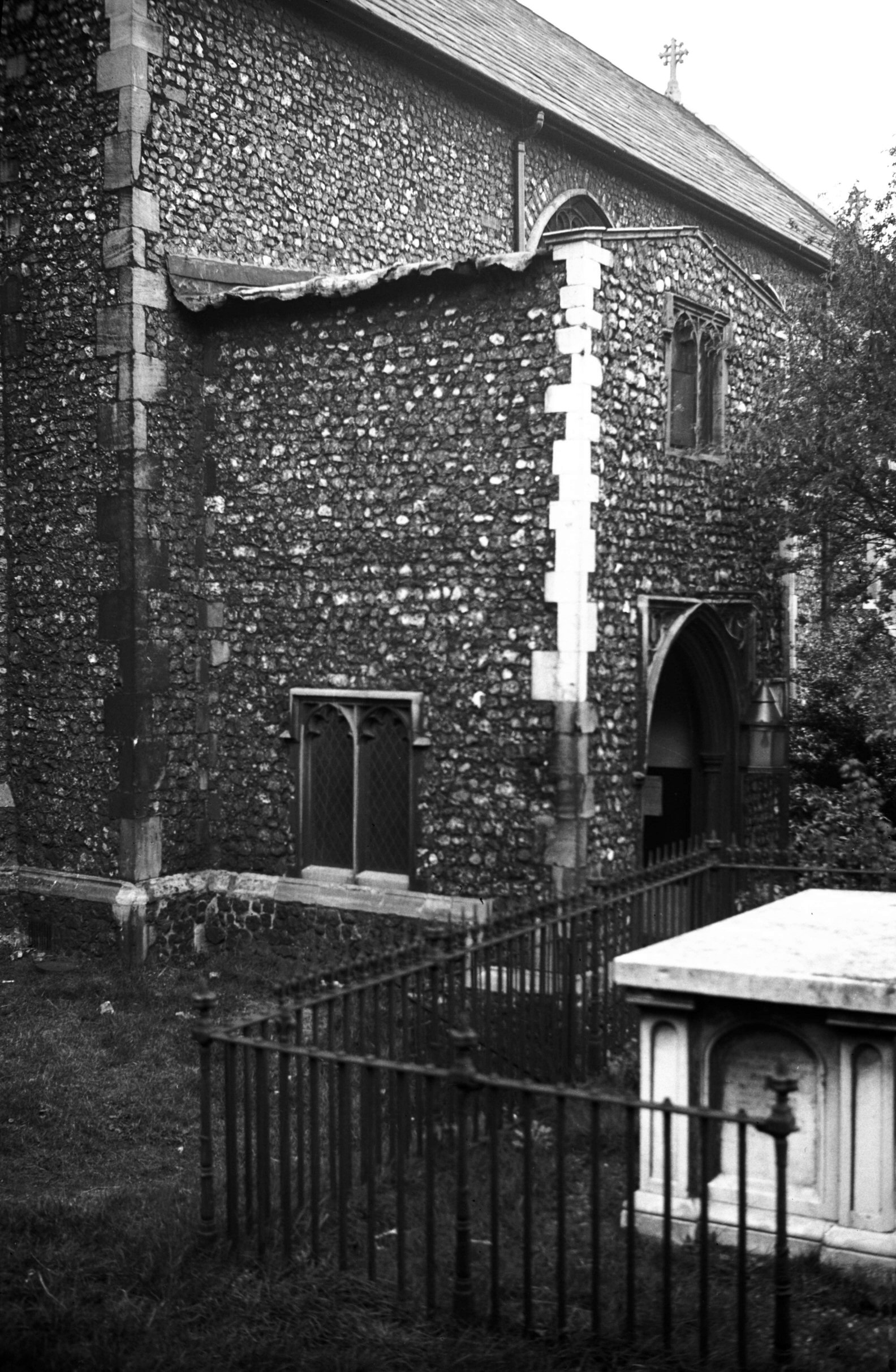
St Peter Parmentergate south porch [2289] 1938-04-10
Parvise of which is converted to a chapel dedicated to St
Anthony. |
|
|
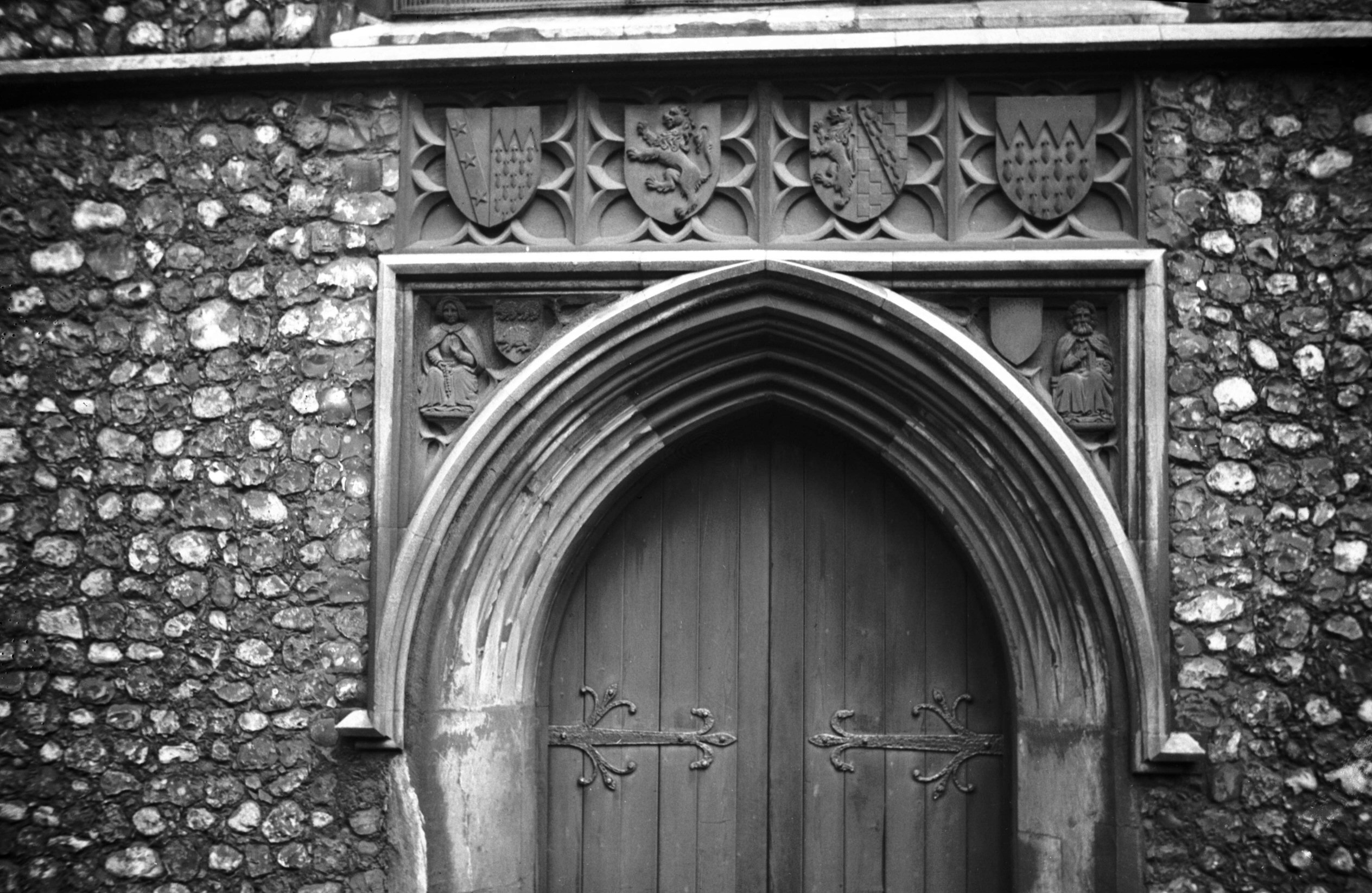
St Peter Parmentergate west doorway [2290] 1938-04-10
With carved shields and spandrels. |
|
|
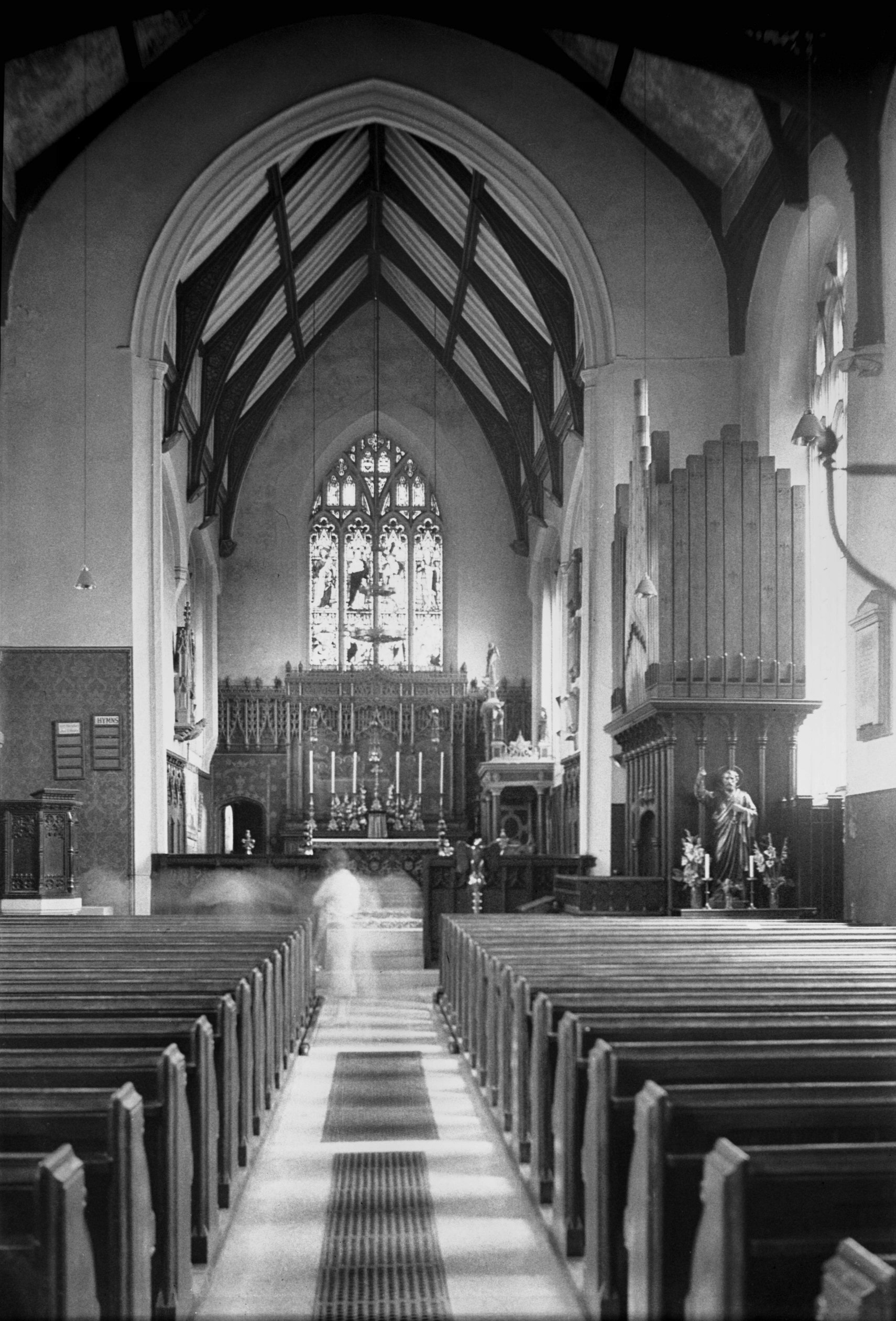
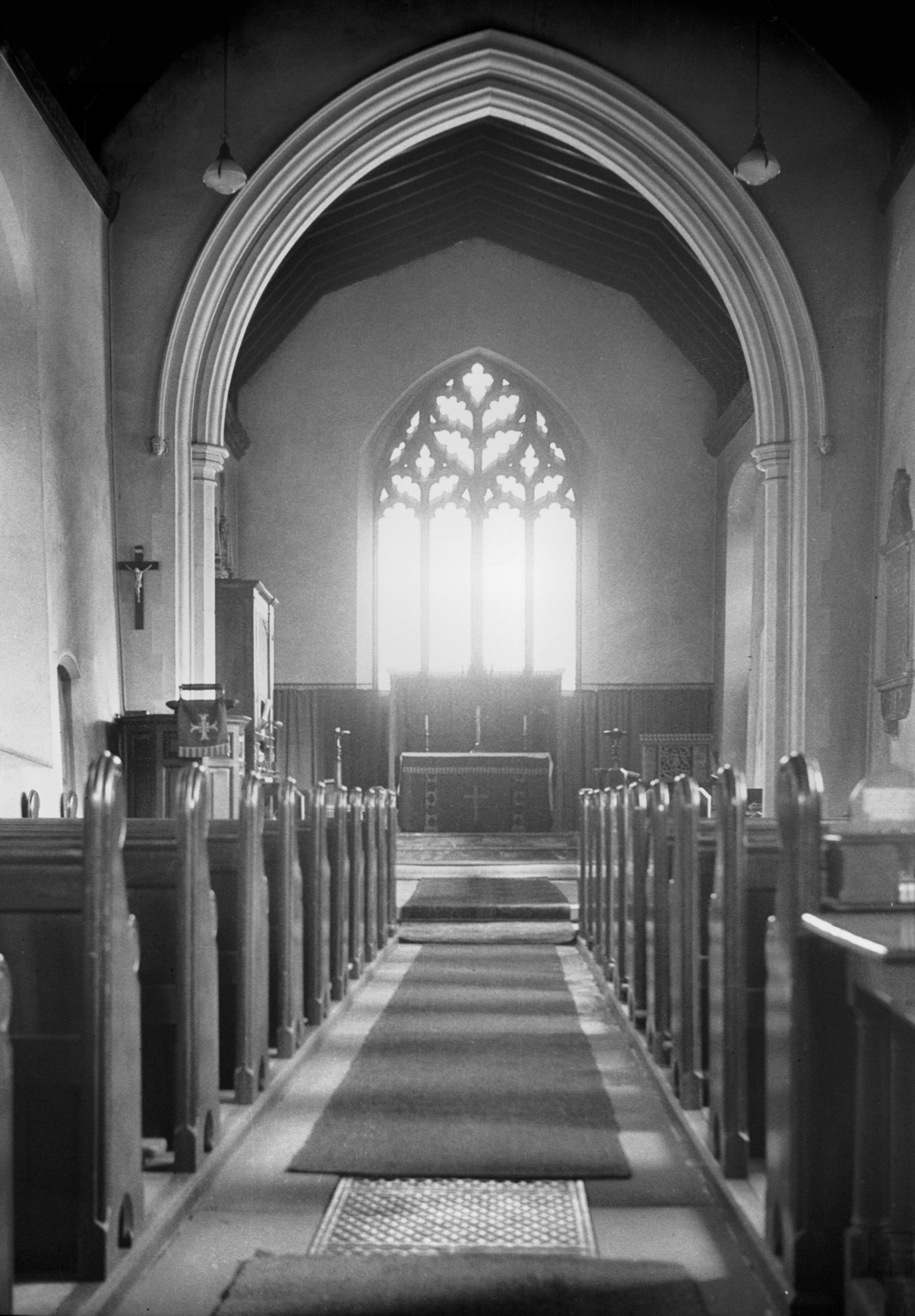
St Peter Parmentergate interior view east [1851]
1937-08-07
The carved oak reredos was erected by Rev W.Hudson vicar
1873-93 in memory of his wife. |
|
|
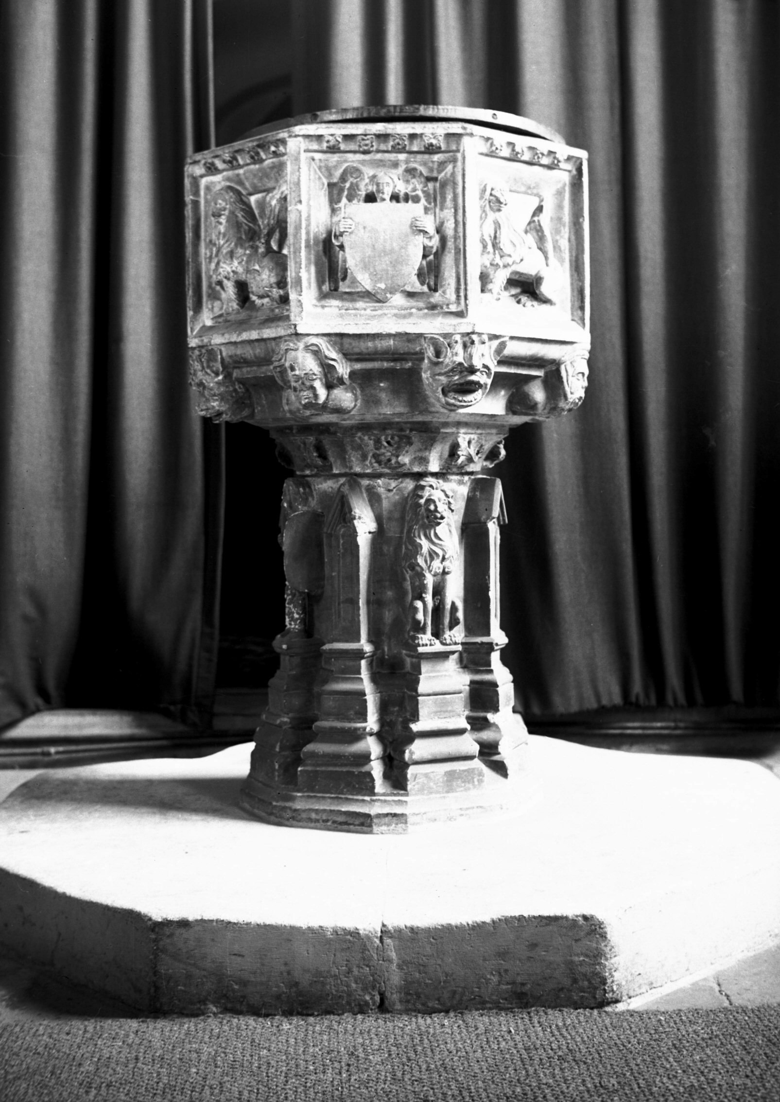
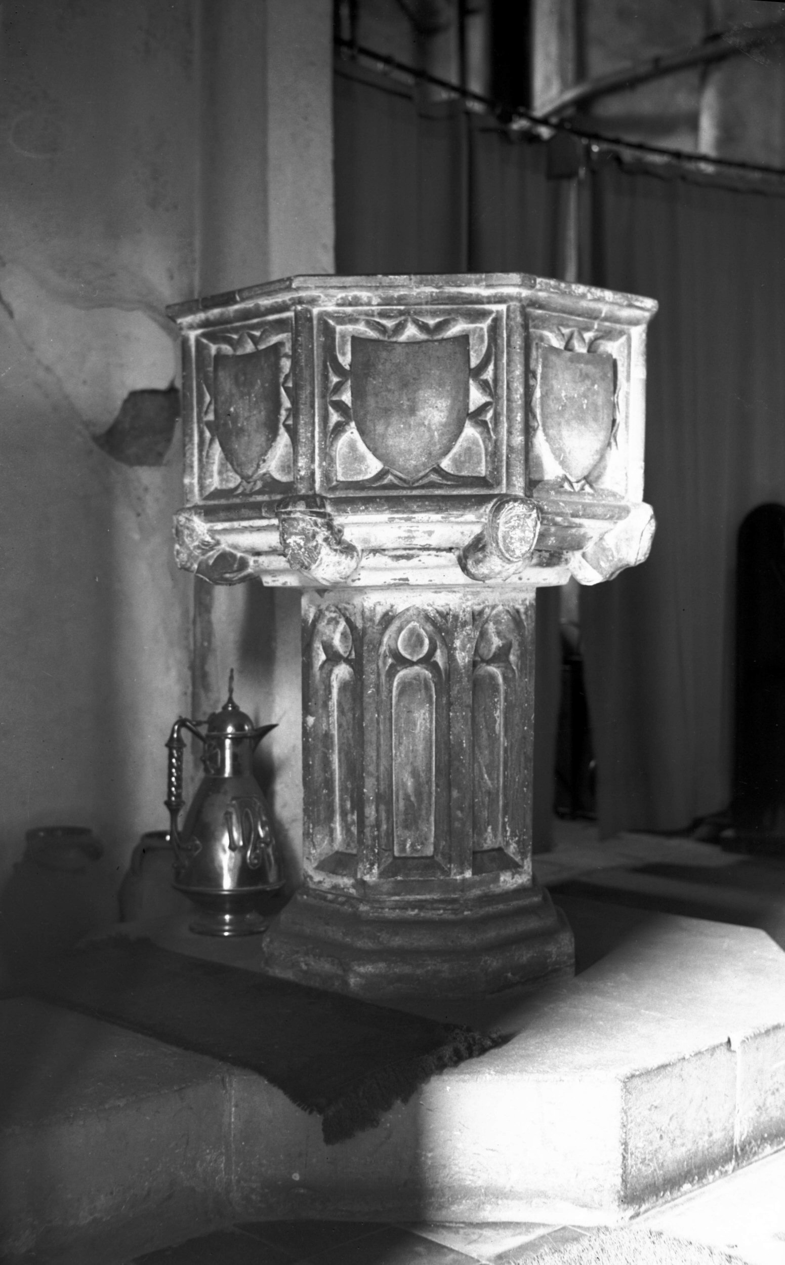
St Peter Parmentergate 15c font [2226] 1938-03-30
East Anglian type. |
|
|
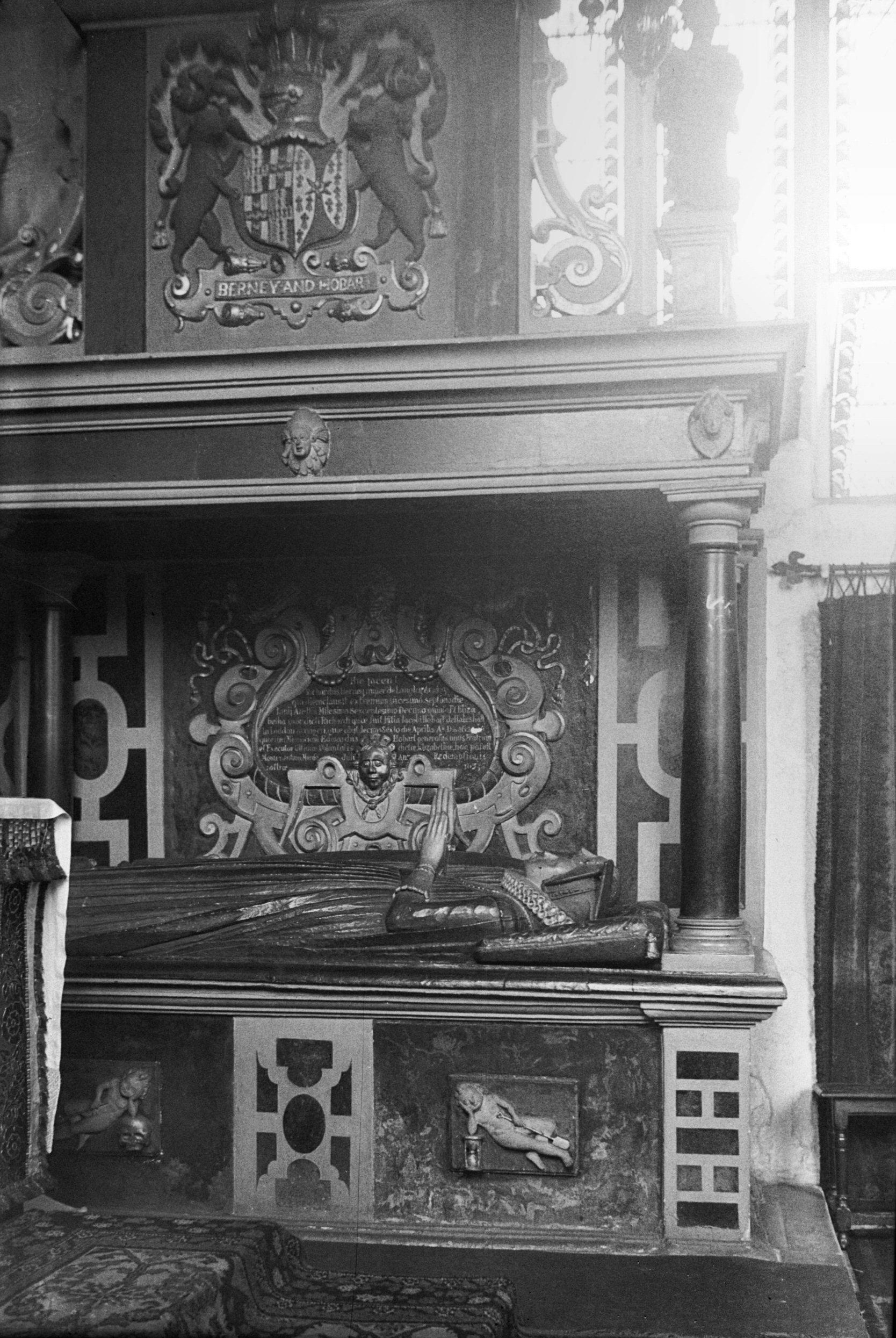
St Peter Parmentergate R Berney altar tomb [1880]
1937-08-14
R.Berney esq and his wife 1623. |
|
|
King St 80 [6849] 1992-06-21
|
|
|
King St 84 [6848] 1992-06-20
|
|
|
King St 86 to 90 [0625] 1935-08-06
In the 14c here was Berney's Inn, John Berney of
Witchingham being entered on the roll of burgesses at
that time. Since then the family maintained its
connection with the city, Richard being Recorder and M.P.
for Norwich in Anne's reign. In the 16c this was the city
house of Heydons of Baconsthorpe. William supported the
Mayor during Kett's Rebellion 1549. |
|
|
King St 86 to 90 [4653] 1961-10-08
|
|
|
King St 86 to 90 [6222] 1981-08-13
|
|
|
King St 130 to 134 [1258] 1936-08-08
|
|
|
King St 130 to 134 [2913] 1939-04-08
Another notable row of houses Nos 132-140 formerly stood
to the north of the entry into Horns Lane. While those on
the corner were being demolished in 1950 workmen
discovered a 17c Bellarmine jar containing human hair,
fingernails and a number of iron nails, believed to have
been used in the rituals of witchcraft. Adjoining to the
north were three other houses of the 17c and later. Built
of flint and brick and faced with plaster, they were of
two storeys, one house having a double dormer above while
the other two had each a single dormer. |
|
|
King St 130 to 134 rear [2881] 1939-02-26
|
|
|
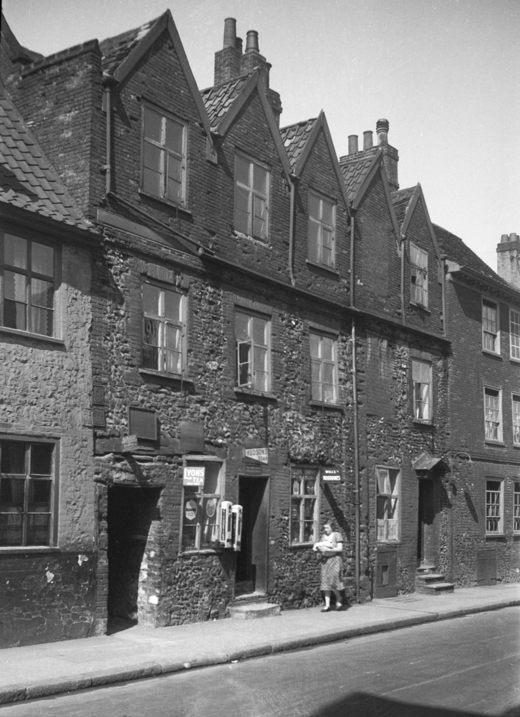
King St 144 to 150 [1257] 1936-08-08
Music House Lane was constructed out of the lower reaches
of Horns Lane when in the 1960s the whole area between
King St and Ber St was redeveloped. Writing about the
year 1720, the historian John Kirkpatrick stated that
Horns Lane (formerly Skeygate) derived its name
"from the sign of a pair of Buck's Horns in
Conesford St, near the lower end of it".
On the south corner, at 142 King St, stood the Waterman
public house, partly rebuilt between the two World Wars
and once famous for displaying the following couplet:
Roam not from Pole to Pole but step in here
Where nought exceeds the shaving but the beer.
The landlord, it should be explained, at one time carried
out the dual occupation of barber and publican.
Nos 144-148 which adjoined the Waterman were of much
earlier date. The first two dwellings occupied a Tudor
building of two storeys only, the upper floor projecting
slightly above the pavement and having its plaster facade
outlined in imitation of stonework. No 148 was of brick
with casement windows and a commodious brick dormer or
large dormer which extended through to the back. In
latter years the front room was in use as a general shop
- in the 1930s the whole of King St was described as a
street of small shopkeepers, before the advent of
supermarkets and its depopulation through slum clearance. |
|
|
King St 150 rear [4763] 1964-05-09
|
|
|
King St 158 to 162 [2912] 1939-04-08
Nos 158-162 were of three storeys, built of brick in the
18c and partly rough-cast.
In May 1939, these houses were the subject of a Ministry
inquiry under the 1936 Housing Act. Witnesses called to
oppose their demolition described the area as one of the
most historic and architecturally attractive corners left
in Norwich, and an expert from London was quoted as
saying that here were some of the best local examples of
Dutch influence. Nos 164 and 166 were described as
Elizabethan gabled houses of considerable interest and it
was felt that Nos 160 and 162 should also be retained to
round off the complete group. In spite of such evidence
the Minister agreed with the City Council and they all
came down. |
|
|
King St 164 to 166 [1256] 1936-08-08
Nos 164-166, which were of flint rubble construction with
brick dressings, appeared to be contemporary with Ship
Row adjacent to the south, but an unusual additional
feature was a row of five conjoined dormers unusually
constructed of brick rather than lath and plaster.
Unfortunately, because of their condition, these houses
were demolished. |
|
|
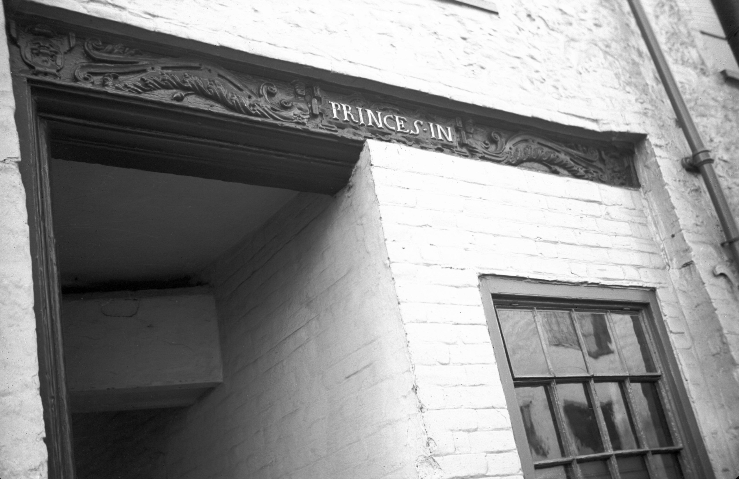
King St 168 Ship Inn [3216] 1939-08-07
The picturesque 17c houses (Nos 168-178) are known as
Ship Row from an inn of that name formerly occupying No
168. The yard to its south has at some time been partly
built over, so that while formerly wide enough for the
passage of carts it will now accommodate only
pedestrians. The finely carved lintel above bears a
design of foliage together with the rather contradictory
inscription "Princes In"; it is believed that
this was brought here at some time from the famous inn of
that name, first mentioned in 1391, which once stood in
St George Tombland parish on the north side of Princes
St.
Previously owned by Youngs, Crawshay and Youngs, who
maintained the buildings in good condition, they were
acquired by the City Council in 1959. Five years later No
182, a tall Victorian house, and Nos 170-180 (dated 1632)
were converted into three flats and five cottages, and at
the same time what was described as "an accretion of
old rubbish" at the back (sculleries, sheds and
outhouses) was removed and some extra land added to the
gardens. In 1970 the public house itself was similarly
acquired and converted into two dwellings. |
|
|
King St 168 Ship Inn carved lintel [2133] 1938-03-07
|
|
|
King St Ship Yard [2073] 1938-01-19
|
|
|
King St 170 to 174 [3028] 1939-05-29
|
|
|
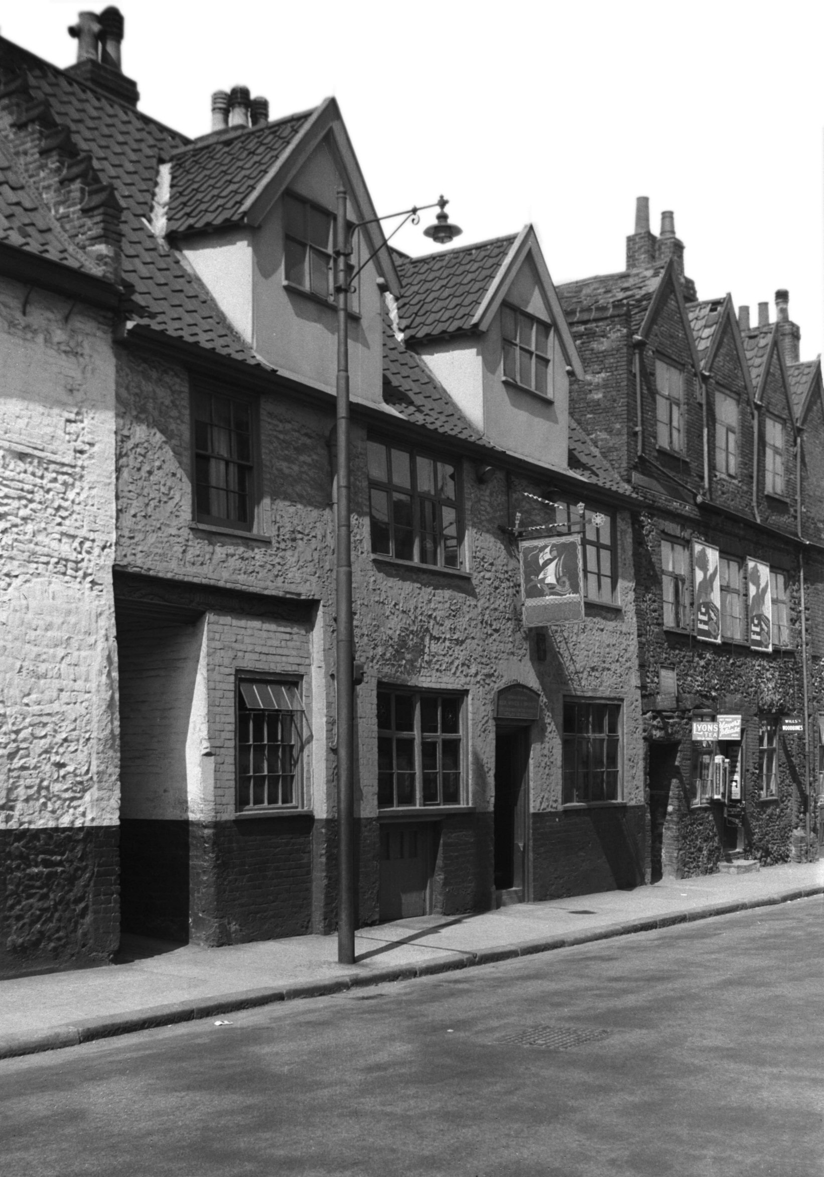
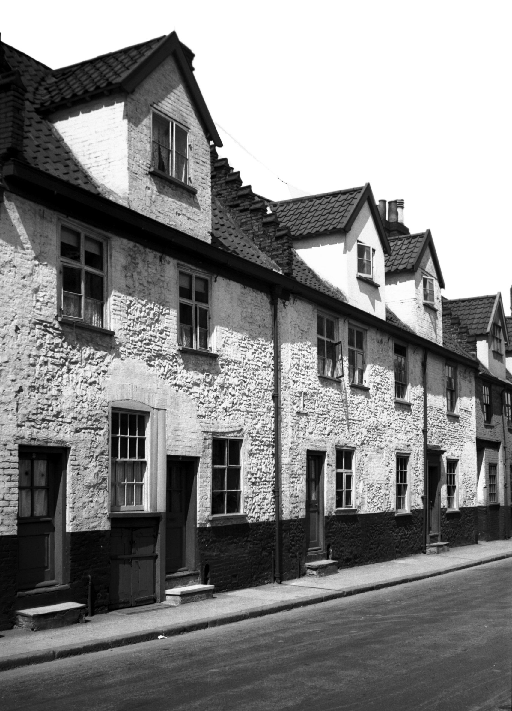
King St 170 to 178 [1255] 1936-08-08
Said to be 17c. |
|
|
King St 174 to 178 rear [4769] 1964-05-23
During 1964 renovation. |
|
|
King St 176 to 178 [3027] 1939-05-29
|
|
|
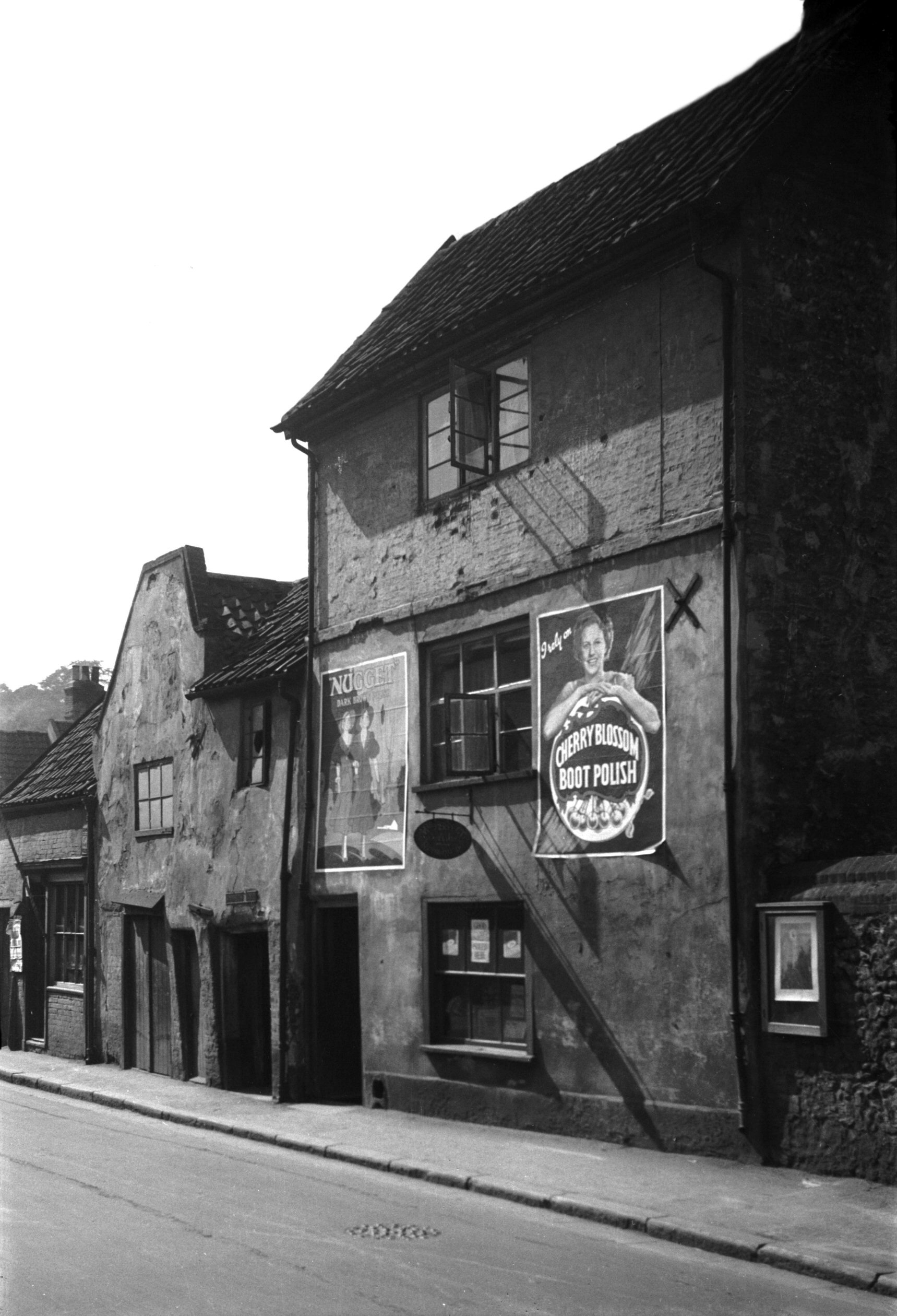
King St 184 Malt house [0592] 1935-05-26
Here is where Mariner's Lane (ancient Holgate) originally
descended from Ber St, entering King St to the north of
St Etheldreda's churchyard. Until the area was
redeveloped, stood a malthouse belonging to the brewery
of Youngs, Crawshay and Youngs. This had been converted
from a dwelling and was constructed (possibly in the 16c
and later) of flint and brick, and with its first floor
partly timber framed with a slight jetty. Upon a corbel
projecting just below eaves level there appeared to be a
coat of arms, or at least some traces of one.
The historian Francis Blomefield referred to the site as
that of the house of Sir Robert de Salle, killed by the
Norfolk Levellers in 1381. At his death it came to his
daughter, Alice de Salle, and was later known as Baist's
Place from some owner of that name. |
|
|
King St 184 Malt house [2911] 1939-04-08
|
|
|
King St 186 to 188 [1254] 1936-08-08
|
|
|
St Etheldreda's SE corner from King St [B128]
1931-00-00
|
|
|
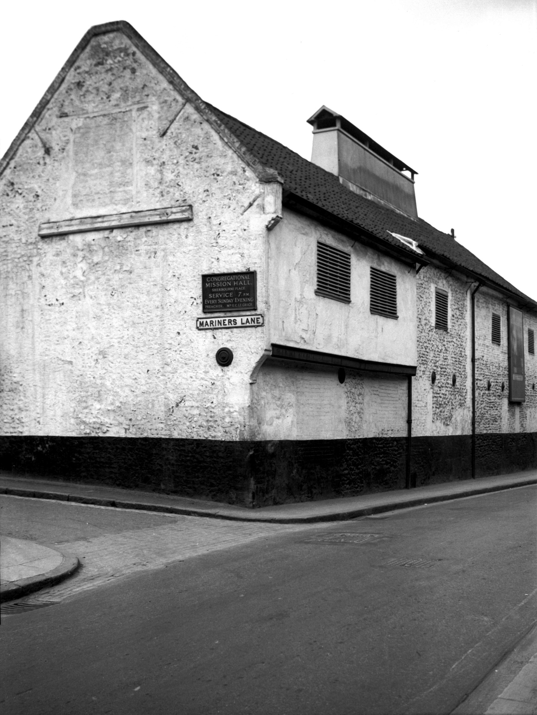
St Etheldreda's from Mariners Lane [2192] 1938-03-21
View from north-west. |
|
|
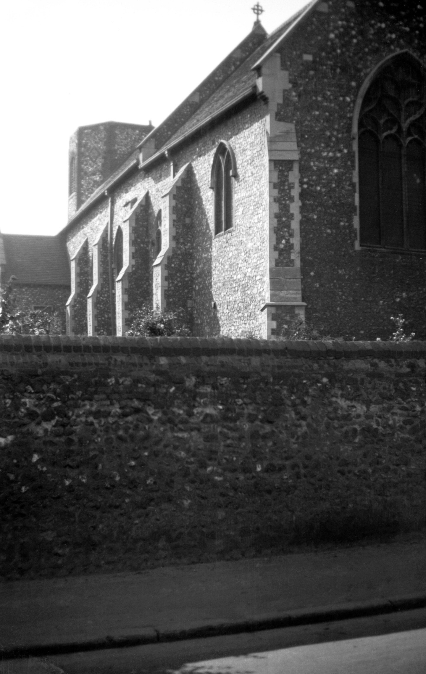
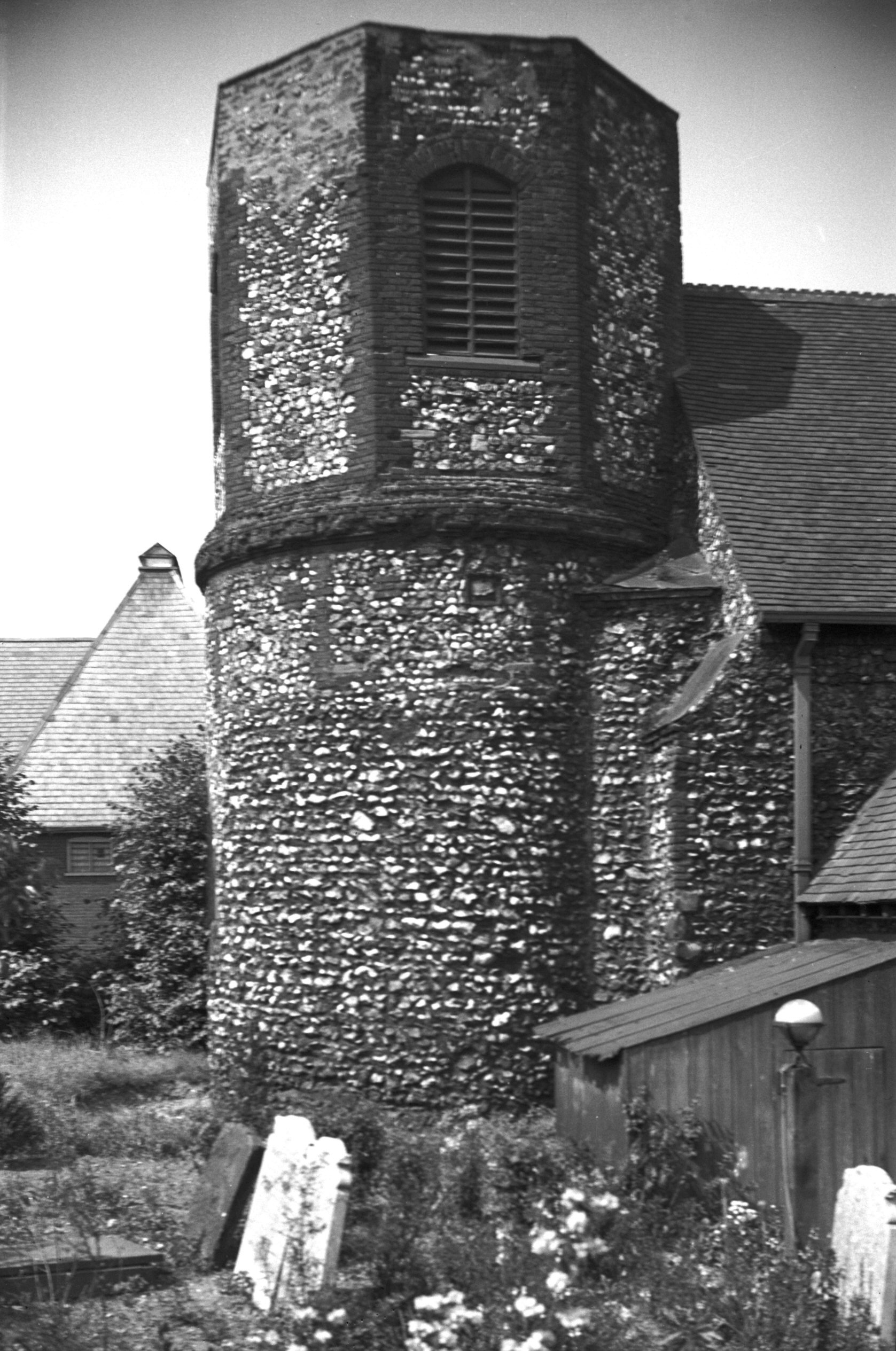
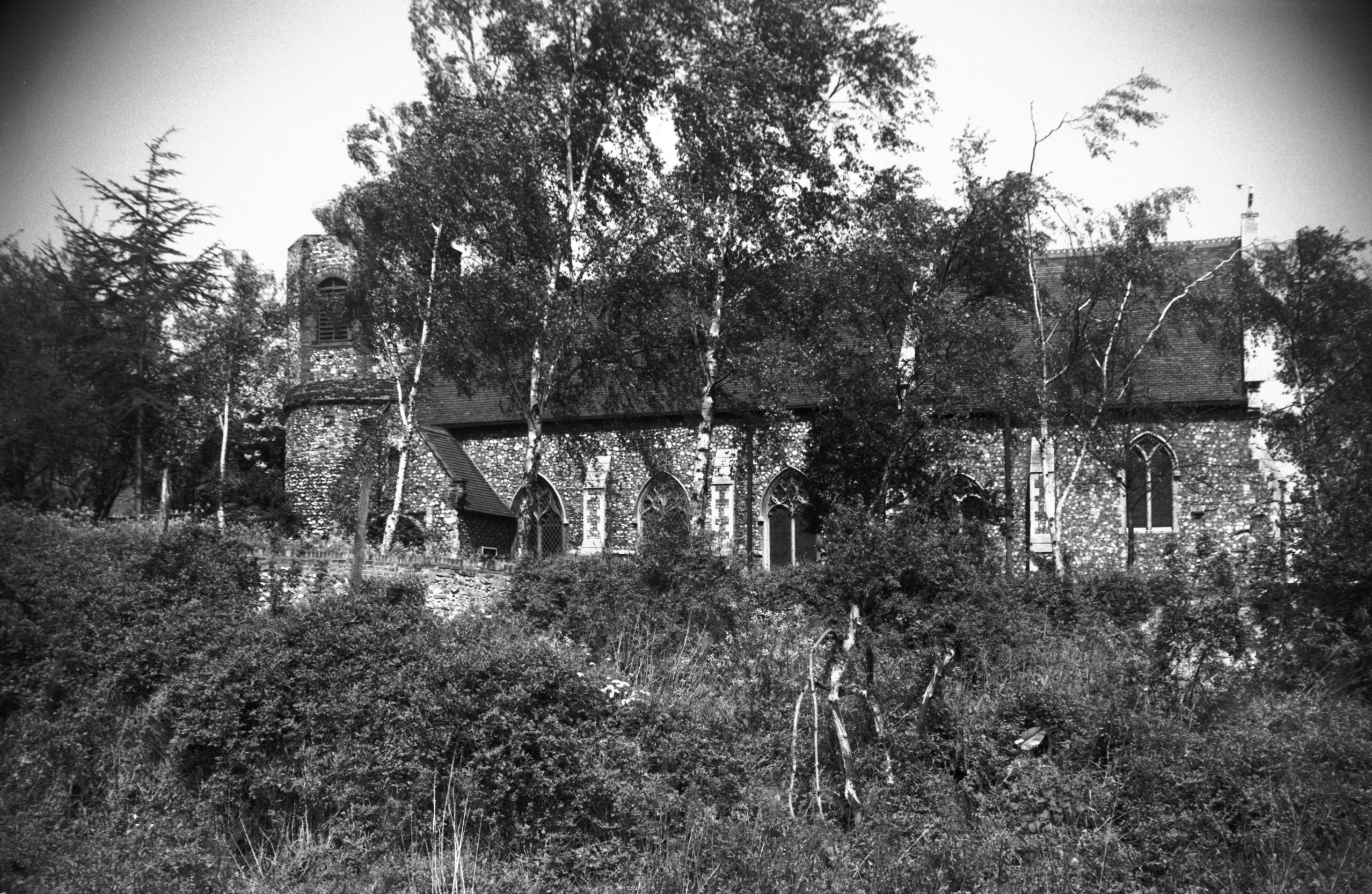
St Etheldreda's tower south side King St [0161]
1934-07-08
Norman round tower with octagonal top. |
|
|
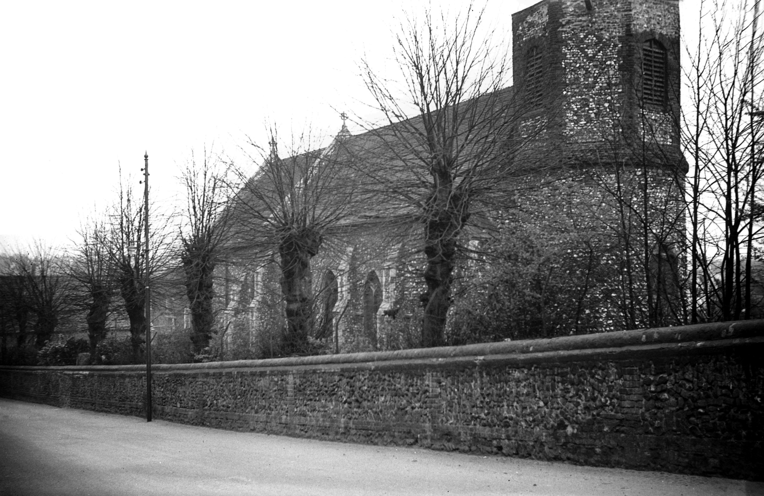
St Etheldreda's south side from King St [4764]
1964-05-09
|
|
|
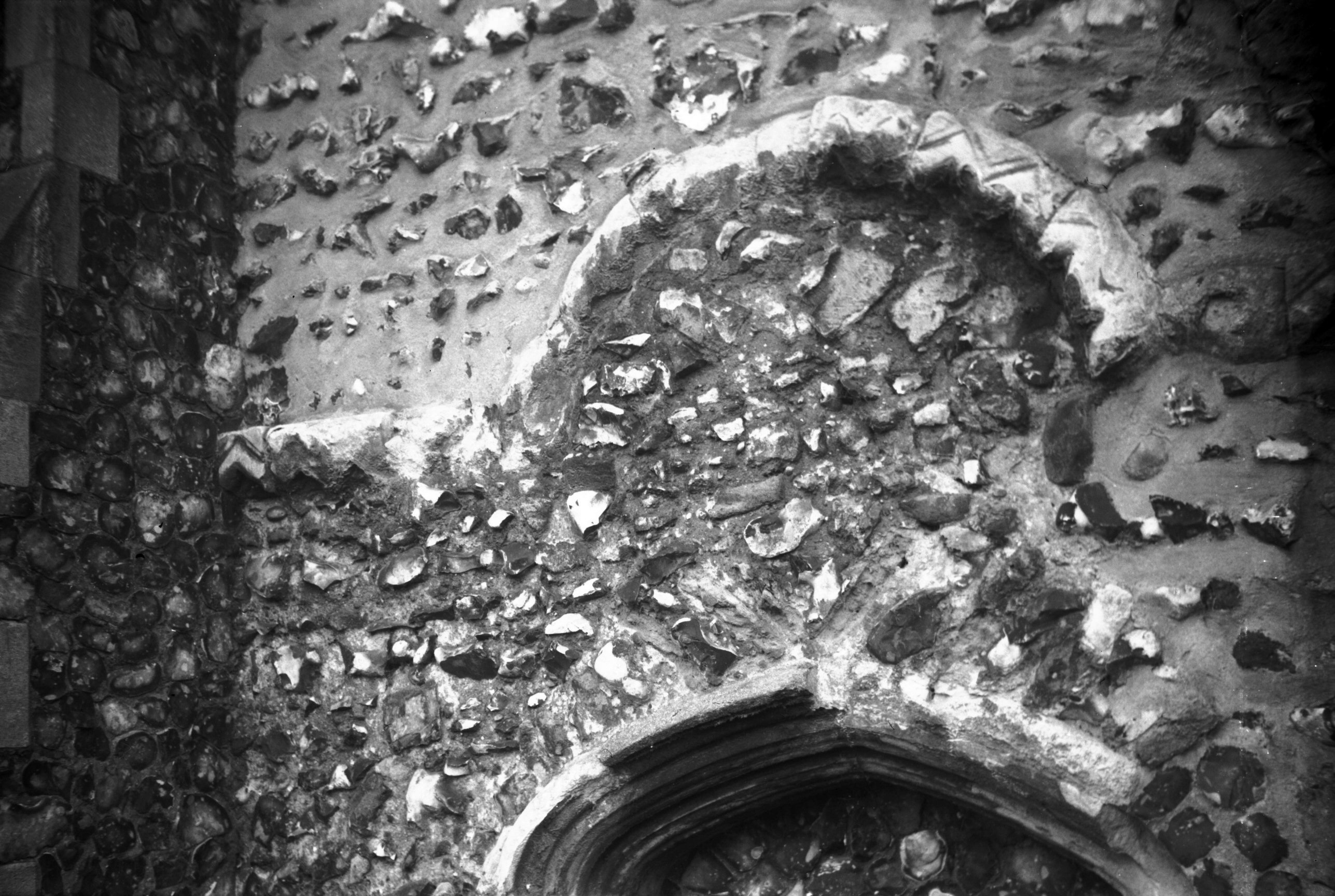
St Etheldreda's nave Norman stringcourse [6259]
1983-04-28
Norman stringcourse on north side of nave. Possibly the
blocked arch of the original north doorway. |
|
|
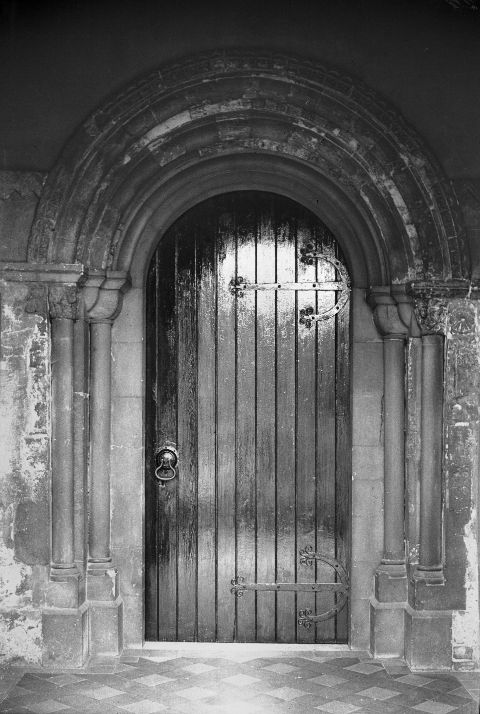
St Etheldreda's Norman south doorway [1923]
1937-08-25
|
|
|
St Etheldreda's interior view east [1852] 1937-08-07
Comparison with Sillett's view drawn in 1828 shows the
present 14c style east window to be a modern
replacement.. |
|
|
St Etheldreda's 15c font [2228] 1938-03-30
With panelled bowl. |
|
|
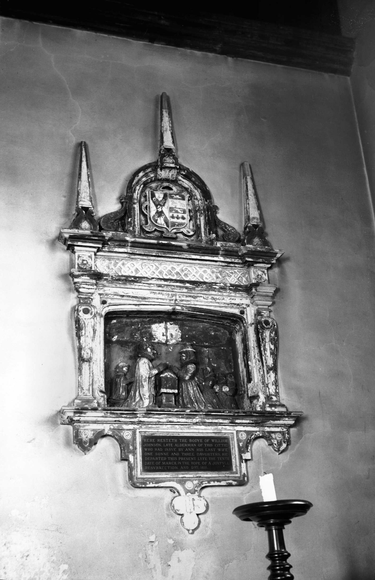
St Etheldreda's William Johnson monument [2227]
1938-03-30
William Johnson, Alderman of Norwich, died 1611. |
|
|
King St 196 and Rayners Yard [1253] 1936-08-08
The main thoroughfare extending from the city's south
(alias Conesford) gate northwards was known for centuries
as Conesford St: not until late in the 18c was it called
by its present name of King St. It was always a
comparatively narrow and sometimes congested
thoroughfare, and the opportunity was taken in the early
1960s to construct Rouen Road as a bypass by demolishing
what had become a somewhat derelict and run-down area.
At a point in King St just beyond the churchyard of St
Peter Southgate, the kerb was realigned to persuade
traffic to take the new road to the west, emerging at the
upper end of Cattlemarket St. This also involved the
demolition of a number of old King St properties between
St Peter's and St Etheldreda's churchyards, including the
parish room, a 19c red-brick building. Immediately to the
north was Rayner's Yard, with an old-established bakery
on the corner; beyond that, and adjoining St Etheldreda's
churchyard, was other old property including a small shop
and the entrance to Rainbow Yard.
Quite near here, and probably now covered by this end of
Rouen Rd, was the site of Hildebrond's hospital or Ivy
Hall, a religious establishment founded in the 13c by
Hildebrond, a mercer, and Maud his wife as a kind of
almshouse "in which poor People wanting House-Room
were to be lodged, and have firing allowed them by the
Master". The site is shown on Francis Blomefield's
map [the 18c Norfolk historian] as being a little to the
south of St Etheldreda's church, and in reply to a query
of mine in 1935 Claude Messent stated that "the
remains now consist of re-used materials incorporated in
later buildings on the site; however, large portions of
old flintwork appear in boundary walls to Rayner's Yard,
but as there are later materials in these walls it is
difficult to be certain that they are the original walls
of the medieval hospital in situ." This seems to
correct a statement he had made a year earlier in his
book The Monastic Remains of Norfolk and Suffolk, where
he had placed the site some distance further north by
Horn's Lane School. |
|
|
King St east side flint house by Rouen Rd [6557]
1989-06-24
|
|
|
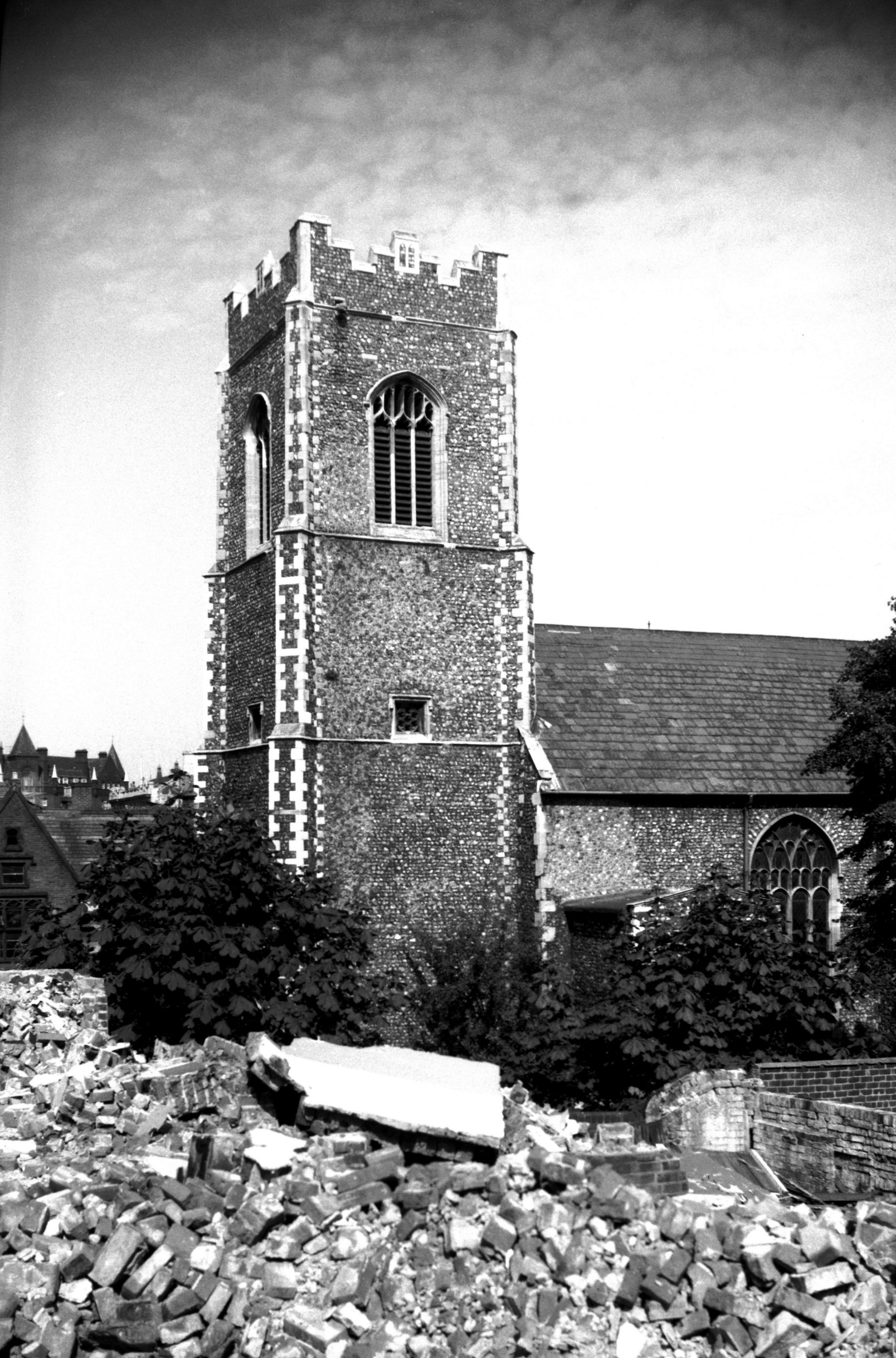
St Peter at Southgate ruined tower [B127] 1931-00-00
|
|
|
St Peter at Southgate ruins view east [2191]
1938-03-21
Overlooking what was Read's flour mill in King St from
the west is the former churchyard of St Peter Southgate,
now a playground. The lower part of the tower with a
brick Tudor arch is all that remains of the church
itself, which was demolished in 1887 (not as erroneously
stated on an adjoining plaque). A sketch of the building
was made by James Sillett in 1828 and a photograph taken
shortly before its abandonment is in the Local Collection
of the Norwich Central Library. |
|
|
St Peter at Southgate ruins view NW [5371] 1974-05-27
This church was used for services until a few years
before its demolition in 1887. It consisted of a nave,
chancel, north chapel, south porch and a square west
tower in which were three bells. Anciently known as St
Peter de Bither, it was founded before 1217 but appears
to have been rebuilt during the late Perpendicular
period. All that now remains is the lower part of the
tower with a brick Tudor arch. |
|
|
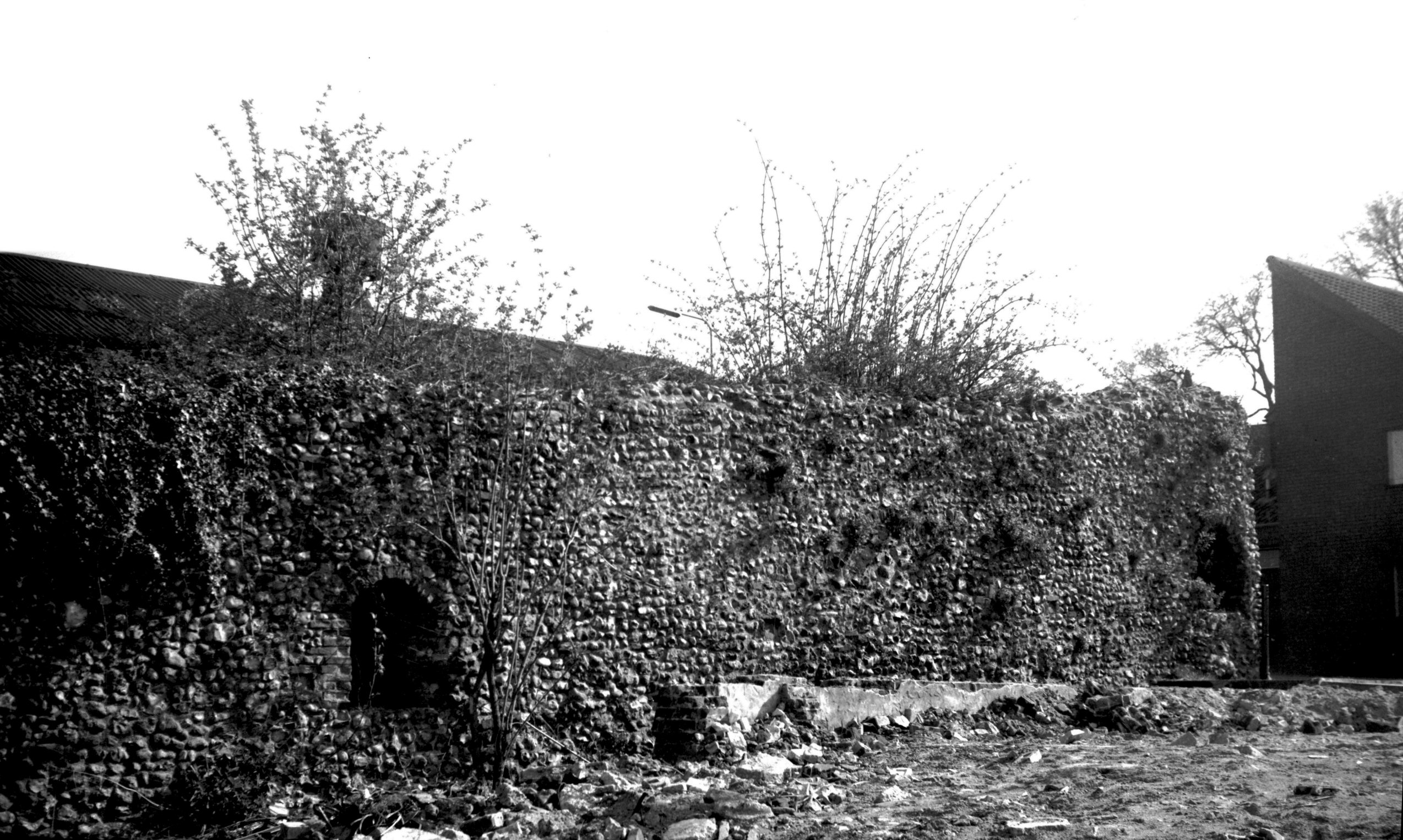
King St Gate east side from inside city [6298]
1984-04-28
View south. |
|
|
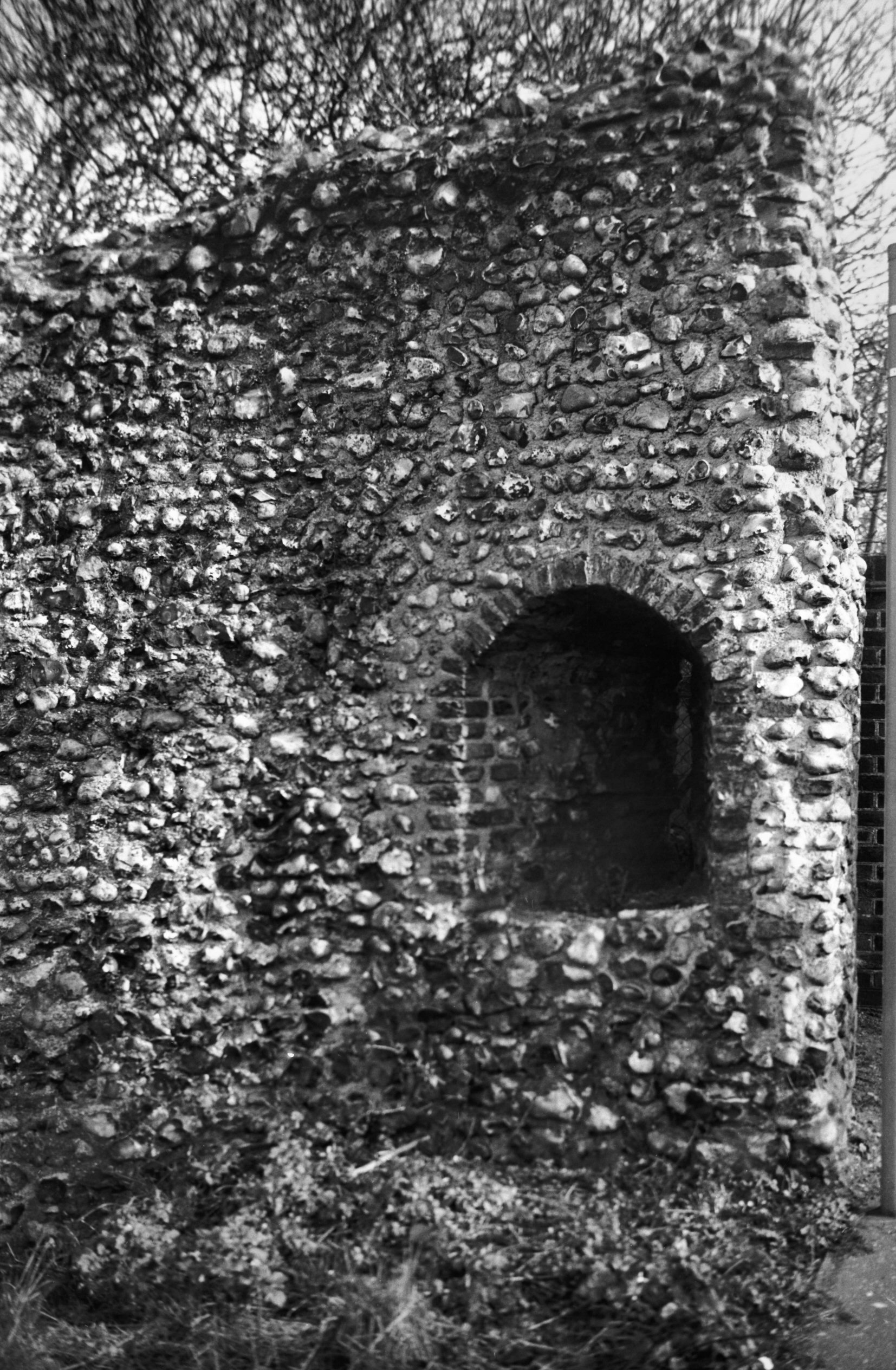
King St Gate east side arrow loop [7922] 2003-03-15
From inside wall. |
|
|
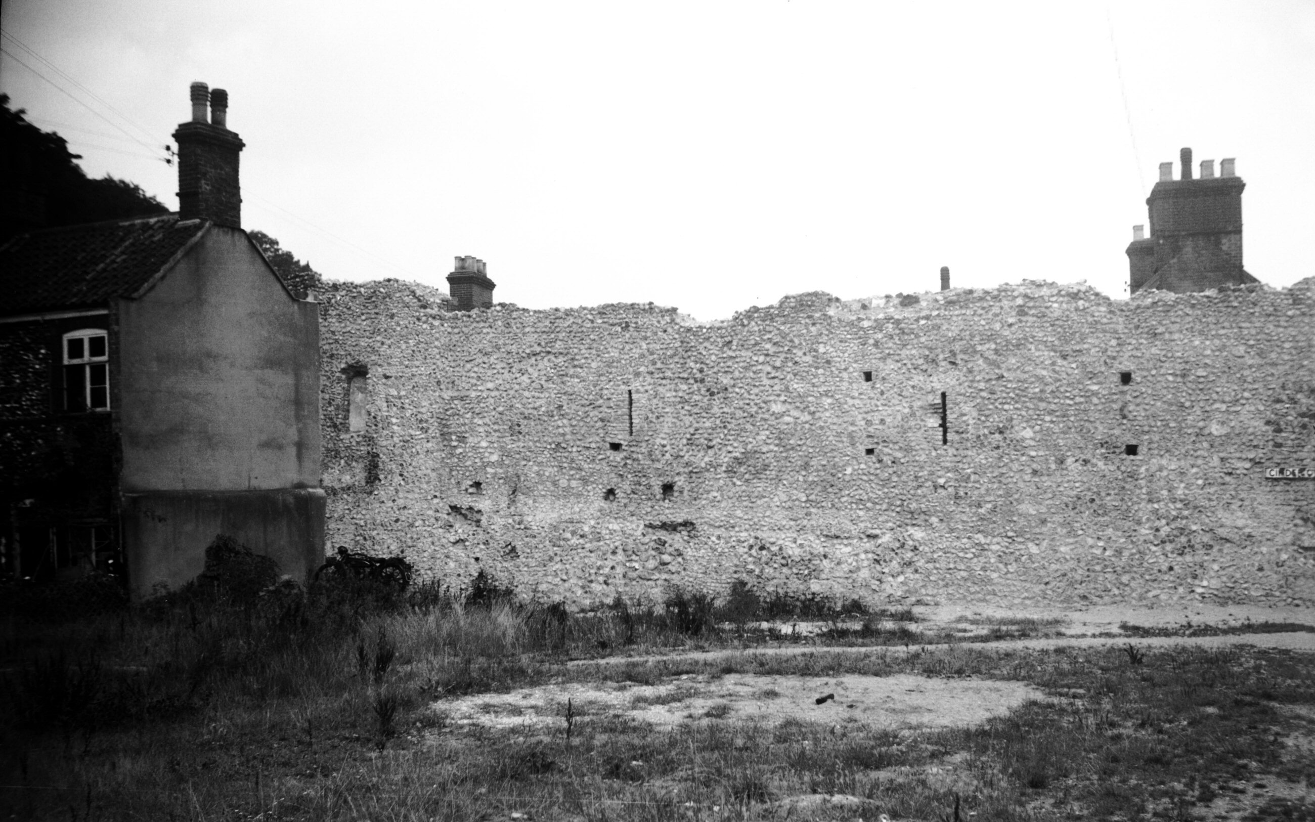
King St west side Cinder Ovens Row [4360] 1955-08-20
|
|
|
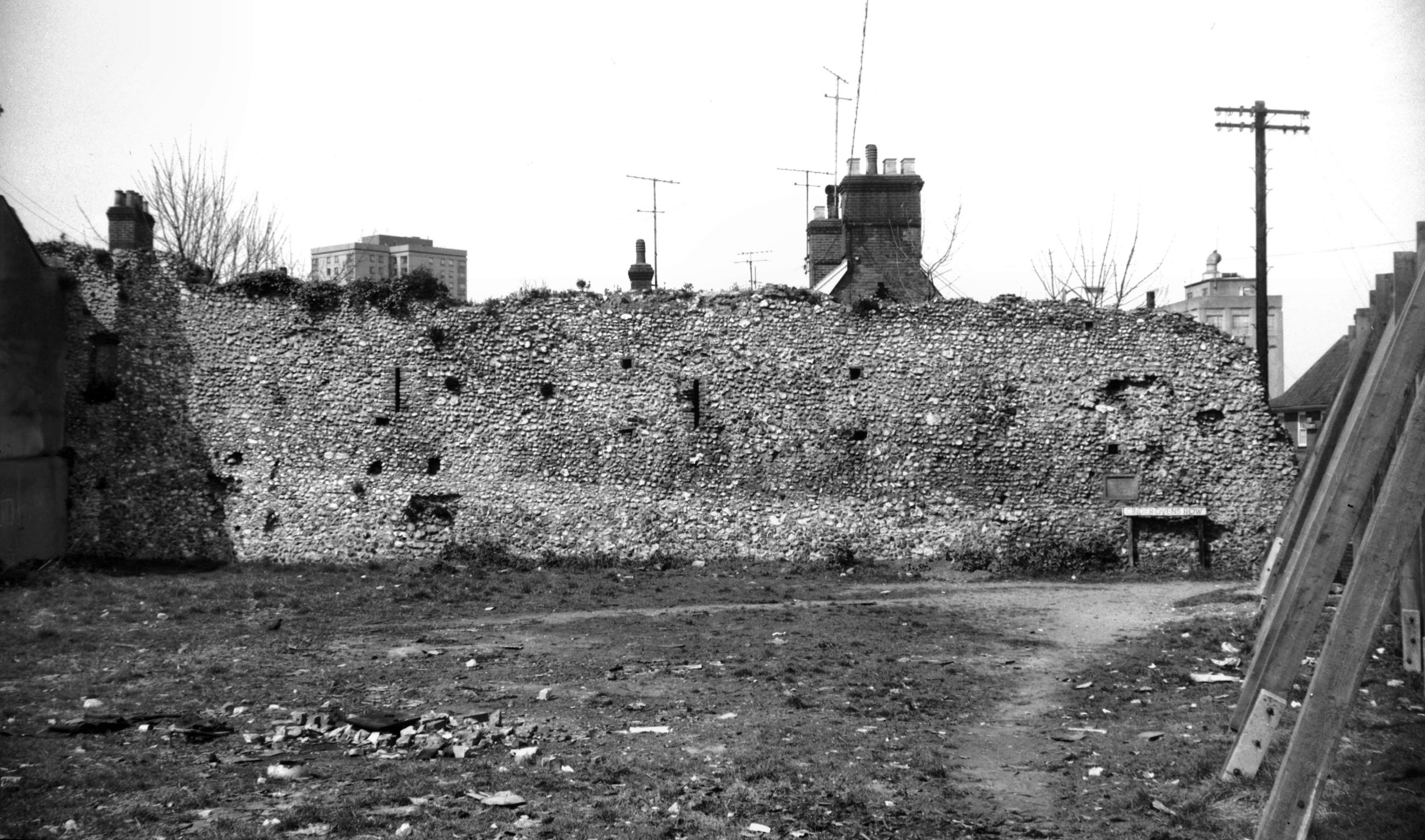
King St Gate west side Cinder Ovens Row [5191]
1968-04-18
View north-west. |
|
|
King St at Bracondale [0039] 1934-02-22
|