|
Botolph St: |
| |
Formerly
from Magdalen
St to Pitt St / Gildencroft / St
Augustine's St
passing Calvert St, St
George's St
East side |
|
|
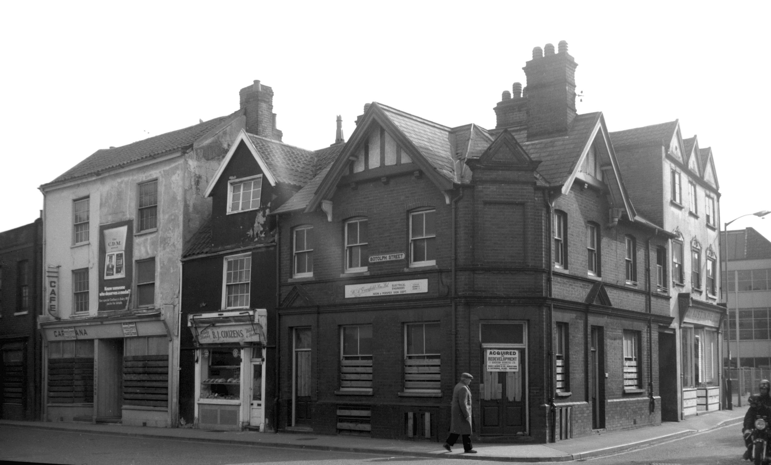
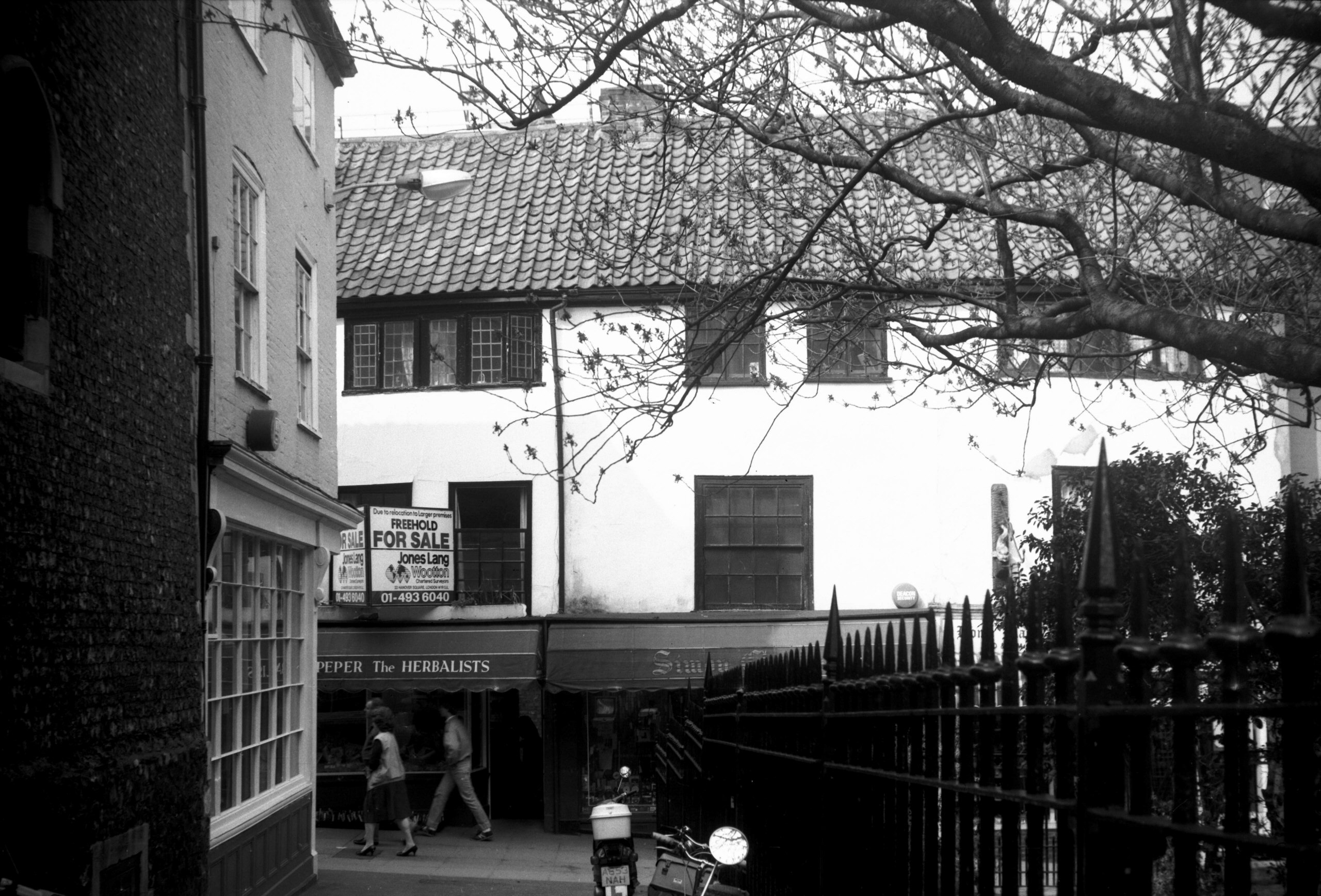
Botolph St 23 to 31 [5040] 1966-05-01
Botolph St derived its name from the former church of St
Buttolph the Abbot, of which the historian Francis
Blomefield said it "stood more south in Magdalen St,
not far north of Stump-cross; its churchyard abutted east
on the said street, and west on St Buttolph's, commonly
called Buttle-street; and is now the
White-horse-yard". He also added "1505, Will
Stephens; he died rector [of St Botolph's church] and was
the last the church had; for in 1544 it was made a
private property by Henry VIII, who granted it to Will.
Godwin; and in 1548, the church being quite demolished,
the parish was united in form to St Saviour's, with which
it now continues".
From Anglia Square it is difficult now without the aid of
maps to pin-point exactly the site of various buildings
which formerly lined Botolph St. The street itself, from
Stump Cross to the northern end of St George's, was
finally closed to traffic at the end of March 1969, by
which time most of the demolition to create the square
had taken place. |
|
|
Botolph St Chapel Yard [0887] 1936-04-12
|
|
|
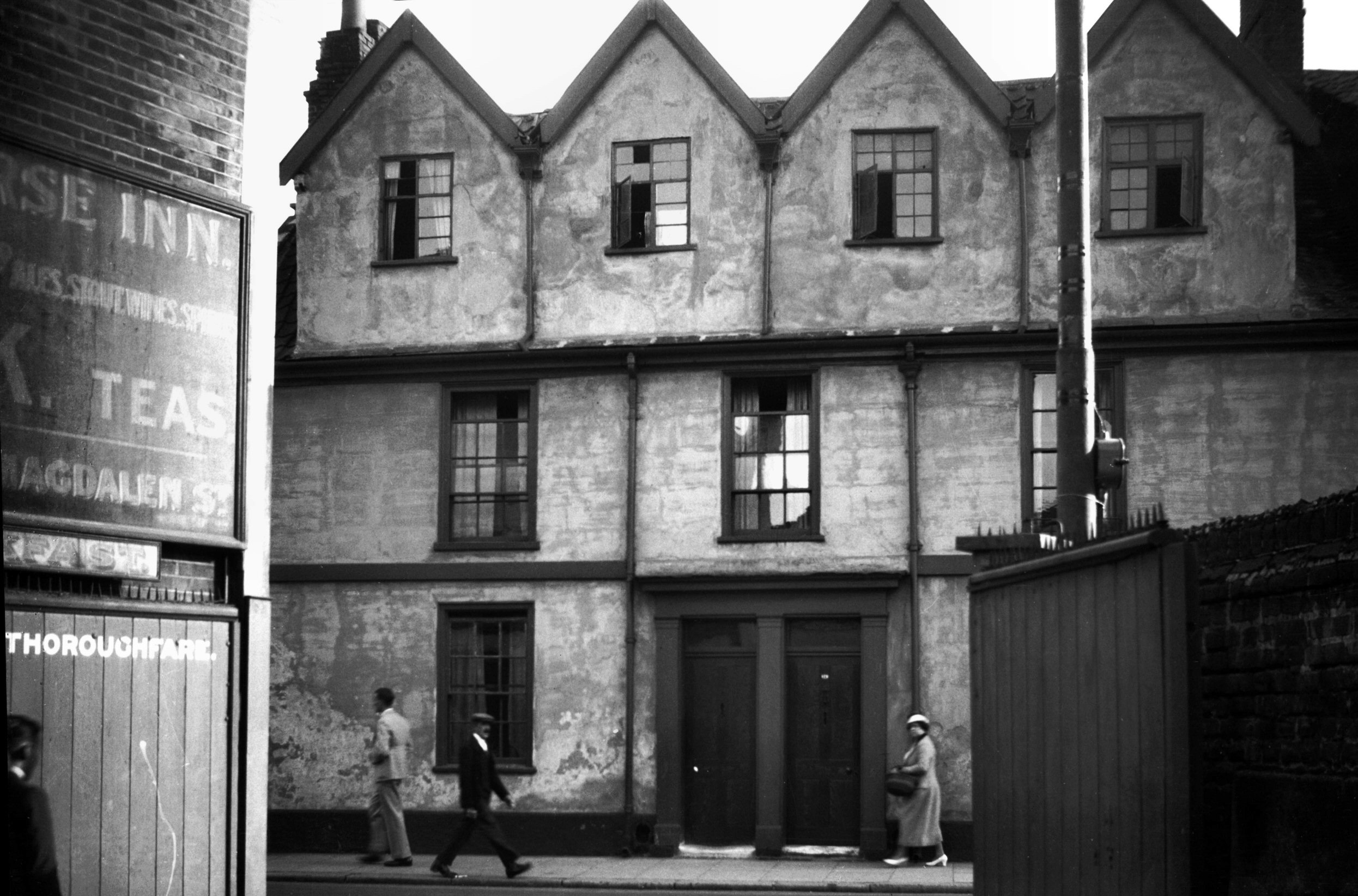
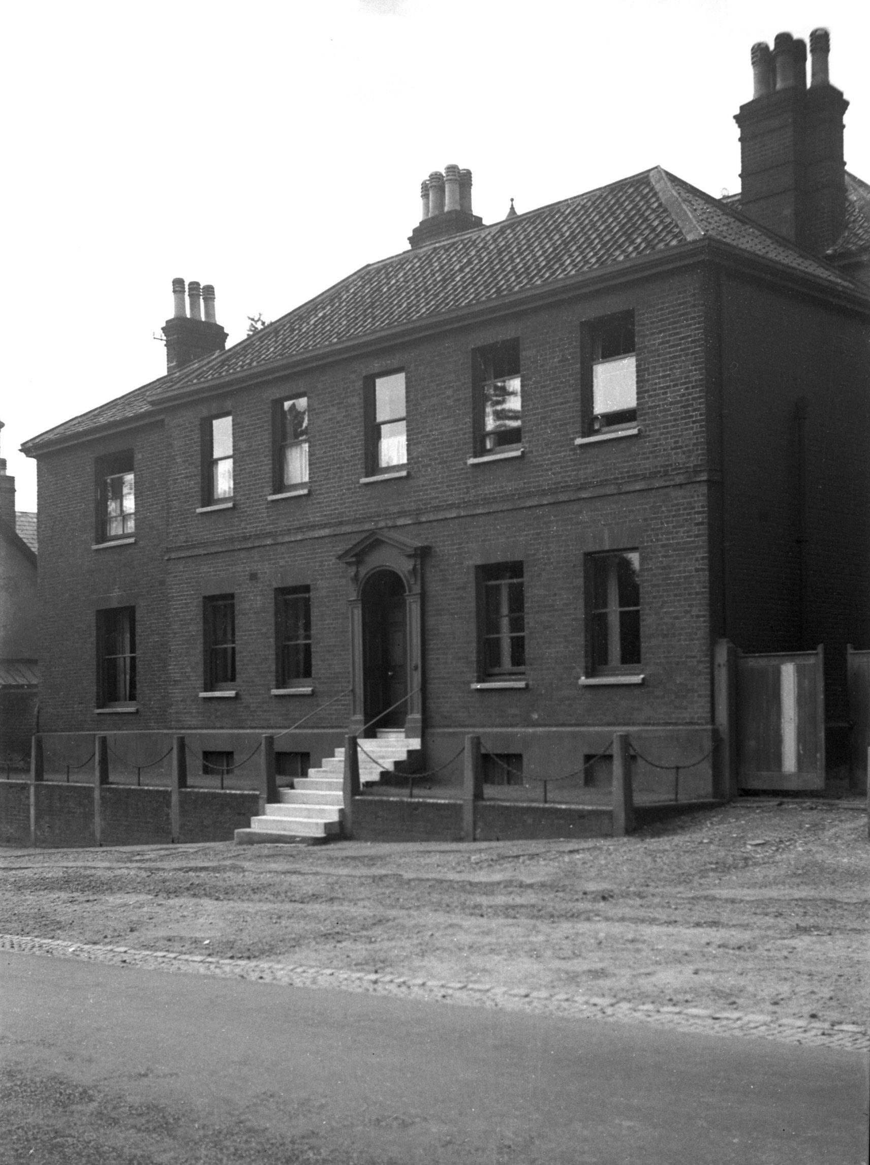
Botolph St 53 [1447] 1936-09-22
|
|
|
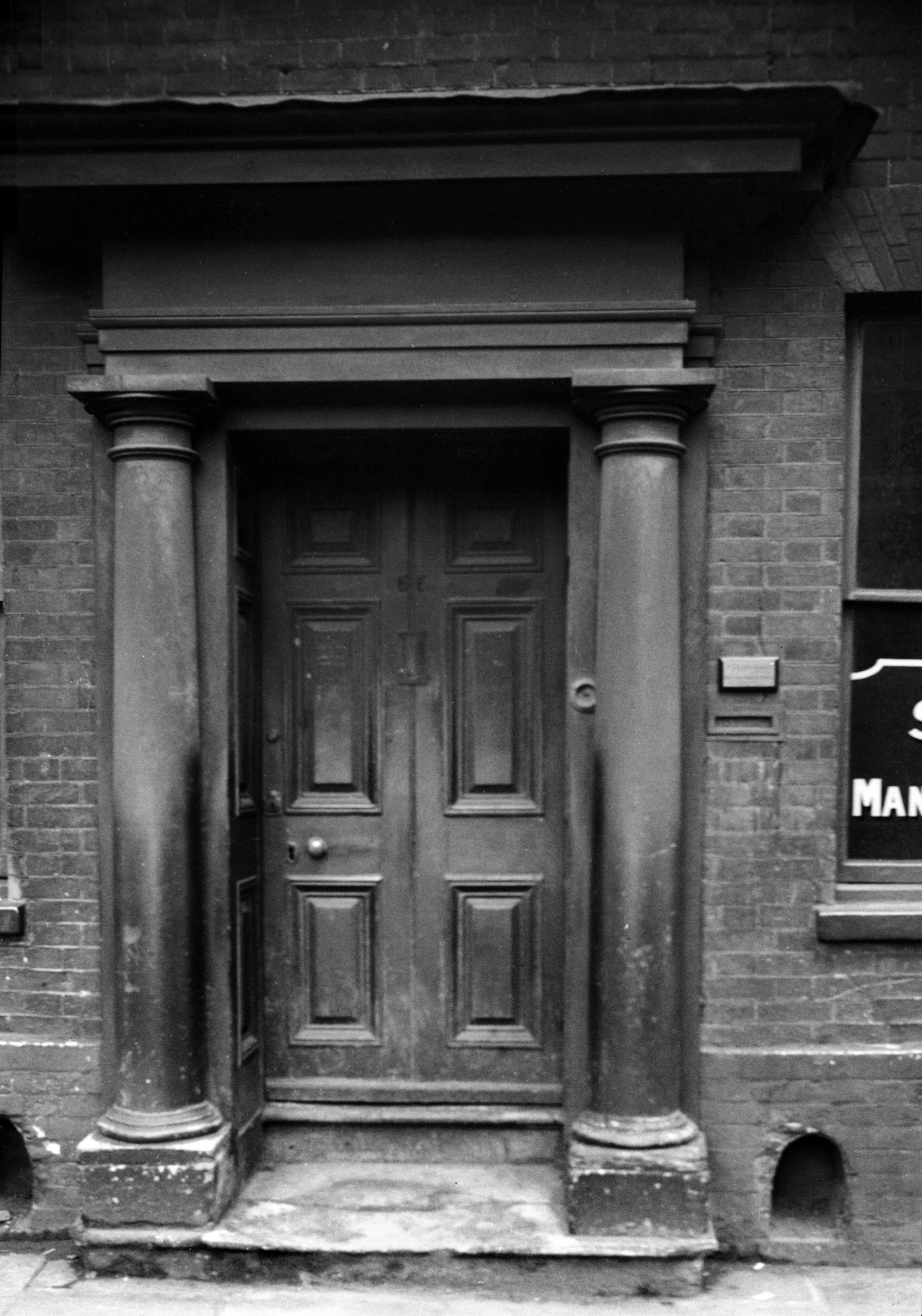
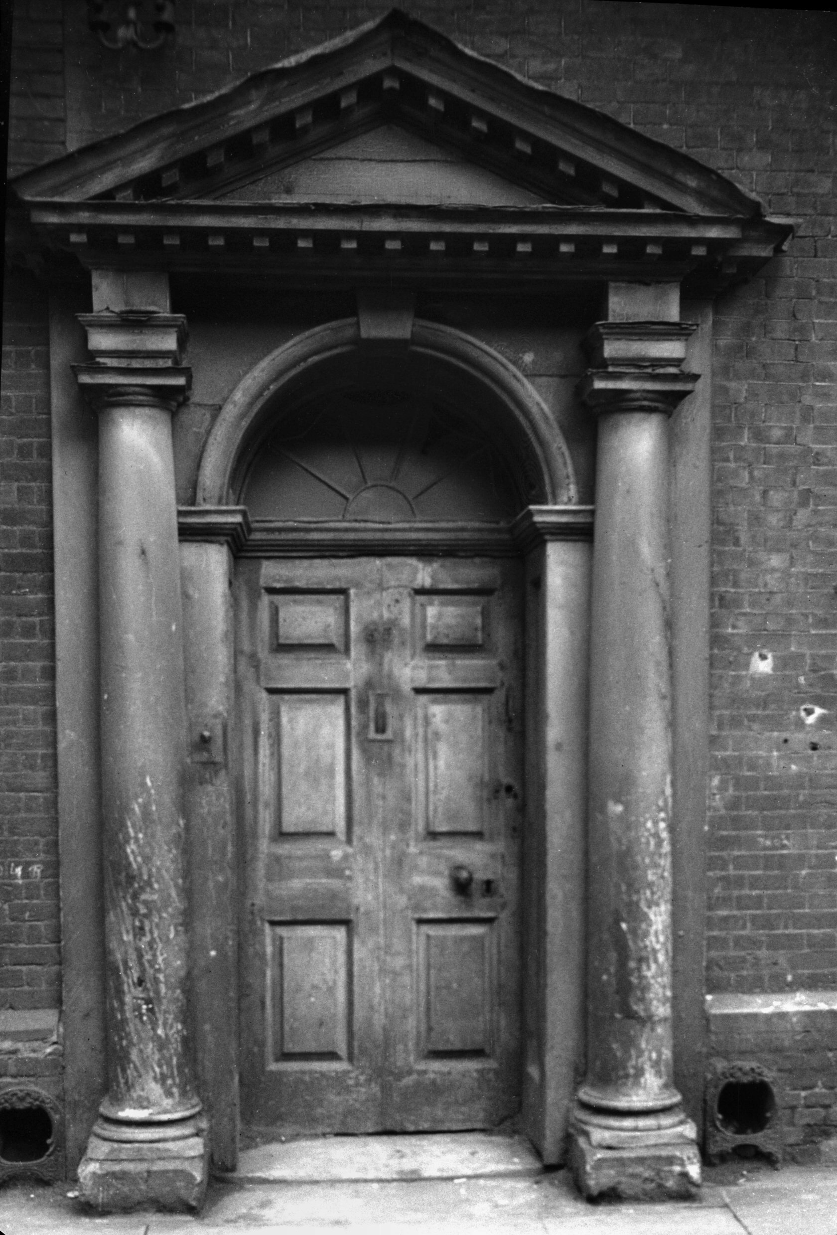
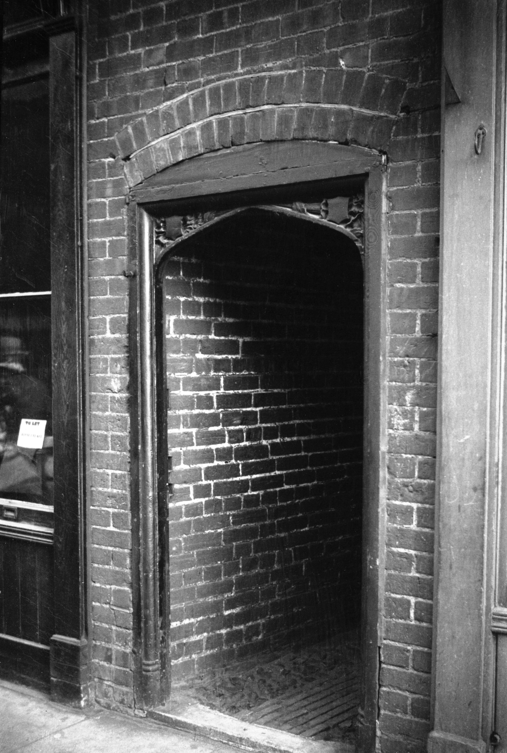
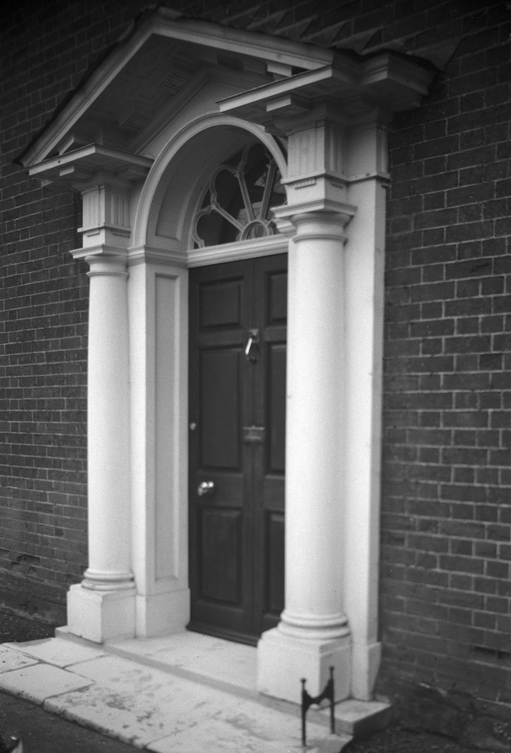
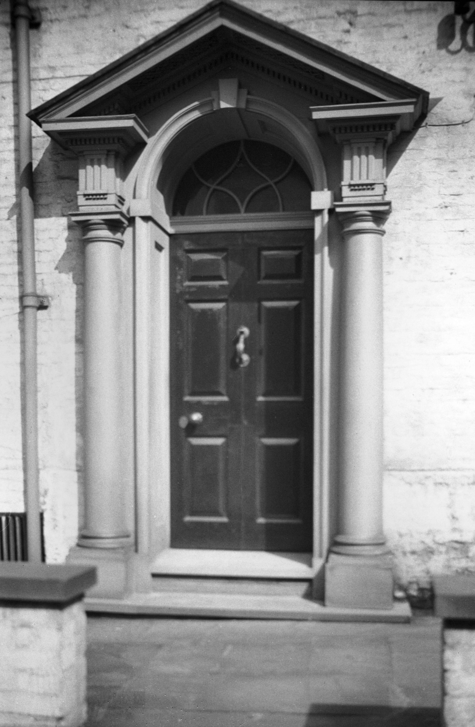
Botolph St 53 Georgian doorway [0407] 1935-03-24
|
|
|
Botolph St 55 Georgian doorway [0406] 1935-03-24
|
|
|
Botolph St 57 [2550] 1938-07-17
|
|
|
Botolph St 71 to 73 former Britannia PH [2545]
1938-07-13
|
| |
West
side |
|
|
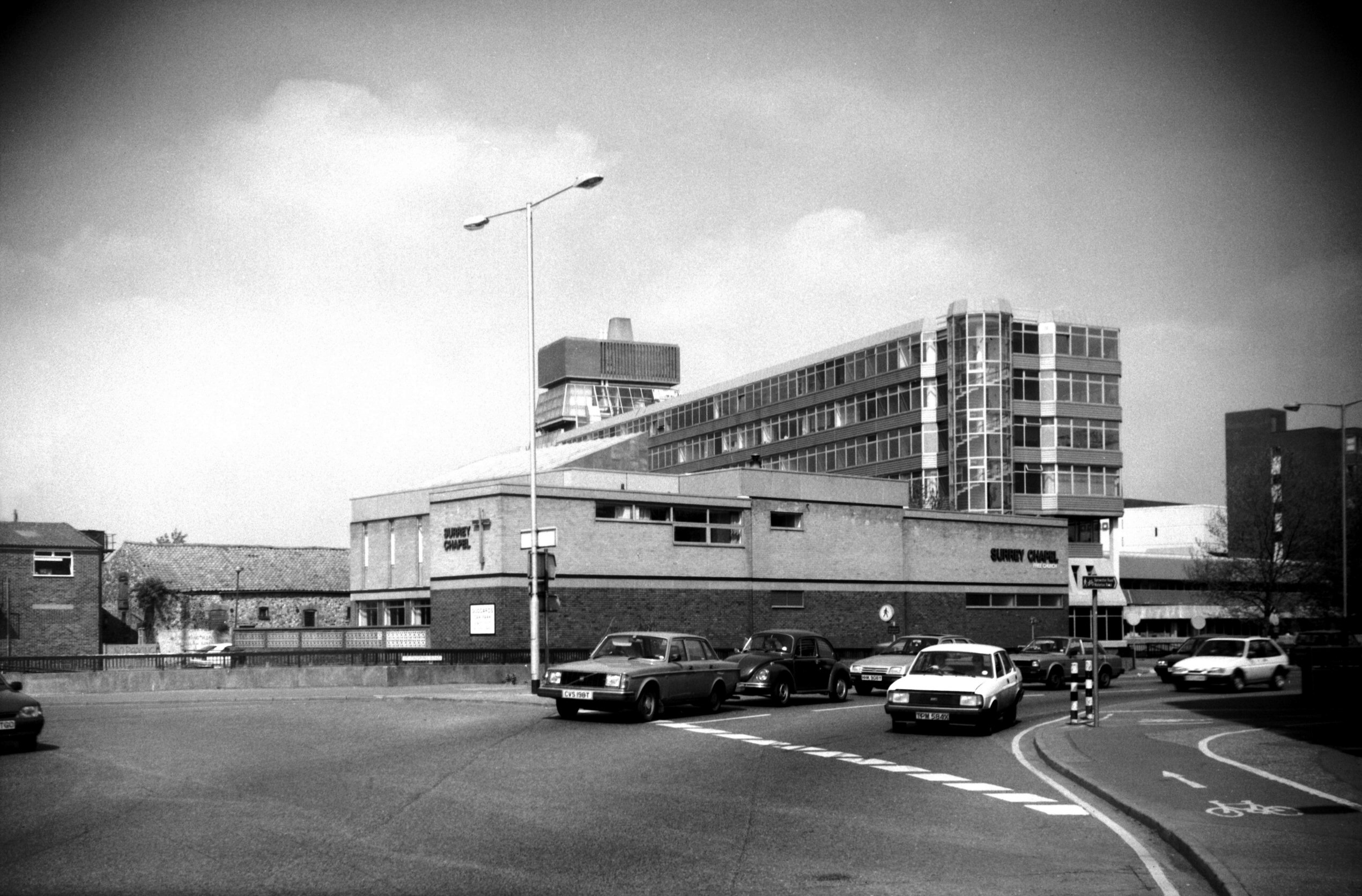
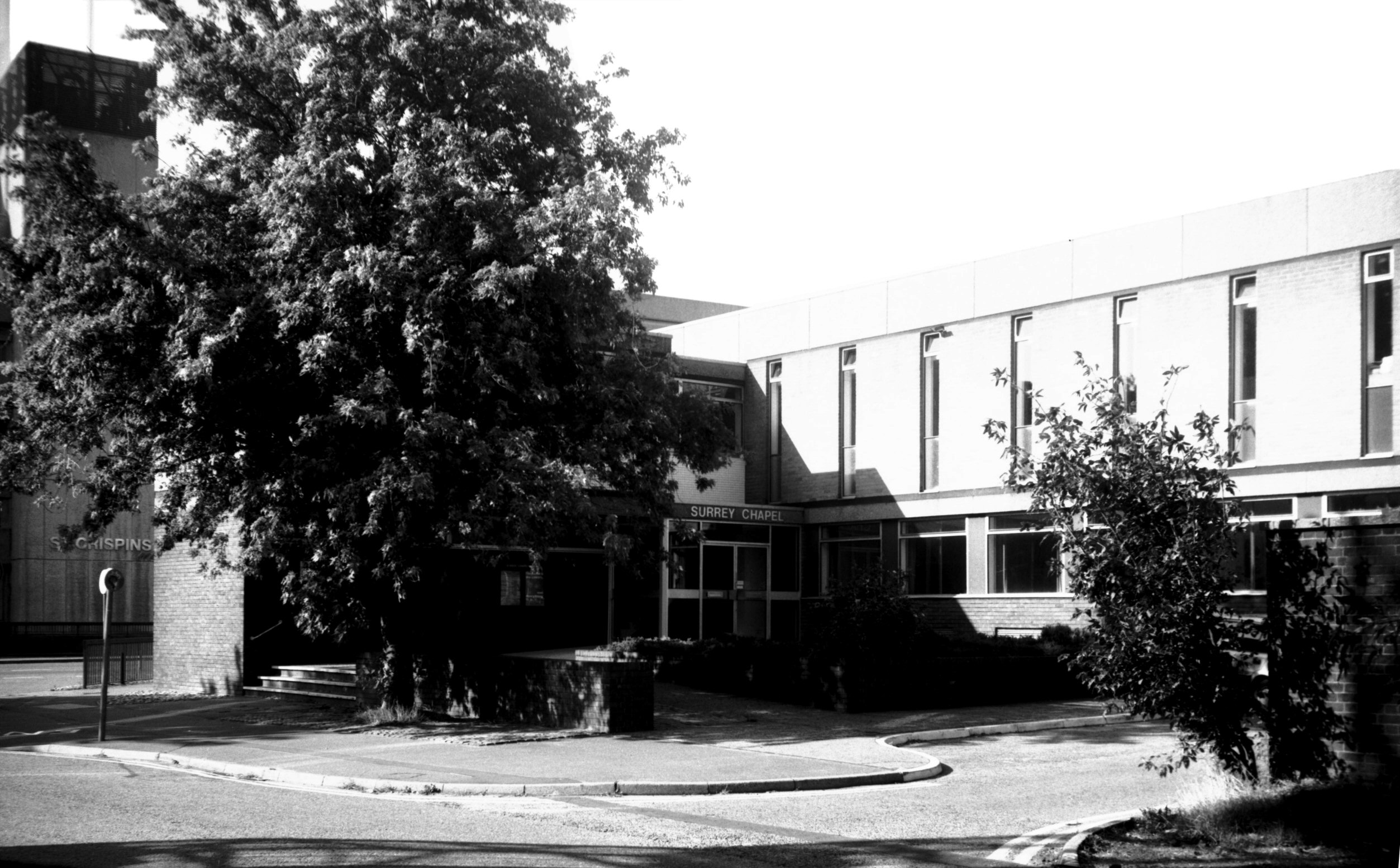
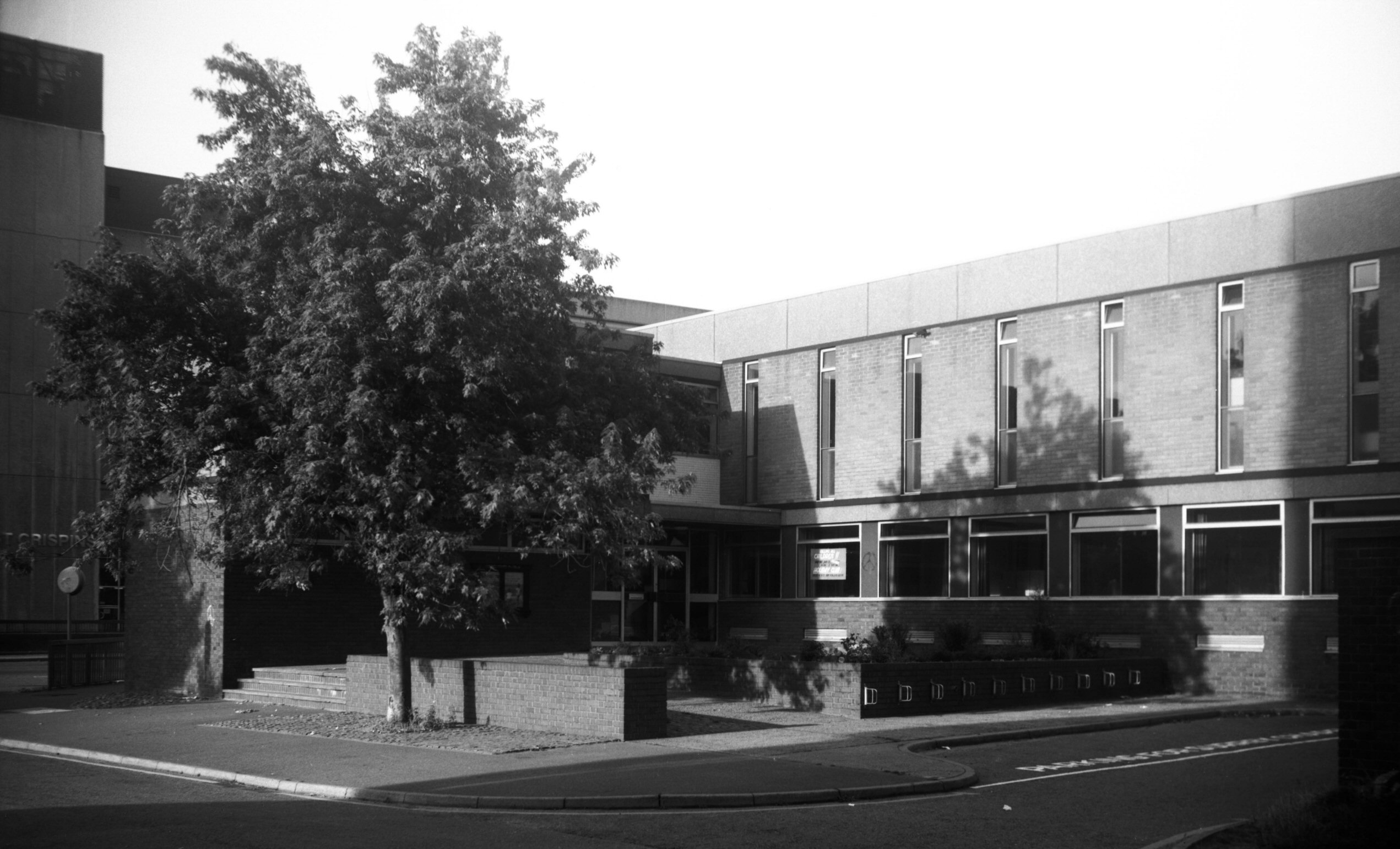
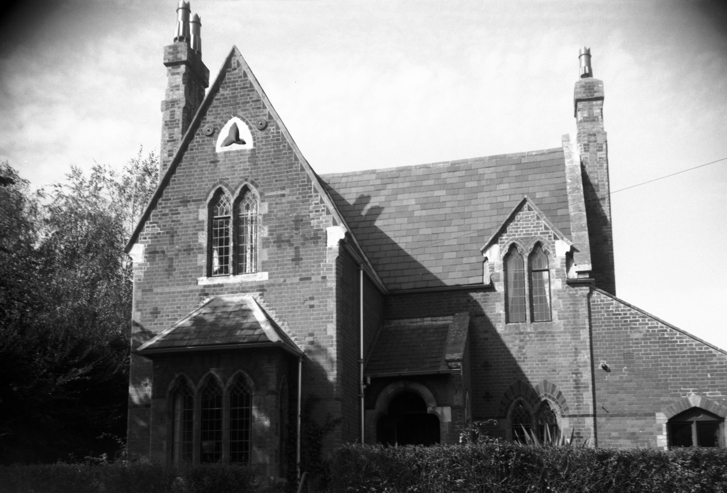
Botolph St Surrey Chapel [6681] 1991-05-20
Independent Evangelical. Adapted and extended in 1985
from the local HQ of the National Union of Footwear and
Allied Trades. |
|
|
Botolph St Surrey Chapel [7391] 1996-09-01
|
|
|
Botolph St Surrey Chapel [6525] 1988-08-29
|
|
|
Botolph St 12 to 14 [1058] 1936-06-27
|
|
|
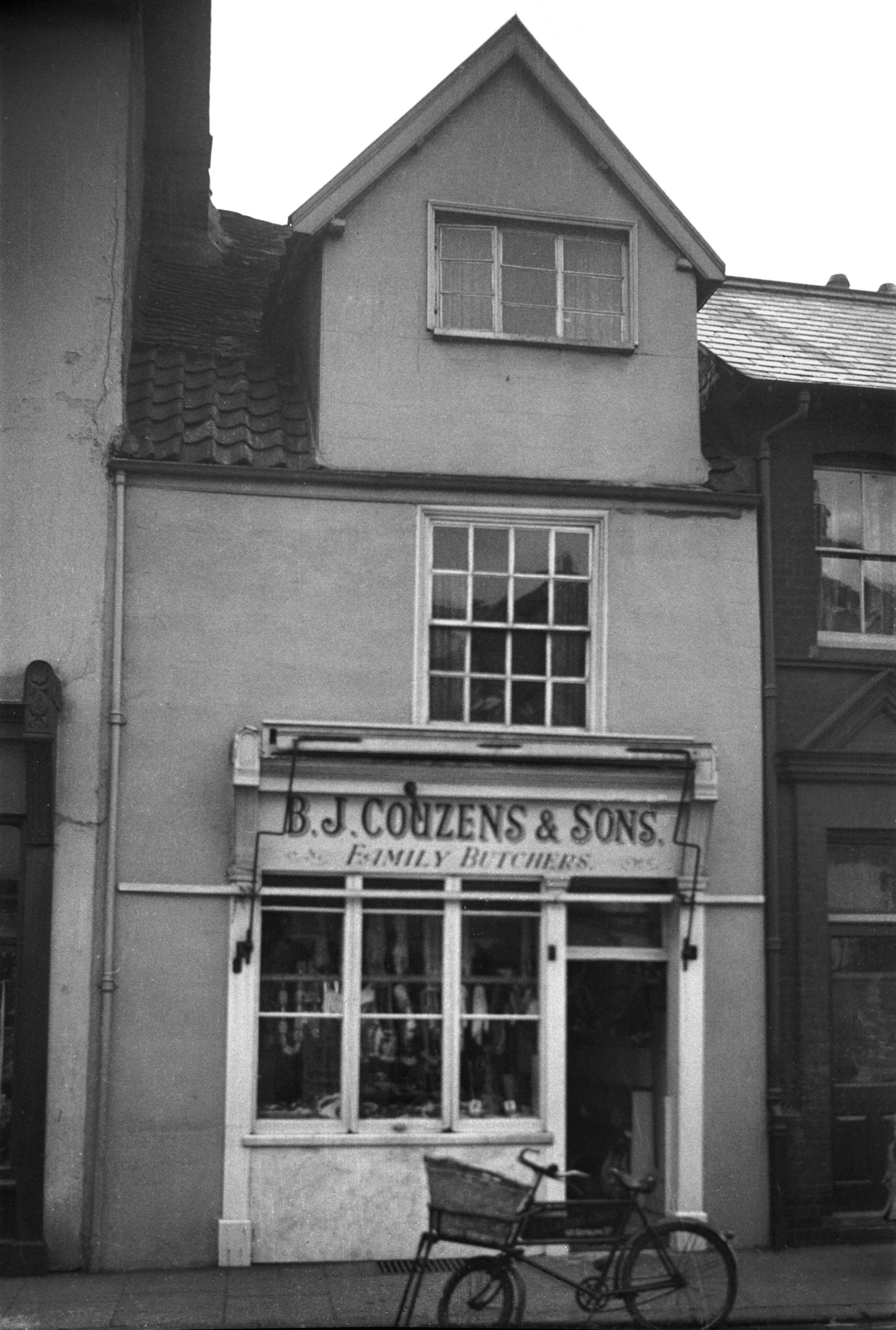
Botolph St next 20 Tudor style doorway [1059]
1936-06-27
|
|
|
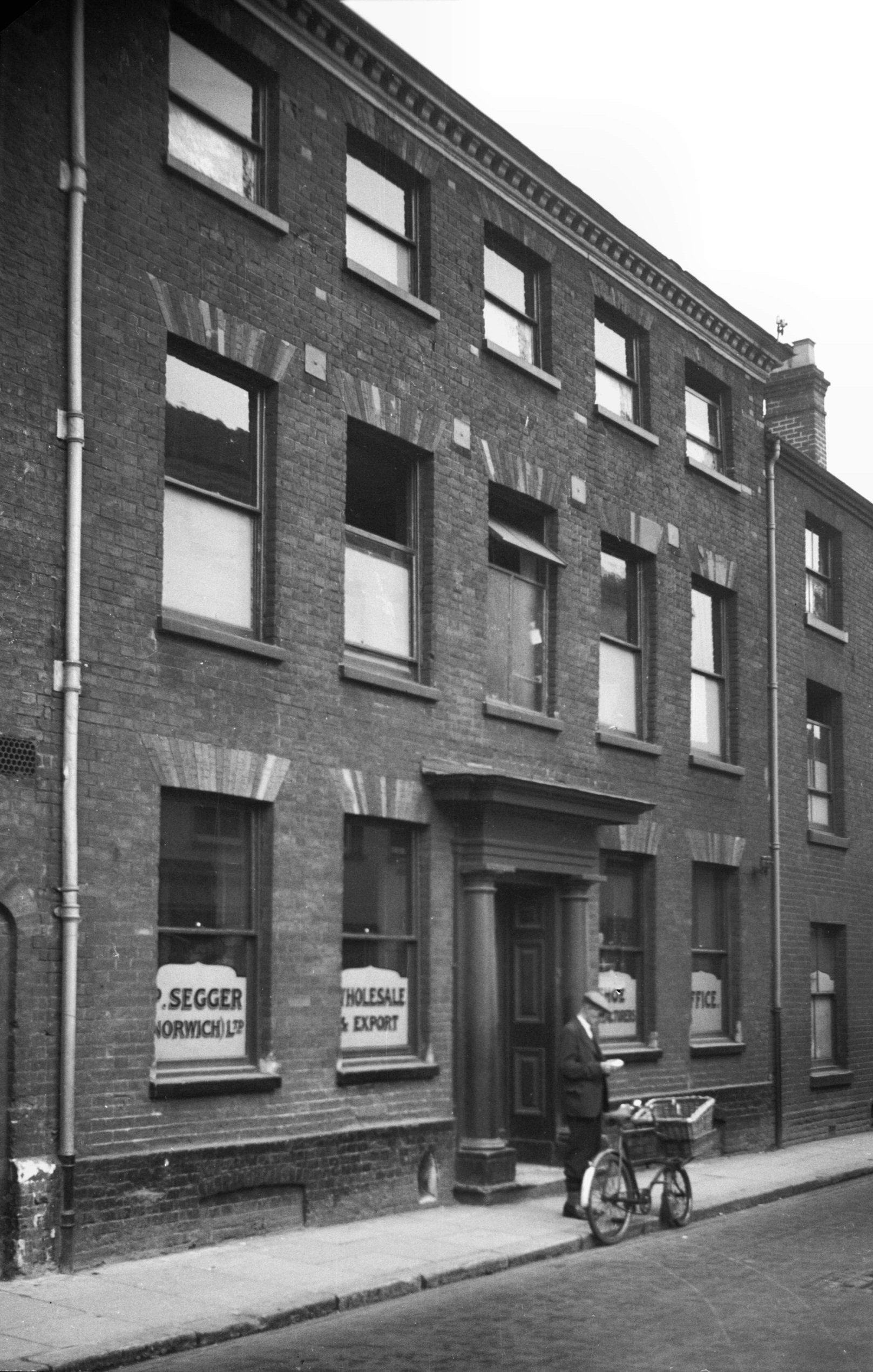
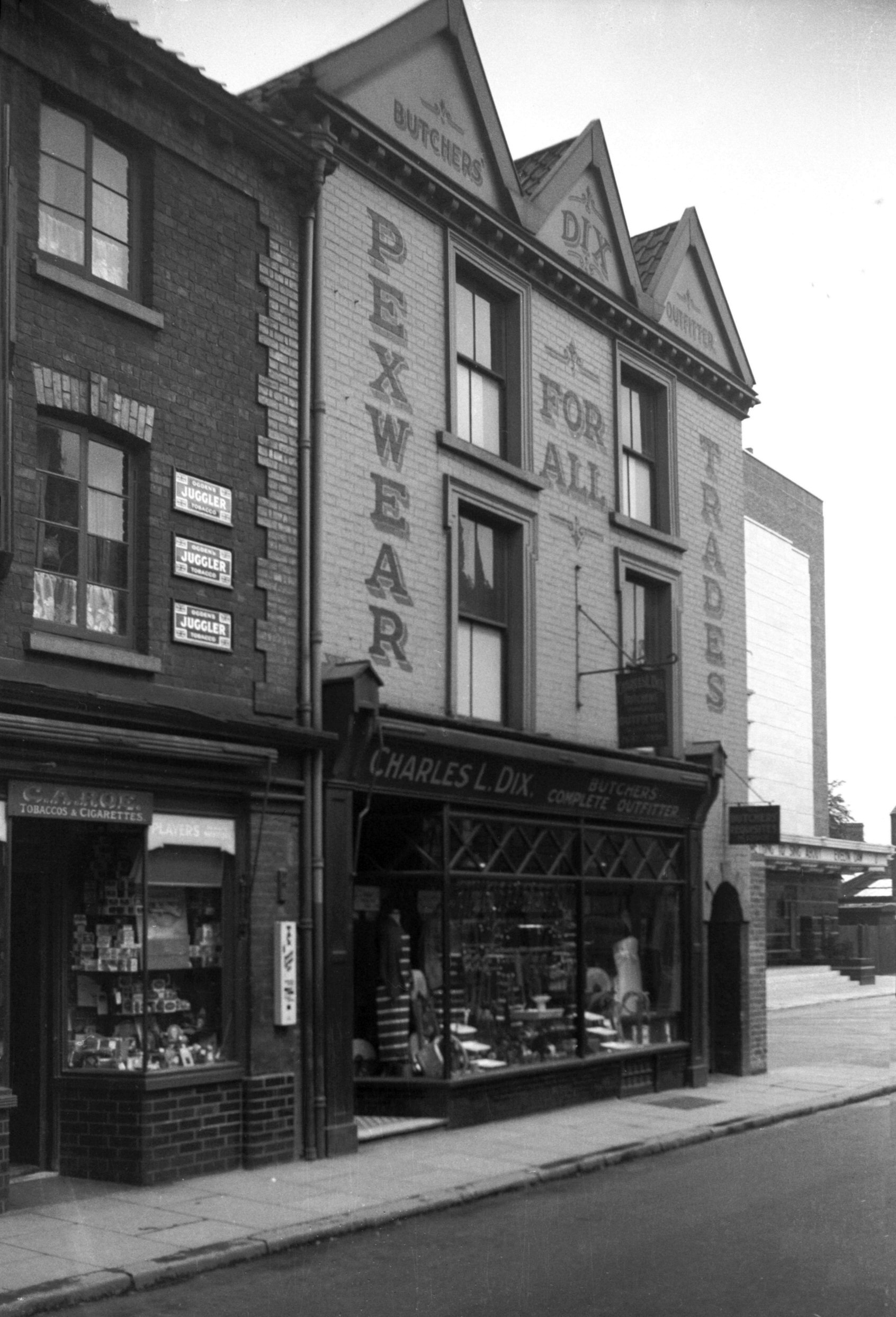
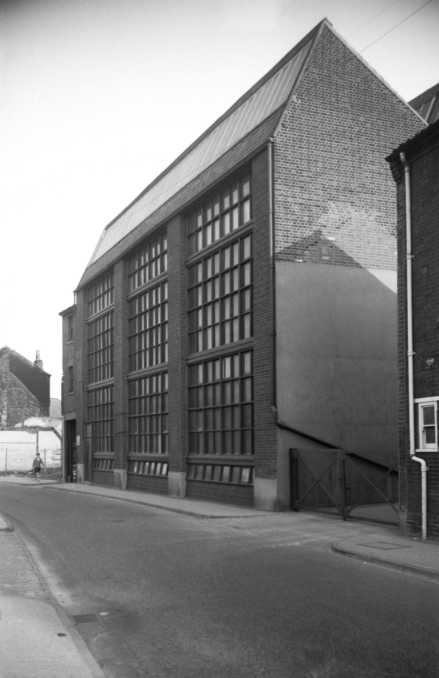
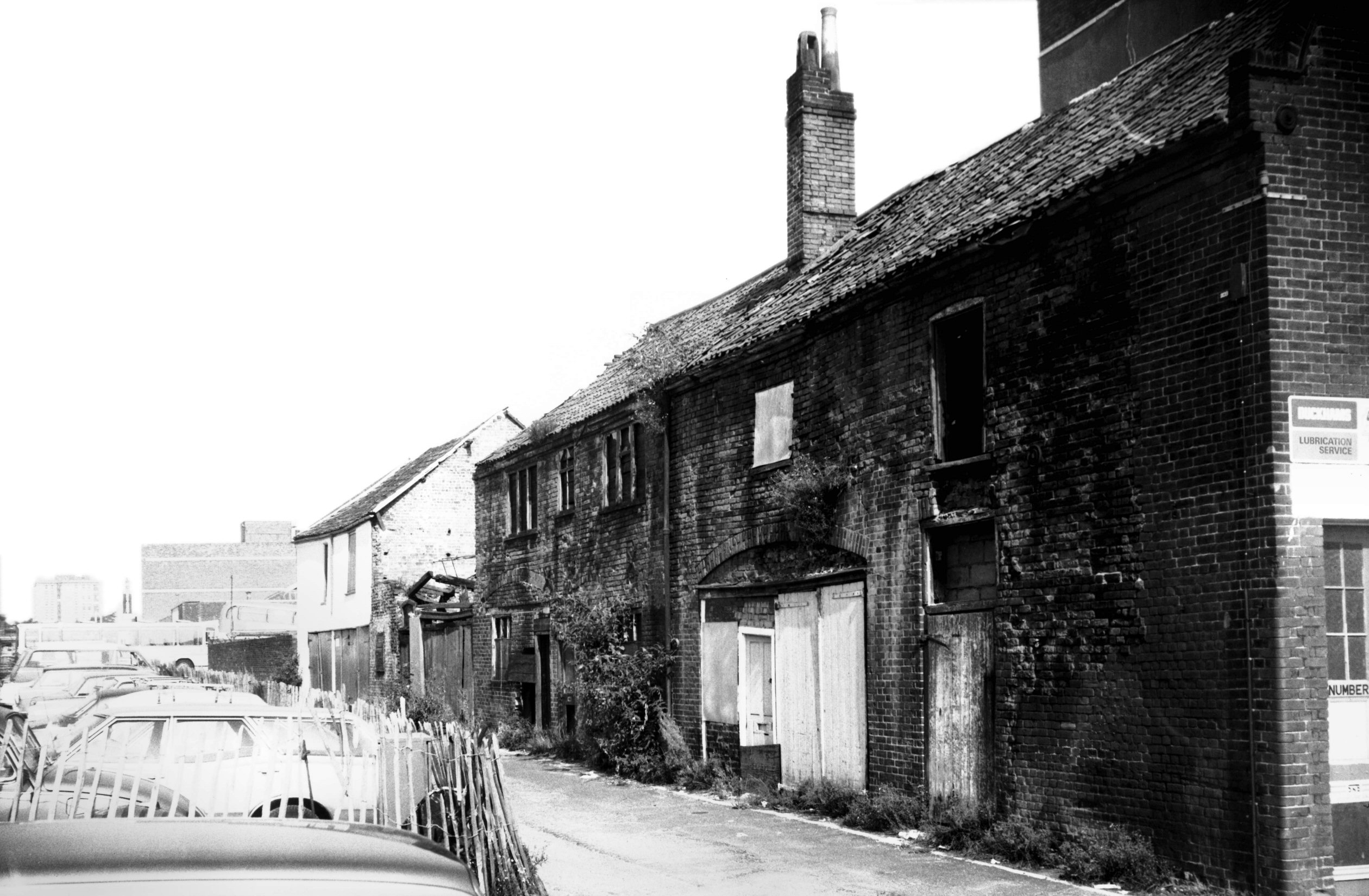
Botolph St 30 to 34 Chamberlin's factory [5142]
1967-05-16
Perhaps chief among the businesses affected by the demise
of Botolph St when Anglia Square was built, was that of
Roberts the Printers at Nos 30-34. First established on a
different site in 1902, the firm had since 1949 been
occupying what Dr Nikolaus Pevsner described as "the
most interesting factory building in Norwich" built
in 1903 as a clothing factory for Chamberlins.
"There was", he added, "little in England,
and indeed in Europe, quite so functional and unfussy
then. Yet it is by no means purely utilitarian."
Its architect was A.F.Scott, the 19c founder of the firm
bearing his name. He was also responsible for a more
prominent building in the city, Buntings the drapers (now
Marks and Spencers) at the corner of St Stephen's and
Rampant Horse St. |
|
|
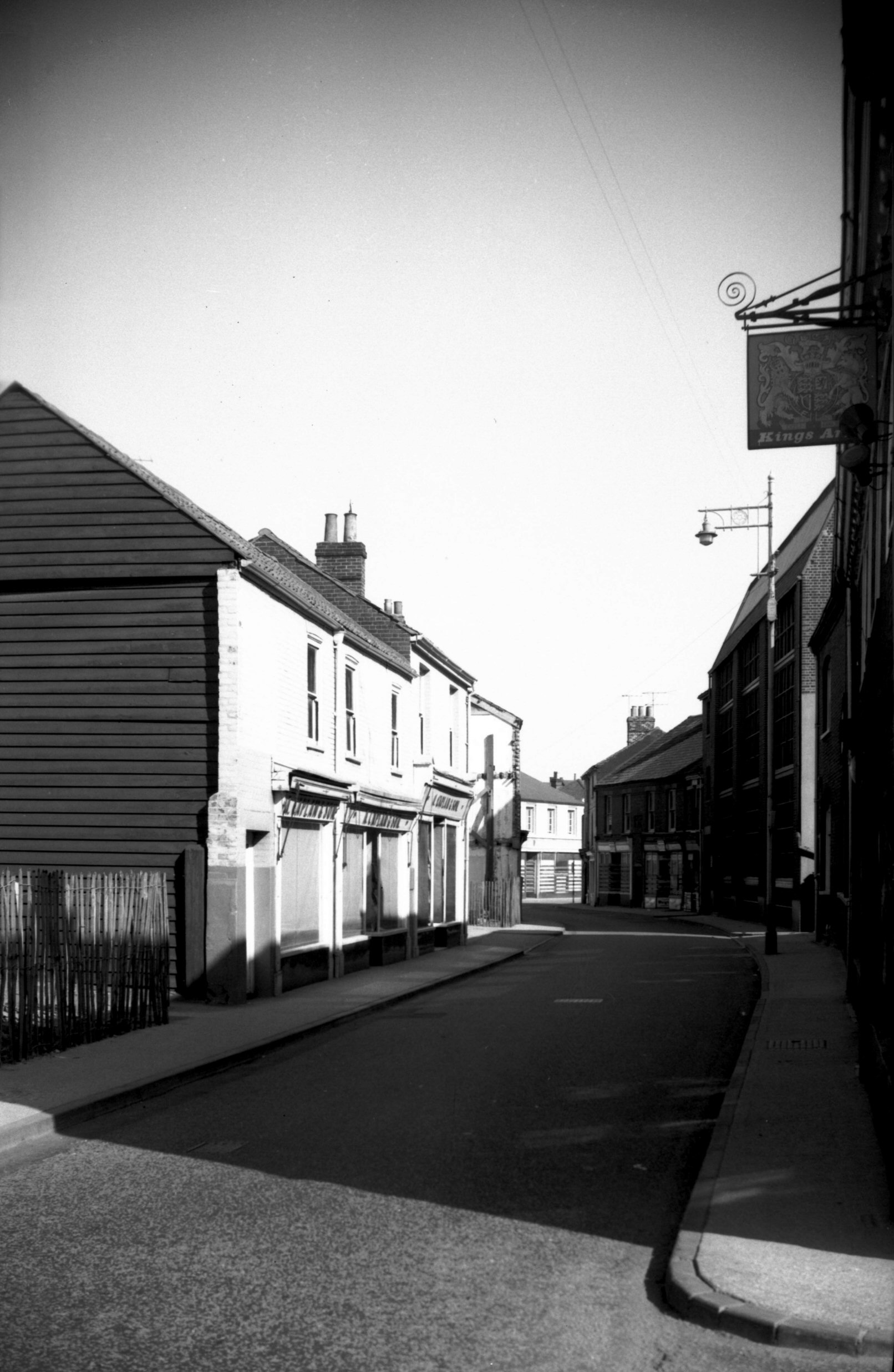
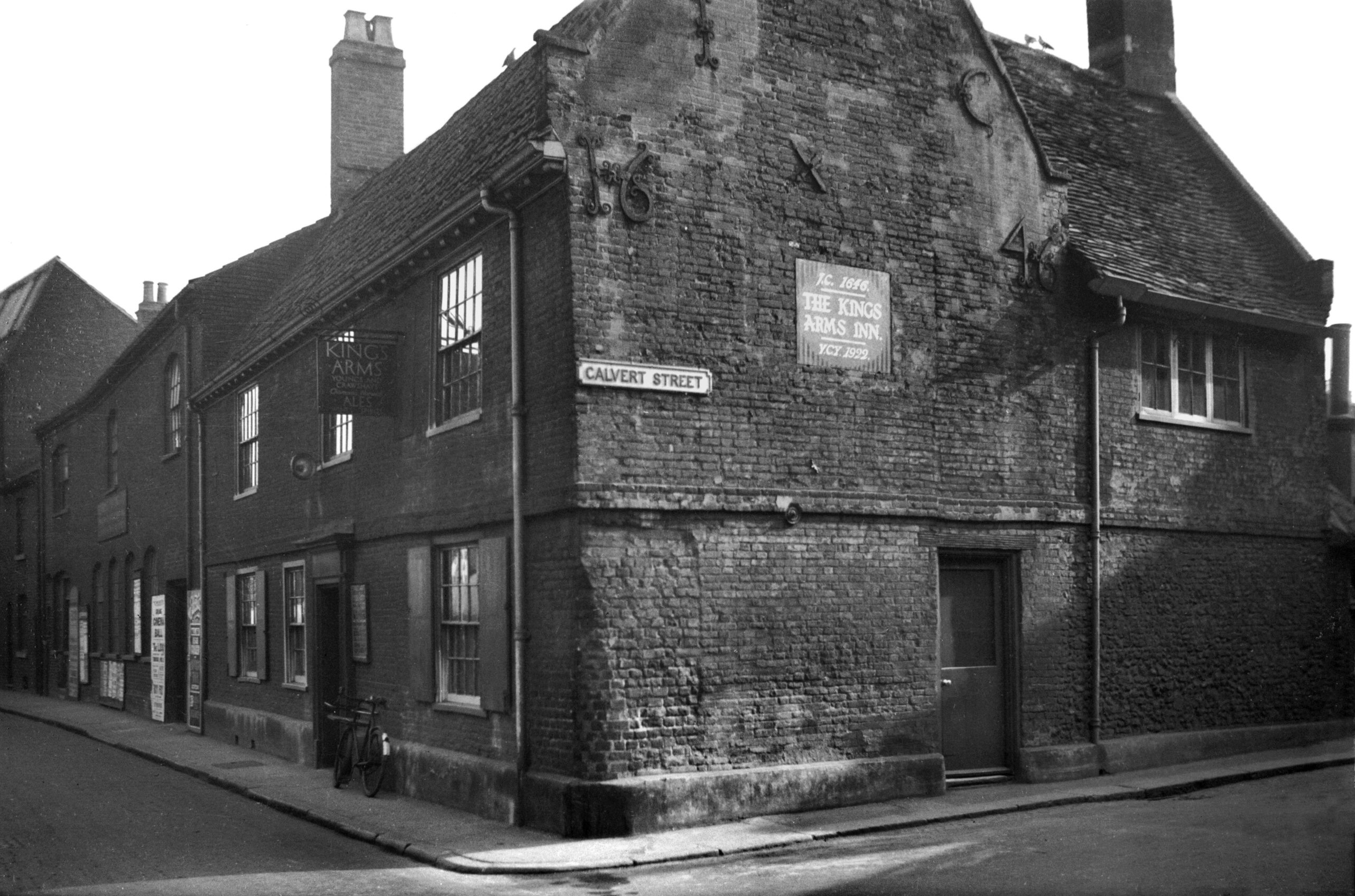
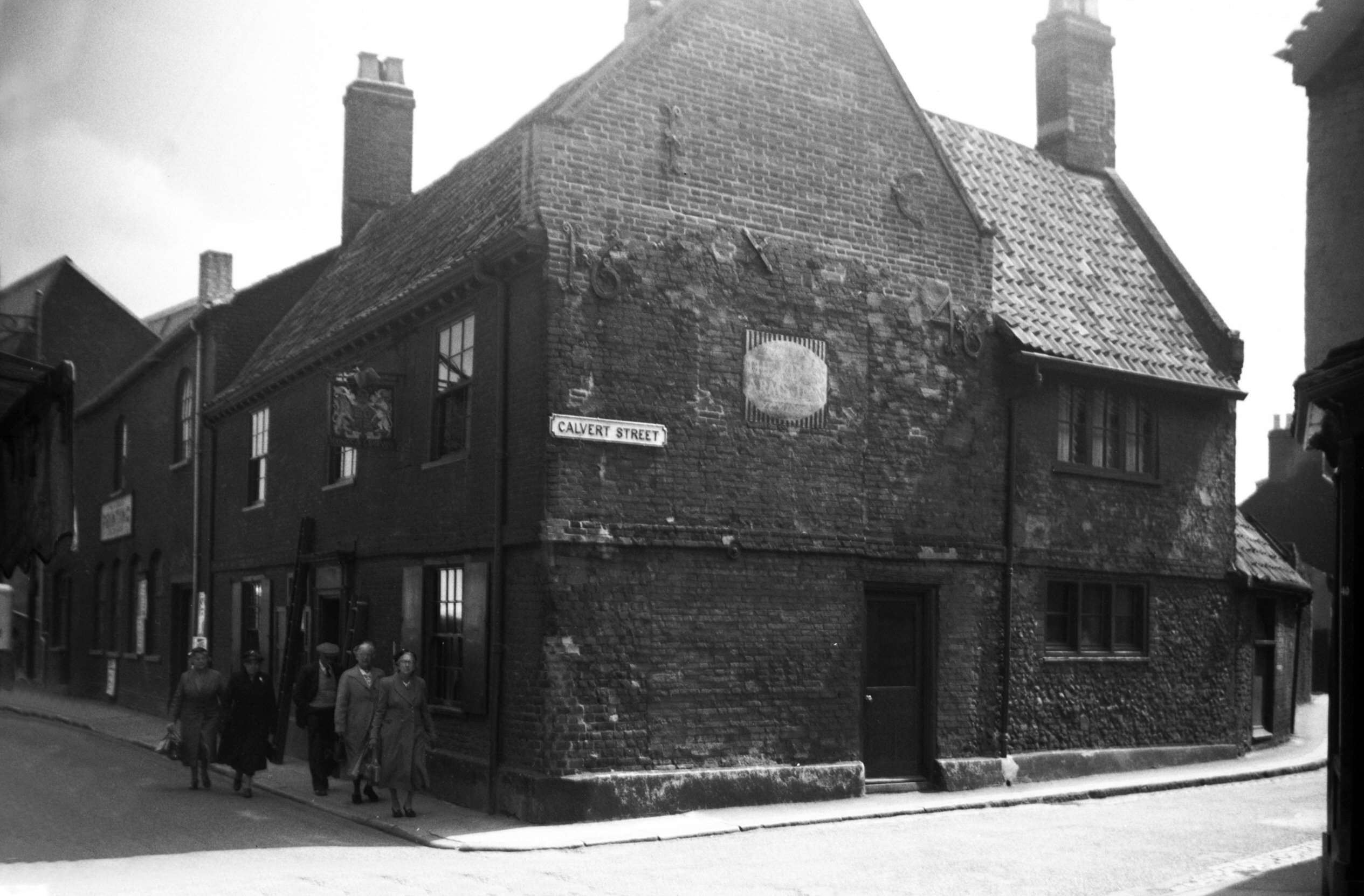
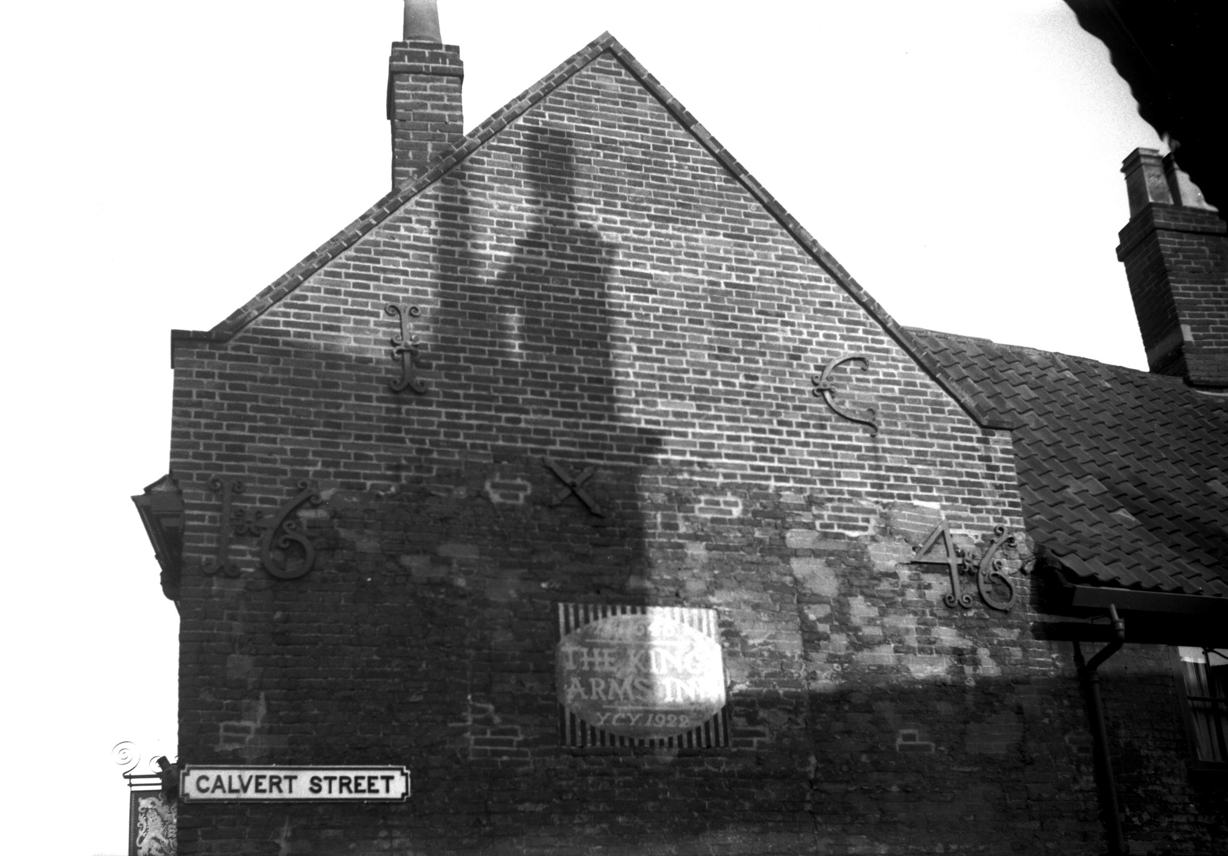
Botolph St 38 King's Arms PH [0818] 1936-03-19
A much older building lost in the Anglia Square
development was the King's Arms public house at No 38, at
the eastern corner of Calvert St. On its gable end in
large iron characters were the letters "I" and
"C" and the date "1646", now
preserved in one of the Norwich museums. Built of brick
with a narrow stringcourse marking the first floor level,
the house had pantiles at the front, with old English
plain tiles covering the roof of the Calvert St wing. |
|
|
Botolph St 38 King's Arms PH [4446] 1956-06-13
|
|
|
Botolph St 38 iron wall anchors I C 1646 [4450]
1956-07-08
|
|
|
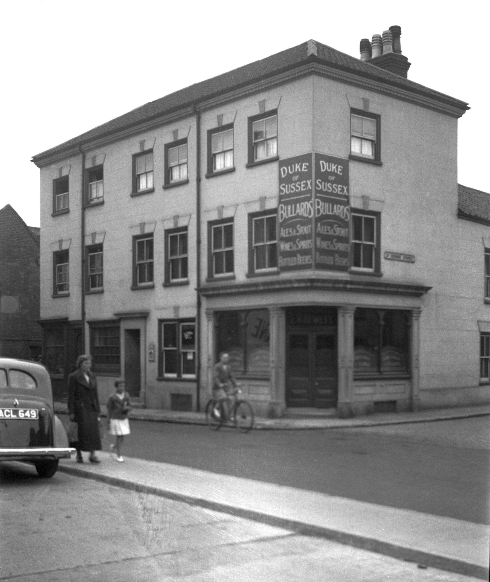
Botolph St 40 to 42 Duke of Sussex PH [2675]
1938-08-03
|
|
|
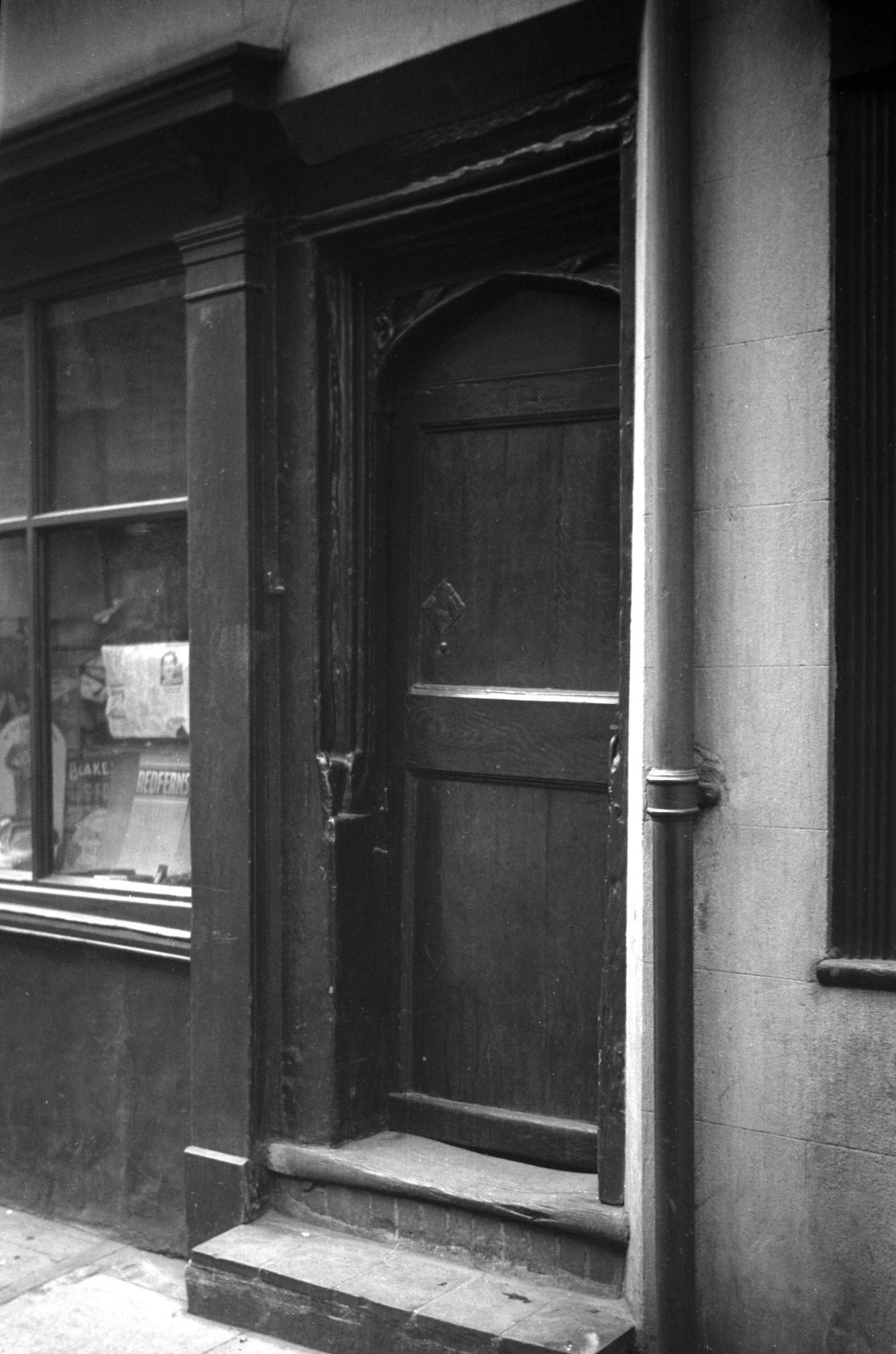
Botolph St 40 Tudor doorway [1064] 1936-06-28
16c. doorway next to 40. |
|
|
Botolph St 44 to 46 [2680] 1938-08-03
|
|
|
Botolph St 52 [2681] 1938-08-03
|
|
|
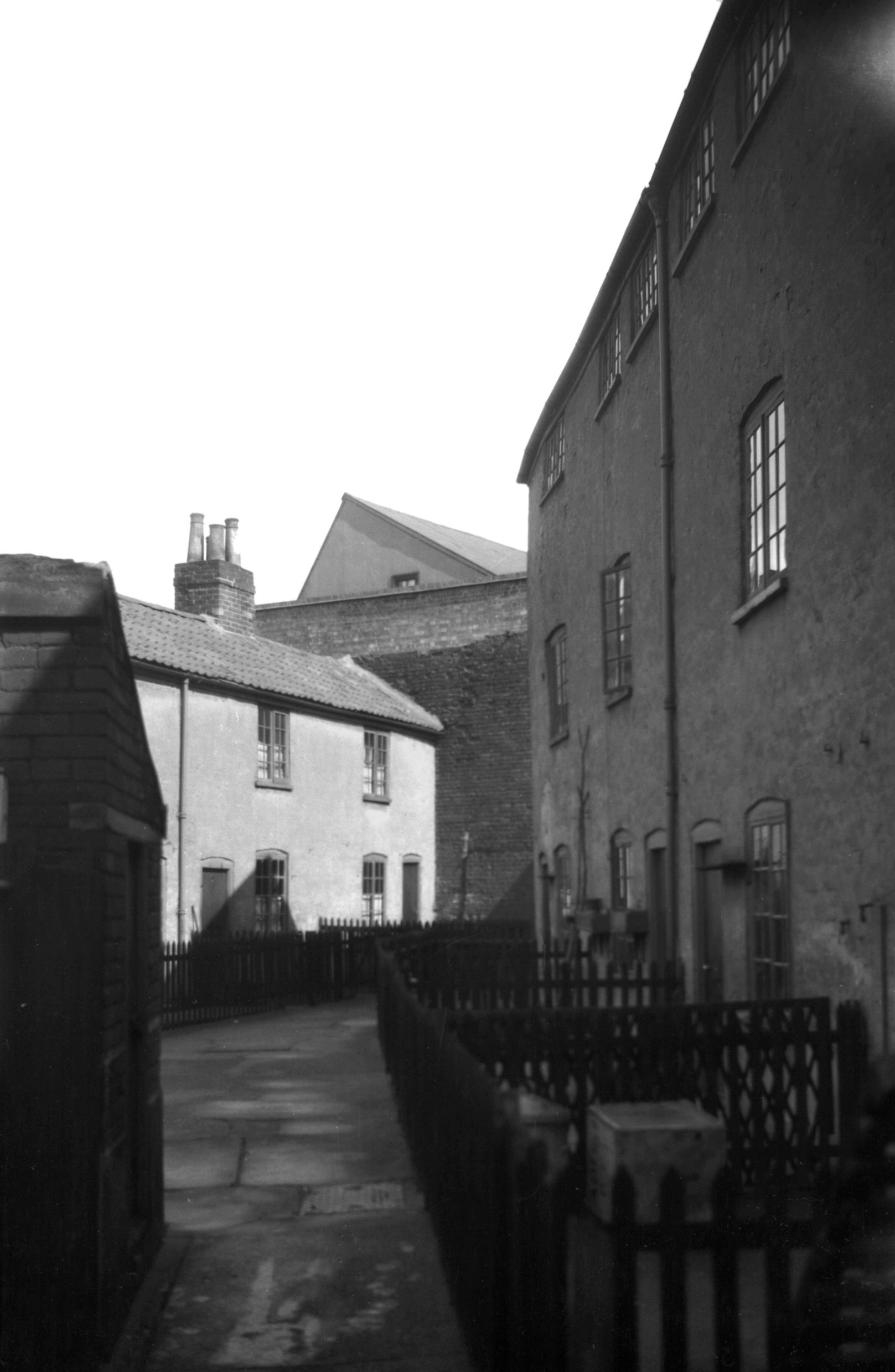
Botolph St 58 rear [5132] 1967-04-01
|
|
|
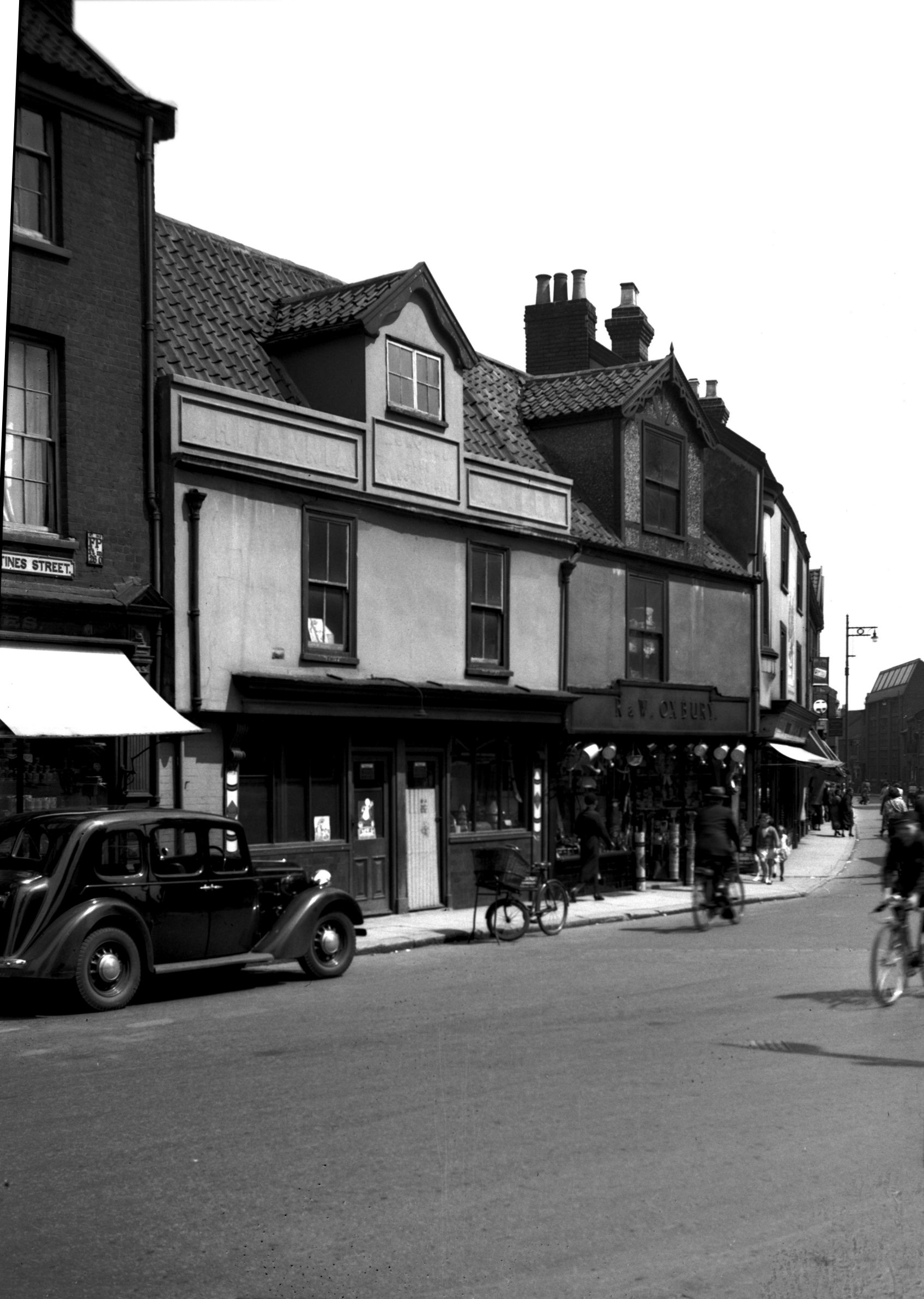
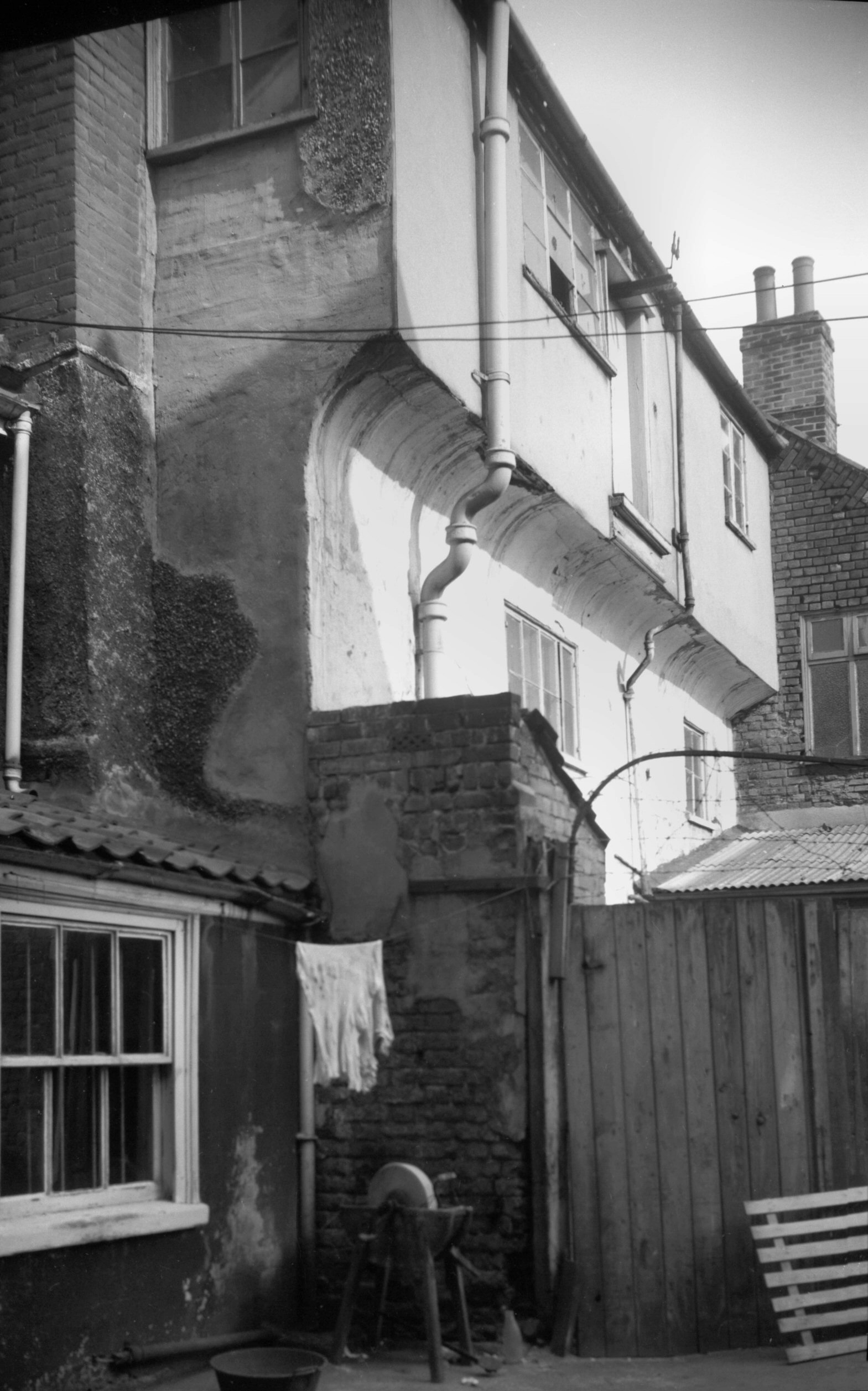
Botolph St 58 to 62 Shuttles PH Pitt St 81 [5133]
1967-04-01
Botolph St to left. Pitt St to right. |
|
|
Botolph St 60 [0897] 1936-04-16
|
|
Boundary Rd: |
| |
From
Aylsham Rd to Drayton Rd / Sweet Briar Rd
passing Hellesdon |
|
|
Boundary Rd at Aylsham Rd [B655] 1933-08-05
Until the construction of Chartwell Rd, linking Mile
Cross Lane, in 1962, the signposted route of the ring
road was by Oak Lane, George Hill and School Lane. An
alternative and less circuitous route was by Woodcock Rd
and Wall Rd. |
|
Bowthorpe Hall Rd: |
| |
Off
Wendene (Dereham
Rd) |
|
|
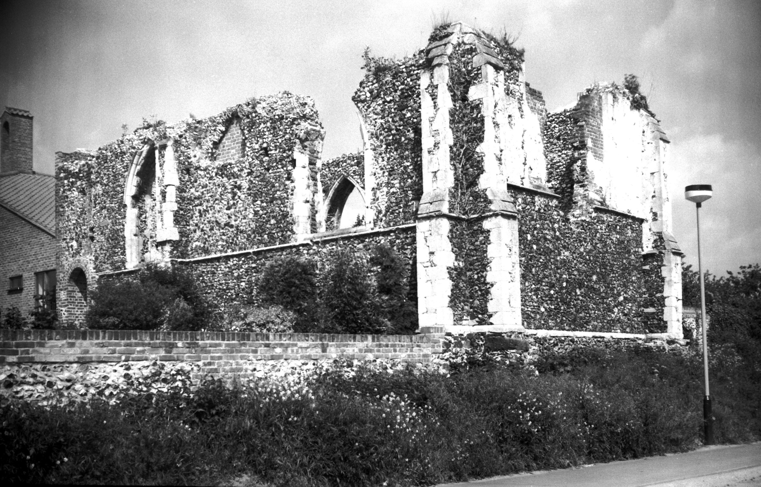
St Michael's Bowthorpe ruin from SE [6693] 1991-06-05
The church was unroofed in 1792. For photos taken before
the boundary revision, see Norfolk, Bowthorpe. |
|
|
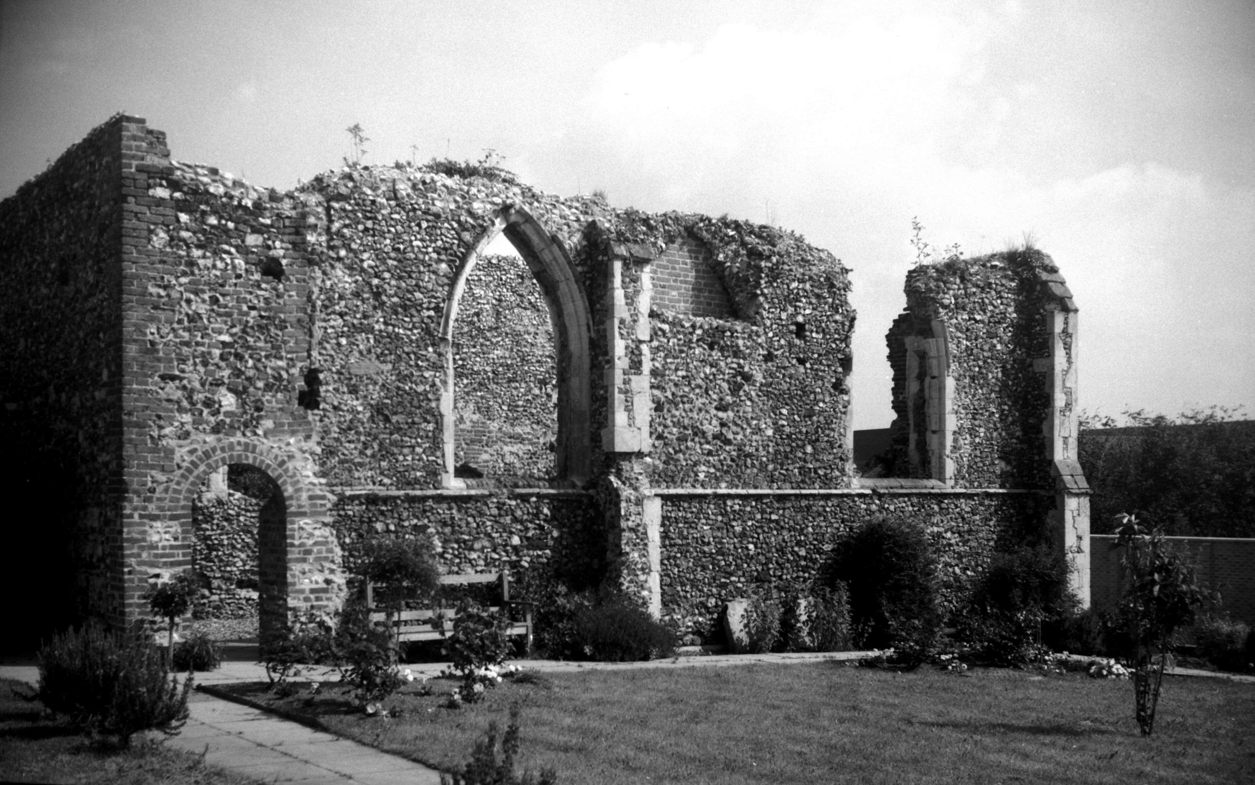
St Michael's Bowthorpe ruin south side [6692]
1991-06-05
|
|
|
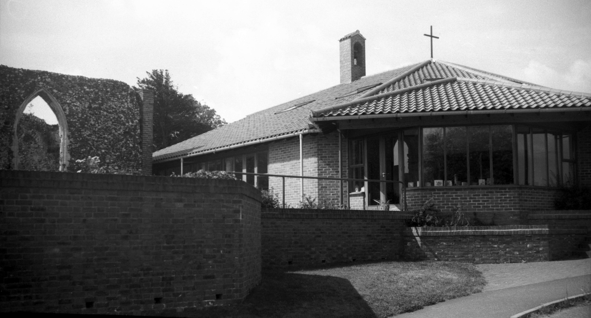
St Michael's Bowthorpe from NE [6691] 1991-06-05
Church and community centre built 1985. |
|
|
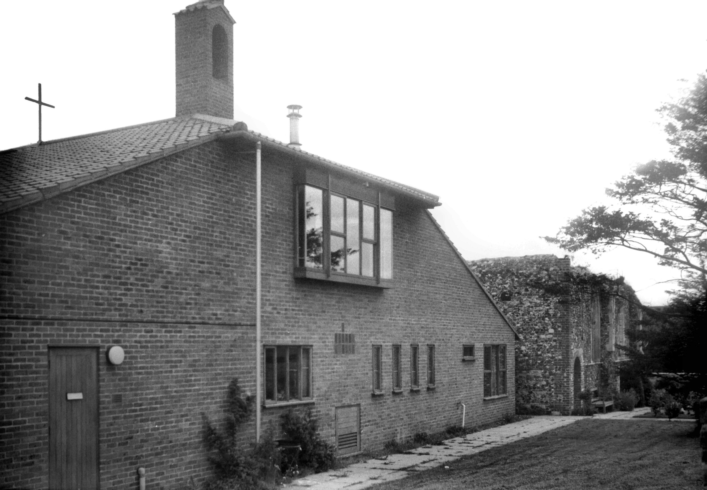
St Michael's Bowthorpe south side [6690] 1991-06-02
|
|
Bowthorpe Rd: |
| |
From
Dereham Rd to Earlham Green Lane
passing Farrow Rd, Guardian
Rd, Gipsy Lane
South side |
|
|
Bowthorpe Rd Earlham Cemetery North Lodge [7478]
1997-08-26
See also Earlham Rd for the
cemetery. |
|
|
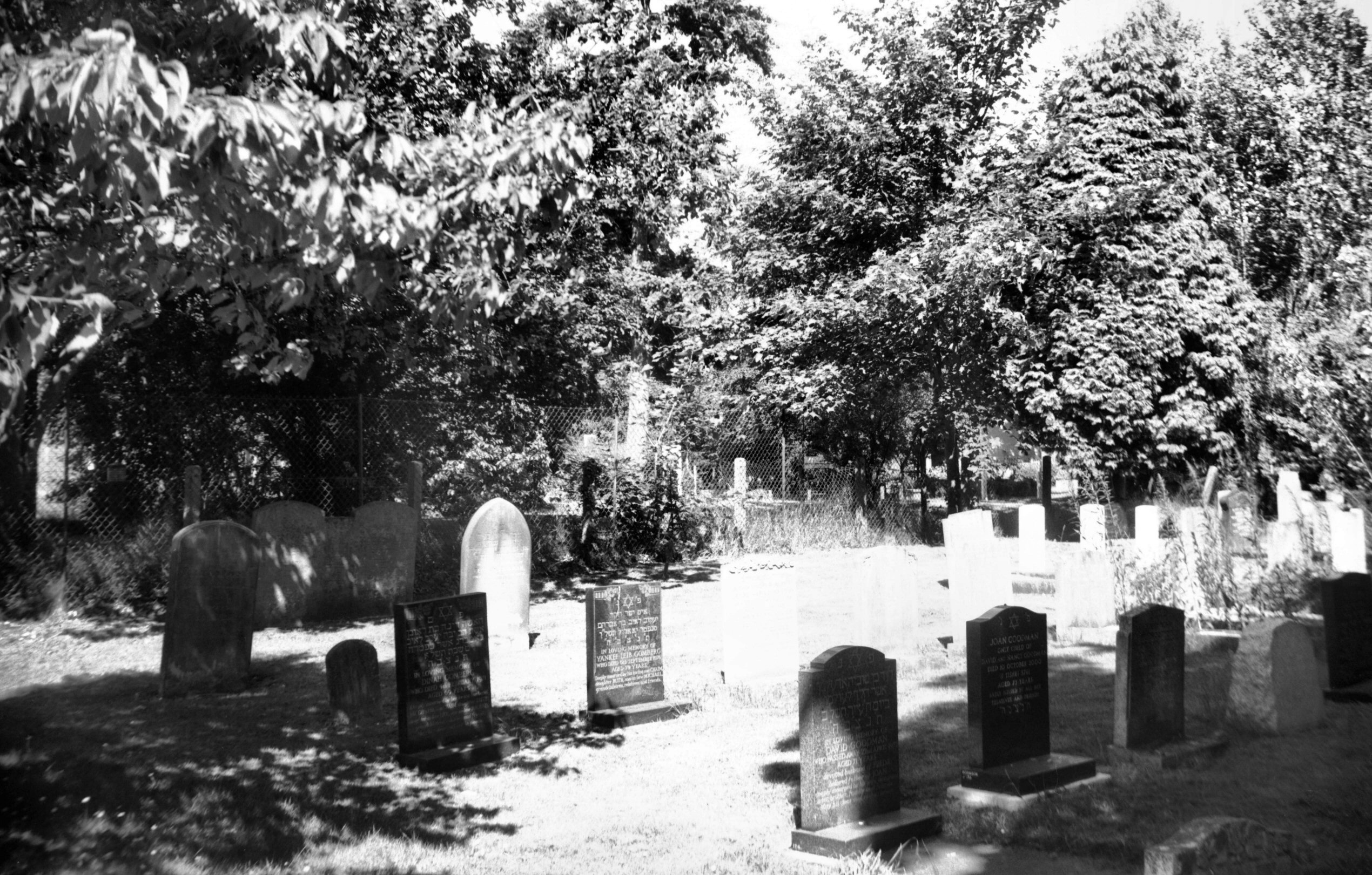
Bowthorpe Rd Jewish Cemetery [7892] 2002-07-14
Established in 1856. |
|
|
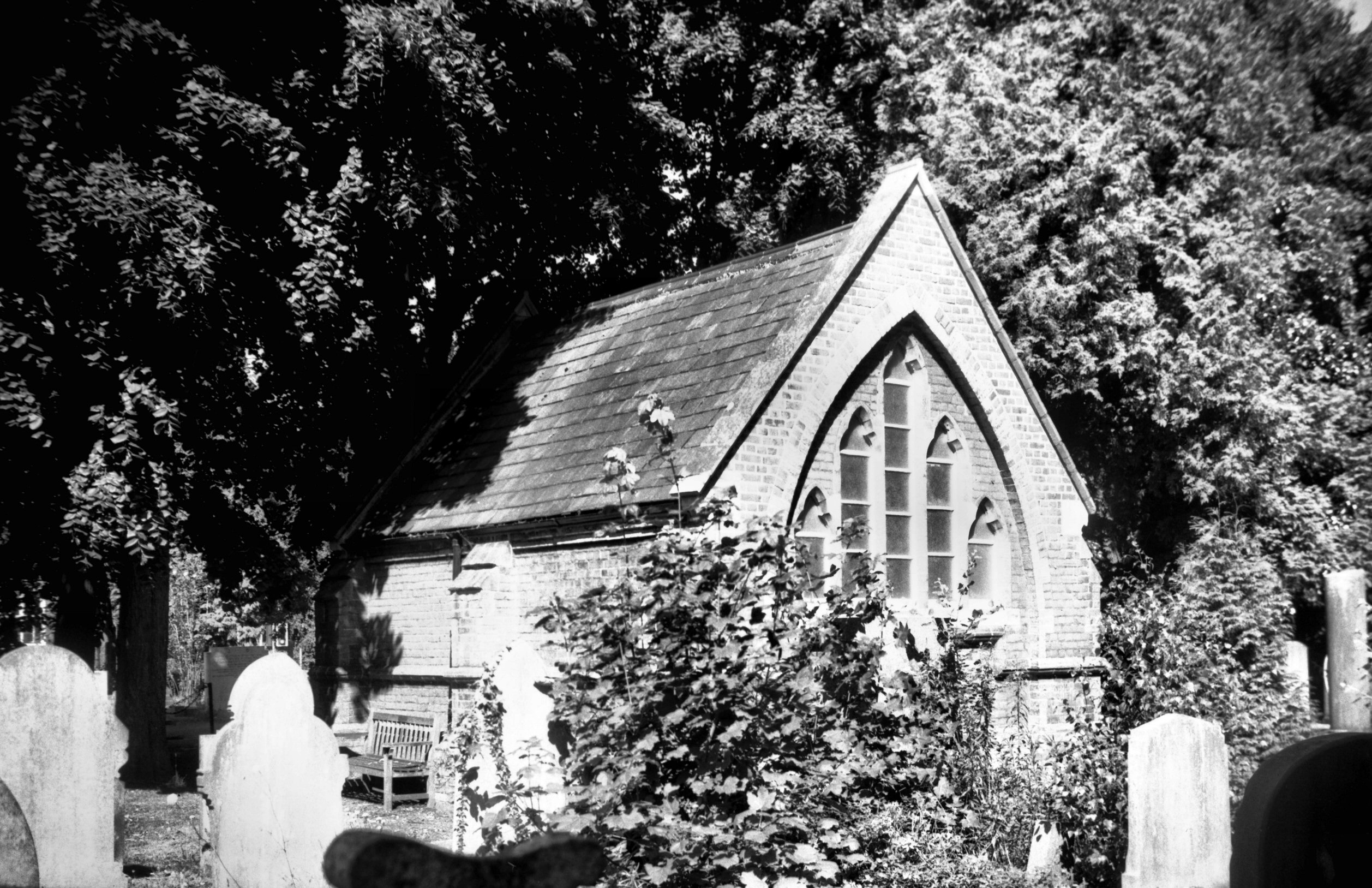
Bowthorpe Rd Jewish mortuary chapel [7891] 2002-07-14
From the east. |
|
|
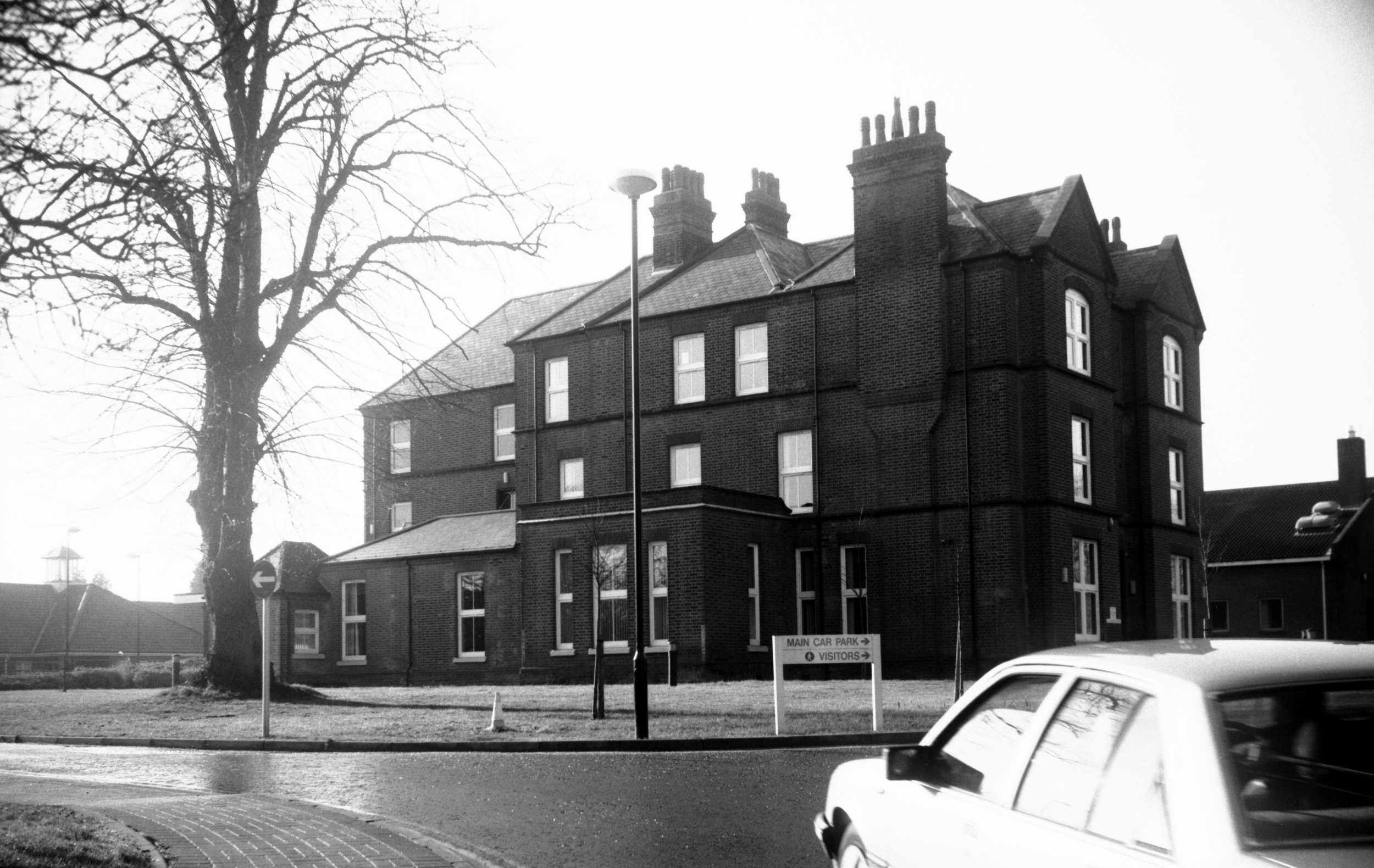
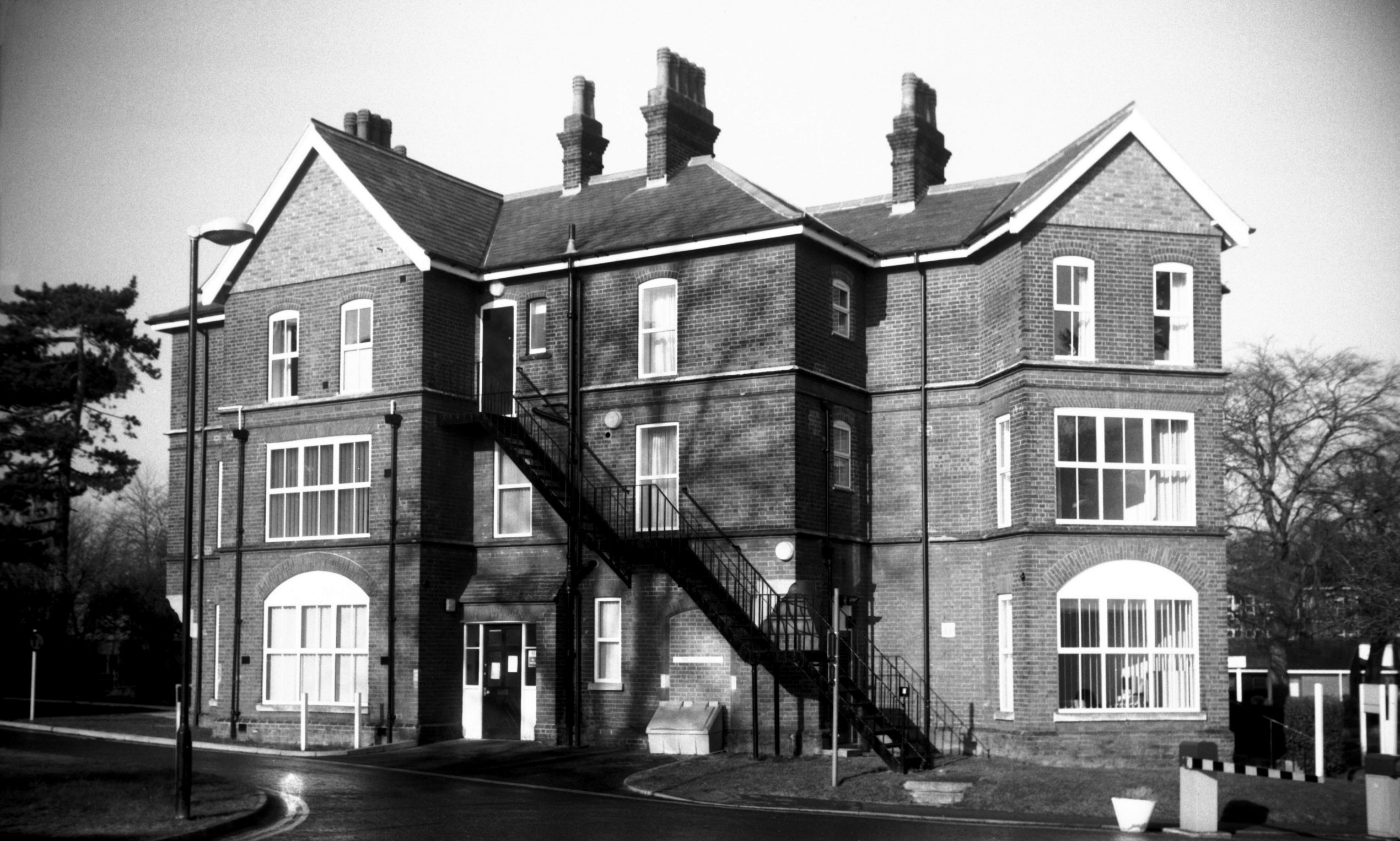
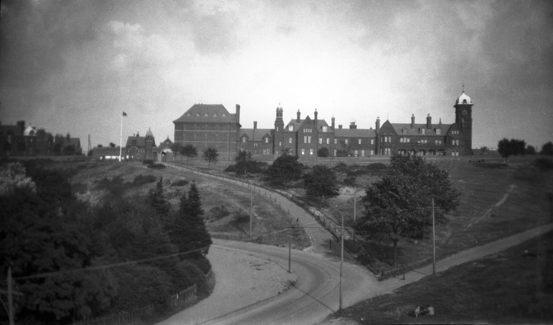
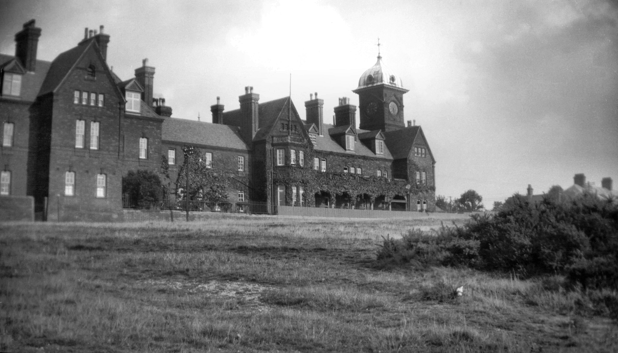
Bowthorpe Rd West Norwich Hosp offices [7798]
2001-01-28
Former isolation hospital, opened 1893. |
|
|
Bowthorpe Rd West Norwich Hosp lodge [7799]
2001-01-28
Former isolation hospital. Medical officer's residence,
gate keeper's lodge etc. |
| |
North
side |
|
|
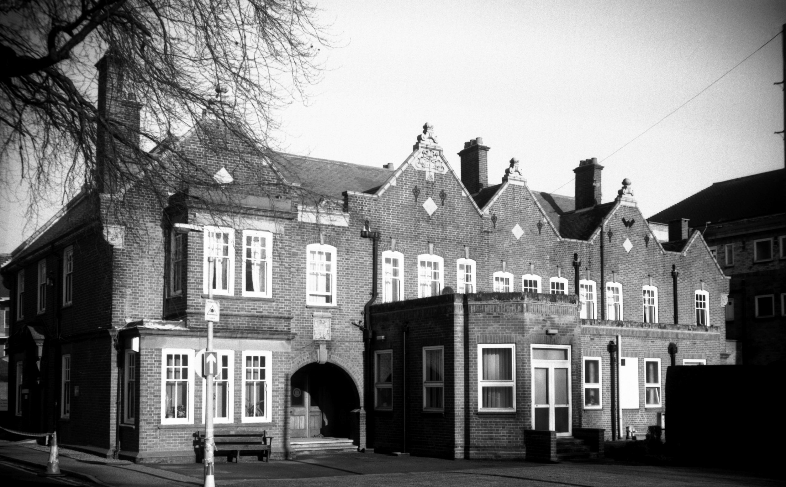
Bowthorpe Rd West Norwich Hosp Woodlands Ho [7796]
2001-01-28
Woodlands House. Built 1923. |
|
|
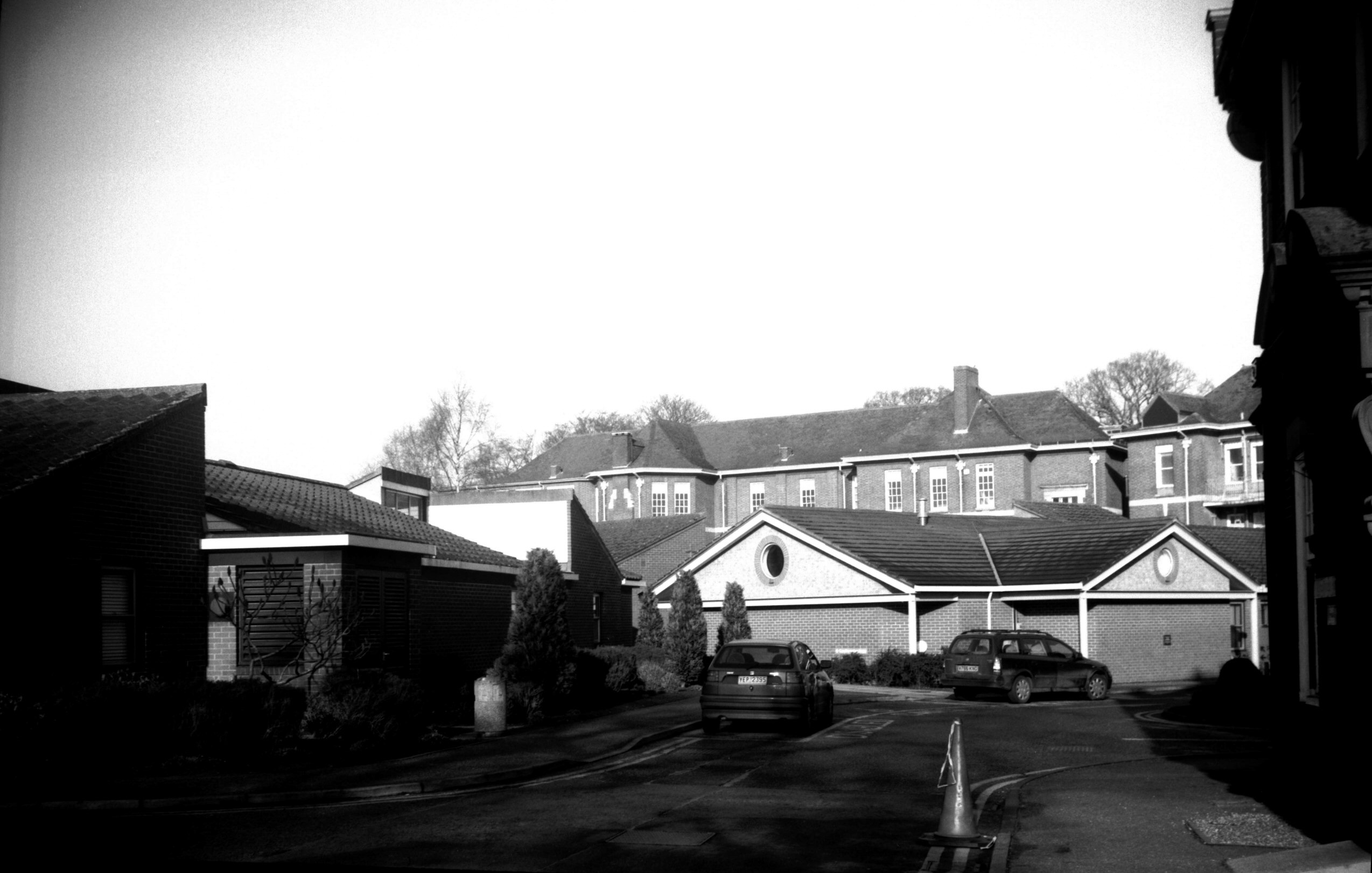
Bowthorpe Rd West Norwich Hosp nurses' home [7790]
2000-12-11
|
|
|
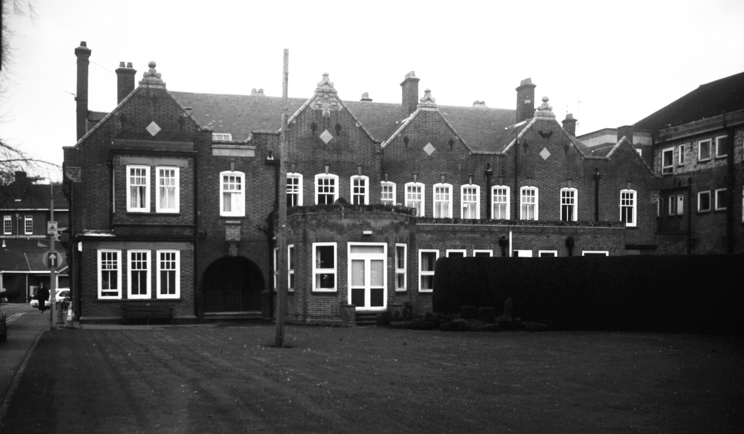
Bowthorpe Rd West Norwich Hosp infirmary [7797]
2001-01-28
Upper part of the former Poor Law infirmary, built
1858-59, in background. |
|
Bracondale: |
| |
From
City Rd / Queen's
Rd / Ber St to Trowse Millgate and
towards Trowse Newton
passing Carrow Hill, Ice
House Lane, King St, Martineau
Lane
East side |
|
|
Bracondale angle in wall near Ber St Gate [3181]
1939-07-30
|
|
|
Bracondale wall near Ber St Gate [0016] 1934-01-21
|
|
|
Bracondale wall near Ber St Gate [3182] 1939-07-30
|
|
|
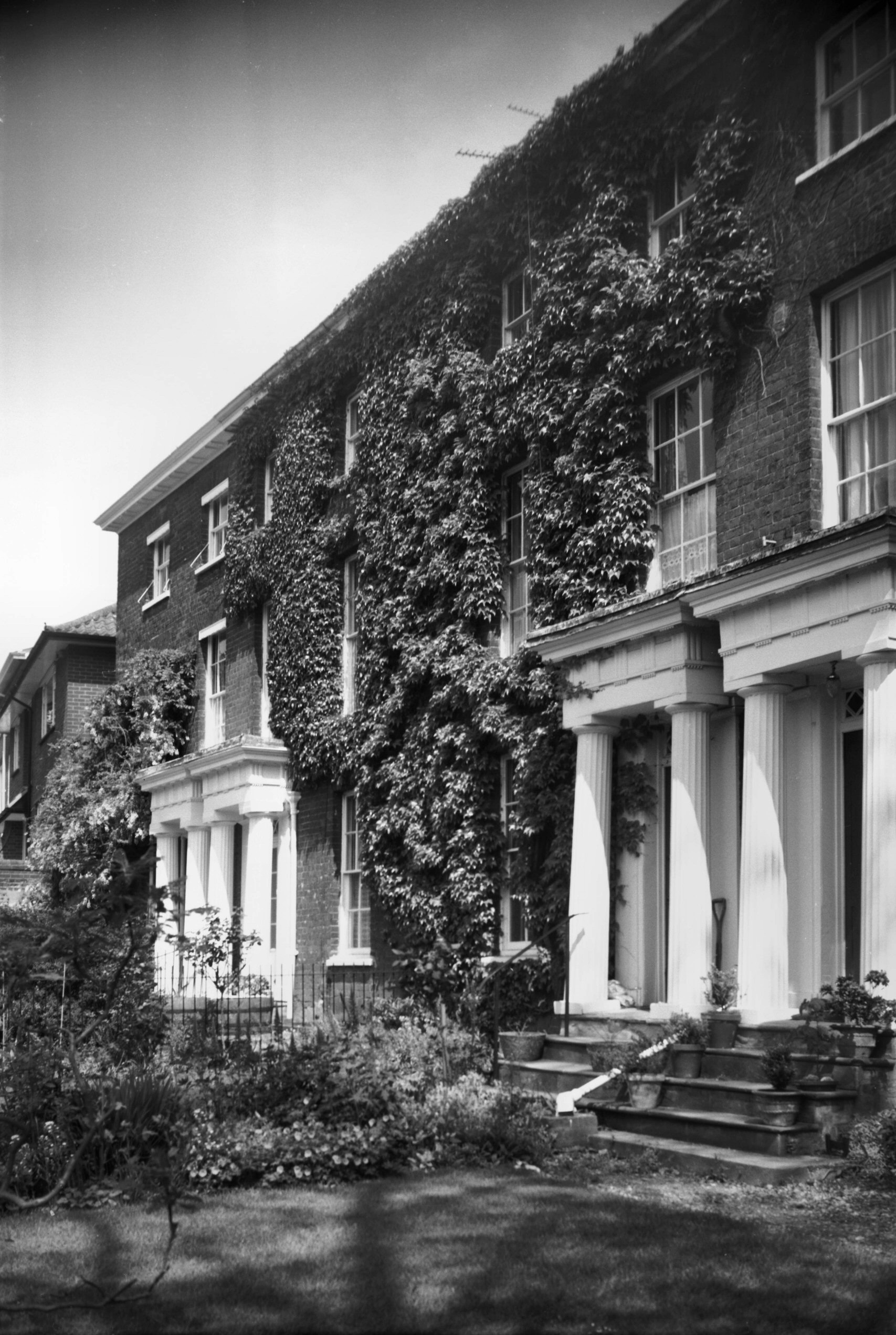
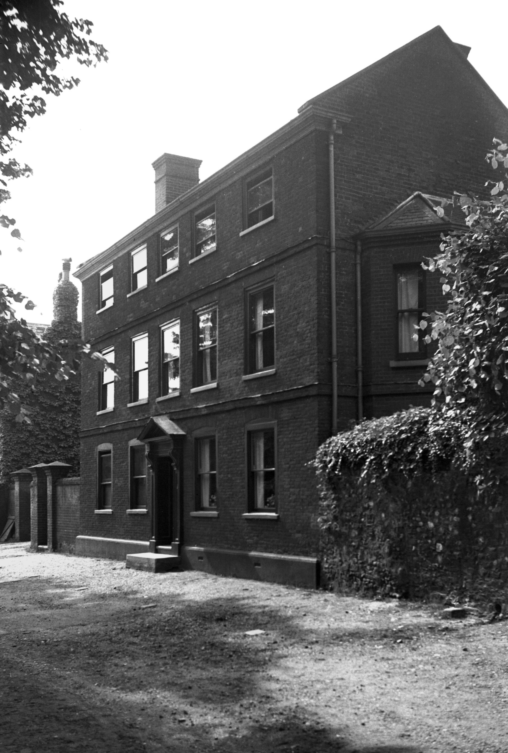
Bracondale 13 Bracondale School [6498] 1988-05-16
|
|
|
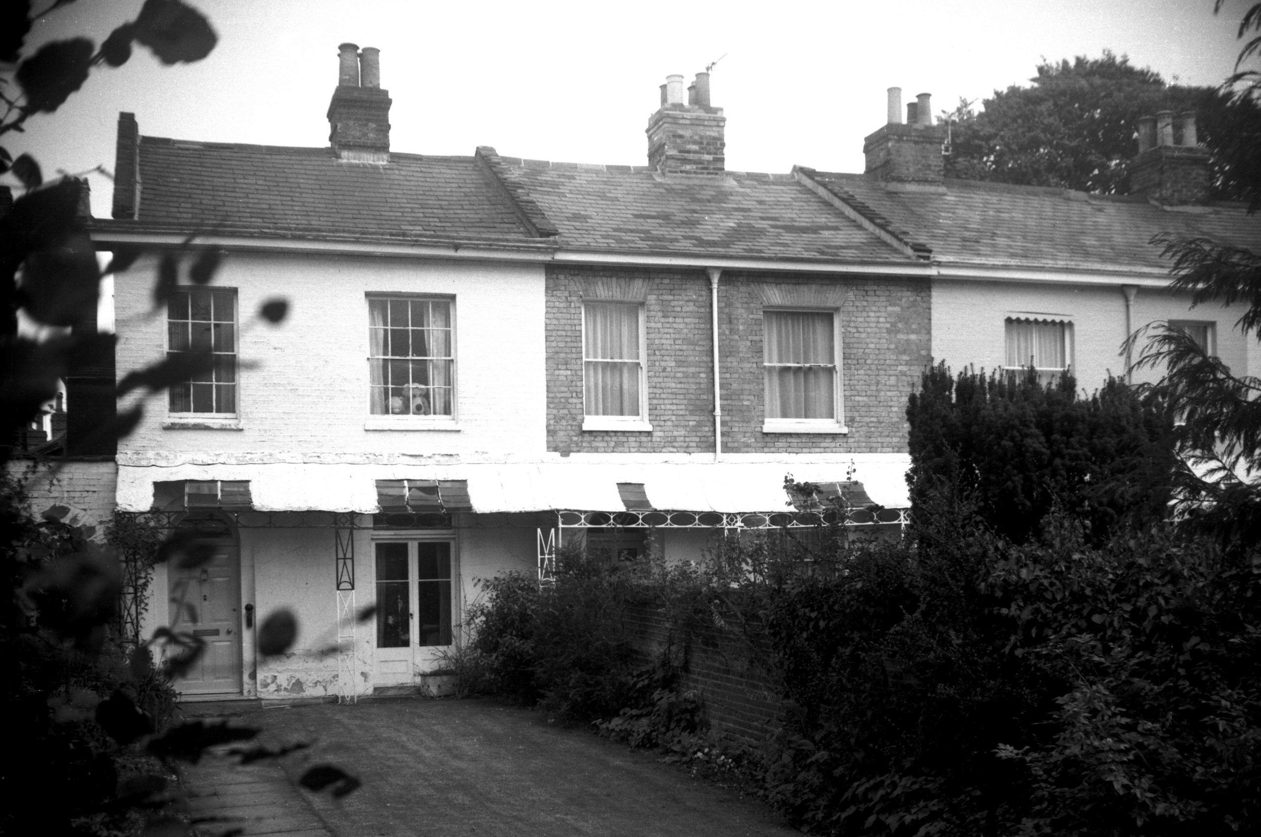
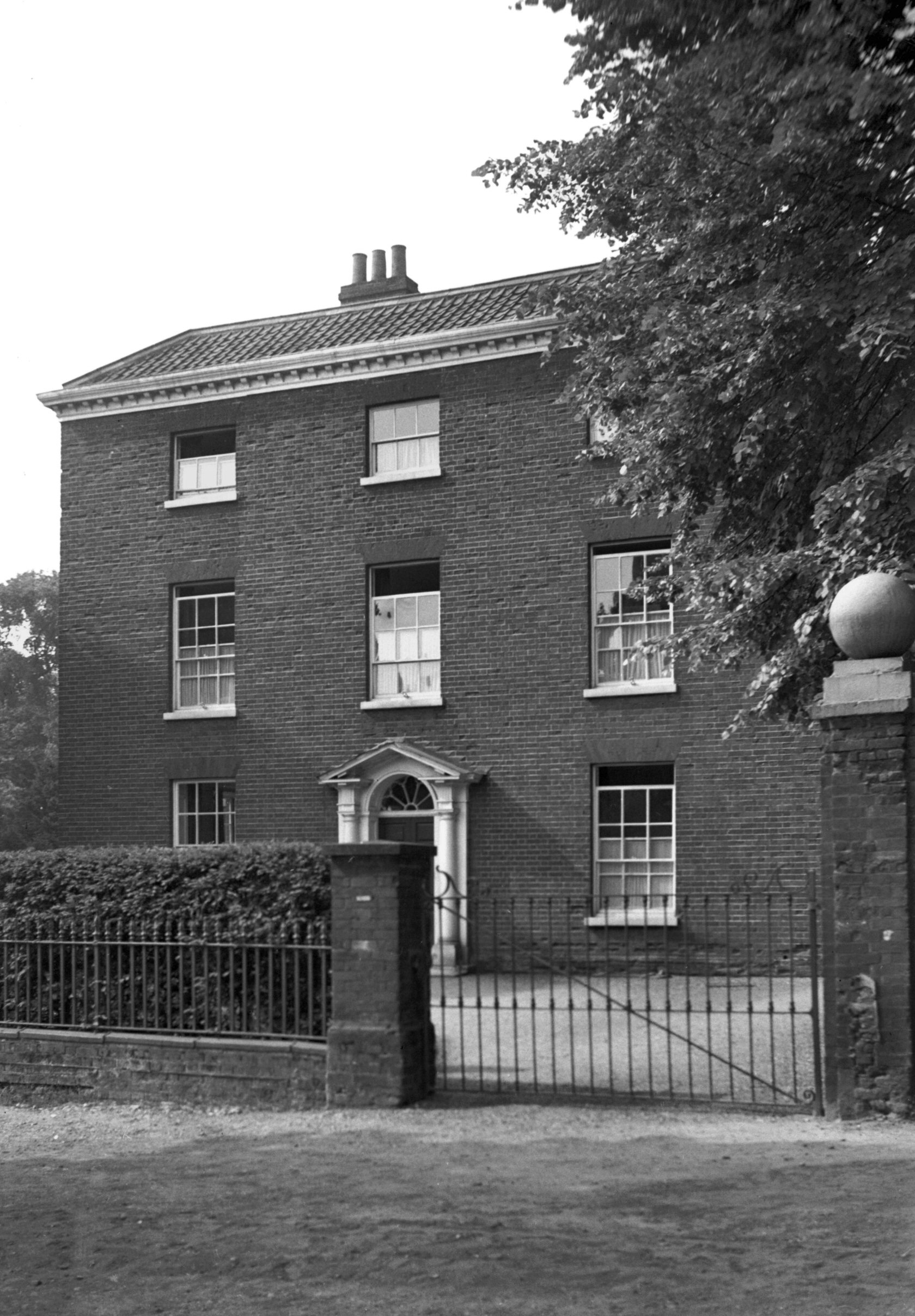
Bracondale 37 to 39 Regency period [6502] 1988-07-11
|
|
|
Bracondale 53 to 57 [6470] 1987-06-01
|
|
|
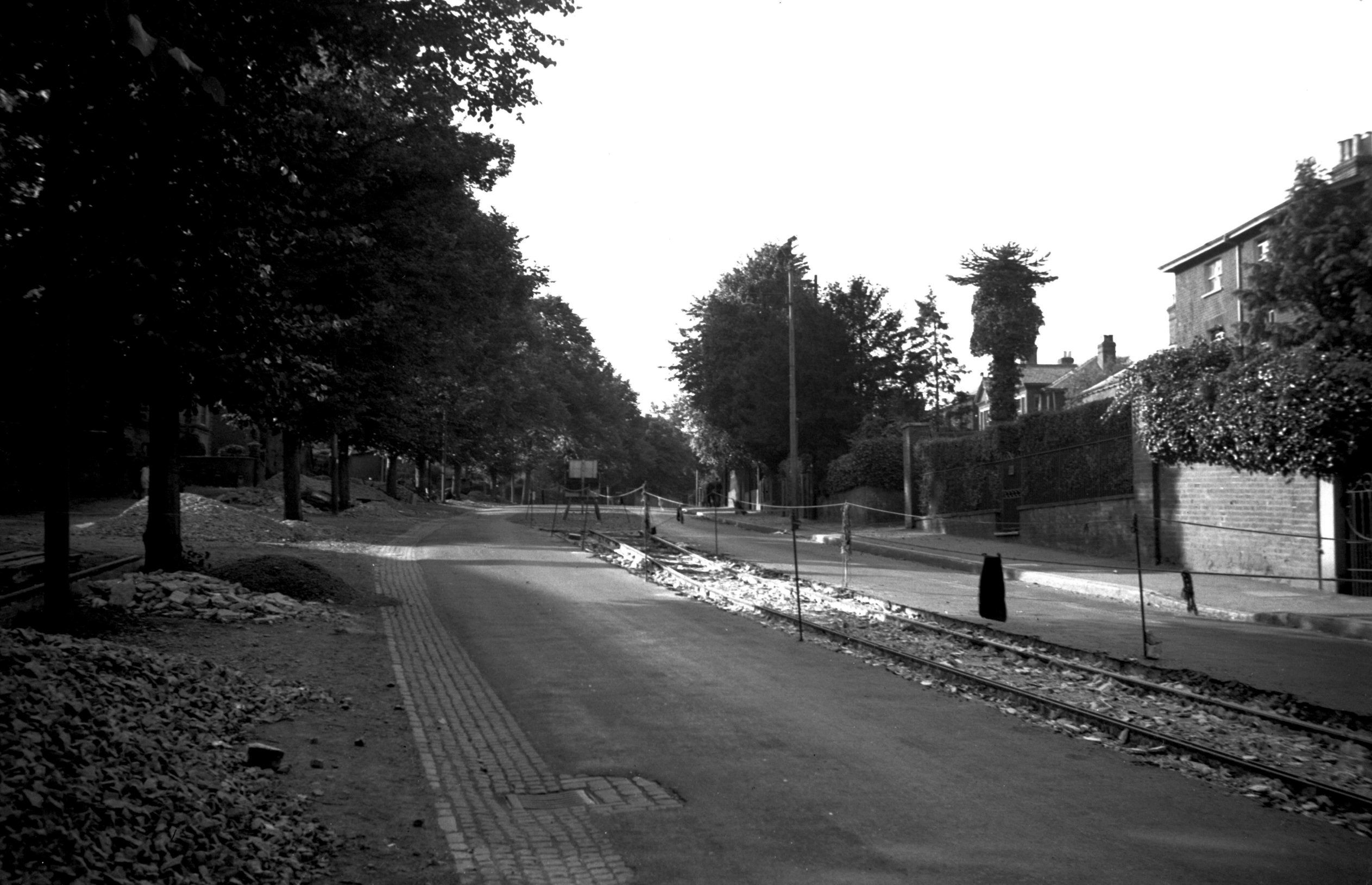
Bracondale removal of tram track view north [0285]
1934-09-09
The Trowse service was withdrawn February 1934. |
|
|
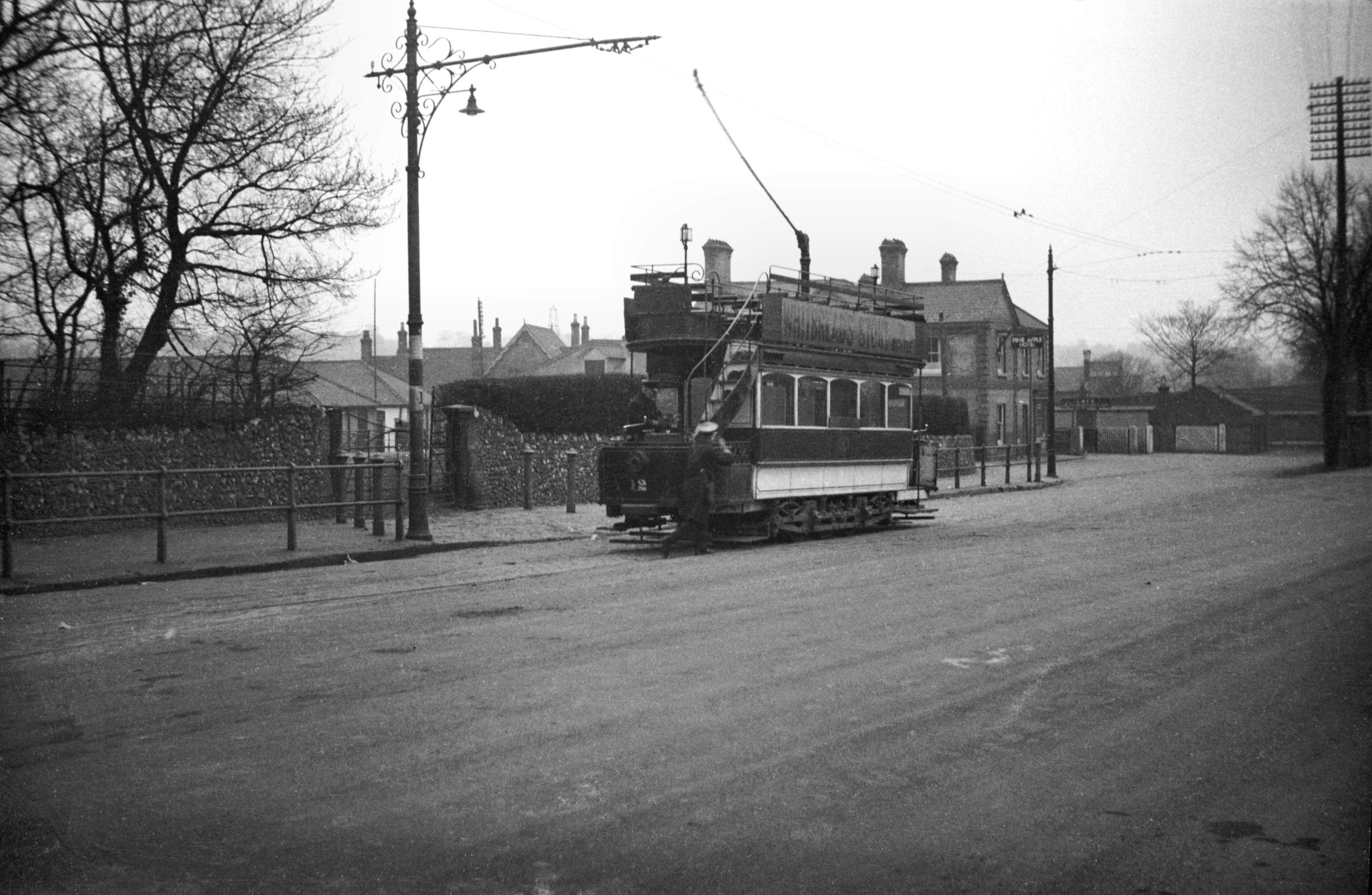
Bracondale tram at terminus [0044] 1934-02-24
Trowse station. The Orford Place to Trowse station route
just before its closure |
|
|
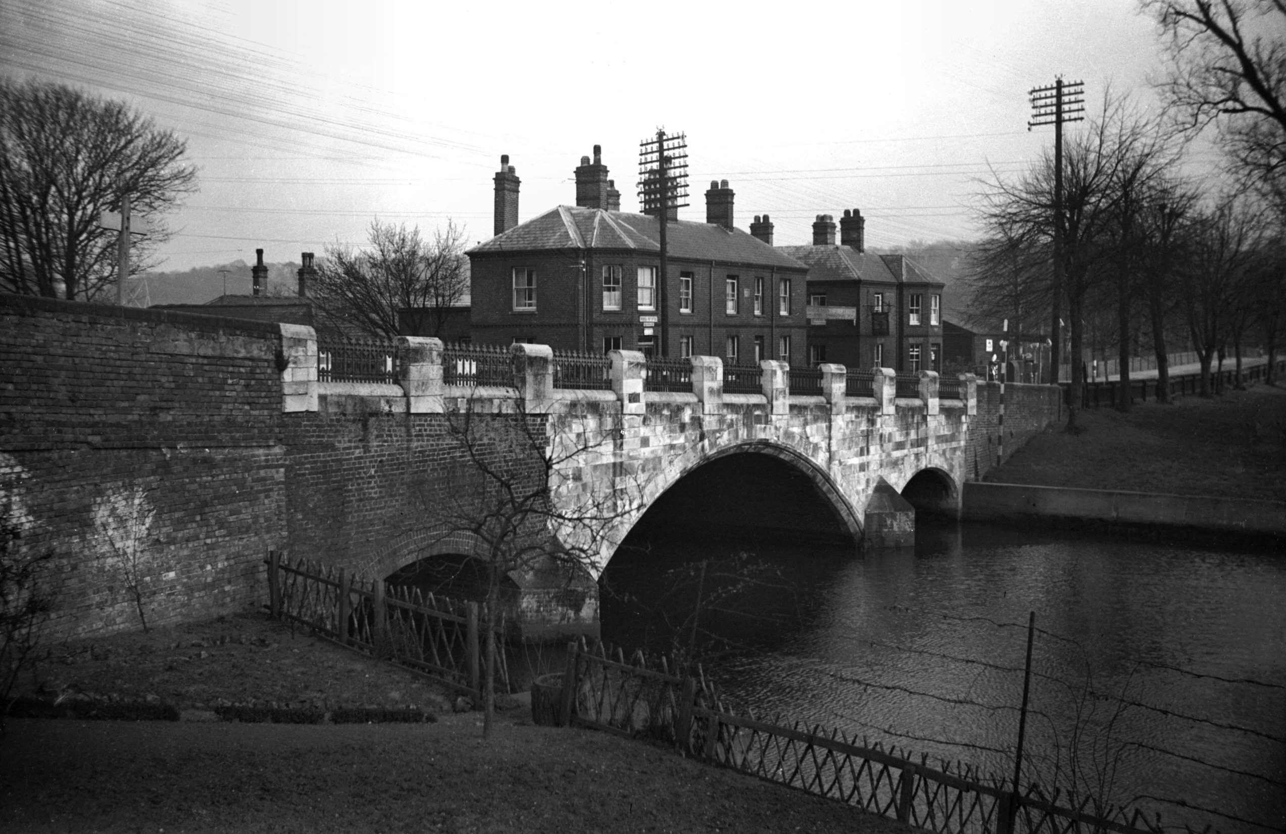
Yare Trowse Bridge west side [0035] 1934-02-20
Earlier structures are mentioned in 1430 and in a Charter
of 1556. King Charles II was met by the Mayor here in
1671 and in October 1697 Trowse, Harford and Bungay
bridges were broken down by floods. The present bridge
was built in 1863 by J.Stanley, contractor, and
R.M.Hipson, County Surveyor. Widened in 1886, this
portion collapsed during the flood of 1912 but was
rebuilt a year later when T.H.B.Heslop was Surveyor. |
| |
West
side |
|
|
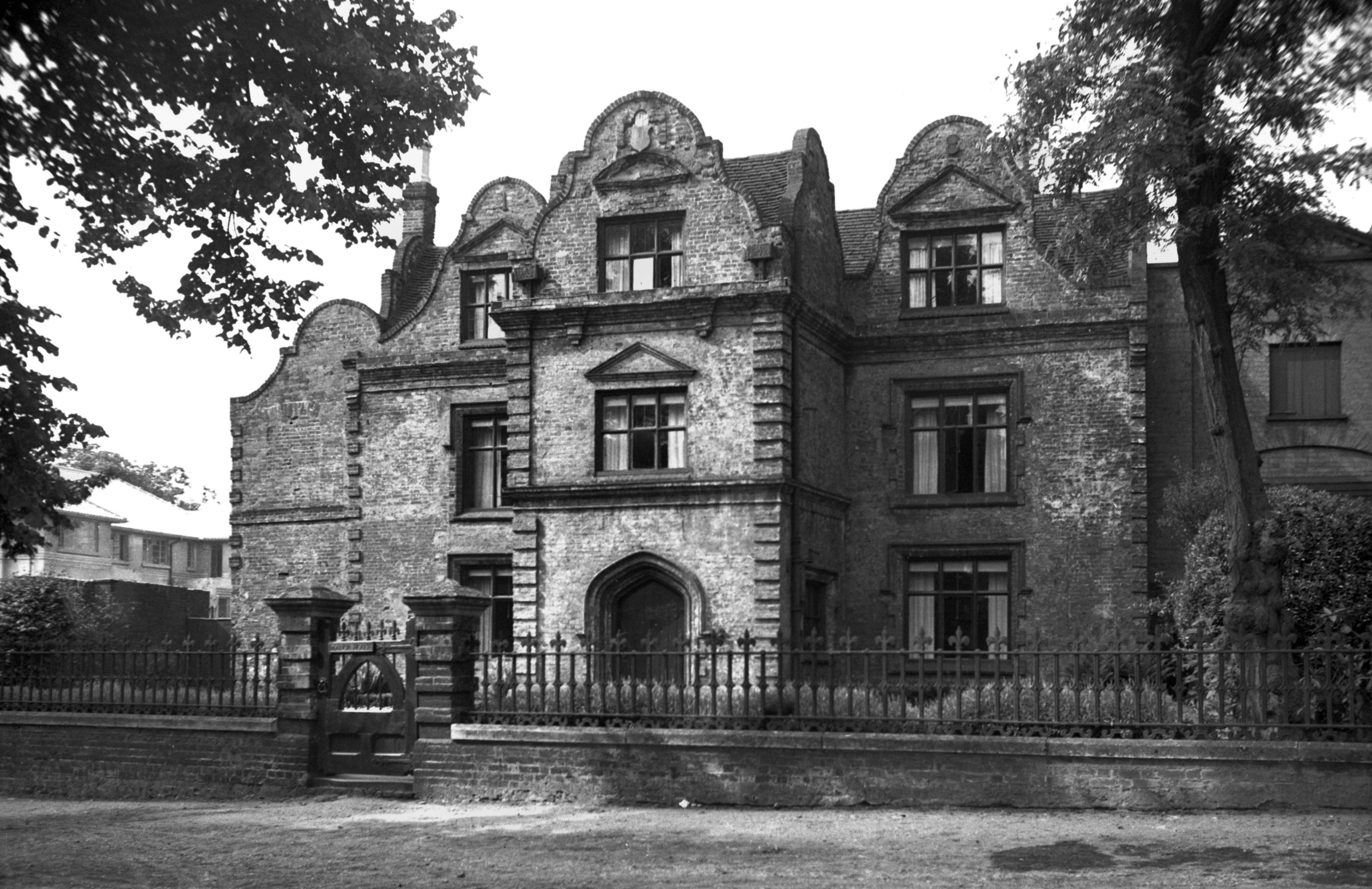
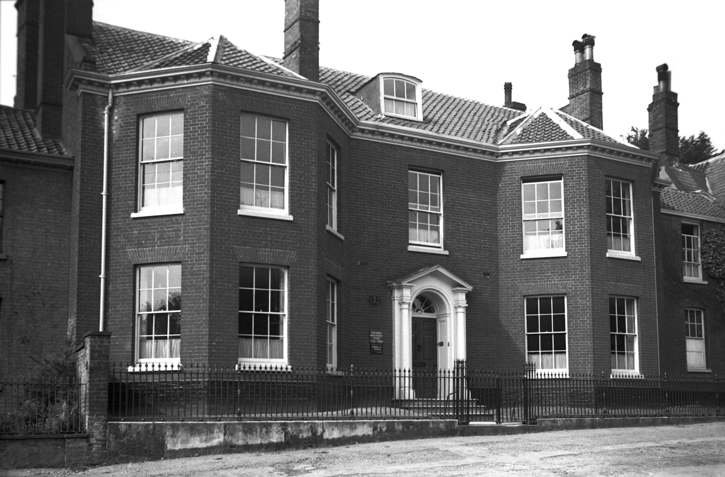
Bracondale 54 Bracondale Manor House [1709]
1937-06-13
Built 1578. |
|
|
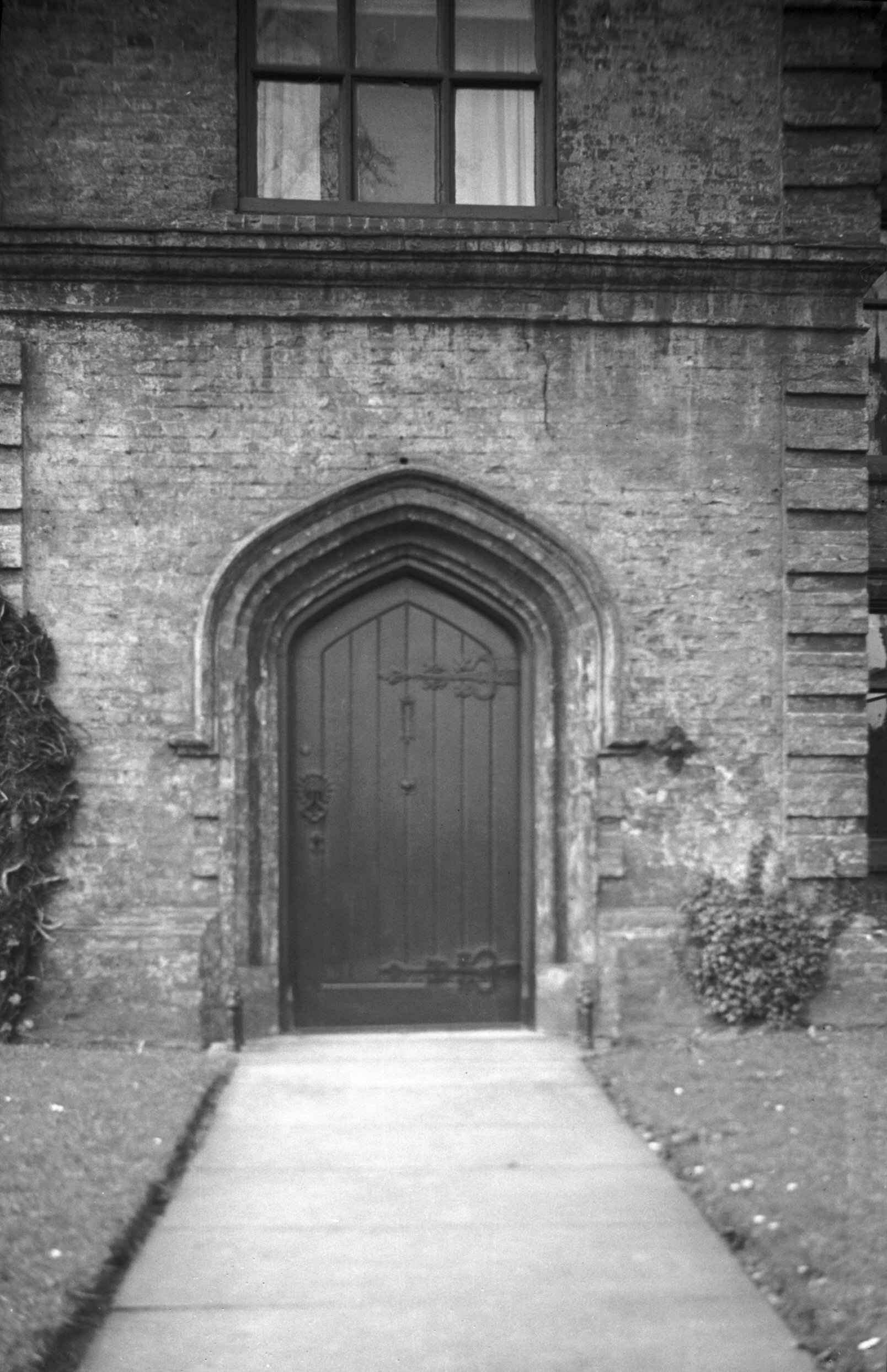
Bracondale 54 Manor House 16c doorway [0471]
1935-04-20
|
|
|
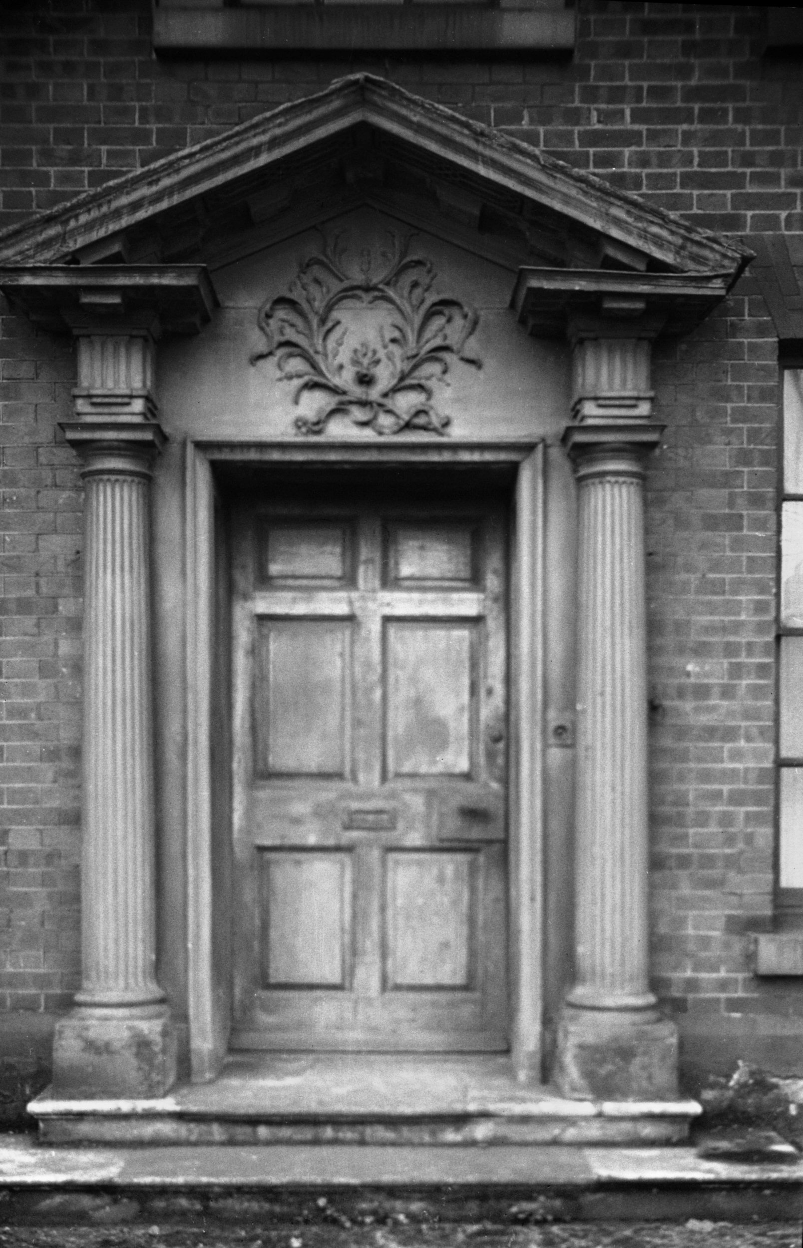
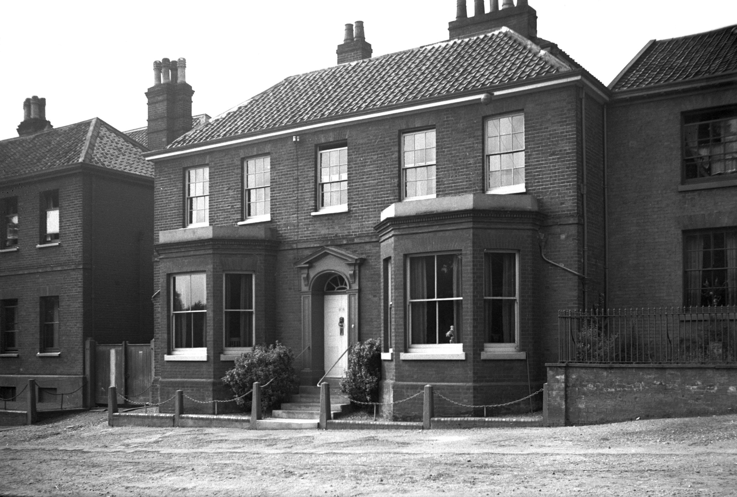
Bracondale 56 Georgian doorway [0470] 1935-04-20
|
|
|
Bracondale 58 16c tower at rear [4677] 1962-06-17
Watch tower (adjoining south side of Bracondale Green). |
|
|
Bracondale 58 Georgian doorway [0485] 1935-04-20
|
|
|
Bracondale 58 Tower House [1710] 1937-06-13
|
|
|
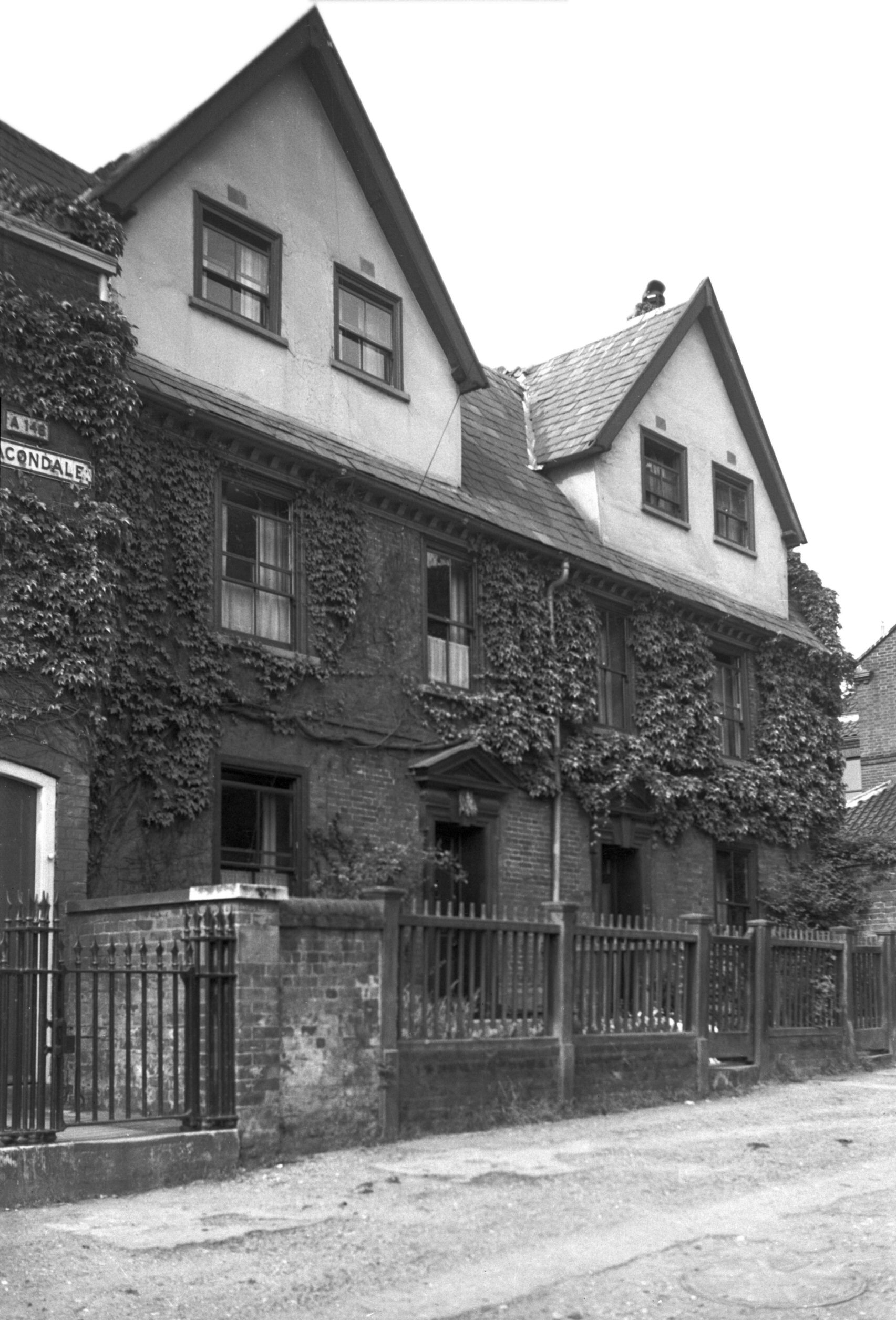
Bracondale 60 [1711] 1937-06-13
|
|
|
Bracondale 62 to 64 [1712] 1937-06-13
|
|
|
Bracondale 66 [1713] 1937-06-13
|
|
|
Bracondale 66 Georgian doorway [0472] 1935-04-20
|
|
|
Bracondale 70 [1714] 1937-06-13
|
|
|
Bracondale 72 [1804] 1937-07-18
|
|
Bridewell Alley: |
| |
From
Bedford St to St Andrew's St
East side |
|
|
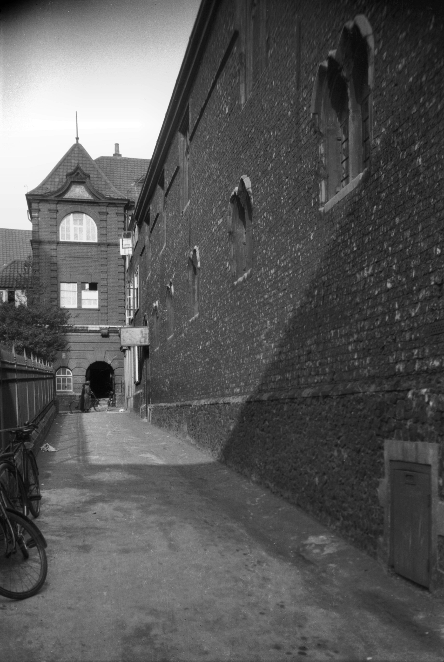
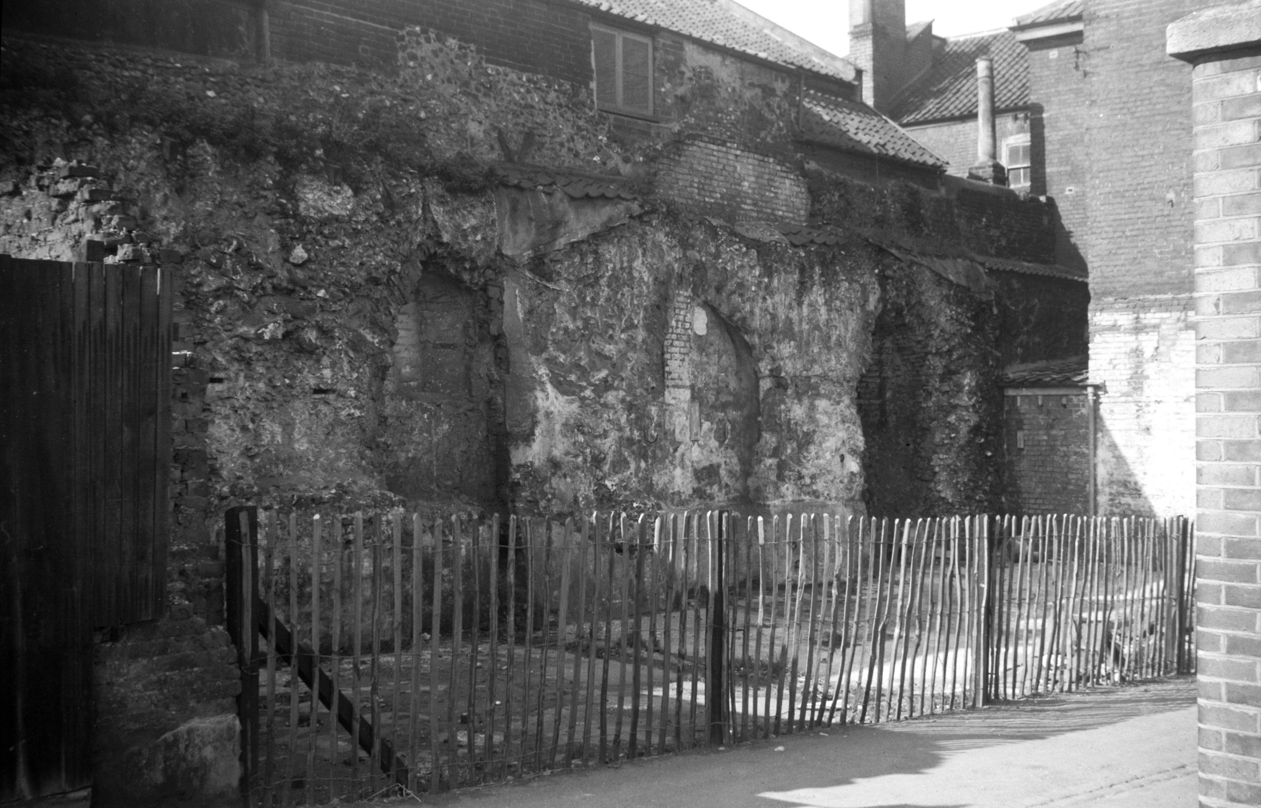
Bridewell Alley 14c flint wall [0121] 1934-06-15
Facing the south side of St Andrew's Church stands the
most remarkable surviving relic of the old Bridewell, a
flint wall 79 feet long and 27 feet high, constructed of
smooth black flints so well squared and put together
"as scarcely to admit the edge of a knife between
the joints". The building of which this wall forms a
part was once the home of the Appleyard family –
Bartholomew, who built it in about 1370, and his son
William, the first to be elected Mayor of Norwich under
its great charter of 1403. Its use as a Bridewell
commenced in 1583, when it was purchased by the city for
that purpose from Baron Sotherton.
In 1751 a fire destroyed all but the flint wall and the
adjoining sequence of groined crypts. At this time a
notorious character, Peter the wild boy, was incarcerated
here. He, it is said, was brought over to England from
Germany, where he had been found wandering in a wood in a
naked and wild condition, having been lost there since he
was a young child. The sign of a public house in nearby
Bedford St perpetuates the association, and long may it
continue to do so.
60 years later, in January 1811, so well behaved were the
citizens that the Bridewell doors were thrown open for
several days. This was the first time for many years that
not one person was being confined there for any
misdemeanour.
Unfortunately by 1826 the pendulum had swung in the
opposite direction, the justices reporting that due to
recent new legislation the accommodation there was
"insufficient, inconvenient and inadequate":
because of the increased number of commitments "a
more commodious building should be erected or
substituted". Two years later the prisoners were
moved to the newly built gaol at St Giles' Gates (now the
site of the Roman Catholic Cathedral), and in 1829 the
Bridewell was sold to a Mr J.Curr for £1,140.
It was then put to a number of different uses, including
use as a tobacco warehouse, and in the 20c until 1923 as
a shoe factory. In that year it was purchased by Henry
N.Holmes (later Sir Henry), who, after having it
restored, presented it to the city for use as a museum of
local industries. It was opened as such by the Duke of
York (later King George VI) in 1925. |
|
|
Bridewell Alley Museum Georgian doorway [0477]
1935-04-20
In Bridewell courtyard, but formerly at 13 London St. |
| |
West
side |
|
|
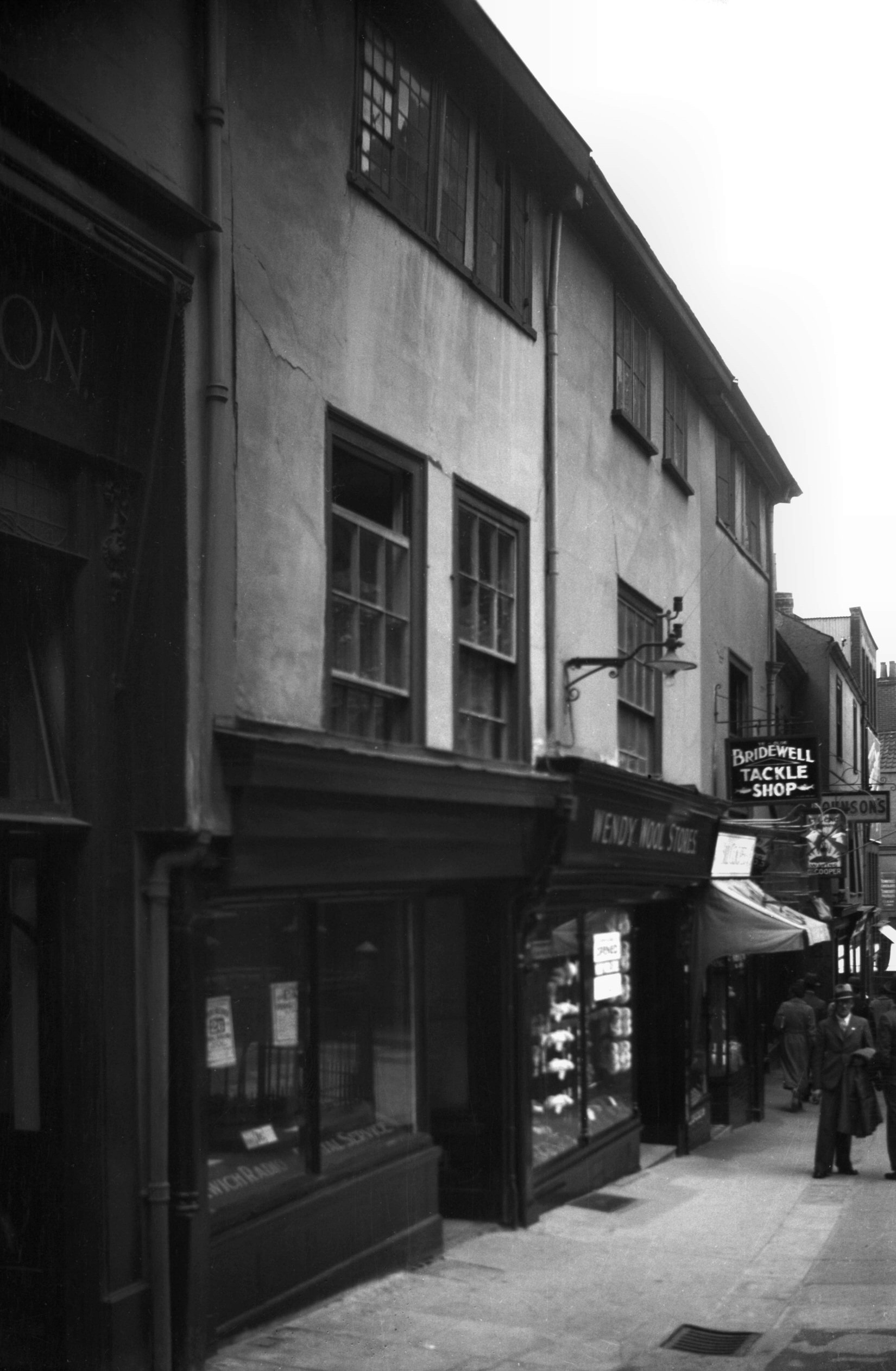
Bridewell Alley 10 to 12 [2549] 1938-07-17
|
|
|
Bridewell Alley 14 to 16 [6359] 1986-05-02
|
|
|
Bridewell Alley 14 to 20 [1146] 1936-07-21
|
|
Britannia Rd: |
| |
From
Gurney Rd to Wolfe Rd
passing Plumstead Rd, Kett's
Hill
East side |
|
|
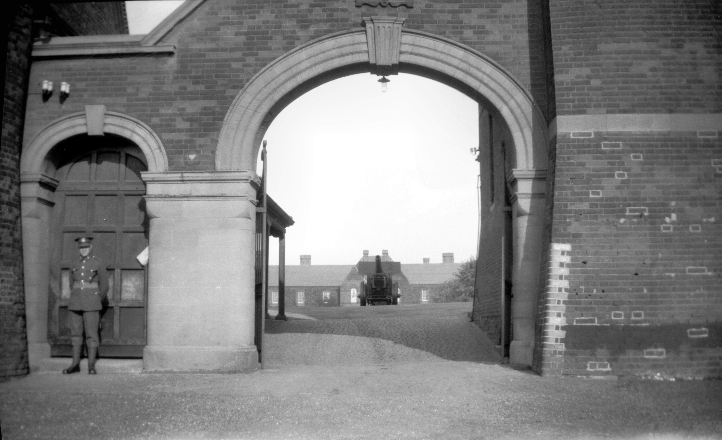
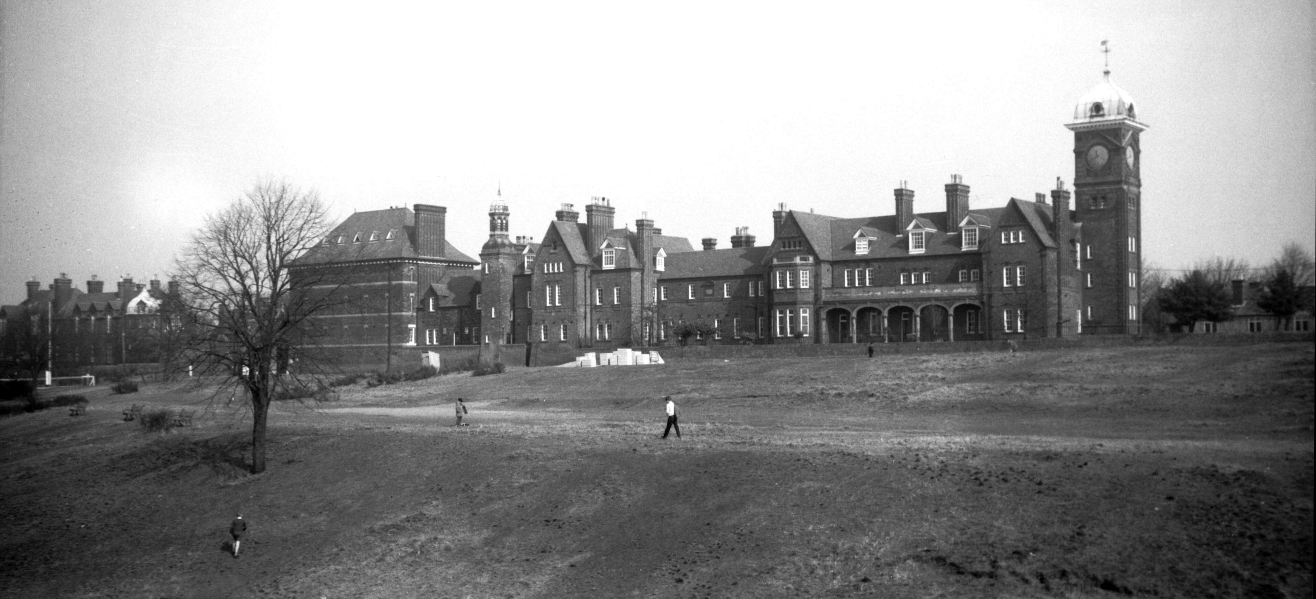
Britannia Rd Barracks from St James' Hill [B184]
1931-00-00
Gurney Rd. |
|
|
Britannia Rd Barracks officers' quarters [B183]
1931-00-00
|
|
|
Britannia Rd Barracks parade ground gateway [B182]
1931-00-00
|
|
|
Britannia Rd Barracks from St James' Hill [4884]
1965-03-13
|
|
|
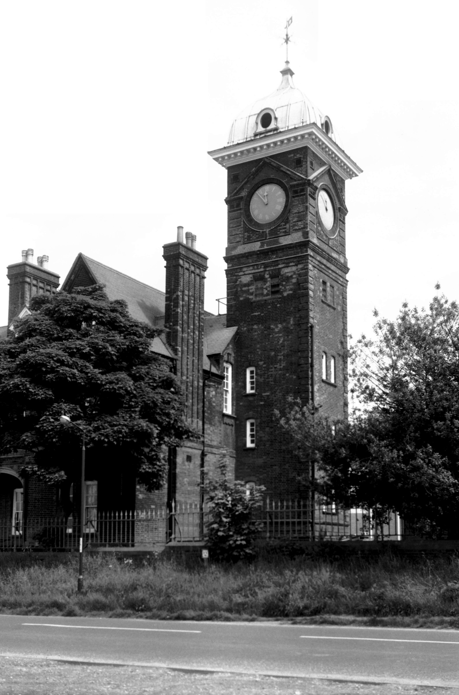
Britannia Rd Barracks clock tower [7128] 1994-05-28
|
|
|
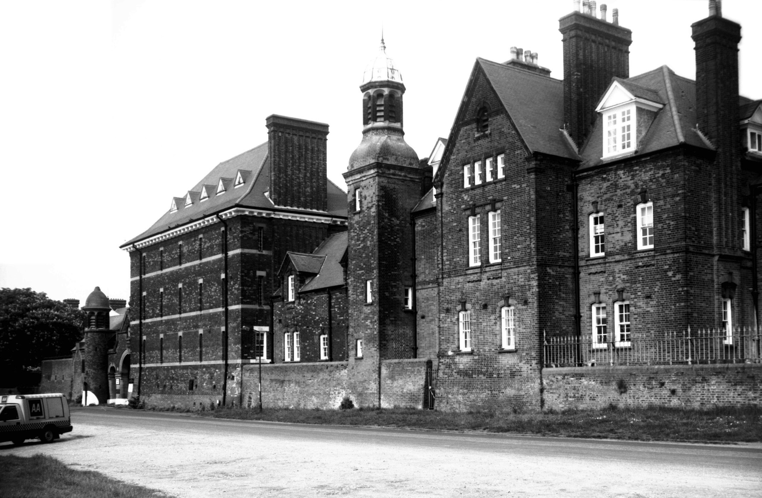
Britannia Rd Barracks as H M Prison [7629] 1999-05-09
|
|
Bull Close Rd: |
| |
From
Magdalen St / Magpie
Rd / Magdalen Rd to Silver Rd
South side |
|
|
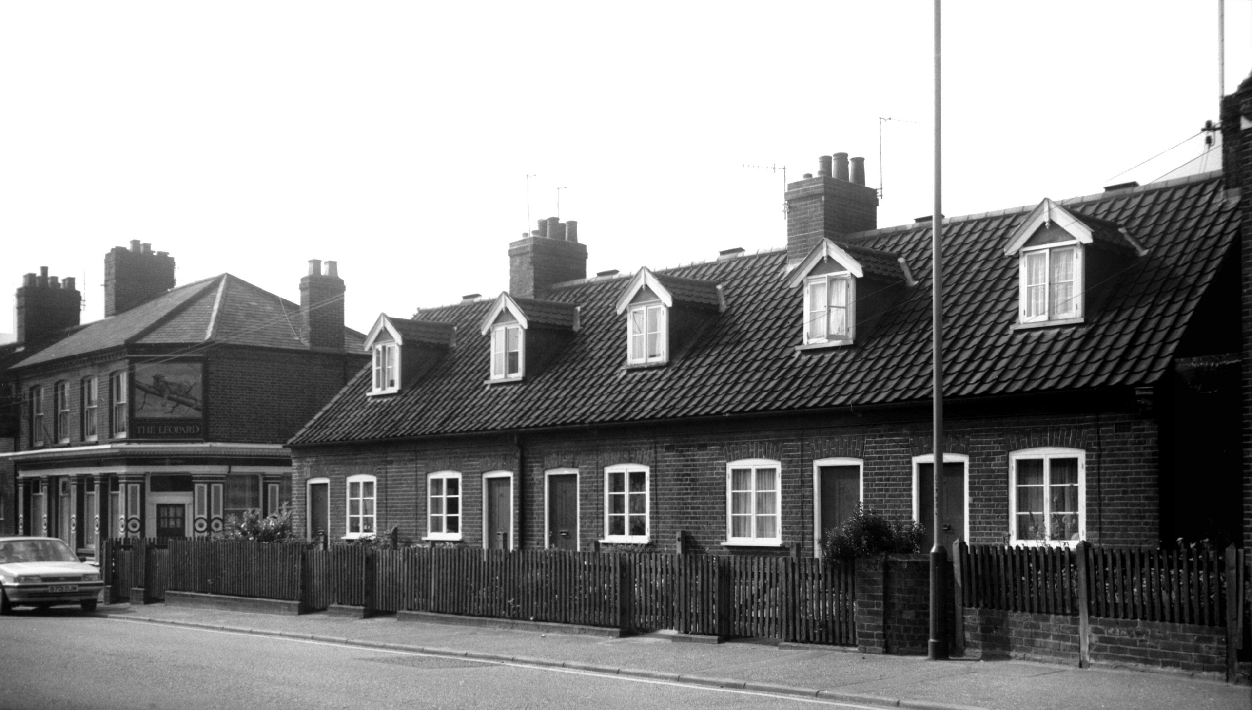
Bull Close Rd 86 to 94 [6556] 1989-06-24
98 Leopard PH. |
|
|
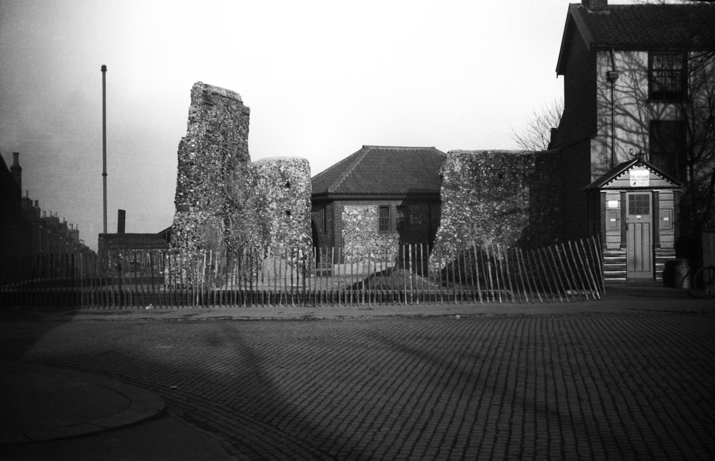
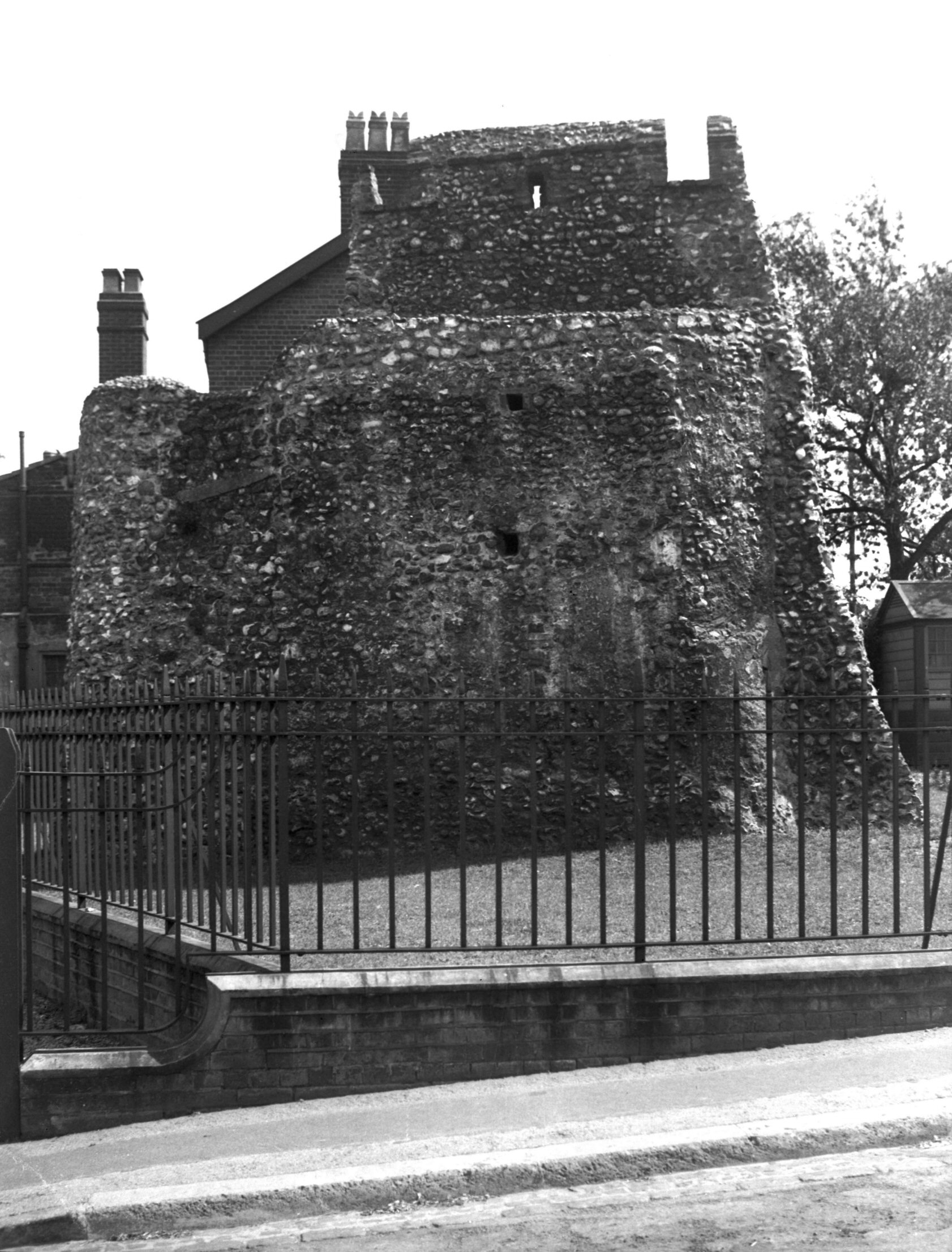
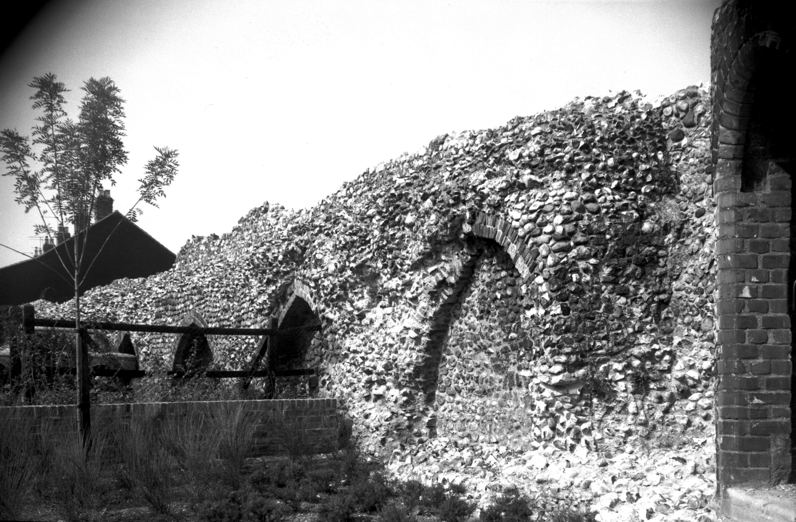
North east corner tower from Wall Lane [B098]
1931-00-00
|
|
|
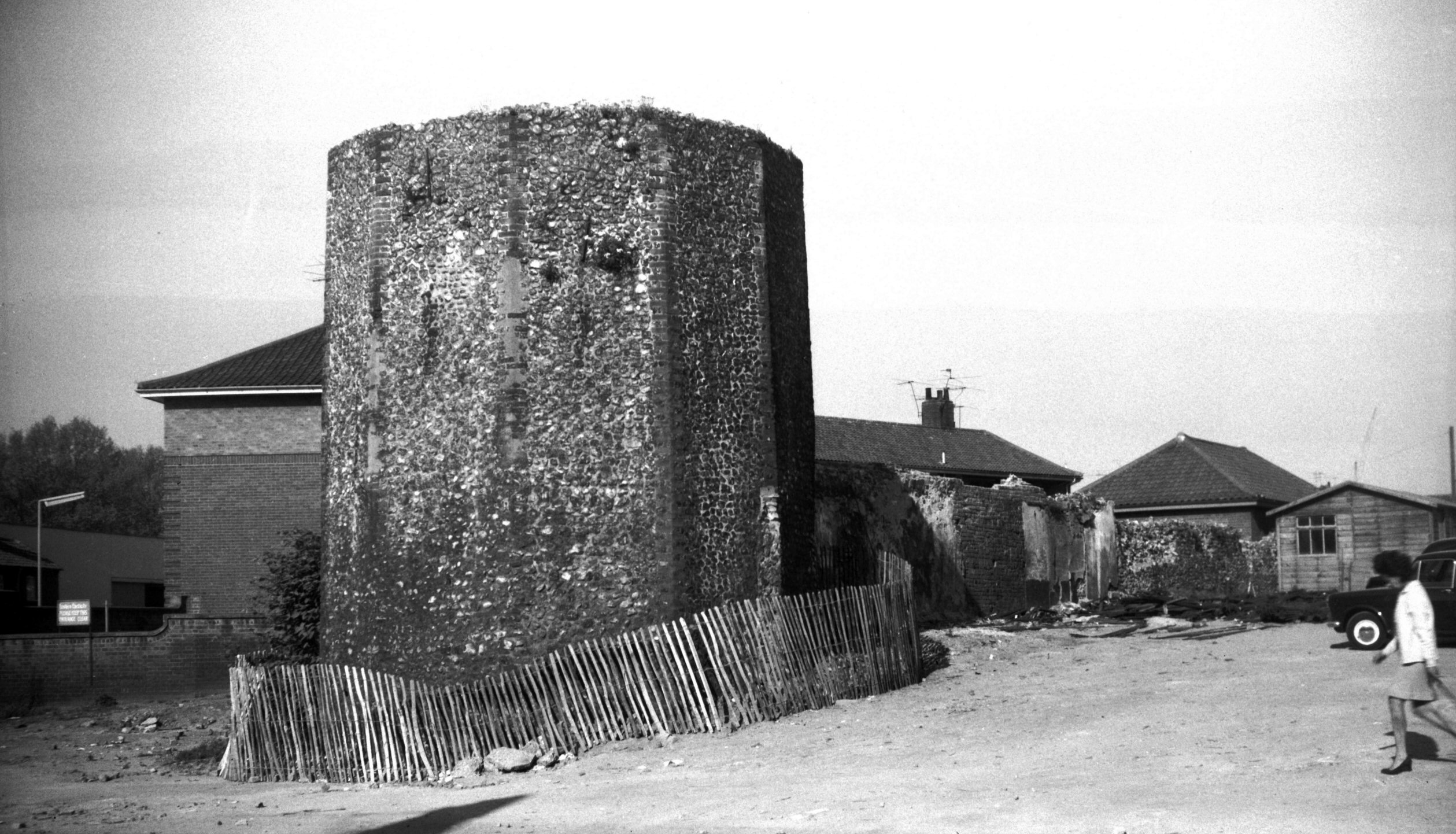
North east corner tower Bull Close Rd [0763]
1935-10-17
|
|
|
North east corner tower Bull Close Rd [0764]
1935-10-17
|
|
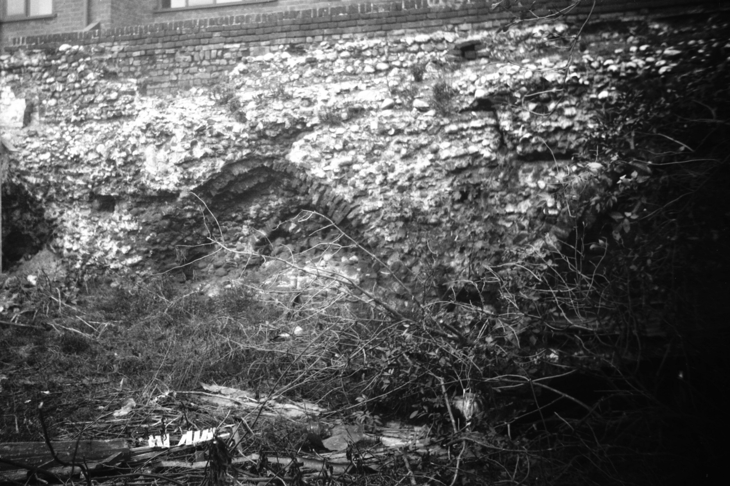
|
North east corner tower wall adjoining [0765]
1935-10-17
|
|
|
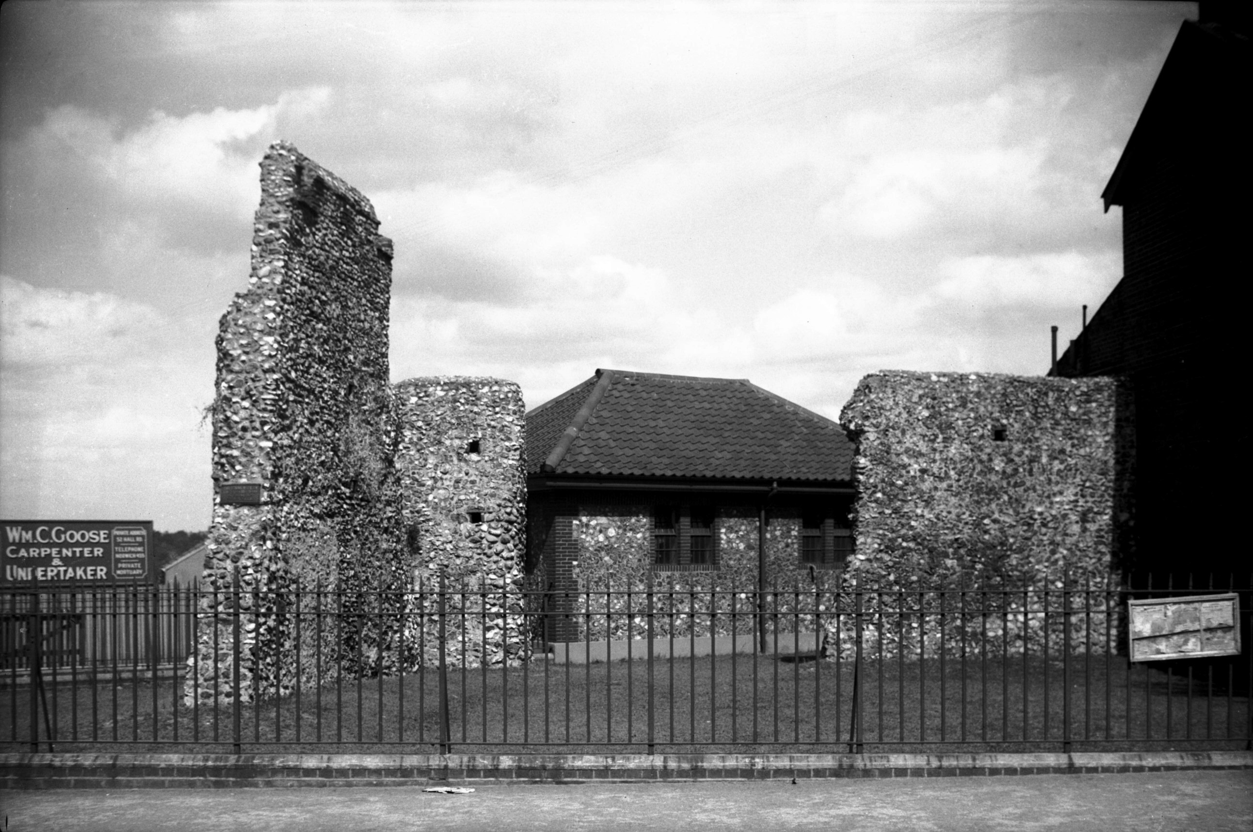
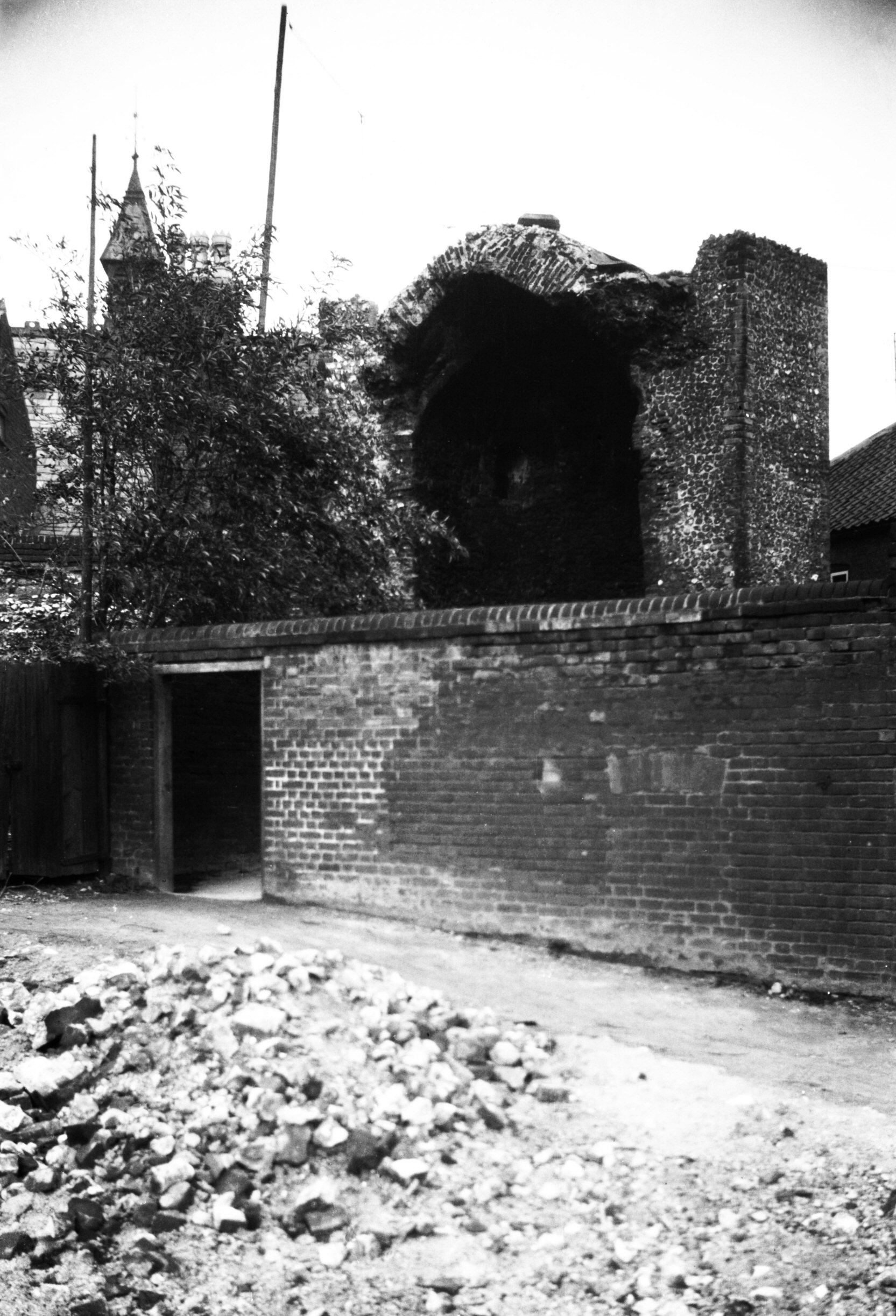
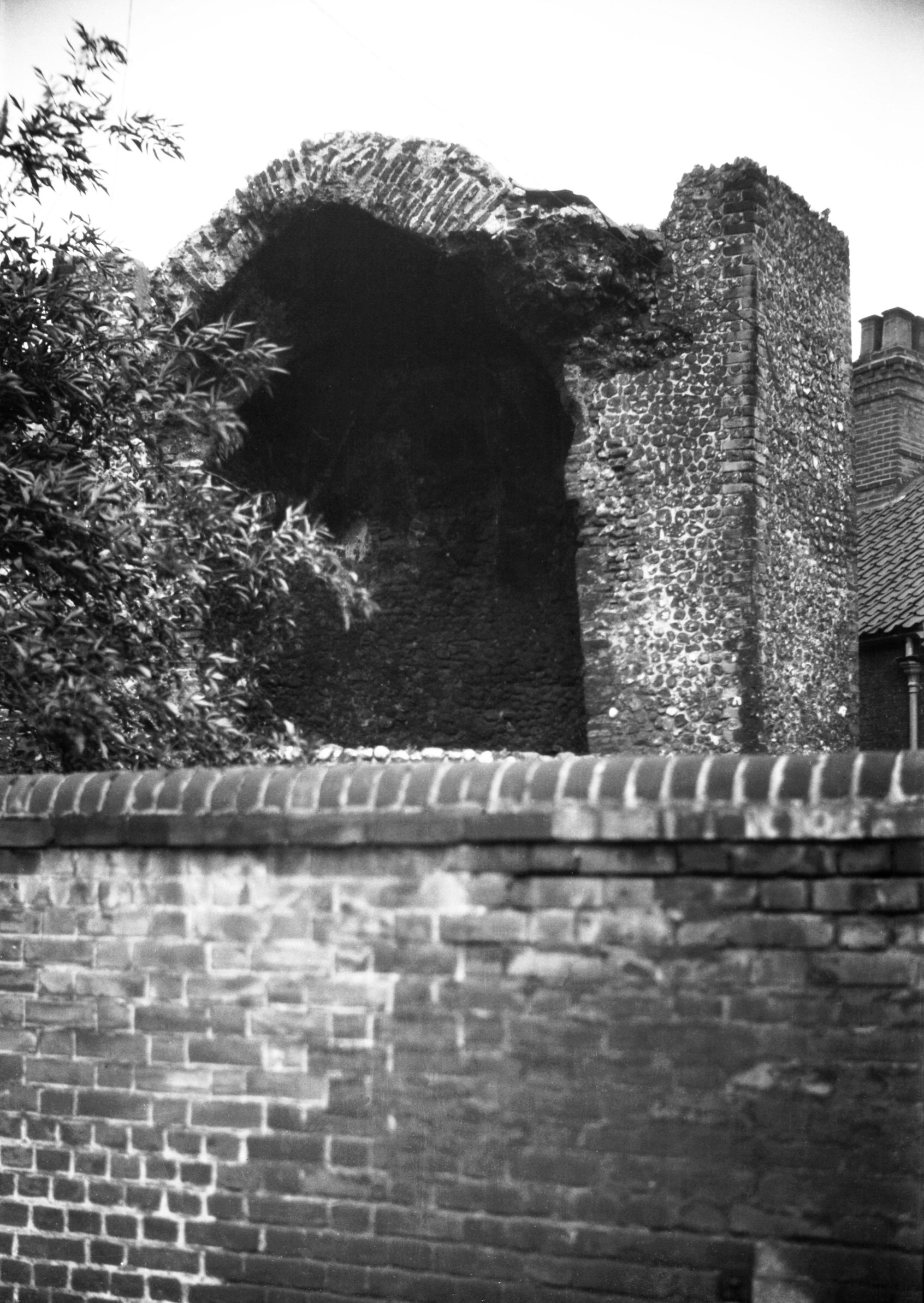
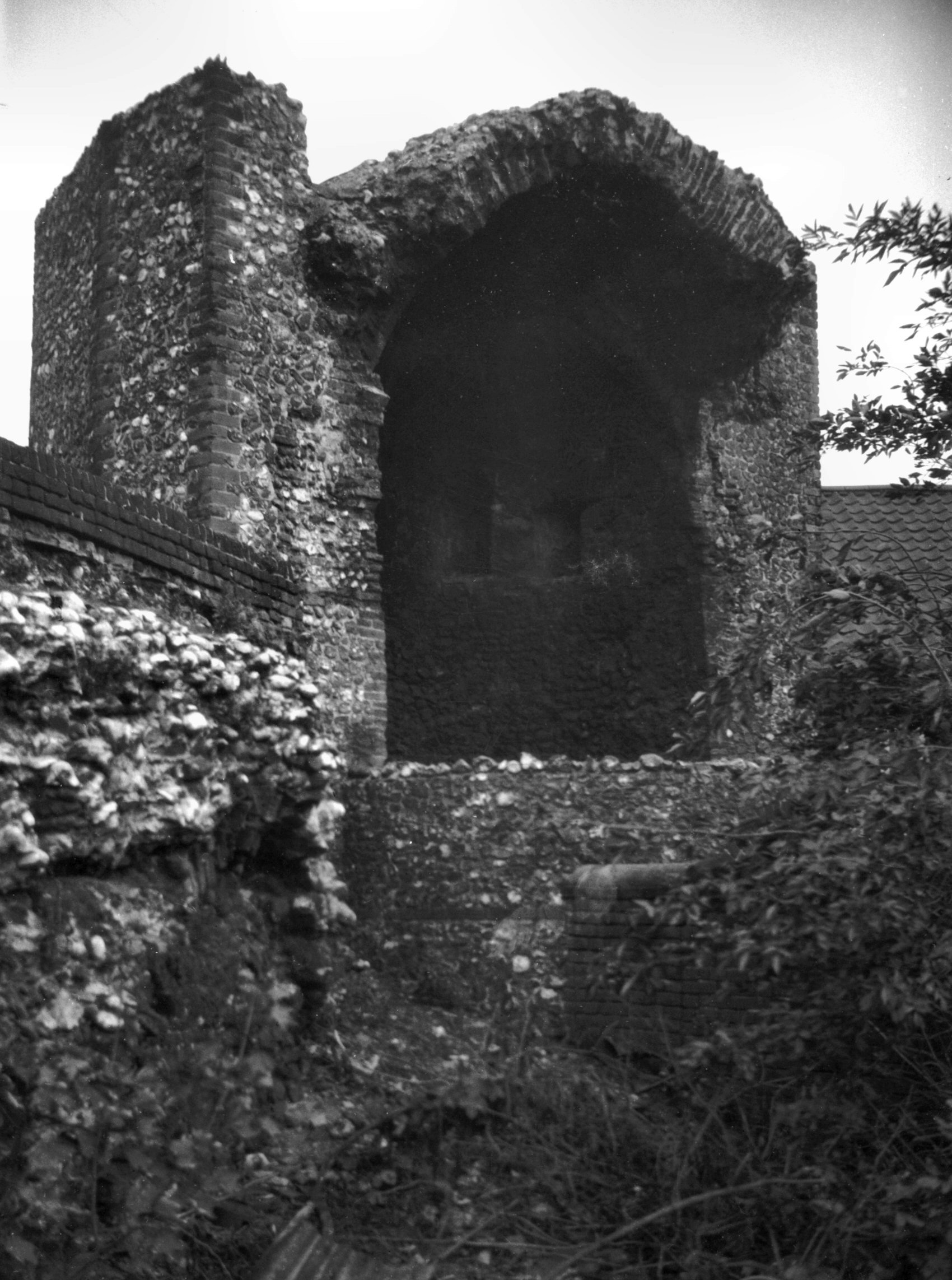
North east corner tower Bull Close Rd [0768]
1935-10-17
The only tower to retain its top vaulting. |
|
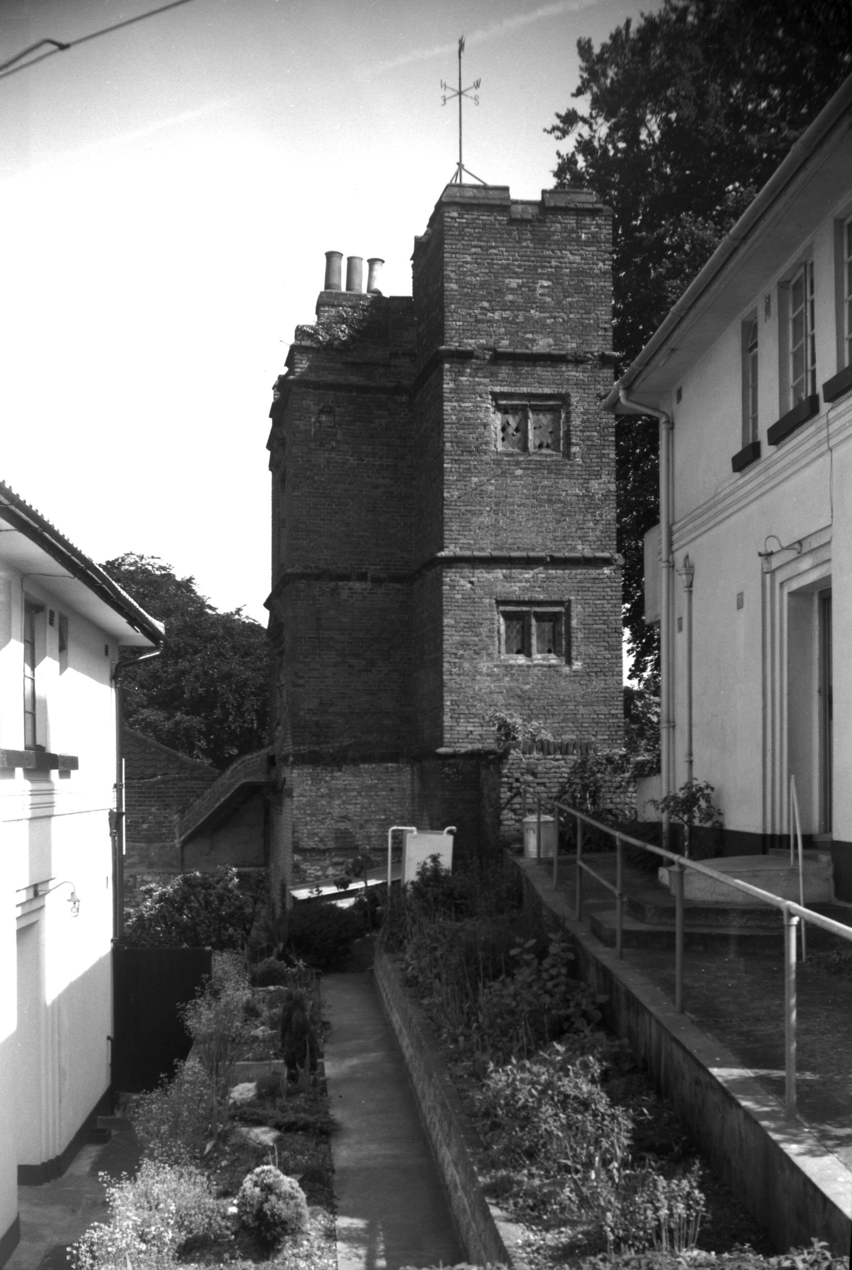
|
North east corner tower Bull Close Rd [5301]
1970-05-27
|
|
|
North east corner tower Bull Close Rd [6001]
1979-04-15
|
|
|
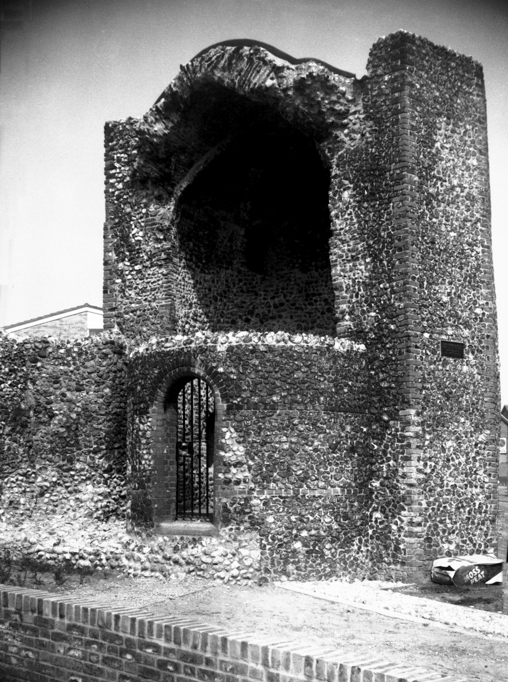
North east corner tower wall adjoining [6047]
1979-08-31
|
|
Bull Lane: |
| |
From
All Saints
Green to St Stephen's St |
|
|
Bull Lane derelict workshops former stables [6232]
1981-08-27
At east end of north-east side of lane. |
|
|
Bull Lane north end wall view NW [3842] 1950-03-25
|