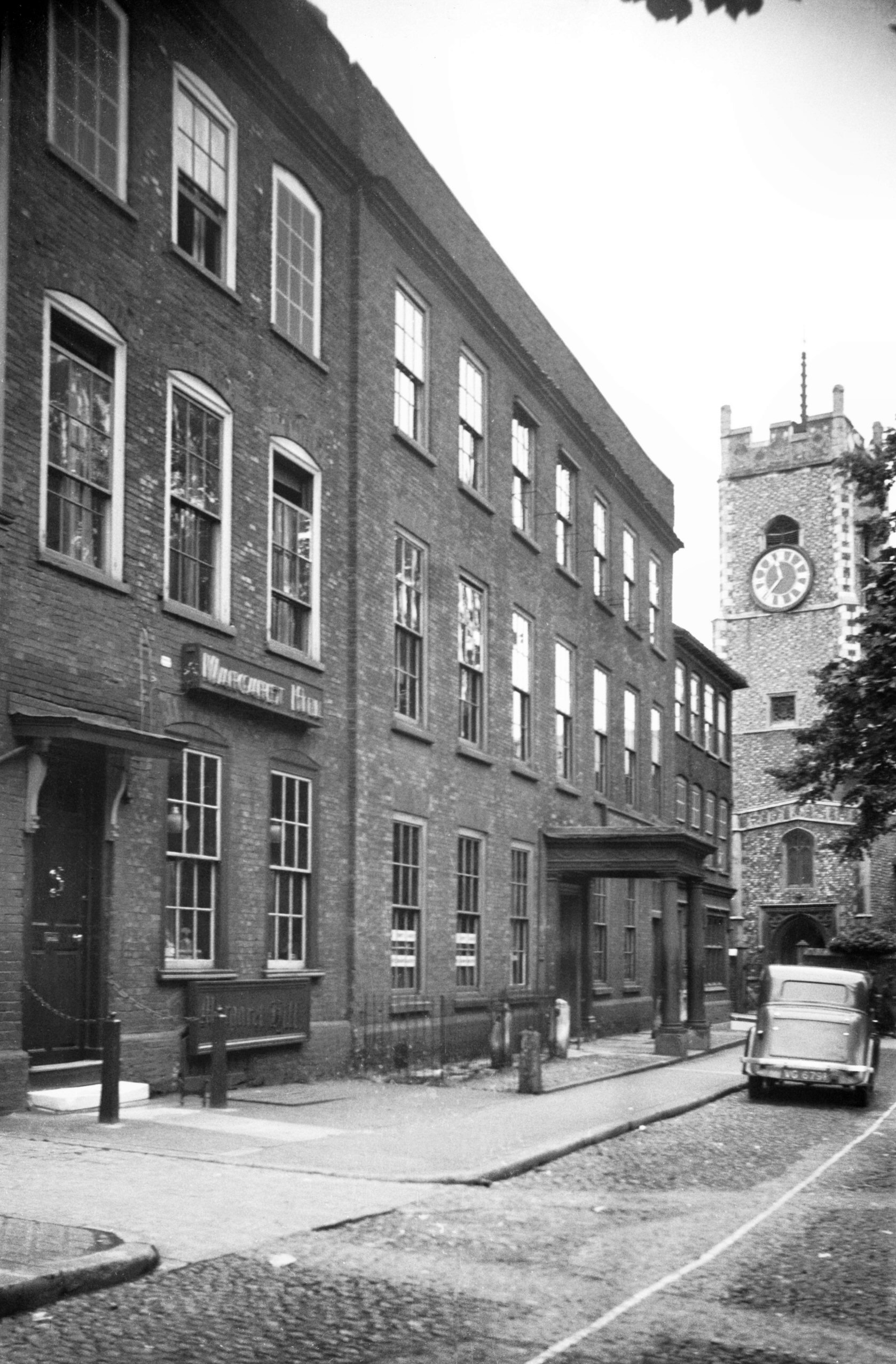
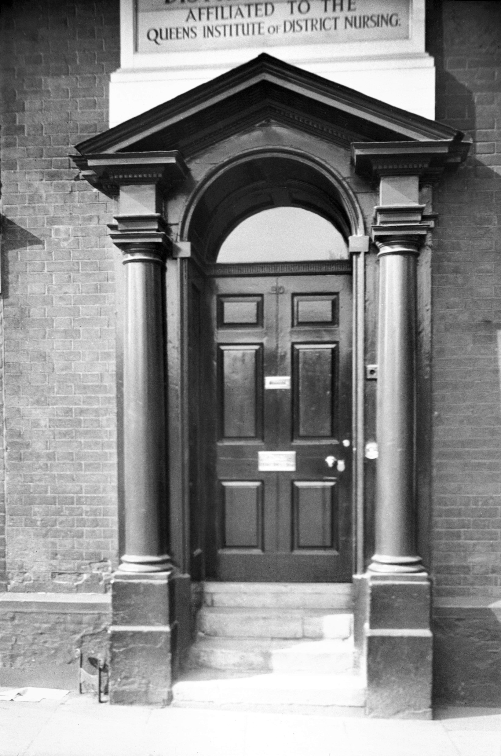
|
Tombland: |
| |
From
Upper King
St / Queen St and The Close / St Faith's Lane to Wensum St / Palace St
passing Princes St
West side |
|
|
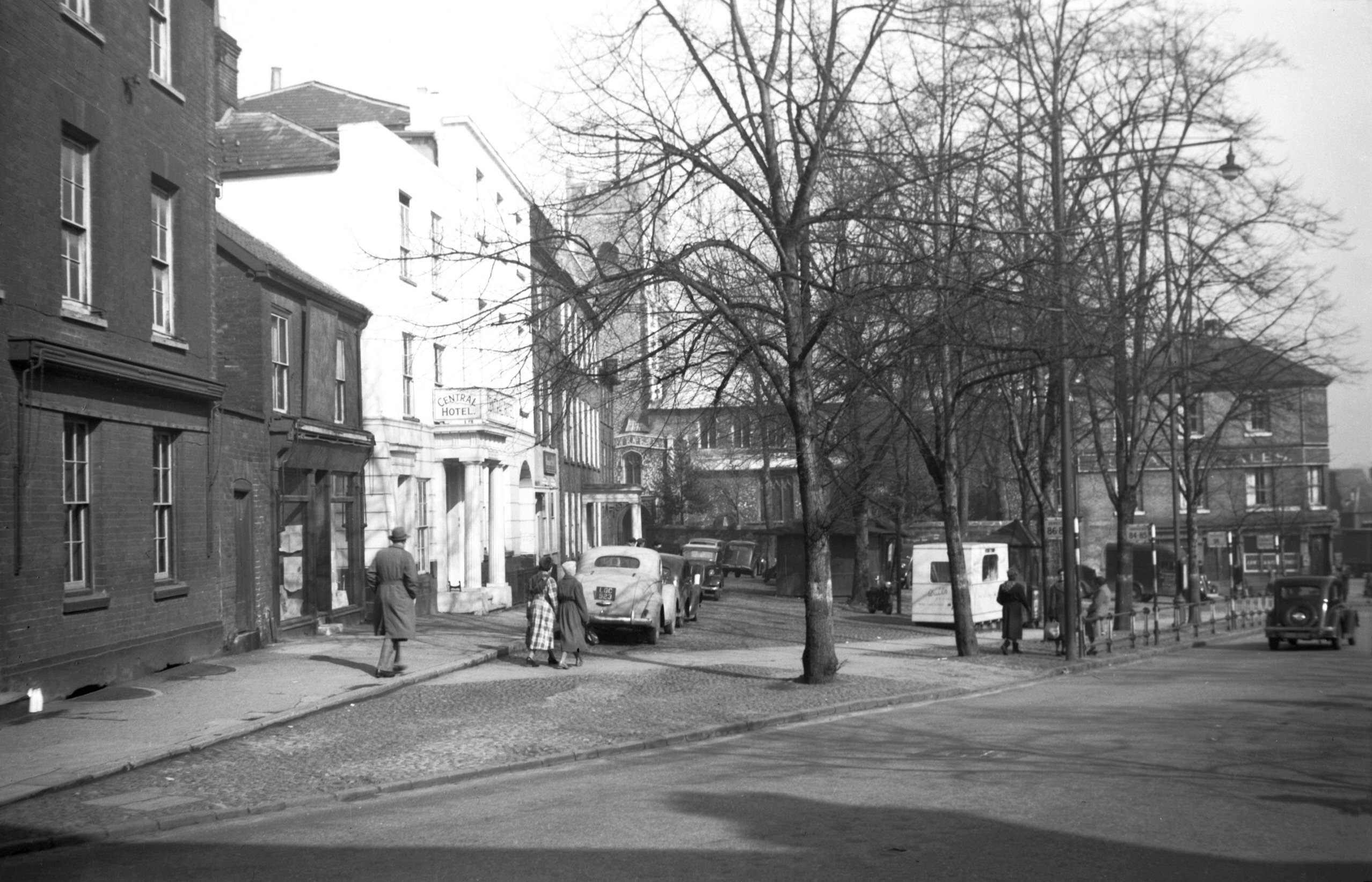
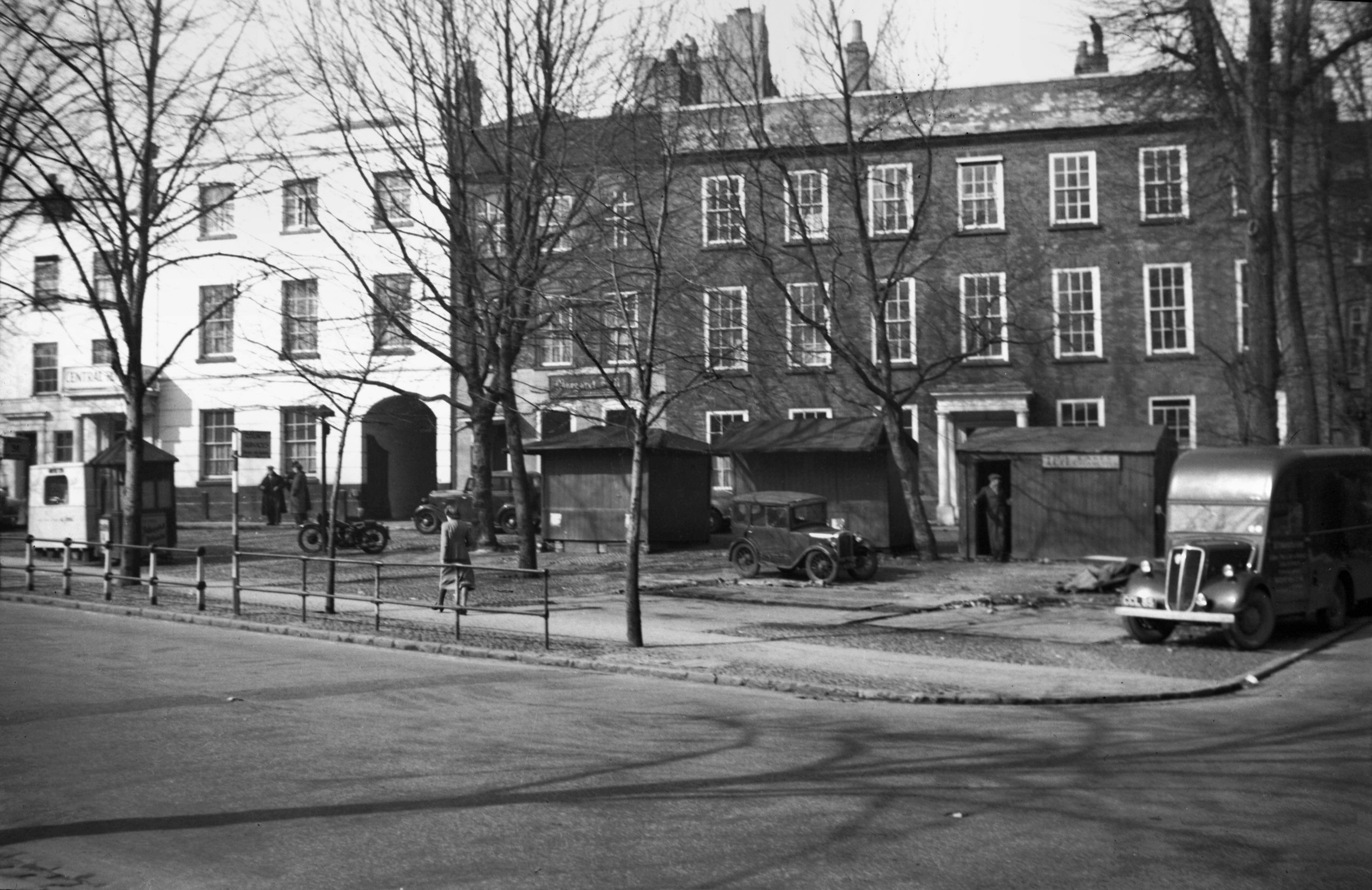
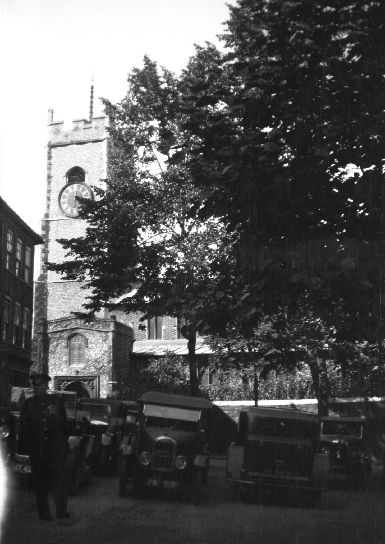
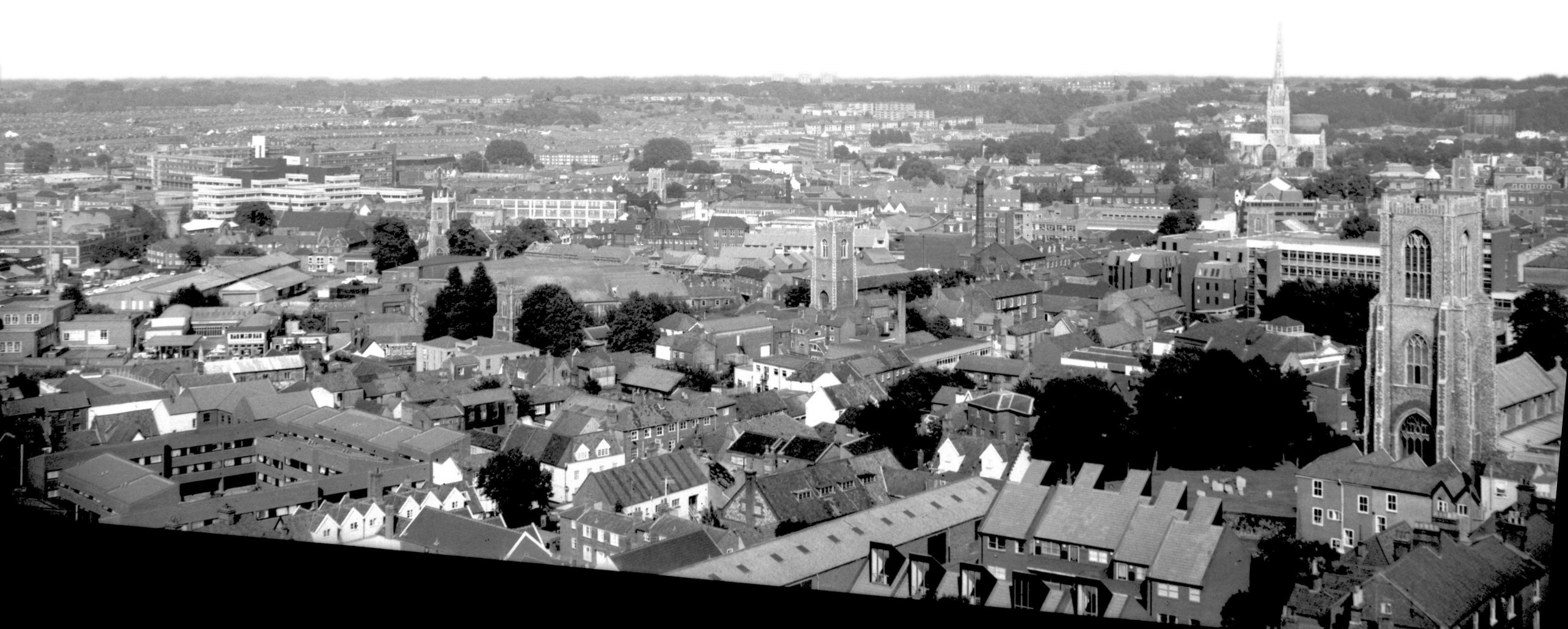
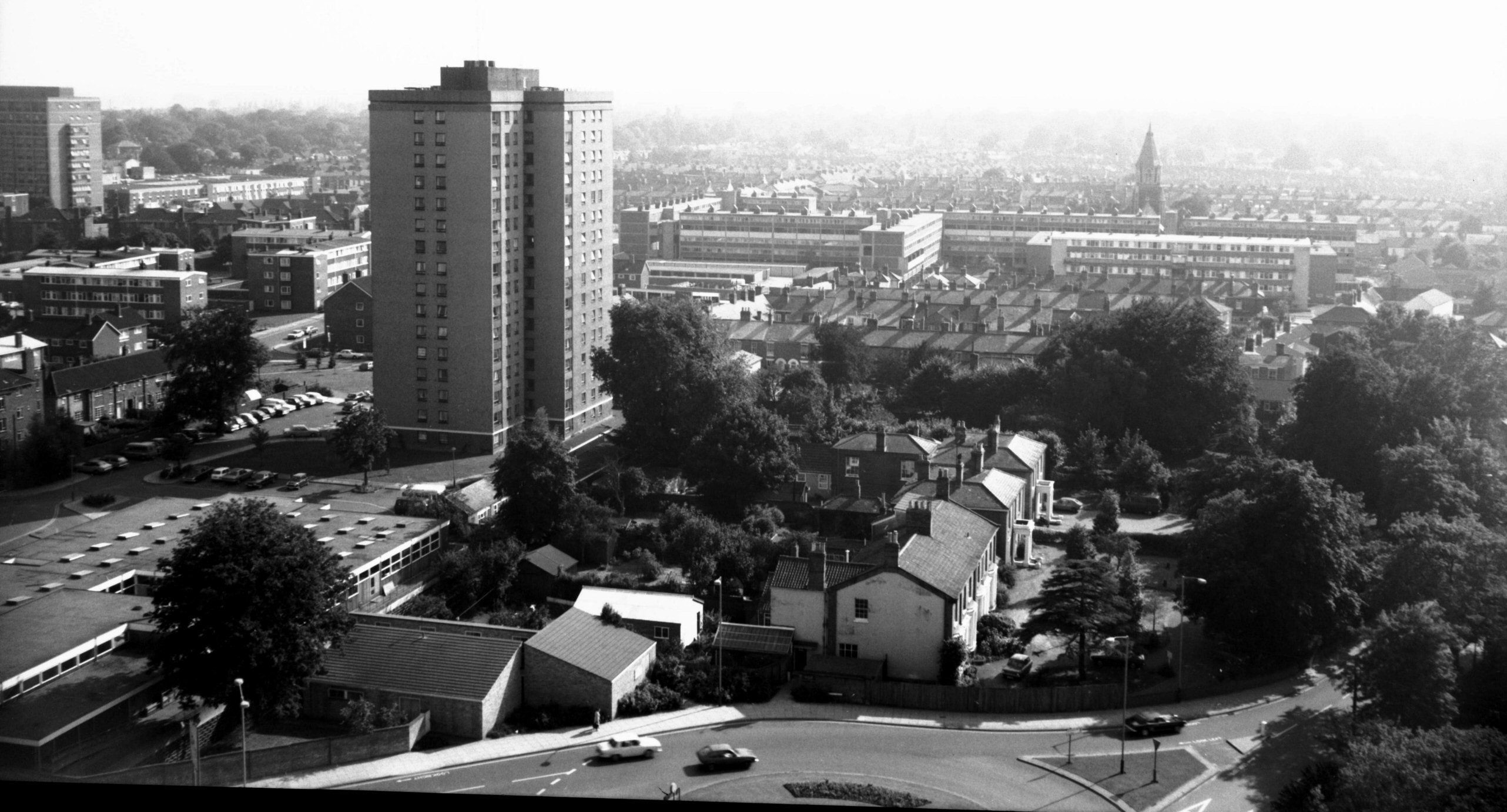
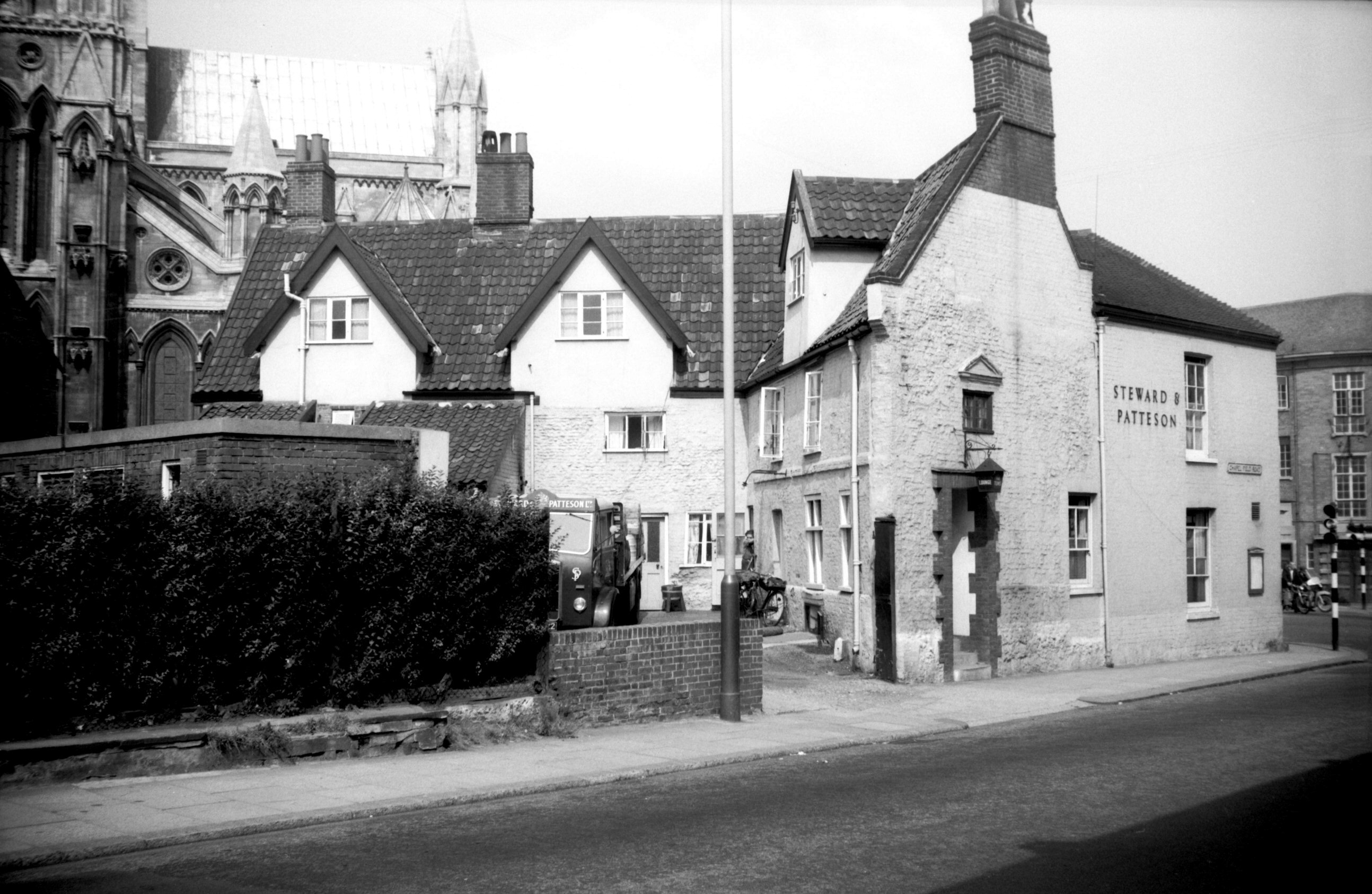
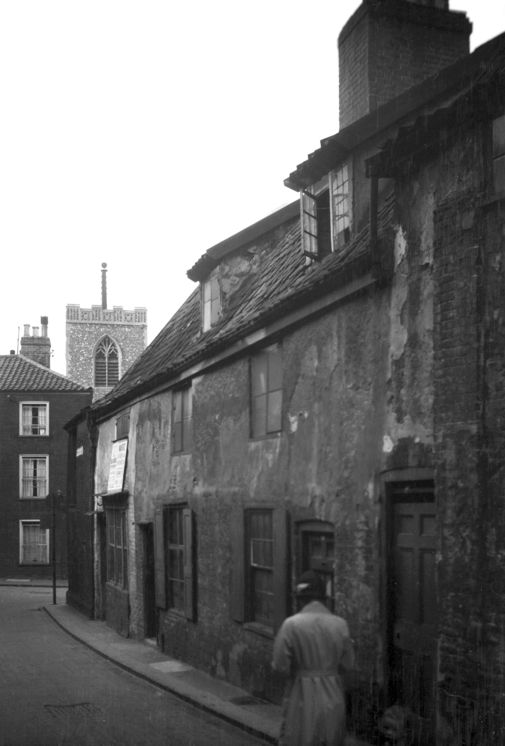
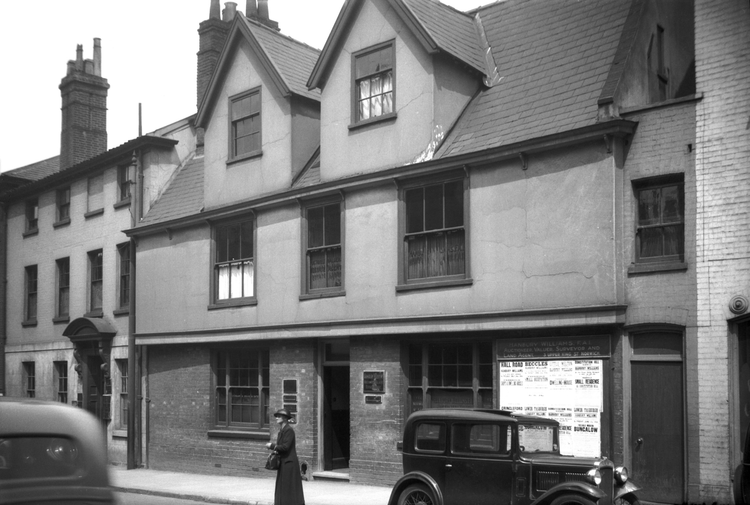
Tombland view north from Upper King St [3982]
1951-04-14
To trace the history of Norwich Market it is necessary to
go back to pre-Conquest times. At least three
settlements, founded by the Saxons and Danes on wither
side of the Wensum, and known respectively as Northwic,
Westwic and Conesford, grew and finally amalgamated into
one community. They sprang up adjacent to the crossing of
two roads - the one running from north to south and
passing over the Wensum at Fyebridge, the other running
from east to west (Holm-street - now Bishopgate - and
Westwick Way). The crossing was at a point just south of
Fyebridge on a site now called Tombland, and here the
Saxon Market seems to have been originally established. |
|
|
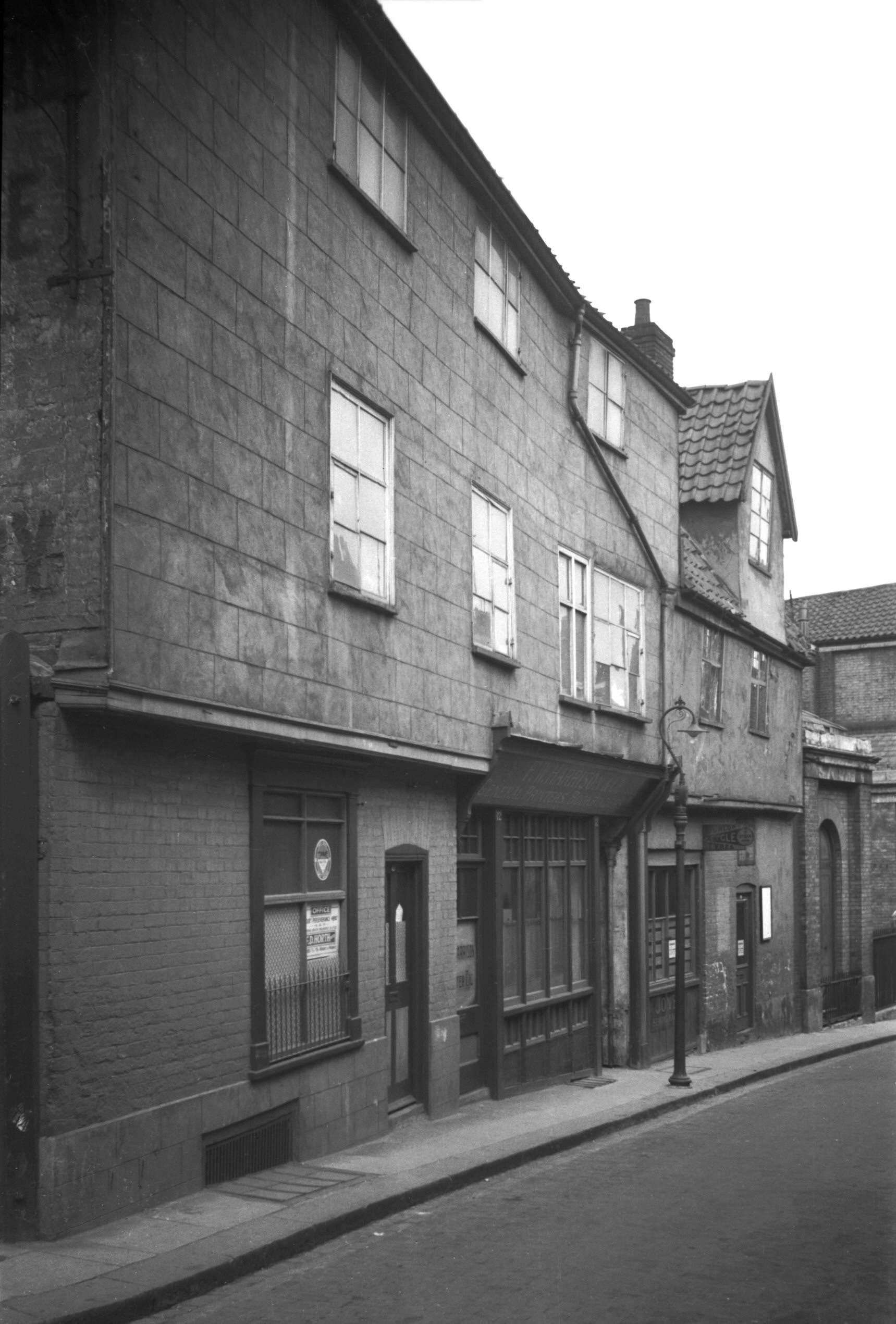
Tombland 1 [4431] 1956-05-15
|
|
|
Tombland 1 and left Queen St 12 [4275] 1954-08-25
|
|
|
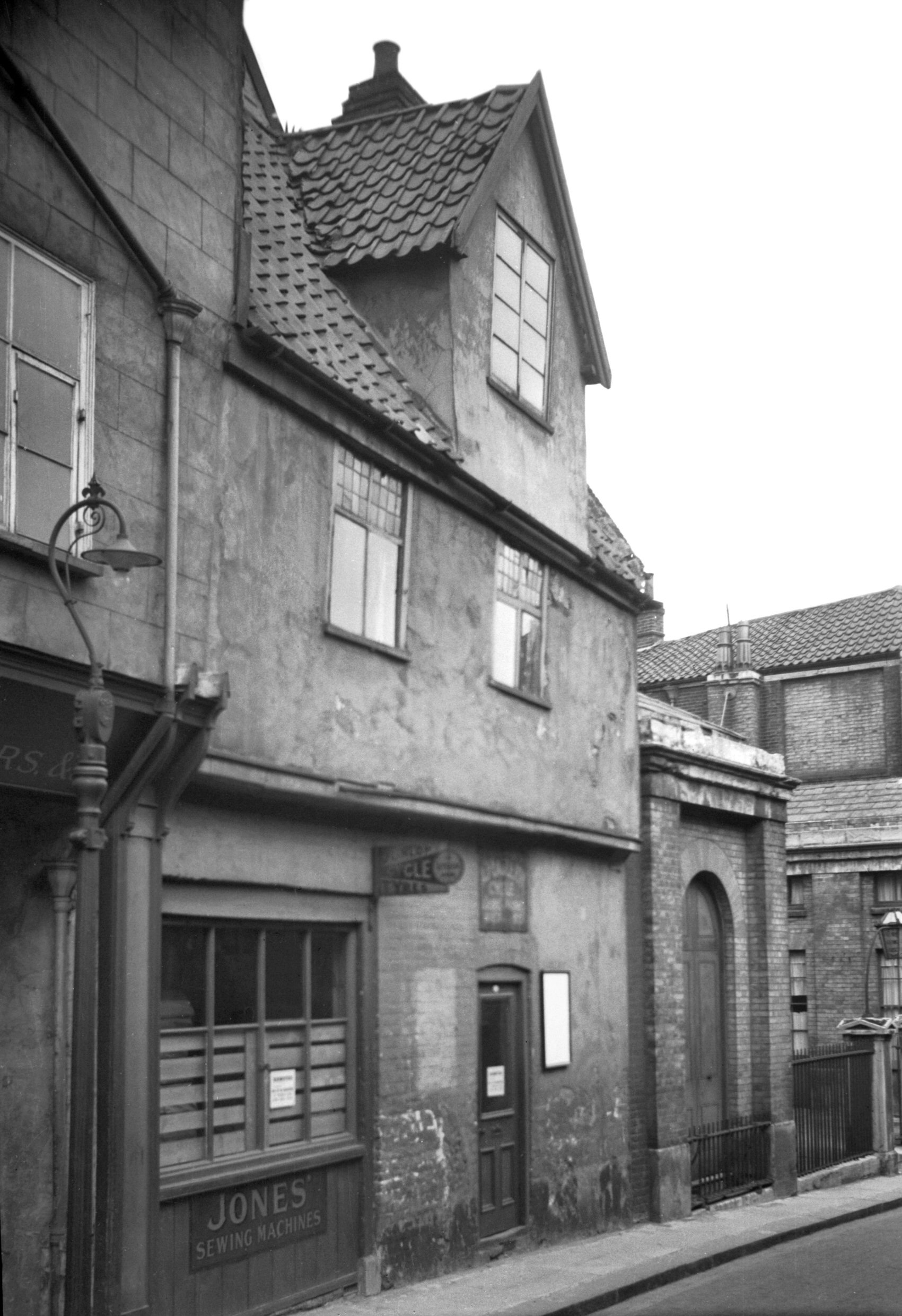
Tombland view SW [3986] 1951-04-19
|
|
|
Tombland view west [3981] 1951-04-14
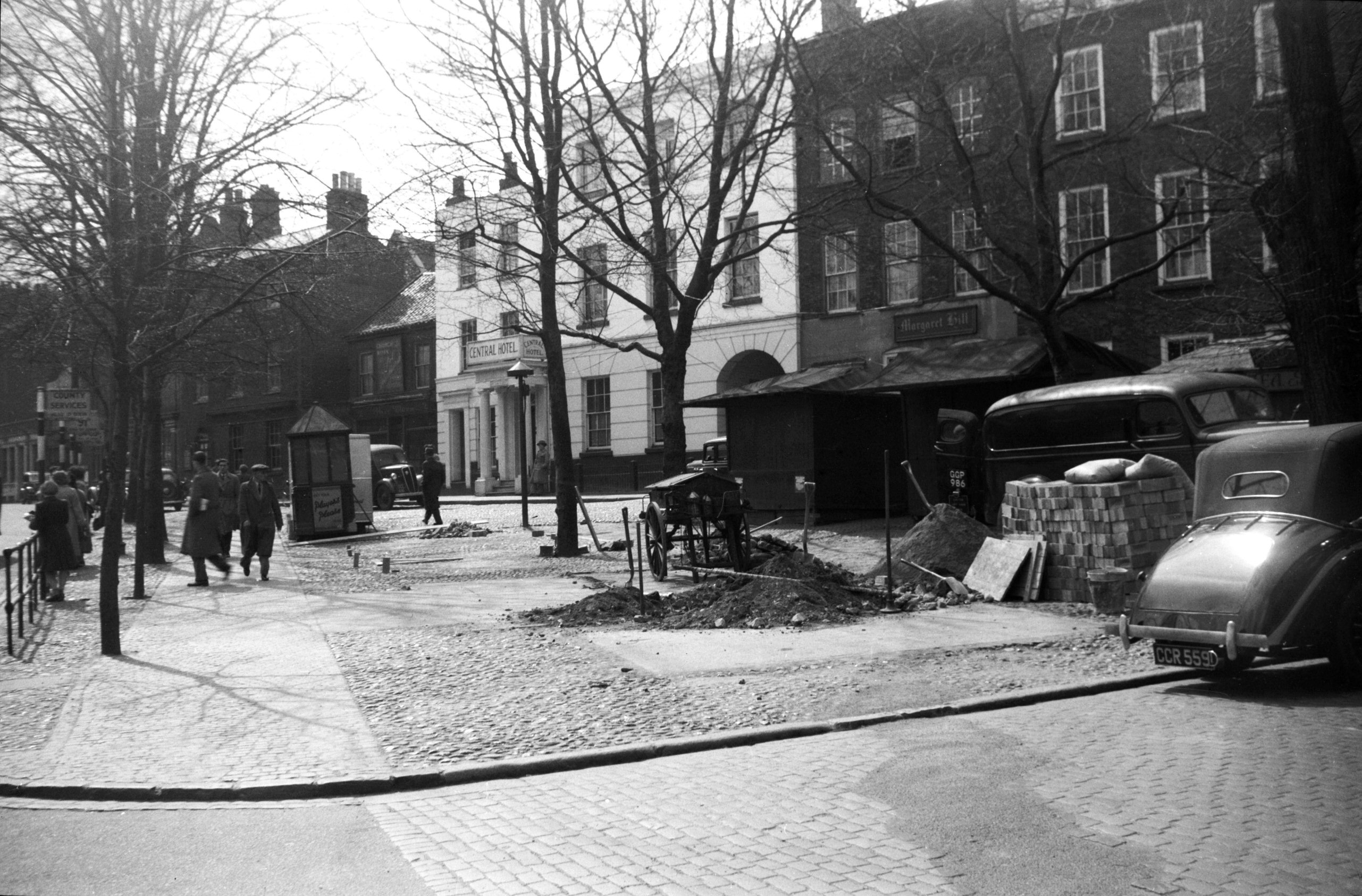
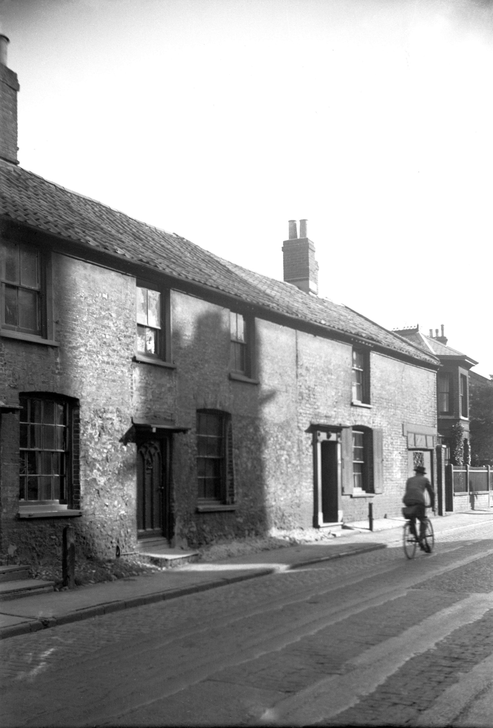
Tombland (from the Danish meaning an open piece of land)
has been an open space since Saxon times. In 1951 the
City Council decided to erect stalls here on brick and
concrete foundations. The old wooden stalls were set back
from their original sites in preparation for the new
work, but at the last moment the Norwich Society obtained
an injunction restraining the Corporation from carrying
out their decision, and the old stalls were instead
replaced by mobile vans. |
|
|
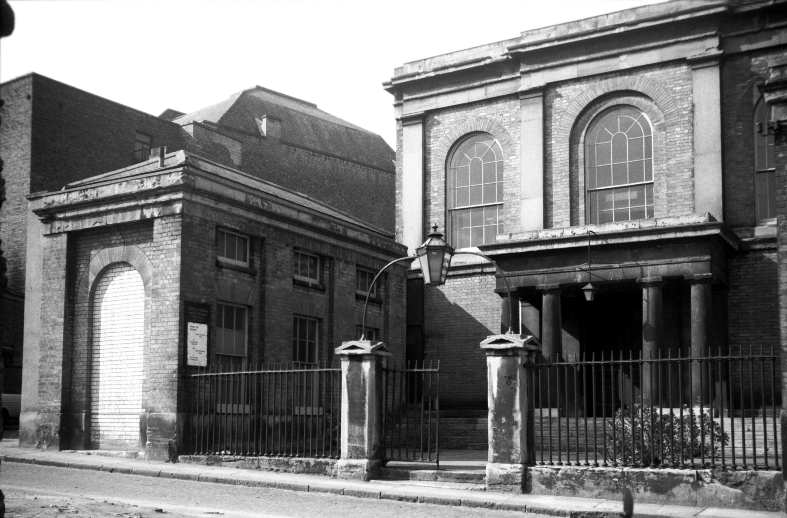
Tombland 3 [5248] 1969-04-08
|
|
|
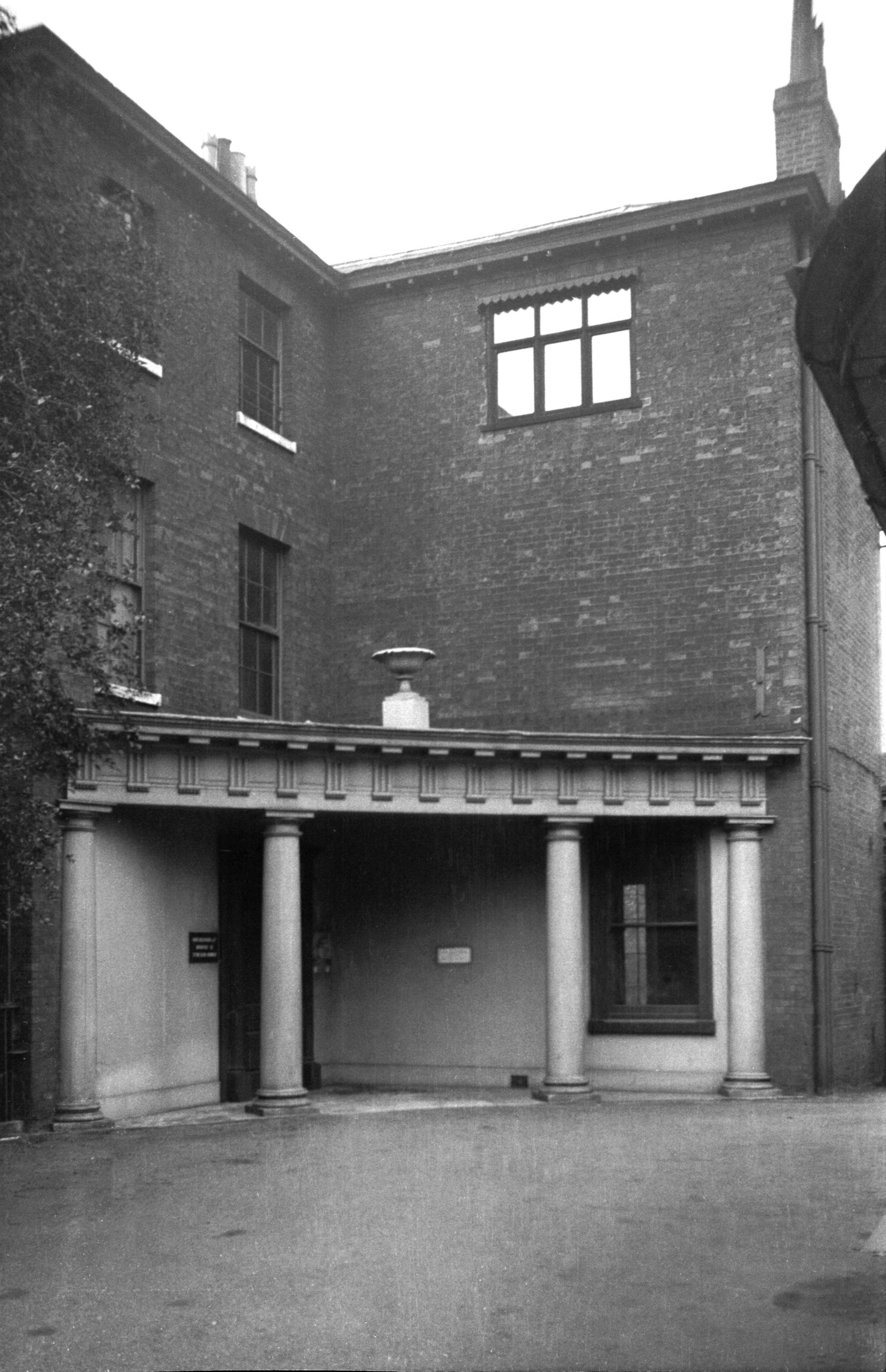
Tombland 3 Regency Georgian portico [6641] 1990-09-26
|
|
|
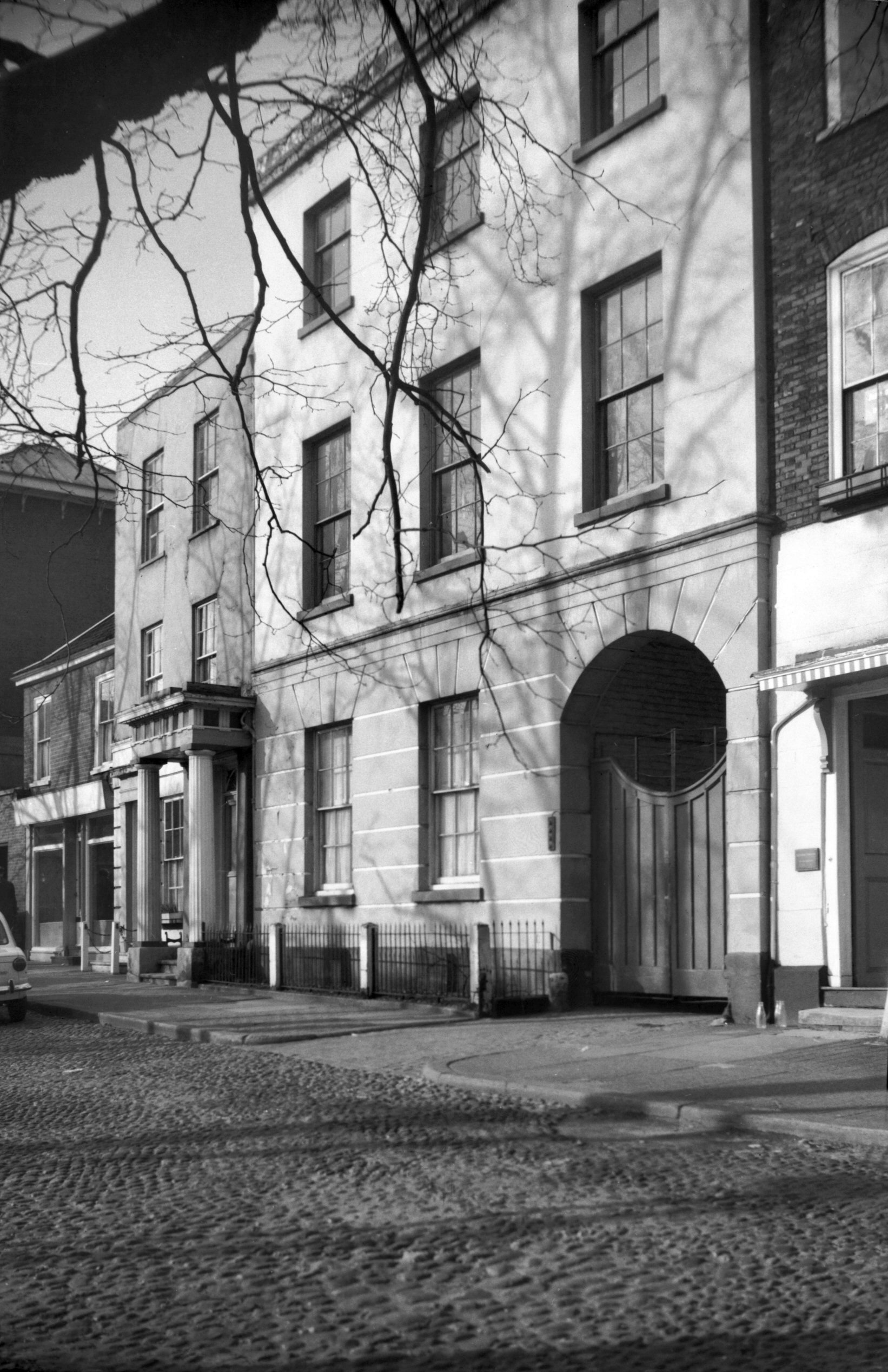
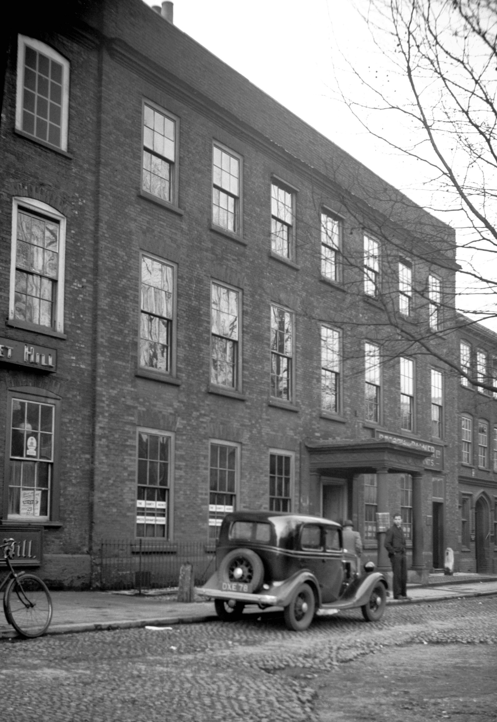
Tombland 4 to 6 [1096] 1936-07-12
|
|
|
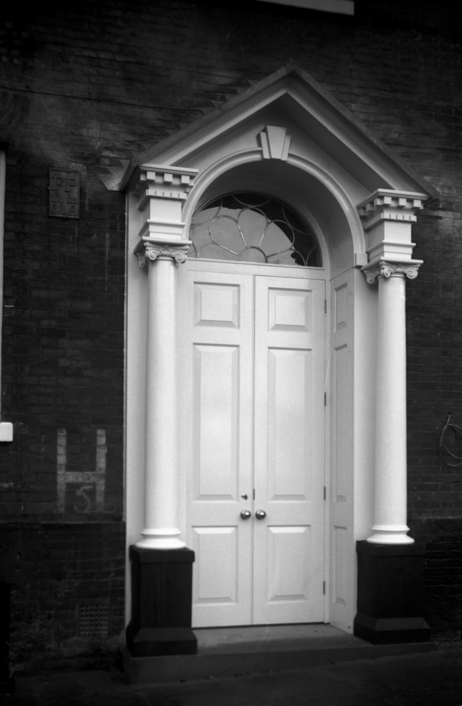
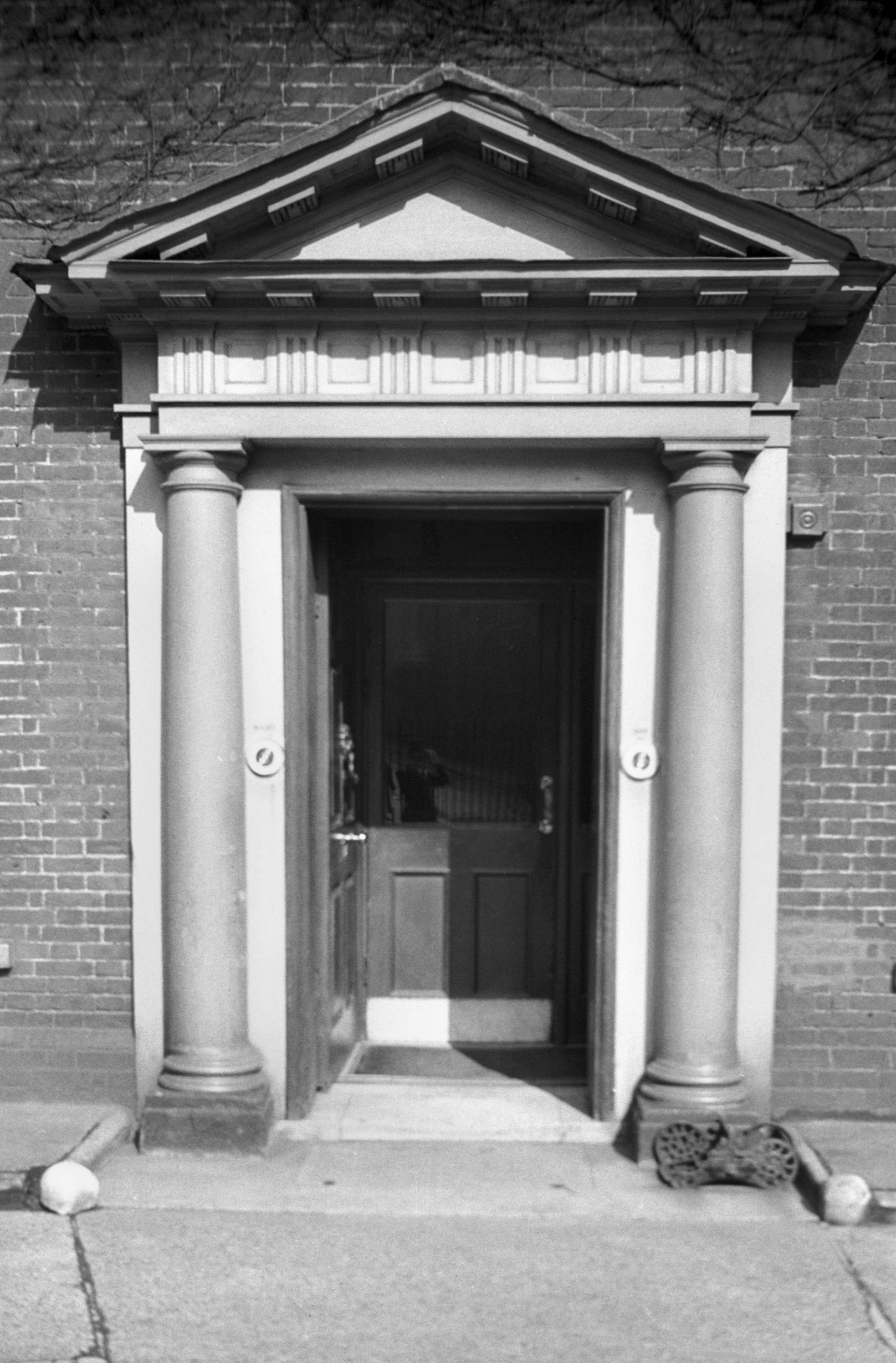
Tombland 5 [2071] 1938-01-17
|
|
|
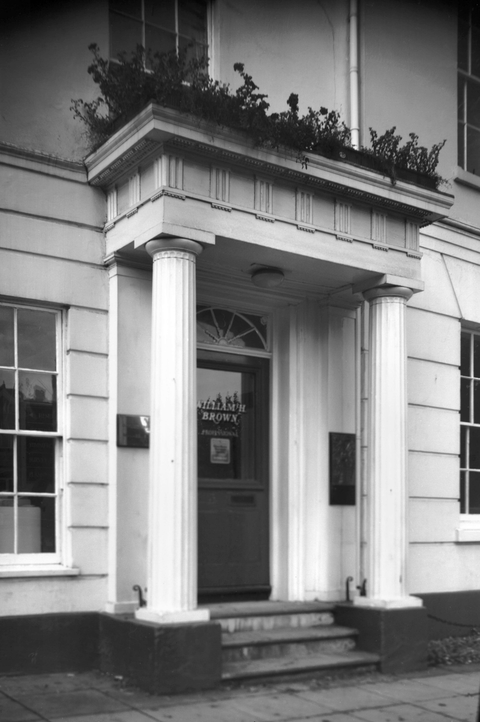
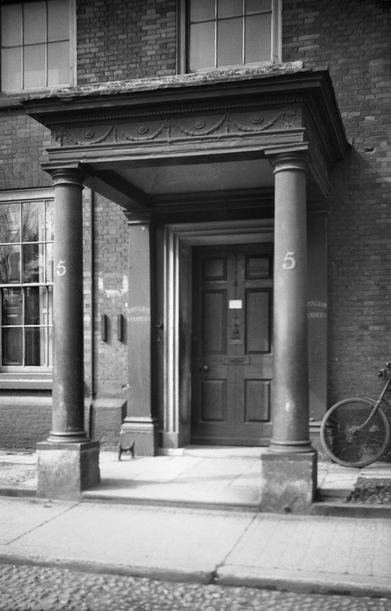
Tombland 5 Georgian doorway portico [0474] 1935-04-20
|
| |
|
|
|
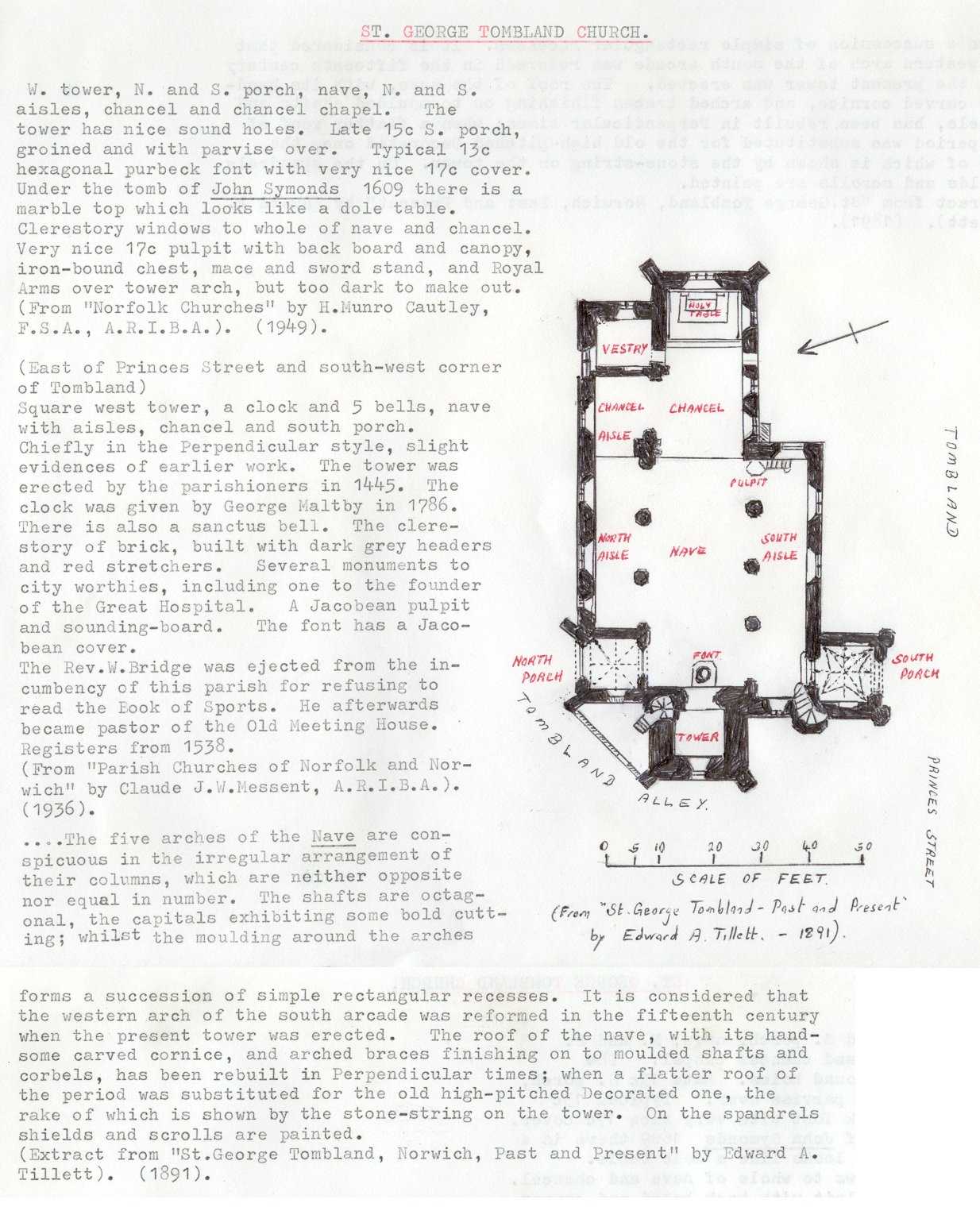
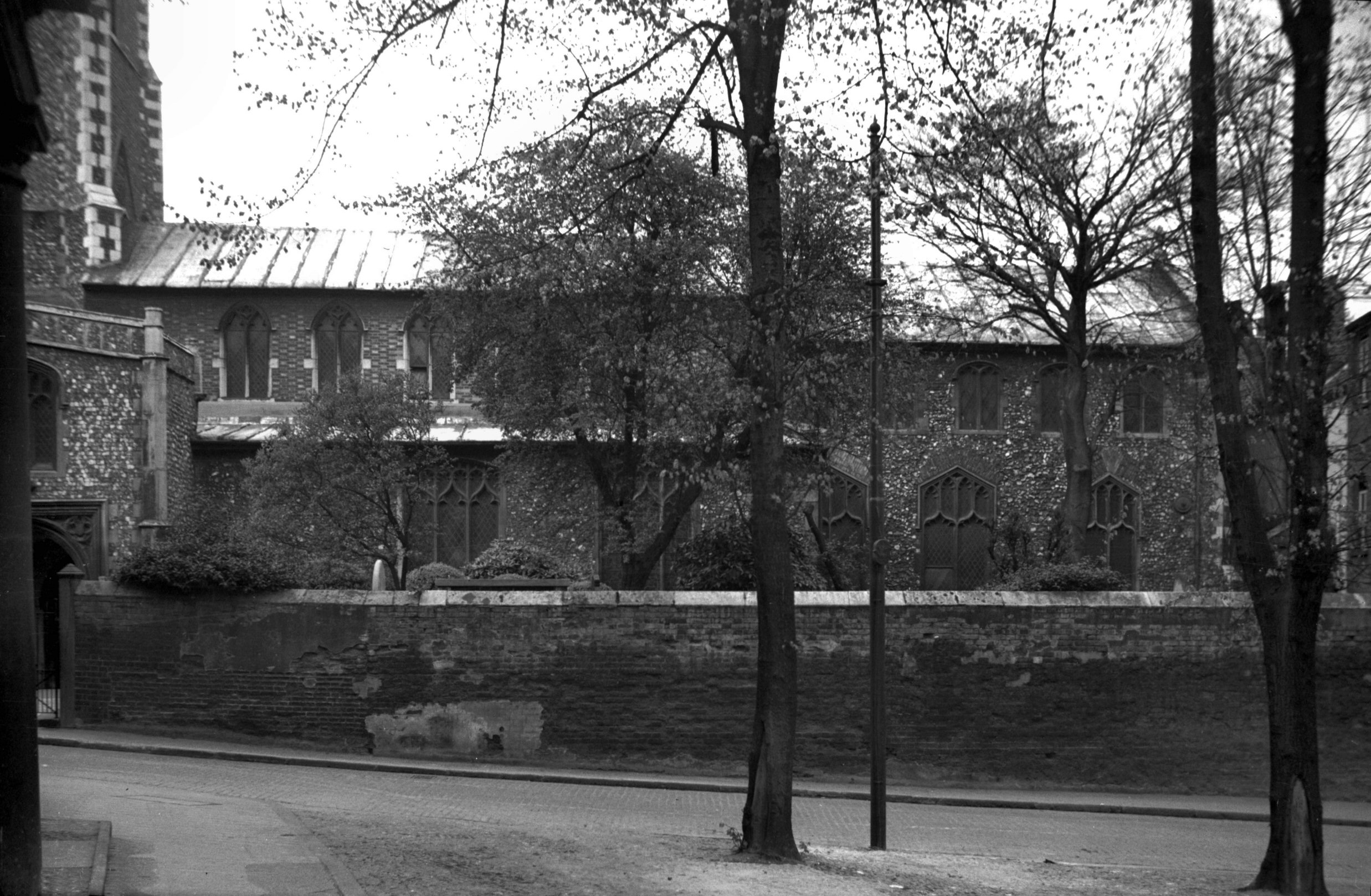
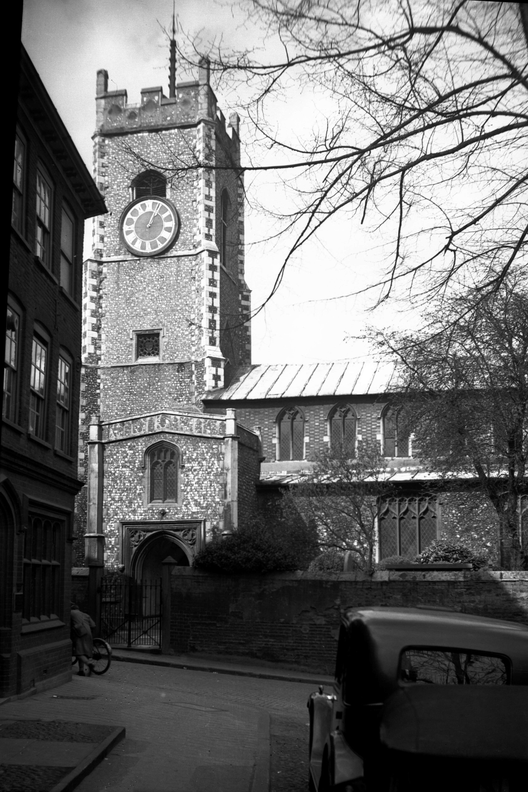
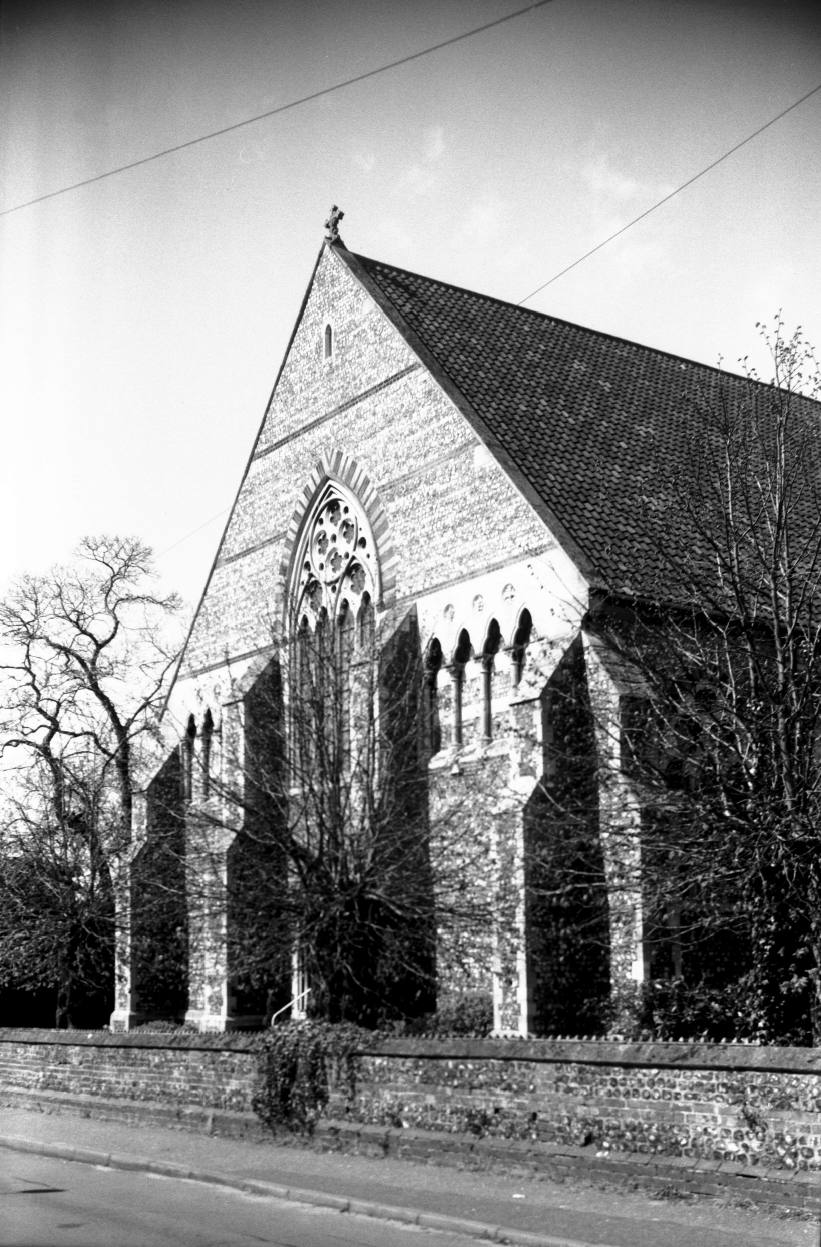
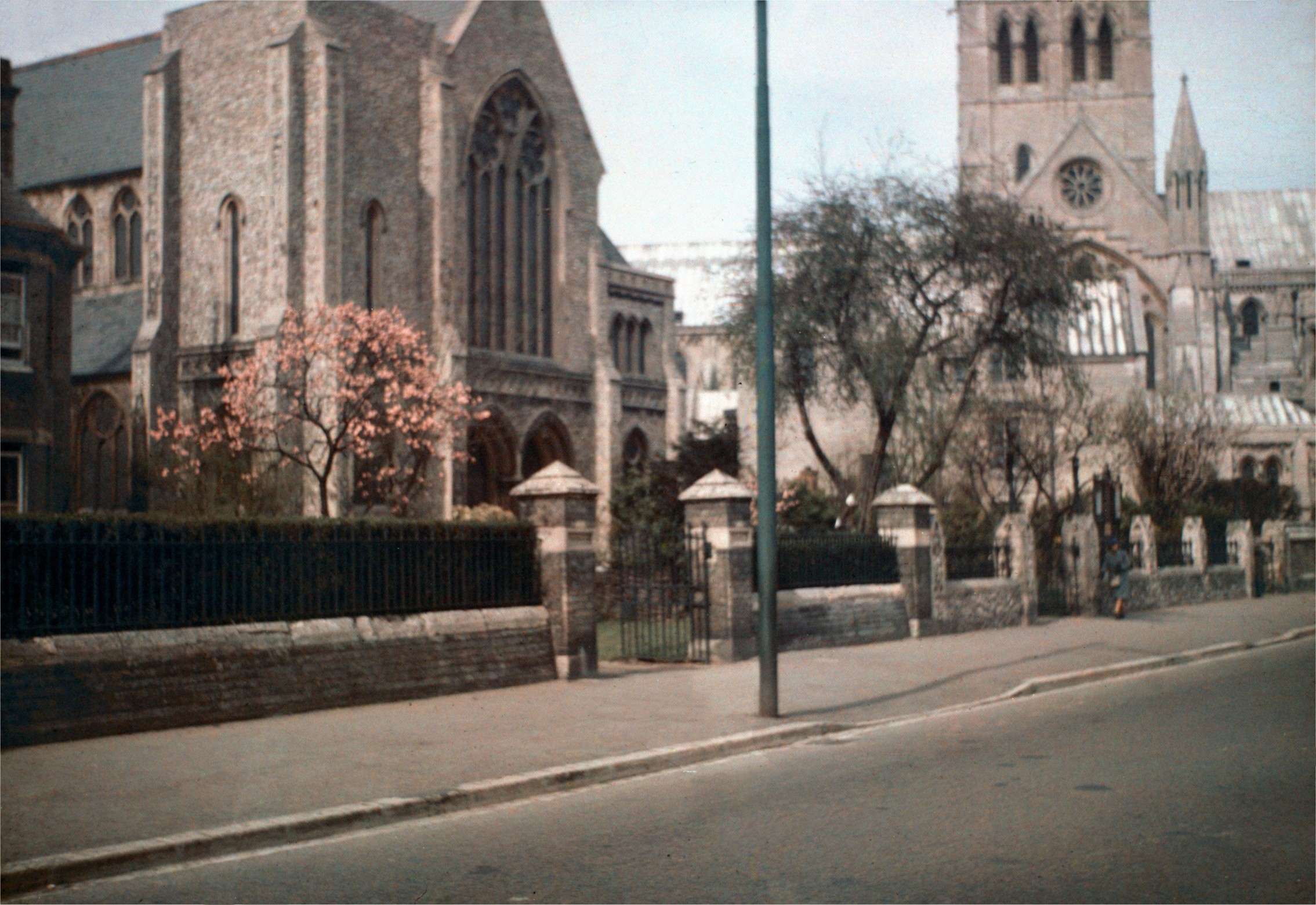
St George Tombland south side from Tombland [2268]
1938-04-07
"W tower, N and S porch, nave, N and S aisles,
chancel and chancel chapel. The tower has nice sound
holes. Late 15c S porch, groined and with parvise over.
Typical 13c hexagonal Purbeck font with very nice 17c
cover. Under the tomb of John Symonds 1609 there is a
marble top which looks like a dole table. Clerestory
windows to whole of nave and chancel. Very nice 17c
pulpit with back board and canopy, iron-bound chest, mace
and sword stand, and Royal Arms over tower arch, but too
dark to make out." (H.Munro Cautley F.S.A.
A.R.I.B.A. in Norfolk Churches, 1949).
"East of Princes St and south-west corner of
Tombland. Square west tower, a clock and 5 bells, nave
with aisles, Chancel and south porch. Chiefly in the
Perpendicular style, slight evidences of earlier work.
The tower was erected by the parishioners in 1445. The
clock was given by George Maltby in 1786. There is also a
sanctus bell. The clerestory of brick, built with dark
grey headers and red stretchers. Several monuments to
city worthies, including one to the founder of the Great
Hospital. A Jacobean pulpit and sounding-board. The font
has a Jacobean cover. The Rev W.Bridge was ejected from
the incumbency of this parish for refusing to read the
Book of Sports. He afterwards became pastor of the Old
Meeting House. Registers from 1538." (Claude
J.W.Messent A.R.I.B.A. in Parish Churches of Norfolk
and Norwich, 1936).
"The five arches of the nave are conspicuous in the
irregular arrangement of their columns, which are neither
opposite nor equal in number. The shafts are octagonal,
the capitals exhibiting some bold cutting; whilst the
moulding around the arches forms a succession of simple
rectangular recesses. It is considered that the western
arch of the south arcade was reformed in the fifteenth
century when the present tower was erected. The roof of
the nave, with its hand-corbels, has been rebuilt in
Perpendicular times; when a flatter roof of the period
was substituted for the old high-pitched Decorated one,
the rake of which is shown by the stone-string on the
tower. On the spandrels shields and scrolls are
painted." (Edward A.Tillet in St George Tombland,
Norwich, Past and Present, 1891). |
|
|
St George Tombland south side from Tombland [B131]
1931-00-00
|
|
|
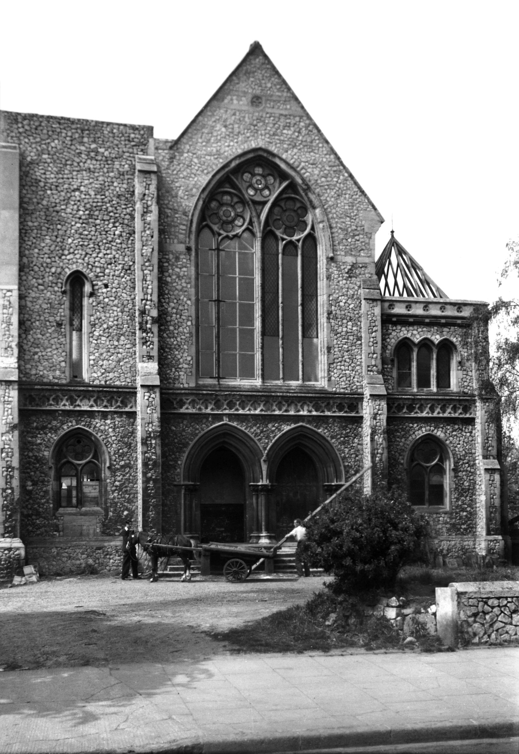
St George Tombland tower and south porch [2210]
1938-03-26
Tower built 1445. |
|
|
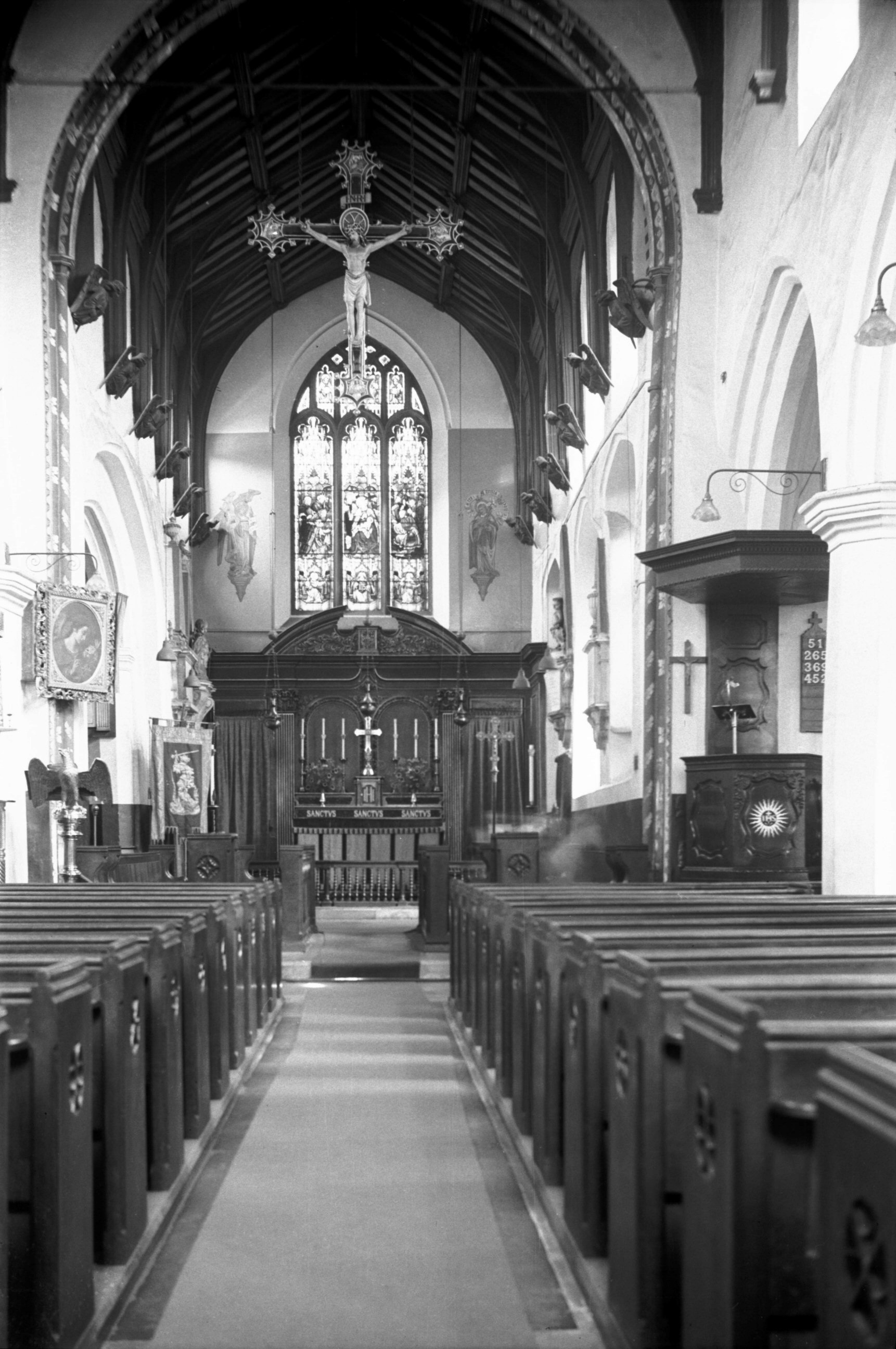
St George Tombland interior view east [1853]
1937-08-07
17c pulpit with backboard and canopy. |
|
|
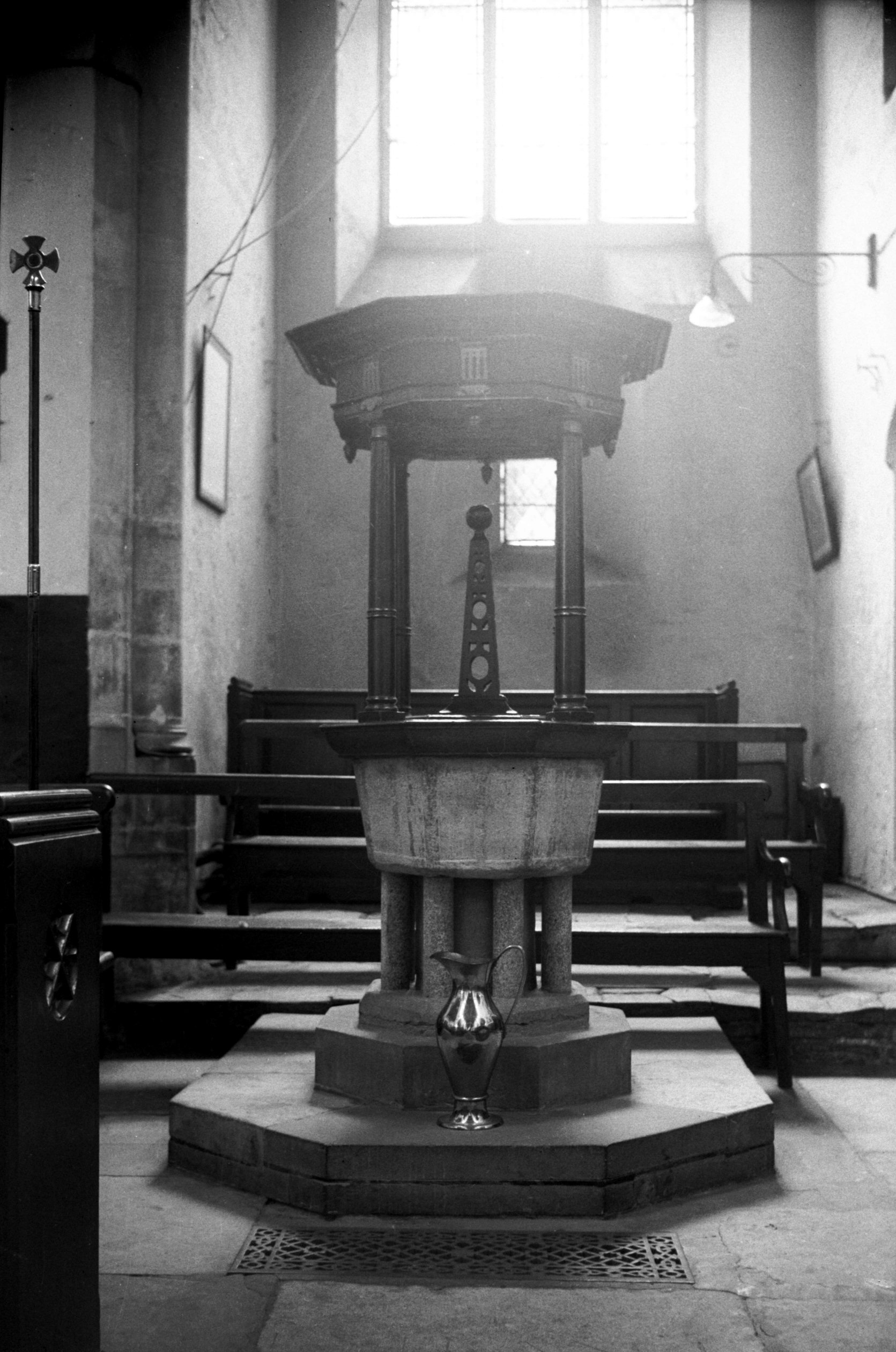
St George Tombland 13c font and 17c cover [1879]
1937-08-14
Purbeck font. |
|
|
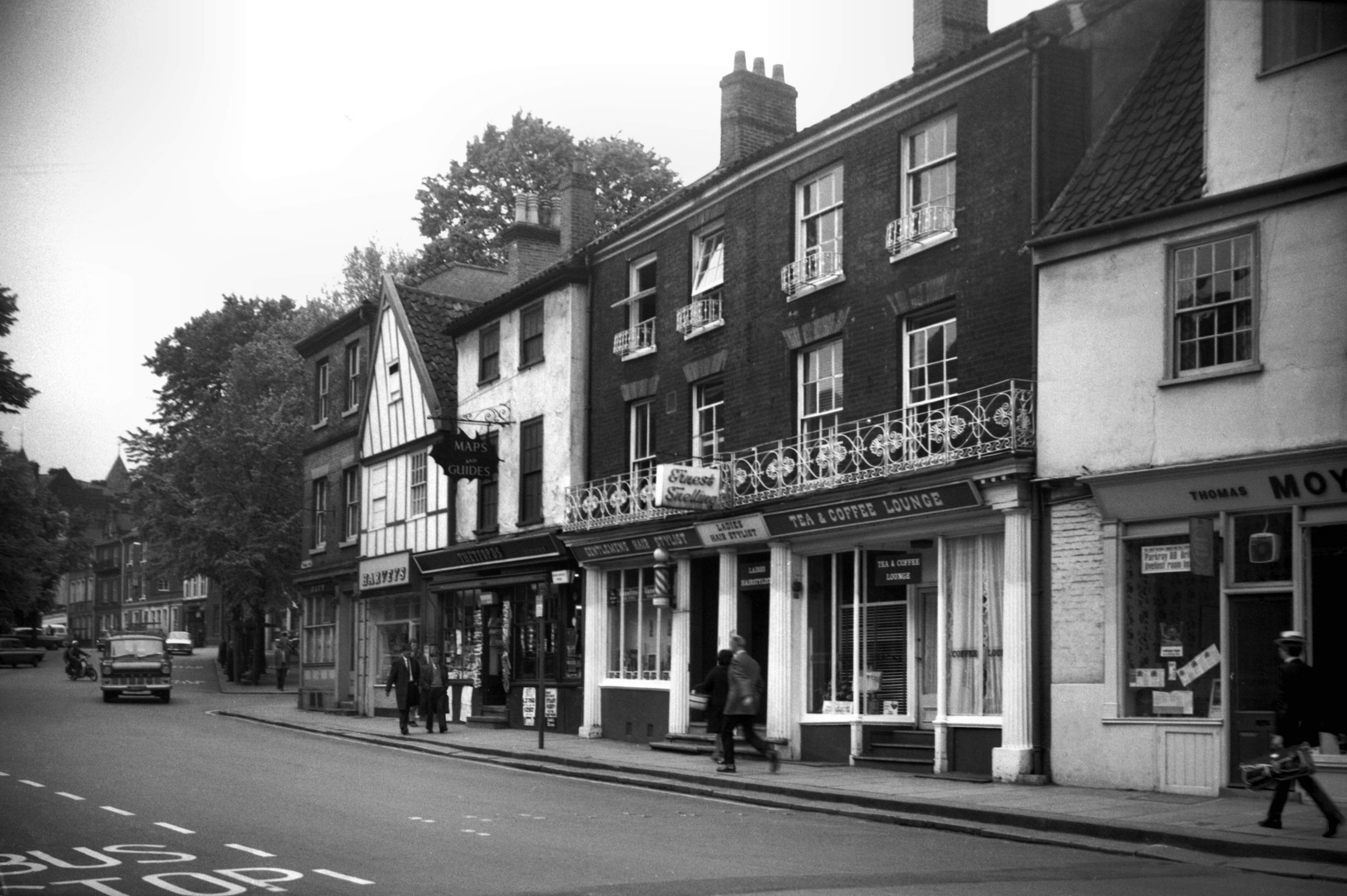
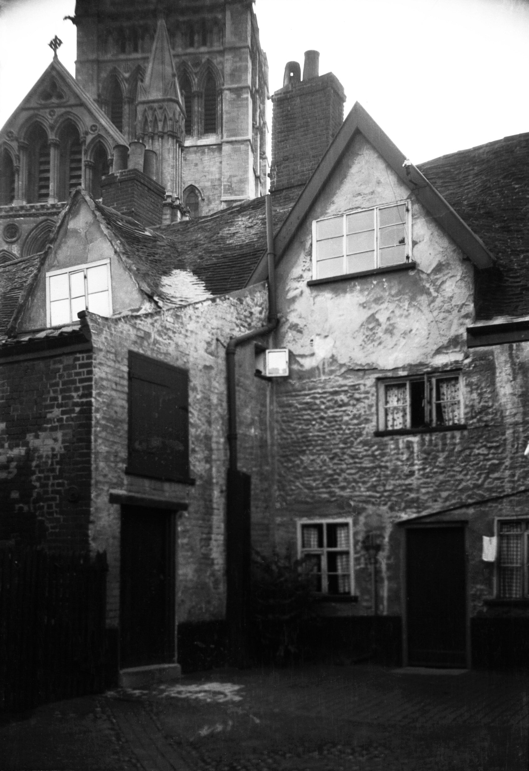
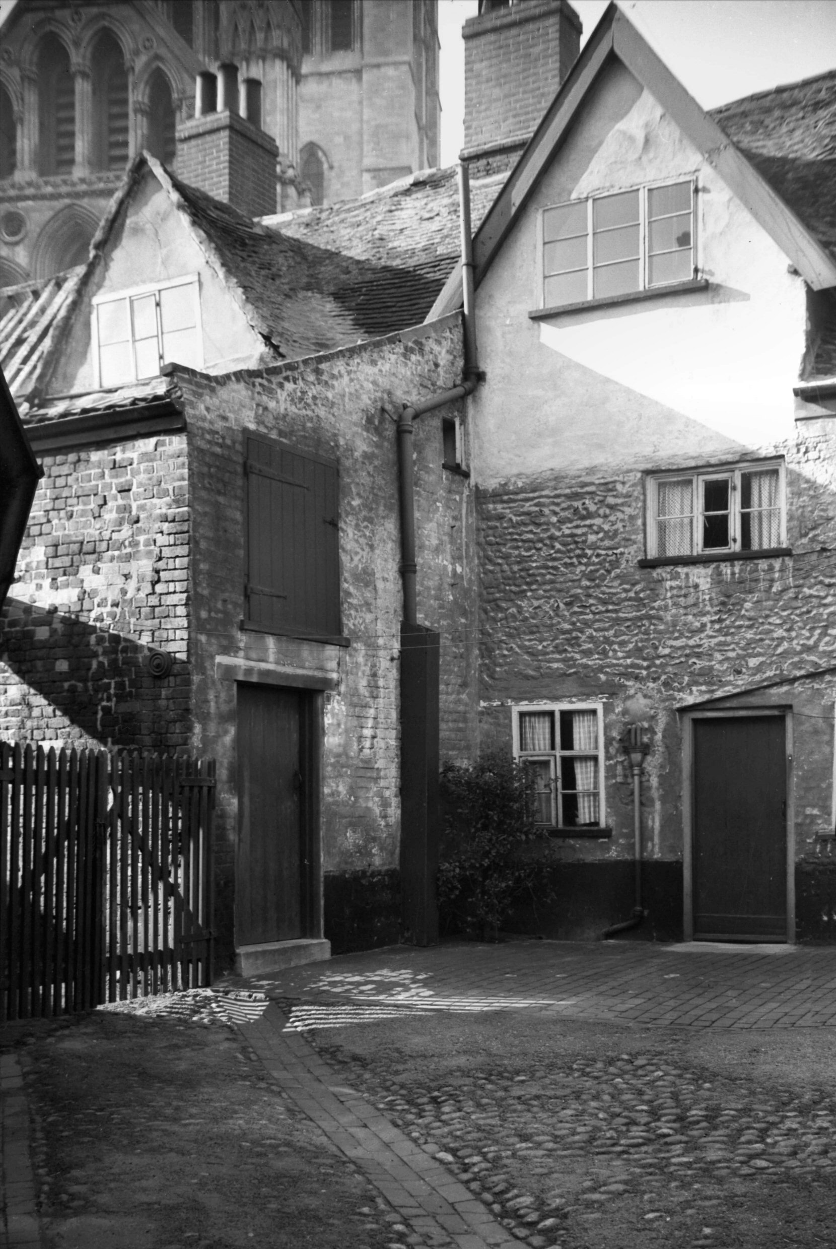
Tombland 7 to 11 [5195] 1968-05-23
|
|
|
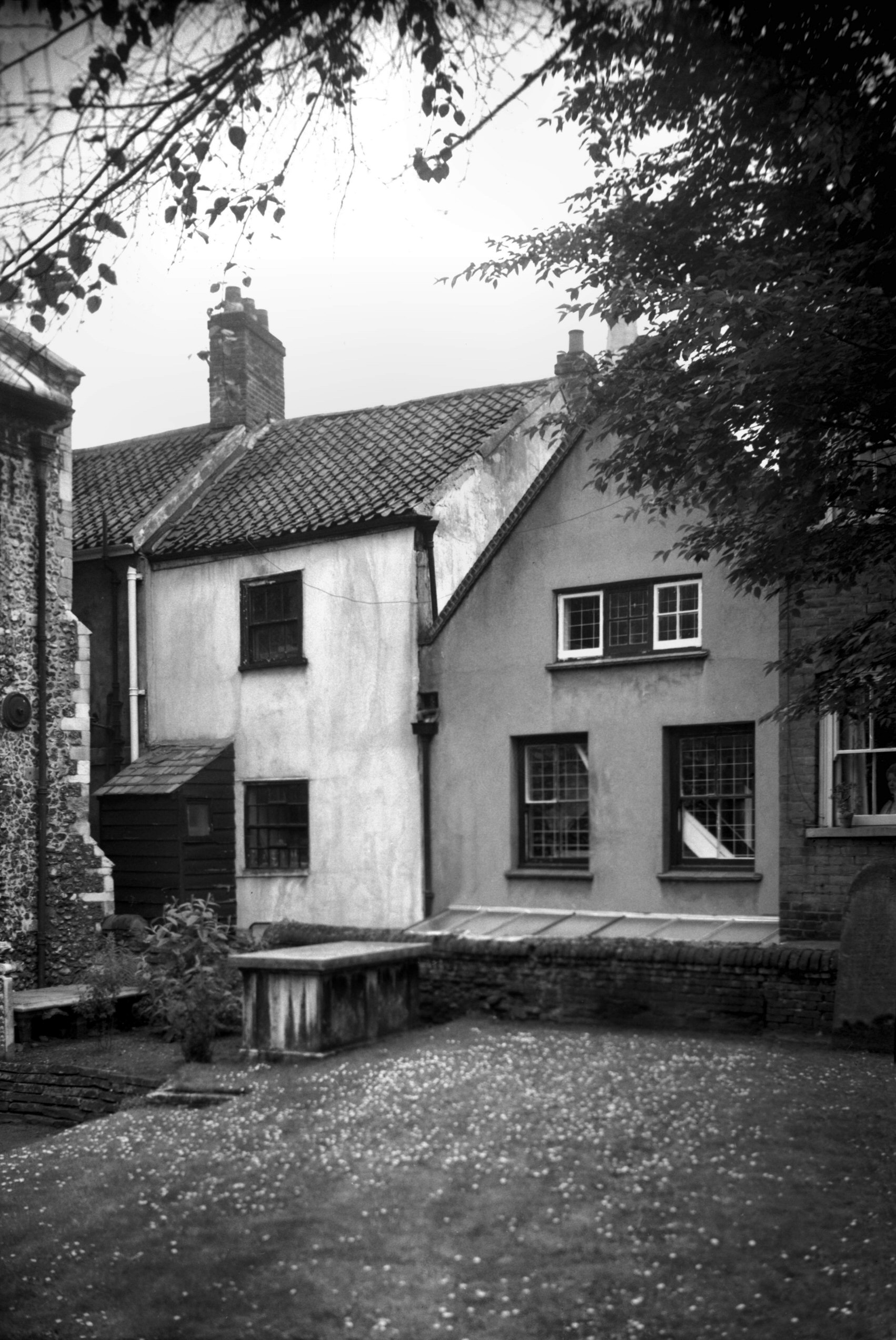
Tombland 8 to 9 [1070] 1936-07-05
|
|
|
Tombland 8 to 9 rear from churchyard [5193]
1968-05-23
|
|
|
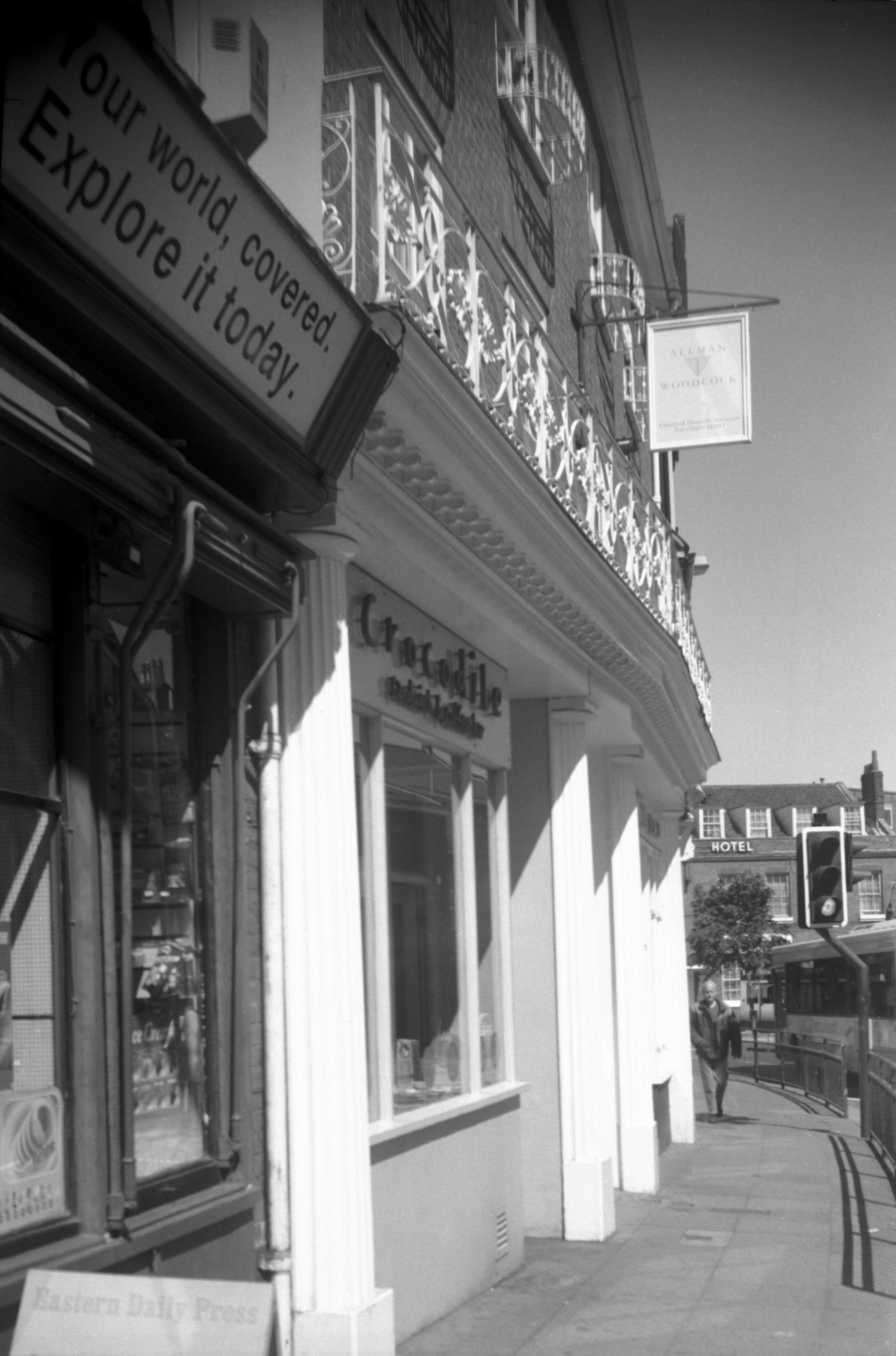
Tombland 10 to 11 shop front and balcony [7946]
2004-05-19
|
|
|
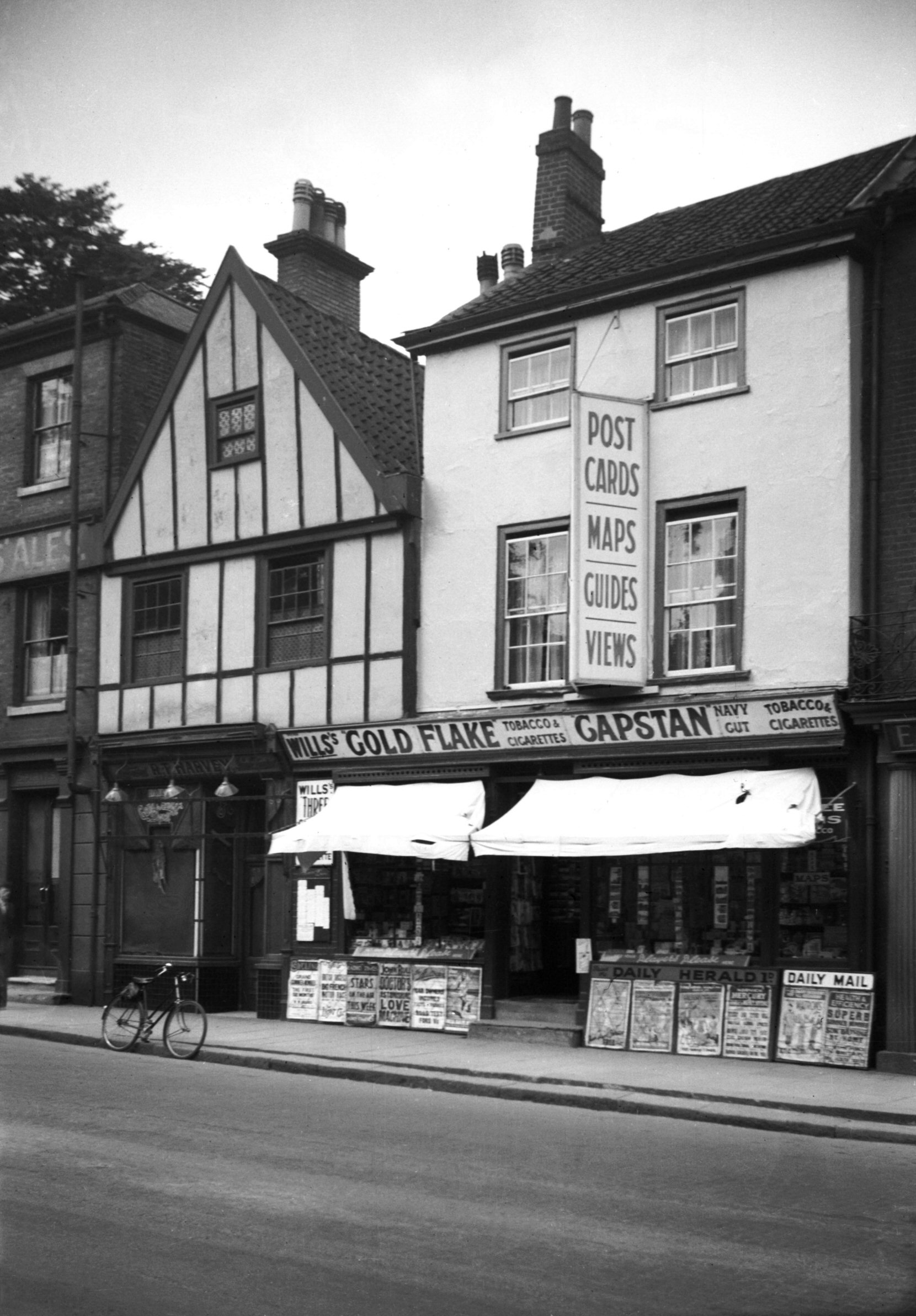
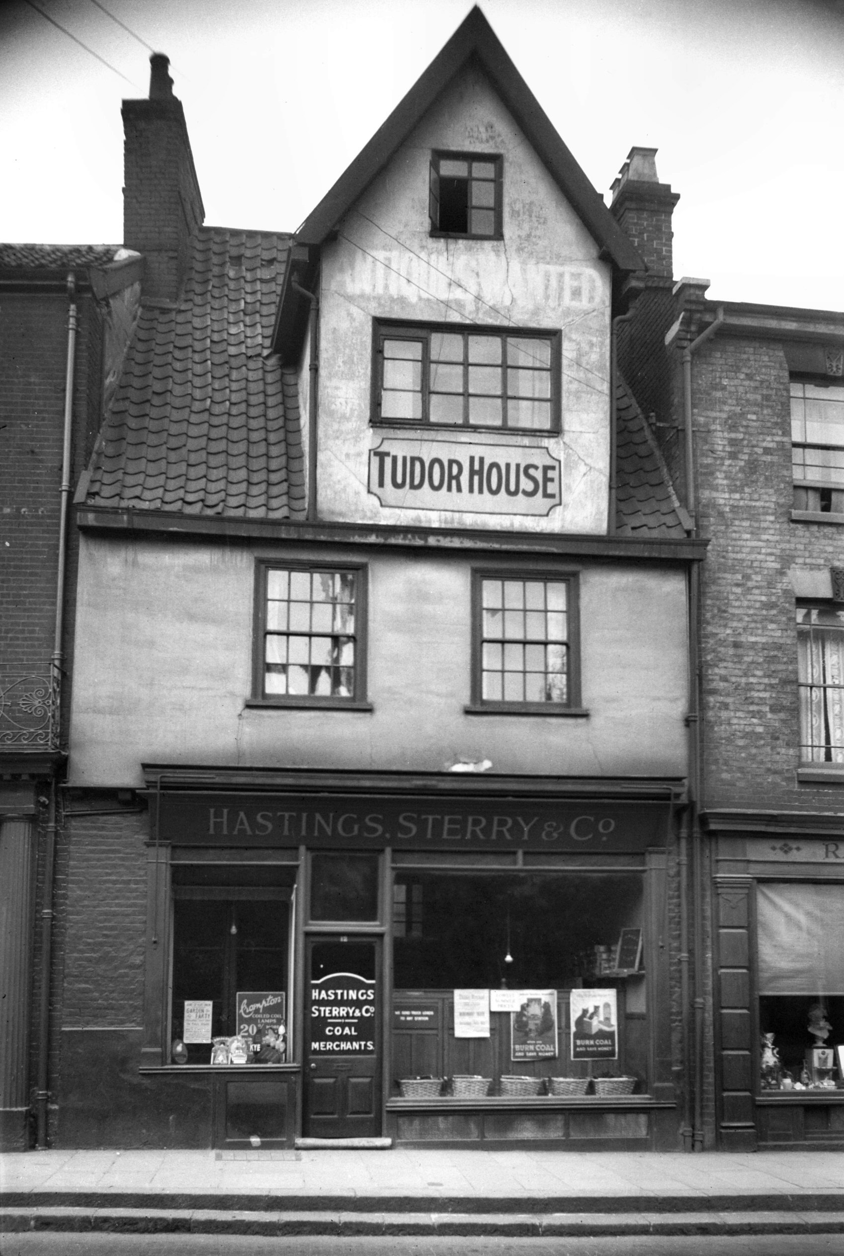
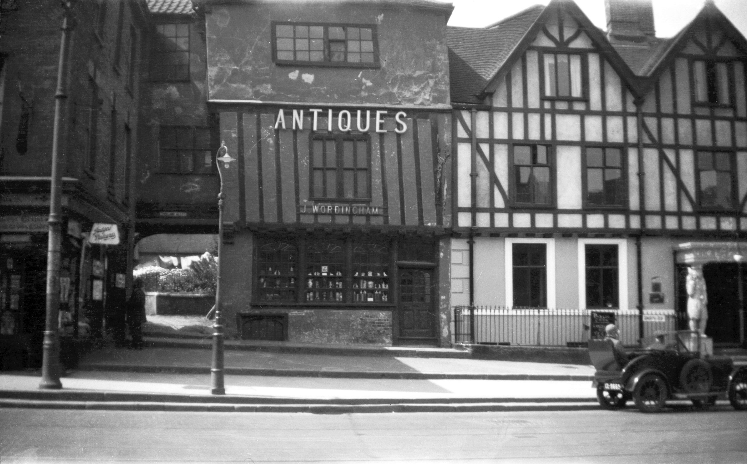
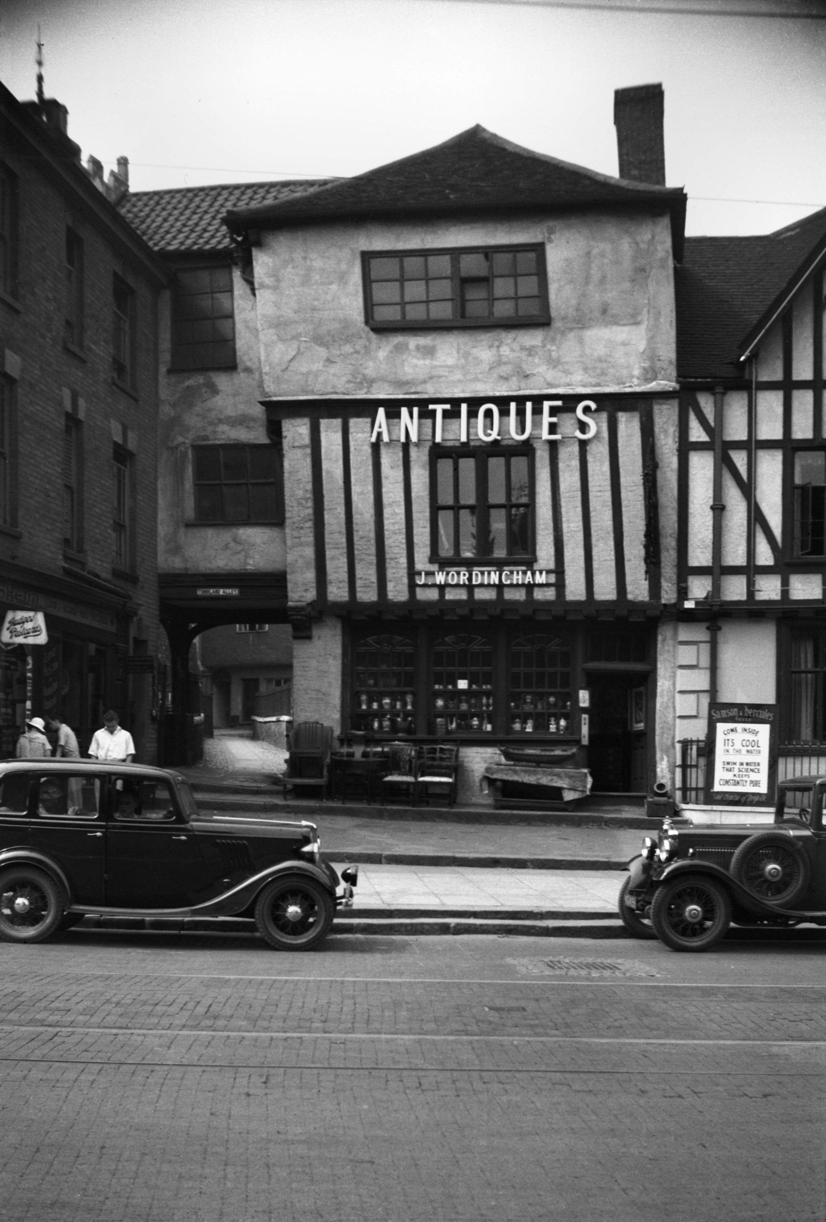
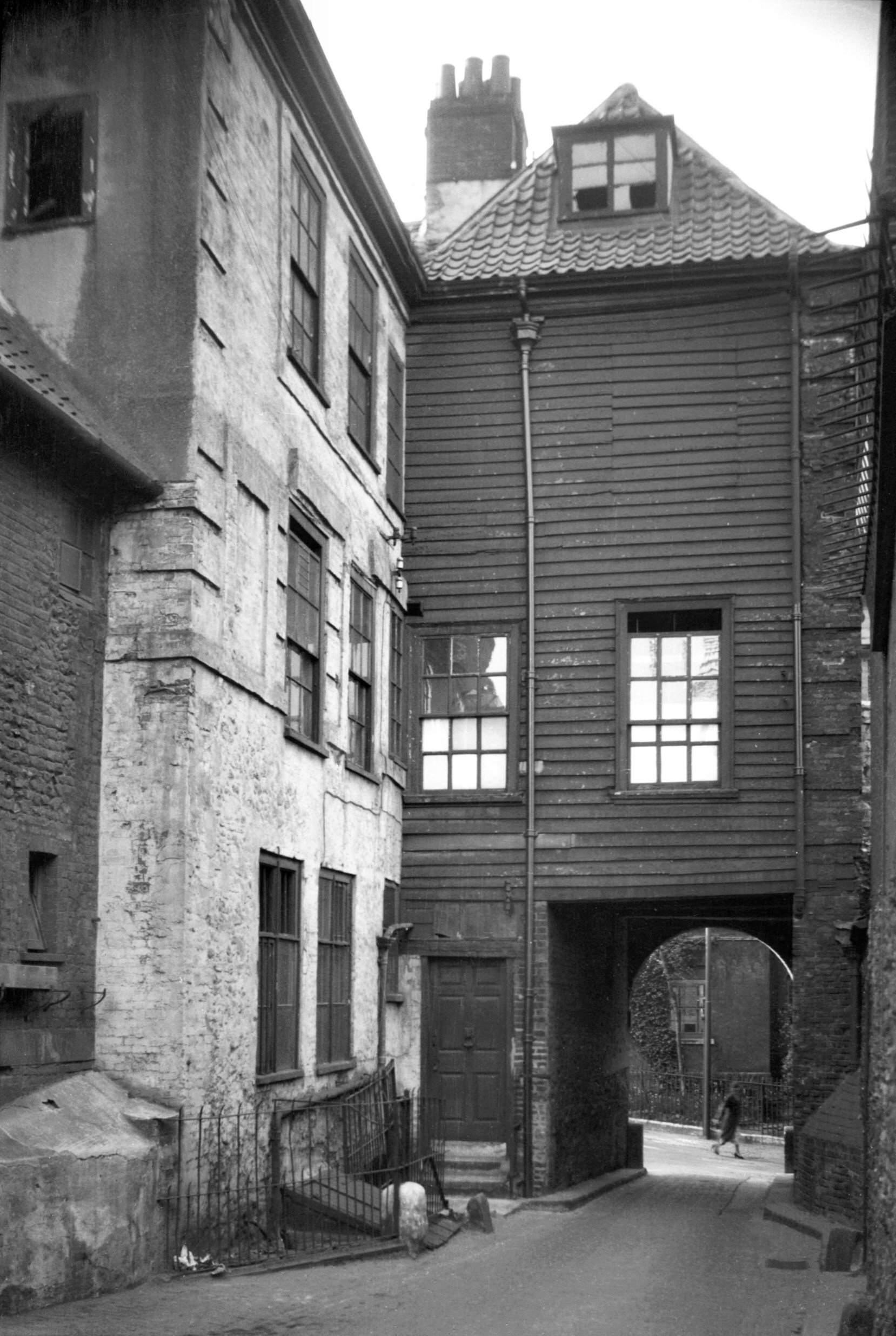
Tombland 12 Tudor House [1069] 1936-07-05
With unusual double-decker dormer. |
|
|
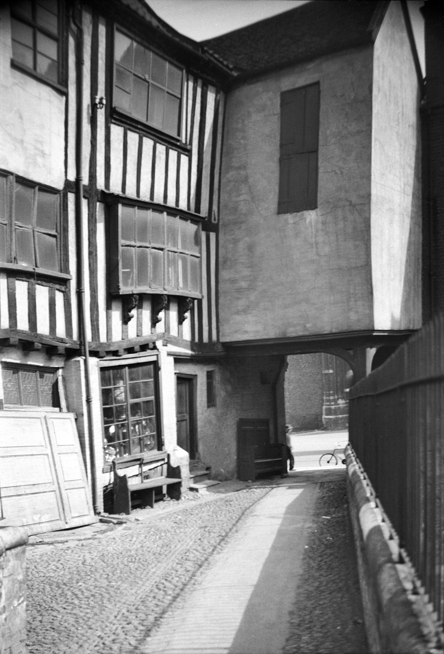
Tombland 12 to 14 rear from Tombland Alley [5197]
1968-05-24
|
|
|
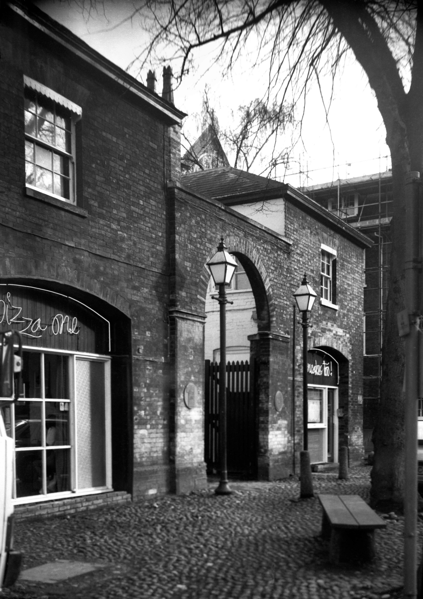
Tombland Alley 1 to 2 [1097] 1936-07-12
|
|
|
Tombland Alley 1 to 2 [6421] 1986-08-06
|
|
|
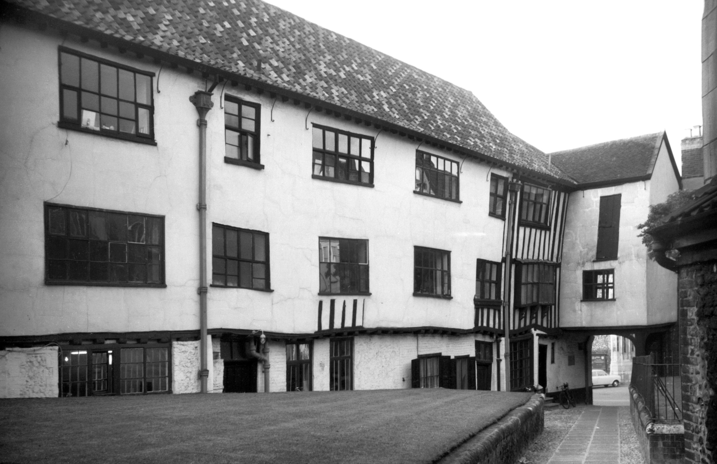
Tombland 14 Augustine Steward's House [B076]
1931-08-03
Part of Samson and Hercules House on right. |
|
|
Tombland 14 Augustine Steward's from Alley [0481]
1935-04-20
|
|
|
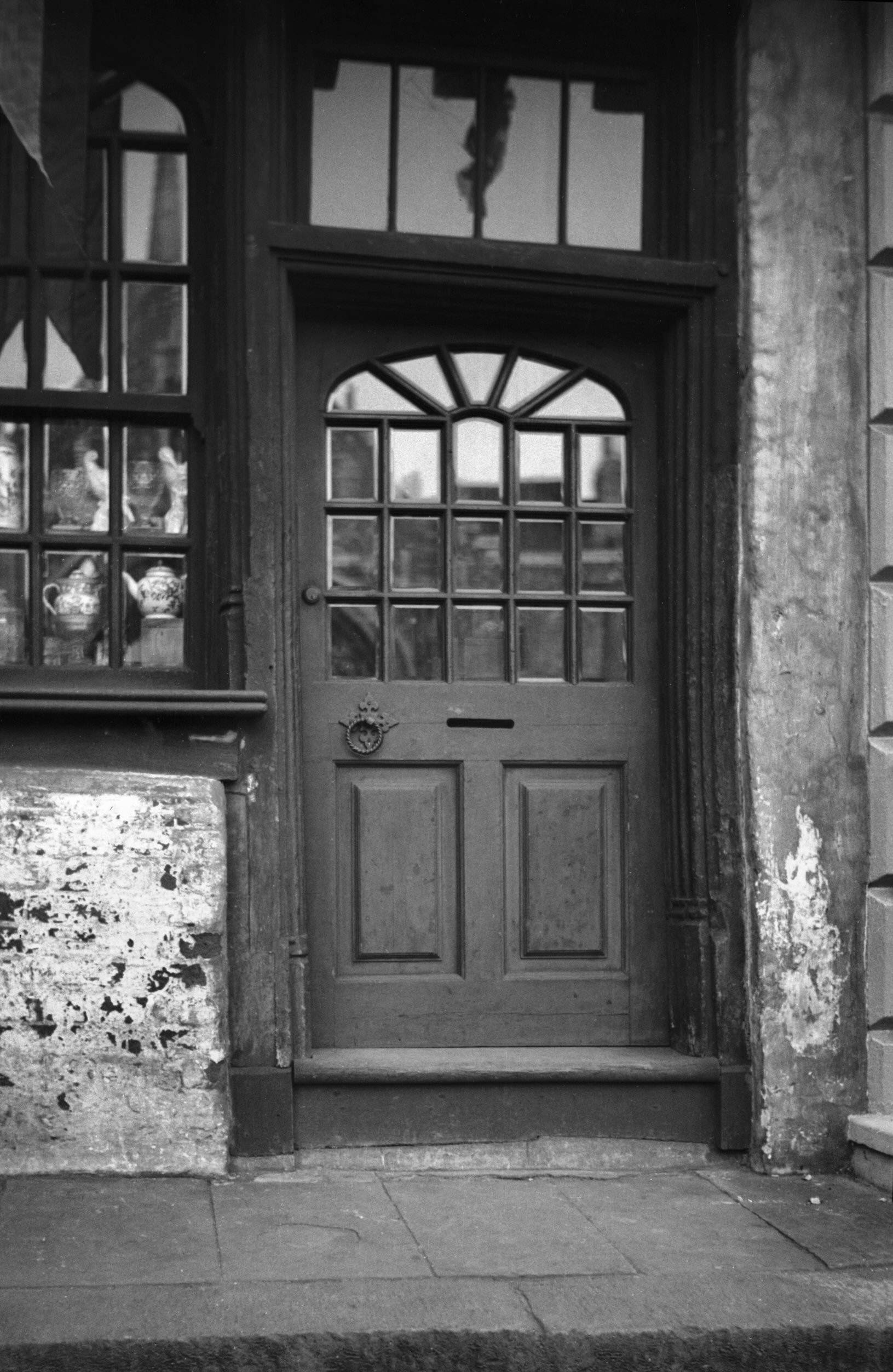
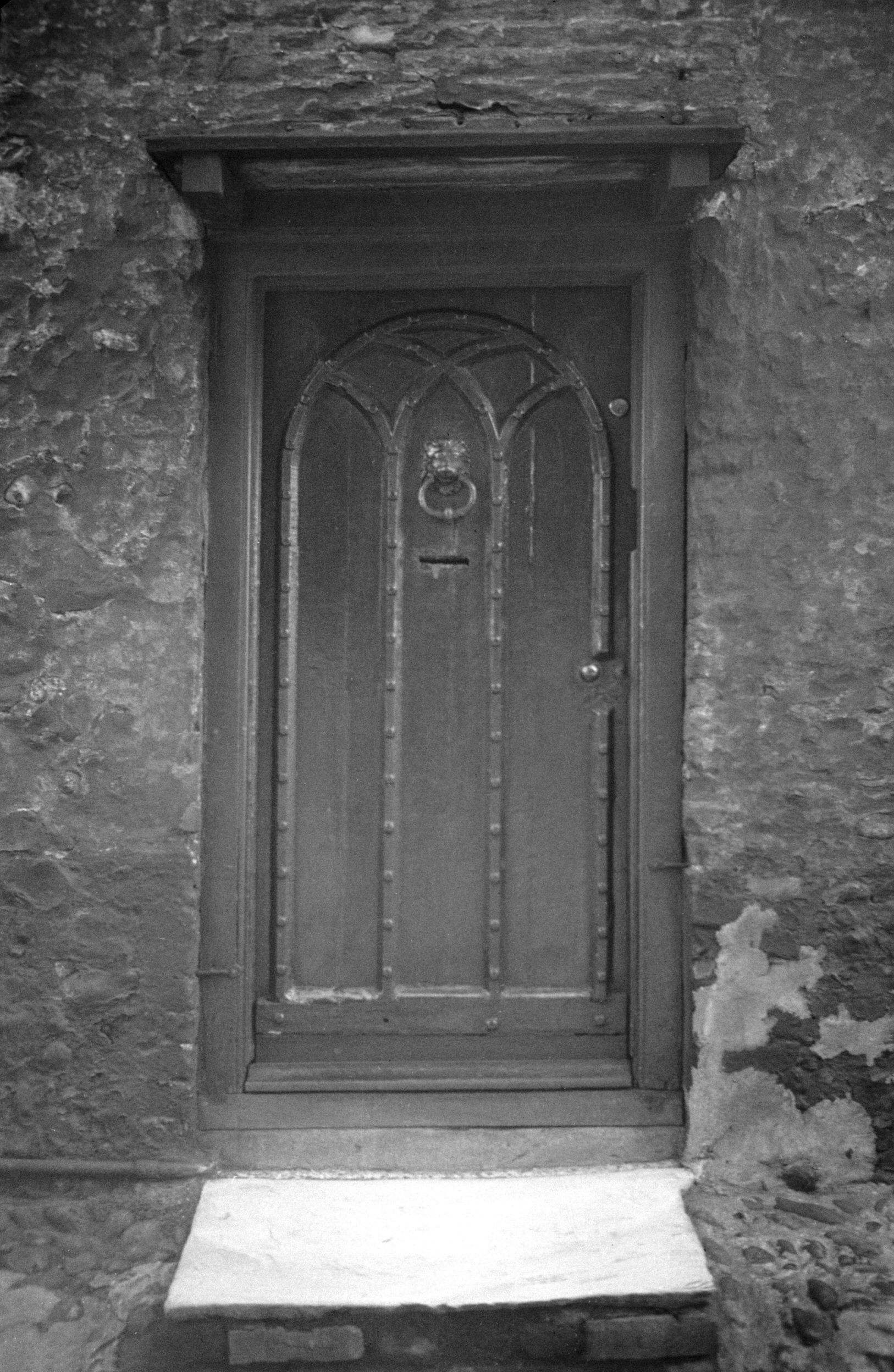
Tombland 14 Augustine Steward's main door [0508]
1935-05-03
|
|
|
Tombland 14 Augustine Steward's east facade [0626]
1935-08-08
|
|
|
Tombland 14 Augustine Steward's COLOUR [0963]
1936-05-16
|
|
|
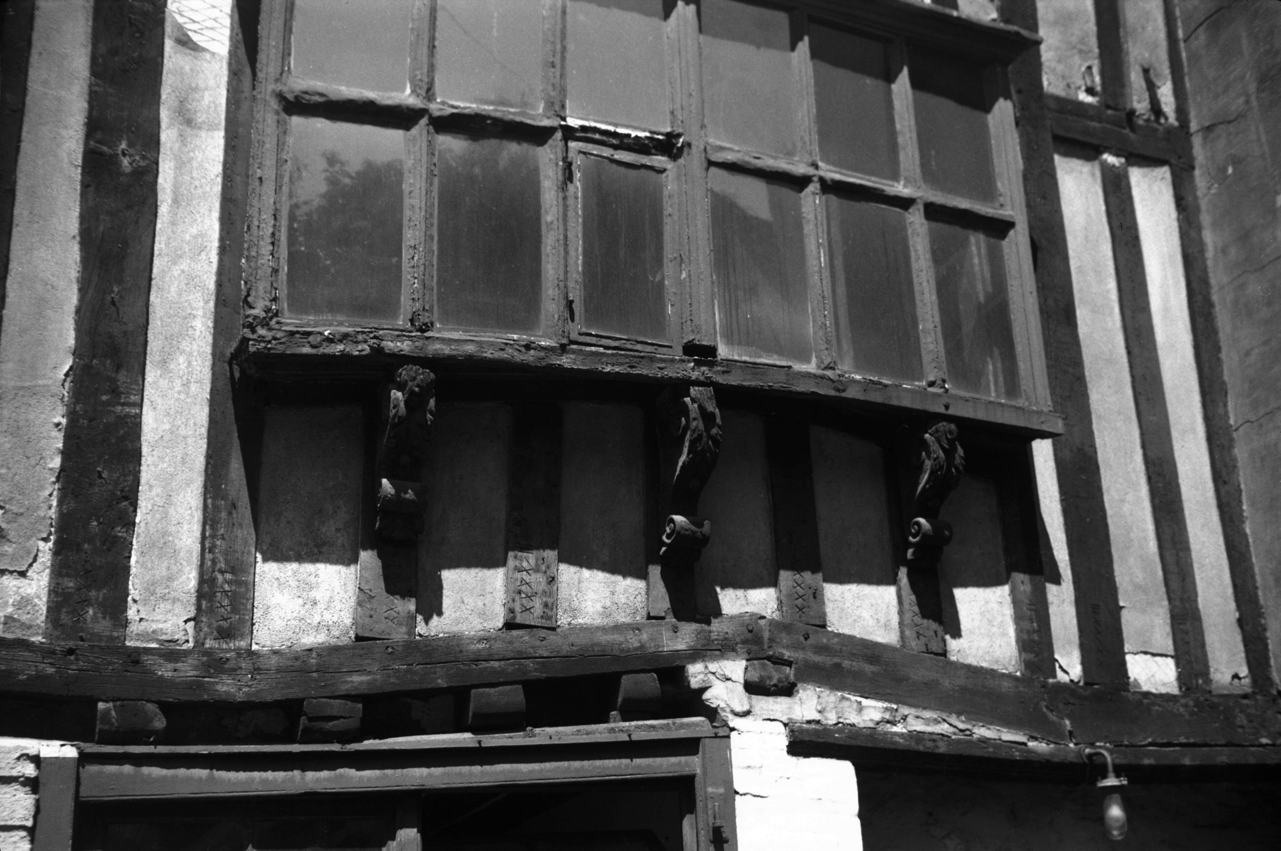
Tombland 14 joiners' marks on timbers [3892]
1950-06-29
The half-timbered construction with Roman numerals
joiners' marks visible at the base of each timber. |
|
|
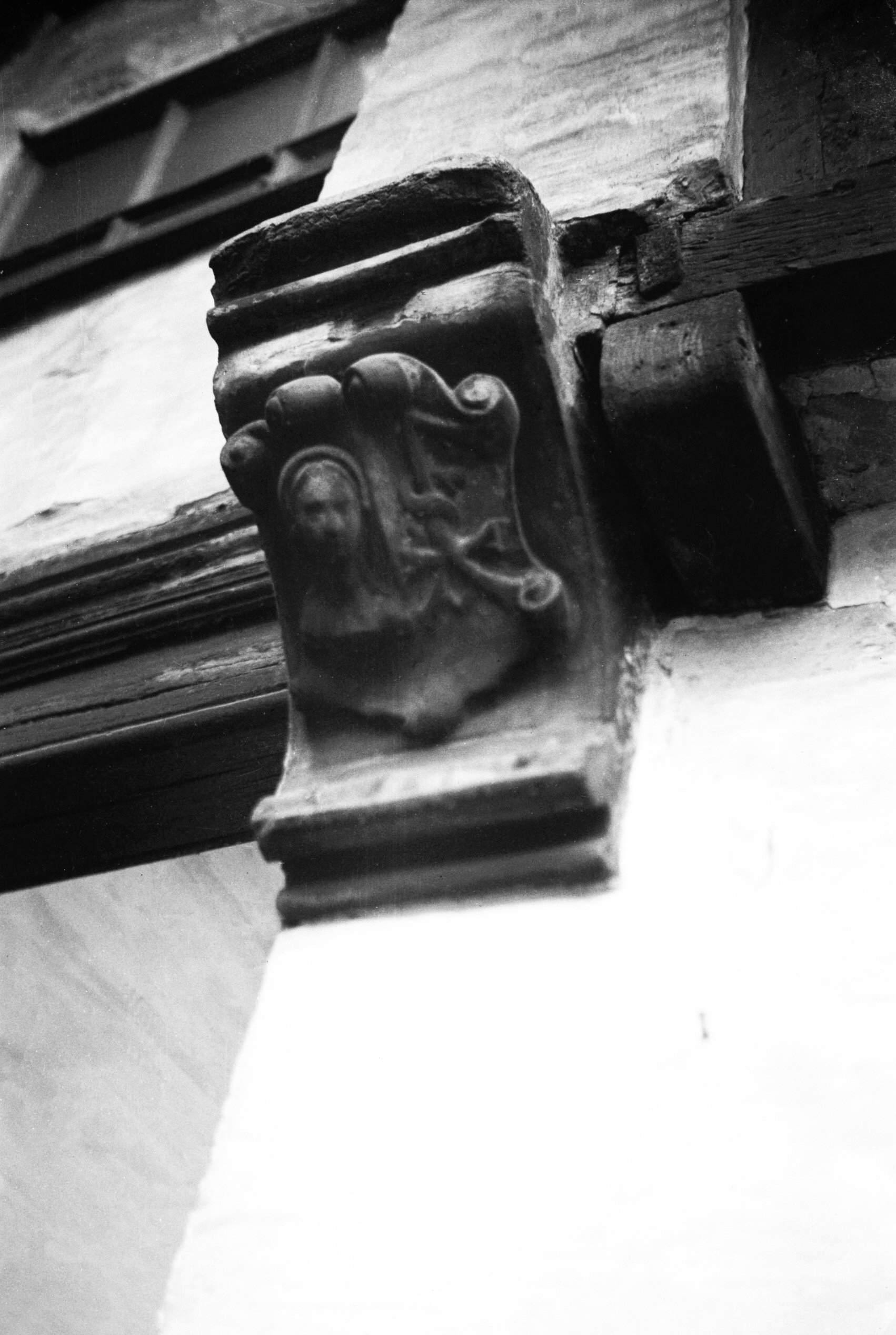
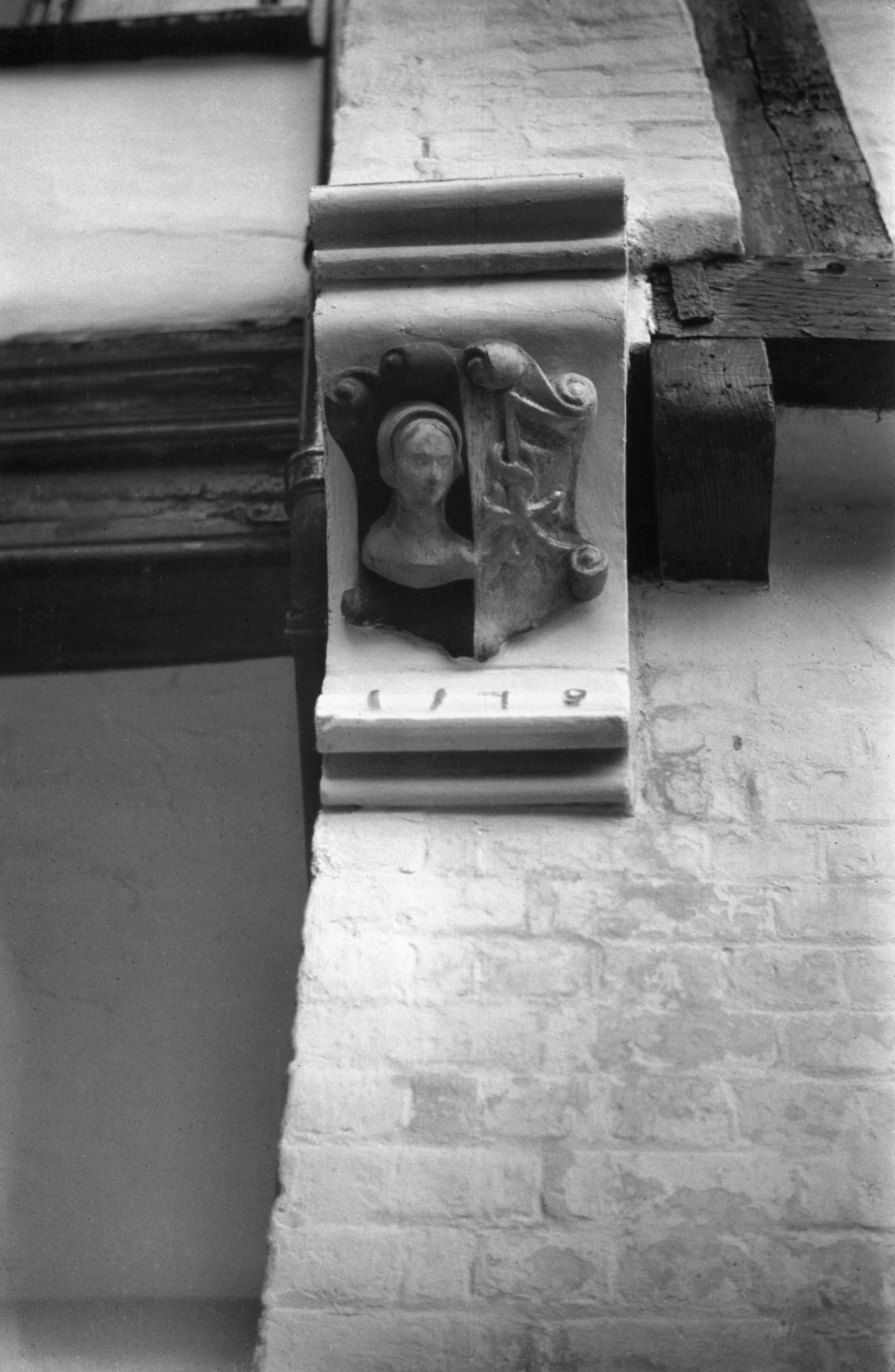
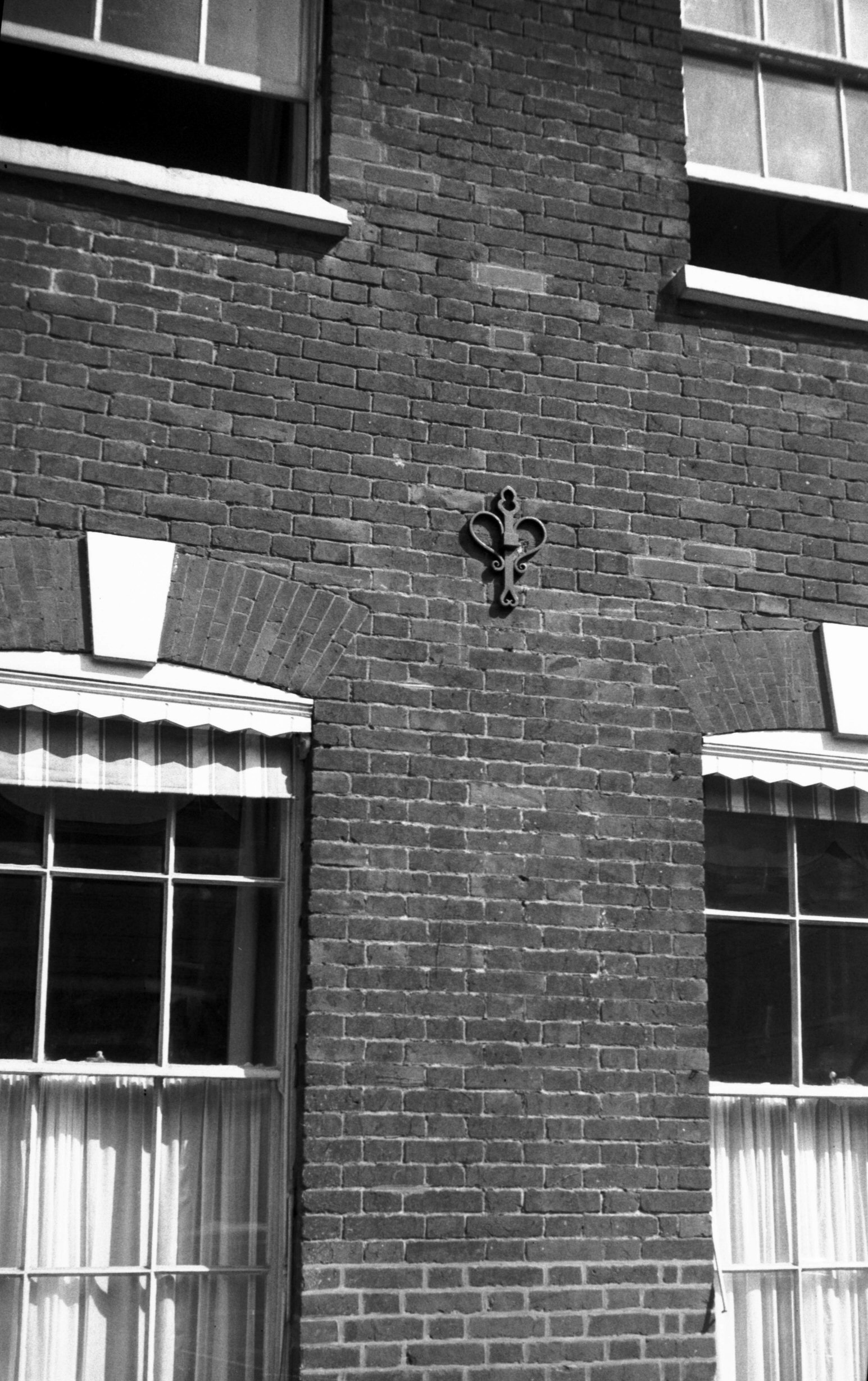
Tombland 14 carved stone bracket [2139] 1938-03-09
|
|
|
Tombland 14 carved stone bracket [4419] 1956-03-27
Bearing Mercers' sign and Steward's initials
"A.S" - worked into a merchant's mark. Dated
1549, the year of Kett's Rebellion when Steward was
Deputy Mayor. |
|
|
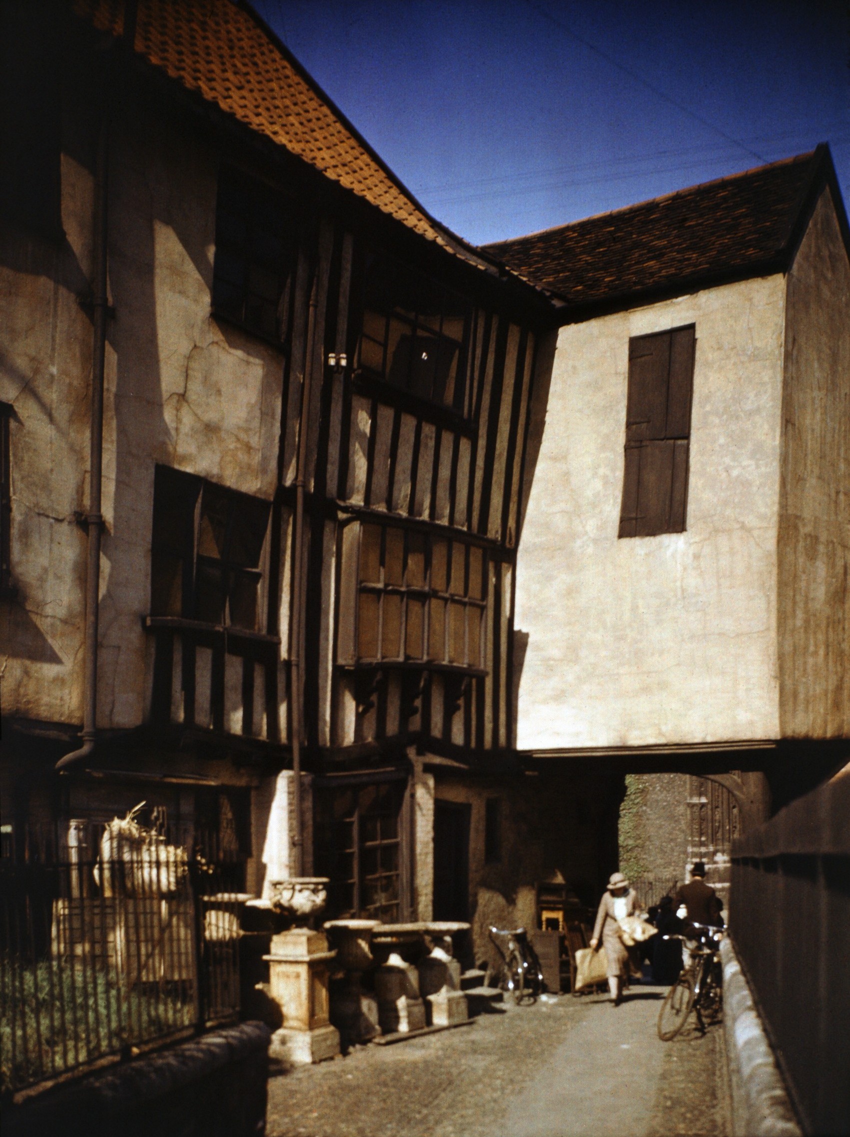
Tombland 14 Augustine Steward's from Alley [5143]
1967-05-16
Uneven settlement of foundations caused beams to bend and
twist. |
|
|
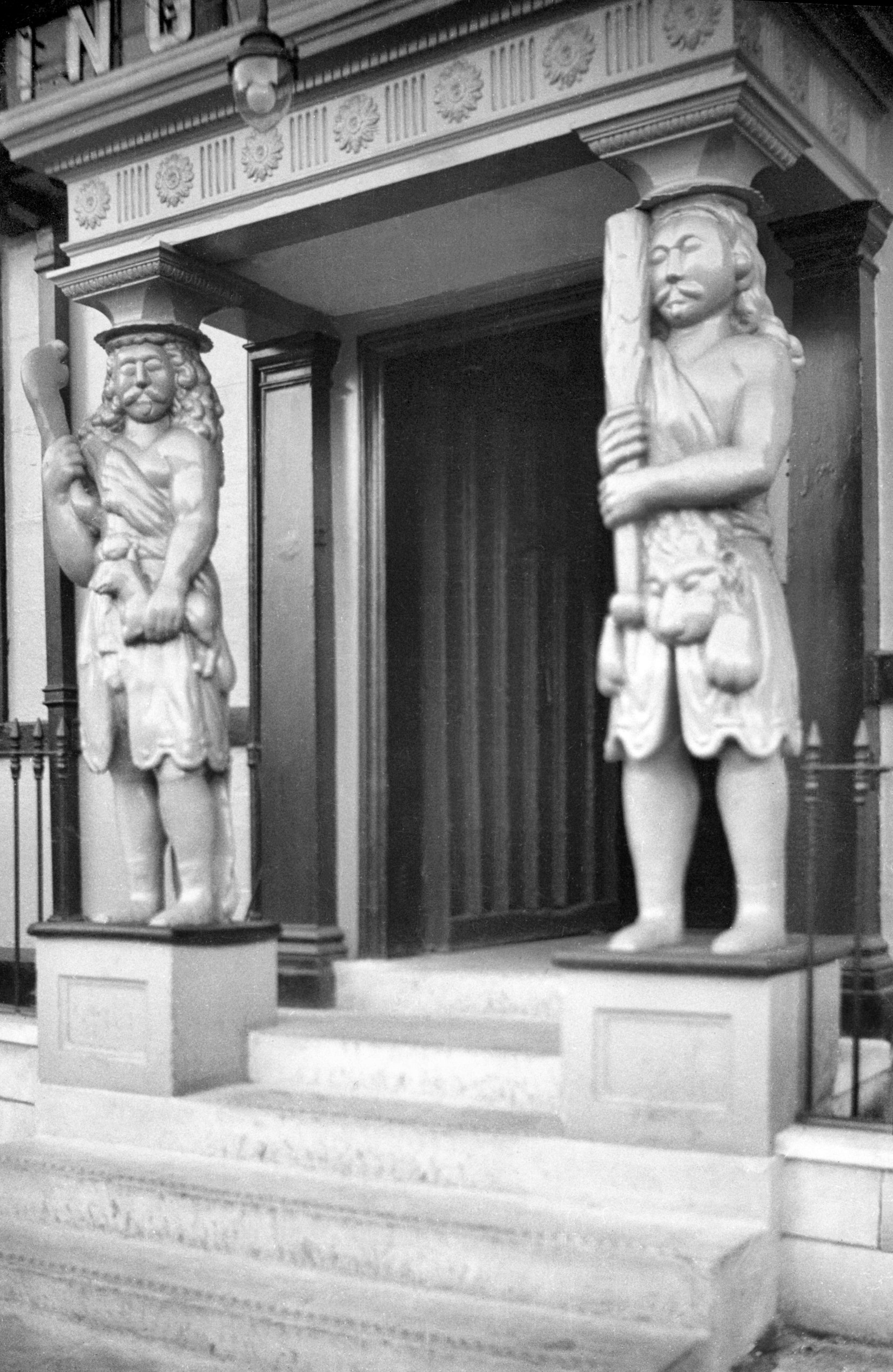
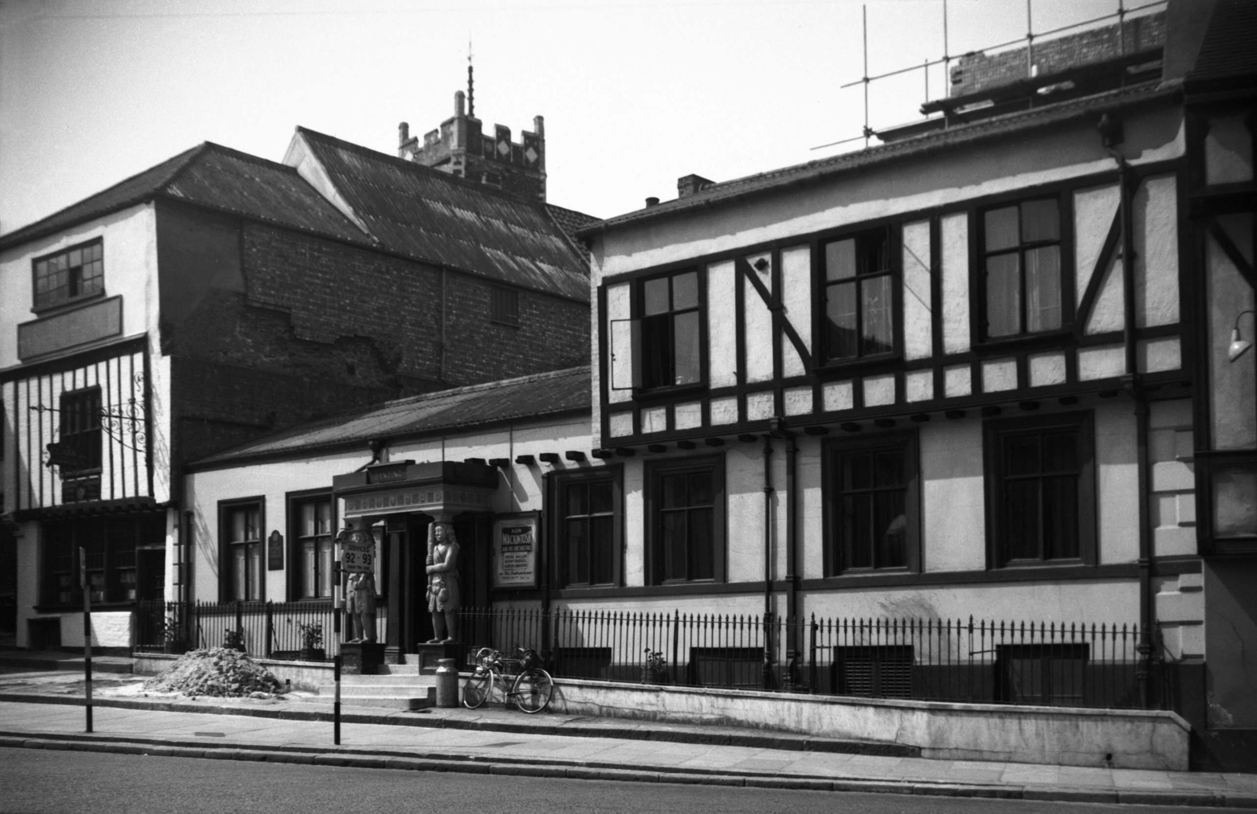
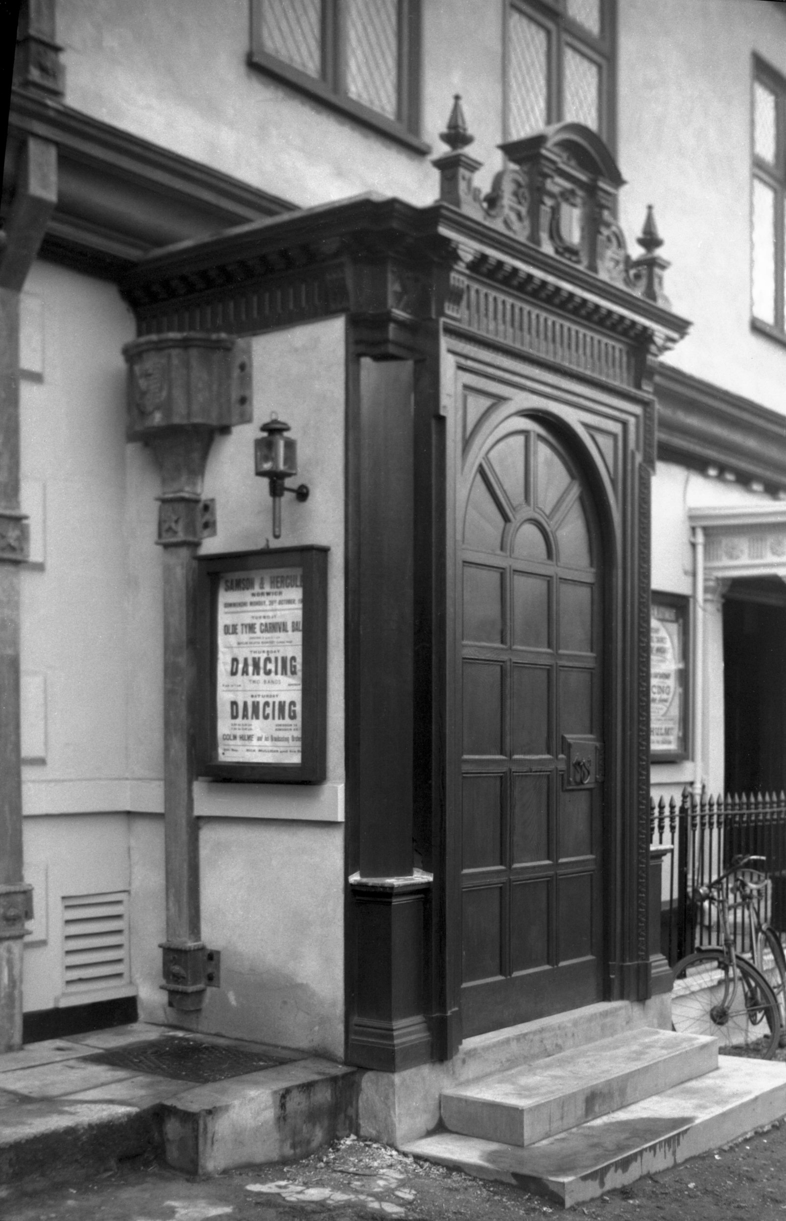
Tombland 15 to 16 Samson Hercules portico [0501]
1935-05-01
|
|
|
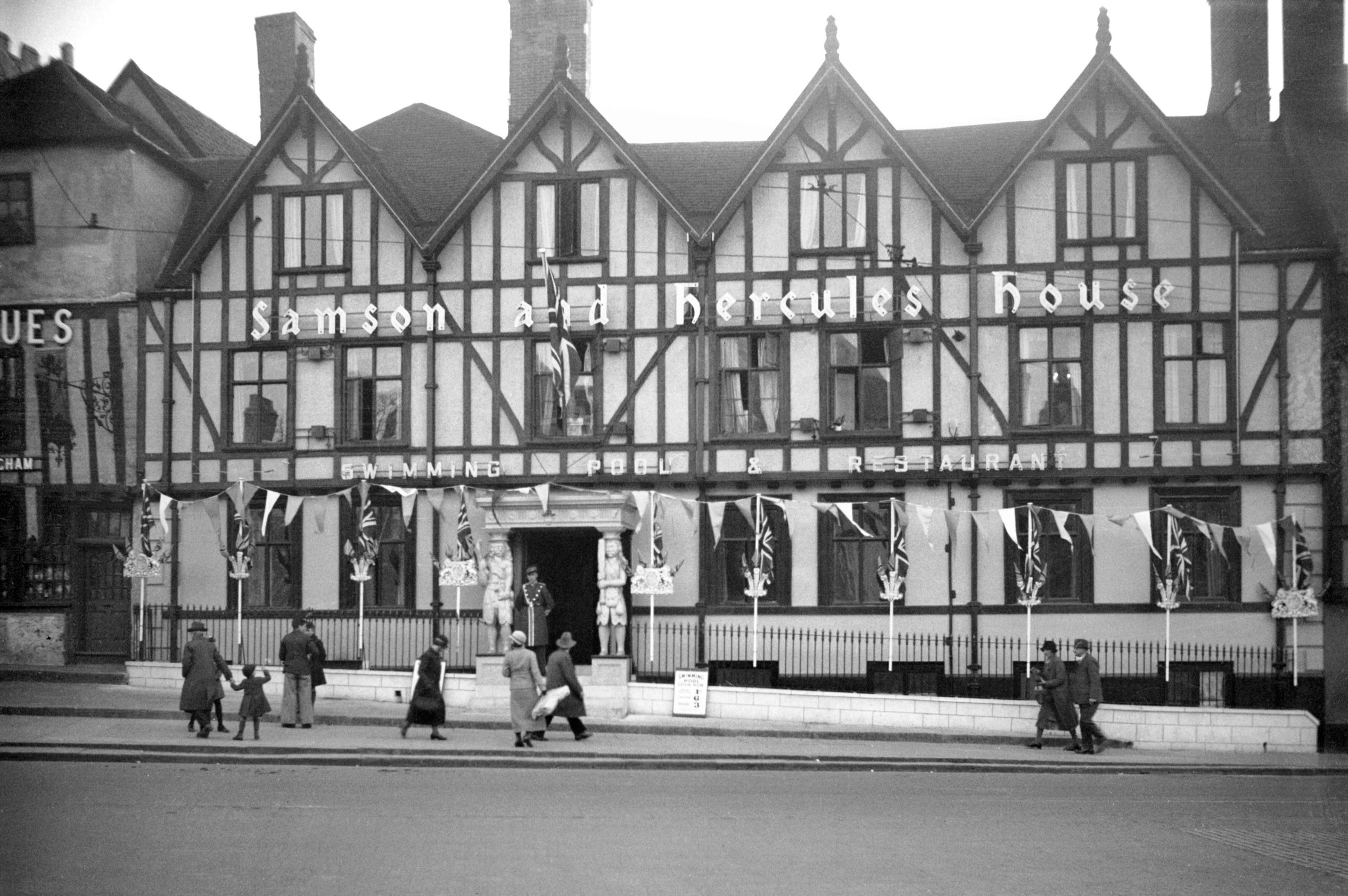
Tombland 15 to 16 Samson Hercules Jubilee [0507]
1935-05-03
Samson and Hercules House was erected by Christopher Jay,
Mayor of Norwich in 1657. Incorporated are some walls and
the undercroft of a 15c mansion. |
|
|
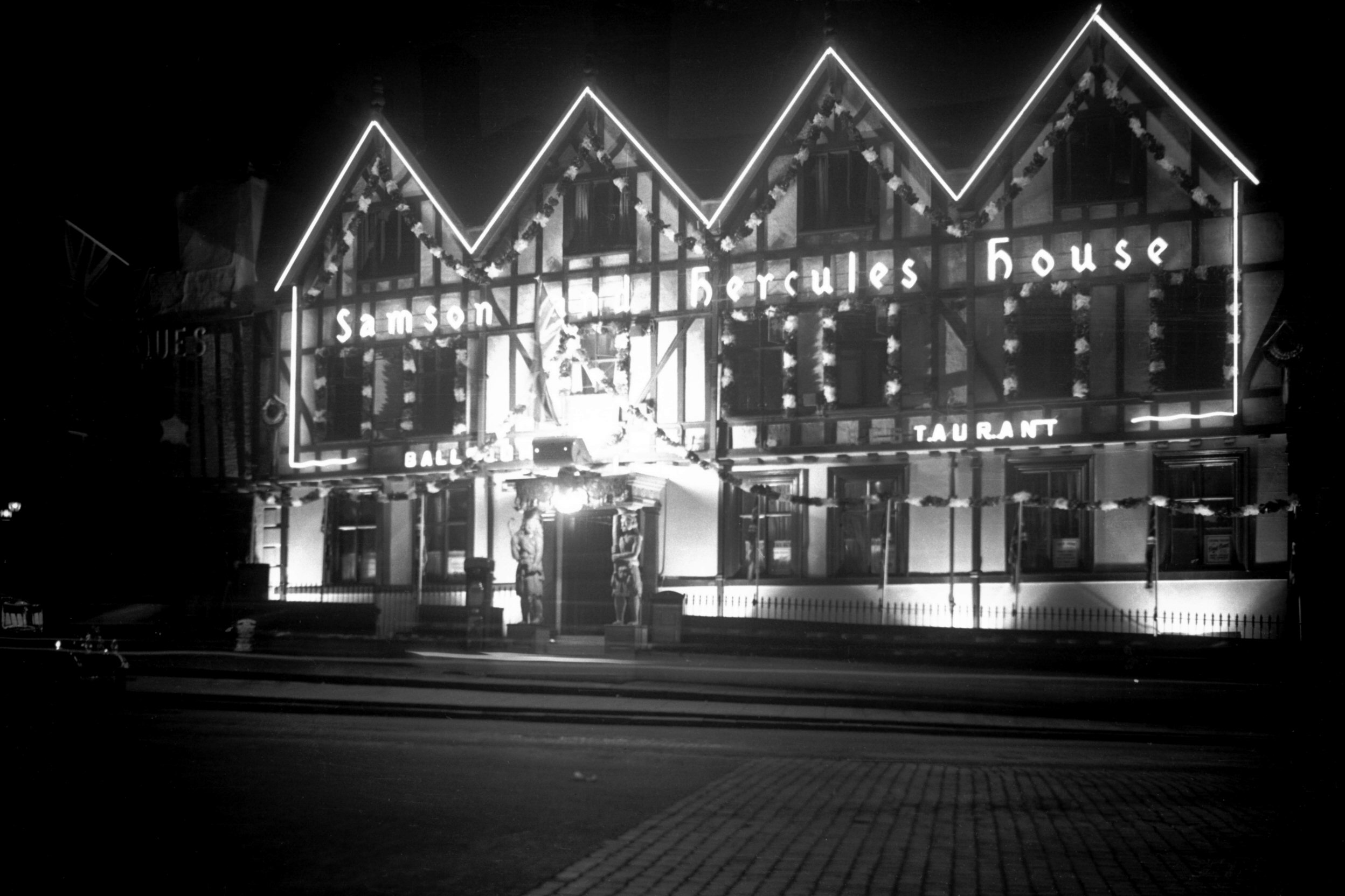
Tombland 15 to 16 Samson Hercules floodlit [1628]
1937-05-13
For coronation. |
|
|
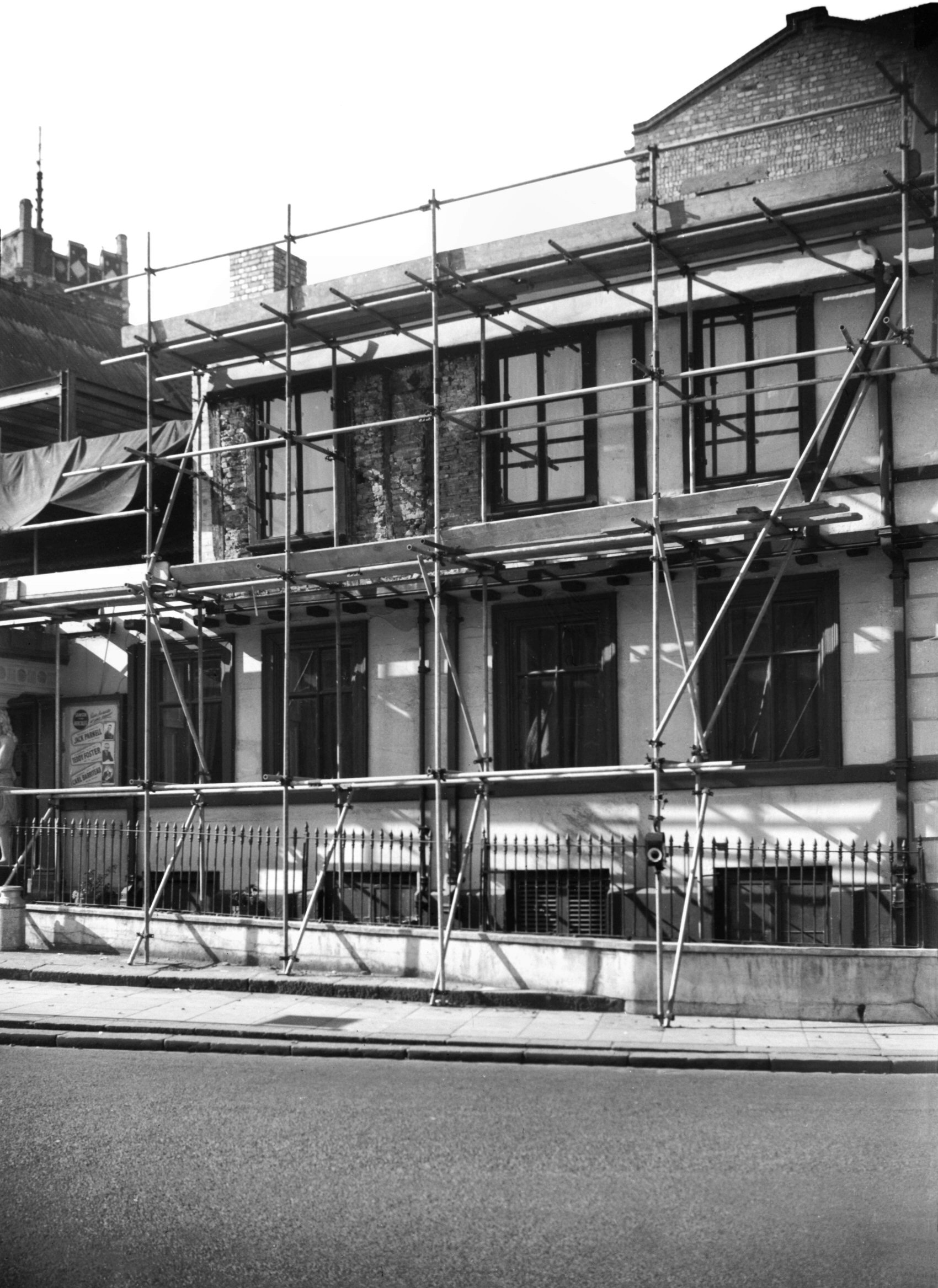
Tombland 15 to 16 Samson Hercules unrebuilt [4077]
1952-07-06
|
|
|
Tombland 15 to 16 Samson Hercules rebuild [4103]
1952-09-28
During reconstruction after fire. |
|
|
Tombland 15 to 16 doorway from Flixton Hall [4238]
1953-10-25
Door moved from Flixton Hall in Suffolk in 1935. |
|
|
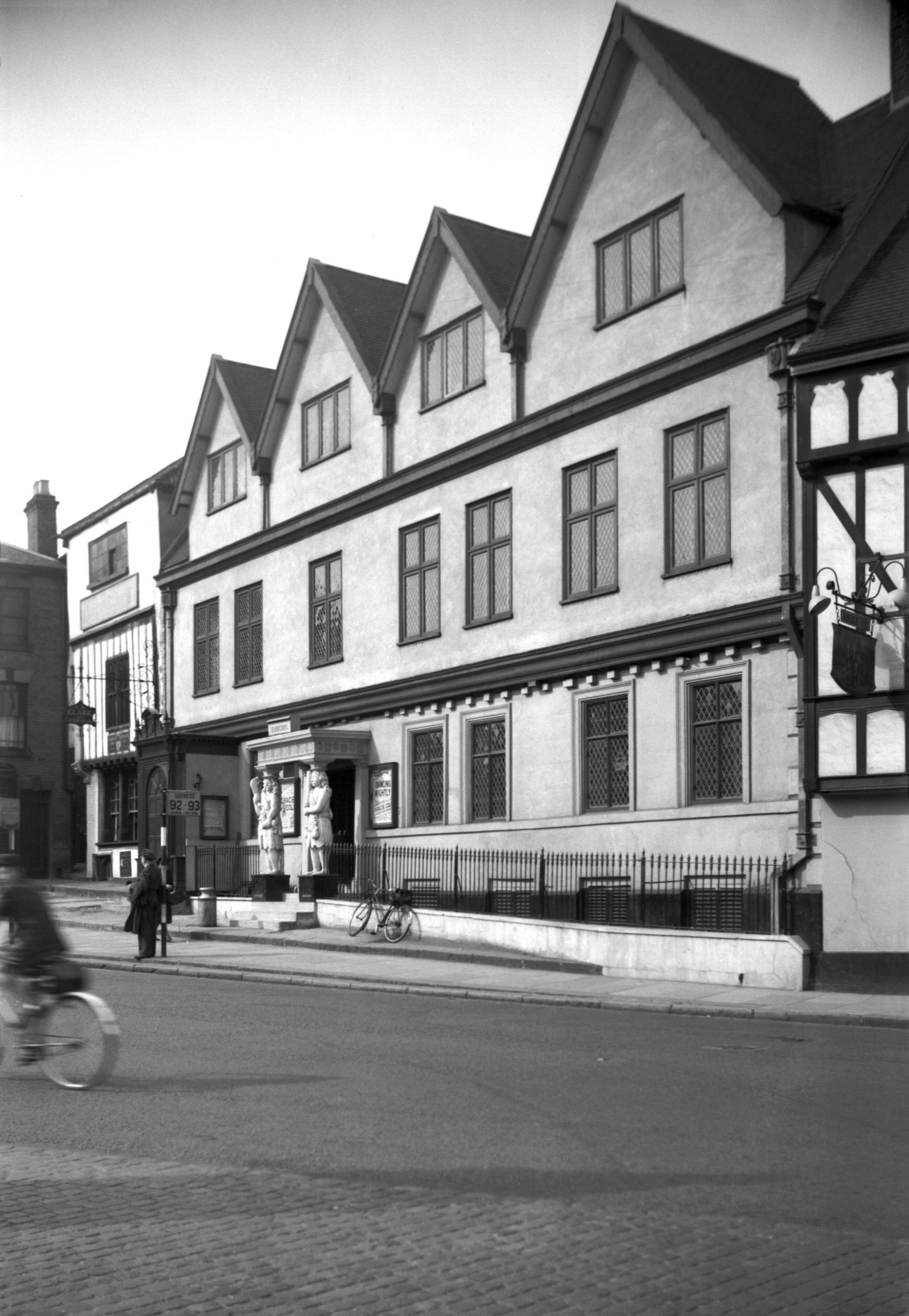
Tombland 15 to 16 Samson Hercules rebuilt [4260]
1954-06-23
|
|
|
Tombland 17 Louis Marchesi PH [6536] 1989-03-25
Formerly the Waggon and Horses PH. |
| |
East
side |
|
|
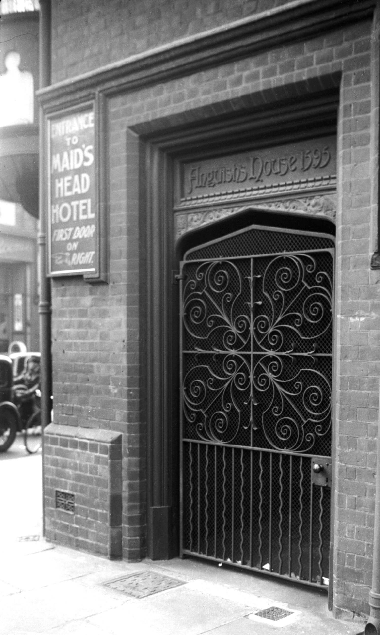
Tombland replica gateway Anguish house site [2897]
1939-03-31
Modern replica of one on the site of the house of Thomas
Anguish at corner of Tombland and Wensum St.
For Maid's Head Hotel see Wensum
St. |
|
|
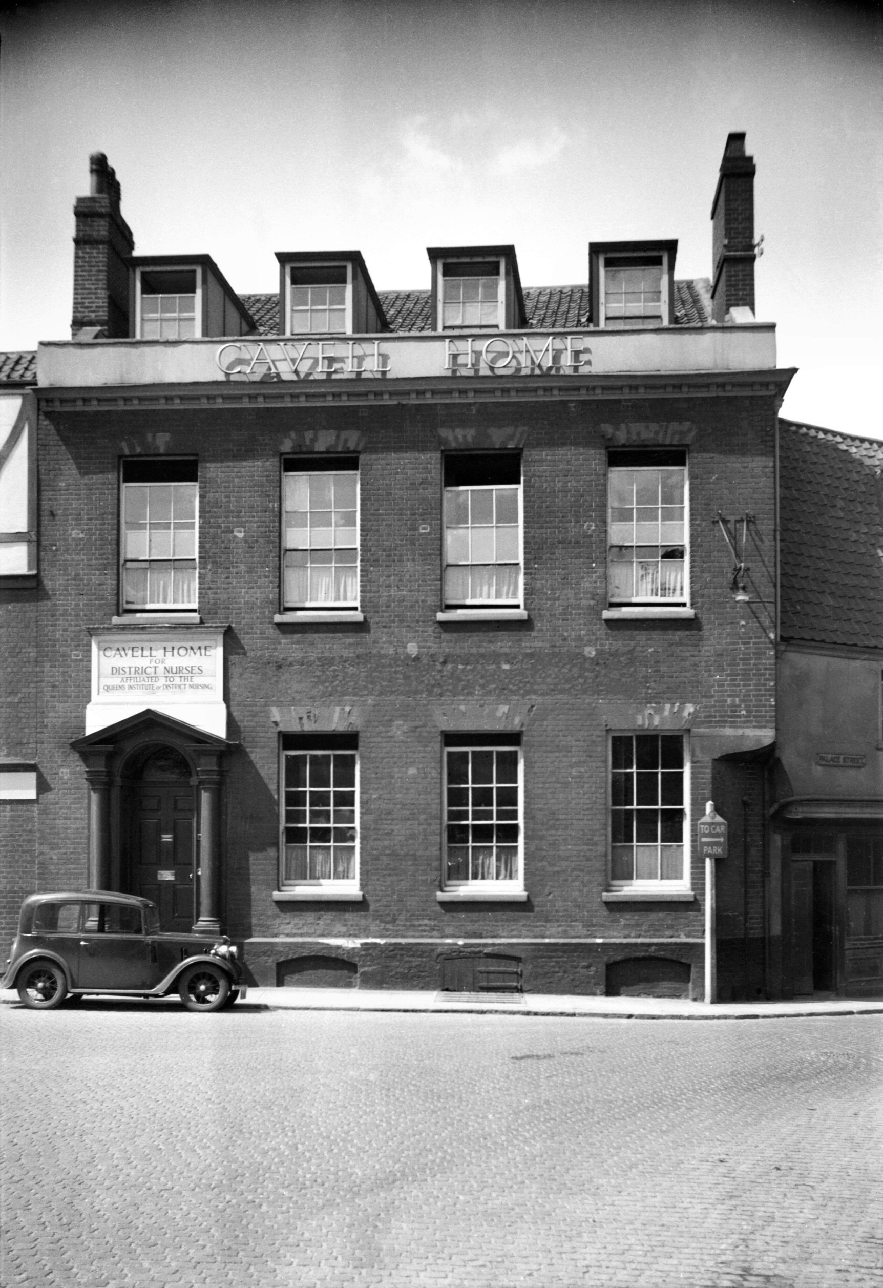
Tombland 20 Cavell House [0997] 1936-06-10
|
|
|
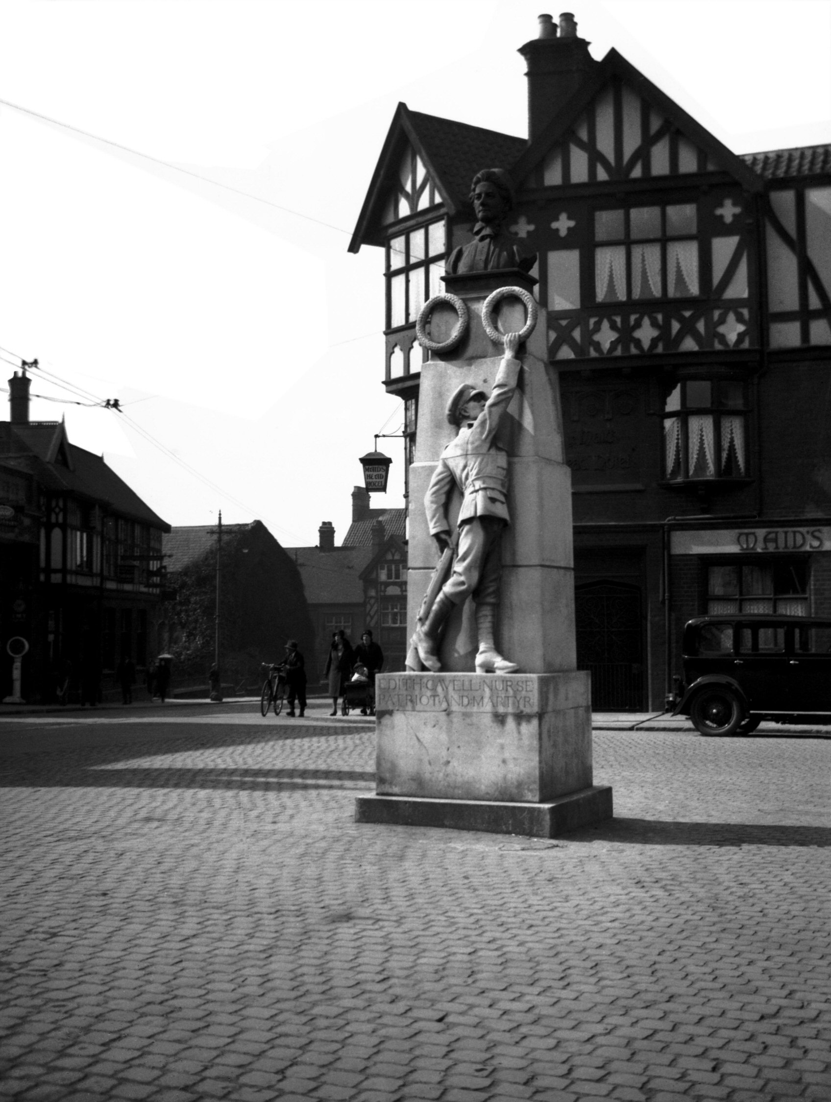
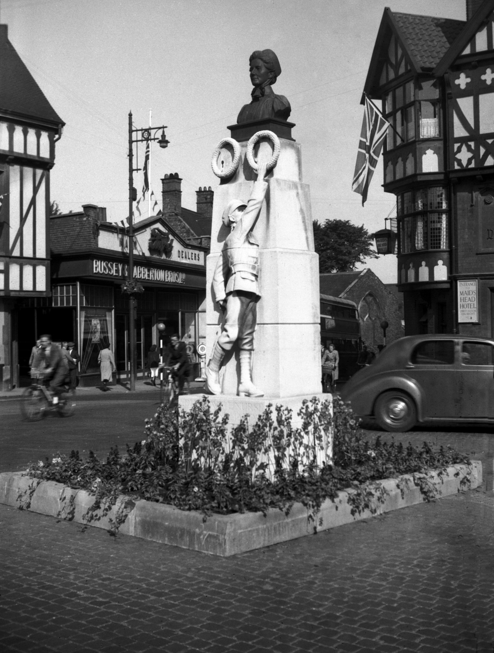
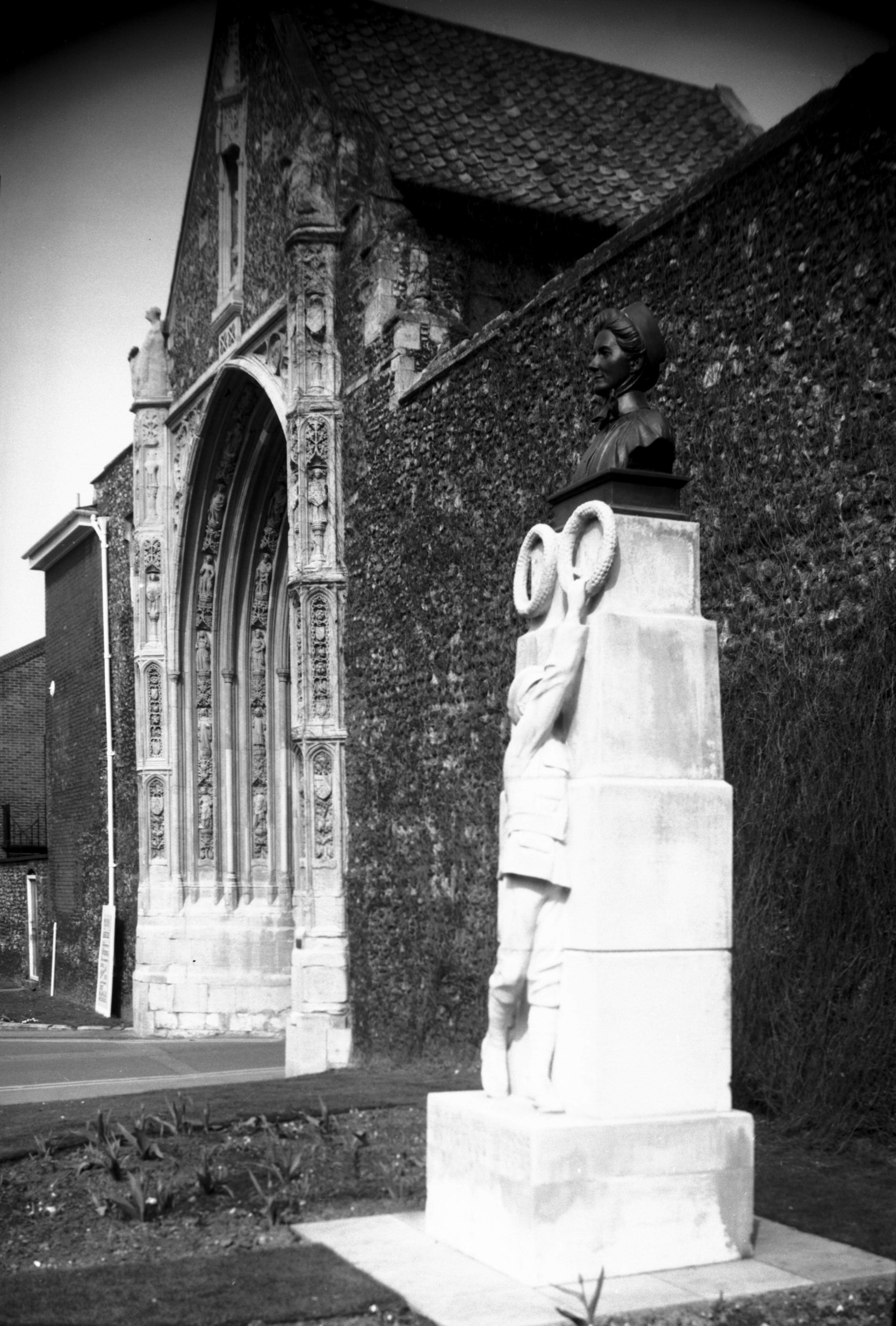
Tombland Edith Cavell monument [B260] 1932-05-00
|
|
|
Tombland Edith Cavell monument [4012] 1951-06-29
|
|
|
Tombland Edith Cavell monument resited [6961]
1993-03-28
Moved 1993. |
|
|
Tombland 20 Georgian doorway [0428] 1935-03-28
|
|
|
Tombland 21 to 22 Erpingham House [7446] 1997-04-27
|
|
|
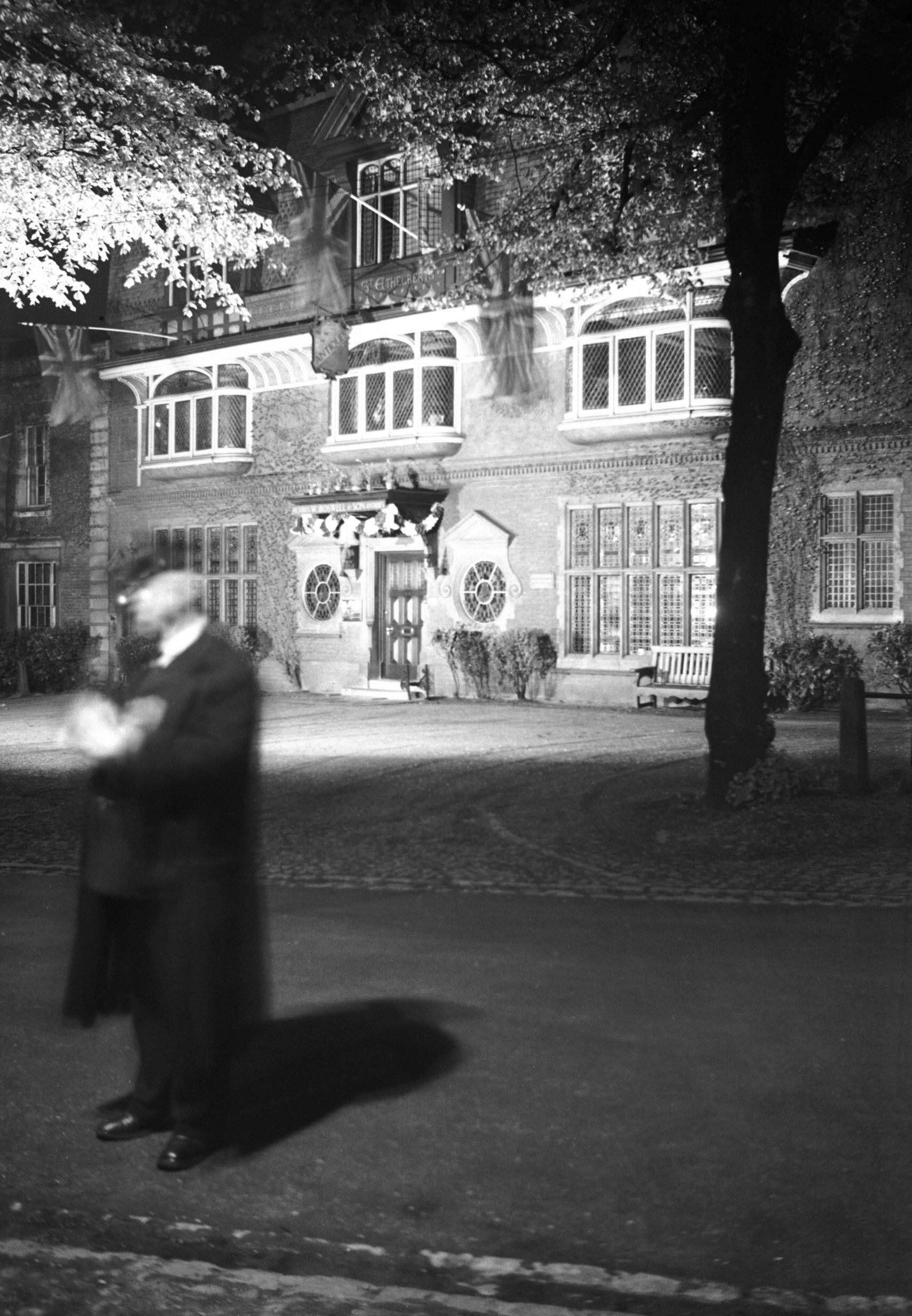
Tombland 24 St Ethelbert's House [0296] 1934-09-23
Georgian much altered in Victorian times. |
|
|
Tombland 24 St Ethelbert's House floodlit [1631]
1937-05-13
|
|
|
Tombland 25 [6436] 1987-02-17
|
|
|
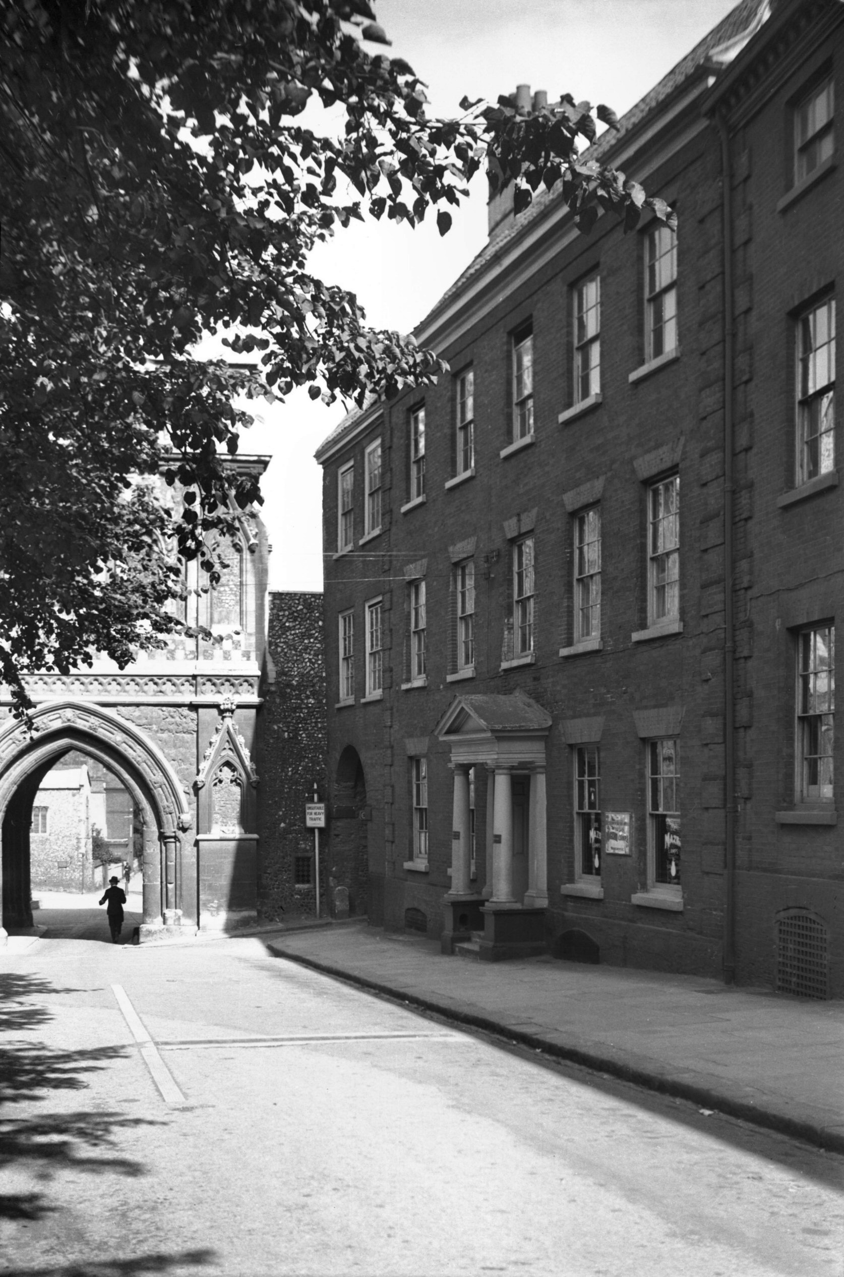
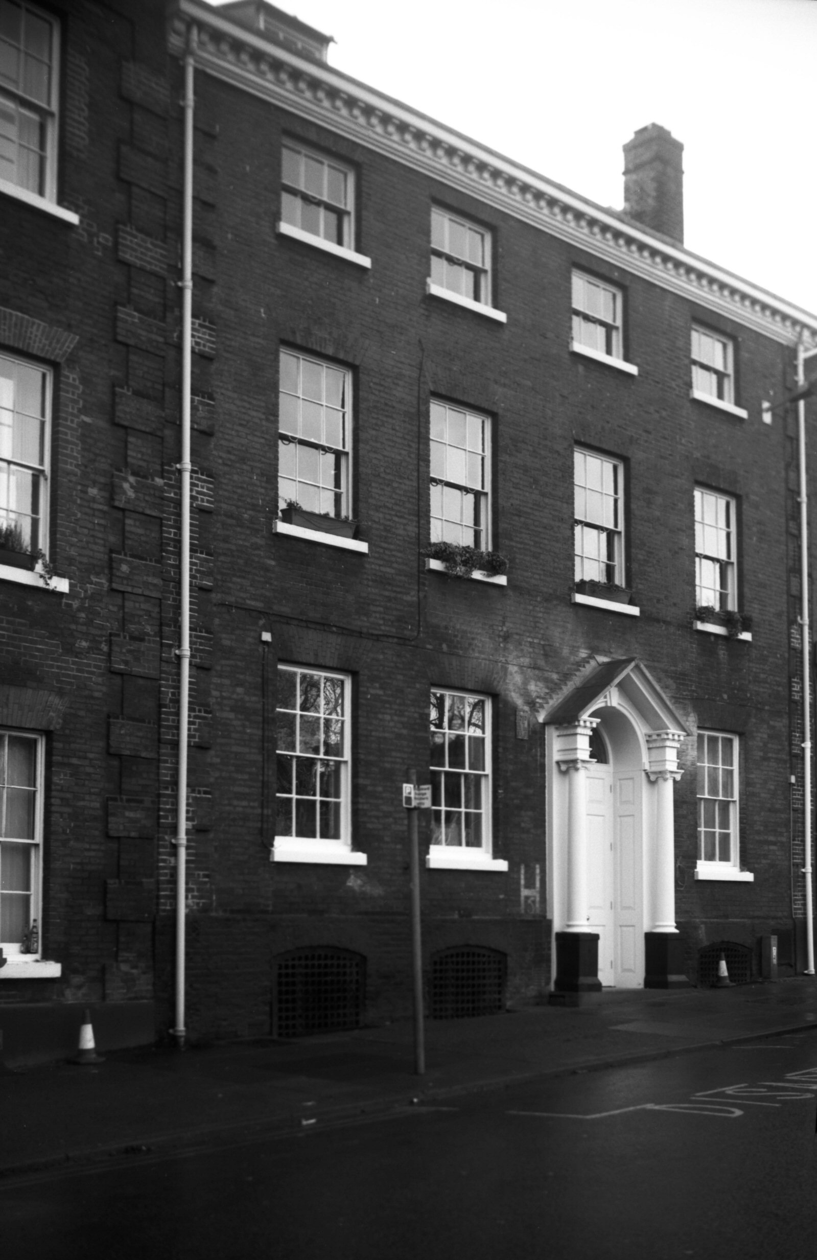
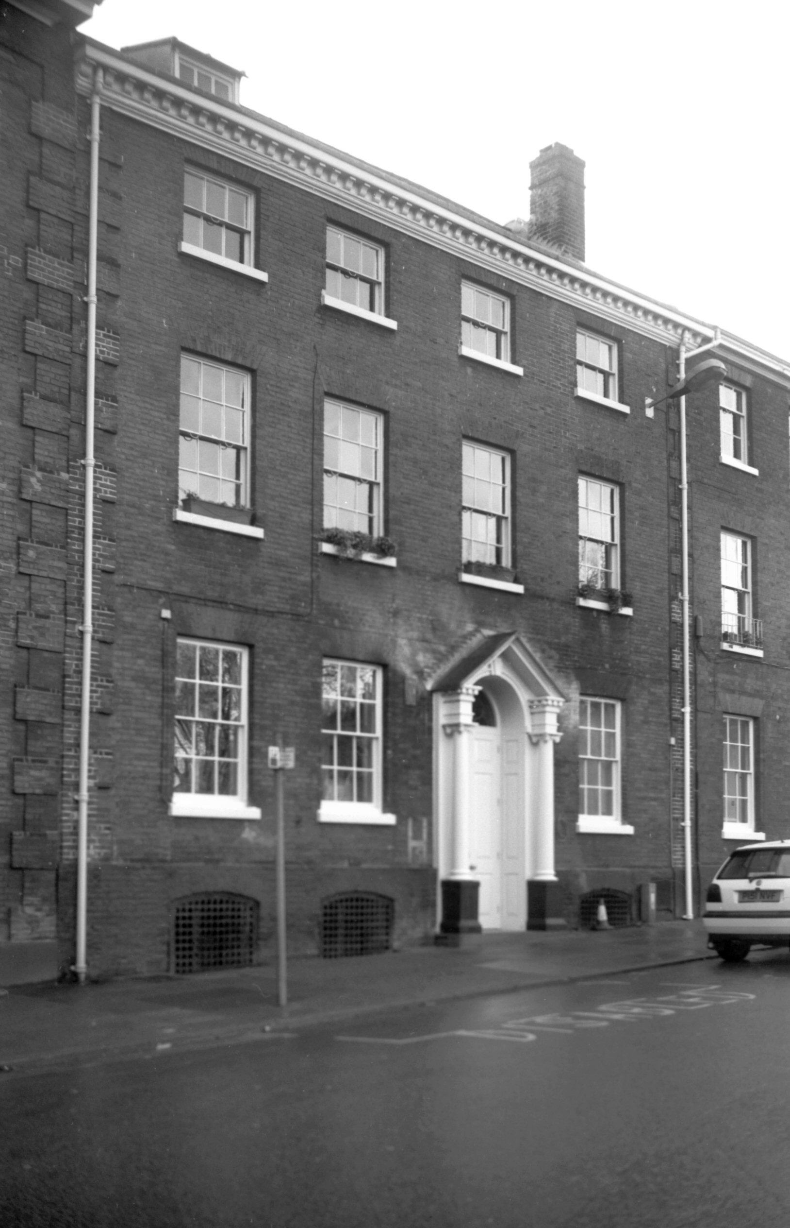
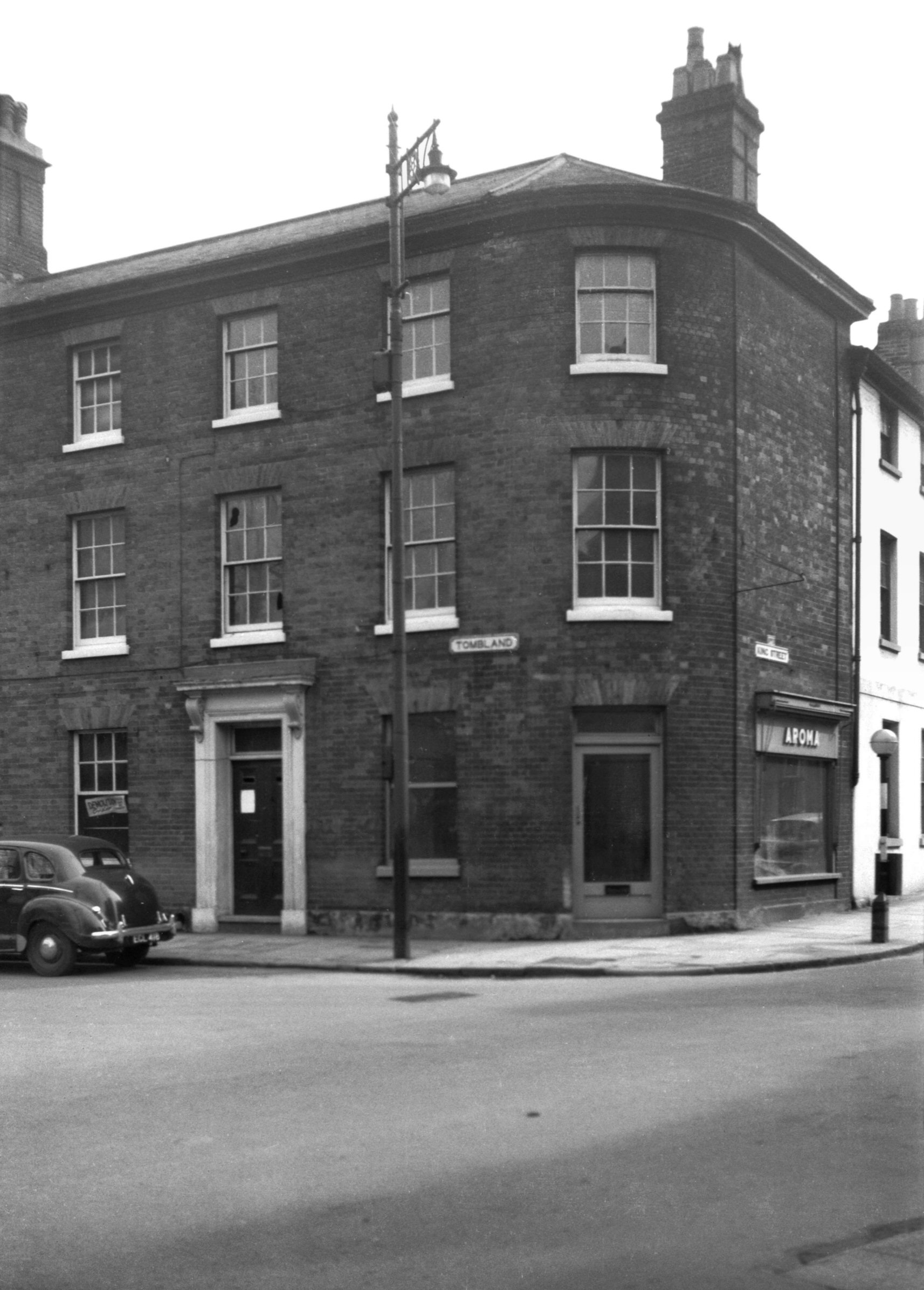
Tombland 26 Cambridge House [3247] 1939-08-13
Where No 26 (Cambridge House) now stands, the Recorder of
Norwich, Sir William Denny, erected early in the 17c a
building called Stonehall. Parts of this were retained
when Cambridge House replaced it during the early part of
the Georgian period. Alderman Jeremiah Ives (Sheriff
1782, Mayor 1786 and 1801), who lived here in 1783, is
believed to have been responsible for adding the present
imposing portico. Otherwise it remained little altered
until 3rd May 1945, when fire entirely gutted the
interior. Fortunately the outer walls remained virtually
intact and it was possible to effect a reconstruction,
preserving the old facade and thus retaining the Georgian
character of this end of Tombland. |
|
|
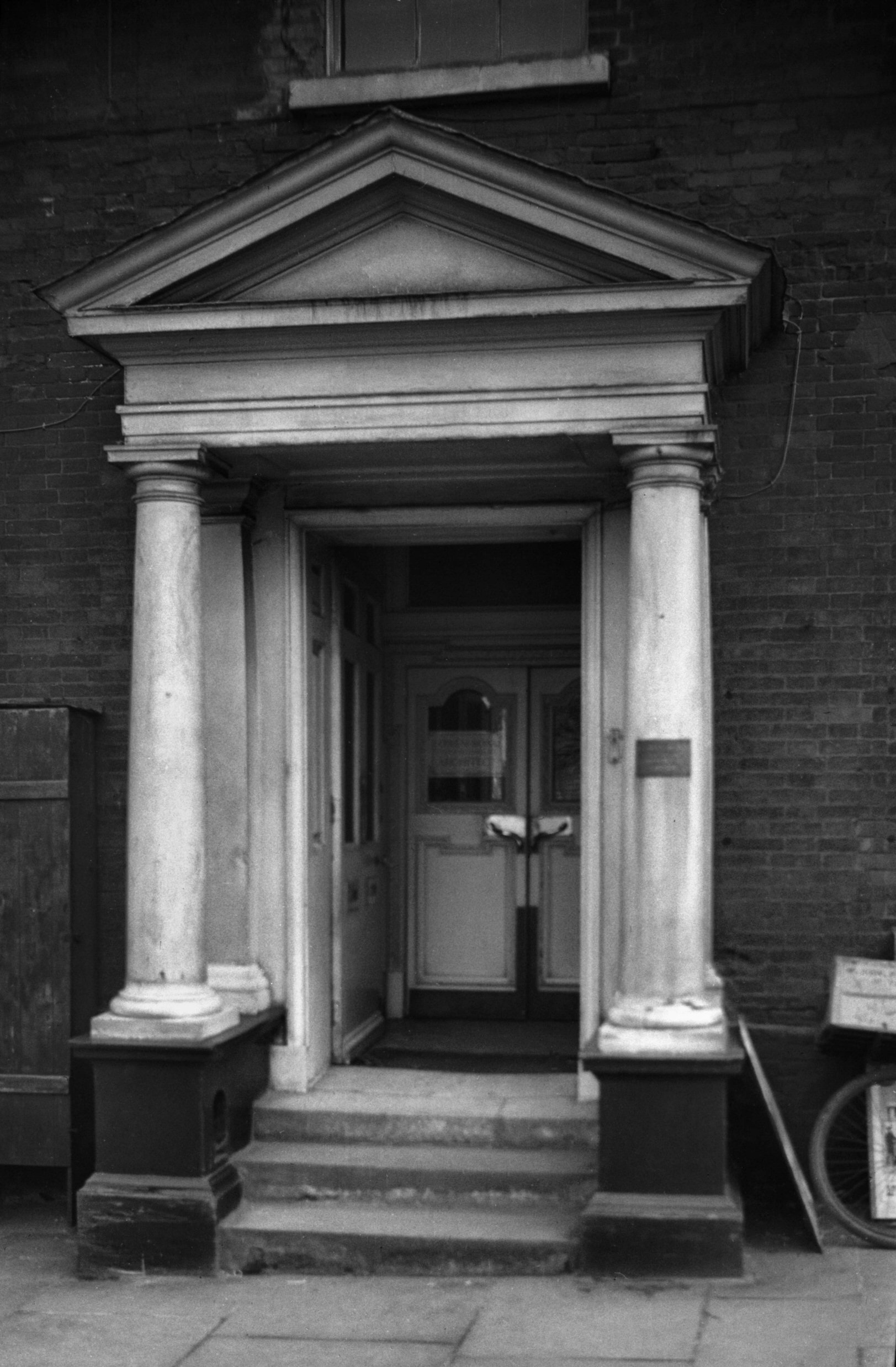
Tombland 26 Georgian doorway [0426] 1935-03-28
|
|
|
Tombland 26 rear from St Faith's Lane [0978]
1936-05-18
The site of the Palace of Saxon Earls. In the 17c Sir
William Denny erected a messuage called Stonehall, parts
being incorporated in the Georgian mansion built in the
first half of the 18c. |
|
|
Tombland 27 [7722] 2000-01-01
|
|
|
Tombland 27 [7723] 2000-01-01
|
|
|
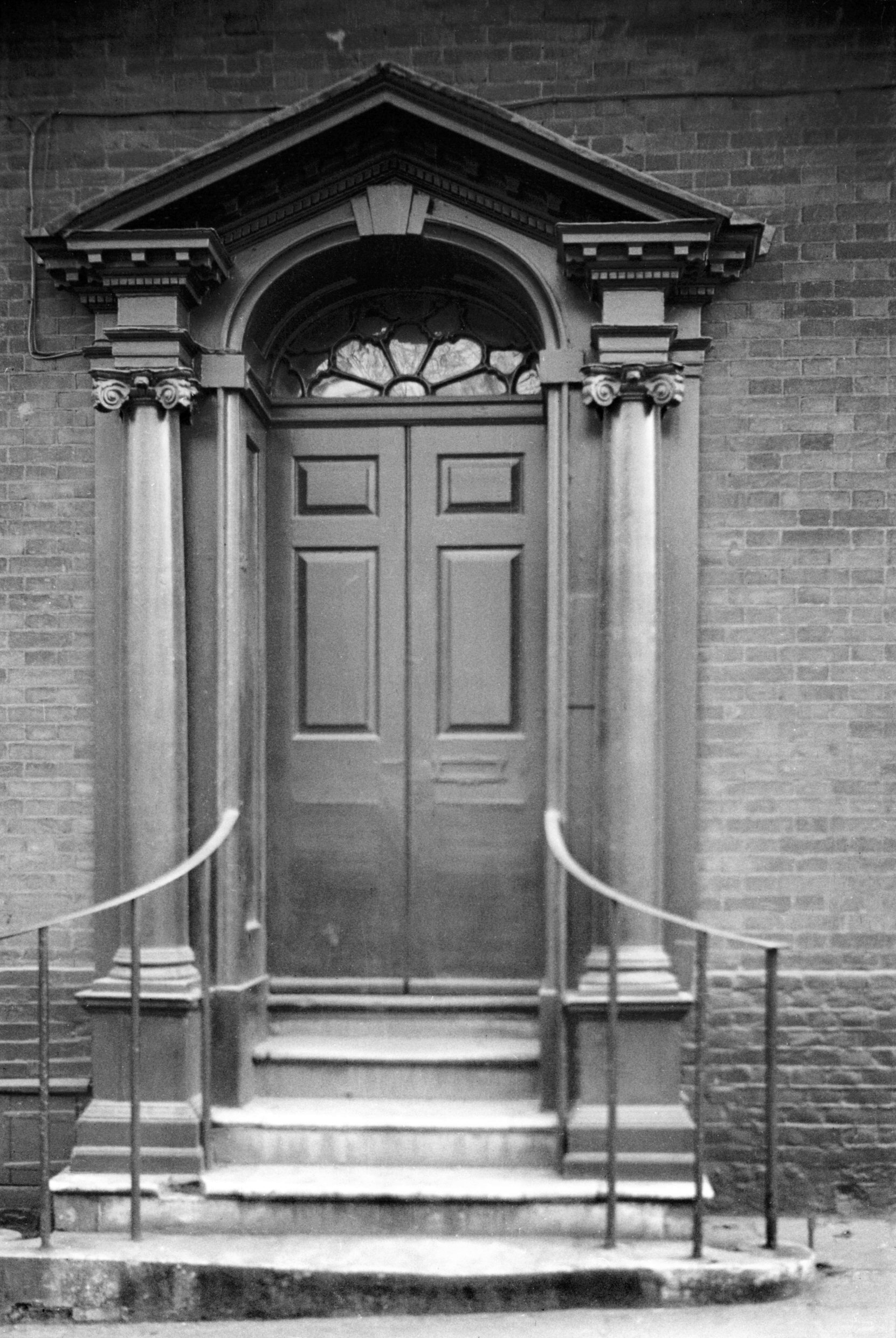
Tombland 27 Georgian doorway [0427] 1935-03-28
On the south side of Tombland is a typical row of 18c
three-storey red-brick buildings. Of these, the middle
one, No 27, had its central doorway removed in the
mid-1930s and replaced by a sash window.
The doorway here consisted of a pair of Ionic pillars
supporting an open pediment. A pair of doors opened from
the centre and folded back, and above was an elliptical
fanlight with "rising sun" motif. A flight of
four stone steps gave access, guarded by a light handrail
on either side. The city's loss was Norfolk's gain, for
the doorway was re-erected in a contemporary building,
West Bradenham Hall, by Mr P.D.Penrose. |
|
|
Tombland 27 Georgian style doorway [7721] 2000-01-01
Happily, in the late 1990s the sash-window in No 27 was
removed, and replaced by a doorway similar to the
original, my photograph here helping the architect. Its
temporary absence emphasised how important such a feature
is in the facades of houses of this period.
A number of important buildings have occupied this side
of Tombland at different periods of its history. Here for
instance, built some years before 1066, stood the Palace
of the Saxon Earls. After the Conquest it was handed over
as part of the endowment of the Priory, and some parts of
it were still standing by about 1300. Later known as
Rotten (or Ratten) Row, the houses here were destroyed in
1507 by a fire which started somewhere near the Popinjay
inn on the western corner. |
|
|
Tombland 29 site of Popinjay Inn [4659] 1962-03-28
|
|
|
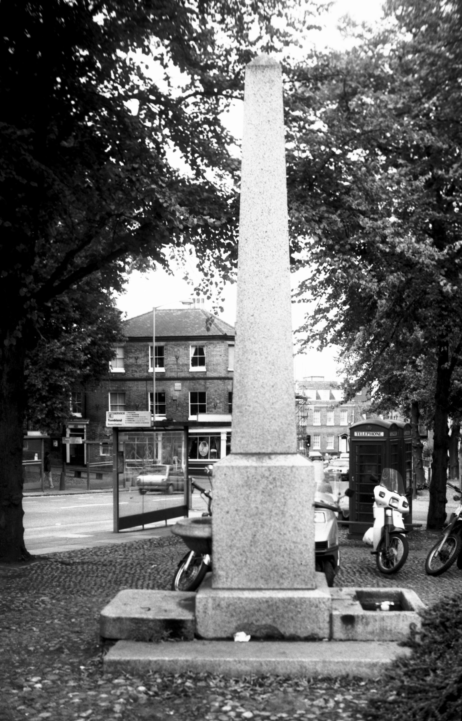
Tombland obelisk drinking fountain [7392] 1996-09-10
Erected 1860 by John Henry Gurney to mark the site used
by machinery to raise and store water for the higher
parts of the city from c1700 to c1850. |
|
Trinity St: |
| |
From
Unthank Rd to Union St |
|
|
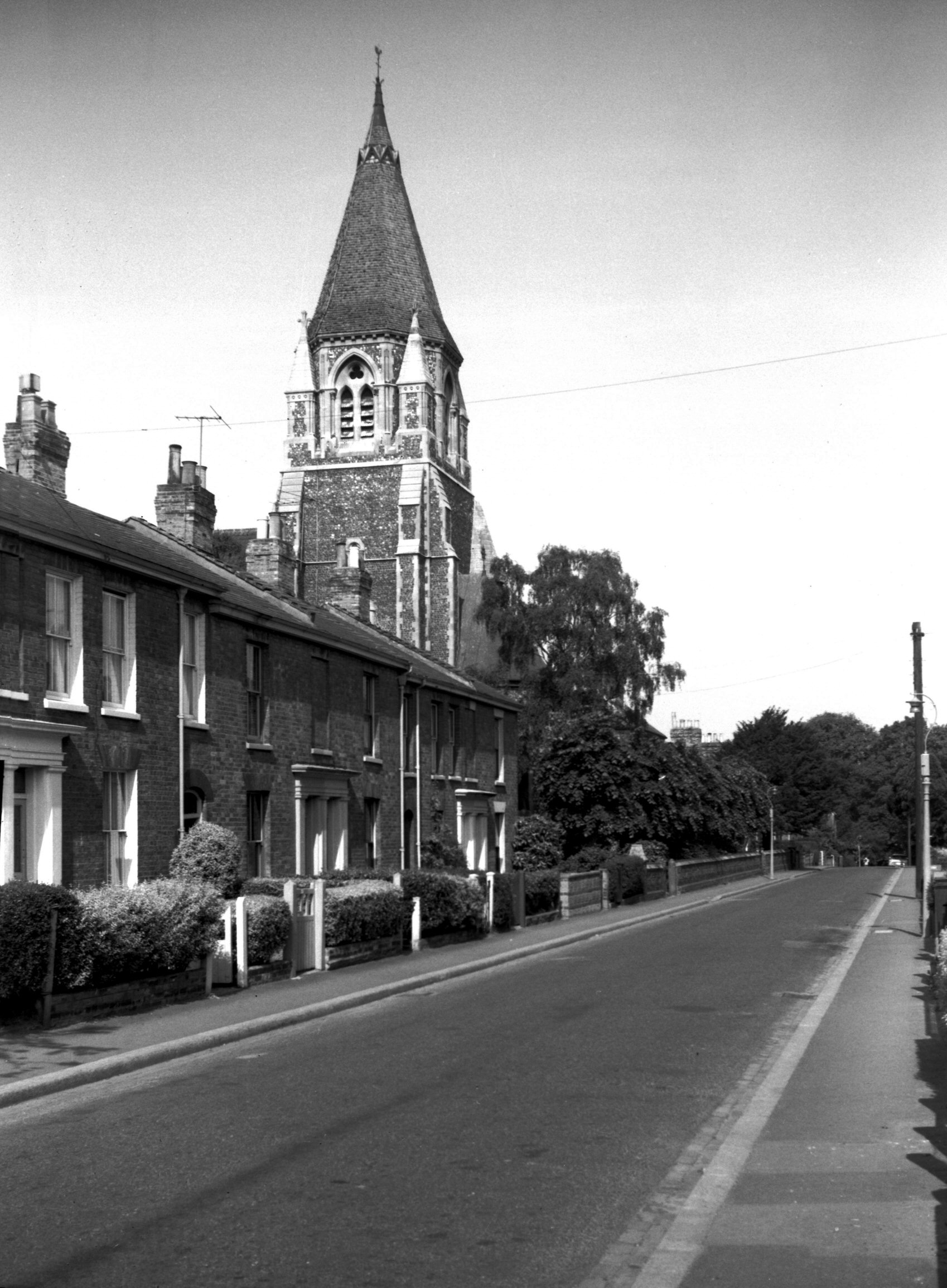
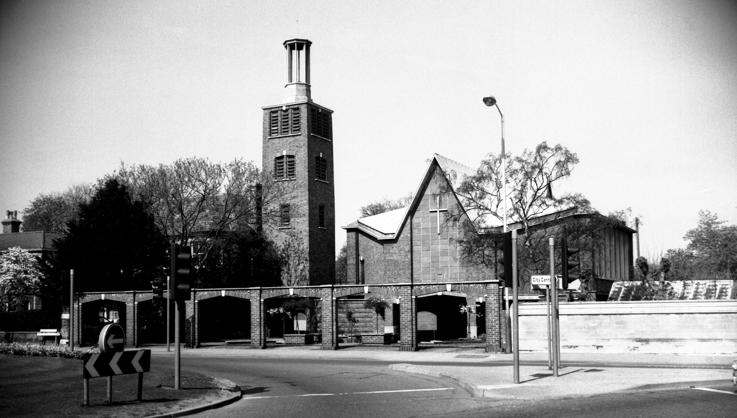
Holy Trinity South Heigham from Essex St [4686]
1962-06-30
Built 1861 in late 13c style, architect William Smith of
London. |
|
|
Holy Trinity South Heigham from Trinity St [7822]
2001-05-08
|
|
Trowse Bypass: |
| |
From
Martineau
Lane towards Loddon |
|
|
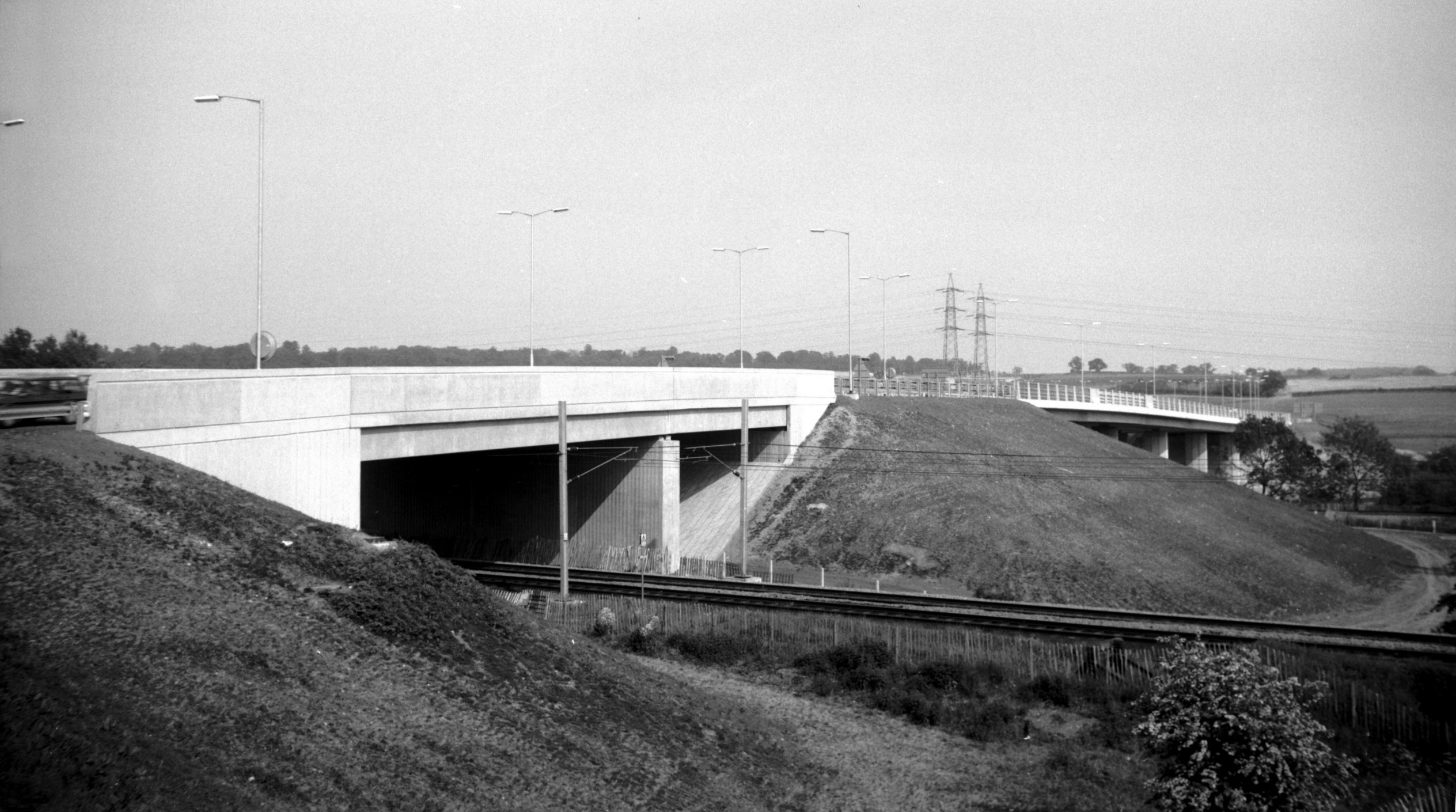
Yare Trowse bypass viaduct [6807] 1992-05-23
Over the railway and river Yare. Opened 20th May 1992. |
|
Trowse Millgate: |
| |
Near
Bracondale, Whitlingham
Lane and Trowse
Newton |
|
|
Trowse Millgate Mill House [6411] 1986-07-02
|
|
Tuckswood: |
| |
Off
Maid Marian Rd (Ipswich Rd) |
|
|
St Paul's Lakenham Tuckswood [4705] 1962-08-18
Tuckswood, built 1951. Chapel of Ease to St John the
Baptist and All Saints. |
|
Turner Rd: |
| |
From
Dereham Rd to Waterworks Rd
West side |
|
|
Turner Rd Wensum School with bell turret [7795]
2001-01-28
Formerly Wensum View school. |
|
Union St: |
| |
From
Vauxhall St to Trinity St
(formerly passing Chapel St, Suffolk
St)
West side |
|
|
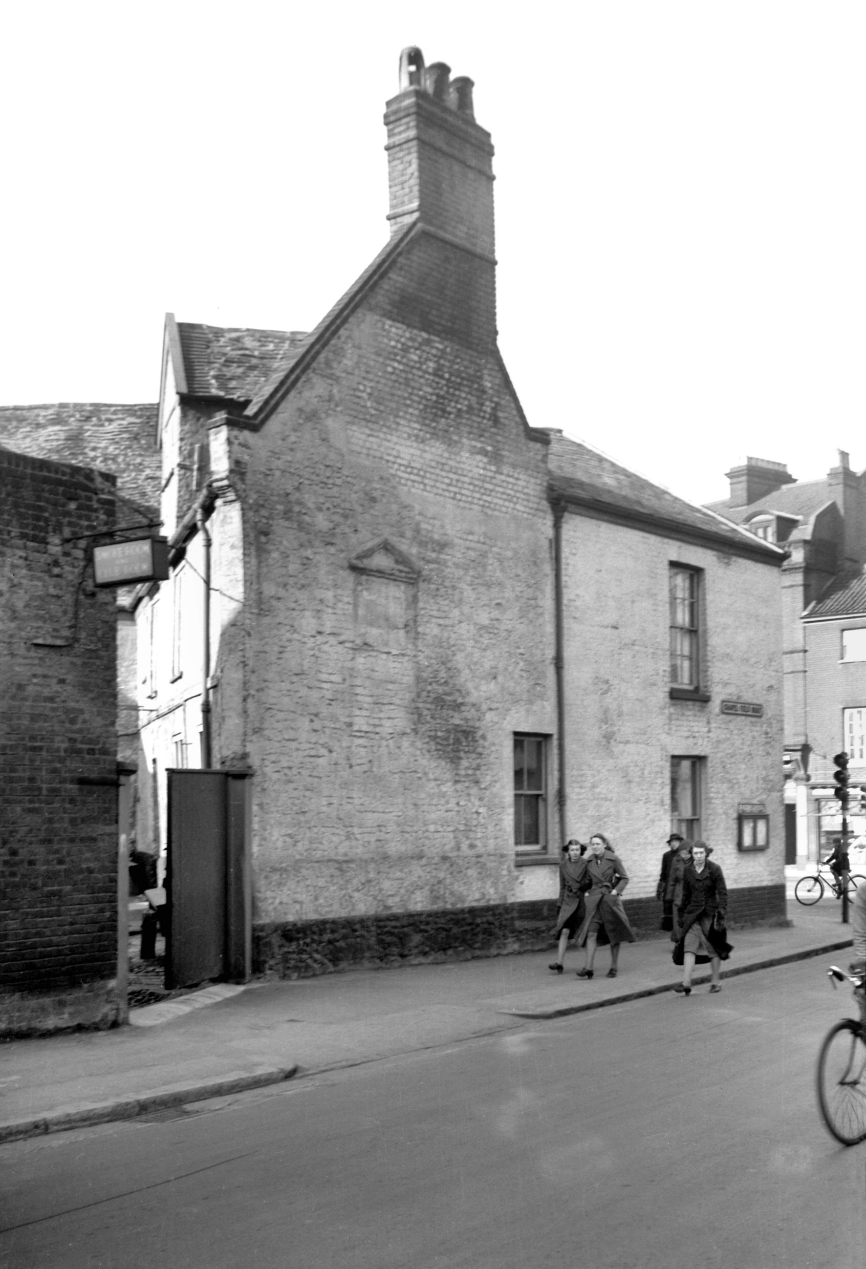
Union St Coach and Horses Row [4687] 1962-06-30
Erected 1961. |
|
|
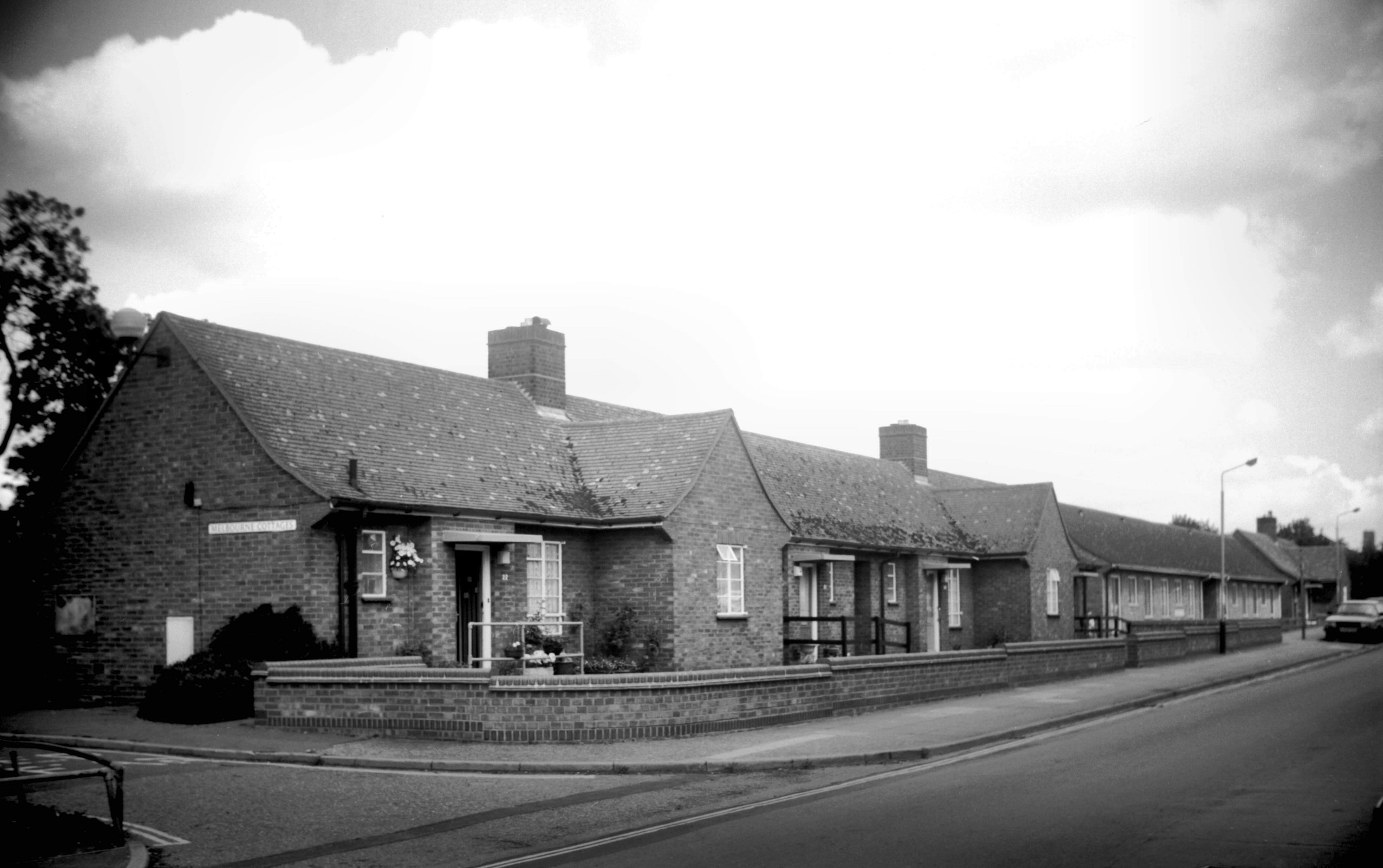
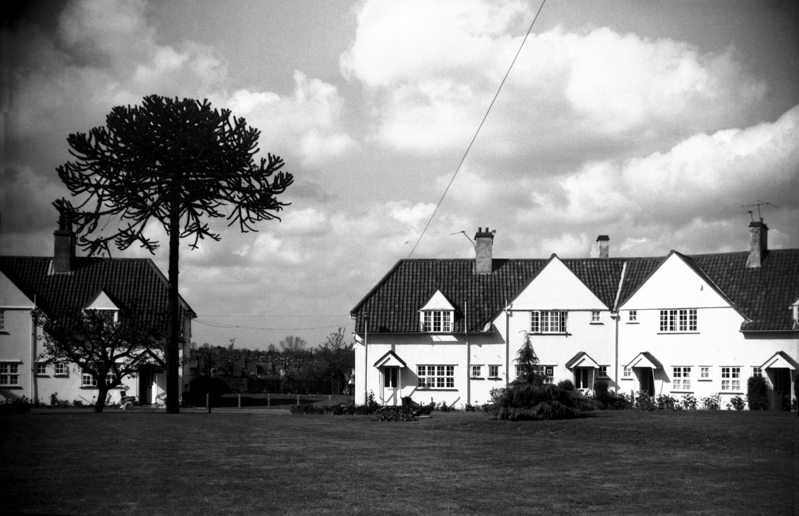
Union St Melbourne Cottages [7357] 1996-07-07
Built 1949-50 by Norwich City Council to house elderly
people. Originally for those whose homes were destroyed
during air raids of the Second World War. |
|
|
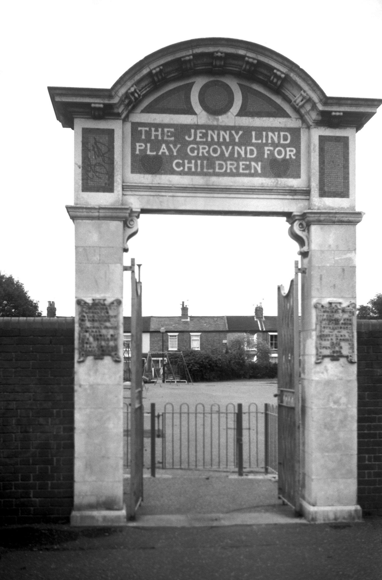
Union St Jenny Lind playground gateway [7512]
1997-10-08
Transferred in 1972 from its original site in Pottergate
which had been purchased and given to the City in January
1900 by James Jeremiah Colman in memory of his son Alan
who had died the previous year. The ornate gateway was
built ready for the official opening on 5th June 1902. By
1970 however the district had become depopulated and it
was decided to give the Pottergate site over to new
housing and form a new playground off Union St near the
Maternity Block of the Norfolk and Norwich hospital. |
| |
East
side |
|
|
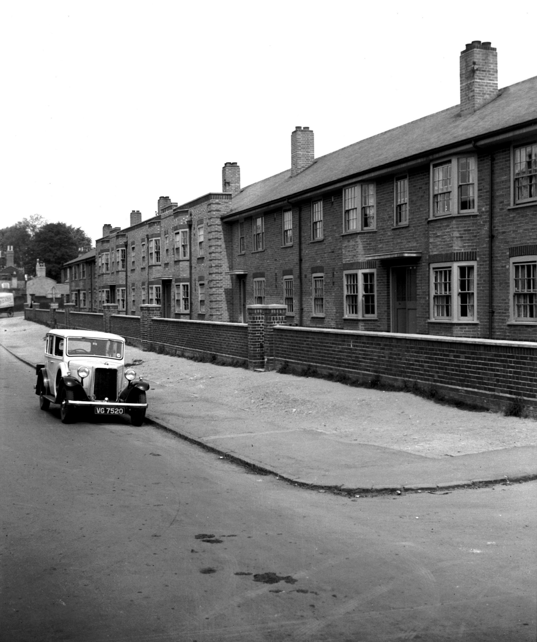
Union St east side council flats [3010] 1939-05-25
Two-storied council flats, erected 1938. |
|
Unthank Rd: |
| |
From
Earlham Rd / Grapes
Hill / Chapel Field Rd to Newmarket Rd
passing Oxford St, Somerleyton
St, Park Lane, Trinity
St, Mile End Rd, Colman
Rd
West side |
| |
|
|
|
St John's RC from St Giles' Gates [B078] 1931-08-03
|
|
|
St John's RC from Unthank Rd [B197] 1931-00-00
|
|
|
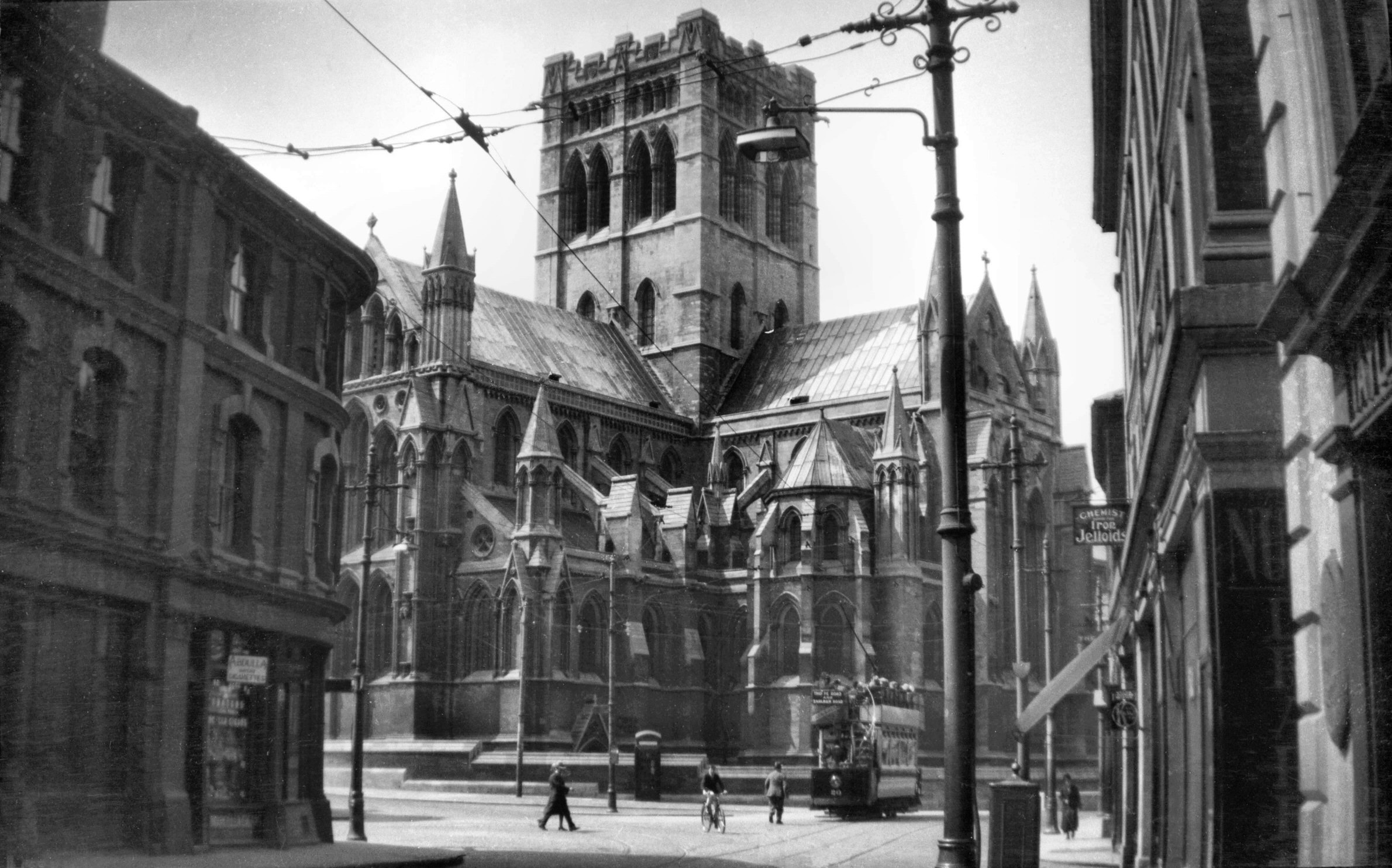
St John's RC north side from Earlham Rd [B275]
1932-05-00
North transept, tower, nave, porch and baptistry. |
|
|
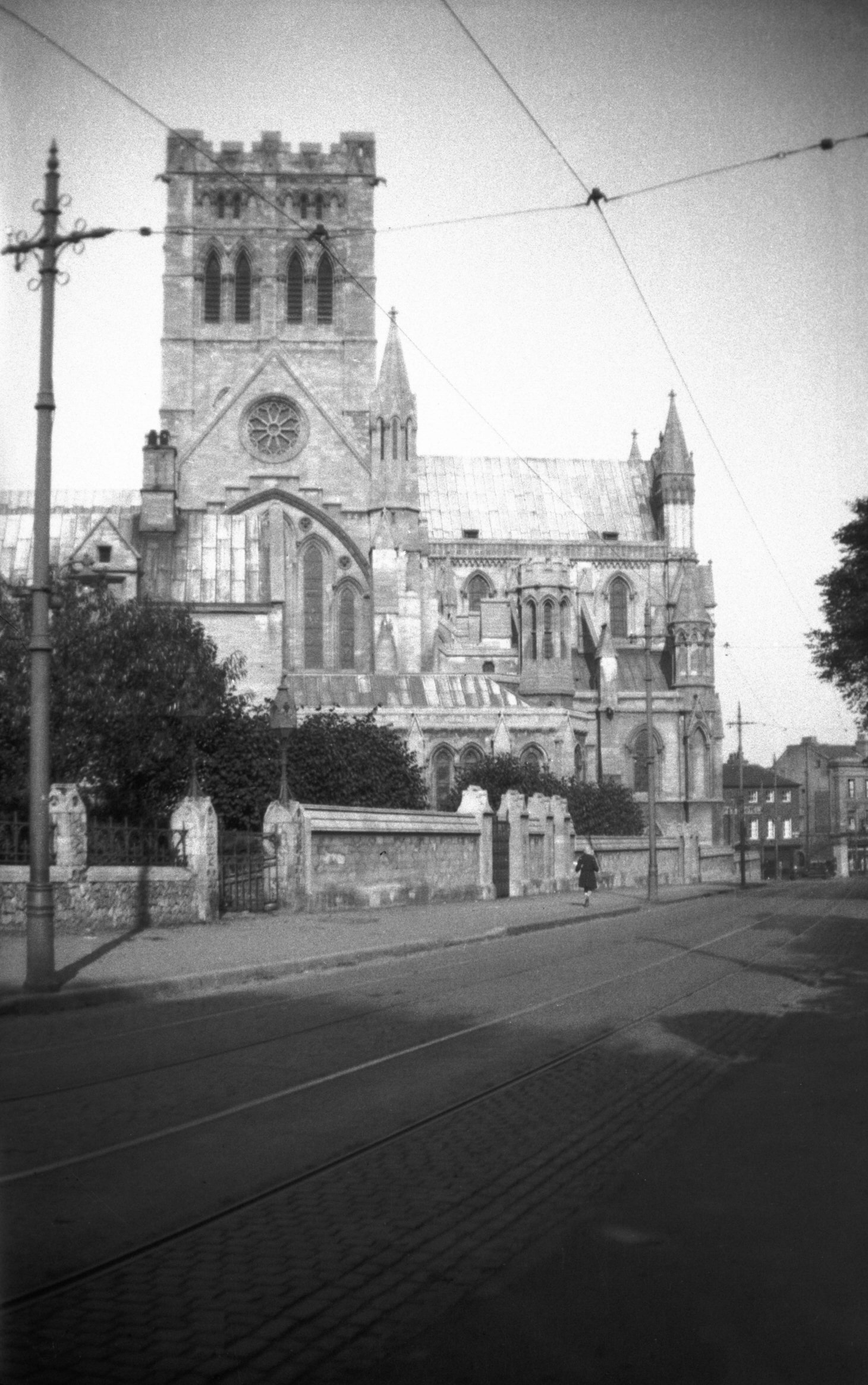
St John's RC tower choir and north transept [4379]
1955-09-09
With Walsingham chapel. |
|
|
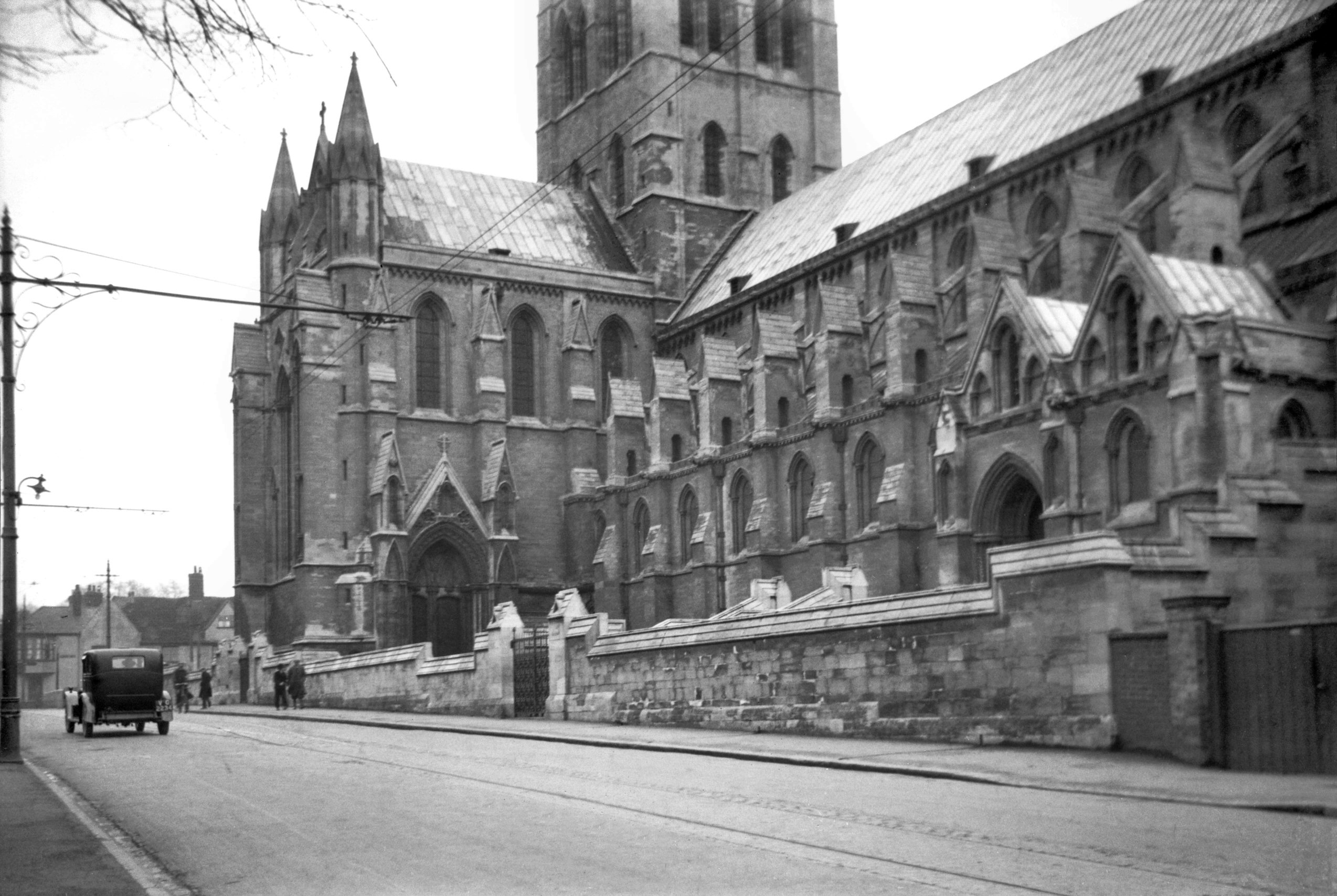
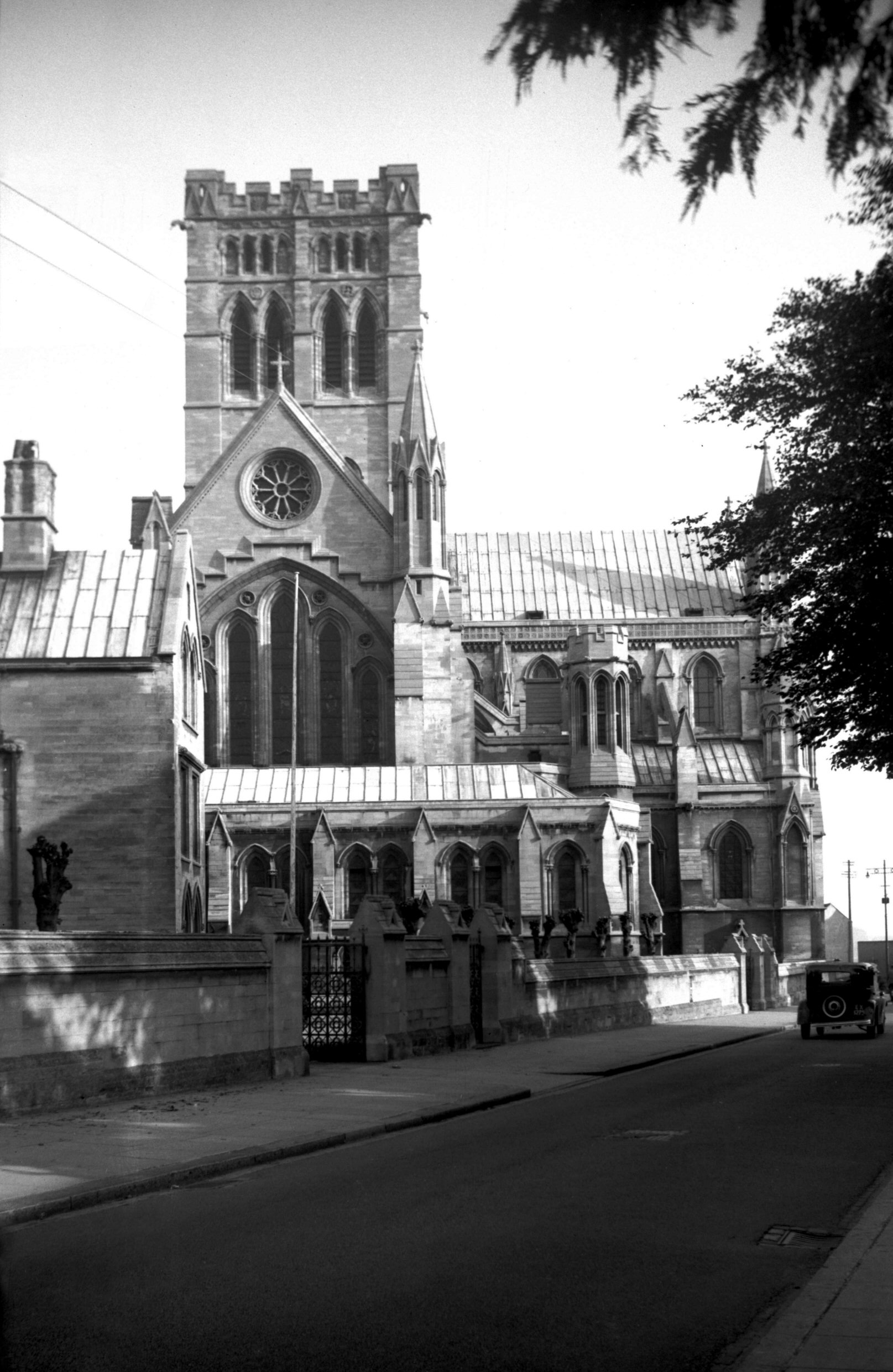
St John's RC south side from Unthank Rd [4415]
1955-10-07
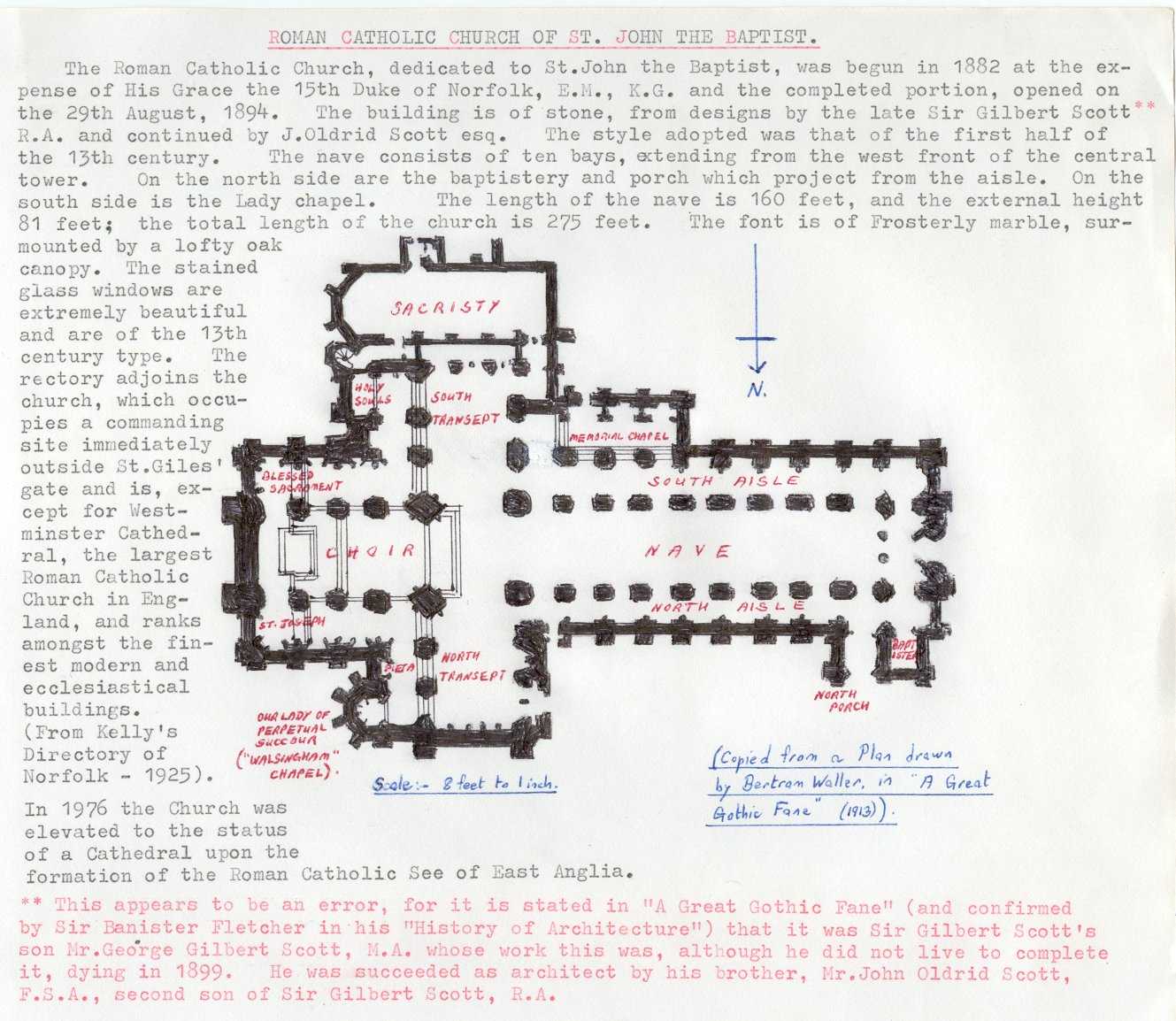
"The Roman Catholic Church, dedicated to St John the
Baptist, was begun in 1882 at the expense of His Grace
the 15th Duke of Norfolk E.M. K.G. and the completed
portion, opened on the 29th August 1894. The building is
of stone, from designs by George Gilbert Scott M.A. and
continued by his brother J.Oldrid Scott F.S.A. The style
adopted was that of the first half of the 13th century.
The nave consists of ten bays, extending from the west
front of the central tower. On the north side are the
baptistery and porch which project from the aisle. On the
south side is the Lady Chapel. The length of the nave is
160 feet, and the external height 81 feet; the total
length of the church is 275 feet. The font is of
Frosterly marble, surmounted by a lofty oak canopy. The
stained glass windows are extremely beautiful and are of
the 13th century type. The rectory adjoins the church,
which occupies a commanding site immediately outside St
Giles' Gate and is, except for Westminster Cathedral, the
largest Roman Catholic church in England, and ranks
amongst the finest modern and ecclesiastical
buildings." (Kelly's Directory of Norfolk,
1925). |
|
|
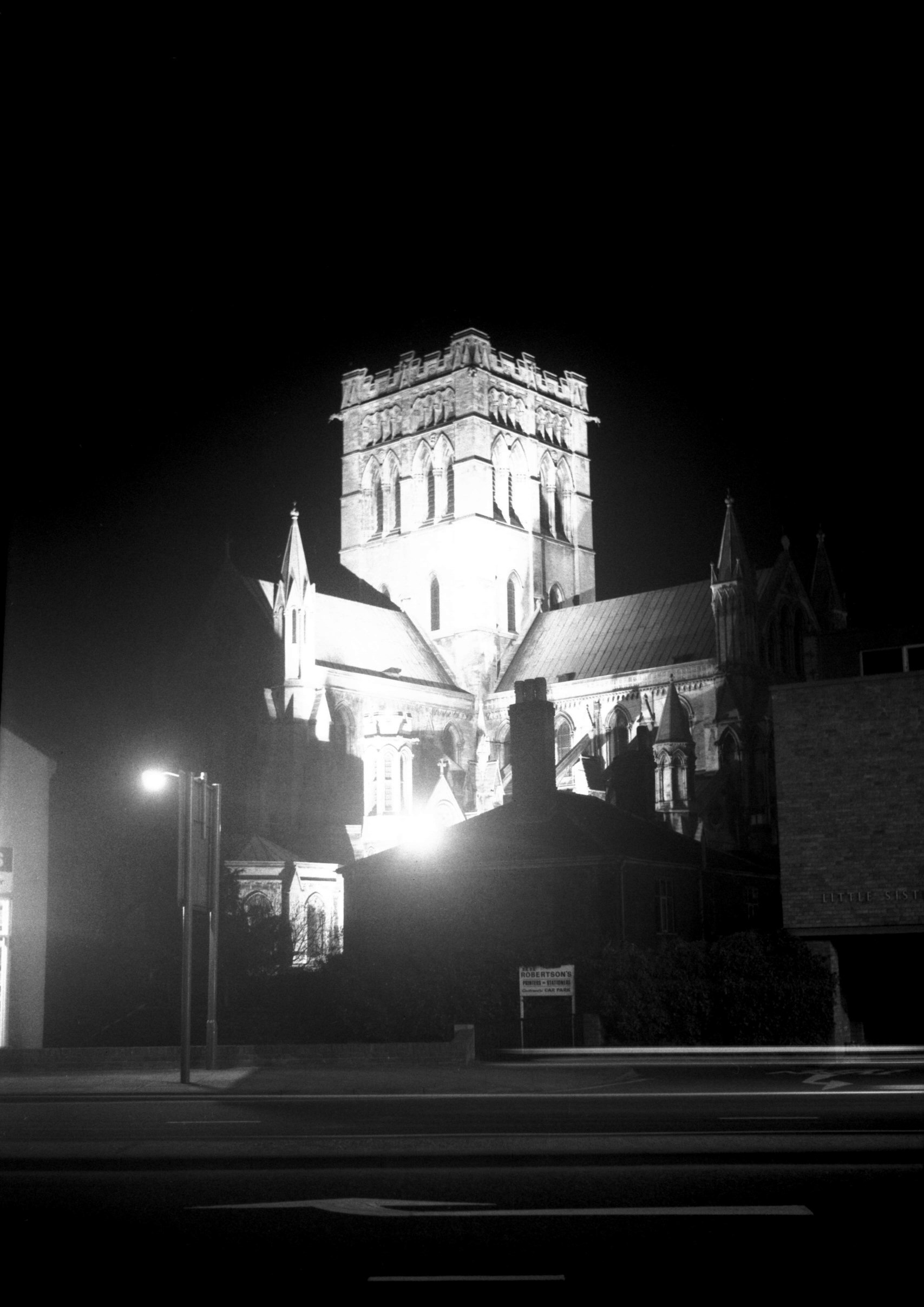
St John's RC floodlit from Convent Rd [5735]
1977-03-12
The building is on the site of the old City Gaol, and was
completed in 1910. In 1976 the church was elevated to the
status of a cathedral upon the formation of the Roman
Catholic See of East Anglia. |
|
|
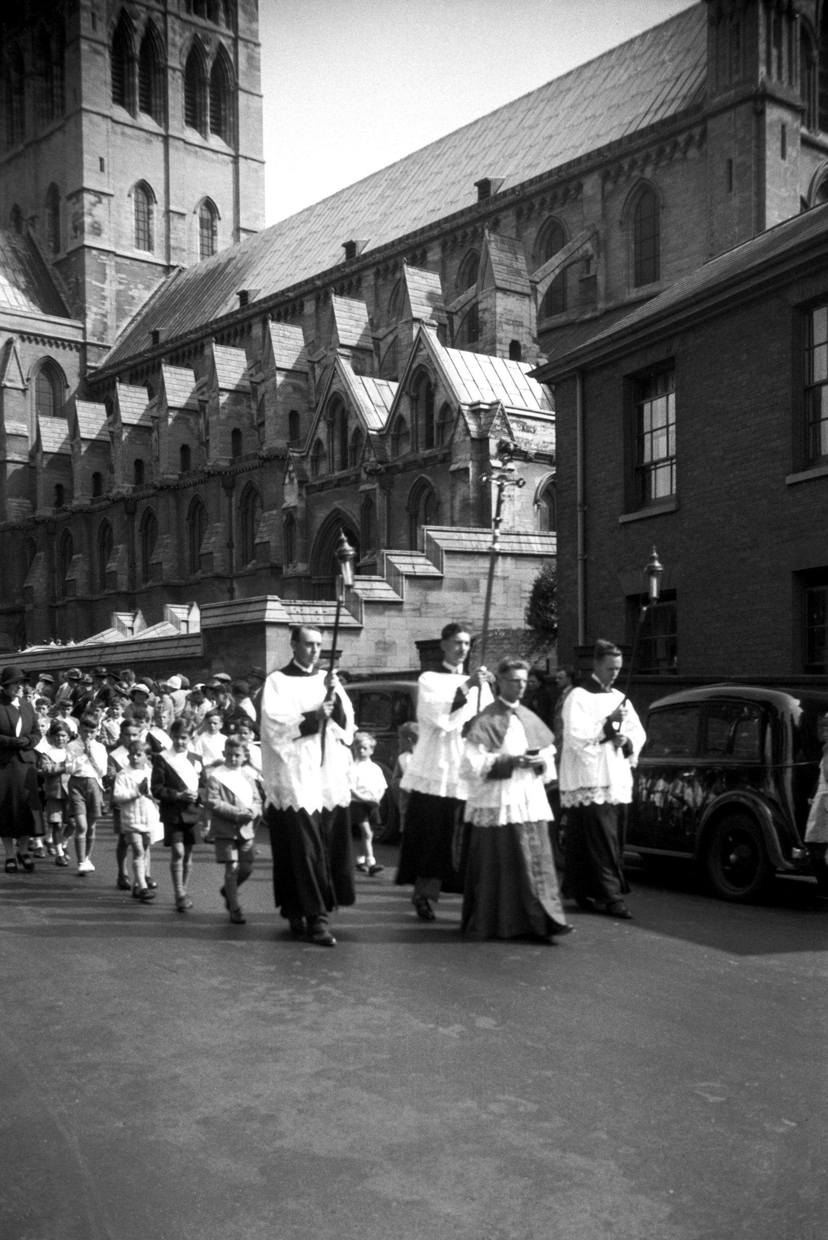
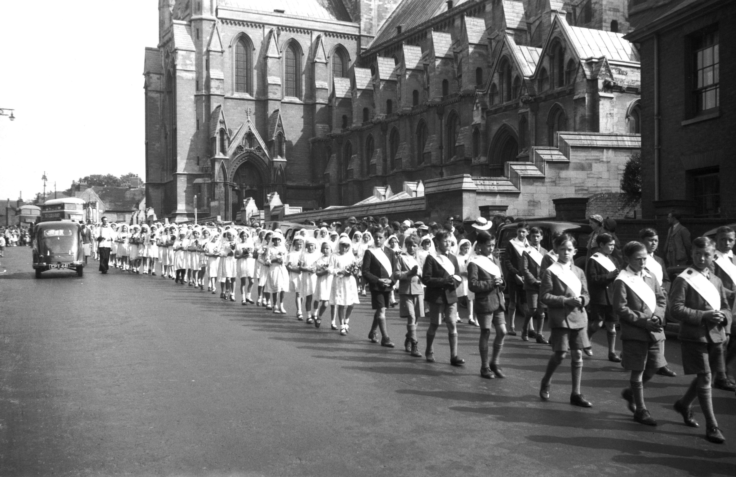
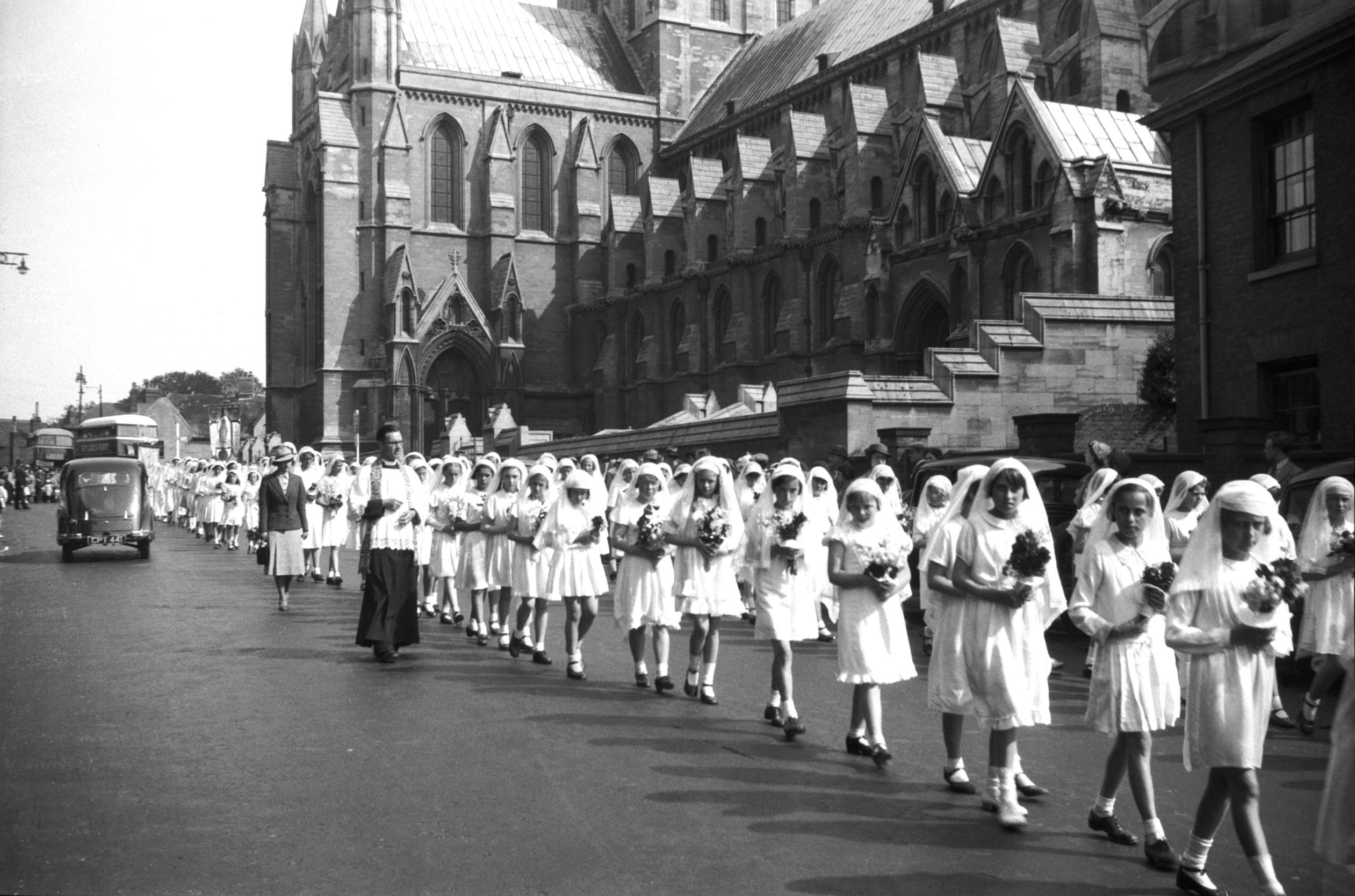
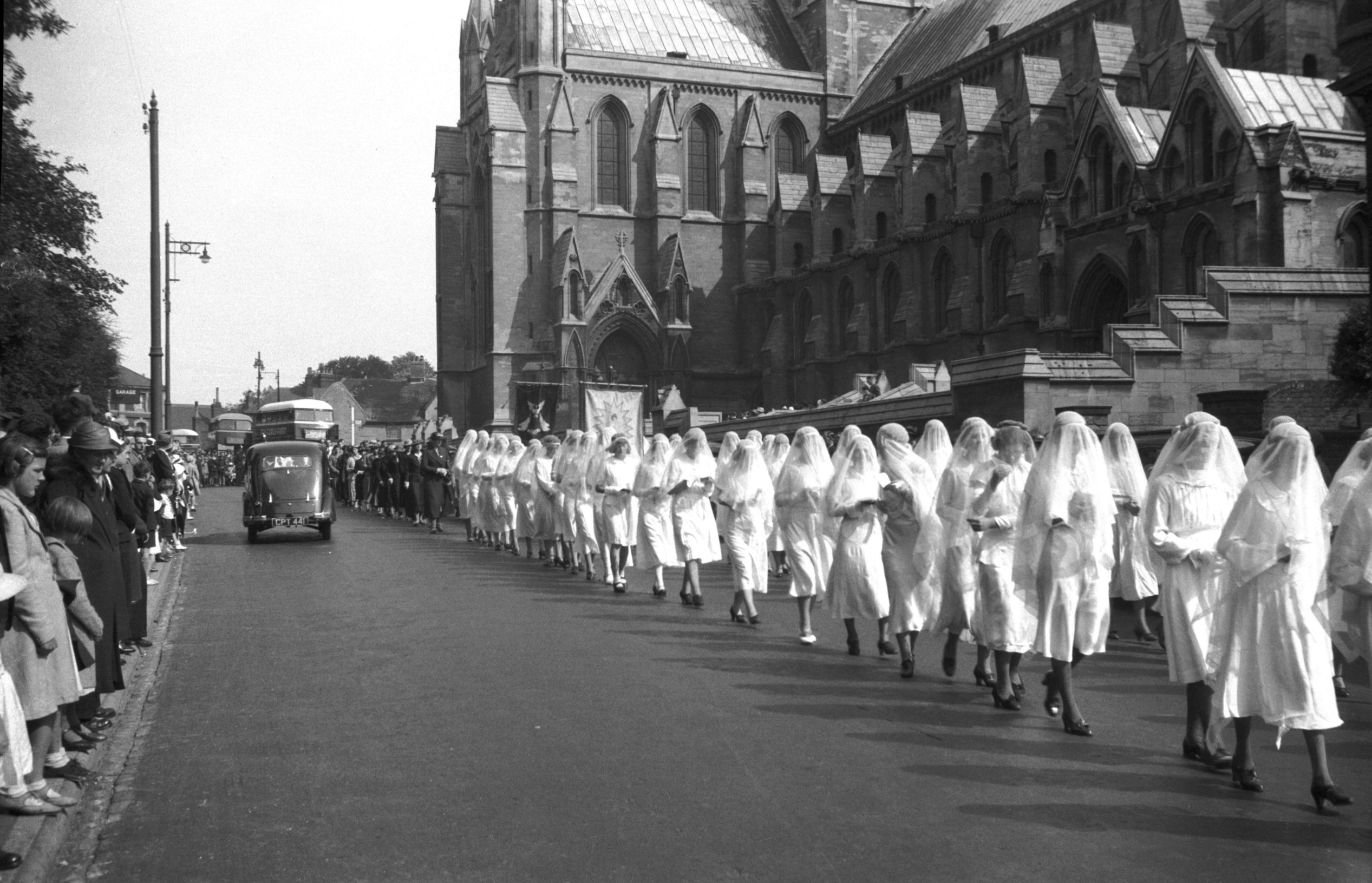
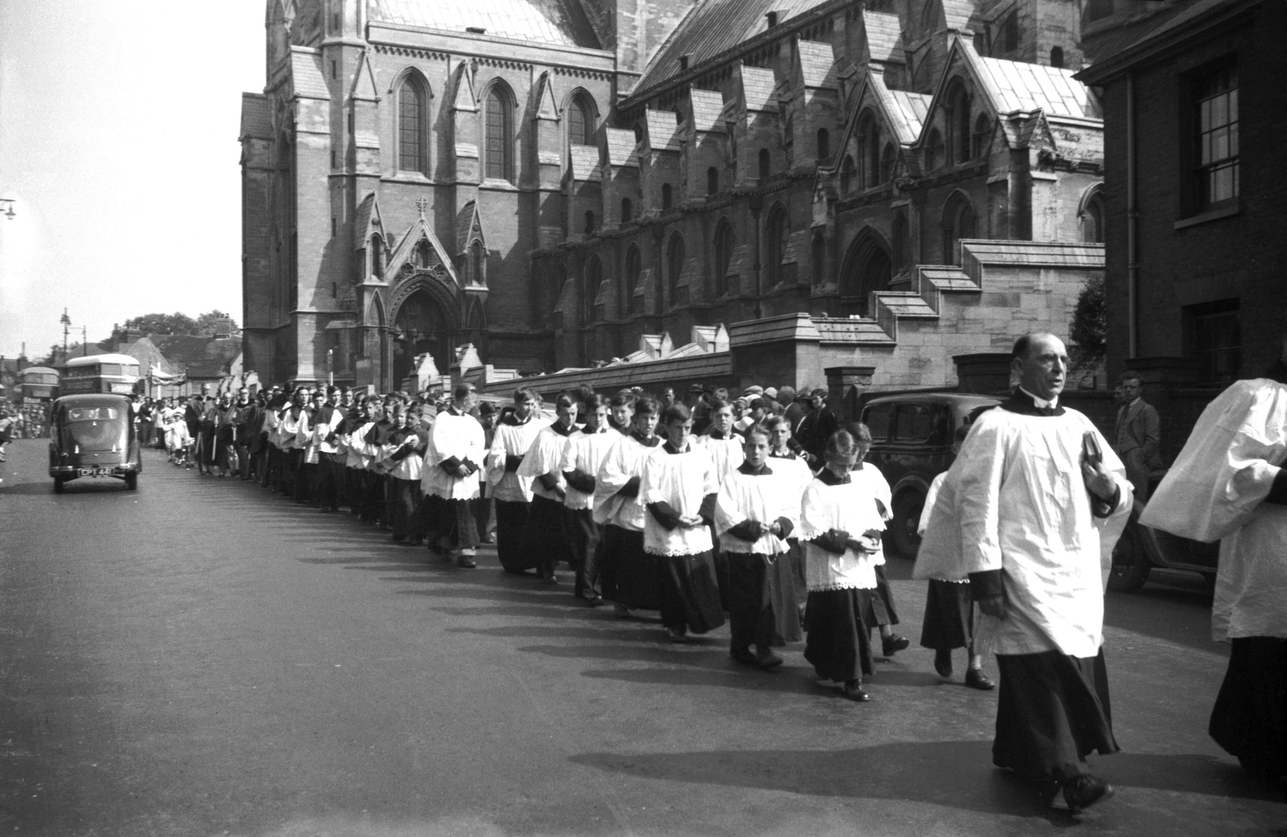
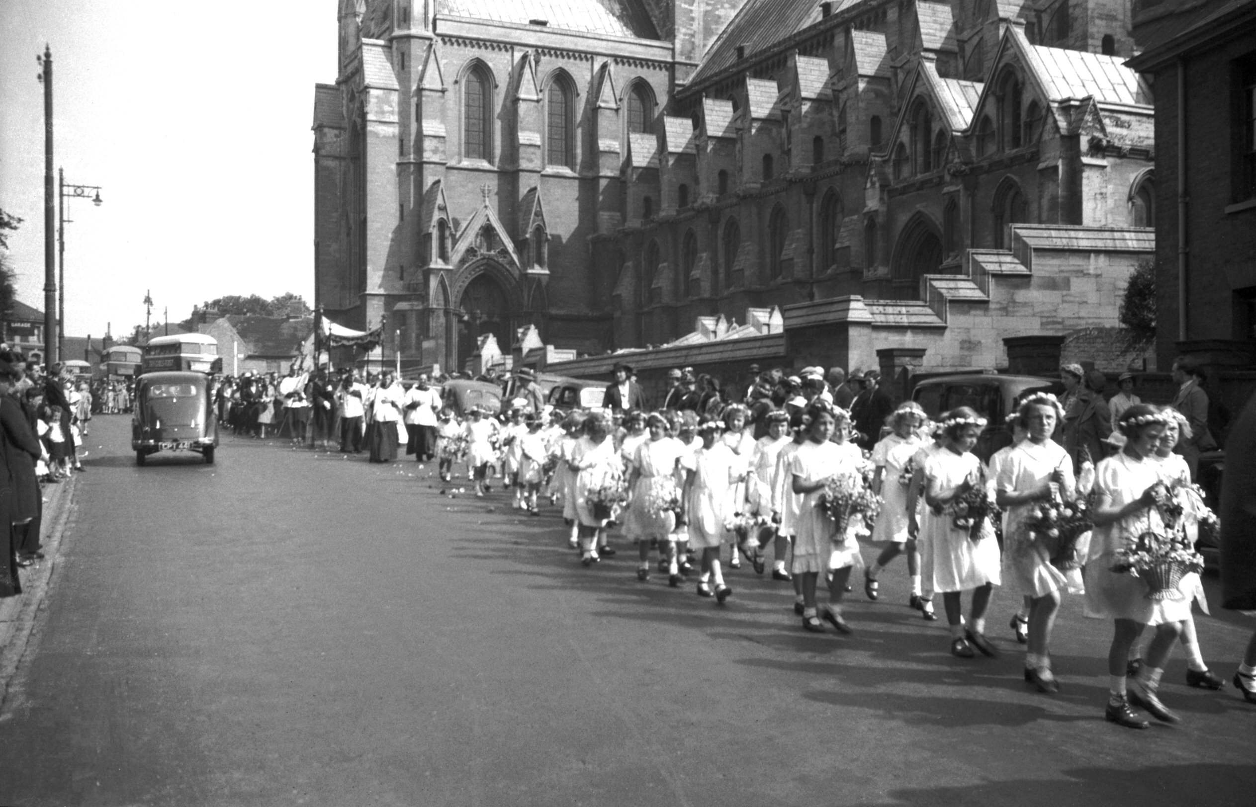
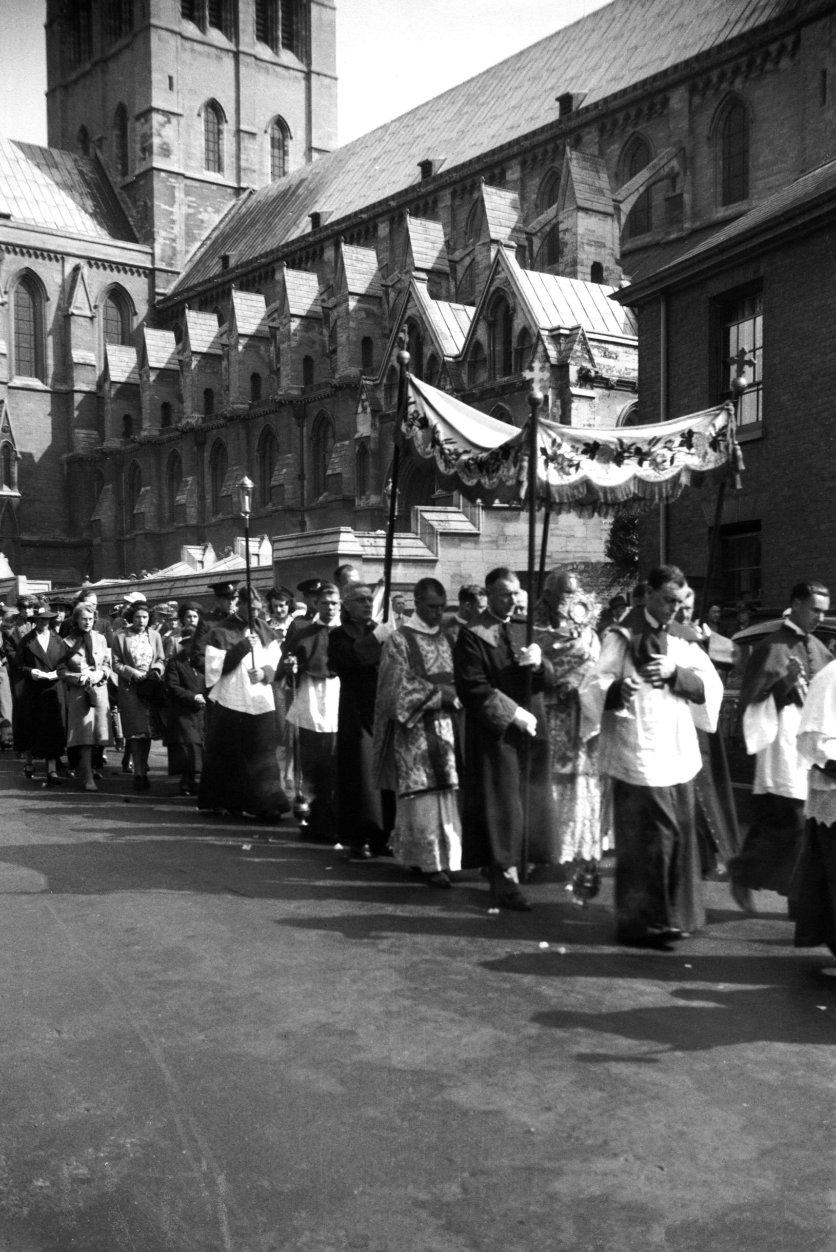
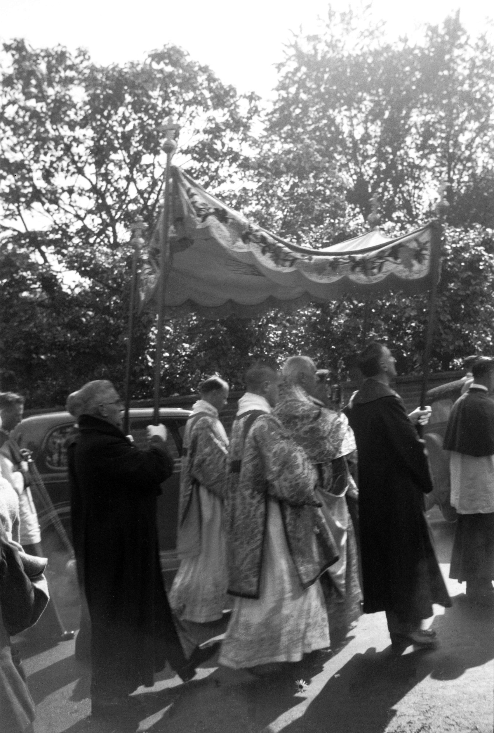
Catholic procession cross bearer [2483] 1938-06-19
Roman Catholic Procession 19th June 1938:
Following Corpus Christi. It proceeded from St John's RC
church along Earlham Rd to Heigham House, Heigham Rd. |
|
|
Catholic procession boys [2484] 1938-06-19
|
|
|
Catholic procession girls with flowers [2485]
1938-06-19
|
|
|
Catholic procession veiled girls [2486] 1938-06-19
|
|
|
Catholic procession robed choir [2487] 1938-06-19
|
|
|
Catholic procession small girls [2488] 1938-06-19
|
|
|
Catholic procession priest carrying Host [2489]
1938-06-19
|
|
|
Catholic procession priest rear [2490] 1938-06-19
Priest and Acolytes. |
|
|
St John's RC view east to City Hall [5971] 1978-08-19
|
|
|
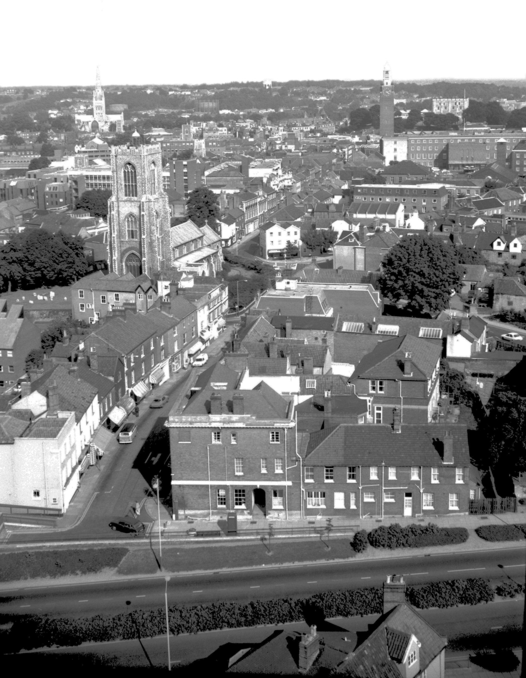
St John's RC view east to St Giles' St [5973]
1978-08-19
|
|
|
St John's RC view NE St Giles' on right [5969]
1978-08-19
|
|
|
St John's RC view NE to St Benedict's [5975]
1978-08-19
St Benedict's church tower left. St Lawrence's church
tower right. |
|
|
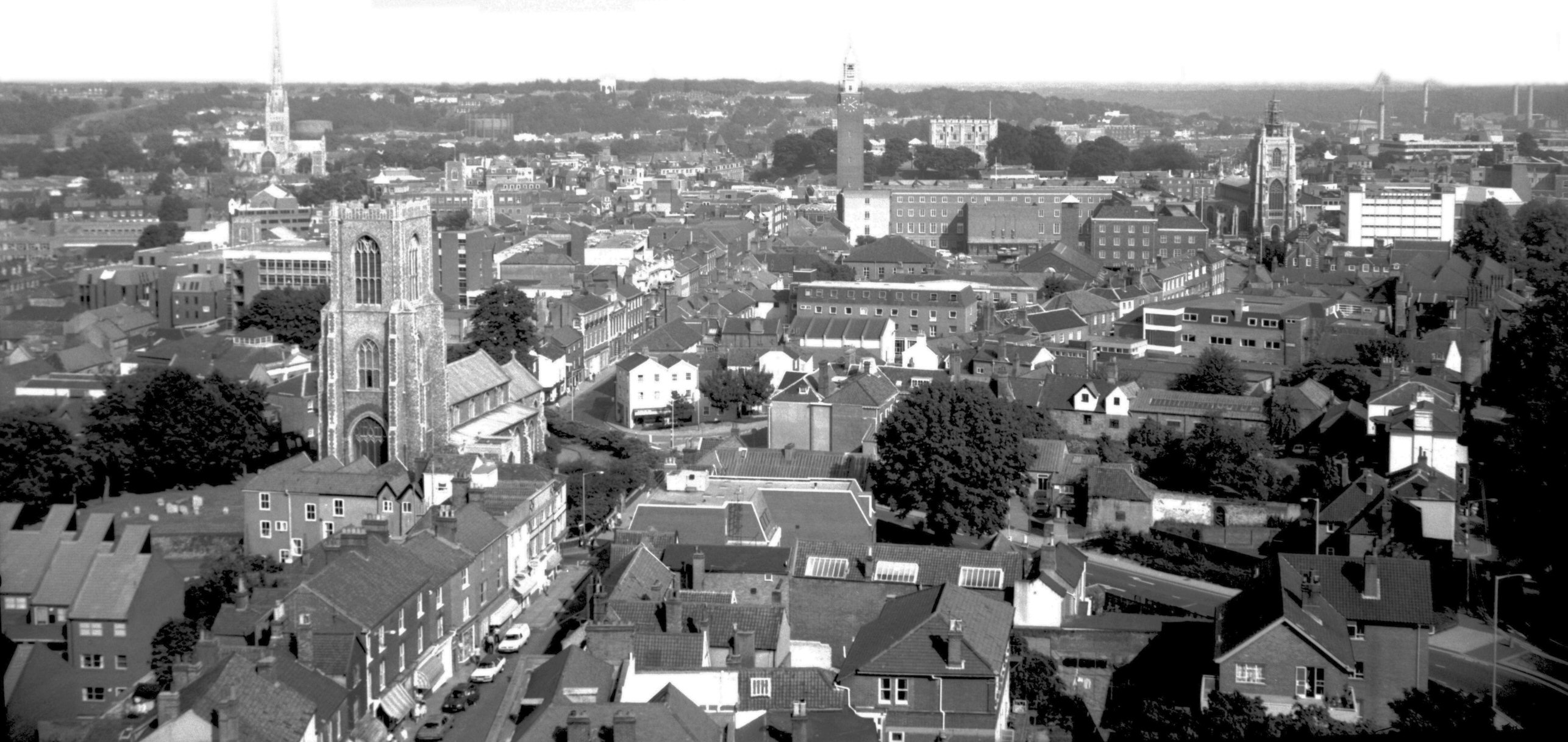
St John's RC view north to Grapes Hill [5970]
1978-08-19
From Catholic Cathedral tower - 152 feet above ground. |
|
|
St John's RC view SE to Chapel Field Rd [5972]
1978-08-19
Site of city wall marked on roundabout. |
|
|
St John's RC view south to Winchester tower [5974]
1978-08-19
|
|
|
Unthank Rd Baptist church COLOUR [2968] 1939-04-16
|
|
|
Unthank Rd Baptist chapel demolition [4244]
1954-05-11
Built 1874-75. Demolished 1954. |
|
|
Unthank Rd United Reformed church [6456] 1987-04-27
Formerly Presbyterian, opened 24th March 1956, architects
Edward Boardman and son and Bernard M.Feilden. |
|
|
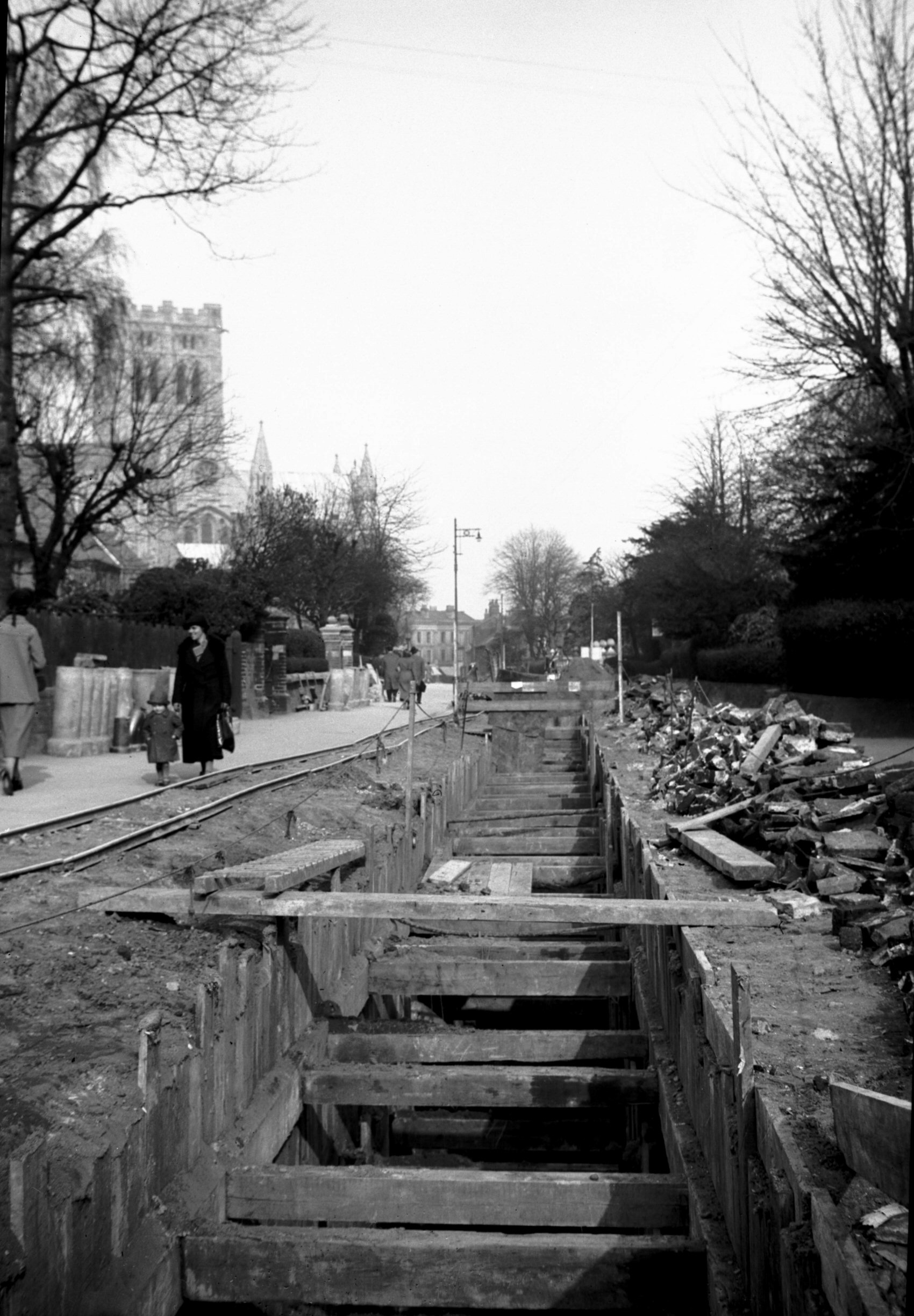
Unthank Rd trenches for new sewer [2156] 1938-03-12
|
|
|
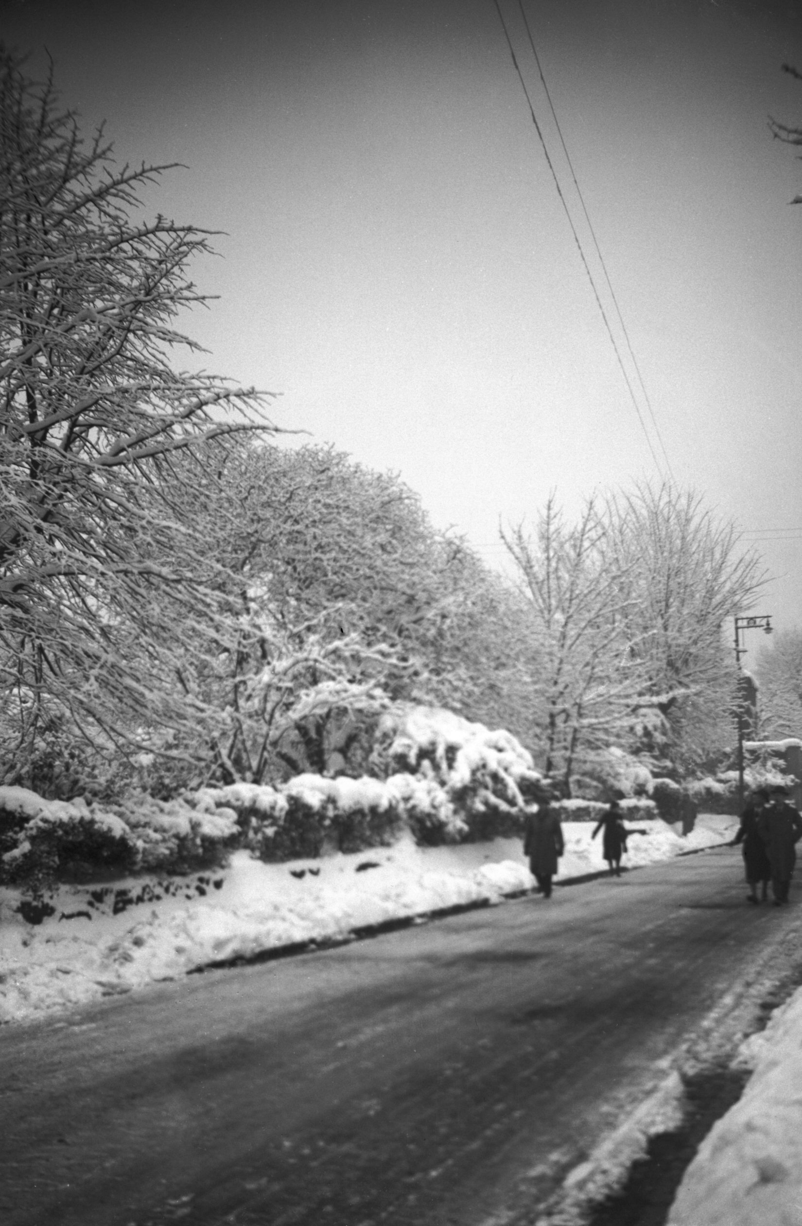
Unthank Rd heavy snow view south [2861] 1938-12-22
|
|
|
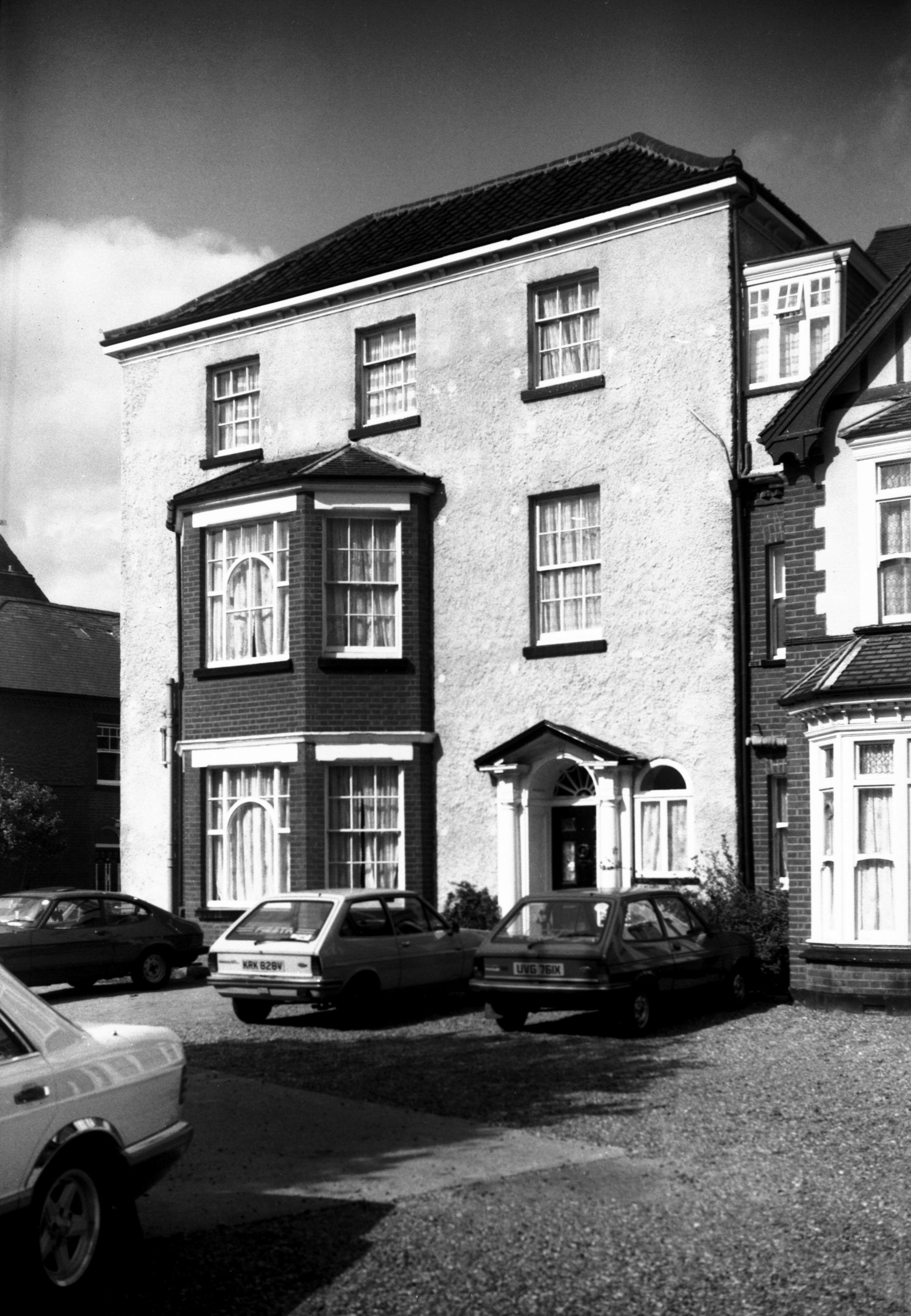
Unthank Rd 23 Heathcote Hotel facade [6599]
1990-04-11
|
|
|
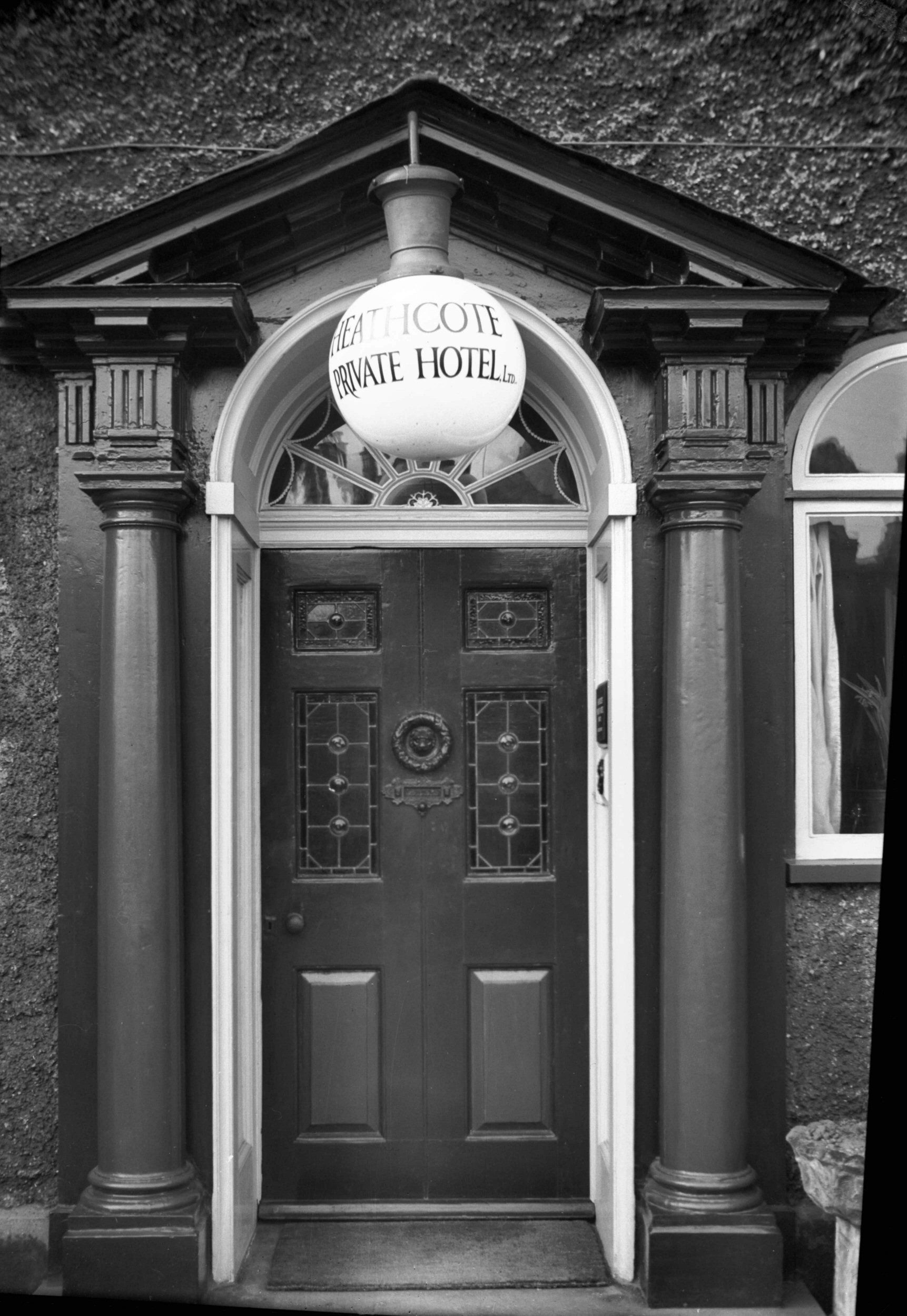
Unthank Rd 23 Georgian doorway [2155] 1938-03-12
|
|
|
Unthank Rd 49 The Elms [6598] 1990-04-11
Rowntree Mackintosh alms houses. |
|
|
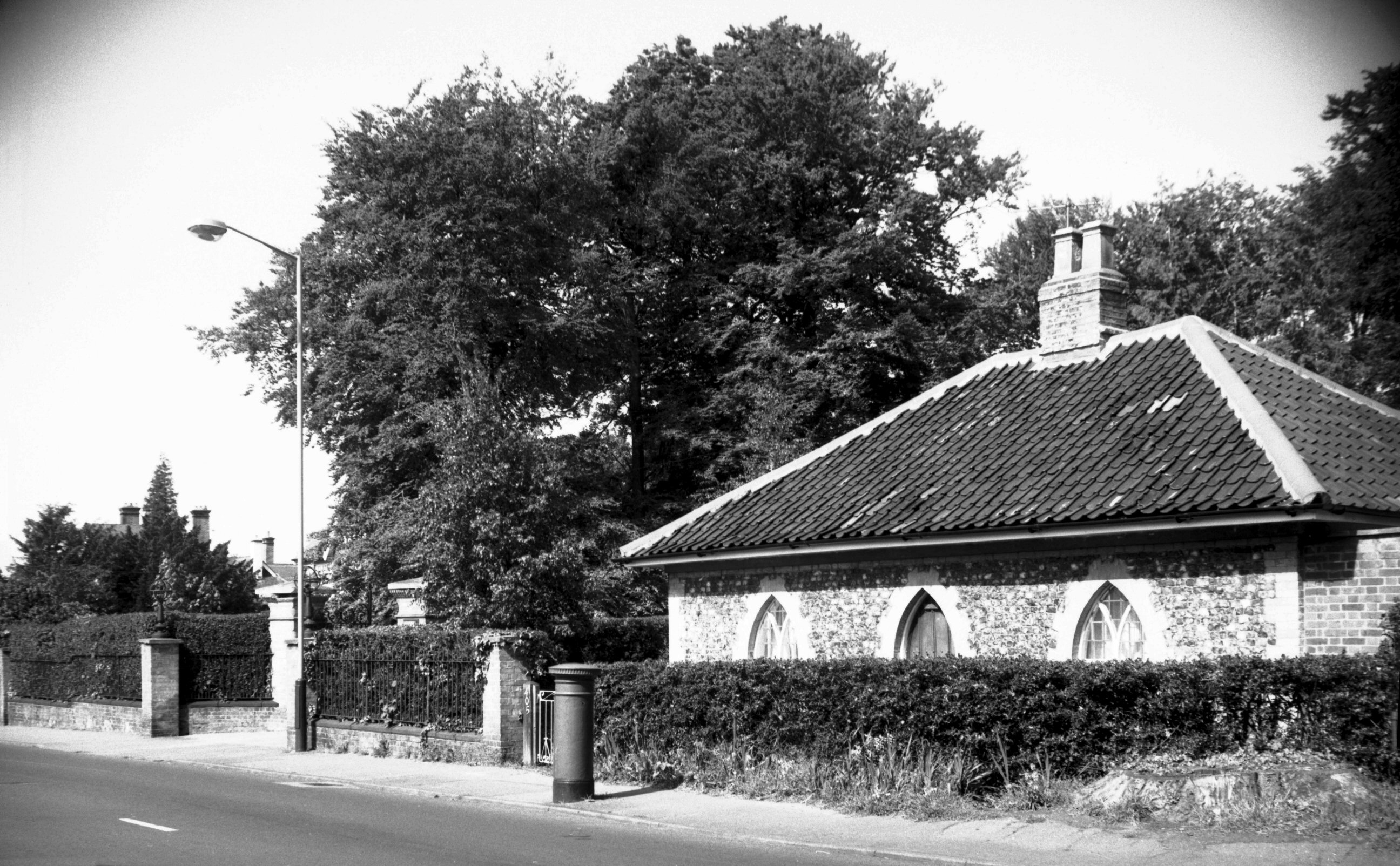
Unthank Rd 405 former Eaton Hall lodge [6785]
1992-05-16
See Hurd Rd for Eaton Hall. |
|
|
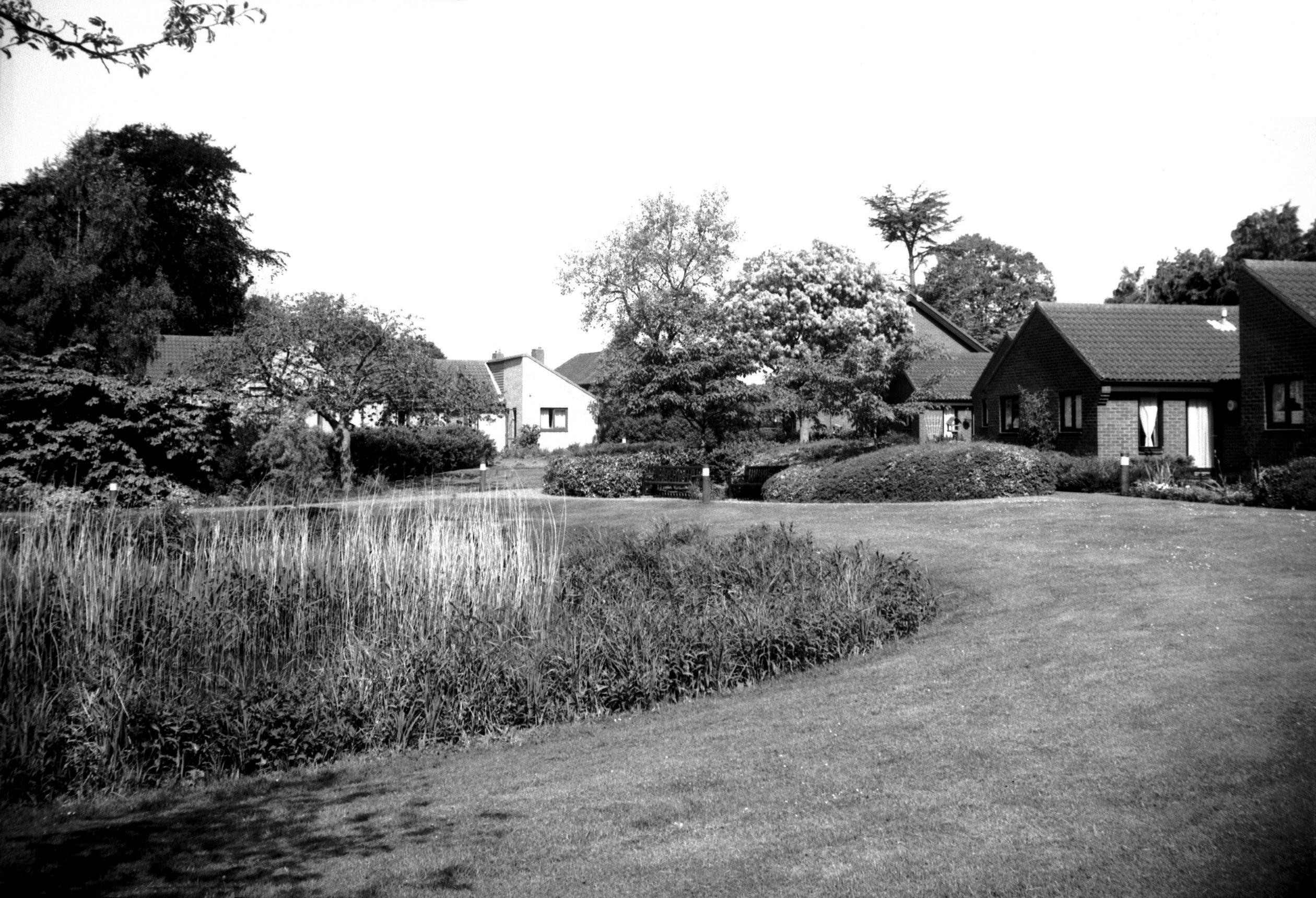
Unthank Rd Ryrie Court sheltered housing [6784]
1992-05-16
|
| |
East
side |
|
|
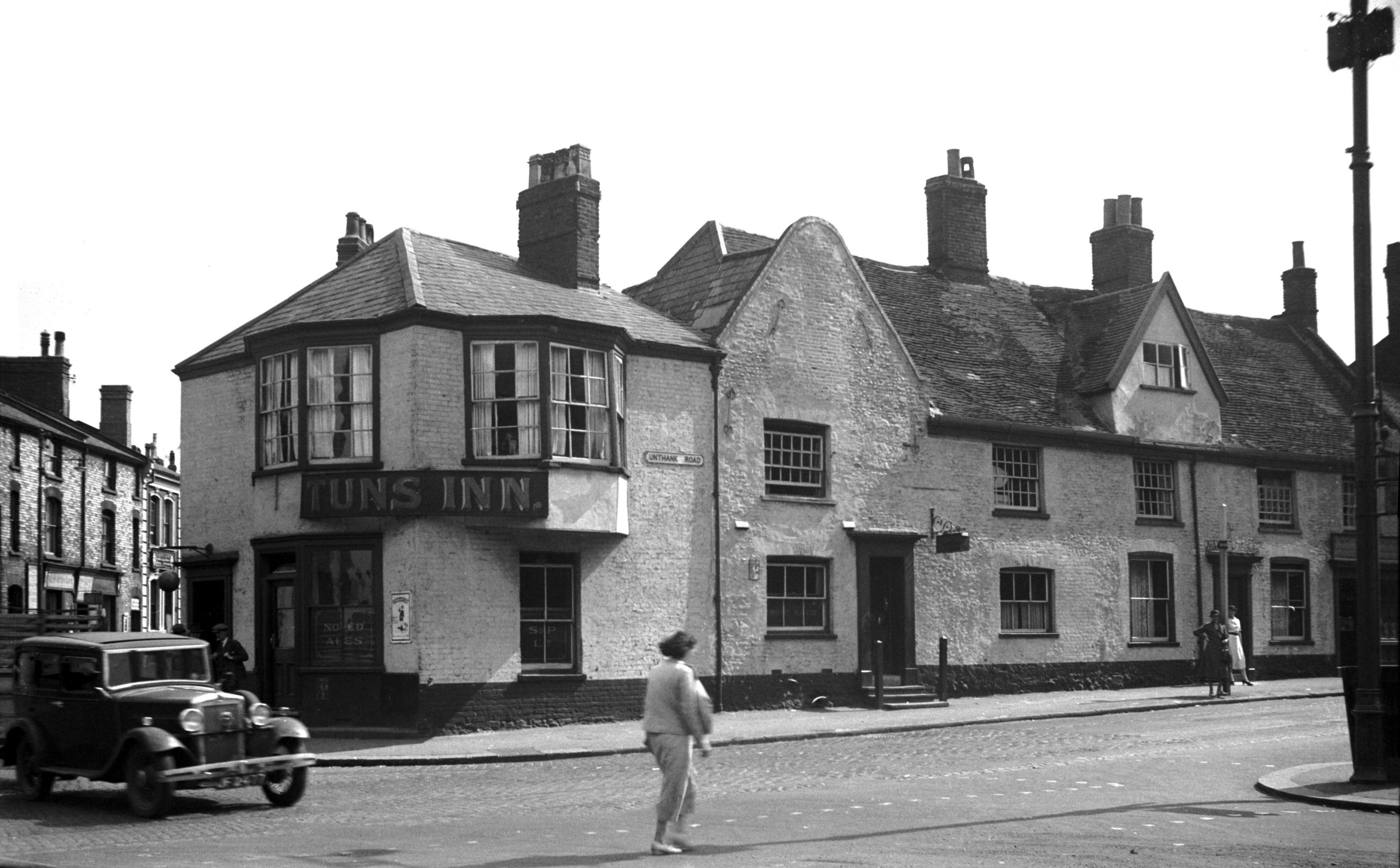
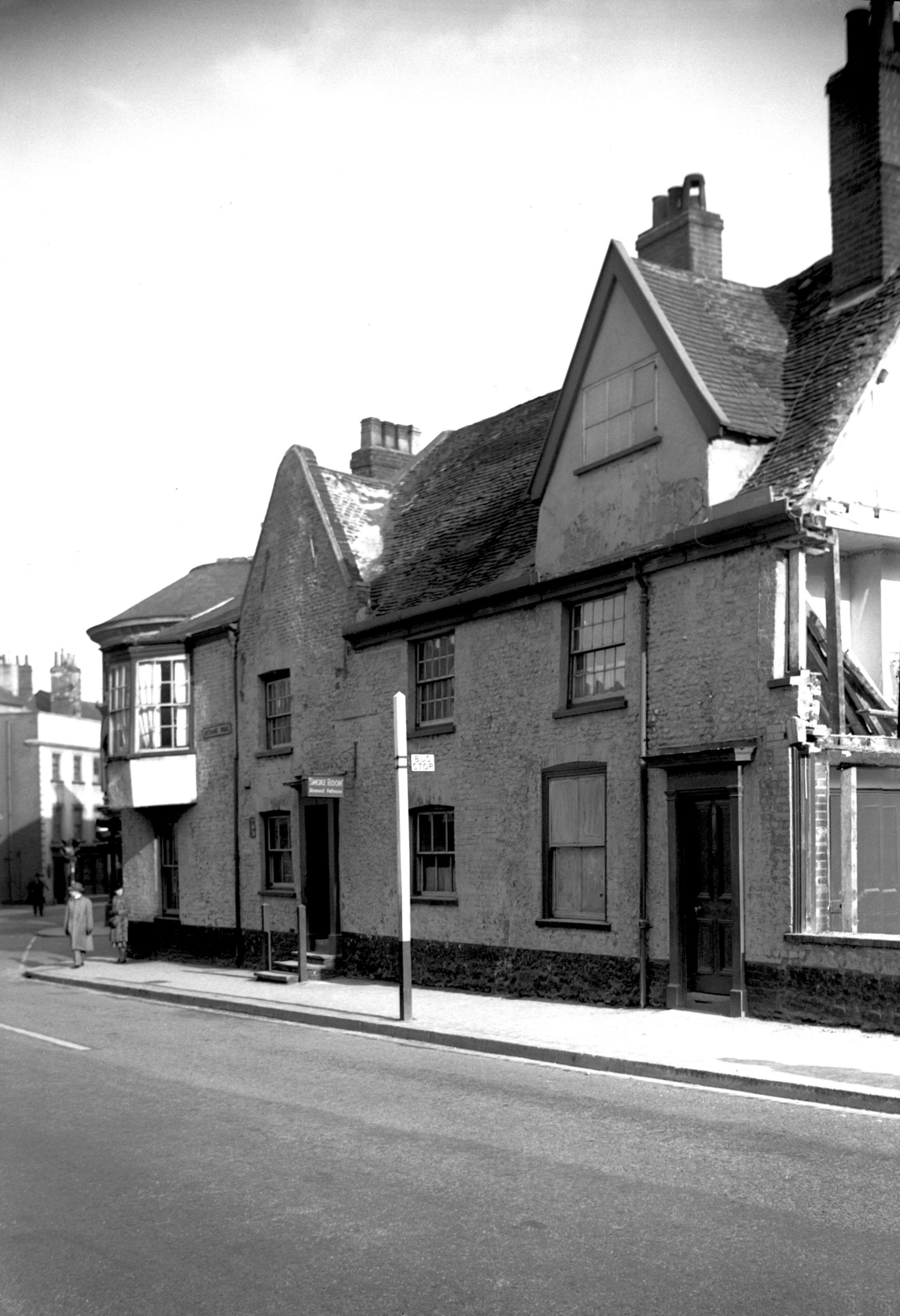
Unthank Rd 2 Tuns PH front [1837] 1937-08-06
|
|
|
Unthank Rd 2 Tuns PH yard [1328] 1936-08-26
|
|
|
Unthank Rd 2 Tuns PH yard [2877] 1939-02-23
|
|
|
Unthank Rd 2 Tuns PH from Chapel Field Rd [2878]
1939-02-23
|
|
|
Unthank Rd 2 Tuns PH W side from Unthank Rd [2883]
1939-02-26
|
|
|
Unthank Rd 2 Tuns PH from Chapel Field Rd [4803]
1964-08-05
|
|
|
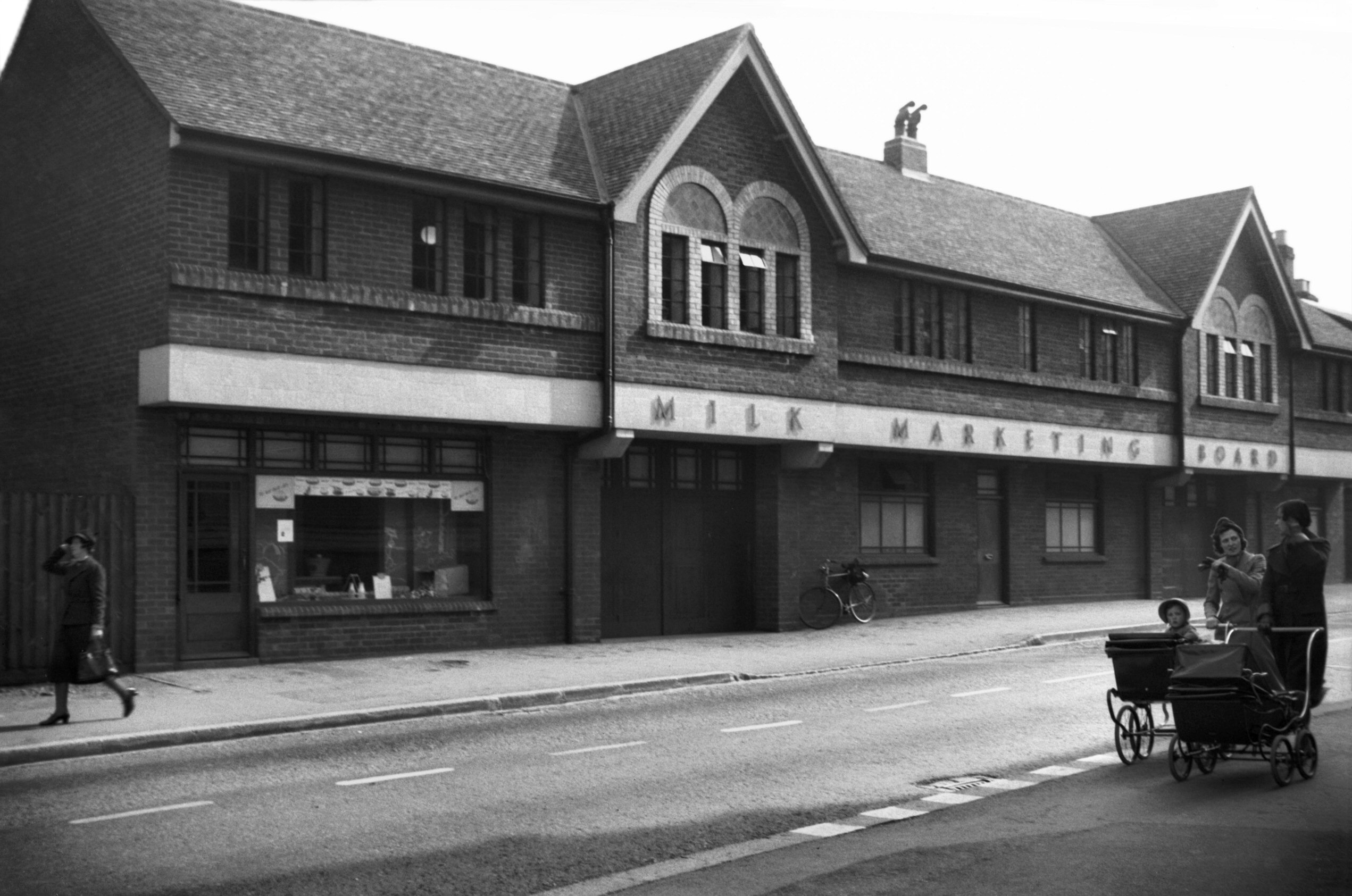
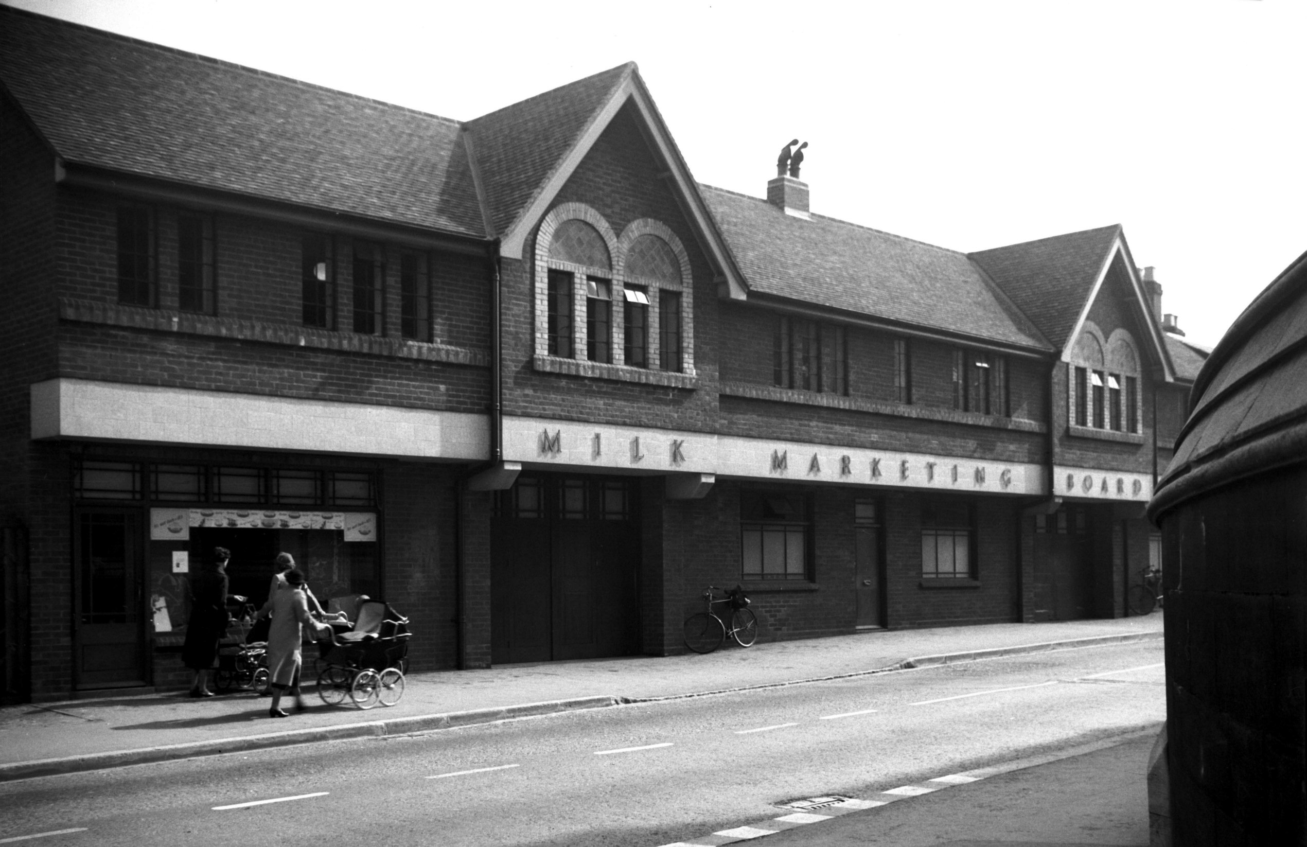
Unthank Rd 4 to 14 Milk Marketing Board [3386]
1940-04-30
Erected 1939, architect Layton. |
|
|
Unthank Rd 4 to 14 Milk Marketing Board [3387]
1940-04-30
|
|
|
Unthank Rd 4 to 8 [1838] 1937-08-06
|
|
|
Unthank Rd 10 to 14 [1824] 1937-07-28
|
|
|
Unthank Rd 12 Regency Georgian doorway [0486]
1935-04-21
|
|
|
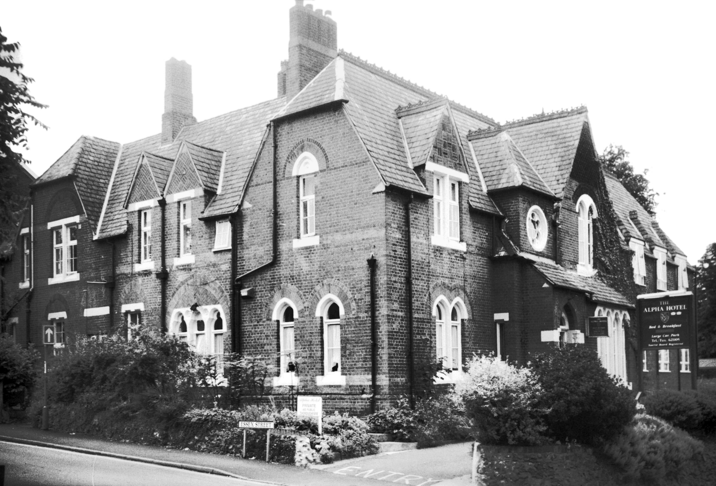
Unthank Rd 82 Alpha Hotel former rectory [7466]
1997-07-16
Alpha Hotel. Formerly the rectory of St John
Maddermarket. |
|
Upper Goat Lane: |
| |
From
St Giles'
St to Pottergate / St
Gregory's Alley
East side |
|
|
Goat Lane Upper 1 [1341] 1936-08-29
|
|
|
Goat Lane Upper 3 to 7 [1383] 1936-09-08
|
| |
West
side |
|
|
Goat Lane Upper 10 to 14 [1062] 1936-06-28
|
|
|
Goat Lane Upper 14 [1061] 1936-06-28
|
|
|
Goat Lane Upper Friends' meeting house [4587]
1961-03-25
Built 1826, architect J.T.Patience. |
|
Upper King St: |
| |
From
Tombland / Queen
St to Prince of Wales Rd / King
St / Agricultural Hall
Plain
passing Bank St
East side |
|
|
King St Upper 9 to 11 [0992] 1936-06-09
|
|
|
King St Upper 15 King Street House [2708] 1938-08-13
|
|
|
King St Upper 17 The Norfolk Club facade [0993]
1936-06-09
For 19 Upper King St see 2 Prince
of Wales Rd. |
|
|
Coronation King St Upper 17 Norfolk Club [1620]
1937-05-13
The Norfolk Club, Upper King St, very highly commended
business premises. 1937 coronation decorations. |
|
|
King St Upper 17 Georgian doorway [0463] 1935-04-19
|
|
|
King St Upper 17 ornamental wall anchor [4376]
1955-09-02
|
|
|
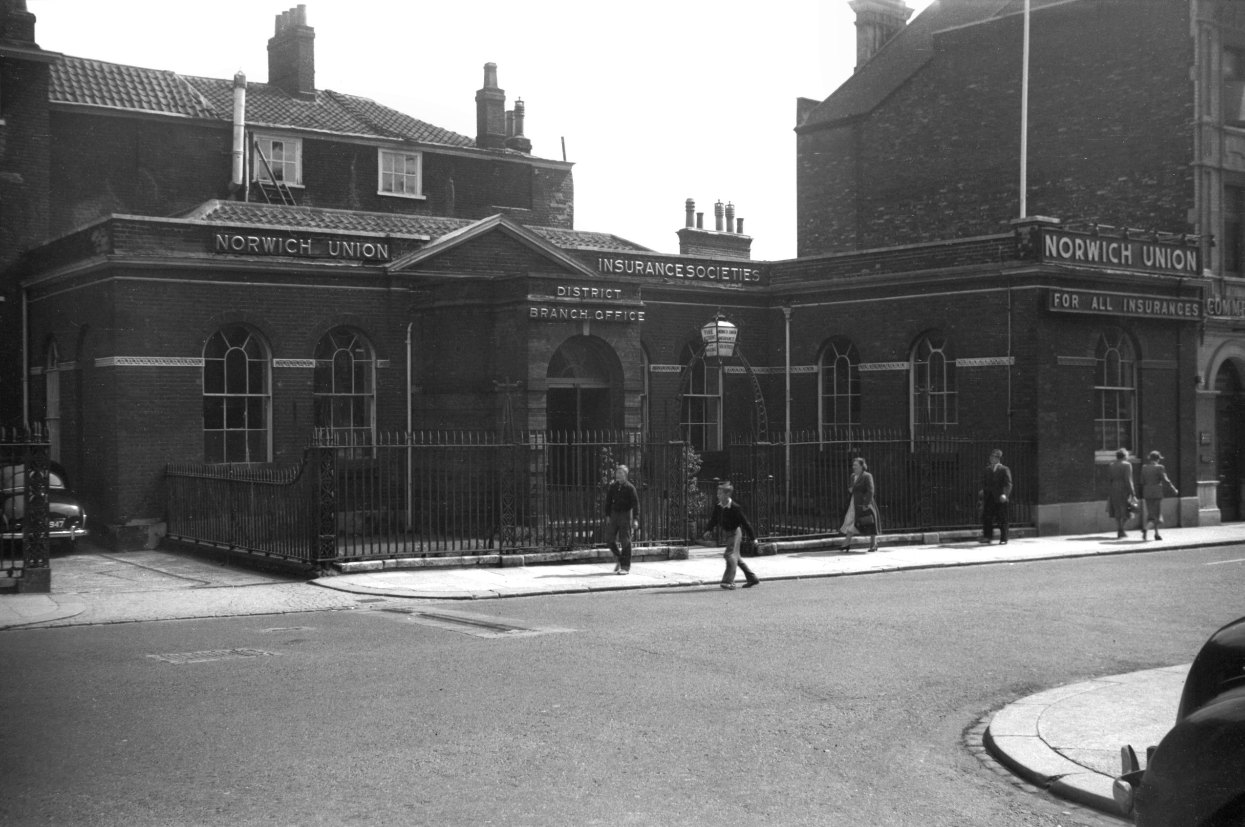
King St Upper 19 Norwich Union branch [4279]
1954-08-25
|
| |
West
side |
|
|
King St Upper 2 [7706] 1999-10-31
|
|
|
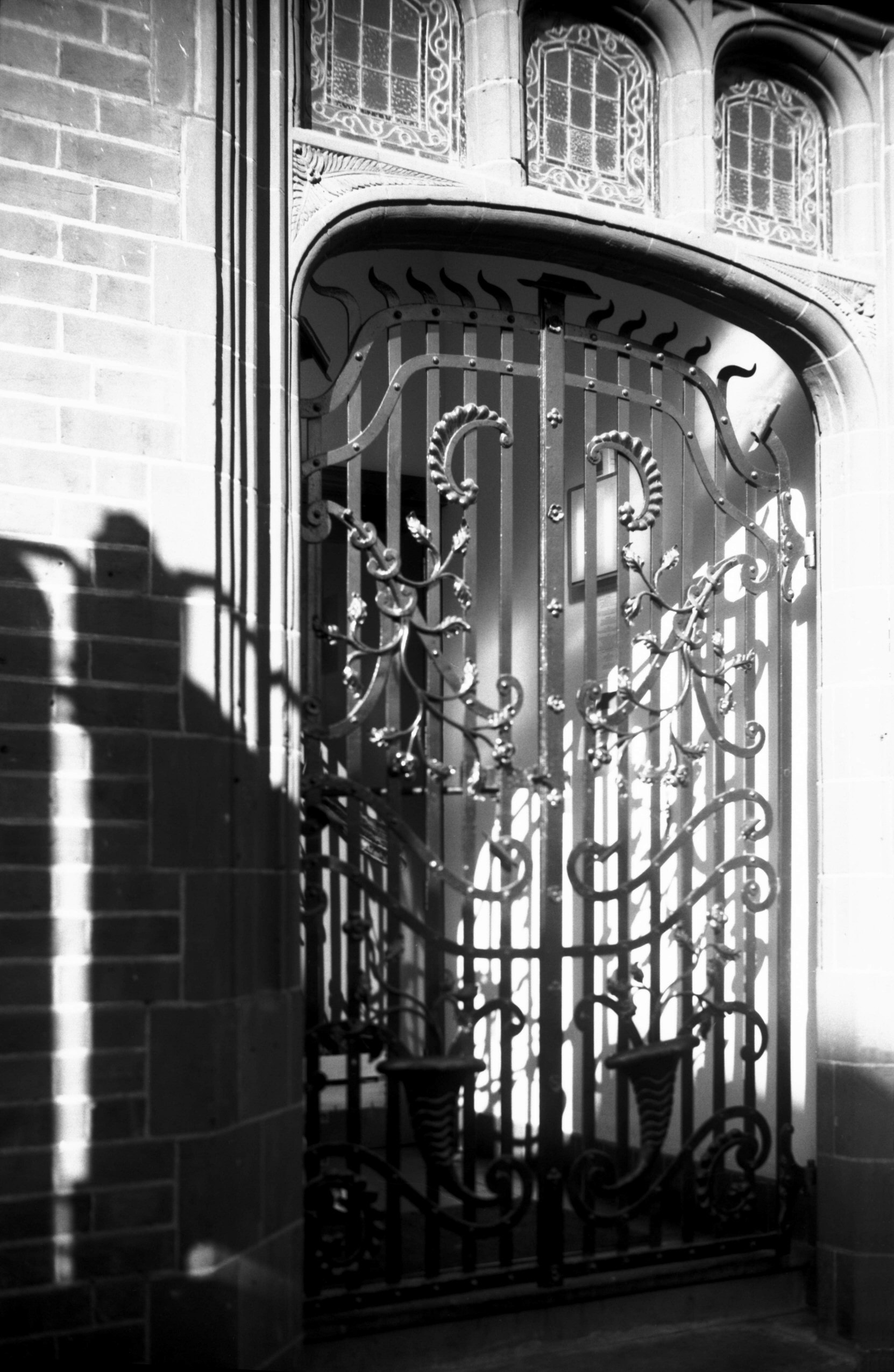
King St Upper 2 Slug and Lettuce PH gate [7814]
2001-04-03
|
|
Valley Drive: |
| |
From
Heartsease
Lane to Gurney Rd |
|
|
Valley Drive view east Heartsease airfield [4229]
1953-10-25
|